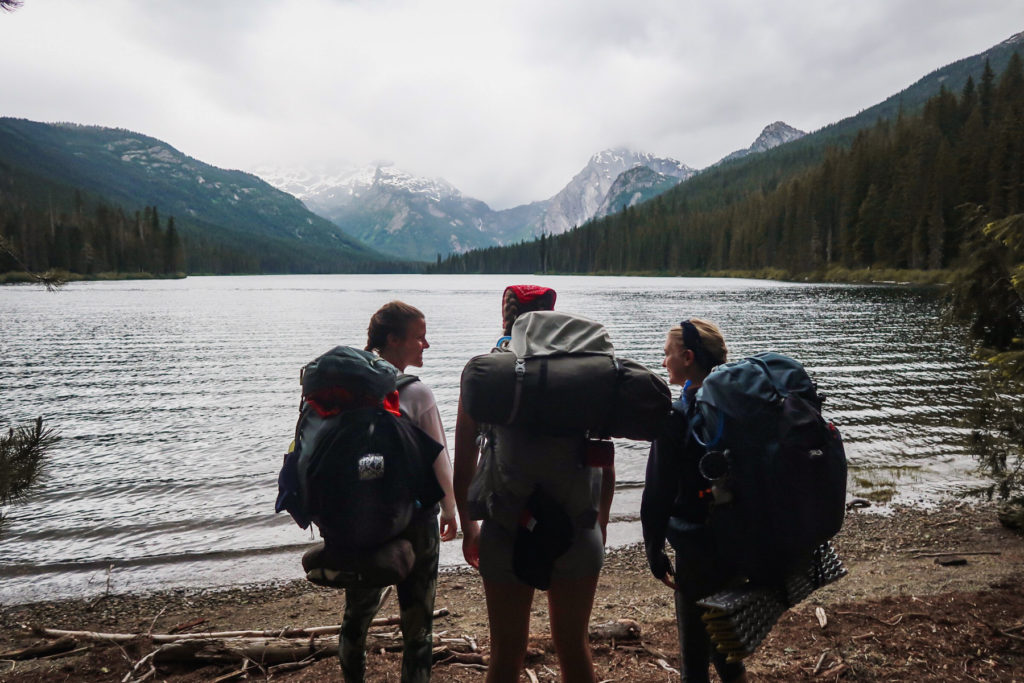
Maps Over Coffee

With so many trails in Washington, it’s easy to wonder which ones offer the best backpacking.
I live between the Olympic and the Cascade ranges, and I’ve spent countless hours on the trails here and even more time planning and researching trips.
In this article, I’ve selected thirteen trips that feature the best backpacking in Washington State, all in different regions, from the Olympic Peninsula to the Central and North Cascades to Mount Rainier.
Whether you’re a seasoned backpacker or a beginner eager for your first adventure, these trails promise an unforgettable experience packed with stunning scenery, opportunities for wildlife sightings, and that unbeatable feeling of being immersed in nature.
Let’s get into it!

Quick Guide: Best Backpacking Trails
- Best Beginner Backpacking Trails: Tuck and Robin Lakes, but stopping at Hyas Lake
- Best Year-Round: Hoh River Trail
- Best for Groups w/ Children: Second Beach
- Best for Wildflowers: Cascade Pass & Sahale Arm
- Best Wildlife Viewing: Enchanted Valley
- Best Multi-Day: Copper Ridge Loop
13 Best Washington Backpacking Trips
This guide features backpacking trips in Olympic National Park and one spectacular must-do trip in Olympic National Forest, exposing you to ecosystems ranging from craggy coastlines to rainforests, valleys, and glaciers.
Also featured here are the best trips available in the Central and North Cascades and at Mount Rainier National Park. These trails are known for their alpine meadows, pristine lakes, and otherworldly granite landscapes.
Olympic National Park
1. second beach.
- Distance: 5 miles
- Elevation: 300 feet
- Difficulty: Easy
- Permit: ONP Wilderness Permit
Second Beach on the Pacific Coast is my favorite beach in Olympic National Park.

Dramatic coastline cliffs, stunning sea stacks, excellent tide-pooling, and a wildlife refuge off its shores make this La Push beach worth exploring.
Camping here allows you to experience low tide at both ends of the beach without rushing.
The short hike from the trailhead makes this an excellent trail for beginners and families with young children.
At the north end, near the natural arch, there’s another smaller, stunning beach accessible at low tide. This end is where most people take photos and near where most set up camp.
I recommend walking south and choosing a site away from the crowds.
On the south end are some of the best beach campsites in the entire state. The beach widens considerably, so there’s little risk of the tide encroaching on your tent.
2. Shi Shi Beach
- Distance: 9 miles
- Elevation: 200 feet
- Difficulty: Moderate
- Permit: ONP Wilderness permit

Point of Arches on Shi Shi Beach offers the best coastline scenery in Olympic National Park. This configuration of over thirty incredible sea stacks is older than any others on the Olympic Peninsula.
The mileage and elevation gain on this trip are relatively easy. It’s roughly 4.5 miles to get to Point of Arches from the trailhead, traveling through the forest and across Shi Shi Beach. But you must hike through a relentless section of mud, even in August.
This is one of the park’s busiest destinations for beach camping, so don’t come here expecting solitude.
You can camp near Point of Arches, giving you a great home base to explore the incredible rock formations here. At low tide, or better yet, a minus tide, explore acres of tide pools filled with colorful sea stars, anemones, and other marine life.
3. Hoh River Trail
- Distance: 10.6 – 37 miles
- Elevation: 367 – 5000 feet
- Difficulty: Moderate – Hard
- Permit: Wilderness permit
On the Hoh River Trail, you’ll hike through a delightful rainforest filled with moss-draped trees along the river, through subalpine meadows, and, if you go the entire distance of this backpacking trip, you’ll eventually reach Blue Glacier.
You don’t have to backpack the entire trail because there are three camps to choose from before reaching Glacier Meadows Camp at the end.
This trail is one of Olympic National Park’s best destinations, showcasing giant trees, river and valley views, and the incredible Cougar Creek cedar grove. You may even cross paths with a herd of the park’s Roosevelt elk.
The crowning glory of this backpacking trip is seeing incredible views of the Blue Glacier stretching down from Mount Olympus, the tallest peak in the Olympics.
This is a fantastic destination for winter backpacking trips because snow usually doesn’t cover the first roughly 12 miles.
4. Enchanted Valley
- Distance: 27.8 miles
- Elevation: 3700 feet
- Difficulty: Hard

Backpacking the Enchanted Valley is a journey along a river, through a lush rainforest filled with ancient trees, into an open valley inhabited by wildlife surrounded by majestic mountains.
It’s a world-class backpacking trip into Olympic National Park’s “Valley of 10,000 Waterfalls.”
While the moniker may be an exaggeration, you’ll see why it’s an apt description once you reach the old Enchanted Valley chalet. To witness numerous waterfalls cascading down valley walls is simply spectacular. Do this trip in spring for the best waterfall experience.
With this place being so beautiful, the word is out. So expect to see plenty of other groups on the trail.
Note that at 12.7 miles, before arriving at the valley, you must cross a high, narrow bridge that will likely test your nerves and balance.
After setting up camp, continue hiking up the valley for two miles to see the largest Western Hemlock tree in the world.
5. High Divide Loop
- Distance: 19.1 miles
- Elevation: 4175 feet
- Difficulty: Hard

This is the hike to do if you’re looking for the most stunning scenery in the Olympic Mountains.
You’ll hike past Sol Duc Falls and serene Deer Lake, ascend a high ridge with expansive views spanning rainforest valleys, and revel in the sight of the Olympic Peninsula’s highest peak, Mount Olympus.
The High Divide’s incredible ridgeline vistas, alpine lakes, and gorgeous meadows are no secret. Be diligent about securing your permit.
Plan for more than one night for this backpacking trip. Once you reach Seven Lakes Basin, you’ll want to stay awhile to explore.
Snow can linger on the hike from Seven Lakes Basin to the High Divide, and if so, the route is much more difficult, if not dangerous. Read trip reports in advance.
Bring bear spray on this hike. Bears will likely ignore you, but you’ll be happy to have it.
Olympic Peninsula
6. marmot pass.
- Distance: 11.5 miles
- Elevation: 3500 feet
- Difficulty: Hard
- Permit: Northwest Forest Pass
If the Buckhorn Wilderness isn’t on your radar, it should be.
You’ll start your trip by hiking through gorgeous old-growth forest while the Big Quilcene River cascades alongside the trail. The climbing is steep, but there are flat areas to pull over, eat, and rest.
Fill up on water at Camp Mystery. Beyond this point, there’s no water source, making a compelling case for camping here.
But if it’s not too windy and you want to wake up to some of the best mountain vistas in the Olympic National Forest, continue to Marmot Pass.
The weather for our trip started with cloud cover, but they parted when we arrived at Marmot Pass. We sat and watched incredulously as the clouds moved across the mountains, exposing the ridges surrounding us.
As the trail’s name suggests, you’ll hear marmots and probably see a few.
Once you set up camp, you can continue your adventure. Options include summiting Buckhorn Mountain or taking a dip in Buckhorn Lake.
North Cascades National Park
7. cascade pass & sahale arm.
- Distance: 11.8 miles
- Elevation: 4000 ft
- Permit: Backcountry Permit

There aren’t enough superlatives to capture just how spectacular of a trail this one is.
Given the choice of when to do this trip, I’d pick late summer every time. In September, fall colors begin to pop, blazing the landscape surrounding you while cool, blue hues of jagged alpine peaks form a magnificent backdrop.
The ridgeline of Sahale Arm offers incredible views in every direction. The meadow here, filled with mountain heather, glows a remarkable shade of crimson in the fall.
Despite the amount of switchbacks on the ascent, it’s the most popular day hike in the North Cascades. Naturally, backcountry permits are at a premium.
Sahale Glacier Camp is the most competitive permit to secure, but other campsites are available.
The push to reach Sahale Glacier Camp is hard climbing. Once you arrive, the high alpine scenery of the mountains around you makes it all worth it.
8. Copper Ridge Lookout
- Distance: 20.4 – 34 miles
- Elevation: 6200 – 8600 feet
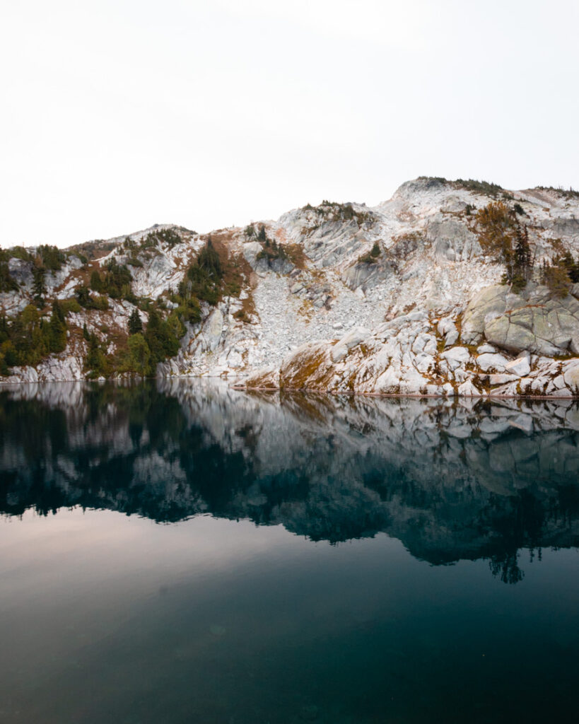
This is the trip to take for views of the most northern peaks of North Cascades National Park. You’ll experience all that makes these mountains worth visiting: a pretty glacier-sculpted valley, jagged mountain peaks, and some of the finest backcountry alpine views.
You can do this trip as an out-and-back to the Copper Ridge Lookout. If you have more time, do the 34-mile Copper Ridge Loop, on which you must cross a river in a self-propelled cable car.
Early on, you have the option to detour and climb Hannegan Peak. Without a doubt, the views make it worth doing.
But the best views are yet to come at the fire lookout. Surrounded by high mountain ridges, you remember why all the tough climbing is worth it.
Note that this trail is buggy. Bring your headnet along with gloves for the cable car crossing.
Cascade Range
9. enchantments.
- Distance: Varies
- Elevation: Varies
- Permit: Enchantments Permit

I’ve read trip reports of hikers calling this the most overrated trail in Washington. Do not listen to them. The fairy-tale-like beauty of this alpine terrain is mindblowing.
Set within the Stuart Range, the Enchantments Lakes basin features an otherworldly granite landscape with jagged peaks and bowls lined with snowfields, even in summer, pristine lakes, mountain goats, and larches that turn a brilliant yellow-gold in fall.
Backpacking in one of the five Enchantment zones in the Alpine Lakes Wilderness requires a permit granted by a highly competitive lottery system.
Permits for the Core Enchantment zone are the most coveted. In 2022, a whopping 26,988 applications were submitted, while only 2,920 total backpackers got the opportunity to stay overnight in this famed backcountry.
With a place this magical, it’s still worth entering the lottery year after year in case you get lucky.
You have better odds applying for the Stuart zone, allowing you to day hike to the core.
10. Tuck and Robin Lakes
- Distance: 12.7 miles
- Elevation: 3400 feet
- Permit: None
Located near the Alpine Lakes Wilderness, the scenery on the Tuck and Robin Lakes trail is similar to the Enchantments, but there are no permits to secure. The trade-off is that it’s a busy trail on summer weekends.
The first section to Hyas Lake is relatively easy, especially considering what comes later. It’s a perfect backpacking trip for beginners and families.
The ascent begins once you push past Little Hyas Lake at about 3.5 miles in. Once you reach Tuck Lake, take a well-deserved break and enjoy the alpine views.
It may be tempting to set up camp here. But pushing that extra 1.5 miles to camp at Robin Lakes is worth it.
Be prepared for some scrambling and route-finding.
The breathtaking granite views around Robin Lakes are your reward for enduring such an arduous climb. On a clear day, you’ll see Washington volcanoes in the distance.
11. Gothic Basin
- Distance: 9.3 miles
- Elevation: 3100 feet
For the experienced hiker, the elevation gain on this trail may not seem like much. The light scrambling required makes this hike harder than it seems just looking at the numbers.
Miners blazed the trail leading to Gothic Basin, a name that belies the joy and delight this landscape elicits when its meadows and wildflowers are in bloom. Today, the state’s Department of Natural Resources manages this conservation area to protect its fragile ecosystem.
Set up camp on established campsites, never on top of meadows or plants.
Once you’re in the basin, there’s much to explore. Gothic Lake can be viewed from many different areas, but remember to walk on rock as best as possible.
Continuing to Foggy Lake is a must. Follow the cairns to get there. There are no trees, only sparkling blue water surrounded by rock and Del Campo Peak.
I highly recommend jumping in on a hot summer day!
12. Mount Margaret
- Distance: 16 miles
- Elevation: 3825 feet
- Permit: Backcountry Camping Permit

This backpacking trip to Shovel Lake Camp allows you to travel through the blast zone of Mount St Helens National Volcanic Monument in Gifford Pinchot National Forest.
You’ll see a rugged, once-decimated landscape regenerating with vegetation and wildlife. Young conifer trees, fruit shrubs, and wildflowers now grow, and the scenery is fantastic in fall.
Start at Boundary Trail 1 and go right to continue to Bear Pass and be rewarded with excellent views of Mount Adams, Mount Rainier, and Mount St Helens.
You can avoid traversing the sketchy Whittier Ridge by approaching this trip as an out-and-back hike rather than a loop.
There’s little shade or tree cover, so UV protection is essential. Read trip reports regarding water sources and be prepared to carry water.
Shovel Lake Camp is spectacular. The water is frigid but feels amazing after hiking in the sun.
Mount Rainier
13. spray park loop .
- Elevation: 5100 feet
- Permit: Wilderness Permit

The Wonderland Trail circumnavigating Washington’s most famous volcano is 93 miles, but you won’t be able to hike it unless you win a coveted and highly competitive permit.
Spray Park Loop offers a fantastic opportunity to experience a section of the Wonderland Trail.
You’ll hike through old-growth forests and meadows dotted with wildflowers, cross rivers and snowfields, see waterfalls and a crystal blue alpine lake, and relish stunning views of Mount Rainier and other peaks.
Decide if you’ll travel clockwise or counter-clockwise. Either way, you’ll have serious elevation gain to contend with, but going clockwise means you’re not saving the toughest climbing for the very end.
This trip is beginner-friendly but only for those with navigation and bouldering skills, ready for log crossings over fast-moving water.
Tips for Backpacking in Washington
Below are helpful tips for a successful backpacking adventure.
Secure Backcountry Permits Early
Permits on some of these trails can be hard to come by. Start planning for the next backpacking season in winter.
Head to the Washington Trails Association’s website in January, which lists key dates regarding when the lottery system and reservations open up.
Avoid Wildfire Smoke
Wildfires now dictate where we can and cannot recreate during the prime backpacking months of July, August, and September.
All planning during these months is incomplete without a visit to fire.airnow.gov.
You can escape to Olympic National Park’s beaches when wildfires rage across the Cascades.
Stop at Ranger Stations
I highly recommend stopping at the corresponding ranger station before a backpacking adventure to learn about trail conditions and the best place to camp or collect water.
Rangers are an incredible resource, and I’ve found them generally eager to help.
Wrap-Up: Best Backpacking in Washington State
I’ve made lifetime memories on these amazing trails, and I hope the same for you.
From the rugged coastline of the Olympic Peninsula to the alpine lakes of the North Cascades, these thirteen exceptional trips showcase the best of Washington’s stunning landscapes.
Like this post? Pin it for later!

Meeshka is the founder of Sand & Elevation. Living between two mountain ranges - the Olympics and the Cascades - she spends her free time in the mountains on the coast, hiking, climbing, and exploring the outdoors. Meeshka helps other nature-loving adventurers by writing comprehensive guides to the Pacific Northwest's best destinations.
Big News! My Green Form is now Maps Over Coffee!
20 Best Backpacking Trips in Washington: Ultimate guide for this Summer
| Filed in Blog , Hiking & Backpacking , Washington | Disclaimer: I use affiliate links and may receive a small commission on purchases. | Leave a Comment
Backpacking season is here and I am beyond excited about it! I had the pleasure of living in Seattle in Washington State for three years and these are my favorite backpacking trips. If you’re looking for some summer inspiration of the best backpacking trips in Washington, you’re in the right place. Let’s break down 15 backcountry locations in backpacking washington for some of the best the Pacific Northwest has to offer!

Photos in Collaboration with Disa Wold , Adam Ramer , and Johnathon DeSoto
Stick to Established Trails and Campsites
Backpacking washington – know before you go.
If you are new to backpacking, don’t worry I’ve got you covered! I have two blog posts that break down my gear, safety tips, Leave No Trace Principles, beginner backpacking tips and more! Check these out below if this seems like a good place for you to start.
Leave No Trace – Backpacking Washington Version
Most people that get outdoors are familiar with the Leave No Trace or LNT Principles. If not I encourage you to check out the link. I’m going to break down some important things that I personally did not know much about as a beginner backpacker.
Pooping in the Woods
Haha I know, what a way to start off this post! There are a LOT of people backpacking in Washington. And unfortunately that usually results in a lot of toilet paper and waste that is not properly disposed of.
When using the bathroom outside , make sure you are 200 feet away from the trail and any water source. And PLEASE pack out any toilet paper. I know this sounds gross, but just bring a ziploc bag or doggie poop bags for toilet paper. You can then tie this to the outside of your bag or put it in an outer pocket of your bag. If you are pooping, make sure to dig a hole at least 6 inches and completely bury it.
If you’re a beginner this might sound insane, but if you CAN go the extra mile, pack out your poop in bags. As long as they are properly tied off, you can dispose of human waste in public garbage after you return to the trailhead. REI sells these toilet kits ($30 for a 12 pack) to minimize the impact of waste on the environment.
I’ve been to so many campsites that are littered in half buried toilet paper and poop. Please don’t be that person in the backcountry (or anywhere, yikes!).
For urinating, I personally like using my Kula Cloth Pee Cloth to avoid using toilet paper for urination. It is antimicrobial and really discreet and doesn’t smell. AGAIN, don’t be that person that leaves toilet paper half buried all around the campsite.

Tips for Packing Out what you Pack In
A lot of people don’t understand that you also need to pack out any food waste. This includes fruit/veggie peels, shells from nuts, etc. These things do break down, but at a VERY slow rate and also impact the wildlife in the area. Example: Banana peels can take up to 2 years to biodegrade. Wildlife can become too reliant on human food waste and lead to dangerous encounters as well as animals being put down due to this.
Bring a small garbage bag or ziploc and keep it ac cessible for your garbage.
Another tip: Avoid bringing any glass! Not only is it HEAVY to carry in and carry out, it often breaks accidentally and can leave dangerous shards around campsites. It’s never a good situation if someone gets injured from leftover glass 13 miles into a trail.
This is another important one that I didn’t really understand the importance of until later in my backpacking career. Going off trail will leave a mark and impact and can lead to erosion or destruction of fragile habitats. If you see a barely worn trail that shoots off of the main trail, this is an example of this.
Same goes for campsites.
- Camp at least 200 feet from lakes and streams. I see this one violated a lot.
- When in relatively untouched areas try to camp on durable surfaces like rock, gravel, dried grass – areas that wont leave an impact
If you’ve gotten outside a handful of times, you’ve probably seen the wear and tear that humans cause. Be responsible of your impact so that it can be a place to enjoy for years to come.

20 Best Backpacking Trips in Washington
Okay, thanks for bearing with me with the necessary education above! Let’s get into the best backpacking in Washington (in my opinion lol – I feel like I need to state this so people don’t come for me.)
Another Note: Be sure to check if fires are allowed/if there is a current ban. I personally discourage any fires in the backcountry during the summer months even if allowed.

1. Enchanted Valley
- Location : Olympic National Park
- Length: 30.6 miles roundtrip
- Elevation Gain : 4,642 ft
- Best Months: March – September
- Difficulty Level: Hard
- Permits: Permit is required
- Bear Cannister Required
- AllTrails Link: HERE
Enchanted Valley is exactly how it sounds – REALLY ENCHANTED. Seriously, I’m talking waterfalls in the mountains towering on both sides of you, PNW fog hovering in all the right places, groves of tall trees, rivers, an abandoned Chalet with a curious history. This is not an easy hike. 15 miles in with some real elevation gain.
If you do not have any backpacking experience, I do not recommend this trip as a first time backpacking unless you are going with someone who does have experience.
I also want to note that this is not a secret place. It can be VERY crowded and permits are needed and can be required prior or walk up. They may begin limiting permits due to erosion and other damage that human traffic is causing. If you do get the opportunity to visit this beautiful place, I trust that you’ll want to respect it and practice leave no trace etiquette.
Check for the most current permit information at the Lake Quinault Ranger Station . For more Destinations in Olympic National Park Check out my blog post: 10 Must See Locations in Olympic National Park
2. Gem Lake
- Location : Mount Baker Snoqualmie National Forest
- Length : 11.0 miles round trip
- Elevation Gain: 2,670 ft
- Difficulty: Rated difficult (Moderate option is Snow Lake!)
- Solitude: Crowded on trail and around Snow Lake, minimal-moderate traffic on the trail to Gem Lake, minimal people camping at Gem Lake (We were one of 2 tents that overnighted on a Thursday in July)
- Camping: first come first serve in established campsites. NO campfires
- Bathrooms: at trailhead and at Snow Lake
- Dogs: allowed on leash
- Fee: Northwest Forest Parking Pass
Gem Lake was such a special overnight for me! I hadn’t been backpacking in almost a year and had moved away from Washington and this was such a great trip to come back and do. Check out my guide or Youtube Video below and you’ll see why it’s some of the best backpacking in washington.
3. Waptus Lake
- Location : Alpine Lakes Wilderness
- Length: 17.4 miles round trip
- Elevation Gain: 2,434 ft
- Best Months: April – October
- Dogs: Allowed on leash
- No Permit Necessary
- AllTrails Link : HERE
My friends and I camped here on accident. We were heading towards Spade Lake (which is an additional 9 miles round trip and 3,500 ft), but we could see the dark clouds and snow lingering above the area we were headed and stayed put at Waptus Lake instead.
And this is now one of my favorite backpacking memories! There were hardly any other people and the lake was so serene. Truly a stunning place to camp with plenty of camping spots along the way to make this a 2 day trek there!
4. Marmot Pass
- Location: Buckhorn Wilderness
- Length: 12.8 miles round trip
- Elevation Gain: 3,917 ft
- Best Months: July – November
- No permit required
- Northwest Forest Pass Required
This is a busier trail and for good reason. I’ll never forget the absurd cloud inversion I saw here. There are many places to camp and the trail actually continues up along a ridge with sweeping views if you’re willing to go a little bit further! This one definitely kicked my butt haha.
5. Pete Lake/Spectacle Lake
- Location : Okanogan-Wenatchee National Forest
- Length: Pete Lake – 9 miles round trip, Spectacle Lake – 18.1 miles round trip
- Elevation Gain: Pete Lake – 734 ft, Spectacle Lake – 2,601 ft
- Difficulty Level: Pete Lake – Easy, Spectacle Lake – Moderate
- Dogs : Allowed
- No Permit Required
- AllTrails Link: Pete Lake , Spectacle Lake
When I did this trail, we hiked to Pete Lake to set up camp and then day hiked to Spectacle Lake the next day to swim! Spectacle Lake is stunning and I highly recommend making the push there either for an overnight or day. All my pictures here are with an ex boyfriend, so i’m going to spare us all and let you check out photos online instead haha. The Pacific Crest Trail runs along this area too if you’re looking for more miles.
6. Gothic Basin
- Location: Mount Baker Snoqualmie National Forest
- Length: 12.5 miles round trip
- Elevation Gain: 3,284 ft
- Best Months: June – October
- Difficulty Level : Hard
Gothic Basin was a very challenging hike. 3,000 feet in 6 miles to get to the top? But my goodness it was worth it. This was a post break-up hike for me with some girlfriends and it humbled me in all the right ways. I’ll never forget the sunset there and the sunrise on that alpine lake.
This hike has gotten extremely busy from what I’ve heard. I’d recommend trying to go during the week rather than weekends if you are able.
Best Backpacking in Washington: Hardest Hike Award Goes to…

7. Lookout Mountain Lookout
- Location: Marblemount
- Length: 9.1 miles round trip
- Elevation Gain: 4,432 ft
- Best Months: July – October
- Dogs: Allowed
I had an awesome time doing this hike with some friends, and I was freshly unemployed and about to move to Alaska. This hike DESTROYED ME. It IS beautiful and is worth it, but seriously make sure you are physically up to the 1,000 ft per mile. There was a lot of bushwhacking for us and full of mosquitoes and stinging nettle.
We saw multiple bears and got to the lookout only to have another group beat us by a little bit. They were kind enough to let us sleep on the porch since there were multiple bear reports.
Tip: Check the sign in log to see if anyone beat you to the trail if you are planning to stay in the lookout. Bring tents in case you need to camp below the lookout. And another warning is this hike is definitely a high avalanche risk, so be sure you go when the snow is gone.
8. Baker Lake Trail | Best Backpacking Trips in Washington
- Length: 13.9 miles round trip
- Elevation Gain: 1,358 ft
- Best Months: April – November
- Difficulty Level: Moderate
Backpacking Washington: Worst Night of Sleep in the Backcountry goes to…
9. Thunder Mountain Lakes
- Location: Alpine Lakes Wilderness
- Length: 12.6 miles round trip
- Elevation Gain: 3,940 ft
- Dogs: Allowed on Leash
- Permit Required at Trailhead
I’m so glad I had an offline map (AllTrails pro version), because it can be easy to take the wrong trail at multiple points. There were so many incredible views on this trail, but windy weather rolled in just as we got to the camping area. I’ve heard so many reports of this same experience on this trail, so it seems like a fiercely windy night is a common occurrence. Like, my tent was caving in on me the entire night. Slept zero hours, but I can laugh about it now haha.
10. Hoh River Trail
- Location: Olympic National Park
- Length: 41.4 miles round trip (OKAY, but hear me out, you can even just go 5 miles in!!)
- Elevation Gain: 8,622 ft (again haha this is absurd and I did not do the entire trail)
- Best Months: June- September
- Difficulty Level: Easy to Hard (Depending on how far you go!)
- Dogs: Not allowed
- Permits Required: HERE
This was actually my first backpacking trip in Washington and second backpacking trip EVER. I legitimately could barely walk after this. We set up camp about 6.5 miles in at Happy Four Campsites. We then dropped our bags for a day pack and hiked as far as we could to get an incredible glimpse at Mount Olympus, which ended up being around 20 miles total. The terrain changed so many times and was truly a beautiful hike.
Best Backpacking Trips in Washington: Worst Mosquitoes Award goes to…

11. Rainbow-McAlester Loop
- Location: North Cascades National Park
- Length: 31.5 miles round trip, 2 nights/3 days
- Elevation Gain: 6,650 ft
- Dogs: No Dogs Allowed
- Permits Required: HERE or at the Wilderness Information Center in Marblemount
- Washington Trails Association Link: HERE
This was one of the most challenging backcountry weekends I’ve done. The elevation gain never seemed to end, but neither did the views. It was so much fun doing a loop trail and staying at a different campsite each night. We barely saw another soul out here and it was magical. But with each magical moment or alpine lake dip, came hoards of mosquitoes. Make sure you pack your face bug net.
12. Rialto Beach
- Length: 3 miles to 13.1 miles round trip (depending on how far you want to go!)
- Elevation Gain : 100 ft to 2,600
- Best Months: Year round honestly, but Summer and Fall are my favorite here
- Difficulty Level: Easy to Moderate
- Permits Required: HERE or try your luck with a walk up permit at any of the ranger stations there.
- National Park Pass Required
I LOVE this trail. It’s easy and has incredible sea stacks and rock formations to keep you occupied. I typically like to hike a couple miles past Hole in the Wall which is at 3.3 miles in. If you don’t plan out the tides correctly to pass through hole in the wall, there is a very steep trail at the forest line that goes up and over and is a little scary with packs on to be honest.
13. Second Beach
- Length: 2.1 miles round trip
- Elevation Gain: 278 ft
- Best Months: Year round
- Difficulty Level: Easy
- Permits Required: HERE or walk up at ranger stations in Olympic NP
Similar vibe to Rialto Beach, Second Beach has some unique rock formations and really incredible tide pools to check out. I like to try to camp on the bluff in the woods just a little bit tucked away to cut down on wind.
14. Tuck and Robin Lakes
- Length: 13.7 miles round trip
- Elevation Gain: 4,343 ft
- Best Months: August – September
- Dogs: Dogs are allowed on leash
- Free self-issuing permits are available at the trailhead
I had somehow convinced my not-so-outdoorsy sister to come with me on this challenging hike for her first time backpacking. She vowed to never go with me again after that haha (which didn’t last long, Love you Chels!), but we saw mountain goats, a rainbow, an epic sunset and a meteor shower! I’ll never forget this backcountry trip.

15. Wonderland Trail to Granite Creek and Mystic Lake
- Location: Mount Rainer National Park
- Length: 17.4 miles roundtrip
- Elevation Gain: 4,780 ft
- Best Months: July – September
- Dogs: Not Allowed
- Permits Required : HERE or Call Longmire Wilderness Information Center about walk up availability
I was lucky enough to score a permit for part of the Wonderland Trail and I jumped at the opportunity! If you’re not familiar with the Wonderland Trail, it is a 96 mile loop around Mount Rainier with 25,000 ft of elevation gain that typically takes people 10-14 days to complete. Me and a coworker hiked into Granite Creek Campground where our permit was to camp, set up camp, and then day hiked to Mystic Lake. The hike to Mystic Lake was tiring, since we did it the same day, but SO worth it.
Best Backpacking Trips in Washington: Early Season Backpacking Award goes to…

16. Ancient Lakes
- Location: North Columbia Basin State Wildlife Recreation Area
- Length: 4.6 miles round trip
- Elevation Gain: 288 ft
- Discovery Pass Required
I’ve backpacked here 3 times! When it’s spring time and I was tired of the cold, wet Seattle weather, I’d plan an overnight or two here! I have fond memories of laying in the sun here and feeling like I traveled out of Washington! The waterfalls and sunsets here can be so lovely.
Note: You must pack in all your water. The water that is available is not safe even when filtered due to pesticide run off from nearby farms.

17. Park Butte Lookout Trail
- Length: 7.2 miles round trip
- Elevation Gain: 2,020 ft
- Northwest Forest Pass or America the Beautiful Pass
I did this trip on a Monday while there was still some snow melting out of the mountains in mid July. There were a lot of cars in the parking lot from people accessing climbing routes for Mount Baker. We were lucky and got to the lookout before any other overnight guests and had the most incredible sunset.
Note: Blue bags are provided at lookout as no toilet paper or pooping in holes is allowed at the summit.
Backpacking Washington Trips on My Bucketlist
There are quite a few backcountry trips in Washington that are still on my bucketlist:
- Seven Lakes Basin
- Sahale Glacier Camp
- The Enchantments
I hope this list has you inspired to plan your first or next backpacking trip in Washington. Backpacking in Washington state is my absolute favorite place to get outside. If you have any questions about these trips, feel free to leave a comment and I will answer the best I can or provide a contact for a ranger station that could better answer! There are endless trails in Washington, and I can’t wait to get back out there myself!
Share and Save for Later!

Share this:
Explore popular posts.

Goblin Valley Yurt Stay: How to book this bucketlist stay

Ultimate Baja California Road Trip | van life in Mexico

San Francisco to Portland Road Trip: Ultimate Itinerary
Join the conversation, 11 comments.

Wow, what a selection! I haven’t backpacked in Washington yet, but I would love to do it soon, maybe even still this summer. What tour would you recommend for beginners?
Thank you!! Best, Stefanie

I think for beginners it’s best to look for something with elevation at 2,000 ft gain or less! Unless you’re in the mountains hiking regularly! REI offers a lot of tours where you can join an expert. But If you’re wanting to try it out, Rialto beach and second beach are easier hikes that are gorgeous!

Awesome selection and I love the awards! You should add Chelan Lakeshore trail to you bucket list for an early season trip, assuming you haven’t done it.

My friends & I are planning on backpacking for 2 nights next week in the Alpine Lakes Wilderness. We’re torn between Waptus (with a day hike to Spade), Marmot Lake (with a day hike to Jade) or Tuck & Robins Lake. We would love your opinion on which was your favorite!
Ooooh that’s a tough one and I’m so jealous!! I still haven’t been to Jade, but from what I know of it – it’s incredible and is top on my list personally. Tuck and Robin lakes were mind blowing to me. We saw mountain goats and a meteor shower. I would lean between those two! Not super helpful I know haha

Very high elevation gain and descent. Do your research.

HI Miss Rover – I’m heading to Eastern Washington for work and want to add a 2-3 night backpacking trip to it. June 21-23. Recommendations? I’m experienced and looking for elevation gains as I’ll be doing tour du mont blanc in July and want to get some training in. Thank you!!

I have already been to goat lake and it was awesome we only got lost(ish) once and but over all pretty great backpacking trip!
Oh heck yeah! I’m itching to get back to Washington soon!
Leave a Comment Cancel Reply
Privacy overview.
- Backpacking in the PNW
10 Best Backpacking Trips in Washington
An epic list + ultimate guide from a washington local..
Looking to add some fantastic backpacking adventures to your list for next summer in Washington State? If yes, then read on. I’ve compiled a selection of in my opinion, the best backpacking trips in Washington that have stood out over the last 10 years.
All of these backpacking trips can be done as overnighters but could easily be made into multi day trips. And they all have that extra something special, I promise!

Table of Contents
A few things to consider before heading out hiking.
Before setting out on any hiking adventure, it’s essential to pack the right things to be prepared for all situations. Firstly, make sure you’re equipped with the necessary tools to navigate safely through the wilderness. Consider utilizing mapping apps such as AllTrails or GaiaGPS but don’t forget the reliability of a physical map as a backup just in case. Electronics can run out of power as we all know.
Always let someone know about your hiking itinerary, including expected return times. Additionally, always carry the Ten Essentials, independent of the length or intensity of your hike. These items can be lifesaving in unexpected situations. You always want to plan for what you hope doesn’t happen! And of course, these items contribute to a smoother outdoor experience.
What are the 10 essentials?
The Ten Essentials are a collection of items to help you prepare for a diverse set of emergency situations as well as basic needs. These essentials can vary slightly depending on factors like location, season, and individual needs, but they generally include:
- Navigation : Map, compass, GPS device, or smartphone with a reliable mapping app like AllTrails.
- Hydration : Sufficient water and a method for water purification or filtration.
- Nutrition : High-energy snacks or meals to sustain you throughout the hike.
- Protection : Clothing appropriate for the weather conditions, including layers, hat, gloves, and rain gear.
- Illumination : Headlamp or flashlight with extra batteries for navigating in low light conditions.
- First Aid Kit : Basic supplies for treating minor injuries and managing medical emergencies.
- Fire : Waterproof matches, lighter, or other fire-starting tools for warmth, cooking, and signaling for help.
- Shelter : Emergency shelter such as a lightweight tent, bivy sack, or space blanket.
- Multi-tool or Knife : For gear repairs, food preparation, and other tasks.
- Sun Protection : Sunscreen, sunglasses, and sun-protective clothing to prevent sunburn and sun-related illnesses.
Carrying these essentials can significantly enhance safety during outdoor adventures, whether it’s a short day hike or a multi-day backpacking trip! I typically don’t hit the trail without them.

When setting out on a hike, please practice the principles of Leave No Trace (LNT). With many of Washington State’s trails attracting substantial foot traffic, it’s important to minimize our environmental impact.
The 7 Leave No Trace Principles (LNT)
- Travel and camp on durable surfaces
- Plan ahead and prepare
- Dispose of waste properly
- Leave what you find
- Minimize campfire impacts
- Respect wildlife
- Be considerate of others
Okay, now for the ultimate list of backpacking trips in Washington…

1. Wing Lake
If you time this hike just right in the fall, it is second to none. It is truly THAT spectacular. The line up of yellow golden larches at the end of the lake (that almost resembles an infinity pool) at the East puts on a show.
The hike to Wing Lake begins on the Maple Pass Loop Trail, a VERY popular and scenic route in the North Cascades. Start by following the trail counter clockwise from the Rainy Pass trailhead. The trail gradually ascends through lush forest, offering occasional views.
After about 2miles, you’ll reach the junction with the trail leaving from Maple Pass on your right. Its pretty easy to spot. From here, the fun of this trail begins and the views become increasingly spectacular, with panoramic vistas of the North Cascades.
You will soon cross a large boulder field. Stick to the tree line, there is a small trail that I found easier to navigate than the big boulders. (Especially with a larger pack) After passing the first lake, Lewis Lake, which is gorgeous and worth a look, you face an uphill climb. This section weaves through the most beautiful grove of larches. And it you are hiking in the fall, they will help distract you from the elevation gain! The final stretch to Wing Lake is challenging but rewarding, as the pristine alpine lake comes into view. When Wing Lake reveals itself, it is truly breathtaking. One to add to your list for sure!
Camping Tips:
Make sure to walk around to the far side of the lake as the view from there is the best. There are many epic campsites all along the lake. I found the further you get towards the back of the lake, the better the views! And you will experience why Wing Lake is a great backpacking trip!
The sunrise here is absolutely amazing! Definitely worth rolling out of your tent at that unreasonably early time. If you do pry yourself from your sleeping bag, make sure to hike up a little towards Black Peak, at the far end of the lake. It is THE BEST vantage point for sunrise.

Wing Lake Practical Trail Info:
- Location : North Cascades National Park
- Distance: 9 miles (Varies if you add Black Peak)
- Elevation : 2,100 ft
- Difficulty Rating : Hard
- Parking Pass : NW Forest Pass
- Trail Guide : Wing Lake

2. Gothic Basin + Foggy Lake
Gothic Basin offers incredibly dramatic alpine scenery. A rocky landscape with expansive views and towering peaks all around Foggy Lake. And in the summer months, the basin is filled with wildflowers.
The trail to Gothic Basin can be rugged and challenging, especially in the upper sections but well worth the climb.
Located off the Mountain Loop Highway, starting at Barlow Pass, the trail initially follows the old Monte Cristo road for about 1 mile before reaching the Weden Creek Trailhead. From there, the trail ascends steeply through dense forest. About halfway up, the forest gives way to more open terrain, offering those stunning views of the surrounding peaks its know for.
As you continue, the trail becomes rockier and a bit more challenging. There are lots of rocks. I mean lots. But once you reach the basin, you’ll be rewarded with sweeping views as it shows off why its one of the best backpacking trips in Washington!
But don’t stop there. Head up to Foggy Lake, take a dip, or just pitch your tent and stare at the views. The lake it bordered by Del Campo and Gothic Peak. And if you have energy left, or the time on your trip I recommend watching the sunset from Gothic Peak. It doesn’t disappoint.
Like Wing Lake, head to the far end of Foggy Lake and there is the sweetest little campsite that straddles the lake and a small tarn. Meanwhile, getting there might feel like you have gone too far but I promise it will reveal itself. Its the perfect spot for some solitude on a trail that has become increasingly popular. And its a great view across the lake.

Gothic Basin + Foggy Lake Practical Trail Info:
- Location : Mount Baker Snoqualmie National Forest
- Distance: 9.3 miles
- Elevation : 3,139ft
- Trail Guide : Gothic Basin + Foggy Lake

3. Ptarmigan Ridge + Goat Lake
Ptarmigan Ridge is a very popular day hike at the base of Mt.Baker, one of Washington’s many volcanoes. And it is for good reason, it offers sweeping views and dreamy vistas. BUT if spend the night, well, the entire experience is elevated.
The hike begins at Artist Point, offering immediate panoramic views of Mount Baker and Mount Shuksan. Yes please, on views starting from the parking lot! Start by following the well-maintained trail towards Table Mountain.
After about 2 miles, you’ll reach the junction for Chain Lakes. (another great backpacking trip especially with kids) Continue straight to stay on the Ptarmigan Ridge Trail. The trail becomes more rugged as it winds along the ridge, and the views become even more spectacular, with close-up views of Mount Baker’s glaciers and the North Cascades.
As you approach the end of the trail, you’ll be rewarded with breathtaking views of Coleman Glacier and all the surrounding peaks. Its as if you can reach out and touch Mt.Baker. It feels THAT close. On this final stretch are many great spots along the way to set up your tent.
But wait, what about Goat Lake?
The trail down to Goat Lake sits at around 4 miles of the main trail. You can see it before you get there. Indeed, its well worth a visit. Or better yet, an epic place to spend the night. Take a dip. Watch the sunset.
Goat Lake IMO is the place to set up your tent for the night. Since the sunset behind Mt.Baker behind the lake is a real treat, its a spot you wont want to miss. Another key point, there are several campsites up on the saddle between Goat Lake and Mt.Shuksan. From these spots you can see Mt.Baker in one direction and Mt.Shuksan in the other.

Ptarmigan Ridge + Goat Lake Practical Trail Info:
- Location : Mt.Baker Snoqualmie National Forest
- Distance : 11.6 miles
- Elevation Gain : 2,480 ft
- Difficulty : Moderate
- Parking Pass : Northwest Forest Pass
- Trail Guide : Ptarmigan Ridge Trail

4. Goat Rocks Wilderness – Old Snowy Via Snowgrass Flats
When you ask a PCT hiker of their favorite part of Washington, you often hear the Goat Rocks Wilderness! And for good reason, its truly special with incredible views of three volcanos, wildflowers, expansive meadows and lots of peaks.
in this region, there are so many overnights that you could do but I found hiking up to Old Snowy with a side trip along the knifes edge to be one of the best. It falls in my ‘favorite category’ and deserving of a spot on the best backpacking trips in Washington!
The trail that starts from the Snowgrass Flats Trailhead and gradually ascends through old-growth forests is about 4.5 miles. When you reach Snowgrass Flats, you will find a beautiful alpine meadow with wildflowers and stunning views of the surrounding peaks.
From Snowgrass Flats, the trail continues to climb steeply. You’ll pass through rocky terrain and alpine meadows, eventually reaching the summit of Old Snowy Mountain. The final section involves some scrambling over some loose rock but nothing too bad.
I would also recommend a side trip along the knifes edge, the views are OOTW! If you are looking to make this a multi day trip I would add Goat Lake, Hawkeye Point (sleep up around the point over Goat Lake as it is quieter), and Cispus Pass. All of these are just stunning! Honestly, all of these spots should all have a spot on the best backpacking trips in Washington!
Campsite Tips:
I set up my tent below Old Snowy on a ridge that had views of Helens, Adams and Rainier. Along the ridge , there are already established campsites and rock walls for wind protection. And 100 ft away, a glacial lake for water. Lastly, the sunrise and sunset from this location is just incredible.

Old Snowy via Snowgrass Flats Practical Trail Info:
- Location : Goat Rocks Wildernes
- Mileage : 13.6 (plus the side detour to the Knifes Edge)
- Elevation Gain : 3,850 ft
- Difficulty : Hard
- Trail Guide : Old Snowy Via Snowgrass Flats

5. Gem Lake via Snow Lake
This lake is a true gem. And it is just as pretty as its very popular neighbor Snow Lake. As a result, you will see significantly less people here. In addition to the gorgeous lake, incredible Alpine setting and beautiful lake reflections, one of the best things about this hike is how close it is to Seattle! It is probably my most favorite (and the most beautiful) hike you can do with only traveling an hour outside of the city of Seattle.
Your journey starts at the Snow Lake Trailhead and with a steady climb through dense forest, offering occasional views of the surrounding mountains. At approximately 3 miles in, you’ll reach the shore of Snow Lake. Although popular, maybe the most visited lake in Washington, it is jaw dropping and a great place to take a dip or eat a bite. Did you know Snow Lake is one of the clearest lakes in Washington?
From Snow Lake, the trail continues along the northern shore, gradually ascending toward the ridge that separates Snow Lake from Gem Lake. This section of the trail involves a bit of rock hopping and if the season is right, berry picking. Eventually, you’ll crest the ridge and be rewarded with the first glimpse of Gem Lake. Its quite breathtaking.
The lake is also crystal clear and could be great to take a dip. Cold plunge anyone, its cold. (brrr)
Looking for a side excursion? Set up your tent and check out Wright Mountain to the North. You will be rewarded with incredible views.
A cluster of campsites exist near the lake when you first arrive but the best sites, in my opinion are past this on the East side of the lake. Especially because they almost all offer lakeviews. Who can say no to a lake view? Subsequently, they offer much easier lake access. In addition, the lake also has the most incredible sunrise and sunsets and you are better positioned.

Gem Lake Practical Trail Info:
- Mileage : 11 miles
- Elevation Gain : 2,670 ft
- Trail Guide : Gem Lake via Snow Lake

6. High Divide Seven Lakes Basin
Is High Divide Seven Lakes Basin already on your list? There is a high chance it is, because it is pretty well known as a stunner of a hike in the Olympic National Park! The views of Mt.Olympus from above Heart Lake and the amount of wildlife on this hike were hands down the highlights. We saw so many black bears nibbling on berries. But dont worry, they really want nothing to do with you. Give them space and NEVER feed them and it will be okay!
One of the biggest challenges of this hike is to secure overnight permits. Equally important, is to ensure that they are spaced out well enough to have somewhat even mileage on each day. You can reserve permits on Recreation.gov . My husband and I took 3 days and 2 nights to complete the loop, but it could easily be done in 2 days or as possibly a long day hike. Another key point is whether to hike this clockwise or counter-clockwise. Overall, I think it depends on what campgrounds you secure with your permit. All things considered, I would recommend counter clockwise for immediate scenic views and an easier descent. You want to take care of those knees.
The trail starts in the lush temperate rainforest of the Sol Duc Valley. You’ll follow the Sol Duc River, passing several waterfalls, including the impressive Sol Duc Falls . A true PNW favorite.
Points of interest along this trail:
There are so many on this trip that a seperate section seemed only appropriate. Deer Lake , Lunch Lake and Heart Lake, and Seven Lakes Basin , a collection of picturesque alpine lakes. In addition, the High Divide Ridge, offering panoramic views of the Olympic Mountains including Mt.Olympus . Lastly, lets not forget the wildlife , the area is home to a variety of wildlife, including black bears – you are almost guaranteed to see them, marmots, and mountain goats.
This one is a quintessential hike in the Olympic National Park.
There are several campsite locations along the loop to book but I found Lunch Lake and Heart Lake to take the cake! You have to book the specific campsite and stay at these designated sites.

High Divide Seven Lakes Basin Practical Trail Info:
- Location : Olympic National Forest
- Mileage : 19.1
- Elevation Gain : 5,387 ft
- Trail Guide : High Divide Seven Lakes Basin

7. Thunder Mountain via Tunnel Creek Trail
Thunder mountain is one of those hikes that makes you feel you have arrived in a newly discovered oasis. Just when you are wondering “where is this place?”, you turn the corner and see a beautiful blue lake nestled amongst the mountains. This hike in unusual because at times there isn’t really an official trail. You can feel as if you have lost the trail and are scrambling over rocks or climbing over and around small trees. You haven’t lost the trail, it is just not as clearly marked as the rest of the trail. In contrast a vast majority follows along the heavily trafficked PCT.
If you partake on this hike you will adventure through some of Washington’s most beautiful and remote wilderness areas. The trail begins at the Tunnel Creek Trailhead, starting with a steady ascent through dense forest. It might feel a little relentless but keep going, it gets better.
Eventually you arrive at Hope Lake continuing on the Pacific Crest Trail (PCT) heading north. This section involves some steep and rocky terrain, but it boasts breathtaking views of the surrounding peaks. Like jaw dropping. After approximately 3.5 miles on the PCT, you’ll reach the junction for the Thunder Lakes. Follow the trail to the Thunder Lakes, which are nestled in a high alpine basin surrounded by rugged cliffs and meadows. It will surely steal your heart.
With this trail being in the Alpine Lakes Wilderness it is a highly sensitive and fragile environment. Please do your best to respect the area and be mindful to stay on the trail and try not to step or sleep on plants.
You have many options here, on the lake, above the lake, its really hard to go wrong. I stayed down by the lake but if I could do it again I would sit up a little bit hight to enjoy the sunset just a little longer.

Thunder Mountain Practical Trail Info:
- Location : Okanogan-Wenatchee National Forest
- Mileage : 12.6 miles
- Elevation Gain : 3,940 ft
- Trail Guide : Thunder Mountain
8. Cascade Pass / Sahale Arm Glacier
This is the kind of hike that stays on your favorite hikes list forever, in essence, you won’t ever regret choosing this one. The hike to and over Cascade Pass has scenery for miles and loads of fall color. (If it’s that time of year) Blackbear sightings are frequent in the alpine meadows. I came around the corner and was greeted by a black bear 14 ft in front of me. It was incredible.
You start the hike with a series of switchbacks (I think 23 in fact). It really gets your heart going. But you soon come to Cascade Pass and this view puts on a show. Climbing again, you get to a series of meadows. Once you leave the meadows which have scenery for miles and this is where you see bears. And mountains. Plus more mountains.
Next, you head up to the glacier this hike becomes a bit steep as you climb. It’s hard to imagine the views getting better but they do. Some of the best views in all of North Cascades National Park. Hands down.
The magic doesn’t stop there. The campsites at Sahale Arm are out of this world. Each site feel like its own little world, sitting up top a small mountain with a “driveway” like path and your own personal rock wall for wind protection and a bot of privacy. And your neighbors are often mountain goats!
Add this one to your list, it is an epic backpacking trip in Washington!
If you can, it’s definitely worth trying to score a permit to spend the night at the base of the Sahale Arm Glacier. Don’t worry if you aren’t lucky enough to get one from the lottery, there are other options. You can also try to get a permit in person at the Marblemount Ranger Station. Walkup permits are available for the same day or for the next day. You can also check at Recreation.gov if there are any permits still available. I slept in the parking lot and was second in line at 7am and it worked. Spending the night up at Sahale Glacier overlooking the mountains of the North Cascades was one of the most spectacular nights I have ever had under the stars.

Cascade Pass / Sahale Arm Glacier Practical Trail Info:
- Mileage : 12.1
- Elevation Gain : 5,029 ft
- Parking Pass : America the Beautiful
- Trail Guide : Cascade Pass

9.Robin + Tuck Lakes
If there is a destination that really make you work for it, this is it. Getting to Robin Lakes with a pack is no easy feat. It is at times a haul that makes you grab onto whatever you can find to hoist yourself up the next rock. But that is part of the fun and the reward. You gotta love Type II fun. Always.
The sunrises and sunsets up at Robin Lakes are unbeatable. And the views of Mt.Daniel just as epic. Remind yourself of this when the going gets tough. It helps.
The good thing with this one is that there is Tuck Lake down below Robin Lakes. And if you think the climb is too much, set up camp at Tuck, go for a swim, (the lake is amazing) then day hike up to Robin. Leave the pack and all the heavy stuff behind. Its an option lots of people take.
If you do make it up to Robin and are craving more, hike up Granite Mountain. Its a fun small scramble that has large views all over the cascades including Mt.Rainier. Its worth every step.
If you hike up to Granite Mountain, don’t take the same trail down. There is an AWESOME boot path the heads around the East side of the lake which has stunning views of Mt.Daniels. And in the fall it’s ALL RED! And a pretty easy and more mellow way down.
Tuck and Robin Lakes Practical Trail Info:
- Location : Alpine Lakes Wilderness
- Mileage : 12.7
- Elevation Gain : 3,389 ft
- Trail Guide : Tuck and Robin Lakes

10.Rampart Lakes + Alta Mountain
The layout of the Rampart Lakes is something special, providing intimate campsites, mountain vistas, epic sunrises and lots of opportunities to swim. Its a great place to set up a tent and spend a few days.
The adventure begins at the Rachel Lake Trailhead. The first part of the trail is relatively gentle, winding through lush forests and alongside creeks. After a few miles, the trail becomes steeper and more rugged as it approaches Rachel Lake. This is a PERFECT spot to take a break, jump in and cool off. The turquoise water of Rachel Lake are nothing short of stunning.
Continuing past Rachel Lake, the trail leads to Rampart Ridge. At this point, the views become more expansive. Once you reach Rampart Lakes, you’ll be greeted by a series of small, interconnected lakes nestled in a high alpine basin. The crystal-clear waters and surrounding wildflowers are just magic.
After you set up your tent, you can make a an afternoon out of a hike to Alta Mountain. From Rampart Lakes, follow the unmarked but well-worn path that ascends steeply towards the summit. The climb is demanding, but the panoramic views from the top are INCREDIBLE. From the summit of Alta Mountain, you’ll enjoy 360-degree vistas of the Alpine Lakes Wilderness, and highlights include views of Mount Rainier, Mount Stuart, and the Central Cascades.
If you have the time, add Lila Lakes to your itinerary making it more of a multi day backpacking trip. Lila Lake is just a pretty as the Rampart Lakes so you cant go wrong!

Rampart Lakes Practical Trail Info:
- Mileage : 12
- Elevation Gain : 3,800 ft
- Trail Guide : Rampart Lakes and Alta Mountain
The 10 best backpacking trips in Washington, in conclusion.
In truth this list could be 5x longer as options in Washington are endless. I always say there is no such think as an ugly hike in the state of Washington. However, start with these 10 of the best backpacking trips in Washington and go from there. You wont be disappointed with any of them and they are all doable for both seasoned and less seasoned backpackers alike.
I would love to hear if you have ever done any of these hikes and what you thought of them! For more mountain adventures follow along with me on Instagram @thetrekkingmama . Happy trails and happy hiking!
You may also like

Tips for Solo Backpacking As a Woman

Backpacking with Kids – Chain Lakes Loop

Start Snowshoeing in Washington State, all you need to know.
Planning Your First Backpacking Trip – The Trekking Mama
July 1, 2024 at 4:25 pm
[…] Looking for a backpacking trip in Washington, check out my favorites: 10 Best Backpacking Trips In Washington (thetrekkingmama.com) […]
Tips for Solo Backpacking As a Woman – The Trekking Mama
July 1, 2024 at 8:05 pm
[…] In Washington and looking for some epic backpacking trips to try it out, check out my favorites: 10 Best Backpacking Trips In Washington (thetrekkingmama.com) […]
Comments are closed.
Previous Post
You are using an outdated browser. Please upgrade your browser or activate Google Chrome Frame to improve your experience.

- Trip Styles
- Destinations
Top Washington Backpacking Trips
- All Inspiration and Destinations
- Canadian Rockies
- New Hampshire
- New Zealand
- North Carolina
- Vancouver Island
- Washington State

When you think about backpacking in the United States, does your mind immediately go to the lush old-growth forests, rugged peaks, and wild coastline of Washington State? If it doesn’t – it should. Washington has some of the most beautiful, varied, and well-maintained trails in the country, so many seasoned backpackers are well aware of the multitude of trails that wait to be explored. It would take a lifetime to scratch the surface of all the magic that Washington has to offer, but here is a collection of some of the most impressive trail systems in the state. There’s something here for everyone – from first-time backpackers to those already comfortable with harsh terrain, snow travel, and navigation.
The unique climate and heavy seasonal rainfall of the Pacific Northwest help to carve dramatic landscapes – from sea stacks to rainforests, to mountains so steep they are nicknamed “the American Alps.” These Washington backpacking trips will leave you exhausted and dirty (with a smile permanently plastered across your face), but you’ll undoubtedly be planning your next trip the moment you step off the trail.
Explore the Pacific Northwest with Expert Guides
1. Seven Lakes Basin/High Divide Loop

Trip Overview
The Seven Lakes Basin Loop is a classic destination that ventures into the high country of Olympic National Park . This eighteen-mile loop takes you past one of the most beautiful waterfalls in the state, through old-growth rainforests, and up into a subalpine basin sprinkled with lakes and tarns (a ‘tarn’ is just a more specific name for a small alpine lake residing in a glacially-carved bowl). The low mileage is deceiving – this hike climbs substantially but packs in the views: from wildflowers to wildlife, to the idyllic turquoise lakes set amidst rolling green meadows and rocky ridges. Hikers also have the opportunity to take short detours to additional lakes or to ascend Bogachiel Peak, which sits along the High Divide Ridge at almost 5500 feet.
Trip Details
Starting the loop counter-clockwise, you’ll follow signs for Deer Lake as you hike through old-growth forest to Sol Duc Falls. If you begin your hike early, you may get to experience the falls with minimal crowds. Later in the day, this is a crowded day hike. Stop on the bridge and let the mist of the falls surround you. From here, you’ll continue to climb and reach Deer Lake at around 3.4 miles. This lake, set amidst a sub-alpine forest, is deserving of its name. If you choose to spend a night here, listen for sounds of deer crunching through the woodland.
If you got an early start, you might choose to take in the sights and sounds of Deer Lake for lunch before advancing to a higher camp, such as Potholes Camp at 4.9 miles or one of many sites at the Seven Lakes Basin around mile 7.5.
High Divide and Seven Lakes Basin
You reach High Divide around mile six, and the grade of the trail eases while the views progressively get better. Around mile seven, a junction leads you down into the Seven Lakes Basin. This basin is home to more than the seven lakes that the name suggests and includes the scenic Round Lake and Lunch Lake, where there is a group camp. In addition to group camps, there are several single campsites further into the basin, towards Wye Lakes if you can secure a permit and want the added solitude.
Once you enter the basin, avoid the temptation to wander. Stay on the established trail and observe the variety of alpine species that surrounds you. Wildflowers begin blooming after the snowmelt, usually around late-July, and peak around early August. In the early fall, be on the lookout for blueberries to snack on. This basin is home to many wildlife species – namely deer, elk, marmots, and black bears.
Mountain goats were once a common sight in this area, but this may be changing. This controversial species was introduced to the Olympic Mountain range by hunting groups in the 1920s, so in 2018, the Park Service began the process of relocating the Olympic population to the Cascade Range on the Eastern side of the Puget Sound, where they are native. Mountain goat populations, when uncontrolled, are detrimental to fragile alpine environments, and ecologists hope that this relocation will help restore the park’s ecology to a more natural state. Hikers can help maintain this balance by watching where they urinate – deer and goats crave the salt in human urine, so be mindful to pee on rocks and trails, rather than alpine plants. This will stop deer from pulling up these delicate species to get to the salt.
Bogachiel Peak
From High Divide, Mt Olympus dominates your view to the South as you stare straight at the park’s largest glacier – Blue Glacier. It is hard to get a sense of scale from this view, but for some context: Blue Glacier contains around 580 million cubic feet of ice and snow. It’s currently retreating, like many of the country’s glaciers, and has lost 178 feet of depth at its terminus since 1987.
The trail meanders along the divide until you can choose to climb a short side trail towards Bogachiel Peak, a former lookout site. It offers spectacular views of the Bailey Range, the Seven Lakes Basin, Mt. Olympus, and the Hoh River Valley snaking its way through various shades of green at the bottom of a U-shaped valley.
It’s a steady descent for the rest of your journey. Heart Lake, located below High Divide at mile 10.5, sits around tree-line and has some great camping options. Keep an eye open for Roosevelt Elk, a species unique to the Olympic region, as hikers often see them grazing in the meadows. Once you leave Heart Lake, the trail dips back into the forest, regularly meeting up with the raging Sol Duc River before joining with the junction near the falls once again. From here, it’s a quick walk back to your car.
Recommended Itinerary
Day 1 : Sol Duc Falls Trailhead to Deer Lake. Total hike is 3.4 miles, 1650 feet elevation gain.
(Alternative with an early start: Sol Duc Falls Trailhead to Lunch Lake or other Seven Lakes Basin camp, Total hike is 7.5 miles, 3000 feet elevation gain.)
Day 2 : Deer Lake to Heart Lake. Total hike is 6.5 miles, 1750 feet elevation gain.
Day 3 : Heart Lake to Sol Duc Falls Trailhead . Total hike is 6.5 miles, 1860 feet elevation loss.
Getting There
The Sol Duc Valley is on the Northern side of the Olympic Peninsula, located off Hwy 101 between Forks and Port Angeles. Road conditions can vary with weather, especially in the early spring and late fall.
From Port Angeles: Drive west on Hwy 101 for 29 miles until you reach Sol Duc Road. Turn left and continue on Sol Duc Road for 14 miles. Once you pass the hot springs and resort, you’ll soon reach the parking lot at the end of the road.
Permits, Fees, and Reservations
There are a limited number of permits for overnight campers to protect this alpine landscape. You can make reservations in advance, which the National Park Service recommends between May 1 st and September 30 th . However, if you’re looking for a last-minute trip, half of the campsites on the High Divide loop are kept open for walk-up permits at the Wilderness Information Center. Camping along the loop is permitted in designated sites only. Bear canisters are required and can be rented at the Wilderness Information Center.
An entrance fee* of $30 per vehicle, or $15 per individual, is required to enter the National Park.
*The America the Beautiful National Park Pass would cover this entrance fee.
Wilderness Camping fees of $8 per person are charged for each adult over 16. There is a $6 non-refundable reservation fee for each overnight permit reserved in advance.
When to Hike
Mid-July through September is the best time of year to hike this loop due to late snowmelt and early snowfall at higher elevations.
Hike OLympic NP with a Guide
Guided Olympic National Park backpacking trips are available, and are a stress-free, exciting way to do this trip. The tour company handles permits, gear, transportation, meals, and provides a professional guide so you can focus 100% on enjoying your adventure. Read more…
Award Winning Hiking Adventures
2. South Coast Trail

The Olympic Coast is unlike any other location in the country. The beaches are unique – from sandy expanses to boulder-covered coastlines, to towering sea stacks silhouetted by the setting sun. Each mile provides a new challenge and adventure to backpackers willing to work with the changing tides. Two sections of the Olympic coastline are completely undeveloped – one of which is the Southern stretch, from Oil City to Third Beach. The low mileage doesn’t mean a more leisurely excursion; this seventeen-mile trek requires you to hop on boulders and driftwood, ford rivers, and climb up and across wild headlands via rope ladders. For those willing to put in the work, a dynamic, wild coastline awaits – abounding with marine life and free from human development.
Oil City Trailhead
The stretch from Oil City to Third Beach is best hiked from south to north based on the tides. Before setting off on your hike, talk to a ranger at the Wilderness Information Center about the tides and best times to ford rivers and get past the rough sections of trail. Once equipped with a tide table, start at the Oil City trailhead and take the South Coast Trail along the Hoh River. You’ll start on level ground as you quickly approach the coast. Hop along boulders and driftwood as you pass Diamond Rock – the lower the tide, the easier this section will be.
Hoh Head and Mosquito Creek
As you approach Hoh Head, you’ll have to divert into the forest and climb a series of rope ladders. Gloves can be helpful during these stretches as you pull yourself (and your pack!) up these ropes. The first rope ladder you encounter is the start of a three-mile stretch overland through the forest. The rainforest contains thick beds of moss, huge banana slugs, bushes of edible thimbleberry, and soaring old-growth Douglas firs and Sitka spruce. You’ll continue to descend and climb, adding elevation to what would be an otherwise gentle trail. The miles are slow here – with many groups averaging one mile an hour. Camp near Mosquito Creek and plan to ford the river at low tide the next day. During high tide or after heavy rains, this can be a very challenging crossing.
Strawberry Point and Toleak Point
Continue along the beach, watching for bald eagles, harbor seals, sea lions, and whales. At times, you’ll turn back inland to climb bluffs when necessary.
A second night of camping at either Strawberry Point or Toleak Point will allow you ample opportunity to take in the immense diversity of sea creatures that inhabit this coast. Tide pools teeming with life should be observed during the lowest tides possible. Vibrant sea stars, waving anemones, sea slugs, and mollusks exist in depressions in and between rocks. The longer you watch, the more life appears before your eyes. Tiny fish dance amidst the floating kelp, while nearly invisible crabs scuttle back and forth in the pools. Barnacles open and close their shell, extending a feathery appendage, to take in microscopic plankton.
Third Beach
From your last campsite, head north towards the Third Beach trailhead, and take in the beauty of the Giants Graveyard, an iconic cluster of sea stacks near Scott Creek. Soon you will be back in the forest, where a mile and a half trek returns you to your parked car.
Day 1 : Oil City Trailhead to Mosquito Creek Camp. Total hike is 6.1 miles.
Day 2 : Mosquito Creek Camp to Strawberry Point. Total hike is 5.6 miles.
Day 3 : Strawberry Point to Third Beach trailhead. Total hike is 5.5 miles.
This one-way hike requires a two-car shuttle to complete. Drop one car at the Third Beach trailhead, and shuttle with the second car to the start of your trek at the Oil City trailhead.
From Forks, WA:
To drop a car at the Third Beach Trailhead, drive north on Hwy 101 for 1.5 miles. Turn left onto WA-110 W/La Push Road. You will reach the Third Beach Trailhead in 11.6 miles. Hop in the second vehicle and backtrack to Forks. Turn right to head south on Hwy 101 for 15.8 miles until you reach Oil City Road. Turn right and follow Oil City Road for 10 miles until you reach the trailhead.
Permits are required for overnight travel in Olympic National Park, and you can obtain one at the Wilderness Information Center in Port Angeles. However, there is currently no limit on permit numbers and no advance reservations are necessary. Many camps, such as Third Beach, can get very crowded in the summer and finding campsites can get challenging. Bear canisters are required and can be rented at the Wilderness Information Center.
Wilderness Camping fees of $8 per person are charged for each adult over 16.
May through October. Always bring a topographical map and tide chart to ensure you follow appropriate routes and times each day. Heavy rainfall and high streamflow levels in the winter and spring increase the challenge of this trail, so it is recommended only to experienced backpackers during these seasons.
Hike the Olympic Coast with a Guide
If the appeal of the coast draws you in, but you dread the logistics surrounding this trip, guided Olympic Coast backpacking trips are a stress-free, exciting way to do this trip. The tour company handles permits, gear, transportation, meals, tide table logistics, and provides a professional guide so you can focus 100% on enjoying your adventure. Read more…
All-inclusive Washington Trekking Trips
3. Cascade Pass/Sahale Glacier/Horseshoe Basin

The North Cascades National Park is an amazing hiking destination less than three hours from Seattle, but with a fraction of the visitors as other parks in the area. The backpacking trips in this park will lead you through old-growth forests, wildflower-filled meadows, into some of the best alpine terrain this country has to offer. As you look out onto a vast wilderness system of hundreds of glaciers crowned with jagged peaks, you’ll gaze at a dynamic yet vulnerable ecosystem that is continually being shaped by our changing climate. Listen for the crashing of hanging glaciers, the humming of the varied thrush, and the bubbling of alpine streams as you traverse through some of the most magnificent environments you’ll ever see.
Cascade Pass
The moment you arrive at the parking lot for the Cascade Pass trailhead, you know this is going to be a special trip. Johannesburg Mountain dominates your view to the Southwest — a dark, blocky, monolith with hanging glaciers dripping over its’ steep relief — while water cascades down the rocky gullies of Cascade Peak and the Triplets, and into the valley below.
The trail takes off into the forest and gently ascends over thirty switchbacks in about three miles. Peek-a-boo views of Eldorado Peak greet you through breaks in the trees as you round switchback corners. As you start ascending higher into a sub-alpine zone, the trees get shorter, and wildflowers get plentiful – depending on the season. Talus fields lead the way towards Cascade Pass, and if you engage your senses, you may be able to hear the resounding whistle of a marmot before you see one scurrying between rocks or lounging in the sun.
Cascade Pass is a favorite day hiker destination – for a good reason. As you reach the crest, expansive views into Pelton Basin open up in front of you. Bears, mountain goats, and marmots frequent this basin and can often be seen moving through the valley. From the pass, trails branch off in multiple directions. A trail ascends north towards the Sahale Arm and Sahale Glacier Camp. A path, which leads into the Upper Stehekin River Valley and towards Horseshoe Basin, descends to the east.
Sahale Glacier Camp
If you’ve secured a permit for the Sahale Glacier Camp, you have a big climb ahead of you. As you head up towards Sahale Arm, be mindful to stay on the trail. You are entering an alpine zone with fragile vegetation. The hike up to Sahale Glacier camp – the highest-elevation established campground in the North Cascades – is not for the faint of heart. It is a strenuous journey of almost 4000 feet of elevation gain. However, every step is worth the effort. As you climb higher, Doubtful Lake, which sits beneath Sahale Peak, comes into view. The various shades of turquoise look almost irresistible, but the trek down to the lake is best saved for another day.
The trail continues up onto the Sahale Arm, the ridgeline that leads towards the peak. The trail progressively gets more narrow and rockier as you gain elevation. The terrain in the last mile crosses loose boulder fields and requires navigation by cairns. Take caution; the trail can quickly become hard to follow in low-visibility conditions. Once you make it to Sahale Glacier Camp, you are rewarded with some of the best views in the state, and maybe even the country. Layers and layers of the Cascade Range extend before you, with new details revealed with the shifting of the sunlight. Choose a camp spot protected by one of the many rock walls. Stake your tent down well here; weather can roll in quickly in this alpine environment, and high winds are common.
Upper Stehekin River Valley
If you don’t have a Sahale Glacier Camp permit or you’re saving it for later in your trip, head downhill from Cascade Pass to descend into Pelton Basin through hills of blueberry bushes (which reach their peak in early-to-mid September). Black bears cubs often tumble around on the snowfields in this basin. The longer you stay on the trail, the higher the surrounding peaks tower above you. Pelton Basin Camp sits at the bottom of this valley and is a great basecamp to explore this area.
If you are continuing to Basin Creek Camp, cross a small pass through a stand of trees. This pass leads you to the adjacent valley: the Stehekin River Valley. Humans historically used this route as a crossing point in the Cascades. Native tribes first crossed these rugged mountains for hundreds of years before eventually, prospectors arrived to search for gold and other precious metals. Relics of mining history remain in Horseshoe Basin at the Black Warrior Mine. There were even talks of developing the Cascade highway through this valley!
Alternative Routes
This area offers many different options for backpackers with alternative routes of varying trip lengths. If you only have one car, it is best done as a four-day out-and-back that starts with a hike down to Basin Creek and Horseshoe Basin, before returning the way you came, to spend your last night at Sahale Glacier Camp. While this is one option, one-way variations of this hike (such as Cascade Pass to Stehekin or Thunder Creek) are available if you have multiple cars to shuttle or arrange a key swap with another party halfway through. If you want a more relaxed multi-day option, you can secure permits for Pelton Basin Camp for two or three nights, allowing you to day hike to Horseshoe Basin and Sahale Glacier Camp without a heavy pack. The options are limitless!
Day 1 : Cascade Pass Trailhead to Basin Creek Campground. Total hike is 7.4 miles, 1800 feet elevation gain, 2300 feet loss.
Day 2 : Horseshoe Basin day hike from Basin Creek. Total hike is 4-6 miles, 1000 feet elevation gain & loss.
Day 3 : Basin Creek Camp to Sahale Glacier Camp . Total hike is 6.4 miles, 4400 feet elevation gain.
Day 4 : Sahale Glacier Camp to the trailhead. Total hike is 6.4 miles, 4300 feet elevation loss.
From Seattle: Follow Interstate 5 north from Seattle until you reach Exit 208 towards Arlington/Darrington. Turn right onto WA-530 East. Continue to follow signs for 530 East until you reach the town of Darrington. Turn left to stay on WA-530 and continue straight for 18.6 miles. Turn right onto Hwy 20 E and follow for 8.4 miles. Directly after the town of Marblemount, turn slightly right and cross a bridge onto Cascade River Road. Follow this road for 23 miles to the Cascade Pass Trailhead.
From Sedro-Wooley: Follow Hwy 20 east for miles until reaching the small town of Marblemount. Turn slightly right and cross a bridge onto Cascade River Road. Follow this road for 23 miles to the Cascade Pass Trailhead.
Backcountry permits are required year-round for all overnight trips into the North Cascades National Park. Advanced reservations are available for many sites in the park and are highly recommended if you want to secure a permit for the Sahale Glacier Camp. These reservations can be made from March 15 – April 15 for the summer season, and there is a $20 non-refundable application fee for each reservation submitted. You can secure walk-up permits for free for many sites the day before or the day of an overnight visit on a first-come, first served basis. You can obtain these permits at the Wilderness Information Center in Marblemount. Bear canisters are required by campers at Sahale Glacier Camp and are loaned to backpackers by the Park Service for free. Proper food storage, in canisters or by bear hangs, is required in all other parts of the park.
Mid-July through September is the best time to do this backpacking trip due to the high elevation of the trails. Weather and trail conditions are more variable at other times of the year and should be checked for every backcountry outing.
Hike Cascade Pass – Sahale Glacier with a Guide
Guided Cascade Pass – Sahale Glacier backpacking trips are available and are a stress-free, exciting way to do this trip. The tour company handles permits, gear, transportation, meals, and provides a professional guide so you can focus 100% on enjoying your adventure. Read more about backpacking with Wildland…
4. Spider Gap/Buckcreek Pass

The Spider Gap to Buckcreek Pass loop is a spectacular late summer backpacking trek that leads you through pristine wildflower-filled meadows, over snowfields, and through rugged alpine terrain. You will marvel at the beauty of the Central Cascade Range and get close-up views of Glacier Peak, one of Washington’s five volcanoes. This 44-mile loop takes you through some of the most scenic lands Washington has to offer. You climb up and over multiple mountain passes, setting you up for over 8000’ of elevation gain by the end of your journey. The endless mountain views, remote atmosphere, alpine lakes, and wildlife sightings will astound you, helping you to forget how hard you’re working. This trip is best suited for those with backpacking experience as it requires navigation skills and travel over difficult terrain.
Spider Meadows and Spider Gap
You’ll leave the Phelps Creek Trailhead and follow an old mining road along the creek for around 4.5 miles. Enjoy the gentle grade of this trail as you make your way towards Spider Meadows. At mile 5, you emerge from the trees and enter Spider Meadows: a popular backpacking and day hiking destination. In late summer, these meadows are alive with numerous varieties of wildflowers in all hues.
If you don’t mind crowds, camping in these meadows is a great option for a more leisurely first day. However, these spots fill up fast on a summer weekend. Another option is to continue along the trail to a more isolated camp – either at Phelps Basin at the far end of the meadow, or the base of Spider Glacier. At the end the meadows, you will branch left to climb up and over Spider Glacier to Spider Gap — your highest point at 7100’. From here, the trail fades, and you will navigate by map and boot path. Traction can be helpful depending on the time of year and softness of the snow. Trekking poles are a must here!
Lyman Lakes Basin
At the top of Spider Gap, you will see your destination – the Lyman Lakes basin. The powdery blue color of these lakes is due to glacial “flour,” the result of the immense pressure of moving glaciers grinding rocks down into fine silt. Descend steep terrain through scree fields towards the Lyman Basin. Early in the season, snow and ice coverage can make this section impassable. In August and September, a lovely campsite at Lower Lyman Lake awaits you. These lakes are a great place to set your pack down and explore the area; Lyman Falls and Hart Lake are worthwhile destinations to hike to from camp.
Once you leave Lower Lyman Lakes, head uphill for 1.5 miles towards Cloudy Pass, a high meadow set at around 6400’. Another 2.5 miles of hiking will take you to Suiattle Pass. Soon, you will turn left to join with the Pacific Crest Trail. You will only hike on this famous trail for about a mile before you turn onto Miner’s Ridge Trail. This trail leads to Image Lake, an incredibly worthy detour to your trip at around 7.5 miles roundtrip. Spend a night at Image Lake, enjoying some of the best views of Glacier Peak – a notoriously remote mountain.
Buckcreek Pass
The next day, follow your steps back to the junction with the PCT. Turn here and descend 1000’ feet along Miner’s Creek. You’ll eventually reach Buckcreek Pass Trail on the left and follow this for about five miles before a detour to Flower Dome calls to you. This .6 mile spur trail is well worth the extra effort. Buckcreek Pass (and your campsite for your last night) is less than half a mile away. On your final day, descend steep yet steady terrain into the Buck Creek Valley. Views of Liberty Cap and Buck Mountain keep you company as you hike out of the wilderness to the Trinity trailhead. If you only have one parked car, you will have to add on an extra three miles of road walking back to your vehicle.
Recommended Day by Day Itinerary
Day 1 : Phelps Creek Trailhead to Spider Meadows. Total hike is 6.2 miles, 2000 feet elevation gain.
Day 2: Spider Meadows to Lower Lyman Lake. Total hike is 4.5 miles, 2000 feet elevation gain, 2000 feet loss.
Day 3 : Lower Lyman Lakes to Image Lake. Total hike is 6.8 miles, 1900 feet elevation gain, 1500 feet loss.
Day 4 : Image Lake to Buckcreek Pass . Total hike is 10.8 miles, 2900 feet elevation gain, 3000 feet loss.
Day 5 : Buckcreek Pass to Phelps Creek Trailhead. Total hike is 13 miles, 3500 feet elevation loss.
From Everett: Head east on Hwy 2 towards Leavenworth. After 85 miles, turn left onto WA-207 N in Coles Corner. Continue 4.2 miles to a Y intersection after crossing the Wenatchee River. Here, take a slight right onto Chiwawa Loop Road and continue for 1.3 miles. Turn left to stay on Chiwawa Loop Road. Stay on this road for 22 miles until you reach a junction. If you have two cars, continue straight for one mile to the Trinity Trailhead to drop off a car for the end of your hike. If you only have one vehicle, bear right at this junction. Drive the last 2.3 very rough miles to the Phelps Creek Trailhead. Low clearance vehicles are not recommended. Check road conditions before attempting to access these trailheads.
A Northwest Forest Pass or Interagency Pass is required to park at the Trinity trailhead off of Chiwawa River Road. No permits or reservations are required for this backpacking trip, although visitors are asked to sign the trailhead register. Proper food storage is necessary, as bears are commonly sighted on this route. Bear canisters are recommended as hanging food at many of the campgrounds is difficult due to small alpine trees.
Like many hikes in the Washington high country, this trip is best done in late summer so that the last of the winter snowfall is melted out. August and early to mid-September are ideal. However, expect to encounter year-round snow travel as you cross Spider Glacier at the top of Spider Gap.
Snow levels can make this route impassable to most parties too early or late in the season.
Wildland Trekking Hiking Adventures
As the world’s premier hiking and trekking company , Wildland believes in connecting people to fantastic environments in amazing ways. The Pacific Northwest region offers an array of incredible hiking and trekking experiences in Washington State. Wildland Trekking provides 14 different multi-day hiking and backpacking adventures in this region. Read more about our Pacific Northwest adventures .
To learn more about our guided backpacking trips and all of our award-winning hiking vacations , please visit our website or connect with one of our Adventure Consultants: 800-715-HIKE
About Hannah Singleton

Hannah is a content strategist, writer, and guide for Wildland Trekking Company. She was born and raised on the East Coast but currently resides in Salt Lake City, UT where she spends her time exploring the wonders of the Rocky Mountain West. You can check out more of her freelance writing at www.hannah-singleton.com.

wildland Wires
Sign up to receive our exclusive Wildland Wire emails and stay up to date with Wildland Trekking's promotions, discounts, contests, outdoor tips and tricks, trip reports and more!
- Sleep Systems
- Trekking Poles
- Camp Kitchen
- Accessories
- e-Gift Cards
- Backpacking 101
- Expert Articles
- Returns & Exchanges
- Search by Map
- Browse List

Top 10 Best Backpacking Trips in Washington State
Washington gives a great taste of the beautiful nature of the Pacific Northwest. Temperate rainforest scenes and massive haystack rocks off the coast likely come to mind. But, the Evergreen State has so much more to offer.
- 10 volcanoes
- 3,000 glaciers; the most of any U.S. state!
- 3,167 named mountains
- Over 8,000 lakes
- Over 100 waterfalls
- 157 miles of coastline, 60 of which belong to Olympic National Park
It's easy to see why so many hikers love spending time here. Looking to visit yourself? Here are some of the best backpacking trips in the state.
Featured Photo: Wonderland Trail (Photo by pixelgerm )
Marmot and Jade Lake
At 20-miles, this out-and-back trail is perfect for a long weekend. Rated as difficult, you'll gain about 4,500 feet in total elevation gain. Be ready for many river crossings and disappearing trail. (Be sure to have a good map and know how to use it.) Look for an ice cave in the Hozbizz Basin. Marmot Lake offers a lot of nice campsites along its shores. It can be difficult finding the way to Jade Lake from here. Keep an eye out for rock cairns guiding the way. If you cross over a small waterfall, you should be on the right path. Don't give up. The beautiful blue-green water of Jade Lake is worth the extra distance. Plenty of streams and waterfalls feed into it as well.
Spider Meadow to Buck Creek Pass
This 40-mile loop trail is rated as moderate to difficult with nearly 8,000 feet of elevation gain. Being immersed in all the wonders of the Washington wilderness are worth it. You'll pass by plenty of alpine lakes, including the Lyman lakes, Image Lake, and Hart Lake. (Don't miss the side trip to Lyman Falls too.) The side trips to Middle Ridge and Flower Dome are worthy. Other highlights include colorful alpine meadows, glaciers, and amazing views of Glacier Peak. If you're looking for solitude and chances to view local wildlife, you'll love this route. Be sure to not leave your packs unattended. Marmots enjoy this area too. You can learn more about this trip in our full write-up .
The trip to Goat Lake and back is a moderate 10.5-mile loop. This makes it a great overnight trip or one to do with the kids. The 1,400 feet of elevation gain is doable for most. The majestic mountains rising around the lake create photogenic reflections. Tons of waterfalls dot the route. The path to the right follows a creek closely, but the stream crossings are reasonable. (Perhaps a better route for beginners and kids.) The path to the left runs up and down an old road. The stream crossings here are trickier. Don't expect too much seclusion once you reach Goat Lake. (Popular area) Do expect to catch some fish if you bring your backcountry fishing poles!
Wonderland Trail
For the ultimate PNW adventure in Washington, head out on the Wonderland Trail. Be sure you're in top trail shape for this strenuous 93-mile trek. You can expect 3,500 feet of elevation change...Per day. The trail circumnavigates Mt.Rainier, which rises over 14,000 feet. The path takes you through vibrant wildflower meadows, verdant valleys, and past clear mountain lakes. And, of course, offers the best views of Washington's tallest mountain. Pack load seem daunting? You can arrange food caches at ranger stations. This trail does require permits and they are hard to get. Plan accordingly. Check out this Washington Trails Association page for a jumping-off point to plan your hike.

Source: Flickr
Hoh River to Sol Duc
For another lengthy adventure, head out on this 51-mile point-to-point route. Located in Olympic NP, you'll start in the infamous temperate rainforest. Meander along the river before splitting off to the base of Mt. Olympus. Head up through alpine meadows and pass several lakes that make great rest stops. Make your way past waterfalls and traverse switchbacks along ridgelines. Finally, descend back to the Sol Duc River Valley. Don't miss out on relaxing in the hot springs before heading home. Find out more about this amazing Cascadian trip in our detailed article .

High Divide and Seven Lakes Basin
For a shorter trip nearby, head out on the High Divide Trail in the Seven Lakes Basin area. This 19-mile loop has a total of 4,000 feet elevation gain. It is rated as moderate to difficult. If you love water features and great views, you'll enjoy this trail. Highlights include Sol Duc Falls, walking along the Sol Duc River, and several lakes. The High Divide Trail, the midpoint, offers incredible views of the surrounding area. This includes Bogachiel Peak, Mount Olympus, and the Hoh River Valley. Plenty of campsites can be found along the way. If you're lucky, you may see some mountain goats, black bears, and other wildlife. The popularity of this area means a limited number of permits are awarded each season. Plan accordingly!
Salmon la Sac to Spade and Venus Lakes
For a moderate 3-day wilderness adventure, head to Spade and Venus Lakes. This trail takes you 28 miles out-and-back to the crystal lakes. They are arguably two of the most remote and photo-worthy in the Alpine Lakes Wilderness Area. The 2,300 feet of elevation gain might sound daunting to some. But, the toughest part is the 4-mile section between Waptus and Spade Lake (lots of elevation gain). Other challenges include a wide, cold river crossing and finding the route between Spade and Venus Lakes. Plenty of campsites and water sources are available. The leisurely pace of the first two days allows extra time to explore all the beauty of the area. You can even make it a 4-day trip if you don't want to rush back to the trailhead on your third day. Get more details on this trail in our full write-up .
Siouxon Trail
At 13 miles round-trip, the Siouxon Trail is another laid-back option for beginners or families. Elevation gain is minimal at 600 feet. Start in an ethereal fern-covered forest. The trail becomes rockier with some stream crossings, so wear your quick-drying shoes. The route ends with some lovely canyons covered with rock outcroppings. The moderate out-and-back trail will delight waterfall lovers. The path follows beside boulder-strewn Siouxon Creek. The rocks make for lots of rapids and stunning waterfalls. Notable cascades include Siouxon Falls, Chinook Falls, 14-Mile Falls, and Horseshoe Falls. Be sure to check closures before leaving. As of April 2021, the trail was closed due to fire damage.
The Enchantments
This 20-mile point-to-point trek is one of the most popular in the region. The terrain is difficult, so plan for a 3-4 day trip. You can expect everything from an alpine hike: Craggy peaks rising towards the sky, unique blue glacier-fed lakes, and sprawling flower-filled meadows. Fall is a wonderful time to visit to enjoy the larches. Keep a lookout for mountain goats as well. This is one of those hikes that words don't really do justice. It's worth noting that backpacking permits are very hard to acquire through a lottery system. Plan ahead! Read our full post for more important information.
Ozette Triangle
Who hasn't dreamed of camping on a beach? The Ozette Triangle is a short 9-mile trip. But, it's totally worth the unique experience of walking along a secluded Washington coast. The easy trail only has 100 feet of elevation gain. This makes it another great option for beginners and short overnight trips. Two legs of the triangle wander through quiet forests full of evergreens. Tskawahyah Island and many haystack rocks can be seen from the beach. Keep your eyes peeled for marine life, such as seals and otters. Take a moment to look over the petroglyphs at Wedding Rock too.

Whether you're seeking lakes, mountains, or beaches, there is no shortage of amazing backpacking trips in Washington. What is your favorite trail in The Evergreen State?
Looking for more hike ideas? Read our " Best Backpacking Trips on the West Coast " roundup post. Also, the following Hike of the Week articles cover other great west coast trips.
Hike of the Week: Skyline-to-the-Sea Trail Hike of the Week: Nootka Trail Hike of the Week: Three Sisters Loop
For even more amazing backpacking trips, visit The Trailhead, our interactive hike map . It contains a curated list of dozens of hikes, each with a detailed write-up.

Finally, check out our comprehensive list of backpacking articles that cover just about everything there is to know about backpacking. If you're just starting out, our Backpacking 101 section covers all the basics. If you already have a few trips under your belt, you can find more advanced topics covered in our Expert Articles .
Leave a comment
Please note, comments must be approved before they are published.
Who is Paria Outdoor Products?
Looking for backpacking trip ideas?
Browse Articles by Topic

We stand behind our gear and offer a lifetime warranty on all of our products.

Free standard shipping on all US orders. Shipping fees apply on international orders.

Browse our interactive map with dozens of amazing hikes through the U.S. and beyond.
- WORK WITH US
Photo Presets
The Mandagies

10 Awesome Beginner Backpacking Trips In Washington State (Not Just for Newbies!)
Post Summary: 10 Beginner Backpacking Trips In Washington State
Backpacking trips are one of our favorite ways to enjoy the Pacific Northwest summer. Serene lakes, breathtaking mountain ranges, and the peaceful bliss of nature make it feel like your soul is refreshed on trips like these!
If you are curious about backpacking but don’t know where to begin your trip planning, you’ve come to the right place! We’re sharing our top 10 favorite beginner backpacking trips in Washington to get your feet wet (quite literally, sometimes). Let’s go!

The Best Beginner Backpacking Trips In Washington State
Beginner backpacking resources.
Before we start our list of top beginner backpacking trips in Washington State, you’re going to want to save these next few blog posts. These are incredibly helpful guides to assist you in backpacking gear, trail tips, and so much more!
- The Beginner Backpacking Gear List (+ a downloadable, printable list!)
- The 57 Best Gifts For Backpackers (perfect for holidays and birthdays)
- Camping Hygiene 101: How To Stay Clean While Backpacking
- How to Find Discount Outdoor Gear To Save Tons of Money
- Our Favorite Backpacking Gear (lots of blog posts to read!)

1. Ancient Lakes (Wenatchee Area)
- Region: Central Washington – Potholes Region
- Distance: 12 miles round trip
- Elevation Gain: ~650 feet
- Best Season: Spring, early summer (it gets HOT in the peak summer months)
Get a desert experience without having to leave the state! Ancient Lakes in Central Washington feels like you’ve been transported into the gorgeous canyons of Utah, but it’s only 2.5 hours away from Seattle.
Come and see this geological wonder by hiking through a recessional-cataract canyon, beautiful lakes, and numerous trails around the area.
There are several routes to the Ancient Lakes Basin, and it all depends on your preference. One route leads to Judith Pool and the others are Upper and Lower trails, with abundant desert plant life, views, and geological wonders.
It’s one of the best beginner backpacking trips in Washington state to do in the early camping season – April and May.
Note: The lakes are unsafe for filtering water, so pack in enough clean water for your entire trip.
2. Barclay Lake
- Region: Stevens Pass Area (Highway 2)
- Distance: 4.4 miles out and back
- Elevation Gain: ~250 feet
- Best Season: Summer
Barclay Lake is an easy and beautiful hike near Seattle , but did you know that you can camp there, too ? This is a perfect short Washington backpacking trip for families because it’s just 4.4-miles roundtrip ! There is little elevation gain, but the end result is camping by the lake, so you can’t get much more Pacific Northwest than this!
This region gets quite a bit of rainfall every year, so come prepared to encounter rain showers even if the forecast doesn’t say so! Make sure to pick up a Northwest Forest Pass and put it in your car’s dashboard before hiking out of the campsite. Otherwise, the fee is $5/day/vehicle!
Confused on what Pacific Northwest forest pass to get? Read our entire guide of PNW Forest passes here!

3. La Push Second Beach
- Region: Washington Coast near Forks, WA
- Distance: 0.7 miles out and back
- Elevation Gain: ~100 feet
- Best Season: Summer, Fall
If you’ve ever been curious about camping on Washington beaches , Second Beach in La Push is the perfect way to get your feet wet (literally!).
It’s one of the best beginner backpacking trips in Washington State for it’s short distance, beautiful views, and simple permit process.
Second Beach is a short trail to a secluded cove, with prime camping real estate among the driftwood logs. Come for beach bonfires with your friends, and to watch epic summer sunsets behind the sea stacks just offshore. It’s one of the best short backpacking trips in Washington, easy for beginners and families!
This beach requires a camping permit , so make sure to pick one up (and a bear canister!) at the Wilderness Information Center in Port Angeles or Lake Quinault Ranger Station .
Read The Full Camping Guide Here: Beach Camping Tips For An Overnight Trip to La Push Beach

4. Ozette Triangle
- Region: Olympic National Park (Coast)
- Distance: 9.7 mile loop
- Elevation Gain: ~550 feet
- Best Season: Late Spring, Summer, Early Fall
If you want a beginner backpacking trip in Washington that is more than just an overnighter, consider hiking the Ozette Loop in Olympic National Park . This trail leads you through the thick temperate rainforest of Washington and out to a quiet section of the Washington Coast.
You’ll camp on the shore, meander on forest boardwalks, and hike alongside some of the most primitive and beautiful Washington beaches. On your way out, don’t forget to stop by Cape Flattery trail – it’s the most northwest corner of the lower 48 states!
Loved hiking the Ozette Loop? Next, try backpacking to Shi Shi Beach or hike up Rialto Beach !
5. Enchanted Valley (Olympic National Park)
- Region: Olympic National Park
- Distance: 26 miles out and back
- Elevation Gain: 1700 feet
- Best Season: Summer, Early Fall
One of the coolest pieces of Olympic National Park history is nestled along the East Fork Quinault River Trail called the Enchanted Valley . This fun beginner backpacking trail in Washington leads you to a backcountry chalet , originally meant as a resting place for tired travelers dating all the way back to the 1930s.
It was once turned into an aircraft warning station during World War II and is occasionally used as an emergency shelter and ranger station , but it needs to be moved to a new location before it can provide full services again. Regardless, this rugged cabin with the snow-capped mountains in the background makes for an incredibly beautiful backpacking trail stop!
Plan A Bigger Trip To The Coast: The Complete Olympic Peninsula Road Trip (With Itinerary!)
6. High Divide – Seven Lakes Basin Loop
- Distance: 19-mile loop
- Elevation Gain: 5,308 feet
If you are interested in Washington beginner backpacking trips in the Olympics with a little bit more elevation, consider the High Divide – Seven Lakes Basin Loop .
This is a great ‘first challenge’ for hikers who want to test out higher elevation camping. This route provides stargazing nights (if it’s clear!), gorgeous wildflower fields, and several sub-alpine lakes to enjoy.
This is a very popular Olympic National Park backpacking trail , and the park encourages advanced reservations between May 1st and September 30th. Half of the campsites are reserved for walk-up permit goers, so you could also try your hand at snagging a last-minute permit, but come with a backup plan too just in case!
Loved backpacking the Seven Lakes Basin? Next, try and snag a permit for the Enchantments in the Alpine Lakes Wilderness!
7. Hidden Lake Lookout
- Region: North Cascades National Park
- Distance: 8 miles out and back
- Elevation Gain: 3,300 feet
Fire Lookouts in Washington are one of the coolest summer mountain experiences, and you can have your very own at Hidden Lake Lookout ! This trail in North Cascades National Park is quite popular, with no permit necessary to stay overnight at the lookout as it actually sits right out of the park borders.
However, it’s first-come-first-serve to snag a spot inside the structure, so come early and during the weekdays to get the best chance of having it to yourself. While the lookout doesn’t require permits, permits ARE required to camp between the lake and the ridge, so come prepared with alternative plans and reservations if your heart is set on this epic beginner backpacking trip in Washington.
Loved hiking to Hidden Lake Lookout? Next, try backpacking to Sahale Glacier Camp , located on the same access road in the North Cascades!

8. Gem Lake / Snow Lake
- Region: Snoqualmie Pass Area
- Distance: 11 miles out and back
- Elevation Gain: 1,800 feet
- Best Season: Summer, Fall (watch out for mosquitos!)
Snow Lake is one of the most popular Washington hiking trails , but if you wanted to make it an overnighter, you can hike one lake farther to camp for the night.
Hike past Snow Lake to the smaller Gem Lake for solitude and some pretty beautiful summer sunsets. This turquoise blue water is swimmable, so jump in after a long day on the trail!
This is one of the best beginner backpacking trips in Washington state for its convenience to Seattle , and attainable miles to elevation ratio for a good challenge (but not too difficult!). No reservations are necessary, but you must display a Northwest Forest Pass in your car before heading up to the lake.
Check out this popular nearby hike: Rattlesnake Ledge Trail
9. Lena Lake
- Region: Southeast Olympic National Park
- Distance: 7.2-mile round-trip
- Elevation Gain: 1,300 feet
- Best Season: Summer and Fall
The trip to Lena Lake is some of the best backpacking in Washington for any level of hikers. The trail starts out with switchbacks up into the forest, where old-growth forests and towering trees provide a wilderness solace for all. Camp at the lake’s edge and enjoy the quiet moments tucked away in the Olympics.
If you’re looking for a classic Pacific Northwest weekend, this might be one of the best Washington beginner backpacking trips for you!
Read More: Forest Bathing – Why You Should Trip This Natural ASMR Experience On Your Next Hike
1. Gothic Basin & Foggy Lake
- Region: North Cascades / Mountain Loop Highway
- Distance: 9.2 miles out and back
- Elevation Gain: 2,840 feet
Gothic Basin is one of the easier-to-reach by car backpacking trips in Washington State if you live near Seattle. Although we wouldn’t truly call this a backpacking trip for beginners, it’s a nice challenge for those who are ready to take the next step, difficulty-wise. We added it to the list because the permit-free camping and convenience from Seattle are very appealing for beginners.
Located on the Mountain Loop Highway (Granite Falls, WA) this trek is a great overnighter for those who want to try mountain camping.
There are steep sections, a waterfall, and a mountain pass (with views of the Monte Cristo area peaks) for a condensed backpacking adventure . Expect a scramble, sections of wildflowers, and possible snow in the early season. Camping is permit-free but come early to snag a spot, as it’s a popular place, especially on the weekends.
Explore More of the Area: 30+ Incredible Hikes in Washington State
What are some of your favorite beginner backpacking trips in Washington State? Share them with others in the comments below!

10 Incredible Winter Backpacking Trips in Washington
Don’t let the winter pass by without spending a night under the stars.
By: The Outbound Collective + Save to a List

Winter is in full force up in Washington and for those of you ready to take on the elements, the backcountry has turned into a winter wonderland for adventure. Backpacking destinations that are typically packed with campers all spring, summer, and fall are now your own personal snowy playground. Don’t let the winter pass by without spending a night under the stars. Layer up, pack your bags, and head into the backcountry.
1. Winter Backpack to the Summit of Mt. Dickerman

2. Winter Camp at Nada Lake

3. Winter Backpack to Jade Lake

4. Winter Camp at Snow Lake

5. Winter Camp at Glacier Vista

6. Winter Ascent of Trappers Peak

7. Winter Backpack in the Mt. Baker Backcountry

8. Winter Backpack below Chair Peak

9. Winter Backpack to Artist Point

10. Winter Backpack to Lake Anne Ridge

Cover photo: Lucas Boland
We want to acknowledge and thank the past, present, and future generations of all Native Nations and Indigenous Peoples whose ancestral lands we travel, explore, and play on. Always practice Leave No Trace ethics on your adventures and follow local regulations. Please explore responsibly!
Do you love the outdoors?
Yep, us too. That's why we send you the best local adventures, stories, and expert advice, right to your inbox.

Spectacular Cascade Views from the Lunch Counter on Mt Adams
Jennifer Carr
The wildflowers, sunset views, Milky Way, and meteors lessen the sting of a botched summit bid.

Reflecting on Why We Backpack: Exploring the North Cascades
Jenna Mulligan
I escaped Spokane one springtime with a group of friends from our college outdoors club. We headed west and were met by rain, a picturesque view of Goat Lake, and characters from the trail.

What are the chances I shit myself today?
Tara Suppes
What on earth would I do if four bears came into my camp? Why, I would die of course. Literally shit myself lifeless. – Bill Bryson, A Walk in the Woods

5 Questions to Answer Before Going Hammock Backpacking
Addison Klinke
Sleep is more comfortable off the ground

Washington’s 10 Best Last-Minute Backpacking Destinations
Rachel Davidson
Waited until the last minute to plan your weekend? Check out these 10 procrastinator getaways in Washington state.
- Local Adventures
- Tours and trips
- Camping Nearby
- Outbound PRO Membership
- Add your property
Mobile Apps

© 2024 The Outbound Collective - Terms of Use - Privacy Policy
Best Backpacking Spots in Washington’s Cascade Mountains You Should Visit
- Backpacking
Table of Contents [Show]
- 1. Chain Lakes Loop
- 2. Marmot Lake and Jade Lake
- 3. Barclay Lake
- 4. Goat Lake
- 5. Yellow Aster Butte
- 6. Thunder Creek
- 7. Bear Creek Mountain
- 8. Pacific Coast Trail - Harts Pass to Holman Pass
- 9. Windy Pass
Choosing from Washington state’s countless, astonishing overnight trips is nearly impossible. The Cascade Mountains span the entire state and offer endless opportunities for day hikes to longer, multi-day outings. The nine hikes listed below can be done in a single night or extended to continue trekking beyond the described route. Best of all, these hikes can be reached easily from Seattle for a full weekend outing.
Chain Lakes Loop
Difficulty: Medium. Length: 6.2 miles. Elevation gain: 1800 feet. Routine Type: Loop. Dog Friendly: Yes. Dogs must be leashed within the developed recreation area of Heather Meadows. Family Friendly: Yes. Trailhead: Artist Point, Chain Lake . Notes: Black bears frequent the area.
This classic backpacking loop of the Cascade Mountains starts in the shadow of two of Washington’s most famous peaks — Mt. Baker and Mt. Shuksan . While the 6.5-mile loop can certainly be completed in a day, the drive to the trailhead makes for a long day for those living in the Seattle area, plus no one will complain about spending more time among these mountains. Just about every season brings a unique beauty to this hike.
Springtime features beautiful wildflowers ; hikers can take a dip in one of the many alpine lakes in summer, and the blueberry bushes put on a brilliant display of colors during fall. There are plenty of camping sites along the trail and options for extended or overnight trips.
You can take a look at our guide on national parks near Seattle for more info.

Marmot Lake and Jade Lake
Difficulty: Medium to Hard. Length: 20 miles. Elevation gain: 2500 feet. Routine Type: There-and-back. Dog Friendly: Yes. Family Friendly: No. Trailhead: Salmon La Sac Trailhead, Cle Elum . Notes: Be mindful of insects, road and trail conditions.
Located in the Alpine Lakes Wilderness outside the small town of Roslyn , this 20-mile round trip hike is a true gem. The hike to Marmot Lake is fairly easy, while the remaining mile and a half after Marmot Lake is not for the faint of heart. The trek to reach Jade Lake requires walking along a rooted and narrow trail with plenty of fallen trees before reaching a steep and treacherous scramble.
Experienced hikers will be fine, and the climb is absolutely worth it to camp above the stunning turquoise Jade Lake . More adventurous hikers can add on Pea Soup Lake , which sits at the base of Mt. Daniel. Getting there means traversing a glacier, so timing is of the essence.

Barclay Lake
Difficulty: Easy. Length: 4.4 miles. Elevation gain: 500 feet. Routine Type: There-and-back. Dog Friendly: Yes. Family Friendly: Yes. Trailhead: Mount Baring / Barclay Lake Trailhead . Notes: Be mindful of road and trail conditions.
This short 5-mile round-trip jaunt is a perfect backpacking trip for beginners . The mostly flat trail follows a wooded path alongside a river much of the way. Towering trees keep the sun out, and hold warmth in during the cooler months.
Barclay Lake sits just below Mt. Baring, a precipitous peak that reflects its jagged peak in the water. Several lakeside camping spots accommodate backpackers. It’s a popular spot , so plan to arrive early.

Difficulty: Easy. Length: 10.4 miles. Elevation gain: 1400 feet. Routine Type: Loop. Dog Friendly: Yes. Family Friendly: Yes. Trailhead: Elliott Creek Trailhead . Notes: Be mindful of road conditions.
This beginner-friendly backpacking trip to the Cascade Mountains is a 10.4-miles roundtrip hike with 1,400 feet of elevation gain in 5.2 miles. At mile 3, hikers can choose to take either the Upper or Lower Elliot Trail to the terminus at the lake. Take one up and the other down to experience the different Cascade views along each route.
Goat Lake has a nice shoreline surrounded by mountain views . Just above the lake are about 15 or so camping spots with a vaulted toilet . Don’t forget to visit the nearby waterfalls !

Yellow Aster Butte
Difficulty: Hard. Length: 7.5 miles. Elevation gain: 2550 feet. Routine Type: There-and-back. Dog Friendly: Yes. Family Friendly: No. Trailhead: Tomyhoi/Yellow Aster Butte Trailhead . Notes: Be mindful of trail and road conditions. Campfires are not allowed. Visitors to this trail must pack out all human waste not bury it.
Practically just a stone’s throw from the Canadian border , Yellow Aster Butte is a wildly popular hike, and for good reason. It has stunning views of Mt. Baker, luscious meadows of wildflowers in the spring, and spectacular fall colors in September. The first mile and a half is tough, gaining 1,500 feet on a steep trail that eventually evens out as you cross through a meadow.
Backpackers may want to ditch their packs at camp , a junction located about 3.6 miles from the trailhead, and carry on to the peak for wide-open views of Mt. Baker, Tomyhoi Peak, Mt. Shuksan, and several other Cascade mountains.

Thunder Creek
Difficulty: Medium. Length: 10.3 miles. Elevation gain: 1300 feet. Routine Type: There and back. Dog Friendly: Yes. Dogs must be leashed. Family Friendly: Yes. Trailhead: North Cascades Hwy. 20, Rockport. Notes: Be mindful of trail conditions and insects.
Located in North Cascades National Park, this trail begins in lush old-growth forest of cedars and Douglas firs and follows a blue-green, glacier-fed creek that winds alongside it. Wide and not too rocky, this section of trail is accessible to hikers of all ages . An abundance of birds such as owls, woodpeckers and osprey find their home in the area.
The trail is perfect for a day hike , with an easy two-mile stroll to the first of two bridges or a longer, strenuous hike farther along the main trail. First-time and experienced backpackers can take advantage of several camps located along different sections of the trail. Experienced backpackers will note that Thunder Creek is a gateway to an extensive network of trails and offers a great opportunity for a multi-day backpacking trip up and over the spectacular Park Creek Pass into the Stehekin Valley.
A backcountry Washington state camping permit (free of charge) is required to camp in North Cascades National Park. Permits are a way of regulating the amount of foot traffic in fragile environments that can only handle so much use before they begin to erode. By limiting the number of visitors to an area, permits not only preserve the environment but also the experience of hikers themselves. Contact the National Park Service for more information about obtaining a backcountry camping permit .

Bear Creek Mountain
Difficulty: Medium. Length: 7 miles. Elevation gain: 1237 feet. Routine Type: There and back. Dog Friendly: Yes. Family Friendly: Yes. Trailhead: South Cascades, Goat Rocks Notes: Be mindful of road conditions and insects.
Located within the Goat Rocks Wilderness area, the trail starts off weaving and climbing through alpine forest full of pines, where hikers will quickly break out into their first spectacular alpine meadow . After crossing Bear Creek and viewing ever-improving vistas of Bear Creek Mountain, even more stunning wildflower filled meadows greet backpackers with colorful daisies, lupine, monkeyflower and buttercups. There is no shortage of meadows to camp in along this trail.
The trail does begin to climb steadily and may be difficult to follow at times, but it’s worth it. As the third-highest hiker-accessible trail in the Goat Rocks, once the summit is reached, hikers will be in awe of the 360-degree impressive views that include Mount Adams, Mount Rainier and the monumental Goat Rocks with its rocky ridges and jagged peaks. Herds of mountain goats are also a likely find while hiking Bear Creek Mountain Trail.

Pacific Coast Trail - Harts Pass to Holman Pass
Difficulty: Medium to Hard. Length: 27 miles. Elevation gain: 2461 feet. Routine Type: There and back. Dog Friendly: Yes. Dogs must be leashed. Family Friendly: No. Trailhead: North Cascades - Pasayten Notes: Be mindful of road conditions. A high-clearance vehicle with good tires is highly recommended, as the road into Harts Pass is treacherous.
Crossing California, Oregon, and culminating in Washington, the iconic Pacific Crest Trail (PCT) is one of the most popular trails in America. Each year, many hikers (known as thru-hikers) embark on a journey of a lifetime up the entire length of the PCT, while many more (known as section-hikers) utilize the trail all summer for day hikes or overnight backpacking trips.
Situated just outside North Cascades National Park, this stunning section of the PCT offers backpackers a triple treat of the dramatic peaks of the North Cascades, the vastness of the Pasayten Wilderness and a spectacular high alpine hiking experience. The first mile is a steady uphill hike through patches of forests and flowering meadows under the shadow of the Slate Peak tower. On the well-kept trail you'll be surrounded by an abundance of huckleberries and blooming wildflowers through late spring and early summer. Wildlife is also quite plentiful. Marmots, pikas, mountain goats and black bears frequent the trail. Water sources and established campsites are frequent on this stretch of the PCT.

Windy Pass
Difficulty: Moderate. Length: 7 miles Elevation gain: 1300 feet. Routine Type: There and back. Dog Friendly: Yes. Dogs must be leashed. Family Friendly: Yes. Trailhead: North Cascades - Pasayten Notes: Be mindful of road conditions. The road up to Windy Pass is full of potholes, boulders and sizable drop-offs. A high-clearance vehicle with good tires is recommended.
Arguably one of the most scenic and easily-accessible hikes on the PCT in the Pacific Northwest. The views of the North Cascades and Pasayten are magnificent almost every step of the way, and hikers don’t have to work terribly hard to reach them.
Hiking along the relatively flat trail, backpackers will encounter breathtaking views at every turn: Gardner Mountain, the Needles, Silver Star, Golden Horn and nearby Ballard and Azurite are to the south. To the west are Jack and Crater and to the east is Pasayten Wilderness. Windy Pass provides an ideal turn-around for a day hike, or backpackers can spend the night in Windy Basin and enjoy plentiful opportunities for exploration.

Interested in more breathtaking landscapes? Then discover the beauty of Olympic National Park !
Jen Sotolongo is a writer, photographer, and blogger. She travels the world in search of the most dog-friendly cities and outdoor adventures. Join her journey at Long Haul Trekkers .

DON'T MISS NEW STORIES AND STYLES
Get all the news right in your mail

Homemade Electrolyte Drink - KÜHL’s Guide to DIY Beverage
Homemade electrolyte drinks are the unsung hero of today's fitness-conscious and health-centric society. These DIY drinks can…
SEASONAL FEATURETTE

The Alchemy of Dreams
Even a dream job is still a job. When Madison began, she treated making art like a job.
- View All >
- Adventure >
- Travel >
- Food + Drink >
- Social >
- DIY / Craft >
- Wellness >
CELL COVERAGE LAYER
See where you can dial 911 and scope out data for (really) remote work with Gaia GPS.
BEST WEEK EVER
Try out unlimited access with 7 days of Outside+ for free.
Start Your Free Trial
Powered by Outside
Seattle's Top 10 Backpacking Trips
Washington's top multiday trails, as selected by backpacker local scouts jason bickford and anastasia allison..
- Share on Facebook
- Share on Reddit
Heading out the door? Read this article on the new Outside+ app available now on iOS devices for members! >","name":"in-content-cta","type":"link"}}'>Download the app .
It’s easy to disappear into true wilderness in Washington. What’s harder is deciding which of the backpacking trips within a few hours’ drive of Seattle are truly worthy of your limited free time. You won’t go wrong with one (or all!) of these 10 local favorite itineraries encompassing everything from the rugged Olympic Coast to azure mountain lakes to a glacier excursion. Pick one and pack your bags.
JASON BICKFORD’S TOP 5

Goat Lake, Mt. Baker-Snoqualmie National Forest
Trailhead: Elliot Creek/Goat Lake
Mileage: 10.4 (round-trip)
Drive from Seattle: 2 hours 40 minutes
My first experience backpacking was a trip to Goat Lake, and it was the perfect difficulty to get started on: It provides enough distance to feel like you are really getting out there without the risk of overdoing it. It is very popular late spring through early winter for backpackers and hikers. The generally well-maintained trail gains 1,400 feet over 5.2 miles. Near the start it splits for about 3 miles so you can take either the Upper Elliot Trail or Lower Elliot Trail. I recommend taking one each way to see more of this stunning part of the Cascades! The upper trail goes through a dense forest with two waterfalls and the lower goes along Elliott Creek much of the time.
The trail ends at Goat Lake itself, which sits below some tree-covered and other bare rock jagged mountains. There are 15 campsites and a box-style toilet just before the lake. When I went in late May the experience was very kind to a green backpacker: very few bugs, flat and spacious camp areas, only a couple of other small groups camping–nothing to fret about other than how horrible I was at repacking my pack!

Jade Lake, Mt. Baker-Snoqualmie National Forest
Trailhead: Deception Pass
Mileage: 20 (round-trip)
Drive from Seattle: 2 hours 45 minutes
Jade Lake provides a moderately strenuous challenge for an overnight trip, with 4,500 feet of gain over 10 miles each way through an absolutely beautiful area. Most of the trail is well-maintained and not too difficult to navigate, although I would recommend a GPS in case of snowfields, downed trees, or anything else that could throw you off the trail. The first major point of interest is Marmot Lake. To reach Jade Lake, follow the trail past the campsites towards the other end of the lake. Marmot Lake is a large, clear alpine lake with forested mountains surrounding most of it. Jade Lake is several times smaller, but stands out so much more against the pale gray rocks and melting icefield that feeds it. It stunningly earns its name, especially on a clear day! Tip: Bug spray or nets are strongly recommended.
There are many other cool spots to visit in the area: For a bigger challenge, keep trekking to Dip Top Peak or Pea Soup Lake.

Hoh River Trail to Blue Glacier, Olympic National Park
Trailhead: Hoh River (Hoh Rain Forest Visitor Center parking lot)
Mileage: 36 (round-trip)
Drive from Seattle: 4 hours 30 minutes
This is an incredible weekend backpacking trip that offers a stark contrast of environments and a moderate climb of 4,700 feet. The trip starts with very little elevation gain for the first dozen miles or so through the Hoh River Valley–quite possibly the greenest and lushest place I’ve ever been.
It’s best to this hike over two nights. It’s manageable to start in the afternoon on day one and hike for 10 to 12 flat miles along the Hoh River to the Lewis Meadows, Martin Creek, or Elk Lake campsites. Day two would be the big day, with 15 to 16 miles of hiking and gaining close to 4,200 feet of rugged and sometimes steep elevation to get to perfect viewpoints of the Blue Glacier and Mt. Olympus, then descending back down that day. You have great chances of seeing elk and maybe mountain goats (watch out for these guys, as some are very aggressive). Look out for heavy bugs late spring through early fall and a ridiculously old and crude dangling wood and rope ladder that you unfortunately pretty much have to use to make it up the very steep terrain. It is at least 150 feet long and is without a doubt the most terrifying part of the trip.

Mt. Margaret Backcountry Loop, Mt. St. Helens National Volcanic Monument, Gifford Pinchot National Forest
Trailhead: Norway Pass
Mileage: 25
Drive from Seattle: 4 hours
The Mount Margaret Backcountry Loop offers my favorite views of Mt. St. Helens, as they are from the north and you see growing domes, inside the crater, and the stunning rim encircling it all, along with Spirit Lake sitting in the foreground. From the Norway Pass Trailhead, take the Lakes Trail to make first camp at Snow Lake. Along the way you will encounter countless bleached-white dead trees, some standing straight up, others blown over from the 1980 eruption. It is beautiful yet eerie and feels like trekking through a haunted forest at times!
The next day you continue on the Lakes Trail to Coldwater Lake. After about 4 miles, when the trail forks, take the path left onto the Coldwater Trail, which you stay on for 4.5 miles taking a fork left onto the Boundary Trail for about 2.5 miles to Dome Camp. The next morning you have about a mile of hiking and 450 feet of elevation to climb to reach Mt. Margaret, the high point of trip with quite possibly my favorite view in the world: the stunning Mt. St. Helens, Spirit Lake, Mt. Rainier and Mt. Adams. You will climb about 5,500 feet in total on this loop.

Chain and Doelle Lakes via Pacific Crest Trail, Alpine Lakes Wilderness
Trailhead: Stevens Pass
Mileage: 23 miles
Drive from Seattle: 1 hour 45 minutes
After striking out with lottery bids for a backpacking permit to the famously popular Enchantments region , Chain and Doelle Lakes stood out to me as an excellent alternative. Start at Stevens Pass and head south on the Pacific Crest Trail, which takes you up through Stevens Pass ski resort slopes and some powerlines. At the first junction, take Icicle Creek Trail past Josephine Lake. When you turn onto Chain Lakes Trail the path goes from gently rolling through meadows to a solid climb of at least 1,000 feet per mile for a couple of miles. The steep climb pays off many times over with expansive views of the Chain Lakes with Bull’s Tooth looming above them.
The trail continues on up another smaller climb through a pass that overlooks the isolated gorgeousness of the Doelle Lakes. I recommend camping at the Chain Lakes if you are doing a more rigorous overnight trip with two longer days; camp at Josephine Lake both nights if you want a slower pace or a late afternoon start.

Foggy Lake/Gothic Basin, Mt. Baker-Snoqualmie National Forest
Trailhead: Barlow Pass
Mileage: 9.2 (round-trip)
Getting to Gothic Basin isn’t for the faint of heart (or calf muscles), but this is one hike where the rewards are directly proportional to the physical exertion (2,850 feet of elevation gain). I’ve done this many times as a dayhike, but why leave so soon? To get there, walk the road beyond Barlow Pass gate for about a mile, then take the Weeden Creek Trail to the basin. There is endless exploring to be had on the slab rock that surrounds Foggy Lake. Pack a helmet and throw in some peakbagging: Del Campo and Gothic Peaks are popular Class 3 scrambles situated directly above the lake. This hike usually isn’t accessible until later in the summer, as several avalanche gullies make the approach somewhat treacherous when snow is present. Foggy Lake doesn’t melt out until August or September. If possible, go midweek to avoid the weekend rush.

Lakeshore Trail to Stehekin, North Cascades National Park
Trailhead: Prince Creek
Mileage: 17.5 (one-way)
Drive from Seattle: 3 hours
The Lakeshore Trail might take more work to organize than a normal backpacking trip, but trust me–it’s worth it. Start your journey by purchasing round-trip tickets in advance for the “Lady of the Lake” boat in Chelan, a picturesque town on the shore of Lake Chelan. Make sure to request a stop at Prince Creek. The boat will nearly run ashore, seemingly in the middle of nowhere, and deposit you with your backpacking gear.
For the next leg of the journey, hike 18 miles along the rolling Lakeshore Trail, camping for a few nights along the way. My favorite campsite is Moore Point with its stunningly beautiful vistas of Lake Chelan, which is the largest natural lake in Washington. Meander into Stehekin, the most remote permanently occupied town in the Lower 48 (accessible by boat, hiking, or seaplane only), while you wait for your return boat back to Chelan. But don’t miss a stop at the famous Stehekin Pastry Company for a cinnamon roll.

Spider Meadow-Buck Creek Pass Loop, Glacier Peak Wilderness
Trailhead: Phelps Creek/ Trinity
Mileage: 41 (plus an additional 3.2-mile road walk, unless you have two vehicles. Note: the Phelps Creek Road is horrible. It has been done by sedans, but if you have an SUV, you’ll feel better about your life on this road.)
Drive from Seattle: 3 hours 30 minutes
This backpacking trip is epic–there is simply no other way to describe it. Start at the Phelps Creek Trailhead and hike a leisurely 5 miles into Spider Meadow, nestled beneath the awe-inspiring summits of Seven Fingered Jack, Maude, and Chiawawa Peaks. Camp in the meadow, or continue on to Larch Knob, a bulging hunk of rock that hangs over the meadow at the head of the valley, right at the base of the Spider Glacier. The camping on Larch Knob is, and I am not exaggerating, magical.
The next day, ascend the “glacier” (which is more like a small snowfield) and descend from Spider Gap down to the turquoise gems known as the Upper Lyman Lakes. Good camping abounds at Cloudy Pass (include a climb of Cloudy Peak if you have time). From Cloudy Pass, make your way to Suiattle Pass, which offers the option to veer off to Image Lake via Miner’s Ridge for a side trip. Don’t miss the chance to camp at Middle Ridge–perfect camping in a picturesque meadow under Fortress Peak with wide-open views of Glacier Peak. From Middle Ridge, you’ll ascend to Buck Creek Pass, and then begin the long descent back to the Trinity Trailhead.

Upper Royal Basin, Olympic National Park
Trailhead: Upper Dungeness
Mileage: 16 (round-trip)
Drive from Seattle: 3 hours 30 minutes (including a ferry ride on the Seattle/Bainbridge Island Ferry )
Upper Royal Basin is a gem of a lake, nestled into a quiet basin in the Olympics. Along the way, the views get better and better as you gently ascend through a forest next to Royal Creek. Set up camp at the lake, and spend a day hiking through Arrowhead Meadow and into the Upper Basin to explore one of the most beautiful blue tarns on the entire Olympic Peninsula. Hikers who want more of a challenge can ascend Deception Peak or explore (off-trail) into Deception or Milk Creek Basins. Most of this trip is in Olympic National Park. Camping is allowed only at designated locations and campsites within Royal Basin. From May 1 through September 30, reservations are also required.

Ozette to Shi Shi Beach, Olympic National Park
Trailhead: Lake Ozette
Mileage: 15 (one-way; you will need to drop a car approximately 1 mile away from the trailhead at Shi Shi)
Drive from Seattle: 5 hours + time to drop vehicles, if needed
I used to be a self-proclaimed mountain snob, until I backpacked the Washington coast from Ozette to Shi Shi. This section of coast is rugged, spectacular, and will leave you with a completely different understanding and appreciation of hiking on a beach. From Lake Ozette, hike to Sand Point for your first expansive views of the Pacific Ocean. From there, hike 3 miles along the beach to Cape Alava, stopping to admire the petroglyphs at Wedding Rock along the way.
After Cape Alava, continue north to the first, “major obstacle” of the trip–crossing the Ozette River. Make sure to stop by the ranger station before heading to Ozette to find out the latest conditions on the river crossing, which can be notoriously hazardous. Once across the river, continue north towards Shi Shi. Good camping with water is available near Duc Point (just make sure you check the tide chart before pitching your tent on the beach). Don’t get lulled into a false sense of security thinking that this is an “easy” hike: There are plenty of adventurous overland trails to get your heart pumping, along with tides and boulder scrambling to contend with. This trip is wild, rugged, and adventurous–and it will leave you with that same sense of accomplishment that you get from ascending any mountain.
Popular on Backpacker

Join Outside+ to get access to exclusive content, 1,000s of training plans, and more.
© 2024 Outside Interactive, Inc
Table of contents
8 Iconic Pacific Northwest Backpacking Trips
Some of the links on this page are affiliate links
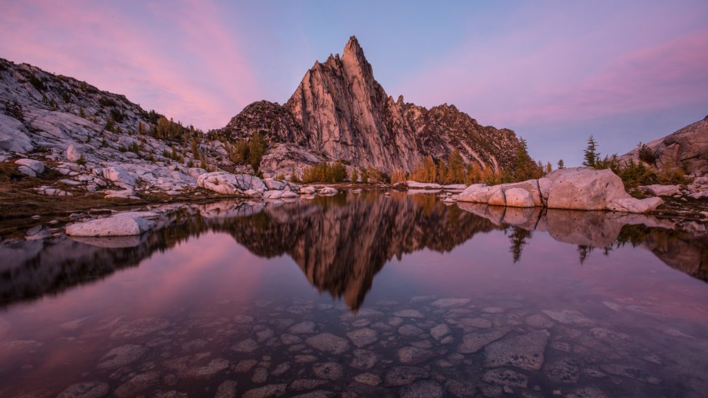
The Pacific Northwest is an adventure junkie’s paradise. It’s a breathtakingly diverse playground of craggy granite peaks, high alpine lakes, meadows socked with wildflowers, a rugged windswept coastline, and more shades of green than your eyeballs can handle.
With so many stunning trails to choose from, it can sometimes be tough to settle on the next one. That’s why we put together this list of our personal favorite Pacific Northwest backpacking trips. These are some of the most iconic and spectacular trails the PNW has to offer, so dust off your pack and add one of these gems to your summer adventure list.
Wonderland Trail
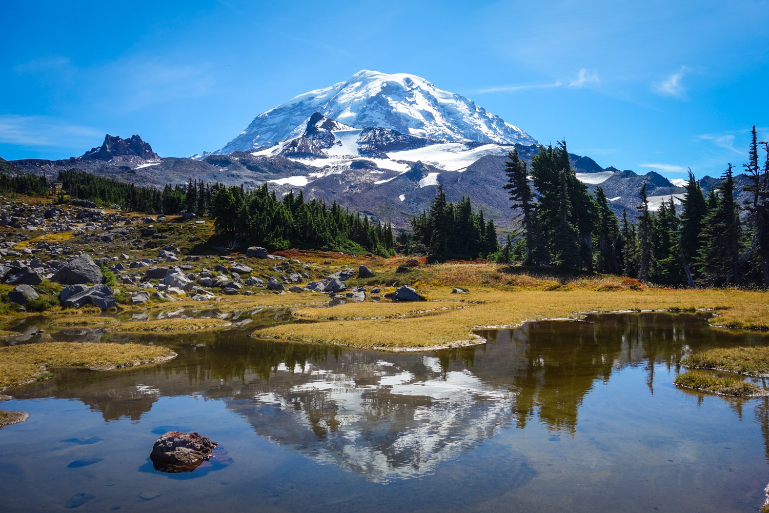
- Length : 93 miles
- Days needed : 8-13 days (most people take around 10 days)
- Location : Mount Rainier National Park, WA
- Best time to hike : Late July to mid-September
- Difficulty : Strenuous
The Wonderland trail circumnavigates massive and spectacular Mount Rainier over the course of 93 miles. It’s a very challenging hike, with over 23,000 feet of elevation change, but the rewards are plentiful. With breathtaking glacier views, wildflower meadows, pristine lakes, and miles of lush rainforests, the ever-changing landscape of the Wonderland Trail will not disappoint.
Permits for this very popular hike can be secured in advance through a yearly lottery system, though the park does save some permits for walk-in travelers.
Wonderland Maps & Guides
- CleverHiker Wonderland Trail Backpacking Guide – Our quick guide to assist you in planning your trip around Rainier.
- FarOut Wonderland Trail Guide – This popular app has user-generated comments on water sources, campsites, and important landmarks.
- Wilderness Trip Planning Map – This basic map from the National Park Service will give you a general idea of campsite locations and the distances between them.
- Green Trails Map 269S – Mount Rainier Wonderland – This is a fantastic map for hiking the Wonderland Trail. It’s a detailed topographical map that’s ideal for use along the trail.
- Hiking the Wonderland Book – A complete guide to the Wonderland by a Washington native that’s hiked the trail seven times. An excellent source of information.
- Plan & Go Wonderland Book – A comprehensive guide that contains everything you need to know for hiking the 93-mile Wonderland Trail.
- Backpacking Washington Book – This hike is covered in the Backpacking Washington book as well, just not in quite as much detail.
TIMBERLINE TRAIl
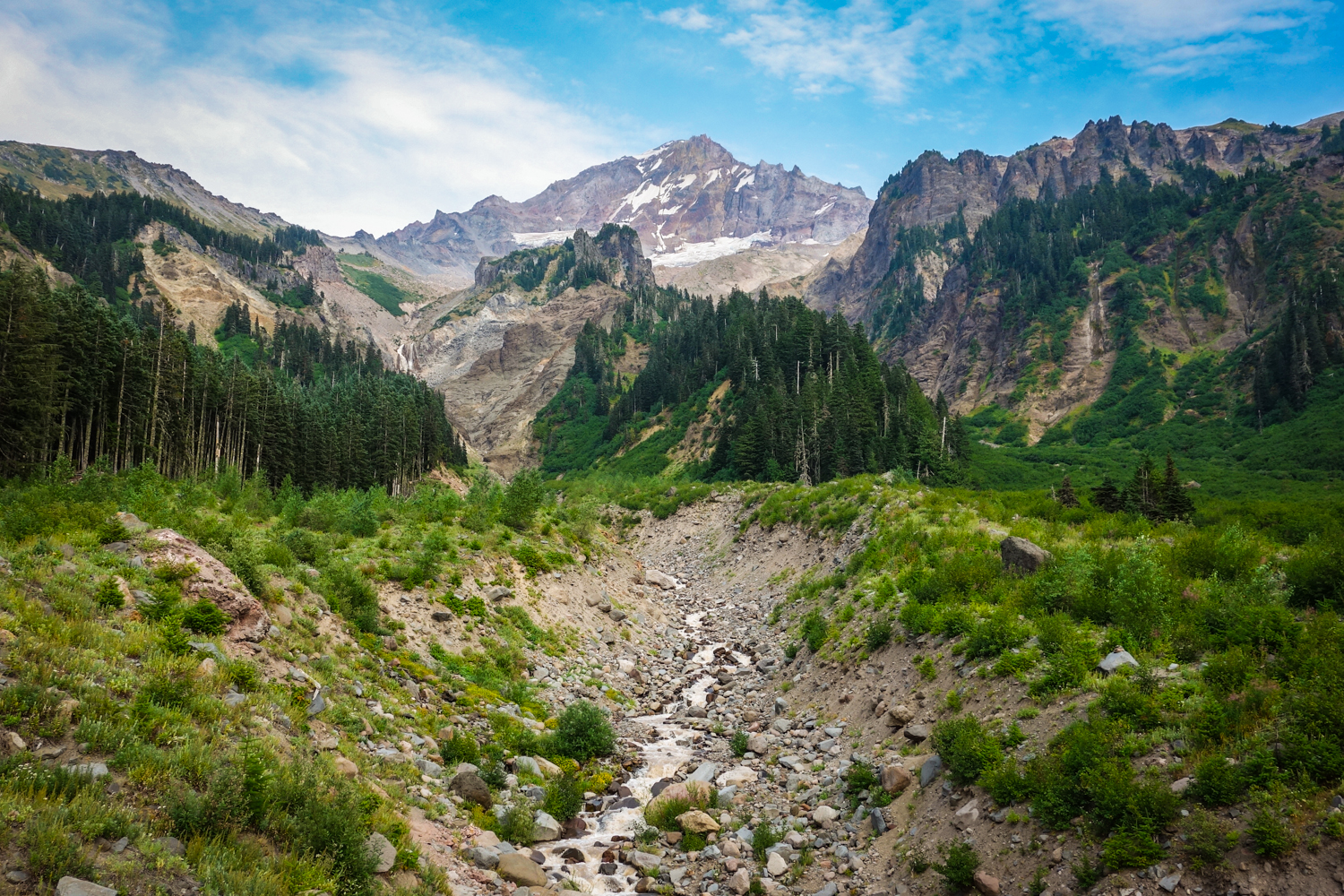
- Length : ~40 miles
- Days needed : 3-5 days (most people complete the loop in 4 days)
- Location : Mount Hood Area, OR
- Best time to hike : End of July to late September
The Timberline Trail around Mt. Hood is one of Oregon’s most iconic and scenic trails. This 40-mile loop is a fantastic way to experience the immense size and beauty of Mt. Hood. On the Timberline you’ll encounter lush old-growth forests, pristine alpine waterfalls, wildflower-filled meadows, towering craggy glaciers, rough volcanic landscapes, and some of the finest cascade views around. The hiking certainly won’t be easy, with plenty of ups and downs along the way, but in the end, the rewards are well worth it.
Timberline Maps & Guides
- CleverHiker Timberline Trail Backpacking Guide – Our complete guide to hiking the Timberline Trail.
- FarOut Timberline Trail Guide – A smartphone app with all the user-generated info you need for navigating the Timberline Trail.
- Green Trails Map 462SX – Mt Hood Climbing Map – This is an excellent, detailed map for the Timberline Trail.
Backpacking Oregon – This hike is covered in depth in the Backpacking Oregon book.
ENCHANTMENT LAKES
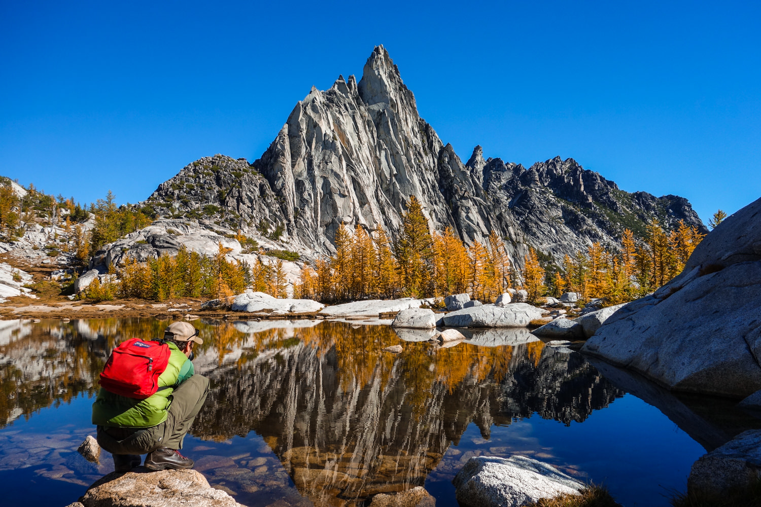
- Length : 19 miles from Stuart Lakes Trailhead to Snow Lakes Trailhead
- Days needed : 3-4 days to explore the entire area
- Location : Leavenworth, WA
- Best time to hike : Permit timeframe is May 15th – October 31st
Washington’s Enchantment Lakes are a truly magical sight to see. They reside in an area where immense granite peaks, majestic mountain goats, and crystal clear alpine lakes are hidden around every corner. Be ready for big climbs and jagged peaks along well-maintained trails. For the ambitious hiker, there are some incredible side trips, such as the can’t-miss climb to the top of Little Annapurna for jaw-dropping panoramic views. This area won’t be too crowded because of the strict permitting process, but securing overnight permits during peak season will require good luck. This hike should be on every backpackers bucket list.
Enchantments Maps & Guides
- CleverHiker Enchantment Lakes Backpacking Guide – Our complete guide to backpacking the Enchantment Lakes.
- Green Trails Enchantments Map 209s – This is an excellent, detailed map for the Enchantment Lakes area.
- Backpacking Washington – This hike is covered in depth in the Backpacking Washington book.
WALLOWA RIVER LOOP
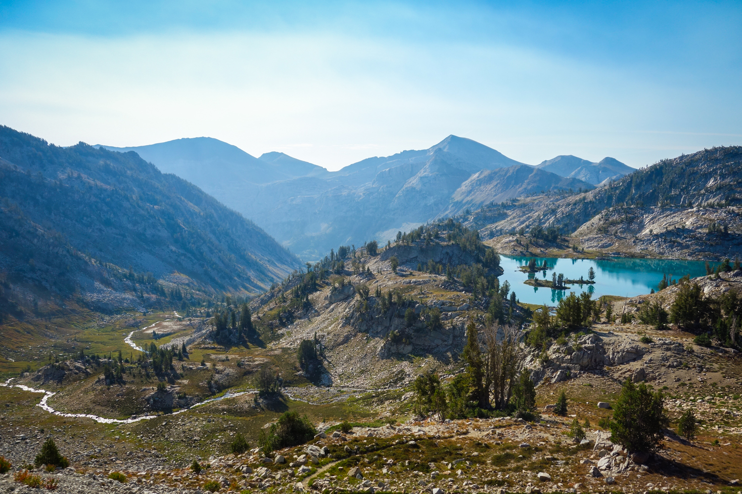
- Length : 36 miles
- Days needed : 4-5 days
- Location : Wallawa-Whitman National Forest – Eagle Cap Wilderness, OR
- Best time to hike : Late July to September
- Difficulty : Moderate to difficult
The Wallowa Mountain Range is one of the finest areas to backpack in Oregon. This loop will take you through the stunning (and popular) Lakes Basin Area and over some breathtaking mountain passes. Over the course of this loop you’ll encounter crystal clear lakes and streams, wildflower-socked meadows, and granite peaks that will make you wonder if you’re still in Oregon. There are also worthy side trips to the summit of Eagle Cap and Matterhorn that will further solidify your appreciation for the Wallowas. Although this trail sees its fair share of hikers, it’s still well worth the trip.
Wallowa Maps & Guides
- CleverHiker Wallowa River Loop Backpacking Guide – Our complete guide to backpacking the Wallowa River Loop. There are two main topo maps for this area – the Imus Geographics and U.S. Forest Service maps .
- Hiking Oregon’s Eagle Cap Wilderness – A practical and thorough book about Eagle Cap trails that’s complete with maps, descriptions, elevation profiles, and photos.
HIGH DIVIDE – SEVEN LAKES BASIN LOOP
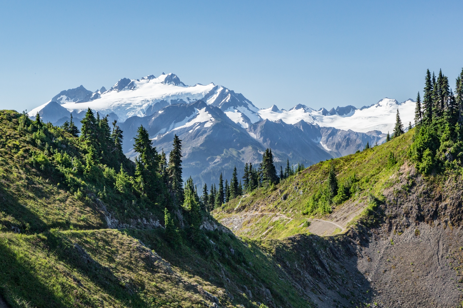
- Length : 19 mile loop
- Days needed : 2-4 days
- Location : Olympic National Park, WA
- Best time to hike : Mid-July to September
- Difficulty : Moderate
- Note : Bear canisters are required for this hike.
Olympic National Park has some of the most stunningly diverse backpacking trails in the Pacific Northwest and the High Divide Trail is one of it’s most scenic. Though this trek is incredibly beautiful, it’s definitely not a secret. This trail winds its way through old growth forests as you climb into dramatic high alpine scenery. Once you reach the lakes basin, you will be spoiled with pristine pools, gorgeous meadows, and stunning views of Mt. Olympus.
Permits are limited for overnight camping between May 1st and September 30th, but there are also some permits given on a first-come, first-served basis. And if you really want to go all out, you can end your trek with a visit to the Sol Duc Hot Springs Resort to rest those weary bones.
High Divide Maps & Guides
- Best Hike High Divide Loop Guide – A great blog post with detailed information on everything you need to know before hitting the trail.
- Green Trails Map 133S – This is an excellent, detailed map for the the Seven Lakes Basin.
National Geographic Map – This is a detailed map of the entire Olympic National Park.If you want an all-encompassing map and don’t mind carrying the extra bulk, this is a good resource.
Hiking Olympic National Park – This is a great resource that covers 66 of the best trails the ONP has to offer, ranging from day hikes to multi-day backpacking trips.
Three Sisters Loop
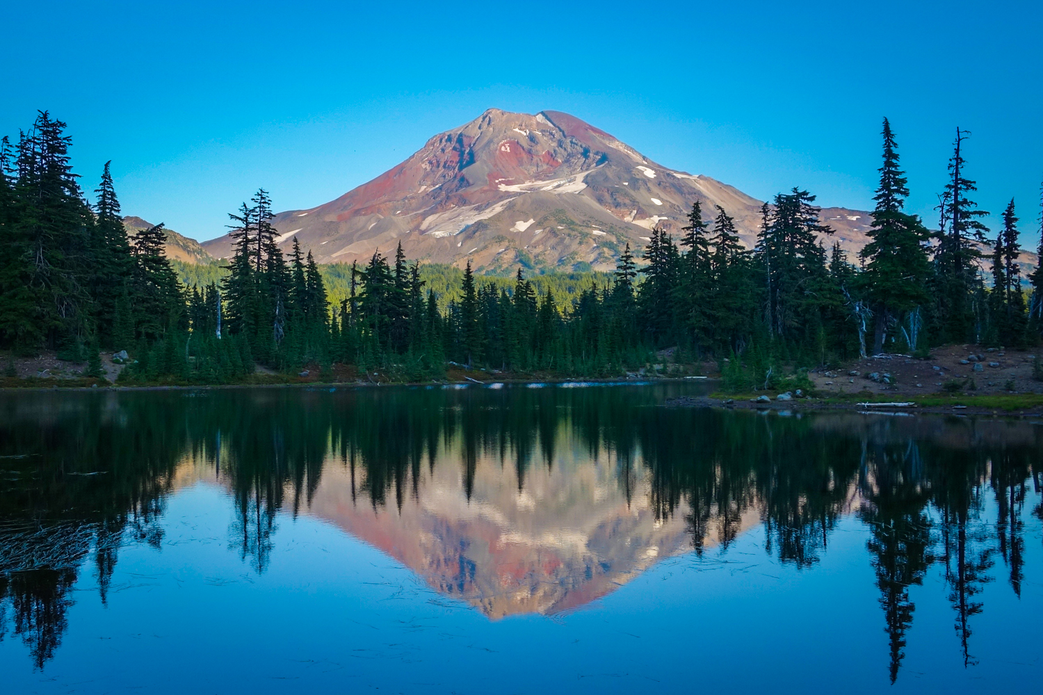
- Length : ~50 miles, depending on trailhead
- Days needed : 3-6 days
- Location : Three Sisters Wilderness, OR
- Best time to hike : Late July to October
This 50-mile loop circles the North, Middle, and South Sister volcanoes, providing a fantastic array of diverse terrain. Take this amazing journey and wander through rugged volcanic landscapes complete with expansive pumice fields, pristine melt lakes, quiet old-growth forests, newly recovering burn areas, peaceful wildflower meadows, and glossy obsidian streams. This is truly an Oregon adventure not to be missed.
Three Sisters Maps & Guides
CleverHiker Three Sisters Loop Backpacking Guide – Our complete guide to hiking the Three Sisters Loop.
Green Trails Maps 622 SX – This is an excellent, detailed maps for the Three Sisters Loop.
GOAT ROCKS – GOAT LAKE LOOP
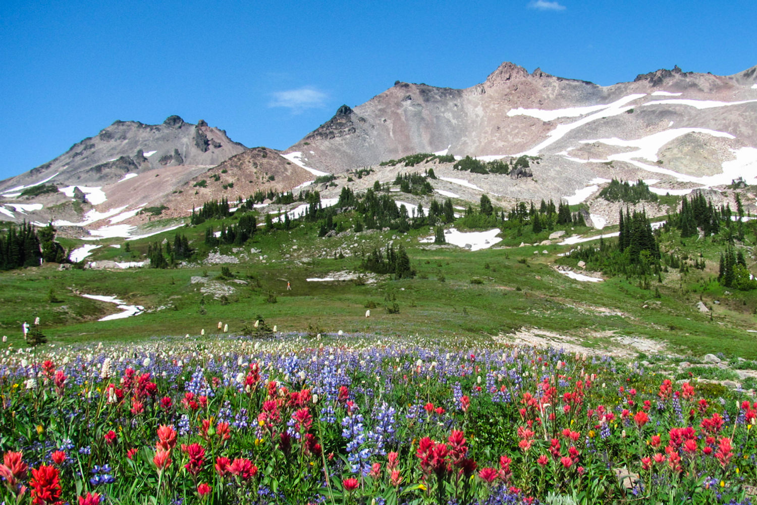
- Length : 13.5 miles (additional miles along the PCT will add time but is well worth it.)
- Days needed : 2-3 days
- Location : Goat Rocks Wilderness, OR
- Best time to hike : July to October
With panoramic views of St. Helens, Rainier and Adams, the Goat Lake Loop is an ideal backpacking trip for those with limited time. Traverse through wildflower meadows and rocky ridges as you ascend to beautiful and frigid Goat Lake. There are a few epic campsites on the ridge near Goat Lake, but you may have to get there early to snag one. If you have more time, set up a basecamp near Snowgrass Flats and hike north along the Pacific Crest Trail. That’s where you’ll find some of the most jaw-dropping scenery in the area: mountain vistas in all directions with a knife ridge hike and, if you’re lucky, mountain goats.
Goat Rocks Maps & Guides
- Oregon Hikers – Goat Lake Loop – This is a great play-by-play description of the Goat Lake Loop with information on mileage, a map, and trip reports.
- Green Trails Map 303S – A detailed backpacking map of the Goat Rocks Area.
Olympic Coast Trail
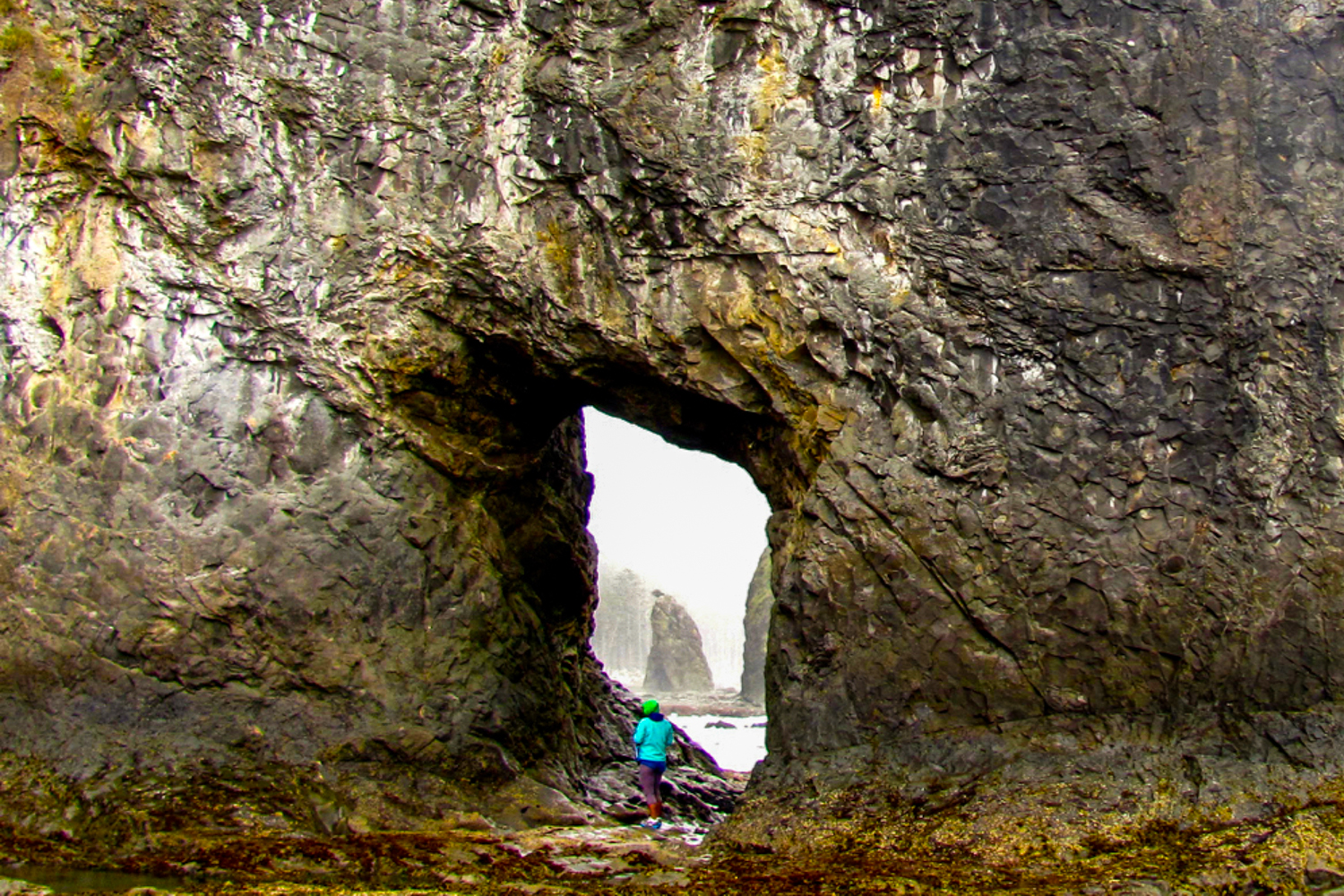
- Length : Varies (73 miles of possible trails)
- Days needed : Varies
- Location : Olympic National Park Coastal Area, WA
- Best time to hike : Year round, weather permitting. Winter storms can elevate tides and make beach walking hazardous, so closely monitor weather reports before your hike.
- Note : Bear canisters are required for this hike. Also, carry a tide chart and know how to read it when camping along the coast.
Many people visiting the Olympic National Park choose to hike into the Hoh Rain Forest or climb into the glaciated peaks surrounding Mt. Olympus. While both of those trips are awe-inspiring in their own right, don’t discount the unique experience of backpacking along the Olympic Coast. You will see wild desolate beaches, endless sea stacks, and daunting headlands with the chance to spot starfish and sea anemones in tide pools along the way. These 73 miles of rugged, undeveloped coastline are uniquely challenging, but very rewarding. Hike from one deserted beach to the next through a series of overland trails, many of which employ ropes and ladders to help you climb the eroded embankments.
Camping is permitted along the coast, except between the Quillayute River and Ellen Creek. The area between Shi Shi Beach and Ozette is the most stunning, however if you venture farther away you’ll find more solitude. Along the coast there are some forested campsites and you can also camp on the beach, just make absolutely certain you’re well above the high tide line.
National Park Service: Olympic Coast Routes – Our favorite source of information on various coastal routes and trails.
Backpacking Washington – Hikes along the Olympic National Park coastal regions are covered in depth in the Backpacking Washington book as well.
Green Trails Maps 98S , 130S , and 163S – Once you decide which portion of the coastal route you are going to tackle, pick the corresponding map and you should be good to go.
PNW Backpacking Considerations
Leave no trace.
No matter where your next adventure takes you, please follow wilderness regulations and help keep our wild spaces pristine for years to come. Leave no trace y’all.
DIFFICULTY RATING
Difficulty depends on your experience, physical fitness, pack weight, trail conditions, and weather. It’s nearly impossible for us to make individual difficulty recommendations without knowing you, so please think about those considerations when planning your hike.
PACKING LIGHT
We love lightweight backpacking because it makes hiking more enjoyable. And in the PNW, keeping your pack light makes a huge difference on climbs and descents. Our gear guides are dedicated to recommending exceptional lightweight equipment to help minimize pack weight and maximize comfort.
Many of the trails on this list are iconic and therefore popular. Hiking during the week or outside of peak season will reduce the number of travelers you see on the trail. Having said that, the wilderness is far from Portland or Seattle, so you’ll have plenty of time to yourself as well.
The trails listed in this guide are generally well-maintained and well-marked. That said, you should always carry a topographical map and compass in the wilderness and know how to use them. If you need a navigation refresher, check out our video tutorials, Navigation #1 – Staying Found, and Navigation #2 – Map, Compass, & GPS.
July and August are generally great for wildflowers in the Pacific Northwest, but that’s also the time when mosquitoes will be the worst. Use a combination of permethrin on your clothing and a small amount of 30% DEET for full protection.
Black bears are common in the Pacific Northwest, so proper food storage is very important. You’re less likely to see bears on popular trails, but there will still be small critters trying to get into your food supply, and they’ll happily chew through your expensive gear to get after it. Make sure to carry a food storage container or know how to hang a bear bag properly. Bear canisters and Ursacks are the most effective and easiest storage methods. Remember: proper food storage is for the safety of you and the bears.
It’s no secret that it rains a lot in the PNW. That’s the main reason it’s so green and lush, but continuous rain can also be a major bummer on backcountry trips. Hypothermia is a very real danger when hiking in the rain, so learning how to stay safe, dry, and happy in the rain is a key PNW skill. Pay close attention to the weather forecast before your trip and always be prepared for wet weather. And if you need some fresh gear, check out our guides on rain jackets and rain pants .
BACKPACKING BOOKS
The Backpacking Oregon and Backpacking Washington books are two of our favorite resources for Pacific Northwest trip planning. They feature detailed information on the iconic trails in this article as well as some lesser known yet equally worthy hikes. If you find yourself in the PNW backcountry often, find a space on your bookshelf for both.
We hope you’ve enjoyed this list of our favorite Pacific Northwest backpacking trips. We absolutely love exploring the PNW and we hope these treks help you do the same. Please remember to hike responsibly and help preserve our beautiful wild spaces for generations to come.

Why trust us?
We understand how tough it is to find trustworthy gear advice, and that’s one of the main reasons we built CleverHiker. We live for outdoor adventure, and we take these guides very seriously.
- Our recommendations are completely independent and based on hands-on experience.
- We test outdoor gear for a living – we’ve logged over 20,000 trail miles and 1,000 nights in the wilderness.
- Our team has thru-hiked some of the most iconic long trails, including the Continental Divide Trail, Pacific Crest Trail, Appalachian Trail, Colorado Trail, Long Trail, Oregon Coast Trail, Arizona Trail, Pinhoti Trail, Superior Hiking Trail, as well as extensive peak bagging, and international treks.
- We field test every product we recommend, which is sadly not the norm.
- We travel to industry trade shows to stay up-to-date on product innovations.
- We continuously update our guides throughout the year and when new products launch.
- We treat recommendations to our readers as if they were for our family and friends.
- We’re lifelong learners and we’re always open to feedback. If you think we’ve missed a worthy product or got something wrong, we’d love to know about it.
Related Content
CleverHiker Gear Guide

Top Gear Picks of 2024
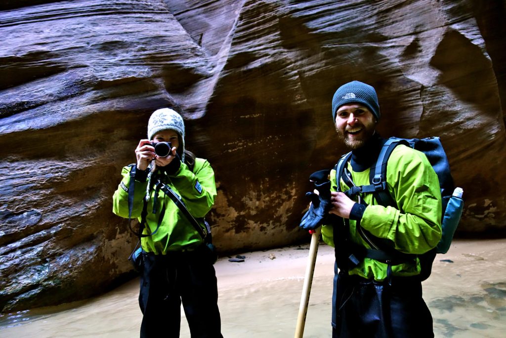
Essential Trail Skills? – CH Season 2

SOTO Amicus Cookset Review

Snow Peak Gigapower 2.0 Backpacking Stove Review

Primus Essential Trail Backpacking Stove Review

MSR WhisperLite Backpacking Stove Review

BRS 3000T Backpacking Stove Review

Men’s Kuhl Renegade Rock Shorts Review

Men’s Nike DRI-Fit Challenger Shorts Review

Men’s REI Trailmade Amphib Review
Get the best content from cleverhiker & around the backpacking world.
Social media is great, but our bi-weekly newsletter is a much better way to stay in the know.
Sign up to get our curated emails with the best content from CleverHiker and around the backpacking world. You’ll be turned on to new videos, trip reports, gear reviews, inspiring outdoor stories and much more. So get in the mix!
IMAGES
VIDEO
COMMENTS
Newbie backpackers and seasoned vets alike can find the perfect backpacking trip on this list. Take a look at these incredible adventures and we're sure you'll start planning your next backpacking trip in Washington ASAP. 1. Hike to Hidden Lake Lookout. Photo: Christin Healey. Distance: 7.39 miles. Elevation: 3415 ft.
Here are a few of our favorite, and most rewarding, backpacking trips in Washington. ... Thornton Lakes Trail + Trappers Peak: Like so many of the best hikes in North Cascades National Park, this trail demands a lot - 10.6 miles there-and-back and nearly 3,500 feet of elevation gain ...
6) Pratt Lake. Photo: Laura Howard. What: Experience one of the Seattle area's most popular hike sans-crowds by backpacking in and camping out for the night. Extend your weekend with a trip to lower Tushcohatchie Lake, Melakwa Lake, or Kaleetan Lake. Where: Snoqualmie Pass, western Washington.
13 Best Washington Backpacking Trips . This guide features backpacking trips in Olympic National Park and one spectacular must-do trip in Olympic National Forest, exposing you to ecosystems ranging from craggy coastlines to rainforests, valleys, and glaciers. Also featured here are the best trips available in the Central and North Cascades and ...
To help you out, here are 9 of the most iconic backpacking routes in Washington, complete with everything you need to know to hit the trail. 1. The Wonderland Trail. Distance: 93 miles (150km) Elevation Gain: 23,000 feet (7,010m) Number of Nights: 14. Difficulty: Strenuous. Hiking Season: Summer, early Fall. Dogs: No.
8. Baker Lake Trail | Best Backpacking Trips in Washington. Backpacking Washington: Worst Night of Sleep in the Backcountry goes to…. 9. Thunder Mountain Lakes. 10. Hoh River Trail. Best Backpacking Trips in Washington: Worst Mosquitoes Award goes to…. 11.
The 10 best backpacking trips in Washington, in conclusion. In truth this list could be 5x longer as options in Washington are endless. I always say there is no such think as an ugly hike in the state of Washington. However, start with these 10 of the best backpacking trips in Washington and go from there. You wont be disappointed with any of ...
Length: 12.0 miles, roundtrip. Elevation Gain: 1300 feet. Thunder Creek is your constant companion on this trail. Photo by trip reporter SlothHikingTeam. This low elevation trail allows for early and late season adventures along the emerald green waters of Thunder Arm through giant old growth forests.
This 28-mile round trip hike offers the best of the Columbia Highlands as it passes through old-growth Ponderosa pine stands, skirts five significant peaks in the Kettle Range, and showcases the effects of the White Mountain Fire of 1988. The Kettle Crest Trail passes just beneath the summits of Sherman and Snow Peaks, Bald Mountain, Barnaby ...
Four of the top backpacking destinations in Washington State including hikes in North Cascades National Park and Olympic National Park. NEW! Now hiking through Spain and France in the Pyrenees. 800-715-HIKE (4453) (9-4:30 Every Day) ... Top Washington Backpacking Trips. Posted on 06-26-19.
Washington gives a great taste of the beautiful nature of the Pacific Northwest. Temperate rainforest scenes and massive haystack rocks off the coast likely come to mind. But, the Evergreen State has so much more to offer. 10 volcanoes 3,000 glaciers; the most of any U.S. state! 3,167 named mountains Over 8,000 lakes Over 100 waterfalls 157 miles of coastline, 60 of which belong to Olympic ...
Mileage: 24.6 miles, one-way. Elevation Gain: 5 00 feet. A view of the lake with low water levels during an early season visit. Photo by trip reporter wet boots, dry hops. Visit one of the best old-growth hikes in the North Cascades, with views of a vivid blue lake and jagged, snowy peaks thrown in for good measure.
It's one of the best beginner backpacking trips in Washington state to do in the early camping season - April and May. Note: The lakes are unsafe for filtering water, so pack in enough clean water for your entire trip. 2. Barclay Lake. Region: Stevens Pass Area (Highway 2) Distance: 4.4 miles out and back. Elevation Gain: ~250 feet.
Winter is in full force up in Washington and for those of you ready to take on the elements, the backcountry has turned into a winter wonderland for adventure. Backpacking destinations that are typically packed with campers all spring, summer, and fall are now your own personal snowy playground.
Olympic National park Shi Shi Beach. This was our first backpacking trip, and we highly recommend it. Parking at the trailhead is limited to day hikers, so backpackers are encouraged to park at a nearby private home, paying $10 per day, in cash (directions in the Washington Trail Association's "Getting There" section) and walk to the trailhead from there.
Best Hike for Autumn Colors: Little Giant Pass. Chiwawa Ridge near Little Giant Pass (Photo: "Chiwawa Ridge close to the Little Giant Pass" by Martin Bravenboer is marked with CC BY 2.0.) Length: 10 miles. Elevation Gain: 4,000 ft. Trail Type: Out and back. Difficulty: Difficult.
This beginner-friendly backpacking trip to the Cascade Mountains is a 10.4-miles roundtrip hike with 1,400 feet of elevation gain in 5.2 miles. At mile 3, hikers can choose to take either the Upper or Lower Elliot Trail to the terminus at the lake. Take one up and the other down to experience the different Cascade views along each route.
Hoh River Trail to Blue Glacier, Olympic National Park. Trailhead: Hoh River (Hoh Rain Forest Visitor Center parking lot) Mileage: 36 (round-trip) Drive from Seattle: 4 hours 30 minutes. This is an incredible weekend backpacking trip that offers a stark contrast of environments and a moderate climb of 4,700 feet.
8 Iconic Pacific Northwest Backpacking Trips. The Pacific Northwest is an adventure junkie's paradise. It's a breathtakingly diverse playground of craggy granite peaks, high alpine lakes, meadows socked with wildflowers, a rugged windswept coastline, and more shades of green than your eyeballs can handle. With so many stunning trails to ...