Questions or Comments?
Customer service:, connect with us.
- Facebook (Open external link)
- Twitter (Open external link)
- YouTube (Open external link)
- Instagram (Open external link)
- LinkedIn (Open external link)

Safe. Clean. Friendly.

- Routes & Schedules
- Plan Your Trip
- Track Bus or Train
- Service Alerts
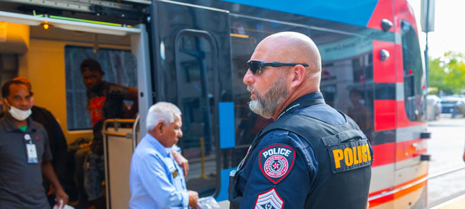
Your Safety Is Our No. 1 Priority
METRO invests in people, equipment and technology to help protect your safety. Learn how the METRO Police Department serves our community.

Exciting Career Opportunities
Join METRO, where a passion for public service is rewarding. Discover available career paths from field personnel to administrative staff positions. Enjoy comprehensive benefits, including medical, dental, vision, retirement and $200 monthly childcare assistance. Advance your career with tuition reimbursement and a supportive work culture.
Explore hiring incentives for select positions including up to $4,000 for bus operators and up to $8,000 for bus mechanics.
Recent News & Activities
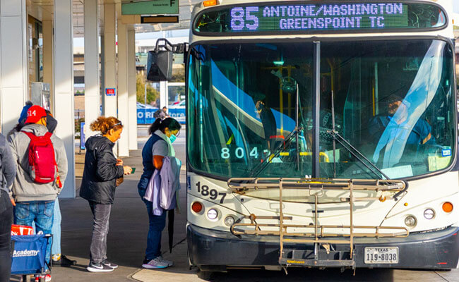
Plan Ahead for METRO Service Changes on Sunday, June 16 >
See the Juneteenth Holiday Schedule for Wednesday, June 19 >
Hurricane Season is Here. Make Sure You Subscribe for Alerts >
Ride METRO to Visit the Discovery Green and Avoid Parking >
Learn More About the METRO Police Department >
METRO Funds Over $4 Billion in Road Maintenance and More >
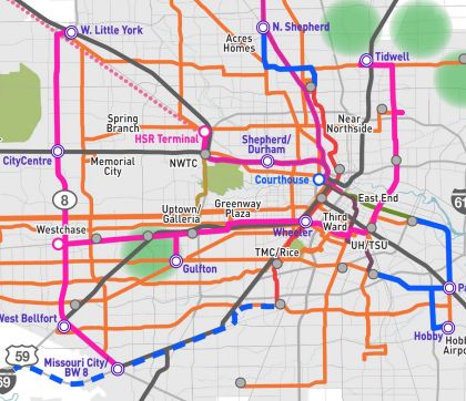
The voter-approved Moving Forward Plan is giving you more ways to move around our region.

Rider Rewards
Score food and entertainment discounts around the region just for riding METRO.
ONE to Ride App
Plan and manage your trip on METRO Local bus, Park & Ride bus, METRORail or METRORapid using an interactive map.

Need Answers? We’re Here to Help
Select a topic you have a question about
storm-recovery
Storm Recovery
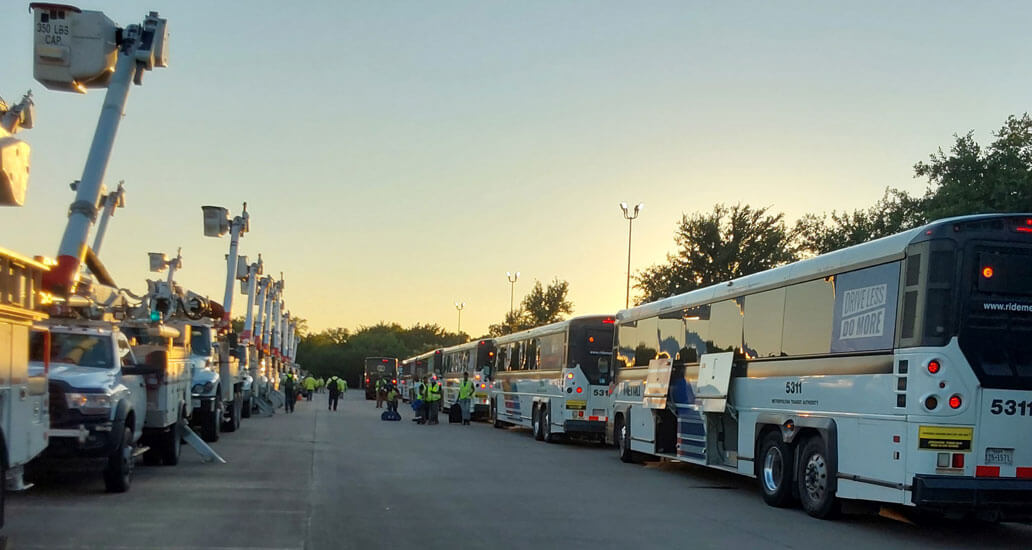
METRO stages buses to transport utility workers to hard-hit areas.
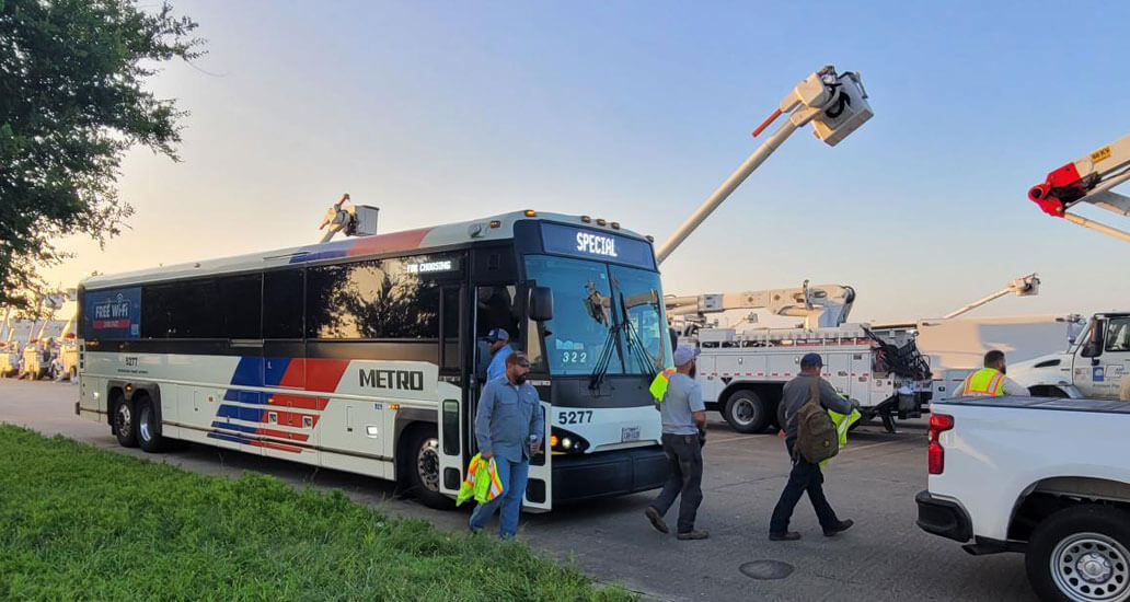
METRO contributes to storm recovery efforts by shuttling aid crews.
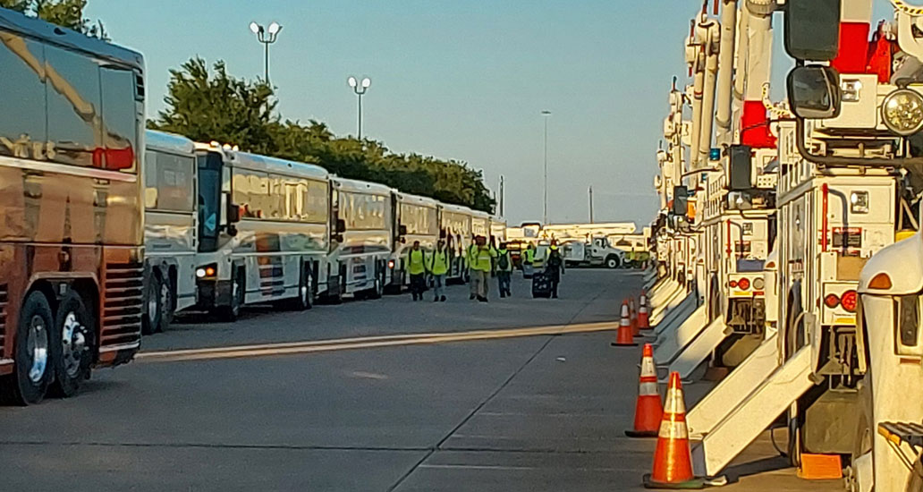
METRO is an active partner in storm recovery efforts following the windstorm.

METRO shuttles utility workers and support personnel to assist with the recovery efforts.

METRO remains on call to shuttle utility workers throughout the evening.
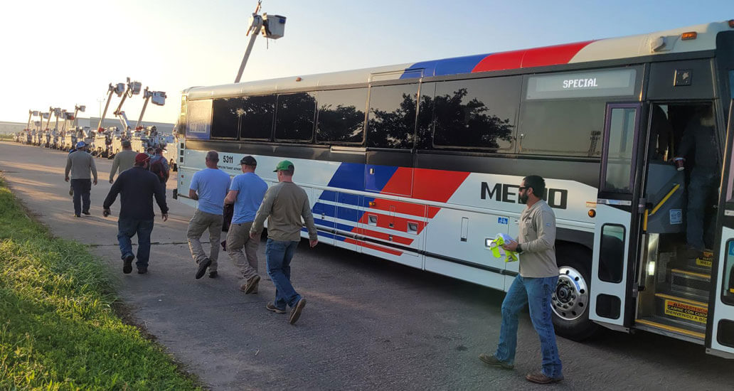
Crews from out of town are shuttled to waiting trucks to begin restoration efforts.
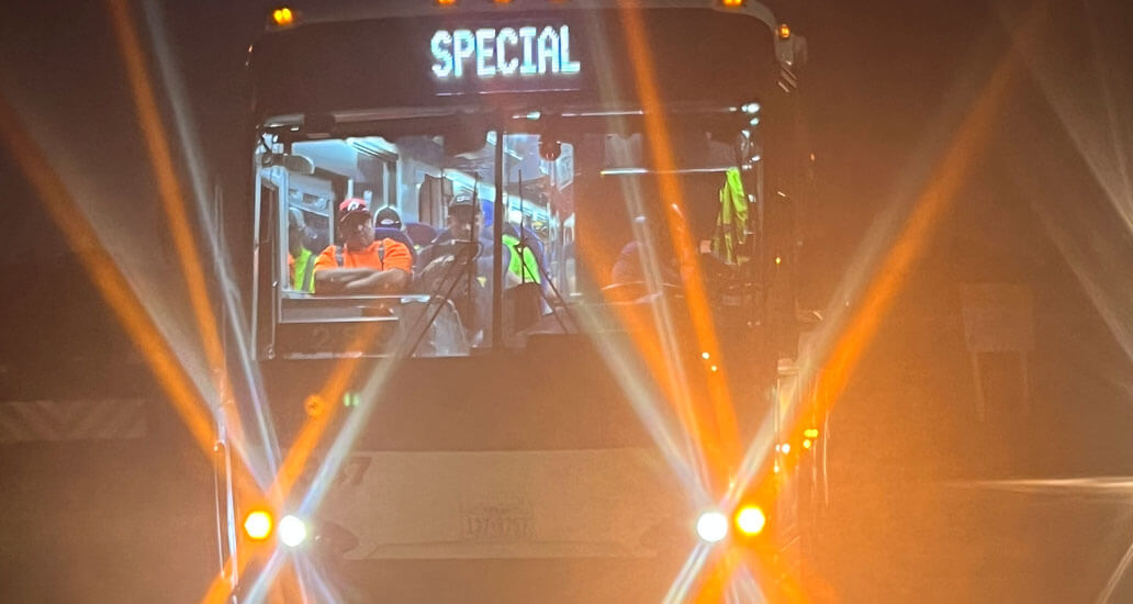
METRO is an essential partner in city-wide recovery efforts following the storm.
Learn the ways METRO is keeping eyes on the community as we reinforce patrols throughout the system.
Hear how dedicated METRO Police and Bus Operators were able to safely reunite a lost child with her family.
From police patrolling to live security monitors, METRO is building a safer transit system.
At METRO, safety is part of everything we do.
Preview METRO's New Mobile Website
Website Preview (mobile)
Every bus route now has its own page. Each METRORail line has a linear map showing nearby connections and services. You can even track the arrival of your bus or train directly from the home page. Watch the video to see how it all looks and works on a smartphone.
Let us know your location and the new METRO website will provide custom results about nearby transfer facilities, nearby METRO public parking, nearby retailers that carry METRO fare cards - and more. Watch the video to see how it all looks and works on a smartphone.
Preview METRO's New Desktop Website
Website Preview (desktop)
Every bus route now has its own page. Each METRORail line has a linear map showing nearby connections and services. You can even track the arrival of your bus or train directly from the home page. Watch the video to see how it all looks and works on a desktop device.
Let us know your location and the new METRO website will provide custom results about nearby transfer facilities, nearby METRO public parking, nearby retailers that carry METRO fare cards - and more. Watch the video to see how it all looks and works on a desktop device.
Browser not supported
It appears you’re on an older web browser we don’t support. Please try one of the options below so you can view the METRO website.

You are using Internet Explorer. Please use Edge or Chrome to get the full experience.
Trip Planner
No trips available.
We were unable to plan a trip between those locations. Try adjusting your trip settings. You can also contact Transit Information for help by phone at 612-373-3333.
*Trips shown are based on default settings tailored for optimal results.
Navigating Washington, DC with Metro
Find out everything you need to know to ride dc’s world-class metrorail system, get a metro map, check operating hours, ride fares and more..
Washington, DC’s Metro is one of the busiest public transportation systems in the country. Its expansive network of tunnels and above ground tracks connect all four quadrants of DC with suburban Virginia and Maryland. The system is heavily used by local commuters and it’s a popular, convenient and affordable way for visitors to DC to get around the region, now so more than ever. Metro has opened its new Silver Line extension, which allows riders to connect to Dulles International Airport and explore Loudoun County. Visit Metro's website for more information about the extension.
Find information about the Washington, DC Metro system:
DC Metro Map
- How Metro Works & Metro Trip Planner
- Metro Fares
- Metro Hours
- Metro Etiquette
Please download the touch-free SmarTrip app for iPhone and Android .
A Metrorail system map will help you navigate the nation's capital during your trip. Click the Washington, DC Metro map below to view a larger version.

How does the Washington, DC Metro work? How do I plan my trip?
The Metro consists of six color-coded lines: Red, Blue, Orange, Yellow, Green and Silver. The lines are connected to each other via transfer stations and many Metro stops are serviced by more than one color. Each train car has an exterior electronic sign that marks the color and the direction of the train. Direction is indicated by the final station of that line.
Popular sightseeing Metro stops include the Smithsonian (Orange, Silver and Blue lines), Woodley Park-Zoo/Adams Morgan (Red line) and Gallery Place-Chinatown (Red, Green and Yellow lines). You can plan your trip and find the best route using Metro's Trip Planner .
Worried about internet connectivity while traveling on Metro? Currently, most Metro stations have free Wi-Fi .
How much are Metro fares and how do you use SmarTrip?
Metro fares are calculated by how many stops you travel and vary during peak and off-peak hours. During peak hours, most fares range from $2.25 to $6 per trip. During off-peak hours, fares typically range from $1.85 to $3.85.
Metro riders must pay via SmarTrip card or the SmarTrip app on iPhone and Apple Watch . SmarTrip cards are plastic, rechargeable fare cards that can be purchased by cash or credit at any Metro station or in advance on wmata.com . You can calculate your fare between two stops using Metro’s Trip Planner .
The SmarTrip app can be used anywhere the SmarTrip card is accepted, including rail, buses and Metro-operated parking lots. Metro is the first rail system in the U.S. to offer a full-service, touch-free payment option at every single stop. See below for more information about how to use SmarTrip in your Apple Wallet .
What are the Metro's hours and when does it close?
DC Metro trains run Monday - Thursday, 5 a.m. until 12 a.m.; Friday, 5 a.m. until 1 a.m.; Saturday: 7 a.m. until 1 a.m.; Sunday: 7 a.m. until 12 a.m.
Metro etiquette
The Washington, DC Metro serves thousands of commuters and visitors each day. Because the train system is so heavily used by busy local commuters, there are a number of unspoken rules that visitors should be aware of. If possible, you may want to ride at off-peak hours when the train system is much less hectic.
When riding the escalator, stand to your right, walk to your left. Standing in a twosome that blocks the left side is strongly (and often loudly) discouraged by your fellow Metro riders.
When waiting to board a train, let riders exit the train first before trying to board. If the train is particularly crowded and you are standing in a doorway, step just outside the train doorway to allow your fellow riders room to exit.
Another important note if the train is crowded: move to the middle of the car so others can board. You will have time to exit when you arrive at your stop.
During peak hours, trains arrive often. Don’t try to board a train that is too full. The automatic doors are very sensitive and if they can’t close, the train operator may offload the entire train because a door stopped working.
Each car usually has several seats for handicapped riders. Please don’t use these seats if there is a rider that needs to sit down.
Be sure and have your SmarTrip card out and ready to swipe when you go through the gate. Riders move through quickly and holding up the line is discouraged.
While the Metro can be a very busy place, most of your fellow riders are friendly and will point you in the right direction. There is also a station manager at each station. Don’t be afraid to ask if you have questions about navigating the Metro!
Now that you have read up on the Metrorail experience, learn about other ways to navigate DC. Check out the best transportation options for getting around the District.
More About DC
You may also like..
Guide to Union Station in Washington, DC
Getting to Washington, DC
Washington, DC Safety Information

The following navigation utilizes arrow, enter, escape, and space bar key commands. Left and right arrows move through main tier links and expand / close menus in sub tiers. Up and Down arrows will open main tier menus and toggle through sub tier links. Enter and space open menus and escape closes them as well. Tab will move on to the next part of the site rather than go through menu items.
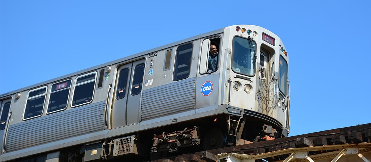
Timetable update
We routinely adjust schedules to help make service operate more efficiently and to account for seasonal ridership patterns.
Several bus routes will have their schedules updated effective June 9.
View the updated route timetables

Washington, DC
Plan your trip by metro.
More Resources
Moovit: All Transit Options 4+
Bus, train, subway live times, moovit app global ltd, designed for ipad.
- #9 in Navigation
- 4.7 • 44.7K Ratings
- Offers In-App Purchases
Screenshots
Description.
Moovit is the world's #1 urban mobility app. All local transit options in one app: buses, trains, subway, bikes, scooters, Uber, Lyft, and more. Plan, pay, and ride. Moovit is one app for all your urban mobility and transit rides. Transportation is an integral part of urban living. Whether you ride the train, subway, bus, light rail, ferry or metro, use dockless scooters, bikes, ride-sharing like Uber or Lyft, getting the best urban mobility information is critical. Enter Moovit! Moovit provides riders with a one-stop-shop journey experience to help them get from point A to B in the easiest and most efficient way. Get train and bus times, maps, and real-time arrival information with ease so that you can plan your trip with confidence. Pay and validate your rides. Find critical alerts and service disruptions for your favorite lines. Get step-by-step directions of optimal route bus, train, metro, bike, scooter or a combination of them. Moovit guides more than 930 million users in over 3400 cities throughout the world. Commuters will find updated bus and train times, transit maps, and, where available, real-time line arrivals. Locate nearby bus stops and train stations, travel with on-the-go live navigation guidance, receive get-off alerts when approaching your destination to ensure a smooth ride. That's why Moovit has been named one of the best apps of the year in 2017 by the App Store. Moovit is your personal assistant for all your transit rides! ► Real-time arrivals. View real-time arrival information, which is taken directly from GPS devices positioned on buses and trains. Avoid wasting time guessing train times or bus times. ► Digital payment. Purchase bus & train tickets and validate your digital pass with a tap (select cities). ► Real time alerts. Know about issues ahead of time by receiving service alerts such as emergency or unexpected disruptions, delays, traffic jams, new construction, and more so that you can plan ahead if your bus time or train time changed. ► Live Directions. Get step-by-step bus directions and other transit directions with live guidance from A-to-B: Know how long you need to walk to your station, view your line's arrival time, receive get-off alerts as you approach your destination, and more. ► Visualize Your Stop. Use augmented reality to locate your bus or train stop with "Way Finder". ► User reports. Moovit’s users report issues found with stations, line service, and schedules so that we can inform all nearby riders about what’s going on in their area. ► Favorite lines, stations, and places. Get easy access to lines, stations, and places you ride and visit all the time. Plus, get real-time updates if/when there are changes to your favorite lines in case your bus time or train time is impacted! ► Bike routes. Get bike routes in addition to the bus, subway, train, or metro trip plans. If you ride bikes (yours or shared) we can plan a route that includes the train or bus. Moovit will help you plan a trip that meets your transit-needs. Bike docking stations are updated in real-time. Bike trip plans are only available in supported metro areas. ► Maps view. Interested in seeing the whole picture? View all stations, routes, and lines on the subway or bus map. Additionally, maps are available in PDF for when you’re offline, or underground on the subway. Moovit is the #1 urban mobility app in the world. We’re proud to collaborate with public transit agencies across the United States, including: MTA NJ Transit MBTA SEPTA LA Metro SFMTA Muni BART Caltrain CTA Metra WMATA MTA Maryland TriMet Sound Transit SARTA PARTA You only need one app on your phone to navigate nearby buses and transit in the U.S. and across 112 other countries and in 45 languages. If you’d like to know bus times and train times all around the world or if you need to find out when the last bus leaves a certain bus stop Moovit has you covered. You ride, we guide! Contact us: * https://support.moovitapp.com/hc/en-us/requests/new?ticket_form_id=175869 * https://www.facebook.com/moovit * https://twitter.com/moovit Terms of Use https://moovitapp.com/en-us/legal/terms-of-service-en
Version 5.146.1
New! Add an extra stop Customize your trip by adding an additional stop to your route. Simply tap the + icon next to your destination. New! Know ahead of time if your line arrival is being delayed due to traffic. Just look for the “traffic” icon near your line.
Ratings and Reviews
44.7K Ratings
Good and helpful app
Update: 6-5: most of the issues I described are from me not understanding how to use the app. GPS still lags, but have a little patients and the route always updates. Great app. I have been using this app for a week. I am visiting family in Hawaii(Oahu). I would be lost without the help of this app. The minor things I have experienced with the app is the gps seems to lag. When I set my destination, as I begin to walk I didn’t see the icon move in the app. Until a few minutes later, also when I begin my trip I read what it says, but at times it is not clear which way to go. Another thing I noticed, when the app tells you what bus to catch, it may give you multiple bus numbers. When I catch one of the bus, the bus number does not match. When the bus moves, the icon does not move, until a few moments later. Then the app seems to catch up and it begins to show the route and the location of where you at as you progress along your trip. It should give and option to select what bus you are on. I am still learning how to use this. I guess I said all that to stay this. When you set your destination, it should lock in your destination choice. I have of habit of planning other destination along my route, my original destination seems to get lost and I struggle to find my original route I planned. You can use Google maps to do the same as this app, but Moove it does it way better. If traveling, I highly recommend this app.
Pocket Travel Guide
Moovit is a must have. We used it nonstop while on our NYC vacation. NYC is big and spread out but getting around is a snap with this app. Just punch in where you want to go (restaurant, hotel, attraction, address, etc...) and it tells you how long it will take to get there and (1) which subway station is closest, (2) gives you gps walking directions to get there, (3) tells you which line to get on, (4) lets you know how many minutes until the next 3 subways on that line will arrive at your station, (5) tells you how many stops until you need to get off, (6) shows you a list of all the stops until your departure, (7) updates that list as you ride, (8) alerts you before your last stop telling you to get off, and (9) gives you walking directions to wherever you are trying to get to. As a visitor I don’t know the terminal ends of the subway lines, and that is what the subways say on them and on the signs. It would give users more confidence if the app said “D toward Brighton Beach” so you feel better about getting on a train going towards a destination you don’t know. That said, the app was always right and the only time we got on the right line going the wrong direction was because we second guessed the app.
Most Useful App I Own
Just took a trip to Italy, France and Portugal and used this in Rome, Venice, Paris and Lisbon. It automatically changes your metro city, tells you which bus/train/metro/vaporetto/traghetto to take, gives you time estimates for your whole trip as well as public transport schedules. You can pick your route based on what’s available right now, when you want to leave, or when you want to arrive, so it’s super handy when you’re trying to figure out when to leave your hotel the next morning to get to exhibit “x” by 8 am. You can also choose your departure location so you can start from your location now or pick where you’ll be in 2 hours so you can plan your day. They also alert you of closures and problems, track your progress in real time via gps, and alert you when your stop is coming up. This app allowed us to safely and effectively ride public transport in countries where we did not speak the language. SO effective and reduced the stress of figuring out cheap transportation. Really, this app is a 100 out of 5 stars, absolutely LOVED it!!!!
App Privacy
The developer, Moovit App Global LTD , indicated that the app’s privacy practices may include handling of data as described below. For more information, see the developer’s privacy policy .
Data Used to Track You
The following data may be used to track you across apps and websites owned by other companies:
- Identifiers
Data Linked to You
The following data may be collected and linked to your identity:
- Diagnostics
Data Not Linked to You
The following data may be collected but it is not linked to your identity:
- User Content
- Search History
Privacy practices may vary, for example, based on the features you use or your age. Learn More
Information
English, Arabic, Bulgarian, Catalan, Croatian, Czech, Danish, Dutch, Estonian, Finnish, French, Georgian, German, Greek, Hebrew, Hindi, Hungarian, Indonesian, Italian, Japanese, Kannada, Korean, Lithuanian, Macedonian, Malay, Marathi, Norwegian Bokmål, Polish, Portuguese, Romanian, Russian, Serbian, Simplified Chinese, Slovak, Spanish, Swedish, Thai, Traditional Chinese, Turkish, Ukrainian, Vietnamese
- 12 month plan $17.99
- Monthly plan $2.99
- 6 month plan $13.49
- 12 month plan $11.99
- 12 month plan $8.99
- 12 month plan $19.99
- 12 month plan $15.99
- Monthly plan $3.69
- 3 month plan $6.99
- Monthly plan $0.99
- Developer Website
- App Support
- Privacy Policy

Get all of your passes, tickets, cards, and more in one place.
More by this developer, you might also like.
Cittamobi: Horários de Ônibus
MoviliXa Bogota
Worldpackers Travel the World
BlaBlaCar: Carpooling and Bus
Rome2Rio: Trip Planner
Omio: Europe & U.S. Travel
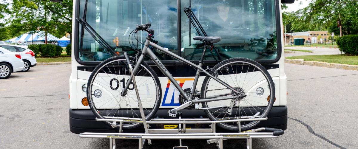
- Plan Your Trip

Plan it. Track it. Google Map it.
Plan your trip and track your bus is by using Google Maps .
Metro Widget
- Track Your Bus
Current Detours
Routes s and w.
O'Keeffe is closed due to construction.
Observatory Dr. is closed between Charter and Park.
Routes H, 634 & 635
Greenway and Coho streets are closed.
Route H and 628
Construction project impacts service on Reetz and Verona West.
Service near Cottontail and Kings Mill Way
Routes A, F, R, 28 & 38
Construction impacts Metro service on Whitney, Sheboygan and Segoe.
Routes C2 and G
Construction closes Dempsey/ Davies.
Current Stop Closures
Stop 1563 closed.
Bus Stop on Doty at MLK Jr. Blvd. is closed
Stop #0178 Closed
Stop #0178 on University at Orchard is closed.
Stop 9520 Closed
Westbound Stop 9520 on E. Wash at E. Springs Closed
Get Metro service updates and detour information for your route with our free email and text alerts.
JavaScript Required
Use metro's ride guide.
Review printable versions of Metro's map and schedules.
Print Schedules
Bus Stop Schedules
View schedules, routes served, and real-time departures at each stop.
Search by stop number or by street name.
How to Ride
- Accessible Services
- New Bus Technology
- Rider Tools & Apps
- Riding Information
- Riding Rules

Metro Transit Justin Stuehrenberg, General Manager
Customer Service
Rider information.
- Routes & Schedules
- Lost & Found
- Service Detours
- Travel in Monona
Business Resources
- Advertising
- Disadvantaged Business Program
- Doing Business with Metro
- App Developers
About Metro Transit
- Annual Reports
- ADA Comments & Complaints
- Civil Rights & Title VI
- Oversight Committees
Trip Planner
- Trip Planner
Trip Planner | Travel Itinerary Planner | Plan a Trip
Are you looking for an itinerary planner to plan your next trip? We know creating a customized travel itinerary manually is an overwhelming task. You have to put a lot of time into selecting destinations, booking hotels, flights, and comparing prices. On top of that calculating budgets & booking hotels and flights is another challenge that makes itinerary planning tough.
But what if all of this is done within a few minutes for you? Yes with TripHobo trip planner you can do this smartly. We have observed that many travelers end up spending more time in researching information than enjoying the actual trip. Not only first-time travelers but also experienced travelers struggle in creating perfect travel plans.
Even though it is a tedious task to create a customized itinerary, everyone agrees on the importance of itinerary for an enjoyable holiday. So Triphobo came up with this easy to use automatic itinerary planner.
How Trip Planner Works / Steps to Plan a Trip
Do you want to create your travel itinerary quickly & easily? Are you ready to use this tool now? TripHobo's trip planner plays a major role to ease the itinerary creation process and helps you overcome the pain in the trip planning . Follow these 4 simple steps to plan a trip & let us know your experience.
1) Choose Your Destination & Dates when you want to travel
Visual algorithmic trip planner lets you choose destinations you want to travel to. You have the freedom to choose the real dates from the calendar. After selecting travel dates, planner runs algorithms to optimize a trip. It starts suggesting activities, sightseeing spots, tours and transport options with the details. For every attraction, it suggests open/close timings, time to spend, and nearby restaurants.
You can drag & drop activities and complete your itinerary within a matter of minutes. You can book yourself a nice vacation once you are sure of all the details, making you plan your trip very easily.
2) Refer to User Created Itineraries
If you have a lot of travel ideas but confused about where to start? Don't worry. Thousands of other people have visited the same destination before and created itineraries with us. Choose from a pool of more than 1 million user-generated itineraries around the globe. You can view other travelers’ itineraries for any location and duration to inspire yourself and then customize them to suit your own preferences.
3) Book Hotels and Flights
TripHobo always tries to offer the best from the travel industry to our valued planners. It has formed alliances with Expedia , Skyscanner, Zomato and Booking.com. Its ratings and reviews come courtesy of TripAdvisor whereas Google (as well as other partners) powers its location data.
TripHobo aims to cater to travelers at every stage of the travel planning process. It provides one platform to create personalized itineraries and hassle-free bookings .
4) Get Ready with a Perfect Itinerary
Once you’ve created your customized itinerary, you can print it. Save your plan for future reference or share it with your friends. When you’re ready, you can finalize and have a perfect travel itinerary ready.
Why Is TripHobo a Smart Trip planner?
There are few things included in the Triphobo planner algorithm & app which builds itinerary within minutes.
- A free virtual map-based trip planner with a smart algorithm
- International trip planner with about 1,50,000 popular destinations
- The largest repository of user-generated itineraries
- Hassle-free booking options for hotels, tours & flights
- Provides local transit options like metro, rail, bus, and car
- Calculates an estimated budget
- Provides options to save, print and share itinerary
- Strategic Partnerships with leading travel companies
TripHobo: Around the Web
- Trip of Your Own
- Traveling made easier with TripHobo
- Making The Southeast Asian Travel Connection
- Ex-HCL employee’s led ‘TripHobo’ is on a mission to become a global brand – a goto place for travel planning!
- Interview: Praveen Kumar, Founder & CEO of TripHobo
- TripHobo inks partnership with Zomato
- How a trip planning startup can succeed
- Karthik Ramachandram Co-Founder COO, TripHobo - Phocuswright Conference
Here's what travelers have to say about our travel planner
- Excellent 238

Great and genuinely wonderful website that makes a proper vacation plan simple, like it should. All reviews are 5 stars. The only suggestion I have to enhance this fantastic website is to include a mobile application. Even paying for a version without ads wouldn't bother me.
Every traveller should use this!
So much easier & more helpful than a travel agency, given lots of fantastic ideas, and was extremely helpful for planning the trip. Would strongly advise my family and friends to use this!
Great tool for trip planning. Impportantly it's free and automatically tailors travel plans to your preferences and is completely customisable. The integration with skyscanner and booking.com, and other OTA like priceline and expedia makes it very easy to plan the whole trip along with the bookings in one place.
NEWS... BUT NOT AS YOU KNOW IT
Billionaire plans $20,000,000 submersible trip to Titanic to prove it’s safe

Share this with

A billionaire businessman has revealed plans to take a $20,000,000 submarine to the Titanic shipwreck in a bid to prove it is safe.
Larry Connor, an American billionaire, has vowed to take a new submarine to the Titanic – months after the OceanGate submersible tragedy that killed five people.
He wants to prove that the expedition can be done safely despite the Titan disaster in June last year.
Connor will go on the risky adventure with Triton Submarine co-founder Patrick Lahey to show that ocean exploration can be done safely.

The pair will travel more than 12,400 feet (3,779 meters) to the Titanic shipwreck in the North Atlantic .
Connor told the Wall Street Journal: ‘I want to show people worldwide that while the ocean is extremely powerful, it can be wonderful and enjoyable and really kind of life-changing if you go about it the right way.’
Now Lahey has designed a $20,000,000 vessel called Triton 4000/2 Abyssal Explorer for the risky voyage.
The real estate investor said Lahey has thought about designing Triton for more than a decade, but building it was not possible until now due to a lack of ‘materials and technology.’

‘You couldn’t have built this sub five years ago,’ he said according to the New York Post.
The fresh expedition plans come almost a year after the Titan submersible imploded while underwater on June 18 on its way to the Titanic which lies at about 12,500 feet off the coast of Canada .
All five passengers, including the CEO of OceanGate Expeditions Stockton Rush, were killed.
The exact cause of the incident remains a mystery, but the submarine operated by OceanGate suffered a ‘catastrophic implosion’ shortly after losing contact with its support vessel.

Connor called Lahey some days after the tragedy and urged him to build a better one.
‘[He said], you know, what we need to do is build a sub that can dive to [Titanic-level depths] repeatedly and safely and demonstrate to the world that you guys can do that, and that Titan was a contraption,’ he told the Wall Street Journal .
Critics, including Lahey, accused OceanGate of questionable safety standards after the incident, with some calling Rush’s approach ‘quite predatory,’ the New York Post reports.
Former OceanGate employee David Lochridge had previously said that Rush would get himself and others killed on the submersible .

To view this video please enable JavaScript, and consider upgrading to a web browser that supports HTML5 video
The engineer said in an email: ‘I don’t want to be seen as a Tattle tale but I’m so worried he kills himself and others in the quest to boost his ego.
‘I would consider myself pretty ballsy when it comes to doing things that are dangerous, but that sub is an accident waiting to happen.’
He said nothing could have made him ‘to dive the thing.’
Others killed on board Titan were British billionaire explorer Hamish Harding , businessman Shahzada Dawood and his 19-year-old son Suleman and French Titanic expert Paul-Henri Nargeolet.
Debris was later found in the ocean, including presumed human remains , the US Coast Guard said a week after the implosion.
Get in touch with our news team by emailing us at [email protected] .
For more stories like this, check our news page .
MORE : The Metro daily cartoon by Guy Venables
MORE : Tricky Minaj, violent Corrie and pie in the sky promises from both sides
MORE : Watch dealer ‘took his own life’ due to ‘anguish and distress’ after robbery
Sign Up for News Updates
Get your need-to-know latest news, feel-good stories, analysis and more.
Privacy Policy

Get us in your feed

IMAGES
COMMENTS
Plan your trip with WMATA's online tool, providing efficient routes and schedules for your journey.
Accessible Trip. Modes Of Travel: Local BusLight Rail. Express BusCommuter Rail. Bus Rapid TransitStreetcar/Monorail. Ferry/Water Taxi. Route Preference: Preferred start route: Preferred end route:
Join METRO, where a passion for public service is rewarding. Discover available career paths from field personnel to administrative staff positions. Enjoy comprehensive benefits, including medical, dental, vision, retirement and $200 monthly childcare assistance. Advance your career with tuition reimbursement and a supportive work culture.
Houston Regional Trip Planner. Plan Trip View Routes Nearby. Plan Your Trip. Switch. Edit departure or arrival time - Today. Leave now. Select a travel mode ...
We were unable to plan a trip between those locations. Try adjusting your trip settings. You can also contact Transit Information for help by phone at 612-373-3333. Edit my trip / Start ... Metro Transit is a service of the Metropolitan Council. Minneapolis/St. Paul, MN
By allowing the Houston METRO Trip Planner (ONE to Ride) app to access your location, you'll see: • Nearby bus, rail and METRORapid routes • Real-time arrival estimates for nearby buses and METRORapid vehicles • Scheduled arrival times for nearby trains You can plan your trip by tapping an icon in the upper right corner of the screen.
The ONE to Ride app acts as your personal guide to riding METRO. Additionally, you can use this app to contact Customer Service, view current Service Alerts and reach the METRO Police Department (MPD) to report suspicious activity. Our app works best when you allow it to use your current location. Then, each time you open it, an interactive map ...
Metro fares are calculated by how many stops you travel and vary during peak and off-peak hours. During peak hours, most fares range from $2.25 to $6 per trip. During off-peak hours, fares typically range from $1.85 to $3.85. Metro riders must pay via SmarTrip card or the SmarTrip app on iPhone and Apple Watch .
Plan your bus and train trip on Metro. Real-time details to get you from A to B. Skip to content. Arrivals. Maps & Schedules. ... Prices are for a one-way trip on Metro bus and rail and include 2 hours of FREE transfers. ... Take survey on your Metro riding experience for a chance to win a $100 gift card!
Miami-Dade Transit Mobile Services provides Metrorail estimated times of arrival and schedules, Metrorail and Metromover station information, Metrobus route information and schedules, and contact phone numbers.
Metro Online offers bus, vanpool, carpool, bicycle and related information for the Seattle-King County area. Trip planner, bus passes and timetables are available.
Several bus routes will have their schedules updated effective June 9. View the updated route timetables. Information about CTA bus and train service in and around Chicago. Find maps, schedules, service alerts, plan a trip, jobs, news and more!
Learn how to use the Metro system to explore Washington, DC, and find information on fares, schedules, maps, and accessibility.
Use our Trip Planner to reach your important destinations on Metro Transit. If you need assistance or would like one of our Transit Information Experts to create your personalized trip plan, contact: Metro Transit Information | Monday‑Friday | 7 a.m. - 6 p.m. Phone: 314‑231‑2345 | Text: 314‑207‑9786.
Your Metro: The Way Forward. ... TRIP PLANNER. TRIP PLANNER. FROM (has autocomplete) TO (has autocomplete) Travel by Bus Rail Both. Trip Plan. Hour. Minute. AM/PM. ON. Month. Day. Show me the route that. I can walk up to. MORE FEWER OPTIONS NEWS READ MORE NEWS. TOMORROW: Discover Day & Public Hearing at Arlington Mill Community Center (3-7 PM) ...
Moovit is the world's #1 urban mobility app. All local transit options in one app: buses, trains, subway, bikes, scooters, Uber, Lyft, and more. Plan, pay, and ride. Moovit is one app for all your urban mobility and transit rides. Transportation is an integral part of urban living. Whether you ride the train, subway, bus, light rail, ferry or ...
Plan your trip with BART, the convenient and reliable transit system in the Bay Area. Find schedules, fares, maps and more.
For non-emergency rail safety concerns, contact Metra Safety at (312) 322.6900 x7233 or at [email protected]. (312) 836.7000. Monday - Saturday 6 a.m. - 7 p.m. The RTA Trip Planner allows travelers to plan trips in the Chicago region using public transit (CTA, Metra and Pace) that include driving, biking and walking directions.
As the weather heats up in the region, festivals and events increase. We want your trip to be safe, convenient, and easy on Metro, so we developed travel tips to help you plan for major events around the area.
Plan your trip and get real-time information on all our routes using our Trip Planner or Sun Metro App. Plan Your Trip. Ride Sun Metro App. App Store Google Play. Route Maps. Schedules indicate when a bus will arrive at time points along the route. Time points are the numbered black circles found on the maps and above the scheduled times.
Plan it. Track it. Google Map it.Plan your trip and track your bus is by using Google Maps.
Check out how to pay your fare, or even load your bike. Using Our Trip Planning Tools. When you need to figure out how to use CapMetro services, our Trip Planner will get you a step-by-step travel itinerary. Using Our Schedules & Maps. We've got about 80 bus routes and a commuter rail line, criss-crossing town.
Whether you need to get to work, school, or anywhere else in Austin, CapMetro's Trip Planner can help you plan your trip with ease. You can enter your origin and destination, choose your travel mode, and see the best routes and schedules for your trip. You can also view maps, alerts, and nearby stops to make your travel more convenient and enjoyable.
Plan Your Trip Trip Planner Schedules Realtime Map Alerts Maps Stations Destinations Parking Bikes, Scooters and Strollers ... Fares Fare Information Ways to Pay . Pay-Per-Ride Fares. Bus and Metro. $2.00 - $2.50. Regional Rail. $3.75 - $10.00. Help . Call Support. Feedback Form. Help Customer Service How to Ride FAQ . Safety . Call for Help ...
Plan your trip. Favorites Feedback. Show Hide map Sign up for service alerts and other updates. Enter your email or 10-digit phone number. Subscribe now. Need assistance? General rider inquiries [email protected] 1-888-889-6368, TTY Relay 711, Monday - Friday, 8 a.m. to 6 p.m.
Most popular fares Subway One-Way $2.40 Local Bus One-Way $1.70 Monthly LinkPass $90.00 Commuter Rail One-Way Zones 1A - 10 $2.40 - $13.25
The integration with skyscanner and booking.com, and other OTA like priceline and expedia makes it very easy to plan the whole trip along with the bookings in one place. TripHobo trip planner is the best FREE alternative in online trip Planning. Create your itinerary, organize day-to-day activities, book hotels and flights with this smart ...
Report Vandalism. If you see or know of someone who has damaged ETS property or equipment, please contact: Edmonton Police Service: call 780-423-4567. Transit Watch: call or text 780-442-4900. Crime Stoppers: call 1-800-222-TIPS (8477)
A billionaire businessman has revealed plans to take a $20,000,000 submarine to the Titanic shipwreck in a bid to prove it is safe. Larry Connor, an American billionaire, has vowed to take a new ...
Your Metro: The Way Forward. ... TRIP PLANNER. TRIP PLANNER. FROM (has autocomplete) TO (has autocomplete) Travel by Bus Rail Both. Trip Plan. Hour. Minute. AM/PM. ON. Month. Day. Show me the route that. I can walk up to. MORE FEWER OPTIONS NEWS READ MORE NEWS. New research highlights the incredible benefits of transit to the Capital Region ...