
- Oct 29, 2020
Kentucky Adventure Tour
Updated: Aug 25, 2021
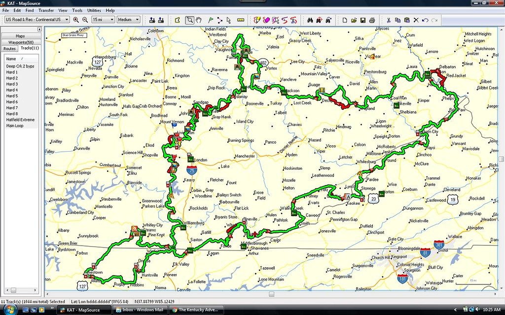
The KAT is the premier overland route in Kentucky. The Kentucky Adventure Tour is the perfect amalgamation of Appalachia with its quaint towns and villages, scenic rivers, and dense forests.


Route Overview
Adventure Rating: Baja
Trip Length: 933 miles, 7-14 days
Season: Year round, but Spring - Fall recommended.
Technical Rating: Mostly green, blue on the alternative "hard trails".
Typical Terrain: 60% gravel and dirt roads, 40% paved backroads.
Recommended Vehicle : Truck/SUV w/ 4x4 and AT tires.
Adventure Vans: Sprinter 4x4s should be able to handle the majority of the main route. There are some sections with low hanging branches that may make passage for high roof Sprinters more difficult.
Alternative Routes: Yes! See bottom of route details for info.
Route Details
The Kentucky Adventure Tour is a 900+ mile loop (not counting the hard sections) around the hills and mountains of southeastern Kentucky. It is about 40% rural narrow twisty paved roads with the rest being gravel, dirt roads and trails. The route can be run in either direction, and you may choose to start at any location you like. Most adventurers tend to do portions of the route, but we recommend doing the entire track if you want to experienced Authentic Kentucky .
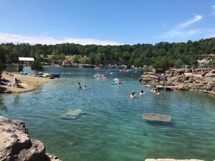
KAT Segment 1 (254 mi) Segment 1 travels from the Hindman area to just outside of the small village of Livingston. Much of this section of the route travels through the Daniel Boone National Forest, which contains numerous campgrounds and side trails to explore. The Red River Gorge Geological Area is definitely worth visiting, and provides numerous swimming, fishing, and boating opportunities. KAT Segment 2 (242 mi) Segment 2 travels from the Livingston to Newcomb, and also traverses through the Daniel Boone National Forest. The route also passes through the 125,000 acre Big South Fork National River and Recreation Area . Segments 1 and 2 of the KAT both provide numerous recreational opportunities, especially those involving water (boating, swimming, fishing, etc). KAT Segment 3 (215 mi)
Segment 3 passes through a combination of forest service roads and county roads and byways. This section does pass through the Cumberland Gap area, but recreational opportunities are fewer compared to segments 1 and 2, although we definitely recommend checking out Pineville Overlook and Chain Rock.
KAT Segment 4 (222 mi) This section of the route begins in the Clintwood, VA area, and makes it's way back across the Kentucky border and concludes near Hueysville. This segment travels primarily through county roads and byways. Please be mindful of private property, as dispersed camping opportunities on this segment will be far and few between.
Alternative Routes
The route features numerous "hard trails" along the route. If you're looking for something bit more technical and challenging, then you'll want to check these out!
Camping Recommendations
Dispersed camping is permitted in various areas within Daniel Boone National Forest. We encourage adventurers to take advantage of the exquisite wild camping, where permitted.
Discovery Points
DP1 - Southfork Elk view
DP2 - North Fork Kentucky River
DP3 - Nada Tunnel
DP4 - Red River Gorge Geological Area
DP5 - Red River Jump Rock
DP6 - Wildcat Battle Monument
DP7 - Natural Arches
DP8 - Laurel River Lake
DP9 - Dog Slaughter Falls
DP10 - Wagon Arch
DP11 - Yamacraw Historic Bridge
DP12 - Princess Falls
DP13 - Twin Arches
DP14 - Pickett Fire Tower
DP15 - Oscar Blevins Historic Farmstead
DP16 - East Rim Overlook
DP17 - Pineville Overlook
DP18 - Cumberland Gap
DP19 - Pinnacle Overlook
DP20 - Hensley Settlement
DP21 - Black Mountain
DP22 - Birch Knob Observation Tower
DP23 - Mill Rock Point Overlook
Maps + Navigation
>> Always check with local land managers for road closures and conditions.
Recommended Maps
Google Maps
Gaia GPS (Neotreks Land Use layer, Gaia base layer)
Download GPX files
TIP: To expose alternative routes and points of interest in Google Maps, open the sidebar and select the desired layer.
Land Managers
Daniel Boone National Forest
Big South Fork National River and Recreation Area
Terms of Use: Should you decide to travel a route that is published on Overlandtrailguides.com , you do so at your own risk. Always take the appropriate precautions when planning and traveling, including checking the current local weather, permit requirements, trail/road conditions, and land/road closures. While traveling, obey all public and private land use restrictions and rules, and carry the appropriate safety, recovery, and navigational equipment. The information found on this site is simply a planning resource to be used as a point of inspiration in conjunction with your own due-diligence. In spite of the fact that this route, associated GPS track (GPX and maps), and all route guidelines were prepared under diligent research by Overland Trail Guides, the route accuracy and current conditions of roads and trails cannot be guaranteed.
- Adventure Vans
- Overland Routes
Recent Posts
Eastern Sierra Timberline Trail
Allegheny Discovery Route
Ozark Overland Adventure Trail
3 commentaires
This KAT (Kentucky Adventure Tour) route is regularly updated due to closures by the author(s) and only posted here: https://www.facebook.com/groups/KentuckyAdventureTour/files/files
"The XML file does not appear to have any style information associated with it. The document tree is shown below." "...(right click and save)" does not allow me to save the file. Please help me download this file. Thanks.

I tried downloading the gpx file into Gaia and it says unknown file type. It downloaded as an html file. Can I get the correct file sent to me please?
The Kentucky Adventure Tour
Explore kentucky.
The Kentucky Adventure Tour is a 900+ mile loop (not counting the hard sections) around the hills and mountains of southeastern Kentucky. It is about 40% rural narrow twisty paved roads with the rest being gravel, dirt roads and trails. It will take 5 full summer days of riding to complete the main loop. It will take 5-6 days if you take the hard sections. Some of these areas are very remote so do not go alone! The average distance between gas stops is around 60 miles. Waypoints are included for gas stations, food and hotels (there are others along the loop that are not marked).
Please use the navigation links at the top of the page to follow KAT developments on social media.
See you on the trail!
KAT Supporters
Kat lodging options, places to stay along the way . . ..
You can't do the Kentucky Adventure Tour in one day! Below are some lodging options that have worked out well for KAT finishers over the years.
Use the links to get in touch with these establishments. Stay at the places that support our sport!
Lodging Options
Hatfield-McCoy Resort Good starting and ending point, free parking while you ride the KAT
Lil' Abner Motel Good starting and ending point, free parking while you ride the KAT
Mount Aire Motel
Days Inn Jellico - Tennessee State Line
Cumberland Inn
Town & Country Motel
Budget Host Westgate Inn
Pine Mountain Resort - Kentucky State Parks
KAT GPX Download
Get ready for the adventure.
Do you have a GPS? If so, you'll want one of these GPX files on your device for the Kentucky Adventure Tour. Updates to the GPS route and waypoints will be updated on a periodic basis so make sure to download a current copy before you depart.
Choose your type of adventure below!
7.56mb GPX File
7.09mb GPX File
KAT Kentucky Adventure Tour

A Playground For Jeeps and Dual Sport Motorcycles
All throughout eastern kentucky runs the kentucky adventure tour, more than 1,000 miles across the hills and mountains..
A mix between 1000 miles of unimproved road, trail, and paved surfaces, the loop winds its way through almost entirely central and southeastern Kentucky, and then wraps into the corners of West Virginia and Tennessee. KAT enthusiast Jeff Stoess , keeps updates of the trails designated for 4x4s and some exclusive single track for Dual Sport riders. The loop offers everything from paved curvy roads through scenic Appalachia, all the way to rocky ledges and water crossings that require 33-inch tires and a rear locker for insurance. It is very important to download the most current edition of the GPX file for the most updated information concerting trail and road conditions.
KAT Video Footage in London, KY
How To Download GPX Files for Kentucky Adventure Tour

Not your Typical Weatherman: The Legendary Dick Proenneke
- Tread Staff
- Appalachian ,
- DualSport ,
- Kentucky Adventure Tour ,
- Kentucky Adventure Trail ,
- Tennessee ,
- West Virginia ,
Share article
Kentucky adventure tour.
The West does not get all the glory — right in the middle of our country’s heartland lies the 1,000-mile long Kentucky Adventure Trail.
A mix between unimproved road, trail, and 40% paved surfaces, the loop winds its way through almost entirely central and southeastern Kentucky, and then wraps into the corners of West Virginia and Tennessee. With specific trails designated for 4x4s and some exclusive single track for DualSport and ADV riders, the loop offers everything from paved curvy roads through scenic Appalachia, all the way to rocky ledges and water crossings that require 33-inch tires and a rear locker for insurance.
Trails consist of paths that were cut with dozers by oil and logging companies in the 1930s that have not been maintained since their initial cut, and trails that now find themselves out of abandoned rail beds. Several tunnels and bridges line the route, all previous rail tunnels from defunct logging railroads and abandoned beds from realigned mainline routes. On average, fuel stations are about 60 miles apart, so it is a worry-free journey without too much isolation from civilization — if that is a good thing or not, we will let you decide.
For more information on the KAT and topographical maps of the routes, please visit Kentucky Adventure Tour .
Also, remember to be responsible stewards on the trail and Tread Lightly!
You May Also Like

- Trails & Tales
Super73-S1 Electric Bike
- April 29, 2020

The Silent Cartographer
- November 01, 2017

VOTW: Death Valley
- February 14, 2019
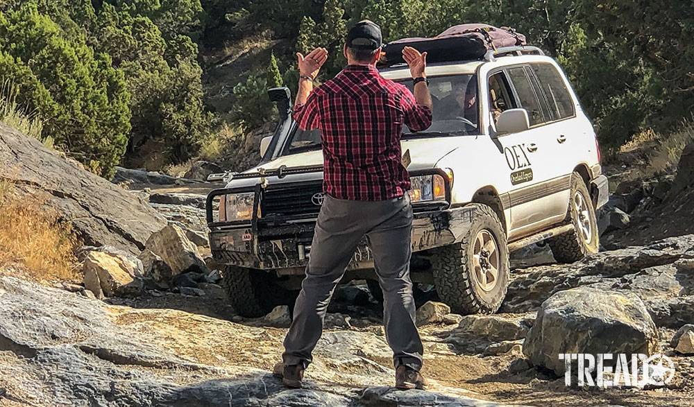
OEX Overlanders: Expertly Trained
- June 06, 2022

- Modifications
RIDE RED WITH THIS CUSTOM RUBICON.
- July 14, 2023
- 3 minutes read
- New Products
- Off-Roading
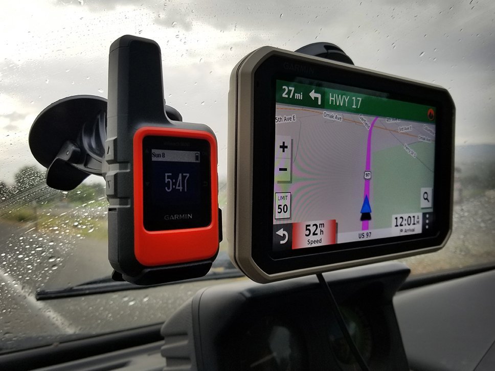
Garmin Overlander and inReach Mini Duo
- Mercedes Lilienthal
- February 14, 2020
- 4 minutes read
- Outdoor Adventures
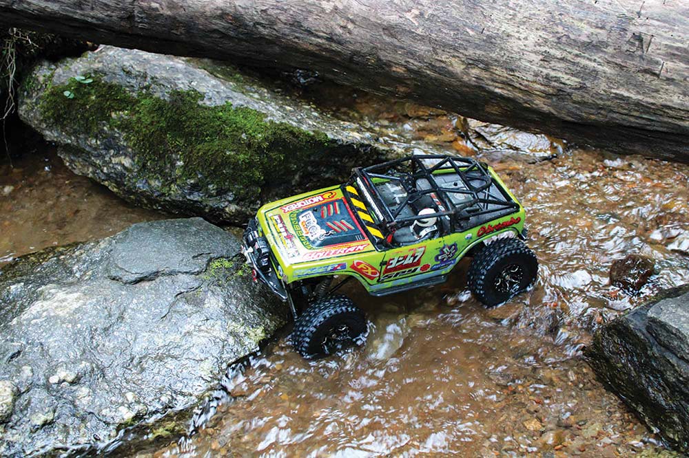
RC Rock Crawling: CREEPY CRAWLING
- April 05, 2023
- 8 minutes read

- Buyer's Guide
Motortopia.com: Your Ultimate Automotive Hub for Builds, Shows, and Community
- MOTORTOPIA STAFF
- December 01, 2023

Your browser is not supported for this experience. We recommend using Chrome, Firefox, Edge, or Safari.
Travel Guide Request
Sign Up Today!
The Kentucky Wildlands
2292 South Highway 27, Somerset, KY 42501
P: (606) 677-6150
Social Media
- Privacy Policy
© 2024 All Rights Reserved.
📧 Email Newsletter Signup 📧
Sign me up to receive exclusive discounts and be the first to hear about new inventory:
" * " indicates required fields
The Kentucky Adventure Tour
The Kentucky Adventure Tour is a 900+ mile loop (not counting the hard sections) in southeastern Kentucky. About 40% rural narrow twisty paved roads with the rest being gravel, dirt roads and trails, it will take five full summer days of riding to complete the main loop without the hard sections and up to six days with the hard sections. Some of these areas are very remote so do not go alone, and keep in mind that the average distance between gas stops is around 60 miles. Keep reading for more resources to help you plan your own Kentucky Adventure Tour!
Kentucky Adventure Tour Discovery Points
- DP1 – Southfork Elk view
- DP2 – North Fork Kentucky River
- DP3 – Nada Tunnel
- DP4 – Red River Gorge Geological Area
- DP5 – Red River Jump Rock
- DP6 – Wildcat Battle Monument
- DP7 – Natural Arches
- DP8 – Laurel River Lake
- DP9 – Dog Slaughter Falls
- DP10 – Wagon Arch
- DP11 – Yamacraw Historic Bridge
- DP12 – Princess Falls
- DP13 – Twin Arches
- DP14 – Pickett Fire Tower
- DP15 – Oscar Blevins Historic Farmstead
- DP16 – East Rim Overlook
- DP17 – Pineville Overlook
- DP18 – Cumberland Gap
- DP19 – Pinnacle Overlook
- DP20 – Hensley Settlement
- DP21 – Black Mountain
- DP22 – Birch Knob Observation Tower
- DP23 – Mill Rock Point Overlook
Kentucky Adventure Tour Camping Recommendations
Dispersed camping is permitted in various areas within Daniel Boone National Forest. We encourage adventurers to take advantage of the exquisite wild camping, wherever permitted. RV hookups, cabins, primitive camping spots, and a lot of opportunity for dispersed camping. Trails are OHV oriented and better suited for the motorcycle riders on the KAT, though the main section of the park is worth the excursion for overlanders (and is free to sightsee). Kentucky Adventure Tour Route Overview
- Season: Year round, but Spring – Fall recommended.
- Technical Rating: Mostly green, blue on the alternative “hard trails”.
- Typical Terrain: 60% gravel and dirt roads, 40% paved backroads.
- Recommended Vehicle: Truck/SUV w/ 4×4 and AT tires.
Kentucky Adventure Tour Routes
Kat segment 1 (254 mi).
Segment 1 travels from the Hindman area to just outside of the small village of Livingston through the Daniel Boone National Forest, which contains numerous campgrounds and side trails to explore. The Red River Gorge Geological Area is definitely worth a visit, and provides tons of swimming, fishing, and boating opportunities.
KAT Segment 2 (242 mi)
Segment 2 travels from Livingston to Newcomb, and also traverses through the Daniel Boone National Forest. In addition, the route also passes through the 125,000 acre Big South Fork National River and Recreation Area. Segments 1 and 2 of the KAT both offer several recreational opportunities, especially those involving water (boating, swimming, fishing, etc).
KAT Segment 3 (215 mi)
Segment 3 passes through a combination of forest service roads and county roads and byways. This section does pass through the Cumberland Gap area, but recreational opportunities are fewer compared to segments 1 and 2, although we definitely recommend checking out Pineville Overlook and Chain Rock.
KAT Segment 4 (222 mi)
This section of the route begins in the Clintwood, VA area, and makes its way back across the Kentucky border and concludes near Hueysville. This segment travels primarily through county roads and byways. Be mindful of private property, as dispersed camping opportunities on this segment are far and few between.
Alternative Routes
The route features numerous “hard trails” along the route. If you’re looking for something bit more technical and challenging, then you’ll want to check these out!
To learn more, read Best Off-Roading Trails Near Tennessee .
Share with your friends:
Related posts.

Kentucky Adventure Trail: Backroads of Appalachia

Caleb McInturff , Marisa McInturff
Our starting point is Pine Mountain State Resort Park in Pineville, KY. It’s mid-March, and the mornings are expectedly chilly. Marisa and I quickly find ourselves shedding additional layers of clothing as the sun warms the Kentucky hills, but as we descend into deep, wooded valleys, where the morning sun doesn’t fall, we feel the temperature drop sharply.
The Kentucky Adventure Tour, a loop of more than 900 miles in southeastern Kentucky comprising mostly one-lane country backroads, takes us south. We are treated to fantastic views as we ride up mountains and descend back through valleys. Evidence of the once booming coal industry’s shrinkage, and, in many cases, exodus, abounds in the small towns we pass through. Abandoned downtown areas and signs of the extreme poverty associated with Appalachia are common along the route.

Eventually we arrive at our lunch stop, Gap Creek Coffee House, just across the state line at the base of a mountain next to a babbling creek in Cumberland Gap, TN. Above us, at the end of a steep, curvy road that ascends the backside of the mountain, is Pinnacle Overlook (elevation 2,440 feet). After lunch we head to the bluff and take in the magnificent view of Kentucky, Virgina, and Tennessee. The rest of the day we ride twisted backroads to Kingdom Come State Park, in Cumberland, KY, where we’ll camp for the night. On the way, we grab a quick to-go dinner and arrive just in time to set up camp before dark.
A very cold night of camping gives way to another chilly but thankfully clear morning. The second day’s route is around 140 miles and primarily consists of narrow, gnarled country backroads that follow the contours of the Appalachian Mountains. In the late afternoon, we round a corner and see a giant column of ominous black smoke rising out of the valley we’re approaching.

Run Boys, Run
As we ride into the small town of Phelps, we realize the smoke is coming from a house fire. By the time we arrive, the structure is completely engulfed and has already been reduced to burning rubble. Nearby buildings are smoldering, and the woods behind the burning home are beginning to catch fire. A few neighbors are trying to contain the inferno but most are frozen, observing in stunned disbelief as many do in terrible situations. Marisa and I quickly find a place for our bikes, and without wasting time to remove our riding gear we rush to find hoses. As we run toward the blaze, we can feel the fire’s intense radiant heat, but surprisingly our gear helps to keep us slightly cooler. Without the aid of actual fire fighting equipment, the only assistance we can offer is in the form of containment.
A trail of 1,000 miles: Kentucky Adventure Tour brings tourism to Eastern Kentucky
HAZARD, Ky. (WYMT) - All throughout Eastern Kentucky runs the Kentucky Adventure tour, more than 1,000 miles across the hills and mountains.
"Oh my gosh it's way bigger than I had ever anticipated. There's always someone on it at any given point in time. There's always someone on it," said KAT creator, Jeff Stoess.
The loop runs through many Eastern Kentucky counties like Laurel, Pike, Whitley, Harlan and Letcher.
"I've been racing and riding Kentucky my whole life and I got to thinking I could put something together as a loop. There's really no start and end you can start anywhere you want on the loop," added Stoess.
Besides being a fun weekend activity the trail does more, by helping bring income to local businesses along the route.
"I have actually had business reach out to me and thank me and they wanted you know what more can we do to help out you know its been pretty amazing," said Stoess.
The loop is a fun way to stay six feet apart, while enjoying the great outdoors.
"We've been inside the whole time since March. It's been a good opportunity to get the family out and just get out in nature and be able to enjoy that and social distance at the same time," added Jeep owner, Jason Burton.
For more information on the trail maps and lodging stops along the route you can visit the Kentucky Adventure Tour Facebook page or their website .
Copyright 2020 WYMT. All rights reserved.

One person dead after police chase

KSP investigating pair of deadly Pike Co. crashes

Magoffin Co. officials working to repair sewage leak

KSP investigating deadly crash in Rockcastle Co.

Longtime pastor steps down from leadership role at church ‘due to sin’
Latest news.

Pit bull leads shelter employees to hanged dog in Floyd Co.

Perry County Fair begins

Trail race set for Saturday

Four arrested in Pulaski Co. following police search

Perry County Fair 6- Austin
A trail of 1,000 miles: Kentucky Adventure Tour brings tourism to Eastern Kentucky
HAZARD, Ky. (WYMT) - All throughout Eastern Kentucky runs the Kentucky Adventure tour, more than 1,000 miles across the hills and mountains.
"Oh my gosh it's way bigger than I had ever anticipated. There's always someone on it at any given point in time. There's always someone on it," said KAT creator, Jeff Stoess.
The loop runs through many Eastern Kentucky counties like Laurel, Pike, Whitley, Harlan and Letcher.
“I’ve been racing and riding Kentucky my whole life and I got to thinking I could put something together as a loop. There’s really no start and end you can start anywhere you want on the loop,” added Stoess.
Besides being a fun weekend activity the trail does more, by helping bring income to local businesses along the route.
"I have actually had business reach out to me and thank me and they wanted you know what more can we do to help out you know its been pretty amazing," said Stoess.
The loop is a fun way to stay six feet apart, while enjoying the great outdoors.
“We’ve been inside the whole time since March. It’s been a good opportunity to get the family out and just get out in nature and be able to enjoy that and social distance at the same time,” added Jeep owner, Jason Burton.
For more information on the trail maps and lodging stops along the route you can visit the Kentucky Adventure Tour Facebook page or their website .
Copyright 2020 WYMT. All rights reserved.

Man found dead in Lexington reservoir was member of Ky. Veterans Hall of Fame, officials say

Miya Rudd’s other grandparents arrested at KSP presence in Daviess Co.

Car ends up underneath semi trailer in I-75 crash

County declares state of emergency due to pipe leaking raw sewage into river

Reported birth of rare white buffalo calf in Yellowstone park fulfills Lakota prophecy
Latest news.

Lexington council debates pet sale ban

FCPS rezoning discussion sparks debate

UK set approve largest budget in its history

Pit bull leads shelter employees to hanged dog in Floyd Co.

KSP: Man staying at the home of missing baby served with multiple drug charges
Log in or Join

- Search titles only
Separate names with a comma.
- Search this thread only
- Search child forums as well
- Display results as threads
Useful Searches
- Recent Posts
You are using an out of date browser. It may not display this or other websites correctly. You should upgrade or use an alternative browser .
The Kentucky Adventure Tour (KAT)
Discussion in ' GPS Tracks - Central, Texas & Gulf States ' started by Jeff@TheQuadShop , Sep 12, 2013 .
How much would you estimate that you spent each day (average) while riding the KAT?

Jeff@TheQuadShop TAT survivor, TOI T1 finisher
After 6 years of development, I've finally got the KAT to where I'm happy with it. This is a 900 mile loop (not counting the hard sections) around the hills and mountains of south eastern Kentucky. It is about 40% rural narrow twisty paved roads with the rest being gravel, dirt roads and trails. It will take 5 full summer days of riding to complete the main loop. It will take 5-6 days if you take the hard sections. Some of these areas are very remote so do not go alone! The average distance between gas stops is around 60 miles. I have marked with waypoints the gas stations, food and hotels (there are others on the loop that I don't have marked). This loop does go through some active coal mining areas but the roads are still open to the public. You may run into a situation where the road is shut down due to work or blasting. There will be a security guard and or signs, the guards that I have spoken with are very friendly and more than happy to tell you a way around. As far as bikes go, the main loop can be done on bigger bikes but keep in mind there are sections with large rocks, logs, mud and hills so I highly recommend that you have experience in these conditions and run FULL KNOBBY tires! You may run into downed trees and creeks that may be too big or deep to cross. Any of this can be bypassed if you just scroll around on your GPS screen. A small saw or machete comes in handy for the small downed trees. Instagram #kentuckyadventuretour #kentuckyadventuretrail The GREEN track is the main loop and the RED tracks are the optional hard sections. If you decide that you want to take the hard sections, I STRONGLY advise light weight bikes that can handle very difficult single track, mud, creeks, hills, rocks, tight switch backs, downed trees and lots of other trail nasties. I would only recommend taking these sections if you are a very experienced off road rider. The Hatfield Extreme is optional and extremely difficult even on race bikes! This section requires a Hatfield McCoy trail pass. FULL KNOBBIES and a high skill level ARE A MUST!!! You must use a GPS that is capable of reading track logs (NOT ROUTES!). Garmin Roads and Recreation software shows most all of these roads. I have also had very good luck using my iPhone and the Motion X GPS app with the Motion X Roads map set. I used this on my final check ride this past week and it worked perfectly. Download the maps of the area that the KAT is in to your phone, you will not need a cell signal if you do it this way. Here are some hotels that I have stayed in and recommend... Slade, Li'l Abner Motel Matewan, Hatfield McCoy Resort/Inn Harlan, Mount Aire Motel Jellico, Days Inn Williamsburg, Cumberland Inn McKee, Quaint Country Cottage London, Westgate RV budget host Inn Middlesboro, Holiday Inn There are tons of places to camp along the route. Most places you can just throw up a tent a few yards off the trail. If you need any help while out on the trail, feel free to PM me for my phone number. Post your comments, ride report links and if you run into any issues here. Have fun and ride safe! A fantastic ride report by Cannonshot... http://www.advrider.com/forums/showthread.php?t=971478 Another great report with pics by Mudaura... http://advrider.com/index.php?threads/high-water-kat-ride.1060895/ Awesome report from 2016 with some great video's of the Hard sections http://advrider.com/index.php?threads/wildkat.1155143/#post-29729357 If you'd like do do this in a 4x4, go here... https://www.expeditionportal.com/forum/threads/the-kentucky-adventure-tour-kat-4x4-version.116377/ KAT FaceBook page... https://www.facebook.com/groups/121845738390272/ Instagram #kentuckyadventuretour KAT stickers are now available... They are 4.5" x 3" and will be $4.50 each mailed. paypal.me/KyAdventureTour Here is the GPX file...always download the latest addition before making the trip as I may add or change things from time to time. Please do not use a KAT track from another source, only use the one below or the FaceBook page!!! The official tracks are here on the KAT website or Facebook page... https://annessky.net/kat/index.html https://www.facebook.com/groups/KentuckyAdventureTour/ The official KAT videos are here... https://www.youtube.com/playlist?list=PLp6-QbRLhwFvt6EwKPaRi1Wzm5Ma1OhoU
Hensley Extreme trail: As of 3/26/17 I have added a track called Hensley Extreme that leads to an early 1900's settlement. There is some really cool history up on top of that mountain https://en.wikipedia.org/wiki/Hensley_Settlement_(Kentucky) Having said that, this trail is VERY HARD!!! It is steep with large rocks and washed out sections. I only recommend that you attempt this trail if you are a highly experienced off road rider on an Enduro bike! As usual, pics don't show the steepness and the true size of the rocks... Here are some highlight pics...

craftycoder Motobrain PDU
Awesome man! I'd love to see that posted up at dualsportmaps.com

Sourjon TAT'erd
Can't wait to look at this in detail. Thanks for all the hard work Jeff! John
Sourjon said: ↑ Can't wait to look at this in detail. Thanks for all the hard work Jeff! John Click to expand...
craftycoder said: ↑ Awesome man! I'd love to see that posted up at dualsportmaps.com Click to expand...

wasions Hang 10
Just... WOW!

brewski83 Squatch Hunter
Can't wait to ride it! Thanks!!!!

Goofy1 Been here awhile
Great work Jeff. Like the others I can't wait to give it a go!

szramer Been here awhile
sounds like plan on late fall

Btown Jason MotoChimp Supporter
Thanks for all of the hard work. I can't wait to get south and try this out!

kimzx1000r Been here awhile
Looks like a good ride!

FYYFFKY Adventurous
Ready set go! Sent from my phone because it's easier.
backwoods bobby Adventurer
where can we get the map or gps cord.:huh
backwoods bobby said: ↑ where can we get the map or gps cord.:huh Click to expand...

woodly1069 Long timer
Fantastic! Can't wait to give it a go, thanks for all your hard work!

Beairmo Keeping it real Supporter
Thank you very much, Jeff!!! Its people like you that make adventure riding the excellent past time it is!! Jeff@TheQuadShop said: ↑ After 6 years of development, I've finally got the KAT to where I'm happy with it. This is a 833 mile loop (not counting the hard sections) around the hills and mountains of south eastern Kentucky. It is about 65% rural narrow twisty paved roads with the rest being gravel and dirt roads. It will take 4 full summer days of riding to complete the main loop. It will take 5-6 days if you take the hard sections. Some of these areas are very remote so do not go alone! The average distance between gas stops is around 50 miles. I have marked with waypoints the gas stations, food and hotels. This loop does go through some active coal mining areas on the far eastern side but the roads are still open to the public. You may run into a situation where the road is shut down due to work or blasting. There will be a security guard in a truck, the ones that I have spoke with are very friendly and more than happy to tell you a way around. As far as bikes go, the main loop can be done on bigger bikes but keep in mind there are sections with large rocks, some mud and hills so I highly recommend that you have experience in these conditions and run an aggressive tire. If you decide that you want to take the hard sections, I highly recommend light weight bikes that can handle very difficult single track, mud, creeks, hills, rocks, tight switch backs, downed trees and lots of other trail nasties. I would only recommend taking these sections if you are a very experienced off road rider. The Hatfield Extreme section requires a Hatfield McCoy trail pass. FULL KNOBBIES ARE A MUST!!! The main loop is broken down into sections using different colors with each color being 500 track points or less. The red sections are the hard sections. You must use a GPS that is capable of reading track logs (NOT ROUTES!). Garmin Roads and Recreation software shows all of these roads. I have also had very good luck using my iPhone and the Motion X GPS app with the Motion X Roads mapset. I used this on my final check ride this past week and it worked perfectly. Here are some hotels that I have stayed in and recommend... Slade, Li'l Abner Motel Williamson, Mountaineer Hotel Harlan, Mount Aire Motel Jellico, Days Inn Williamsburg, Cumberland Inn‎ McKee, Town & Country Motel Post your comments, ride report links and if you run into any issues here. Have fun and ride safe! Here is the GPX file...always download the latest addition before making the trip as I may add or change things from time to time. Click to expand...

alpiv Sr. nOOb
Rocking it baby....

LexLeroy Socially Distant
Thanks for bringing it over the goal line. This will be a huge boost to riding in our state.
- No, but I wanna be.
- Yes! My password:
- Forgot your password?
12 Outdoor Adventures To Have In Kentucky, One For Each Month Of The Year

Andrea Limke
A Cincinnati native who has lived in Kentucky for over 10 years, Andrea's heart belongs both in the Queen City and the Bluegrass State. After earning an education degree and working in that field for a number of years, Andrea began to pursue her passion for writing over 6 years ago. Since then she has written for a number of print and online publications, as well as published a children's book.
More by this Author
If you’re the adventurous type, perhaps you prefer to choose your activities spontaneously, or maybe you like to plan out a year at a time. If you plan to explore Kentucky, there’s no shortage of things to do and experiences to have; in fact, there are more than enough to try for one outing each month of the year. The outdoor adventures in Kentucky range from cave exploration to zip-lining to hiking past frozen waterfalls, deep in the woods. The options are endless, so we narrowed it down to 12 of the best outdoor Kentucky adventures, one for each month of the year. Grab your calendar and start planning, or at least keep these in mind when you want to try something new in the Bluegrass State.

Related Stories

Get Away From The Crowds At This Incredible, Little-Known State Park In Kentucky

This Historic Estate In Kentucky Is The Perfect Day Trip Destination

Your Ultimate Guide To Summer Fun In Kentucky
While 12 outdoor adventures in Kentucky sound like a lot, these experiences are just the beginning of a long list of things to do outside in the Bluegrass. Whether underground, on water, or flying through the sky, make this the year that you try some new Kentucky adventures. What do you think of this list? How many have you already tried? We’d love to hear about your travel plans in Kentucky, so be sure to share in the comments!
OnlyInYourState may earn compensation through affiliate links in this article. As an Amazon Associate, we earn from qualifying purchases.
Want more Kentucky in your inbox?
Get the latest on things to see, do, and eat around Kentucky!
An error occured.
More to Explore
Kentucky adventures.
What are some other Kentucky adventures I can go on this year?
Here are a few more Kentucky adventures we suggest:
- Go on an easy hike to Princess Arch .
- Take a tour of the Lost River Cave .
- Explore an arboretum and find the forest giants .
Related Articles
- An Unforgettable Dining Experience Awaits At The Unique Pay-What-You-Can Restaurant In Kentucky
- I Checked Out The New Location Of Hi-Five Doughnuts In Louisville
- The Gorgeous, Little-Known Lake Is One Of The Most Underrated Fishing Spots In Kentucky
- Experience A Romantic Getaway In This Tiny Cabin For Two In Red River Gorge In Kentucky
- Here Are The 13 Best LGBTQIA+ Friendly Travel Destinations Across The U.S.
- 13 Bucket List-Worthy Hikes From Every Corner Of The United States
- We’re Dreaming Of A Waterfront Getaway And We Found 12 Perfect Spots In The Midwest
- These 9 Caribbean Vacation Destinations Are An Easy Plane Ride From The U.S.
Featured Addresses
No items are currently in your cart

- Partners & Community
- Member Badge Nominations
Kentucky Adventure Tour

Add To Your Adventure Log
Share your journey with a premium adventure badge $20.00.
After adding Kentucky Adventure Tour to your Adventure Log, you'll have the option to purchase a premium, USA-made Adventure Badge.
Trail Information
Nearby adventures.
2024 Hot Rod Power Tour is coming to two Kentucky cities. What to know about schedule, route, tickets

The Hot Rod Power Tour, a long-standing national traveling car show featuring over 6,000 custom vehicles for its 30th year, is making two stops in Kentucky this month as part of a five-city cruise. Here's what to know about it.
Kentucky Attractions, Events See how Kentucky attractions ranked in USA Today's 10Best Readers' Choice Award
2024 Hot Rod Power Tour to stop in two Kentucky cities
The Hot Rod Power Tour will visit two Kentucky cities in June.
- Monday, June 10: Beech Bend Raceway Park near Bowling Green. Event from 9 a.m. to 6 p.m. Located at 798 Beech Bend Road in Richardsville.
- Wednesday, June 12: L&N Federal Credit Union Stadium. Event from Noon to 6 p.m. Located at 2550 S. Floyd St. in Louisville.
30th Hot Rod Power Tour schedule
The full schedule for the five-city tour is as follows:
- Monday, June 10: Beech Bend Raceway Park near Bowling Green.
- Tuesday, June 11: Nashville Superspeedway in Lebanon, Tennessee.
- Wednesday, June 12: L&N Federal Credit Union Stadium in Louisville.
- Thursday, June 13: National Trail Raceway in Hebron, Ohio.
- Friday, June 14: Lucas Oil Indianapolis Raceway Park in Indianapolis, Indiana.
Hot Rod Power Tour 2024 tickets
Multi-day and single-day tickets are available for purchase here. The multi-day pass is $160 and includes two-day credentials, vehicle entry at all venues and a goodie bag. The single-day ticket is $60 for on-site parking for one vehicle and giveaway items. Spectators can attend events for free.
See custom cars for free at these Kentucky events
Spectator entry for events is free with a downloaded ticket or QR at entry, according to the Hot Rod website. Venues may charge parking fees and events are cashless, meaning only debit and credit cards are accepted.
Race cars at the National Corvette Museum in Bowling Green
Car enthusiasts can drive pace laps on the road course at the National Corvette Museum on Sunday, June 9. Costs start at $106 and space is limited. Slots for an hour are still available from 9 a.m. to noon. To learn more, click here.
Prohibited items at the Hot Rod 2024 Power tour events
Prohibited items include drones, illegal drugs, weapons, pepper spray, fireworks, signs and pets besides service animals. Click here for the full list.
- Twitter / X
Readers' Choice
- Food & Drink
- Arts & Culture
- Travel Guides
10Best | Trusted Travel & Lifestyle Advice
Readers' choice awards: vote now.

Best Fast Casual Restaurant (2024)

Best Fast Food Breakfast (2024)

Best Fast Food Burger (2024)

Best Fast Food Fried Chicken (2024)

Best Fast Food Fries (2024)
Readers' choice awards: recent winners.

Best Lake (2024)

Best Lake for Swimming (2024)

Best Lake for Water Sports (2024)

Best River for Fly Fishing (2024)

Best River for Tubing (2024)
New articles & slideshows.

Make a splash with great summer cocktails: Margaritas, mimosas, and more
Where to make a splash this summer: Best lakes and rivers in the US

Road trip to explore Denmark's beaches and charming Danish Riviera towns

Which fast food restaurants will reign supreme? Cast your votes now

Namaste, wine lovers: Destinations where yoga and wine pair perfectly
Top stories, bait your hook at the 10 best fishing lodges in the us.
Readers' Choice Awards · June 14, 2024

Fishing lodges across the United States offer a unique blend of relaxation, adventure, and connection with nature. They provide an escape for anglers of all skill levels to immerse themselves in the serene beauty of the country's diverse landscapes while engaging in the sport they love. With options ranging from the remote Alaskan wilderness to the warm waters of the South, these 10 lodges — selected... Continue Reading >
Food & Drink · June 13, 2024

These delicious and easy-to-make summer cocktails are perfect for toasting the season, and we're here for it. Continue Reading >
Supreme streams: 10 best rivers for fly fishing in the US
Readers' Choice Awards · June 13, 2024

Fly fishing on rivers across the United States offers a diverse and enriching experience. Anglers can enjoy the tranquility of nature, the thrill of the catch, and the satisfaction of mastering the art of the sport. These 10 rivers, selected by an expert panel and voted by readers as the best for fly fishing in the country, each present a unique challenge and stunning backdrops. Continue Reading >
Interests · June 12, 2024

There are thousands of lakes and rivers across the nation, with a variety of ways to enjoy them. From the chilly shores of the North to the more temperate waters of the South, you can find a lake or river for any activity you like, such as tubing, fishing, boating, swimming, or kayaking. With so many lakes and rivers to choose from, it can be difficult to decide where to go. So, we've narrowed the field... Continue Reading >

New Articles

8 North Cascades National Park adventures for this summer
Despite growing pains and staffing challenges, North Cascades National Park remains one of the most rewarding places to explore the mountains in Washington , if not the entire country. The superlative stretch of peaks motivated Bellingham-based nature photographer John D’Onofrio to pen the newly published guidebook, “ Hiking Mt. Baker & the North Cascades .”
“Sure, nowadays there are some places in the North Cascades that attract a crowd and require advance planning to secure a permit,” D’Onofrio said. “But there are also lots of places that are empty of people, where solitude can still be found and where serendipity holds sway. Hikers can experience true wilderness and — with a little effort — the increasingly rare experience of being alone.”
With a lower-than-typical snow year, many of the park’s hikes might melt out sooner than normal, potentially affording a longer-than-average hiking season. Nevertheless, check wta.org for trip reports (and submit your own!) and be prepared for snow travel at higher elevations. Boaters be advised, however, that those same conditions have led to lower-than-normal water levels in Diablo and Ross lakes.
Here are eight ways to explore the park this summer.
Stay at the North Cascades Institute
The North Cascades Institute maintains a world-class environmental learning center on the shores of glacial blue Lake Diablo. It offers spartan but clean and comfortable overnight accommodations in lodge rooms with bunk beds, three healthy cafeteria-style meals included (from $100 per person ; see ncascades.org ). The center is the closest North Cascades National Park has to a grand hotel — just don’t expect anything approaching the white tablecloth ambience of the Paradise Inn Dining Room or Roosevelt Dining Room at Lake Quinault Lodge. Rather, the experience is what my colleague Tan Vinh once called “ nature camp for grown-ups .”
Take a tour of Lake Diablo on a glass-roofed boat
Lake Diablo and neighboring Ross Lake, home to the coveted floating cabins at Ross Lake Resort and boat-in campsites along the lake’s 23-mile serpentine sprawl, are the result of Seattle City Light dams on the Skagit River. Much of the electricity that powers Seattle comes from water draining out of the national park, while tribes are challenging the dams’ future due to their environmental impact. You can ponder those issues on a lake tour aboard the Alice Ross IV , a glass roof boat, offered jointly by the institute and City Light on Wednesdays through Sundays starting July 3 ($50 for adults, $45 for seniors age 62-plus, $30 for youth ages 3-12). Reserve lodging and boat tours at ncascades.org .
Related outdoors
- 6 Mount Rainier hikes that won’t require a reservation this summer
- Youngest climber to complete WA’s Bulger List featured in new movie
- 5 WA beginner backpacking trips for this summer
- Forget the long drive home: Here are 5 great hike-campground combos in WA
- Top tips for first-time campers in WA
- Whitewater rafting is a springtime rush for WA adventurers
Swim in a “sea of peaks”
If there is one classic hike in the park, with the crowds to match, it’s Cascade Pass/Sahale Arm . Start at the end of Cascade River Road (unpaved for the final 16 miles, but suitable for low-clearance vehicles) and switchback up 1,700 feet across 3.6 miles to Cascade Pass. The view here is stunning as you immerse yourself in the North Cascades “sea of peaks,” as the collection of jagged summits is sometimes described, but it’s worth pushing another 2.5 miles and 2,400 feet up the rocky outcropping of Sahale Arm until you reach the Sahale Glacier Camp. The lucky few campers here (maybe you, if you snagged a lottery spot or a walk-up permit) are perched at the park’s highest-elevation trail-accessible camp.
Climb to an alpine lookout
For another dip into the sea of peaks, perhaps with fewer crowds, try the hike to Hidden Lake Lookout . The trailhead starts after a rutted 5-mile forest road — high clearance recommended — then ascends 3,300 feet over 4.5 miles to one of the most panoramic fire lookouts in the state, cabled to the side of a rock pile. The 360-degree views are spectacular, and you can even spend the night on a first-come, first-serve basis. Consider a donation to Friends of Hidden Lake Lookout to defray maintenance costs. Only a sliver of the trail just before the lookout enters the national park, but the lake itself down below is squarely inside the park — permit required for overnight camping.
Beat the crowds while hiding in plain sight
You wouldn’t know cars are zooming above you on North Cascades Highway while you meander along the cacophony of Ruby Creek . Starting from either the East Bank Trailhead or the Canyon Creek Trailhead, it’s a 6.5-mile round-trip walk through mossy forest and along the occasional sandy riverfront beach. If you’re driving over Highway 20 without plans to otherwise visit North Cascades National Park, consider this forest stroll a worthy pit stop.
Get way off the grid — then ride a cable car
There are many options for plunging deep into the North Cascades for days on end. But only Copper Ridge and the Chilliwack River trails offer you a chance to live an Indiana Jones-style moment, hauling yourself by hand over a raging river on a rickety cable car. Start at the Hannengan Trailhead off Highway 542 (the road to Mt. Baker Ski Area) and head 5.1 miles to Hannegan Pass. From here, you have a choice. Fork right and you’ll reach the cable car crossing at 10.7 miles. Fork left and you’ll reach Copper Lake at 11.2 miles, after passing the Copper Ridge Lookout and some spectacular views of surrounding, rarely seen high peaks like Mount Redoubt. Unfortunately, the trails east of the lake and the cable car are closed due to the 2021 Bear Creek and 2022 Chilliwack fires, so you cannot currently complete this loop hike. This is nevertheless a popular backpacking destination, so overnight permits may be limited.
Wing it below Black Peak
While crowds flock to Rainy Pass Trailhead during larch season for the way-too-popular Heather-Maple Pass Loop, take the offshoot trail west out of the basin and toward towering Black Peak, the 16th highest mountain in Washington. Cross a difficult talus field and ascend above Lewis Lake until you reach the alpine gem that is Wing Lake . This is a rugged 8-mile hike with off-trail sections — you’ll be following cairns or your GPS through the boulder field — but the lake is a stunner, especially if you stay the night for sunrise and sunset. On Labor Day weekend a few years back, my wife and I shared the area with just one other tent. We also got snowed on. That’s the North Cascades for you.
Take an easy stroll through ancient forest
Colonial Creek Campground may be full of families around the campfire, but the longer you stroll up the Thunder Creek Trail , the fewer people you’ll see. This aptly named waterway makes quite the roar when in earshot, a pleasant soundtrack to the old-growth forest setting. With campsites at regular intervals, backpackers of any level will find something they like. Families can start out little ones on a short 1.5-mile jaunt to Thunder Camp, while scenery seekers can press on 10.2 miles to Junction Camp for views out to the Boston Glacier.
Most Read Life Stories
- WA’s 10 most popular state parks in 2023 — plus some hidden gems
- At 5 new Seattle bars, find cocktails, natural wine and good food
- FareStart Restaurant will reopen — with 9 top Seattle chefs on deck
- Visiting Mount Hood this summer? Here's where to stop on the way
- Langbaan in Portland wins James Beard Award for 'outstanding' restaurant
The opinions expressed in reader comments are those of the author only and do not reflect the opinions of The Seattle Times.
IMAGES
VIDEO
COMMENTS
Explore over 900 miles of gravel, dirt and paved roads in southeastern Kentucky with the KAT. Learn about the route segments, alternative trails, camping options, discovery points and more.
Find places to stay along the 1000-mile trail of the Kentucky Adventure Tour, a challenging ATV and UTV ride. Download GPX files for your GPS device and get ready for the adventure.
Kentucky Adventure Tour (KAT) A challenging 1000 mile self guided dirt, gravel and paved loop around eastern KY for street legal dual sport motorcycles and 4x4's.
Learn about the 1000+mile overland route in southeast KY that loops in and out of other states. Find updated GPS map data, trail tips, camping options, and offroad parks on the Facebook group.
Explore over 1,000 miles of scenic and challenging trails in Eastern Kentucky and bordering states with KAT, a free GPS self-guided tour. Download the latest GPX files and enjoy paved, gravel, and dirt roads in London, KY.
The Kentucky Adventure Tour, or KAT, is a 900+ mile loop (not counting the hard sections) around the hills and mountains of southeastern Kentucky. It is about 40% rural narrow twisty paved roads with the rest being gravel, dirt roads and trails. This route highlights the very best aspects of eastern Kentucky.
The Kentucky Adventure Tour is a 900+ mile loop that covers much of southeastern Kentucky, northern Tennessee and a couple sections crossing into Virginia an...
Kentucky Adventure Tour. The West does not get all the glory — right in the middle of our country's heartland lies the 1,000-mile long Kentucky Adventure Trail. A mix between unimproved road, trail, and 40% paved surfaces, the loop winds its way through almost entirely central and southeastern Kentucky, and then wraps into the corners of ...
The Kentucky Adventure Tour is a 1,000 loop around the hills and mountains of southeastern Kentucky. It is about 40% rural narrow twisty paved roads with the rest being gravel, dirt roads and trails. It will take 5 full summer days of riding to complete the main loop.
The Kentucky Adventure Tour is a 900+ mile loop (not counting the hard sections) in southeastern Kentucky. About 40% rural narrow twisty paved roads with the rest being gravel, dirt roads and trails, it will take five full summer days of riding to complete the main loop without the hard sections and up to six days with the hard sections.
The Kentucky Adventure Tour, a loop of more than 900 miles in southeastern Kentucky comprising mostly one-lane country backroads, takes us south. We are treated to fantastic views as we ride up mountains and descend back through valleys. Evidence of the once booming coal industry's shrinkage, and, in many cases, exodus, abounds in the small ...
Louisville native Jeff Stoess created the Kentucky Adventure Tour (KAT) about 7 years ago. After stumbling onto Spaas Creek by accident in 2016, I've been ob...
Kentucky Adventure Tour. 4.6. (753) 2 items. Filter. Copy to my lists. Share. Explore Kentucky Adventure Tour - view hand-curated trail maps and driving directions as well as detailed reviews and photos from hikers, campers and nature lovers like you. View full map.
Published: Jul. 31, 2020 at 1:39 PM PDT. HAZARD, Ky. (WYMT) - All throughout Eastern Kentucky runs the Kentucky Adventure tour, more than 1,000 miles across the hills and mountains. "Oh my gosh it ...
The Kentucky Adventure Tour is a 900+ mile loop that covers much of southeastern Kentucky, northern Tennessee and a couple sections crossing into Virginia an...
Published: Jul. 31, 2020 at 7:15 PM PDT. HAZARD, Ky. (WYMT) - All throughout Eastern Kentucky runs the Kentucky Adventure tour, more than 1,000 miles across the hills and mountains. "Oh my gosh it ...
The Kentucky Adventure Tour (KAT) Discussion in 'GPS Tracks - Central, Texas & Gulf States' started by Jeff@TheQuadShop, Sep 12, 2013. ? ... This is a 900 mile loop (not counting the hard sections) around the hills and mountains of south eastern Kentucky. It is about 40% rural narrow twisty paved roads with the rest being gravel, dirt roads and ...
The options are endless, so we narrowed it down to 12 of the best outdoor Kentucky adventures, one for each month of the year. Grab your calendar and start planning, or at least keep these in mind when you want to try something new in the Bluegrass State. January - Take an Underground Boat Tour.
Join us on the KAT! We take a day trip along the Kentucky/Virginia/West Virginia borders to ride the "Main 4" section of the Kentucky Adventure Tour. Main 4 ...
The Kentucky Adventure Tour is a labor of love, maintained by enthusiasts for future generations of adventure seekers. Donations can be make directly to support updates and improvements, and stickers are sent as tokens of appreciation. Information on making donations can be found on the KAT website.
Kentucky Adventure Tours, Winchester, Kentucky. 4,652 likes · 1 talking about this · 30 were here. Hiking and wilderness guide
The Hot Rod Power Tour, a long-standing national traveling car show featuring over 6,000 custom vehicles for its 30th year, is making two stops in Kentucky this month as part of a five-city cruise ...
In this week's video we start exploring Main 1 of the Kentucky Adventure Tour or KAT. We start in Slade, KY and head down towards Beatyville, KY The KAT is a...
10 best adventure tour operators that will help you conquer new horizons. Readers' Choice Awards · June 11, 2024. These 10 adventure tour operators — nominated by an expert panel and voted by readers as the best — cater to travelers who crave excitement, challenge, and fun in their vacations. Whether you're looking for an individualized ...
Join us as we embark on an overlanding adventure around the Kentucky Adventure Tour (KAT). The KAT is a 1000+ mile adventure route that is made up of dirt, ...
8 North Cascades National Park adventures for this summer . May 31, 2024 at 6:00 am Updated May 31, ... $30 for youth ages 3-12). Reserve lodging and boat tours at ncascades.org.
Well what an adventure for Day 1 of the 2024 Hot Rod Power Tour! We start off our journey in central Kentucky with about a 2 hour drive to the day 1 venue of...