
CAPE YORK TRIP ITINERARY – 10 DAYS TO THE TIP!!
Ten days from Cooktown to Cape York and back via Weipa and the Old Telegraph Track (OTT). A total of 2022km travelled and an EPIC TRIP!
CHEERS – JUSTIN & BEC
When we first hit the road getting to the tip was on our bucket list! It’s one of those locations that’s tarred with adventure! We’d heard all the stories of recoveries, breakdowns, fishing and campfire tales and we were pumped to create our own…. Now, your timing to get up to the Cape is imperative as it can only be done in the dry season from around April-November (depending on the rain). For us, we didn’t want to go in school holidays as it gets very busy and we hate crowded campsites so we hit Cooktown in early September to prepare for the tip.

$$ Firstly, I’ll start off with our budget stats for the trip. $$
Diesel – $542.57 and the most expensive at Jardine River Ferry @ $2 per Litre.
Food – $350 along the way and we also cleared out our van before we left (about $150 worth of food). The supermarket at Bamaga is fantastic and has everything you’ll need. Groceries are expensive in this area of Australia and we also purchased our drinking water too.
Accomodation – $172 Elim Beach $20p/n – Weipa Caravan Park $35p/n x2 – Punsand Bay Campground $44p/n x2 – Moreton Telegraph Station $20p/n
Alcohol – $180 You definitely need a beer or ten every afternoon at the Cape. The Tavern at Bamaga has some good specials. But do remember there are restrictions on how much grog you can carry up this way.
OUR 4WD SET UP AND CAMPING GEAR
OZtrail Fast Frame 450 Tourer – OZtrail Toilet – 12V Shower – Gas Stove – Sleeping Bags – Camp Chairs – Air Mattresses – Duffle Bags
You can read all about our MAZDA BT50 and how it’s kitted out for touring below……….

TRAVEL AUSTRALIA BUDGET SPREADSHEET

OUR MAZDA BT-50 & SETUP
This is our Rig and how we have set it up!
OUR CAMP ITINERARY -10 NIGHTS
Cook town – elim beach – weipa – bertie creek – logans creek – roonga point – punsand bay – morton telegraph station – cooktown.
COOKTOWN We love this little town. Lots to see and do around the area and it’s the start of your adventure to Cape York. We parked up at the Cooktown Holiday Park. It’s a beautiful park with plenty of shade, large grassy sites and a resort style pool to cool off in.
A small but busy town that is a hub for travellers heading north and south. Cooktown is a great place to not only stock up for your adventures but it also has a lot to see! After parking our van at the BIG4 Cooktown Holiday Park we decided to lay low for a day and do a ton of washing. The amenities are fantastic, staff are beyond friendly and the park itself is a winner!
If your after some Top Notch Seafood while you’re here, there is a great bloke in town who runs Nicko’s seafood! He does a seafood run every avo through the caravan park so look out for him and make sure you grab some prawns, they are Delicious!! Hit him up when your buying some prawns about leaving your caravan somewhere while you head to the tip!!
Only 30km away you will find, “The Lions Den Hotel”. One of North Queenslands most Iconic Pubs. It provided us a tasty beer while the kids played in the playground. What a pub this is! With it’s quirky memorabilia, a swimming hole out the back and wood fired pizzas to die for, it’s a Mecca for tourists! It’s a must stop while in the area. With its history and licenced bar what’s not to love.
After a couple of nights preparing for our trip we put our van into storage & stock up on some last minute groceries and we’re ready to hit the road.

We’d highly recommend stopping at Elim Beach on your way up to the Tip. An absolutely magic spot & make sure you check out the coloured sands while your there. The next day we do a big drive to Weipa, via the battlecamp road. Which was pretty much just a well maintained gravel road, but a great shortcut instead of driving back through Cooktown and Laura.
The road up to Weipa was excellent. It had just been graded and over half of it was bitumen. This place actually surprised us! A little tight knit township with just about everything you could need. Driving into the Weipa caravan park we didn’t expect grass. But you drive through the gates and it was as green as ever, so we found a spot to set our tent up with an ocean view. There is a cafe on site that do a mean pizza, a fantastic pool and a great atmosphere. It was a beaut place to relax so we decided to stay 2 nights. It’s also where you will find the last big shopping centre as you head north. There is a Woolworths, tackle shops, medical centre etc… There is places to pick up a few things as you head further north, but your better off stocking up while your in Weipa.
THE OLD TELEGRAPH TRACK
Woohooo, after leaving Weipa we are stoked to finally hit the Old Telegraph Track. We make a quick pit stop for some fuel and pics at the Bramwell Roadhouse and we’re off!!
The start of the track is pretty tame with just a single vehicle track cutting through the bush with a few washouts and rocky sections along the way. Once you hit Palm Creek, this is where the track really starts to get a bit gnarly. A steep entry and exit into the creek make things a bit tricky. If your towing a trailer, you will need to head to the right to find the chicken track or you will be winching up the exit!!l

FRUITBAT FALLS Our next pit stop was Fruit Bat Falls and an iconic part of the OTT. The falls are located where the the OTT crosses the PDR(Peninsula Development Road) .A beautiful waterfall that cascades over a ledge into a shallow pool perfect for swimming. We were quick to jump in and have a slash around. The kids loved playing under the waterfall and it really was magic! It wasn’t crowded either so we had plenty of room to enjoy the beautiful refreshing water on a stinking hot day!
As you continue on the northern section of the Tele Track you will soon come across Elliot Falls. Another picturesque waterfall and pool that we admired.There is also a great National Park campsite here if you book ahead.
LOGANS CREEK
Our next stop was Logans Creek crossing, where you can sit and watch others attempt the water crossing before you of it yourself. We had a big day and decided to pull up and camp here for the night before finishing the track the next day.

ROONGA POINT What an epic spot this one was and we had it all to ourselves. Beautiful blue waters and great fishing. I managed to catch a few fish and we watched a stunning sunset. Roonga Point is in-between the Croc Tent and Punsand Bay Campground. When you stop in at the Croc Tent for a look, ask them for a mudmap with the campgrounds and tracks on it. It will only cost you a few dollars and well worth it.
An epic beach camp near the tip of Cape York. Easy to get to, great fishing and it’s a free camp!! So Good!
BAMAGA A great place to stock up, refuel, grab some more beers and do some grocery shopping. Be prepared to pay for expensive fuel here as well as all other items, which is fair enough in this remote part of Oz. The caravan park here is a great place to pull up and fishing off the jetty is a must.

PUNSAND BAY We were pretty excited to stop in here, get some washing done and have a swim in the (bore water) pool. We snagged a site right on the beach and had some amazing views. The restaurant do a fantastic meal and some of the best wood fired pizza’s we’ve had! We were even able to enjoy a few beers while the kids played with other families.
Punsand Bay Campground cost $44 per night and we stayed two as we did our trip to ‘The Tip’ from here.
THE TIP OF AUSTRALIA – PAJINKA
We made it to The Tip and it was a good feeling. Although it’s not an overly difficult trek, it’s still a lot of km’s and a lot of corrugations to get there. We parked up at the bottom and as it was high tide we had to walk over some rocky outcrop to get to the tip. If you can get there on low tide, heading around the headland on the sand is a bit of a shortcut and it’s magnificent. The walk in was about 15 minutes and the kids all managed well.
THE WAY BACK Now once you have reached the TIP, the adventure isn’t over just yet!! There is still some great campsites to visit before you head back down. Here’s a few things to check out before you head back down. SOMERSET BEACH – A great free camp 5 BEACHES DRIVE – A scenic coastal loop that takes you past 5 beaches and back to the PDR. THE FRENCHMANS TRACK- Another challenging 4wd track that takes you to the east coast & Chiili Beach . CHILLI BEACH – An amazing campground where rainforest meets the snow white sands of Chilli beach. We didn’t make it there as the winds were howling 70-80km an hour, not ideal for setting up a tent.
MORETON TELEGRAPH STATION Our last stop on our Cape York trek & this was such a welcoming visit. After all the red dirt we were very excited to pull into a lush green campground. We set up in a camp nestled amongst the bush and it was the perfect way to end out Cape York travels. Our final night here before heading back to Cooktown to pick up our van and continue down the East Coast.

FAVOURITE CAMPS –
BERTIE CREEK ON THE OTT AND ROONGA POINT BEACH CAMP JUST NEAR PUNSAND BAY.
HOT TIPS!!!
1. DON’T GET TO THE JARDINE RIVER FERRY AT LUNCHTIME.
2. DO THE WALK TO THE TIP AT LOW TIDE SO YOU CAN WALK AROUND THE BEACH.
3. TAKE YOUR TIME AND BE SAFE
4. TRY AND DO IT WHEN IT’S NOT BUSY. WE HAD A DREAM RUN UP HERE WITH THE TRACKS MAINLY TO OURSELVES – WE RECKON IT WOULD NOT BE AS ENJOYABLE WHEN THERE IS HEAPS OF TRAFFIC.

WHAT A BLOODY GREAT TRIP!! WE LOVED GETTING OUT OF THE VAN AND TACKLING THE ADVENTURE OF THE OLD TELEGRAPH TRACK AND CAPE YORK.
A MASSIVE THANKS TO OZTRAIL FOR TEAMING UP WITH US, THE GEAR PERFORMED OUTSTANDING AND MADE LIFE EASY ON THE TRACKS.
DEFINITELY PUT THIS TRIP ON YOUR HITLIST! IT’S ONE YOU WILL REMEMBER FOR EVER.
CHEERS CAPE YORK!!
TRIP WRAP UP!!
WE HAVE SOME GREAT PARTNERS ON BOARD WITH OUR TRAVELS.
Huge thanks to these guys for the support. cheers.

The Ultimate Lap Of Australia Itinerary (eBook)
Travel Australia Cost Calculation/Budget Spreadsheet

The Essential Guide to Road Tripping Australia eBook
Central Australia Itinerary
15% OFF NAVIGATOR GEAR

BIG LAP BUDGET
Learn how much it will cost you to Travel Oz like us!
FUNDING OUR TRIP
How we funded our trip and tips for you to do the same
OFF-GRID BATTERY SET-UP
THE ULTIMATE IN FREE CAMPING POWER
Map of Australia Decal - 15% OFF TIAV15
- Cape York Peninsula
- Hope Vale and Elim Beach
- Lakeland and Laura
- Rainforest Coast
- Getting Here
- Black Mountain Picnic
- Weipa Fishing Classic
- Cooktown Discovery Festival
- Laura Races and Rodeo
- Cook Shire Public Holiday
- Black Mountain Unplugged BMUP
- Cardiac Challenge
- Wallaby Creek Festival
- Conquer the Corrugations
- Bloomfield Cultural Bazaar

Suggested Cape York Self-Drive Itinerary
Pascoe River
Many travellers start their Tropical Far North Queensland and Cape York adventure from Cairns. There are 2 routes north from Cairns.
The Coastal route via Cape Tribulation, the Daintree Rainforest and the Bloomfield Track to Cooktown requires 4WD and is incredibly scenic. This is the only place in Australia where you can experience the splendour of tropical rainforest while being just a stone’s throw from the World Heritage-listed Great Barrier Reef.
See the Great Tropical Drive Discovery Trail and Great Tropical Drive Daintree Trail for further information.
The Inland route via the fully sealed Mulligan Highway gives the option of turning off at Lakeland towards Laura or continuing to Cooktown from where you can take the 4WD Battlecamp Road on to Laura.
Cairns – Laura and Quinkan Country
Drive from Cairns through World Heritage-listed tropical rainforest out to Mareeba then join the sealed Mulligan Highway north through rolling savannah to Quinkan Country and the 30,000-year-old rock art galleries at the Split Rock sandstone escarpment. Tours to other incredible rock art sites such as the Giant Horse and Mushroom Rock galleries can be booked through the Quinkan Regional and Cultural Centre.
Camp either at Laura or in nearby Lakefield National Park, or alternatively split the journey at Lakeland where there is a caravan park where you can store your caravan.
It is approx 310 km from Cairns-Laura and approx 330 km Cairns-Cooktown on the Mulligan Highway route.
Laura-Lakefield – Musgrave Station
Explore Queensland’s second largest National Park Lakefield with it’s rivers, lagoons and swamps is a wildlife refuge and home to several threatened species. There is prolific birdlife, and both estuarine and saltwater crocodiles, with plenty of barramundi in the rivers. Recreational fishing is permitted at all camping areas with barramundi and catfish the most common species caught. Permits for camping must be pre booked through Queensland National Parks . 4WD is essential and campers need to be fully self sufficient. There are several scenic campsites in the Park.
From the Kalpower Crossing in Lakefield N.P. you can continue for a real adventure out to Cape Melville N.P. and great fishing spots at Bathurst Heads. This is extremely remote so you will need to be fully self sufficient.
Drive on from Lakefield to Musgrave’s historic telegraph station .
Alternatively you can continue on the Peninsula Development Road up to Musgrave, approx 140km. Stop in at the Hann River Roadhouse for refreshments, 76 km past Laura.
Musgrave Station to Coen
The PDR continues for around 100km to the Cape outpost of Coen . There are campsites and basic accommodation in Coen as well as a post office, general store, mechanical services and petrol station. The beautifully restored Heritage House provides a glimpse back to the days gone by and an exhibition of old mining equipment is on display next door to the Heritage House.
An option on this stretch of road is to turn off towards Port Stewart and there are some lovely camping spots along the Stewart River.
Coen – Bramwell Junction
Visit the Cape York Information Centre and Quarantine Inspection Station 20-km north of the township to find out more about this area.
Friendly staff here can offer advice on places to visit and road conditions.
About 5km past the Quarantine Station is the turn off for Mungkan Kandju N.P. which is a noted bird watching area. There are several campsites in the Park and access is 4WD only.
66km further along the Peninsula Development Road from Coen, meals, camping and accommodation are available at Archer River Roadhouse as well as facilities for minor mechanical repairs.
The PDR continues all the way up to Bramwell Junction but it is worth taking the turn offs to fully appreciate Cape York Peninsula. At the Wenlock River on the PDR, Moreton Telegraph station is a popular campsite.
Lockhart River and Portland Roads Route

About 35 km north of the Archer River is the turn off to Lockhart River, Portland Roads and Iron Range N.P.
The first river crossing is at the Wenlock River and just past this there is a track which leads to the old Batavia goldfields where you can still see some of the old mining equipment.
The next river crossing is at the Pascoe River – this is a longer stretch with a sandy bed. The track then leads towards Iron Range N.P. with some spectacular scenery and Australia’s largest area of lowland rainforest. The campsites at Chilli Beach are very popular and there is great bird watching with 15 endemic species, and some interesting walking trails in the Park.
Lockhart River is an Aboriginal community famous for the incredible array of artistic talent produced by the Lockhart River Art Gang. A visit to the Arts Centre is a great experience. There is also a supermarket and fuel in the town.
Portland Roads is a beautiful little fishing community with a couple of beach shacks for rent and a fantastic restaurant .
Weipa and Merluna Route
The turn off to Weipa is around 50km north of Archer River. The family operated Merluna cattle station is located off the Weipa road and also offers accommodation and camping. From Merluna you can drive to the bauxite mining town of Weipa, with modern facilities and fantastic fishing. This is a good place to stock up on supplies or enjoy the world class fishing. From Weipa you can drive east through Batavia Downs Cattle Station to Moreton Telegraph Station, on the Wenlock River or continue from Merluna on the Telegraph Road up to Bramwell Station or Jardine National Park .
PDR Bypass Roads
From Bramwell Junction you can either take the challenging Old Telegraph Line 4WD route or the PDR Bypass roads which are maintained to a good standard. The Bypass roads are around 260 km from Bramwell Junction to the Jardine ferry which can take up to 5 hours.
Interesting side trips from the Southern Bypass road include the turn off to Captain Billy Landing where there is a campsite.
The Old Telegraph Line
The Old Telegraph Line really starts after Bramwell Junction and continues up to the Jardine River. It is important to have a properly equipped 4WD for this adventurous route but most travellers to the Cape will take the OTL north then return by the bypass roads.
Driving north you will need to negotiate several creek crossings, some of which have challenging entry and exit points.
Palm Creek is the first crossing, then you face the Ducie River, South Alice Creek and North Alice Creek. After around 30 km from Bramwell Junction you come to the Dulhunty River which is a popular spot to camp.
Next is Bertie Creek and after this there is the option of the Gunshot bypass or continue on the OTL to Cholmondely Creek. The infamous Gunshot Creek is the next crossing – this is probably the most challenging crossing on the OTL. Then you continue to Cockatoo Creek, another challenging crossing, and the final creek crossing is the bridge over Sailor Creek.
The section from Bramwell Junction to the intersection with the Northern Bypass Road is approx 80 km which can take up to 5 hours depending on conditions.
At this junction there is a track to Heathlands Reserve and the lovely Fruit Bat Falls which offers a refreshing swim stop on the way to the campground at Eliot Falls and Twin Falls.

The OTL continues from Eliot Falls through the rough Canal Creek, then you face crossings at Sam Creek, Mistake Creek, the aptly named Cannibal Creek, the rickety old bridge over Cypress Creek, Logan Creek and Nolan’s Brook before emerging at the Jardine River. A track then leads back to the Northern Bypass road and the Jardine River ferry.
The section from Eliot Falls to the Jardine River is approx 40 km and can take up to 4 hours depending on conditions.
Jardine River - Bamaga/Seisia/Tip of Cape York
Cross the Jardine River by cable ferry and head to the northernmost Tip of Australia .
Ferry tickets can be purchased online here . The ferry operates from 08.00-12.00 and then from 13.00 - 17.00, daily in the dry season.
Contact the Northern Peninsula Area Regional Council for further information - phone 07 4090 4100.
The drive from the Jardine ferry to Bamaga is about 42 km and Seisia is 6km north of Bamaga.
There are several camping and accommodation options in Bamaga, Seisia, Loyalty Beach and Punsand Bay with guided tours, hire cars and fishing available within the area. As well as the great fishing there are several WW2 sites, pioneer mining sites and old telegraph memorabilia to visit. Long stretches of deserted beach and the Lockerbie Scrub Rainforest Trail provide good walking options. The historic Somerset beach is another popular site to visit.

The Tip of mainland Australia is 32km from Bamaga and 7km north of Lockerbie – the must see destination for all visitors to Cape York Peninsula.
Having made it to The Tip spend a few days to enjoy the whole area and why not extend your trip to the Torres Straight Islands. Thursday Island is just 30 km from Cape York Peninsula and easily accessible by ferry from Seisia.
Natures Powerhouse
Walker st, cooktown, call us at 07 4069 6004.
- Your Privacy
- Related Sites
- Staff Login
- Privacy Policy and Terms of Conditions
Our Cape York Trip: Brisbane to Cape York Itinerary
by Liam | Jul 30, 2021 | North Queensland

Like most adventure lovers, it had always been our dream to take a Cape York trip . I spent hours and hours researching and planning the best Brisbane to Cape York itinerary and trying to determine whether we were best to join a tag along 4WD tour or whether we were brave enough to make the Cape York road trip alone.
In the end, mainly due to the need to be completely flexible with our dates, we decided we’d give it a crack and made the road trip to Cape York alone. So we took our off road camper trailer and our trusty Pajero Sport and with my copious amounts of notes which I took from spending hours and hours learning from other experienced Cape York travellers – set off for our 3 week Cape York holiday .
While thanks to other general travellers, I came up with a pretty detailed Cape York trip itinerary before leaving – I will admit that this was one of the hardest trips to plan. Unfortunately, there is limited Cape York travel information online and when talking to other travellers, while some make it sound like it’s a near impossible mission, others make it sound like a walk in the park – I knew it was probably going to be neither.
So we did as much Cape York trip preparation as we could and with a huge dose of adventure, we set off on what turned out to be a trip of a lifetime!
If you’re planning a Cape York trip , this is a great guide for you to read. In this guide, I’m going to cover off, day by day, our Brisbane to Cape York road trip to help you put together your own itinerary. I’ll also cover things like:
- All the best things to do in Cape York
- Cape York accommodation and camping suggestions
- Our Cape York trip cost
- Tips on Cape York driving
- Tips on the best time to go to Cape York
This guide won’t go into loads of details about each of the Cape York towns we visited – however, it will link to separate articles on this.
Also, just so you know upfront – we are not hardcore 4×4 enthusiasts – so we certainly took the easy route to the Cape York tip and back. So if you’re looking for a guide on all the gnarliest 4wd tracks on the cape – sorry, this isn’t the Cape York travel guide for you. However, if you’re the average punter looking for an amazing adventure – then read on – I’ve got you covered with some great Cape York information .
Are you planning a trip to Outback Queensland? Have any questions? Join our Queensland Travel Planning Facebook group here now! It’s the perfect place to ask any questions and to be inspired!
This post may contain compensated links. Please refer to my disclaimer here for more information.
- 1.1 Day 1: Brisbane to Marlborough (Drive 11 hours – 780 km)
- 1.2 Day 2: Marlborough to Rollingstone (Drive 8.5 hours – 676 km)
- 1.3 Day 3: Rollingstone
- 1.4 Day 4: Rollingstone to Laura (Drive 8.5 hours – 576 km)
- 1.5 Day 5: Laura
- 1.6 Day 6: Laura to Bramwell (Drive 8 hours – 475 km)
- 1.7 Day 7: Bramwell – Day Trip to OTT
- 1.8 Day 8: Bramwell to Punsand Bay (Drive 6 hours – 237 km)
- 1.9 Day 8: Punsand Bay
- 1.10 Day 9: Punsand to the Tip / Pajinka
- 1.11 Day 10: Punsand Bay to Loyalty Beach (Drive 45 minutes – 35 km)
- 1.12 Day 11: Loyalty Beach
- 1.13 Day 12: Day Trip to Thursday Island
- 1.14 Day 13: Seisia to Eliot Falls (Drive 4.5 hours – 110 km)
- 1.15 Day 14: Eliot Falls to Weipa (Drive 4.5 hours – 300 km)
- 1.16 Day 15: Weipa
- 1.17 Day 16: Weipa to Chili Beach (Drive 4.5 hours – 285 km)
- 1.18 Day 17: Chili Beach to Archer River (Drive 3.25 hours – 162 km)
- 1.19 Day 18: Archer River to Ravenshoe (Drive 8 hours – 644 km)
- 1.20 Day 19: Ravenshoe to Charters Towers (Drive 3.25 hours – 162 km)
- 1.21 Day 20: Charters Towers
- 1.22 Day 21: Charters Towers to Injune (Drive 8.5 hours – 787 km)
- 1.23 Day 22: Injune to Home (Drive 6.25 hours – 556 km)
- 2 Best Time to go to Cape York
- 3 How Long to do Cape York
- 4.1 Get Your Car Checked Over
- 4.2 Make Sure You Have Telstra Mobile
- 4.3 Get the Car Organised
- 4.4 Download Shows and Podcasts
- 4.5 Things to Bring
- 5 Are Modifications to your 4WD Required?
- 6 Cape York Alcohol Restrictions
- 7 Cape York – Our Verdict
In this Cape York holidays guide , I will be relatively brief and link you to my more detailed articles where applicable. The purpose of this Cape York guide is to simply provide you with a detailed Cape York 4WD trip itinerary, so you don’t need to worry about planning your own trip day by day.
We live in Brisbane, but you may well live further than that, closer to the tip or somewhere completely different. That’s ok – just start on whichever day covers a town you’ll be passing through and go from there.
Also, this is the Cape York 4WD itinerary that we took – you, of course, can take way longer and see loads more or take more time going up to the Cape and back – there are loads of ways you can make this trip. We were trying to make the trip within 3 weeks and spend most of our time in Cape York, so we went up and back in the fastest time that was comfortable for us. So this is just a Cape York suggested itinerary – to get you started.
Throughout this itinerary, if I think we could have done something better – I’ll mention this so you can learn from our mistakes.
Also, as I said, we took our camper trailer with us, but along the way, I’m going to cover off where you can stay, even for those families not planning on a Cape York camping trip.
Day 1: Brisbane to Marlborough (Drive 11 hours – 780 km)

Day one saw us leave home bright and early at 6 am. It was an uneventful day, consisting of a few toilet breaks and about 30 minutes for lunch in Gin Gin.
Thanks to a combination of books, iPads and podcasts, the day went surprisingly fast. Although the last hour or two was a killer.
We found most of the toilet stops within towns had some good little playgrounds for families with young children.
We arrived at our stop for the night at 5 pm.
Accommodation : Marlborough Motel & Caravan Park cost us $25 for the night for the 3 of us on an unpowered site. They do have motel rooms available if you’re not camping. Click here for our full review and everything you need to know about staying at the Marlborough Motel & Caravan Park.
Fuel : $73.10
If you’re coming from down south and planning on stopping a few days in Brisbane – click here for a guide on things to see and do in Brisbane.
Day 2: Marlborough to Rollingstone (Drive 8.5 hours – 676 km)

On day two, we were on the road by 8 am and fueled in Marlborough before we left– there is a petrol station right across the road.
We pretty much drove straight through again until we reached Rollingstone Beachfront Resort. We had a quick stop for lunch at a rest stop just outside of Mackay.
We arrived in Rollingstone around 4.30 pm and had a great beachfront powered site.
Accommodation : Rollingstone Beachfront Resort cost us $116.10 for a beachfront powered site for 2 nights for the 3 of us. They do have cabins available if you’re not camping. Click here for our full review and everything you need to know about staying at the Rollingstone Beach Front Resort.
Fuel : Marlborough $83.23 and Ayr $70.14
If you’re stopping for a few days in Townsville – click here for a guide on things to do and see in Townsville.
Day 3: Rollingstone

We had a late start to the day and a swim in the pool. We then headed to the local golf club – Mystic Sands Golf Course for lunch ($56 for 3 meals, 2 wines and 1 soft drink). You can camp here if you’re on a budget and fully self sufficient as there are no facilities.
After lunch, we headed to the beautiful Paluma Range National Park – an afternoon just doesn’t do this park justice – there is so much to see. It’s only about a 20-30 minute drive to the park from Rollingstone.
There is a range of places to visit in the national park, probably the most popular being Little Crystal Creek. This is probably one of the most picturesque waterfalls and rock pools I’ve ever seen – it’s just gorgeous. There are various pools with different depths, so perfect for kids of all ages to swim in. It is super cold though!
We also visited Big Crystal Creek, which is in a different area of the National Park. Here there is sliding rocks and Paradise Waterhole.
Sliding Rocks isn’t signposted – but just follow the signs to Big Crystal Creek and the road eventually stops. There is no sign here and you’ll probably be like us and have no idea which way to go. But just walk through the boom gate and follow the track to sliding rocks. It’s about 100 metres and well worth the walk. The kids will love swimming here.
Then we backtracked to the Paradise Waterhole – this place is huge! And the water is crystal clear – no wonder it’s named Big Crystal Creek. There is a campground here and it would be a great place to stay while exploring the National Park.
It was then back to camp to watch the sunset from our campsite at Rollingstone Beachfront Resort.
Accommodation : Rollingstone Beachfront Resort
Day 4: Rollingstone to Laura (Drive 8.5 hours – 576 km)

We woke up to a brilliant sunrise over the beach at Rollingstone – they are spectacular here and well worth the early wake up time.
We were on the road by 8.30 am, headed for Laura – where most people start their Cape York adventure from. It’s also the last of the continuous bitumen road – so enjoy it while you can!
For lunch, we stopped in Milla Milla for some quick sandwiches on the side of the road and then another stop in Lakeland – the gateway to Cape York. There is a little interpretative centre here with some general information about Cape York, including its history, local people, wildlife and fauna.
It was then onwards to Laura where we pulled into the Peninsular Hotel around. I found in my research that the hotel is called a few different things – Laura Hotel, Quinkan Hotel – but its official name is the Peninsular Hotel.
Behind the hotel is a lovely little grassy and shady campground – there are both powered and unpowered sites. There is no camp kitchen and the amenities are basic – but we quite liked it here. Click here for more details about staying at the Peninsular Hotel.
Accommodation : Peninsula Hotel cost us $35 per night for a powered site for the 3 of us. For non camping accommodation – there are motel rooms across the road at Laura Motel. Click here for our full guide on where to stay in Laura.
Fuel : Can’t remember where?? $76.62
Day 5: Laura

After breakfast, we headed across to the Quinkan Cultural Centre. This is an excellent little centre that has information about Laura with a focus on the indigenous people. It’s $10 per adult and kids are free.
After the centre, we drove to the Split Rock Art Galleries – considered one of the most significant rock art sites in the world. It costs $10 per person to visit Split Rock while we were there, but I understand it has increased to $30 per person and payment is via an honesty system.
If you prefer, you can do a guided tour of Split Rock – you can arrange this via the Quinkan Cultural Centre. They are expensive though, at $190 per adult and kids over 12 being $85 – kids under 12 are free.
We then headed back to camp for lunch. Afterwards, we headed out to the Old Laura Homestead, about a 30 minute drive out of town.
On return to camp, we walked across the road to Mary Harris Memorial Park, which has a few old relics from when Laura was a gold rush town. We then drove out to the old railway bridge, which is just out of town.
Accommodation : Peninsula Hotel
Fuel : Laura General Store $93.71
Click here for our full guide on visiting Laura
Day 6: Laura to Bramwell (Drive 8 hours – 475 km)

It was recommended to us to air down before leaving Laura – so we did. However, the reality is the majority of the road is bitumen – it’s at least 50 km or more of bitumen straight out of Laura. Even when the road is gravel, it’s in excellent condition and you probably don’t need to air down. So I’d suggest waiting to air down until you think it’s necessary.
From Laura, we left around 8.30 am and arrived in Coen at 12.30 pm. Here we headed straight to the Exchange Hotel for lunch. Lunch isn’t cheap, with meals starting at $20 and only burgers on offer. However, the serves are huge and you could easily share one between two people. They have kids meals too for $10.
After lunch, we headed across the road to Cape York Heritage House. It’s right on the corner of the main street and just looks like a residential home. It’s not staffed, but you can go in and look around. There is a range of items and photographs on display mostly from the gold rush era.
We had considered stopping and checking out the Bend but were short on time, so we didn’t. The Bend is a popular riverside spot that is a great place for swimming. The water is crystal clear and there aren’t any crocs. It’s also a popular free campsite.
To reach the Bend, drive north out of town and you’ll eventually find a spot on the right hand side of the road. It’s usually easy to spot as there will be plenty of cars there.
From Coen, we drove a further 3.5 hours to Bramwell Station Tourist Park. First though, we stopped at the turn off to Bramwell for a photo stop at the sign. It’s becoming a popular spot to take a photo – probably because it’s one of the first signs you come along which mentions Cape York.
If you’re going to Weipa, at this point, you will continue on the Peninsular Development Road. Or a little back before this turn off is a road heading east to Portland, Chili Beach, Iron Range National Park or Lockhart River. We visited both Weipa and Chili Beach on the way back.
We arrived at Bramwell Station Tourist Park at around 4.30 pm.
Accommodation : Bramwell Station Tourist Park – $25 per vehicle for an unpowered site. There are also rooms for $112 or ensuite rooms for $200 per night. Click here for our full review and everything you need to know about staying at Bramwell Station Tourist Park.
Fuel : Archer River Roadhouse $85.05
Day 7: Bramwell – Day Trip to OTT

A few kilometres north of Bramwell Station is the Bramwell Roadhouse – you can camp here too. This is also the start of the famous Old Telegraph Track (also called the OTT or Tele Track). You need to have all the 4WD gear to safely do this track, as well as plenty of experience. I’d also recommend you go with at least one other vehicle for assistance if you get in trouble.
We were travelling alone and didn’t think it was wise to do the entire track. However, you can duck in and out of the track from various points where you can still see some of the OTT highlights.
So while in Bramwell, we decided to go and check out a few places. First, we drove the start of the track for 3 km until we reached Palm Creek. The water level was low and we could have crossed it. But decided not to and just watched a few others cross before turning back.
We then drove around 44 km north, where we took the Gunshot bypass to the infamous Gunshot Creek. The track is well signposted; just keep a lookout for it. It’s then another 25 km to the OTT. The bypass road is pretty similar to the main road – it is very bumpy, so be prepared.
Once you reach the OTT, it’s 7kms to Gunshot. This section of the OTT is relatively easy to drive. You’ll certainly need some 4WD experience though, but it’s nothing even beginners like us couldn’t handle.
We then pulled up at Gunshot and spent an hour or so watching others cross the creek. The actual infamous Gunshot is pretty crazy stuff and we didn’t see anyone do it. But there are a few different options for crossing Gunshot creek, which doesn’t involve going that way. Still – it’s a hairy crossing and certainly one for only those well experienced.
You could travel north from Gunshot along the OTT to Cockatoo Creek; however it was getting late in the day and we headed back to camp.
Just a note about fuel. The campers next to us at Bramwell left bright and early; we took it easy and left a few hours later. Anyway, we saw them when we stopped at the Roadhouse a few hours after they left. We chatted with them and they said the petrol station had run out of fuel and so they had been waiting there all morning as a truck was coming to fill the tanks up.
This made us always top up on fuel at almost every station we passed from here on in, as we didn’t want to get stuck waiting like these poor buggers.
Accommodation : Bramwell Station Tourist Park
Fuel : Bramwell Junction Roadhouse $83.17
Day 8: Bramwell to Punsand Bay (Drive 6 hours – 237 km)

We left Bramwell Station at 8.30 am bound for Australia’s most northern campground – Cape York Camping, Punsand Bay.
If you want to look at a few more places on the OTT, you can also do this from this section of the trip. You can enter the OTT to see Fruit Bat Falls, Eliot Falls and Twin Falls – we did this on the way back.
Also, just south of Fruit Bat Falls, there is also another well signposted section you can enter and see Sailor Creek – it’s not very far at all from the main road.
From Bramwell to Jardine would have to be some of the worst gravel roads we encountered on the trip. So be prepared for some crazy bumps! Although conditions change all the time and you may be lucky and the road might be freshly graded when you come through.
We arrived at Jardine Ferry by 11.30 am, which we were happy about as we heard they closed for lunch from 12 to 1 pm. However, we arrived to a million cars lined up waiting for the ferry. Apparently, the ferry had broken down before we got there and so now there was a serious wait to cross. We waited 1.5 hours before it was our turn – thankfully, they didn’t end up closing for lunch.
The ferry was $130 return for the car and our trailer.
From the Jardine Ferry, we drove another 30 minutes or so and stopped at the Bamaga supermarket. It’s a good sized supermarket but expect the variety to be limited and items much more expensive than regular prices.
From Bamaga, we stopped into the Croc Tent for a bit of a look – this is the place to go if you want to buy any souvenirs for your trip. They have Cape York branded everything!
Also, across the road from Croc Tent, you can see the old Jardine Homestead. Unfortunately, it’s quite derelict now and you can go near the old buildings – but it’s interesting to see this old historical building.
We then arrived at Cape York Camping, Punsand Bay, where we had booked a powered site for 3 nights. It’s a great spot right on the beach with a bar, restaurant, laundry and swimming pool.
Accommodation : Cape York Camping Punsand Bay – $70 per night for a powered site for the 3 of us. They also have a range of other accommodation options if you’re not camping. Click here for our full review and everything you need to know about staying at Cape York Camping Punsand Bay.
Day 8: Punsand Bay

After more than a week on the road, this was always going to be a chill out day. So we spent the day by the pool. We caught up on some work and my daughter made new friends – it was a great way to recharge the batteries after being on the road and Punsand Bay is the perfect place to do it.
If you don’t need a rest day – you can skip this day and move straight to day 9.
Accommodation : Cape York Camping Punsand Bay
Day 9: Punsand to the Tip / Pajinka

Today was the day we reached the very tip of Queensland – in fact, the very tip of Australia!
It’s just a short drive to the tip – formally known as Pajinka. However, if you’re going in peak season, I’d recommend going early as otherwise you’ll be crowded by people coming from further afield – after all, this is what people have come for.
There is a small car park at the tip and it’s about a 15 minutes walk to the very tip. The walk does take you over many rocks and uneven surfaces, so it is best to wear enclosed shoes. Another option is to go at low tide and walk around via the beach – however, I recommend going up over the rocks if you can because the views are phenomenal!
Once we returned, we wandered around Frangipani Beach – the beach where the car park is located. It is so beautiful here – such a shame this is croc territory and you can swim in the electric blue waters here.
From the car park, it’s just a short drive and you’ll come across some old abandoned buildings. This is actually an old 5 star resort which was called Cape York Wilderness Lodge. We popped in for a look where you can see the reception area, bar, pool and a few more old buildings.
We then headed out to Somerset, which is just south of the tip. This was the very first administrative centre of Cape York and the first permanent white settlement. It’s crazy to think this, as the area is so remote and isolated and the landscape so harsh and rugged.
In 1864, Police Magistrate John Jardine was sent here to oversee the region. Unfortunately, there was much rivalry between Jardine and the local Indigenous population resulting in significant Indigenous deaths. You can see some old graves here from this time, including that of Jardine.
Apart from the graves, there is pretty much nothing here today, apart from a few old relics, although unfortunately, much of it is not signposted and difficult to find. So we couldn’t find much of it.
Apparently, you can see some old ruins from the original homestead and there are some caves with Aboriginal paintings. Have a look at this article which may help you find some of these places.
Also, at Somerset is the start of the 4WD track called Five Beaches Drive. We didn’t take this drive, but we heard from other travellers that it’s a lovely drive. The drive starts from Somerset Beach, where you take the track up over the headland down to Fly Point, then Vallack Point, Nanthau and Narau Beaches. So including Somerset – that’s 5 beaches.
We then returned to camp and spent the remainder of the day relaxing around the pool area at Punsand Bay.
Day 10: Punsand Bay to Loyalty Beach (Drive 45 minutes – 35 km)

We decided to break up our time at the tip between Punsand Bay and Loyalty Beach. Punsand Bay is a bit expensive, whereas Loyalty Beach is about half the price. However, if I had my time again, I’d probably just stay put at one or the other and my recommendation would be Punsand Bay. You can always visit either one of them for meals at their restaurant – which I’d recommend you do.
Anyway – so we drove down to Loyalty Beach and set up camp, right on the beachfront. We caught up on some washing and relaxed.
One of my favourite places at Loyalty Beach was down at DJ’s Restaurant and Bar – you can read more about it by clicking the link below. They open at 5 pm and we were down there on the dot to relax with a drink in hand and watch the sunset.
Accommodation : Loyalty Beach Campground – $37 per night for an unpowered site for the 3 of us. They also have a range of other accommodation options if you’re not camping. Click here for our full review and everything you need to know about staying at Loyalty Beach Campground.
Day 11: Loyalty Beach

Today we went out in search of all the old WWII plane wrecks which are in the area. If you’re short on time, you could do this the same day as you head out to the tip and Somerset.
Make sure you pick up a map while you’re at the Croc Tent, as this will help you located where all the wrecks are. Some are easier to find than others, but you’ll be able to see the DC3 -air force courier that crashed on its landing approach killing all six crew on board and Beaufort Bomber just 2kms past DC3.
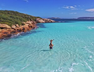
We then headed to Mutee Heads (pictured above) for a picnic lunch. This is such a beautiful part of Cape York and a lot of people chose to camp here and fish – I can see why.
We then headed back to Loyalty Beach, stopping in at New Mapoon first. Just next to the council building is the New Mapoon Indigenous Knowledge Centre. It’s just a small outdoor information centre that provides information about how the Aboriginal people were forcibly removed from their homes in Mapoon.
We spent the remaining part of the day relaxing around camp and of course, we headed to DJs at 5 pm for a drink and watched the sunset.
Accommodation : Loyalty Beach Campground.
Day 12: Day Trip to Thursday Island

Today we went on a day trip with Cape York Adventures to see some of the Torres Strait Islands. The tour started at 8.15 am from the wharf in Seisa, just a 10 minute drive from our campsite at Loyalty Beach.
The tour took us to three islands – Horn Island, Thursday Island and Roko Island – you can read more about our trip here (coming soon) or see our YouTube video, which shows some of the highlights from our trip.
The day trip is not cheap by any means, but I mean, we weren’t going to be all this way and not visit the Torres Strait Islands. The trip was $250 per adult and $140 per child.
Day 13: Seisia to Eliot Falls (Drive 4.5 hours – 110 km)

It was time to start making out way down the Cape – but our adventures weren’t over – the best was still to come!
We headed back to the Jardine Ferry and once again, it had broken down, so the lineup of cars was even longer than when we came up. We waited around 2 hours for our turn to cross the river!
We had intended to have a bit of a look at Nolan’s Creek on the OTT without crossing it, but given how long we waited at the ferry, we decided to push on. Apparently, there is a track some 28kms north of the Fruit Bat Falls where you can go in for a sticky beak. If you have a Hema Map, it’s marked there.
You can also go into the OTT from Bamaga Road to see Sam Creek – there is a gorgeous swimming hole here that I’ve seen some photographs of and looks lovely. To get here, there is a track some 15 km north of Fruit Bat Falls – again, if you have a Hema Map, it’s marked there.
We were a bit nervous about getting to Eliot Falls as it’s on the OTT and you need to cross Scrubby Creek. All the maps have it listed as a deep and long crossing and given we are not overly experienced 4WDers; this worried us a little.
However, arriving at Scrubby Creek, we found a small detour that still crosses the creek but has a causeway across the creek. We did it with ease, even with our heavy camper trailer on the back.
We arrived at our campsite at Eliot Falls, set up camp, and headed straight out to swim in the waterfalls and rockpools. The waterfalls and rock pools are amazing! We spent the whole afternoon at The Saucepan, Eliot Falls and Twin Falls. It’s no more than a 15 minute walk to the various falls from your campsite and just a few minute walk between each of them.
Accommodation : Eliot Falls Campground – $20.55 per night for an unpowered site for the 3 of us. Click here for our full review and everything you need to know about staying at Eliot Falls Campground.
Fuel : Bamaga BP $36.95
Day 14: Eliot Falls to Weipa (Drive 4.5 hours – 300 km)

We had intended on spending two nights at Eliot Falls and I would recommend you do that. However, at the last minute, we decided to squeeze a trip to Weipa into our itinerary. If you are super short on time, one night at Eliot Falls is certainly doable.
So we got up reasonably early, packed up our campsite and headed out to Fruit Bat Falls. This was hands down the highlight of our entire trip! This place is amazing. It’s only 10 km from the Eliot Falls campground, but the roads are a bit rough, so it takes around 30 minutes to get to Fruit Bat Falls.
You could spend hours here; it’s so amazing – if you go with kids – they will never want to leave! This is why having at least two nights here is recommended.
We then continued to Weipa, which is another 4.5 hours or around 295 km.
If you want to see a little more of the OTT, you could make a detour to Sailor Creek on the way. From where you exit from Fruit Bat Falls onto Bamaga Road, just 7km away, there is an entrance to the OTT. From here, it’s just a short drive to Sailor Creek.
Once in Weipa, before checking into the campground, we stopped at the Woolworths in town to stock up on supplies. It was great to see a full size supermarket finally!
Weipa was so busy that we couldn’t get a campsite there, but they had a cheap cabin there which we booked into. So it was kind of nice not having to set up our camper trailer!
After settling into our cabin, we went down the beach to enjoy one of the spectacular Weipa sunsets we had heard so much about.
Accommodation : Weipa Campground – we paid $240 for two nights for a budget cabin with a kitchenette but no bathroom. Campsites start at $37. Click here for our full review and everything you need to know about staying at Weipa Beach Campground.
Day 15: Weipa

We really wanted to do the mine tour in Weipa, but given this was a last minute addition to our itinerary, they were booked out during our stay. However, I also heard good things about the Western Cape Eco Tours, so we booked into their Wildlife Tour and their Sunset Tour – both similar but slightly different.
The Wildlife Tour is dependent on the tides and for us, the tour started at 8.30 am. It is a cruise through the local waterways, searching for local wildlife, including birds and of course, crocodiles!
After the Wildlife Tour, we checked out the Weipa Cultural Centre, which is just a short walk from where the boat disembarks.
We then headed back to the campground and spent some time in the pool.
In the afternoon, we headed back out with Western Cape Eco Tours for their Sunset Cruise. While cruising the same waterways as the morning, it looked completely different as it was high tide and the sun slowly setting in the sky; it put a beautiful orange glow over everything. And of course, we were served champagne and beer!
After the cruise, we headed back to the campground and ordered fish and chips at Barramuchies – the campground’s on-site cafe. The food was delicious!.
Accommodation : Weipa Campground
Day 16: Weipa to Chili Beach (Drive 4.5 hours – 285 km)

Next up, we drove over to the eastern side of Cape York to Chili Beach. It was a real mission getting across to Chili Beach and in hindsight, while Chili Beach is absolutely beautiful – given our short timeframe, we probably should have left this off our itinerary.
With that being said, Chili Beach is lovely and drive through the rainforest as you get closer is just amazing!
We had booked 3 nights at Chili Beach – but given we spent two nights at Weipa, which wasn’t in our planned itinerary, we shortened this to just one night. We gave the additional nights to some fellow campers we met at Weipa.
After setting up our campsite at Chili Beach, we took a long stroll down the beach and relaxed around camp.
Accommodation : Chili Beach Campground – $20.55 per night for an unpowered site for the 3 of us. Click here for our full review and everything you need to know about staying at Chili Beach Campground.
Fuel : Weipa $45.47, Lockhart River $73.03
Day 17: Chili Beach to Archer River (Drive 3.25 hours – 162 km)

Before lunch, we headed down to visit the speck of a town called Portlands Road. There is really not much to this town except a beautiful outlook across the ocean and there is a cafe run out of someone’s house called Out of the Blue Cafe – it wasn’t open though when we were there.
Portlands Road is where you’ll also find The Temple – which looks like a fabulous place to stay.
We then headed back to camp for lunch and then packed up. Then we drove to Archer River Roadhouse – one of our favourite roadhouse campsites.
After setting up camp, we all headed down to the Archer River for a swim. The river offers beautiful crystal clear water, with shallow areas for wading and deeper areas for a swim. Many people were sitting in the water with a stubbie – a great way to end the day.
After our swim, we headed back for a shower and then dinner at the roadhouse.
Accommodation : Archer River Roadhouse Campground – $25 per night for an unpowered site for the 3 of us. There are also rooms for those non campers. Click here for our full review and everything you need to know about staying at Archer River Roadhouse.
Day 18: Archer River to Ravenshoe (Drive 8 hours – 644 km)

Another early start to the day, which saw us officially end our time in Cape York. We had a stop in Laura to fuel up and have lunch and we farewelled the Cape York Peninsula. However, we welcomed the bitumen road!
We were on our way home now, which we had included a few days in Charters Towers. So on this day, we drove late until we reached Ravenshoe for an overnight stop. We got in late in the day, so we decided to treat ourselves to a motel room at Tall Timbers Motel and Van Park.
Tall Timbers is a really lovely property and in fact, Ravenshoe is really pretty and it would be well worth staying a day or two to explore if your itinerary allowed it.
Accommodation : Tall Timbers Motel and Van Park – we paid $130 for the night in a motel room. Campsites start at $37. Click here for our full review and everything you need to know about staying at Tall Timbers Motel and Van Park .
Fuel: Coen $86.78 and Laura $55.94
Day 19: Ravenshoe to Charters Towers (Drive 3.25 hours – 162 km)

We left Ravenshoe bright and early so we could be in Charters Towers by lunchtime. We checked into the Charters Towers Tourist Park, set up camp and had lunch.
We then headed out to Texas Longhorn, where we had a fantastic tour around their property, getting up close to the many gorgeous texas longhorns and learning heaps about these unique cattle.
After leaving Texas Longhorn, we popped into Visitor Centre to pick up a few brochures and then went down to Lissner Park, where we checked out the ducks and the WWII digital trail.
We then headed back to our campsite for the night.
Accommodation : Charters Towers Tourist Park – campsites start at $31.50 per night and there are self contained cabins for the non campers. Click here for our full review and everything you need to know about staying at Charters Towers Tourist Park Park .
Fuel : $67.80 Ravenshoe and $71.36 Blue Waters
Day 20: Charters Towers

We started the morning by heading back out to the Visitor Centre to see their short orientation film on Charters Towers.
From here, we then did the self guided heritage walk through town, which took us past all the grand old historic buildings.
Next, we stopped at the Zara Clark Museum for an hour or so. A fantastic little museum with loads of little knick knacks from long ago.
After the museum, we started the self drive tour, which took us around town to places such as where gold was first discovered, the old cemetery and the Venus Gold Battery. At Venus Gold Battery, we joined their 11.45 am 90 minute tour, where we learned more about how gold was discovered in Charters Towers and how it was processed at the battery.
After the tour of Venus Gold Battery, we continued with our self drive tour around town. Then we headed back to our campsite for a bit of a rest.
At 4.30 pm, Raleigh from the Tourist Park took us up to Towers Hill, where she provided us with a great grazing platter and bottle of wine – it’s part of their Sunset at Towers Tour. We enjoyed watching the sunset and checking out the cute little rock wallabies that came out to say hello. A great way to end the day.
Click here for our full guide to Charters Towers
Accommodation : Charters Towers Tourist Park
Day 21: Charters Towers to Injune (Drive 8.5 hours – 787 km)
This was our biggest driving day of the entire trip. We wanted to put a big day in so we’d get home the following day with plenty of time to unpack and clean up.
We arrived in Injune around 5 pm and booked into the Injune Motel – so we didn’t need to worry about setting up camp or packing up the following morning.
We went to the Injune Pub for a good country meal – just a 5 minute walk around the corner.
Accommodation : Injune Motel – we stayed in a motel room here for $130.
Fuel : Bellyingdon Cross and Rolleston $79.96
Day 22: Injune to Home (Drive 6.25 hours – 556 km)
Another driving day – we left early and arrived home mid afternoon.
Fuel : $66.81 in Dulacca
Best Time to go to Cape York

One of the most important things to know before setting out on your Cape York trip is the best time to visit. Many of the roads in Cape York are not sealed, and are in poor condition – this means that during wet weather many of the roads can become flooded. Therefore travellers are best to visit Cape York during the months of May to around October – although these times may vary year to year depending on the weather conditions.
Peak season tends to be during school holidays, so avoid these times if you can – particularly June / July – although this is exactly when we went and didn’t find it overly crowded at all. If you prefer fewer crowds, September onwards is recommended. However, you’ll also want to consider your tolerance to hot weather. Of course the closer you get to the end of the year, the warmer it will be. Even though we went in June / July – at the tip it was still hot.
Many say the very best time to go is as soon as all the roads open up, which is usually early May. Everything is green and the roads are freshly graded. However keep in mind that the roads open up at all different times.
How Long to do Cape York
Well, that’s going to be different for everyone. I often see people in the various Cape York FB groups say you need months for it even to be worth it to go to Cape York and I just don’t agree with that at all. Of course the more time the better – but most people just don’t have a spread few months to go on holiday.
As you can see we had 3 weeks from Brisbane and we had a great time! Would more time be better – absolutely. Could you do it in less time – probably? If you have all the time in the world, then you’ll have the luxury of travelling slow and seeing much more of the Cape than those short on time. However, if we all waited for the perfect time, we may well never get there.
One great idea I heard from a few travellers to help save time on the road was if one person in your group/family has more time than others – get that person to drive up to Cairns and have the others fly into Cairns to meet them. You could also do this on the way home.
However, provided you have at least a week or so to spend on the Cape (not including time to get to the start of the Cape) then just do it. Life is short – take the trip now – don’t wait!
Cape York Trip Preparation Tips
While we’ve been on road trips before, we’ve never done anything like a road trip to Cape York, so this one took a little extra planning, but nothing too major. Anyway, here are a few tips you might want to consider before heading off.
Get Your Car Checked Over
Definitely worth getting your car serviced before you go and let your mechanic know exactly where you’re headed. That way they can check to ensure nothing is loose. We also had our mechanic service our camper trailer.
We also had our RACQ cover increased to the highest level, just in case.
Make Sure You Have Telstra Mobile
The next thing I’d recommend is to get a Telstra mobile SIM card if you haven’t already. While you still won’t get service everywhere, you’ll have better luck with Telstra then any other service provider.
Get the Car Organised
Given you’re going to be spending a lot of time in the car, you’re going to want to give some thought to how you organise everything in the car. We got this car organiser from Aussie Outback Supplies which was really handy for our daughter to stay organised in the back of the car. Our daughter also has this lap tray from Spotlight so she can draw, read and even eat food from easily.
We also had one of these multi chargers plugged into the power outlet of our car so that we could ensure all devices were always charged up.
Download Shows and Podcasts
Given we were spending so much time in the car, before the trip we all downloaded a bunch of things on our devices, like shows on Netflix for our daughter and podcasts for us – it keeps everyone entertained on those long driving days.
Things to Bring
Everyone is different in terms of what they consider the essentials – but here are a few things I recommend for your Cape York trip:
- Cape York Hema Map – given you won’t get much service on the road and the additional detail this map shows you, it really is crucial
- UHF Radio – tune it to channel 40 to talk with others on the road
- Recovery Gear – in case of those times you get stuck
- Laundry Strips – much more compact and lighter to carry around than washing liquid, just ensure they are in a watertight container because if they get wet they will be ruined
- Dustbuster – for cleaning up all that red dust
- Blower – for blowing away all that red dust
Are Modifications to your 4WD Required?
Well, that depends on the sort of trip you’re planning on taking. Now like I keep saying – we are not 4WD experts. We’ve owned a 4WD for almost 12 months – so are certainly not qualified to give advice. However, we sought out loads of advice before this trip and I shall with you what they said and what we ended up doing.
So we did not take our car through any major creek crossings on the OTT or throughout the Cape – just a few minor ones here and there. So we decided not to get our car fitted with a snorkel or a winch – however, we would have if we were going to do the OTT.
We had been recommended to upgrade the shock absorbers on our car, but we didn’t. However, in hindsight, this probably would have been a good idea – because some of those corrugations really are brutal!
So in the end we decided not to make any modifications whatsoever to our vehicle – this was decided in consultation with our mechanic. The only modification we have on our vehicle are air bags for our camper trailer and this was done last year – so not in preparation for this trip.
Were we silly for not getting any modifications done? Were we just lucky nothing went wrong? I’m not sure but we did seek out lots of advice and in the end, felt we made an informed decision not to make any modifications to the trip. However like I said, in hindsight, we would have upgraded our car’s shock absorbers.
Basically, it really depends on your existing vehicle set up and the type of trip you tend to make.
Cape York Alcohol Restrictions
Coming soon!
Cape York – Our Verdict

We had such a fun time on our Cape York trip! I had a few concerns before we left, such as how we’d go with driving that far as well as how the car and camper trailer would go on the corrugations and other tracks. The long distances didn’t seem to be a problem at all. While we did have some long days of driving, I tried to make sure we never had more than two long driving days in a row and in fact, tried to limit it to one driving day followed by a sightseeing day or two.
As to how the car and camper trailer went – well there was some damage along the way, but nothing too major. We got a chipped windscreen on day one, just outside of Brisbane! We also got a few minor scratches to the car, the air condition vent in the car came loose, a few bolts were lost from the camper trailer etc etc. But everything was easily fixed which was good. As to the driving itself, we did fine, even though we are fairly inexperienced 4WD drivers.
Cape York itself was brilliant! It is so remote, rugged and so pretty in places – it was excellent to see this part of Queensland.
I also really enjoyed the camaraderie there is among other travellers. Everyone’s up for a chat, to pass on some advice or lend a hand when needed. There was also such an awesome sense of adventure that was felt among us. I mean it wasn’t an “easy” trip and most days required us to muck in together to set up or pack up camp. But the bond this created and the memories we now have will be something to be cherished for a lifetime.
If you’re somewhat of an inexperienced 4WDer like us and wondering whether you should take a Cape York trip – then I hope after reading our story the answer is an overwhelming yes! With plenty of preparation, some common sense and a big sense of adventure – your very own Cape York holiday will no doubt be a trip of a lifetime!

Recent Posts
- Camping at Thunderbird Park, Mount Tamborine
- MaMa Country Escape Camping Review
- The Complete Guide to the Best Camping Lanterns Australia 2024
- The Complete Guide to the Best Camping Lights Australia 2024
- The Complete Guide to the Best Pop Up Tents Australia 2024
The ridgy-didge outdoor & adventure blog!
10 Tips for Planning Your Trip to Cape York
A trip to the northernmost point of Australia is an absolute bucket list destination. The remoteness, the untouched beauty, the majestic nature and feeling of being ‘on top of Australia’ is like nowhere else. More and more people are making the trip every year, discovering the many hidden gems and locations that have remained a secret for so long.
Our family ventured to Cape York as part of a two-week camping adventure. We hope that the following tips assist you with planning your own trip.
1. Research your route
It may seem obvious, but it pays to plan ahead and map out where you want to go. There are many options and more locations to visit than you may first realise. Do you want to go straight up the middle, or venture to the east and west coasts on your way up or down from the tip? No matter where you go, every destination has something unique to offer.
As a general guide, you will need around two weeks to venture to the tip and back, without feeling rushed. If you want to go east and west, you could easily add a few days or more, each side.

The northernmost point of Australia takes your breath away.
Peninsula Developmental Road (PDR)
The main road that runs to the tip of Cape York is known as the PDR, short for Peninsula Developmental Road. This is the main ‘arterial’, although its red dirt has a character of its own. The PDR is under constant development, with almost permanent roadworks making improvements to the ‘worst’ sections of the road.
During our trip, the road was in great condition, but it always pays to check recent updates closer to your time of travel. The rainy season causes havoc with many closures. We, however, visited in the drier spring months.
Remember, drive to conditions, slow down and lower your tyre pressures for any rough sections.

Dropping your tyre pressures and driving to the conditions is essential.
The Old Telegraph Track
Snaking its way alongside and occasionally overlapping with the PDR is the Old Telegraph Track. This is a highlight for 4WD enthusiasts, with many challenging obstacles along what is very much a bush track. Those who dare to take the road less travelled are rewarded with some of the most pristine, untouched landscapes, creeks and waterholes. There is a real sense of camaraderie with other travellers, and friendships are easily formed.
The Old Telegraph Track can be tackled in two sections, North and South, and is best travelled from South to North, as this is the direction most people take, and with narrow roads, it is sometimes difficult to overtake.

The Old Telegraph Track is a unique and fun adventure, access starts from Bramwell Junction Roadhouse .
2. Decide on your mode of transport
Cape York is a remote location but it’s stunning beauty can be equally as rugged and unforgiving. It pays to be prepared and take a vehicle that will take you safely to where you want to go.

A 4WD is a great option if you’re looking to be adventurous on the Old Telegraph Track.
Most people choose to take a 4WD of some type, as these vehicles are built for off-road and can be the safest and best-equipped vehicles for the conditions. Accessories such as a fridge, UHF radio, tools and an air compressor are all items that will come in handy on a trip like this.
If you choose to tackle all or part of the Old Telegraph Track, you will certainly need a 4WD, preferably with high clearance. Additional accessories such as a snorkel, winch and recovery gear are essential.

Being prepared with the right setup can mean the difference between ending up like the car on the left, or being able to keep on trucking, like on the right!
3. Camping, glamping or room hire?
There are many options for accommodation for a trip to Cape York. Your route and desired destinations will guide your accommodation, or if you have a fixed preference for where and how you want to stay – vice versa.
Camping is the most flexible option, allowing you to travel and stay almost anywhere. There are some stunning free camps along the Old Telegraph Track that are fairly easily accessed if camping or with a camper trailer. Likewise, heading out to coastal areas is easiest with a tent or small camper.
If glamping is more your style, it is very possible to take a caravan to the tip, and we saw quite a few! Ensure your off-road van is best prepared by protecting cables, pipes and fittings from roads and stones. As with your car, lower the tyre pressures on the van to minimise impact, and be prepared to travel a little slower than you would in a car alone. With careful driving, many campsites are accessible by van, but there may be some spots that are tricky to reach. If you want to tackle the entire Old Telegraph Track, you will need to unhitch and venture off without the van for a day trip.
Finally, if you prefer more luxury, there are rooms available at most station stays, caravan parks and resorts along the way at the tip of Cape York. Planning ahead is key, as you don’t want to be stuck without having somewhere to rest your head at night. Booking prior to arrival is advisable, especially in peak periods.

Camping makes it possible to get off the beaten track and stay in some amazing locations.
4. Plan your meals
When it comes to meals, any remote travel requires planning and organisation. If you are camping, you will need to consider food storage, to both fit in the quantity of food you will need, and to keep it fresh. Remember to pack adequate drinking water, especially if heading into bush camps.
The major towns, including Bamaga, Seisia and Weipa , all have well-stocked supermarkets. Station stays and resorts usually offer restaurants and takeaway food as well.

Food is available for purchase at various locations, including roadside stalls.
5. Yes, there is fuel available!
It is a long way to the tip of Cape York! Whatever your mode of transport, you will require multiple fuel top-ups along the way.
It can be handy to have a jerry can of fuel for unforeseen circumstances or to save a little bit of cash as prices are on the high side, as you would expect. There are plenty of opportunities to fill up along the way, and a good rule for remote travel is to never pass by a service station without filling up. You can also plan ahead using a fuel app to find the next available petrol station.

Planning ahead and taking some time to ensure you have all the supplies you need can save you a lot of time and hassle.
6. The best-hidden gems are off the beaten track
You will be rewarded for taking the road less travelled! A trip to Cape York is all about adventure. Taking the time to venture a bit further is often well worth the effort.
The well-known water holes along the Old Telegraph Track include Twin Falls, Fruit Bat Falls and Elliot Falls. Lesser known but equally amazing locations are the Saucepan and Canal Creek. It takes a bit more research and perhaps some extra hiking time to make it to these destinations, but having this amazing part of the world almost to yourself is a truly unique experience.

There are so many stunning spots to visit, you may well have them all to yourself.
Likewise, after visiting the tip, why not venture east to Five Beaches, where you can navigate the 4WD track along the pristine beach and unforgettable scenery. Up to date, local information is available from The Croc Tent, just before you reach the tip.

Local knowledge (plus lots of souvenirs!) are available at The Croc Tent, close to the tip.
7. Fishing enthusiasts, this one is for you!
Unlike highly populated areas where there is a limited supply of fish, there are many opportunities for fishing enthusiasts to catch something special at Cape York. It is well worth packing a rod or two!
Much of the fishing is off the beach, so suitable tackle and bait will be needed. If you fancy catching something big, you are in luck, with sharks not too far off the shore, make sure you have a suitable rig. Local advice and supplies are available at the tackle shop at Bamaga.

If you fancy a fish, throw in your rod and gear.
8. Remember your recovery gear
If you plan to go off the beaten track, make sure you come prepared. There are a number of water crossings along the Old Telegraph Track including the renowned Nolan’s crossing, plus some steep inclines. Many people need assistance to come through the other side, and there’s always a chance that you might be the one needing help.
There are often plenty of people available to help, but it is good etiquette to have your own gear. Snatch straps, winch and recovery points and max tracks (or similar) and are basic gear that you should consider taking. Make sure that you know how to use it safely, too!

Remember your recovery gear…it might be you that needs to be rescued.
9. Kids are welcome
Children love adventure, and a trip to Cape York is the true adventure of a lifetime. Kids will love seeing the red dirt (and feeling it between their toes!), playing in water holes, exploring the bush and camping under a crystal clear sky full of stars.
School-aged children, in particular, will learn all about the history of the Old Telegraph Track, why it was constructed in the 1800s, and enjoy swinging from ropes at many of the obstacles (giving parents plenty of time to plan their approach!).
There are plenty of families making the trip to Cape York, and kids love getting back to nature and exploring such remote and untouched county.

The water holes are full of pure, freshwater.
10. Take your time
Finally, make sure you allow enough time to fully appreciate and enjoy the wonders of Cape York. It is a long way to the top, and as such, some stops might be overnighters. But many locations warrant longer stays – 2 or 3 nights, or even a week. The more time you have, the more you’ll be able to enjoy the atmosphere of Cape York.
If you don’t have as much time as you would like, perhaps only select a few key locations to visit. This would be a better option than rushing to get everywhere and not feeling like you have experienced anything properly. It’s a great excuse to plan a return trip in the future, there’s always more to see!
Do you plan on visiting the tip of Australia?

Hi, we’re the Todoing Family! We’re all about family travel and adventure, currently road tripping our way around Australia in a caravan. We’ve never caravanned before and are sharing our experience as we go. We’re a family of 5 with a big ‘to do’ list. Follow along on our adventures on our website, Facebook, Instagram or YouTube @todoingfamily
Leave a comment: Cancel reply
Your email address will not be published. Required fields are marked *
Newsletter Sign Up
Adventure Awaits
Exploring Cape York is definitely a #BucketList place. Our Guide Book will help you discover everything The Cape has to offer
Exploring Cape York is definitely a #BucketList place.
Our Guide Book will help you discover everything the Cape has to offer
Which Journey Will You Take?
We are keen, let's do it, adventure please, we're going, let's go bush, read our faq, we love maps.
And so we created a few Explore Cape York Peninsula Google Maps.
Keep checking our maps page as we are always adding new tracks and places.

What Will You Explore?
Fishing you say, cape melville, bush camping, yes, old coach rd +, history buffs +, fishing galore, beach cafes, yes, captain billy, beach camping, north of jardine, island tours, island esacpe.

- Our Tow Rig
- Outside of our Caravan
- Inside of our Caravan
- Lap of Australia
- Northern Territory
- South Australia
- Western Australia
- Planning Tips
- Travel Tips
- Caravan Setup & Tips
- Car Setup & Tips
- Travel Lifestyle Tips
- Education While Travelling Tips
- Food While Travelling Tips
- Series 1 Planning
- Series 2 South Australia
- Series 3 Western Australia
- Series 4 Northern Territory
- Series 5 Queensland
- Accommodation Reviews
- Product & Gear Reviews
- Experience Reviews
- Gear We Love
- Partner Enquiry
- Tourism Operators
We’re live on Instagram, check out our latest posts!
Todoing Family

Navigate forward to interact with the calendar and select a date. Press the question mark key to get the keyboard shortcuts for changing dates.
Navigate backward to interact with the calendar and select a date. Press the question mark key to get the keyboard shortcuts for changing dates.
Cape York Trip Planner
Top destinations in cape york.

Top attractions in Cape York

Explore nearby places
- Thursday Island
- Cape Tribulation
- Wonga Beach
- Mount Carbine
- Cooya Beach
- Port Moresby
- Port Douglas
- Mount Molloy
All related maps of Cape York
- Map of Cape York
- Map of Mapoon
- Map of Weipa
- Map of Merluna
- Map of Bamaga
- Map of Lockhart
- Map of Seisia
- Map of Thursday Island
- Map of Aurukun
- Map of Coen
- Map of Cook Shire
- Map of Merauke
- Map of Hope Vale
- Map of Cooktown
- Map of Bloomfield
- Map of Cape Tribulation
- Map of Daintree
- Map of Cow Bay
- Map of Whyanbeel
- Map of Wonga Beach
- Map of Mount Carbine
- Map of Miallo
- Map of Mossman
- Map of Cooya Beach
- Map of Port Moresby
- Map of Port Douglas
- Map of Julatten
- Map of Mount Molloy
- Map of Yirrkala
- Map of Chillagoe
- Map of Wangetti
Cape York throughout the year
- Cape York in January
- Cape York in February
- Cape York in March
- Cape York in April
- Cape York in May
- Cape York in June
- Cape York in July
- Cape York in August
- Cape York in September
- Cape York in October
- Cape York in November
- Cape York in December
Add places from guides with 1 click
Collaborate with friends in real time, import flight and hotel reservations, expense tracking and splitting, checklists for anything, get personalized suggestions.
4.9 on App Store, 4.7 on Google Play

absolutely stunning k'gari
formerly Fraser Island

accommodation of all descriptions
click here for accommodation options

another stunning sunset

Daintree rainforest
not to be missed

Cape York, a rugged peninsula located at the northern tip of Australia, is a land of untouched wilderness, rich cultural heritage, and breathtaking landscapes. CapeYork.au is your ultimate guide to exploring this remote and beautiful region, offering insights into the best experiences, travel tips, and cultural knowledge to help adventurers and nature enthusiasts discover the heart of Cape York. As an advertising platform, we emphasize our role in promoting tourism and exploration in Cape York without implying ownership or direct operation of the tours and attractions featured.

Cairns holiday

Holiday in Australia

Australian sightseeing

Visitor Centre
Journey to the wild.
Cape York is renowned for its expansive savannas, dense rainforests, and pristine beaches, making it a paradise for those seeking adventure off the beaten path. CapeYork.au highlights the diverse range of activities available, from 4WD adventures along rugged tracks to serene river cruises observing unique wildlife. The peninsula's natural wonders, including the iconic Tip of Australia, provide the perfect backdrop for outdoor exploration.
Rich Indigenous Culture
The Indigenous heritage of Cape York is profound, with communities maintaining strong connections to their land and traditions. CapeYork.au respects and promotes cultural tours and experiences that offer visitors a deeper understanding of Indigenous history, art, and lifestyle. By engaging with local guides and participating in cultural activities, visitors can gain invaluable insights into the rich tapestry of Indigenous culture that shapes Cape York.
Eco-friendly Exploration
CapeYork.au is committed to sustainable tourism, emphasizing the importance of preserving Cape York's unique ecosystems and cultural sites. We encourage travelers to engage in eco-conscious practices, such as adhering to leave-no-trace principles and supporting Indigenous-led tours. Our platform showcases eco-friendly accommodation options and tours that contribute to the conservation of the region's natural and cultural heritage.
Adventure Awaits
For those drawn to the thrill of discovery, Cape York offers unparalleled opportunities for adventure. From fishing in remote rivers teeming with barramundi to camping under the stars in untouched landscapes, CapeYork.au guides you through the myriad of experiences that make Cape York a destination like no other. Whether it's trekking through ancient rainforests or snorkeling in crystal-clear waters, Cape York promises adventure at every turn.
Plan Your Cape York Adventure
CapeYork.au is your comprehensive resource for planning an unforgettable journey to one of Australia's most remote and remarkable destinations. With travel tips, accommodation guides, and detailed itineraries, we make it easy for travelers to navigate the challenges and rewards of exploring Cape York. Join us in discovering the beauty, adventure, and culture of Cape York, where every journey is an exploration of the extraordinary.
ADVERTISING PRODUCTS

FIXED PRICE ADVERTISING

KNOW YOUR COSTS

limited advert slots

ADVERTISING GROUPS

EXTEND YOUR BUDGET

limited membership

CORPORATE ADVERTISING

USE YOUR EXPERTISE

put on your best face
Free Shipping on orders over $20
Hema Alpha Program
Emprise Posted on July 13 2023
Planning your Cape York Trip
Cape York is remote, beautiful and somewhat mysterious. It’s a land of extremes, with historical, cultural and natural qualities and is well worth the time and preparation to explore.

When you think of Australia’s northern Queensland regions, you may think of dusty roads, remote roadhouses and pubs, unparalleled natural wonders, captivating yet dangerous wildlife and unforgiving conditions. You’d be right on many of these. Taking a trip to Australia’s northern-most regions is not for the unprepared. The Hema Cape York Atlas & Guide is the ideal travelling companion. It’s also got the maps you need to navigate the region, but it also offers helpful tips on preparation, safety aspects, unique points of interest and information on the extensive Indigenous and post-settlement history of the iconic destination.
When undertaking the Hema-endorsed 4WD Tag-Along Tour of Cape York , the Hema team of course was aware of the need to stay safe and be prepared for any issues that may arise.
“Cape York in many ways is the ultimate Aussie destination,” said Sam Hayward, Hema Maps Chairman. “It’s remote, it’s beautiful and representative of the diversity of Australia. You can see the true contrasts of Australian landscapes. Untouched beaches, tropical rainforests, towering escarpments, arid environments, inland bodies of water, sacred Indigenous sites … it really is symbolic of the beauty of this land.”

Despite its unarguable pull, the Hema team is well aware of the dangers that such a remote region can pose.
Hema Maps GM Matthew O’Meara says that safety is a priority when travelling.
“We all love to travel, but part of that preparation process is learning about what to take and how to plan. This includes safety. When you’re in a region with few medical facilities and limited communication options, it’s vital that you’re well prepared. We love travel but we take our safety responsibilities seriously. Our Atlas & Guide series features valuable safety information, hazard warnings and information on what to take on your travels,” he said.
Personal preparation is important, such as packing a full first aid kit and ensuring that you have an effective communication device. However, it’s also essential that your vehicle is prepared . Becoming stranded in a remote area is a dangerous situation. On roads that can go days without passing cars, it has never been more important to carry the right equipment and have a vehicle that is fully equipped for the rigours of remote travel.
With a whole chapter on preparation, the Hema Cape York Atlas & Guide offers advice on how you need to kit out your 4WD to survive the trip. It’s recommended that you fit a snorkel to your car for those often-challenging water crossings. Bullbars are vital, given the size and unpredictable nature of wildlife, such as wallabies, livestock, and wild pigs. Also, you need to consider fitting a winch, using the appropriate tyres (and being educated on tyre pressure) and installing a cargo barrier so your gear doesn’t fly around the car in rough conditions .

Heavy-duty suspension is a must, as is a dual battery system and carry an air compressor. Cape York isn’t the place for 4WDs that are only used to taking on low-ranked trails in the Dandenongs. It’s well worth visiting an expert for advice on whether your 4WD is ready for the Cape York challenge.
Communication
While some areas of the Cape now offer adequate mobile telephone reception (such as Punsand Bay), other areas are still ghost towns in terms of mobile coverage. Telstra seems to offer the best reception, but this is still only present in towns and Indigenous communities. Once you venture out further into the bush, coverage can be non-existent. Satellite phones are a great option and can be hired for your trip. However, remember that calls are expensive, so save it for emergency situations or to check in with your nominated person who is monitoring your travels.
A personal locator beacon is also a great addition to your Cape York travel kit. If all goes wrong, it can mean the difference between rescue or remaining stranded.
Budgetary Considerations
Things can be expensive in remote areas. Cape York is no exception. The rising cost of fuel is a consideration for many travellers. Prepare yourself a budget and include some emergency money.
Most places on the Cape now accept EFTPOS, but you should also carry cash because there are often disruptions to electronic transactions. Make sure you withdraw your cash before you head north of Cooktown. Beyond this town there are only four places to withdraw money.
Other costs to factor in are the fees associated with camping permits for national parks and food. Most towns have a supermarket or general store, but prices can be higher than usual given the extra freight costs.
As with all trips, preparation can save you money in the long term. A well-serviced and appropriately equipped 4WD is less likely to break down, costing you big money, particularly in remote areas. There is also the issue of obtaining 4WD parts on the road. It can be days before parts can be delivered to remote communities, and there may not even be a mechanic who can help you.
Plan, Plan, Plan
We all know the value of planning, even for a trip to a caravan park only hours away. But this is especially important when taking on Cape York. Its remoteness is certainly part of its attraction. However, it also means that you need a reliable vehicle , appropriate communication equipment, safety essentials and a knowledge of where you’re going and when you’ll get there.
Trust Hema to help you prepare. We’ve been there, done that and learnt the tricks. The Hema Cape York Atlas & Guide is a trustworthy companion that will help you long after you’ve left city highways and small, remote towns.

Now days many people (not just novices) prefer to join a Tag-Along Tour when travelling through remote regions. Typically run by a professional registered and experienced Tour Guide, one can travel in your own vehicle, confident that you’ll not end up stranded in the middle of nowhere, all alone. There can be safety in numbers. Read in our next article how this format has worked very well for Hema’s own adventures to Cape York.
At Hema Maps, we strive to provide the most comprehensive and accurate maps and guides for outdoor enthusiasts looking to explore Australia's natural wonders.
Did you find this information useful? If so, please share it with your fellow explorers. Whether it's by sms, social media, or email, your friends and fellow adventurers will appreciate the valuable tips and insights we've shared. Let's work together to make the most of every adventure.

Very good info on what to take , thank you

Have travelled the cape with my wife in a 2007 76 series Landcruiser at the time we were both 78 years of age. We traveled with my daughter and her partner in the same year and model LC taking in the Telegraph Track and everything in between. The cape was the most beautiful and rugged area of Australia we have travelled We continue to travel at 80 years of age in our land cruiser fully fitted out with spares, sat phone, first aid kit and AED in emergency heart attacks if needed Regards Roger and Delma
Leave a comment
All blog comments are checked prior to publishing
Blog Category
- Hema Maps & Gear
- Iconic Destinations
- Location Guides
- Trip Essentials
Related Articles

Heading north for the dry season? Here’s what you need to know

How to Prepare your Vehicle for a Cape York 4WD Adventure?

Cape York Essentials – Recovery Gear

Top Trip Essentials for Cape York

Cape York Tag-Along Adventure Tour with Hema Maps
Sign up to explorer news.
Get our latest adventure articles, travel tips, community news, and latest deals delivered straight to your inbox!
Let customers speak for us
Very easy to read and easy to follow our route around Australia
Great map nicely detailed certainly still good to have paper based maps when planning outback trips
This is a fantastic asset for our six weeks in Tassie.
I'm sure it would be great, if Australia post had delivered it.
They are great
You are using an outdated browser. Please upgrade your browser to improve your experience.

Plan Your Trip
- 72 Hours in Cape York and the Torres Strait Islands
- Plan your trip
Some may scoff if you say you’re going to spend three days in Cape York and the Torres Strait Islands, but if that’s all the time you have, seize the opportunity – it’s much better to see it on a whirlwind trip than not at all!
For the sake of this itinerary, we’ll bypass Cooktown – not because it’s not worth the visit, but because you can easily tack on a few days here at the start or end of your trip as you please. To discover more about Cooktown and Cape York, check out our regional hub here.
If you’re even more limited on time, consider Air Tour Australia’s Cape York Day Tour , AKA the world’s longest scenic flight (said with an air of endearment, this is no 14hr cattle class drudgery).
Day 1 - Bamaga to Panjinka (The Tip)

Flight – Cairns to Bamaga
A route that takes most days to complete, can be done in a short two hour flight from Cairns. Both Skytrans and Rex Airlines offer regular services to Bamaga several days a week, with the earliest flight departing Cairns at 7am and arriving to Bamaga at 9am with Rex.
Respectively, Skytrans will get you in around 10:20am, or you can opt to fly in the afternoon before and stay a night in Bamaga before to best capitalise on your short time. Services may vary throughout the year so it’s best to do your own research into what days and times flights are offered based on when you’d like to go.

Adventure time
Waste no time, you’ve only got three days! Today you’ll be visiting Panjinka (The Tip), Australia’s most northerly mainland point.
Cape York Peninsula Lodge in Bamaga offers a car hire service if you would like to self-drive, however, you’ll get more out of your day (including a chef-prepared packed lunch), by joining one of their guided tours .
These tours have been developed in consultation with Traditional Owners of the land to ensure authenticity and accuracy and provide an insight into the region you’d otherwise miss on self-guided trips. Subject to availability, your guide may be one of the local Traditional Owners.

On top of conquering Panjinka itself, visit historical sites including the earliest permanent European settlement on the Peninsula, Somerset, a WWII plane wreck and Lockerbie Scrub, which shares many species with Papua New Guinean forests not found anywhere else in Australia. You’ll also be able to stock up on souvenirs at the famous Croc Tent – what’s a trip into Australia’s most remote communities without buying fishing shirt or stubby cooler?

For dinner, The Paperbark Restaurant is Cape York Peninsula Lodge’s la carte restaurant, offering a seasonal menu that wouldn’t feel out of place in a city. Expect the likes of dukkha roasted cauliflower, Spanish Mackerel nummus (a pickled fish dish similar to ceviche common throughoutthis region), kangaroo fillet, curries, steaks and more.

Bamaga may be the largest township north of Jardine River, but that doesn’t mean it’s big, you’re in one of Australia’s most remote regions after all. There are a small handful of accommodation options in the vicinity including Cape York Peninsula Lodge itself, Seisia Holiday Park , Loyalty Beach Campground & Fishing Lodg e , and Cape York Camping Punsand Bay .
Cape York Waterfall Day

Adventure time – round two
Picture this: it’s the middle of winter, you’re basking in the sun, crystal-clear water lapping your sides, the temperature hovers around 28-30ºC, and a waterfall provides a steady rhythm in the background. Sounds made up, right? In this part of the world, that’s just a typical winter day.
Fruit Bat Falls is located around 1.5hrs south of Bamaga and is another day-tour offered by Cape York Peninsula Lodge. On this tour, stop at Umagico and Injinoo townships, and hear stories of the Saibai migration at Mutee Head, before crossing the iconic Jardine River Ferry.

Your 4WD adventure includes another of Cape York’s most-famed sections, the Old Telegraph Track, before popping out to wash off the dust and enjoy a picnic lunch at the mind-blowingly beautiful Fruit Bat Falls.
On the journey back, learn more about the plants and herbs commonly used in traditional medicine, food, shelter and customs from an Indigenous guide.

At a latitude of -10º, an ice-cold drink is a must no matter the season, so tonight you’ll be hitting up Bamaga Tavern for a good old-fashioned pub feed. You have to tick Australia’s most northerly mainland pub off the list, after all! Are you keeping track of how many “Australia’s most northern” places you’ve visited yet?
While you’re here, be sure to check out the colourful mural painted by the local secondary school students depicting the Bamaga family canoes used historically by Saibai Islanders.
Torres Strait Islands
Day 3 - torres strait islands.

It’s an early start, your Peddell’s ferry for Thursday Island (Waibene) leaves from Seisia at 8am.
While Thursday Island is the Torres Strait’s largest population centre with just shy of 3,000 people, a little bit of forward planning does help out as you can’t just book an Uber at a whim. However, you will find local taxi services as well as a range of day tours – find a list of them all on Torres Shire Council’s website .

You can spend your entire day on Thursday Island taking in the sights – Green Hill Fort, Gab Titui Cultural Centre , Australia’s actual top pub and more – or island hop to Horn Island (Ngarupai) to visit the Torres Strait Heritage museum and undertake a guided WWII history tour, which was a critical army base in the war.
The Torres Strait boasts over 200 islands so a scenic helicopter flight affords you the luxury to see a little more of them from the air. These depart from either Thursday or Horn Islands.
For more inspiration on how to spend your day, jump across to our Torres Strait in a Day blog .

If you’re in a rush to get home, QantasLink has a 5:20pm flight from Horn Island to Cairns several days a week. Otherwise, you can check QantasLink and Skytrans ’ schedules from Horn Island, or Skytrans and Rex Airline’s from Bamaga. A regular water taxi service runs between Horn Island and Thursday Island with McDonald Charter Boats or Rebel Tours , and Peddell’s have afternoon services back to Seisia.
Optional Detour – Glamping experience at Roko Island
The pearling industry makes up an important part of the Torres Strait Island’s histories – pearl shell was found here in the 1860s and the area was soon supplying pearls all over the world. Eventually luggers gave way to cultivated pearls, of which Roko Island housed one of the Strait’s pearl farms.
Now, the floating log and barrel jetty acts as your pathway to heaven with private glamping tents offered in this secluded paradise. You can organise private tours and fishing charters from here, so you can opt to head straight here from Seisia (only 20mins by boat) and undertake your Torres Strait sightseeing directly from Roko.
Discover Roko Island
Note: Due to the seasonal nature and remoteness of this region, it’s best to check all flights, tours and transport ahead of time. These are subject to change or can fill up quickly ahead of time.
Find more in Cape York & Torres Strait

Cape York is calling: Planning a trip to The Tip
Ready to tackle one of Australia’s most remote landscapes, Cape York? Just you, a car and 1,200km of untamed, World Heritage-listed, 180 million year-old rugged rainforest beauty – aka The Tip.

5 Unmissable sights in the Torres Strait Islands
Between Cape York and Papua New Guinea, there’s a fascinating world of unforgettable adventures to be had. Journey to this culturally unique part of Australia and you’ll find vibrant Indigenous communities celebrating their strong connection to land and sea.

Ways to connect with Aboriginal & Torres Strait Islander cultures
Tropical North Queensland is the only region in Australia with two distinct Indigenous cultures, Aboriginal and Torres Strait Islander. Connect with these ancient cultures 60,000 years in the making.

No car, no worries – try these Cape York Tours
Where else but Cape York can you stand on the tip of Australia, discover one of the world’s oldest rainforests in the world and travel on roads few even dare to tread? Just because Australia’s last frontier is calling, doesn’t mean you need to travel it alone.
For the adventure of a lifetime, without any of the ‘going solo’ stress, join one of these guided Cape York tours.
Privacy Overview
Accessibility, accessibility modes, online dictionary, readable experience, visually pleasing experience, easy orientation.
Cairns & Great Barrier Reef Accessibility Statement
Accessibility Statement
- tropicalnorthqueensland.org.au
- June 7, 2024
Compliance status
We firmly believe that the internet should be available and accessible to anyone, and are committed to providing a website that is accessible to the widest possible audience, regardless of circumstance and ability.
To fulfill this, we aim to adhere as strictly as possible to the World Wide Web Consortium’s (W3C) Web Content Accessibility Guidelines 2.1 (WCAG 2.1) at the AA level. These guidelines explain how to make web content accessible to people with a wide array of disabilities. Complying with those guidelines helps us ensure that the website is accessible to all people: blind people, people with motor impairments, visual impairment, cognitive disabilities, and more.
This website utilizes various technologies that are meant to make it as accessible as possible at all times. We utilize an accessibility interface that allows persons with specific disabilities to adjust the website’s UI (user interface) and design it to their personal needs.
Additionally, the website utilizes an AI-based application that runs in the background and optimizes its accessibility level constantly. This application remediates the website’s HTML, adapts Its functionality and behavior for screen-readers used by the blind users, and for keyboard functions used by individuals with motor impairments.
If you’ve found a malfunction or have ideas for improvement, we’ll be happy to hear from you. You can reach out to the website’s operators by using the following email
Screen-reader and keyboard navigation
Our website implements the ARIA attributes (Accessible Rich Internet Applications) technique, alongside various different behavioral changes, to ensure blind users visiting with screen-readers are able to read, comprehend, and enjoy the website’s functions. As soon as a user with a screen-reader enters your site, they immediately receive a prompt to enter the Screen-Reader Profile so they can browse and operate your site effectively. Here’s how our website covers some of the most important screen-reader requirements, alongside console screenshots of code examples:
Screen-reader optimization: we run a background process that learns the website’s components from top to bottom, to ensure ongoing compliance even when updating the website. In this process, we provide screen-readers with meaningful data using the ARIA set of attributes. For example, we provide accurate form labels; descriptions for actionable icons (social media icons, search icons, cart icons, etc.); validation guidance for form inputs; element roles such as buttons, menus, modal dialogues (popups), and others. Additionally, the background process scans all the website’s images and provides an accurate and meaningful image-object-recognition-based description as an ALT (alternate text) tag for images that are not described. It will also extract texts that are embedded within the image, using an OCR (optical character recognition) technology. To turn on screen-reader adjustments at any time, users need only to press the Alt+1 keyboard combination. Screen-reader users also get automatic announcements to turn the Screen-reader mode on as soon as they enter the website.
These adjustments are compatible with all popular screen readers, including JAWS and NVDA.
Keyboard navigation optimization: The background process also adjusts the website’s HTML, and adds various behaviors using JavaScript code to make the website operable by the keyboard. This includes the ability to navigate the website using the Tab and Shift+Tab keys, operate dropdowns with the arrow keys, close them with Esc, trigger buttons and links using the Enter key, navigate between radio and checkbox elements using the arrow keys, and fill them in with the Spacebar or Enter key.Additionally, keyboard users will find quick-navigation and content-skip menus, available at any time by clicking Alt+1, or as the first elements of the site while navigating with the keyboard. The background process also handles triggered popups by moving the keyboard focus towards them as soon as they appear, and not allow the focus drift outside it.
Users can also use shortcuts such as “M” (menus), “H” (headings), “F” (forms), “B” (buttons), and “G” (graphics) to jump to specific elements.
Disability profiles supported in our website
- Epilepsy Safe Mode: this profile enables people with epilepsy to use the website safely by eliminating the risk of seizures that result from flashing or blinking animations and risky color combinations.
- Visually Impaired Mode: this mode adjusts the website for the convenience of users with visual impairments such as Degrading Eyesight, Tunnel Vision, Cataract, Glaucoma, and others.
- Cognitive Disability Mode: this mode provides different assistive options to help users with cognitive impairments such as Dyslexia, Autism, CVA, and others, to focus on the essential elements of the website more easily.
- ADHD Friendly Mode: this mode helps users with ADHD and Neurodevelopmental disorders to read, browse, and focus on the main website elements more easily while significantly reducing distractions.
- Blindness Mode: this mode configures the website to be compatible with screen-readers such as JAWS, NVDA, VoiceOver, and TalkBack. A screen-reader is software for blind users that is installed on a computer and smartphone, and websites must be compatible with it.
- Keyboard Navigation Profile (Motor-Impaired): this profile enables motor-impaired persons to operate the website using the keyboard Tab, Shift+Tab, and the Enter keys. Users can also use shortcuts such as “M” (menus), “H” (headings), “F” (forms), “B” (buttons), and “G” (graphics) to jump to specific elements.
Additional UI, design, and readability adjustments
- Font adjustments – users, can increase and decrease its size, change its family (type), adjust the spacing, alignment, line height, and more.
- Color adjustments – users can select various color contrast profiles such as light, dark, inverted, and monochrome. Additionally, users can swap color schemes of titles, texts, and backgrounds, with over seven different coloring options.
- Animations – person with epilepsy can stop all running animations with the click of a button. Animations controlled by the interface include videos, GIFs, and CSS flashing transitions.
- Content highlighting – users can choose to emphasize important elements such as links and titles. They can also choose to highlight focused or hovered elements only.
- Audio muting – users with hearing devices may experience headaches or other issues due to automatic audio playing. This option lets users mute the entire website instantly.
- Cognitive disorders – we utilize a search engine that is linked to Wikipedia and Wiktionary, allowing people with cognitive disorders to decipher meanings of phrases, initials, slang, and others.
- Additional functions – we provide users the option to change cursor color and size, use a printing mode, enable a virtual keyboard, and many other functions.
Browser and assistive technology compatibility
We aim to support the widest array of browsers and assistive technologies as possible, so our users can choose the best fitting tools for them, with as few limitations as possible. Therefore, we have worked very hard to be able to support all major systems that comprise over 95% of the user market share including Google Chrome, Mozilla Firefox, Apple Safari, Opera and Microsoft Edge, JAWS and NVDA (screen readers).
Notes, comments, and feedback
Despite our very best efforts to allow anybody to adjust the website to their needs. There may still be pages or sections that are not fully accessible, are in the process of becoming accessible, or are lacking an adequate technological solution to make them accessible. Still, we are continually improving our accessibility, adding, updating and improving its options and features, and developing and adopting new technologies. All this is meant to reach the optimal level of accessibility, following technological advancements. For any assistance, please reach out to
What to Pack for Cape York: The Complete Cairns to Cape York Trip Checklist
The journey from Cairns to Cape York is one of the true outback adventures this country has to offer. The 2,000 km return journey takes intrepid travelers across remote and rugged landscapes following trails and tracks that have remained unchanged for hundreds of years. Before you set off on the adventure of a lifetime, take a moment to check exactly what to take on your Cape York trip with our comprehensive Cairns to Cape York trip checklist.
Challenging though it might be, contrary to popular belief, the Cairns to Cape York drive is a trip that is accessible to everyone, even four-wheel-driving novices like ourselves.
Before we left we didn’t have a whole lot of 4WD experience and were frankly lucky we were shown the ropes by the many enthusiasts and experts along the way who relish the opportunity to share wisdom with newbies.
Regardless of whether you are a novice like us or a seasoned veteran, the journey up Cape York to Pajinka at the northern tip of Australia requires careful planning and preparation to complete.
During our three-week trip from Cairns to Cape York, we put together the complete Cape York trip checklist of exactly what to pack for Cape York.
*If you find this packing list helpful and need to purchase something from the list, consider following the Amazon links in the article, it won’t cost you any more and will help support the blog!
Thinking about a Cape York road trip? Find the perfect vehicle!
Planning What to Pack Cape York
Considering what to take to Cape York is a little different from your run-of-the-mill weekend getaway.
There are several things to consider given the remoteness and ruggedness of the location. Spare parts, recovery equipment, first aid, and specialized remote camping equipment are all things that you might need to check you have packed before you set off to the top.
The first thing to consider when planning what to bring to Cape York is the remoteness. Long distances between stops and communities where you can find fuel, food, water, electricity, mobile reception, and medical or mechanical assistance mean you will need to be more self-sufficient than when traveling to other parts of Australia, where you are never too far from a Woolies or roadside assistance.
Check out our FAQ guide on driving Cape York , answering all your burning questions before you set off!
The second issue when thinking about what to pack for Cape York is road conditions. The Peninsula Development Road, or PDR, is the major road running between the Cairns and Pajinka at the tip of Cape York. Much of it remains an unsealed dirt road, which varies in condition in different sections and at different times of the year.
Corrugation, dust holes, deep causeways, and flooding make this road a challenge, even for tough four-wheel-drive vehicles. In addition to the rough main road, the various Cape York tracks and trails that take explorers out to the beaches, waterfalls, and rivers of the Cape are even more treacherous. Steep creek banks, fast-flowing waters, deep ruts, and washed-out tracks pose a risk even to experienced off-roaders.
A Complete Cape York Trip Checklist
With your Cape York must-haves sorted, it’s time to pack the rest. Everything you need to successfully and safely complete your very own trip to Cape York. Read on to find out all of the things that we think you should take for the ultimate Cape York camping trip!
Spare Parts Checklist
Because of the ruggedness of the terrain, breakdowns are an ever-present threat. And because of the remoteness of the Cape, it is recommended to travel with some basic spare parts that will get you going again if your vehicle breaks down. It can be tough to find a mechanic out here and tougher to find the parts you need when you need them. To avoid being stranded for a long time, grab the essentials before you head out.
Even if you don’t have lots of mechanical experience (like us), the Cape is a popular route for people handy under the hood who can help get you moving again. For example, while traveling one of the more treacherous parts of the journey along the Old Telegraph Track (OTT) we had our clunking shock absorber fixed with a new bush, and our rattling winch reaffixed to our car and left this infamous route in better condition than we started thanks to the helpful bush mechanics (and actual mechanics) we met along the way. People are always willing to lend a helping hand en route to Pajinka at the northern tip of the Cape.
- Drive belts
- Radiator Hoses
- Fuel filters
- Spare Tires
- Shock absorber bushes – The tracks here can put a lot of pressure on these weak points. One of our bushes was on the way out when we started the trip to the Cape and disintegrated on the OTT.
Outside of the specific spare parts for your exact vehicle, here are a few other items that could come in handy on the drive to Cape York and keep you safe.
Tire Repair Kit
A tire repair kit will plug a hole if you manage to puncture a small hole in a tubeless tire. Of course, for large holes or shredded tires, you’ll need a decent spare.
A basic mechanic tool kit, including sockets, spanners, and pliers, will help repair things along the way.
A simple solution to hold things in place (at least for the time being) when you don’t have the exact right tool or spare.
This list is by no means exhaustive. If there are other spare parts that are unique, known weak points, or hard to track down for your specific vehicle, go ahead and pick up a spare. Your mechanic or a forum dedicated to your vehicle type are the best places to ask for vehicle-specific recommendations. You don’t want to be caught without a hard-to-find item at the top of the Cape; it will be time-consuming and expensive.
Recovery Kit Checklist
The Cairns to Cape York journey has many opportunities for off-roading adventures, including the infamous Old Telegraph Track. If you are going to the Cape, you owe it to yourself to check out at least a bit of one of Australia’s most legendary off-roading challenges. But before you do, make sure you have the necessary equipment to pull yourself out of trouble if you get stuck with this 4WD checklist!
A winch is a worthy addition to any 4WD vehicle and definitely something to consider as part of your Cape York 4WD touring checklist. The upside to a winch is that unlike some other recovery kit options, it doesn’t require a second recovery vehicle to get you going again. While there are usually heaps of enthusiasts on the 4WD tracks with you, the ability to self-recover can be appealing, especially if you plan to deviate from the busier routes.
Tree Trunk Protector
An essential part of your recovery gear if you have a winch. A tree trunk protector wraps around the tree to provide a safe recovery point for your winch to attach to.
Recovery Tracks
A popular addition to any recovery kit, recovery tracks allow you to self-recover if you get bogged in soft sand or mud. Recovery tracks are a must on any Cape York 4WD checklist if you are tackling the 4WD tracks or plan to drive on some of the remote beaches.
Recovery Strap / Snatch Strap
Make sure you carry a recovery strap so someone can pull you out if you get stuck. A recovery strap can also be used (in a pinch) if you don’t have a tree trunk protector or can’t find one, just wrap the strap around the tree a few times because a snatch strap is longer, and has more stretch.
D-Ring Shackle
Essential in any 4WD touring checklist. D-ring shackles can be used as safe attachment points for recovery equipment.
If you are headed to the beach or plan on doing some off-roading in Cape York, make sure to pack a shovel . No one wants to get their hands dirty digging you out of a sunken situation.
Air compressor
If you have off-road tires* with re-enforced, treaded tire walls, you may opt to lower your tire pressure when tackling the 4WD tracks or even when driving on the PDR and other unsealed roads in the Cape due to the severe corrugation.
Having a portable air compressor lets you adjust your tire pressure to the road conditions, which could come in handy as you drive from Cairns to Cape York. An air compressor will also be a blessing if you puncture a tire and are able to repair it using a tire repair kit.
*If you have road tires, letting the pressure down is a bad idea. You will put the weaker tire wall on the ground where a rock or stick is likely to punch a hole in it.
Safety Gear Checklist
The journey from Cairns to Cape takes you far from civilization into some of the more remote parts of the country. Taking a few pieces of key safety equipment can provide some peace of mind far from home.
Personal Location Beacon
A Personal Location Beacon or an Emergency Position Indicating Radio Beacon is an emergency distress signal that is monitored by a global network of satellites. Once activated a distress signal and location will be provided to search and rescue services who will initiate a rescue mission within a few hours. This small and relatively inexpensive safety device is worth its weight in gold in the remote Cape, where telephone reception is extremely limited.
Google Maps stops working somewhere north of Cooktown. To be sure you always know where you are, consider investing in a map of the Cape to help plot your journey. HEMA has a reputation for the best digital and print Cape York maps.
UHF or CB Radio
A cheap and easy way to make sure you are staying safe on the road, UHF or CB radio will allow you to communicate with the large road trains that tear up and down the PDR leaving a dust cloud behind them.
Fire Extinguisher
This one really doesn’t need any further explanation.
Medical Supplies Checklist
Medical supplies are few and far between on the drive from Cairns to Cape York, so adding the basic medical supplies to your Cape York trip checklist is a must. The roadhouses along the way will carry basic items, but it is unlikely that you will be at a roadhouse when a medical “emergency” arises.
So here is our list of basic medical supplies that we think you should consider when deciding what to pack for Cape York!
- Antibiotics
- Antihistamines – Good if allergies flare up due to the dust or if you have a bad reaction to an insect bite.
- Pain killer
- Insect repellant
- Sunscr e en
Camping Checklist
There is no shortage of great campsites located on the drive from Cairns to Cape York. Camping beside freshwater creeks, at local watering holes, on wild beaches, the options are endless. To take advantage of the incredible camping here, make sure to check this list of essential gear as you prepare your own Cape York camping checklist.
Tent or Swag
Accommodation is available at all of the roadhouses along the PDR, but to get the most out of your trip to the Cape and its beautiful remote camping opportunities, you will need to bring a tent or swag.
Camping Chairs
While the ground or a nice log can suffice in a pinch, good camp chairs (or even cheap ones) make relaxing on a beach or by a creek much more
If you don’t want to eat cans of tuna for every meal, grab a simple camp stove for the trip. We travel with a two-burner stove and gas canister, but a single burner butane stove would do the trick. Just make sure you are fully stocked with enough fuel for your needs.
12-v Compressor Fridge
A 12-v compressor fridge is a great addition to any camping trip but especially on the Cape. Ice is hard to come by and is in limited supply in Cape York. A 12-v compressor fridge might set you back a bit, but it is well worth it to have a nice cold beer after a long dusty drive on the red clay.
Car Awning or Gazebo Tent
Cape York is hot. Having your own shade is important to escape the relentless sun. Whether it is an awning attached to your car or a gazebo tent you will be racing to put it up when you settle in for the day at one of the many great campsites in Cape York. If you don’t have a roof rack and still want to attach an awning, check out our guide on how to attach an awning without roof racks for all our vanlife tips and tricks!
Outdoor Camping Lights
There are no city lights to keep the night lit up out on the Cape. Make sure to pack 12-v camping lights , solar-powered lights, or battery-operated lights for when the sun goes down.
We love our bulb lighting , which adds a little decor to our camp set-up!
Water Storage
Camping in remote locations means limited access to water. Make sure your rig is fitted out with enough capacity to carry a minimum of 5-7 liters of water per person per day. We carry 60 liters of water with us and can last roughly five days, being careful with our water consumption. You will also need to make sure you pack a hose as well as a tap fitting and hose connector set to attach to the water tap.
Water Basin
For washing dishes, and here in Cape York, for washing the red dust from your clothes. We prefer a collapsible basin to save on space.
Clothes Line
Fo With few laundry facilities on the drive from Cairns to Cape York, washing your clothes with water from the creek and hanging them out to dry is your next best option. Make sure to bring a clothesline because you won’t want to be drying your clothes by hanging them on your dusty vehicle.
The remoteness of Cape York means a toilet is not always available. Make sure to pack a trowel along with some recyclable toilet paper for the times when nature calls and nature is the answer. (If you have packed a shovel as part of your recovery kit and it’s easily accessible, this is even better!)
Biodegradable Toilet Paper
For when nature calls and when nature’s the answer. This toilet paper won’t harm the planet but don’t forget to bury it with everything else.
Being remote doesn’t necessarily mean that you have to be dirty all the time (although being dirty is inevitable with all of the dust on the roads to the Cape). And while showers are available for $5 at most of the roadhouses, having the ability to shower at your remote campsites by the creek is helpful.
We have a camping solar shower bag , but you can also use a rechargeable shower and heat water in a steel pot on the fire.
Water Purification Tablets or Water Filter
Water purification tablets or a water filter are always handy things to carry when heading somewhere remote.
If you miscalculate and your water runs dry, the many creeks and rivers of the Cape mean that freshwater is usually not too far away during your drive from Cairns to the Cape.
Having the ability to purify your own water makes you a little more flexible to explore the wilderness of the Cape at your own pace.
Wild camping means you have only the light of the moon and the stars at night, but if that’s not enough, a headlamp can make camping at night a bit easier.
Spare Batteries
A must for any camping adventure. We recommend rechargeable batteries which can be recharged while driving to your next favorite camping spot.
Lighter / Matches
Sitting around the fire and swapping stories at the end of a long day in the Cape is one of the best bits of the trip…don’t forget the matches.
Recreation Gear Checklist
The Cape is a wild land, and the appeal for many is the vast, unexplored, and untamed environment, just waiting to be conquered. Outdoor and adventure is the name of the game here so you may want to consider bringing some recreation gear.
All-Terrain Vehicles (ATV)
Driving from Cairns to Cape York we saw plenty of people towing ATVs, dirt bikes, and other types of all-terrain recreational vehicles being towed on off-road trailers. If you are an enthusiast, the Cape is a great place to bring your gear and tackle the tracks.
Fishing Rod
Fair warning the fish out here are massive, and the apex predators that hunt them are even bigger. If you don’t want to get laughed at and lose a lot of fish and gear, take something more heavy-duty than the small boat rod and spin reel we took.
If you have a small boat and the capability to take it with you to Cape York, either mounted to the roof or on a serious off-road trailer, bring it. If not, you can rent a boat in New Mappoon from Bully’s for the day for only $360 plus fuel. We highly recommend getting out on the waters of the Cape which are teeming with fish and marine life. It was a particular highlight of our trip from Cairns to Cape York. We saw a few people traveling with kayaks however given the number (and size) of crocs and sharks we saw on our trip, I would be wary…
This Cape York trip checklist is meant to highlight some of the essentials needed on a recreational trip to Cape York. But of course, it is by no means exhaustive. If you have a question about your packing list for the Cape, ask us below. Or, if you’ve completed the journey and you think we’ve missed something, let us know what you would add to the Cape York trip checklist!
If you found this packing list helpful and need to purchase something from the list, consider following the Amazon links in the article, it won’t cost you any more and will support the blog!
Do you have other unanswered questions about driving to Cape York? Check out our FAQ to find everything you need to know before you go to Cape York!
Out of a love of travel we met in a hostel in Estonia, one snowy Christmas night. Eighteen months later, we quit our day jobs in search of a more nomadic life style together.
Five years later, we are still traveling. Between us we have explored more than 80 countries, undertaken countless #vanlife adventures in more than 12 countries on 4 different continents. Most recently we have been learning to sail on our little boat whisper in the Mediterranean, falling in love with sailing and the live aboard lifestyle. While we travel and work work remotely as digital nomads.
Through this website and our vlog we hope to share some of the things we learn about the off-the-beaten path destinations we visit, about van life, sail life and working remotely from the road.
We are the Vanabonds, these are our tales.
Eddie & Kelli
Leave a Reply Cancel reply
Your email address will not be published. Required fields are marked *
This is a very useful and detailed guide for novices like me. I wouldn’t have known exactly what to bring to an off-road adventure in Cape York.
There are so many things you could easily forget!
This place looks so wild and authentic!!!! Would love to visit there someday, thanks for the tips, bookmarking the page for future reference. 😀
Wild is an understatement! Nature was literally on steroids in the Cape!
Such an extensive list for what looks like an awesome trip! Wow! I’ll add it to my list 🙂 thanks for sharing!
I have been a lot of places and it truly was one of my favorite road trips!
What an awesome adventure! I’ve never been north past Cairns but it’s nice to know it’s doable, even for novices. I’d definitely need the EPIRB though!
It is so doable! We are not even 4WD enthusiasts and loved it!
- Car Rentals
- Airport Transfers
- Attractions & Tours
- Flight + Hotel
- Destinations
- Trip.com Rewards
"Viki Sinema"
Explore near "viki sinema": where to stay, eat, and visit, "viki sinema" reviews: insider insights and visitor experiences, additional information, you might also like.

The State Tretyakov Gallery

The Moscow Kremlin

State Historical Museum

Moscow Circus on Ice
Nearby attractions, popular types of attractions in elektrostal', popular restaurants in elektrostal', popular destinations, recommended attractions at popular destinations, popular ranked lists, more things to do in elektrostal'.
- Customer Support
- Service Guarantee
- More Service Info
- Website Feedback
- About Trip.com
- Terms & Conditions
- Privacy Statement
- About Trip.com Group
Other Services
- Investor Relations
- Affiliate Program
- List Your Property
- Become a Supplier
ELECTROSTAL HISTORY AND ART MUSEUM: All You Need to Know BEFORE You Go (with Photos)
Electrostal History and Art Museum - All You MUST Know Before You Go (2024)
IMAGES
VIDEO
COMMENTS
A detailed account of a 10-day road trip from Cooktown to Cape York and back via Weipa and the Old Telegraph Track. Includes budget, camping, 4WD setup, highlights and tips for travelling to the tip.
Plan your trip to map out the best fuel stations and roadhouses along the way. Contrary to what Cape York horror stories will tell you, there are fuel stations and roadhouses stocking both petrol and diesel along the way (in fact, the longest distance between bowsers is 140km). Major towns like Weipa will have a couple of different fuel service ...
1. Drive the Old Telegraph Track. Cape York trip planning should allow for at least some off-roading. Built to allow access to the telegraph lines connecting Cooktown and the Cape in the early 1800s, the Cape York Track or Old Telegraph Track was originally the only way to access the Tip.
The ferry operates from 08.00-12.00 and then from 13.00 - 17.00, daily in the dry season. Contact the Northern Peninsula Area Regional Council for further information - phone 07 4090 4100. The drive from the Jardine ferry to Bamaga is about 42 km and Seisia is 6km north of Bamaga.
Like most adventure lovers, it had always been our dream to take a Cape York trip.I spent hours and hours researching and planning the best Brisbane to Cape York itinerary and trying to determine whether we were best to join a tag along 4WD tour or whether we were brave enough to make the Cape York road trip alone.. In the end, mainly due to the need to be completely flexible with our dates ...
The water holes are full of pure, freshwater. 10. Take your time. Finally, make sure you allow enough time to fully appreciate and enjoy the wonders of Cape York. It is a long way to the top, and as such, some stops might be overnighters. But many locations warrant longer stays - 2 or 3 nights, or even a week.
Explore Cape York Peninsula Australia. Everything you need and more. 4WD Tracks, Camping, Line Maps. Peninsula Development Road, Old Telegraph Track ... Captain Billy Landing is a side trip from the PDR. You take a left turn off 65km north of Bramwell Junction. Then you will have a 28km drive and you are there. And it is a beautiful place
A 2 Week Cape York Itinerary full of Adventure! October 1, 2019. We commenced our 14 day itinerary up to Cape York from Cairns. We kept a daily blog recording the action, adventure and amazing sites we saw in one of the absolute highlights of our lap of Australia. Day 1 - Cairns to Laura.
When to Visit Cape York. The best time to visit is during the dry season, from May to October. During these months, the roads are more accessible, and the weather is more conducive to exploring the outdoors. Planning Your Trip Visiting Cape York requires planning, especially considering its remoteness.
Cape York Peninsula. Welcome to Visit Cape York, your official guide to this vast and unique Australian outback adventure land. Find things to do in the region, attractions and sightseeing, events, and accommodation. Plan your trip to Cape York Peninsula with our useful traveller information. Welcome to Cape York Peninsula, Far North Queensland ...
Cape York is calling: Planning a trip to The Tip. Ready to tackle one of Australia's most remote landscapes, Cape York? Just you, a car and 1,200km of untamed, World Heritage-listed, 180 million year-old rugged rainforest beauty - aka The Tip. Read more . Cape York .
With Wanderlog's mobile travel planner on Android and iOS, access and edit your trips wherever you go — even while offline. 4.9 on App Store, 4.7 on Google Play. Keep your places to visit, flight/hotel reservations, and day-by-day itineraries for your trip to Cape York in our web and mobile app vacation planner.
Plan Your Cape York Adventure. CapeYork.au is your comprehensive resource for planning an unforgettable journey to one of Australia's most remote and remarkable destinations. With travel tips, accommodation guides, and detailed itineraries, we make it easy for travelers to navigate the challenges and rewards of exploring Cape York. Join us in ...
For more information on how to plan your route from Cairns to Cape York, check out our step-by-step Cape York trip planning guide! Do I Need to Carry Cash to Cape York? Yes. Although we carried cash with us, we did not use it on our trip. Everywhere we went had card facilities. However, given the limited infrastructure up here, if the internet ...
With a whole chapter on preparation, the Hema Cape York Atlas & Guide offers advice on how you need to kit out your 4WD to survive the trip. It's recommended that you fit a snorkel to your car for those often-challenging water crossings. Bullbars are vital, given the size and unpredictable nature of wildlife, such as wallabies, livestock, and ...
Cape York is calling: Planning a trip to The Tip. Ready to tackle one of Australia's most remote landscapes, Cape York? Just you, a car and 1,200km of untamed, World Heritage-listed, 180 million year-old rugged rainforest beauty - aka The Tip. Read more . Torres Strait .
A 12-v compressor fridge is a great addition to any camping trip but especially on the Cape. Ice is hard to come by and is in limited supply in Cape York. A 12-v compressor fridge might set you back a bit, but it is well worth it to have a nice cold beer after a long dusty drive on the red clay.
Water treatment may be required in some spots (non-potable water will be signed), so pack something to treat your water before you drink it. 4. Fuel up. Cape York isn't like the city, where petrol stations are mere minutes from each other; rather, there can be hours between bowsers.
Destination Cape York - Trip Planning Guide, Bamaga, Queensland. 16,050 likes · 1 talking about this. PLEASE NOTE that, for a quick and sure reply, it is ALWAYS better to get in touch via the 'Contact Us. Destination Cape York - Trip Planning Guide, Bamaga, Queensland. 16,051 likes. ...
Top Dzerzhinsky Landmarks: See reviews and photos of sights to see in Dzerzhinsky, Russia on Tripadvisor.
Discover "Viki Sinema" in Elektrostal'! See updated opening hours and read the latest reviews. Discover nearby hotels and dining for a perfect trip. Plan your visit to "Viki Sinema" on Trip.com.
Art MuseumsHistory Museums. Write a review. Full view. All photos (22) Suggest edits to improve what we show. Improve this listing. Revenue impacts the experiences featured on this page, learn more. The area. Nikolaeva ul., d. 30A, Elektrostal 144003 Russia.
Electrostal History and Art Museum. 19 reviews. #3 of 12 things to do in Elektrostal. Art MuseumsHistory Museums. Write a review. All photos (22) Revenue impacts the experiences featured on this page, learn more. The area. Nikolaeva ul., d. 30A, Elektrostal 144003 Russia.