Maps, travel and exploration
- Maps Everywhere NJCU exhibit

So you want to design a map for Tourists
One thing I like about a good paper tourist map is that place names, buildings and parks don’t appear and disappear every time I touch it. They are all in exactly the same place as the last time I looked at it.
I hear you. You are saying, “Why would someone pick up a map, wouldn’t you just use your phone?” Sure, the phone is great, but many people I’ve met while traveling do not pay for data while abroad. They use wifi when they can find it, but they rely on paper maps.
Since I’ve been traveling, I’ve picked up several free tourist maps. A paper map can give you a good overview of the area. If it’s designed properly, you can see clusters of attractions and determine which direction you want to head in. A good tourist map will tell you all you need to know for the first 48-36 hours in a place. It can also transfer a feeling about a place. They can be good for navigating without your phone (gasp!), but only if some simple graphic design rules are followed. I’ve used some good ones and not used some very bad ones.
What makes a well designed map for a Tourist?
Hold on, let’s start with the question that should preface any design project, no matter how big or small. Who is the audience for this design?
Who is this map for? It is for the Tourist. Let’s dig deeper.
Who is the Tourist? Our Tourist is a casual explorer, with limited amounts of time, limited experience with the language and customs and who knows next to nothing about where they are. They want to see the sights and have a good time. The more adventurous Tourist may take mass transit, but most will walk, blisters and all, from morning until night, for days, probably in new shoes bought especially for the trip (rookie mistake #1).
It is important to understand that everything the Tourist sees is brand new to them and often not understood. Common things look different in different countries. Stores sell different products. A coffeeshop (one word) in Amsterdam is not where you get a cappuccino. This Tourist is grappling with many things simultaneously, more than how to get from the church square to the world-class museum and back to the hotel. Let’s just say, the Tourist could be confused, hungry, tired, and/or possibly in pain, in any combination, at any given point.
This is why a tourist map must be clear and concise and make the Tourist feel comfortable. It must be easy to use.

Ok, so how do you design a map for the average tourist?
Oh wait – there are more questions before we start.
What is a map? A map is a diagram, or schematic representation of a specific place. A map is primarily made of lines, colors, text and some type of imagery. A map has a scale, meaning there is relationship between the sizes and distances on the map and those sizes and distances in reality. The map can be for one street corner or an entire country, or continent, or anything in between.
What is the purpose of a map? A map of a place can be made for many reasons. It can show property borders, or geological structures, or it may indicate heights of mountains and directions of rivers. A map explains a complex three dimensional space in a two dimensional form.
This post is about general tourist maps, so let’s conclude the tourist map must 1) inform the Tourist of the location of major attractions, restaurants, retail stores, notable neighborhoods, and transit hubs, 2) provide street names, and 3) help the Tourist navigate comfortably in a place for a few days.
Now that we have defined whom the map is for and what the person should do with that map, we can start to think about the map in terms of design.
Hierarchy. What is the most important thing on this map? It will probably be major tourist attractions, and streets with street names. If you receive the map at your hotel, conveniently your hotel is prominent on the map as well. Hierarchy on a map is created through the use of color or pattern, line weights, scale, typography and images.

Simplify. If you mapped ten blocks around any given point in any city, you’d find hundreds or maybe thousands of things to map. Newstands, doctor’s offices, shoe stores, bus stops, dry cleaners, museums, police stations, cab stands, bakeries, jewelry stores, repair shops, grocery stores, delivery services – a slice of an entire cast of characters and scenes that make up any city. The Tourist does not need to know about 95% of this. Leave it off the tourist map. Too much information makes the map confusing and thus confuses the Tourist and makes them uncomfortable.
Did you know that you are demonstrating a bias when you add or subtract things from a map? All maps, like all designed things, have a point of view, even if you try to project a neutral voice. Choose carefully to create a balanced overview of the area. Due to limited space on your map, you may have to make some hard decisions.

Contrast. A tourist map must make full use of contrast. This is not the place to be subtle. The Tourist wants to find things fast. Contrast can be easily achieved with color and scale. At times, spacing can also be used, but generally speaking, spacing is set by the streets on the map.
Color. Where is the tourist when they are looking at your map? Are they sitting comfortably at home with their favorite pup or kitty in their lap, with a warm cup of tea and good lighting? No. They are standing on a busy street corner in a foreign country, staring at a map, wondering how a street name can have 17 letters and only 2 vowels. And they are getting hungry. This is not the time to use all pastels or put lots of small white type on a black backgound, or even worse, a yellow background. Use pleasant, but contrasting colors, to make things stand out and easy to find.
The colors you choose should relate to your subject matter and can help convey your message or invoke time period. Color can set the scene for the Tourist as they explore.

Scale. Maps have limited space by virtue of the street plan and the size of the paper they are printed on. You can manipulate scale by changing size and also by making things out of scale from the rest of the map. On a tourist map, scale (distance) does not have to be entirely accurate. Areas of interest for the Tourist can be larger and out of scale , just keep the sequence of things in order. Main streets can be made a little wider, or attractions can be moved a bit to accommodate place names. When designing indicators for the map, you can use different sizes for groups of things. Attractions might be one size. Restaurants might be a little smaller.

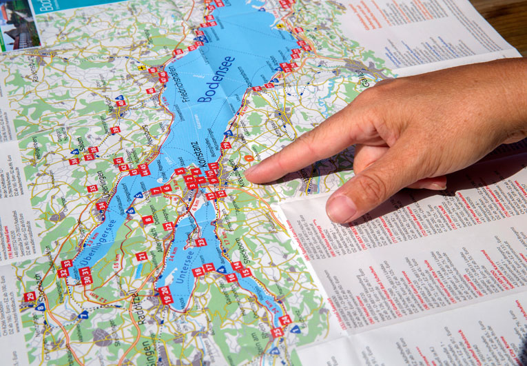
This map also educates the viewer on the structure of Barcelona’s street plan, with the square blocks of Eixample surrounding the cramped blocks of the old city. Also, as I discussed in another post , the city is oriented with the sea and Eixample parallel the paper. North would be pointing toward the upper right corner, not the top of the paper. —
Typography. No teeny tiny type please. Your Tourist’s feet hurt, their phone ran out of juice and they are already supposed to be in line for their 15:30 Van Gogh Museum tickets. They have to locate the museum on the map, determine which streets will get them there, all while they figure out what time 15:30 really is. They need clear, legible type on everything, even if it’s small. Keep the flowery stuff for the cover panel. You can use serif or sans serif, just be sure it has enough space around it and contrasts to the background. If you use upper and lower case, don’t let your descenders touch the lines of the streets. Type in all caps should have adequate spacing above and below. Avoid italic type on maps unless you are trying to highlight information.

Symbols. Yes, please use symbols, or very abstracted (simplified) drawings. Symbols are good shorthand for maps and other information design because they can be understood quickly. Symbols, or icons, are most effective when you have to indicate different locations for similar things, like monuments. Using one symbol to signify “museums” is good. Creating an individual symbol for every different museum on your map will be confusing. Your Tourist will have to always be consulting a key to decipher the symbols. If you have room on your map, pair the symbol with the name of the place for double information. Your Tourist can use all the help she can get, because her feet are killing her and she’s carrying her coat because it’s hot now.

Images. Remember, the Tourist doesn’t know anything about where they are. Aside from the Eiffel Tower, Big Ben and the Empire State Building, most people do not know what specific buildings in other cities look like. Small, simplified drawings of buildings or attractions, placed on the map are very very helpful. In my opinion, drawings are easier to “read” than photographs. Photographs have too much unnecessary information, such as surrounding buildings or trees.

Lastly, the overall map as a piece of design should be balanced . You can’t move streets or rivers (too much), but you can play around with the other map elements, such as titles, information keys, the scale indicator and various text boxes or other images. You may embellish the map with illustrations or photos. As you design, hang the map upsidedown and stand back to look at it. Right away you’ll see what is sticking out or too big or too small. This is a trick you can use to see if any design is balanced and holding together.
Here are a few more maps in my collection I just have to share…

I found this cheeky little map of Lisbon in an “alternative” shop. It has fun commentary and a friendly, hip look and feel. This map is geared toward a more specific audience (perhaps those that know the virtue of using a Nikon). Numbered discs are keyed nicely to explanations and photos on the opposite side. It’s interesting it uses pink and blue like the other Lisbon map I got. It’s got a wicked sense of humor and is worth enlarging the images to read the text. —

Ok, you know you’d love to have this map in every city! This map from Belfast hits all the marks, although that’s easy when you limit what you want to present. A wall of clean white tiles greets you on the cover. The title borrows familiar international visual language for restrooms, merging humor with comfort – you don’t need to read the text to understand the content of this document. The map itself has been simplified to the basics, streets, the major attraction to orient you and numbered discs that are easily keyed to more information. The bonus on the back is photos of that ever important facility. Bravo! —
A tourist map can be a good free souvenir, especially if it’s designed well. Every time you look at that map, you will be filled with memories from your trip. I’ve collected many more than I show here!
–All of these maps are used without permission!
Categories MAKING THINGS
Tags Amsterdam Barcelona Dresden Dublin Lisbon paper Prague research travel try this! Vilnuis wayfinding
You must be logged in to post a comment.

How To Make A Travel Map [Tips and Free Template]
Planning a trip abroad? If you want your trip to go smoothly, especially if traveling with a group, you'll want to make a travel map.
Chelsey Roney
CEO, Co-Founder

Putting together a travel map can be a fun and insightful exercise that helps you throughout your journeys. Any seasoned traveler knows that planning and anticipating your trip is an enjoyable part of the process. And they also know that, when it comes to having a positive experience, a little bit of planning and preparation goes a long way.
That’s why we put together this guide on how to make a travel map. We hope that you find this advice useful during your itinerary. You may even find that your travel map is a wonderful way to remember your trip long after the travel dates have come and gone. Without further ado, let’s dive into some FAQs about travel planning maps.
What is a Travel Map?
A travel map is any kind of representation of the places you’re going. It can help you keep track of places you want to go and the information you need to remember. Back in the old days, a travel map would be on paper. While some people may prefer the nostalgia of putting together a paper map, most people in the 21st century prefer a more high-tech solution. You can put together a group travel map on many types of mapping software.
Those who use Google maps or Apple Maps may lean towards their preferred daily navigation tool. However, there is also value in finding a more niche solution to this exciting project of putting together a personal travel map . Before we dive into the specifics of how you can put together your very own travel map, let’s take a look at some of the benefits that a travel itinerary map has to offer.
Benefits of a Travel Map
First and foremost, having a travel map will help you keep your itineraries organized. If you’re hoping to make the most of your trip and see every site that you had on your bucket list, a bit of organization goes a long way. After all, you don’t want to waste precious time and energy on your vacation or travels trying to figure out basic logistics that you could have researched beforehand if you were more diligent.
A travel map can also be a good opportunity to share information and collaborate with your travel partners. Different people have different visions of the ideal journey. Therefore, collaboration and communication are quite important. Some tools (such as Proxi) offer the opportunity to build a travel map together on a single platform from multiple accounts. This can help reduce miscommunications and frustrations over poorly planned Itineraries.
What to Include in Your Travel Map?
Now that we’ve talked about the benefits of putting together a travel map, let’s take a look at a few of the most common elements that you want to consider adding to yours. We’ll start with some basic trip amenities that any traveler will need to consider. From there, we can talk about the specifics of your journey.
Hotels and Accommodations
On your trip, you will obviously need a place to stay. The exact hotel that you choose will depend on your budget and your plans during your stay. But a few things to always look for are location, quality, and price.
You want a hotel that is located close to the attractions you’ll be visiting. It’s also worth considering if the area your hotel is in is walkable and if it has connectivity with local trains, buses, bike shares, and other transit options. Checking Google reviews and other customer feedback can help you decide between the hotel options.
Price is a concern for most travelers to some degree, so you will want to understand the cost of each option as well. Once you have chosen a hotel, your travel map can help you remember key details such as the address, check-in hours, and where you will be heading out to once you leave your hotel
Sights and Attractions
Add attractions your want to see. Now that we’ve taken care of accommodations let’s dive into the attractions! You can find information about the attractions in the area you’re traveling to by creatively scouring the web. Platforms like Yelp, Reddit, and even Quora are good places to start . If you can find a travel blog or YouTube channel with more personal and subjective content from creators you love, that may help even more. Once you’ve chosen the attractions you’d like to visit, you can use your travel map to keep track of information such as the address, the ticket page, the hours, when you will go, and any relevant links to reservations.
Travel Arrangements
A Travel map is also a good place to keep track of your arrangements. There’s nothing worse than arriving at an airport or train station and not being able to find your boarding pass. So why not keep your ticket links directly in a unified and cohesive travel map? You can also note down information such as station location, transit to the airport, and departure times of all your journeys.
When traveling with a large group, these situations can be particularly chaotic or even stressful if not managed well. In order to coordinate your party when heading to the airport, train station, or bus terminal, digital tickets and a readily accessible itinerary are invaluable.
Food, Drinks, and Dining
A key part of experiencing any local culture is finding the food fare. If you do research beforehand, you can take note of the restaurants you would most like to visit. Of course, you can also add information on hours, menu items, reservations, and the address for any dining establishments you will be patronizing.
With a digital travel map, you can start researching (and anticipating) all the amazing food, drinks, and experiences you will have. And all that research can be stored and accessed, making for a wonderfully seamless chain of events.
Additional Tips
By now, your travel vision is really beginning to take shape. The big day is approaching, and soon you will be on your way to experience new things and build memories that will last a lifetime. Here are some final tips to put the finishing touches on your travel map and be fully prepared for everything that life – and your journey – will throw at you.
Take Advantage of the Cloud
Use an online map maker so you can access your map anywhere. There’s nothing worse than putting tons of work into a map that you then leave in the hotel at the most crucial moment. An online map will allow you to access the same information from multiple devices, and it will make it easy to share that information among multiple people.
While there is certainly some nostalgic value in a paper map, we would recommend buying one for a souvenir if you really want one but relying on a more modern and robust digital solution for your day-in and day-out travel necessities.
Get Organized and Create Categories
Group map pins into different categories to help keep things organized. For example, you may wish to group all of the museums you will be visiting into one category and all of the architectural sites you wish to experience in a different one. Things such as accommodations, hotels, and transit can also deserve their own categories.
The exact division of locations into distinct categories is ultimately up to you, but you want to pick a consistent theme that is practical for the purposes of your particular travel experience. Grouping pins in this fashion can also help make sure that everyone on the trip gets to have their own input. Group travel is sometimes challenging, but good communication can help.
Add Photos and Organize Memories
A digital travel map with pins is useful for more than just planning. The great thing is that you can later use the pins to upload photos of your vacation if you are using a proper travel map software such as Proxi. You can upload photos of your vacation to each respective pin, turning your map into a photo album.
With Proxi, you can also embed this on your blog, so others can follow along with your journey. Our platform was made with adventurous and creative travelers like you in mind, so make sure to check us out and see everything that proxy has to offer. It will help you make the most of your trip and will also help you organize and share all the memories and experiences that you take in along the way.
Check Out Our Travel Map Template
Ready to start creating your travel map for your upcoming trip?
Spend some time exploring our free Travel Map Template for group trips.
Just pick the city or region you’ll be traveling to and start marking down the information that is most useful to you. Our design is intended to put powerful map-creation tools into the hands of everyday travelers like you. We hope you’ll enjoy our work. But most importantly…be sure to enjoy your trip!
Related Articles

Get Inspired
Adventure awaits.
How would you like to plot your course!?

How to Use Google My Maps to Plan a Trip (Ultimate Guide)

Note: Some of the links in this post may be affiliate links. This means if you click on the link and purchase the item, I will receive a commission at no additional cost to you. More details are here .
I love a good map. I’ve got maps hanging on my walls. I go to the bookstore to read maps. Whenever I navigate my way home using only a map, I feel like I must have some innate bushcraft skills. And if you’ve read my posts about traveling in Maine , you’re probably sick of me talking about the DeLorme Atlas by now.
But while reading paper maps will always inspire a sense of get-up-and-go adventure for me, I’m not totally opposed to using tech for planning my trips and navigating on the ground.
And one of my favorite techy solutions? A secret little trip planner called Google My Maps, buried inside of everyone’s favorite map tool.
Google My Maps lets you create shareable custom maps with multiple layers, plus location pins with icons and notes. It’s a great way to brainstorm travel plans or create a trip itinerary from a desktop. And since the map can be viewed in the Google Maps app, you can use it to navigate on the go.
To give you an example of what this post will show you how to do, here’s one of the custom Google Maps I’ve created for a trip.
Keep reading for an overview of how to use Google My Maps to plan a trip, plus a video tutorial of how to set it up—all updated in 2023. I’ll also share answers to commonly asked questions and some lesser known tips to help you get the most out of this tool.
A quick note: Creating a custom map in Google My Maps is distinct from Google Lists of saved places. Check out our Google My Maps vs Lists comparison to see all the differences and our full guide to using Google Maps Lists .
8 Top Google My Maps Features
(AKA Why It’s Awesome)
Google My Maps allows you to see your trip itinerary.
This is so helpful, especially if you’re a visual person or enjoy using maps. But even if you’re not, it’s still really useful to see where everything is in relation to each other as you plan your trip, vacation, or holiday because it helps you be realistic about your plans.
It connects with other Google apps.
Setting aside my (ahem, very rational) fear that they may take over the world soon, I love all things Google. My Maps stores a copy of the map in whatever Google Drive account you’re using. (Am I the only one who has six of these?) So if you like to create Google Docs or folders to store trip planning information, documents, photos, or itineraries, it’s nice to have your map easily accessible in the same folder.
You get additional location information since it’s part of Google Maps.
If a location is on Google, you can see their website, phone number, address, reviews, and website when you add it to your custom map. (Note that you can’t see this information when clicking on your saved pin from the Google Maps app, but you can from desktop.)
You can add your own extra notes and photos.
Customize your map even more by adding notes, photos, or videos. Use the notes during planning to add website, hours, or tips. If I hear about the location from a particular website, I usually add that link and what was noted in the article about the location (e.g., it’s a great sunset spot, which dish on the menu is recommended) so I can reference it later.
You can view your route by creating a layer with directions.
When I traveled to Burlington, Vermont, I wanted to see the length of the bike trail on the map, so I used the directions feature to show the whole route. (Check out the Burlington travel guide for an example of the travel map I created that includes the bike path route.) And while I haven’t done this yet, you could also use Google My Maps to plan a road trip itinerary for a longer adventure.
Caveat: As I’ll discuss later, you can’t use directions layers to get turn-by-turn directions (but I mention an alternative below). For this reason, I only use these layers to visualize my route.
It’s highly customizable.
Don’t mind me while I swoon over the color coding and organization options over here. Use custom icons, layers, and colors so it’s easy to see what things are at a glance. For example, you can give different locations individual styles: a coffee cup icon for cafes, a bed icon for hotels, and a swimming icon for beaches. You can also use layers in many different ways, such as one layer for each day of your trip or one layer for each category (like dining, lodging, and things to do).
In-depth planning on your computer. Easy, on-the-go access from your phone.
While you can’t edit the maps from the Google Maps app on iPhone or Android, you (and anyone you’ve shared them with) can view them. You can click on icons and see your notes, as well as navigate to those locations.
Note that there used to be a dedicated My Maps app on Android, but this has been deprecated.
It’s easy to share it with a friend or with the world.
If you’re planning a trip with other people, it’s easy to share the map with others . And if it’s something you want to make available to everyone (like I do on my travel guide posts), just change the privacy setting and share the link or embed it on a website.
3 Ways to Use Google My Maps
Brainstorm and store ideas for future “maybe” trips.
I often come across a really interesting hotel, restaurant, or fun thing to do in destinations I want to travel to in the future, and I want to make sure I don’t forget about them. I have so many bookmarks in so many places (Pinterest, Facebook, Instagram), but Google My Maps is the place I’ve started storing ideas for future trips.
Plan your trip itinerary.
Want to use Google Maps for route planning? When you’re ready to plan an upcoming trip, plot it out visually by using Google My Maps to create your itinerary. If you like structured itineraries, you can easily create a detailed day-to-day plan.
Or, you can use a looser itinerary structure like we usually do by adding all the places you might like to go.
For example, on a day trip to NYC, we added tons of places to eat on the map (thank you, Tiktok). As we were walking around doing other activities and started to get hungry, we were able to easily see which saved restaurants were closest to us.
Navigate on the go.
Whether you’re using your map loosely for ideas or for a structured itinerary, you can pull it up on your phone anytime and get directions to your next location.
Not sure what you want to do today, or want to see what the closest restaurant from your list is for dinner? Pop into your custom map to jog your memory from the notes you made or to get directions to your next location.
Recommended: Need an organized backpack to take on the road? Check out my favorite luggage for camping, road trips, and flying: the Cotopaxi Nazca 24L and Allpa 35L !
How to Use Google My Maps to Plan a Trip
How to create a new custom map.
Go to Google My Maps from your desktop browser . Check the Google icon in the top right corner to make sure you’re using the Google account you want to. Click “Create A New Map” and a window will open with a blank map. To give your map a name and description , click the map name (“Untitled Map”).

You can also change the color and style of the base map if desired. At the bottom of the layer panel on the left, click the arrow next to “Base Map.” You’ll get a window with nine options, including terrain, light political (a very light version of the standard Google Maps), satellite, and some different colored versions. Note that changing the base map style on desktop won’t change anything when viewing on mobile in Google Maps.
How to Add and Edit Layers
When you create a new map, the first layer will already be created, so you’ll probably want to rename it. To give your first layer a title , click directly on the title name like you did with the map name, or click the 3 dots next to “Untitled Layer” and then click “Rename Layer.” Clicking these 3 dots next to a layer title is also how you can delete a layer if you add one accidentally or change your mind. In this example, I’m changing my first layer to “dining” and will add all restaurants to this layer.
You can use layers any way you want to, or simply stick to one layer if you don’t need multiple. To add new layers , simply click “Add Layer” in the gray section below the map title and description.
To move a pin between layers , click the pin on the layer and hold down the mouse, and then drag it to the desired layer.

How to Add Location Pins
There are various ways to add location pins to a layer. First, make sure the correct layer is chosen by clicking anywhere in the white area on the layer. You’ll see which layer is selected by looking for the blue bar on the left of the layer.
- In the map search bar, type either a place name or an address. Click “Add to Map” to add a pin for this location . This is how I add most pins.
- If you don’t need an exact location or don’t have an address , you can click the pin marker button below the map search bar (“Add Marker”). It will turn your mouse into a T and you can click anywhere on the map to add a blank pin. You’ll immediately be prompted to add the pin title and description.
- If you’re dealing with very remote locations (or you just like geeky map stuff), you can also use latitude and longitude coordinates in the search bar.
To delete a pin , simply click on it and click the trash icon.

A few tips and best practices for adding pins:
- If the place you’re searching for does not have a listing on Google, you’ll have to use an address. One thing to note is that sometimes Google Maps listings aren’t correct or don’t take you to the right place, so you may want to double check the location if you’re not using a street address to add the pin (especially if it’s a small business without a website).
- I have also found that hiking trail heads are frequently on Google Maps, but they’re not always correct in terms of navigating there by car. I usually add them to my map to get a basic idea of where they are while planning, but I use a paper map or atlas to find them while traveling.
How to Customize Location Pins
To change the title and add notes to your listing, click on the pin on the map, and then click the pencil icon (“Edit”).
To change the color and icon of the pin , click the paint bucket icon (from the pin itself or directly in the layer). Click “More Icons” to view all the icon options. You can color code by type of activity, by layer, or any way that makes sense to you.
To add photos or videos to a pin , click on the pin on the map, and then click the camera icon (“Add Image or Video”). This is another way to make your map interactive, especially after you’ve visited a location and want to share it with others.

How to Add A Directions Layer
I find that directions layers are helpful for showing the route of a walking tour, bike path, or road trip you want to take, but I don’t find them useful for directions while traveling since I can simply use the maps app to navigate.
I use directions layers whenever I want to show an entire route on a map , rather than a specific location. Think of this as the 2024 version of mapping out a trip with AAA paper maps and a highlighter (if you’re old enough to remember).
Click the arrow icon underneath the search bar, which will create a new directions layer. On the legend, click “Driving” if you want to change this to walking or biking directions. Add a location name or address to Points A and B in the legend. If you find that the pins are not exactly where they should be, you can drag the points on the map.
Continue adding points by clicking “Add Destination” on the map. You can either type the information into the legend or hover your mouse to a spot on the map and double click it. (This is especially useful if you’re tracing a route on something like a bike path or hiking trail that won’t have an address.)
Rearrange the order by dragging the items around in the legend. Just like altering directions on Google Maps navigation, you can click on part of the route and drag it to a different road if you want to change part of the route after it is complete.
If you need to access the directions so you can see the distance of your route or the time it will take, click the three dots on the layer and click “Step-by-Step Directions.” Note that you can’t actually use this to get turn-by-turn directions in Google Maps.

How to Share A Google My Map
There are several options for sharing your Google Maps trip plan.
Open up your map, then click the share button in the gray bar above your layers. To allow others to view your map (which includes embedding on your website), click “change” under the section “Who has access.” For embedding, you will need to make this setting public.
Otherwise, if you want to allow others to edit your map, add their email address in the “invite people” section.

How to View Your Custom Map in Google Maps (iPhone or Android)
Open Google Maps and go to the Saved icon at the bottom. Scroll to the bottom of this screen and click “Maps.” Choose the My Map you want to view. The layers with your custom icons will now be visible on your Google Map. You can click on any pin to view your details (such as description or photos), as well as to navigate there.
To close a map, click on a pin and then click “View Map Legend.” There, you can click the Close icon.
From the Map Legend, you can also toggle layers on and off, and then backing out to the main map (don’t click Close—just the back arrow or back button).
How to Navigate with a Custom My Map (iPhone or Android)
To navigate to one of your pins, open your map, find the pin for where you want to go, click it, and then click “directions.” When you do this, you won’t see your custom map anymore but will be looking at the regular navigation of Google Maps.
You can’t use a My Maps “directions layer” for navigation. If you’re looking for that functionality, I recommend just creating a route in Google Maps and sending it to your phone (or sharing with others). See here for more details.
How to Import Locations from Google Sheets, CSV, or Excel
Importing locations to a My Maps layer can be helpful in a few scenarios:
- You have a significant amount of locations to add to your layer
- Your data is already in the form of a spreadsheet
- You want additional fields included besides the default Name and Description
- You want to create groupings of pins (for example, a list of 50 restaurants could have a column for “Cuisine,” which will give you the option to group and style the pins by cuisine)
The process is simple, and you can import a variety of file types, including CSV, Excel (XLSX), or directly from Google Sheets. There are also special file formats that import map data from other programs, but this section is focused on spreadsheet-type files that you create and format.
Create a spreadsheet with the desired column headers. At a minimum, you need place names and either addresses or latitude-longitude information .
If you want to group your pins by some type of categorization, you should include that as a column. Other columns you could include: website, phone number, description, or notes. While Google Sheets allows you to include photos in a cell, Google My Maps will not import photos in this way (it will include the column as a field, but will be blank).
Once your spreadsheet file is ready, click “Import” on a blank layer (if your map already has layers, you will need to add a new layer to see this option). If uploading a CSV or XLSX, do this from the Upload tab. If using a Google Sheet, click the Google Drive tab and choose your file.
Choose which column has location data (address or latitude-longitude) and click “Continue.” Choose the location name column next and click “Finish.”
To change the icons individually, click “Uniform Style” next to the paintbrush on your layer. Under “Group Places By,” choose “Individual Styles.”
To change styles by a category column (such as Cuisine), click the link next to the paintbrush and choose to group places by the desired column. You can then give each category its own color or icon.
You can manually add new pins to this layer, and they will include all the fields you imported from the spreadsheet columns.
You can also add more items to your spreadsheet, and import this new data. Click the three dots on your layer. Under “Reimport and Merge,” click “Add More Items” and choose your file. It will add the new rows to your layer.
How to Import a Route from Google Maps Timeline History (KML) or GPS Data From a Fitness App (GPX)
Google My Maps can import routes and locations you’ve already traveled to via special file types that are very easy to download from certain apps. This could be useful if you want to share a walking, biking, or driving route that you’ve taken without having to recreate it on a directions layer.
Note that this only works as well as the GPS satellites were able to track your location while you were traveling.
If there are a lot of clouds, dense forest, buildings, or anything else blocking the GPS signal, your tracked route will be much less precise. I’ve noticed that Google Maps sometimes has my route showing somewhere I couldn’t have walked or driven.
If you have your location history turned on in Google Maps, you can download a KML file from a trip, which will include the route traveled and location pins for any stops. Sometimes it misses a location name or adds a pin in the wrong place, but overall it’s pretty good.
Go to your Google Maps Timeline and locate the day you want to export. Click on it, and you should now see your route highlighted along with any stops you made. Now click the gear icon on the bottom of your map, and click “Export this day to KML.” Go to your My Map and on a new layer, click “Import.” Choose the KML file you just downloaded. You can now edit each portion as needed—changing the color and thickness of the route line, changing the location icons, as well as adjusting the route where desired.
If you have other apps that track your location, such as fitness apps, you may be able to download a GPX file that shows the route you took. The instructions for doing this will vary from app to app, but I was able to easily find it in Samsung Health by looking at the detail of a particular workout/walk and clicking the three dots to download a GPX. The import process to Google My Maps is the same as above.
With both methods, you can make adjustments to points/stops along the way or even add more pins. With the Google Maps KML file, you can also adjust your route by moving the small white dots.
Google My Maps Tutorial
Here’s a walk through video to show you how to use Google Maps to plan a trip, along with several of my own Google My Maps itinerary examples. Coming soon: a 2024 update!
Google My Maps Examples
Here are a few more examples of My Maps I’ve created for sharing recommendations, trip ideas, and actual vacation planning.

Google My Maps FAQs and Tips
As great as Google My Maps is for planning a trip, there are some limitations to using it. Lots of questions have also come up about more specific uses and ways to use its features. Thanks to all the readers who have asked or shared tips in the comments as I’m always looking to make this a more robust guide. I’ve organized the questions and tips here since it makes it easier than scrolling through the comments.
How many layers can you add to a map?
Google My Maps limits you to 10 layers. If you are planning a longer road trip and want to create a layer for each day, this limitation may prove frustrating.
Here are a couple of workaround ideas: You can create 2 maps, and have the entire master route as 1 layer on each (showing the very basic route for all 12 days—say from city to city) as a reference. Then build individual layers for each day. As a second option, you could add multiple days to 1 layer and change the titles to start with the day they correspond to (so it would be “1 – Name of Place” instead of just “Name of Place.”) However, this option may not be ideal since you can’t see the titles until you click when you’re on the phone.
How many location pins can you add to each layer?
You can add up to 2,000 pins per layer, and the entire map cannot exceed 10,000 lines, shapes, or places total. I haven’t tested the limits, and it’s possible adding this amount of items could slow things down. My guess is that most travelers wouldn’t need anything so large, but it is possible according to Google .
Are custom Google My Maps available offline?
No, but keep reading for a workaround and alternative.
One of the biggest complaints about Google My Maps is that you can’t download your custom map and pins to use offline, unlike the rest of Google Maps.
However, I have been able to use it in areas with spotty reception. I pulled the map up when I did have reception, and I left it running in the background. It would stay loaded in the app and I was able to pull it up to look at it later when I was out of reception. I’m not sure I would rely on this as a surefire workaround, but it can work in a pinch.
Another alternative, especially if you’ll be traveling in another country where you’ll be completely offline, is to use Google Maps Lists, which can be edited from desktop or your phone but don’t offer the option for separate layers, unique icons, or adding photos.
Is there an app for Google My Maps?
There is no separate Google My Maps app, but you can view your maps within Google Maps. Just make sure you’re signed into the same account, and all your maps will sync.
(There used to be a dedicated My Maps app on Android, but this was deprecated in 2021.)
Can you create or edit maps from your phone?
No, the maps cannot be edited from the Google Maps app. Google My Maps can only be created or edited from the desktop version of the site. This is another huge advantage Google Lists has over Google My Maps because Lists allow you to add new places or entire lists from any device—iPhone, Android, tablet, laptop, or desktop.
Is there a bridge height filter?
No. For RVers and others who need to plan ahead for height limitations, there is no bridge height filter available in Google Maps. Since I haven’t had to use this feature myself, I am not confident in an alternative to recommend. However, from a bit of digging around, there are some apps and GPS units for truckers that may be a good place to start looking if you have an oversize vehicle.
What is the difference between Google Maps Lists and Google My Maps?
They both allow you to create custom maps with pins, but there are some key differences, such as offline access, layer capabilities, customizable pins, and creating/editing within the app. Check out the details on how Google My Maps compares to Lists (including a features comparison table).
How many stops can you add on a directions layer?
You can only add 10 stops per directions layer. This is also the maximum number of stops you can add for navigation in Google Maps. As some readers have pointed out, this can be limiting when you want to use this feature for a long road trip.
Can you use the directions layers on your phone for navigation purposes?
No, you cannot create a directions layer and then access those turn-by-turn directions for navigation in the Google Maps app.
So…are directions layers totally useless? What’s the point of having a Driving Directions layer in My Maps?
Personally, I still like to use these layers, but only to show a route for my very visual brain, rather than to actually create custom directions.
Can you send a custom created route (layer) to someone else so that the other person will take that specific driving route on google maps?
No, you can’t do this from My Maps, but there’s a workaround I can suggest.
Forget My Maps, and use Google Maps from desktop or mobile to plot a route. You can add up to 10 stops, and then you will be able to share your custom directions.
From desktop, there’s an extra step in first sending the directions to your phone. If you’ve created the directions in the mobile app or once you have them pulled up there, you can share them with anyone by clicking the 3 dots next to your list of locations (sharing must be done before clicking “Start”—if you’re already in the navigation, you need to back out of it to share). When you share, it will list all the steps as well as send a link for the other person to open the directions in Google Maps directly.
An important caveat to sharing custom routes: Google Maps will reroute the directions as it normally does according to current traffic at the time of driving, so this method cannot be relied upon if you’ve mapped a specific route for bridge clearances. As a workaround, you can add “stops” on the desired interstate (zoom in and add this literally on the road itself so navigation doesn’t try to take you off an exit), which will force Google Maps to take the driver that way. This is what I do when driving south from Connecticut to PA because Google Maps always wants me to take its beloved George Washington Bridge and I always don’t want to. I add a stop to force my route across the Tappan Zee Bridge. However, I’m not sure I would rely on this workaround as a sole method for RVs or truckers.
Can you see how much time the directions will take?
Yes, on desktop you can view the details if you want to know the distance or how long a route will take. To view distance and time for a directions layer, click the 3 dots on the laye, then click Step-by-Step Directions.
Of course, this doesn’t really help when you want to get this information on your phone or use the directions for navigation. As mentioned elsewhere, the “directions” layer functions best as a way to visualize a route. If you need turn-by-turn directions, see the steps mentioned above to save and send directions in Google Maps.
This post was originally published on July 27, 2017 and has been updated in May 2023.

Travel Photographer | FAA Certified Drone Pilot
Naomi is the coffee-loving, crazy-about-Latin-America writer and photographer behind everything here. She's guided by curiosity and a belief that every place has a story to tell–whether it’s through the intricate details of nature, history that has shaped a culture, or the people who call a place home. Learn More
- Share full article
Advertisement
Supported by
How to Make an Illustrated Map in 8 Steps
Release your inner explorer. Here’s a way to relive, commemorate or envision a favorite place in the world by creating an illustrated map.

By Nate Padavick
Travel and travel planning are being disrupted by the worldwide spread of the coronavirus. For the latest updates, read The New York Times’s Covid-19 coverage here .
Many of us are in the same situation: homebound, a little restless and a lot distracted. Not only are our future travel plans on hold, but even our local outings and excursions — a quick trip to the market, a stroll in the park, a walk with the dog — are limited. That doesn’t mean we need to curtail our wanderlust or stop exploring the world around us, and within us. Here is an idea that will help fill the void left by travel restrictions and social distancing, redirect our attention to the immediate worlds we know best — either before our eyes or in our minds — while keeping our creative juices flowing:
Make an illustrated map!
The rigid and scientific rules of cartography simply do not apply here! Nope. While an illustrated map is often a wildly useless tool for providing directions, it can be a beautiful and highly personal reflection of a place you, friends and family know quite well. It can tell a story, a personal history, or be a unique lens through which one can experience a special place. An illustrated map can be loose and hand-drawn, filled with fun drawings and doodles that together make a sometimes inaccurate, but always spot on record of a memory or a place from one’s own perspective.
As a freelance illustrator who specializes in map illustration , I find that my clients — hotels, travel magazines, colleges — ask for an illustrated map because they want to excite their visitors, encourage them to learn more about or visit a specific place. You can use a comparable tactic to create your own illustrated map. Which place do you enjoy the most or know the best? Maybe it’s a favorite vacation spot or even your immediate neighborhood. Using illustration to recreate and interpret a place rewards your creativity and shifts your imagination into a dreamy space of idealistic representation and positive recollection.
Follow these eight steps to make your own illustrated map:
1) Pick your destination
Will you illustrate a place you know and love? Maybe your last vacation? Your own neighborhood?
Or will you illustrate a place you’ve never been? Maybe the first place you plan to visit once travel is safe again? Or the No. 1 city on your bucket list? Or even a fictional place, like the city in your favorite book, film, or series?!
2) Make your list of go-to sites
What sites are there to see? What activities and experiences are there to have? What landmarks or natural wonders exist at your destination? Pick eight to 10 specific sites in and around your destination.
Consider a fun theme, like all the historical landmarks or public parks or favorite trees or interesting buildings — the possibilities are endless! You could even build a narrative into your map, so that it tells the story of an adventure or illustrates a specific itinerary or captures the memories of your time at this place. For example, create a memory map of your childhood world!
3) Plot your sites
Before I start illustrating a map I use an online mapping tool, such as Google Maps, to plot all the sites. This helps me understand where they all are in relation to each other. This is totally optional — doing it from memory sometimes produces hilarious results!
Using a large sheet of paper, start with the most important site on your list. Maybe this is your home or a hotel you’ve stayed in, or a famous landmark. Lightly sketch a little numbered marker for this site in the center of the space (you’ll erase that marker later.) Next, place similar markers all around your central site.
It’s OK to distort your map by reducing the distances between places — throw accuracy out the window!
4) Sketch icons for each place
An icon is a little spot illustration that represents a site. It does not need to be a drawing of the actual building — it could be anything! A bagel, a taco, a movie camera, a dog walker, an elephant, a rainbow, whatever is super fun and reminds you that specific site. Start with your central site: Erase the little marker and draw an icon in its place.
5) Place your title
Find the biggest empty space left on your sketch and use it for the title of your map.
6) Add roads
It’s important to include at least a few major roads. These give viewers good points of reference.
7) Include other map elements
If you have more room, consider placing a compass, an inset map and a legend, too!
8) Fill it in with fun details
This is my favorite part! In the empty spaces on your map, illustrate trees, birds, animals, flowers, clouds, rainbows, cars, swirlies, dots, doodles, whatever you want!
Show us your illustrated maps! Tag us at @nytimestravel on Instagram to have your work featured. You can also email us at [email protected].
Follow NY Times Travel on Twitter , Instagram and Facebook . Get weekly updates from our Travel Dispatch newsletter, with tips on traveling smarter, destination coverage and photos from all over the world.
Explore Our Style Coverage
The latest in fashion, trends, love and more..
USA Olympic Uniforms: What does it mean to dress to represent the United States? As far as Ralph Lauren is concerned, it appears to mean a navy blazer .
Piece of Me: R.O. Kwon’s jade rings , passed down by her mother, remind the author of the connection she has to her ancestors.
Dries Van Noten Says Goodbye: In an exclusive interview, the designer reveals why he is retiring , his fears and why fashion is “an addiction.”
Behind the Crown: When Miss USA and Miss Teen USA quit, it rocked the pageant world. But those inside the organization weren’t so surprised .
Living Out Loud: For people bothered by the liberal use of speakerphones, the public sphere can be a circle of hell. Here’s a closer look at the etiquette debate .
What are some Different Types of Maps and their Uses
There are many types of maps, which are usually labeled based on what their trying to show. There are lots of ways to read these types of maps.
Each show different data. Most maps will include a compass rose, indicating which way is north, south, east and west. Additionally, they add a scale to help you estimate distances.
It must be noted that there’s often overlapping features between maps. One example is, a topographic map that could be utilized to show the distribution of a local orchid making it both a topographic and thematic map. It could also be used to show popular features of specific interest to travelers making this topographic, general reference, and thematic maps all in one.
Every one of these map types can be a one of a kind, stand-alone, map without any association with other maps or they might be piece of numerous related maps, these are typically called Series Maps.
All of the below maps have one important thing in common – they have a set of rules that decide how their made and what they show.
An example of a single stand-alone map is a tourist resort map that may be rather simple. An example of an extreme opposite map is the 1776 American Atlas by Thomas Jeffreys. It is a very complex series of maps where inside all maps are essential to each other and have similar content. All the maps have a uniform ‘look and feel’.
Cadastral Maps
What is a cadastral map.
Cadastral maps are much more detailed. The plans map out individual properties providing details, such as, boundary information when houses or land are surveyed, and could be combined to build bigger cadastral maps.
Cadastral mapping was among the earliest types of mapping where the ancient Egyptians created cadastral records to establish ownership of land just after flooding from the Nile River.
“Cadastral” comes from the word cadastre, meaning a public record, survey, or map of the value, degree, and ownership of land for purposes of taxation.
Topographic Maps
What is a topographic map.
A topographic map is a lot like a physical map because it indicates different physical landscape features. These maps are different on the other hand because they use contour lines rather than colors showing changes in the land.
Contour lines on topographic maps are usually spaced at regular intervals showing elevation changes and the closer the lines are together, the steeper the terrain.
These maps can be used for a variety of reasons, from camping, hunting, fishing, and hiking to urban planning, resource managing, and surveying.
The nice thing about relief or topographical maps is that they show the true lay of the land, so to speak. That includes streams, valleys, rivers, mountains, hills, and more. They also display important landmarks and roads.
Political Map
What is a political map.
Political maps are made to show governmental boundaries of nations, states, counties, cities and towns, and might have some physical features such as rivers, streams, and lakes. The characteristic of a political map is a simple to use detailed index.
Political maps will not indicate any topographic features. It instead focuses just on the national and state borders of a region. They will also add the location of key cities, plus they usually include significant bodies of water, according to the details in the map.
Although some physical features show up on political maps, including major mountain ranges, the use of this is to provide geographical reference indicating any physical features.
These boundaries and locations are usually based on people instead of the natural world.
Physical Maps
What is a physical map?
The definition of a physical map is a description of the geographical features of a location.
Physical maps can include a lot of identical information available on a political map, however, their main function is to indicate land forms like deserts, mountains, lakes and plains.
Their topography style provides a complete picture of the local terrain. A physical map displays the natural landscape characteristics of an area.
Thematic Map
What is a Thematic Map?
Thematic maps are data maps of a unique topic or for a specific purpose.
A thematic map is not the same as a general reference map since these maps don’t just show natural features like rivers, cities, political subdivisions, elevation, and highways.
If these things are on a thematic map, they are background details and they are used as reference points to improve the map’s design.
Climate Map
What is a Climate Map?
A climate map shows knowledge about the climate of a region.
Their able to display things like the precise climatic zones of an area using the temperature, such as, how much snow an area gets or average amount of cloudy days.
These maps normally use colors to point out different climatic areas.
What is a Road Map?
A road map or route map is a form of navigational map that primarily displays roads and transport links instead of natural geographical information.
A road map is one of the more popular types of maps. These maps show minor and major highways and roads (based on detail) along with things like airports, city locations, and interesting attractions, such as, parks, campgrounds, and monuments.
Major highways with a road map are usually red and bigger than other roads, while minor roads can be a lighter color and a smaller line.
General Reference Map
What is a general reference map.
Imagine a regular map, where towns and cities are named, major transportation routes are included together with natural features like lakes and rivers, and you’ll be thinking of a general reference map.
These are the basic maps which are perfect for helping you get to your destination. They are easily read and include street and tourist maps.
The maps display the boundaries, names and different identifiers of ordinary regional areas, along with major cultural and physical features, for example roads, railroads, coastlines, rivers and lakes.
Navigational Chart Map
What is a navigational chart map.
It’s a map that shows the layout of the shoreline and seafloor.
Navigational charts are priceless tools helping you make your way around, no matter whether you’re on the ocean or in the air. Maps for the ocean are usually known as charts, and the same is true for air navigation mapping.
These charts often include information that’s essential to avoiding accidents in and around the water like submerged rocks, as well as, providing additional navigational aids.
- More Networks
- PRO Courses Guides New Tech Help Pro Expert Videos About wikiHow Pro Upgrade Sign In
- EDIT Edit this Article
- EXPLORE Tech Help Pro About Us Random Article Quizzes Request a New Article Community Dashboard This Or That Game Popular Categories Arts and Entertainment Artwork Books Movies Computers and Electronics Computers Phone Skills Technology Hacks Health Men's Health Mental Health Women's Health Relationships Dating Love Relationship Issues Hobbies and Crafts Crafts Drawing Games Education & Communication Communication Skills Personal Development Studying Personal Care and Style Fashion Hair Care Personal Hygiene Youth Personal Care School Stuff Dating All Categories Arts and Entertainment Finance and Business Home and Garden Relationship Quizzes Cars & Other Vehicles Food and Entertaining Personal Care and Style Sports and Fitness Computers and Electronics Health Pets and Animals Travel Education & Communication Hobbies and Crafts Philosophy and Religion Work World Family Life Holidays and Traditions Relationships Youth
- Browse Articles
- Learn Something New
- Quizzes Hot
- This Or That Game
- Train Your Brain
- Explore More
- Support wikiHow
- About wikiHow
- Log in / Sign up
- Navigation and Directions
- Orienteering
How to Read a Map
Last Updated: June 17, 2024 Fact Checked
This article was co-authored by wikiHow Staff . Our trained team of editors and researchers validate articles for accuracy and comprehensiveness. wikiHow's Content Management Team carefully monitors the work from our editorial staff to ensure that each article is backed by trusted research and meets our high quality standards. There are 9 references cited in this article, which can be found at the bottom of the page. This article has been fact-checked, ensuring the accuracy of any cited facts and confirming the authority of its sources. This article has been viewed 686,302 times. Learn more...
If your GPS is on the fritz and you need to know how to get from point A to point B without getting lost, there’s no need to admit defeat by stopping to ask for directions. Just pull out your trusty map! Whether you’re hiking the Swiss Alps or planning a cross country road trip , knowing how to read a map is practical skill that everyone should possess. And contrary to popular belief, it isn’t particularly difficult. Once you understand what key markers like scale, longitude and latitude , and topographical lines mean, you’ll be able to travel just about anywhere with a few quick calculations.
Understanding the Map's Layout

- For example, there are road maps to help drivers navigate back roads and interstate highways, topographical maps telling campers how to reach campsites and lodging areas, and even tourist maps highlighting famous landmarks for sightseers.
- Maps can be found just about anywhere, from gas stations and visitor centers to restaurants and popular attractions.

- North is considered a “neutral” orientation which provides a reference for the other directions. It can be used to help travelers get their bearings.

- Here you’ll find symbols representing roadways, town and city limits, and prominent landmarks, as well as color-coded environmental features like mountains, forests, and bodies of water. [4] X Research source
- These elements are designed to educate travelers on how to interpret and safely traverse their surroundings.

- The Equator and the Prime Meridian were chosen as handy reference points because they’re located roughly in the center of the globe.
- If you’re just making a trip to the next town over, longitude and latitude won’t come into play. For long-distance journeys, however, they’ll be invaluable for coordinating your positions.

- You’ll usually be able to find the scale at the bottom or off to one side of the map.
- Depending on the type of map you’re using, the scale will be adjusted accordingly. For instance, an explorer map (used for hiking, cycling, kayaking, and similar short-range activities) will have a scale around 1 : 25,000, while the average driving map will be closer to 1 : 50,000. [6] X Research source
- On a roadmap with a scale of 1 : 100,000, for example, 1 inch (2.5 cm) of space on the map will be equal to 1.578 miles (2.540 km).
Using a Map to Get Where You're Going

- Some common features that can help you identify your location include outstanding natural features, like rivers and mountains.
- One useful trick for establishing your whereabouts is to start with two landmarks within seeing distance (for example, a water tower and a small town) and draw a straight line between them. The point where they intersect is your rough location, give or take a mile or two. [8] X Research source

- It’s a good idea to keep a compass in your vehicle or gear bag whenever you embark on an expedition where becoming lost is a distinct possibility.
- Nowadays, most smartphones have compass apps that are remarkably accurate and don’t need to be connected to the internet to function.

- Calculating the distance to scale will help you to track your movements more precisely.

- Remember, interstate systems are most often laid out left to right and south to north, while city streets are arranged in a grid pattern for more efficient navigation. [10] X Research source
- One shortcoming of traditional maps is that they won’t be able to alert you to road closings, construction work, renamed streets, and other potential obstacles.

- The exact course you take will largely be a matter of preference—in some cases, you may be pushing it to get to your destination on time, while in others you might be traveling at a leisurely pace and want to make the occasional stop to do some sightseeing.
- If you’re traveling with someone else, assign the navigating duties to one person so there won’t be any dispute or confusion over how to interpret the map.

- Every time you stop, record how far you’ve come, and work out how much distance you still have ahead of you.
Community Q&A
- Make sure you keep your map where it can easily be accessed at all times. Thanks Helpful 9 Not Helpful 0
- You can also use a compass to navigate your way. Thanks Helpful 7 Not Helpful 0
- Pick up a complete roadmap of your area before you set out on a road trip. One of these maps will contain the names and configurations of the interstate system and all major highways, and can come in handy if your GPS navigation goes out. Thanks Helpful 5 Not Helpful 2

- Avoid tearing, smudging or misplacing your map. Without it, you’ll really be in trouble! Thanks Helpful 8 Not Helpful 0
- Try to stay on marked roads and trails as much as possible. It may be tempting to find a shortcut or cut straight across open expanses, but the further you venture into uncharted territory, the harder it will be to find your way back. Thanks Helpful 2 Not Helpful 4
Things You'll Need
- Pen or pencil
- Compass (optional)
You Might Also Like

- ↑ https://jalopnik.com/5329157/how-to-read-a-paper-map-like-an-old-timer/
- ↑ https://blog.geogarage.com/2016/12/map-orientation-north-is-not-always-up.html
- ↑ https://www.outsideonline.com/2202086/how-read-map
- ↑ https://kids.nationalgeographic.com/homework-help/article/how-to-read-map-symbols
- ↑ http://www.gaorienteering.org/Education/BeginnerGuide/map_reading.htm
- ↑ https://www.youtube.com/watch?v=xkzXYWDm9OE&feature=youtu.be&t=26
- ↑ http://www.compassdude.com/compass-triangulation.php
- ↑ https://gizmodo.com/how-to-use-a-map-and-compass-1680534317
- ↑ https://media.nationalgeographic.org/assets/file/preK_6_MapActivitiesSummary.pdf
About This Article

To read a map, start by looking at the compass rose on the top of the map to make sure you are holding the map correctly. The top of the map should be North. Then, determine what direction you are facing by using a compass or your GPS. Once you are oriented, circle where you are and where you'd like to go on the map. Use those 2 points to plot out a course, making note of any turns or changes in direction that you will need to take. You can determine how far you need to go by looking at the map's scale. To learn how to read a map's key and determine longitude and latitude, read on! Did this summary help you? Yes No
- Send fan mail to authors
Reader Success Stories
Did this article help you?
Agniva Chowdhury
Jun 16, 2019
Dec 28, 2020
Steven Parrott
Nov 3, 2016
Nov 3, 2017

Featured Articles

Trending Articles

Watch Articles

- Terms of Use
- Privacy Policy
- Do Not Sell or Share My Info
- Not Selling Info
wikiHow Tech Help Pro:
Level up your tech skills and stay ahead of the curve
Creating Maps for Tourist Guides

Whether it’s a metropolis like New York or the rugged countryside of the remote Highlands of Scotland: travelling to far flung places will always hold an allure for people. To make sure people find their way around these places, publishers produce a staggering amount of tourist guides. And what tourist guide would be complete without comprehensive maps to illustrate routes, points of interest and the like?
In this guide we will show you how to create the perfect tourist guide maps.
What to see on a tourist guide map
Points of interest, or short POIs, are places usually indicated by a marker on a map. In tourism, POIs are vital, as they show tourists where sights, gastronomy or lodgings can be found.
As with any map that should help people find their way around, the base cartography used should at least include the road-network and place-names, allowing people to see at a glance how to get there. Topography, that is hill-shading and the like, is only of minor importance in that regard.
Also, in order to quickly denote what kind of POI it is, signifying its role with the right icon is vital. In order to do this, make sure you use symbols which are commonly recognizable, like an airplane for airports, a burger for a place to eat, or for those more interested in liquid nourishment, a wine-bottle with a glass for places to drink.

Hiking routes
Many tourist destinations are used by visitors to go out and enjoy nature. For readers to be able to find the best routes for hikes or walks, it is advisable to map out routes. As opposed to the above described maps for POIs, in these kinds of maps the inclusion of topography is most important, so visitors will see at a quick glance, whether they’ll be walking up-hill or along a plane that won’t test their fitness.
Taking advantage of Printmaps

Once our geocoding engine has converted the addresses to their respective coordinates, you can go ahead and change the type of marker, the colour, icon or their size. All POIs will be saved in a separate layer, so once you’ve downloaded your map in Photoshop format, you can open it up and fine-tune the positioning of your POIs.
But wait, there’s more

Using shapes will not only help guide the viewer’s focus to the area you want to show off, but will also remove areas you don’t want to be visible on your map, whatever your reasons may be.

Creating routes with a few clicks
Adding maps with hiking routes is a walk in the park as well. Our route editor not only lets you draw your routes free-hand, it also utilizes a wizard that magnetically snaps to existing roads, allowing you to literally create routes within seconds.
But that’s not all. If you have ever recorded your routes with a GPS-enabled device, you can upload these files – usually in GPX-format – to the editor and they will then be displayed on your map. Another great thing about it: You can upload as many routes as you want – and can fit on your map.
It is what you make of it
Crafting printable maps for publications involves more than just having the right geo-tools; it’s about leveraging your own designs and ideas. With Printmaps, you have complete flexibility, whether it’s choosing the type of cartography or selecting the features to include in your map.
But the customization doesn’t stop there. Once you’ve created and downloaded your map, the possibilities are endless. Want to enhance points of interest with additional details? Add your own logos, graphics, or text? Our maps are delivered in a layered PSD format, allowing you to modify every aspect, right down to individual points of interest.
Why not give our editor a try and discover how you can effortlessly transform your ideas into the perfect map tailored for publication?
Try Printmaps
Our map-editor lets you create printable maps worldwide in no time.
Tourist Attractions Map Template

Download Template:
Get EdrawMax Now!
Share Template:
- Process Flowchart
- Cross-Functional Flowchart
- Data Flow Diagram
- IDEF Diagram
- Basic Org Chart
- Photo Org Chart
- Creative Org Chart
- Family Tree
- Rack Diagram
- Network Topology
- CCTV Network
- AWS Diagram
- Azure Diagram
- GCP Diagram
- Cisco Network
- Active Directory
- Neural Network
- Column Chart
- Doughnut Chart
- Spider Chart
- Scatter Plot
- Bubble Chart
- Gauges Chart
- Comparison Chart
- Seating Plan
- Office Layout
- Garden Design
- Wiring Plan
- Security and Access Plan
- Fire Escape Plan
- Reflected Ceiling Plan
- Plumbing and Piping Plan
- Arrow Diagram
- List Diagram
- Pyramid Chart
- Venn Diagram
- Circular Diagram
- 2D Block Diagram
- 3D Block Diagram
- SWOT Matrix
- Brainstorming
- Marketing Diagram
- Fishbone Diagram
- Value Stream Map
- Enterprise Architecture
- Concept Map
- Bubble Diagram
- Strategy and Analysis
- Main Idea and Details
- Sequence Chart
- Compare and Contrast
- Vocabulary Study
- Grid and Matrix
- Fact and Opinion
- K-12 Education
- Process Flow Diagram
- Electrical Diagram
- Circuit and Logic
- Schematic Diagram
- Laboratory Equipment
- Human Anatomy
- Mathematics
- Gantt Chart
- Project Timeline
- Quotation Form
- Report Form
- UML Diagram
- Database Diagram
- Directional Map
- More Templates

Maps: Tourist maps
- Printed maps & atlases
- Finding printed maps
- Digital maps & data
- Reference maps & data
- World atlases & collections of maps
- British atlases & collections of maps
- Regional and country atlases & collections of maps
- Historical maps
- GIS & remote sensing
- Directorate of Overseas Surveys
- World War II
- Maps of Reading and Berkshire
- Tourist maps
Tourist maps give an insight into changing patterns of tourism in the last 150 years or so, as well as showing how the way tourism is depicted has changed.
“Tourist maps are central tourist devices, especially in urban locales, for planning day activities, finding the way to different sites, identifying major tourist attractions, and so on.” (Farías, 2011)
Tourist maps are often topographic maps with added information (Medynska-Gulij, 2003) eg walking, skiing or cycling routes, mountain huts or watersports facilities. They may have added pictorial symbols to show tourist attractions eg stately homes, good beaches, theme parks.
This type of map started to develop in the second half of the 19 th Century. Sport and tourism clubs such as the 'Alpine Club' or the 'Touring Club de France' promoted tourism and sponsored maps in selected areas. Often, when visiting relatively remote areas, it was difficult to plan transport and accommodation, so maps which indicated railways and villages where accommodation might be found were very useful. They tended not to have extra ‘tourist’ information added, but were basic topographic maps marketed for tourists.
Later, pictorial maps showing sites or buildings of interest, which may help the tourist plan their visit became popular.
We have a few pre-World War I maps specifically aimed at tourists:
- Nouveau plan ou guide de l'étranger dans Paris, 1852
- Bennett's tourist route map of Norway, 1895
- Cook's plan of Paris, 1900
There was an explosion in tourism at the start of the 20 th Century, despite the interruption of two world wars:
- Black's large tourist map of Scotland : district 5, Glasgow, Trossachs and Oban, 1930?
- Übersichtskarte der Staatlichen Postkraft-Fahrlinien in Österreich, 1934 [Overview map of the state postbus routes in Austria]
- Mürren (Switzerland), 1923
- Exkursionskarte für das Brüniggebiet, 1946 [Excursion map of the Brünig area (Switzerland)]
- The Maltese Islands, 1950?
Post 1950 tourism expanded as people in Western Europe (and North America) gained more money and leisure time, and more remote areas of the world started to be opened up to tourism. This created a market for maps of these areas, and these were increasingly published in English or other European languages:
Nairobi Royal National Park, 1956
- Khartoum tourist map, 1963
- Western Samoa tourist map guide, 1970?
- Tourism in Peru, 1985
- Tourist map of Korea, 1989
- Tourist map of Esfahan, 2002?
- Everest base camp : Kalapatthar-Gokyo-Renjola Pass -Chola Pass- Kongma La, 2014
The twentieth century also saw the emergence of specialist tourism maps eg maps of waterways, or aimed at cyclists, hikers or skiiers as well as maps for the traveller in general eg road maps, urban plans:
- Vízisporttérkép : a Duna, Esztergomtól Budapestig, 1958 [Watersports: Danube, Eszertergom to Budapest]
- Jugoslavenska obala Jadrana = The Yugoslav Adriatic coast, 1959
- [Monuments de Paris], 1960?
- Born's kaart van Nederland met de scheepvaartwegen, spoorwegen, schutsluizen, 4000 plaatsnamen en de internationale klasse-indeling van de vaarwegen = with navigable waterways, railways, locks, 4000 names of villages and the international classification of waterways, 1960?
- Cotswolds cycling map, 1996
- Dive atlas of the world, 2003
- South Downs Way, 2005
If you want to see these maps please speak to the Map Librarian – many are not on the Enterprise system, or have only a basic record.
References:
Farías, I. (2011) Tourist Maps as Diagrams of Destination Space Space and Culture 14 (4) 398–414
Levet-Labry, E., Schut, P.-O. (2014) Sport and tourism - An effective cooperation: Canoeing and mountaineering in France before the First World War Sport in History 34 (2), 276-294
Medynska-Gulij, B. (2003) The Effect of Cartographic Content on Tourist Map Users, Cartography , 32 (2), 49-54
Roma : pianta monumentale, 1937

This street plan of Rome shows important buildings as pictures within the map.
Shropshire Union Canal

This map was published by GEOprojects (UK), with the co-operation of British Waterways, in about 2000, and a scale of approximately 1:60 000. It shows information for boat users, including locks, turning points, towpaths and mooring points as well as general and tourist information, such as built-up areas, pubs, roads and footpaths. The map is confined to a strip either side of the canal. It includes enlargements of towns and other useful information eg. marina and boatyard facilities.
Bennett's tourists' route map of Norway, 1895

This English language map was published by Bennett's Tourist Office in Christiania (Oslo) in 1895. It shows major and minor posting roads (solid red lines), steamer routes (blue lines) and bridle paths (dotted red lines) as well as railways. The text includes information about telegraph and telephone stations and tables of distances and travel times between places.
Kraftwagenfahren der Österreichischen Postverwaltung, 1934

This map shows the network of postbus routes in Austria in 1934, and how they link in to the rail network. It is lavishly illustrated with photographs of beauty spots, often with a charabanc (an early motor coach) full of tourists in the foreground
Exkursionskarte von Kandersteg

This map of the Kandersteg area, Switzerland, was produced in the 1920s for walkers by the local tourist office, and published by Kümmerly & Frey. The scale is 1:30 000. It is a topographic map with relief, glaciers, roads, railways and built up areas. In addition it shows marked footpaths and hotels, and there is also an overprint indicating the colours of the route markers. Similar maps were produced for popular areas all over Switzerland, and some also showed ski-routes.

This extract is from a 1:30 000 map of the Nairobi Royal National Park published in 1956, by the Survey of Kenya. It aims to help the tourist navigate within the park, so shows forests, roads and tracks, signposts landmarks (eg Lion Corner, Warden's Camp) and settlements. The legend is decorated with a photograph of a lion, and there is an accompanying list of mammals and reptiles, classified by likelihood of observation.
- << Previous: Maps of Reading and Berkshire
- Last Updated: Jun 24, 2024 11:26 AM
- URL: https://libguides.reading.ac.uk/maps

Enter your email address below to view the latest Visit USA newsletter and receive special Travel Offers.
You’ll get plenty of ideas to help you decide where to go and what to do!
By providing your email address and clicking “submit” you consent to be contacted by Visit USA with offers and updates which we feel may be of interest to you. To opt out, use the unsubscribe link or email [email protected] . Find out how Visit USA safeguards user information by reading our Privacy Statement .

Explore the USA
Explore by state, our latest offers.
Our latest travel offers direct to your inbox
Plan your trip
Request our FREE travel planner
Use the interactive map below to click on the US State you are interested in - or use the Explore by State dropdown menu above - and find useful facts, inspirational ideas, offers and videos about each area.
Whether you are a first-time visitor or returning to explore more of the USA, the US State map below provides a great way of exploring different destinations and understanding how they fit together.
Just pick a destination from the dropdown menu or click on our interactive map to start planning your USA trip and you can access a guide to each US State.
From useful facts, to the latest inspirational ideas , offers , brochures and videos the possibilities are endless. Every state is different and has so much to offer. Just pick a destination from the dropdown menu or click on our interactive map to start planning your USA trip! The United States of America is a country that is so vast that one visit is never enough! it truly has some great places to explore. While America’s big cities often grab the limelight the nation’s state capitals are also worth a closer look. Although some capitals are also their state’s main tourism hubs – such as Denver , Boston and Nashville – others are smaller but no less lively or captivating. Weekends away in America’s lesser-known capital cities are the next big thing. Montpelier, Vermont , the smallest of all 50 state capitals, is big on arts, music, world beating breweries and eating out, for example, while others like Carson City, Nevada , are popular bases for outdoor activities. Head on down to Tennessee for a taste of the real America and to experience the best of its musical heritage. Tennessee is all about authentic experiences. Whether in the major cities of Memphis, Nashville, Knoxville or Chattanooga, or in some of America’s most inspiring small towns, like Franklin, Collierville or Cleveland, Tennessee delivers hospitality and a true American experience. Alternatively, holiday in the state of Kentucky where southern hospitality is what it’s all about in the Bluegrass State. Here visitors can taste bourbon, enjoy the races and explore the great outdoors. Kentucky is home to Mammoth Cave, the longest cave system in the world, as well as thousands of miles of waterways. Explore Washington D.C. , the nation’s capital and home to the US President and Congress with many important government buildings and monuments to explore. Or visit the East Coast perfect for a short break, and explore America’s largest city New York , home to many skyscrapers, museums and theatres. Find out all about the U.S. states and territories using the interactive map, or read the “State Round-up” in our travel planner .
Visit USA | E-Newsletter Sign-up
By providing your email address and clicking “sign-up” you consent to be contacted by Visit USA with offers and updates which we feel may be of interest to you. To opt out, use the unsubscribe link or email [email protected] . Find out how Visit USA safeguards user information by reading our Privacy Statement .

Home » Mapping » How Illustrated Mapping Styles work well with different tourist attractions
How Illustrated Mapping Styles work well with different tourist attractions
The definition of the world ‘illustrated’: – ‘to provide with visual features intended to explain or decorate’
When we look at the literal meaning of ‘illustrated’, it’s obvious why so many commissions for tourist attractions and visitor destinations use this form of map. The illustrated approach can bring a subject area to life, providing the user with a unique visual experience through the use of interesting graphics. This cartographic design can also help enormously with the fundamental purposes of a map – orientation and navigation. Let’s take a quick look at how illustrated maps use this technique.
Waterfront City Plan – Hamilton, Bermuda
The City Council of Hamilton, Bermuda, were looking for a highly illustrated style of map to showcase the waterfront aspect of the town, being the key arrival point by sea. The design uses 3D buildings and frontages to great effect to help the first-time visitor orientate themselves. Simple call-out boxes label these key buildings for additional interest and assist with wayfinding. This is a common style of information board map used at key arrival points in tourist locations.

Cycling and Historic Walks – Perth and Kinross
This map covers a fairly large area, centred on a 4.5 mile long historic path. The purpose of this activity map is to encourage outdoor use of the area but rather than a being a traditional 2D map, the design incorporates some subtle graphical elements such as illustrated points of interest, allowing the cycling and walking information to stand out. The map is produced in a leaflet format and is available as a download from the council website (PDF) .

Villages and smaller Local Attractions – Great Missenden
This entirely illustrated map provides a town plan in an artistic style and is both fun and interesting for the user. The key points of interest, brought to life as illustrated vignettes across the piece, were agreed with our client and encourage the reader to linger and learn what the town has to offer. The labelling is also drawn in this water colour hand-lettering illustrated style. This style of map works well on signage and notice boards.

Major visitor attraction – Holyrood Park
The Holyrood Park map is also drawn in an illustrated style, albeit using a more realistic digital tone than the previous softer water colour example. With as many as 5 million visitors a year and many of those tourists, the map was designed to be deliberately realistic in style and extremely user-friendly. The illustrated style also helps to give a sense of the changing height across the site, something just not possible with many 2D traditional maps.

Artistic illustration for luxury hotel
In some ways less a map and more of a graphic illustration, this depiction of a Florence hotel and landscaped gardens is drawn from the best angle to show the frontage of the building and beautiful terraced gardens. Great care has been taken in choosing the appropriate illustrative style to replicate existing branding. This map gives the user many reference points for orientation and navigation and describes the site in great detail.

From large display boards in town centres, through to brochures, leaflets and high resolution website images, the illustrated map is proving increasingly popular with the travel, leisure and tourism sector. These are just some examples that show how hotels, parks and villages are using better mapping techniques to inform and help their audiences, giving these pieces a real sense of identity and unique graphic illustration.
Comments are closed here.
Related blog posts
- Bridging the gap between Cartography and GIS By Symon Porteous on November 12, 2021
- How good Campus Map design can help University Students By Louisa Keyworth on October 18, 2021
- How Parish and Town Councils are using maps By Symon Porteous on August 24, 2021
Read more about
Illustrated maps.
- Travel and Tourism
- artistic maps
- travel and tourism
- illustrated maps
- illustrated mapping styles
Want to know more about Illustrated Maps and how we can help you? Why not chat to a member of our team today by calling 01993 880934 or email us at [email protected]
50 years of mapping expertise

The Map Room
How to Make an Illustrated Map

In the travel section of yesterday’s New York Times , map illustrator Nate Padavick offers a way to make lemonade from travel-restriction lemons with a short guide to making an illustrated map (pictorial map, map illustration—the terms are roughly interchangeable) of a favourite place—a neighbourhood, a vacation spot, “a place you’ve never been.”
The rigid and scientific rules of cartography simply do not apply here! Nope. While an illustrated map is often a wildly useless tool for providing directions, it can be a beautiful and highly personal reflection of a place you, friends and family know quite well. It can tell a story, a personal history, or be a unique lens through which one can experience a special place. An illustrated map can be loose and hand-drawn, filled with fun drawings and doodles that together make a sometimes inaccurate, but always spot on record of a memory or a place from one’s own perspective.
Not the first time we’ve seen map art as lockdown activity. Previously: Maps from Isolation ; CityLab Wants Your Hand-Drawn Quarantine Maps ; Still More Coronavirus Maps ; Fuller’s Quarantine Maps .
Related Posts
By visiting our site, you agree to our privacy policy regarding cookies, tracking statistics, etc. Read more
Manage cookies
Catch up on our latest blog posts
We appreciate your patience as we redesign our website.
Maps for 5 types of tourism marketing
Since 2013 I’ve created custom maps for clients from around the world in a variety of industries. I particularly enjoy creating maps for the tourism industry, because I love travelling and learning about new places. Over the years I’ve discovered at least 5 main types of tourism maps.
1. Marketing for economic development
Often a city’s economic development department, or local tourism marketing organizations, need maps to promote the potential of the area to prospective businesses. They want to bring awareness of the area’s attractions, community resources, and events to bring businesses here or encourage people to move here. These maps might be in industry magazines or part of other print or social campaigns.
Some different types of maps would help get the message out that this area is connected, growing, and vibrant. For example, we might design a map showing Waterloo Region’s central location and airport and highway connections:

We might design a map showing transit connections within the Region, or business improvement areas:

2. Destination marketing to tourists
Of course the maps above can also be used to promote tourism, showing communities and tourist information centres and attractions – at a regional level or a more detailed view of a community:

Maps to promote the area as a tourist destination can be more detailed. They show locations of attractions and events of interest to tourists, and help people explore your community for day-trips or longer visits. These maps can also help residents know what’s going on and help them explore their own communities.

We can design maps to promote an entire region as a tourist destination, with an overview of the area but not as detailed as a city map:

3. Marketing for tour companies and travel agents
Sometimes marketing is aimed at tour operators and travel agents, to help them learn about your destination:

or to give them a high-level overview of the area to plan your journeys:

4. Sponsored local business or business improvement area maps with ads
These maps can often be found in local businesses or Chamber of Commerce offices. They are usually large folding city maps, with business locations on the map in addition to tourist points of interest. These maps are sponsored by local businesses to advertise on the map. They are provided free and are a way of promoting local businesses while providing a service to tourists.

5. City walking maps for tourists
These are similar to sponsored maps but without ads. Some cities or tourism marketing groups create these maps and add information and resources for tourists on the back of the map, such as accommodations, events, restaurants, entertainment, etc. So they do promote local businesses but are not sponsored. Think of Lonely Planet maps, which show hotels and restaurants but don’t receive payment in exchange for the listings – the information is provided as a service to tourists and these maps are created as part of the marketing plan for the city or organization.

This brief overview illustrated different ways to use maps to promote tourism. If your organization wants to attract visitors or businesses, maps can highlight your message and tell people what’s great about your community. When you’re ready to tell stories about your communities, contact me for a free consultation to see how maps can help.
Follow me on LinkedIn , Instagram , and Facebook .
To make sure you don’t miss the next blog post, sign up to our newsletter to receive news and updates.
- Shopping center
- Fair & Event
- Hotels & resorts
- Amazing Maps with Routes
- Location Intelligence
- Monitoring of People and Assets
- Guide for the Visually Impaired
- Contact tracing
Tourist Maps: Why Your Business Needs One
Do you understand how the tourist maps Can they transform the tourist experience and boost your business?
Stay tuned for this article and we will tell you what you need to know about it.

Conventional Maps or Tourist Maps?
When planning a trip to an unknown destination, it is natural for tourists to look for tools that facilitate their navigation and provide an enriching experience. However, conventional maps often cannot meet these demands. Leaving a lot to be desired in terms of usability and detailed information.
Printed or digital, static maps, for example, can be difficult to read and interpret, especially in large, complex cities.
Furthermore, they do not offer interactive features, such as searching for points of interest or real-time information. This can make it difficult to find specific places, such as restaurants, tourist attractions and hotels, and limit tourists' ability to explore the city efficiently.
In an increasingly digital world, where practicality and agility are valued, conventional maps simply cannot keep up with the expectations of modern tourists. This is why the adoption of most advanced and interactive tourist maps becomes increasingly important for businesses that want to provide a differentiated experience to their customers.
Advantages of Zapt Tourist Maps
Our tourist maps stand out for their innovative approach and diverse features that elevate the user experience. One of the main advantages of maps is their interactivity, which allows users to explore the city in a dynamic and engaging way.
Points of Interest and Flexible Searches
With ultra interactive tourist maps , tourists can easily navigate through different areas of the city, viewing points of interest, such as restaurants, shops and tourist attractions, in a clear and intuitive way.
Additionally, flexible face-to-face searches allow users to find relevant information easily. Thus, when searching by text or voice, a carousel of results ordered by proximity is generated. Thus, making the trip planning experience more efficient.
“Private Waze” on Tourist Maps

Another feature of our tourist maps is “Private Waze” . Which offers optimized and real-time routes for tourists. It even helps them avoid traffic jams and reach their destinations faster and safer. Thus, tourists can view their position on the map, select the desired destination and plot the best route to the location. You can even choose routes using available transport, such as cable cars, bicycles, cable cars and others.
Universal Accessibility
Another important aspect of tourist maps It is its universal accessibility, which ensures that people with visual impairments or reduced mobility can enjoy the tourist experience equally. Thus avoiding complex paths, with stairs and other risk factors in relation to mobility. Furthermore, with the option of an audio and video guided tour with Libra interpreters, tourists can learn about the places visited independently, without depending on tour guides. Another point about the accessibility of our tourist maps is the Zapt Guide for Visual Impaired People. This guarantees a 100% accessible platform capable of guiding visually impaired people with audio description of the environment and obstacle alerts.
Georeferenced Information
Our tourist maps offer automatic proximity content, which means users receive relevant information about the places around them as they move around the city. This makes the experience more dynamic and personalized, increasing tourists' engagement with the destination.
Security and Real-Time Support
Another feature of our tourist maps , is the “I need help” option. Which allows users to request assistance in case of questions or problems during the trip. This provides a feeling of security and tranquility, ensuring a more pleasant and hassle-free tourist experience.
Attractive Features of Tourist Maps for Managers
In addition to the advantages offered to tourists, Zapt tourist maps they also offer attractive features for managers.
Advertise Smartly
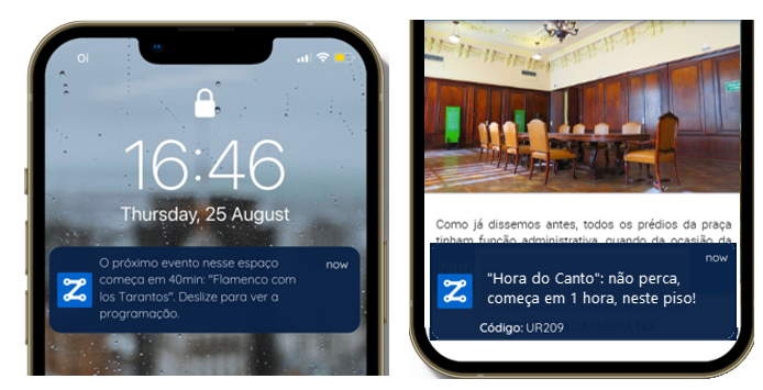
One of these features is the proximity marketing and sales . Which allows commercial establishments to promote their products and services in a targeted way to tourists who are close to their stores. This increases the chances of conversion and generates more sales, in addition to generating other income through paid ads.
Gamification and Engagement
Another interesting feature is gamification with geolocation. Which allows business owners to create interactive and fun experiences for tourists. Encouraging them to explore different areas of the city and visit partner establishments. This helps increase tourist engagement and promote loyalty.
“Context-Aware” Features
The “context-aware” features of Zapt tourist maps They are designed to offer important georeferenced information, such as the location of where the tourist parked their vehicle and even the best place to order an Uber. In addition to being able to send satisfaction surveys to collect feedback when a tourist is leaving a certain region/location. Thus collecting “fresher” and more complete information about their experience and opinion. And it also allows tourists to like and share attractions and services with third parties, indicating their location on the map. This becomes especially relevant for group trips, making planning easier for everyone. All of these features result in a more personalized and engaging experience, increasing customer satisfaction and strengthening the brand image.
Intuitive Maintenance
Os tourist maps they also offer a portal for autonomous maintenance. Which allows managers to update and manage their information and maps quickly and easily. No need for advanced technical knowledge. This ensures that the information provided to tourists is always accurate and up to date.
Multiple Channels
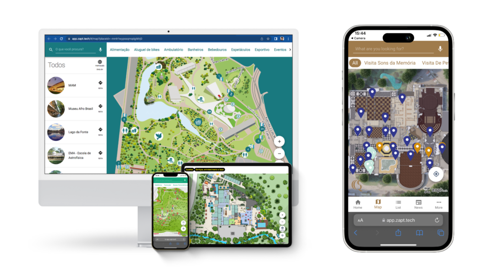
Furthermore, our tourist maps they also offer the same solution across multiple channels. Which means that business owners can make the map available on their websites, applications, WebApps and social networks, reaching a wider audience and increasing visibility. In addition to being compatible with all screen formats: computers, tablets, smartphones, TVs and totems.
Smart and Georeferenced Data

The data intelligence of tourist maps allows managers to analyze tourist behavior, identify trends and make strategic decisions based on concrete data. Which can lead to a significant increase in sales, experience and business success.
Embrace the Future of Tourism with Tourist Maps
In short, the tourist maps They are not just an investment in technology. But rather a powerful tool to improve user experience, boost sales and make your business stand out in the market. Get in touch with us via email: [email protected] to learn more about how we can help you transform your customer experience and drive your business success. And stay up to date with our innovative solutions and updates by following our LinkedIn e Instagram.
Latest Posts
The interactive map is more than just orientation, what are the types of maps and which is the best, interactive map: why investing in it can save money.
Contact us to find out how Zapt Tech can benefit your business
São Paulo – (11) 3090 2841
Belo Horizonte - (31) 3181 0708
WhatsApp – (11) 94336-8326 (messages only)
Country Brazil Argentina Bolívia Chile Colombia Costa Rica Cuba Equador El Salvador Guatemala Haiti Honduras Mexico Nicaragua Panama Paraguay Peru Dominican Republic Uruguay Venezuela Others
Which department do you work? —Choose an option— Marketing TI Innovation Operations and Maintenance Others
Segment —Choose an option— University Fair & Event Hospital Hotels & resorts Industry Museum Shopping center Outdoor Tourism Retail Universities (Campi) Others
When do you need the solution? —Choose an option— up to 6 months up to 1 year from 2 to 3 years exploratory - get to know the technology
What challenge do you want to solve? Guiding fans with routes on digital maps inside the stadium Monitor the location of workers and suppliers within the stadium All above Others
What challenge do you want to solve? Guiding visitors with routes on digital maps within the event Engaging visitors with gamification or guided event tours Monitor the location of workers at the event Provide complete App for events All above Others
What challenge do you want to solve? Guiding patients and visitors with routes on digital maps in a hospital complex Monitor the location of employees in the internal spaces of a hospital complex to improve safety and processes Monitor the location of assets (equipment) in the internal spaces of a hospital complex to improve processes and reduce losses Monitor temperature, humidity and other measurements from diverse sensors in hospital spaces Manage hospital units with operational indicators displayed on digital maps All above Others
What challenge do you want to solve? Guide guests with directions on digital maps at the hotel/resort Engaging guests with an audio guide via the "concierge" App that presents attractions, services and hotel/resort gamification Engaging guests with child monitoring within hotel spaces Manage hotels/resorts visually, with indicators displayed on digital maps All above Others
What challenge do you want to solve? Guide workers and/or third parties with digital maps and routes in industrial plants Monitor workers and/or third parties in outdoor/indoor private areas of industrial plants Monitor the location of assets (equipment, vehicles, packages, containers, etc.) in private outdoor/indoor areas Manage plants visually, with operational indicators displayed on digital maps All above Others
What challenge do you want to solve? Guide visitors with routes on digital museum maps Enchant visitors with gamification and/or audio guide, in App, with itineraries that present museum attractions with audio, texts and multimedia All above Others
What challenge do you want to solve? Guiding consumers with routes on digital shopping center maps Orient consumers with digital maps in mall directories Increase accessibility in visitation for the visually impaired Engaging consumers with gamification on digital shopping center maps Monitor the location of employees and third parties in the shopping center to increase security and automate processes Manage shopping malls by indicators on digital maps for management All above Others
What challenge do you want to solve? Guiding visitors on digital tourist maps, with routes Delight tourists with audio-guided tours on digital maps Engaging tourists/visitors with gamification Attract more groups of tourists/visitors by allowing them to track the location of people in the group on digital maps All above Others
What challenge do you want to solve? Help customers find products with digital maps, directions and audio Improve management with location data for shopping carts and baskets Track the location of shopping carts, with alerts to prevent theft Manage stores by operational/financial indicators on digital maps for management Implement Store Mode Others
What challenge do you want to solve? Guide students, teachers and visitors with routes on digital maps Guiding students, teachers and visitors with maps and routes in Totems All above Others
What challenge do you want to solve? Guiding people on an indoor digital map Guiding people on a digital outdoor map Track people's location in a private location Monitor asset location in a private location Others
How do you prefer to be contacted? Ligação Whatsapp Email
In accordance with Laws 12.965/2014 and 13.709/2018, which regulate the use of the Internet and the processing of personal data in Brazil, I authorize Zapt Tech to send communications by email or other means and I agree with its Privacy Policy.
Zapt Tech specializes in Indoor Positioning System (IPS), Real-time Locating System (RTLS), Proximity Marketing & Services in general, providing end-to-end technologies for locating and orienting users in indoor spaces, tourist circuits and humanized maps. - and contexts that enable ultra-fast disruptive transactions by mere proximity.
Zapt Tech. All rights reserved
We use cookies to improve your browsing experience on our website. By using our services you consent to the storage of cookies on your device.
Discover story-worthy travel moments
Where to next.

Best in travel 2024
Your dream itinerary, crafted with you.
Elsewhere by Lonely Planet connects you with an award-winning local expert to craft your personalized, unforgettable trip.

Travel stories and news
Explore our latest stories.

Jun 26, 2024 • 6 min read
A pair of writers go head to head comparing these two popular African destinations.

Jun 26, 2024 • 8 min read

Jun 26, 2024 • 9 min read

Jun 26, 2024 • 3 min read

Jun 26, 2024 • 4 min read

Jun 26, 2024 • 10 min read

Jun 26, 2024 • 7 min read

Jun 26, 2024 • 5 min read

Jun 25, 2024 • 7 min read

Jun 25, 2024 • 13 min read

Jun 25, 2024 • 5 min read

Jun 25, 2024 • 6 min read

shop our books
Our guidebooks & travel books
Whether you’re interested in traveling to a new city, going on a cruise, or cooking a new dish — we’re committed to inspiring you to experience travel in a whole new way. Lonely Planet’s collection of 825+ travel and guidebooks is sure to inspire the traveler within.
#lonelyplanet
Follow lonely planet:.

Itinerary Template for a Trip: Free Downloadable Examples & More Resources
- Updated: 04/04/2024
If you are looking for a free, easy, and detailed itinerary template for a trip that you can download and conveniently add your own travel details—then you are in the right place.
Find the sample trip itinerary template I created and tweaked over years of travel to include the most relevant information in one easy-to-scan document and in four different file formats.
Additionally, I share alternative template ideas that include my top picks for itinerary-building apps and other online places where you can find more free or affordable trip itinerary designs and layouts. So, go to the file format that works best for you, scan my quick tips for editing, and get your trip details organized in a downloadable, easy-to-edit, and very sharable document.
Table Of Contents
Itinerary template for a trip in 4 file formats.
Find my travel itinerary template in the four different file formats below. Choose the one you like to work in best. Then find more recommendations here .
- Microsoft Word trip itinerary template
- Microsoft Excel trip itinerary template
- Google Sheets trip itinerary template
- Canva trip itinerary template
About This Template: 7 Main Components
There are seven main components to this template. I have included each because it contains the information I reference most while traveling, organized in a way that helps me figure out when my trip schedule is overloaded or lacks the right amount of buffer time between activities or transit.
Sign up for my monthly Discovery Newsletter & get a free Trip Budget Calculator !
The 7 trip itinerary template components include:
- Header. For a destination image and title. Replace this image with your own.
- High-level trip summary: An at-a-glance summary of essential trip information—the number of travelers, dates of travel, flights (or other transit), and location(s) of the trip.
- Travel day column. Know which day of your trip an activity is happening.
- Day of the week column. Know the day of the week and date to ensure lodging, tour, and transfers are booked correctly.
- Activities column. A place to capture details for all activities and lodging. Hyperlink text to websites for additional information.
- Location(s) column. In this space, recap the destinations for each day, link to lodging websites, and include important notes such as included meals or overnight flights.
- Lodging contact info sheet. A second tab or sheet for additional lodging information is included in all template files except for Microsoft Word
Since the detail on this template prints small, consider saving it to a PDF file , allowing you to zoom in as needed and easily share it with others.
Additionally, reference your itinerary offline when you save a PDF version of this itinerary to your phone to an app like iBooks (Apple users) or Google Play Books (Android users). Having an offline itinerary comes in handy in travel situations when you have limited or zero cellular or wi-fi connection.
Microsoft Word Template
Click on the image below to download a free version of this trip itinerary template containing actual details from a visit to Iceland in Microsoft Word.
6 Editing Tips (Word Template)
As Microsoft Word is the most universally used software program, it is the trip itinerary template file I share first. Here are six essential editing tips when using the Microsoft Word version of this template.
Header area editing (Word template)
- To change out the image at the top of the itinerary, right-click on the image and select Change Picture. Select from a stock photo or upload your own image. I am a Canva user and found this image there, added a text overlay, and saved it using the dimensions 2000x458px.
- However, you can upload any size image file you would like. If your uploaded image is not the correct size, click on it and drag its diagonal corner to resize and fit the page. If you find it too tricky to insert a new image, delete the existing one and type your preferred itinerary title. It might not look as pretty without a picture, but the template will still convey all essential information.
Main itinerary body editing (Word template)
I created this itinerary using a table in Microsoft Word, hiding vertical gridlines to achieve a cleaner look.
- To edit text , select and delete existing text. Then, type text as you normally would in Word documents.
- To add a table row , select a row by dragging your mouse to highlight it, then right-click and choose Insert to add a row above or below. Repeat the process to delete a row . Find one additional blank row at the bottom of the template.
- To add or change hyperlinks , select the word(s) you would like to link (or unlink) to a website, right-click, select Hyperlink, and from the sub-menu, select Edit or Remove Hyperlink.
- To add back vertical gridlines , select the entire table, right-click, and select Borders and Shading to adjust the design with the gridline configuration you like best.
Microsoft Excel Template
Click on the image below to download a free version of this trip itinerary template containing actual details from a visit to Iceland in Microsoft Excel.
9 Editing Tips (Excel Template)
As Microsoft Excel is more specialized software, I share nine file-specific tips, knowing that the traveler who prefers to download this file type is likely already familiar and comfortable editing in Excel.
Header area editing (Excel template)
To change out the header image at the top of the itinerary, right-click on the image and select Change Picture. Select from a stock photo or upload your own image. I am a Canva user and found this image there, saving it using the dimensions 2000x458px. Once uploaded, I added the semi-transparency in Excel.
However, you can upload any size image file you would like. If your uploaded image is not the correct size, click on it and drag its diagonal corner to resize and fit the page . If you find it too tricky to insert a new image, delete the existing one. It might not look as pretty without a picture, but the template will still convey all essential information.
- Though—if you upload a new image and want to keep the semi-transparency , double-click on your picture to get to the Picture Format menu. Find the Transparency icon in the header menu and adjust it to your preference.
- To change the header text , click on the text in the Text Box and edit all elements.
Main itinerary body editing (Excel template)
- To insert bullet points , copy these from an existing cell in the document. I created and copied the bullet points from a Word document and pasted them into Excel.
- All cells are set to wrap text and are oriented to align left and at the top of the cell. If this changes or the format structure is lost, right-click on any cell and select Format Cells to reset the cell structure to your preference.
- To start a new line of text in a cell when using a Mac, press the Option+Return buttons on your keyboard. Using a PC, press the Alt+Enter buttons or get more tips from Microsoft Help .
- To insert hyperlinks , select the cell you would like to hyperlink, and from the main menu, select Insert. From that submenu, choose Link. Microsoft Excel—from what I can tell (please correct me in the comments if you know how to bypass this)—does not allow users to link individual text within a cell. Google Sheets does, and it is one of the reasons I prefer using that format type.
Lodging contact tab editing (Excel template)
Note a second tab in this Excel template for lodging details—set to print landscape (horizontally). Edit all elements in the same way as the main itinerary.
Google Sheets Template
Click on the image below to download a free version of this trip itinerary template containing actual details from a visit to Iceland in Google Sheets. This image links to a read-only document.
To copy it, click File from the main menu and select Copy . Doing this will create a copy of the document on your Google Drive. You will want to be logged into Google when you do this.
7 Editing Tips (Google Sheets Template)
Google Sheets is my preferred file type to create, edit, and share new trip itineraries. I find its slimmed-down menu is easier to use than Excel. Plus, I appreciate the ability to highlight and hyperlink specific text using Sheets vs. having to link an entire cell (in Excel).
Additionally, I find this file type easier to share as not everyone uses Microsoft documents. And I find it convenient since I already use Google Drive to manage my business documents and keep my travel information organized . Here are seven things to know when editing this template.
Header area editing (Google Sheets template)
To change out the header image at the top of the itinerary, right-click on the image and select Change Picture. Select from a stock photo or upload your own image. I am a Canva user and found this image there, added a text overlay, and saved it using the dime nsions 2000x458px.
However, you can upload any size image file you would like. If your uploaded image is not the correct size, click on it and drag its diagonal corner to resize and fit the page . If you find it too tricky to insert a new image, delete the existing one and type your preferred itinerary title. It might not look as pretty without a picture, but the template will still convey all essential information.
Main itinerary body editing (Google Sheets template)
- All cells are set to wrap text and are oriented to align left and at the top of the cell. If this changes or the format structure is lost, select a cell and choose Format from the main menu. From the drop-down menu, select Wrapping or Alignment to adjust to your preference.
- To start a new line of text within Google Sheets when using a Mac, press the Command (or Control or Option)+Return buttons on your keyboard. Using a PC, press the Alt (or Control) +Enter buttons.
- To insert hyperlinks , select the specific text you would like to hyperlink, and from the iconographic menu, just below the main menu, select the three vertical dots at the far right for more editing items. Select the Link icon to insert and link to your preferred URL. Or choose Insert from the main menu, then select Link.
Lodging contact tab editing (Google Sheets template)
Note a second tab in this Google Sheets template for lodging details—set to print landscape (horizontally). Edit all elements in the same way as the main itinerary.
Canva Template
Click on the image below to access and edit a free version of this trip itinerary template in Canva.
Although Canva is an excellent and intuitive design software usable by non-professionals, it requires prior knowledge and experience to use it comfortably. I do not recommend downloading and editing this file type unless you are already comfortable creating and editing in Canva.
If you are, have fun! You have full editing capability to change any element of this two-page trip itinerary template, which includes a second page for lodging contact information.
Tips for duplicating the template: Click the above image, then click the “Create with Canva” button in the upper right-hand corner. When you do this, it should take you to your Canva account and let you copy, and then edit a duplicate version of the template.
2 Recommended Online Itinerary Builders
If you prefer using an app or an online itinerary builder to create your itineraries, TripIt and Wanderlog are the top two options. I have used TripIt before and found it handy—though short on the functionality I prefer. Despite easy integration with travel booking uploads, the program was less flexible than I would have liked, still requiring some manual uploading and editing.
I have not used Wanderlog, though I have repeatedly seen it recommended highly by frequent travelers and travel professionals. To see which is right for you, scan through this Reddit thread of users comparing notes on each.
4 More Places to Find Travel Itinerary Templates
In addition to the free templates I share, are four more places to find free or affordable trip itinerary templates.
- Microsoft Excel, Word, and Google Sheets free templates
Find multiple travel itinerary templates on Jotform . Edit them using its web-based a PDF editor. Then, download your edited form after you create an account. You get five complimentary form downloads with a free membership .
Find multiple trip itinerary templates on Canva . There are several free options. To edit and download them, create a free account on Canva if you do not already have one. Some templates are restricted to paid Pro Canva users only.
Microsoft Excel, Word, and Google Sheets
Microsoft Excel, Word, and Google Sheets offer free templates. These software programs offer several free travel itinerary templates. To access these complimentary templates, choose File, then select Create New from Template or New from template gallery from the main menus. Search for templates related to trips or travel to find one that fits your needs.
Several shops on Etsy sell downloadable trip itinerary templates for a low price, often $5 or under. Some designs are beautiful. Several come packaged with multiple detailed pages that could be perfect for your needs or be superfluous. Search digital download options here to see what fits your preferences best.
Related Reading
If you are searching for more travel planning assistance to help you save time and money, stay organized, and achieve better results, check out the related articles below.
- How to Plan a Trip Quickly: 9 Best Places to Find Inspiring Trip Itineraries
- 49 Things You Need to Do to Plan Your Best Trip (Free Travel Research & Planning Checklist)
- Google for Travel: Plan Better with These 8 Tools
- Why You Will Love Google Maps for Trip Planning
- How to Save Time & Money with Google Flights Price Tracker
- 5 Proven Ways to Simplify and Organize Your Travel Research
- Pack Faster & Better with This Universal Printable Packing List
- 25 Expert Packing Tips to Help You Travel Better
- Pre-Trip: A Practical Checklist to Close the House & Pack
Additional Trip Planning Resources
To further help you with travel planning, I share my go-to resources for every trip below.
Google Flights. My first research stop for affordable flights for every trip. Learn why here .
Google Hotels . Use its “ Where to stay ” button to discover the best neighborhoods to base your visit.
Booking.com. For hotel and rental bookings, I appreciate its flexible cancellation, candid user reviews, discounts, loyalty program, and easy-to-use interface.
Viator , Get Your Guide , & Airbnb Experiences . Quickly find and book highly-rated tours and activities on these sites.
Google Travel Things to Do & Google Maps . Find more things to do in your destination on Google Travel, then record where you want to visit on a custom Google Maps list.
AllTrails . Love to hike? Me too. I religiously use AllTrails to discover hiking and biking trails and download its offline maps to manage my hikes.
Guide Along . 5-star self-guided audio tours that are GPS-compatible for US road trips and national parks. We loved the Glacier National Park tour .
Insure My Trip. I never travel internationally without trip insurance. Learn why here . My preferred place to shop and compare policies is InsureMyTrip.com .
Plus, check out the 15 travel apps I use on trips, my preferred guidebooks , and my free customizable travel itinerary template , downloadable in four file formats.

About the author: Janice Moskoff is a travel writer and blogger who loves hiking, exploring the world, and reading. She writes to inspire travel-loving families, adult friends, and couples on her blog, Gather and Go Travel . Check out her bio , learn how she became a blogger , and discover how to work with her . Sign up for her monthly Discovery Newsletter to get her latest travel recommendations and how-to’s .
Love to travel? Sign up for m y monthly Gather & Go Travel Discovery Newsletter and get a free trip budget calculator .
Affiliate Disclosure: Some of the links on this page may be affiliate links, and at no additional cost to you, I earn a commission if you make a purchase. I only recommend products and companies I use. And the income goes to keeping the site community-supported and ads minimal.

Glacier National Park: 37 Amazing Things to See & Do

Cathedral Rock: How to Make the Most of Your Hike

Why You Will Love Enchantment Resort: A Review

From An Expert: InsureMyTrip.com is My #1 Pick for Trip Insurance

35 Places You Will Love for Your Next Ladies’ Trip

How to Make the Most of Missoula in 3 Days
2 responses.
Hi Nicole, thanks for messaging about this. Happy to troubleshoot. I am sorry you having issues. Since you would like to use this template I’ll take an educated guess that you are familiar with Canva and already have an account? When you click the “Create with Canva” link in the upper right hand corner it should take you to your account and let you edit a version of this template. I’ll check in with you via email as well to see if this is happening. If not, I’ll email you a direct link and dig in to adjust settings. Or feel free to email me directly at (janice at gatherandgotravel dot com.). Thank you!
Hi! I was hoping to use your Canva template but it linked to a preview that wouldn’t open the template. I also couldn’t find it by searching.. Is it available anywhere?
Leave a Reply
Your email address will not be published. Required fields are marked *

Welcome to Gather and Go Travel , a blog inspiring families, adult friends, and couples to explore US and international destinations and to get outdoors. I am Janice, an experienced traveler to over 50 countries and a travel writer, book lover, and blogger. Learn more about me , read our story , and how to work with me .

Need an Itinerary for a Spring Trip to Europe? Here are 25 Amazing Ideas

49 Things You Need to Do to Plan Your Best Trip (Free Travel Research & Planning Checklist)

Rental Car Insurance: When You Need It & When You Don’t
Your Family Will Love These 30 Road Trips Near Chicago

Pack Faster & Better With This Universal Printable Packing List

How to Spend 10 Days In Rome, the Amalfi Coast & Sorrento
Instagram....

gatherandgotravel
📍US & 🌎 travel for families, friends + couples 📝 Itineraries, destination guides and ideas + tips ❤️ hiking🥾, mountains + 📚books 🏡 Chicago

love this info?
And receive our F REE Budget Trip Calculator .

© 2023 All Rights Reserved
Travel planning.
Amazeballs Better Travel Guide
Travel Planning Tips
Destinations
Travel Learning
Conversations With Travel Pros
Blogs I Love To Follow
Work With Me / Contact Me
Journey From 100 To 10K
Terms of Use
Privacy Policy
Get A Free Trip Budget Calculator
Sign up for my monthly gather & go travel discovery newsletter packed with tips and vacation ideas and get my trip budget calculator for free..
Winter is here! Check out the winter wonderlands at these 5 amazing winter destinations in Montana
- Plan Your Trip
How To Write Tourist Leaflets
Published: November 19, 2023
Modified: December 28, 2023
by Colene Thornhill
- Arts & Culture
- Hotel Reviews
Introduction
Welcome to the world of trip planning! Whether you’re a seasoned traveler or someone who is new to exploring new destinations, effective trip planning is the key to a successful and enjoyable adventure. In this article, we will delve into the art of writing tourist leaflets, providing you with valuable tips and strategies to create engaging and informative content that will captivate your target audience.
When it comes to writing tourist leaflets, it’s crucial to understand the importance of capturing the attention of your readers right from the start. With the abundance of travel options available today, you need to make sure your leaflet stands out among the crowd. By combining informative content with an appealing layout, you can ensure that your leaflet becomes a valuable resource for travelers seeking their next adventure.
One of the first steps in writing an effective tourist leaflet is understanding your target audience. Who are the people you’re trying to attract? Are they adventure seekers looking for adrenaline-pumping activities, or are they culture enthusiasts who crave history and architecture? Knowing your audience will help you tailor your content to their interests and preferences, making your leaflet more appealing and relevant.
Once you have a clear idea of your target audience, it’s time to select a compelling destination. Whether it’s a vibrant city, a tranquil beachside retreat, or an exotic cultural hub, choose a destination that has a unique appeal and offers a range of attractions and activities. This will provide you with ample material to highlight in your leaflet and entice potential travelers to visit.
In the next sections, we will explore various techniques to make your tourist leaflet engaging and informative. From crafting captivating headings and subheadings to incorporating vivid descriptions and useful information, we will cover it all. We will also discuss the importance of using imagery and visual elements to enhance the overall appeal of your leaflet, as well as creating a user-friendly layout to ensure easy navigation for your readers.
Lastly, we’ll emphasize the significance of proofreading and editing your leaflet to eliminate any errors or inconsistencies. A polished and well-presented leaflet will instill confidence in your readers and make them more likely to consider your destination for their travel plans.
So, let’s dive into the fascinating world of writing tourist leaflets and discover how to create compelling content that captures the essence of a destination, sparks curiosity, and inspires wanderlust in your readers!
Understanding Your Target Audience
Before you start writing your tourist leaflet, it’s crucial to have a deep understanding of your target audience. Knowing who you’re trying to attract will help you tailor your content and language to their preferences, making your leaflet more appealing and persuasive.
Begin by identifying the demographic characteristics of your target audience. Consider factors such as age, gender, interests, and travel preferences. For example, if you’re targeting young adventure seekers, your language can be more energetic and adventurous. On the other hand, if your audience is primarily families, your tone should be more friendly and informative.
Next, consider the psychographic aspects of your target audience. What motivates them to travel? Are they seeking relaxation, cultural experiences, or thrilling adventures? Understanding their desires and aspirations will enable you to create content that resonates with their emotions and desires.
A good way to understand your target audience is through market research. Conduct surveys, analyze online reviews and social media discussions, and seek feedback from previous travelers to your destination. This valuable information will provide insights into their expectations and help you tailor your leaflet content accordingly.
Once you have a clear understanding of your target audience, you can begin crafting your leaflet content. Use language and terminology that will resonate with your audience, appealing to their interests and desires. For example, if targeting food enthusiasts, emphasize local cuisine and unique gastronomic experiences.
Another important aspect of understanding your target audience is understanding their level of travel experience. Are they seasoned travelers looking for off-the-beaten-path destinations, or are they more comfortable with popular tourist spots? Tailor your content to cater to their level of familiarity and curiosity. Provide insider tips and recommendations for hidden gems to engage experienced travelers, or provide essential information on must-visit landmarks for those new to the destination.
By truly understanding your target audience, you can create a tourist leaflet that speaks directly to their needs and desires. Remember to strike a balance between informative content and engaging language, ensuring that your leaflet captures their attention and keeps them interested throughout.
So, dive into the mindset of your target audience and craft an appealing leaflet that showcases the unique experiences and attractions your destination has to offer.
Selecting a Compelling Destination
When it comes to writing a tourist leaflet, one of the most important decisions you’ll make is selecting a compelling destination to showcase. The destination you choose sets the tone for the entire leaflet and can make or break its appeal to potential travelers.
First and foremost, consider the uniqueness and attractiveness of the destination. Look for destinations that offer something special, whether it’s stunning natural landscapes, rich cultural heritage, or a blend of both. A compelling destination needs to captivate the reader’s imagination and spark their desire to explore and experience something new.
Research popular travel trends and preferences to understand what travelers are currently seeking. Are eco-friendly destinations on the rise? Is there a growing interest in adventure tourism? By selecting a destination that aligns with these trends, you can tap into the interests of your target audience and position your leaflet as a must-have resource for the latest travel experiences.
Consider the accessibility of the destination. While remote and exotic locations are intriguing, ensure that they are easily accessible and have adequate transportation options. Travelers appreciate convenience and want their journey to be hassle-free. Therefore, choose a destination that has good connectivity and transportation infrastructure.
Another crucial aspect to keep in mind is the seasonality and weather patterns of the destination. Highlight the best times to visit in your leaflet, taking into consideration factors such as weather, festivals, or special events. This will help potential travelers plan their trip accordingly and ensure they have a memorable experience.
Furthermore, assess the safety and security of the destination. Travelers prioritize their well-being, so it’s essential to choose a destination that is known for its safety measures and reliable infrastructure. Highlight any safety precautions, emergency services, or health facilities available to reassure your readers.
Finally, consider the overall appeal and diversity of attractions and activities the destination offers. Travelers look for variety in their experiences, so ensure that your chosen destination has something for everyone. Whether it’s historical landmarks, adventure sports, cultural festivals, or culinary delights, showcase the range of attractions that will make your leaflet irresistible.
By carefully selecting a compelling destination, you lay the foundation for a successful tourist leaflet. A destination that captures the imagination, aligns with travel trends, is easily accessible, offers safe and diverse experiences, and has a unique appeal, will be an enticing draw for potential travelers.
So, take the time to research and choose a destination that has all the ingredients to make your tourist leaflet a must-read resource for wanderlust-filled explorers!
Highlighting Key Attractions and Activities
Once you’ve selected a compelling destination, it’s time to showcase its key attractions and activities in your tourist leaflet. As the main focus of your content, highlighting these standout features will capture the attention of potential travelers and inspire them to visit.
Start by identifying the most iconic and famous landmarks of the destination. These could be historical sites, architectural marvels, or natural wonders that define the uniqueness of the location. Include captivating descriptions, historical context, and interesting facts to bring these attractions to life and create a sense of wonder.
In addition to the popular attractions, don’t forget to include off-the-beaten-path gems. These hidden treasures provide a sense of discovery for travelers who are looking for unique and lesser-known experiences. Whether it’s a hidden waterfall, a local market, or a charming neighborhood, showcasing these hidden gems adds an element of exclusivity and adventure to your leaflet.
Furthermore, highlight the range of activities and experiences that visitors can enjoy in the destination. Are there adrenaline-pumping adventure sports like zip-lining or bungee jumping? Are there opportunities for leisurely hikes or scenic cycling routes? Include details about these activities, such as difficulty levels, equipment rental options, and any necessary safety precautions, to help travelers plan their itinerary.
Consider the diverse interests of your target audience and include attractions that cater to various preferences. If your audience includes culture enthusiasts, showcase museums, art galleries, or historical walking tours. For nature lovers, emphasize national parks, botanical gardens, or wildlife safari experiences. By providing a well-rounded selection of attractions and activities, your leaflet becomes a valuable resource for a wide range of travelers.
When highlighting key attractions and activities, use descriptive and engaging language to paint a vivid picture in the reader’s mind. Capture the essence and atmosphere of the location, using words that evoke emotions and create a sense of anticipation. For example, instead of simply mentioning a white sandy beach, describe it as a pristine paradise with crystal-clear turquoise waters and palm-fringed shores.
Don’t forget to include images or visual representations of these key attractions and activities. A picture is worth a thousand words, and by incorporating visuals, you can enhance the appeal of your leaflet and give readers a glimpse of what they can expect. Ensure that the images are high-quality and showcase the best aspects of each attraction.
By effectively highlighting the key attractions and activities, your tourist leaflet becomes a gateway to the destination’s wonders. It ignites the reader’s curiosity and compels them to start planning their trip, eager to explore all that the location has to offer.
So, let your enthusiasm for the destination shine through as you showcase its captivating attractions and activities, creating a desire in your readers to embark on their own extraordinary adventure.
Captivating Headings and Subheadings
When it comes to writing a tourist leaflet, captivating headings and subheadings play a crucial role in grabbing the attention of your readers and guiding them through the content. Well-crafted headings not only make your leaflet visually appealing but also provide a glimpse into what lies within, enticing readers to delve deeper into the information you have to offer.
Start by brainstorming catchy and intriguing headings that reflect the essence of the destination and its unique offerings. Use words that evoke curiosity, adventure, relaxation, or whatever emotions you want to resonate with your target audience. For example, instead of a generic heading like “Attractions”, consider something more captivating like “Embark on a Journey of Discovery: Must-See Sights and Hidden Gems”.
Subheadings are equally important, as they break down the information into digestible sections, allowing readers to navigate easily through the leaflet. Use subheadings to categorize and highlight different aspects such as attractions, activities, accommodations, and dining options. By organizing the content with informative subheadings, you make it easier for readers to find the information that is most relevant to them.
Another effective technique is to use power words and action verbs in your headings and subheadings. These words can create a sense of urgency or excitement, compelling readers to take action or imagine themselves already experiencing the destination. For example, instead of “Cultural Landmarks of XYZ City”, consider “Immerse Yourself in the Rich Tapestry of XYZ City’s Cultural Landmarks”.
Consider using questions in your headings to engage readers and pique their curiosity. Questions make the reader pause and think, enticing them to seek answers within the content. For example, instead of a straightforward heading like “Outdoor Activities”, you could ask, “Ready for Adventure? Discover Thrilling Outdoor Activities in XYZ Destination!”.
When crafting your headings and subheadings, keep in mind that brevity is key. Keep them concise and to the point, making sure they effectively convey the main idea while being visually appealing. Avoid using jargon or complex language that may confuse or alienate readers. Instead, opt for simple and straightforward wording that appeals to a broad audience.
Lastly, ensure that your headings and subheadings are visually distinct from the body text. Use formatting techniques such as bold font, larger font size, or different colors to make them stand out. This makes it easy for readers to skim through the leaflet and quickly find the information they are looking for.
By crafting captivating headings and subheadings, you capture the attention of potential travelers and guide them through the journey of your tourist leaflet. They serve as signposts, directing readers to the most enticing aspects of the destination and making them eager to explore further.
So, let your creativity flow as you create headings and subheadings that are eye-catching, informative, and irresistible, setting the stage for an engaging and immersive reading experience.
Crafting Persuasive Descriptions
When it comes to writing a tourist leaflet, crafting persuasive descriptions is key to engaging your readers and convincing them to choose your destination over others. Descriptions provide the opportunity to showcase the unique features, experiences, and beauty of the location, enticing travelers to pack their bags and embark on an unforgettable adventure.
Start by putting yourself in the shoes of your target audience. What aspects of the destination are most likely to resonate with them? Is it the breathtaking natural scenery, the vibrant cultural heritage, or the exciting culinary scene? Tailor your descriptions to highlight these key points, emphasizing what makes your destination stand out.
Paint a vivid picture with your words, capturing the reader’s imagination and bringing the destination to life. Use descriptive language that appeals to the senses, evoking the sights, sounds, smells, and tastes of the location. For example, instead of simply describing a beach as beautiful, you could say, “Feel the powdery white sand between your toes, as the gentle sea breeze plays with your hair, and the azure waves crash against the shore.”
Appeal to the emotions of your readers by highlighting the potential experiences and memories they can create in the destination. For instance, describe the exhilaration of hiking to a breathtaking viewpoint, the awe-inspiring moments of exploring ancient ruins, or the joy of immersing oneself in a vibrant local festival. By evoking emotions, you make the destination more personal and desirable to the reader.
Showcase unique selling points such as exclusive events, special promotions, or limited-time attractions. Create a sense of urgency by emphasizing the rarity or limited availability of these features, encouraging readers to take immediate action. For example, “Don’t miss the chance to witness the spectacular XYZ Festival, happening only once a year. Join thousands of revelers as the town comes alive with music, dance, and vibrant cultural celebrations.”
Include testimonials or quotes from previous travelers who have visited the destination. Positive reviews and personal endorsements add credibility and make the descriptions more relatable and trustworthy. Highlight their memorable experiences and the transformative impact the destination had on them.
Avoid generic and cliché descriptions. Instead, focus on specific and unique aspects of the destination. Dive deep into the local culture, traditions, and history, presenting insights and interesting facts that go beyond what can be found in a simple online search. This will provide readers with a truly immersive experience through your leaflet.
Lastly, proofread and edit your descriptions to ensure they are clear, concise, and error-free. Use active voice and vibrant verbs to make the text more engaging and dynamic. Eliminate repetitive phrases and unnecessary filler words, keeping the descriptions focused and impactful.
By crafting persuasive descriptions, you entice readers to envision themselves in the destination, experiencing its unique charm and wonders. Your words have the power to inspire wanderlust and ignite the desire to explore the world, one destination at a time.
So, let your creativity soar as you craft descriptions that transport readers to the destination, tempt their senses, and fuel their desire to pack their bags and embark on their next adventure.
Incorporating Useful Information
In addition to captivating descriptions of your destination, it is important to incorporate useful information in your tourist leaflet. This includes practical details that help travelers plan their trip and make informed decisions about visiting your destination.
Start by providing essential travel information, such as the best time to visit, visa requirements, and local currency. This helps potential travelers understand the logistics of planning their trip and ensures they have the necessary documents and arrangements in place.
Include details about transportation options available in the area, such as airports, train stations, or bus routes. Mention any public transportation systems, taxi services, or recommended car rental companies. Providing information on how to navigate the destination will give travelers peace of mind and make their experience smoother.
Highlight accommodation options, ranging from luxury resorts to budget-friendly guesthouses. Include information about amenities, location, and any unique features or services offered. Consider featuring hotels or accommodations that have received positive reviews or certifications, as these provide an added layer of trust for potential guests.
Another crucial aspect to include is dining and culinary experiences. Highlight local delicacies, popular restaurants, and street food hotspots. Mention any dietary considerations or specialty cuisine options, such as vegetarian or vegan-friendly establishments. Providing suggestions and recommendations for dining options will enhance the overall experience for travelers.
When it comes to incorporating useful information, don’t forget about safety and emergency assistance. Include contact information for local emergency services, hospitals, and clinics. It’s also helpful to provide tips on personal safety, such as reminding travelers to be cautious with their belongings and to follow any local customs or guidelines.
Consider including maps and guides to help visitors navigate the destination. This can include maps of popular tourist areas, transportation routes, or suggested itineraries. Visual aids like maps make it easier for travelers to plan their activities and explore the area confidently.
Additionally, incorporate information about local customs, traditions, and etiquette. This helps visitors understand and respect the cultural norms of the destination. Indicate any dress codes or behavior expectations when visiting religious or sacred sites to ensure travelers are aware and can plan accordingly.
Lastly, provide contact information for local tourism offices or visitor centers. This gives travelers a resource to reach out to for further information or assistance during their visit. Including website links or contact details enables travelers to easily access additional resources to enhance their experience.
By incorporating useful information, you not only assist travelers in planning their trip but also showcase your destination as a reliable and informative resource. This builds trust and increases the likelihood of visitors choosing your destination for their travel adventures.
So, arm your readers with the information they need to make their travel plans a reality, empowering them to explore all the wonders your destination has to offer.
Using Imagery and Visuals
When it comes to creating a captivating tourist leaflet, the use of imagery and visuals is essential. Humans are visual creatures, and incorporating high-quality images and appealing visuals can greatly enhance the impact and appeal of your leaflet.
Start by selecting stunning and eye-catching images that showcase the beauty and highlights of your destination. Choose images that evoke emotions and create a desire within the viewer to experience the location firsthand. Whether it’s a breathtaking sunset over a picturesque landscape, a vibrant cultural festival, or mouthwatering local cuisine, make sure the images create a lasting impression.
Vary the types of visuals you use to provide a well-rounded representation of the destination. Include photographs of landmarks, attractions, and activities, as well as illustrations, icons, or infographics that provide information and enhance the visual appeal. This variety keeps the leaflet visually engaging and prevents the reader from getting bored or overwhelmed by repetition.
Ensure that the images you select accurately represent the destination and its offerings. Avoid using overly edited or heavily filtered images that misrepresent the reality of the location. Transparency is key to building trust with potential travelers, so aim for authentic and genuine visuals that accurately depict the experiences they can expect.
In addition to static images, consider utilizing other visual elements such as maps, diagrams, or charts. These visual aids can help travelers better understand the layout of the destination, identify key points of interest, or comprehend specific information at a glance. For example, you can include a map showcasing popular tourist areas, transportation routes, and the proximity of attractions to give readers a comprehensive overview.
Pay attention to the placement of visuals within the leaflet to optimize their impact. Place visuals strategically alongside related text to enhance comprehension and capture attention. Ensure that the images are of high resolution and clarity, allowing readers to fully appreciate the beauty and details of the destination.
Consider the overall design and color scheme of your leaflet to create a visually cohesive and aesthetically pleasing experience. Choose colors that complement the destination and evoke the desired emotions in your audience. For example, cool blues and greens may be suitable for a beach destination, while warm oranges and yellows may be fitting for a vibrant cityscape.
Remember, visuals should complement the text and enhance the storytelling aspect of your leaflet. They should not overpower or distract from the written content but rather work together harmoniously to create a visually appealing and immersive experience for the reader.
Incorporating imagery and visuals in your tourist leaflet allows you to transport potential travelers to the destination and ignite their imagination. They provide a glimpse of the experiences that await, inspiring wanderlust and enticing readers to embark on their own adventure.
So, let your visuals speak volumes and capture the essence of your destination, leaving a lasting impression on those who flip through your leaflet.
Creating a User-Friendly Layout
When it comes to designing a tourist leaflet, creating a user-friendly layout is essential to ensure that readers can navigate through the information easily and find what they’re looking for efficiently. An effective layout helps to engage readers, enhance readability, and make their experience with your leaflet enjoyable and seamless.
Start by organizing your content into logical sections. Use headings, subheadings, and clear sections to divide the information and make it easy to scan. Utilize bullet points and numbered lists to present information concisely and attract attention to key details.
Consider the readability of your text by selecting a legible font size and style. The text should be large enough for comfortable reading, and the font should be clear and easy on the eyes. Keep in mind that different fonts may convey different tones, so choose one that aligns with the aesthetic of your leaflet and the overall brand image.
Whitespace is your friend when it comes to layout design. Allow for sufficient whitespace between paragraphs, headings, and images to create visual breathing space and avoid a cluttered appearance. This not only improves readability but also makes the leaflet visually appealing and pleasant to look at.
Guide the reader’s eye with a clear and intuitive flow. Place important information and eye-catching visuals strategically within the layout. Use visual cues such as arrows, icons, or contrasting colors to direct attention to specific sections or calls to action.
Consider the use of columns in your layout to maximize space and make the most of each page. Columns help to organize content and prevent it from appearing overwhelming or dense. This is particularly useful when presenting information in tables, lists, or multiple sections.
Incorporate clear and consistent navigational elements in your leaflet. Include a table of contents or an index page at the beginning to guide readers to specific sections. Utilize page numbers or section tabs to make it easy for readers to flip to particular information of interest.
When placing images, ensure they are appropriately sized and positioned. Avoid obstructing the flow of text and make sure the images enhance the content without overwhelming it. Leave sufficient space for captions or descriptions near the corresponding images to add context and provide additional information.
Choose colors thoughtfully to create a harmonious and visually appealing palette. Use colors that are easy on the eyes and complement the visuals and overall theme of your leaflet. Consistency in color schemes throughout the leaflet helps to maintain a cohesive and professional appearance.
Finally, test the usability of your leaflet layout before finalizing it. Share it with others for feedback, and consider their suggestions for improvements. Make sure the layout is intuitive, easy to understand, and offers a seamless reading experience.
A user-friendly layout is crucial in ensuring that readers can easily navigate and digest the information you present in your tourist leaflet. By organizing content logically, utilizing whitespace, creating a clear flow, and incorporating navigational elements, you enhance the overall usability and appeal of your leaflet.
So, take the time to design a layout that prioritizes readability, simplicity, and intuitive navigation, turning your leaflet into a user-friendly guide that captivates and guides potential travelers on their journey.
Proofreading and Editing
Once you have written the content for your tourist leaflet, it is crucial to invest time and effort into proofreading and editing to ensure a polished and professional final product. Proper proofreading and editing not only eliminate errors but also enhance the overall readability and impact of your leaflet.
Start by reviewing the content for spelling, grammar, and punctuation mistakes. Pay close attention to commonly confused words and homonyms, ensuring that your writing is clear and error-free. Use grammar and spell-check tools, but do not solely rely on them, as they may overlook certain errors.
Check for consistency in language and style throughout your leaflet. Ensure that you use consistent terminology and tone throughout the content. Inconsistencies can confuse readers and give an unprofessional impression. Proofread carefully to catch any instances where you may have inadvertently switched between different styles or tones.
Review the flow and structure of your content. Check for logical coherence between paragraphs and sections to ensure smooth transitions and seamless reading. Make sure that information is presented in a logical order and that the reader can follow along easily without any confusion.
Be mindful of sentence structure and readability. Vary sentence lengths and structures to avoid monotony. Break up lengthy sentences and paragraphs to improve readability. Aim for clarity and conciseness, eliminating any unnecessary repetition or wordiness.
Ensure that all information is accurate and up to date. Verify facts, figures, and details, such as opening hours, contact information, or prices. Outdated or incorrect information can be misleading and damage the credibility of your leaflet.
Consider seeking feedback from others, such as peers or professionals, to gain a fresh perspective on your content. They may catch errors or offer suggestions that you may have missed. Constructive criticism can help you refine your content further and ensure its effectiveness.
Take a break from your writing before embarking on the proofreading and editing process. This allows you to approach the content with a fresh perspective and can help you identify errors or areas of improvement more easily.
Read your content aloud during the proofreading process. This can help you catch awkward phrasing, run-on sentences, or any issues with flow and rhythm. Reading aloud engages multiple senses and can reveal errors that may go unnoticed when reading silently.
Consider getting professional help if needed. Hiring a proofreader or editor can provide an additional layer of expertise and ensure the highest quality for your leaflet. They can help identify nuanced errors, fine-tune the language, and offer suggestions for improvement.
Proofreading and editing are the final stages in creating a polished and error-free tourist leaflet. By investing time and attention to detail in this process, you ensure that your content is professional, engaging, and leaves a positive impression on your readers.
So, take the time to meticulously proofread and edit your leaflet, striving for perfection and excellence in every aspect of your content, resulting in a final product that speaks volumes about your destination and captures the reader’s attention.
Congratulations! You’ve reached the end of our guide on how to write effective tourist leaflets. We’ve explored various strategies and techniques to help you create engaging, informative, and persuasive content that captures the attention of potential travelers and inspires them to choose your destination for their next adventure.
Throughout the article, we emphasized the importance of understanding your target audience, selecting a compelling destination, and highlighting key attractions and activities. We discussed the significance of captivating headings and subheadings, crafting persuasive descriptions, incorporating useful information, using imagery and visuals effectively, creating a user-friendly layout, and the importance of proofreading and editing.
The process of writing a tourist leaflet requires careful planning, research, and creativity. By understanding your target audience, you can tailor your content and language to their preferences. Selecting a compelling destination with unique features and attractions will ensure that your leaflet stands out among the competition.
Once you’ve captured the reader’s attention with captivating headings, it’s important to create persuasive descriptions that evoke emotions and paint a vivid picture of the destination. Incorporating useful information, such as travel logistics, accommodations, dining options, and safety tips, helps potential travelers plan their trips with ease.
Utilizing eye-catching imagery and visuals enhances the overall appeal and engagement of your leaflet. Through the careful use of graphics, maps, and photographs, you can transport readers to the destination and ignite their desire to explore its wonders.
A user-friendly layout, with clear sections, organized content, and intuitive navigation, ensures that readers can easily navigate through your leaflet and find the information they need. Lastly, proofreading and editing your content guarantees a polished and professional final product.
Remember, creating a successful and engaging tourist leaflet is not only about providing information but also about creating an experience that captivates and inspires. By implementing the strategies and techniques discussed in this guide, you can create leaflets that not only inform potential travelers but also spark their desire to embark on unforgettable journeys.
So, take these valuable insights and apply them to your own tourist leaflet writing efforts. Craft a compelling narrative, showcase the unique features of your destination, and inspire wanderlust in the hearts of your readers. Happy writing, and best of luck in creating impactful and enticing tourist leaflets!
- Privacy Overview
- Strictly Necessary Cookies
This website uses cookies so that we can provide you with the best user experience possible. Cookie information is stored in your browser and performs functions such as recognising you when you return to our website and helping our team to understand which sections of the website you find most interesting and useful.
Strictly Necessary Cookie should be enabled at all times so that we can save your preferences for cookie settings.
If you disable this cookie, we will not be able to save your preferences. This means that every time you visit this website you will need to enable or disable cookies again.
- Visual Tools for Brainstorming
- Brainstorming Content Ideas
- Brainstorming in Business
- Brainstorming Questions
- Brainstorming Rules
- Brainstorming Techniques
- Brainstorming Workshop
- Design Thinking and Brainstorming
- Divergent vs Convergent Thinking
- Group Brainstorming Strategies
- Group Creativity
- How to Make Virtual Brainstorming Fun and Effective
- Ideation Techniques
- Improving Brainstorming
- Marketing Brainstorming
- Plot Diagrams
- Rapid Brainstorming
- Reverse Brainstorming Challenges
- Reverse vs. Traditional Brainstorming
- What Comes After Brainstorming
- Flowchart Guide
- Spider Diagram Guide
- 5 Whys Template
- Assumption Grid Template
- Brainstorming Templates
- Brainwriting Template
- Innovation Techniques
- 50 Business Diagrams
- Business Model Canvas
- Change Control Process
- Change Management Process
- Decision Making Framework
- Decision Making Model
- Decision Making Techniques
- Digital Customer Journey
- Macro Environmental Analysis
- NOISE Analysis
- Product Portfolio
- Profit & Loss Templates
- Scenario Planning
- SPACE Analysis
- Stakeholder Communication Plan
- Strategic Vs Tactical Planning
- Strategy vs Plan
- What are Tree Diagrams
- Winning Brand Strategy
- Work Management Systems
- Balanced Scorecard
- Developing Action Plans
- Guide to setting OKRS
- How to Write a Memo
- Improve Productivity & Efficiency
- Mastering Task Analysis
- Mastering Task Batching
- Monthly Budget Templates
- Program Planning
- Top Down Vs. Bottom Up
- Weekly Schedule Templates
- Cash Cow Matrix
- Decision Tree Guide
- Kaizen Principles
- Opportunity Mapping
- Strategic-Goals
- Strategy Mapping
- Strategy vs Tactics
- T Chart Guide
- Business Continuity Plan
- Developing Your MVP
- Experience Mapping Guide
- Incident Management
- Needs Assessment Process
- Perceptual Maps
- Position Maps
- Product Development From Ideation to Launch
- Value-Proposition-Canvas
- Visualizing Competitive Landscape
- Communication Plan
- Graphic Organizer Creator
- Fault Tree Software
- Bowman's Strategy Clock Template
- Decision Matrix Template
- Communities of Practice
- Goal Setting for 2024
- Meeting Templates
- Meetings Participation
- Microsoft Teams Brainstorming
- Retrospective Guide
- Skip Level Meetings
- Visual Documentation Guide
- Visual Note Taking
- Weekly Meetings
- Affinity Diagrams
- Business Plan Presentation
- Post-Mortem Meetings
- Team Building Activities
- WBS Templates
- Online Whiteboard Tool
- Communications Plan Template
- Idea Board Online
- Meeting Minutes Template
- Genograms in Social Work Practice
- Conceptual Framework
- How to Conduct a Genogram Interview
- How to Make a Genogram
- Genogram Questions
- Genograms in Client Counseling
- Understanding Ecomaps
- Visual Research Data Analysis Methods
- House of Quality Template
- Customer Problem Statement Template
- Competitive Analysis Template
- Creating Operations Manual
- Knowledge Base
- Folder Structure Diagram
- Online Checklist Maker
- Lean Canvas Template
- Instructional Design Examples
- Genogram Maker
- Work From Home Guide
- Strategic Planning
- Employee Engagement Action Plan
- Huddle Board
- One-on-One Meeting Template
- Story Map Graphic Organizers
- Introduction to Your Workspace
- Managing Workspaces and Folders
- Adding Text
- Collaborative Content Management
- Creating and Editing Tables
- Adding Notes
- Introduction to Diagramming
- Using Shapes
- Using Freehand Tool
- Adding Images to the Canvas
- Accessing the Contextual Toolbar
- Using Connectors
- Working with Tables
- Working with Templates
- Working with Frames
- Using Notes
- Access Controls
- Exporting a Workspace
- Real-Time Collaboration
- Notifications
- Using Creately VIZ
- Meet Creately VIZ
- Unleashing the Power of Collaborative Brainstorming
- Uncovering the potential of Retros for all teams
- Collaborative Apps in Microsoft Teams
- Hiring a Great Fit for Your Team
- Project Management Made Easy
- Cross-Corporate Information Radiators
- Creately 4.0 - Product Walkthrough
- What's New
The 4 Types of Concept Maps With Templates and Examples

In this blog post, we delve into the four main types of concept maps and their applications.
The Purpose of Concept Maps
The primary purpose of a concept map is to organize and present complex information in an easy-to-understand visual structure. By representing data visually, concept maps facilitate a deeper understanding of the relationships between concepts. There are four main types of concept maps which can be used for various purposes.
Educational Applications: In educational settings, concept maps are used to help students grasp difficult subjects. They serve as a visual aid to connect new and existing knowledge, thereby enhancing learning and retention. This method is particularly effective in breaking down complex theories into digestible, interconnected parts. Learn more about the educational uses of concept maps .
Professional Use: In the business world, concept maps are employed for brainstorming and strategic planning. They help teams visualize relationships between different market elements, project components, or operational data, which is crucial for making informed decisions.
4 Types of Concept Maps
Concept maps can have many different structures and formats. The four most popular types are:

Spider Maps
Spider maps are a type of conceptual diagram that centers around a main idea or theme, with sub-themes radiating outwards like the legs of a spider. They are particularly useful for brainstorming sessions, note-taking, and exploring the relationships between a central concept and associated topics or ideas. The structure of a spider Map allows for a visual representation of how different concepts are interconnected, which can aid in memory retention and understanding complex subjects.
Central topic at the core
Branches representing related ideas
Ideal for brainstorming and initial explorations
- Ready to use
- Fully customizable template
- Get Started in seconds

Flowcharts are another form of concept map that are used to represent processes or workflows. They consist of various shapes such as rectangles, diamonds, and ovals, each symbolizing a different type of action or decision point within the process. Flowcharts are particularly effective for outlining the steps of a process in a sequential manner, making it easier to identify potential bottlenecks or inefficiencies. They are widely utilized in business process modeling, software development, and educational settings to facilitate understanding and communication of procedures.
Shows step-by-step processes
Directional arrows indicate flow and sequence
Essential for procedural documentation
Hierarchy Maps
Hierarchy maps, also known as organizational charts, are a type of concept maps that depict the structure of an organization or system in a tree-like format. They show the relationships and relative ranks of its parts, from the highest level to the lowest. Hierarchy maps are essential for visualizing the layers of authority within an organization and can be used to illustrate the flow of information, decision-making processes, and reporting relationships. They are a valuable tool for both management and employees to understand their place within the larger context of the organization.
Top-down organizational structure
Clear depiction of hierarchical relationships
Useful for organizational charts and system hierarchies
System Maps
System Maps provide a comprehensive overview of the various components within a system and their interactions. They are used to map out the elements of a system, such as stakeholders, processes, and resources, and how they interrelate. System Maps are particularly useful in systems thinking, where understanding the dynamic interplay between different parts of a system is crucial for problem-solving and strategic planning. They can be applied in a range of fields, from urban planning and healthcare to education and environmental management, to gain insights into complex systems and identify areas for intervention or improvement.
Displays components and their interactions
Crucial for complex systems analysis
Helps in identifying and resolving system issues
You can use any type of these concept maps using Creately software .
Practical Usages of Concept Maps in Various Fields
Here’s how different industries benefit from using concept maps:
Education: In educational settings, concept maps are used to break down complex subjects, making them easier for students to understand and remember. They help in linking new knowledge with existing knowledge, thus improving learning outcomes.
Business: For business professionals, concept maps facilitate the organization of complex projects and strategic planning. They serve as visual aids in brainstorming sessions, helping teams visualize relationships between different project elements and streamline processes.
Software Development: In software development, concept maps are crucial for planning and visualizing software architectures. They help in outlining system functionalities and interactions, which aids in smoother development and implementation processes.
Healthcare: Healthcare professionals use concept maps for patient education and staff training. They help in explaining complex medical conditions and treatments in a more digestible format, enhancing patient understanding and care.
Research: Researchers utilize concept maps to structure and analyze data. They help in identifying and visualizing relationships between different research variables, which can lead to more insightful findings and conclusions.
Each of these applications demonstrates the versatility of concept maps in translating complex information into clear, manageable visuals. To experience these benefits firsthand, start creating your concept map today .
Key Benefits of Concept Mapping
Here are some key benefits of incorporating concept mapping into your processes:
Visual Representation: Concept maps transform dense and intricate data into clear visual structures, making it easier to absorb and retain information. This is particularly beneficial in settings where quick comprehension of complex subjects is crucial.
Clarifying Complicated Ideas: Whether you’re dealing with a challenging project or a complex academic subject, concept maps help in breaking down and organizing ideas so they are easier to understand and manage.
Understanding Relationships: One of the standout features of concept maps is their ability to clearly show how different concepts are interconnected. This aids in understanding dependencies and relationships between various elements of a project or study area.
Comparison and Contrast: Concept maps facilitate direct comparison and contrasting of ideas, which can be invaluable during decision-making processes or when trying to understand varying approaches to a problem.
Supports Development: By organizing knowledge visually, concept maps support educational and professional development, helping individuals and teams to think more clearly and communicate more effectively.
For those looking to leverage these benefits, Our review of top concept mapping software of 2024 offers insights into tools that can enhance the creation and sharing of concept maps, making these processes even more efficient.
Integrating Types of Concept Maps to Your Learning and Planning Processes
Concept maps are a transformative framework for various applications, offering significant benefits. Whether you’re a student grappling with complex subjects or a project manager organizing vast arrays of information, the right concept map type can be pivotal.
Concept maps are versatile tools that adapt to multiple needs and goals, making them indispensable in both learning and strategic planning.
Choosing the appropriate concept map type is crucial, depending on your specific objectives and the complexity of the information.
Regular practice with concept maps enhances your ability to organize and visualize intricate data, promoting a clearer understanding of the subject matter.
Encouraging the adoption of concept mapping in both educational and professional settings can lead to improved outcomes, fostering an environment where complex ideas are more accessible and actionable.
Join over thousands of organizations that use Creately to brainstorm, plan, analyze, and execute their projects successfully.
More Related Articles

Hansani has a background in journalism and marketing communications. She loves reading and writing about tech innovations. She enjoys writing poetry, travelling and photography.
Filter by Keywords
Mind Mapping
Concept map examples to showcase your project ideas.
Sudarshan Somanathan
Head of Content
June 25, 2024
Do you believe you’re a visual thinker? Do you often feel it’s easier to draw a diagram or connect ideas on a whiteboard than write a document?
Then, you’ll find that a concept map is a fantastic productivity tool. Of course, you can draw on a notepad and click a picture, but there’s a better way.
Let’s look at the benefits and uses of a digital concept map. We’ve also brought some examples for inspiration.
Why use a concept map?
What can concept maps be used for, who can benefit from concept maps, 1. concept map for simple relationships, 2. concept map of related areas, 3. concept maps for organizational frameworks, 4. concept maps for processes, 5. decision tree concept maps, 6. concept maps for learning use cases, 7. get things done concept map, 8. activity concept maps, 9. software architecture concept map, 10. customer journey concept map, clickup whiteboard, clickup mind maps.
What is a Concept Map?
A concept map is a visual representation of an idea, process, or principle, illustrating meanings and connections between the various elements. A concept map could be a process flow chart, organizational hierarchy, or a mind map of a new product/feature.
Key elements of a concept map are:
- Main idea/concept
- Related ideas/concepts
- Lines or arrows denoting connections between them
Using a concept map provides innumerable benefits, such as:
Simplifying complexity
Take the example of a product development team. Even a simple product can have dozens of features, each with multiple user stories, and acceptance criteria. All this information can get too unwieldy. A concept map helps simplify these in a visual, yet connected, way.
Better understanding
Concept maps help grasp complex information by visually displaying the relationships between different concepts.
For example, in a construction project, the concept map might include site preparation, foundation work, framing, and finishing. This single-pane view connects concepts to help the team understand the bigger picture and the sequence of activities clearly.
Effective problem-solving
Using concept maps, teams can systematically break down problems into smaller, manageable parts and visualize potential solutions. Unlike an outline, which follows a linear path, concept maps allow you to connect various complex ideas, even if they’re disparate.
Meaningful collaboration
Sometimes, it’s better to see something rather than hear/read about it. Concept maps enable that. Concept maps ensure that everyone paints the same picture.
Accountability
Hierarchical concept maps of the organization’s structure can ensure that everyone has the same view of each other’s responsibilities. This helps the team work together as a unit, supporting each other in the process.
At its core, a concept map is merely a visual representation of an idea or a process. This means that you can use it for any number of purposes, such as:
- Planning a project roadmap
- Documenting a complex process
- Organizing an event
- Brainstorming ideas for a new logo
- Preparing a presentation for the next board meeting
A concept map can be great for anyone who needs to explain an idea to a larger group of people, such as project managers, finance professionals, IT teams, operations leaders, etc.
That’s a lot of good talk. Now, let’s see concept maps in action.
10 Concept Map Examples for Different Use Cases
In this section, we’ve curated ten of the most useful concept maps for project managers, IT professionals, and operations leaders. We’ve also included links to ClickUp templates you can use to apply these examples to your needs.

James Clear, while writing of habits, says that “you can make incredible progress if you are consistent and patient.” He demonstrates this using a concept map, demonstrating the connection between the sustainability and effort involved in each habit.
A simple diagram of two lines and a curve helps in two ways:
- Explain the concept unequivocally
- Aid in remembering the concept over the long term
If that seems too simple, let’s get into more complex concepts.

The scientific discipline of chemical biology comprises of four components, which you’ll see illustrated in the image above. This spider concept map is a great example because it simply and clearly explains the fundamental idea. The illustrations representing each component also make it easier to remember.
Another important benefit of this concept map is that it lends itself to expansion. For instance, if you need to include the components of biochemistry, you could just add another connecting line.
Have an idea in mind? ClickUp’s concept map template is designed for you! It’s beginner-friendly, fully customizable, and can serve a number of use cases.

Marketers have used the funnel model (a concept map in itself) for long. Today, as an extension of the funnel, the hourglass model has evolved. Product marketing expert, Latoya Bowlah, illustrates it in the way you see above.
This is a great example, not just for the fact that it makes the concept extraordinarily clear but also that it makes future plans much simpler.
For instance, you can add elements like campaign ideas or messaging for each stage. You can link related campaigns, such as retention and advocacy emails, to draw a complete picture.
ClickUp’s campaign launch brainstorm template can get you there!
A concept map can be a transformational process improvement tool . While a process map is more likely to be a linear step-by-step illustration, a concept map can be more free. So, it might serve as a great starting point for crystallizing the process.

In this example, you’ll see that the process map is supported by information about current tools, human solutions, and technical solutions available. Linking words that are related helps visualize factors that influence the process.
With various shapes, colors, and connections, you can create a comprehensive documentation of the process you seek to design. In that sense, a concept map can also become an effective process mapping tool .
For software engineering teams, ClickUp’s bug and issue tracking concept map would be a great starting point in designing the quality process.

Decision trees make actionable concept maps. Simply put, a decision tree is the breakdown of the question into smaller sub-components to explore all possible decisions.
In the world of project management outsourcing , decision tree concept maps can help the extended team do the right thing as per company policy and culture. The above decision tree serves as one such example for customer service teams.
It is great inspiration because it not only explores the possible decisions but also their consequences. The visual of a sad ‘dissatisfied customer’ at the bottom right is sure to make anyone think again about giving up.
Create your frameworks with ClickUp’s decision tree concept map .

The above concept map, using stickie notes, is a simple example of a higher education curriculum. It’s a great example because it serves as a great foundation to build lesson plans and training modules.
For instance, if you’re a corporate trainer in communication practices, your concept map might include verbal communication, non-verbal communication, body language, inclusive language, etc. You can then outline each of these modules and expand on the lessons.

David Allen’s Getting Things Done is a very popular and widely used framework across industries. The concept includes a number of factors including actionability, time it would take, next action items, etc.
For instance, let’s say you’re taking action on email requests. Here’s how it might go.
- What is it? Expense reimbursement request
- Is it actionable? Yes
- What’s the next action? Approve or deny request
- Will it take less than 2 minutes? Yes
- Do it! Give the approval
Ammon Beckstrom’s concept map visualizes this clearly in a flow chart, making its application easier and consistent. By using this flow chart a few times repeatedly, you’ll memorize it, making future decisions significantly quicker and more effective.
In any organization, teams perform a number of tasks and activities. Each project is made up of multiple activities and milestones. Concept maps can help reiterate the importance of each activity and outline what needs to be performed.
The following concept map seeks to answer the focus question: What can a UX document describe?

It demonstrates the activities to be performed and their connections to each other. A product team might use this concept map to create comprehensive and consistent UX documents personalized to their product/organization.

Every software team creates an architecture diagram for the products they build. This is then used by the development, testing, and DevOps teams.
The above concept map is a powerful example of visualizing an approach/thought process rather than a specific design itself. A similar concept map outlining the basic philosophy of the organization’s architecture design is a great addition to the product documentation. It will help teams of the future with meaningful learning to build on or troubleshoot product-related problems.

In today’s business, the customer journey is a key factor in the growth team’s efforts. Everyone in sales, marketing, and customer success seeks to influence the various steps.
For instance, the sales team might have specific templates/processes for discovery, which then serve as an important input for the onboarding and adoption conversation. This concept map helps you link related concepts and get the entire journey right.
Are you inspired to create concept maps yet? If yes, let’s take a look at how.
How to Create a Concept Map
To create a concept map, all you need is pen and paper. However, to share, collaborate, improve, and use the concept map effectively, you might be better served with a digital concept mapping tool.
ClickUp’s all-in-one AI project management tool includes a whiteboard, a mind-mapping tool, and multiple concept map templates for you to get started.
ClickUp is one of the best whiteboard software , with versatile visual collaboration features. It enables you to create and connect shapes, text, stickie notes, images, tasks, and even documents.
With ClickUp Whiteboard , you can simply drag and drop the elements you need to create a clear concept plan. Once you’re done, convert general concepts into specific tasks to make them actionable and manage the progress right within ClickUp.
Customizable templates
What’s more? ClickUp also offers a number of whiteboard templates , so you don’t have to start on a blank page.
Another way to create your concept map is to use mind-mapping software . ClickUp Mind Maps enables you to:
- Create diagrams that start with a central idea
- Branch out into related key concepts and sub-topics
- Edit existing maps/workflows with a simple drag-and-drop feature
- Create reference points as nodes to highlight important points
- Convert them into tasks as and when required
First time mind-mapper? We’ve brought help with several customizable mind map templates .
Walk Through Complex Concepts Confidently With ClickUp
Today’s knowledge workers use dozens of concepts and frameworks on a daily basis. For instance, the product team might be following Agile/Scrum methodology. The content team might follow the storybrand philosophy. Training a new team member on each of these concepts can be a challenge.
A good concept map, included within the virtual workspace like ClickUp can serve as a training tool as well as a constant reminder to everyone on the team.
By mapping out project components, relationships, and dependencies, you can comprehensively view the project scope and structure, ensuring clarity and alignment among all stakeholders.
See how you can use ClickUp’s features to create your own concept map and bring clarity and alignment to your organization. Try ClickUp for free today .
Questions? Comments? Visit our Help Center for support.
Receive the latest WriteClick Newsletter updates.
Thanks for subscribing to our blog!
Please enter a valid email
- Free training & 24-hour support
- Serious about security & privacy
- 99.99% uptime the last 12 months
IMAGES
COMMENTS
This post is about general tourist maps, so let's conclude the tourist map must 1) inform the Tourist of the location of major attractions, restaurants, retail stores, notable neighborhoods, ... This map of Barcelona shows an example of indicators or "symbols" that are less useful for the Tourist. The different color of the discs helps a ...
A digital travel map with pins is useful for more than just planning. The great thing is that you can later use the pins to upload photos of your vacation if you are using a proper travel map software such as Proxi. You can upload photos of your vacation to each respective pin, turning your map into a photo album.
Go to Google My Maps from your desktop browser. Check the Google icon in the top right corner to make sure you're using the Google account you want to. Click "Create A New Map" and a window will open with a blank map. To give your map a name and description, click the map name ("Untitled Map").
3) Plot your sites. Before I start illustrating a map I use an online mapping tool, such as Google Maps, to plot all the sites. This helps me understand where they all are in relation to each ...
An example of a single stand-alone map is a tourist resort map that may be rather simple. An example of an extreme opposite map is the 1776 American Atlas by Thomas Jeffreys. It is a very complex series of maps where inside all maps are essential to each other and have similar content. All the maps have a uniform 'look and feel'.
tourist ows - a good example is a map which . shows "tourist attractiveness" of individual Euro-pean countries (the attractiveness is measured . on the basis of the number of tourists visiting .
For example, there are road maps to help drivers navigate back roads and interstate highways, topographical maps telling campers how to reach campsites and lodging areas, and even tourist maps highlighting famous landmarks for sightseers. Maps can be found just about anywhere, from gas stations and visitor centers to restaurants and popular ...
Just click this Button in the editor: and you'll have a familiar sight right in front of you. All you need to do is paste your content into the respective fields, and Printmaps will do the rest. Once our geocoding engine has converted the addresses to their respective coordinates, you can go ahead and change the type of marker, the colour ...
Tourist Attractions Map Template. A free customizable tourist attractions map template is provided to download and print. Quickly get a head-start when creating your own tourist attractions map. Here is a simple tourist attractions map example created by EdrawMax, which is available in different formats.
Great examples: Map tour. Browse stories that skillfully use the map tour block to either guide readers through the narrative one point at a time, or encourage them to explore the destinations in any order they see fit.
Maps: Tourist maps. Tourist maps give an insight into changing patterns of tourism in the last 150 years or so, as well as showing how the way tourism is depicted has changed. "Tourist maps are central tourist devices, especially in urban locales, for planning day activities, finding the way to different sites, identifying major tourist ...
tourist flows - a good example is a map which shows "tourist attractiveness" of individual Euro-pean countries (the attractiveness is measured on the basis of the number of tourists visiting individual countries within a given time period). Maps of this kind are not directly used by tourists, and their main users are researchers who ana-
Whether you are a first-time visitor or returning to explore more of the USA, using the Visit USA interactive US State map provides a great way of exploring different destinations and understanding how they fit together. The possibilities are endless, from big cities and remote deserts to mountainous national parks, bargain-packed shopping outlets, palm-fringed coastlines and theme parks with ...
The Holyrood Park map is also drawn in an illustrated style, albeit using a more realistic digital tone than the previous softer water colour example. With as many as 5 million visitors a year and many of those tourists, the map was designed to be deliberately realistic in style and extremely user-friendly. The illustrated style also helps to ...
How to Make an Illustrated Map. Published on 27 April 2020by Jonathan Crowe. Nate Padavick (The New York Times) In the travel section of yesterday's New York Times, map illustrator Nate Padavick offers a way to make lemonade from travel-restriction lemons with a short guide to making an illustrated map (pictorial map, map illustration—the ...
5. City walking maps for tourists. These are similar to sponsored maps but without ads. Some cities or tourism marketing groups create these maps and add information and resources for tourists on the back of the map, such as accommodations, events, restaurants, entertainment, etc. So they do promote local businesses but are not sponsored.
With ultra interactive tourist maps, tourists can easily navigate through different areas of the city, viewing points of interest, such as restaurants, shops and tourist attractions, in a clear and intuitive way.. Additionally, flexible face-to-face searches allow users to find relevant information easily. Thus, when searching by text or voice, a carousel of results ordered by proximity is ...
Use the interactive London attractions map to find your way around the capital. Making an ideal tourist map, simply tick the boxes below to find attractions, parks, museums, historic houses and more, plotted on the map.
Lichfield City illustrated vector tourist map Like. Elly Walton. Like. 67 25.3k View Housing Development Map for CALA Homes. Housing Development Map for CALA Homes Like. Bek Cruddace. Like. 4 1.5k View 100 days of UI: Map. 100 days of UI: Map Like. Bhavika. Like. 2 4.5k View Valletta map ...
tractions in specific areas, hiking trails, meanders)• Electronic maps: global positioning systems (GPS), Google street maps, Google Earth and other ICT resources: Computers or smart phone. c. n be used to access examples of electro. ic. maps.A. A variety of. maps used in tourism context. 1. Study the maps below. Draw the table in yo.
Our guidebooks & travel books. Whether you're interested in traveling to a new city, going on a cruise, or cooking a new dish — we're committed to inspiring you to experience travel in a whole new way. Lonely Planet's collection of 825+ travel and guidebooks is sure to inspire the traveler within. View All Books.
Click on the image below to download a free version of this trip itinerary template containing actual details from a visit to Iceland in Google Sheets. This image links to a read-only document. To copy it, click File from the main menu and select Copy. Doing this will create a copy of the document on your Google Drive.
This can include maps of popular tourist areas, transportation routes, or suggested itineraries. Visual aids like maps make it easier for travelers to plan their activities and explore the area confidently. ... For example, you can include a map showcasing popular tourist areas, transportation routes, and the proximity of attractions to give ...
In this blog post, we delve into the four main types of concept maps and their applications. The Purpose of Concept Maps. The primary purpose of a concept map is to organize and present complex information in an easy-to-understand visual structure. By representing data visually, concept maps facilitate a deeper understanding of the relationships between concepts.
The above concept map is a powerful example of visualizing an approach/thought process rather than a specific design itself. A similar concept map outlining the basic philosophy of the organization's architecture design is a great addition to the product documentation. It will help teams of the future with meaningful learning to build on or ...