
- Cape York Peninsula
- Hope Vale and Elim Beach
- Lakeland and Laura
- Rainforest Coast
- Getting Here
- Black Mountain Picnic
- Weipa Fishing Classic
- Cooktown Discovery Festival
- Laura Races and Rodeo
- Cook Shire Public Holiday
- Black Mountain Unplugged BMUP
- Cardiac Challenge
- Wallaby Creek Festival
- Conquer the Corrugations
- Bloomfield Cultural Bazaar


Suggested Cape York Self-Drive Itinerary
Pascoe River
Many travellers start their Tropical Far North Queensland and Cape York adventure from Cairns. There are 2 routes north from Cairns.
The Coastal route via Cape Tribulation, the Daintree Rainforest and the Bloomfield Track to Cooktown requires 4WD and is incredibly scenic. This is the only place in Australia where you can experience the splendour of tropical rainforest while being just a stone’s throw from the World Heritage-listed Great Barrier Reef.
See the Great Tropical Drive Discovery Trail and Great Tropical Drive Daintree Trail for further information.
The Inland route via the fully sealed Mulligan Highway gives the option of turning off at Lakeland towards Laura or continuing to Cooktown from where you can take the 4WD Battlecamp Road on to Laura.
Cairns – Laura and Quinkan Country
Drive from Cairns through World Heritage-listed tropical rainforest out to Mareeba then join the sealed Mulligan Highway north through rolling savannah to Quinkan Country and the 30,000-year-old rock art galleries at the Split Rock sandstone escarpment. Tours to other incredible rock art sites such as the Giant Horse and Mushroom Rock galleries can be booked through the Quinkan Regional and Cultural Centre.
Camp either at Laura or in nearby Lakefield National Park, or alternatively split the journey at Lakeland where there is a caravan park where you can store your caravan.
It is approx 310 km from Cairns-Laura and approx 330 km Cairns-Cooktown on the Mulligan Highway route.
Laura-Lakefield – Musgrave Station
Explore Queensland’s second largest National Park Lakefield with it’s rivers, lagoons and swamps is a wildlife refuge and home to several threatened species. There is prolific birdlife, and both estuarine and saltwater crocodiles, with plenty of barramundi in the rivers. Recreational fishing is permitted at all camping areas with barramundi and catfish the most common species caught. Permits for camping must be pre booked through Queensland National Parks . 4WD is essential and campers need to be fully self sufficient. There are several scenic campsites in the Park.
From the Kalpower Crossing in Lakefield N.P. you can continue for a real adventure out to Cape Melville N.P. and great fishing spots at Bathurst Heads. This is extremely remote so you will need to be fully self sufficient.
Drive on from Lakefield to Musgrave’s historic telegraph station .
Alternatively you can continue on the Peninsula Development Road up to Musgrave, approx 140km. Stop in at the Hann River Roadhouse for refreshments, 76 km past Laura.
Musgrave Station to Coen
The PDR continues for around 100km to the Cape outpost of Coen . There are campsites and basic accommodation in Coen as well as a post office, general store, mechanical services and petrol station. The beautifully restored Heritage House provides a glimpse back to the days gone by and an exhibition of old mining equipment is on display next door to the Heritage House.
An option on this stretch of road is to turn off towards Port Stewart and there are some lovely camping spots along the Stewart River.
Coen – Bramwell Junction
Visit the Cape York Information Centre and Quarantine Inspection Station 20-km north of the township to find out more about this area.
Friendly staff here can offer advice on places to visit and road conditions.
About 5km past the Quarantine Station is the turn off for Mungkan Kandju N.P. which is a noted bird watching area. There are several campsites in the Park and access is 4WD only.
66km further along the Peninsula Development Road from Coen, meals, camping and accommodation are available at Archer River Roadhouse as well as facilities for minor mechanical repairs.
The PDR continues all the way up to Bramwell Junction but it is worth taking the turn offs to fully appreciate Cape York Peninsula. At the Wenlock River on the PDR, Moreton Telegraph station is a popular campsite.
Lockhart River and Portland Roads Route
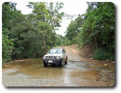
About 35 km north of the Archer River is the turn off to Lockhart River, Portland Roads and Iron Range N.P.
The first river crossing is at the Wenlock River and just past this there is a track which leads to the old Batavia goldfields where you can still see some of the old mining equipment.
The next river crossing is at the Pascoe River – this is a longer stretch with a sandy bed. The track then leads towards Iron Range N.P. with some spectacular scenery and Australia’s largest area of lowland rainforest. The campsites at Chilli Beach are very popular and there is great bird watching with 15 endemic species, and some interesting walking trails in the Park.
Lockhart River is an Aboriginal community famous for the incredible array of artistic talent produced by the Lockhart River Art Gang. A visit to the Arts Centre is a great experience. There is also a supermarket and fuel in the town.
Portland Roads is a beautiful little fishing community with a couple of beach shacks for rent and a fantastic restaurant .
Weipa and Merluna Route
The turn off to Weipa is around 50km north of Archer River. The family operated Merluna cattle station is located off the Weipa road and also offers accommodation and camping. From Merluna you can drive to the bauxite mining town of Weipa, with modern facilities and fantastic fishing. This is a good place to stock up on supplies or enjoy the world class fishing. From Weipa you can drive east through Batavia Downs Cattle Station to Moreton Telegraph Station, on the Wenlock River or continue from Merluna on the Telegraph Road up to Bramwell Station or Jardine National Park .
PDR Bypass Roads
From Bramwell Junction you can either take the challenging Old Telegraph Line 4WD route or the PDR Bypass roads which are maintained to a good standard. The Bypass roads are around 260 km from Bramwell Junction to the Jardine ferry which can take up to 5 hours.
Interesting side trips from the Southern Bypass road include the turn off to Captain Billy Landing where there is a campsite.
The Old Telegraph Line
The Old Telegraph Line really starts after Bramwell Junction and continues up to the Jardine River. It is important to have a properly equipped 4WD for this adventurous route but most travellers to the Cape will take the OTL north then return by the bypass roads.
Driving north you will need to negotiate several creek crossings, some of which have challenging entry and exit points.
Palm Creek is the first crossing, then you face the Ducie River, South Alice Creek and North Alice Creek. After around 30 km from Bramwell Junction you come to the Dulhunty River which is a popular spot to camp.
Next is Bertie Creek and after this there is the option of the Gunshot bypass or continue on the OTL to Cholmondely Creek. The infamous Gunshot Creek is the next crossing – this is probably the most challenging crossing on the OTL. Then you continue to Cockatoo Creek, another challenging crossing, and the final creek crossing is the bridge over Sailor Creek.
The section from Bramwell Junction to the intersection with the Northern Bypass Road is approx 80 km which can take up to 5 hours depending on conditions.
At this junction there is a track to Heathlands Reserve and the lovely Fruit Bat Falls which offers a refreshing swim stop on the way to the campground at Eliot Falls and Twin Falls.
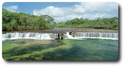
The OTL continues from Eliot Falls through the rough Canal Creek, then you face crossings at Sam Creek, Mistake Creek, the aptly named Cannibal Creek, the rickety old bridge over Cypress Creek, Logan Creek and Nolan’s Brook before emerging at the Jardine River. A track then leads back to the Northern Bypass road and the Jardine River ferry.
The section from Eliot Falls to the Jardine River is approx 40 km and can take up to 4 hours depending on conditions.
Jardine River - Bamaga/Seisia/Tip of Cape York
Cross the Jardine River by cable ferry and head to the northernmost Tip of Australia .
Ferry tickets can be purchased online here . The ferry operates from 08.00-12.00 and then from 13.00 - 17.00, daily in the dry season.
Contact the Northern Peninsula Area Regional Council for further information - phone 07 4090 4100.
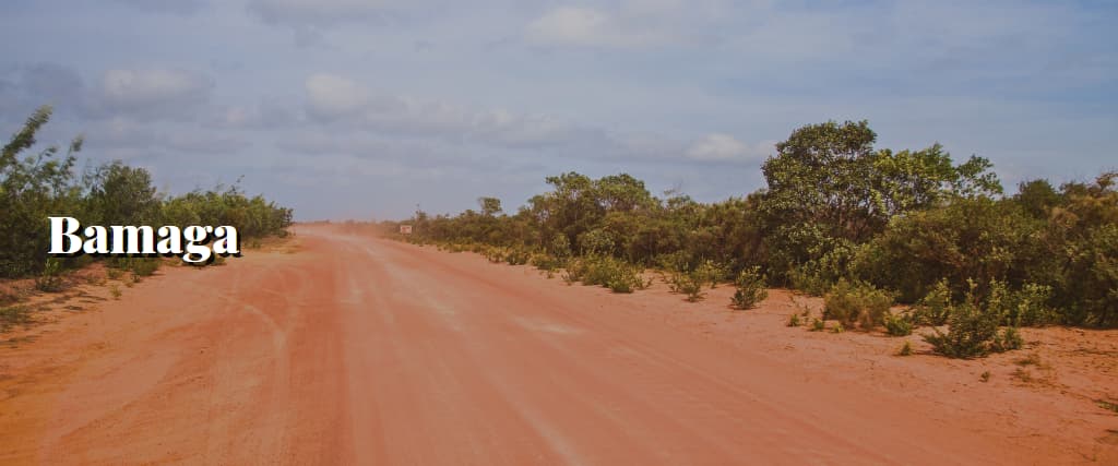
The drive from the Jardine ferry to Bamaga is about 42 km and Seisia is 6km north of Bamaga.
There are several camping and accommodation options in Bamaga, Seisia, Loyalty Beach and Punsand Bay with guided tours, hire cars and fishing available within the area. As well as the great fishing there are several WW2 sites, pioneer mining sites and old telegraph memorabilia to visit. Long stretches of deserted beach and the Lockerbie Scrub Rainforest Trail provide good walking options. The historic Somerset beach is another popular site to visit.

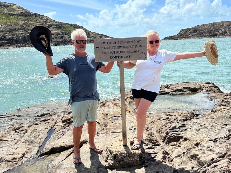
The Tip of mainland Australia is 32km from Bamaga and 7km north of Lockerbie – the must see destination for all visitors to Cape York Peninsula.
Having made it to The Tip spend a few days to enjoy the whole area and why not extend your trip to the Torres Straight Islands. Thursday Island is just 30 km from Cape York Peninsula and easily accessible by ferry from Seisia.
Natures Powerhouse
Walker st, cooktown, call us at 07 4069 6004.
- Your Privacy
- Related Sites
- Staff Login

Cape York Trip Itinerary – 10 Days to the Tip!
When we first set out, one of our goals was to reach the tip of the cape. It’s one of those places where danger and excitement are practically synonymous. After hearing countless comeback, fishing, campfire stories and breakdowns, we were eager to make our own.
You may only visit the Cape between April and November (depending on the rain), so planning your trip accordingly is essential. We avoided the summer months since campgrounds are too crowded during the school year and instead visited Cooktown around early September to get ready for the tip.
Planning a Trip to Cape York: Ten Days to the Finish!
For many people, a trip to Cape York is a once-in-a-lifetime opportunity to experience the unspoiled natural beauty of Far Northern Queensland.
Cape York is a once-in-a-lifetime opportunity thanks to its spectacular natural vistas, rich cultural heritage, and challenging terrain.
In this plan, we lay out a 10-day trip to Cape York, marking stops at several of the cape’s most famous landmarks and some lesser-known but no less fascinating attractions.
Prepare for an unforgettable journey across one of the country’s most beautiful areas, whether you’re an experienced traveller or newly starting.

1. Cooktown
This quaint city is perfect for us. There’s a ton to do in the neighbourhood, and this trip marks the beginning of an incredible journey to Cape York.
A spot at the famous Cooktown Holiday Park was reserved for us. It’s a gorgeous park that offers ample tree cover, spacious grassland sites, and a pool fit for a resort.
A busy crossroads for travellers going north or south. In addition to being a convenient stop for resupply, Cooktown is rich in attractions.
We left our RV at the BIG4 Cooktown Holiday Park for the day to relax and do laundry. The park is great, and the staff is accommodating and pleasant.
If you’re searching for first-rate seafood while in town, the genial proprietor of Nicko’s Seafood has got you covered.
Keep an eye out for the guy as he makes his daily seafood delivery run through the trailer park; his prawns are to die for! Ask him where to leave your RV while you shop for prawns and proceed with the trip.
The “Lions Den Hotel” is located only 30 kilometres away. This pub is a North Queensland institution. We enjoyed a refreshing beer there as our children played on the next playground.
This is one heck of a bar. Thanks to its eccentric souvenirs, swimming hole in the back, and wood-, it’s a tourist hotspotfired pizzas. Those in the area must visit. What’s not to like about this place, with its long history and legal bar?
After spending two nights packing and loading the van, we have everything we need to get on the road, including a few last-minute supplies.
When we initially set out, one of our goals was to reach the very end of the cape. It’s among those places where danger and excitement are practically synonymous. After hearing countless comebacks, breakdowns, fishing, and campfire anecdotes, we were eager to make our own.
You may only visit the Cape between April and November (depending on the rain), so planning your trip accordingly is essential.
We avoided the summer months since campgrounds are too crowded during the school year and instead visited Cooktown at the beginning of September to prepare for the tip.
We brought a chemical toilet with us, which proved quite useful. We also have a 12V shower with us. To get HOT water, we had to plug it into our vehicle. It’s pleasant to enjoy a hot shower on a cool evening, and taking an outdoor shower is a massive thrill for kids.
On your trip to the cape point, we suggest stopping by Elim Beach. This is a magnificent place, and you must see the multicoloured sands.
We take a long trip along the battle camp route to Weipa the following day. Which, while essentially just a well-kept gravel road, was a fantastic alternative for travelling back through Laura and Cooktown.
For our camping trip to Cape York, we’ve partnered with OZTRAIL. Come by ELIM BEACH and look at our set-up for further details on the equipment.
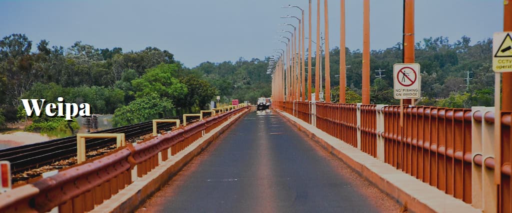
The drive to Weipa was smooth and easy. More than half of the freshly graded material was bitumen. This area took us by surprise. A close-knit community provides its residents with almost everything they want.
We were surprised to see grass when we pulled into Weipa Caravan Park. But once inside the gates, the vegetation was as lush as ever, so we picked the perfect spot to pitch our tent overlooking the water.
The pool is fantastic, the cafe serves delicious pizza, and the vibe is relaxing. We thought it was such a lovely spot to unwind that we stayed for two nights. It’s the northernmost point where you may find a major shopping mall.
Stocking up in Weipa is the best plan, as there will be limited opportunities to buy supplies on the way north.

3. The Old Telegraph Track
We are excited to begin travelling on the Old Telegraph Track after departing Weipa. We stop briefly to visit Bramwell Roadhouse for gas and photographs, and then we’re on our way.
There is only one vehicle track through the dense bush at the beginning of the trail, and it’s rather mild, with several rocky spots and washouts. The track starts becoming rough until you reach Palm Creek. The brook has a steep entrance and exit, so be careful.
You should take the route to the right to avoid having to winch up the exit when pulling a trailer.
4. The Bertie Creek
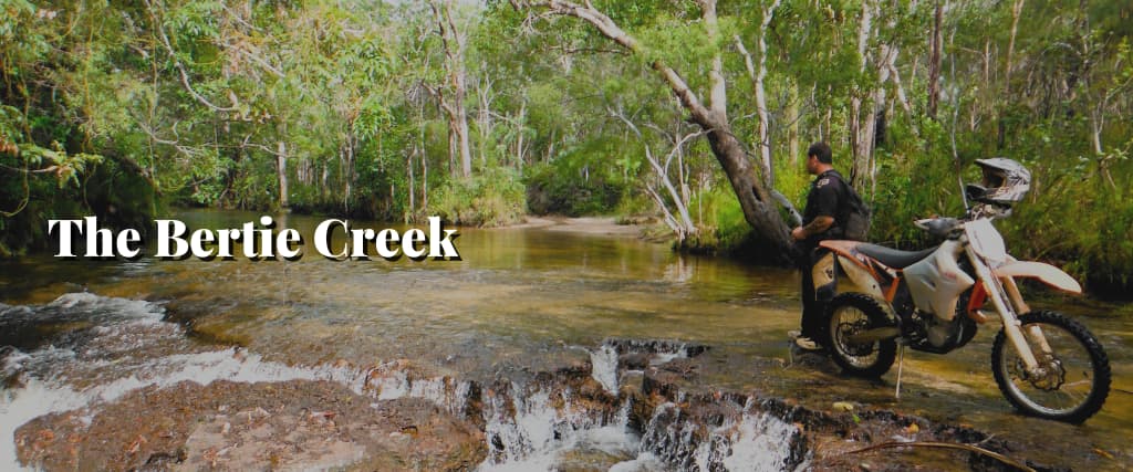
We must do a few more modest river crossings and navigate rougher trail stretches before we can set up camp. We figured Bertie Creek would be a great site to stop on the OTT because we had been there before.
We veer off the beaten path just a moment to visit a secluded creek through rapids and gin-clear water where this Bertie flows into the Dulhunty. We pitch our tents, drink beer, and swim in the refreshingly calm shallow rapids.
This is a great spot to pitch a tent.
We chose to camp on The Old Tele Track on the first night, which is an absolute corker. The creek has clean water with rapids right on the edges. Beer and a bonfire make for the perfect camping trip.
5. Gunshot Creek
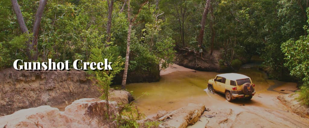
We camped peacefully at Bertie Creek for the night and then headed north to the top. Gunshot Creek, with its infamous cliff fall that some insane people dare to navigate their cars through, is the next prominent landmark.
Our obvious choice was taking the chicken track that loops to our right, across the creek, and then up the rocky slope. Lunch at Gunshot is perfect for people-watching as they explore the trail and cross the stream.
6. Drop of Fruitbat Falls
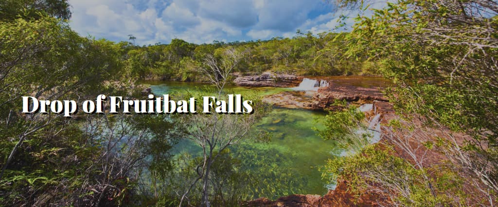
Fruit Bat Falls, a recognisable landmark in the OTT, was our next stop. The OTT and PDR (Peninsula Development Road) meet at the falls. A lovely waterfall drops over an edge into a nice, shallow pool below. We rushed in to have a little fun with the swords.
The kids thought it was magical to play beneath the waterfall. There were plenty of areas for us to spread out and enjoy the cool shade and crystal-clear water on this sweltering day.
If you keep travelling north along the Tele Track, you’ll eventually reach Elliot Falls. We also admired another beautiful pool and waterfall. If you plan, you can also stay at a fantastic campsite in the national park.
7. The Waters of Logans Creek
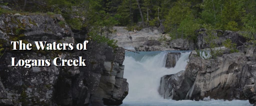
We then moved on to Logans Creek Crossing, where one can watch people crossing the creek before attempting. After a long day, we pulled over to set up camp for our overnight stay to continue the trail in the morning.
8. Roonga Point
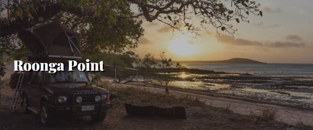
We picked an awesome place and got the whole thing to ourselves. The place had excellent fishing and blue waters. I caught a couple of fish and witnessed a beautiful sunset. Positioned midway between the campground of Punsand Bay and Croc Tent lies Roonga Point.
When you visit the Croc Tent, ask for the mud map showing the campsites and trails. It’s cheap (only a couple of dollars) and highly recommended.
A legendary beach camp in the vicinity of Cape York. It’s a free campsite with easy access and excellent fishing.
A fantastic spot to do some food shopping, load up on essentials and recharge. In this far-flung corner of Australia, you should expect to pay a premium for everything from the gas you use to the groceries you buy.
A stop at this caravan site is ideal, and fishing from the jetty marks the visit for most travellers.

10. Punsand Bay
We were thrilled to swing by, do some laundry, and swim in the shallow (borehole water) pool. We camped directly along the beach while having spectacular sunset views.
The wood-fired pizzas here are some of the greatest we’ve ever eaten, and the rest of the meal was also excellent. Having other families around meant we could relax with a beer or two while our children played.
We spent two nights at the $44/night Punsand Bay Campground on our way to the tip of the cape.
A legendary beach camp not far from Cape York’s tip. It’s free, it’s close, and it has excellent fishing!

11. Australia’s Southernmost Point, Pajinka
It felt great to reach The Tip finally. The journey is relatively easy but involves many kilometres and bumps. We parked at the base, and because of the high tide, we had to traverse an outcrop of rocks to reach the end of the peninsula.
At low tide, you can take a beautiful, albeit slightly shorter, route through the ridge on the sand. The youngsters did great on the fifteen-minute hike.
Our Way Back
Just because you’ve made it to the end-all, be-all doesn’t mean the fun ends! Before heading back down, some fantastic campsites are still available.
Before you go back down, there are a few things I want you to see.
- Somerset Beach: A Fantastic Free Campground
- 5 Beaches Drive is a beautiful coastline loop that goes by five different beaches before bringing you back into the PDR.
- The Frenchman’s Track is a difficult 4WD route that leads to Chiili Beach and the east coast.
- Chilli Beach These pristine white beaches of Chilli Beach meet the verdant canopy of the rainforest at this beautiful campground. The 70-80 km/h gusts that day prevented us from establishing camp there.
Telegraph Station in Moreton
This was the final stop on this journey to Cape York, and we were delighted with our reception. We finally reached a green campground after driving over so much red soil.
We camped in the wilderness as a fitting finale to our time in Cape York. Tonight is our last night in this hotel before we return to Cooktown tomorrow to retrieve the vehicle and continue our journey east.
The Eleven-Step Cape York Itinerary Planner
Travelling to Cape York is one of the most exciting journeys one can have in Australia. One of the greatest treks in Australia’s wilderness is across the northern peninsula of Queensland.
Here in the Cape’s vastness, human influence is minimal, and nature reigns supreme. Going around is challenging because of the terrain’s distance and roughness. Preparation is the key to a successful Cape York drive.
We have compiled a Cape York itinerary guide to help you prepare for your monumental journey into the distant Cape York peninsula.
This comprehensive guide can assist you in organising the unexpectedly involved process of visiting Cape York. It covers everything you need to know to organise a successful vacation to Cape York, not just the highlights.
We have provided information and various resources on planning a route, what to bring, where to stay, how to maintain your vehicle, and much more. If you follow the steps in this guide, your drive to Pajinka, Australia’s northernmost tip, will go off without a hitch.
Step 1: Find a Reliable Map for Cape York
Finding a reliable Cape York map is essential to organising your Cape vacation.
Maps from Google have entirely abandoned the Cape. Instead of occasionally sending you towards the ocean or mislabeling cow trails as “roads,” Google often fails to load the map and spins endlessly into infinity.
Fortunately, various navigational aids exist to help you plot your course.
If you need a map of Cape York for off-road driving, go no further than this app. If you’re planning a crazy 4WD excursion on the tip of the Cape and want to avoid the tourist traps, this is the nautical gear you need.
Included are detailed maps of all of the area’s off-road paths. It’s GPS-based and functional even when you’re not online.
Get a paper map of the Cape York Peninsula from nearby tourist centres, such as the one in Cooktown. One of the best elements of preparing for a voyage to Cape York is sitting around using a paper map, including your crew, and mapping your course.
MapsMe provides the greatest free digital alternative when you cannot afford to spend $100 on the Cape York HEMA maps or if you find paper maps unsuitable.
While the estimated travel times did not match, downloading and using the maps without an internet connection was invaluable on the Cape’s remote interior.
Step 2: Acquire a Sense of Cape York’s Distances
You’ll spend most of your time on the trip to Cape York in the car, driving down the red gravel roads. The long, sandy journey to Cape York demands careful preparation.
Knowing the distances between stops is crucial if driving from Cairns to Cape York. Google may say that travelling 1,000 kilometres takes thirteen and a half hours, but it will take much longer.
The time it takes to complete a trip is highly variable, depending on several factors like the season, the weather, and the number of other vehicles on the road.
The times are only estimates, and the actual travel time could be significantly longer or shorter depending on the state of the roads. Allow extra time in case you hit bad weather or experience car issues on the road.
Step 3: Determine What to Do While in Cape York
Knowing how far places are and how long it will take to get there will help you plan for your time in Cape York. Cape York is a large natural playground full of exciting and unique destinations. Waterfalls, secluded beach camping, and difficult 4×4 trails are only the beginning.
Planning what to do while visiting Cape York is crucial because of the considerable distances between the numerous points of interest.
To help you start, we have compiled a list of some of the most common activities. This is not a complete guide to Cape Cod but a selection of our favourite activities.
1. Follow the Route of the Old Telegraph Track
When preparing for a trip to Cape York, it’s important to pack the right recovery gear in case you get stuck while crossing a creek on the Old Telegraph Track.
Remember to include time to go off-roading when planning a trip to Cape York. The Cape York Track, also known as the Old Telegraph Track, was constructed at the beginning of the nineteenth century to provide access to telegraph lines between the Cape and Cooktown.
Many visitors bring their four-wheel drives because of this track. Many visitors to Australia add this historic and well-known 4WD circuit to their itinerary.
2. Travel to Australia’s Most Northern Location
The northernmost point of Australia is a must-see on every journey to Cape York. About 45 minutes drive from Bamaga will bring you to Australia’s northernmost tip. It shouldn’t take over an hour to stroll back to the sign, including stopping for the customary group shot.
3. Trip Charter a Vessel for Cape York Fishing
Renting a boat and going fishing is among the best activities you can do in Cape York. Bully’s in New Mapoon is where we rented the boat.
When we showed up at the Seisa Pier using our one reel and small rod, Bully’s reaction was priceless. However, the fish in the Cape’s pristine waters aren’t exactly minnows.
We didn’t need to venture too far to see schools of jumping tuna and bait balls full of diving seabirds. Monster trevally swam just below the surface near the entrance of Jardine River, and massive turtles drifted lazily above.
Huge sharks swarmed the boat, preparing to pounce on our catch. The fishing was the craziest we’ve ever seen, especially for being so close to shore.
Sailing around Cape York is an unforgettable experience. A visit to the source of the Jardine River constitutes the highlight of any vacation to Cape York.
4. Soak in the Waters of Cape York
Since diving into the ocean is not an option on Cape York, visitors should visit the area’s refreshing waterfalls instead. Eliot Falls, Fruit Bat Falls, and the secluded Sam Falls are must-sees on any Cape York itinerary, providing welcome relief from the scorching temperatures and a chance to shake off some of that red dust.
Taking a refreshing swim in one of Cape York’s waterfalls is a trip highlight that may easily stand in for the day’s shower.
5. Take on the Archer Burger
The Archer Burger has become almost as well-known as the historic Old Telegraph Track. Archer Roadhouse serves a massive burger with all the fixings. In addition to the standard fixings, your burger will come with bacon, fried eggs, pineapple, beetroot and grilled onions.
Whether heading to Cape York for lunch, towards the end of the day, or in the early morning, you must stop at Archer Roadhouse for breakfast or dinner.
6. Chill Out at the Chili Beach
With its constant, strong offshore winds, the beach brought back memories of our stay at El Cuyo, Mexico. To make the stay at Chili Beach memorable, reserve a campsite in the national park, which is out of the way of the constant winds.
The rare and stunning Palm Cockatoo, commonly called ‘palmiers’, with its jet-black plumage and bright red crest, can be spotted in this area if you’re an avid birdwatcher.
7. Barramundi Fishing at Weipa
Many visitors to Cape York need to consider the western end of the cape. However, those with more time on their hands could travel to Weipa to enjoy some of the best fishing at Cape York. One of the best places to catch a barramundi on land is Weipa.
8 Go to Bramwell Junction and Have a Chicken Burger.
Bramwell Junction, known for its enormous chicken burger, competes for the title of Cape Cod’s best roadhouse burger. You will not regret this classic on the road to Cape York: fried chicken with lettuces, pineapple, tomato and delightful, sour, spicy mayo.
9. Drink a Beer in the Northernmost Pub in Queensland
In Australia, visiting the pub is a must on any vacation. The Bamaga bar is the northernmost drinking establishment in Australia, and it’s the only spot on the Tip of the Cape where one can get a drink to go. Be wary; the prices at this out-of-the-way bar are high.
10. See Some Old War Stuff
Don’t miss the military relics scattered over the Cape if you’re interested in WWII history. When the Japanese might have invaded Australia, they used nearly the entire Cape.
The Cape was important to Australia’s participation in World War II since it housed multiple air facilities and large bases. Explore the remnants of World War Two, such as airfields, fuel fields, and aircraft wrecks.
Among the most interesting activities around Cape York is checking out these artifacts.
11 Explore Nature
The enormous variety and quantity of wildlife are among the first things visitors to Cape York will observe. Nature has become dominant as the Cape has been relatively untouched by humans. And if you can spare some time to relax and watch the wildlife, you will be amazed.
On our way towards the Cape, we saw a lot of interesting animals. Hawks were roaming the creek adjacent to our campsite, bringing fish to their young, and bowerbirds were constructing elaborate nests to attract mates.
It’s possible to spot a shark breaching, a crocodile taking a dip, a scorpion slithering, or a snake basking in the sun. The Cape’s natural beauty never ceases to astound.
At Cape York, among the best things to do is to tune into your environment and learn about the abundant wildlife. We think you’ll find it a memorable part of your Cairns to Cape York trip.
12. Be Alert for Crocodiles
Saltwater crocodiles are an essential part of any vacation to Cape York. There is a morbid fascination with hazardous animals like saltwater crocodiles because they are known as the kind of creature most likely to devour a human.
The sight of a crocodile, which can reach lengths of up to 6 meters, will undoubtedly be one of the highlights of your tour from Cairns towards Cape York.
Loyalty Beach, up at Cape York’s Point, and Captain Billy’s Landing, across the east coast, are popular crocodile-spotting locations.
Don’t ever try to pet or feed the crocodiles. It could be entertaining for you. However, it won’t be for the kid who succumbs to an attack because the Croc got used to seeing people.

Step 4: Plot out Your Route to Cape York.
The next stage in organising your road trip to Cape York is to draw up a route using your map, knowledge of distances, and list of potential stops.
Fuel stations and camping spots are scarce, and the distances between locations are enormous. It is essential to plan your route to Cape York, including how much time it takes to reach there and how much gas one needs.
WikiCamps is an excellent tool for route planning you may use while on the road. The app displays the locations of campgrounds, attractions, water amenities, day-use areas and even dump stations. Free camping spaces abound in Cape York, and WikiCamps is an excellent tool for finding them.
It’s smart to have a backup strategy ready if your original one doesn’t work. Learn the layout of the area, including the whereabouts of key persons and sources of fuel.
In a dire situation, it could be helpful. Include a couple of extra days in your itinerary if something goes wrong or you fall in love with a place and don’t want to leave!
Step5: Meal Preparation for Your Cape York Vacation
We had burgers made from black beans in week three. Planning for the trip to Cape York made it possible.
Meal planning is a crucial component of getting ready for any camping trip. Meal preparation is always vital, but it becomes even more crucial when travelling to Cape York owing to the scarcity of food and other goods.
Bamaga/Umagico, Cooktown and Weipa, close to Cape York, are the only places to stock up on groceries. While a bit more expensive than at home, the supermarkets have a good selection and reasonable prices.
There are a few gas stations and convenience stores between the convenience stores, but they have a very limited selection and charge exorbitant prices. The secret to having a wonderful eating experience in Cape York without going broke is to plan your meals and ensure you have all you need.
Meal preparation should be included in your overall Cape York travel itinerary. Where and when you may restock groceries en route from Cape York to Cairns, and what you’ll need to bring.
We stocked up on dry and canned goods in Cairns for three weeks at the Cape. We brought our fresh produce, dairy products, and meat for our first week, then restocked at gas stations and grocery stores.
Step 6: Plan for Your Stay in a National Park
Understanding the alcohol policies in place in Cape York is crucial. There are places in the world where drinking alcohol is completely forbidden or strictly regulated, known as “dry communities.”
It’s important to know which states have per-vehicle alcohol limits and which offer waivers for legitimate tourists like yourself. On your way to Cape York’s point, you will undoubtedly travel through at least one of the dry villages.
Visit the alcohol restrictions section of our comprehensive Cape York travel guide for more details.
Step 7: Plan to Stop by Captain Billy’s Landing on Your Way to or From Cape York.
While free camping is available throughout Cape York, visiting one of the many national parks is the best way to take advantage of the area.
However, national parks have limited spots, filling up quickly, particularly during the school year. While preparing for a trip to Cape York, reserve a room in advance.
Captain Billy’s Landing and Chili Beach are two of the most sought-after camping spots in the national parks.
Step 8: Deciding What to Bring to Cape York
Choosing what to bring to Cape York is an essential first step. It can be challenging to know what to bring to Cape York. Due to the location’s isolation, you should pack more provisions than necessary for a typical camping excursion.
Ensuring you’ve got everything from spare components to recovery gear to additional supplies might be daunting.
For your convenience, we have compiled a list of all the things we brought to Cape York and some items we should have brought but didn’t. Items like recovery, medical, and camping gear are on the Cape York trip’s packing list.
You shouldn’t expect to be able to quickly run to a neighbouring Woolies or Big W if you forget something around the Cape.
9. Review Safety Advice Before Making the Trip to Cape York
The route to Cape York passes through some of Australia’s most inaccessible and mountainous terrain.
Reviewing some basic safety procedures before embarking on any road trip is excellent, but doing so in Australia is crucial. Do not forget to check your Cape York trip safety plan before you go.
We’ve compiled some of our best safety advice to help you prepare for your vacation to Cape York.
Keep the headlights on when driving.
Turning on your headlights in the daylight is a good idea in Cape York.
On a clear day, they may seem unnecessary, but if you drive into a cloud of dust churned up by cars travelling in the opposite direction, they’ll be all that other drivers can see.
Reduce Air Pressure in Off-Road Tires When Traveling on Roads with Severe Corrugation.
It smooths out the ride (to some extent).
If your vehicle has off-road tires, reducing pressure will help it ride more comfortably over the PDR’s harsh corrugation.
Do not let your tyre pressure drop below the recommended level if you use road tires without traction on the sidewalls. Doing so exposes the vulnerable tyre wall to damage from a stick or stone. The trip may be rough, but it beats driving home with flat tires!
Pace Yourself
Most of the route to Cape York’s tip is unpaved, with quality varying widely from kilometre to kilometre. You should not drive flatly strapped since you never know when gaping potholes, violent corrugation or sudden curves will appear.
Know Your Crocs
It’s crocodile country out here, so brush up on your croc knowledge in addition to the usual scorpions, sea stingers, snakes, and spiders. If you’re going to Cape York, it’s a good idea to review the offered advice to understand what you should do if you see a crocodile.
Step 10: Get Your Car Serviced
Avoid disaster by having your car serviced before heading to Cape York.
In preparing for a trip to Cape York, many people forget how crucial it is to check that their vehicle is in good working order. Nothing like breaking down on the highway could ruin the start of this 44 journey.
Visit your trusted mechanic to check the condition of your vehicle and its components before embarking on this journey.
However, even if you get a thorough checkup before you leave, there is still a chance that something will go wrong. Since these roadways are among the most hazardous in the Australi, it’s prudent to prepare for and anticipate some difficulty.
Our trip checklist provides a comprehensive list of the tools and spare components we recommend bringing on your Cape York excursion.
Preparing your car for the long drive to Cape York should be on everyone’s must-do list before heading there.
Step11: Carry Something for Your Entertainment
The final step may seem counterintuitive if you consider that the whole goal of a trip to Cape York was to escape from civilisation.
While true, getting to Cape York will require significant travel time. Also, if you have a weak cell signal, Spotify won’t be as accessible as usual.
The final piece of advice for the Cape York vacation we took was a planning guide to prepare for the long drive there by downloading road trip songs, podcasts, or some movies for our kids.
Believe us when we say that only some of the journey is as interesting as the well-known Old Telegraph Track, so these will come in handy.
In conclusion
We hope this post has given you the confidence to plan and organise your trip to Cape York. Leave a comment telling us how helpful you found this Cape York travel guide and if we forgot anything important.

Cape York Trip: Cape York Itinerary And Preparation
This post may contain compensated links. For more information, read our disclaimer here .
This post provides information to help you with your upcoming Cape York trip. It includes suggested places to camp on the way to Cape York, what to see and do along the Peninsula Development Road (PDR), and information about the Cape York area.
Also included are hints and preparation tips so you and your gear arrive and return in one piece.
We didn’t do the Telegraph Track, so we haven’t included any information about the Tele track. Instead, we took the PDR bypass, which is just a continuation of the PDR.
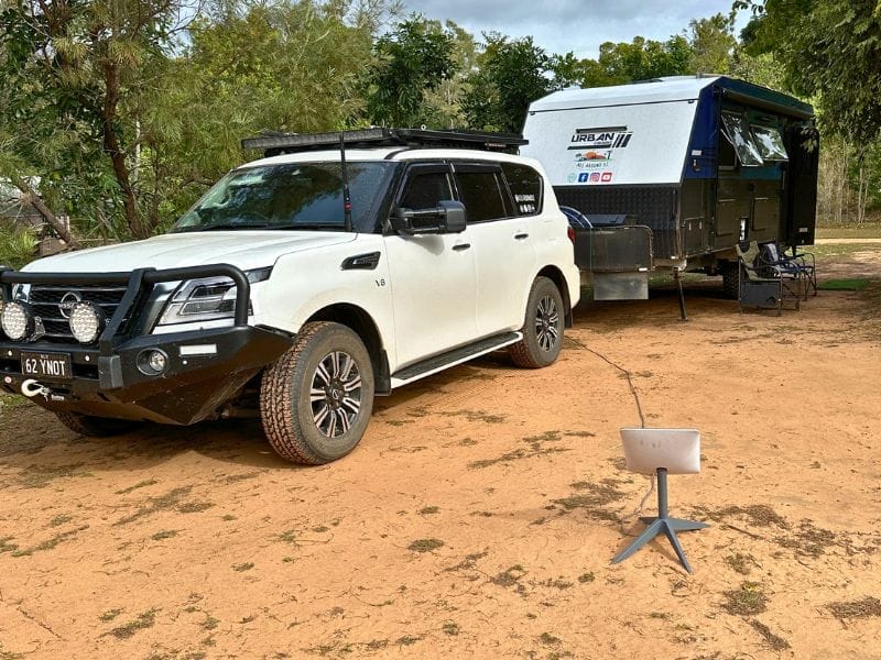
We towed our off-road caravan with our Y62 Patrol to Cape York and back. In the Cape region, we saw various setups, including off-road caravans, camper trailers, motorhomes, roof-top tents, swags, tents and motorbikes. Cars ranged from 4WD wagons and utes to 4WD trucks, 4WD vans, 2WD vans, and even 2WD sedans.
Not everyone wants to tow their van to the Cape and back. Some travellers store their vans at the many campgrounds or stations along the PDR. However, we bought an off-road van to take off-road, so our Cape trip was the first off-road trip that we’d made.
Preparation is king if you are on the fence about taking your van. Let your tyres down on your 4WD, caravan, motorhome, or camper trailer and drive to the conditions of the corrugated roads.
Preferring a hard copy of a map, we used Hema’s Cape York map for our trip. We also carry Hema’s Australia & 4WD Atlas .
Lakeland To Cape York Trip
Table of Contents
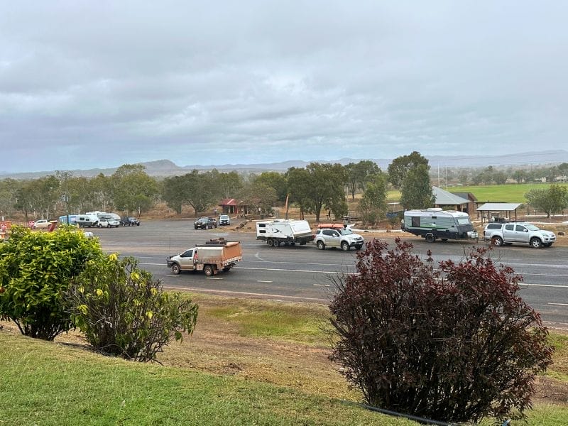
You’ll start your journey at Lakeland, the Gateway to Cape York. Walking around and learning about the area’s history is worth a stop. It’s a popular spot for everyone heading to Cape York.
The photo above was taken at a service station opposite Lakeland. It’s the last reasonably priced fuel, so I recommend you either fill up or top up there.
Hann River Roadhouse
Hann River Roadhouse has a good campground, and when we stayed, there were a few animals (baby goats) there. They also have a cafe that is open for dinner.
The bitumen finishes, and the red dirt starts north of Hann River Roadhouse.
Welcome to the bone-jarring, teeth-rattling PDR – Peninsula Development Road! Strap in, tighten those bra straps and enjoy one of the best Aussie road trips!
Musgrave Roadhouse
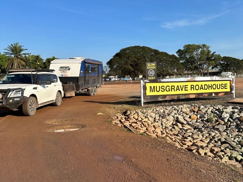
Musgrave Roadhouse has a freshwater crocodile attraction and some history. It’s good for an overnight stay, and meals are available if you don’t feel like cooking. We stayed at Musgrave on our way back down.
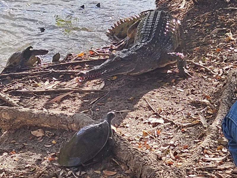
I had an online Zoom appointment when the croc feeding occurred, but Kev went and enjoyed it.
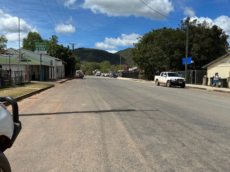
Coen has the Sexchange pub, great food, and historical attractions across the road.
Coen has two petrol stations, one heading north and one heading south. We filled up at the station heading south.
Just north of Coen, on the right, is a great free camping area at The Bend.
Archer River Roadhouse
Archer River Roadhouse has a sizeable park-anywhere campground. It also has a bar, and the food is reported to be good.
When we went through Archer River, the bridge was under construction. It was very noisy (as you would expect) during the day, but it was okay at night. The workers worked twelve-hour days from 6 a.m. to 6 p.m.
There’s a small Free Camp on the north side of the bridge on the right. Beware—the sand is very soft. Yes, we know this from a first-hand experience!
Chilli Beach
The turn-off to Chilli Beach Campground is north of Archer. Although it can be windy on Chilli Beach, the views are stunning.
Lockhart has several attractions—WWII was in that area, and the beaches are spectacular. Iron Ranges have lime-green pythons, Cuscus (a possum species), and beautiful birdlife. You can camp in the area, too.
Bramwell Station
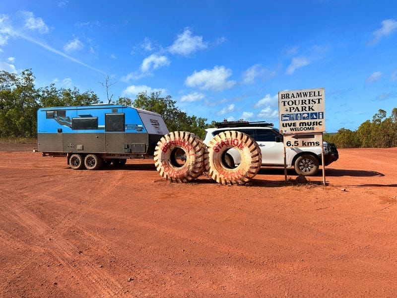
Bramwell Station has an excellent flat Campground. There is no need to book, as you can roll in and set up camp. They have nightly dinner and entertainment, but you must book it in advance as it is popular.
We found the worst corrugated road south and north of Bramwell when we headed north and south to Cape York. But that could be different when you drive the road. We stayed at Bramwell, heading north and south.
Bramwell Junction
North of Bramwell Station is Bramwell Junction, which has a campground and food. You can also fuel up there. This is the next place we filled up. To pay, you take a photo with your phone of the petrol bowser showing how many litres and the price, and then show it to the cashier. Fuel was $2.70/litre when we filled up.
Captain Billy Landing
Captain Billy Landing is worth a visit to camp or do a day trip, and the bookings are made through Queensland National Parks .
Fruit Bat Falls, Eliot Falls and Twin Falls
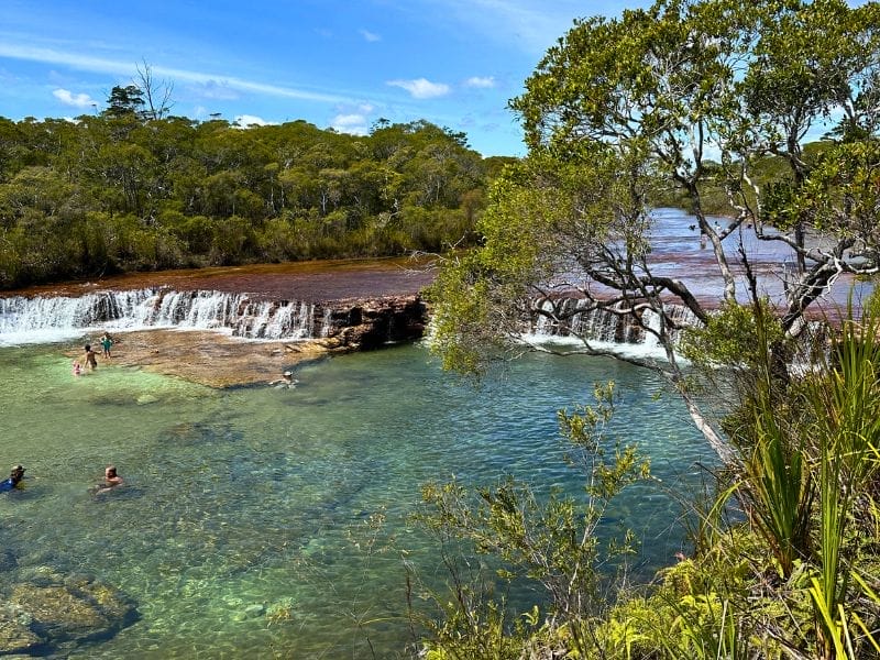
Fruit Bat Falls, Eliot Falls, and Twin Falls are stunning. We only spent a few hours there, but if we visit again, I’d make a day of it and take lunch. We visited the falls on our way back down from the Cape, unhitched the van, and drove in.
The water temperature was perfect for cooling off and swimming, and as you can see in the photo above, it was lovely and clear.
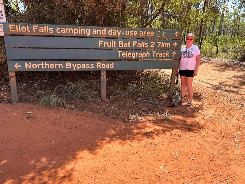
You can camp at Elliot; again, bookings are through Queensland National Parks. It’s a pretty gnarly track with some deep ruts into the falls. You can’t tow a large off-road van; you can pull a smaller hybrid van or camper trailer. You could also drive further down and free camp at Canal Creek.
Once back on the PDR, the Jardine River Ferry is next. Try to get there before noon, as noon is lunchtime. We arrived at five minutes to twelve, and they were closed for 45 minutes. There was quite a queue to cross by the time they re-opened.
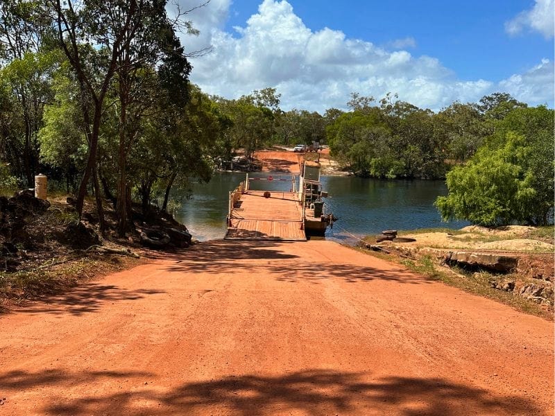
If you are too late for the ferry, the ferry crossing also has a Campground right next to it along the Jardine. There are also amenities there.
The ferry takes one 4WD and caravan or six 4WDs at a time. Crossing the Jardine took less than a minute, which was $197 when we visited. This covers a return trip on the ferry and free camping on the other side of the river.
Once you cross the Jardine, it’s only around an hour’s drive, and you’ll reach Bamaga. Parts of the road were very corrugated towards the bitumen end.
The roads are mainly bitumen between the townships in the Cape York region.
Alua Campground
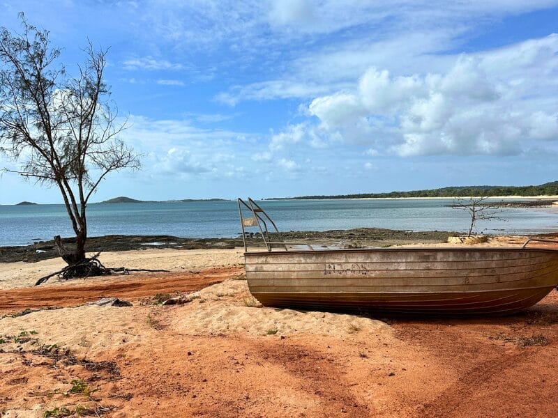
Umagico township has the Alua Campground. It is right on the beach and also has a pool. It’s a pretty area with some beach-front sites. As you can imagine, they are very popular, so you may have to book in advance depending on the time of year you visit.
Loyalty Beach
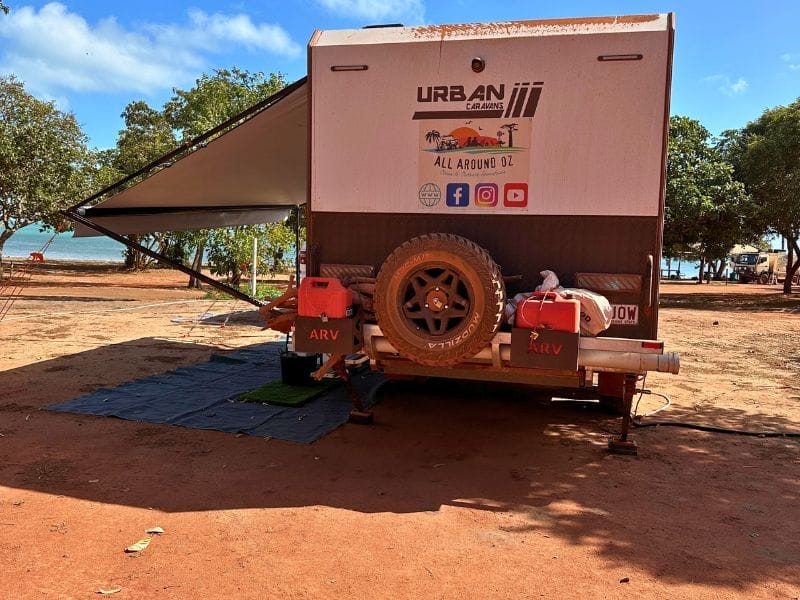
We stayed at Loyalty Beach Campground. It’s a large campground right on the beach and is fantastic for sunsets. They have a cafe of sorts and also have fish and chip night on Sunday. Wild horses visit daily; more about the horses further down.
When you arrive you are given a map and shown where you are permitted to camp, depending on your set up. On the left of the entry, the front row of the campground is reserved for RTTs and tents. The second, third and fouth rows are for camper trailer and caravans. To the right of the entry are for swags, tents and RTTs.
Seisa Campground
Another large campground is Seisia Campground. Our friends camped there in the overflow section and reported it was pretty good.
Seisia Wharf is just around the corner from the Seisa Campground, where you can catch Peddell’s ferry to Thursday Island for the day. We did the day trip to TI and highly recommend it.
World War Two Plane Wrecks
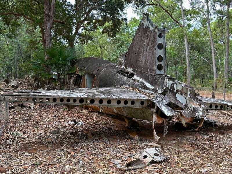
There are 3 WWII Plane wrecks in the Bamaga area, which are well worth visiting.
The Trip To The Tip To See the Sign
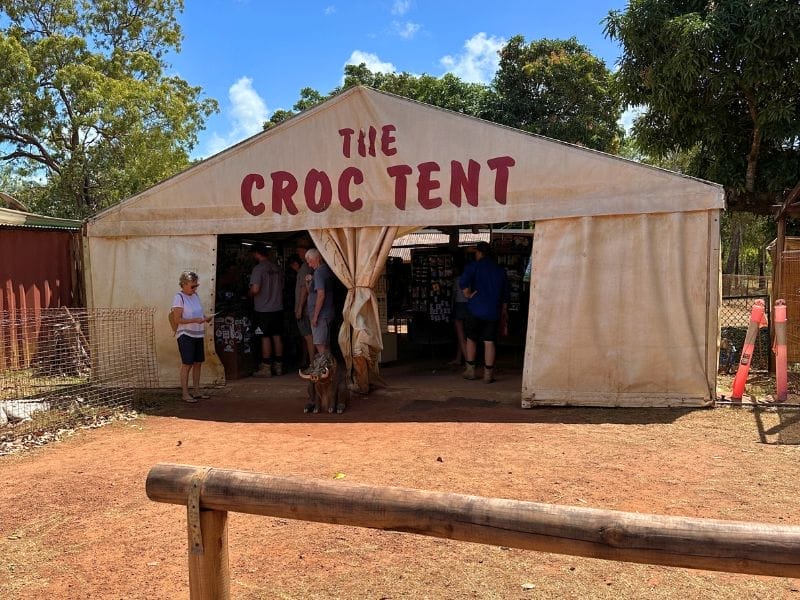
Travel on Pajinka Rd and stop at The Croc Tent for your merch. You can buy everything there, including postcards, T-shirts, fishing shirts, maps, and stubby coolers.
After the Croc Tent, keep driving north. You’ll drive through a beautiful rainforest, which I didn’t expect. There is a small carpark at the tip and some portable dunnies. I didn’t use them as most people opened the doors and quickly shut them!
Depending on the tide, you can walk to the tip from the beach area and then across some rocks. The day we went to the Tip, We Did both. We climbed over and down the rocks to reach the Tip and then crossed the rocks and over the beach back to the car park.
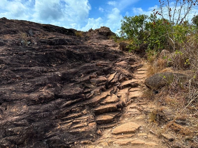
I’d recommend wearing at least some runners, as the rocks are rough and uneven in spots. That said, we wore pluggers and had no problems with slipping. I was pretty cautious, though, and took my time.
Once you are at the sign, there is a great atmosphere. People from all walks celebrate and tick this big, hairy goal off their bucket lists. Take your time, soak it all in, and enjoy the moment; you made it!
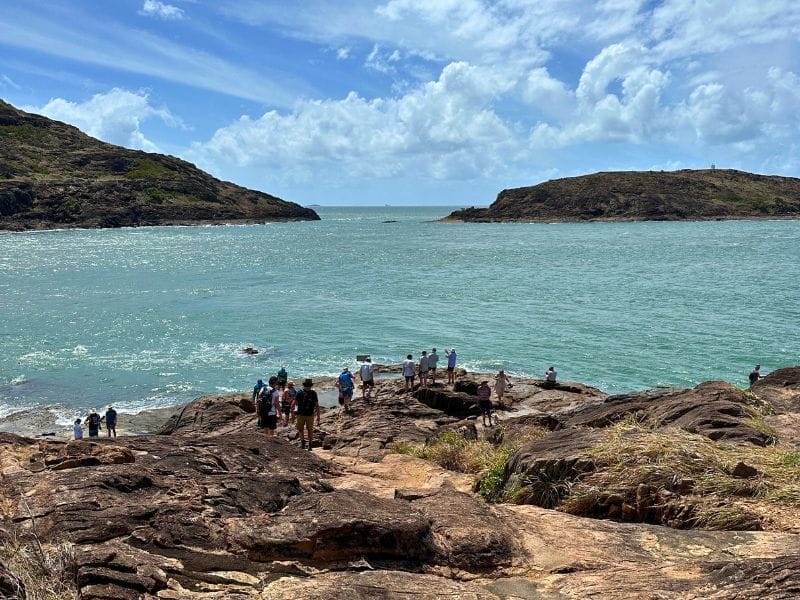
Don’t worry about who will take your photo or video. We found that people are very keen to help. Usually, the group in front of you who just had their happy snaps taken will help you take your photos.
After visiting the Tip and heading south, you can turn to the left to visit Somerset. At Fly Point, visit the old Jardine airport. There are historical graves to see and five beaches.
Punsand Bay
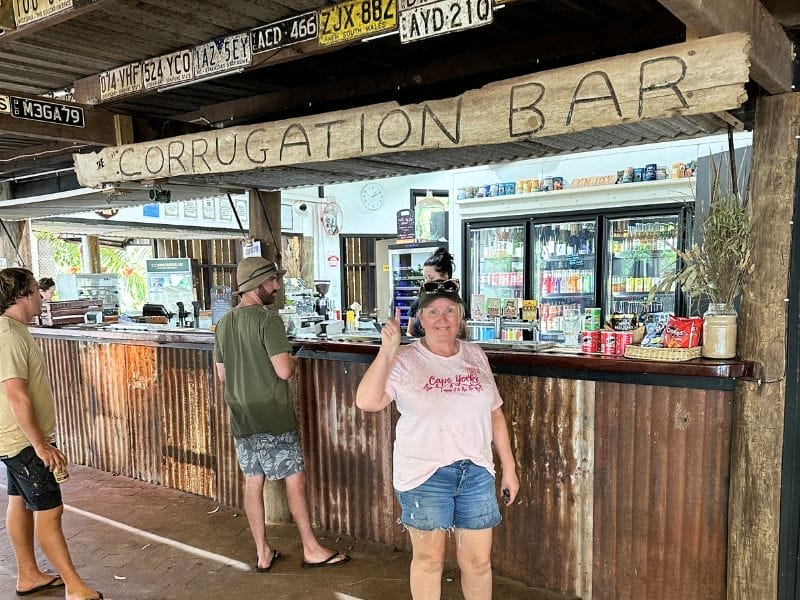
Back at the Croc Tent, instead of heading north to the Tip, turn off to the left at the Croc Tent and drive to Punsand Bay; you’ll see the signpost.
Some say it’s a ‘must-do,’ but others won’t agree. We think it’s worth visiting, and if you can camp there, that would be even better. We didn’t camp there because it was booked for two weeks. The Corrugation Bar area’s entertainment/food/bar has a resort feel. We found it had good food but small portions.
Heading South From Cape York
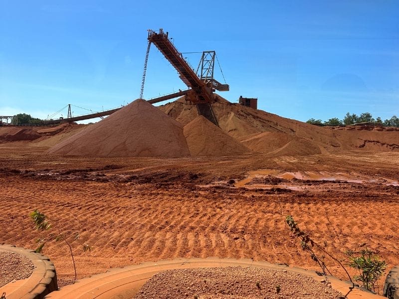
Weipa is a must-see and stay. The caravan park is an oasis in the middle of red dirt country. Do the Weipa mine tour if you can; we found it fascinating and informative. You’ll need to book the caravan park and the tour in advance, depending on the time of the season you go.
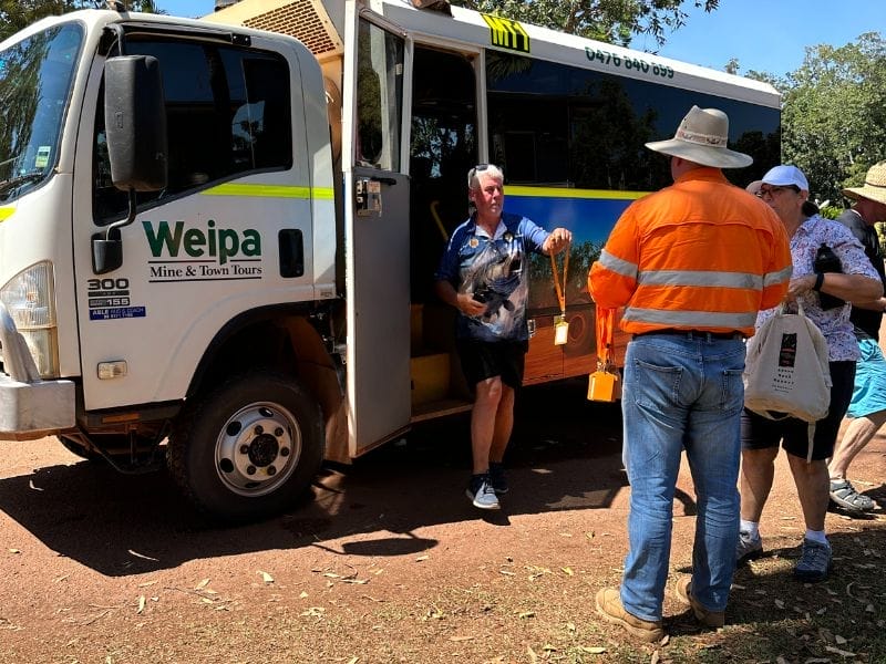
The Weipa Region
We visited Weipa on the way back and loved it. Take the Batavia Downs Road; it’s known as a shortcut and will cut hours off your trip. It’s a great dirt road – better than some parts of the Bruce Highway (although that’s not hard!).
Pennefather
Another beautiful place to camp is the Pennefather Free Camp , North of Weipa. The sandy roads to get there are very soft. Although it’s a free camp, you must buy a permit before you go, and you can get one at the Weipa Campground.
Mapoon was an old mission established by the Presbyterian Church. It has a lot of history; you can read about it here.
Preparation For Your Cape York Trip
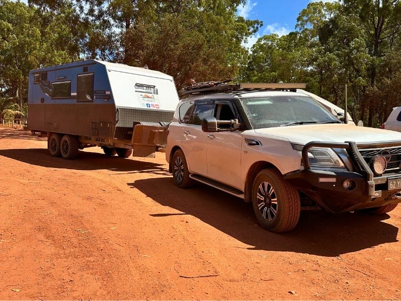
Preparation to visit Cape York involves two areas: your tow vehicle and caravan or camper.
4WD Preparation
Following is an essential list for your rig’s prep before heading to Cape York. If you are a keen off-roader, you’ll have your version, plus the tools, bits, and pieces that suit your rig. Most of the prep for the trip is common sense; however, I’ve included it anyway:
- Take recovery tracks
- Take a tyre repair kit
- Have your rig serviced
- Check the tyre wear and tear
- Check the suspension and brakes
- If you don’t have a winch, have one fitted
- If you are doing the Tele Track, check your winch
- If you don’t have a UHF radio , have one installed or at the least get a hand-held one
Caravan Preparation
These are the things to consider for your caravan preparation before heading to Cape York:
Outside Your Caravan
- Check the wheel bearings
- Silicone any holes around plumbing pipes
- If you don’t have dust suppression, tape the external vents
- If there is no under-body armour under your van, use hollow pool noodles to protect plumbing pipes
Inside Your Caravan
- Pre-cook some meals and cryovac them
- Buy fresh meat and chicken and cryovac them
- Stock up on your favourite food and drink (i.e. specialty milks)
- Stow and secure e verything that moves, including hand wash
- If you use light-coloured sheets and doona, change them for darker sheets
- Secure your fridge and freezer doors with permanent clips or 1000-mile-an-hour tape
Hints and Tips for Visiting Cape York and the Bamaga Region
- Let your tyres down on your rig and van and drive to the conditions.
- SLOW DOWN when you see signs for Dips and Floodways; they often have bulldust holes before them
- Bulldust holes can be anywhere along the road
- Drive in the table drains when the corrugations are too much
- Corrugations are often too much!
- If a grader has just graded the road, the corrugations will barely exist, and you’ll wonder what everyone is talking about
- You’ll often wish the grader had been through the day before
- Red dirt stains everything, and you’ll find it for months afterwards
- You don’t need to book the Jardine Ferry, roll up
- Despite the petrol bowsers, there is no fuel at the Jardine Ferry
- There are only three petrol stations – Injinoo, Bamaga and Seisa
- There are only three supermarkets – Seisia, Bamaga and Umagico
- There are only a few takeaway places, and they close early; we didn’t use any as we took food with us
- The chemist isn’t open on the weekends
- The Bamaga Pub is the only one up there
- The Pub is CLOSED on Sundays
- The Pub has a drive-through
- There are limits on the amount of alcohol you can take on the north side of the Jardine River, click here to read about it
- The best time to visit Cape York is in the dry season from May to October. The temperatures are beautiful as it is a dry heat
- The busiest times at Cape York are between June and September
- You’ll see wild horses everywhere. It’s not advisable to pat them as some can be aggressive. We saw them often through the park at Loyalty Beach. They know how to knock over wheelie bins to get to the food scraps
- There are lots of green ants on the trees, so be careful where you camp and look before you touch a tree
- We both have Telstra, but it only worked when we were in towns.
- We use Starlink, and it worked brilliantly everywhere we camped
- Lock up your valuables, especially in RTTs and Tents. Camping tables and chairs are ok to leave out at night
Final Thoughts
You can spend as little or as much time travelling from Lakeland and back on your Cape York trip. We were on the move daily with only 1-night stops until we reached Loyalty Beach. We spent seven nights at Loyalty to explore the Cape York region.
I would stay longer if we were to do another Cape York trip.
Enjoy your Cape York trip. Remember to take it easy and enjoy the journey; it’s as exciting as the destination.
You May Also Like:
Facebook Community
Privacy Policy
Disclosure Policy
Work With Us

IMAGES
VIDEO
COMMENTS
We have compiled a Cape York itinerary guide to help you prepare for your monumental journey into the distant Cape York peninsula. This comprehensive guide can assist you in organising the unexpectedly involved process of visiting Cape York.
Looking for Cape York trip information & Cape York Itinerary? Read our info to get you to the Cape York tip & back including where to camp, what to see & do.