Travelspirations


The Ultimate Guide to California’s Highway 1 Road Trip
Reading time:
You won’t find invasive popups or giant ads on Travelspirations.com – we’re not fans either. To support our site, we use affiliate links. If you click one and make a purchase, we might earn a small commission. It won’t cost you extra.
Last updated 6 months ago
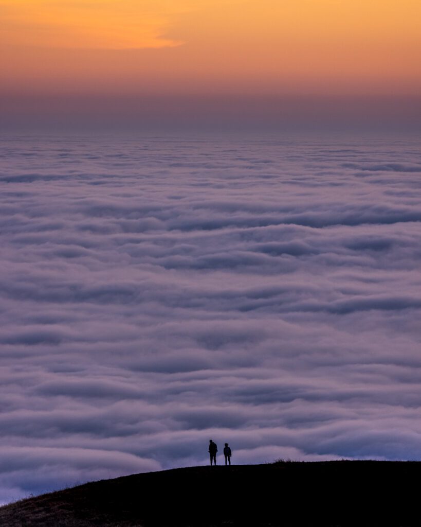
Hello, fellow explorers! You know, they say life isn’t about the destination, it’s about the journey , right?
Well, they must’ve had California’s Highway 1 in mind when they came up with that pearl of wisdom. I’ve been fortunate enough to journey down this mesmerizing stretch of road myself, and I’m here to share the magic of it with you.
Imagine this: You’ve got your favorite tunes playing, the sun is warming your skin through the open window, and there’s nothing but miles of shimmering coastline , towering cliffs , and infinite ocean blues in your view. Sound like a dream?
Table of Contents
Understanding the Basics of California’s Highway 1 Road Trip
Best time to go, essential tips for planning, best stops along highway 1, san francisco, monterey and carmel-by-the-sea, san luis obispo, santa barbara, los angeles, essential packing list for highway 1 road trip, enjoying the california cuisine along the route.
That’s Highway 1 for you!
Winding its way along the heart-stoppingly beautiful California coastline , this iconic route is quite literally the road trip of a lifetime.
It’s the embodiment of freedom, a concrete ribbon of possibility stretching from the historic heart of San Francisco to the glamour of Los Angeles.
Whether you’re an adventurous solo traveler or embarking on a memory-filled family vacation, the Highway 1 experience is nothing short of transformative.
From discovering hidden beach towns to feasting on fresh-off-the-boat seafood and marveling at panoramic ocean views , it’s an experience that truly ingrains itself into your soul.
Stay with me as I guide you through the twists and turns of this iconic route. Ready to buckle up and join me for the ultimate California’s Highway 1 road trip ?
Let’s hit the road!

Before we start revving our engines, it’s important to grasp the fundamentals of this epic adventure. Officially known as State Route 1, and affectionately referred to as the Pacific Coast Highway, Highway 1 is a major north-south state highway that runs along most of the Pacific coastline of the U.S. state of California.
What sets it apart from your average highway is its stunning views and distinctive locations. Every mile brings a new vista, a different beach, a unique town, making it a prime candidate for one of the most beautiful drives in the world.
Stretching roughly 656 miles from end to end, Highway 1 snakes its way from Leggett in Mendocino County, all the way down to Dana Point in Orange County. But the real meat of the journey – and the portion most folks are familiar with – starts in San Francisco and ends in Los Angeles.
Along this route, the highway clings to the coast, treating travelers to cliff-hugging turns, heart-stopping seaside views, and access to some of California’s most iconic cities and attractions. And remember, folks, don’t rush it – Highway 1 is all about taking your sweet time.
Choosing the right time for your road trip down Highway 1 can make a huge difference. If you ask me, spring (April to June) and fall (September to November) are the most comfortable times to travel.
You’ll dodge the summer crowd, encounter less fog than in winter, and still enjoy some delightful weather. Not to mention, the scenery during these times is particularly enchanting, with spring’s wildflowers and fall’s radiant sunsets offering a feast for your eyes.
Planning is key for a successful road trip. Start by deciding how many days you want to allocate to the journey – I’d recommend at least 5 to 7 days to savor the experience fully. Be sure to check your vehicle thoroughly before leaving – that includes oil levels, tire pressure, brakes, and such.
Have a rough itinerary but don’t make it too rigid, flexibility is key when you’re on the road – who knows what hidden gem you might stumble upon! Lastly, always keep your tank at least half full, fuel stations can be few and far between in some stretches. Happy planning!
Also in United States

Road tripping down Highway 1 is not about racing from point A to point B, it’s about savoring every moment and immersing yourself in the journey. Along the route, there’s a treasure trove of must-see sights and experiences waiting for you.
From vibrant cities to quaint coastal towns, these stops are what make the journey so unforgettable.

Let’s start our journey in the City by the Bay, San Francisco. This city offers an eclectic mix of attractions.
Don’t miss out on the iconic Golden Gate Bridge, the vibrant Pier 39, and the historic Alcatraz Island. Head to Twin Peaks for panoramic views of the city, or unwind at Golden Gate Park, an urban oasis filled with gardens, museums, and even bison!

Next up is the laid-back city of Santa Cruz, home to a charming boardwalk, quirky downtown, and beautiful beaches. Make sure to check out the historic Santa Cruz Beach Boardwalk for some old-fashioned fun, or head to Natural Bridges State Beach to enjoy the idyllic coastal scenery.
Want to reconnect with nature? The redwood-filled Henry Cowell Redwoods State Park awaits.

Monterey and Carmel-by-the-Sea are neighboring gems that you simply can’t skip. Monterey’s premier attraction is its world-class aquarium, the Monterey Bay Aquarium, which offers a peek into the rich marine life of the region.
And don’t miss the scenic 17-Mile Drive, a beautiful road that weaves through a stunning stretch of coastline and iconic golf courses. In Carmel-by-the-Sea, enjoy a stroll through its charming downtown filled with unique shops, art galleries, and top-notch eateries.

Prepare to be awestruck as you reach Big Sur, a rugged stretch of California’s central coast renowned for its breathtaking views. This is the place for hiking and exploring natural wonders like McWay Falls, a stunning waterfall that cascades straight onto a pristine beach.
The iconic Bixby Bridge is another must-see, an architectural masterpiece overlooking the ocean.

San Luis Obispo, or “SLO”, is a charming college town nestled halfway between Los Angeles and San Francisco. A wander through its friendly downtown is a must, as is a visit to the eccentric Madonna Inn.
Nearby, you have the seaside town of Pismo Beach, the dramatic Morro Bay, and the wine lover’s paradise – Paso Robles.

Known as the American Riviera, Santa Barbara will wow you with its Mediterranean-style white stucco buildings with red-tile roofs, enveloped by stunning mountains and sparkling ocean.
Head to East Beach for some sun, take in the city view from the Santa Barbara County Courthouse, and savor the local wine at the numerous downtown tasting rooms.
And finally, we reach Los Angeles, the City of Angels. With a diversity of attractions ranging from the glitz and glamour of Hollywood to the historic Griffith Observatory, and the tranquil Getty Center, Los Angeles is a city that truly has something for everyone.
And let’s not forget the sun-soaked beaches of Santa Monica and Venice, the perfect places to end your Highway 1 adventure.
With each stop offering its unique charm, these destinations collectively paint the diverse and enchanting picture that is California’s Highway 1.
Buckle up and get ready for the road trip of a lifetime!
As the saying goes, “Fail to prepare, prepare to fail.” Packing the right gear can make or break your road trip, ensuring you’re ready for whatever the open road throws your way.
From clothing to car essentials, here’s a list of items you won’t want to leave behind on your Highway 1 adventure.
- Clothing : California weather can be a bit of a mixed bag. Packing layers is a smart move – think T-shirts, a sweatshirt or sweater, a waterproof jacket, and comfortable pants or shorts. Don’t forget your swimsuit for beach days and comfy shoes for those hikes!
- Snacks and Drinks : Long stretches of road mean you may not always have immediate access to food or drinks. Pack a cooler with plenty of water and your favorite snacks. Remember, staying hydrated and fueled is key!
- First Aid Kit : Safety first, adventurers. A basic first aid kit with band-aids, antiseptic wipes, tweezers, and any necessary medication is a must-have.
- Sun Protection : California is known for its sunshine, so don’t forget to pack sunscreen, sunglasses, and a hat.
- Car Essentials : Make sure you have a spare tire, jumper cables, and tools for a basic tire change. Also, keep a flashlight and a multipurpose utility tool handy.
- Camping Gear : If you plan to camp along the way, pack your tent, sleeping bags, and camping stove. Remember, some areas require camping reservations in advance.
- Reusable Water Bottles and Coffee Cups : Stay hydrated and caffeinated while reducing your environmental footprint.
- Camera and Binoculars : You’ll want to capture the stunning views and wildlife you’ll encounter along the way.
- Entertainment : Road trip playlists, audiobooks, or podcasts can make long drives more enjoyable.
- Cash and Cards : While most places accept cards, it’s always smart to have some cash on hand for small vendors or in case of emergencies.
By packing wisely, you’ll be prepared for just about anything, leaving you free to enjoy the magnificent views and experiences on your Highway 1 road trip. Safe travels!
- A Music Lover's Guide to the Ultimate USA Road Trip
What’s a road trip without tantalizing your taste buds with the local cuisine? From roadside diners to gourmet dining experiences, California’s Highway 1 offers a culinary journey as diverse and exciting as the journey itself.
Let’s check out some must-try food and drink spots along the route.
Start your culinary adventure in San Francisco with a visit to Fisherman’s Wharf for some fresh seafood – don’t skip the clam chowder in a sourdough bread bowl.
For an upscale dining experience, check out Michelin-starred restaurants like Quince or Atelier Crenn.
In Santa Cruz, stop by the iconic Beach Street Café for a hearty American-style breakfast.
For a more casual and unique experience, head to The Picnic Basket for fresh, local, and delicious sandwiches.
Indulge in mouth-watering seafood at Monterey’s Fish House, and be sure to sample clam chowder at Old Fisherman’s Wharf.
In Carmel-by-the-Sea, enjoy an unforgettable farm-to-table dining experience at Earthbound Farm Stand.
Big Sur is home to the famous Nepenthe Restaurant, offering hearty American cuisine coupled with breath-taking views of the coast.
For a more intimate setting, visit the Big Sur Bakery, a true hidden gem with gourmet offerings.
For a taste of the local vibe in San Luis Obispo, check out Firestone Grill, known for their delectable BBQ.
For wine lovers, don’t miss a wine tasting experience at one of the many local vineyards in nearby Paso Robles.
In Santa Barbara, enjoy fresh seafood at the bustling Santa Barbara Shellfish Company.
If you fancy a gourmet meal, The Lark, located in the vibrant Funk Zone neighborhood, is a must-visit.
Finally, Los Angeles offers a smorgasbord of culinary delights. For a legendary LA dining experience, visit The Ivy.
For something more laid back, swing by Gjelina in Venice Beach for their much-loved pizzas.
Remember, food isn’t just about satiating hunger, it’s about experiencing local cultures and flavors. So, make the most of it and don’t be afraid to try something new.
Bon appétit!
There you have it, adventurers, the ultimate guide to California’s Highway 1 road trip.
As we come to the end of our virtual journey together, let’s remember what makes this trip truly extraordinary.
Highway 1 is more than just a road; it’s a journey through diverse landscapes, vibrant cities, and quaint towns, all backed by the continuous symphony of crashing waves. It’s about the majestic sights, from the iconic Golden Gate Bridge to the rugged cliffs of Big Sur.
It’s about the unique experiences that await at each bend, from exploring world-class aquariums to hiking through redwood forests.
And let’s not forget the flavors!
Whether it’s fresh seafood by the wharf in San Francisco, an intimate farm-to-table meal in Carmel, or gourmet pizza in Los Angeles, the culinary journey is just as exciting and diverse as the road trip itself.
Every mile of California’s Highway 1 presents a new adventure, a fresh perspective, a moment that begs to be savored.
It’s a place where memories are made, where every bend of the road, every wave of the ocean, every ray of golden California sunshine becomes a part of your story.
So, here’s my final piece of advice: Don’t rush it. Take your time. Stop often. Wander.
Explore. Taste. And most importantly, experience the journey – because in the end, it’s the journey that makes the destination worthwhile.
Ready to turn the key and hit the road? Trust me, California’s Highway 1 is ready for you, and it’s a road trip you’ll never forget.
Safe travels, friends, and here’s to the journey ahead!
Also interesting

Help us improve your experience
We strive for accuracy and reliability in our travel articles. If you have noticed any inaccuracies, outdated information, or errors in this article, please help us improve by reporting it. Your feedback is valuable and will contribute to providing the most up-to-date and reliable travel information to our readers. Kindly specify the section and details of the mistake you found, and we will promptly review and rectify it. Thank you for your assistance in making our travel content better!
Leave a Reply Cancel reply
Your email address will not be published. Required fields are marked *
Save my name, email, and website in this browser for the next time I comment.
Join the Travelspiration Club. Never miss a story!
The Lovers Passport
Home » Blog » Best Highway 1 Road Trip Itinerary & Guide
Best Highway 1 Road Trip Itinerary & Guide
Disclaimer: This post may contain affiliate links. Please see our Disclosure Policy for details.

Highway 1 is arguably one of the most beautiful stretches of coastal roads in the United States, perhaps even in the world. Our first road trip together was actually this very itinerary! If you’re looking for jaw dropping views of never ending coast, beautiful blue water beaches, and gorgeous overlooks, this is Highway 1 Road Trip for you.
Disclaimer : The Lovers Passport is reader-supported. Your engagement on this site allows us to bring you this content for free! Since this website contains affiliate links, if you make a purchase through these links, we may earn a commission at no extra cost to you. It’s one of the ways I can keep producing free guides and resources for all of our readers. This has absolutely no effect on our recommendations or evaluations and all opinions are our own. Thanks for supporting our adventures!
ROAD TRIP ITINERARY
Living in California for all of our lives, both Stephen and I have done this road trip several times. In fact, we’ve probably done this itinerary at least 4 or 5 times in the past year. So this blog post is all based on our own personal experiences down the coast, as well as some recommendations from fellow adventurers we’ve met along the way.
WHERE TO START & END YOUR HIGHWAY 1 ROAD TRIP
Since LAX is one of the most popular starting spots for this trip, we’ll be starting off on a route from LA up the coast and back, as well as a route for those that would rather make a loop around after completing the stretch of Highway 1. In saying that, you could jump on either of these itineraries at any stage of your Highway 1 road trip and you may choose to start/finish in different spots. Or, if you start from San Francisco, you can drive down the route in reverse and just complete it in a different order. This itinerary is more geared toward those driving the whole way, whether it’s in your own car, a rental, or a campervan , rather than flying in between major cities.
If you decide to go the camper van route, we loved doing this itinerary in our Kuga Rental from Traveller’s Autobarn . We picked it up in Los Angeles and drove all the way up to Point Reyes and Back using this itinerary. The van was so convenient in terms of spaciousness, comfortability, and transportability. We usually car camp, so this was our first van life experience, and the rental worked out super well for us in terms of getting us from Point A to B in a super easy and hassle free way!
If you’re interested in booking a camper van for your Highway 1 Road Trip, make sure to use the code “LoversPassport ” at checkout with Travellers Autobarn to receive a $50 discount on a Kuga camper van rental. The coupon will work on a 5 day minimum rental for a Kuga Campervan model for the rest of 2021!
HIGHWAY 1 ROAD TRIP TIPS:
Best time of year to visit highway 1.
California generically has fantastic weather year round. However, when it comes to the coast, expect several mornings to be socked in with low hanging clouds or fog. Usually it will burn off by the afternoon, but we’ve encountered the Big Sur Coast to be cloudy and moody like 7/10 times we’ve gone so just be prepared.
Honestly, the summer months of June, July and August are the most foggy. The best weather is usually in September or October with still moderately warm temperatures, less crowds, and less likelihood of clouds. Mid-to-late February through April is also pretty nice, just with mildly colder temperatures.
WHERE TO RENT A VEHICLE FOR YOUR HIGHWAY 1 ROAD TRIP
Choosing a Highway 1 rental car will depend on the type of trip you plan to take and whether you would prefer to stay in Air BnBs, hotels, tents, or stay in a camper van. If you plan to stay in hotels or guest houses then you can opt for a regular rental car and we would recommend picking it up after you fly into Los Angeles International Airport.
We personally love to either travel via a SUV with a camper build or rooftop tent or a camper van when traveling around the coast of California. That way we have more flexibility in terms of where we want to go each day and what we want to do, as well as where we want to stay the night. Other perks of renting a car camper or camper van is that you can adjust your plans on the go without having to worry about a spot to sleep. Click here to book your Highway 1 campervan rental (we highly recommend using Travellers Autobarn if flying into Los Angeles or San Francisco ). If you plan to tent camp then you’re probably best to opt for a small rental car as that will be your most budget-friendly option.
WHERE TO STAY ALONG THE CALIFORNIA COAST
The biggest piece of advice when it comes to finding accommodations is to plan in advance! Campground reservations along the latter part of Highway 1 up closer to Big Sur book out several months in advance. If you want to stay in established campgrounds, make sure to set reminders on your calendar of when campground permits are released.
However, there are several other options. If you don’t mind dispersed camping in which you are completely self sustained, then make sure to check out freecampsites.net or iOverlander to find campsites along the route that you’d like to stay at.
If you are going along the hotel route, some of the most popular hotels along this route tend to run on the more pricey side. That being said, we’d still recommend some popular favorites like the Ritz Carlton Bacara or Rosewood Miramar Hotel in Santa Barbara, The Cliffs Hotel in Pismo Beach, the Madonna Inn in SLO, Ragged Point Inn near San Simeon and Big Sur, and Ventana in Big Sur.
LOGISTICS OF A HIGHWAY 1 ROAD TRIP
Gas in California has gotten quite expensive recently. Mapping out your route ahead of time can give you a good idea of how much you’re going to need to budget for gas since this road trip does cover quite a bit of miles! We always like to use Gas Buddy to find the best gas prices along our route.
Theft is also quite prominent in major cities. Always make sure to be wary of your surroundings and keep your valuables with you and out of sight when exiting your car along Highway 1 Road Trip stops.
CAR SICKNESS
Also, it should be noted that there are a lot of curvy roads along the way. If you get carsick, make sure to take proper precautions!
CLEANLINESS ON THE ROAD
While road tripping for a week, you are likely going to want to shower. We love bringing our Rinsekit on road trips like this where we are typically car camping. It’s a portable shower that is so easy to just pack in the car so you can basically shower anywhere you want! We lay down a tarp we bought from Walmart and hang a towel across the back of the car with magnets for privacy, but you can also invest in a pop up shower tent to go along with your Rinsekit.
LENGTH OF YOUR HIGHWAY 1 ROAD TRIP
If you are dedicated and don’t mind driving a ton with less time at each stop, you could totally do this itinerary in 3 days. However, if you want to fully experience Highway 1, I’d recommend allotting 5-7 days to really experience each town along the way. Since the total drive is quite a bit of miles, it will be nice to pace your itinerary out a bit rather than rushing through the whole thing.
That being said, Stephen and I both work full time office jobs during the week and are able to do this road trip with modifications on a Friday Night-Sunday Night. If you have less time, I would cut out 3-4 of the stops listed below so that way you can still enjoy your Highway 1 Road Trip without feeling rushed. You’ll also have an excuse to come back and see the beauty of the California Coast again in the future!
EPIC HIGHWAY 1 ROAD TRIP ITINERARY
Any Highway 1 Road Trip is going to be jam packed with lots of beautiful spots and lots of driving. BUT, it’ll totally be worth it! Thankfully, the California Coast has some of the most scenic coastal viewpoints where your mind will be blown for the majority of the ride,
SANTA MONICA
Whether you love relaxing at the beach or hiking in the mountains, Santa Monica has a variety of things to do. Make sure to stop by the Santa Monica Pier and shop around the Third Street Promenade. If you are a history or fine arts lover, the Getty Villa is also close to Highway 1 and is a great little stop to enjoy beautiful views of the Santa Monica coastline.
For our avid hikers, check out Tuna Canyon for beginners, or one of our favorites in the Santa Monica recreation area called Sandstone Peak. If you head up to hike Sandstone Peak for sunrise or sunset, you may just get treated to a cloud inversion depending on the cloud elevation!
The Malibu coastline boasts some of the best beaches in all of California. My home beach of Zuma Beach is a classic one to visit to enjoy a summer day or learn how to surf. Leo Carrillo State Beach is another gorgeous option for a beautiful beach day.
For some classic brunch spots along the Malibu coast, check out Duke’s Malibu and try to get an early reservation for brunch outside for a view or Malibu Farm along the pier for a trendy (but expensive) brunch or cocktail with a gorgeous beach in front of you! If you are a wine lover, make sure to check out Malibu Wine Safari and Rosenthal Winery right along Highway 1.
For our outdoorsy lovers, check out Point Dume. If you love outdoor rock climbing, you can actually climb here! As previously mentioned, the surfing in the area is fantastic, or you can enjoy a variety of coastal hikes found here on All Trails. Finish up your time in Malibu with a sunset at El Matador State Beach.
OXNARD & VENTURA
This is our stomping ground, so if you’re ever in the area make sure to reach out and say hi! Check out the Oxnard or Ventura Harbor and even rent a kayak or paddleboard if you want to get out on the water. Enjoy a beautiful view of the beach towns up at Serra Cross, grab a delicious brew from Madewest Brewery on the Ventura Pier, and check out the surfers at Surfers Point before heading on up the coast further. If you want a more in- depth guide on just Ventura, check out this video on a day in the life of the gorgeous coastal city.
OPTIONAL HIGHWAY 1 ROAD TRIP ADD ON: CHANNEL ISLANDS NATIONAL PARK
While at either city harbor, you can check out Island Packers, where you can book a day trip or overnight trip to one of the Channel Islands in Channel Islands National Park! We recently did an overnight trip to Anacapa Island and it was beautiful, but you could definitely do it as a mini day trip! Santa Cruz is by far the most popular island and offers a lot more diversity on the island! Make sure if you decide to camp out there that you book your sites in coordination with your f erry tickets out to the islands.
Check out our Youtube video of our experience camping on Anacapa to see the full experience!
SANTA BARBARA
Just around 40 minutes north from Ventura, you’ll find a beautiful paradise in Santa Barbara. This city is a MUST stop along the way! Stephen and I both lived here for 4 years and it’s honestly our favorite city in all of California. There’s a little something for everyone.
For the adventure lovers, make a little detour from Highway 1 up the Santa Barbara Mountains via the 154 and check out Lizards Mouth or La Cumbre Peak for sunrise or sunset. If you are into hiking, check out Inspiration Point or 7 Falls Trail for beautiful views of the Santa Barbara Coast and the Channel Islands in the distance on a clear day. For more on Santa Barbara, check out our Couple’s Guide to Santa Barbara or our Santa Barbara videos on Youtube.
Make a stop at East Beach and set up your hammock or slackline among the palm trees. Swing by East Beach Tacos or La Superiqua for some amazing Mexican food for lunch. Some of our other favorite beaches in the area are Hendry’s Beach (dog-friendly, too, and has a great restaurant called Hendry’s Boat House there), as well as Butterfly Beach and Santa Claus Beach. There’s also the beach that is next to the Santa Barbara Pier which is often nice, and you can also rent kayaks or paddle boards here.
For the city lovers, check out the Funk Zone in downtown Santa Barbara for some of the finest wine, beer, and food. We always love checking out The Lark, Loquita, Helena Avenue Bakery, the Lucky Penny, Finneys, and there are so many more options for amazing restaurants in the area. Once you’re done exploring there, you can cruise on up to State Street and check out the amazing outdoor shopping and other dining opportunities. Lastly, make sure to get some ice cream from McConnell’s Ice Cream on State Street before heading to your next road trip stop!
North of Santa Barbara, you’ll encounter Gaviota, which is a quaint little area with beautiful, quieter beaches than Santa Barbara. We always love checking out Gaviota State Park! Our favorites are the Gaviota Hot Springs Hike as well as the Gaviota Wind Caves hike, which is a great one for kids as well. Please make sure to leave no trace and keep the trails better than you found them when recreating in these areas since they are more fragile and less maintained.
OCEANO & PISMO
We always love making a pit stop at the Oceano Sand Dunes right near Pismo Beach. If you’ve ever checked out the Sand Dunes in Death Valley, you probably won’t be as impressed. However, these dunes are still super fun to walk around. We love coming here for sunrise photography since there’s usually no one else around. Beware, walking on the sand is much more strenuous than you think though! Allot yourself more time than you think you’ll need when visiting here.
We love stopping at Brooks Burgers here for lunch before we keep heading up Highway 1.
AVILA BEACH
One of our favorite hidden gems along the coast is Avila Beach. Right after Pismo and right before you get to San Luis Obispo, check out Avila Beach. It is tucked away off the side of Highway 1 and is the cutest little beach town! We love parking in the beachfront area and ordering a pizza from Mission Pizza (their Maui Wowie pizza and Cheese Sticks are awesome) and having a beach side picnic. There’s also a cool mini hike down to Pirate’s Cove. This requires descending down a cliffside rope, so make sure to be wearing the right shoes and don’t do anything you aren’t comfortable with. Beware, you might see some nude people hanging around since there’s a neighboring nude beach right there as well!
SAN LUIS OBISPO
Stephen’s all time favorite donut place in California is SLO Donut Company and it’s right off of Highway 1. If you’re driving late, it’s open from 5am-12am (*check Yelp as hours may change with pandemic restrictions), and it has the best donuts and fantastic coffee.
We always love heading into downtown SLO as well for other restaurants, fun nightlife, and nice shopping. If you are a Spanish food lover, we cannot recommend the Paella from Luna Red enough.
SLO is also an adventure lovers playground. Bishop Peak offers several amazing outdoor climbing routes and an amazing view of the city when hiking the peak itself. Madonna Mountain, also known as Cerro San Luis, also offers some nice hikes. Another stop to include would be Terrace Hill for a beautiful view of the ocean.
Morro Bay State Park and Morro Strand State Park are amazing parks to check out if you have time. They both offer stunning views of Morro Rock and are great areas to sit and enjoy the sunset. If you have extra time, also add the nearby Montana De Oro State Park to the list. Monta De Oro State Park features rugged cliffs, quiet sandy beaches, coastal plains, streams, and more.
Unless you are into surfing, the only pitstop in Cayucos you really need to make is visiting the Brown Butter Cookie Company. You will thank us later. They have some of the best homemade cookies you will ever try.
San Simeon is home to the famous Elephant Seal Lookout and is pretty close to Hearst Castle as well. If you have kids, this is a great stop along your Highway 1 Road Trip! Due to the pandemic, Hearst Castle hasn’t been open recently; however, it’s definitely worth checking out when it reopens!
RAGGED POINT
Ragged Point is known as the “Portal to Big Sur.” It truly is the first amazing look at the Big Sur coast line on your way up from LA. We like to stop here for a coffee and we’ll take it around the property so we can look at all the beautiful viewpoints around the inn. If you are in need of some food, too, they usually have a cafe as well!
For more information on Big Sur specifically, make sure to check out our ultimate guide to Big Sur . This blog covers all information from campsites, hikes to do, and beaches to see across the Big Sur stretch of Highway 1.
We highly recommend checking out all of the following stops along the Big Sur Coast!
- Sand Dollar Beach
- Limekiln State Park
- Julia Pfeiffer Burns State Park
- Mcway Falls
- Hike Partington Cove
- Andrew Molera State Park
- Bixby Bridge: Make sure to not park illegally here or you will get a ticket. People drive quite crazily trying to pull off here, so just be aware.
- Notley’s Landing: if you blink, you might miss it! This is just a tiny little pullout for a few cars with a gorgeous look at Bixby Bridge from a far.
- Garrapata State Park: One of the few dog friendly beach areas in Big Sur!
The Big Sur area, in particular, is especially known for limited accommodations. Make sure to know exactly where you will be camping or staying before since you can get in trouble for staying overnight on certain parts of Highway 1, and campgrounds fill up incredibly quickly.
Before you get to San Francisco, also try hitting Monterey, Santa Cruz, and Davenport along the way for beautiful views of beaches! Shark Fin Cove is also along the way if you happen to be driving by it for sunset.
Monterey is a beautiful coastal city right along Highway 1 after Big Sur. There are so many family friendly activities in Monterey. For a more in depth guide to exploring this beautiful area, check out our weekend recommendations for visiting Monterey .
SAN FRANCISCO
A note before visiting San Francisco, this city, especially now, has been experiencing more theft and break ins ever than before. Please remember when visiting to take all of your valuables with you and leave nothing in sight in your car or van to prevent theft. If you can’t find a reputable campground, there are a variety of hotel options as well.
As more outdoorsy people, we hardly ever venture into the city because of the insane amount of traffic and trash. HOWEVER, we try to make a point to hit the following spots in San Francisco when doing our typical Highway 1 Road Trip.
- Battery Spencer
- Bunker Hill Hike
- Golden Gate Overlook
- Baker Beach
- Marshall’s Beach
- Muir Woods National Monument (Make sure to make a parking reservation ahead of time!)
- Muir Beach Overlook
- Mt. Tamalpais State park
- Stinson Beach
Food wise, Aristicault’s Bakery is a MUST for pastry lovers. Their croissants are seriously next level. When we take people with us to visit SF, we will also do the touristy clam chowder bowls down in Fisherman’s Wharf or take them to the Ferry Building to look around.
POINT REYES NATIONAL MONUMENT
Point Reyes was one of those spots that we had little expectations for, but it absolutely blew us away! That’s why we chose to end the road trip itinerary here! Make sure to hit the Cypress Tree Tunnel and the Lighthouse area to take in mind blowing views of the California Coast line that almost compare to those of Iceland’s Black Sand Beach.
If you are lucky enough to have more time in this area, definitely check out the hikes in the monument. The coastal bluffs are ridiculously beautiful.
And that’s it for this itinerary! If you continue on heading up North via Highway 1, you’ll get some amazing chances to visit the Redwoods. But we’ll save that for a specific Northern California Road Trip itinerary! If you decide to do a more Northern CA road trip, we would recommend picking up your campervan in San Francisco and doing a loop from there.
Have you ever taken a road trip up Highway 1? If so, which spot was your favorite?
The Lovers Passport is reader-supported. Your engagement on this site allows us to bring you this content for free! Since this website contains affiliate links, if you make a purchase through these links, we may earn a commission at no extra cost to you. It’s one of the ways I can keep producing free guides and resources for all of our readers. This has absolutely no effect on our recommendations or evaluations and all opinions are our own. Thanks for supporting our adventures!
You may also enjoy:

Bali’s Secret Art Markets and Villages: How to Visit Them

Romantic Itinerary for Couples Visiting New Zealand (2024)

What Are Cenotes and How Can You Visit Them in Cancun?

Love this! thank you!

You may also like

- Privacy Overview
- Strictly Necessary Cookies
This website uses cookies so that we can provide you with the best user experience possible. Cookie information is stored in your browser and performs functions such as recognising you when you return to our website and helping our team to understand which sections of the website you find most interesting and useful.
Strictly Necessary Cookie should be enabled at all times so that we can save your preferences for cookie settings.
If you disable this cookie, we will not be able to save your preferences. This means that every time you visit this website you will need to enable or disable cookies again.

Best Stops on Highway 1: California Road Trip Itinerary
Post Topic: Best Stops on Highway 1
Our road trip down the coast on California’s Highway 1 was a bittersweet one. It was the start of a long road trip back to the Lone Star State. Randy and I had spent over five months away from home, working remotely, and exploring America’s vast beauty and diversity. We had mixed feelings about heading back to Dallas, but we were just trying to soak up every last minute of our epic trip.
After heading up to Redwoods National Park and making it within 5 miles of the Oregon border (still kicking ourselves for not crossing that border), we were a grand total of 2,100 miles away from home. We started our grand trek home with an unforgettable trip down the California Coast on the famous Highway 1.
Is your California Pacific Coast Highway Road Trip a part of a longer trip? You may also like these articles:
10 Can’t Miss Stops on the Oregon Coast
Channel Islands National Park – Santa Cruz Island
10 Jaw-Dropping Things to do in Redwoods National and State Parks
How to Plan an Unforgettable U.S. Road Trip
Disclaimer: This post contains some affiliate links, which means if you buy something through those links my blog will receive a small commission at no extra cost to you. This helps me to create free resources like the one you just read. Thank you for the support!
Map of the Best Stops on Highway 1
You can experience the magic of Highway 1 from either direction. Although, I do highly recommend driving from north to south as you’ll have the ocean views and pull offs to the right.
Leggett to San Francisco: Best Stops on Highway 1

Did you know that Highway 1 doesn’t go all the way up California to the border of Oregon? It actually starts much further south in Leggett, California.
If yo u’re wanting to explore the coast of California north of the start of CA-1, check out my post on Redwoods National Park which has lots to see and do on the coast.
There’s actually not much to do in Leggett, but it’s where we’ll start this road trip. The first city you’ll come to on the California 1 is Fort Bragg where you can check out the Glass Beach in MacKerricher State Park .
A bit further south you’ll find Jug Handle Beach, which wasn’t originally on our road trip itinerary. As we were driving past, I got a glimpse of this small beach perfectly situated in a little alcove and I insisted that Randy pull the car over for a quick stroll on the beach. So glad we did!
Mendocino is a short drive south from Fort Bragg. Check out Mendocino Headlands State Park for insane views of the coastal bluffs. There are a couple of easy trails along the cliffs that provide epic sights of the ocean and rock formations below. Keep your eyes open for seals and other wildlife in the area.
After checking out the state park, spend some time strolling the streets of charming Mendocino. Some great local places to check out are Mendocino Country Store , which offers wine tastings on the weekends, and Mendocino Jams and Preserves.
Up for some exercise? Head to the Big River Estuary and rent a kayak from Catch a Canoe or check out one of the nearby hiking trails.
Point Reyes National Seashore
Our next big stop on the Pacific Coast Highway is Point Reyes National Seashore . Point Reyes was one of the places that I was most excited to visit on our road trip down the coast. Unfortunately, we visited on a day with super dense fog that impeded our view of a lot of the most popular landmarks in the park.
If you’re wanting to “better your chances” of seeing the famous Point Reyes Lighthouse and other sights, plan to visit in the afternoon after the sun has burned off most of the fog.
Here’s a few things to see while you’re at Point Reyes:
- Visit the abandoned Point Reyes Shipwreck in Inverness . This interesting landmark is a must-see!
- Take a short hike to the Chimney Rocks , one of the best views in Point Reyes National Seashore.
- Visit the iconic Point Reyes Lighthouse . What’s a coastal drive without a few lighthouses?
Palace Market in Point Reyes Station is the perfect place to grab a deli lunch. Head to the back of the grocery store for a selection of pre-made and build-your-own sandwiches that are delicious and super fresh! Their buffalo milk soft-serve ice cream is also delicious and worth a try!
Stinson Beach
Stinson Beach is located only an hour north of San Francisco and is known for its long sandy beaches. It’s also the first town on this road trip that gives off a surf-town vibe.
If it’s a sunny day, park your car at the beach and then spend some time strolling the walkable tiny town.
Wanting more epic views of the coast? If it’s a clear day, head up to the Muir Beach Overlook .
San Francisco Area: Best Stops on Highway 1

Next up, the great city of San Francisco! If you can, stay here for a couple of days to take in all of the sights and sounds.
San Francisco has a special place in my heart as it was the first city I traveled to as an adult. Planning that trip did a lot to inspire me to start this blog. I actually wrote my first blog post ever on San Francisco, which I’ve since revamped. Go check it out here!
There’s lots to do here but make sure that you check out these epic stops on Highway 1!
But before you actually get to San Francisco, stop at Muir Woods National Monument which is in Mill Valley, just 30 minutes north of the city. Muir Woods, named after naturalist John Muir, is one of the best places in California to see the Coastal Redwoods. Parking at Muir Woods requires a reservation which you can obtain here .
You can easily spend a couple of hours or all day hiking the trails in Muir Woods. I recommend hiking the Main Trail and Hillside Trail for an easy loop trail that features the best views of Redwood Trees that Muir Woods has to offer.
San Francisco
No California Coast road trip would be complete without a drive over the Golden Gate Bridge. For a different vantage point of the bridge, check out Fort Point, Marshall’s Beach , and Golden Gate Overlook . Riding a bike across the Golden Gate is also an unforgettable experience.
Continuing along highway 1, you’ll find lots of great beaches in SF like Ocean Beach . I once found over a dozen perfectly intact sand dollars from this beach.
Note: If you plan to fly home, sand dollars may trigger an additional search at airport security . I may or may not know this from experience.
Add Golden Gate Park to your San Francisco Highway 1 itinerary. Fun fact, Golden Gate Park is the 3rd most visited park in the United States. You’ll find lots of great museums, gardens, and even a Dutch windmill.
Is this your first visit to San Francisco? Check out my First Timer’s Guide to San Francisco.
San Francisco to Big Sur: Best Stops on Highway 1

We didn’t make too many stops on our way to Big Sur from San Francisco but there are a few places that we highly recommend stopping at. One of those places is the Fitzgerald Marine Reserve to explore the tide pools. This stop is a must if you’re traveling with kids! Spend some time hunting for crabs and other sea creatures – you may also be able to see sea lions down the beach.
Further down the coast, check out the Pigeon Point Light Station State Park , one of the most picturesque lighthouses on this coastal road trip. If you’re visiting this area near lunch or dinner time, make a stop at Highway 1 Brewing Company for some bites and brews.
No trip down the Pacific Coast would be complete without a stop in Monterrey . While we only made a quick stop in Monterrey, you could easily spend several days in this part of California.
If you’re looking to get out of the car and stretch your legs, walk the Monterrey Bay Coastal Trail. Or rent a bike and explore on two-wheels! Carmel Beach is a great spot to soak up some rays.
Monterrey (and Carmel-by-the-Sea) is located just north of Big Sur which makes it a great place to stop for food and essentials before continuing south where amenities and services become limited.
Big Sur: Best Stops on Highway 1

Big Sur is by far the most popular and well-known section of the Pacific Coast Highway and it’s not hard to figure out why. This 90-mile stretch of coast is absolutely breath-taking around every bend.
Although some disagree on where the Big Sur area begins and ends, most agree that the northern end starts at the Carmel River and the southern end, San Carpoforo Creek.
There are many state parks, state beaches, coastal hikes, redwood tree groves, and other amazing things to see in Big Sur. And like I just mentioned, this area is full of incredible nature parks but few food and gas services so make sure you plan accordingly.

- WORK WITH US
Photo Presets
The Mandagies

An Iconic California Coast Road Trip Itinerary (45 Epic Stops!)
Post Summary: 45 Epic California Coast Road Trip Stops (Northbound!)
Did you know that California’s Highway 1 is one of the most popular west coast road trips in the United States?
It makes perfect sense. California’s rugged coastline, gorgeous sunsets, and nostalgic adventure feel have drawn us in more times than we can count!
If you’re hoping to plan your own road trip down the famous Highway 1, you’ve come to the right place. From the Redwoods all the way down to the sunny beaches of San Diego, there are so many amazing stops to see!
In this post, we’re sharing our favorite stops along Highway 1 for the ultimate California coast road trip. We hope this post encourages you to create your own adventure in California and explore this beautiful coast!
After reading this guide on how to plan a trip to the California coast, you’ll be ready to have another epic western US adventure.

The Ultimate California Coast Road Trip (All The Best Stops)
Where do i begin northbound or southbound.
Where to start your California Coast road trip is completely up to you!
Starting south and driving northbound is probably the most common way to travel Highway 1 because of the easy access to airports and rental cars to begin your journey.
There are easy southern starting points like San Diego or Los Angeles. Northern California starting points are a little more difficult – you’ll have to begin in Medford, Oregon, or Redding, California and drive a few hours to the coast to begin.
However, if you’re driving from Portland or Seattle and following our Pacific Coast Highway road trip or our Oregon Coast Road Trip , you’ll find that going southbound isn’t much of a problem!
For the sake of this post, we’re sharing stops in the order of someone going northbound!

Want To Take On The Entire Pacific Coast Highway?
We’ve got lots of information about the ultimate Pacific Coast Road Trip and tons of advice for your journey . Here are some posts to get you started on planning your next road trip on Highway 1!
- The Ultimate Pacific Coast Road Trip (Washington To California)
- 10 Amazing Road Trip Planner Tools + Apps For Your Best Trip Yet
- How To Pull Off A Day Trip To Big Sur, California
- Adventurous Things To Do In And Around San Francisco
- 30 Necessary Road Trip Essentials You Need To Be Packing
The California Coast Road Trip – Northbound (Beginning in San Diego!)
San diego area stops.
To get a taste of SoCal, visit San Diego! San Diego is one of the most beautiful places in California, and it offers visitors gorgeous views, lots of fun attractions, and a diverse array of activities and experiences.
Here are some of the most popular (for good reason!)–and our favorite–places to go in San Diego:
La Jolla is one of the most popular attractions in San Diego! This is because of its cute and high-end shops, delicious restaurants, and tons of amazing places to stay.
If you love animals and long walks, you’ll want to visit the La Jolla Cove and the La Jolla Coast Walking Trail to see all kinds of coastal creatures!
The beaches in La Jolla are also top-notch for ocean kayaking (where you can go into sea caves!)! There are also tons of opportunities to go snorkeling/swimming, and relaxing.

Torrey Pines State Natural Reserve
Looking to be close to town while still having adventures in nature? Check out Torrey Pines State Natural Reserve !
In the Torrey Pines State Natural Reserve, you’ll find tons of hiking trails (both popular and more secluded), unique foliage specific to this area, lots of wildlife, gorgeous Pacific Ocean views, and lovely corners to find solitude and relaxation.
Some of our favorite things about Torrey Pines State Natural Reserve are the beautiful cliffs, blooming wildflowers native to Southern California, and the Torrey Pines State Beach .
A day use fee to the Torrey Pines State Natural Reserve costs between $10-25 , depending on what vehicle you drive. The gates open at 7:15AM, though the park is busiest from 10AM-1PM everyday!

Just north of San Diego , Encinitas is another perfect stop on your California coast road trip.
Here, you’ll find lots of great beaches to relax or play, including Cardiff State Beach , Swami’s Beach , and Moonlight State Beach !
For a full stay in Encinitas, take a day at LEG O LAND California (just 15 minutes north of Encinitas in Carlsbad, CA)! You can also stroll through the San Diego Botanic Garden , and grab a bite to eat at the famous restaurant, The Taco Stand .
San Clemente
For cute California vibes, you must stop in San Clemente, California!
San Clemente boasts top-notch relaxation and picnicking at the San Clemente State Beac h . There is also fun hiking/strolling along the 2.3-mile San Clemente Beach Trail , great surfing, epic sunset views on the San Clemente Pier , and tons of cute shops and restaurants.

Orange County Stops
Orange County is the place to go if you’re looking for epic outdoor adventures. From surfing their iconic waves to exploring the gorgeous bluffs and canyon trails, there’s so many amazing places to go in Orange County!
Here are some of our favorite things to do:
Laguna Beach
Laguna Beach is full of amazing opportunities to hit the beach, explore the coast, and stroll around downtown. With their weekly summer art walks, this is a perfect stop for people who love locally-made goods.
Looking to stay on a budget during your California Coast road trip? Here are some free things to do in Orange County to have fun and save money at the same time!

Newport Beach
Newport Beach is the perfect destination for boutique shops, paddle boarders, and sailboat lovers!
Looking for a bit more adventure? Head over to “The Wave” which is located at the end of the jetty. This is where giant waves come and challenge even the best surfers – you’re sure to get a show here!

Huntington Beach
Huntington Beach is the place to go if you’re seeking that iconic California coast culture. There won’t be a shortage of surfers here! Some of the best waves on the entire California Coast are found on Huntington Beach.
Want to experience the waves for yourself? Consider taking a lesson with Toes on The Nose surf school to try out a new skill!

Los Angeles Stops
Los Angeles is another big city stop along your California Coast road trip. Known for its fame and glamor, Los Angeles features the world-famous Hollywood Walk of Fame , top-tier restaurants, and hundreds of unique shops, hotels, and attractions.
Santa Monica
Santa Monica is the place to go for iconic California fun. Popular for its amazing public pier, this area is full of activities to do on your California Coast road trip. Stop a while and play in the waves, check out the amusement park right on the pier, or grab an ice cream cone and watch the sunset.
There isn’t a bad way to experience Santa Monica Pier!
Venice Beach
When planning your California coast road trip itinerary, be sure to include visiting Venice Beach. This is a classic SoCal beach with tons of popular attractions.
Known for its bohemian vibe, the walkable Venice Beach highlights street performers, a fun pier to walk on and watch the sunset, and unique beachside activities.

The Getty Museum is a FREE museum located in West Hollywood in Los Angeles.
Being one of the largest art organizations in the world, you must visit the Getty Museum! Here, you’ll find both American and European Art, lots of unique architecture, and gardens to spend hours in.
Other Famous L.A. Destinations
Want more to do while in Los Angeles? We gotchu! While in this popular SoCal city, be sure to check out The Broad , Griffith Observatory , Hollywood Bowl , Watts Towers Arts Center , Los Angeles Theater , Los Angeles Conservancy , and Huntington Beach Pier .
Topanga State Park
Topanga State Park is known as the largest state park within a city limit in the US. It is one of the easiest natural attractions to access while in the greater Los Angeles area!
With over 76 miles of trails, Topanga State Park is the perfect place to escape after exploring the big city.
The most popular trails in Topanga State Park include the Eagle Rock/Eagle Spring Loop Trail , Musch Ranch Trail , and Will Rogers Trail .
Not up for hiking? Try biking or horseback riding!
Malibu, California is one of the most well-known cities along the California coastline. It’s known for its big estates and the grand homes of celebrities!
In Malibu, you can also expect a relaxed surf culture in places like Zuma Beach and Point Dume State Beach .

For jaw-dropping harbor scenes and vintage town vibes, be sure to stop in Ventura, CA!
What makes Ventura unique is their popular Surfers Point at Seaside Park . This is a paved beach pathway lined with palm trees–and easy access to Santa Cruz Island . This is an island located in Channel Islands National Park that has tons of hiking, kayaking, diving, and camping.
Santa Barbara
Santa Barbara is one of the most picturesque areas along the west coast with cool attractions. It’s often called the American Riviera!
Some of the most popular destinations in Santa Barbara include the Old Santa Barbara Mission and botanical gardens, hiking at Figueroa Mountain or Arroyo Burro Beach County Park , and stopping for a margarita, Mexican food, and epic sunsets at the end of the day.
San Lius Obispo Stops
San Luis Obispo, or SLO, is one of the cutest stops on the California coast with many fun attractions!
Here are some of our favorite activities in San Luis Obispo:
Lompoc Flower Fields
The Lompoc Flower Fields is a stunning area filled with larkspur, stock, and sweet peas.
The best times to see the blooms at the Lompoc Flower Fields are between May and June!
While the fields are privately owned (AKA no trespassing!), you can take pictures from the side of the road. Even better, stop to buy some locally owned fruit stands along the way and enjoy a treat!
The Town of San Luis Obispo
The charming town and greater area of San Luis Obispo has lots of things to do for families, couples, individuals, and friends. It’s almost halfway between San Francisco and L.A.!
While in the area, you can relax at Pismo Beach , go wine tasting in SLO’s wine country , or explore the Montaña de Oro Bluff Trail (easy, 4.1-mile trek with 229’ elevation gain) in Montaña de Oro State Park .
Hiking the Bluff Trail and tide pooling near Spooners Cove is another fun stop in SLO. It offers visitors epic views of the California coast!
Big Sur Stops
For a complete road trip up the California coast, you must travel along the world-famous Big Sur Scenic Byway.
Big Sur is a 90-mile stretch of coast with some of the most scenic curves and bends along the coast. It’s truly a must-see attraction!

Sunrise at Coastal Pullouts
Along these winding, twisting roads are endless opportunities to pull the car over and capture the roaring waves crashing into the cliffs! Foggy hills, jagged rocks, and dramatic coastlines are around every corner here in Big Sur.
Read More: The Ultimate Pacific Coast Road Trip

McWay Falls
If any view can sum up your time on the California Coast, the view of this 80ft tall McWay Falls would be it!
It’s the shortest recorded trail in the Big Sur area. That makes it a perfect option for families and people who want to quickly stop by on their drive.
Park at the parking lot labeled “Overlook/Waterfall Trail/Pelton Wheel” and head back toward the coast. You cross through a tunnel that goes under the highway, and then have access to the boardwalk view of McWay Falls. Viewing platforms, short walk.
There is no beach access at McWay Falls!
Read More: How To Pull Off A Day Trip To Big Sur, California

Pfeiffer Beach
Pfeiffer Beach is a wonderful place to explore, that’s marbled with purple sand! However, be caution of the route! The way to the beach is through a winding 2-mile narrow road, so be prepared to squeeze right next to another car to get by one another!
Another popular attraction for visitors in Keyhole Rock. Keyhole Rock which is a natural bridge worn through by the crashing waves.
Read More: California’s Black Sand Beach

Bixby Creek Bridge
Did you know this is one of the most photographed bridges in California?
Built in 1932, this bridge was important to the people of Big Sur because it finally connected communities on either side of the canyon. Before the bridge, people had to drive on an 11-mile old and dangerous coastal road to reach the other side!
There are pullouts available on either side of the bridge and an overflow parking lot on the north/inland side.
Carmel-by-the-Sea Stops
One of the cutest and most charming spots along the California coast is Carmel-by-the-Sea and Monterey!
There are tons of little shops, art galleries, and cafés in these towns. Here are some of our favorite attractions in Carmel-by-the-Sea:

Point Lobos State Natural Reserve
Point Lobos Natural Reserve is located just south of Monterey, California. This area is widely referred to as the “crown jewel” of California state parks. This is because of its focus on natural preservation, miles of trails, and gorgeous coastline. Because of its proximity to larger cities and right off Highway 1, this place is an easy getaway for visitors to be immersed in nature.
You can explore See Monterey’s website for things to do at Point Lobos like as hiking, bird watching, diving and other activities!
Natural Bridges State Beach
For excellent bird watching and places to explore marine life, check out Natural Bridges State Beach!
At Natural Bridges State Beach, you’ll see grand sea stacks along the compact, sandy beach, tide pools that are perfect for curious kids, and lots of wildlife.
Just 10 minutes north of Carmel-by-the-Sea, Monterey, CA is another charming town in Central California.
In Monterey, the most popular attractions include visiting Cannery Row. It actually inspired John Steinbeck’s Cannery Row , and the Monterey Bay Aquarium .
Santa Cruz Beach Boardwalk
For a romantic date with your beau or fun day with the family, visit the Santa Cruz Beach Boardwalk –an amusement park set right along the sandy beaches of Central California!
Admission to the Santa Cruz Beach Boardwalk starts at $40 (though you can often find deals!), and hours are typically 10AM-10PM in the peak summer season.

Shark Fin Cove
Be on the lookout for this spot before the small town Davenport, California because it can be easily missed! There is no sign indicating the cove’s location, just a large pull out on the coastal side of Highway 1! You can park your car free of charge right off the road on a cleared dirt area.
After a brief walk across old train tracks from the “parking lot”, you can stand on the cliffs above to get a dramatic view. There are walking paths to see the “shark fin” from many perspective, and all are unique and beautiful, in our opinion.
You can also choose to climb down to to the bottom to explore on the beach. The beach access is a steep but manageable trail, and we enjoyed an empty beach with the early sunset. Be careful not to enter the natural arch on the far left side of the beach. Loose rocks often fall from the top (we saw it happen!) and standing under when that happens could be extremely dangerous.
Read More: What To Expect At Shark Fin Cove – Davenport, California
Davenport Pier
This is located not even a mile away from Shark Fin Cove. The Davenport Pier was once used for the village of Davenport, but only the concrete base remains intact. Park at the Davenport Beach parking lot to view it from the cliffs about.
The route down to the actual beach is dangerous, so use your best judgement when deciding to make the descent. Here is a helpful article that explains the area and what you might expect here!

San Francisco Area Stops
San Francisco–like many big cities–is a bustling area full of unique places, diverse people, and lots to do!
We’ve narrowed down some of the best stops in San Francisco for you to add to your California Coast road trip itinerary:
Gol d en Gate Bridge
Who doesn’t love a classic? While traveling along the California coast, you must stop at the iconic Golden Gate Bridge for pictures and to enjoy the view of the bay and Alcatraz.
Just 30 minutes from the city center, this stop is one of the most convenient along your entire road trip!
Fisherman’s Wharf
Fisherman’s Wharf is another one of those iconic San Francisco stops you must take while traveling along the California coast.
Here, you can explore the wharf, rent a bike , go shopping , eat at any of the amazing restaurants, visit local galleries and museums , and more!
Want more activities like this? Check out Pier 39 –a popular pier on the ocean that offers visitors tons of fun activities, shops, restaurants, and experiences!

About 40 minutes from San Francisco, Muir Woods was named a national monument in 1908 after the well-known naturalist, John Muir.
Within Muir Woods, you can hike the Canopy View Trail, which is a great hike that takes you right under big redwoods!
IMPORTANT: Muir Woods has very specific parking requirements, and you must reserve a spot in advance , so be sure to plan ahead before you go as walk-ins are prohibited.

Bolinas Ridge
Bolinas Ridge –a mountain in Mt. Tamalpais State Park –is one of the most popular hiking destinations for visitors and locals alike!
You can summit Bolinas Ridge for yourself on the Bolinas Ridge Trail , which is a 21.9-mile trek with 2,470 feet of elevation gain.
One of the best things about this area is that you can hike it or bike it, take as much or as little time as you’d like, and enjoy the scenery of Central California all the while!
Stinson Beach
Found on Bolinas Bay, Stinson Beach is a great way to stop and have a picnic while driving along the California coastline.
Here, you can look for critters in tide pools with the kids, relax with a book and drink on the beach, or explore the nearby town.

Point Reyes National Seashore
Point Reyes National Seashore is one of the most unique stops along the Pacific Coast Highway , as it’s known as being one of the “foggiest places in North America,” has lots of hiking, is perfect for camping overnight, and has tons of epic hiking trails .
Some of our favorite hikes (among many more !) in Point Reyes National Seashore include the Laguna Trail Coast Trail Loop (6 miles), Tule Elk Road Tomales Point Trail (9 miles), and Elephant Seal Overlook Trail (0.5 miles).
Northern California Stops
While making your way up to Northern California, you’ll want to make sure to visit these popular attractions:
Just north of San Francisco, Bodega Bay is a must-see stop on your California coast road trip.
Known for its hiking around Bodega Head –which also has epic whale watching–and easy access to the beachside Doran Regional Park , this area is perfect for nature-lovers and outdoor adventurers.
Near Bodega Bay, you can also take a spa day at the OSMOSIS Day Spa Sanctuary , stay at The Lodge at Bodega Bay , or hike around the bay on the Shorttail Gulch Trailhead .
Sonoma Coast State Park
North of Bodega Bay, you’ll find the stunning Sonoma Coast State Park –a natural area full of great hikes, epic Pacific Ocean views, and fun beaches to explore. It’s the perfect place for families or solo trips!
Within Sonoma Coast State Park, you can go horseback riding on the Bodega Dunes trail system , hike the Kortum Trail (easy, 9.3 miles with 912 feet elevation gain), and go beachcombing on the rugged, sandy beaches.

Shelter Cove – Black Sands Beach
With a coastline of over 20 miles and unique black sand, the Black Sands Beach near Shelter Cove is one of the coolest beaches in Northern California!
One of the best ways to experience Black Sands Beach is on the Lost Coast Trail –a 24.6-mile trek that offers visitors a unique coastal wilderness hiking adventure and sightings of classic coastal wildlife.
Not up for hiking? This area is perfect for tide pooling and enjoying the natural wildflowers!
Fort Ross and the Fort Ross State Historic Park is a great place to experience the wide variety of stories, cultures, and natural history of the area. The primary people group that inhabits the land have been the Kashia Pomo Indian Tribe . Russian colonizers (1812-1842) and the Ranch era (1842-1972) changed the primary inhabitants, then the area became a protected resource as a State Historic Park.
You can learn more about this area’s rich history at the park’s Visitor Center !
Mendocino is another unique coastal area in Northern California that has lots of things to do on the California coast.
While in the area, you should explore the Mendocino Headlands State Park , peruse the Water Gallery , and walk through the Cypress Grove park .
Eureka! While the name might have a silly history , it also means “I have found it!” with a connotation of discovery. Eureka, California is no exception, as there’s lots to discover in this California coastal town!
While in Eureka, be sure to check out the town’s local stores , explore the Victorian-era Carson Mansion , stop at Stinky Beach (which, unlike the name, is not stinky…anymore), and follow the city’s mural map to see unique art from local artists.

Sue-Meg State Park
Directly 30 miles north of Eureka, Sue-Meg State Park is the perfect stop for those who want to camp overnight , hike, or learn more about the culture and history of the area.
One of the easiest ways to experience Sue-Meg State park is by hiking the 3.1-mile-long Patrick’s Point Rim Trail , which starts at Palmer’s Point and ends at Agate Beach.
If you’re staying here for longer, make it a full day and drive along Wedding Rock Road to make the short, steep climb up to Wedding Rock . Here, you can explore North Coast Native American history at Sumêg Village .

Trinidad is one of the best places in California to explore cool beaches, because of the many sea stacks and unique geological features!
While in Trinidad, you’ll want to check out Agate Beach , Trinidad State Beach (where you can also hike the Trinidad Head Trail Loop ), and Old Home Beach !
Whether you want to go on a morning walk on the beach or love seaside sunsets, Trinidad’s beaches are the way to go.
Redwood National Park Stops
Redwood National Park is one of the coolest national parks in the west–and for good reason!
If you’re not sure what to do while in Redwood National Park, make sure to add these to your list:
Humboldt Redwoods State Park
To travel the 32-mile-long Avenue of the Giants –a scenic drive through some of the largest redwood trees in the area–you’ll want to visit Humboldt Redwoods State Park !
Open year-round, Humboldt Redwoods State Park is the perfect place to vacation and get a taste of Northern California magic.
We suggest stopping by the visitor center , admire the 300-foot-tall trees on the Gould Grove Nature Trail , walk along the fallen Dyerville Giant , and take a dip in the South Fork of the Eel River .

Fern Canyon
The Fern Canyon Trail is one of our favorites in Redwoods National Park and is a Northern California gem. With tons of plants, cool lighting, and enchanting vibes, you’ll feel like you’re in a fairytale when hiking along the Fern Canyon Trail!
The Fern Canyon Trail is a short 1-mile loop that’s perfect for all levels.
Prairie Creek Redwoods State Park
The expansive Prairie Creek Redwoods State Park is one of the best state parks in the redwoods area, as it has over 75 miles of hiking trails, great camping spots , and epic views of Northern California’s world-famous redwood trees.
There’s also tons of resources for kids , making it a perfect stop on your family road trip!
While visiting Prairie Creek Redwoods State Park, you might even catch sight of a herd of Roosevelt Elk.
NOTE: Permits/day-use fees are required in some locations in Prairie Creek Redwoods State Park, such as Gold Bluffs Beach .

Tall Trees Grove
One of the best hiking areas in the greater Redwoods National Park is the Tall Trees Grove .
You can park at the trailhead parking lot and reach the Tall Trees Grove on a 4.5-mile round trip backcountry hike with a total 1,600 feet of elevation gain.
Permits are required to visit the Tall Trees Grove , but they’re easy to get online and FREE! You must reserve your permit 24 hours in advance of visiting the Tall Trees Grove.
California Coast Road Trip Conclusion
Alright, you’ve made it all the way across Highway 1 and 101 on a California Coast road trip! Want to keep driving? Read our guide on the best Oregon Coast road trip route, and even continue to Washington with our Olympic Peninsula road trip route !
We hope you enjoyed our post and happy travels!
READ MORE ROAD TRIP ROUTES
The Ultimate Pacific Coast Road Trip
Olympic Peninsula Loop Trip
30 Necessary Essentials For Every Road Trip
101 Fun and Random Road Trip Questions To Ask Your Friends
20 Brilliant Car Camping Hacks For Your Best Trip Yet
Driving Through The Redwood National Forest
9 Lessons We Learning Living In A Van For 10 Days
Follow Our Pacific Coast Road Trip Board on Pinterest For More California Road Trip Ideas!
DISCOVER CALIFORNIA
© 2024 California.com All Rights Reserved
RECOMMENDED BUSINESSES

The Ultimate Pacific Coast Highway Road Trip
Get ready to enjoy a scenic Highway 1 road trip. Our Pacific Coast Highway itinerary highlights the best places to stop along the way.

February 16, 2024
“It is all very beautiful and magical here—a quality which cannot be described. You have to live it and breathe it, let the sun bake it into you.” ― Ansel Adams
Brisk, salty air flows through your hair, sweeping curves captivate your senses, and cliffside views take your breath away. Taking a road trip down the Pacific Coast Highway feels like a right of passage and reminds us that it’s as much about the journey as it is about the destination.
So, load up on your favorite California-made snacks , fill the gas tank, secure your surfboard, turn on the radio, and get ready for the ultimate Pacific Coast Highway (PCH) road trip . Whether you've recently gotten your car repaired by a mechanic or you’re fresh off the lot , there’s no better way to show off your whip than to take it for a ride along 655 miles of California’s coastline.

Known as one of the most scenic drives in the country, the PCH—also called Highway 1—runs next to the ocean’s crashing waves, from Leggett in Mendocino County all the way down to Dana Point in Orange County . With so many miles to cover, considering all the potential Pacific Coast Highway stops can seem daunting—but we found the best road trip sights along the way, so relax and make the most of every minute.
Pacific Coast Highway Road Trip Itinerary: Day 1

Begin your adventure at the starting point of Highway 1, located just beyond Capistrano Beach in Dana Point. You will have an enjoyable and scenic 45-minute drive that takes you past the picturesque Laguna Beach , skirts the edges of Crystal Cove State Park, and brings you close to the Newport Beach Pier, before you reach your destination at Huntington Beach.
Huntington Beach
Dubbed “Surf City USA”, this stop is a must on any true California coastal road trip . Pull over, grab your surfboard, and jump into the swells to really experience the Golden State. After catching the perfect wave, it’s time to climb back into the car, roll down the windows, and breathe in the fresh air as you make your way up the state.

Venice Beach
After driving on Highway 1 for about two hours, you’ll come upon Venice Beach. Between the street performers, local artists, eclectic shops, and gorgeous views of the pier in the distance, this destination is well worth the time spent off the road. Appreciate the quirky culture of the Venice Beach Boardwalk and explore the iconic Venice canals to stay along the water’s edge.
If the beach is not calling, however, head inland to grab a slice of vegan pizza , visit the art museums of downtown Los Angeles , see the Hollywood Walk of Fame , or admire the architecture of Beverly Hills mansions.
Santa Monica
Once you’re done exploring Venice, make your way to Santa Monica. The Santa Monica Pier is worth a trip, so take a ride on the ferris wheel at Pacific Park and grab a bite to eat for dinner. With a long day under your belt, spend a luxurious evening in town , rest your head at one of the nearby hotels, and get ready for the adventures awaiting on the next leg of your trip.
Pacific Coast Highway Itinerary: Day 2

The following morning, make the short drive up to Malibu to look at the coastal homes and enjoy breakfast at one of the local restaurants. Stop by the rocky coves, cliffs, and headlands at Point Dume, and practice your skills at one of the most scenic rock-climbing spots in California . Then, take in the views of the San Fernando Valley from Topanga Overlook before continuing on.
Drive north to Ventura to take a surf break at Surfers Point, see the long Ventura Pier where fishermen cast their lines, walk around Ventura Harbor Village, visit the town’s historical sights, and discover beauty within the art galleries.

Santa Barbara
From Ventura, it’s a short jaunt to Santa Barbara , where the rolling hills and sweeping vineyards show the agricultural power of the California coast. Indulge in the local goods, dine alfresco, and hike around the varied landscape before hitting the road again.
San Luis Obispo
Spend some time getting to know the Central Coast’s surf scene to see how it stands up to Southern California’s reputation. Then, explore Pismo Beach’s oceanside parks, farmers market, shopping outlets, and butterfly grove before enjoying a picnic on the sand. After walking around this beloved beach town, head slightly inland to San Luis Obispo .
Admire the Spanish architecture, meander through the museums, snap a pic in the quirky Bubblegum Alley, and check in to the vibrant Madonna Inn for a charming overnight experience unlike any other.
Pacific Coast Highway Road Trip Itinerary: Day 3

Drive for 45 minutes and start the day with a 15-minute excursion inland to San Simeon to tour the elaborate Hearst Castle. While mansions are anything but rare in Southern California, this opulent residence showcases the impressively lavish life of newspaper magnate William Randolph Hearst , whose home included 165 rooms on 127 acres complete with pools, fountains, and precisely landscaped gardens.
Savor the ocean views from the balconies before heading into town to check out one of the industry-changing surf shops : Hobie Surf Shop. Add another surfboard to your collection, then find your way back onto Highway 1 to experience more of the breathtaking coastline.
In the morning, venture on toward the hot springs , rolling dunes, and unbeatable seafood of Big Sur . Take a short hike to see McWay Falls in Julia Pfeiffer Burns State Park , then continue on to cross the oft-photographed Bixby Bridge and experience the rugged coastal views from atop one of the tallest single-span concrete bridges in the world. Just north of here, you’ll find the quaint town of Carmel-by-the-Sea , followed by the popular destination of Monterey.

Take some time to explore the aquarium, Cannery Row, and Old Fisherman’s Wharf that make Monterey one of the best stops along the coast . Just on the other side of Monterey Bay, you’ll find the adorable town of Capitola, followed by the ultimate beach-bum town.
Take the opportunity to surf the waves and ride the roller coasters that epitomize the Santa Cruz lifestyle . Stroll around to see the boutiques and eateries that exude the coastal vibe and the California dream before continuing north.

For a slight detour, jump on Highway 17 to San Jose to witness the incredibly unusual Winchester Mystery House . This supposedly haunted mansion has been under continual construction since 1884, due to Sarah Winchester’s wishes and the upkeep that comes along with having the eccentric home open to the public.
Half Moon Bay
After exploring the unique San Jose landmark, take Highway 9 south toward Santa Cruz and drive through Castle Rock State Park, or travel north through Mountain View to catch Highway 84, which meets up with Highway 1 again at San Gregorio. Either road will lead you to Half Moon Bay for exclusive beaches and decadent seaside eateries. Once you’ve had your fill of adventures for the day, check in to a nearby hotel and catch the sunset before turning in.
Pacific Coast Highway Itinerary: Day 4

San Francisco
A Highway 1 road trip isn’t complete without a stop in San Francisco . Enjoy sumptuous spoonfuls of clam chowder from a sourdough bread bowl ; indulge in a bar of Dandelion Chocolate ; and say hello to Karl the Fog (who will undoubtedly stop by). Then, drive across the iconic Golden Gate Bridge and visit Sausalito for stunning views of the city before traveling west toward Point Reyes.
Point Reyes
Soon, you’ll find Muir Woods National Monument , which provides the perfect scenery for a forested hike . Continue your outdoor adventure in nearby Stinson Beach and walk around Point Reyes before driving through Bodega Bay.
Pull off the road in the seaside town of Bodega Bay , and go on a horseback ride to take full advantage of the environs. Sit on the sand to admire the waves, bluffs, and beauty that surrounds you before you tackle the curvy section of the PCH, which eventually leads to Timber Cove Resort —one of the best places to stop on the Pacific Coast Highway.
Check in for the evening, capture the view with a photograph or two, and savor the flavors of sustainable seafood and local produce at Coast Kitchen. Listen to a record and enjoy a pour-over by the fireplace to experience a truly decadent evening in.
Pacific Coast Highway Road Trip Itinerary: Day 5

Spend the morning relaxing in your room, then set out toward Mendocino . Watch the waves become rougher as the inland scenery incorporates denser brush and taller trees. Get out of the car in Mendocino to look at the historic architecture, making sure to drive north to Fort Bragg to see the intriguingly beautiful Glass Beach.
Cruise northeast for just over an hour and you’ll find yourself in Leggett, completing the last portion of the drive. When Highway 1 ends, turn around , and prepare yourself as you begin the Pacific Coast Highway road trip from north to south . S top by the colorful fruit stands, fishing villages, intimate beaches, and bustling towns that caught your eye on the way up. Returning home with a happy car and even better memories will leave you eager to plan your next California road trip .
Ready for another adventure? Check out the sites worth stopping for on Route 66 .
Need help with a home improvement project? Get a free quote today!
Enter your zip code.

Inspiration delivered straight to your inbox.
Awesome thank you for subscribing to our newsletter..
When you provide your email address, you are agreeing to our Terms of Service and Privacy Policy , and you are giving your consent to receive email communications from California.com regarding updates, happenings, special offers, and promotions from our partners.

RELATED Articles

RELATED CITIES

Discover More

Your Guide to Visiting Garrapata State Park
Check out this beautiful Central Coast park with our guide to visiting Garrapata State Park.

Rae Studios Shines Among Bay Area's Dance Community
Looking for great dance instruction in the Bay Area in a supportive and fun learning environment? Rae Studios shines with these qualities.

Best Ice Cream Shops in the Bay Area
Get through the hot California days with these excellent ice cream shops in the Bay Area.

California's 5 Best Film Festivals: Celebrating the Art of Cinema
Explore California's top 5 film festivals, showcasing the best in independent, international, and LGBTQ+ cinema.

Driving California's Scenic Highway One
:max_bytes(150000):strip_icc():format(webp)/betsy-hikey-1000x1500-56a386bf3df78cf7727ddc41.jpg "travel hwy 1")
TripSavvy / Taylor McIntyre
California's Highway One is a state highway. It runs from Capistrano Beach in Orange County to Leggett in northern Mendocino (Dana Point), a total of about 650 miles. You can tackle it in sections, pick just part of it to see or make the journey into a week-long road trip.
No matter what you have in mind, this guide links to detailed directions for every single mile of it, starting from the south.
Orange and Los Angeles Counties
Highway One begins in the town of Capistrano Beach in Orange County. From there, to Santa Monica and through Malibu, it's a city street.
It takes on several street names but is most often called Pacific Coast Highway (which locals shorten to PCH). Between Manhattan Beach and LAX, it's called Sepulveda. North of the airport to Santa Monica, it's Lincoln Blvd.
The route sometimes follows the coastline, but far more often it passes neighborhoods and mundane strip malls. The best parts of that route are from Laguna Beach to Naples (just south of Long Beach) and from Santa Monica through Malibu to Oxnard.
Santa Monica, Malibu, and Oxnard
One of the most scenic sections of Hwy 1 goes through beautiful Malibu . For the first part of the trip, the road passes the garages and back doors of coastal homes, but north of Pepperdine University it sometimes runs so near to the continent's edge that it feels like you could reach out and dangle your fingers in the water.
Oxnard to San Luis Obispo
North of Oxnard, CA Hwy 1 merges with US Hwy 101. The stretch of 101 between Oxnard and Santa Barbara is especially scenic, with views of the Channel Islands offshore.
Just north of the Gaviota Tunnel (which is north of Santa Barbara), Hwy 101 turns inland, and you won't see the ocean again until you get to Pismo Beach, and then only briefly.
Hwy 1 splits off from Hwy 101 north of Gaviota, passing through Lompoc and Guadalupe before rejoining Hwy 101 just south of Pismo Beach . This 50-mile section is sometimes called the Cabrillo Highway. You could drive it if you want to cover every single inch of the famous highway, but there's little of interest if you're just sightseeing. From Pismo Beach to San Luis Obispo, Highways 1 and 101 are the same.
San Luis Obispo to San Francisco
The road you think of as the Pacific Coast Highway is probably the section between San Luis Obispo and Monterey. Its sights include Hearst Castle , the Big Sur coast , Carmel , Monterey , and Santa Cruz .
Through the City of San Francisco
In the city of San Francisco , Hwy 1 is a street: 19th Avenue. It leads to the Golden Gate Bridge . It's a busy street with little to see and traffic that's more than annoying. You can get through town more easily by merging with I-280 north of Pacifica or by taking CA Hwy 35 north and following the coastline.
Golden Gate Bridge, Marin, Sonoma, and Mendocino
North of the Golden Gate Bridge, the official highway name of Highway 1 is Shoreline Highway. It passes along some dramatic coastline, through scenic Marin, Sonoma and Mendocino Counties . It ends north of Rockport, where it turns inland toward Leggett and disappears.
Tips and Advice
These tips and ideas will help make your trip more pleasant:
- Check your gas gauge. There's no gasoline available for up to 40 miles in some stretches, especially in Big Sur and north of San Francisco.
- "Go" when you have a chance. Restrooms are also scarce in those same areas.
- Allow plenty of time. Assume you will average about 30 miles per hour (45 kph). A trip to Hearst Castle and Big Sur from San Luis Obispo can take most of a day. San Francisco to Mendocino can be a very tiring all-day drive.
- If anyone in your party suffers from motion sickness, be prepared. If that party is a licensed adult, try letting them drive which helps control nausea.
- If you are driving Highway One in only one direction, go from south to north if you can. You will be driving on the less knuckle-whitening insides of the curves and views are clearer toward the north.
- If you are driving the road in both directions (making a round trip to Hearst Castle from Big Sur, for example), avoid crossing traffic to see things on the opposite side of the road. Save them for the return trip instead.
- CA Hwy 1 is prone to closure due to landslides, especially during rainy winters. Check its condition online or call 800-427-7623 before you go.
It's always good practice to follow these safety tips, but they become even more important along busy CA Hwy 1:
- Drive defensively. Avoid dangerous situations and allow plenty of distance between your vehicle and the one in front of you.
- Buckle up! California law requires it for the driver and all passengers.
- Pull over if five or more cars are following you. It's also a California law, but only do it when you can pull over safely
- Don't pass where there are double yellow lines. This rule is more important than ever on the curve-filled sections of the highway where visibility is limited.
Camping Road Trip: California's Central Coast
Top 12 Places to Visit in the US
Best of the West: Top Tourist Destinations
How to Get to Big Sur, California
Los Angeles to San Francisco on US Highway 101
California's Central Coast: The Complete Guide
Los Angeles to San Francisco on the Pacific Coast Highway
Scenic California Drives: 7 Routes That Will Make You Swoon
Driving the Pacific Coast Highway in Malibu, California
Weather on California’s Central Coast: Climate, Seasons, and Average Temperature
Road Trip: North from San Francisco on CA Highway One
A Map of the Best California Regions
The 12 Best Destinations on California's Central Coast
A Guide to California's Coast
Weekend Getaways in California: 34 Trips You Can Take
Driving California's Pacific Coast Highway in the Los Angeles Area
We use Cookies Cookies help us deliver the best experience on our website. By using our website, you agree to the use of cookies. See our privacy policy.
Accept ×
- Scenic Drive: Your Highway 1 Road Trip
- Things To Do
Travel Where The Road Takes You
Drive our special stretch of Highway 1 between Ragged Point and Nipomo, and you can’t help but be awed by its natural beauty and scenic riches. These 81 miles are what make a Highway 1 road trip one of the top bucket-list excursions in the world. But finding all the secret treasures of this famous byway would take several days — and a local’s know-how. If you want the inside scoop on the best places to stop while driving the Pacific Coast Highway, you’ll need inspiration from a knowledgeable guide.
Here, we’ve shared a thorough list of must-drive routes along Highway 1 that will open your eyes to its many charms. Stand beneath a waterfall and listen to its roar. Taste wines influenced by the proximity of the Pacific Ocean. Travel through patchwork farmland and past towering sand dunes. Be dazzled by the kaleidoscope of thousands of Monarch butterflies. Explore the grounds of a historic lighthouse. Hunt for sea glass, pick apples, and summit coastal mountains. All of this and so much more can be found just off Highway 1, if you know where to look.
Have a look at our list of the best places to stop along Highway 1, and use the links to Google maps to help you navigate each destination and attraction. If, however, you want to explore more in any given area, check out the destination-specific maps at the end of each section. And if you want a single map detailing all of the best things to see on your drive, look at our “Discovery Route” map .
Now turn the ignition, roll down the windows, and put it in gear — it’s time to take that iconic Highway 1 road trip.
Highway 1 Road Trip
Be in the moment with highway 1 coastal beauty.
Experiencing awe is one of the simplest, fastest ways to become fully present. If you seek to live in the moment, Highway 1 offers free and accessible wonder-making opportunities around every bend. Stand on the cliffs at Ragged Point and watch the ocean churn below. Look out into a dreamily secluded bay at Hearst Memorial State Beach. Pull off Highway 1 onto Moonstone Drive for a magical view of the Cambria shoreline. Catch views of farms and backcountry on the Old Creek Loop. Marvel at the sand, surf and sunshine on Cayucos State Beach. Explore the rock formations and turquoise waters of Spooner’s Cove inside Montana de Oro State Park. Or drive out onto a historic pier to glimpse vistas of scenic Avila Beach. Each of these awe-inspiring moments is yours, just off Highway 1.
Ocean-View Cliffs of Ragged Point
Home of the “Million-Dollar View,” Ragged Point offers some of the best scenery from the road. Park at the Ragged Point Inn, where you can grab a glass of wine or beer and enjoy panoramic views from the patio. This is an especially bewitching sight during sunset, perched high over the ocean. And don’t miss the Ragged Point Inn Restaurant for fresh-caught seafood, or the coffee bar and gift shop, too.
Thrill-seekers will want to take the steep walk along the Cliffside Trail down to a secluded purple-sand beach. Here, the Black Swift waterfall tumbles down to the beach and rolls to the ocean — a great view that’s hidden from the road. (Just be sure to wear grippy shoes and save some stamina for the steep walk back up!)
No matter where you turn in Ragged Point, ocean views are never far. And as the gateway to Big Sur , it offers some of the first cliffside driving heading north (or some of the last heading south).
For motorcyclists, this section of Highway 1 is one of the most popular rides on the globe. If you love tight turns, narrow roads and expansive ocean views, this is the area for you.
Where’s the best place to stop for this adventure? Pull over here for easy access to Ragged Point scenic views . Or use our Ragged Point Activity Map for more points of interest nearby, including the famous Bixby Bridge on Highway 1. Other experiences might include dipping your toes in San Carpoforo Creek or snapping photos of the vintage Piedras Blancas Motel.

Vista Point at Hearst Memorial State Beach
Located just south of the entrance to San Simeon State Park , this vista point offers an ideal place for taking in effortless views. You can even park in the Hearst State Beach lot, off Highway 1, and see it all from the comfort of your vehicle. This is also a great place for whale watching, with its expansive ocean views. Bring binoculars to look for gray whales, minke whales, harbor seals, and sea otters, as well as dolphins and porpoises. These marine mammals are regular visitors to this stretch of shoreline. Do this from the bluffs above the beach, or with your toes wiggling in the warm sand below.
For the best place to stop on Highway 1, follow our map to the Vista Point at Hearst Memorial State Beach . Find plenty of other pullover activities on our San Simeon Road Trip Map. Sip award-winning wines at the Hearst Ranch tasting room then fish off the San Simeon Pier and take in the scenery. Or watch the kites of windsurfers and kiteboarders at Arroyo Laguna Beach, where winds can get up to 40 mph in the afternoons.

Moonstone Beach Drive
From Highway 1, it takes just a moment to pull onto this 2-mile oceanfront roadway that parallels the shoreline. Moonstone Beach lies below, a favorite hidden beach where locals come for excellent beachcombing that includes sea glass, colorful worn stones, and driftwood. Taking advantage of the classic coastal California views across Moonstone Beach Drive, several restaurants offer indoor and outdoor seating here, overlooking the ocean.
Start at the north end of Moonstone Beach Drive; the best place to stop is at the Leffingwell Landing State Park parking lot . A trail leading toward Hearst State Beach stands here, for those wanting to take a stroll north. Otherwise, to walk toward Moonstone Beach Park, pick up the Moonstone Beach Boardwalk about 0.5 miles south of Leffingwell Landing . Walk the boardwalk, which spans the majority of the shoreline, for a romantic stroll or to watch seals from the viewing deck. If you’re driving rather than walking, the best place to stop for this spot is at the Santa Rosa Creek Parking Lot . The Moonstone Beach Park offers an ideal setting for a picnic or a sunset view.
Many more attractions lie nearby in Cambria’s East and West Villages, including the Covell Clydesdale Ranch where horses roam over 2,000 acres. Or peak into the tiny Old Santa Rosa Chapel, Gardens & Cemetery, where Bing Crosby attended services when he stayed at Hearst Castle. For these and other Highway 1 road trip ideas in Cambria, see our Cambria Road Trip Map .

Old Creek Loop from Cambria to Cayucos
Looking for a scenic backcountry adventure while driving the Pacific coast? Follow this itinerary through the roads behind Cambria and Cayucos, forming a loop with Highway 1. You can begin in Cambria at Santa Rosa Creek Road, or in Cayucos with Old Creek Road. Along the way, check out the views of Whale Rock Reservoir , a deep blue basin above Cayucos and the coastline. You can also buy slices of pie at the quaint Linn’s Fruit Bin Farmstand (temporarily closed), tucked into the hillsides surrounding Santa Rosa Creek Road. And don’t miss wine tasting at Stolo Family Vineyard & Winery ; you can even sit on their lush lawn to indulge in a picnic. For details on the itinerary, check out the Old Creek Loop route map .
Riders on a Pacific Coast Highway motorcycle trip will love this back-road loop, too. Here, motorcyclists can twist and wind through scenic farmland and over rolling hills. The intersection of Highway 46 offers opportunities to travel even deeper into the mountains west of Highway 1. Get lost on wine country backroads like Vineyard Drive, Peach Canyon and Chimney Rock Road. These can take you to Paso Robles winery tasting rooms, or out toward Lake Nacimiento, if you feel like making a day of it.
And if you’d like more things to do and see near Cambria, have a look at the Cambria Road Trip Map. You may consider tacking on a hike along the Fern Canyon Henry Kluck Memorial Trail or Strawberry Canyon.

Ocean View from Cayucos State Beach
On your road trip, pull over for a cruise down North Ocean Avenue in Cayucos , just a stone’s throw away from Highway 1. This is Cayucos’s main thoroughfare, running directly parallel to downtown, Cayucos State Beach, and the historic Cayucos Pier . North Ocean Avenue offers plenty of dining options, from clam chowder and fish and chips, tacos to farm-to-table fare. Pull over to grab a bite, then head to the Cayucos Pier, which is within walking distance of all downtown restaurants. Here you can walk the planks of Captain Cass’s pier, originally built in 1872, and watch surfers hang ten below. Kids will love the play structure, directly on the beach, and they may just spy dolphins or a whale spouting offshore.
Of course, the view from just about anywhere in Cayucos is picture-perfect, but some of the best spots are really tucked away. Make like a local and travel to the southern end of Cayucos State Beach. Here, you’ll nearly be “on” the beach, with a wide open view of the waves. Enjoy the ocean view from your car, or step out and take a stroll north to Cayucos Pier or south to Morro Rock . The best places to stop are in the parking lots for Morro Strand State Beach Day Use Area or Sand Dollars Beach .
Want to hang a bit longer in the Cayucos area? Try ideas from our Cayucos Road Trip Map , including wine tasting the Pacific Coast Wine Trail and hiking Harmony Headlands.

View of Spooner’s Cove and Montana de Oro
At 8,000 acres, with 7 miles of shoreline, Montana de Oro State Park makes for a lovely scenic drive. This special state park offers panoramas of Estero Bay as well as paths that wind beneath towering eucalyptus forests. The road that travels through it all is Pecho Valley Road, which extends directly from Los Osos to Montana de Oro State Park.
One of the best places to stop is Spooner’s Cove , a secluded, magical beach cove with swimming, beachcombing and picnic facilities. Park in the parking lot, step out of your car, and you’re immediately right at the center of a locals’ favorite beach. Another best place to stop is further into the park, featuring grand ocean views you can take in from your car. To find this cliffside pull-over spot , drive slightly further past Spooner’s Cove to park between the Bluff Trail and the Spooner Ranch House .
Of course there’s a lot more to do nearby, like hiking the Black Hills Trail and bird-watching at the Elfin Forest. For more activities near Montana de Oro, check the Los Osos / Baywood Road Trip Map .
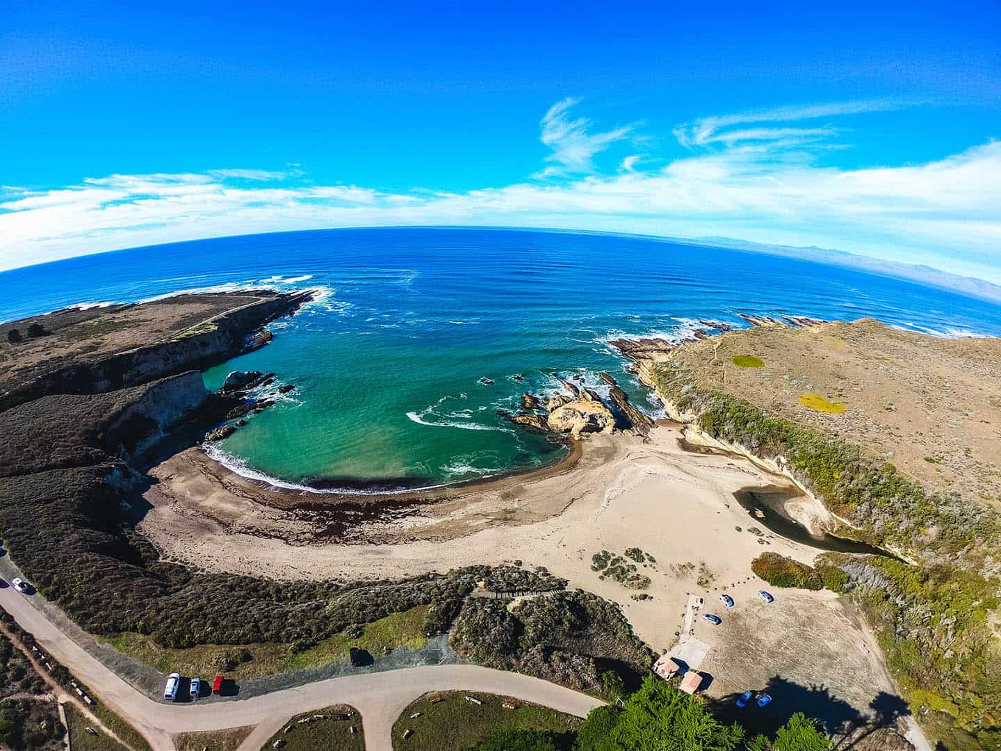
Scenic Views of the Avila Bay
Anyone who cruises Avila Beach Drive through Avila Beach can tell you what a stunning ocean-side drive it offers. But the hidden vistas and lesser-known views from historic Point San Luis Lighthouse are absolutely worth the hunt.
Pick up Lighthouse Drive near the end of Avila Beach Drive, before it terminates on the Harford / Port San Luis Pier. This will eventually lead you out to Point San Luis Lighthouse. The best place to stop is at the Point San Luis Lighthouse parking lot . Along the way, enjoy the remote coastal scenery, from both sides of the vehicle. At the parking lot, you’ll have access by stairs to a secluded beach cove, as well as the trailhead for the Pecho Coast Trail .
Pro tip: This Lighthouse Drive excursion is a much less-trafficked scenic drive than the more well-known cruise out to Pirate’s Cove off Cave Landing Road. Pirate’s Cove definitely delivers on amazing views, along with a bluff trail and a clothing-optional beach — but it can be very crowded. The best place to stop for this alternative adventure is in the parking lot at the end of Cave Landing Road .
For other activities nearby, like hayrides at the Avila Valley Barn or kayaking, paddleboarding and sport fishing, check our Avila Beach Road Trip Map .

Refresh the Soul with Uncrowded Beaches and Coastal Hiking
Think “California beaches” and you might picture busy spots where folks compete for space on the sand and in the surf. Not so here. The beaches on this stretch of Highway 1 are remarkably uncrowded and open, with sunshine and space aplenty in which to revel. Even better, these beaches are accessible right off the road, making it easy to turn any day into a spontaneous beach day. You’ll also find coastal hiking trails of various lengths and difficulty off Highway 1. Pull off and take a quick jaunt down to the beach or spend the day exploring the coastal plains, forests, and shoreline via winding paths. Breathe in the salty-fresh air and feel your workaday cares melt away. Reconnect with yourself, your friends, your family, and your planet. With something for everyone, Highway 1 beaches and trails offer a special way to restore your spirit and experience roadside coastline wonder.
Find Uncrowded Beaches and Wide-Open Spaces
We all long for space: space to breathe, space to explore, space to think. Thanks to our year-round comfortable climate and under-the-radar location, nearly every corner along our Highway 1 Road Trip is wide open and welcoming. Beaches offer miles and miles of unspoiled white sand and lush scenery that will take your breath away. Over a dozen state parks stand with gates open, begging to be explored. Trails for hiking, biking, and horseback riding fan out in every direction. Need your space? You will most definitely find it here.

Park for Coastal Hiking
The 100 miles of pristine coastline between Ragged Point and Nipomo comprise one of the world’s greatest playgrounds for hikers of any ability. Whether you want a casual boardwalk stroll, a moderate hike out to a waterfall, or a strenuous climb, your perfect hike is here. Pick a destination along Highway 1, find a spot to park, then locate the trailhead and start walking. It really is that easy — no need for 4-wheel drive, mosquito hats or topographical maps! Around here, coastal hiking is a regular part of everyday life, not just for special occasions. Do as the locals do and keep it simple and spontaneous, pulling over whenever you see a trailhead sign. Along Highway 1, they’re easy to find. No matter which hike you lace up for, you’ll always be within reach of secluded beaches, panoramic views, and curiosity-satisfying flora and fauna.
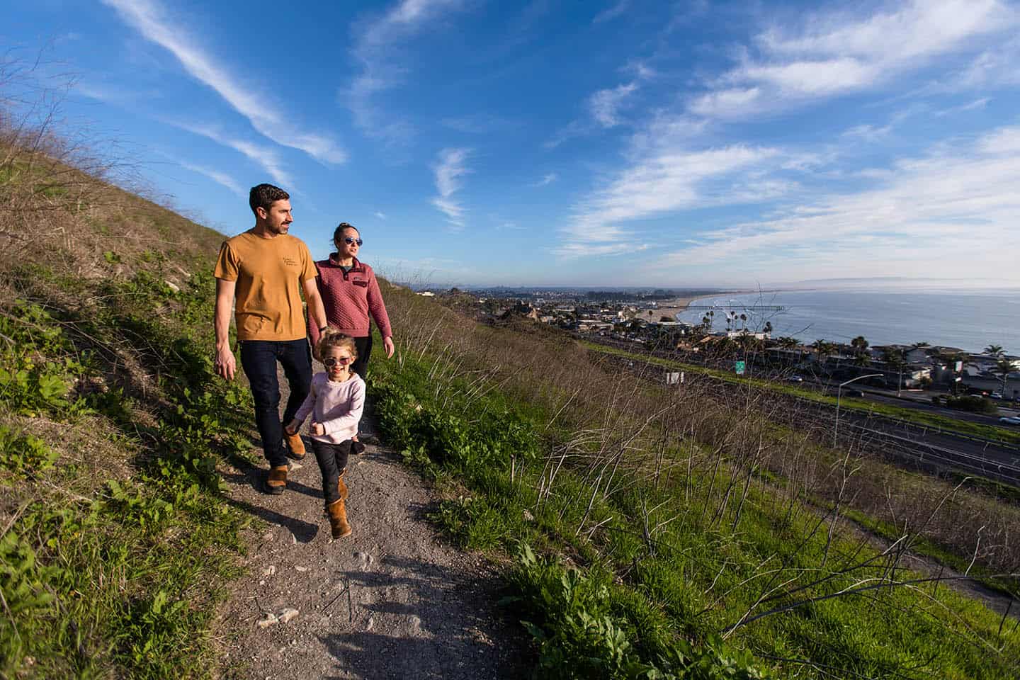
Park and Stroll the Estero Bluffs State Park
One of the best bang-for-your-buck walks off Highway 1, the Estero Bluffs trails can be explored a little or a lot. In other words, you don’t need hours to enjoy this dramatic state park. The trick is knowing where to find the 7 pull-outs that lead to the trails, midway between the towns of Harmony and Cayucos. These are nondescript dirt turnouts just off Highway 1 that can easily be missed without local know-how. If you find them, they’ll grant access to a magical coastal walk to view the state park and its namesake, the Estero Bluffs. Alternatively, you can just park and enjoy the ocean views from the comfort of your car.
For more activities to tackle en route to Cayucos, check out our Cayucos Discovery Loop Map . Here you’ll find ideas for your trip, like tasting cookies at Brown Butter Cookie Company and surfing and swimming at Cayucos State Beach.

Be Surprised and Amazed with Wildlife
People aren’t the only ones who value life along Highway 1 — animals do, too! Just like us, they enjoy the mild climate, towering mountains, lush forests, and coastal riches. Opportunities abound to witness wild creatures in their natural habitat here, as well as those just passing through. Highway 1 lies just beneath the Pacific Flyway, a superhighway in the sky for birds migrating between Canada and Mexico. Birders from all over come to our coastal communities to spot rare birds and log their findings. It’s also a hot spot for whale watching, with gray whales, humpback whales, blue whales and even orcas cruising offshore seasonally. (The Whale Trail organization has even named ten recommended whale watching spots here — the most of any area in California.) Each winter in Oceano, thousands of Monarch butterflies take up residence in a grove of eucalyptus trees, delighting visitors and locals alike. Also in late winter, huge populations of the Great Northern Elephant Seal show up to mate, pup and molt onshore in San Simeon. We even have zebras (yes, zebras!) that are descendents of those owned by billionaire William Randolph Hearst at Hearst Castle.
Elephant Seals & the Piedras Blancas Light Station
Driving the Pacific Coast Highway, it’s easy to see the Piedras Blancas Light Station from the road, but it’s not a close view. Some people park at the light station’s gated entrance to get a peek at it, but there’s actually a better way.
As an alternative, park at the Elephant Seal Rookery viewing area, where thousands of Elephant Seals can be seen mere steps away. Enjoy viewing the wildlife, then walk the adjacent Boucher Trail , which travels to the Piedras Blancas Light Station , built in 1875. This easy 1.9-mile walk parallels the coastline and provides more chances for wildlife viewing. You can even schedule a tour of the Light Station on your way, making this one of the Central Coast’s best two-for-one itineraries. Access to the light station grounds is by guided tour only.
For this adventure, the best place to stop along Highway 1 is at the Elephant Seal Vista Point . In addition to elephant seals and lighthouses, San Simeon offers many more things to see on Highway 1. Travel back in time with a tour of opulent Hearst Castle, the home of historic newspaper baron William Randolph Hearst. Or pull over to glimpse the famous zebras of Hearst Ranch, descendants of those in Hearst’s private zoo, still roaming beside Highway 1. These ideas and many more are available on our San Simeon Activity Map .

Zebras Along Highway 1
For decades, people have pulled over on Highway 1, shocked to see zebras grazing on the plains of San Simeon. Native to southern Africa, they are a sight to behold here, amongst the coastal cliffs, towering mountains and grandeur of Hearst Castle. It’s no accident that these zebras reside near Hearst’s magnificent estate: they were once members of his private zoo. He called his menagerie the “Hearst Garden of Comparative Zoology,” and it was the largest private zoo in the world in the 1930s. The zoo included lions, leopards, jaguars, tigers, grizzly bears, orangutans and an elephant, among other species. A lifelong animal-lover, Hearst hired a full-time veterinarian to his staff to care for the animals and ensure they were healthy and safe. When Hearst lost much of his fortune in 1937, he began dismantling the zoo — a process that lasted 15 years. Even then, the Hearst zoo never fully disappeared; zebras continue to cruise the property, as well as several other descendent species. Spying the zebras’ iconic black and white stripes along Highway 1 is one of the great pleasures of traveling this equally iconic roadway.

Butterfly Groves and the Oceano Dunes
Thousands of Monarch Butterflies migrate to the eucalyptus trees within the Pismo State Beach Monarch Butterfly Grove each year. Directly on Highway 1, this incredible sight is one of the easiest wildlife viewing opportunities available on the Central Coast. The best place to stop on your Highway 1 road trip is the Monarch Butterfly Grove parking lot , just south of Pismo Beach.
After marveling at the Monarchs, drive 2 miles south to discover California’s only drive-able beach! The best place to stop for this is at the entrance to the Oceano Dunes Natural Preserve . The ideal time for most vehicles to drive the beach is during low tide. Stick to driving over the hard-packed sand closer to the water to avoid getting stuck in the soft sand further from the shoreline. (Find a tide table for this area at Central Coast Weather .) Parking is also available at the park’s entrance for those who can’t or don’t want to drive onto the beach.
Pro tip: South of the Oceano Dunes Natural Preserve lies Oso Flaco Lake, which drains into the ocean via Oso Flaco Creek. While this area is well worth a visit, crossing the creek without a four-wheel drive vehicle is not recommended.
Can you ride motorcycles on the beach? Yes, you can; in fact, it’s welcomed. Keep in mind that it’s recommended to stay on the hard pack sand unless you’re riding a full enduro or dirt bike. That said, if you have the right kind of bike, you can easily venture deep into the dunes — a bucket-list adventure, if ever there was one. Dirt bikes are available for rent, along with ATVs, dune buggies and just about any other kind of vehicle you can think of.
For more activities nearby, including stellar golfing and side-splitting comedy at the Great American Melodrama, download the Oceano / Nipomo Road Trip Map .

Pacific Coast Highway Motorcycle Trip
The jaw-dropping stretch of Highway 1 between Big Sur and Santa Barbara County is often considered one of the best roads for motorcycling in the nation. Here, the climate is mild most of the year, perfect for freewheeling under the sun. Each of the destinations and drives below work just as well on two wheels as they do on four or more. The diversity of terrain will excite even the most veteran rider, while giving novices and easy riders plenty of choice.
Before embarking on a Highway 1 motorcycle trip, be sure to plan your itinerary to travel both north and south on Highway 1. For instance, if you’re traveling from San Francisco to Los Angeles, be sure to take Highway 1 both directions. This will give you right-side views of the ocean driving southbound, and easier and safer access to turnouts, since turning lanes are rare on Highway 1.
Also, you can of course ride in on a motorcycle, but you can also drive in and rent a motorcycle while here. This is a good option for those who want the comfort of indoor travel over long distances, and the thrill of motorcycling to explore the Central Coast. That way, you can tour Highway 1 at your leisure.

Top 10 Reasons You Should Take a Highway 1 Road Trip
It’s the journey, not the destination! When it comes to taking a road trip on Highway 1, you’re bound to enjoy every mile along the
#Highway1RoadTrip
Sign up to receive your free Highway 1 Beaches map with insider knowledge to the best beaches for your Highway 1 roadtrip.
- Search Please fill out this field.
- Manage Your Subscription
- Give a Gift Subscription
- Newsletters
- Sweepstakes
- Destinations
The Perfect Pacific Coast Highway Road Trip
Where to stay, eat, and sightsee on the drive between San Francisco and Los Angeles.
Laura Itzkowitz is a freelance writer and editor based in Rome. She has been contributing to Travel + Leisure since 2014, when she started as a fact checker before becoming a contributing digital editor in 2015 and going freelance in 2016. She has also held positions as a contributing editor at The Points Guy and the NYC cities editor at DuJour Magazine. In addition to Travel + Leisure , her writing has appeared in Architectural Digest , Surface Magazine , Brooklyn Magazine , T Magazine , The Wall Street Journal , Vogue, GQ, Departures, Afar, Fodor's, Town & Country , Condé Nast Traveler , Robb Report , Hemispheres, and others. When she's not jetsetting around Italy and beyond, she can be found in Rome, enjoying some cacio e pepe or relaxing at home with her husband and two dogs. Originally from the Boston area, Laura moved to New York City in 2011 to pursue a master's degree in creative writing and translation at Columbia University. She also holds a bachelor's degree in French from Smith College. * 10+ years of experience writing and editing * Co-wrote "New York: Hidden Bars & Restaurants," an award-winning guide to New York City's speakeasy scene published by Jonglez Editions in 2015 * Contributed to "Fodor's Brooklyn," published by Penguin Random House in 2015, which won silver in the Lowell Thomas Travel Journalism competition * Contributed an essay to "Epic Hikes of Europe," published by Lonely Planet in 2021 * Updated the 2022 edition of "Fodor's Essential Italy"
:max_bytes(150000):strip_icc():format(webp)/Laura-Itzkowitz-7768a0f140c54a79a100af7f9a83e829.jpg "travel hwy 1")
California’s Pacific Coast Highway is one of America’s most scenic drives, with stunning bluffs and designated vista points featuring sparkling ocean views. While Highway 1 extends more than 600 miles, the most photogenic stretch can be found along California’s Central Coast between San Francisco and Los Angeles. In addition to picturesque panoramas, this classic road trip offers plenty of restaurants (Korean barbecue!), beaches (Santa Barbara!), and attractions (the Henry Miller Memorial Library!) along the way.
I hit the road with the mission of plotting out the best itinerary for a weekend trip from San Francisco to Los Angeles. Here's my play-by-play guide, complete with stops for photos in Big Sur, antique shopping in Solvang, and craft cocktails at one of L.A.'s coolest bars.
Looking to finally take that perfect Pacific Coast Highway road trip? Read on.
Breakfast at the Ferry Building Marketplace in San Francisco.
If you're departing from San Francisco, it's a good idea to kick-start your Pacific Coast Highway road trip with a hearty breakfast. Welcome to the Ferry Building Marketplace on the Embarcadero, an 1898 transit hub that's something of an icon thanks to its handsome white clock tower. Inside, you'll find artisanal bakeries, cheese shops, cafes, and a mushroom shop. Grab a cup of joe from the Oakland-born Blue Bottle Coffee and a pastry at the Acme Bread Company .
Stop for photos at Bixby Bridge in Big Sur.
Valerie de Leon/Travel + Leisure
It'll take you about three hours to reach Big Sur from San Francisco, and by then you'll be ready to stretch your legs. As soon as you hit the section of the Pacific Coast Highway connecting Carmel-by-the-Sea to Big Sur, you'll start seeing vista points where you can pull off the road and take photos. Be sure not to miss the one approaching Bixby Bridge. Sure, there will be plenty of other tourists getting out of their cars to take selfies, but with a stunning view like that, how can you blame them? Join in and snap away — you'll want to remember this landscape forever.
Lunch in Big Sur with breathtaking views.
After you've filled your camera roll, it's time to fill your stomach. If you feel like splurging, the Post Ranch Inn's restaurant Sierra Mar offers a $75 prix fixe lunch menu and a chance to dine at a clifftop restaurant with a breathtaking view of the Pacific Ocean. For more casual fare with equally fantastic ocean views, stop at Nepenthe , which serves sandwiches and salads in a rustic lodge dating back to the 1940s.
Visit the Henry Miller Memorial Library.
Big Sur has inspired many famous writers, and seeing the natural beauty of the cliffs overlooking the Pacific, it's easy to understand why. Walt Whitman wrote about its charms, and the Beats were drawn to the enchanting landscape and bohemian way of life. Henry Miller lived in Big Sur from 1944 to 1962, and his experiences informed his book "Big Sur and the Oranges of Hieronymous Bosch." After Miller died in 1980, his good friend, the painter and writer Emil White, founded the Henry Miller Memorial Library within his own home — now an art-filled reading room, bookstore, and performance venue in the heart of the woods.
Spend a night in Big Sur.
If you want to stay overnight in Big Sur, the Post Ranch Inn is an excellent choice. There's also Alila Ventana Big Sur , which landed a spot on the T+L 500 best hotels of 2023 list and boasts villas and glamping tents spread out over 160 acres of redwood forest, a restaurant overlooking the ocean, and a spa that uses organic and locally made skin care products. As you sip your morning coffee with views of the Pacific, you might never want to leave.
Stop to see the elephant seals in San Simeon.
As you continue south on the Pacific Coast Highway, you won't want to miss the Elephant Seal Rookery at San Piedras Beach in San Simeon. Over 15,000 elephant seals migrate here every year. From the viewing platform, you can watch them sunbathe and flop around on the sand.
Get your retail fix in Solvang.
Nestled in the Santa Ynez Valley is the charmingly anomalous town of Solvang , which was settled in the early 20th century by Danish pioneers. Take a quick detour off the Pacific Coast Highway to explore quaint streets full of Danish architecture, antique shops, restaurants, and more. The town square features a bust of Hans Christian Andersen and a replica of Copenhagen's famous Little Mermaid statue. Pop into the family-owned Mortensen's Danish Bakery for strudel, butter cookies, and other treats.
Rest and refuel near Santa Barbara.
You'll be ready for a good meal and some R&R at one of the best hotels in Santa Barbara after a full day of driving. Just outside of Santa Barbara, The Leta Santa Barbara Goleta, Tapestry Collection by Hilton, offers both — plus cocktails and SoCal vibes. The easygoing hotel centers on the pool, where bands perform some evenings, and people gather around fire pits with margaritas and beers. Grab a table at the restaurant and order fish tacos, ahi poke nachos, and cauliflower tempura for an eclectic feast. After dinner, unwind with a nightcap at the bar or head up to your room, with its plush bed, coastal furnishings, and turntable.
Breakfast at Renaud's Patisserie in Santa Barbara.
In the morning, head over to Renaud's Patisserie , a Santa Barbara institution just a short drive from the Leta. Sample their excellent pastries, or order organic eggs prepared any style for a heartier meal.
Enjoy the art and views at the Getty Center.
Before heading into the heart of Los Angeles, stop at the Getty Center to get your culture fix. Oil tycoon and art collector J. Paul Getty originally built the Getty Villa in Malibu to house his collection of European art. His foundation continues to fund the museum and the Getty Center, designed by Richard Meier. Ride the tram up to the top of the hill and spend a few hours exploring the galleries and grounds — they have excellent views thanks to their elevated vantage point.
Explore Los Angeles' most dynamic neighborhood.
The Line LA is not only a great base for exploring the city's hip Koreatown neighborhood, but it's also a destination in and of itself. The hotel's revamped midcentury building features a raw but polished aesthetic (think exposed concrete custom furnishings and original art), a great restaurant by renowned chef Josiah Citrin, a cafe, an outdoor pool, and multiple bars including the '80s-themed Break Room 86 (complete with private karaoke chambers). Be sure to request a room with a view of the Hollywood Hills — the beds face the windows. so you can wake up to a stunning vista.
Feast on Korean barbecue at Park's BBQ.
While you could easily stay within the bounds of the Line and dine at Openaire , you'd be remiss not to venture out and see what else the neighborhood has to offer. Beeline to Park's BBQ , a no-frills restaurant in a strip mall, for authentic Korean barbecue that draws locals and celebrities alike. Feast on shrimp or Wagyu beef grilled tableside and a smorgasbord of sides, including veggies and savory kimchi pancakes.
Related Articles
Top Tips For Driving Highway 1: Ultimate California Road Trip
Update: April 1, 2024
BiG SUR IS CLOSED! Do not try to drive to Big Sur and do not attempt to go to any of the state parks in the area. Part of the highway washed out over the Easter weekend.
For more information check here and the Caltrans Social media channels .
The Ultimate California Road Trip
Want to take the ultimate California road trip? Drive California’s Highway 1 (aka Pacific Coast Highway) along the Central Coast. It’s rightfully rated as one of the top road trips in the world.
This is a particularly breathtaking drive, especially along the Big Sur coast where the Santa Lucia mountains plunge into the sea, and the wind bends the native cypress trees into otherworldly shapes. You’ll see coves painted in shades of turquoise, sapphire, and teal, that will make you long to plant your flag and declare that beach your own.

Photo courtesy of See Monterey
Before you embark on the ultimate California road trip, let me share some of my top tips to help you along the way . While it’s a fun drive, it can be very challenging and demands 100 percent of your attention.
I’ll also share some of the top attractions from Monterey to Cambria . Keep in mind this is a small selection. Honestly, there is so much to see and do, especially if you’re an outdoor enthusiast, I can’t cover it all in one article.
Be sure to read 5 Things to Love About Monterey which includes information about restaurants and tours in the area. You’ll also find there are more than 5!
How long does it take to drive California Highway 1?
The trip takes about five hours if driven at a leisurely pace. I drove both north to south and south to north (Monterey to San Luis Obispo). Most people prefer driving north to south and I agree because that way the ocean views were on my right side and it was easier to pull off at the turn-outs to take pictures.

Top tips for the ultimate California road trip
Tip: 1 drive a comfortable car.
Driving a comfortable and reliable car is a must. This is a two-lane mountain road. In some places, the shoulder is quite narrow, and there’s not much between you and the sea below. There’s a forty to fifty-mile stretch that’s full of hairpin twists and turns. Since you’ll be pulling over a lot to take photos and admire the views, it’s a good idea to drive a car that picks up speed quickly.

Asilomar Beach, Pacific Grove
Tip 2: When is the best time to go?
The short answer is to go in the off-season. The main reason to go in the offseason is probably obvious, but let me be clear: driving this road with heavy traffic would make it that much more challenging. The distance from Cambria to Big Sur is only 60 miles but it takes at least two hours depending on how many stops you make, not to mention the curves in the road make the distance pass a little more slowly.
California gets plenty of sunshine and it’s not that cold in the winter– even in the offseason the weather is temperate. I was there the first week of January and it was chilly in the mornings but sunny; and got warmer as the day went by. Just be sure to wear layers that you can easily remove and you’ll be fine.
If you go during the off-season, the only activity that you may miss out on is working on your tan. You can still surf, hike, go whale-watching, and enjoy everything else that makes California so popular.
Winter Weather warning
One possible drawback to the winter – winter is the rainy season. Be sure to check for updates on the road conditions. Excess rain in California can mean road closures due to mudslides.
Here’s a great article from USA Today about whale watching on the California coast.
Tip 3: Fill Up Your Car
Be sure you’ve filled up the car with gas before you hit the road. There are 40 miles of highway between Cambria and Big Sur–and no gas stations.
Tip 4: There are no bathrooms
If you need to use the bathroom, don’t wait. Again, there’s no place to stop, even on the roadside. The only places to pull over are turnouts where there will be other tourists. No privacy.
Tip 5: Take Your Time
Don’t rush it. A California coast road trip is one of the bucket list experiences that people dream about. Take your time. Smell the ocean air. Notice the natural beauty around you; stop and look for whales migrating up the coast, then, feel the tension leave your body. Relax, you’re in California. Do you feel it?

Just a typical view along California’s Highway 1
Tip 6: Charge Your Camera
Make sure you have a great camera with you, and that you have a fully charged battery and plenty of memory on the card. Be sure to ask someone to snap a photo of you in that stunning scenery. I saw plenty of people with selfie sticks at vista points, it’s an option if you’re traveling alone. Your phone is also a great camera and many times it’s the best choice.
Tip 7: It’s Better To Drive Than Ride
If you suffer from carsickness it’s best if you drive because once you enter the Big Sur area the road is a bit of a roller coaster. If for some reason you cannot drive, be prepared with some non-drowsy Dramamine. It would be a crime to fall asleep on this bucket list road trip.
Have questions? Feel free to email me via my contact page and Subscribe to receive more useful content like this
Top Attractions Along California Highway 1

Hearst Castle
The story goes, that when publishing mogul William Randolph inherited 40,000 acres of California coastal land from his mother, he told architect Julia Morgan, that he wanted to “build a little something.” That little something was Hearst Castle.
As a young boy, Hearst and his father spent a lot of time camping on the land around San Simeon. The glamorous castle, once his private residence, is now a state park and vacation destination about twenty miles north of San Luis Obispo.

Tour Heart Castle
I took the Grand Rooms Tour. T hough the house is a magnificent example of Mediterranean and Gothic architecture, filled with antiquities from all over the world, my favorite part of the tour was the indoor Roman Pool . From the exquisite blue tile work to the soft ambient lights, and the mirror reflection of the water, this pool begs you to lose yourself in its deep blue calm.
I loved the stories of famous personalities and frequent guests at the castle who would sneak out to the pool after hours for a little romantic interlude in one of the many secluded corners. Cary Grant was quoted as saying “The Roman pool is a great place to get to know someone just a little bit better.” I wouldn’t mind meeting up with him there at all.

The Roman Pool at Hearst Castle
As you walk through the house imagine all the famous and infamous people that stayed there. As owner of the largest media company in the United States, Hearst entertained the movers and shakers of the world. After the tour, you can wander outside to your heart’s content. Be sure to book a castle tour in advance. Plan to spend at least two hours here.
For more information about Hearst Castle and the various tours available, you can book online .

Elephant seals on the beach near San Simeon.
Elephant Seal Viewing Area
Just five miles from Hearst Castle is the Piedras Blancas Elephant Seal Rookery. These animals are really quite ugly, but very interesting to watch. They’re also really noisy, especially during the mating season. The shore area is dotted with large lava rocks, and it can be hard to distinguish the seals from the rocks when they are in the water. The day I drove past, there was a backup of cars waiting to get into the parking lot. This is another good reason to go off-season or on a weekday.

Imagine building bridges along this road.
Attractions in the Big Sur Area
Bixby bridge.
This may be the most photographed bridge in California, aside from the Golden Gate Bridge in San Francisco. Bixby Bridge is a single-span concrete arch more than 260 feet high and 700 feet long. You can park at a turnout at either end to take photographs. Bixby Bridge, along with Garrapata and Rocky Creek Bridge, was built in the 1930s and paved the way for tourism to come to Big Sur. Before the completion of Highway 1, the Old Coast Road was the only access. It remains an unpaved road and is not suitable for standard passenger automobiles.

McWay Falls, a top attraction in Big Sur
Julia Pfeiffer Burns State Park
A great place for hiking, this park is best known for McWay Falls , a 100-foot waterfall that cascades from an 80-foot high drop-off into the cove below. The trail to get there is quite easy and it’s such an iconic spot that you can’t skip it.
Don’t park on the side of the road. You’ll see that a lot of people do, but I think it could be dangerous. There’s plenty of parking in the park itself, at least in the off-season.
The falls used to drop into the ocean but due to a landslide several years ago, now they fall onto the sandy cove. It’s an idyllic spot and one that makes you wish you could access the beach and the falls. There is signage everywhere warning against it. Be smart and admire safely from afar.
Pfeiffer Beach is one of the best beaches in the area. But it is not the beach with the waterfall.
Nepenthe Big Sur
Nepenthe is an indoor/outdoor restaurant best known for its views, but it also has an interesting history. The restaurant and surrounding land have been in the family for over 50 years. It’s still a popular spot with locals and tourists alike. There’s a very nice gift shop with handcrafted jewelry, unique fragrances, books, and children’s gifts, carefully curated from around the world.
The view from Nepenthe, Big Sur
Highway 1 North of Big Sur
After you pass Big Sur it’s about thirty or forty minutes to Carmel by the Sea. Carmel is also known as “the little town in the forest by the sea,” an apt description. Much like a European village, it’s a place to walk, not drive. There are many unique shops, galleries featuring local artists, and great restaurants. The beach there is known as one of the best places on the Monterey Peninsula to watch the sunset.
Carmel was voted #2 Best Small City in the USA by Conde Nast Traveler last year.

Carmel by the Sea
Pebble Beach
A short drive from Carmel-by-the-Sea, Pebble Beach is known for it’s stunning golf links among the sand dunes and the famous 17-mile drive. Do this drive at sunset if you can. Check out my short article about 17-mile Drive and the Lone Cypress.
Monarch Butterfly Sanctuary
I did not have time to visit the sanctuary but the information I found on Wiki makes me want to go.
The black-and-orange butterflies spend much of the fall and winter in the local Monterey Pine trees, roughly from Halloween until Valentine’s Day. Residents of Pacific Grove help the butterfly’s habitat by planting purple and yellow flowers, such as lantana, yellow aster, Pride of Madera, and Mexican Sage, in what is called Butterfly Gardens. from wikipedia

Point Pinos Lighthouse
Since 1855, the Point Pinos Lighthouse has been a beacon for ships on the Pacific coast . It’s the oldest continually operating lighthouse on the West Coast and is on the National Register of Historic Places. Hours of operation are Thursday – Monday 1:00 – 4:00 pm.
A personal side note: I left a ring in the bathroom at the lighthouse and didn’t realize it until I was back in my room several hours later. Luckily I thought to check if they had a Facebook page. I left a message about leaving the ring in the bathroom and asked if it had been found. The next morning, I was on my way to pick it up. You might say the lighthouse provided the lumens I needed to know the best way to make contact with them, thereby reuniting me with my ring. Either way, I will never forget the lighthouse.

Jellyfish at the Aquarium
Monterey Bay Aquarium
Monterey Bay Aquarium opened in 1984, quickly becoming one of the most visited aquariums in the world. Today the aquarium receives over 2 million visitors per year. Located on the north end of Cannery Row, it’s on the former site of the Hovden Cannery, the last cannery to close, in 1973.
Cannery Row
Cannery Row, originally Ocean View Avenue, became famous largely due to John Steinbeck’s eponymous novel. The book was the basis for a film named Cannery Row and starred actors Debra Winger and Nick Nolte. One of the main characters, Doc, was a real person – a scientist- named Edward F. Rickets. His lab still exists and across the street is a Chinese-American-owned store, also mentioned in the novel. Today, Cannery Row is filled with shops, restaurants, and hotels, and is a tourist attraction in Monterey.
I am reading an excellent book about Steinbeck and Monterey by author Susan Shillinglaw, A Journey Into Steinbeck’s California . You can purchase this book at the Aquarium or the Steinbeck house in Salinas. You can also obtain a copy through Roaring Forties Press.
Where To Stay
The Monterey Bay area has a good selection of places to stay from bed and breakfasts to cottages and modern hotels. If you want to be in the middle of it all, stay in Monterey. You are five to ten minutes from Carmel, twenty from Big Sur, and only two hours from San Francisco.

Bungalow at Casa Munras, Monterey, California
Casa Munras
I stayed at the historic Casa Munras, one of the Inns of Monterey . Located just off the 101, it’s an excellent location for walking downtown and to the Fisherman’s Wharf. You can compare prices at this link .
Intercontintental Monterey
A really beautiful hotel right on the water in an excellent location. It’s easy to walk around the historic area of Monterey. If you truly want to be in the heart of Cannery Row, stay at the Intercontinental on Cannery Row.
Great weather almost 365 days a year, a laid-back attitude, and scenery that has inspired romantics, artists, explorers, and adventurers for centuries – any time of year is a great time to take the Ultimate California Road Trip.
Alternate Routes Are Listed Below
If you are driving from San Francisco or the San Jose area, take the 101 south to Highway 156 through Castroville. 156 will connect to Highway 1 where you can continue your journey south, to Monterey.
From Los Angeles take the 101 north to the 156. Alternatively, you can drive the 101 north to Santa Barbara where you will connect with Highway 1 (this is not the most scenic stretch). From there you can drive to Morro Bay and Cayuga, a beautiful stretch of highway. If there are road closures you’ll need to take Highway 46 and reconnect with the 101 to continue north. If your road trip begins or ends in Los Angeles , be sure to visit this historic winery in downtown LA.
Highway 46 will take you to the city of Paso Robles , a great place for tasting Rhone varietals. Or, visit the wine tasting rooms along Highway 46 – there are 40 to choose from!
No matter when you go, California’s Highway 1 is the Ultimate California Road Trip.

Looking north from McWay Falls, Big Sur.
Like the images you see? Please be respectful. If you’d like usage just shoot me an email.
Looking for more articles like this? Sign up for email updates.
Related posts:

Vote! For Bernini, Italy, and Me
Where would you go creating a bucket list, if you liked this article check out another.

8 Things To Do: First Time Visitors To Seattle, Washington

7 Things To Do For A Fantastic Experience In Glen Rose, Texas

Top Things To Do For A Perfect Weekend In Santa Barbara, California 2024

How To Have A Solo Adventure In Enchanting Bath, England

6 Fascinating Dark Tourism Sites In France You Shouldn’t Miss
96 comments.

Hi Penny, we are planning a 3-week tour through the western USA at the end of July to mid-August (SF – LA – LV – Death Valley NP – Yosemite NP – Sac – SF). Of course we also want to drive Highway 1 and hope that it will be passable again at that time. Your report is very inspiring, we will definitely consider many of your tips. Best regards from Germany, Juergen

I hope you’re planning on spending a month or two here! 🙂 You’re covering a lot of pretty places. Enjoy! Reach out if I can help, which means ask me about California but not LV. Also, I haven’t been to Yosemite, yet! Can you believe it?
Just by the way, I’ve seen all 3 seasons of “Emily In Paris”, the 4th is due to be released on Netflix in August. On our trip we will visit Alcatraz in S.F., Death Valley NP and Yosemite NP. In your opinion, is it better to buy the AMERICA THE BEAUTIFUL Annual Pass or to pay the fee for the parks individually? And you’ve never been to Yosemite? Unbelievable! I’ll report back to you 😉
Yes please do let me know! I’ve never been to any of those places. I mean I’ve been to San Francisco, LV, Sac, Los Angeles, many times etc. You know there’s a nice little area called Muir Woods near SF. About the park pass, that’s a good question. A quick google search regarding fees for Yosemite and Death Valley, it looks like 65 to go to those two places. Not sure if Alcatraz would be included in that pass. If you think you might go to more parks then the 80 USD for the pass seems maybe a good deal. https://www.nps.gov/aboutus/entrance-fee-prices.htm
Also, check if you can buy an REI membership. For 30 dollars it’s good forever. And you can return things. But if you don’t need to buy anything for your trip then maybe it’s not good for you. But if you love camping, the outdoor life, etc. you’ll love REI. About Emily in Paris, so do you agree with me about the episode and the luggage?!
Also, I really need to update those about pages!

This is a great resource for anyone planning a road trip down Highway 1! The Big Sur coast is definitely one of the most scenic drives in the country, and your tips about avoiding crowds and renting a comfortable car are spot on.
I was wondering if you had any recommendations for places to stay along the way? There are so many great little towns and stops, it would be hard to decide where to base yourself for the night. Thanks!
Hi there, glad to hear you found the article useful. Where to base yourself is actually pretty easy. Monterey, Carmel by the Sea, and Pacific Grove (all north of Big Sur) are all within a stones throw of each other. There are two hotels mentioned at the end of the article that are in Monterey but there are many others. I enjoyed staying in Monterey and if you stay in the historic area you can walk everywhere. But, I also stayed in Carmel by the Sea, Carmel Valley, and in Big Sur. Here’s a link with more hotel options. https://www.adventuresofacarryon.com/lodging-options-cambria-to-carmel-california/
[…] about five hours north of Los Angeles and two hours south of San Francisco on California’s Central Coast, the sublime scenery attracts artists, photographers, tourists, and locals, all of whom come for […]
[…] January, I packed the car and headed north to discover California’s Central Coast and drive iconic Highway 1 from Los Angeles to Monterey County, staying in Cambria, Big Sur, and […]
[…] boomers road-tripping in the Golden State, Penny Sadler offers Top Tips for Driving Highway 1: Ultimate California Road Trip. But even a walk in the neighborhood can be an adventure, she says with a laugh. (If only at our […]

My driver will drive an International 24 passenger bus from a town called Seaside, CA 93955 going on to Hwy 1 to Los Angeles, what is the best route please?

I love your detail article! I am taking my husband for the first time to Monterey Bay on September 3, and I am so excited!! This will be my third time going to Monterey Bay, and I’ve already made my list of stops to see along route 1. I will be driving from Los Angeles to Monterey Bay so he can see the most beautiful aquarium and walk the beach, see Cannery Row. Thanks for the additional point of interest.

Hi there, We visited CA last year and drove down Hwy 1 from San Francisco to the Paso Robles area, and used your guide every step of the way. We took many of your suggestions of where to stop, sights to see, and places to lodge and eat. We really enjoyed all of your suggestions. So I just tried to find that online guide again, and can no longer find it. Wondered how we can get to it? We are traveling this fall from Santa Barbara down to Newport Beach and would like to use your guide again. Thank you!!!
Hi Brenda, First of all, thank so much for the message. As a writer and blogger I focus on writing what I love and hope that others will too. Your affirmation means a lot. I’m not sure what guide you speak about though as I have several articles about traveling on Highway 1 from Cambria to Monterey, but they are not in a guide format. I don’t have one for Santa Barbara to Newport Beach either, but there are many articles about what to do in Santa Barbara, especially where to go wine tasting. You may have read one of my articles published on another site perhaps? There’s also an article about a few sites along the Malibu coast and the Getty Museum, downtown LA, Long Beach and a few others. Just look under destinations, Californai. Hope this helps! I’m actually working on some new content for southern California. Thanks for being a loyal fan and reader. I’d love to hear from you how you think the site could be a better resource. Cheers!

I would like to travel highway #1 in July this year from San Francisco to LA. What is your suggestion what to see and for how many days travel.
Hi there, There is a lot of content about what to see along the way in the article. Of course, there is also much more. I’ve also provided links to other websites that can provide more information to help you plan your trip. If you’ve never done the drive before, I’d allow at least 5 days, with overnight stops at your desired locations. Of course, what will be open may dictate where you stop. If you’d like me to map out an itinerary including hotels for you I can send you a questionnaire to fill out and we can go from there. Just send you info through the contact form on this site. Thanks!

Hi, love this article! Me and my partner are also planning on doing San Fran to LA this July. Have you got any tips on car hire? Also, if you have this itinerary still, I would be really grateful to have a copy? Thank you so much!
Hi Dee, Sorry I’m just getting around to approving article comments. I don’t have an “itinerary” but you can make your own via the article. I was traveling on my own so I just stopped where I wanted to really. As for car hires, I’m really sorry but I have not rented a car in a long time.

Hi Penny, I am travelling to the US for the first time and would like to get the link to the questionnaire as I am planning to rent a camper van and drive from San Francisco to LA for 5 days. Looking forward to your reply and guidance on the road map itinerary.
Hi there, I’m not sure what questionnaire you are referring to?

place me on your email list

Thanks for the tips. My sister and I are planning this drive from Seattle in March. We are so excited! Glad to hear the road is clear through Big Sue!
You will love it. Be sure to read my other article Reasons To Visit Monterey, California. There’s more info, not the same …

Awesome post, Penny. Very informative and helpful. I’ll be going to Monterey next week and plan on driving along this coast. Thank you so much for all the fantastic tips.
Glad to know that you found it helpful. That’s what it is all about!

Hi Penny, Just want to say I enjoyed this report as Im in California 4 weeks today for a 24 day holiday. Travelling from Spain where I live now. So looking forward to the drive down the PCH isn´t fully booked yet as trying to cram so much in. We have 4 days in San Francisco booked (Tues to Sat) then pick up hire car and move to Vallejo (six flags) for 2 days(Sat and Sun). next booked in at Santa Cruz for a night (Mon)and next day booked in at Monterey(Tues). Now we have nothing booked until we arrived in Downtown L.A (Sat to Sat). Obviously we don´t want to rush but would lo love to be in San Diego by the Friday before heading to L.A Saturday afternoon. So we´re thinking as leaving Monterey (Tues), next night stop Cambria or San Luis Obispo(Weds) , then next stop Santa barbara or Ventura (thurs) and travel to San deigo on the Friday morning. In your opinion do you think we have given us enough time to see everything or are we cramming too much in? San Diego isn´t a must but would love to see it. Would it be safe to just drive and book when we want to stop? After L.A. we have two free days to get to Las Vegas where we drop off hire car and have booked 4 nights before heading home. Any help would be appreciated. Regards Rob and Kike.
Hi Rob, I’m afraid I’m not clear exactly what you’re doing but I can say that I would spend at least 4 days in the Monterey/Big Sur area. Have a great time!

How many beaches, state parks, and national parks did you visit along your trip? I am debating buying a California Explorer Vehicle Day Use Annual Pass ($195) and/or a National Parks & Federal Recreation Lands Annual Pass ($80). Do you think it would be worth it or should I just plan to pay as I go?
Hello Dakota, I can’t really say if you’d find it worth it or not. I didn’t actually visit that many because I had limited time. If you’re going to have more than a week or two it may be worth it to you. Maybe decide where you want to go and add up the costs individually compare to the passes?

Amazing tips for highway driving. Thaks for share for fantastic this tips.
Thanks Lisa!

Loved ur writing!! Question for you? I have done the Carmel to big sur route in the past and have to agree it’s truly amazing! I am heading to Napa now and want to do the northern shore (1 North) – is it as good as this one? Ocean on one side and mountains on the other? Thanks!
Hi there, I can’t really comment. I’ve only been as far north as River’s End at Jenner Beach. However, my friends from the area say yes! Enjoy your trip!
[…] and explore. For boomers road-tripping in the Golden State, blogger Penny Sadler offers these “Top Tips for Driving Highway 1: Ultimate California Road Trip.” But even “a walk in the neighborhood can be an adventure!” she laughs. (Now if only at our […]
[…] cost you a fortune, either. Join me on a photo walk along California’s famous Pacific Coast Highway. We’ll stop for happy hour and watch the surfers ride the waves. Then, we’ll continue […]

Thank you for sharing all this info of this wonderfull place! I’m from Brazil and planning driving from San Francisco down to LA next year with my boyfriend, but we can only go by the end of March. Could you please tell me what to expect in this time of year? We’ll probably be in SF on March 20. I’ve read a lot about the weather but nothing conclusive…I understand it’s in the very beggining of spring and can still be a little cold for brazilian references. It’s not the cold we are worried about but the cloudy days! Can you please help me? Thanks!
Hi Emilia, Unfortunately it is very hard to predict. This year California had a lot of rain but next year, who knows. The end of March should be ok. There could be fog in the mornings and sunshine in the afternoon. Ultimately, does it matter? Go and have a great time enjoying the beauty – never mind the weather!
Hello Penny, thanks for the feedback! Actually that’s what everyone says right? It’s beautiful no matter when! We are thinking perhaps we should postpone the trip and go on september or novemeber, would it be better?
It might be warmer but I don’t know what to tell you. Go when it works best for you. Off season will be less expensive. Maybe that’s a factor?
Well it could be! I’ve done a little research and people say it’s the best time to visit… I think we will stick to September! Thank you!

It’s really a cool and helpful piece of information. Thanks for share.
Thanks Lara

Amazing and informative road tips about California! I did not know most of them. Thanks dear for sharing with us.
So happy to hear you found the information useful. Best wishes to you
[…] Cambria, about 60 miles, you’ll come to the coastal area known as Big Sur – this is the ultimate Highway 1 experience. Travelers who want to immerse themselves in the great outdoors and fall asleep to the sound of waves […]
[…] I’d heard a lot about California’s scenic 17 Mile Drive, it was on my list of recommended attractions in the Monterey Bay area. Would it really be worth it I wondered. I’d just driven Highway 1, the most spectacular coastline I’d seen since my 1999 trip to Italy’s Amalfi Coast. (read my article The Ultimate California Road Trip.) […]
[…] Willow City Loop is one of the prettiest drives anywhere and I should know. I’ve driven California’s scenic central coast and the gorgeous Hudson River […]
[…] meal at the Harmony Cafe is a must when traveling Highway 1 in San Luis Obispo County. Chef Giovanni will woo you with his passion for preparing and serving […]

Your post brought back wonderful memories of a girlfriend’s road trip I did back in the day. I’d love to do it again and this time focus on the outdoor activities instead of just the drive.
Those are exactly my thoughts Mary. It’s a lot to see and the drive is only part of the experience, or it can be the entire experience.

What a dreamy area! It’s definitely one of those places where renting a car makes full sense. We’ve got to head back there soon!
Highly recommend. 🙂

When I was in undergrad, I drove that highway from Stanford to L.A. Solo. Got a ticket on my way back but it was such a wonderful expression of freedom at such a young age, I’m baffled thinking about it. THanks for the trek down memory lane.
So glad you enjoyed it and it brought back good memories.

Love this part of the world.
One tip though, go from Carmel / Santa Cruz in the north to the south. This way, the passenger is overlooking the ocean without another lane in the way (and all those cars in high season) and the driver has a better view too.
For those moments when a glimpse can be snatched while driving that road!
Stop for food at the Big Sur River Inn or Fernwood Resort (also a nice place to stay, they even have cabins in among the Redwood trees).
Hi Jack, I totally agree with you, the drive from north to south is the easier and prettier for caching a glimpse or pulling over. I stayed at the Big Sur River Inn but did not eat there. Interesting place right on the river. Unfortunately it was too cold to enjoy sitting in the river, but the atmosphere and location were perfect.

America really is the best country for road tripping! We went to Monterrey on our trip from Seattle to Vegas and I have to say I didn’t enjoy it. Left after a night!
Hey Bethaney Sorry you had a bad time. I have to wonder where exactly you were. The entire area which includes Big Sur, Carmel by the Sea, Pacific Grove and lots more, is stunning. But if you stayed near Cannery Row or some other more urban touristy areas then I can’t really comment. If you’re ever back in the area go to Big Sur. I’m sure you will love it.

We’re considering this for a mini moon before heading back abroad – great article, and our other ideas have some serious competition!
thanks Cat!
[…] fresh food, and great museums. I recently crossed one of my California wishes off my list – driving Hwy. 1 and seeing Big Sur. That was epic. Of course I’d like to do it again, but slower this […]

I haven’t been on the PCH-1 in a long time. Many years ago, we drove out from Malibu on the 1 in an attempt to arrive in the South Bay Area later that very same day. Riiiiiggghht; yeah, no. Of course, we underestimated the driving time by a ridiculous amount. We decided by committee, and “surrendered” by heading inland at San Luis Obispo, with cuts back to 101 then up I-5 the rest of the way north.
Years later, I’m on a big coach/bus for a comfortably reclined 7-hour ride from Santiago, Chile to the small coastal resort town of La Serena. The drive takes place on Ruta-5 (Route 5), also known as the Carretera Panamericana or the Panamerican Highway. Much of the Chilean Pacific coastline is very similar to scenery along the PCH-1.
Wow that is really interesting. South America is appealing because no time zone change! LOL. I also underestimated this drive because my GPS kept saying it’s only 60 miles. I didn’t factor 60 miles of switchbacks!

Highway 1 through Big Sur is indeed a spectacular scenic drive. Thanks for the great tips & article.
Thank you for the comment!
Thanks for stopping by Marilyn.

Very nice article! I would like to add that gasoline is available in Gorda.
Steve, thank you very much! I remember passing through Gorda. How far is it from Cambria?

California road trips are near and dear to my heart and the Central Coast is amazing. You’ve captured it brilliantly in your photos. Great tips, too. There are so many wonderful places to visit along the way — Hearst is definitely a must. Love your pic of the indoor pool – that’s one of my favorite places in the castle, too.
Cathy I envy you living there. I hope to be able to spend most of my summer there.

I have done this road trip a few years ago. Unfortunately when I visited in August it was quite misty and the views weren´t as clear. It is a beautiful landscape and the perfect drive. It is great to see yoour photos of the trip

I have done quite some Road Trips in the US but I have never done this one. It looks like a stunning trip with lots of attractions along the way. Definitely added to my list, thanks for the great tip !
The US is a great place for road trips. My family used to drive from Texas to California often enough when I was a kid. Now that’s a road trip I could have done without out! LOL

I’ve been top to bottom and bottom to top on the PCH — When people ask me for vacation recommendations — this is number 1 for sure. Nothing like it anywhere!

California is one of thos places I am determined to get to, and this post makes me want to do it even more. Carmel looks like my kind of place, although it all looks lovely.
California is “one of those places.”

Love the look of Carmel, Penny. This sounds like a road trip best experienced from the passenger seat. I knew there was a reason I still haven’t got my licence.
Ha! I hope you have a good driver!

Awesome post, we’re actually leaving for the Highway 1 April 10 so these tips are great! Thanks!
Glad you find them useful.
There is a place just south of Nepenthe – very rustic place to stay – Lucia Lodge. We have stayed there several times. No frills, but breathtaking views!!!
Nancy, I stopped at Lucia because they have a little market there. I hoped to get a look at some of the rooms but they were all booked. I agree it’s in an amazing spot. I’d love to go back and stay there a couple of days though you aren’t close to anything except nature so you have to prepare. 🙂

This post brought back great memories. I’ve only done a few of the side trips – elephant seals and the Monterey Aquarium and for the beauty alone it’s a drive worth repeating. I don’t know if there is a foggy time of the year but that’s the only time I’d really not want to go.
Leah, good point! There is a foggy time of year and I believe it’s summer. Definitely would not be a fun drive in the fog!

ooooh lovely! These photos brought back some wonderful memories of when my friend and I made this tour. We got super lucky at the car rental place, and they upgraded us to a convertible for only $20 extra per day, so that really made the trip and view amazing. We drove from LA up to Carmel-by-the-Sea and then back down the same way we came. Beautiful shot of the jellyfish, by the way! Love that color contrast.
Hi Dana, Yes I did the drive both ways. It’s not easy but worth it. A convertible would be fun! I had a sun roof, not quite the same. 🙂 thanks for the compliment on the photo. I loved the jellyfish!

We just did the coast road trip at Christmas time, It was an amazing trip.we were heading to San Diego. I’m surprised that you didn’t go to” Point Lobos ” It is my favorite place to visit. it also has the beautiful rugget landscape. it was also the setting for alot movie scenes.”A Summer Place”one of my favored movie.
Moneypenny that is also one of my nicknames. 🙂 I now will have to watch a Summer Place.

Penny, check out “The Sandpiper” w/Liz Taylor and Richard Burton for another Big Sur-locale film. It will take you back to a 60s vibe (which still exists in some ways in the area). Nice article and good shots!
I agree. And thanks for the film tip.

VERY top tip: do not head north from LA towards Pacific Grove/Big Sur on Hwy 1 after dark! We left LA around sunset. The lady we were to meet in Monterey/Pacific Grove called to ask where we were, as we should have arrived around 4 PM. I told her we were coming up Hwy 1. She asked if she might suggest an alternative route. I said we’d wanted to see the water and wanted to do this. She wished us luck. Now, back when E-Systems sent me to Stanford to attend an AI seminar for two weeks, I drove *south* from Palo Alto to the Monterey peninsula on Hwy 1, and it was beautiful. Thus I did not expect the AAAAAAA experience of having the sheer cliff dropoff to the ocean on the left and the mountains on the right. Hubby drove this, including the Bixby Bridge (XOXOX), in the pitch blackness with no moon and other cars on the two-lane road coming the other way. He said he enjoyed it and that it was like the first-person videogames he has played. I think my mother began her decline as she clung to the sides of the back seat of the van because she could actually see the ocean. I was looking straight ahead and willing the oncoming vehicles to go more slowly and NOT come into our lane, as there was NOWHERE to go. Man! We arrived at our host house around midnight. Do not do as we did. Do the drive during the day when you can be properly terrified!
Too Funny. You’re right though, very good tip, drive during the day! Otherwise, what’s the point.

Just gorgeous! And what fantastic (and useful) tips – thank you!
Thanks Jessie.
Thanks Tawanna and don’t forget to vote.
Leave a Comment Cancel Reply
Save my name, email, and website in this browser for the next time I comment.
Notify me of follow-up comments by email.
To revisit this article, visit My Profile, then View saved stories .
The Essential Road Trip Itinerary for California’s Highway 1
By Christina Liao

We may earn a commission if you buy something from any affiliate links on our site.
When Pfeiffer Canyon Bridge collapsed earlier this year, Big Sur came to a bit of a halt. California’s crown jewel was now divided into what the locals referred to as the north and south, indicating which side of the overpass you were on. In order to get from one end to the other, residents had to hike up and down a steep trail; vehicular access was cut off, and so was Highway 1. Regarded as not only one of the best road trips in the United States but also in the world, the coastal cruise down this major State Route is on many a bucket list. After eight months, the bridge reopened on October 13, and with most of the freeway now clear, the prodigious drive is calling your name.
The key is to start in San Francisco and head down to Los Angeles so that you’re riding along the Pacific Coast. Plus, it also makes it easier to pull over at viewing points and take those FOMO-inducing Instas. To help you embark on this adventure, we’ve put together a comprehensive itinerary on where to stop along the way as well as mini guides to the major cities you’ll be passing through.

By Hannah Jackson

By Philipp Wehsack
Day 1 If you can, nab a flight that’ll get you to San Francisco by noon to make the most of your first day. Head straight from the airport to The Battery , a chic member’s club that also doubles as a hotel. With only 15 accommodations, it’s intimate and, thankfully, quiet. Once you’ve dropped off your bags, go down the street to Hog Island Oyster Co. and pick up some fresh (and sustainable) mollusks for lunch. For dessert, venture over to their neighbor Humphry Slocombe for a scoop of Blue Bottle Vietnamese coffee ice cream or Golden Gate Bakery in nearby Chinatown for egg tarts that rival those of Hong Kong (just make sure they’re open; the owners have a very sporadic vacation schedule) before you make a beeline to Alcatraz . After you’ve toured the famed former federal penitentiary, wander over to Fisherman’s Wharf where you’ll see hundreds of sea lions at Pier 39, but skip the touristy shops and head back to your room to recharge and freshen up before a stellar dinner at Sons & Daughters . This 28-seat restaurant sources seasonal ingredients from local farms for their ever-changing nine-course tasting menu. Make sure not to skip out on their bread and butter—both house-made, both incredible. And if you’ve still got some energy before you call it a night, enjoy The Battery’s cozy courtyard with a tipple from the bar.

Day 2 Kick off the day with some delicious dim sum at Lai Hong Lounge , a better and much more authentic option than another glitzier establishment in the city. But if you’re not a fan of the Chinese small plates, run over to Mama’s for some classic breakfast offerings, but be prepared to wait as there’s always a line out the door. Then, if you’ve never been, make your way over to San Fran’s famous winding Lombard Street to snap a few photos before venturing over to the famous Golden Gate Bridge, followed by a stroll around Golden Gate Park , the California Academy of Sciences , and a visit to the row of pastel-color Victorian and Edwardian homes known as the Painted Ladies.
Otherwise, fill your time with a little shopping (yes, there’s more to this techie city than hoodies and jeans). Up first: Hero Shop , the brainchild of former Vogue editor Emily Holt . It’s certainly the city’s coolest concept store, carrying designers like Rosie Assoulin , Creatures of the Wind , and Of Rare Origin. Follow that up with a trip to Veer & Wander (if you want a quick snack on the way, swing by 20th Century Café for a slice of fluffy Russian honey cake or Salt & Straw for some inventive ice cream), where the beauty salon has a brilliant selection of products for purchase, Le Point for another well curated clothing boutique, and Taylor Stitch for great shirting and basics.
By now it’s time for lunch and you won’t want to miss out on La Taqueria , a no-frills eatery serving up some of the best burritos in San Francisco. Walk it off in the eclectic Mission District and keep your eyes peeled for vibrant murals (Balmy Alley and Clarion Alley are two great places to start). Afterward, venture back to Hayes Valley for an aperitif at new champagne bar The Riddler before dinner at State Bird Provisions , where dim sum–style plates of modern Californian fare with an Asian influence are carted around the dining room, ready for your taking.

Day 3 Pick up your rental car early in the morning and drive over to Tartine Manufactory , where bread is made in-house daily and a breakfast sandwich is the perfect way to start your day, before you hit the road for Monterey (preferably by 8:00 a.m. at the very latest). Your GPS will tell you to take 280 or 101 for the fastest route, but don’t forget you’re here for a reason, and that’s to take the longer, much more scenic Highway 1. It’ll take you anywhere between two to three hours before you hit the seaside town that has been made even more famous on the HBO hit Big Little Lies . Take in harbor views at Fisherman’s Wharf and, if you want to check out marine life on land, take a spin around the Monterey Bay Aquarium . And while the 17-mile drive through Pebble Beach (where the Lone Cypress resides) passes through an exclusive neighborhood with gorgeous homes and offers great views of the coast, it doesn’t quite warrant the admission fee given what you have in store ahead. Instead, scoot on down to Carmel-by-the-Sea and drive along their beach before dropping by Il Grillo for lunch, a small casual Italian restaurant dishing out rustic plates. (Their homemade pasta is obviously a must.)
Now it’s time to head inland, where you’ll check into the sprawling Carmel Valley Ranch . Spread over 500 acres, accommodations are spacious and there’s plenty to keep you busy. An 18-hole golf course, eight tennis courts, and multiple pools (one of which is adults-only and overlooks the property’s vineyard) are at your disposal in addition to a long list of activities including beekeeping, a variety of fitness classes, visits to the organic garden and goat pen, and nightly s’mores by the fire pit. Once you’ve traipsed around a bit, go back into town for dinner at Cantinetta Luca for more impeccable Italian fare, or just snuggle up in your quarters with room service.

Day 4 Now it’s onto the good stuff: You’re going to Big Sur today! The route from Carmel to California’s forest gem is perhaps the best stretch of the drive, warranting multiple stops along the way. Grab a bite at the hotel before you check out or head back into town to favored bistro La Bicyclette for a croissant and coffee before pulling into Point Lobos State Natural Reserve . With several trails to hike and panoramic vistas of the Pacific Ocean, you don’t want to rush your time here. Take in the limestone rock formations, rugged bluffs, and coves dotted with seals and sea lions while peering out into deep blue waters, keeping an eye out for spouting whales.
Continue on, and you’ll find that there are a number of pull-over spots along the highway for you to step out and take photos of the undisturbed coastline. One in particular is right before Bixby Bridge, an architectural marvel (one of the tallest single-span concrete bridges in the world) that acts as a gateway to Big Sur. Shortly after you’ll come across Point Sur State Historic Park , home to the still-functioning Point Sur Lighthouse. But before you step into Big Sur Bakery for a quick bite, make sure to drive down to Pfeiffer Beach, where tide pools and a natural arch known as Keyhole Rock await. (Note: You might lose cell service along the way, so make sure you have directions saved elsewhere just in case.)

By now it’s late afternoon and you’ll want to retire at the newly renovated Ventana Big Sur . Reopened on October 20, the 160-acre hotel grounds have transformed into an Alila property, with the brand’s namesake spa, two outdoor pools, Japanese bath houses, and an upcoming glass art gallery. Its 59 revamped cabin-like rooms are spacious, each with a private balcony or patio looking out on the soaring redwoods. (They’ve also got a glamping option should you really want to connect with the great outdoors.) Opt for a Big Sur suite, furnished with a woodburning fireplace, a hammock on the deck, and a stone bathroom with a large soaking tub for two, and make sure to grab an alfresco table at the resort’s restaurant for some delectable coastal cuisine by Chef Paul Corsentino.

Day 5 Wake up early and try to hit the road by 8:00 a.m. Your first stop will be a short 20-minute drive down to Julia Pfeiffer Burns State Park , where you’ll hike a short distance to the McWay Falls overlook and set your eyes on 80 feet of cascading water. If you want to stretch your legs some more, check to see if the other trails are open, otherwise, enjoy the rest of the coastal drive ahead. While we wait for the Mud Creek area to recover from a recent landslide, you’ll have to turn off of Highway 1 onto Nacimiento-Fergusson Road to continue south, which actually sets up the perfect opportunity to visit Paso Robles and San Luis Obispo. The former is home to a number of vineyards and distilleries, but the one to visit is Re:Find , where handcrafted spirits are made from saignée (free run juice from wine grapes). They offer a $15 tasting that includes all of their wine and liquor offerings; in the summer go for a refreshing cucumber vodka, while the fall calls for a tangy kumquat liqueur. To assuage a rumbling stomach, drive 40 minutes to SLO and dine at Thomas Hill Organics , where seasonal ingredients come in the form of light and healthy dishes, while others are more indulgent, like their thick-cut fries cooked in duck fat.
After you’ve had your fill, jump back in the car and head straight to L.A. It’ll take you between three to four and a half hours depending on traffic, landing you in Beverly Hills by late afternoon. The renowned neighborhood plays host to some of the finest hotels in the city, such as Viceroy L’Ermitage Beverly Hills , Montage Beverly Hills , Beverly Wilshire , and the brand-new Waldorf Astoria Beverly Hills . Check into your luxurious temporary home and grab a snack at The Blvd —a creative take on a classic dessert by pastry chef Chris Ford will do just the trick—while looking out onto Rodeo Drive.

Once you’ve recharged, do a little shopping on Melrose Place, popping into Cassandra Grey’s cult beauty shop Violet Grey and Vanessa Traina’s chic retail concept store The Apartment by the Line before heading off to dinner at Gwen . As it’s a butcher shop–meets–restaurant, there’s no question that meat is the name of the game here. Go for the five-course tasting menu and enjoy the finest charcuterie plate in the city, but make sure to supplement your main course with a tender, mouthwatering steak (the Wagyu New York strip is the way to go). End the night at No Vacancy , a speakeasy-esque bar with a secret entrance (we won’t ruin the surprise) inside a restored Victorian home. Sip on craft cocktails in the courtyard and enjoy live entertainment (live bands, burlesque, tightrope walkers, oh my!) by the Baroque fireplaces as you unwind.

Day 6 Sleep in. No, really, it’s okay. After a packed several days, it’s well deserved. Skip breakfast and head over to A.O.C. for lunch, where a seat in the ivy-lined, exposed brick patio awaits. Make sure to start off with a cheese plate (they even carry Pantaleo from Sardinia) before you dive into a brilliantly composed salad or, if they have it—the menu is constantly changing—the grilled sea bass, where the skin is crispy and the meat is moist, topped with a lemon labneh that adds the perfect amount of acidity to the dish. Then head on up to the Hollywood Hills and drop by Jerome C. Daniel Overlook for sweeping vistas of the City of Angels before heading over to Griffith Observatory for even more exceptional views.
Once you’re done with your jaunt in the hills, make your way downtown and stop by The Broad , where Yayoi Kusama’s Infinity Mirrors is on display from October 21 until January 1. Continue the gallery hopping at Art Share L.A. to check out the works by emerging local artists, then head off to dinner at Bestia , where the multiregional Italian cuisine has been receiving accolades year after year and is one of the hottest seats in town. And before you head back west to check out Chris Burden’s Urban Light installation at LACMA and crash in your comfy bed, drop by Spire 73 , the highest rooftop bar in the United States, at the new InterContinental Los Angeles Downtown for a quick nightcap.

Day 7 If you can swing it, book a flight that doesn’t leave until early evening so that you’ll still have plenty of time to explore on your final day. Start off with breakfast or brunch at République , a French eatery that makes all of their bread and pastries on-site with a great juice and smoothie menu to boot. Afterwards, drive over to Santa Monica to walk around the carnivalesque pier and savor your final moments at Venice Beach , paying a visit to the skate park and ogling at all of the amazing tricks. If you happen to be leaving on a Sunday, track down the Guerilla Tacos truck between these two spots for some unique takes on the Mexican favorite, otherwise, a trip to In-N-Out (there’s one right by the airport) will definitely hit the spot and end your trip on a high note.

Coastal Highway 1
Down south it’s called the ‘PCH,’ or Pacific Coast Hwy, but North Coast locals simply call it ‘Hwy 1.’ However you label it, get ready for a fabulous coastal drive, which cuts a winding course on isolated cliffs high above the crashing surf. Compared to the famous Big Sur coast, the serpentine stretch of Hwy 1 up the North Coast is more challenging, more remote and more real, passing farms, fishing towns and hidden beaches. Drivers use roadside pullouts to scan the hazy Pacific horizon for migrating whales and explore a coastline dotted with rock formations that are relentlessly pounded by the surf. The drive between Bodega Bay and Fort Bragg takes four hours of daylight driving without stops. At night in the fog, it takes steely nerves and much, much longer. The most popular destination is the cliffside charmer of Mendocino.
Attractions
Must-see attractions.

Point Arena Lighthouse
This iconic lighthouse was constructed in 1870, destroyed in a 1906 earthquake and then rebuilt in 1908. It remains the tallest on the US West Coast (tied…

Mendocino Coast Botanical Gardens
This gem of Northern California displays native flora, rhododendrons and heritage roses. The succulent display alone is amazing and the organic garden is…

Salt Point State Park
Stunning 6000-acre Salt Point State Park has sandstone cliffs that drop dramatically into the kelp-strewn sea and hiking trails that crisscross windswept…

Pacific Star Winery
In a dramatic, rub-your-eyes-in-disbelief-beautiful location on a bluff over the sea, the wines here don't get pros excited but they are perfectly…
Bodega Head
At the peninsula’s tip, Bodega Head rises 265ft above sea level. It’s great for whale-watching. Landlubbers enjoy hiking above the surf, where several…
Walk-On Beach
A half-mile trail passes through a large grove of cypress trees leading to a staircase down to this pristine quarter-mile beach. Walkers can follow the…
Westport-Union Landing State Beach
Located 1.5 miles north of Westport, this ruggedly beautiful beach extends for three miles on coastal bluffs. A rough hiking trail leaves the primitive…
Ren Brown Collection Gallery
The renowned collection of modern Japanese prints and California works at this small gallery is a tranquil escape from the elements. Check out the…
Latest stories from Coastal Highway 1
Filter by interest:
- All Interests
- Adventure Travel
- Art & Culture
- Beaches, Coasts & Islands
- Food & Drink

Wildlife & Nature
Feb 25, 2020 • 2 min read
One company is capitalizing on the desire for a device-free getaway with programming to help balance the need for screens with a healthy dose of time offline –…

May 23, 2019 • 9 min read
Purchase our award-winning guidebooks
Get to the heart of Coastal Highway 1 with one of our in-depth, award-winning guidebooks, covering maps, itineraries, and expert guidance.
Coastal Highway 1 and beyond


Travel Babbo
A Family Travel Blog
A Perfect Highway 1 California Road Trip
By Eric Stoen on September 10, 2021 • Last Updated November 17, 2021 This post may contain affiliate links. Read my Disclosure here .
Note: This Highway 1 California road trip post is sponsored by Ecolab .
Travel in 2021
I’ve loved road tripping the past two summers. Last year it was all about treading lightly as we were in the height of COVID-19. This year, our 18-day road trip from California to The Broadmoor in Colorado Springs in June only made me want to travel more, but at the same time, the news from day-to-day is a roller coaster.
A Highway 1 California Road Trip through Big Sur to Monterey
Because Highway 1 through Big Sur closed several times the past few years due to landslides, it had been at least a decade since I had driven the iconic highway. I thought it was time to change that before the next rainy season possibly shuts things down again.

I took a three-day / two-night road trip from Ventura to Monterey and back along Highway 1. It’s around half an hour faster to travel inland, but then I’d miss some of the best coastal scenery in the world. Where’s the fun in that?
I LOVED this quick trip, fitting in as much as possible. But not everything went right. Here’s how I planned this trip, everything I did, and what didn’t quite work out.

My Planning
I booked this trip on a Monday night and then left Tuesday morning – embrace the spontaneity! I had two priorities when it came to selecting accommodations: 1) the hotel is committed to a higher level of cleanliness; and 2) it’s situated in a walkable location (a must I’ve learned after visiting Monterey several times). Casa Munras Garden Hotel & Spa fit the bill as the location has earned the Ecolab Science Certified ™ seal and was near all the sites and restaurants.
Cleanliness has never been more important to me, especially when traveling. I wanted to feel confident in my hotel choice and that the location was committed to clean – from the products being used to the behind-the-scenes practices.

I stayed mid-week so the tourist destinations would be less crowded, more enjoyable, and less expensive than the weekends.
With a hotel booked, I looked into activities – specifically those that were outside and adventurous. The activities that immediately jumped out were an ebike ride around 17-Mile-Drive and Pebble Beach, and a whale watching excursion. I booked both online – the whale watching for my first night (a sunset sailing) and the ebike ride for the next morning.
Driving to Monterey
I planned my departure so that I would arrive in Cambria, one of my favorite small towns, around 11:30 am to beat the lunch rush. I parked in a public lot and walked to Robin’s – recommended by an Instagram follower. After a quick lunch (the lamb burrito is great), I got back on the road heading north.
If you’re only going to travel one direction on California’s Highway 1, I’d recommend traveling north to south. Virtually all pullouts are on the west side of the road, so it’s a lot easier to stop when you’re heading south. Knowing that I would be driving the highway back down the coast, I only stopped a few times heading to Monterey.
One of my stops was at Bixby Creek Bridge, the second most famous bridge in California. This is also the only exception to the north-south guidance, as the easiest parking is on the east side of the road just past the bridge.

I also stopped whenever the view was just too good not to photograph! This is one of my favorite pictures.

My attempted stop at Pfeiffer Beach was a failure. The beach looked stunning, so I mapped to it. There’s virtually no signage at the road and then there’s a two-mile very narrow road to the beach. I made it one mile down the road before a person heading the other way told me that there was a three-hour wait for parking. So I turned around and drove on to my hotel.
Casa Munras Garden Hotel and Spa
I mentioned Casa Munras and its Ecolab Science Certified seal above. In addition to adhering to the highest standards of cleanliness, the hotel is simply a great place to base in Monterey. I loved the location. When a follower recommended Alta Bakery for breakfast, I looked it up and it was only a four-minute walk from my room! The staff at the front desk had a lot of Monterey recommendations for me, parking was easy, the pool was great, and my room was perfect.

A Two-Day Monterey Itinerary
The farmers market at old monterey marketplace.
After checking into Casa Munras and finding out that my sunset whale watching was cancelled due to high winds, I walked towards Fisherman’s Wharf and quickly found myself at the Old Monterey Farmers Market, which stretches down four blocks of Alvarado Street on Tuesday evenings. In addition to fruit, berries and vegetables, there were countless street food stands, arts & crafts and even a walk-up COVID-19 vaccine table. If you’re planning a Highway 1 California Road Trip, you may want to time it so you’re in Monterey on a Tuesday!

Whenever I’m somewhere new and there’s street food, I head to the stand with the longest line. It’s a good indicator that the locals like that one best! In this case, there was an Indian food vendor with maybe 20 people in line. I purchased dinner and found a place to stand up and dine along Alvarado Street.

Fisherman’s Wharf
The Monterey Fisherman’s Wharf has restaurants and shops, and it’s where whale watching excursions and harbor cruises leave from. My whale watching was cancelled, but I still walked all around the area – a perfect place to watch the sun go down (the last time I would see the sun for a day and a half).

An Ebike Ride Around 17-Mile-Drive
I had never been on the 17-mile Pebble Beach loop, and I thought a bike ride sounded like a great way to see the area. I booked through Big Sur Adventures , met up with Rob our guide and eight others near Cannery Row, and we set off towards Pebble Beach. I’ve been ebiking in Europe several times but never before in the US, and this was fun…and social! We stopped often, and there was a half-hour break at the Pebble Beach Visitor Center where we relaxed, snacked and talked. I’d recommend this for anyone 10 and over who can ride a bike – the biking was very easy (the ebikes do all the work) and there was very little traffic.

Cannery Row
Cannery Row isn’t my favorite area as it always feels a little too touristy, but I walked around, looked for otters and sea lions, and had lunch at the fisherman-owned, non-touristy Sea Harvest Fish Market, recommended by Rob the bike guide.

One of Monterey’s top-rated restaurants happened to be at my hotel – convenient, plus knowing it had earned the Ecolab Science Certified seal made me feel confident dining there. Reservations for Estéban typically fill up well in advance, but I managed to get a table at 5:45 p.m. on my final night in Monterey. I brought a book with me but ended up talking with the hostess most of the time while waiting for my food. The empanada and the coca were excellent!

Carmel Beach
After my failed attempt to visit Pfeiffer Beach, and the clouds and rain present for most of my trip, I wasn’t planning on seeking out another beach. But a follower on Instagram highly recommended Carmel Beach, so I picked up croissants and coffee from Lafayette Bakery in Carmel when they opened at 7am and drove to the beach. Parking is easy that early! I sat on a bench overlooking the beach and enjoyed breakfast, and then walked up and down the beach with my coffee. So glad I went since the sun finally came out and the beach in the morning was absolutely perfect.

Point Lobos State Natural Reserve
When I checked into Casa Munras, Bob at the front desk said that his favorite place to hike near Monterey was at Point Lobos State Natural Reserve. So after Carmel Beach I drove over to Point Lobos, arriving just after they opened the gate at 8am (entry is $10). I drove the standard loop through the reserve, stopping frequently and hiking the marked trails I saw. Such a gorgeous setting! I highly recommend visiting early in the day as most of the trailheads and overlooks have small parking areas.

Driving South on My Highway 1 California Road Trip
From Point Lobos I headed south towards home, but I was in no hurry. I stopped whenever the view of the coastline was particularly stunning, I hiked at Garrapata State Park, and then I headed to McWay Falls. At Point Lobos I talked with a woman at the Whalers Cove overlook who, after learning that I was driving south, brought out her phone to show me all of her favorite stops along Highway 1. One that jumped out at me was McWay Falls. She said to look for a line of cones near the road, park and view the falls from the road. I did that, but then I turned into the parking area (parking is free if you’ve already paid to enter Point Lobos the same day) and I walked out to the main overlook. I’m posting photos from both areas below so you can decide whether the free overlook is sufficient or you want to pay $10 to park. It’s a short, easy hike if you do decide to pay to park.

I then drove further down the coast and found a turnout with a great view where I stopped and ate lunch (I had purchased a sandwich from Lafayette Bakery), and talked with others who were also enjoying the perfect scene. Then I drove home, completing my north-south road trip in roughly seven hours, including hiking stops.

What I Skipped
There are a lot of famous sites between Cambria and Monterey. Some I visited on this trip, but four notable ones that I skipped were:
Hearst Castle
Hearst Castle in San Simeon has been closed to visitors since the start of the COVID-19 pandemic.
Elephant Seal Vista Point
Also in San Simeon, the Elephant Seal Vista Point is usually crowded, but well worth a stop at least once since it’s fun to see dozens of elephant seals lazing on the beach and occasionally waddling into the ocean. I’ve been several times with the kids.

The Monterey Bay Aquarium
Likewise, I’ve visited the Monterey Bay Aquarium many times with my kids. It’s one of the world’s great aquariums, but I wasn’t tempted to spend $49.95 and several hours visiting again solo. I highly recommend a visit if you’ve never been. Buy tickets in advance (they often sell out) on their website .
Carmel-by-the-Sea
I’ve visited Carmel a lot over the years, so I didn’t explore the town this time. Definitely recommended.

Scientific Clean
Throughout my travels, I’ve come to discover that there is a difference between “clean” and “Scientific Clean.” A “Scientific Clean” is deeper than just shiny surface or a fresh scent – it’s advanced cleaning and disinfecting products, combined with repeatable practices and periodic check-ups, that help businesses deliver a higher level of cleanliness. A higher level of cleanliness is one that makes me feel more confident as I get back to the moments and places I’ve been missing.
And it’s for exactly that reason that I look for establishments that have earned the Ecolab Science Certified seal.
Ecolab Science Certified
I’ve written about the Ecolab Science Certified seal a lot the past two years. It really is a great way to feel confident that any hotel, restaurant, grocery store or other business that has earned the seal has committed to a higher level of cleanliness – it brings the same scientific cleaning expertise used in hospitals to the places you eat, stay, shop and play. When you see the Ecolab Science Certified seal, you know they:
- Use the broadest product portfolio proven to kill the COVID-19 virus as well as other germs. This includes hospital disinfectants and food-contact sanitizers like Ecolab ’s Sink & Surface Cleaner Sanitizer, proven to kill the COVID-19 virus in just 15 seconds.
- Implement protocols created to support a higher level of cleanliness informed by the U.S. Centers for Disease Control and Prevention (CDC) and developed by Ecolab’s team of food safety and public health experts, backed by decades of experience helping keep hospitals, restaurants and hotels clean.
- Train their employees on current public health and food safety cleaning and disinfecting practices.
- Are subject to independent audits by Ecolab specialists to verify practices are being followed and products are being used correctly. They receive additional support and training to resolve any gaps.

Before the Ecolab Science Certified program, it was difficult to feel confident that an establishment adhered to a higher level of cleanliness before booking. Now even before we arrive, we know there will be science-based products and practices behind the surfaces!
This post is sponsored by Ecolab , the global leader in cleaning and disinfecting expertise for commercial environments. Follow them on Facebook , Instagram and Twitter to learn how they are using scientific expertise to deliver a higher level of cleanliness. To view a list of some of the businesses that have earned the Ecolab Science Certified seal, visit sciencecertified.com/partners/ .
All photos and text are mine. I planned every element of this Highway 1 road trip, including choosing activities and restaurants, and did not receive media discounts.
A Highway 1 California Road Trip: Your Turn
Have you taken a Highway 1 California Road Trip? What did you like best? What did I miss? And if you made it to Pfeiffer Beach, what’s your secret? 🙂

More from Travel Babbo

Leave a Reply Cancel reply
Your email address will not be published. Required fields are marked *
Newsletter Signup
Sign up to receive email updates and to hear what’s going on with Travel Babbo!
Privacy Overview
OUTSIDE FESTIVAL JUNE 1-2
Don't miss Thundercat + Fleet Foxes, adventure films, experiences, and more!
GET TICKETS

The Perfect Highway 1 Road Trip Through California
Don't travel this iconic route without hitting up great camping, hiking, surfing, and more along the way

Heading out the door? Read this article on the Outside app available now on iOS devices for members! >","name":"in-content-cta","type":"link"}}'>Download the app .
California’s Highway 1 is a perennial favorite for adventurous road-trippers—and for good reason. You can visit the sunny beaches of San Diego, the wine country of the central coast, the rugged cliffs of Big Sur, and the towering redwoods of Mendocino without ever leaving the road. Sections of the iconic highway were closed due to wildfire and mudslides for over a year, but these reopened in July 2018 and the route is eager for visitors. Along the way, score dreamy campsites overlooking the Pacific Ocean or post up at the many revamped retro hotels that dot the route. Tackle the whole thing, or take it on piecemeal by planning a trip for one of the sections below.
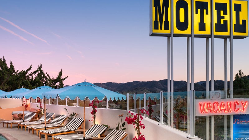
San Diego to Santa Barbara
Start from the southern end of Highway 1 in San Diego, where you’ll find a thriving craft-beer scene, friendly surf breaks, and 65 miles of trails in the city’s 1,200-acre Balboa Park . Stay in Hotel del Coronado (from $323), a historic guesthouse on Coronado Island in the heart of San Diego Bay, and don’t miss the ever changing collection of small plates, like pork shoulder with bacon-braised lentils and black trumpet mushrooms, at the award-winning restaurant Juniper and Ivy in the city’s Harbor View neighborhood.
Crystal Cove , near Newport Beach (south of Los Angeles), has oceanfront cottages and private rooms for rent starting at just $37 a night, or continue north and hit Sandy’s Beach Shack in Huntington Beach for mahi-mahi tacos, beer, and a surf session before checking into Malibu’s Surfrider Hotel (from $369), a revamped 1950s-era motel with wetsuits and surfboards for rent and a rooftop deck. Near Santa Barbara, Skyview Los Alamos (from $179) is another renovated motel, this one with outdoor showers overlooking wine country and loaner mountain bikes for exploring the area’s miles of quality singletrack.
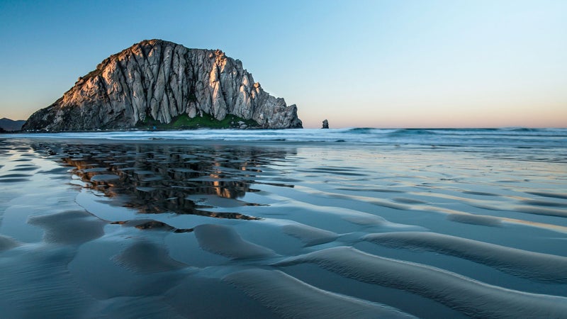
The Central Coast
Camp, sandboard, or drive ATVs on more than five miles of sand dunes in Oceano Dunes State Park , and check out the history of skateboarding at the Morro Bay Skateboard Museum . Then be sure to grab a scoop of Harmony Valley Creamery ice cream at the legendary Thursday-night farmers’ market in San Luis Obispo. The Hotel San Luis Obispo (from $445) opens in June, or check out the town’s eccentric Madonna Inn (from $109), where you can stay in a rock-lined room designed to mimic the granite walls of Yosemite.
Instead of continuing north on Highway 1, make a short detour inland to visit the wineries that surround Paso Robles in addition to a new multi-acre installation from artist Bruce Munro called Field of Light , where you can wander among 58,800 solar-powered spheres that light up the night. Back on route, spot elephant seals on the beach in the seaside village of Cambria, and book a tour of Hearst Castle in San Simeon to take in the art, gardens, and free-roaming zebras that were once part of William Randolph Hearst’s private zoo.
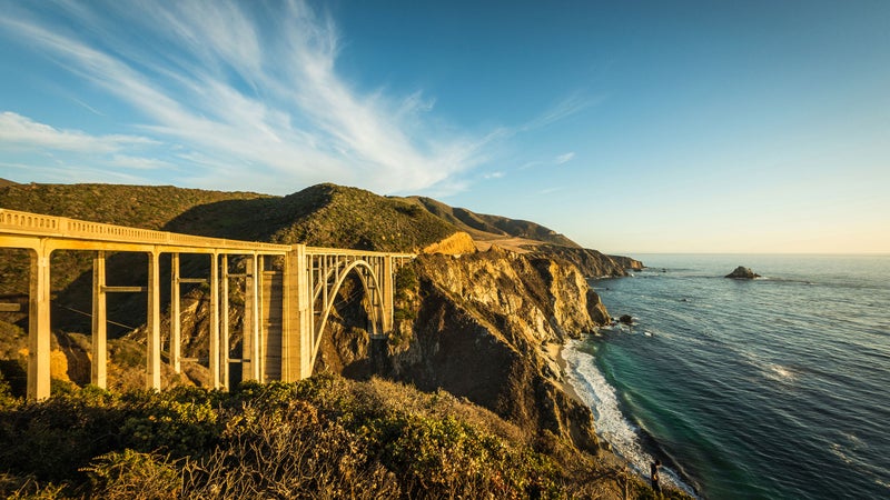
Big Sur to San Francisco
Stop off in Limekiln State Park and you’ll find a secluded beach and views of the Big Sur coast. Then hike the trails and pitch a tent in Julia Pfeiffer Burns State Park , which should reopen sometime this summer after a storm damaged it in early February. From there, it’s just an hour north to Big Sur proper and the surf breaks at Sand Dollar Beach. If you’re in search of some luxe accommodations, opt for a safari-style tent nestled in a redwood forest at Ventana Big Sur (from $450), which overlooks the ocean and has Japanese-inspired hot baths and a gallery featuring the works of local artists. Can’t-miss eats in the area include the cookies at Big Sur Bakery and the Ambrosia burger on the outdoor patio at Nepenthe .
On your way north toward San Francisco, Carmel Coffee , in the charming one-square-mile town of Carmel-by-the-Sea, has espresso and surprisingly good ramen bowls, and there’s quality mountain biking in Santa Cruz’s Demo Forest , just south of San Francisco. Don’t miss the freshly baked artichoke bread at Norm’s Market in the old fishing town of Pescadero, just off Highway 1, and the sunset from San Gregorio State Beach .
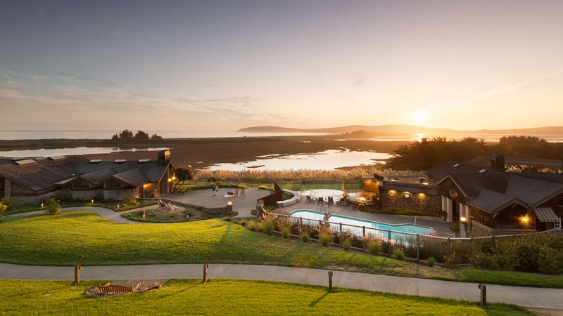
Mill Valley to Mendocino
Once Highway 1 crosses the Golden Gate Bridge, you’ll be treated to vast stretches of empty, jagged coastline and little towns worth long pit stops. Start with a mountain-bike ride or a trail run with ocean views in Mount Tamalpais State Park , north of Muir Beach, where mountain biking first got its start. There’s a well-loved surf break in Bolinas—and good beta and gear at the town’s 2 Mile Surf Shop , which rents boards and offers lessons—if you can find the turnoff for this unmarked beach town . Fuel up with tasty tacos in an old lifeguard tower at Siren Canteen in Stinson Beach.
In Guerneville, AutoCamp (from $190) rents decked-out Airstreams for a night along the Russian River and provides canoes for a mellow paddle. Or book yourself into the Bodega Bay Lodge (from $189), which has recently renovated rooms on a rocky bluff above the sea. In Mendocino, Catch a Canoe and Bicycles Too rents paddleboards and bikes and offers guided boat tours on outrigger canoes up the Big River, which flows into Mendocino Bay. From there the highway continues along the coast for a few dozen miles before turning inland to join Highway 101.
- San Francisco
- Santa Barbara
When you buy something using the retail links in our stories, we may earn a small commission. We do not accept money for editorial gear reviews. Read more about our policy.
Popular on Outside Online
Enjoy coverage of racing, history, food, culture, travel, and tech with access to unlimited digital content from Outside Network's iconic brands.
Healthy Living
- Clean Eating
- Vegetarian Times
- Yoga Journal
- Fly Fishing Film Tour
- National Park Trips
- Warren Miller
- Fastest Known Time
- Trail Runner
- Women's Running
- Bicycle Retailer & Industry News
- FinisherPix
- Outside Events Cycling Series
- Outside Shop
© 2024 Outside Interactive, Inc
U.S. Highway 1

- 1 Understand
- 3.2 New Hampshire
- 3.3 Massachusetts
- 3.4 Rhode Island
- 3.5 Connecticut
- 3.6 New York
- 3.7 New Jersey
- 3.8 Pennsylvania
- 3.9 Maryland
- 3.10 District of Columbia
- 3.11 Virginia
- 3.12 North Carolina
- 3.13 South Carolina
- 3.14 Georgia
- 3.15 Florida
- 4 Stay safe
U.S. Highway 1 is 2,390 miles long (3,846 km) and follows the eastern coastline of the United States of America . The north end is in Fort Kent, Maine and the south end is in Key West, Florida.
Understand [ edit ]
The north end of U.S. Highway 1 has always been in Fort Kent , Maine and in 1926 ended in Miami , Florida . In 1938, the ending was extended to Key West , Florida. It is also the longest north-south highway in the United States. Although a good part of the route hugs the Atlantic coastline, a large part is quite distant from the coast. US 1 was built to provide quick travel before the Interstate system was built. Now that Interstates are the primary mode of quick transportation, most of US 1 within city limits is regulated by stoplights. Plan on a much slower trip than a run down I-95, but one in which you drive past city greens and quaint shops on some stretches. If you take this route, your aim should be to have a relaxing, medium-speed drive.
The Northeast Corridor between Boston and Norfolk (Virginia) largely coincides with the From Plymouth to Hampton Roads historical tour, and the Washington–Rochambeau Revolutionary Route . For the southern coast, see From St. Augustine to Hampton Roads .
Get in [ edit ]

It is possible to drive U.S. 1 in either direction. The mile markers in Florida begin in Key West at zero and go northward and in Fort Kent, Maine there is a sign that proclaims on one side it is the beginning and on the other side that it is the end. You might want to pick one or more states and travel the route through those states.
Drive [ edit ]
From north to south:
Maine [ edit ]
There are 529 miles of highway in Maine, the second longest stretch and only 4 miles shorter than the mileage in Florida. Traveling south in Maine some of the cities and towns you will see are: Fort Kent , Madawaska , Grand Isle , Caribou , Ellsworth , Bucksport , Belfast , Camden , Rockport , Rockland , Waldoboro , Newcastle , Wiscasset , Bath , Brunswick , Freeport , Yarmouth , Portland , Saco , Biddeford , Kennebunk , Ogunquit and Kittery . US 1 ends at W Main St at the foot of the Clair Fort Kent Bridge. The road becomes ME-161 for the next 30 mi (48 km) to Allagash, Maine. The Clair Fort Kent Bridge takes traffic over the St John River into Clair, New Brunswick from the end of US Hwy 1 in Fort Kent .
New Hampshire [ edit ]
The coast line of New Hampshire is fairly short and therefore U.S. Highway 1 is short also. You will visit the Seacoast region and the cities of Portsmouth , Hampton and Seabrook .
Massachusetts [ edit ]

Traveling from Salisbury at the New Hampshire border southward one passes through the North Shore towns of Newburyport , Newbury , Rowley , Ipswich , Topsfield , Danvers , Peabody , and Saugus . The portion from Topsfield northward is predominantly a local road, while the portion from Danvers south is a commuter highway into Boston with a large amount of commercial activity.
Here the route enters Boston , passing through Malden , Revere , Chelsea , Charlestown , downtown Boston, the South End , Dorchester , and Quincy . An alternate route (which carries Route 1 signage but actually is not part of the route) goes through Boston’s Longwood, Mission Hill, Jamaica Plain, Chestnut Hill and West Roxbury neighborhoods along with the suburb of Dedham , before meeting up with the regular route in Westwood. This alternate route is a more scenic drive along Boston’s famed Emerald Necklace, before becoming a divided commercial highway in West Roxbury, while the official route is a freeway that is concurrent with Interstate 93 and (at its southern end) Route 128.
Continuing south you'll follow what was known as "the Old Boston Post Road" and pass through Westwood , Norwood , Sharon , Walpole , Foxborough , Wrentham , Plainville , North Attleborough , and Attleboro to the Rhode Island border.
Rhode Island [ edit ]
From Pawtucket at the northern border of the state, Route 1 travels through Providence , Cranston , Warwick , East Greenwich , North Kingstown , South Kingstown , Narragansett , Wakefield , Charlestown and Westerly .
Connecticut [ edit ]
Crossing into the state over the Pawcatuck River, Route 1 travels west along the coastline and heads through several historic cities such as New London , New Haven , Bridgeport , Fairfield , and Stamford and passes many charming village greens in between.
New York [ edit ]
Route 1 enters New York at Port Chester and passes through Rye , Mamaroneck , Larchmont , New Rochelle and Pelham in Westchester County where it is known as the Boston Post Road. From there the road passes through the Bronx and a short stretch of Upper Manhattan before leaving on the George Washington Bridge to New Jersey. It is a very busy road with lots of trucks and pollution in much of this area, but it is also one of the main commercial streets for some stretches, such as in New Rochelle, where as Main Street it goes right through the historic and still vibrant Downtown and is lined by shops and restaurants.
New Jersey [ edit ]

From Fort Lee at the eastern border of the state, Route 1 travels through Palisades Park, Ridgefield, Fairview, North Bergen, Jersey City , Kearny, Newark , Elizabeth , Linden, Rahway, Woodbridge Township, Edison Township, New Brunswick , North Brunswick Township, South Brunswick Township, Plainsboro Township, West Windsor Township, Lawrence Township, and finally Trenton , before crossing the Delaware River and entering Pennsylvania. Portions of the route are also concurrent with Route 9. Route 1 is a superhighway in much of Jersey City, Kearny, Newark and Elizabeth and uses the Pulaski Skyway for 3 1/2 miles of that stretch, but much of the stretch south of New Brunswick, which goes past car-centered shopping centers, rather than through downtowns, remains a legacy highway with occasional traffic lights.
Pennsylvania [ edit ]
Upon entering Pennsylvania, Route 1 travels farther southwest through North Philadelphia . After leaving the Philly area , Route 1 turns south and enters Maryland.
Maryland [ edit ]
Route 1 crosses the Mason-Dixon Line just northeast of Rising Sun and then heads roughly south west through Conowingo, Bel Air, Kingsville, Baltimore , Elkridge, Laurel, College Park, Hyattsville before entering the District of Columbia.
District of Columbia [ edit ]
The highway enters the District of Columbia along Rhode Island Avenue and turns left onto 6th Street. A right on Constitution Avenue brings the traveller along the edge of the National Mall. Route 1 turns left onto 14th Street in front of the Washington Monument, although it is illegal for drivers to turn left at this intersection (instead, one must turn left onto 15th Street, left again at the second traffic light onto Jefferson Place, then right onto 14th Street). From there Route 1 passes the Jefferson Memorial and crosses the Potomac River into Virginia.
Virginia [ edit ]
Immediately upon entering Virginia, Route 1 heads through Arlington and Alexandria , then south to historic Fredericksburg and then to Downtown Richmond . South of Richmond, Route 1 traverses Petersburg before crossing into North Carolina.
Just south of Alexandria, Route 1 passes very close to Mount Vernon , the home of George Washington.
North Carolina [ edit ]
In North Carolina, US 1 runs along I-85 through Henderson. It then proceeds toward Raleigh becoming Capital Blvd. It then latches on to the I-440 Beltline around the western side of Raleigh and continues as a freeway south of Raleigh through Cary. It is a freeway south of Cary though Sanford and to Southern Pines. The section from Southern Pines to Rockingham has been widened to four lanes. It continues south along the geological fall line to South Carolina.
South Carolina [ edit ]
Two lanes for much of its length in South Carolina, US 1 here is farther from the interstates and remains an important route in its own right. Tracing the ancient coastline of the Cretaceous period, Hwy 1 connects many of the state's oldest inland settlements and is the primary means of access from the sparsely populated sandhills region to both Columbia and the NC capital of Raleigh. Route 1 enters the state north of Wallace and passes through Cheraw and Camden, there widening to four lanes and running approximately parallel to I-20 into Columbia. As Gervais St., Highway 1 is a primary street in Columbia's central business district and passes directly in front of the statehouse. Leaving the capital, US 1 continues west roughly along the route of I-20 through Batesburg-Leesville and Aiken, entering Georgia at Augusta.
Georgia [ edit ]
From South Carolina, US 1 goes from Augusta south through Wadley, Swainsboro, Oak Park, And Lyons. It continues through Santa Claus And Baxley before continuing through Waycross and Homeland.
Florida [ edit ]

If you travel south through Florida on U.S. Highway 1, some of the towns or cities you will pass by include: Jacksonville , St. Augustine , Palm Coast , Ormond Beach , Holly Hill , Daytona Beach , Port Orange , New Smyrna Beach , Edgewater , Titusville , Cocoa , Rockledge , Melbourne , Palm Bay , Grant , Sebastian , Vero Beach , Fort Pierce , Port St. Lucie , Stuart , Hobe Sound , Jupiter , North Palm Beach , Riviera Beach , West Palm Beach , Lake Worth Beach , Boynton Beach , Delray Beach , Boca Raton , Deerfield Beach , Pompano Beach , Fort Lauderdale , Dania , Hollywood , Hallandale , North Miami Beach , North Miami , Miami , Coral Gables , South Miami , Kendall , Perrine , Homestead , Key Largo and the rest of the Florida Keys to Key West , where it ends at an intersection of Whitehead & Fleming St in front of the Judge Jefferson Browne Courtroom Complex in old town Key West. The highway is 533 miles long through the state of Florida.
Stay safe [ edit ]
US-1 travels through the big cities of Boston , New York City , Philadelphia , Washington, D.C. , and Miami on the Atlantic Seaboard. Within Boston, Chelsea and Dorchester do have some crime, although both areas are rapidly gentrifying. However, you may want to be cautious in parts of North Philadelphia which Highway 1 traverses. If you do plan to stop in the City that Never Sleeps, though, you'll still want to exercise caution because driving in New York City is not necessarily a "smart" option due to crowded streets.
US-1 also travels through the Florida Keys . Most of US-1 in the Keys is a two-lane street heading north and south. Though there are rails alongside each lane on the bridges, take care because some South Floridians are considered to be "reckless" drivers.
Go next [ edit ]
Fort Kent and Key West are the termini of the highway, but US-1 goes through many large cities, many of which are found in the Drive section of this article.
- Worcester (Massachusetts) is the second largest city in Massachusetts, about 30 or so miles from Boston.
- Yonkers is one of New York City's largest suburbs, behind Newark (New Jersey) ; it is the largest suburb of NYC within the state of New York.
- Wilmington is 30 miles south of Philadelphia with a population of almost 71,000 residents. This is the largest city in Delaware, and was formed in 1638 - 44 years before Philadelphia.
- Virginia Beach and Norfolk are the two largest cities in Virginia, which make a great side-trip from Richmond.
- Savannah is a major port city in northeast Georgia, accessed from Interstate 95.
- Orlando can be accessed from Florida's East Coast with ease, from Daytona Beach via I-4, to Miami , from the Florida Turnpike.
- From Plymouth to Hampton Roads is an itinerary along the Atlantic coast of the United States , showcasing the nation's early history , from the first Anglo-American settlements in the 17th century to the American Civil War , which ended in 1865.
- Interstate 10 begins at its junction with I-95 and US Hwy 1 in Jacksonville, Florida and goes 2,460 mi (3,960 km) west towards Los Angeles, California through the Florida Panhandle, Alabama, Mississippi, Louisiana, Texas, southern New Mexico, Arizona and Southern California. It replaces or parallels much of the Old Spanish Auto Trail (US Hwy 90 and old US Hwy 80), known to by the Old Highway 66 of the south, between Jacksonville and Casa Grande, Arizona. The original Old Spanish Auto Trail spanned from St Augustine, Florida to San Diego, California. Therefore, the section of US Highway 1 between Jacksonville and St Augustine replaces the Old Spanish Auto Trail while Interstate 8 replaces the Old Spanish Auto Trail (old US Highway 80) between Casa Grande and San Diego.
- The Lincoln Highway is a historic, and first, trans-continental highway that starts at Times Square in New York City and runs approximately 3,142 mi (5,057 km) west through the states of New Jersey, Pennsylvania, West Virginia, Ohio, Indiana, Illinois, Iowa, Nebraska, Colorado, Wyoming, Utah, Nevada and California; to Lincoln Park in San Francisco, California. It was made up of different roads linked together to create the first organized trans-continental auto trail in a time when the automobile was becoming more affordable, with more people traveling longer distances by car. A section of US Hwy 1 and 1-9 in New Jersey is on the Historic Lincoln Highway between Newark and Philadelphia. Between Philadelphia and Granger Junction in Western Wyoming it closely follows the present US Highway 30. It follows Interstate 80 through Wyoming, Utah and California while US Hwy 50 replaces the old Lincoln Highway across Nevada.
- Presidents of the United States There have been 45 individuals who have served as presidents of the United States between 1789 and today (including two non-consecutive terms for Grover Cleveland). This article discusses sights and destinations all over the world related to the (former) presidents of the United States. Many of these sights and destinations are lined up along the eastern seaboard, some of which are accessible from US Highway 1 or off of US Highway 1 along a different road.
- The Underground Railroad is a network of disparate historical routes used by African-American slaves to escape the slave holding southern states to reach freedom in the northern states and to Canada. Today many of the "stations" along the "railroads" serve as museums and memorials to the former slaves' journey north. Historically the "stations" served as a "pit-stops" and hiding places for escaped slaves on the run to avoid capture. A number of these sites identified, nearest to US Hwy 1, are in Connecticut, Delaware, Maine, Maryland, Massachusetts, New York, and New Brunswick.
- The American Civil War from 1861 to 1865 was the most destructive armed conflict in the history of North America, with more than 600,000 deaths in total. The United States still bears scars from this conflict, in which the slaveholding southern states formed the Confederate States of America, attempting to secede from the Union, and the North fought to defeat the secession. There are a number of old Civil War battlefield sites and other significant historic sites along US Highway 1. Some of which may require a detour of several miles east or west along another road from US Highway 1.
- Has custom banner
- Has routebox
- Usable itineraries
- Usable articles
- North America itineraries
- Itineraries
Navigation menu

California's scenic Highway 1 to Big Sur opens to around-the-clock travel as slide repair advances
B IG SUR, Calif. (AP) — A section of California's scenic Highway 1 leading to the famous Big Sur coast reopened to around-the-clock traffic Friday after stabilization of a storm-triggered rockslide that dropped a chunk of one lane into the ocean and hampered tourism.
The gap has yet to be closed, but after placement of steel and concrete into the cliff, a temporary signal system was activated to allow alternating north-south traffic on the undamaged lane, according to the California Department of Transportation.
The reopening came eight days ahead of schedule and just in time for summer travel.
“Highway 1 is the jewel of the California highway system and our crews have been working non-stop for the last month and a half so Californians can have unrestricted access to this iconic area of our state,” Caltrans Director Tony Tavares said in a statement this week.
Big Sur is a 90-mile (145-kilometer) stretch of the state’s central coast where misty, forested mountains rise up from the ocean. Much of the highway is perched high on cliffs, presenting dramatic views.
Highway 1 is normally a must for California visitors traveling between Los Angeles and San Francisco, but the approach to Big Sur from the south has long been blocked by previous landslides requiring massive repairs, leaving the approach from the north as the area's lifeline.
After heavy rains, a rockslide south of Monterey on March 30 caused about 6 feet (nearly 2 meters) of the southbound lane and a retaining wall that supported the highway to fall about 170 feet (52 meters) to the ocean below.
Caltrans determined the other lane was usable, but traffic was limited to twice-daily convoys in and out of Big Sur. Initially, only residents and essential workers were allowed to join the convoys. A crane had to be removed each time to make room for the convoys, said Kevin Drabinski, a Caltrans spokesperson.
In April, Kirk Gafill, president of the Big Sur Chamber of Commerce, told the San Francisco Chronicle that total losses to Big Sur businesses since the slide were exceeding $1 million a day.
A permanent repair to the highway is being designed and is expected to be completed in spring 2025, Caltrans said.
")
- Business & Tech
- Food & Drink
- Arts & Entertainment
Highway 1 Reopens Ahead of Schedule, Making Way for Big Sur Travel Ahead of Summer
Highway 1 has reopened to regular traffic, thanks to a new signal system that will allow traffic to flow in one direction at a time past the area where a rockslide made part of the roadway disappear in late March.
You can now get into Big Sur again as a non-resident, without needing to join a twice-daily convoy. Caltrans announced the reopening of Highway 1 Friday, eight days ahead of schedule, and posted video of cars passing by the Rocky Creek Bridge where the "slipout" occurred on March 30.
That slipout, or rockslide at the cliff edge of the road, stranded around 1,600 people over Easter weekend, and Highway 1 was subsequently closed to traffic for six weeks — save for the morning and afternoon convoys that let residents in and out for supplies, etc.
"All systems are go!" Caltrans tweeted Friday morning.
The temporary fix to the damaged section of Highway 1 was expected to be completed by Memorial Day Weekend, and has been finished early. For now, a traffic light will allow southbound and northbound traffic to flow past the damaged section one at a time, using a single lane.
A permanent fix to the damaged southbound lane of the roadway will be completed next spring.
"Highway 1 is the jewel of the California highway system and our crews have been working non-stop for the last month and a half so Californians can have unrestricted access to this iconic area of our state," said Caltrans Director Tony Tavares in a statement.
All systems are go! Temporary signal system was activated this morning and #Hwy1 at the Rocky Creek slip out has opened to all travelers with 24/7 access. Travelers will be able to travel 40 miles south of Monterey with a full closure still in effect one mile south of Esalen. pic.twitter.com/OCJs3WAGZ3 — Caltrans District 5 (@CaltransD5) May 17, 2024
"Crews have been working day and night to quickly repair the damage to Highway 1 caused by recent storms, which has disrupted the lives of individuals living in and around Big Sur – limiting access to the area and hampering tourism," said Governor Gavin Newsom. "Thanks to the diligent efforts, traffic will resume eight days ahead of schedule – bringing relief and a sense of normalcy back to one of California’s most iconic coastal communities."
Travelers can now access Big Sur from the north, however a rockslide-damaged section of Highway 1 remains completely closed about 40 miles south of Monterey, just past the Esalen Institute . That closure has been in effect since early 2023 , and those coming from the south have had to take a three-hour detour to get to Big Sur.
Residents of the area are no strangers to being stranded and semi-stranded from the larger world, as Highway 1 has a habit of being hit hard by land movement, particularly in the winter and spring after heavy rains.
A massive landslide in May 2017 , called the biggest in state history, engulfed a section of the highway south of Big Sur, and the process to get the road reopened after that disaster took over a year.
Previously: Road Collapse On Highway 1 Strands Around 1,600 People In Big Sur Over Holiday Weekend
Subscribe to SFist - San Francisco News, Restaurants, Events, & Sports
Get the latest posts delivered right to your inbox
Stay up to date! Get all the latest & greatest posts delivered straight to your inbox
- Election 2024
- Entertainment
- Newsletters
- Photography
- Personal Finance
- AP Investigations
- AP Buyline Personal Finance
- AP Buyline Shopping
- Press Releases
- Israel-Hamas War
- Russia-Ukraine War
- Global elections
- Asia Pacific
- Latin America
- Middle East
- Election Results
- Delegate Tracker
- AP & Elections
- Auto Racing
- 2024 Paris Olympic Games
- Movie reviews
- Book reviews
- Personal finance
- Financial Markets
- Business Highlights
- Financial wellness
- Artificial Intelligence
- Social Media
California’s scenic Highway 1 to Big Sur opens to around-the-clock travel as slide repair advances
In this provided by the California Department of Transportation, a section of Highway 1 re-opened, Friday, May 17, 2024, in Big Sur, Calif., after repairs were made following storm damage. (Kevin Drabinski/California Department of Transportation via AP)
- Copy Link copied
BIG SUR, Calif. (AP) — A section of California’s scenic Highway 1 leading to the famous Big Sur coast reopened to around-the-clock traffic Friday after stabilization of a storm-triggered rockslide that dropped a chunk of one lane into the ocean and hampered tourism.
The gap has yet to be closed, but after placement of steel and concrete into the cliff, a temporary signal system was activated to allow alternating north-south traffic on the undamaged lane, according to the California Department of Transportation.
The reopening came eight days ahead of schedule and just in time for summer travel.
“Highway 1 is the jewel of the California highway system and our crews have been working non-stop for the last month and a half so Californians can have unrestricted access to this iconic area of our state,” Caltrans Director Tony Tavares said in a statement this week.
Big Sur is a 90-mile (145-kilometer) stretch of the state’s central coast where misty, forested mountains rise up from the ocean. Much of the highway is perched high on cliffs, presenting dramatic views.
Highway 1 is normally a must for California visitors traveling between Los Angeles and San Francisco, but the approach to Big Sur from the south has long been blocked by previous landslides requiring massive repairs, leaving the approach from the north as the area’s lifeline.
After heavy rains, a rockslide south of Monterey on March 30 caused about 6 feet (nearly 2 meters) of the southbound lane and a retaining wall that supported the highway to fall about 170 feet (52 meters) to the ocean below.
Caltrans determined the other lane was usable, but traffic was limited to twice-daily convoys in and out of Big Sur. Initially, only residents and essential workers were allowed to join the convoys. A crane had to be removed each time to make room for the convoys, said Kevin Drabinski, a Caltrans spokesperson.
In April, Kirk Gafill, president of the Big Sur Chamber of Commerce, told the San Francisco Chronicle that total losses to Big Sur businesses since the slide were exceeding $1 million a day.
A permanent repair to the highway is being designed and is expected to be completed in spring 2025, Caltrans said.
- - K-town Now
- Asia-Pacific
- - Storm Tracker
- Middle East
- Map of Memorials
- Entertainment
- - Video Games
- Europe Travel
- - Quick Trips
- - After Hours
- Pacific Travel
- The Meat and Potatoes of Life
- U.S. Travel
- Storm Tracker
- Rewards for readers
- Get Stripes
- Stripes Lite
- Archives/Library
- Special Publications
- Mobile Apps
- Email Newsletters
- Digital Access
- Home Delivery
- Marine Corps
- Coast Guard
- Space Force
- Archive photo of the day
- - Schedules Europe
- - Scoreboards Europe
- - Schedules Pacific
- - Scoreboards Pacific
- - Pacific Sports Blog
- - WW II Podcast
- - Military Matters
- - Force for Hire
- Out of Uniform
- - WW II Videos
- Communities
- Stripes Europe
- Stripes Guam
- Stripes Japan
- Stripes Korea
- Stripes Okinawa
- Our Other Websites
- In Memoriam
- Month of the Military Child
- Best of Germany
- Best of the Pacific
- Letters to Santa
Why Highway 1 is the climate challenge that California can’t fix

The stretch of Highway 1 along the Central Coast has for decades epitomized California’s reputation for scenic and rugged landscapes. (Melina Mara/The Washington Post)
BIG SUR, Calif. - Workers dangle from a crane, drilling into the vertical face of rock that holds up one of the most famous and picturesque stretches of road in the world. They’re performing a delicate surgery on fragile geology in hopes that a single lane of traffic can safely flow to Big Sur before summer arrives.
On this day, it had been nearly a month since a rockslide severed Highway 1, California’s beloved road-trip destination.
Across this stretch of the Central Coast, landslides have repeatedly buried the highway’s undulating curves or sent pavement tumbling into the Pacific Ocean. They bring a steady drumbeat of road blockages, tourism disruptions and stranded communities. Now, some fear the landslides are getting worse, due to climate change and engineering missteps throughout the roadway’s 86-year life span.
It was always a risky proposition to maintain a highway at the very edge of a continent. But now Big Sur is facing wetter storms that infiltrate and weaken cracked and porous rock. Wildfires leave behind extra debris for those floodwaters to carry downhill. Pounding waves from stronger storms and rising seas eat away at cliffs from beneath.
“Everything is working against Highway 1,” said Gary Griggs, an oceanography professor at the University of California at Santa Cruz.
The latest slip-out, known as the Rocky Creek slide, exemplifies the complexity of the problem. It stranded 1,500 people at the end of March as workers were making slow progress addressing three other slides. California’s transportation agency - known as CalTrans - estimates it will take more than $100 million to fix them all - if new slides don’t come first.
California is a national leader in confronting climate change, but making Highway 1 sustainable may be a challenge it cannot surmount. Despite spending a billion dollars a year to fix damage that climate-related stressors inflict on its roadways - plus $100 million in projects to make infrastructure more resilient to climate change - the state is struggling to fortify one of its most prized landmarks.

Workers from Teichert Construction finish creating a temporary one-way roadway at the Rocky Creek slide April 6, 2024. (Melina Mara/The Washington Post)

Since Highway 1 was closed by a landslide, Big Sur residents have been able to enjoy an empty Partington Cove Trail usually crowded with visitors. This sunbather enjoys the waves and wind April 6, 2024. (Melina Mara/The Washington Post)
Some have suggested rerouting Highway 1 inland, but they don’t understand its terrain, or its identity, said state Sen. John Laird (D), a former California natural resources secretary who represents part of the Central Coast in the state legislature. Barriers and boulders armor sections of the road and the cliffs against erosion, but extending those interventions along some 100 miles of highway isn’t feasible, others say.
That leaves few options: Get better at predicting and fixing the landslides, and preventing them when possible. Or else imagine the unthinkable: Giving up on maintaining a continuous 656-mile stretch of blacktop from Orange County to Mendocino County, and letting parts of Highway 1 become dead ends.
CalTrans routinely patrols the cliffsides and deploys remote sensing for signs of movement to predict where the next slide might occur. It is repairing the latest section of crumbled highway with an eye toward the climate of the future, officials said.
“As we rebuild we have to do so with the knowledge that the conditions that have washed out sections of roadway will become more and more common in the future,” CalTrans officials said in a statement. “We have to prepare for that.”
But still, the agency did not expect the most recent slide would hit when and where it did. It’s like a high-stakes game of whack-a-mole - one in which, Laird said, Mother Nature and climate change keep upping the ante.
For now, there is no option but to keep knocking down the obstacles as they come. Nearly everyone interviewed for this article said California wouldn’t be California without this road.
“Of course we have to keep it alive,” Laird said.
The most landslide prone stretch of Highway 1, from around Hearst Castle in San Simeon to Carmel-by-the-Sea and the Monterey Peninsula, has for decades epitomized California’s reputation for scenic and rugged landscapes. It’s where road trippers can get a view of dense redwoods out of one window and crashing waves out of the other, often at the edge of cliffs as much as 500 feet above the beach.
For decades, this region has attracted artists and others seeking beauty and isolation. As the author Henry Miller once wrote, “Big Sur has a climate all its own and a character all its own.”
More recently, the rise of Instagram and selfie culture has helped fuel a crushing surge in tourists to its 33 bridges and postcard-like coastlines to look for whales, sea lions and elephant seals.
“Big Sur’s massive popularity is damaging the very scenic qualities and natural beauty that make the area so precious,” said a 2020 CalTrans study of the highway.
But now, it’s geology that is perhaps more threatening.

CalTrans workers drill into the side of a cliff April 17, 2024, installing rock dowels aimed at stabilizing the southbound portion of Highway 1 in Big Sur, Calif. A section of the iconic highway has been closed since March 30 because of a landslide, one of several to strike the region in the last seven years. (Melina Mara/The Washington Post)

CalTrans employees and contractors prepare a worksite on Highway 1 on April 17, 2024. (Melina Mara/The Washington Post)
The ground has been shaky beneath this stretch of Highway 1 ever since it started carrying traffic in 1937, crossing over diverse rock formations that are still in their adolescence, geologically speaking.
Deep down sits the hard crystalline base of the Sierra Nevada some 150 miles to the east. On top of that are layers of sedimentary rock left over from an older mountain range. And then, mixed within, there are shreds of shale like volcanic rocks that were scraped up from the ocean floor as two tectonic plates clashed.
“It’s as if that area went through a blender,” said Jon Warrick, a Santa Cruz-based research geologist for the U.S. Geological Survey.
In older parts of the continent, such as the East Coast, rock formations are older and denser, and therefore not prone to movement. But in Big Sur, gaps and joints still exist from when the rocks first came together along the nearby San Andreas fault, and other secondary faults in the area.
This is the country’s steepest coastline outside of Alaska, according to Kevin Schmidt, another USGS geologist, and when these formations are exposed to the elements, their fragility becomes evident.
Water trickles - and sometimes pours - into the cracks between rocks, reaching layers of clay-rich rock crushed as finely as flour. It turns them into a slick slurry - a recipe for landslides.
Climate change has only juiced up those ingredients. Take what happened in 2017, when one of the region’s wettest winters in a century interrupted an extended drought.
Weeks of heavy January and February rains saturated a mountainside that was already imperceptibly sliding above Highway 1, until, by May, the instability became too much. In an instant, so much earth poured down steep slopes near Mud Creek, the USGS said, that it was enough to “fill a line of dump trucks nearly a thousand miles long.”
It took more than a year and $54 million to reconnect Big Sur communities to points south.
Though it took experts by surprise, Griggs said it shouldn’t have. Two decades earlier, CalTrans had declared the area “very active,” with “high landslide potential” due to weaker bedrock and unstable construction.
The slides often occur weeks, if not months, after rainy weather, with about 90 percent of the region’s rain typically falling between November and April. Geologists add that the stormy pattern of the last two years - the 2022-2023 winter brought record-setting amounts of precipitation - has compounded landslide risks.
Much of that increased rain is likely to come through juiced-up storms known as atmospheric rivers, which can pummel California’s coasts in winter months, sometimes one after another. But even without those, the state is seeing more thunderstorms typical in other parts of the country but less so in California, said Daniel Swain, a climate scientist at UCLA. California, including Big Sur, is seeing precipitation events that are about 10 percent more intense statewide than they have been historically, he said.
Add it all up, and it appears a trend of bigger and more frequent landslides is coming, Warrick added, if it isn’t already here.
The latest Highway 1 interruption feels all too familiar to Big Sur veterans, including Ben Perlmutter, whose family has lived in Big Sur for three generations.

Ben Perlmutter recently moved back to Big Sur to take over the Big Sur River Inn from his father. With no tourists coming to town, he is unsure if he will break even in his first year. (Melina Mara/The Washington Post)

Nicholas Leahy, center, plays with other musicians at Pfeiffer State Park on April 6, 2024. Community gatherings, with free pizza, are one way Big Sur residents are coping with the closure of Highway 1. (Melina Mara/The Washington Post)
Now 33, Perlmutter has experienced or heard stories about decades of disasters. In 1995, the National Guard had to erect a bridge to reconnect Big Sur to the outside world after a washout. In 1998, Highway 1 collapsed in five places and an Army helicopter had to rescue his family. In 2008, a wildfire ignited nearby, forcing them out of their home for more than a week. In 2017, a landslide closed the highway again, leaving residents cut off for nine months.
Now, “we can’t catch a break,” he said, explaining how the latest slide brought business that was already slow to a grinding halt. Residents can leave and enter Big Sur only in convoys at 7 a.m. and 5 p.m. Tourists, the town’s main source of income, are not yet allowed in - resulting in lost revenue that business owners say amounts to roughly $1 million a day.
Perlmutter, who grew up behind the bar of his father’s restaurant, moved back home with his wife six months ago to take over the Big Sur River Inn from his 91-year-old father and is now unsure if he’s going to break even his first year. He feels responsible for his 77 employees, 60 of whom are now unemployed.
“There is this fatigue level. … You have to totally transform on a dime to prepare your businesses to respond to these disasters,” Perlmutter said, noting that the inn’s financial situation is way worse than before. “A lot of emotion goes into that.”
Even so, Perlmutter and other businesses owners have thrown themselves into community efforts since the latest slide.
Within 24 hours, Perlmutter said his bar manager, a volunteer firefighter and EMT, quickly coordinated places for 1,500 stranded tourists to sleep. The Big Sur River Inn has also hosted a Taco Tuesday, practically giving away food and drinks so they didn’t go to waste. Deetjen’s, another historic inn, has also been serving discounted community breakfasts. Musicians have been playing impromptu shows, for a distraction.
Yet these charitable responses can endure for only so long. Costs of doing business keep rising in Big Sur, and bigger corporations continue to move in and subsume long-standing family operations.
“You feel like you are in a rodeo getting bucked continuously,” said Kirk Gafill, who also grew up in a landmark restaurant that he now runs, called Nepenthe. “You are constantly calling on reserves, never knowing what is going to happen.”
Preserving the Big Sur that residents and tourists love sometimes seems like a fantasy venture.
To prepare for bigger storms and help water run off the cliffs, CalTrans officials told The Washington Post they are replacing and enlarging stormwater culverts. They are engineering ways to strengthen the roadway and the cliffs it sits upon.
But sometimes such engineering isn’t possible because of concerns for wildlife, such as an endangered snail known as the black abalone. And it cannot last forever. Longtime residents and officials say that along the rocky coast, walls built during the 1980s to stabilize the road have since eroded and withered away.
CalTrans officials said they have no long-term scheme for maintaining the highway, other than tackling landslides as they emerge and preventing them whenever possible.
But sometimes, there is nothing that could keep cliffs upright. There was a concrete wall at the base of a bridge over Rocky Creek, site of the latest slide, for example. Now, to get a single lane of traffic flowing again, workers are hammering vertical and horizontal supports deep within the cliff and reinforcing it with a sprayed-on material known as shotcrete.
A permanent fix is unrealistic, Griggs said. Even if California turned Highway 1 into a toll road - like the famous 17-Mile Drive on the nearby Monterey Peninsula - all the money in the world could not eliminate landslides, he said. “There are some problems we just don’t have solutions for,” he added.
California received some $375 million to prepare its highways for climate change through the federal bipartisan infrastructure law passed in 2021. While such spending is vital, Laird said, his single Senate district - one of 40 statewide - has transportation needs that could easily consume billions of dollars.
From his perspective, the state should be spending all it can to preserve Highway 1 and access to Bug Sur because it epitomizes what is so unique about California. “It’s a natural mecca,” he said.
Others foresee a day when such investment becomes foolish and preservation becomes impossible. Cheryl Hapke helped lead study of the geology beneath Highway 1, spending 22 years as a USGS research scientist working closely with CalTrans in studying landslide risks. By now, she said, communities continually finding themselves stranded may need to think about relocating.
“I’m not saying do it tomorrow, but at some point, the conversation probably has to be had,” said Hapke, now a Florida-based principal consultant in coastal resiliency for Fugro, an environmental consulting firm.
“We’re living with what we’ve created in this changing climate,” she added. “There’s answers. They’re not easy.”
Sign Up for Daily Headlines
Sign up to receive a daily email of today's top military news stories from Stars and Stripes and top news outlets from around the world.
Sign Up Now
Big Sur’s Highway 1 to reopen Friday — ahead of schedule — after major rockfall

- Show more sharing options
- Copy Link URL Copied!
Along an almost 40-mile stretch of Highway 1, Big Sur has been isolated from the rest of the state for weeks — with limited access for residents and essential workers — after a massive chunk of the roadway fell into the ocean in late March.
But on Friday — ahead of schedule — the damaged section of the scenic highway will reopen to the public, via an alternating single lane, Gov. Gavin Newsom announced Tuesday at a news conference. The reopening, following major repairs and remediation completed under arduous conditions, restores access to several tourism hot spots along the roadway.
“Caltrans is working overtime,” Newsom said. “Subject to an act of God, extreme winds, unlikely rain … we’ll be able to achieve that: 6:30 [a.m.] this Friday, Highway 1 will be reopened.”
The California Department of Transportation had previously committed to reopening the section of damaged highway by Memorial Day.

Highway 1 collapse in Big Sur was caused by weather, waves, gravity. That’s the good news
Wet winters accelerate damage along the vulnerable Big Sur coast. But repairs should allow Highway 1 to partially reopen by Memorial Day.
April 16, 2024
The iconic route has been closed to the public since March 30, when torrential rains pounded the coast and a section of the southbound lane near the Rocky Creek Bridge collapsed, about 12 miles south of Carmel.
Officials have been working to confirm stability and restore access to the area using only the northbound lane, as it wasn’t damaged when the rockfall took a bite out of the southbound lane. Caltrans plans to use traffic signals to alternate vehicles traveling in both directions across the single lane, allowing for 24/7 traffic.
Newsom on Tuesday acknowledged the “deep anxiety” that residents and business owners had felt the last few weeks, coming and going only through twice-a-day convoys, which were canceled a few times due to weather concerns. The local chamber of commerce had urged expedited repairs to help avoid further losses during one of Big Sur’s peak seasons for tourism, the area’s largest industry.
The closure from the March slip-out was particularly challenging because access to much of Highway 1 had already been limited to travelers coming from the north, as a different stretch of the roadway has been closed since January 2023. About 30 miles south of the Rocky Creek slip-out, a string of landslides — including one this winter — closed about 12 miles of the roadway near Lucia. That closure begins near Limekiln State Park in the south.
Repairs there remain ongoing, and officials have said they hope to reopen that stretch sometime this summer.

Big Sur tourism ‘on standstill’ after its connecting roadway crumbles into the sea -- again
Caltrans has shut down the southbound road on Highway 1, letting only essential workers and locals through on the northbound side.
April 1, 2024
At the Rocky Creek closure, crews have been working since March — often suspended in a basket from a crane above the 200-foot ocean-side cliff — to improve stability, safety and drainage in the area. Caltrans contractors also started work on more long-term stabilization efforts, aimed at eventually reopening two-lane traffic.
Soon after the slip-out occurred, engineers and work crews assessed the damage and made sure the precipitous coastal geology — technically referred to as a “scarp” — would not threaten the northbound lane as well.
Once confident of its stability, the team began a series of steps to shore up the eroded cliff.
The goal was “to stabilize and reinforce,” said Ryan Turner, a geotechnical engineer with Caltrans who headed the construction work. “We did not want to let the scarp advance across the highway and take out the other lane.”
The work required drilling 40 vertical holes, all about 5 feet apart, in the existing roadbed, each 6 inches in diameter and 25 feet deep. Then, steel dowels were placed into the holes and encased with grout, essentially creating a steel curtain inside the rocky cliff.
Then crews drilled an additional series of holes in five rows that extended into the cliff almost horizontally. Steel rods and grout were also placed in these holes, further supporting the cliff, Turner said.
Their repair work, known as rock doweling, has been used to stabilize rock faces by “increasing shear resistance across failure planes,” Turner said.
The effectiveness of this repair “is in the grouted steel bars,” he said. “In order for the rock mass to shear, it would have to shear through these steel bars.”
To further stabilize the scarp, wire mesh was placed over the eroded cliff and sprayed with shotcrete — a form of concrete that will affix to the vertical wall of rock — to prevent loose rocks from sloughing off.
The challenging work was able to continue only during fair weather and was halted several times during storms and high winds.
A recent analysis of the slip-out near Rocky Creek Bridge determined that it was most likely caused by routine weather, erosion and water — common challenges along the Big Sur coast, which has repeatedly suffered through highway closures and unforeseen land movement, according to a new analysis by federal geologists.
Although such events are almost impossible to predict, officials said it’s good that a more precarious, deep-seated landslide doesn’t appear to be the cause of the March slip-out. That could result in ongoing and repeated issues.
More to Read

California roads damaged by storms could get help with Newsom’s emergency declaration
May 3, 2024

Topanga Canyon could remain closed into the fall after massive landslide
April 19, 2024

Construction of wildlife crossing in Agoura Hills to partially close 101 Freeway
April 11, 2024
Start your day right
Sign up for Essential California for news, features and recommendations from the L.A. Times and beyond in your inbox six days a week.
You may occasionally receive promotional content from the Los Angeles Times.

Grace Toohey is a reporter at the Los Angeles Times covering breaking news for the Fast Break Desk. Before joining the newsroom in 2022, she covered criminal justice issues at the Orlando Sentinel and the Advocate in Baton Rouge. Toohey is a Maryland native and proud Terp.

Thomas Curwen is staff writer for the Los Angeles Times, specializing in long-form narratives, and was a Pulitzer Prize finalist in 2008 for feature writing.
More From the Los Angeles Times

Namaste away: Rangers bar yoga classes at cliffside San Diego park
May 18, 2024

Climate & Environment
California’s effort to plug abandoned, chemical-spewing oil wells gets $35-million boost

California school district becomes first in nation to go all electric buses

L.A. County investigating reported hepatitis A case at Beverly Hills Whole Foods
May 17, 2024
Transportation | Highway 1 to Big Sur opens to around-the-clock…
Share this:.
- Click to share on Facebook (Opens in new window)
- Click to share on Twitter (Opens in new window)
- Click to print (Opens in new window)
- Click to email a link to a friend (Opens in new window)
- Click to share on Reddit (Opens in new window)
Today's e-Edition
- Latest News
- Environment
Transportation
Transportation | highway 1 to big sur opens to around-the-clock travel as slide repair advances.
")
The gap has yet to be closed, but after placement of steel and concrete into the cliff, a temporary signal system was activated to allow alternating north-south traffic on the undamaged lane, according to the California Department of Transportation.
The reopening came eight days ahead of schedule and just in time for summer travel.
“Highway 1 is the jewel of the California highway system and our crews have been working non-stop for the last month and a half so Californians can have unrestricted access to this iconic area of our state,” Caltrans Director Tony Tavares said in a statement this week.
Big Sur is a 90-mile (145-kilometer) stretch of the state’s central coast where misty, forested mountains rise up from the ocean. Much of the highway is perched high on cliffs, presenting dramatic views.
After heavy rains, a rockslide south of Monterey on March 30 caused about 6 feet (nearly 2 meters) of the southbound lane and a retaining wall that supported the highway to fall about 170 feet (52 meters) to the ocean below.
Caltrans determined the other lane was usable, but traffic was limited to twice-daily convoys in and out of Big Sur. Initially, only residents and essential workers were allowed to join the convoys. A crane had to be removed each time to make room for the convoys, said Kevin Drabinski, a Caltrans spokesperson.
In April, Kirk Gafill, president of the Big Sur Chamber of Commerce, told the San Francisco Chronicle that total losses to Big Sur businesses since the slide were exceeding $1 million a day.
A permanent repair to the highway is being designed and is expected to be completed in spring 2025, Caltrans said.
- Report an error
- Policies and Standards
More in Transportation

Editorials | Editorial: About 1,000 passengers could have died at SFO. Finally, Congress has acted

Travel | Travelers gearing up for Memorial Day road trips will have plenty of company

Transportation | Interstate 680 to partially close this weekend for repairs

Technology | The first electric school bus fleet in the US will also power Oakland homes
Say hello to the transformed Idaho 511
Welcome to Idaho 511
Get started to discover new and exciting features!
Signing up with Idaho 511
- Creating an account is NOT mandatory on this website; however if you do, you’ll be able to personalize your experience and receive traffic notifications.
- Select ‘Sign Up’ from the menu options in the top right corner
- Enter your name, email, and create a password. Click ‘Sign Up' when done.
- You will get an email to verify your account, click the link that was sent to your email.
- Including a phone number will allow you to receive text notifications, you will receive an SMS (text) with your confirmation code. Note this is in addition to the email verification.
Creating & Saving a Customized Route
- Enter your start and end locations by typing the addresses into the address fields. Alternatively, you may also right click on the map. Once you have entered the route locations, click ‘Drive’.
- Review the routes generated and select the one that suits you best.
- When done, enter a name for your route and click ‘Save’.
Creating a Notification for your Route
- Once your route is saved, you will be asked if you want to be notified of events on this route. Click ‘Create Route Notification’
- You will be redirected to the notification creation page. Enter the required information for your route, select a delivery option (email or SMS), and click ‘Save’.
- You will now be notified of any future events that affect your route.
Road Conditions

Travel Itinerary For One Week in Moscow: The Best of Moscow!
I just got back from one week in Moscow. And, as you might have already guessed, it was a mind-boggling experience. It was not my first trip to the Russian capital. But I hardly ever got enough time to explore this sprawling city. Visiting places for business rarely leaves enough time for sightseeing. I think that if you’ve got one week in Russia, you can also consider splitting your time between its largest cities (i.e. Saint Petersburg ) to get the most out of your trip. Seven days will let you see the majority of the main sights and go beyond just scratching the surface. In this post, I’m going to share with you my idea of the perfect travel itinerary for one week in Moscow.
Moscow is perhaps both the business and cultural hub of Russia. There is a lot more to see here than just the Kremlin and Saint Basil’s Cathedral. Centuries-old churches with onion-shaped domes dotted around the city are in stark contrast with newly completed impressive skyscrapers of Moscow City dominating the skyline. I spent a lot of time thinking about my Moscow itinerary before I left. And this city lived up to all of my expectations.

Travel Itinerary For One Week in Moscow
Day 1 – red square and the kremlin.
Metro Station: Okhotny Ryad on Red Line.
No trip to Moscow would be complete without seeing its main attraction. The Red Square is just a stone’s throw away from several metro stations. It is home to some of the most impressive architectural masterpieces in the city. The first thing you’ll probably notice after entering it and passing vendors selling weird fur hats is the fairytale-like looking Saint Basil’s Cathedral. It was built to commemorate one of the major victories of Ivan the Terrible. I once spent 20 minutes gazing at it, trying to find the perfect angle to snap it. It was easier said than done because of the hordes of locals and tourists.
As you continue strolling around Red Square, there’s no way you can miss Gum. It was widely known as the main department store during the Soviet Era. Now this large (yet historic) shopping mall is filled with expensive boutiques, pricey eateries, etc. During my trip to Moscow, I was on a tight budget. So I only took a retro-style stroll in Gum to get a rare glimpse of a place where Soviet leaders used to grocery shop and buy their stuff. In case you want some modern shopping experience, head to the Okhotny Ryad Shopping Center with stores like New Yorker, Zara, and Adidas.

Read Next: Things To Do on Socotra
To continue this Moscow itinerary, next you may want to go inside the Kremlin walls. This is the center of Russian political power and the president’s official residence. If you’re planning to pay Kremlin a visit do your best to visit Ivan the Great Bell Tower as well. Go there as early as possible to avoid crowds and get an incredible bird’s-eye view. There are a couple of museums that are available during designated visiting hours. Make sure to book your ticket online and avoid lines.
Day 2 – Cathedral of Christ the Saviour, the Tretyakov Gallery, and the Arbat Street
Metro Station: Kropotkinskaya on Red Line
As soon as you start creating a Moscow itinerary for your second day, you’ll discover that there are plenty of metro stations that are much closer to certain sites. Depending on your route, take a closer look at the metro map to pick the closest.
The white marble walls of Christ the Saviour Cathedral are awe-inspiring. As you approach this tallest Orthodox Christian church, you may notice the bronze sculptures, magnificent arches, and cupolas that were created to commemorate Russia’s victory against Napoleon.

How to Get a Decent Haircut in a Foreign Country
Unfortunately, the current Cathedral is a replica, since original was blown to bits in 1931 by the Soviet government. The new cathedral basically follows the original design, but they have added some new elements such as marble high reliefs.
Home to some precious collection of artworks, in Tretyakov Gallery you can find more than 150,000 of works spanning centuries of artistic endeavor. Originally a privately owned gallery, it now has become one of the largest museums in Russia. The Gallery is often considered essential to visit. But I have encountered a lot of locals who have never been there.
Famous for its souvenirs, musicians, and theaters, Arbat street is among the few in Moscow that were turned into pedestrian zones. Arbat street is usually very busy with tourists and locals alike. My local friend once called it the oldest street in Moscow dating back to 1493. It is a kilometer long walking street filled with fancy gift shops, small cozy restaurants, lots of cute cafes, and street artists. It is closed to any vehicular traffic, so you can easily stroll it with kids.
Day 3 – Moscow River Boat Ride, Poklonnaya Hill Victory Park, the Moscow City
Metro Station: Kievskaya and Park Pobedy on Dark Blue Line / Vystavochnaya on Light Blue Line
Voyaging along the Moscow River is definitely one of the best ways to catch a glimpse of the city and see the attractions from a bit different perspective. Depending on your Moscow itinerary, travel budget and the time of the year, there are various types of boats available. In the summer there is no shortage of boats, and you’ll be spoiled for choice.

Travel Itinerary for One Week in Beijing
If you find yourself in Moscow during the winter months, I’d recommend going with Radisson boat cruise. These are often more expensive (yet comfy). They offer refreshments like tea, coffee, hot chocolate, and, of course, alcoholic drinks. Prices may vary but mostly depend on your food and drink selection. Find their main pier near the opulent Ukraine hotel . The hotel is one of the “Seven Sisters”, so if you’re into the charm of Stalinist architecture don’t miss a chance to stay there.
The area near Poklonnaya Hill has the closest relation to the country’s recent past. The memorial complex was completed in the mid-1990s to commemorate the Victory and WW2 casualties. Also known as the Great Patriotic War Museum, activities here include indoor attractions while the grounds around host an open-air museum with old tanks and other vehicles used on the battlefield.
How I Planned My Trip to Vietnam
The hallmark of the memorial complex and the first thing you see as you exit metro is the statue of Nike mounted to its column. This is a very impressive Obelisk with a statue of Saint George slaying the dragon at its base.
Maybe not as impressive as Shanghai’s Oriental Pearl Tower , the skyscrapers of the Moscow City (otherwise known as Moscow International Business Center) are so drastically different from dull Soviet architecture. With 239 meters and 60 floors, the Empire Tower is the seventh highest building in the business district.
The observation deck occupies 56 floor from where you have some panoramic views of the city. I loved the view in the direction of Moscow State University and Luzhniki stadium as well to the other side with residential quarters. The entrance fee is pricey, but if you’re want to get a bird’s eye view, the skyscraper is one of the best places for doing just that.
Day 4 – VDNKh, Worker and Collective Farm Woman Monument, The Ostankino TV Tower
Metro Station: VDNKh on Orange Line
VDNKh is one of my favorite attractions in Moscow. The weird abbreviation actually stands for Russian vystavka dostizheniy narodnogo khozyaystva (Exhibition of Achievements of the National Economy). With more than 200 buildings and 30 pavilions on the grounds, VDNKh serves as an open-air museum. You can easily spend a full day here since the park occupies a very large area.

Places to Visit in Barcelona That Aren’t Beaches
First, there are pavilions that used to showcase different cultures the USSR was made of. Additionally, there is a number of shopping pavilions, as well as Moskvarium (an Oceanarium) that features a variety of marine species. VDNKh is a popular venue for events and fairs. There is always something going on, so I’d recommend checking their website if you want to see some particular exhibition.
A stone’s throw away from VDNKh there is a very distinctive 25-meters high monument. Originally built in 1937 for the world fair in Paris, the hulking figures of men and women holding a hammer and a sickle represent the Soviet idea of united workers and farmers. It doesn’t take much time to see the monument, but visiting it gives some idea of the Soviet Union’s grandiose aspirations.
I have a thing for tall buildings. So to continue my travel itinerary for one week in Moscow I decided to climb the fourth highest TV tower in the world. This iconic 540m tower is a fixture of the skyline. You can see it virtually from everywhere in Moscow, and this is where you can get the best panoramic views (yep, even better than Empire skyscraper).

Parts of the floor are made of tempered glass, so it can be quite scary to exit the elevator. But trust me, as you start observing buildings and cars below, you won’t want to leave. There is only a limited number of tickets per day, so you may want to book online. Insider tip: the first tour is cheaper, you can save up to $10 if go there early.
Day 5 – A Tour To Moscow Manor Houses
Metro Station: Kolomenskoye, Tsaritsyno on Dark Green Line / Kuskovo on Purple Line
I love visiting the manor houses and palaces in Moscow. These opulent buildings were generally built to house Russian aristocratic families and monarchs. Houses tend to be rather grand affairs with impressive architecture. And, depending on the whims of the owners, some form of a landscaped garden.
During the early part of the 20th century though, many of Russia’s aristocratic families (including the family of the last emperor) ended up being killed or moving abroad . Their manor houses were nationalized. Some time later (after the fall of the USSR) these were open to the public. It means that today a great many of Moscow’s finest manor houses and palaces are open for touring.

20 Travel Tips I’ve Learned From Travelling The World
There are 20 manor houses scattered throughout the city and more than 25 in the area around. But not all of them easily accessible and exploring them often takes a lot of time. I’d recommend focusing on three most popular estates in Moscow that are some 30-minute metro ride away from Kremlin.
Sandwiched between the Moscow River and the Andropov Avenue, Kolomenskoye is a UNESCO site that became a public park in the 1920’s. Once a former royal estate, now it is one of the most tranquil parks in the city with gorgeous views. The Ascension Church, The White Column, and the grounds are a truly grand place to visit.
You could easily spend a full day here, exploring a traditional Russian village (that is, in fact, a market), picnicking by the river, enjoying the Eastern Orthodox church architecture, hiking the grounds as well as and wandering the park and gardens with wildflower meadows, apple orchards, and birch and maple groves. The estate museum showcases Russian nature at its finest year-round.
12 Stunning National Parks and Regional Parks In France
If my travel itinerary for one week in Moscow was a family tree, Tsaritsyno Park would probably be the crazy uncle that no-one talks about. It’s a large park in the south of the city of mind-boggling proportions, unbelievable in so many ways, and yet most travelers have never heard of it.
The palace was supposed to be a summer home for Empress Catherine the Great. But since the construction didn’t meet with her approval the palace was abandoned. Since the early 1990’s the palace, the pond, and the grounds have been undergoing renovations. The entire complex is now looking brighter and more elaborately decorated than at possibly any other time during its history. Like most parks in Moscow, you can visit Tsaritsyno free of charge, but there is a small fee if you want to visit the palace.

How To Stop Procrastinating When Trip Planning
Last, but by no means least on my Moscow itinerary is Kuskovo Park . This is definitely an off-the-beaten-path place. While it is not easily accessible, you will be rewarded with a lack of crowds. This 18th-century summer country house of the Sheremetev family was one of the first summer country estates of the Russian nobility. And when you visit you’ll quickly realize why locals love this park.
Like many other estates, Kuskovo has just been renovated. So there are lovely French formal garden, a grotto, and the Dutch house to explore. Make sure to plan your itinerary well because the estate is some way from a metro station.
Day 6 – Explore the Golden Ring
Creating the Moscow itinerary may keep you busy for days with the seemingly endless amount of things to do. Visiting the so-called Golden Ring is like stepping back in time. Golden Ring is a “theme route” devised by promotion-minded journalist and writer Yuri Bychkov.
Having started in Moscow the route will take you through a number of historical cities. It now includes Suzdal, Vladimir, Kostroma, Yaroslavl and Sergiev Posad. All these awe-inspiring towns have their own smaller kremlins and feature dramatic churches with onion-shaped domes, tranquil residential areas, and other architectural landmarks.
Two Weeks In Thailand: The Perfect 14-Day Itinerary
I only visited two out of eight cities included on the route. It is a no-brainer that Sergiev Posad is the nearest and the easiest city to see on a day trip from Moscow. That being said, you can explore its main attractions in just one day. Located some 70 km north-east of the Russian capital, this tiny and overlooked town is home to Trinity Lavra of St. Sergius, UNESCO Site.

You Will Also Like: 3-Day London Itinerary
Sergiev Posad is often described as being at the heart of Russian spiritual life. So it is uncommon to see the crowds of Russian pilgrims showing a deep reverence for their religion. If you’re traveling independently and using public transport, you can reach Sergiev Posad by bus (departs from VDNKh) or by suburban commuter train from Yaroslavskaya Railway Station (Bahnhof). It takes about one and a half hours to reach the town.
Trinity Lavra of St. Sergius is a great place to get a glimpse of filling and warming Russian lunch, specifically at the “ Gostevaya Izba ” restaurant. Try the duck breast, hearty potato and vegetables, and the awesome Napoleon cake.
Day 7 – Gorky Park, Izmailovo Kremlin, Patriarch’s Ponds
Metro Station: Park Kultury or Oktyabrskaya on Circle Line / Partizanskaya on Dark Blue Line / Pushkinskaya on Dark Green Line
Gorky Park is in the heart of Moscow. It offers many different types of outdoor activities, such as dancing, cycling, skateboarding, walking, jogging, and anything else you can do in a park. Named after Maxim Gorky, this sprawling and lovely park is where locals go on a picnic, relax and enjoy free yoga classes. It’s a popular place to bike around, and there is a Muzeon Art Park not far from here. A dynamic location with a younger vibe. There is also a pier, so you can take a cruise along the river too.

How to Save Money While Traveling in Europe
The Kremlin in Izmailovo is by no means like the one you can find near the Red Square. Originally built for decorative purposes, it now features the Vernissage flea market and a number of frequent fairs, exhibitions, and conferences. Every weekend, there’s a giant flea market in Izmailovo, where dozens of stalls sell Soviet propaganda crap, Russian nesting dolls, vinyl records, jewelry and just about any object you can imagine. Go early in the morning if you want to beat the crowds.
All the Bulgakov’s fans should pay a visit to Patriarch’s Ponds (yup, that is plural). With a lovely small city park and the only one (!) pond in the middle, the location is where the opening scene of Bulgakov’s novel Master and Margarita was set. The novel is centered around a visit by Devil to the atheistic Soviet Union is considered by many critics to be one of the best novels of the 20th century. I spent great two hours strolling the nearby streets and having lunch in the hipster cafe.
Conclusion and Recommendations
To conclude, Moscow is a safe city to visit. I have never had a problem with getting around and most locals are really friendly once they know you’re a foreigner. Moscow has undergone some serious reconstruction over the last few years. So you can expect some places to be completely different. I hope my one week Moscow itinerary was helpful! If you have less time, say 4 days or 5 days, I would cut out day 6 and day 7. You could save the Golden Ring for a separate trip entirely as there’s lots to see!
What are your thoughts on this one week Moscow itinerary? Are you excited about your first time in the city? Let me know in the comments below!
JOIN MY FREE WEEKLY NEWSLETTER!
Email Address *
YOU WILL ALSO LIKE

10 Dishes You Must Try When Going To Moscow

15 Fantastic and Easy Day Trips Close to Moscow

When Is the Best Time To Visit Russia
24 comments.

Ann Snook-Moreau
Moscow looks so beautiful and historic! Thanks for including public transit information for those of us who don’t like to rent cars.

MindTheTravel
Yup, that is me 🙂 Rarely rent + stick to the metro = Full wallet!

Mariella Blago
Looks like you had loads of fun! Well done. Also great value post for travel lovers.
Thanks, Mariella!

I have always wanted to go to Russia, especially Moscow. These sights look absolutely beautiful to see and there is so much history there!
Agree! Moscow is a thousand-year-old city and there is definitely something for everyone.

Tara Pittman
Those are amazing buildings. Looks like a place that would be amazing to visit.

Adriana Lopez
Never been to Moscow or Russia but my family has. Many great spots and a lot of culture. Your itinerary sounds fantastic and covers a lot despite it is only a short period of time.
What was their favourite thing about Russia?

Gladys Parker
I know very little about Moscow or Russia for the\at matter. I do know I would have to see the Red Square and all of its exquisite architectural masterpieces. Also the CATHEDRAL OF CHRIST THE SAVIOUR. Thanks for shedding some light on visiting Moscow.
Thanks for swinging by! The Red Square is a great starting point, but there way too many places and things to discover aside from it!

Ruthy @ Percolate Kitchen
You are making me so jealous!! I’ve always wanted to see Russia.

Moscow is in my bucket list, I don’t know when I can visit there, your post is really useful. As a culture rich place we need to spend at least week.

DANA GUTKOWSKI
Looks like you had a great trip! Thanks for all the great info! I’ve never been in to Russia, but this post makes me wanna go now!

Wow this is amazing! Moscow is on my bucket list – such an amazing place to visit I can imagine! I can’t wait to go there one day!

The building on the second picture looks familiar. I keep seeing that on TV.

Reesa Lewandowski
What beautiful moments! I always wish I had the personality to travel more like this!

Perfect itinerary for spending a week in Moscow! So many places to visit and it looks like you had a wonderful time. I would love to climb that tower. The views I am sure must have been amazing!
I was lucky enough to see the skyline of Moscow from this TV Tower and it is definitely mind-blowing.

Chelsea Pearl
Moscow is definitely up there on my travel bucket list. So much history and iconic architecture!
Thumbs up! 🙂

Blair Villanueva
OMG I dream to visit Moscow someday! Hope the visa processing would be okay (and become more affordable) so I could pursue my dream trip!
Yup, visa processing is the major downside! Agree! Time and the money consuming process…
Save my name, email, and website in this browser for the next time I comment.
- Privacy Overview
- Strictly Necessary Cookies
My website uses cookies so that I can provide you with the best user experience possible. Cookie information is stored in your browser and performs functions such as recognising you when you return to my website and helping me to understand which sections of Mind The Travel you find most interesting and useful.
You can adjust all of your cookie settings by navigating the tabs on the left hand side.
Strictly Necessary Cookie should be enabled at all times so that I can save your preferences for cookie settings.
If you disable this cookie, I will not be able to save your preferences. This means that every time you visit my website you will need to enable or disable cookies again.
Official website of the State of California
Resources for California
- Key services
- Health insurance or Medi-Cal
- Business licenses
- Food & social assistance
- Find a CA state job
- Vehicle registration
- Digital vaccine record
- Traffic tickets
- Birth certificates
- Lottery numbers
- Unemployment
- View all CA.gov services
- Popular topics
- Building California
- Climate Action
- Mental health care for all
May 14, 2024
Governor Newsom announces the reopening of Highway 1, ahead of schedule
WHAT YOU NEED TO KNOW: The Governor announced today that a portion of Highway 1, near Big Sur, which was severely damaged by recent storms, is set to reopen more than a week ahead of schedule this Friday, May 17.
BIG SUR – Governor Gavin Newsom today announced that Caltrans will open the portion of Highway 1 closed by the Rocky Creek slip-out to traffic, starting at 6:30 a.m. this Friday, May 17 – eight days sooner than previously expected .
Crews have been working day and night to quickly repair the damage to Highway 1 caused by recent storms, which has disrupted the lives of individuals living in and around Big Sur – limiting access to the area and hampering tourism. Thanks to the diligent efforts, traffic will resume eight days ahead of schedule – bringing relief and a sense of normalcy back to one of California’s most iconic coastal communities.
Governor Gavin Newsom
This portion of Highway 1 will reopen with the use of a 24/7 signalized traffic control. This temporary signal will provide unrestricted public access with one-way alternating traffic in both the north and southbound directions.
“Highway 1 is the jewel of the California highway system and our crews have been working non-stop for the last month and a half so Californians can have unrestricted access to this iconic area of our state,” said Caltrans Director Tony Tavares . “I thank Governor Newsom, Senator John Laird and our elected officials for their unwavering support, the residents and businesses for their patience and the crews for reopening the roadway as quickly and as safely as possible.”
“We are deeply grateful to have Highway 1 open and functional an entire week ahead of schedule. I want to sincerely thank Caltrans and the people of Big Sur for their work, effort, and patience through this process,” said State Senator John Laird (D-Santa Cruz) . “This was a true team effort, including Governor Newsom and his staff, Caltrans executives and contractors, Assemblymember Dawn Addis, Sheriff Tina Nieto, the California Highway Patrol, Big Sur Fire, and leaders in and the community of Big Sur. Highway 1 is a vital lifeline for communities on the Central Coast, and so our ongoing task will be to ensure this route remains resilient and open.”
On March 30, a rockslide below Highway 1 south of the Rocky Creek Bridge left the southbound lane partially undermined and impassable. Approximately 6 feet of the pavement and a portion of an unreinforced masonry retaining wall that supported the highway fell to the ocean about 170 feet below the road.
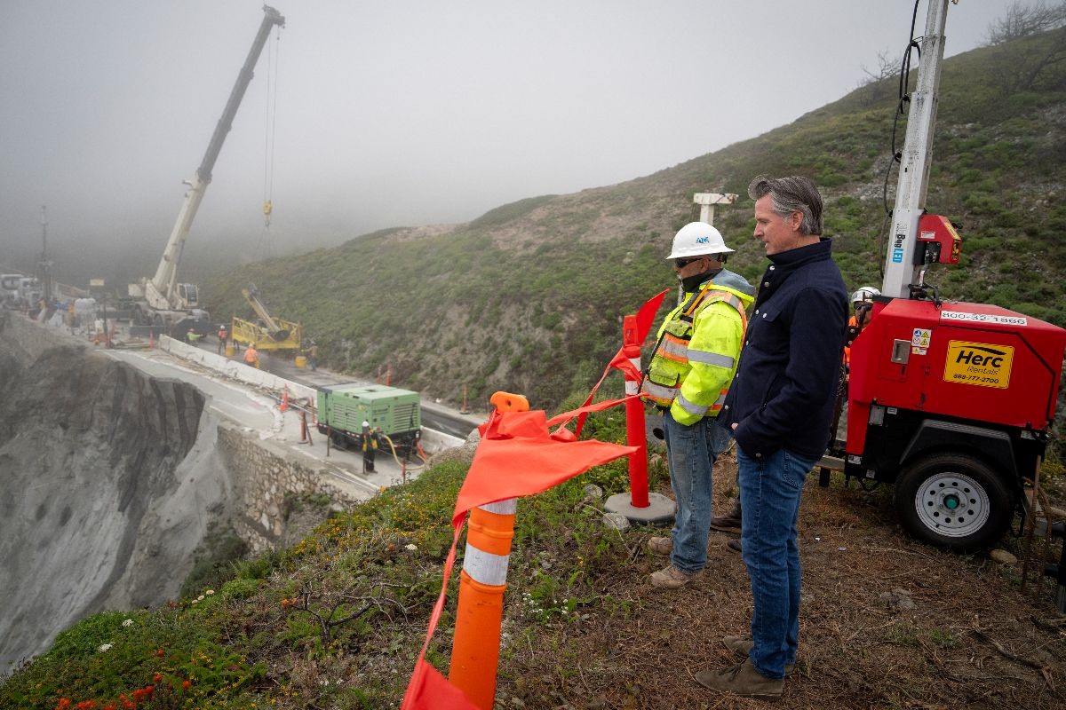
Governor Newsom surveys damage near the Rocky Creek Bridge earlier this month.
In order to stabilize the remaining southbound lane and preserve the northbound lane, crews drilled, installed and grouted 40 vertical and 75 sub-horizontal steel elements into the slope. The steel elements, or rock dowels, are covered by an application of shotcrete to protect the exposed rock slope. This work required Caltrans to close the roadway in both directions at Rocky Creek, aside from twice-daily convoys through the slip-out area.
Now that Caltrans has stabilized the southbound lane and preserved the northbound lane, the site will continue to be monitored and visually inspected. A project to construct a permanent repair to the highway at this location is currently in the design phase, with an estimated completion date of spring 2025.
Earlier this month, the Governor surveyed the work being done at the Highway 1 slip-out and announced state action by signing an emergency proclamation . This action will help secure an estimated $100 million in federal funding for repairs to multiple areas of the state impacted by the recent storms.
Press Releases
8 Must-See Stops on the Ultimate Idaho Road Trip
Idaho’s rugged, diverse beauty is accessible from all sides, making a road trip one of the best ways to explore the state. To make your experience on four wheels as simple and pleasant as possible, this road trip welcomes you in the southeastern corner of the state from nearby Salt Lake City and snakes you all the way north into Idaho’s panhandle. Drop the top and prepare for high mountain deserts; deep, jagged canyons; dense, lush forests and lots of cool, fresh mountain water — and plenty of adventure — along this most scenic of routes.
Getting There
From Salt Lake City, take Interstate 84 northwest to Twin Falls, where your Idaho road-trip adventure begins.
See & Do
Perched across the awe-inducing Snake River Canyon lies the I.B. Perrine Bridge — your scenic gateway to Twin Falls. As you cross, watch for BASE (Building, Antenna, Span or Earth) jumpers. These thrill-seekers come from all over the world to load up with a parachute, leap from the bridge and free-fall before pulling their chute and floating to the canyon floor. If you’re ready for some more jaw-dropping views, head to Shoshone Falls (“the Niagara of the West”), which cascade 212 feet into the Snake River. Snap a selfie on the overlook and then hit Dierkes Lake Recreation Area for hiking trails, rock climbing and water activities. When hunger hits, grab a seat on the patio at Elevation 486 , where the impressive dishes are matched only by the spectacular view.

Nearby & Noteworthy
- Milner’s Gate
- Koto Brewing Co.
- Zip the Snake
- Canyon Springs Golf Course
- Putters Mini Golf
- Cloverleaf Creamery
- Thousand Springs Scenic Byway
- Bruneau Dunes State Park
From Twin Falls, take I-84 west.
Idaho’s capital city tops all types of lists for livability due to its vibrant arts and culture scene, outdoor recreation opportunities, and flourishing culinary options. Stretch your legs on the Ridge to Rivers Trail System, where you’ll find more than 100 miles of hiking and biking trails offering views of the city below. For a more leisurely stroll, rent a Boise GreenBike to explore the Boise Greenbelt , which winds through downtown and multiple parks along the Boise River. Stop off at the Capital City Public Market or The Boise Farmers Market for fresh, local foods and arts, crafts and more. Grab a bite at one of Boise’s palate-pleasing dining options or a raise a glass of Idaho craft beer or Idaho wine at one of several local breweries and wineries . If you’re staying the night, book tickets to the Idaho Shakespeare Festival (tip: you’ll want to book in advance as performances can sell out quickly) for an unforgettable night of theater under the stars.

- Basque Museum & Culture Center
- Freak Alley Gallery
- Boise Whitewater Park
- World Center for Birds of Prey
From Boise, take Highway 55 north.
Wrapped around the southern banks of Payette Lake , McCall is a charming mountain town packed with outdoor adventure for any age or level. Spend a day at the lake, where you can rent everything from paddleboards and kayaks to jet boats and pontoons or book a lake cruise . Hike or bike the variety of trails Ponderosa State Park or get your downhill thrills at Brundage Mountain Resort and then catch the sunset with a spectacular lake view at Osprey Cliff Overlook. When it’s time to cool down from all your activity, head straight to Ice Cream Alley .

- Payette River Scenic Byway
- Whitewater rafting on the Payette River
- Lake Cascade State Park
- Kelly’s Whitewater Park
- Tamarack Resort
- Gold Fork Hot Springs
- Jug Mountain Ranch
- Locals’ Favorite Hikes
- Local Breweries
Cambridge & Hells Canyon
From McCall, take Highway 55 north through New Meadows and onto Highway 95 south.
The small town of Cambridge offers access to big adventure in the nearby Hells Canyon National Recreation Area . Stunning Hells Canyon is North America’s deepest river gorge (ever deeper than the Grand Canyon) and a staggering 10 miles wide at some points. Book a half- or full-day jet boat tour or a single- or multi-day whitewater rafting excursion (or a combo trip). Don’t miss an opportunity to take a breathtaking hike or fish for salmon and steelhead. Pro tip: The splendor of Hells Canyon lies 24 miles west from Cambridge, so be sure to load up on gas, ice and snacks as you come through town.

- Mundo Hot Springs
- Hells Canyon Scenic Byway
- Weiser River Trail
From Cambridge, take Highway 95 north through New Meadows.
Lewiston is home to Idaho’s newest wine region (Lewis-Clark Valley AVA), where you’ll find 10 wineries producing award-winning wines. Book a wine tour to experience the area’s best sips and learn the history’s rich viticultural history and then indulge in the distinctive dishes at Mystic Café . A launching point to the Hells Canyon National Recreation Area , Lewiston is an ideal base camp for tours on the Snake River that introduce you to wildlife, historical sites, and more.

- Northwest Passage Scenic Byway
- Nez Perce National Historical Park
- Monastery of St. Gertrude
- River Dance Lodge
From Lewiston, take Highway 95 north.
Surrounded by miles upon miles of rolling hills and fertile farmland, the charming college town of Moscow is an oasis of art, food and drink with enough hiking and biking to balance it all out. Play a round at the University of Idaho Golf Course or stroll through the garden displays at the University of Idaho Arboretum and Botanical Gardens . Learn the significance of the horse to the Nez Perce at the Appaloosa Museum and Heritage Center . Take a hike in Idler’s Rest Nature Preserve or bike the Latah Trail . Enjoy an eclectic mix of sandwiches and soups at Kitchen Counter and then top it off with a pint at Hunga Dunga Brewing Co . or a glass of wine at Colter’s Creek Tasting Room.

- White Pine Scenic Byway
- Elk River Backcountry Byway
Coeur d’Alene
From Moscow, take Highway 95 north.
This stop in Idaho’s panhandle area features plenty of chances to get on or in some pristine Idaho mountain water. Spend the day at City Park & Beach on Lake Coeur d’Alene (kore-duh-LANE) — home to sandy beaches, barbecue pits, volleyball and basketball courts and more. After all that fun in the sun, treat your taste buds to some comfort food at Meltz Extreme Grilled Cheese . Tame the fiercest of hunger pangs with the seasonal Huckleberry Heaven sandwich and then head to McEuen Park for an evening of music at Life After 5 . Start your next morning off by fueling up with a Cajun-inspired breakfast at Ten/6 . Then it’s off to soar above and among the trees with fantastic views of Lake Coeur d’Alene on a zipline canopy tour . If you have any energy left, plan an evening hike on Tubbs Hill to catch the sunset on a lakeside trail or enjoy a sunset dinner cruise .

- Lake Coeur d’Alene Scenic Byway
- St. Joe River Scenic Byway
- Silverwood Theme Park
- Route of the Hiawatha
- Red Horse Mountain Ranch
- Trail of the Coeur d’Alenes
- Idaho Centennial Trail
From Coeur d’Alene, take Highway 95 north.
Sandpoint hugs the shore of Idaho’s largest and deepest body of water, Lake Pend Oreille (pond oh-RAY), where you’ll find one of the best sunrise spots at City Beach as well as paddleboard, kayak and jet ski rentals. Huddled among the Selkirk, Cabinet and Bitter Root Mountain Ranges, Sandpoint is surrounded by hiking and biking trails for all levels. For a one-stop-shop of ultimate adventure, purchase the Ultimate Fun Pass at Schweitzer Mountain Resort , which gives you a full day of all-you-can trampolining, ziplining, rock climbing and scenic chairlift riding. If you’re cruising into town in August, the Festival at Sandpoint is a must-do. When replenishing fuel stores is critical, Sandpoint delivers. Load up on locally sourced pub fare and a cold one at Baxter’s on Cedar or settle into a martini or classic cocktail served up with unrivaled fare and a waterfront view at the splendid Trinity at City Beach .

- Western Pleasure Guest Ranch
- Wild Horse Trail Scenic Byway
- Pend Oreille Scenic Byway
For more trip ideas, check out the Idaho Roadsider and when you’re ready to hit the road, be sure to download the Idaho 511 app for real-time traffic updates.
Visit Idaho
Published on February 14, 2020
Related Tips

Healing Waters, Shopping Therapy, Adrenaline Rushes and More Await in Southwestern Idaho

Know Before You Go: Changes to Camping in the Sawtooths and Idaho State Parks
Related adventures.

Zims Hot Springs

Donnelly Farmers Market
IMAGES
VIDEO
COMMENTS
Best Time to Go. Choosing the right time for your road trip down Highway 1 can make a huge difference. If you ask me, spring (April to June) and fall (September to November) are the most comfortable times to travel. You'll dodge the summer crowd, encounter less fog than in winter, and still enjoy some delightful weather.
EPIC HIGHWAY 1 ROAD TRIP ITINERARY. Any Highway 1 Road Trip is going to be jam packed with lots of beautiful spots and lots of driving. BUT, it'll totally be worth it! Thankfully, the California Coast has some of the most scenic coastal viewpoints where your mind will be blown for the majority of the ride, SANTA MONICA
For updates visit CalDOT or reach out to us at [email protected] on how to customize your Highway 1 itinerary to go around the slide. Try to get to Big Sur by midday so that you can do both lunch and dinner there. For fine dining with an incredible view, you can beat Sierra Mar at the Post Ranch Inn.
Big Sur to Santa Barbara: Best Stops on Highway 1. After you leave Big Sur, make a stop at Elephant Seal Vista Point to see the funny-looking elephant seals. These awkward looking creatures are really a funny sight to watch. Between their goofy looking "elephant trunks" and their grumpy attitudes.
California's Highway 1 is a 1,100-mile national treasure. These six itineraries feature more than 150 scenic sites and experiences to help you plan your next coastal road trip.
Starting south and driving northbound is probably the most common way to travel Highway 1 because of the easy access to airports and rental cars to begin your journey. There are easy southern starting points like San Diego or Los Angeles. Northern California starting points are a little more difficult - you'll have to begin in Medford ...
California's coast-hugging Highway 1 is what dream drives are made of. The iconic roadway—which extends for more than 650 miles from Dana Point north to Leggett —offers endless vistas overlooking the Pacific, with plenty of redwood trees and wildlife sightings along the way. The most well-known stretch runs along California's Central ...
Cruise down the iconic Highway 1 for a scenic and unforgettable California road trip. Known as one of the most scenic drives in the country, the PCH—also called Highway 1—runs next to the ocean's crashing waves, from Leggett in Mendocino County all the way down to Dana Point in Orange County. With so many miles to cover, considering all ...
North of San Francisco, California's Highway 1 clings to the state's western edge, winding north from Sausalito through Marin, Sonoma, and Mendocino Counties. North of Fort Bragg, it veers inland, ending where it connects with U.S. Highway 101 in the town of Leggett. This classic California road trip route follows the coastal contours, rising and falling, zig-zagging around coves and curving ...
Hwy 1 splits off from Hwy 101 north of Gaviota, passing through Lompoc and Guadalupe before rejoining Hwy 101 just south of Pismo Beach. This 50-mile section is sometimes called the Cabrillo Highway. You could drive it if you want to cover every single inch of the famous highway, but there's little of interest if you're just sightseeing.
Travel Where The Road Takes You. Drive our special stretch of Highway 1 between Ragged Point and Nipomo, and you can't help but be awed by its natural beauty and scenic riches. These 81 miles are what make a Highway 1 road trip one of the top bucket-list excursions in the world. But finding all the secret treasures of this famous byway would ...
California's Pacific Coast Highway is one of America's most scenic drives, with stunning bluffs and designated vista points featuring sparkling ocean views. While Highway 1 extends more than ...
Tip: 1 Drive a comfortable car. Driving a comfortable and reliable car is a must. This is a two-lane mountain road. In some places, the shoulder is quite narrow, and there's not much between you and the sea below. There's a forty to fifty-mile stretch that's full of hairpin twists and turns.
McWay Falls Photo: Courtesy of SeeMonterey.com. Day 5. Wake up early and try to hit the road by 8:00 a.m. Your first stop will be a short 20-minute drive down to Julia Pfeiffer Burns State Park ...
Coastal Highway 1. Down south it's called the 'PCH,' or Pacific Coast Hwy, but North Coast locals simply call it 'Hwy 1.'. However you label it, get ready for a fabulous coastal drive, which cuts a winding course on isolated cliffs high above the crashing surf. Compared to the famous Big Sur coast, the serpentine stretch of Hwy 1 up ...
Also known as Highway 1, Hwy 1, California State Route 1 — and, if you ask us, the number-one road trip west of the Mississippi — the Pacific Coast Highway truly is one of the most breathtaking stretches of road in the world, let alone America. The coastal highway winds its way from where it intersects with I-5 in Dana Point at the south ...
Note: This Highway 1 California road trip post is sponsored by Ecolab.. Travel in 2021. I've loved road tripping the past two summers. Last year it was all about treading lightly as we were in the height of COVID-19. This year, our 18-day road trip from California to The Broadmoor in Colorado Springs in June only made me want to travel more, but at the same time, the news from day-to-day is ...
Download the app . California's Highway 1 is a perennial favorite for adventurous road-trippers—and for good reason. You can visit the sunny beaches of San Diego, the wine country of the ...
The north end of U.S. Highway 1 has always been in Fort Kent, Maine and in 1926 ended in Miami, Florida. In 1938, the ending was extended to Key West, Florida. It is also the longest north-south highway in the United States. Although a good part of the route hugs the Atlantic coastline, a large part is quite distant from the coast.
The reopening came eight days ahead of schedule and just in time for summer travel. "Highway 1 is the jewel of the California highway system and our crews have been working non-stop for the last ...
Caltrans announced the reopening of Highway 1 Friday, eight days ahead of schedule, and posted video of cars passing by the Rocky Creek Bridge where the "slipout" occurred on March 30. That ...
The reopening came eight days ahead of schedule and just in time for summer travel. "Highway 1 is the jewel of the California highway system and our crews have been working non-stop for the last month and a half so Californians can have unrestricted access to this iconic area of our state," Caltrans Director Tony Tavares said in a statement ...
CalTrans workers drill into the side of a cliff April 17, 2024, installing rock dowels aimed at stabilizing the southbound portion of Highway 1 in Big Sur, Calif. A section of the iconic highway ...
Along an almost 40-mile stretch of Highway 1, Big Sur has been isolated from the rest of the state for weeks — with limited access for residents and essential workers — after a massive chunk ...
May 17, 2024 at 10:09 a.m. BIG SUR — A section of California's scenic Highway 1 leading to the famous Big Sur coast reopened to around-the-clock traffic Friday after stabilization of a storm ...
Creating a Notification for your Route. Once your route is saved, you will be asked if you want to be notified of events on this route. Click 'Create Route Notification' You will be redirected to the notification creation page. Enter the required information for your route, select a delivery option (email or SMS), and click 'Save'.
Day 6 - Explore the Golden Ring. Creating the Moscow itinerary may keep you busy for days with the seemingly endless amount of things to do. Visiting the so-called Golden Ring is like stepping back in time. Golden Ring is a "theme route" devised by promotion-minded journalist and writer Yuri Bychkov.
WHAT YOU NEED TO KNOW: The Governor announced today that a portion of Highway 1, near Big Sur, which was severely damaged by recent storms, is set to reopen more than a week ahead of schedule this Friday, May 17. BIG SUR - Governor Gavin Newsom today announced that Caltrans will open the portion of Highway 1 closed by the Rocky Creek slip-out to traffic, starting at 6:30 a.m. this Friday ...
From McCall, take Highway 55 north through New Meadows and onto Highway 95 south. See & Do. The small town of Cambridge offers access to big adventure in the nearby Hells Canyon National Recreation Area. Stunning Hells Canyon is North America's deepest river gorge (ever deeper than the Grand Canyon) and a staggering 10 miles wide at some points.
About 836 road-less kilometers (520 miles) across desolate terrain separates Nome from the closest major city and road network in Fairbanks, the unofficial northern terminus of the Alaska Highway.