Singapore On a Budget
Free Things to Do
Family-Friendly Activities
Foods to Try
Hawker Centers
Restaurants
10 Reasons to Visit Singapore
Best Time to Visit
Weather & Climate
Changi Airport Guide
Neighborhoods to Explore
48-Hour Itinerary
Public Transportation

Getting Around Singapore: Guide to Public Transportation
:max_bytes(150000):strip_icc():format(webp)/mike_borobudur-5b6d3ea446e0fb0025fcb683.jpg)
Calvin Chan Wai Meng/Getty Images
Singapore's unfair advantage lies in its small size: the ultra-efficient government has been able to put together a public transport system that makes moving from point A to point B a completely effortless task. That means tourists looking to shop at Orchard Road in the morning, go to Singapore Zoo in the afternoon and make their late evening flight at Changi Airport can ride a bus or MRT and get to each place on time, almost without any friction or delay.
Luckily, the efficiency means that it's easy to ride Singapore’s public transportation system like a local from the minute you touch down. Here's how.
How to Ride the MRT
Singapore's Mass Rapid Transit (MRT) was launched in 1987 and has grown continuously to cover most parts of Singapore, from its residential suburbs to its business and heritage hotspots to Changi Airport.
Six lines and some 130 stations snake throughout the island. Each of the stations has a name based on the line and a sequential number: the North-South Line’s Orchard Station, for instance, bears the station code NS22.
Interchanges throughout the MRT network allow travelers to change lines without exiting the paid area, though some of the more recently-built crossings force commuters to walk long distances from one track to another.
To get a clearer idea of the MRT system’s range, look at the official MRT network map .
- Hours: The MRT operates from 5:30 a.m. to midnight, but operating hours are usually extended during holidays and other special seasons. The MRT’s train frequency varies, generally arriving in 2-3 minute intervals during peak hours from 7 a.m. to 9 a.m., to intervals of 5-7 minutes during the rest of the day.
- Fares: Prices are based on the distance covered, ranging from .83 to 1.25 Singapore dollars (around 60 to 90 cents). Use the Singapore Land Transport Authority Fare Calculator to estimate fares between stops.
- Ticketing: Both train and bus fares use a stored-value, contactless smart card called the EZ-Link Pass. To enter and exit the paid area, tap the card on the gantry; a screen will show the EZ-Link Pass’ remaining value.
- Where to Get Passes: You can buy EZ-Link Passes at MRT Stations, bus terminals, and 7-Eleven stores. Single-journey passes are also available. Read our article about Singapore’s EZ-Link Pass for more details on Singapore’s contactless transit cards.
- Accessibility: MRT stations have been designed from the ground up for accessibility, with ramps, elevators and barrier-free access; wheelchair-accessible toilets; and trains with wheelchair-accessible carriages. Allowances for visually-impaired and deaf riders—from Braille plates in elevators to strategically-placed signage and lights—have been made where possible. Read the Singapore Tourism Board’s official page on their accessibility accommodations.
- Getting to Changi Airport: Ride to Tanah Merah Interchange (EW4), where you can transfer to a train that goes directly to Changi Airport (CG2).
To plan your route, you can download and access a number of free apps or websites that let you input Point A and B, and generate a travel plan based on both points.
Singapore’s Land Transport Authority has MyTransport , which lets you customize a trip based on your favorite transport services. Meanwhile, CityMapper and GoThere.sg both offer trip planning functionality for both mobile and desktop, with slightly different graphic user interfaces.
MRT-Accessible Tourist Attractions in Singapore
Once you’ve made sense of the MRT, ride the rails to any one of these key MRT-accessible stops in Singapore:
- Botanic Gardens: Singapore’s only UNESCO World Heritage Site can be easily reached through the Botanic Gardens Interchange (CC19/DT9) that straddles the Downtown Line and Circle Line.
- Chinatown: Singapore’s Chinese ethnic enclave is most easily reached via Raffles Place Interchange (EW14/NS26), Outram Park Station (EW16), or Chinatown Station (NE4). Read about Singapore’s ethnic enclaves.
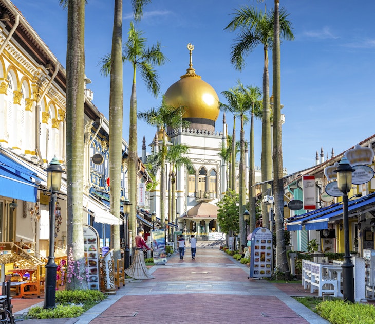
- Kampong Glam: to get to Singapore’s main Muslim cultural center, take the MRT’s East-West Line to Bugis Station (EW12).
- Little India: Singapore’s Indian enclave can be reached by taking the North-East Line’s Little India Interchange (NE7/DT12) and Farrer Park Station (NE8).
- Marina Bay: You can visit Marina Bay and nearby attractions through Raffles Place Interchange (EW14/NS26), City Hall Interchange (NS25/EW13) Marina Bay Interchange (NS27/CE2/TS20), Bayfront Interchange (CE1/DT16), Promenade Interchange (CC4/DT15), and Esplanade Station (CC3).
- Orchard Road: Singapore’s primary retail hotspot can be reached through Dhoby Ghaut Interchange (CC1/NE6/NS24), Orchard Interchange (NS22/TE14), and Somerset Station (NS23). Read about shopping in Singapore .
- Sentosa: Singapore’s resort island can be reached by taking either the North-East Line or the Circle Line to HarbourFront Interchange (NE1/CC29), then ascending to the attached VivoCity Mall, where you can then ride the Sentosa Express people-mover to the island.
- Singapore Zoo: Ride the North-South Line to Khatib Station (NS14); from here, you can take the Mandai Khatib Shuttle to Singapore Zoo .
Riding Singapore’s Bus System
Singapore’s MRT may be fast, but the bus system has a better range. It's an extensive network that reaches all across the island, covering far-flung public housing estates too far to reach by train.
Two bus lines operate in Singapore: SBS Transit ( sbstransit.com.sg ) and SMRT Buses ; buses run throughout the island from 5:30 a.m. to midnight, with frequencies ranging from five to 30 minutes.
After midnight, extended night transport services ( Nite Owl from SBS, NightRider from SMRT) cover abbreviated routes throughout Singapore until 2 a.m.
Like the MRT, Singapore’s buses use the EZ-Link Pass for electronic ticketing. You can also pay in cash, exact change only.
The same apps that can plan your MRT trip also help plot out your bus trip, too: MyTransport, CityMapper, and GoThere.sg can program an itinerary using both public transportation methods based on your point of origin and planned destination.
Riding Singapore’s Taxis and Ride Shares
Taxis are numerous in Singapore, though they are considerably more expensive. Look for a marked taxi queue stand to catch a cab, or summon one either by calling their number or by using their smartphone app to pick you up at your location.
Here are a few taxi phone numbers worth remembering, to use when you’re in Singapore:
- Comfort Transportation: (+65) 6552 1111
- CityCab: (+65) 6555 1188
- SMRT Taxis: (+65) 6555 8888
- Trans-Cab Services: (+65) 6287 6666
The two most commonly-used taxi apps are Comfort DelGro and Cabify/Easytaxi . Grab is Singapore’s ridesharing app. If you’re in a hurry, you can open up the app to order the nearest Grab car or taxi to pick you up and then drop you off where you need to be.
Taxi and Ride-Share Prices and Surcharges
Taxis and ride-shares have a complicated pricing scheme, due to congestion charges and other surcharges, which were instituted by the Singapore government to minimize congestion on the roads.
For example: on a regular, non-premium taxi ride, expect to pay between 3.20-3.90 Singapore dollars (around $2.50) for the first kilometer, then an additional 0.22 Singapore dollars (around 15 cents) for every 400 meters up to 10 kilometers, and every 350 meters beyond.
Additional surcharges will be tacked onto your fare if the following conditions are met:
Travel during peak periods: A peak period taxi surcharge of 25 percent of your metered fare applies if you’re riding a taxi from 6 a.m. to 9:30 a.m on weekdays (excluding Singapore public holidays), and 6 p.m. to 12 a.m.;
Travel after midnight: A midnight surcharge of 50 percent of your metered fare applies for taxi travel from 12 a.m. to 6 a.m.
Travel from certain areas: A location-based taxi surcharge applies for taxi trips departing from certain areas at certain times. These include:
- Central Business District (5 p.m. to 11:59 p.m.): 3 Singapore dollars
- Marina Bay Sands (6 a.m. to 4:59 p.m., Sundays and public holidays): 3 Singapore dollars
- Changi Airport (5 p.m. to 11:59 p.m., Friday to Sunday): 5 Singapore dollars;
- Resorts World Sentosa, Gardens by the Bay, Tanah Merah Ferry: 3 Singapore dollars at any time
Travel through certain areas: Congestion penalties called ERP charges apply if you pass under an ERP gantry in your taxi. Rates vary depending on the location.
Payment using a credit card: For credit card payments, taxis add an extra 10 percent administrative fee.
All these charges add up to something fierce. That’s why we suggest using the bus or MRT at all times, and use the taxi only if you can avoid paying the surcharges listed here.
Tips for First-Time Commuters in Singapore
- Rush hour is the enemy. Trains are packed to the gills, bus queues lengthen considerably, and taxis impose surcharges that can almost double the fare. Avoid traveling from 7 a.m. to 10 a.m. on public transport whenever possible
- EZ-Link Pass—don’t leave home without it. It’s the Swiss Army Knife of cards in Singapore —you can use it on buses and trains; you can pay for purchases with it in select stores, and its cool design makes it a nice souvenir to take home with you!
- Buy a local SIM card for your out-of-network phone. For every aspect of your Singapore commute—from leaving Changi Airport to hailing a cab to planning a trip on public transportation, there’s an app to help you every step of the way. You should get a generous data plan to work with all the apps we’ve listed above, so buy a local SIM card (assuming your phone works with Singapore’s 4G network ), download the apps you need, and commute like a local.
Singapore Changi Airport Guide
Surviving Singapore on a Budget
Singapore Guide: Planning Your Trip
Getting Around Detroit: Guide to Public Transportation
Top Ten Reasons to Visit Singapore
Getting Around Mexico City: Guide to Public Transportation
Getting Around Beijing: Guide to Public Transportation
Chinese New Year in Singapore: An Islandwide Celebration
Getting Around Seattle: Guide to Public Transportation
Getting Around Paris: Guide to Public Transportation
Getting Around Salt Lake City: Guide to Public Transportation
Getting Around Madrid: Guide to Public Transportation
Getting Around Pittsburgh: Guide to Public Transportation
Getting Around Frankfurt: Guide to Public Transportation
The 9 Best Beaches in Singapore
What $100 Can Get You in Southeast Asia
- Deutschland
- Traveller Essentials
Getting Around Singapore
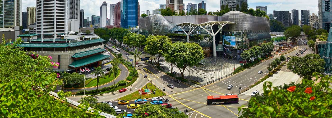
Singapore's public transport system is fast and efficient, and will whizz you to memorable attractions without fuss.
By Public Transport

If you need assistance or have any queries, drop by one of any of the seven Singapore Visitor Centres.
The visitor centres boast a range of helpful services and information. You’ll be able to plan your itinerary, get tips on must-see attractions, purchase tickets for sightseeing, book accommodation and even pick up a souvenir (or two).
Find Out More
Visit Singapore Travel Guide App

Made for exploring the city with ease, The Visit Singapore Travel Guide app offers everything you need to know in a bite-sized format.
Whether it's information on first-time travel, transportation, or local recommendations, our app ensures the most up-to-date essentials are at your fingertups for a pleasant Singapore experience.
How to use public transportation to get around in Singapore

Mar 8, 2024 • 6 min read
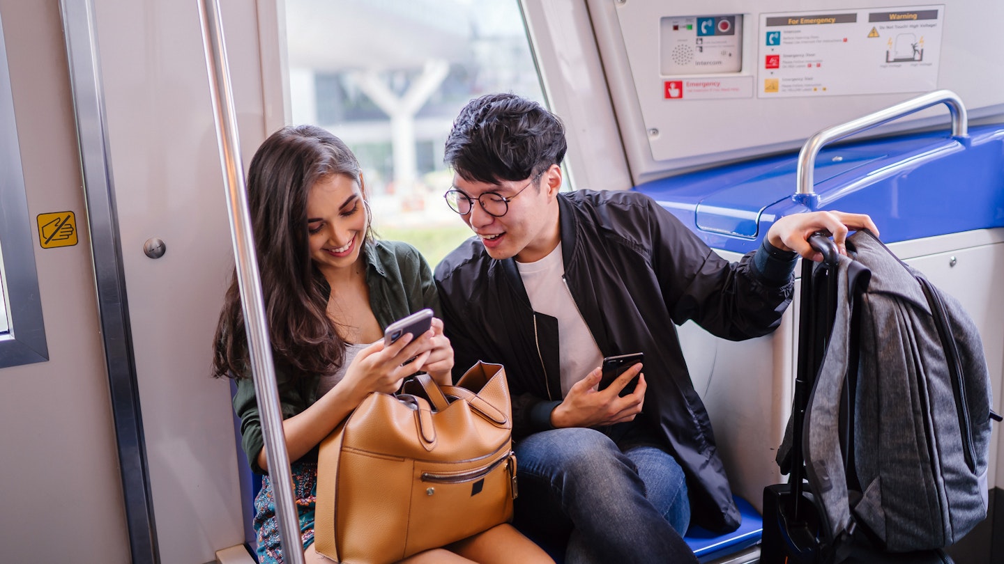
Know your Mass Rapid Transit from your public bus with this guide to getting around Singapore © mentatdgt / Shutterstock
Singapore ’s extensive public transportation system makes navigating this compact country a breeze.
While the cost of living makes Singapore one of the more expensive countries to visit, you might be able to save a little by learning how to make full use of its bus and subway networks. Stretch your budget and see more of this beautiful nation with our guide to getting around Singapore.
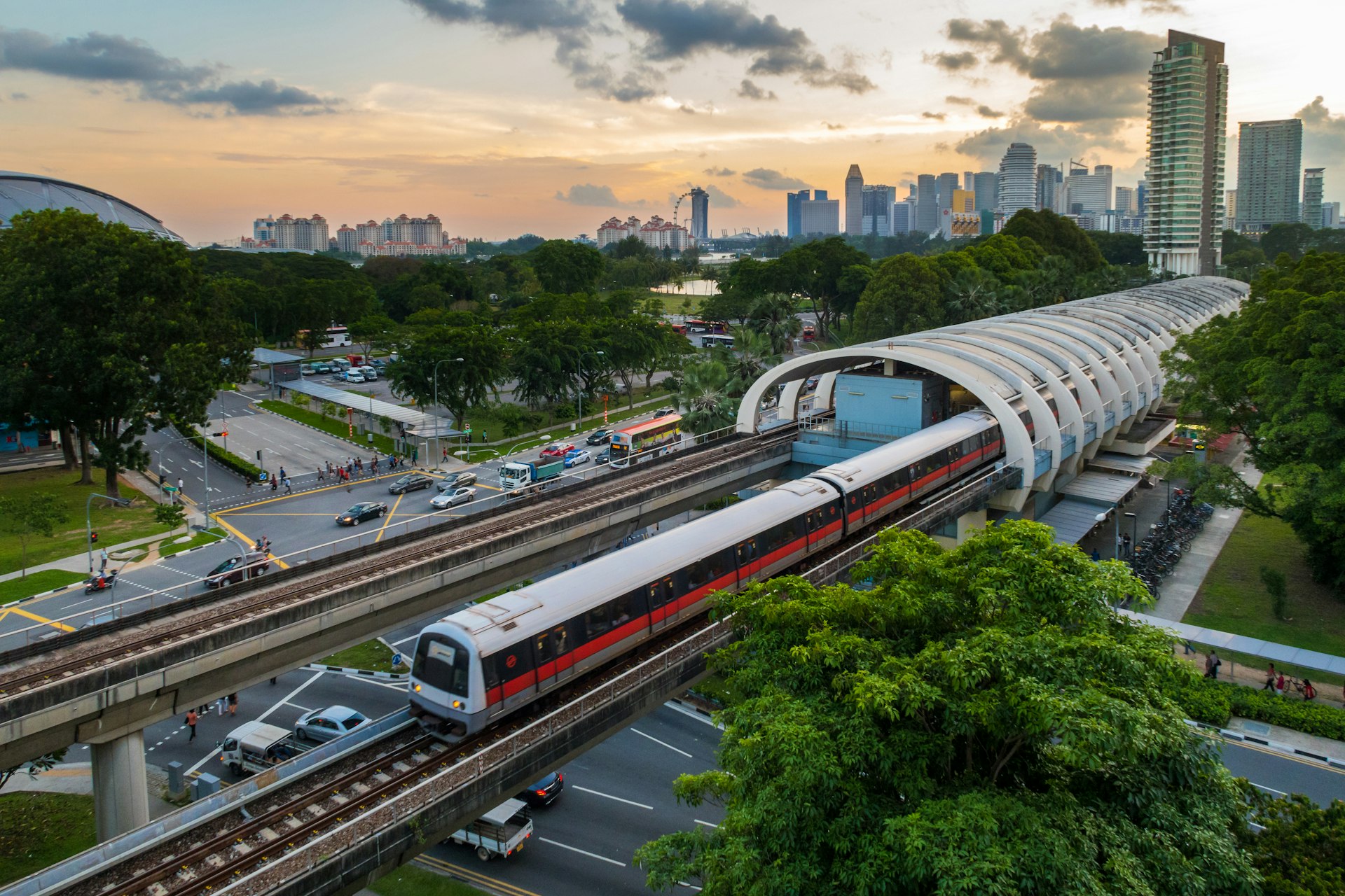
Get around Singapore easily on the MRT
Singapore’s subway system or the Mass Rapid Transit (MRT) is the most convenient way for travelers to get around cheaply and easily. Hopping on the MRT lets you avoid traffic jams, though platforms can get quite crowded during the morning and evening rush hours.
Navigating the MRT is quite straightforward for anyone used to a city metro. Currently, there are six MRT lines each marked with a distinct color, while stations are assigned numbers for easy identification – see the SMRT Journey Planner for the latest updates . Station signage and announcements are in the four official languages: English, Chinese, Malay and Tamil.
There are several smaller, driverless Light Rail Transit (LRT) systems that tourists are unlikely to encounter as they mostly serve residential neighborhoods. The Sentosa Express is a monorail line that connects from Vivocity Shopping Centre in Harbourfront to the offshore island of Sentosa.
See the sights on a budget with the public bus network
The public bus network is another cheap option for getting around Singapore. While you may get stuck in peak-hour traffic jams, taking the bus is a more scenic way to enjoy the journey. It can also offer direct connections on routes that may require multiple changes on the MRT.
Singapore’s bus network is extensive and covers most of the island, with frequencies typically from 10–20 minutes. Bus stops have a unique ID number to help you identify where to stop, and most bus stops will have some route information at the bus stop itself. Google Maps is fairly accurate when planning a bus route; other apps you can use include Citymapper and MyTransport.sg on Android or Apple .
Opt for free shuttle buses
There are some private shuttle bus services that may be more convenient than public buses. Notable ones for tourists include the free shuttle bus lines that go around Sentosa Island , the weekend Kranji Farms Shuttle to explore Kranji Countryside, and the Mandai Khatib Shuttle that goes from Khatib MRT Station to the various parks at Mandai Wildlife Reserve.
Get a transport pass or tap in/out with a local app
To use the public buses or MRT in Singapore, you will need to purchase a stored value card ( EZ-Link Card ) available at all MRT stations and bus interchanges. Alternatively, the SimplyGo initiative allows you to use your contactless debit or credit card to pay for public transport without registration required – just tap your phone, smartwatch or physical card.
The fares for traveling via bus or MRT in Singapore are calculated based on distance so make sure to tap in and tap out to ensure you are charged the correct fare. There are no single-trip tickets for the MRT, but you can use cash to pay on the bus – you will need exact change to pay for your fare. A helpful online fare calculator can provide estimated fare prices.
For tourists, you can consider the Singapore Tourist Pass which allows for unlimited rides on the public bus and MRT for 1–3 days.
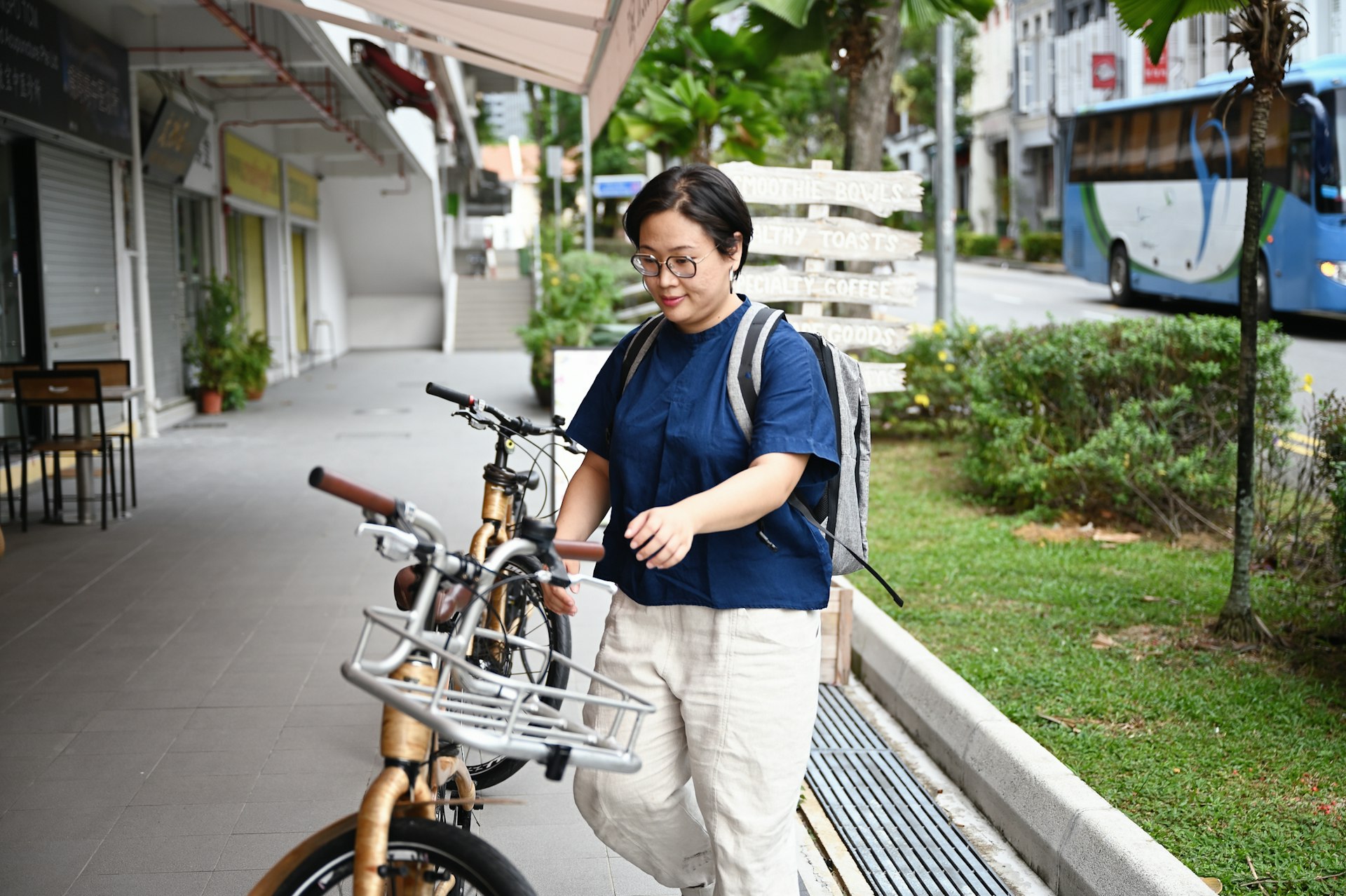
Shared bicycles are good for short distances
There are shared bicycles with multiple locations to pick up and return, like SG Bike and Anywheel , that can be accessed via an app. This is a cheap and green alternative to taking the bus or MRT, but best for covering shorter distances as the bicycles are quite basic.
While cycling has gained popularity in recent years, most of Singapore’s roads have not been built to accommodate bicycles, which can make road cycling challenging for those unfamiliar with the local driving culture. Also, the tropical humidity and sudden downpours can make cycling in Singapore less than pleasant.
Many of Singapore’s green spaces and parks have bike rental kiosks. East Coast Park , Bukit Timah Nature Reserve , Marina Bay , Sentosa and Pulau Ubin are popular spots to explore on two wheels.
Ride in comfort via taxi
If time is of the essence or you’re traveling in the wee hours of the morning, taxis may be a more comfortable way to get around Singapore. Taxis do cost more but can be economical if traveling in a small group.
Official taxis in Singapore have a small electronic "Taxi" sign on the roof. You can hail a cab along the road in suburban areas, but taxis are only allowed to stop at proper taxi stands in the Central Business District area. They are particularly hard to find when it is raining.
Standard taxi fares are distance-based, but there are many add-on surcharges based on when you ride, where you hail the cab and whether there are tolls on the route taken. All taxis in Singapore use the meter so there’s no haggling involved, and cash is the preferred method of payment. Some cabs may accept credit card payments but there is an additional 10% service fee and tax.
Book a rideshare for convenience
Rideshares are an alternative to taxis if you have a local data plan and access to the apps. You can usually book and pay through the app, but you may also be subject to surge pricing during peak hours.
Grab is the largest rideshare company in Singapore – there is no Uber or Lyft here. Other players in the market include Gojek , TADA and carpooling app Ryde . Taxis can be booked via Zig or via the rideshare apps.
There's no real need to drive in Singapore
Given Singapore’s small size and good public transport network, there is no real need for tourists to rent a car to explore the city . Most of the main sights are in the downtown area and well connected by MRT or bus, and for more out-of-the-way spots, calling a taxi or rideshare is much easier and economical than renting a car where you have to factor in the costs of fuel, road tolls and expensive parking.
There are car-sharing options like BlueSG , TribeCar or GetGo that you can consider if you really must drive – note that vehicles in Singapore drive on the left side of the road.
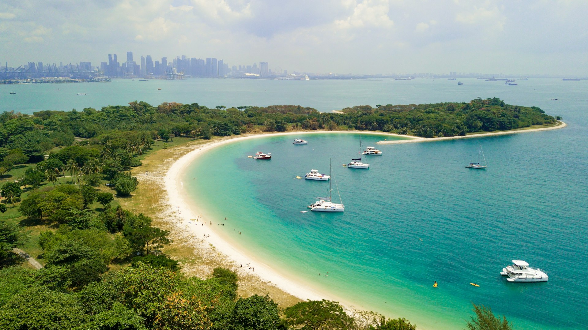
Sail to Singapore’s outer islands on the public ferry
You can charter a private boat to explore Singapore’s offshore islands, but the public ferry is the cheapest way to access them. To get to Pulau Ubin in the northeast, head to Changi Point Ferry Terminal where there are small bumboats that take you to the island in just 10 minutes.
If you want to explore the Southern Islands ( St John’s Island , Lazarus Island and Kusu Island ), Singapore Island Cruise and Marina South Ferries both run regular ferry services from Marina South Ferry Terminal.
Accessible transportation in Singapore
Most of the buses and trains in Singapore have spaces and ramps equipped for strollers, wheelchairs and personal mobility aids, as well as marked priority seats for those who need them. Train stations and bus stops are barrier-free with at least one entrance that is accessible, and staff are trained to provide assistance if necessary.
For taxis, there are specialized transportation services with wheelchair-accessible vehicles and medically trained drivers such as Strides Care and Caring Fleet .
Learn more about accessible travel options by downloading Lonely Planet's free Accessible Travel guide .
This article was first published Oct 13, 2021 and updated Mar 8, 2024.
Explore related stories
Tips & Advice
Apr 16, 2024 • 12 min read
Singapore's allure goes beyond its iconic hotels, manicured gardens and world-class airport – here are the best places to visit when you arrive.

Apr 6, 2024 • 6 min read

Mar 9, 2024 • 6 min read

Mar 8, 2024 • 5 min read

Mar 8, 2024 • 10 min read

Feb 9, 2024 • 12 min read

Jan 27, 2024 • 17 min read

Jan 5, 2024 • 20 min read

Jan 2, 2024 • 11 min read

Dec 15, 2023 • 7 min read

NAVITIME Transit
Singapore journey planner / transit map.

Singapore Station / Bus Stop List
- [NS4/BP1]Choa Chu Kang
- [BP2]South View
- [BP3]Keat Hong
- [BP4]Teck Whye
- [BP5]Phoenix
- [DT1/BP6]Bukit Panjang
- [BP8]Pending
- [BP9]Bangkit
- [BP10]Fajar
Singapore Railway List
- Bukit Panjang LRT(Choa Chu Kang - Bukit Panjang)
- Bukit Panjang LRT(Bukit Panjang - Fajar)
- East West Line (CG)
- East West Line (EW)
- North East Line
- North South Line
- Punggol LRT(East Loop)
- Punggol LRT(West Loop)
- Sengkang LRT(East Loop)
- Sengkang LRT(West Loop)
Nearest places
- 成記119 335 Smith Street, Chinatown Complex #02-190 6562228202 Others (Eat out)
- アイス・コールド・ビア 9 Emerald Hill Road 6567359929 Others (Eat out)
- ヤ・クン・カヤトースト ファーイーストスクエア店 18 China Street #01-01 S(049560) Others (Eat out)
- チャイナタウン・コンプレックス・フードコート Blk 335 Smith St Others (Eat out)
- ロイキー・ベスト・チキンライス/黎記海南雞飯 342 Balestier Road 62522318 Others (Eat out)
- なだ万 22 Orange Grove Road, Shangri-La Hotel, 62134571 Others (Eat out)
- レッド・ハウス (ロバートソン・キー) 60 Robertson Quay #01-13/14 The Quayside 67357666 Others (Eat out)
- ラブレッツア 29 Tanglin Road,The St. Regis Singapore 2F 65066866 Others (Eat out)
- ローリーズ 333A Orchard Road #04-01/31 Mandarin Gallery,Meritus Mandarin Hotel Singapore 238897 68363333 Others (Eat out)
Nearest hotels
- Shangri-La Singapore 22 Orange Grove Road ★★★★★ 0m
- The Fullerton Hotel 1 Fullerton Square Singapore ★★★★★ 0m
- Goodwood Park Hotel 22 Scotts Road Singapore ★★★★★ 0m
- Voco Orchard Singapore – An IHG Hotel 581 Orchard Road Singapore ★★★★★ 0m
- Orchard Scotts Residences by Far East Hospitality 5 Anthony Road Singapore ★★★★★ 0m
- Comfy Stay (Common Room and Kitchen Bathroom Only) Woodlands Crescent Singapore ★★★★★ 0m
- Oasia Residence Singapore By Far East Hospitality 123 West Coast Crescent Singapore ★★★★★ 0m
- AIR Residences Service Apartment Singapore 36 Club Street Singapore ★★★★★ 0m
- The Robertson House by The Crest Collection 1 Unity Street Singapore ★★★★★ 0m
Singapore Airport List
- SIN Singapore Changi International Airport
- XSP Seletar Airport
North America
South america.


- Animal Attractions
- Area - Bedok
- Area - Changi
- Area - Chinatown
- Area - City & Downtown
- Area - Jurong
- Area - Kallang
- Area - Marina Bay
- Area - Orchard Road
- Area - Pasir Ris
- Area - Punggol
- Area - Sentosa Island
- Area - Tampines
- Galleries & Museums
- Gardens & Parks
- Theme Parks & Water Parks

Marina Bay Sands

Gardens By The Bay

Universal Studios Singapore

Singapore Zoo

Singapore Flyer

Singapore Night Safari

ArtScience Museum

Resorts World Sentosa

National Gallery Singapore

Singapore Botanic Gardens

Chingay Parade

River Hongbao

Chinese New Year

Singapore Art Week

M1 Singapore Fringe Festival

Pongal Harvest Festival

Singapore Motorshow

Marina Bay Singapore Countdown

New Years Eve

Singapore Marathon

Christmas Wonderland
- Boutique Hotels
- Luxury Hotels
- Cheap Hotels
- Clarke Quay
- Jalan Besar

Kampong Glam
- Little India
- Robertson Quay
- Sentosa Island
Tiong Bahru
- Food & Nightlife
- Markets & Hawker Centres
- Sports Venues

Holiday Packages

Singapore Sports Hub

Marina Bay Sands Skypark

Theatres on the Bay

Sentosa Cable Car

Shoppes at Marina Bay Sands

Marina Bay Sands Casino

Leong San See Temple

Buddha Tooth Relic Temple and Museum
- General Enquiries
- Advertising Enquiries
- Add Your Business
- Add Your Event

Singapore MRT
Singapore is popularly known as the Garden City of Southeast Asia which, due to its size, is easy to navigate and only takes a short time to get from North to South, or East to West.
Aside from taxis, the most common mode of transportation in Singapore is the MRT , also known as the “Mass Rapid Transit” system.
Singapore MRT, Ticket Prices & Fares, Maps & Routes
All trains are air-conditioned and are well maintained. The North-East line operated by SBS is also an automated underground rail system which operates from Punggol to Harbourfront . Aside from being one of the most modern MRT systems in the world, the advanced features of the trains make them some of the safest in the world.
One of the unique features also of the Singapore MRT system is the use of destination numbers instead of usual line numbers. The train lines are also distinguished by colour: The Green Line travels east/west, the Red Line travels north/south. Like most train operators, a contactless smartcard required for each passenger which is scanned when entering or exiting the station.
Although fare prices vary depending on the boarding and alighting stations, you can store money on these cards in order to take multiple journeys over your extended stay. A single trip for an adult start from $1.40 and can be purchased from ticket machines at the stations. Usually, the train operation starts daily at 5.30am and runs until midnight with peak hours between 7am to 9am.
Announcements are made in English as is all signage. To get to and from Changi Airport , you can take the East/West (green) line. Simply follow the signs from the arrivals hall to the MRT. You can purchase a one-way ticket with cash or credit for about $1.40 each way. Take the train and get off at the second stop ‘Tanah Merah’, you need to interchange here and it is extremely simple as the ongoing train is just across the platform. The train will continue on the green line heading towards the city. If you need to get on a Purple Line, you can change at Bugis . If you need to get on a Red Line, change at City Hall . A one-way train trip from City Hall to Changi Airport only takes around 15 minutes.
Singapore MRT Images & Photos
Singapore mrt area, street & hotel map, singapore, other places we recommend.
7 Underrated Spots in Singapore To Go on Your Next Visit

Chinatown Visitor Centre
Getting to Sentosa Island
5 Things About Singapore Every Traveller Should Know

5 things not to do during the Singaporean Hungry Ghost Festival

The Best Family Tourist Attractions Around Singapore
13 comments, cancel reply.
Please Enter Your Question Below
Your Name *
Your Email *
Is there a map which shows where MRT is overground & underground? One of our party doesn’t like tube trains.
I have searched online for a map that illustrates this, but unfortunately, there doesn’t appear to be anything that strays away from the standard map.
Based on other people’s feedback, they state that “all stations and tracks within Orchard, Marina and the Central Business District area are underground”. So it’s to say that if you are within the popular business direct area, the train station will be underground.
Thanks Michael
Where is the nearest MRT station to suntec city
Although Esplanade and Promenade on the Circle Line look to be equal distance from Suntec City, i would recommend using Promenade as the walk will be much quicker.
Getting off at Esplanade would require you to wait for the lights or use the overpass in order to get over Nicoll Hwy.
But it all depends really from what direction you are coming from. That is, any time spent going the extra station might negate the time saved.
Thanks Michael. Btw what kinda distance are we talking about. I’ll be taking the MRT from changi with 2 large bags so I think you get my predicament right. Regards
What is the MRT fare for going to city hall from Beauty world?
You can use the fare calculator here to work out how much it costs to travel on the Singapore MRT. The standard fare will be S$2.20.
Best regards, Jess
Hi. What time is the last MRT? Planning for the new year fireworks at Gardens by the bay
You don’t mention which line you wish to travel on, however the MRT is extended for NYE celebrations with the last MRT’s generally running between 1am – 2.30, depending on which line you require.
Best to check with the SMRT site directly. Insert the station and it will give you the last MRT time.
We will be staying eight days over the Christmas period, are the MRT trains running as normal.
Yes, the MRT runs as normal. In fact, extra services are typically offered over the busy NYE period.
Is there a MRT ticket card for senior citizens like it is in Hongkong?
There are seniors tickets, but only for permanent residents and citizens only, who will have a concession EZlink card.
Regards, Jess
Weather Forecast
Upcoming events, disney on ice, hari raya aidilfitri, 2xu compression run, singapore rugby sevens, ocbc cycle singapore, singapore international festival of arts, i light singapore, sundown marathon, dragon boat festival.

MRT/LRT Fare Calculator, Travel Time and Route Guide
* Commuting times are estimates only. Actual travel times may be affected by transfers, waiting times, train system faults and peak/non-peak hour carriage frequencies.
More about popular stations ...
Acknowledgment:.
- Admiralty [NS10]
- Aljunied [EW9]
- Ang Mo Kio [NS16]
- Bakau [SE3]
- Bangkit [BP9]
- Bartley [CC12]
- Bayfront [CE1][DT16]
- Beauty World [DT5]
- Bedok [EW5]
- Bedok North [DT29]
- Bedok Reservoir [DT30]
- Bencoolen [DT21]
- Bendemeer [DT23]
- Bishan [CC15][NS17]
- Boon Keng [NE9]
- Boon Lay [EW27]
- Botanic Gardens [CC19][DT9]
- Braddell [NS18]
- Bras Basah [CC2]
- Bright Hill [TE7]
- Buangkok [NE15]
- Bugis [DT14][EW12]
- Bukit Batok [NS2]
- Bukit Gombak [NS3]
- Bukit Panjang [BP6][DT1]
- Buona Vista [CC22][EW21]
- Caldecott [CC17][TE9]
- Canberra [NS12]
- Cashew [DT2]
- Changi Airport [CG2]
- Cheng Lim [SW1]
- Chinatown [DT19][NE4]
- Chinese Garden [EW25]
- Choa Chu Kang [BP1][NS4]
- City Hall [EW13][NS25]
- Clarke Quay [NE5]
- Clementi [EW23]
- Commonwealth [EW20]
- Compassvale [SE1]
- Coral Edge [PE3]
- Dakota [CC8]
- Damai [PE7]
- Dhoby Ghaut [CC1][NE6][NS24]
- Dover [EW22]
- Downtown [DT17]
- Esplanade [CC3]
- Eunos [EW7]
- Expo [CG1][DT35]
- Fajar [BP10]
- Farmway [SW2]
- Farrer Park [NE8]
- Farrer Road [CC20]
- Fernvale [SW5]
- Fort Canning [DT20]
- Gardens by the Bay [TE22]
- Geylang Bahru [DT24]
- Great World [TE15]
- Gul Circle [EW30]
- HarbourFront [CC29][NE1]
- Havelock [TE16]
- Haw Par Villa [CC25]
- Hillview [DT3]
- Holland Village [CC21]
- Hougang [NE14]
- Jalan Besar [DT22]
- Jelapang [BP12]
- Joo Koon [EW29]
- Jurong East [EW24][NS1]
- Kadaloor [PE5]
- Kaki Bukit [DT28]
- Kallang [EW10]
- Kangkar [SE4]
- Keat Hong [BP3]
- Kembangan [EW6]
- Kent Ridge [CC24]
- Khatib [NS14]
- King Albert Park [DT6]
- Kovan [NE13]
- Kranji [NS7]
- Kupang [SW3]
- Labrador Park [CC27]
- Lakeside [EW26]
- Lavender [EW11]
- Layar [SW6]
- Lentor [TE5]
- Little India [DT12][NE7]
- Lorong Chuan [CC14]
- MacPherson [CC10][DT26]
- Marina Bay [CE2][NS27][TE20]
- Marina South Pier [NS28]
- Marsiling [NS8]
- Marymount [CC16]
- Mattar [DT25]
- Maxwell [TE18]
- Mayflower [TE6]
- Meridian [PE2]
- Mountbatten [CC7]
- Napier [TE12]
- Newton [DT11][NS21]
- Nibong [PW5]
- Nicoll Highway [CC5]
- Novena [NS20]
- Oasis [PE6]
- one-north [CC23]
- Orchard [NS22][TE14]
- Orchard Boulevard [TE13]
- Outram Park [EW16][NE3][TE17]
- Pasir Panjang [CC26]
- Pasir Ris [EW1]
- Paya Lebar [CC9][EW8]
- Pending [BP8]
- Petir [BP7]
- Phoenix [BP5]
- Pioneer [EW28]
- Potong Pasir [NE10]
- Promenade [CC4][DT15]
- Punggol [NE17][PTC]
- Punggol Point [PW3]
- Queenstown [EW19]
- Raffles Place [EW14][NS26]
- Ranggung [SE5]
- Redhill [EW18]
- Renjong [SW8]
- Riviera [PE4]
- Rochor [DT13]
- Rumbia [SE2]
- Sam Kee [PW1]
- Samudera [PW4]
- Segar [BP11]
- Sembawang [NS11]
- Sengkang [NE16][STC]
- Senja [BP13]
- Serangoon [CC13][NE12]
- Shenton Way [TE19]
- Simei [EW3]
- Sixth Avenue [DT7]
- Somerset [NS23]
- Soo Teck [PW7]
- South View [BP2]
- Springleaf [TE4]
- Stadium [CC6]
- Stevens [DT10][TE11]
- Sumang [PW6]
- Tai Seng [CC11]
- Tampines [DT32][EW2]
- Tampines East [DT33]
- Tampines West [DT31]
- Tan Kah Kee [DT8]
- Tanah Merah [EW4]
- Tanjong Pagar [EW15]
- Teck Whye [BP4]
- Telok Ayer [DT18]
- Telok Blangah [CC28]
- Thanggam [SW4]
- Tiong Bahru [EW17]
- Toa Payoh [NS19]
- Tongkang [SW7]
- Tuas Crescent [EW31]
- Tuas Link [EW33]
- Tuas West Road [EW32]
- Upper Changi [DT34]
- Upper Thomson [TE8]
- Woodlands [NS9][TE2]
- Woodlands North [TE1]
- Woodlands South [TE3]
- Woodleigh [NE11]
- Yew Tee [NS5]
- Yio Chu Kang [NS15]
- Yishun [NS13]
- Station Info
- Network Map
- Bus Interchanges
- Fare Calculator
Sim Ruenn Kang
Designed for ipad.
- 2.5 • 4 Ratings
- Offers In-App Purchases
Screenshots
Description.
SG GO is a Singapore public transport journey planner in OFFLINE mode. No matter you at which bus stop or train station, SG GO will lead you to your destination. Public transport supported: SMRT/SBS Bus, MRT, LRT and Monorail to Sentosa. SG GO app is the only OFFLINE journey planner in the market now, i don't think you can get another one. :D Try compare to other apps, you will notice SG GO app provide more transit results. Features: » Offline Journey Planner, able to filter by MRT, LRT, Bus and Irregular Hours Bus Services. » Each journey can has up to 4 changes of public transport. » Location Search with Google Map or Offline Data. » bus stops nearby & routes show on map » Google Map Street View implemented » History of previous search and used locations. » Bookmark Location » Journey Plans display in list view or map view. » Landscape view with fullscreen map Notes: Long distance BUS journey may take more than 10 seconds to process data, please be patient. Tips: Filter transport type may speed up the process time. If no result found, try move your starting point/destination marker to nearby bus stop/stations.
Version 1.2
This app has been updated by Apple to display the Apple Watch app icon. - support iPad - update routes - update MRT first and last train
Ratings and Reviews
Horrible! Paid to get rid of ads and it is still there! What a ripoff!
Developer Response ,
Hi, need to reopen the app after you make purchase. sorry for inconvenience.
simply amazing
I have used this app and it is amazing. Simple easy to use and free.
App Privacy
The developer, Sim Ruenn Kang , has not provided details about its privacy practices and handling of data to Apple.
No Details Provided
The developer will be required to provide privacy details when they submit their next app update.
Information
- Remove Banners S$ 3.98
- App Support
More By This Developer
You might also like.
Singapore Train Route Planner
SGBus Helper
SG Land Transport
SG Bus Times + MRT Map
SG-BUS (Real Time)
- News & Press
- App Support
- Airport Transfer
Things to Do

Traveloka Team
09 May 2024 - 5 min read
The MRT Line Map Singapore Guide for Travelers
It will be very helpful for you to learn about the MRT Line Map before you go strolling around Singapore with your friends or family. Save this guide for your trip!
Singapore is famous for its easy access and transportation. You can go ride the bus to get to your destination, you can read the MRT Line Map easily to get to know which MRT line you need to get to your wanted place, you can use a taxi, and you can even ride your bicycle.
With several options of transportations in Singapore, you can get wherever you want to be. Besides, Singapore is also known for its good service of transportation. You won’t find any dirty bus or MRT, or you won’t find the MRT Line Map has unclear information for travelers like you.
That’s why, a lot of Singaporean people still prefer using public transportation, because it is reliable and it is comfortable. If you are from outside of Singapore, the first thing you have to do when you arrive in Singapore is get the MRT Line Map to help you reach your destination..
What is MRT Line Singapore?

kandl stock / Shutterstock.com
One of Singapore's most effective public transportation systems is the Mass Rapid Transit (MRT) system. It is open every day, however not twenty-four hours a day. Services usually start at about 5:30 AM and end at midnight.
With more than 130 stations and a vast network spanning more than 200 kilometers, the MRT makes it easy for locals and tourists to commute. The MRT continues to evolve to accommodate the increasing demands of Singapore's dynamic urban setting, with plans for expansion still in the works. Its wide coverage guarantees accessibility to important locations, linking travelers to a range of residential, business, and recreational locations around the island nation.
The MRT continues to be a vital conduit that promotes connectivity and improves mobility, connecting busy city areas to suburban neighbourhoods. The MRT system serves as Singapore's commitment to provide environmentally friendly, dependable, and efficient transportation options for its citizens, and it also demonstrates the country's commitment to sustainable urban development.

Ez-link Card Singapore

Singapore Changi International Airport (SIN)
How to Use The MRT Line
Using Singapore's MRT is a breeze! Here's a quick guide:
1. For payment, you'll need a contactless credit/debit card (foreign cards may result in admin costs), an EZ-Link stored-value card, or a Singapore Tourist Pass—which provides unlimited rides for one to three days. You may buy EZ-Link cards at convenience stores and MRT stations.
2. To locate your platform, use the station map or any helpful signage as a guide. Exit points for particular streets are marked on locality maps, and large directional signs highlight neighbouring sites and attractions.
3. Enter the station by tapping your EZ-Link card or contactless card on the reader at the fare gantry to enter.
4. Board the train by waiting for your train on the designated platform. Announcements and large displays indicate the arriving train's destination.
5. Enjoy the ride as trains are frequent and air-conditioned, making for a comfortable journey.
6. Exit the station upon reaching your destination by tapping your card again at the fare gantry to exit. The fare is automatically calculated based on your journey distance.
Singapore MRT Map
The six lines that comprise Singapore's MRT system each have an identifiable colour on the map:
1. North South Line (NSL) - Red
This line passes through the city centre and important business districts as it travels from Marina Bay in the south to Jurong East in the northwest. There are 27 stations that are covered by the North-South Line.
Let's explore the tourist attractions, landmarks, and important facilities near each MRT line in Singapore:
2. East West Line (EWL) - Green
The East West Line (EWL), also known as the Green Line, traverses the entire width of Singapore, stretching from Pasir Panjang in the west to Joo Koon in the southwest and covering 35 stations.
By using this green line, you can explore the tourist hotspots, significant landmarks, and essential conveniences near each MRT station.
3. Circle Line (CCL) - Orange
The Orange-colored Circle Line (CCL) circles the city centre, making connections to other MRT lines and important locations easier. If you plan to utilise the Circle Line (CCL) Stage 6 in the near future, it is advisable to inquire about any temporary service adjustments since ongoing expansion works are underway.
Delve into the tourist destinations, notable landmarks, and key amenities surrounding CCL MRT route in Singapore. Here are some of them:
4. North East Line (NEL) - Purple
Distinguished by its Purple colour, this line extends from Punggol in the northeast to HarbourFront in the south, catering to residential areas and leisure destinations such as HarbourFront.
While traversing by this MRT line, you can visit some places. Discover the tourist spots, iconic sites, and essential amenities close to this MRT stops in Singapore:
5. Downtown Line (DTL) - Blue
The Downtown Line (DTL) spans from Bukit Panjang in the west to Expo in the east, slicing through the city center. It provides crucial connections to other MRT lines and serves as a vital link to various business hubs.
This line is planned to extend the Downtown Line by 2040, connecting it with the North-South Line via Sungei Kadut Station. However, these are the place you can visit around each station:
6. Thomson-East Coast Line (TEL) - Brown
The Thomson-East Coast Line (TEL), indicated by its Brown colour, is the latest expansion of the MRT network. It stretches from Woodlands North in the north to Gardens by the Bay East in the south. As of now, the TEL is still under construction, with the final three stations anticipated to open by 2025.
Using this brown line, you can explore the tourist attractions, famous sites, and necessary amenities that surround each MRT TEL stop.
Explore the entirety of Singapore with its extensive MRT network! Planning a vacation in Singapore? Let the MRT be your reliable travel companion, whisking you effortlessly from the iconic Marina Bay Sands to the vibrant district of Punggol. Convenient payment options like Ez-Link are available, and you can even manage your expenses seamlessly with Traveloka.
Flight to Singapore

Jetstar Asia Airways
Start from US$ 13.40
Penang (PEN) to Singapore (SIN)
Fri, 7 Jun 2024

Start from US$ 20.63
Mon, 20 May 2024
Start from US$ 22.73
Langkawi (LGK) to Singapore (SIN)
Wed, 15 May 2024
Looking for a cozy place to stay overnight? Trust Traveloka to uncover the perfect hotel for your needs. Not only do we promise convenience, but we also offer fantastic deals and promotions through our user-friendly app. And don't forget to book your flight ticket with Traveloka to complete your travel plans! So why wait? Dive into your Singapore adventure with Traveloka and make every moment unforgettable!
Payment Partners
About Traveloka
- How to Book
- Help Center
Follow us on
- Traveloka Affiliate
- Privacy Notice
- Terms & Conditions
- Register Your Accommodation
- Register Your Experience Business
- Traveloka Press Room
- Vulnerability Disclosure Program
Download Traveloka App
Due to scheduled maintenance on 7 April 2024 from 1am to 12pm, all Bus Arrival Time information on this Transport Tools page will be temporarily unavailable. We apologise for any inconvenience caused.

Government agencies communicate via .gov.sg websites (e.g. go.gov.sg/open) . Trusted website s
This quick tour will bring you through the key enhancements.
Use the links at the top navigation bar to help you find what you are looking for

Jump straight into the popular pages that
are most relevant to you

Taking a bus, train, or cycling to your
destination? Plan your routes and check
the fares using these tools!

Our latest featured projects are just a click away!

Start exploring
LTA.GOV.SG now!
How can we help you today?
Popular searches.
- Contactless payments
- Routes and timetables
- Concessions
- School student travel
- Opal Travel app
Transport North East
Transport North East is now part of the North East Combined Authority. Find out how to access information about their previous work, governance documents, and ongoing commitments under the Transport portfolio.

Transport North East is now part of the North East Combined Authority
Transport North East worked hard to deliver game-changing transport schemes and initiatives.
Their goal was to greatly improve the lives of everyone living or working in our region. The team provided strategy, planning and delivery services on behalf of the North East Joint Transport Committee and worked tirelessly to implement their vision of moving to a green, healthy, dynamic and thriving North East.
On 7 May 2024, Transport North East ceased to exist and its role and responsibilities were merged into the new North East Combined Authority.

Looking for something?
Transport portfolio.
Information regarding strategies, policies, projects, and initiatives that were started by Transport North East and which are still live, can be found on the Transport portfolio section of this website.
Document archive
Meeting agendas and minutes, decision notices, forward plans and other relevant governance documents published by Transport North East are now available in the document archive.
Projects and investments
Some projects started under Transport North East have transferred to the new North East Combined Authority. Details can be found in our projects collection.
Need support?
Can’t find what you’re looking for? Get in touch and we’ll point you in the right direction.

- Montepulciano Tourism
- Montepulciano Hotels
- Montepulciano Bed and Breakfast
- Montepulciano Vacation Rentals
- Flights to Montepulciano
- Montepulciano Restaurants
- Things to Do in Montepulciano
- Montepulciano Travel Forum
- Montepulciano Photos
- Montepulciano Map
- All Montepulciano Hotels
- Montepulciano Hotel Deals
- Last Minute Hotels in Montepulciano
- Montepulciano
- Things to Do
- Restaurants
- Vacation Rentals
- Travel Stories
- Rental Cars
- Add a Place
- Travel Forum
- Travelers' Choice
- Help Center
Correct Bus timetables in Montepulciano and Val d orcia - Montepulciano Forum
- Europe
- Italy
- Tuscany
- Province of Siena
- Montepulciano
Correct Bus timetables in Montepulciano and Val d orcia
- United States Forums
- Europe Forums
- Canada Forums
- Asia Forums
- Central America Forums
- Africa Forums
- Caribbean Forums
- Mexico Forums
- South Pacific Forums
- South America Forums
- Middle East Forums
- Honeymoons and Romance
- Business Travel
- Train Travel
- Traveling With Disabilities
- Tripadvisor Support
- Solo Travel
- Bargain Travel
- Timeshares / Vacation Rentals
- Province of Siena forums
- Montepulciano forum

We are a family of 3 planning to travel to Montepulciano. Pienza and Val d Orcia in first week of June.
We will be using public transport (buses) and planning to arrive to Montepulciano via Bus FT4 from Chiusi Stazione-P.Zza Dante.
We are bit confused with the bus time tables
1.I looked up the https://www.at-bus.it/en to find the bus schedules for bus FT4 and found that there is only winter time table valid from 15 Sep. As we are travelling in June , what is the correct time schedule we should look at to plan our travel.
2. Similarly for bus 112 , what is the correct schedule to refer
3. Is Moovitapp a reliable source for the bus schedule or I should stick to at -bus website
Thank you in advance for your valuable help
8 replies to this topic

The summer timetables should be online at https://www.at-bus.it/en by the 9th/10th June 2024 in time for the school holidays.
Thank you Mesh!
Which means if we are traveling before June 9th, the winter timetable is the correct time table to use, am I right?
Many thanks
"Which means if we are traveling before June 9th, the winter timetable is the correct time table to use, am I right?" Yes, that's the https://www.at-bus.it/en timetable to use. Sometimes both winter & summer timetables will be online together so make sure you use the winter one.
Thanks for your prompt reply!
You're most welcome!

Saw the previous posts. We are a family of nine traveling the same route a few days after 9-10 of June. Is there any historical timetable that could help us plan before the new summer schedules are officially posted?
As far as I'm aware unfortunately not.
Ok. Thanks for your response.
- Correct Bus timetables in Montepulciano and Val d orcia yesterday
- Itinerary Thoughts yesterday
- Best way to get from Florence to Montepulciano Apr 28, 2024
- Montepulciano to train station on a Sunday Apr 22, 2024
- Restaurants Apr 21, 2024
- Hot Air Ballooning Apr 19, 2024
- Wine tasting and tours Apr 14, 2024
- Restaurant Reservations Apr 08, 2024
- Apartment in the centre of Montepulciano available June 2024 Apr 05, 2024
- Fresh Pasta Shops Apr 04, 2024
- Dinner with a View? Mar 11, 2024
- Parking for dinner and driving after dark Mar 06, 2024
- Navigating Montepulciano Mar 06, 2024
- Late June - best time to arrive to get a public parking spot Feb 29, 2024
- How to visit Montepulciano,Pienza,Montalcino..with NO car!!! 13 replies
- winery tours 6 replies
- Need tips on Parking in Tuscan hill towns 3 replies
- How to get to Montepulciano by train. 2 replies
- Why do people think there's no train to Montepulciano? 6 replies
- montalcino or montepulciano 15 replies
- Bus Siena to Montepulciano 9 replies
- Getting from the train station 11 replies
- Vineyard Suggestions??? 3 replies
- Drive from Montepulciano to Montalcino? 11 replies
Montepulciano Hotels and Places to Stay
- How do I get from Rome FCO Airport to Montepulciano?

COMMENTS
In February 2020, Travel Smart Journeys (TSJ) was introduced as a trial on Bus Service 43e to help distribute peak-hour public transport demand by encouraging commuters to adopt alternative modes of travel. The trial benefitted residents in Punggol, Sengkang and Buangkok who were travelling to their workplaces in eastern Singapore.
Calculate the exact fare for your public transport journey with the SimplyGo Travel Guide. ... Download the SimplyGo app on Google Play or Apple App store and use the journey planner feature to plan your travel route! Search by Bus. Bus Guides; Bus Interchanges / Terminals; Bus Stop Codes ... Singapore 069112. Hotline: 1800-2255 663 (8 am - 6 ...
Here are a few taxi phone numbers worth remembering, to use when you're in Singapore: Comfort Transportation: (+65) 6552 1111. CityCab: (+65) 6555 1188. SMRT Taxis: (+65) 6555 8888. Trans-Cab Services: (+65) 6287 6666. The two most commonly-used taxi apps are Comfort DelGro and Cabify/Easytaxi.
Calculate the total fare cost of your public transport journey around Singapore for public buses and MRT/LRT trains when using fare cards. ... Remove Trip . Add a Trip. Start New Query. Note: ... Plan your routes and check.
1. Get a Singapore Tourist Pass (STP), a special EZ-Link stored-value card which will allow you unlimited travel for one, two or three days. The Pass can be bought at the SimplyGo Ticket Office at selected MRT stations listed here. 2. Adult Stored-Value Smartcard (EZ-Link / NETS FlashPay): These cost $10 and come with a stored value of $5 for ...
Get around Singapore easily on the MRT. Singapore's subway system or the Mass Rapid Transit (MRT) is the most convenient way for travelers to get around cheaply and easily. Hopping on the MRT lets you avoid traffic jams, though platforms can get quite crowded during the morning and evening rush hours. Navigating the MRT is quite ...
Reminiscent of the Lion City, this big cat charm-cum-pass offers unlimited travel on Singapore's basic bus services, as well as MRT and LRT trains. It is valid for one day and retails at SGD 36.90 (INR 2,247.96). To make your experience hassle-free, Singapore's public transport app Moovit lets you enter the start and end destination and ...
The new MyTransport.SG mobile app now offers you with more useful travelling information and new features to help you get around Singapore. New features of MyTransport.SG: • Personalisation - Quick access to your frequently used bus service and traffic information. • My Notifications - Manage push notifications to receive MRT or Road alerts ...
Best public transport apps in Singapore. Photography: Jiachen Lin via Unsplash. 1. Singabus. Enjoy all the features of an efficient bus app and the A to Zs of MRT lines through this app. We love the options that allow us to save our favourite stations and stops and rename them for easier access.
Moovit public transport app shows all public transport maps in Singapore with all MRT & LRT, Metro, Train, Bus, Ferry and Cable Car routes and stops on an interactive map. Singapore has 6 transport type (s), including: Bus, Train, Metro, MRT & LRT, Ferry, Cable Car, operated by several transport agencies, including SMRT, SBS Transit, Tower ...
Tourists who plan to travel via public transport at least seven* times per day *derived from an average S$1.60 per trip. Fares: Up to 3 days of unlimited rides on basic public bus and train services Distance-based fares apply to rides on premium services (RWS8, Chinatown Direct, Premium and Express buses), or when the unlimited pass is inactive.
DOWNLOAD THE APP. NAVITIME Transit for Journey plannner / Transit maps in Singapore, can be used for trains (railway), MRT, LRT, subways (metro), buses and ferries. Cities, Singapore. You can confirm access information (directions/travel time/route information, etc.) for your destination. We also provide iPhone/Android apps.
SimplyGo Ticketing Service Centres. Use Your Bank Card For Travel. Learn About SimplyGo. TransitLink plays an important role in Singapore's Public Transport system as the Transit Acquirer which provides integrated services and solutions to the authorities.
The new MyTransport.SG mobile app now offers you with more useful travelling information and new features to help you get around Singapore. New features of MyTransport.SG: • Personalisation - Quick access to your frequently used bus service and traffic information. • My Notifications - Manage push notifications to receive MRT or Road alerts ...
A single trip for an adult start from $1.40 and can be purchased from ticket machines at the stations. Usually, the train operation starts daily at 5.30am and runs until midnight with peak hours between 7am to 9am. Announcements are made in English as is all signage. To get to and from Changi Airport, you can take the East/West (green) line.
From 23 Dec 2023, card fares are raised by 4-5 cents (students, seniors, persons with disabilities, and workfare concession holders) to 10-11 cents (adults) per journey for stored value and concession card holders. The exact increase depends on distance. Cash fares (only available for buses) will increase by 10 to 20 cents depending on fare types.
Toggle navigation. Journey; MRT. Station Info; Network Map; Bus. eGuide; Fare; Bus Interchanges; Fare Calculator
SG GO is a Singapore public transport journey planner in OFFLINE mode. No matter you at which bus stop or train station, SG GO will lead you to your destination. Public transport supported: SMRT/SBS Bus, MRT, LRT and Monorail to Sentosa. SG GO app is the only OFFLINE journey planner in the market now, i don't think you can get another one. :D
Moovit: More than a train and bus time app! Use it for public transit navigation, maps, schedules, real-time arrivals and more!
One of Singapore's most effective public transportation systems is the Mass Rapid Transit (MRT) system. It is open every day, however not twenty-four hours a day. Services usually start at about 5:30 AM and end at midnight.
Access the Interactive MRT & LRT Systems Map for information such as train schedules, routes or nearby points of interest for any train stations.
Use the Trip Planner to plan a trip on public transport by metro, train, bus, ferry, light rail, coach or by walking, cycling, taxi or rideshare anywhere in Sydney and NSW, with real-time information where available.
Transport North East worked hard to deliver game-changing transport schemes and initiatives. Their goal was to greatly improve the lives of everyone living or working in our region. The team provided strategy, planning and delivery services on behalf of the North East Joint Transport Committee and worked tirelessly to implement their vision of ...
We are a family of 3 planning to travel to Montepulciano. Pienza and Val d Orcia in first week of June. We will be using public transport (buses) and planning to arrive to Montepulciano via Bus FT4 from Chiusi Stazione-P.Zza Dante. We are bit confused with the bus time tables
MTC is the Metropolitan Transportation Commission. We are a public, governmental agency responsible for planning, financing and coordinating transportation for the nine-county San Francisco Bay Area. And we're part of every trip you take.cf