
- Skip to main content
- Skip to main navigation
- Accessibility Statement

Highway 1 - Kamloops to Alberta - Travel Advisories
The Trans-Canada Highway 1 is the primary east-west connection through British Columbia. The Four-Laning Program is underway and may create travel delays throughout the corridor. Find out why this is still your most efficient route from Kamloops to Alberta and what to expect during construction.

Anticipated construction delays
Expect travel delays as we continue to upgrade the Trans-Canada Highway to a modern four-lane standard.
Plan travel in advance and be mindful of construction activities. Please continue to check DriveBC.ca and this website for more detailed and up-to-date information.
We would like to thank the public in advance for their patience as we work to improve the safety, reliability and capacity of the highway.
Overall travel advice
Project travel advisories.
- Chase Four-Laning
- Ford to Tappen
- Salmon Arm West
- Illecillewaet
- RW Bruhn Bridge
- Jumping Creek to MacDonald Snowshed
- Quartz Creek Bridge
- Kicking Horse Canyon
Check DriveBC for current highway conditions and follow @DriveBC on Twitter.
Obey the Cone Zone
There will be enhanced enforcement around cone zones for the duration of the construction. Plan for delays. Slow down. Keep your cool.

- conezonebc.com
- Slow Down, Move Over
Driving tips
- Prepare Your Vehicle for Summer Driving
- Rest Area Interactive Map
- Kamloops to Alberta Rest Area Map - Printable (PDF)
- Share the Road
- Encountering Large Vehicles
- Elevations on B.C. Highways
- Stops of Interest
- RoadSafetyBC: High-Risk Driving Behaviors
Learn more about B.C.'s Trans-Canada Highway 1 on TranBC
- Four Laning BC Highway 1: Your Questions Answered
- Trans-Canada Improvements (and Delays) Ahead: How You Can Be Prepared
- Learn about avalanche control
- 10 Things You Don’t Know About the Trans-Canada Highway
- 4 Unseen Engineering Marvels in BC
- BC Road Trip Time Machine: Lytton to Revelstoke, circa 1966
- What is So Important about Phase Four of the Kicking Horse Canyon?
- Boots on the Ground: A Day in the Life of a Road Area Manager
- Innovative Rockfall Netting System Aims to Improve Safety at Three Valley Gap
- Search TranBC for Trans-Canada Highway
Project Photos
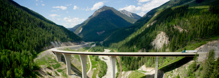
Photographs of the Highway 1 - Kamloops to Alberta - Four Laning Program
Go to Project Photos
Project Videos
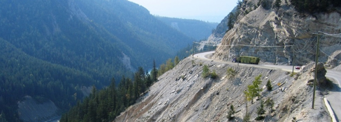
Videos of the Highway 1 - Kamloops to Alberta - Four Laning Program
Go to Project Videos
Know Before You Go

- Skip to main content
- Skip to "About this site"
Language selection
Search travel.gc.ca.
Help us to improve our website. Take our survey !
Travel advice and advisories by destination
COVID-19: travel health notice for all travellers
The Government of Canada’s official source of travel information and advice, the Travel Advice and Advisories help you to make informed decisions and travel safely while you are outside Canada. Check the page for your destination often, because safety and security conditions may change. See Travel Advice and Advisories – FAQ for more information.
Where are you going?
Take normal security precautions
Exercise a high degree of caution
Avoid non-essential travel
Avoid all travel
Travel advice from other countries
Travel advice is also provided by the governments of Australia , New Zealand , the United Kingdom and the United States .
Risk Levels
take normal security precautions.
Take similar precautions to those you would take in Canada.
Exercise a high degree of caution
There are certain safety and security concerns or the situation could change quickly. Be very cautious at all times, monitor local media and follow the instructions of local authorities.
IMPORTANT: The two levels below are official Government of Canada Travel Advisories and are issued when the safety and security of Canadians travelling or living in the country or region may be at risk.
Avoid non-essential travel
Your safety and security could be at risk. You should think about your need to travel to this country, territory or region based on family or business requirements, knowledge of or familiarity with the region, and other factors. If you are already there, think about whether you really need to be there. If you do not need to be there, you should think about leaving.
Avoid all travel
You should not travel to this country, territory or region. Your personal safety and security are at great risk. If you are already there, you should think about leaving if it is safe to do so.

Plan Your Route
CV Height Clearance Tool
Commercial Vehicle Chain Requirements
DriveBC Mobile
Variable Speed Limit Signs
Major Events
BC Highway Webcams
Border Delays
Inland Ferry
Report a Highway Problem
More Links...

Four Laning BC Highway 1: Your Questions Answered
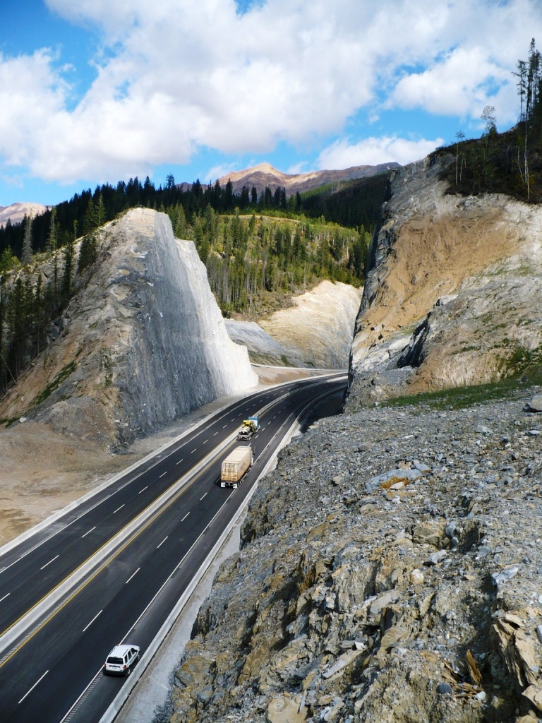
If you’ve driven in British Columbia, chances are pretty good you’ve been on the Trans-Canada Highway. It’s the primary east-west connection through our beautiful province, our main gateway to the rest of Canada, and a vital route for travel, tourism and trade. The section of BC Highway 1 between Kamloops and the Alberta border is also one of the most technically challenging corridors in the province and despite a lot of work to improve this part of the Trans-Canada in recent years, there are still many sections with sharp curves, steep grades and narrow bridges to tackle. We often hear from folks asking about four-laning this stretch , so we thought we’d share the most frequently asked questions (and their answers) here for you:
Why is it taking so long to modernize the road to a four-lane standard throughout?
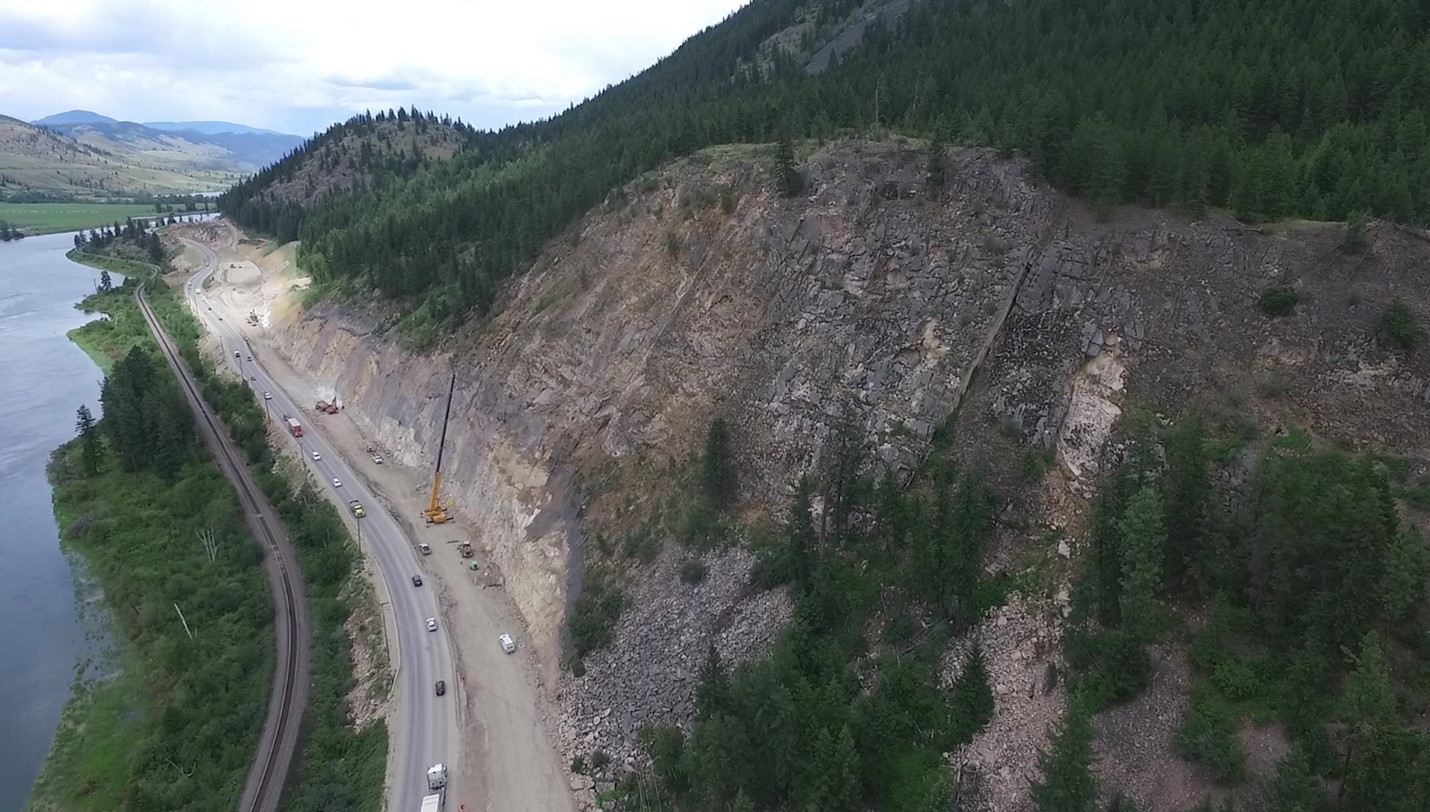
The same mountain ranges, river valleys and adjacent railways that make this route so stunning to travel through, also create a unique set of issues to tackle in order to plan, design and expand the corridor. These issues include design considerations for avalanches, slope stability, floods, the environment, archaeology and stakeholder input, to name a few. Construction challenges associated with mountainous terrain include cost, blasting, scaling, as well as traffic and schedule management, weather challenges, consideration of other infrastructure (such as railways) and the short construction season (from mid-April to mid-October). Once construction has started on a project along this corridor, improvement projects typically require multiple construction seasons . A program of this size is very expensive to undertake, and we need to balance limited funds against many priorities.
How do you decide which parts of the highway are updated first?
We look at the entire corridor from multiple technical perspectives to identify needs. We then prioritize projects to improve sections that have higher than average crash histories, high traffic volumes and bridges that need replacing, while also keeping other issues, such as maintaining mobility along the corridor during construction, in mind as well. We also need to understand the impact of proposed improvements on indigenous interests and communities along with a wide range of stakeholders.
Can’t you just put tunnels in where there isn’t enough width?
When we plan projects, analyzing options is a critical part of our process. We evaluate the pros of those options against their technical difficulty and cost to build and maintain. If a design includes tunnels while achieving the objectives within the available budget, they might become part of the final solution.
How long will it take to complete the program?
There are 338 kilometres of Highway 1 between Kamloops and the Alberta Border under provincial control (with Parks Canada responsible for the remaining 102 kilometres) and there are currently 121 kilometres that are four lanes or more. We expect that the entire effort will take many decades to complete.
Upgrading the Trans-Canada between Kamloops and the Alberta border to a modern, 100 km/h, four-lane standard, will allow traffic to move more safely and efficiently. Despite a lot of work to improve the Trans-Canada in recent years, there are still many sections with sharp curves, steep grades and narrow bridges so we have a lot of work to still do. It’s our driving concern, and we are working as hard as we can to get there . We hope that this helps answer your questions. If you have any other questions about this or anything else the ministry does – let us know in the comments below.
Learn more about the Trans-Canada Highway in BC:
- Trans Canada Highway Improvements Ahead: How To Be Prepared
- Share and Share Alike: Federally Run Highways in BC
- 4 Unseen Engineering Marvels in BC
- BC Road Trip Time Machine: Lytton to Revelstoke, circa 1966
- What is So Important about Phase Four of the Kicking Horse Canyon?
- Boots on the Ground: A Day in the Life of a Road Area Manager
- Innovative Rockfall Netting System Aims to Improve Safety at Three Valley Gap
- 10 Things You Don’t Know About the Trans-Canada Highway
Page 1 of 148 comments on “Four Laning BC Highway 1: Your Questions Answered”
Leave a comment cancel reply.
You must be logged in to post a comment.
Should be renamed the Kamloops to Perry River and Albert Canyon to Alberta Program. That is because it seems you aren’t even doing any long term planning or preparation for upgrades on this section. Indeed you are doing or planning major repairs to three bridges and keeping them 2 lanes.
Thanks for your feedback, Nick.
I know that there is public consultation going on right now with regards to the Highway 1 expansion from 264 to Highway 11, but I do want to mention it here that there should be separate express and collector lanes (at least 2 lane for each) right thru all Abbotsford interchanges. This would allow the thru traffic not having to worry about vehicles merging or exiting the freeway and slowing down their progress. There is a high volume of local traffic that uses the freeway as an east/west connector for travel in Abbotsford.
Hello Walter.
You are correct, public consultation is underway for this project. Please follow the directions on this website under “Public Consultation” towards the bottom of the page for how to submit your feedback here: gov.bc.ca/264toHighway11
Comments on the proposal are being accepted until September 15, 2023.
Thanks for connecting with us. Safe travels!
Hwy #1 from Vancouver to Abbotsoford should have been 8 lanes 10 years ago!! Every inner city and town road is 4 lanes, yet the main and only artery is also 4 lanes?? It’s ludicrous!! It’s a cart track! The govnt always waits until it’s critical before starting expansion, and the costs just increase every year it’s not done. If this had been planned properly the drainage, clearing, pre-load would have been done 10 yrs ago, even if they only widened 3 lanes back then, now they would just have to pave the 4th lane. There are so many rear-ender accidents as people are frustrated – causing driving too close to stop – then we are down to 1 lane as one is blocked!
The other issue is HOV lanes, why are they not controlled by time? It could be 4 am yet I can’t drive in that lane, yet my taxes paid for it! It should take only be an HOV during peak times 0530-1030 and 3:30-7:30 after that anyone should be permitted to use the lane. This will allow traffic to spread out and reduce accidents.
Hi Luciano.
Thanks for reaching our to us here and sharing your thoughts. There are several improvements in the works for the Fraser Valley Highway 1 Corridor stretching from Langley to Chilliwack which you can learn more about here: gov.bc.ca/fraser-valley-highway1.
There are several phases and the public is invited to review and comment on the proposed upgrades which we would highly recommend you do. More info: https://news.gov.bc.ca/releases/2023MOTI0119-001252 Where you can provide feedback: https://www2.gov.bc.ca/gov/content/transportation-projects/fraser-valley-highway1/264tohighway11
Hope this helps.
Stop playing games and build a proper, “limited access” freeway all the way to the Alberta border. Every infrastructure project in this Province is done as an afterthought, even though the population is booming. Highway 97 to Prince George should also be a Freeway!
Thanks for connecting with us here and sharing your opinion, Tony. Unfortunately, for many of the reasons listed in this blog – this is not as straightforward as it might initially seem. We continue to prioritize and expand the highway to the Alberta border, within those constraints. Hope this is helpful. Safe travels.
I live at 6670 Trans Canada Highway NE. (Canoe) When The 4 lane Salmon Arm to Sicamous comes through, what is the setback from the current highway in meters? Highway Right Away Property. Is there a Map I can see or have PDF file sent showing the current highway and the highway right away property line? It will give us a heads up what the future holds here where we live. Thanks
Hi Lawrie, thanks for reaching out. We have directed your question to staff working in the area, and will reply to you again here as soon as we hear back from them. Please stay tuned.
How much of this section of highway twinned
Hi Carol, thanks for reaching out to us here. Could you please clarify your question so we can get you the best answer? Is there a specific stretch of Highway 1 that you are inquiring about?
BC and Canadian highways are generally not safe highways compared to the Interstate highways in the USA and we will never see a 4 lane highway from Kamloops to Alberta or from Cache Creek to Prince George. The reason why? Their is no political will to complete safe 4 lane highways in our province. If you have to drive across North America I would suggest using the interstate highways in the USA. I would prefer to spend my money in Canada and travel across safe 4 lane roads but that’s never going to happen in this country. It’s amazing when you travel across the USA and see so many Canadian license plates and when you talk to them their destination is usually the other side of Canada. The 300 plus km between Kamloops and Alberta could easily be completed in 10 years but it is not a priority.
Hi Gary. Thanks for sharing your feedback, we have forwarded it to local staff in the area.
Couldn’t agree more!
The remaining Kamloops to Alberta 4 lane highway should be built using the cochahalla model of a toll road. Should have borrowed the money when rates were lower and have the completed highway done decades ahead of your pace now. Pay off the borrowed money by adding a $10-$15 toll to pay down the debt and remove the toll when paid off. That way everyone wins with a completed 4 lane highway decades earlier than planned now and the government is not burdened with the huge debt. It’s a pay as you use system. But this common sense approach is mysteriously not being used?
Hi Jonathan, thank you for sharing your suggestion with us here. We have passed your comment along to local staff working in the area, and will reply again here with their reply as soon as we get it. Please stay tuned, and thanks again.
You seem to be slowing down on the twinning with only 2 future projects announced. Both announced years ago and still not even started. With hundreds of kms not twinned… some near Kamloops which could be described as prairie… are you even serious about this at all? Seriously… I bet if someone timed a snails speed I’d bet that’s how fast the progress has been. Has BC even pressured the feds to start a new section on their quarter? Do you realize how long this will take if you finish only 1km per year… your current pace!
100% correct
You could also say it’s at the speed of light traveling out of the Milky Way. By the time the light has travelled from Earth to the end of Milky Way, the project completes.
no phone number why not
Hi there, Bob.
Thanks for connecting with us here.
This is likely because there are multiple folks on the project team, making email a more accessible option. If you would like to speak to someone in person, we encourage you to reach out to our staff in the Kamloops Regional office, who may be able to point you in the direction of someone who can chat via phone. Hope this information is helpful.
Southern Interior Regional Office 447 Columbia Street Kamloops, BC V2C 2T3 Telephone: +1-250-828-4220 Email: [email protected]
Will you guys consider using a p3 method in order to complete the four laning faster?
Great question, Anonymous.
We encourage you to reach out to program staff for more information on this.
https://www2.gov.bc.ca/gov/content/transportation-projects/highway1-kamloops-alberta
Is there any plan to expand the highway in salmon arm? They have done the west part near Walmart but the stretch between the roots and blues sign and water slides has remained untouched. The only information I gathered was a video on the tranbc YouTube from 5 years ago saying that negotiations where in place with the native band that owns that part of the land.
Hello – we encourage you to reach out the TCH four-laning program staff for more specific information on the work they have planned along the corrdior. Here is their email:[email protected] Safe travels. https://www2.gov.bc.ca/gov/content/transportation-projects/highway1-kamloops-alberta
I have heard that the southbound lane of hwy 1 in kamloops will be made into 3 lanes going up the hill towards the Peterson creek bridge? This will cause an immense stoppage of semi trucks at times as they will be going to slow to merge back into hwy speed traffic, going onto the bridge!This is the dumbest idea that has come out in years. just mandate all semi’s to the outboard slow lane, and your problem will be solved. What is the timeline for construction on this project?
Hi there, Reid.
Thanks for taking the time to connect with us here. We suspect you might have seen or heard about the third lane climbing to Peterson Creek Bridge as an option from the Kamloops Area Transportation Study. The options outlined as a part of the study are currently in the concept generation and assessment stage. The project website outlines the proposed concepts for further review and we encourage you to connect with the project team at [email protected] to share your feedback. We hope this is helpful.
In February 2010 we drove a car we had just bought back from Toronto to Vancouver Island and due to the large number of stretches of unsafe 2 lane road on the TCH in northern Ontario and BC, we drove home on the I94/I90 corridor.
I appreciate that getting to a 4 lane standard is expensive ….but frankly, there are some third world countries that have better highways than us. The work underway is good but it needs to be expanded and accelerated.
I think the Government of Canada needs to step up big-time to make a major push towards a 4 lane freeway (preferably not a 4 lane expressway with left turns and lights) standard on our one main TCH (Hwy 1 in BC and 17 in Ontario), and in a reasonable timeline, say 20 years to completion. Start with the National Parks, and also fund MoTI for this with 75 cent dollars.
Thanks for your comment, Mike. The federal government does provide funding for projects on the TCH, but given the constraints of many of the locations, along with the consultations and planning required, it can take time to deliver on them properly. Safe travels.
When Can we see 3-4 Lanes on Highway 91 in Surrey-Delta-Richmond. Traffic has no highway rule enforcement is seen and speeds are too slow.
Hello Jazab – thanks for your message. Is there a particular section of the road you are concerned with?
What route will the highway take from Jade mountain to Ford road in Tappen?
Hi there, Gord
Here’s a link to the current information available on the Ford to Tappen project. If you don’t find what you are looking for, we suggest that you email the project team at the email provided on the page for more details, if available: https://www2.gov.bc.ca/gov/content/transportation-projects/highway1-kamloops-alberta/bchwy1-ford-tappen Hope this is helpful.
What is the lowest elevation of the Trans Canada in BBC
Hi Georges, the ferry between Horseshoe Bay and Nanaimo is considered to be part of the official Trans-Canada Highway. That would mean that the lowest elevation would be zero feet above sea level at both ferry terminals and while crossing the Georgia Strait between the two communities.
When will a 4 lane highway be completed between cache creek and Prince George? It was started in 1980 but still hasn’t been completed.
Upgrades to sections of Highway 97 were completed under the Cariboo Connector project, including most recently intersection improvements at Racing Road in Quesnel. The ministry continues to focus on improvements to roads in the Cariboo area, after significant damages to roads due to climate change. Here is a link to more information on these improvements: https://www2.gov.bc.ca/gov/content/transportation-projects/cariboo-road-recovery-projects We hope this information is helpful.
The responsibilities of highway infrastructure was given in the wrong hands long time ago. Not having a reliable transportation route from east to west has devastated our country in both lives and economy, if you were to ask any truck driver who drives on hwy 1 why they are here, its usually one thing…. can’t cross the USA border which leave drivers desperate to drive these roads and that is the only reason our country is still running. Honestly I am not here to rant but you guys, y’all need some engineers from Colorado, Pennsylvania, and Texas they’ll have it done in less than a year. I’ve seen other comment replies of “decades to complete”… like really I’ve driven throughout US and Canada have seen multiple construction projects and highways in way worse geographical areas done quicker with 6 lanes 120kmh speed limits. At the end democracy dies in darkness, politics win.
Hi Adam – thanks for sharing your opinion with us.
Well said and absolutely right. Canada should have a safe and modern 4 to 6 lane highway across our country. Many people I know drive across the USA because their highways are faster and better. Just think of all the money we lose because Canadians prefer to drive across the USA.
The responsibilities of highway infrastructure was given in the wrong hands long time ago. Not having a reliable transportation route from east to west has devastated our country in both lives and economy, if you were to ask any truck driver who drives on hwy 1 why they are here, its usually one thing…. can’t cross the USA border which leave drivers desperate to drive these roads and that is the only reason our country is still running. Honestly I am not here to rant or disrespect but you guys, y’all need some engineers from Colorado, Pennsylvania, and Texas they’ll have it done in less than a year. I’ve seen other comment replies of “decades to complete”… like really I’ve driven throughout US and Canada have seen multiple construction projects and highways in way worse geographical areas done quicker with 6 lanes concrete 120kmh speed limits. To conclude my comment there is no excuse of obstacles and complications until an Mpp or daughter of a premier gets hurt this would be over and completed
Thanks for sharing your opinion with us here.
What do you mean thank you for your opinion. Give them an answer. Spending to much money and getting nothing done.
Do you have any current design plans for twinning between Sorrento and Chase? That section seems to pose significant challenges with terrain and possible First Nations buried artifacts. Is it possible the highway gets bumped up and over from Notch Hill?
I think our future planning of Sorrento possible incorporation and expanding development is critical in knowing the future highway upgrade plans. If the highway was twinned through current Sorrento path it appears most businesses would be displaced on the highway as they are all so close to the current road.
I appreciate your feedback and any info you can offer.
The Trans-Canada 4 -laning is a priority to the ministry and we always evaluate many options before undertaking projects. The Sorrento area is not currently in an active planning stage but options do exist for a bypass as well as on current alignment. If you would like to talk directly to a ministry staffer about this more specifically – we encourage you to email: [email protected]
It has been a blessing to have cycled these roads from 2010 to 2020. I started out from Edmonton to Calgary in 2010 and then a month later, I bicycled it from Calgary to Kelowna in 6 days. The Kicking Horse portion from Yahoo National Park to Golden was under construction and the opening between the mountains was neat. The narrow areas past the rest area were very narrow and dangerously challenging but I survived walking it up. I biked the Coquihalla 3 times from 2013, 2014 and 2015. Along the 97C in 2014. The Crow’s Nest #3 in 2014 from Hope to Osyoos than up to West Bank. I have lots of biking in BC. I even forced to walk from Kamloops to Golden in 2017 as my bike crank seized and I had my bike trailer to push. I walked a total of 724 kms. Yes it was hard and daunting but I am a strong survivor.
Wow, thanks for sharing your many experiences cycling and walking BC, Gordon. You are indeed strong and hardy to have made all those journeys! Wishing you safe travels wherever you go.
I remember reading a document written from the 1990’s about a limited access expressway bypass proposed in Kamloops. Is there still an active plan on creating a bypass from Dallas Rd to the highway 5 interchange. That part of the Trans-Canada is a bottleneck.
Is there any plans on widening the three mile gap part of the trans-Canada highway? Will you add landfill onto the lake by removing material from the Monashee Mountains (which i’m totally fine with) to widen the road?
Hi there – thanks for your question. We have sent it forward to our staff in the area and will let you know what we hear back.
Good afternoon – thanks for your comment. We consider all options when planning future highway improvements. At this time we have no plans for a bypass at Three Valley Gap. In Kamloops we are in the very early stages of gathering input from the public and will be considering many options. We hope this information is helpful. Safe travels.
is there a plan to improve Highway 1 from Salmon Arm West to Ford Road? What is the time frame?
Hi there Connie,
At this time, the ministry is committed to work from Ford Road to Tappen. Here’s a link to more info on that particular project https://www2.gov.bc.ca/gov/content/transportation-projects/highway1-kamloops-alberta/bchwy1-ford-tappen
and here is a link to more information on the Four-Laning program in general: https://www2.gov.bc.ca/gov/content/transportation-projects/highway1-kamloops-alberta
What is the long term fix for Tank Hill and Jack Ass Mt washouts, and what are the timeframes?
Hi there Phil,
Thanks for your message. We are developing long-term solutions at impacted sites and have created a website outlining works underway at these sites: https://www2.gov.bc.ca/gov/content/transportation-projects/bc-highway-flood-recovery/2021-flood-road-recovery-projects-highway-1-fraser-canyon
This project website is also regularly updated with a newsletter: https://www2.gov.bc.ca/assets/gov/transportation-infrastructure-projects/2021-flood-road-recovery-projects/highway-1-fraser-canyon/2022-06-02_highway_1.pdf
Hope this information is helpful.
Thanks for the info
Where and when is traffic Prioritize Where are Bottlenecks? Know and prioritize Let People know
Thanks for this, Anonymous. DriveBC.ca, our traveller information site captures all of the where and when info. We are sharing any traffic impacts across our social channels, to help keep people “in the know”. Safe travels!
The challenges of Eagle Pass will make the Kickinghorse Canyon look cheap and easy. And there is no 90 minute detour through Radium. None at all really. The Eagle is a Protected river. It’s going to cost bazillions. And the Federal government is going to have to cough up lot more than the 50% of costs they currently contribute to Hwy 1 projects they approve of. It is unrealistic to imagine this province – or any – having the financial capacity for that massive undertaking.
Hello and thanks for your comment. We currently do not have planning underway in this area.
If this was an eastern Canada it would’ve been done decades ago get on with it
Thanks for sharing your opinion with us here, Mark.
Tranbceditor do you know that it only took 4 years to build the railroad across from about Calgary thru the Rockies to the Coast (~1882-1886). Did you wonder “were they late” or “on-time”? Early!!! In fact…by 5 years according to their Contract completion date.
You write of Decades+ to simply widen a couple hundred clicks of road …seems pretty weak political will. You’d think our civil engineering could outpace 1882 tech…but we have 2022 politics layered on top…no will to get it done…just layers of union and bureaucratic grift and “pass the buck” or “community consult.”
Send it out fixed price to a “design, build, maintain” contract and lets get her done in 4 years.
We can’t get anything done in this country…it’s sad really. The rest of the world will be eating our lunch soon enough…like they’ve bought up the West coast. Force foreign home buyers to pay a “HWY1 improvement fee” kinda like an airport Tax.
Heck anyone new to Canada to pay it. Also give Canadians an opt-in on their Tax form: “Do you want to put forward a special ‘Hwy 1 widening bond’ then check yes and donate your Tax refund to the lroject“. Heck let those who donate a certain amount get an extra Maple-leaf on their license plate or something.
Or do a go-fund-me. Seriously this is mad how there’s zero creativity in gov’mnt to get shit done.
Hey Chuck – thanks for your comment – we acknowledge your frustration. Unfortunately, it isn’t just a couple hundred clicks of flat, straight road, nor is it a matter of 1882 v 2022 tech (the tech at that time was back breaking, around the clock labour, and many of the workers lost their lives to lay the track – not a comparable by any stretch of the imagination). Some stretches of the TCH are literally constrained on both sides by rivers and mountain ranges, while other sections pass through lands requiring extensive consultation and consideration (as per modern understandings of our community partners), when this is combined with budget constraints, etc., means four laning will take time. We appreciate your patience.
We are just wondering how much gravel we will encounter over the construction on Highway 1 between Kamloops and Golden? We are coming through on motorcycles and are hoping to not have to face gravel on the trip.
Good afternoon, Terry and thanks for your question. Our maintenance contractors have completed most of their spring clean up to remove sand and gravel along the roadway. Unless we are completing crack sealing work, the highway surface should be relatively smooth sailing. That being said, you should expect construction sites along the TCH this summer and give yourself plenty of extra travel time as delays are likely. We’ve created a travel advisory page to give you more info on the work along the TCH between Kamloops and the Alberta border: https://www2.gov.bc.ca/gov/content/transportation-projects/highway1-kamloops-alberta/highway1-kamloops-alberta-travel-advisories
Hi there, Can there be some assurance on all of the four lane sections that there are median barriers? They have continually proven to reduce head on collisions where people always tend to go faster and either fall asleep at the wheel or lose control on ice and/or water. Let’s keep the traffic on the “right” side of the hwy to avoid such fatal accidents. Thank you David Pfuetzner Kelowna
Hi David. Yes, four-laning these sections includes median barriers.
How long? And then you don’t answer the question. I challenge you and the federal government to give us date. Lives are lost every year on the more dangerous 2 lane sections. It’s 2022 we can do it.
Hi Chris – thanks for your message. We do answer the question but don’t give an exact date as that would be almost impossible to do. There are 338 kilometres of Highway 1 between Kamloops and the Alberta Border under provincial control (with Parks Canada responsible for the remaining 102 kilometres) and there are currently 121 kilometres that are four lanes or more. We expect that the entire effort will take many decades to complete. Hope this is helpful and thank you for your patience.
Decades lol? A decade is 10 years. At the current pace it’ll take approximately 200 to 300 years. I assume you hope the pace will accelerate but even then it will take more than 100 years. They will literally be building roads on Mars before BC has a twinned highway. Oops half-twinned. You still haven’t done Kamloops to Vancouver!
I totally agree with Calgary driver in kamloops hwy the grade if the highway is so steep all the semi truck can barely crawl up the hill. This is so dangerous I see cars swerving in and out of the lanes because its a major highway then suddenly in front of you is a big rig truck going 30 km an hour lots of times there are several trucks some trying to pass on the left lane but they can’t pass because of the long steep grade. Whoever built that highway should be fired
Hello Erin – thanks for connecting with us here to share your concern. Unfortunately, BC’s mountainous terrain mean steep grades on our mountain passes. We have recently legislated that commercial vehicles are required to travel in the right lane on the Coquihalla, to allow passing room for other vehicles, who are able to move more quickly uphill. Safe travels!
I know that the highest priorities seem to be on the western sections, as they likely have higher traffic volumes (i.e. from Salmon Arm to Kamloops). However, there are a couple issues I see that can prevent a fairly easy completion of the last sections.
In the Squilax area, I know there is about 12 km of highway literally sitting against the mountainside. How will that be managed once done through Chase? That is the connecting part between the Chase and Sorrento 4-lane sections.
Also, how will it be managed through Salmon Arm? I know it is an urban 4-lane cross section, however, the desirable alignment should be to avoid traffic signals. A bypass would be very difficult and expensive (having to cross Shuswap Lake) so would an urban freeway through Salmon Arm be considered? Even at a speed limit of 80 km/h (allowing a narrower right of way), that would require quite a few businesses to be demolished and numerous pedestrian/local road crossings to ensure community connectivity for all users. It’s certainly feasible though.
Hi there Craig,
Thanks for your questions. The ministry is prioritizing certain sections first, in an effort to increase capacity and safety. As you have noted, some stretches will be more challenging and will require more time, money and planning. We encourage you to visit our four-laning program website – where you can see the current projects underway, as well as future projects being considered on the corridor. The website also has email and phone for further communication with program staff for more specific questions. We hope that this is helpful.
http://www.bchwy1.ca Media Enquiries Phone: 250 356-8241 General Information: [email protected]
Safe to say that nobody alive today will see the highway twinned at the pace they’re going. I include babies in that statement. I think a big factor is politics… timing announcements for political gain. Another factor is Victoria and Vancouver ignore the entire rest of the province. A big factor is provinces slowly upgraded their highways once the initial trans Canada was completed. Except BC. They sat as is for 50 years. BC didn’t even ask the feds to twin the parks until recently. BC didn’t even twin the easy flat sections! Shameful. The tragedies… the wasted time… and yes even the pollution and animal deaths… will continue. Don’t forget the projects that were announced and then canceled. The funding that was budgeted but was left unused. The safety features like simple concrete barriers that were left out of many sections. And now focusing on unions and political correctness causing massive delays and massive cost increases. Overall an F grade. Will you at least take down the signs saying the highway is being twinned ? And remove the shameful BC is the best place on earth signs at the border. Lol. Worst roads doesn’t equal best. Best at making excuses I guess. A 200 year project is embarrassing.
Thanks for sharing your opinion with us, Calgary Driver. We will share your concerns forward on your behalf.
Well said v r in 2022 bt going on hwy 1 kamloops to Alberta border v feel v r in 1900
Lol… by the time its twinned everybody will be using some form of anti-gravity transportation…
Highway from Kamloops too Clearwater good. B better in too 4 Line Highway
Thanks, Mike, for your suggestion! Safe travels.
Sucessive governments including the present have failed to address the twinning of TransCanada highway. Years of delay, lack of funding leave us with an overcrowded unsafe highway, filled with heavy trucks. And now the present government adds hundreds of millions of cost in so called community benefits. Actually the money goes to their trade union buddies. People who live and travel on this corridor worry for their safety everyday coupled with multiple road closures that have been going on for decades. Disgraceful!
Thanks for sharing your opinion with us here. We too, live and drive on this corridor and take the safety of the travelling public very seriously. Unfortunately, due to many factors, the four-laning and modernization of certain stretches of this route will take time to complete. Here is another blog outlining the current work underway on the route and our plans for future improvements: https://www.tranbc.ca/2021/05/12/trans-canada-improvements-and-delays-ahead-how-you-can-be-prepared/
is the highway 4 lanes from golden to hope?
Hi Donald – thanks for your question. At this time, no. The stretch between Golden and Hope is not four-laned. Here is a link to the work we currently have underway between Kamloops and the Alberta border: https://www2.gov.bc.ca/gov/content/transportation-projects/highway1-kamloops-alberta
Yes. Vary much Needed
Years ago, x %-age of road tax was designated to road infrastructure from gasoline. There always seemed to be money for road improvements. Then all that tax went into the general tresurery,, ever since our roads have slowly gone downhill. Reinstate that tax from gasoline,, but don’t add more taxes to our fuels.
Hello Jake and thank you for your comment. We have shared your comment forward for consideration.
Will the future 4 lane highways also be divided? I noticed that some sections have the space for a divider but doesn’t have it. Will they eventually have it?
Hi Michael – thanks for your question. We have sent it forward to our staff in the program and will let you know what we hear back.
When can I expect to hear back from you? Thanks
Hello Michael,
All new 4-laning projects are required to be divided. Thanks for following up.
Then why there are still some 4 laning section such as at Donald Bridge and other parts aren’t divided?
Hi Michael – we have sent your question forward to our staff in the area and will let you know what we hear back.
Greetings from the Trucking industry…these are hard days for us I can tell you, reading in the overview “We expect that the entire effort will take many decades to complete.” Why? – I expect your answer is budget related. this issue makes many of us angry! When anyone compares BC Hwys to anywhere in the developed world, its beyond embarrassing. -need evidence? look at the recent destruction of Hwys 1 & 5… Look at Hwys thru Mountains in USA, China, Europe, etc etc Ministry of Transportation, Infrastructure –change your thinking, change your engineering design ideas, and get building. This department is a disgrace The Feds & the Province can cost share this National hwy – have you heard of fuel taxes?- there’s some revenue, for building roads- what a concept
Hello Gman – thanks for your message. We have shared your comments forward with our staff responsible for the four-laning program and will let you know what we hear back.
Hello again Gman – Thanks again for connecting with us here. We agree that H1 is a critical highway. We are very fortunate to cost share most projects on Highway 1 with the Federal government. And, we will continue to seek ongoing cost sharing opportunities as we continue to improve this important link. We hope that this information is helpful.
Can’t we just cut military budget and corporate welfare and direct these funds to infrastructure upgrade? That will stimulate the economy far better than subsidizing dying industries.
Thanks for your suggestion, Anonymous.
What are the proposed changes on the stretch of highway between Chase and Blind Bay. Is the proposal from back in 1993 to have a bypass around Sorrento being looked at?
Hi there Curious Local, Thanks for connecting with us here. Here’s a link with an overview image of improvements scheduled for the area between Chase and Salmon Arm. https://www2.gov.bc.ca/assets/gov/transportation-infrastructure-projects/highway-1-kamloops-to-alberta/hwy1-kamloops-alberta/chase/4449-project_location.jpg We encourage you to visit this website for more info on specific areas. Any public consultation display boards will be available for you to view as well: https://www2.gov.bc.ca/gov/content/transportation-projects/highway1-kamloops-alberta/chase-four-laning The ministry is not currently working on an expansion project through Sorrento. As new projects are added to the TCH program, the design process will include public consultation and input from the public and others will help define project design. We hope that this information is helpful.
We’re in trucking business. Can we take a load of steel on 53 foot flatbed trailer around 45,000 lbs from DELTA, BC to CALGARY, AB and how much time or delay should be consider? Thanks
Good morning Denis – please reach out directly to our staff in the CVSE to determine the best route available for your cargo at this time. Travel time may be considerably slower as the speed limit on restricted corridors has been reduced. Here’s their contact info: https://onroutebc.gov.bc.ca/#contactus
I am considering purchasing property on the east side of Highway 1, between the junction of 97B and Canoe. I am trying to find out on which side of the highway the road would be expanded to 4 lanes from the current 3 lanes. The house is fairly close to the highway as it stands now. … Also, I would appreciate knowing the average volume of traffic on highway 1 thru this stretch. Thanks so much!
Hi there Marilyn – thanks for connecting with us here. Please reach out to our staff in the area office closest to this location. They will have the best info for you.
Salmon Arm Area 850c – 16 Street NE, Bag 100 Salmon Arm, BC V1E 4S4 Telephone: 250 503-3664
When will the Valleyview Bypass in Kamloops get put in queue? Hwy 1 should be a Freeway. Vicars Rd is the first traffic light heading east from Horseshoe Bay to Alberta. Juniper Ridge is growing and the only way to get better access to the highway is through the proposed bypass alignment. It was proposed when the city got to 80,000 then then the goal post changed to 100,000 then 120,000!
Hi Kenton, the ministry is evaluating the safety and mobility aspects of the highway system in the Kamloops area. As part of this comprehensive review, an extensive list of long-term highway improvement options will be identified, including evaluating historic options. Short, medium, and long-term transportation improvement recommendations will be identified, with near-term solutions focused on improving safety and capacity along the existing highway corridor. Improvement strategies will be diligently assessed based on technical, environmental, cultural, financial, and community considerations, including comprehensive engagement with local and Indigenous governments and diverse stakeholders.
I fully agree with a previous poster – *Ken Laloge. Our highway infrastructure specific to B.C and not the entire country is an absolute national disgrace, certainly a third world way of operations with respect to significantly lacking the building and maintenance/expansion planning/upgrades of our vital trade routes. It should be noted that these same trade corridors also serve as an important military defense infrastructure.
Thank you for sharing your thoughts, Daniel.
Hwy 1 closed at Golden and traffic rerouted along Hwys93 and95.. The hwy that comes from Golden thru Radium has large trucks using their retarder brakes at all hours during evening and early morning. Its most annoying to hear this very loud noise. The area at the Welcome to Radium sign is flat …there is no downhill grade or uphill grade..there is no need to use these loud air brakes. I wish someone would put up a sign to ask truckers to not use these brakes. Would that be so difficult?
Hi there Don – thanks for your comment. We’ve sent it to our staff in the area and will let you know what we hear back.
Hi again Don. Our staff in the area are unclear which section of the highway you are referring to and have asked if you could kindly reach out to them to discuss this further? Engine air brakes are a standard sign, however they are an advisory and not enforceable by law. Please connect with [email protected] or [email protected] . Thank you!
One key way to keeps costs down is to avoid the construction of interchanges at major junctions on the TCH in the BC interior. Traffic lights are only a fraction of the cost and have been highly effective on the Vancouver Island TCH north of Victoria.
Thanks for your comment, Chris!
It only took 5 or 6 years to build the coquihalla, I guess Bill Bennet junior’s home being Kelowna had nothing to do with it. Obviously money is not the problem, it’s just the political will to get thinks done. There are a few highways in BC that need 4 landing Hwy 97 to Prince George Hwy 97 north of Armstrong Alaska Hwy Dawson Creek to Pink Mountain There are more I’m sure . They have been working on the Kamloops to Salmon Arm section for about 20 years and not 1/2 done. To bad Salmon Arm doesn’t have a resident premier. Please, throw some real money at it, work around the clock, 7 days a week, then we might see some real progress. Remember the Coquihalla. Political will, that’s all it takes. Alas, I digress, perhaps we can hold the politician ( past and present) responsibility for the carnage on our Hwys.
Thanks for this feedback, Andy!
Will there be any improvements made on the Upper Levels Highway? How about Highway 1 from 264th Street in Langley to Chilliwack?
Hi there Adrian,
Thanks for connecting with us here. This content is specific to the stretch of Highway 1 between Kamloops and the Alberta border but we have also recently announced plans to improve Highway 1 through parts of the Fraser Valley as well. Here is a link to more information on that: https://www2.gov.bc.ca/gov/content/transportation-projects/fraser-valley-highway1
The ministry is in the final steps of improvements to Highway 1 on the North Shore with the Lower Lynn Improvements: https://www2.gov.bc.ca/gov/content/transportation-projects/highway-1-lower-lynn-improvements
Hope this information is helpful!
Any future plans for the stretch of road west of Golden to the weigh scales? The distance is approximately 23 km. It appears not to be technically difficult in terms of earth moving, etc., so I would think the cost would be lower. There are several collisions a year in this stretch.
Hi Chris – we’ve sent your question to the project team and will let you know as soon as we hear back.
Hello Chris – thank you for your question about future four-laning and our apologies in the delay in our response. The ministry is continually assessing and prioritizing sections for future improvement and advances projects as funding allows. At this time, there is no timeline for the improvements between the Golden weigh scales and the Town of Golden.
Hi will the new 4 laning project continue to go through the town of Sorrento or have you decided on a bypass? Thank you.
Hello Darren,
Thank you for your question and our apologies for the delay in our response. We are currently in the planning and active construction phases for works deemed higher priority. A complete corridor review was undertaken in the past and a by pass option was a part of that review; however it is not something that we are currently considering at this location. We hope that this information is helpful.
Hello Darren – thanks again for connecting with us here. The ministry is not currently working on an expansion project through Sorrento. As new projects are added to the TCH program, the design process will include public consultation and input from the public and others will help define project design. We hope that this information is helpful.
Just wondering if Tran BC has any coordination with parks Canada for the 4 laning since Glacier Park is the worst part of the highway and there is no information about any possible upgrades to Hwy 1 on PCs website. Also wondering if you have considered putting a median in on two lane sections to improve safety while waiting for the funding for a full 4 lanes. P.S the Revelstoke Bridge is a major bottleneck please twin it ASAP Thank you
Hello Darren – thanks for your message. We reached out to our staff in the interior for more information on upgrades to the federal sections of the TCH. They provided us with an email for you to use for specific information in that regard: A program of this size is very expensive to undertake, and we need to balance limited funds against many priorities. We have shared your feedback regarding the Revelstoke Bridge to our staff in the area as well.
We hope that this is helpful! Safe travels.
Just curious if the Ministry had the chance to review potential cost savings associated with preparing for six lanes for the route (undertaking preliminary timber removal, basic dirt works, etc.)?
Many thanks,
Hi there TC – thanks for your question. Just to clarify – are you asking if the ministry estimated cost (and cost savings) of six laning vs. four laning?
If you think you can’t build highway improvements because you have no money then consider building toll roads. The coquihalla was a toll road and I didn’t mind paying to drive a decent road. If you need further information on toll roads you can check out Houston Texas bypass or Denver Colorado bypass
Thanks for this, Ronald. Yes, the Coquihalla was a toll road and the ministry has implemented tolls in the past. We will share your suggestion forward with the project team. Safe travels.
highway 1 between hope and lytton used to be a toll road as well, according to a rand mcnally map from 1939. it was only open from april to november. remember still?
proof: https://www.davidrumsey.com/luna/servlet/detail/RUMSEY~8~1~258685~5522128:Rand-McNally-Road-map–Western-and-
Decades and the USA did 60 years ago, national disgrace, third world countries with better highways and both with tougher mountains, higher passes and bigger snow falls. Just a lack of political leadership. Gas taxes spent elsewhere as usual. Decades….
Hello Ken – thanks for your comment. We can’t speak to political leadership, third world infrastructure or gas taxes but we can assure you that ministry staff lives and works in BC and we continue to work toward an improved TCH corridor for everyone to travel on safely.
I find I have to hold back my laughter at the following comment…
“Government (both federal and provincial) must balance the priorities of their constituents with fiscal responsibility.”
If our governments practised fiscal responsibility to it’s constituents instead of squandering it away on many other things we’d have these roads (and other things) built already.
Governments now are taking in considerably more money from many sources that they didn’t have 50 years ago yet we constantly seem to be struggling to improve our infrastructures, not to mention so many other things.
I say it’s time to practise what you preach.
Thanks for your feedback Rick – we can appreciate your concerns to be sure. We certainly try to work with the federal government for additional funding wherever possible because the cost of building has also increased over the years, as have the number of travellers on BC highways.
The comment above stating that “the entire effort will take many decades to complete” is understandable while being unacceptable. People are dying on this road routinely; if we could build the Coquihalla in a relatively short timeframe, this can for sure be sped up. It’s all about the will. I get that the Coquihalla and related highways didn’t have to face the many other issues faced on Hwy 1, such as traffic/population/built up areas etc, but something needs to be done to speed this up. For one thing, I guarantee that if we were talking about a roadway in Quebec that was similarly busy and important, it would be done already. Both governments need to take this seriously. Other countries are building amazing highways and solving problems. We’re doing it at turtle speed.
Thanks for your feedback, Bryan. Unfortunately, it’s not just the population along the corridor that needs to be taken into consideration but also the geography, construction season, and provincial budget. Government (both federal and provincial) must balance the priorities of their constituents with fiscal responsibility. We live here and we travel this corridor as well. We understand the needs and are working as hard and as fast as we can to achieve them. We hope this helps clarify. Safe travels.
Please understand I don’t blame the timeframe on ministry staff. I blame it on political will. There should be a reasonable time frame, a goal to achieve. “Decades to complete” is just utterly inadequate for the needs. As mentioned in someone else’s comments, toll it if needed. I’d happily pay a few bucks to travel highway 1 if it didn’t mean I wanted to pull my hair out or risk my family’s safety on every trip. I just think governments need to put a higher priority on this. But I also know staff in the ministry are doing their best and working with the tools provided to them.
Three valley gap west of revelstoke very dangerous section rocks still coming down please fix this would love to see it double laned from revelstoke to sicamous please. When is this section being upgraded ? Thank you
Hi there Mark,
The ministry continues to work on the Three Valley Gap stretch to improve safety, with safety netting and barrier installation projects and continued innovation improvements around avalanche.
https://www.tranbc.ca/2019/06/20/innovative-rockfall-netting-system-aims-to-improve-safety-at-three-valley-gap/
https://www.tranbc.ca/2018/02/20/ka-boom-3-types-of-remote-avalanche-control-in-bc/
While there are no announced projects for the stretch between Sicamous and Revelstoke, we continue to review this corridor for improvements under our the four-laning program .
We hope this is helpful.
Instant about the cost of up Grade,s. But we need more bigger Crews on the construction or multiple companies to speed it up. What’s out here now is taking way too long to get anything done and mess up all schedules they keep the world turning in transportation of every day goods
Thank you for the feedback. Many of the projects along the TransCanada highway are very complex and technical in nature and involve steps such as blasting and slope stabilization. In order to proceed with the work safely the project must follow a step by step process that at times may seem slow. This is done to ensure safety of the crews, the public and prevent damage to the existing infrastructure. We hope this is helpful. Safe travels.
The first mention I could find of the “Kamloops to Alberta Program” in Ministry news releases was in 2013. Was this when the ‘program’ officially came into existence?
Hello Nick – our apologies for the delay.
The first mention of the program as we know it today (Kamloops to Alberta Four-Laning Program) began in 2012, when the province committed $650 million to projects along the highway and, subsequently, in its 10-year transportation plan in 2015, called B.C. on the Move.
The earliest mention of the corridor improvements we could find began in 1998 with the publication of the Cache Creek to the Rockies Program report
For more background information on the studies involved in the improvement works on this corridor, you might be interested in this link: https://www2.gov.bc.ca/gov/content/transportation/transportation-reports-and-reference/reports-studies/rocky-mountain
We hope that this is helpful and
Not helpful at all! It’s true that Chrispy Clark budgeted $650 million to ‘4 lane Hwy. 1 from Kamloops to the Alberta border’ (about the same amount as she spent on her frivolous trips to Asia). But the truth of the matter is if “they” (the Provincial Cartel) got their collective heads out of their a$$e$ this thing would would have been completed in the 10 year time frame. The $650 million will barely cover the cost of the Golden Canyon Project. The Site C fiasco cost north of $20 BILLION! If that money, energy and equipment had been directed toward something constructive, such as 4 laning Hwy.1, the project would be competed and the remainder of the money used for Health Care, education or frivolous trips to Asia! Cost sharing with the Federal government (yes, you admit it’s a 50/50 venture) would have resulted in $40 BILLION for road construction and a workforce of 5,000 YEAR ROUND (not just in the ‘April to October’ time frame you espoused. And it would free up the 4,000 man camp to house homeless people and perhaps coddle them into a meaningful task of farming the Peace valley, long neglected due to BC Hydro’s nonsensical notion of damning the river. Rant over!
At the current rate of progress there is no chance of 4 laning of the provincial sections of the highway being completed before the 2060s. I suspect some sections will NEVER be 4 laned. The so called Kamloops to Alberta Program has no plan, no timescale, no feasibility studies and no cost estimate. The government really needs to work out what else it can do to address the horrendous accident rate on this highway and the increasing congestion. I hold out no hope whatsoever that it will.
Hi there Nick – we really appreciate your continued comments and concern on this stretch of highway. As this blog outlines, there is no easy fix and some of the more complex work will take time. Here is a link to more information on consultations and studies undertaken on the corridor. We hope that this helps. https://www2.gov.bc.ca/gov/content/transportation-projects/highway1-kamloops-alberta/highway1-kamloops-alberta-public-consultation

Trans-Canada Highway: The Ultimate Road Trip Guide
How long is the trans-canada highway, what to expect while driving the trans-canada highway, how to get ready to drive the trans-canada highway.
How long does it take to drive the Trans-Canada Highway?
Language selection
Wxt language switcher.
- Français fr
Trans-Canada Highway
From: Transport Canada

The Trans-Canada Highway is Canada's longest national road. It extends east-west across Canada between Victoria, British Columbia and St. John's, Newfoundland and Labrador, passing through all ten Canadian provinces and linking Canada's major cities. Car ferries link both Newfoundland and Vancouver Island to the mainland.
- Map of the Trans-Canada Highway
- Backgrounder
- Trans-Canada Highway Act, 1949 (link to copy of the 1949 act -FIND OUT WHERE EXACTLY !!!)
Report a problem with this page

The Ultimate Trans-Canada Highway Itinerary
By: Author Elizabeth Lampman
Posted on Published: June 22, 2017 - Last updated: February 5, 2021
St John’s, Newfoundland
Gros morne national park, newfoundland, cape breton, nova scotia.
- Bay of Fundy & Hartland, New Brunswick
Quebec City, Quebec
Ottawa, ontario, thunder bay, ontario, drumheller, alberta, lake louise, alberta, yoho national park, british columbia, vancouver, british columbia.
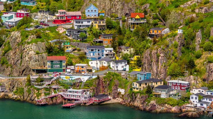
Signal Hill in St. John’s Newfoundland, Canada by Jarmo Piironen | Shutterstock.com
Located on the coast in Newfoundland, St. John’s is a historical city along the Trans-Canada Highway that you can’t miss. Be sure to stop by and experience the attractions and cuisine that make this city uniquely fun.
Things to Do
St. John’s is filled with plenty of things to do, no matter what your interests are. Whether you want to stay inside or head out and experience nature, St. John’s has something for you to do.
Botanical Garden – Experience nature at the Botanical Garden located at Memorial University. This place is filled with beautiful flowers and plants that will make your experience unforgettable.
East Coast Trail – If you enjoy spending time outside, be sure to plan a hike along the East Coast Trail. Along the way, you’ll get to enjoy the wildlife and fauna that’s indigenous to Newfoundland, as well as a coastal view that you won’t want to miss.
Newfoundland Museum at The Rooms – Do you want to experience the history and culture of Newfoundland? Be sure to visit the Newfoundland Museum at The Rooms. This museum has plenty of exhibits that will teach you so much about the history of Newfoundland.
Water Street – Take a stroll and shop the charming boutiques along water street, the oldest commercial street in North America, with most shops open seven days a week.
Places to Eat
Not only does St. John’s have a variety of attractions that will make your stay unforgettable, this magnificent city is also filled with many restaurants that will make your taste buds tingle.
Raymonds Restaurant – This restaurant, located off Water Street in St. John’s, comes highly recommended by many visitors. Not only is the food delicious, Raymonds has also been commended for have a great atmosphere and staff.
Chafe’s Landing Seafood Eatery – If you want to taste delicious seafood, then you’ll need to visit this restaurant. The menu is filled with mouthwatering seafood that will leave you extremely satisfied.
Che’s Fish & Chips – Another great place to eat in St. John’s is Che’s Fish & Chips. This restaurant has tasty food at a reasonable price, making it the perfect place to dine.
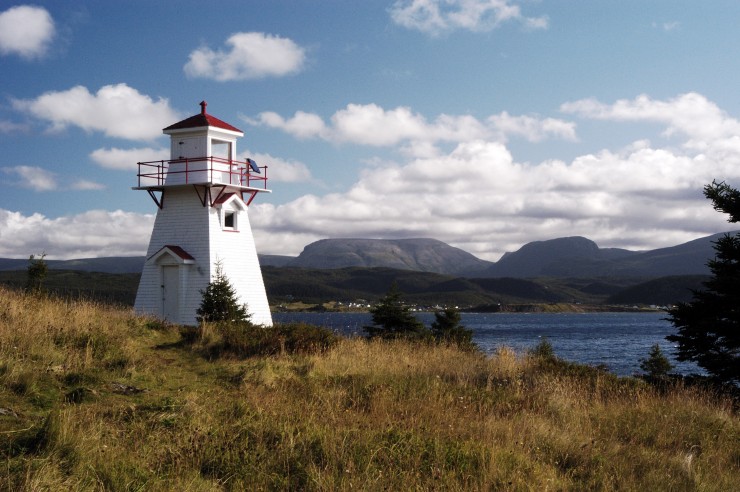
Woody Point Lighthouse, Gros Morne National Park, Newfoundland by Jim Parkin | Shutterstock.com
While traveling the Trans-Canada Highway, be sure to schedule a visit to the Gros Morne National Park into your itinerary. This national park is filled with natural wonders that will amaze you.
Natural Attractions
Gros Morne National Park can boast of many natural attractions that draw visitors from around the country. This national park has mountains, rivers, and beaches that you can explore during your stay. It is also filled with a variety of wildlife, both on land and in the sea. If you’re lucky, you might even be able to catch sight of a whale during the summer season.
Gros Morne National Park has plenty of activities that will be the highlight of your Trans-Canada trip. During the summer, you can participate in such activities as hiking, kayaking, and swimming. Additionally, you can take a boat tour that will give you a great view of the area. In the winter, you can have fun in the snow with skiing, snowmobiling, and snowshoeing.
Places to Stay
If you visit Gros Morne National Park, you’ll need someplace to stay. Thankfully, there are many sleeping accommodations located in and around this beautiful national park. If you enjoy roughing it, you can choose from a variety of campsites, many of which include flushing toilets, kitchen shelters, and sometimes even wireless internet. If you would prefer more comfortable accommodations, you can reserve a room at any of the hotels located in the communities surrounding Gros Morne.
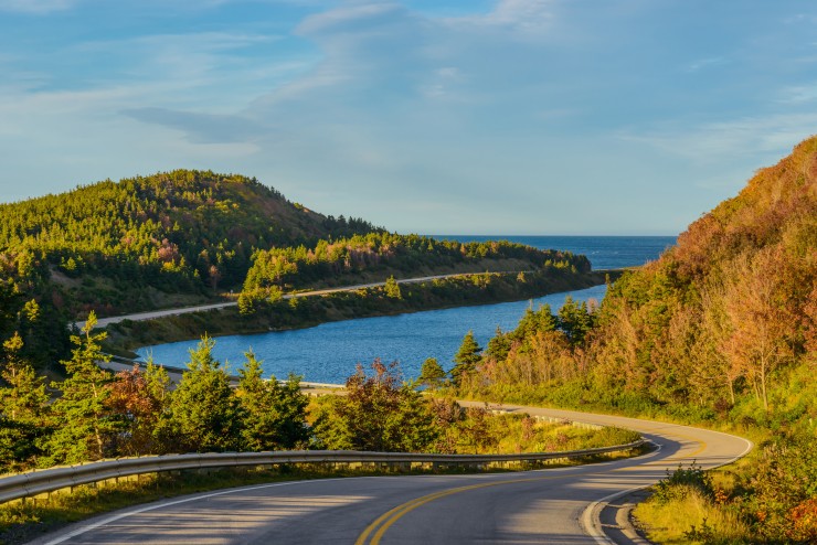
Cabot Trail Highway, Cape Breton, Nova Scotia, Canada by Vadim.Petrov | Shutterstock.com
The Cabot Trail – ranked #1 among US and Canadian island destinations by Travel + Leisure magazine, and best road trip by Lonely Planet, is well worth making a day trip off the Trans-Canada highway. Take in spectacular views as you take in the beautiul solitude of the Cape Breton highlands, through coastal villages, past lighthouses, beaches and more.
Fort Louisbourg National Historical site – About an hour east of the highway you will find a fully restored French fort where you can experience life in the mid 1700’s. This is another day trip you will need to plan ahead for. Visit for FREE in 2017 when you g et your free Discovery Pass !
You can’t drive through Cape Breton without stopping for a taste of their delicious fresh lobster and crab dishes. There are many jewels to be found, but this is a selection you will not want to miss.
Coastal Waters Restaurant & Pub – Located on the Cabot Trail, they are known for their Ringer Burger, fresh Crab Dip and Cinnamon Roll Skillet. Find good service, delicious, fresh, homemade food, and a comfortable setting for the whole family..
Charlene’s Bayside Restaurant and Cafe – Home to Charlene’s Famous Seafood Chowder, known to locals as the best chowder on the island, and quite possibly the best in the world. It is a dining experience enjoyed by locals and tourists alike located in Whycocomagh, right on the Trans-Canada highway.
Black Spoon Bistro – Located in North Sydney, the Black Spoon Bistro is a surprising find in a small town. You will find everything from fresh seafood to options for vegetarians and more.
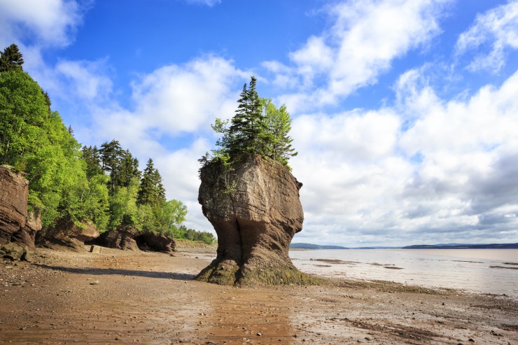
Hopewell Rocks Provincial Park, New Brunswick, Canada By Andreas Prott | Shutterstock.com
Fundy National Park & Hartland, New Brunswick
New Brunswick is a beautiful province offering some great destinations along the Trans-Canada Highway. If you get the chance, you can also take a detour off the Trans-Canada highway to visit Prince Edward Island.
Bay of Fundy – Just southeast of the Trans-Canada highway from Moncton, you can drive a loop that takes you into Hopewell Rocks Park and down though Fundy National Park ending up near Sussex, skipping a portion of the highway. Not only does the Bay of Fundy provide a beautiful coastline view, it also provides adventure for any daring visitors. You won’t want to miss low tide at the Hopewell Rocks in Hopewell Rocks Park, a world-class destination and home to the world’s highest tide which comes with some unique and pretty incredible sights.
Hartland Covered Bridge – This prominent landmark has helped make the town of Hartland famous. This bridge is renowned for being the longest covered bridge in North America, making it the perfect attraction to visit.
Museums – In addition to being the home of the largest covered bridge, Hartland is filled with museums and galleries that preserve the area’s culture and history. From the Chocolate Museum to Science East, you’ll love learning about this wonderful town.
Place to Eat
Hartland is also home to many restaurants that will quickly become favourites. Whether you’re stopping for a quick lunch or planning to stay for a few days, these restaurants will fill you up.
Williams Mercantile – This unique restaurant is home to delicious food at a great price. The menu is filled with food that is sure to satisfy any craving you have, all at a price you can’t ignore!
Jeremiah’s – Another great restaurant located in Hartland is Jeremiah’s. This restaurant is perfect for grabbing a quick meal, especially if you’re craving a burger and some fries. Be sure to stop by and experience Jeremiah’s at some point during your stay in Hartland.
Covered Bridge Restaurant & Bar – Named after the famous Covered Bridge in Hartland, this restaurant is a part of the local golf club. Stop on by to grab a quick bite after spending a day on the course.
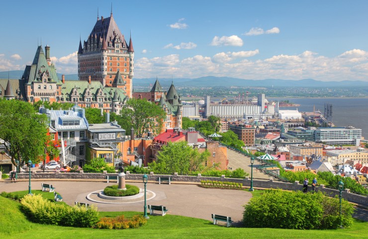
If you’re looking for a great place to stop, as well as a place to learn about history, then Quebec City should definitely be on your Trans-Canada Highway itinerary. This city is home to many historical buildings and parks, as well as great places to eat.
When you take a trip to Quebec City, you’re sure to find something that you’ll enjoy doing. This city is filled with many historical sites and attractions that will fill your days with fun. Here are just a few things you’ll want to check out.
Old Quebec – Are you ready to learn more about the history behind Quebec? Then you need to schedule a visit to Old Quebec into your travel itinerary. Filled with monuments, churches, and beautiful masonry, you’ll get a chance to experience what Quebec was like years ago.
Montmorency Falls Park – The Montmorency Falls Park is home to waterfalls that are taller than Niagara Falls. You can get close to the falls for a magnificent view by taking advantage fo the cable car or suspended bridge, as well as lookout points around the park.
Plains of Abraham – The Plains of Abraham is home to the historical Battlefields Park. Not only is this a wonderful park to enjoy, it’s also the perfect place to learn about Quebec history with the different exhibitions hosted here.
This historical city is filled with plenty of places to dine. You can find a wide variety of restaurants that serve your favorite cuisine.
iX pour Bistro – This bistro is renowned for having delectable food complete with a cozy atmosphere. If you know that you’ll be stopping by during your stay in Quebec, you can always guarantee a table by making a reservation.
Casa Calzone – Do you want to dine in style while staying in Quebec? Casa Calzone is the place for you. You’ll enjoy the exquisite cuisine that’s coupled with elegant décor and friendly staff.
Le Chic Shack – You definitely need to experience a meal at this amazing burger joint. Le Chic Shack has delicious food that you won’t find anywhere else in the city.
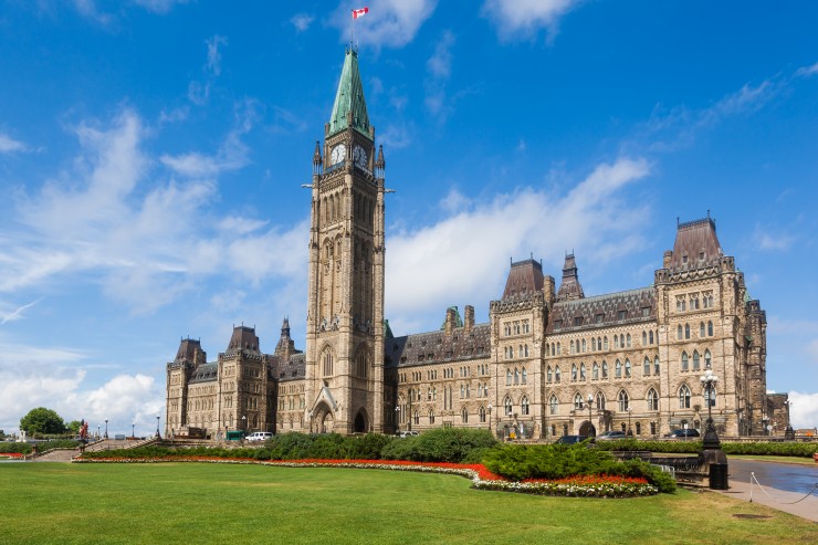
Parliament Hill, Ottawa, Canada By Maurizio De Mattei | Shutterstock.com
Located in Ontario, Ottawa is a great place to stop when travelling the Trans-Canada Highway. This city is sure to have something for everyone in the family, from fun sites and attractions to delicious restaurants.
As our capital, Ottawa is a beautiful city that’s filled with many things to do. From shopping at a large market to exploring nature, you’re sure to find something that you’ll enjoy.
Rideau Canal – You can experience the beauty of nature in Ottawa when you add a trip to the Rideau Canal into your itinerary. The Rideau is filled with many places to fish and kayak, as well as museums to learn about the wildlife.
ByWard Market – If you want to experience Ottawa while doing a little bit of shopping, be sure to stop by the ByWard Market. This historical area is filled with shops and boutiques that you’ll enjoy visiting.
Parliament Hill – Tour the Parliament buildings, stop at the Peace Flame for a photo op, wander around the grounds and see memorials including my personal favourite one – the famous five. In the summer you can watch the Changing of the Guard. Nearby is The National Gallery of Canada which is a must for anyone with a love of art.
Canadian Museum of History – Experience the history of this beautiful area at the Canadian Museum of History. This museum has many exhibits that will inspire awe as you learn about this nation’s history.
When you pass through Ottawa during your Trans-Canada Highway trip, be sure to take advantage of the many dining experiences.
Vittoria Trattoria – If you are on the look-out for accessible Italian fine-dining, this is the restaurant for you. Their extensive menu has something for everyone, and you won’t be disappointed! You’re bound to love your dining experience at this location.
The Manx Pub – Enjoy dining in when you eat at The Manx Pub. The excellent service offered by this restaurant, combined with the ambiance and delectable food, make this pub a necessary stop while in Ottawa.
Aroma Meze – As suggested by its name, this restaurant is filled with the wonderful aroma of delicious food. Enjoy relaxing while the friendly staff serve you your choice meal, giving you a dining experience you won’t forget.
While in Ottawa you may want to hop across the bridge back into Quebec to visit the Gatineau area where you will find several more great attractions including the Canadian Museum of History, the Canadian Children’s Museum, and the Canadian Museum of Nature.
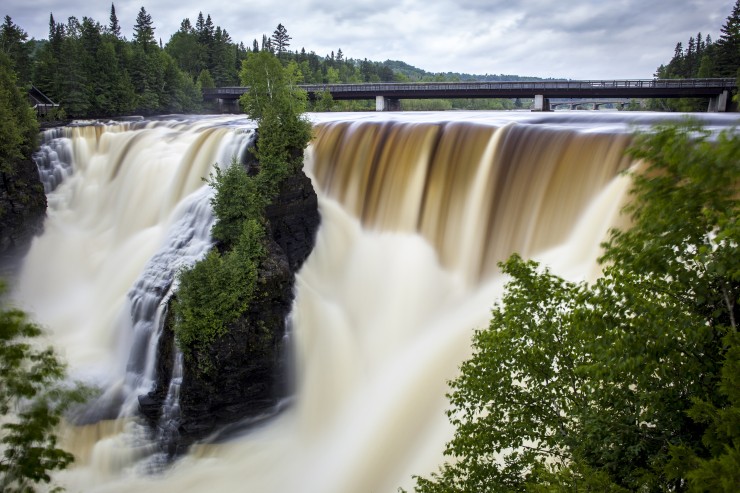
Kakabeka Falls, Thunder Bay, Canada By SebStock | Shutterstock.com
Thunder Bay is a fun city that’s located in Ontario along the Trans-Canada Highway. Located on Lake Superior, this city combines city living with beautiful scenery, making it a great place to visit.
You will definitely enjoy your stay in Thunder Bay when you take advantage of the many sites and attractions. From a scenic lookout to a historical museum, you’ll have plenty to keep you busy in this city. For more ideas for what to do in Thunder Bay, check out my post about must-see attractions in Thunder Bay .
Mount McKay Scenic Lookout – If you want to get a good look at Thunder Bay and the surrounding area, be sure to visit this convenient lookout. Located on Mt. McKay, this lookout allows you to get a good view of the area, including Lake Superior.
Thunder Bay Museum – Have fun learning the history of Thunder Bay at this fun museum. The building that houses the exhibits is a part of history itself since it used to be the police station and court house.
Botanical Conservatory – Now you can experience nature without taking long hikes when you visit the Botanical Conservatory in Thunder Bay. This conservatory is home to a large tropical house, allowing you to view exotic flowers and plants from all over.
Finding a great place to eat is easy when you visit Thunder Bay. From fine dining to charming bistros, you’re sure to find a restaurant that has your favorite foods.
The Silver Birch – If you want to dine in style, take a trip to The Silver Birch. This restaurant has it all, from delicious food to charming décor.
The Sovereign – Enjoy a delicious meal while sipping on some ale at this tasty restaurant in Thunder Bay. With a menu filled with variety, you’ll get to try a dish that is sure to fill you up.
Polish Bistro – Do you want to try something new while in Thunder Bay? Then you’ll want to dine at Polish Bistro, a restaurant that serves delicious Polish dishes that are sure to satisfy your craving.
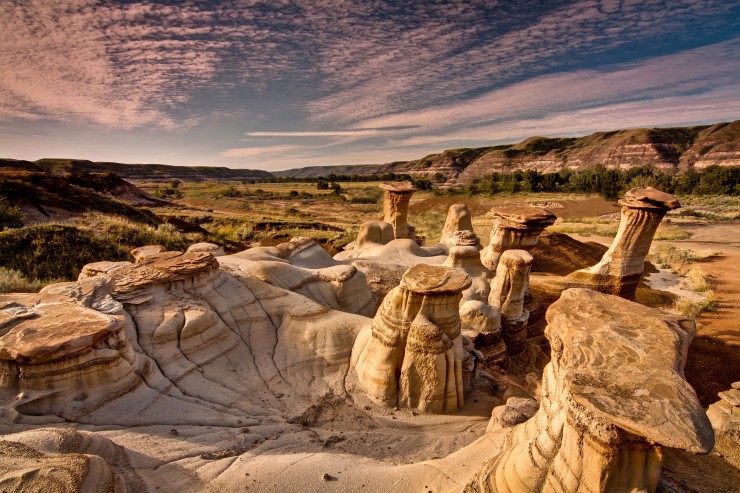
Drumheller Hoodoos in Alberta, Canada By Jeremy Klager | Shutterstock.com
As the Trans-Canada Highway passes through Alberta, you’ll need to add Drumheller to your travel itinerary. This city is home to the famous Hoodoos, as well as the world’s largest dinosaur. In addition to the many attractions, you can also find great places to eat.
Drumheller is home to many attractions that are unique to this area. Plan to stay a few days so that you can experience all of the fun things to do.
Drumheller Hoodoos – If you’re visiting Drumheller, be sure to check out the amazing Hoodoos. These amazing pillars take millions of years to form, making it even more amazing that the Badlands have so many of them.
Atlas Coal Mine National Historic Site – Ready to have fun learning about history in Drumheller? Visit the Atlas Coal Mine National Historic Site. You’ll enjoy everything about this site, from the underground tunnel to the rickety train tracks.
World’s Largest Dinosaur – The world’s largest dinosaur is located in Drumheller, Alberta. Not only can you observe this tall dinosaur from the outside, you can also have the unique experience of climbing the dinosaur and viewing the surrounding area from inside its mouth!
You’ll definitely enjoy your dining experience in Drumheller. There’s a restaurant for everybody, including fine dining and historical saloons.
Bernie and the Boys – Enjoy a quick yet delicious meal when you visit Bernie and the Boys. The menu is filled with delicious sandwiches and burgers that will leave you satisfyingly full.
Old Grouch – Despite its name, you won’t leave this cozy café grouchy. The Old Grouch is a great place to eat, with delicious food filling the menu. If you’re ready for a surprisingly good dining experience, then this is the restaurant for you.
Last Chance Saloon – If you want to have a charming dining experience, take a trip to the Last Chance Saloon. The second you pull up to the restaurant, you’ll be transported back in history, giving you an experience you won’t forget.
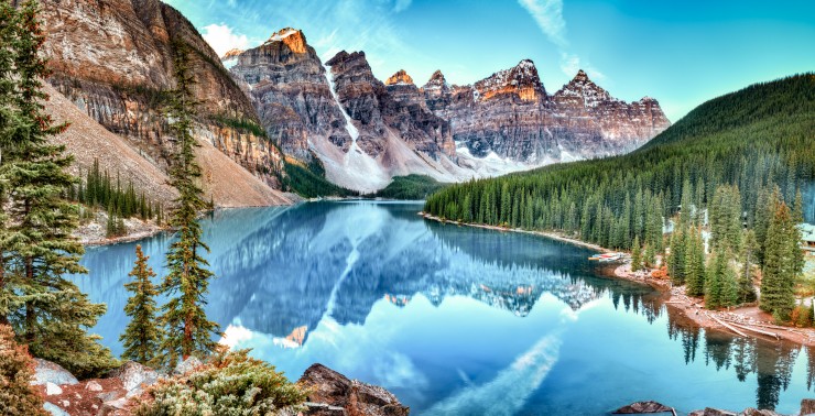
Banff National Park, Alberta, Canada by Zhukova Valentyna | Shutterstock.com
Lake Louise is located in Banff National Park in Alberta. This beautiful lake is the perfect stop along the Trans-Canada Highway, especially if you love hiking, camping, and more. In addition to the fun nature experiences, Lake Louise is home to many restaurants that you’ll enjoy eating at.
Lake Louise is the perfect place to get in tune with your nature-loving side. There are many experiences available to you in and around the lake.
Hiking – If you stop by Lake Louise, you can’t miss out on some fun hiking. Lake Louise and the surrounding Banff National Park are full of hiking trails that vary in difficulty. This makes it perfect for a beginner hiker to an experienced on.
Skiing – If you are able to visit Lake Louise during the cooler months, you can take advantage of the wonderful skiing opportunities available. The entire family will love getting a chance to experience the hills and mountains in the area.
Lake Louise is also home to many restaurants that are sure to tantalize your taste buds. From a charming tea house to a hotel restaurant, you’ll find a place that’s perfect for dining in.
Post Hotel & Spa – The restaurant located at the Post Hotel & Spa is a great place to eat, regardless if you’re a guest or just eating in. You’ll get to choose from a variety of food, all of which is cooked to your preference.
Plain of Six Glaciers Tea House – If you want a light yet satisfying meal, head in to the Plain of Six Glaciers Tea House. You’ll love visiting this tea house in between your many activities at Lake Louise.
The Walliser Stube – Experience a taste of Germany at this restaurant located in Lake Louise. The ethnic food combined with the elegant atmosphere will make the Walliser Stube one of your favorite places to dine.
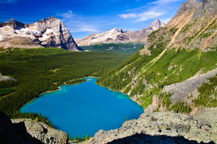
Lake O’Hara, Yoho National Park, Canadian Rockies By Tim Stirling | Shutterstock.com
As you near the end to your Trans-Canada Highway trip, you’ll want to continue the fun with a stop at Yoho National Park. This national park is filled with many natural treasures, making it a great place to add to your itinerary. From finding fossils at Burgess Shale to enjoying the view at Takakkaw Falls, Yoho National Park is a great place to stay during your Trans-Canada Highway trip.
Yoho National Park, located in British Columbia, is filled with natural wonders that you’ll love experiencing. In addition to different plants and animals indigenous to the area, you can also step back in time by visiting the Burgess Shale . This landmark is home to many fossils that date back millions of years ago.
If you visit Yoho National Park, your days will be filled with many fun activities . Throughout the summer and autumn months, you can take advantage of guided hikes around the area. You can also take initiative and go backpacking along the scenic trails. During the winter and spring, you can have some fun in the snow by going cross-country skiing, snowshoeing, and even waterfall ice climbing! You can also visit different points of interest during any season, including the Spiral Tunnels and Takakkaw Falls.
There’s so much to do at Yoho National Park that you’ll need to spend a few nights there. If you’re planning an extended stay, you can camp out at any of the four campgrounds located in the area. Each campground comes with accommodations that make your stay easier, some of which even have toilets and showers available.
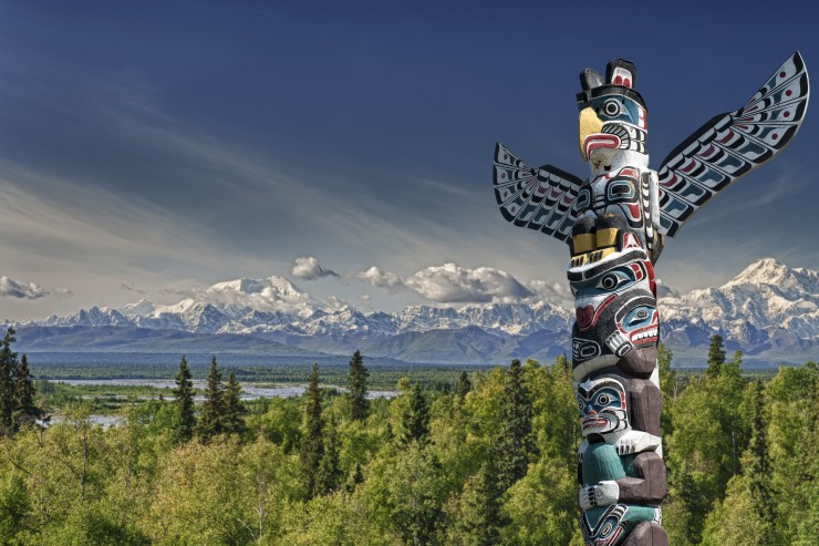
Stanley Park, Vancouver, B.C. by Andrea Izzotti | Shutterstock.com
Vancouver is a great place to visit along the Trans-Canada Highway. Not only is this city filled with historical sites, it also has a modern side that you’re sure to enjoy.
There are plenty of things to do in Vancouver. Regardless if you feel more comfortable in nature or if you prefer an urban atmosphere, Vancouver has something for you to do.
Stanley Park – Even with all of the city buildings and landscape in Vancouver, you can still experience nature when you visit Stanley Park. This park is considered a national historic site, so Vancouver has preserved it for citizens and visitors to enjoy.
Granville Island – Another treasure buried in the Vancouver area is Granville Island. This island is filled with many things to do, including a trip to the public market or a boat ride around the island.
Vancouver Aquarium – Anytime you visit the area, you definitely need to add a visit to the Vancouver Aquarium to your itinerary. This aquarium is huge, with many different exhibits and activities available for guests. You’ll love visiting this aquarium so much, you might come back the next day to explore more.
If you’re looking for a great place to eat, look no further than the city of Vancouver. This area has great dining options available for you, no matter what type of food you enjoy.
Calabash Bistro – If you’re craving delicious food coupled with fun entertainment, then stop by Calabash Bistro for an experience that will satisfy your craving. Not only does this restaurant serve authentic food, it also has entertainment not often found in restaurants.
DDMAU – Do you want delicious food in a relaxing atmosphere? Then stop by DDMAU for any of your meals. The owners of this restaurant aim to combine traditional and modern flavors so that you have the culinary experience of a lifetime.
Salmon n’ Bannock – This restaurant is perfect if you’re looking for an authentic Native American dining experience featuring a fabulous atmosphere and great food. The Salmon n’ Bannock is sure to provide you with delicious food served by friendly staff.
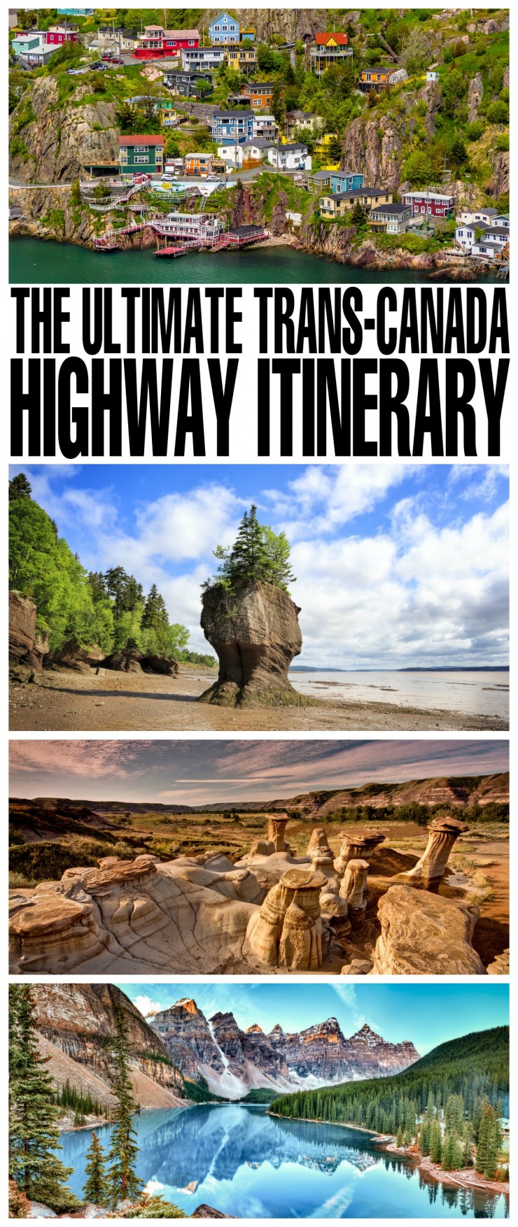
Elizabeth Lampman is a coffee-fuelled Mom of 2 girls and lives in Hamilton, Ontario. She enjoys travelling, developing easy recipes, crafting, taking on diy projects, travelling and saving money!
Sunday 14th of February 2021
I would love to visit Newfoundland and hike through Gros Morne National Park. I'm so close just have to make this happen soon.
Stephanie LaPlante
Saturday 24th of June 2017
I would absolutely love to travel across Canada someday. We have such a beautiful country to explore.
Friday 23rd of June 2017
What a gorgeous country we live in! I have driven across Canada twice and there is just so much to see, I would gladly do the trip every year for vacation if my family would agree.
There are so many places here that I would love to visit! I've been to the Bay of Fundy and Hartland, as well as old Quebec. The other places are new to me.
One place to consider on the itinerary is Temiskaming Shores! The original writer of the Hardy Boys, Leslie Macfarlane, was from Haileybury (and the first several stories are based there!) Lake Timiskaming is one of the deepest freshwater lakes in the world. Devil's Rock is a beautiful lookout...you can hike to the top or see it from the water below. Cobalt has lots of history as the silver capital of Canada.
Elizabeth Matthiesen
Thursday 22nd of June 2017
I have been to many of these places but would still love to do this whole trip in one go. These photos are marvellous and go to show what a very beautiful and diverse country we live in.

Water main break in northwest Calgary triggers Alberta Emergency Alert, supply in critical state
A water main break that left hundreds of homes without water Wednesday evening has triggered an Alberta Emergency Alert warning that Calgary's water supply is in a critical state.
The provincial alert, issued to Calgarians' mobile phones and local broadcast systems at 6:37 a.m., said the water main break along 16th Avenue N.W. has affected the city's ability to provide water to communities and ensure adequate water is available to support emergency fire suppression.
"All residents and businesses must conserve water. Do not shower or bath. Do not wash dishes, or run appliances that use water," the alert said.
During a press conference on Thursday morning at the city's Emergency Operations Centre, Sue Henry, chief of the Calgary Emergency Management Agency (CEMA), called the water main break a "critical situation."
Henry said the cause of the "large and complicated" break is still unknown.
The city also invoked a mandatory outdoor watering ban in order to conserve water for emergency firefighting needs and instituted a city-wide fire ban.
"Every drop of water will count," said Henry. "This is not the time for anything other than critical uses."
However, Calgary Mayor Jyoti Gondek said it was important to clarify the difference between the mandatory restrictions in place for outdoor use and the city's request for Calgarians to curtail water use within the home.
"We are not saying that you can't give your kids a bath," said Gondek.
Gondek also said that the provincial government is being kept apprised and is working with the city to navigate the ongoing situation.
Repair timeframe, break cause both still unknown
Just before 7 p.m., the break caused streets to suddenly flood in the Montgomery area around Home Road, forcing the closure of several roads and intersections, including 16th Avenue in both directions.
The Trans-Canada Highway remained closed from Sarcee Trail to Home Road as of 8 a.m. Thursday morning, and Calgarians are being asked to avoid the area during their morning commute.
"This is a significant break on a critical water main — called a feeder main — that moves water across the city," the city said in a release earlier on Thursday, as the city issued a boil water advisory for the Bowness area at the direction of Alberta Health Services.
Nancy Mackay, director of Water Services with the City of Calgary, said the boil water advisory will be in effect for Bowness until further notice, but the water in all other communities is safe to drink.
The break also affected water pressure in several other areas, including the communities of Parkdale, West Hillhurst, Hillhurst and Scarboro.
"The city has enacted its Municipal Emergency Plan and currently, we do not have an estimate for how long the boil water advisory or the water restrictions will be necessary," the city said in a release Thursday.
The boil water advisory requires all residents and businesses in Bowness to bring water to a rolling boil for at least one minute before any consumption, including:
- Brushing teeth.
- Cleaning raw foods.
- Preparing infant formula or juices.
- Making ice.
The city could not give an estimate as to when it would be repaired.
The Calgary Board of Education says seven of its schools have been affected. Water has been shut off at:
- Belvedere Parkway School.
- Bowcroft School.
- Bowness High School.
- Thomas B. Riley School
- Discovering Choices – Bowness
- Two Wood's Homes sites
Portable toilets and bottled water is being made available at these sites, the board said.
Water wagons have been deployed at the Bowness Community Association, Bow Crest nursing home, Our Lady of Assumption School and Belvedere Parkway School, the city says.
The water main break in Calgary has also prompted the City of Airdrie to ban all outdoor water use and to strongly encourage indoor water conservation.

- Skip to main content
- Skip to "About government"
Language selection
- Français
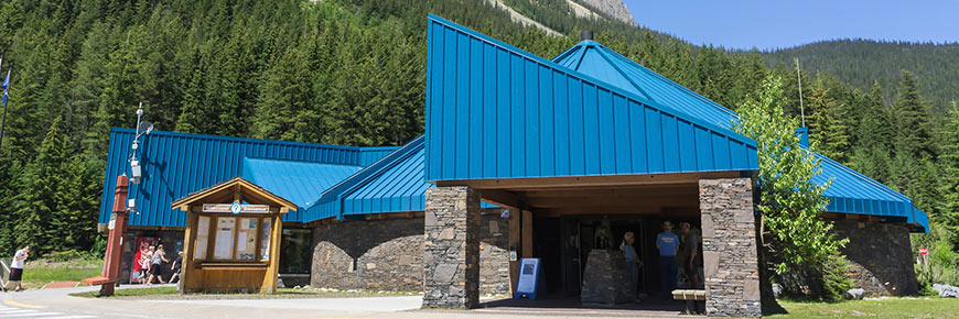
Yoho National Park is open year-round. The peak season is during July and August. Some Parks Canada services are only available from May to early-October.
Visitor Centre
The Yoho National Park Visitor Centre is located on the Trans-Canada Highway in the community of Field, British Columbia. The visitor centre shares a building with the Friends of Yoho and Travel Alberta . Come in to speak with our friendly parks staff or to visit a small scale exhibit of the Burgess Shale Fossils.
- May 1 to June 6: 9:00 am to 5:00 pm
- June 7 to September 25: 9:00 am to 6:00 pm
- September 26 to October 14: 9:00 am to 5:00 pm
- October 15 to April 30: Closed
Friends of Yoho Gift Shop
Be sure to stop by the Friends of Yoho Gift Shop to take home a Yoho momento.
- May 1 to June 7: 9:00 am to 5:00 pm
- June 8 to September 4: 8:30 am to 6:30 pm
- September 5 to October 9: 9:00 am to 5:00 pm
Campgrounds
Yoho National Park’s campgrounds operate from mid-May until early October.
Roads and day use areas
Yoho National Park is bisected by the Trans-Canada Highway. Day use areas located along the Trans-Canada Highway are open seasonally from May until mid-October. In winter, the highway is controlled for avalanches to ensure visitor safety and to reduce the frequency of road closures. Winter tires or mud and snow (M+S) tires are required from October 1 to March 31.
Emerald Lake Road, located 3 km west of Field, is open year round.
The Yoho Valley Road, located 5 km east of Field, is open seasonally from late June until mid-October, weather permitting.
Seasonal closures and restrictions
Additional closures and restrictions may happen at any time, in any location, and without prior notice. See the Important bulletins: Warnings, closures, and restrictions page for a current listing.
Related links
- Pre-arrival checklist
- Fire information and updates
- Getting here
- Where to stay
- What to see
- Maps and brochures
- Facilities and services
- Visitor guidelines
Alternate travel options to consider if TTC strikes
Strike planned for friday could bring buses, streetcars and subways to a halt.

Social Sharing
Commuters who rely on public transit to get to work, school or elsewhere in Toronto will have to find other ways to get around the city if a public transit strike goes ahead as planned later this week.
- Head to this story for the latest news about the potential strike by TTC workers
Nearly 12,000 TTC workers could walk off the job Friday at 12:01 a.m. if negotiations between the transit agency and the Amalgamated Transit Union (ATU) 113 don't produce a new contract — which could disrupt travel plans for tens of thousands of commuters.
ATU Local 113 president Marvin Alfred said there hasn't been enough progress on the union's wage, benefit and job security demands, while TTC spokesperson Stuart Green said a deal is possible as long as the parties remain at the bargaining table.
A strike would mean subways, buses and streetcars won't run, but the Wheel-Trans service for people with disabilities would continue to operate.
If you're one of the people who normally takes public transit in Toronto, here is some information to help you plan ahead.

TTC users talk about their options to get to work if the transit service goes on strike
Other transit systems.
Metrolinx, the provincial transit agency that operates the GO Transit bus and train networks, said in an email it "always has contingency plans in place" in the event of service disruptions.
The agency added that GO trains and the UP Express will continue to operate as normal, and its stations will remain open, but it wouldn't say whether those plans include increasing the frequency of trains and buses.
Durham Region Transit (DRT) said in a news release Tuesday that it "does not anticipate significant impacts to our local transit services," although it is planning to make alternative stop arrangements for its PULSE 900 (Highway 2) and Route 920 services near the Scarborough Town Centre and Centennial College, if required.
"If a disruption occurs, customers who usually transfer to/from TTC services may wish to consider GO Transit options to reach their destinations. DRT does offer connection opportunities to GO Transit train stations and bus stops within Durham Region," the statement said.
- Union says TTC workers will strike on June 7 if no deal reached
- TTC workers could strike. Here's what they want
Mississauga's MiWay said by email it's also preparing contingency plans for stops it serves that could be affected by a TTC strike, including the Kipling Bus Terminal and Long Branch Bus Loop.
"As part of these plans, we are reviewing possible detour options for routes servicing Kipling Bus Terminal (i.e. Routes 1/1C, 3, 11, 20, 26, 35, 70, 71, 76, 101/101A, 108, & 109) and Long Branch Bus Loop (i.e. Routes 5 & 23)," said Eve Wiggins, director of MiWay Transit, in an email statement.
Kristine Hubbard, operations manager at Beck Taxi, said she expects the company's entire fleet of around 1,300 vehicles to be on the roads. However, she said with demand expected to surge, the company won't be able to guarantee arrival times.
"We'll try to do our best to help, but we are no replacement for TTC," she said.
Beck Taxi has stopped booking scheduled trips for Friday, but customers can still request taxis on-demand by hailing them down on the street, via phone or by using the Beck Taxi app or website .
"We won't forget about you. We won't overcharge you, but pack your patience and if you don't have to go, you know, don't," she said.

Uber Canada said in a statement that if the strike goes ahead it will use surge pricing, which means prices will increase in response to higher demand, although it will put a cap on prices.
The exact price of each fare will be based on factors such as the length of the trip, the amount of traffic in the area and how many riders are requesting rides versus the number of Uber drivers on the road, the company said.
Uber said it will also offer incentives to its drivers to entice them to increase the number of trips available.
It recommends riders also use its "group ride" feature to carpool and split fares with friends, or use UberX Share, which pairs different riders together.
Cycling, walking or driving
Commuters who normally leave their cars at home will likely choose to get behind the wheel and drive to their destinations, which could lead to more congestion than normal .
The Toronto Parking Authority (TPA) said it encourages anyone driving downtown to visit the Green P website for a list of municipally-run parking locations, including those with electric vehicle charging spots.

Where negotiations stand as potential TTC strike looms
Others may choose to ride their own bikes or to rent one.
Bike Share Toronto has more than 9,000 bikes available at 700-plus stations across the city that are available to rent for short trips. Riders can access these bikes by creating an account through the Bike Share website , mobile app or at a station kiosk. Pricing options include pay-as-you-go, day passes or annual memberships.
Michael Longfield, executive director of advocacy group Cycle Toronto, said the city's network of bike lanes have expanded rapidly over the past few years, particularly since the onset of the COVID-19 pandemic.
"A lot of folks did start dusting their bikes off in the early weeks and months of the pandemic. I'm sure some folks will be tempted to take them out again," Longfield said.
Longfield said it's important to make sure your bike is in working order, so make sure to check the air in your tires, that your brakes work and that your chain is functional and not too rusty.
David Simor, director of the Centre for Active Transportation, said for those whose bikes have been sitting in a garage for the winter or longer, there are lots of bike repair shops to get it fixed up. He also pointed to community bike hubs where cyclists can learn do-it-yourself repairs. The city maintains a list of both here .
Simor pointed to the city's "amazing and under-advertised" multi-use trail and ravine systems .
"It might not be quite as direct as on streets, but certainly very comfortable and really, you know, beautiful and gorgeous to boot at this time of the year," he said.
Finally, Simor said, those who are fortunate to live close to work, grocery stores and other amenities can go for an old-fashioned walk.
"It's actually a really helpful thing for those who need to drive by keeping your car off the road. And also it's great for your mental and physical health," he said.
The airport
Toronto Pearson Airport issued a statement Thursday saying its aware a strike would be a problem for air travellers.
It said some 4,700 people per day use the TTC to get to and from the airport via the 900 Airport Express route that runs from Kipling Station.
It urged those travellers to instead consider the UP Express, taxis or other ride-hailing services or a GO bus (routes 40 and 94 service the airport).
Elementary school students at Toronto's public and Catholic school boards won't attend class Friday due to a scheduled PA Day, but high schools will be open for a regular school day.
The Toronto District School Board told parents and caregivers Wednesday that school buses will operate normally for secondary school students, but warned of possible delays due to increased traffic.
"All other students should explore alternate methods of transportation including carpooling or biking and/or walking in order to get to school," the note said.
"Thank you for your understanding as we all prepare for what could be a challenging time to get around in our city."
ABOUT THE AUTHOR

Ryan is a reporter with CBC Toronto. He has also worked for CBC in Vancouver, Yellowknife and Ottawa, filing for web, radio and TV. You can reach him by email at [email protected].
- Follow Ryan Patrick Jones on Twitter
Related Stories
- Itineraries List★
- Trans-Canada Highway Main Route (#1, #17)
- To-From Toronto #401 and #400
- Yellowhead Highway #16
- Crowsnest Highway #3
- Ontario Northern Route #11
- Ontario Southern Route #7
- Canada Road Trips, Tours, and Detours
- Trans-Canada Highway Map
- ULTIMATE Canadian Bucket List
- Top ”Must See” Attractions along the way on the Trans-CanadaHighway
- Farmers’ Markets Across Canada
- Craft Breweries & Wineries
- Trans-Canada Webcams and photos
- Weather Across Canada
- Geography & Geology
- Wildlife & Animals
- Flora & Forests
- Agriculture, Crops & Animals
- Listings by Category
- Listings by Locale
- How Long is the Trans-Canada Highway?
- What is the Highest Point on the Trans-Canada Highway?
- Ferries & Bridges
- Roads & Speed Traps
- Canadian Airports
- International Visitors to Canada (border and visa issues)
- Getting Ready For Your Trip
- Budgetting for your Trans-Canada Trip
- Planning for Trans-Canada Highway Emergencies
- Lowest Gas Prices
- Canadian Road Information
- Packing for Bicycle Trip on the Trans-Canada Highway
- Rules For RVs in Canada
- National and Provincial Parks
- Construction Overview
- British Columbia
- Saskatchewan
- New Brunswick
- Nova Scotia
- Newfoundland
- Provinces in Canada
- Newfoundland & Labrador
- Northwest Territories

- Ontario Winter storm and Winter weather travel advisory along TCH #17 and #400 [Nov 21-222]
- Road Conditions
- Road Conditions , Weather Conditions & Closures
- Trans-Canada Highway
- No Comments
- November 21, 2023

Snow covered Roads weather
ON: Winter weather travel advisory in effect for Tuesday afternoon into Wednesday morning for an upcoming snowfall (4 to 8 cm) along the Trans Canada Highway 17 and Highway 400 routes.
See more highway news, weather alerts, and highway closure updates on our News page , or if you are travelling on our Facebook page

COMMENTS
News Releases for Travel Advisories; Wildfires are occuring in parts of B.C., ... This section of highway was closed Aug. 28, 2023 because of a rockslide when approximately 3,000 cubic metres of material came down. Highway 97 is generally OPEN to two lanes of traffic, one in each direction, subject to short scheduled and unscheduled closures.
Trans Canada Highway Road Info & Speed Traps. We are the ONLY CANADA-WIDE source for Trans Canada Highway closures and weather alerts: See our TCH News page for weather issues, winter avalanche closures in the mountains, and other construction detours and closures. While on the road follow our TransCanadaHighway Facebook page, which is more ...
The Trans-Canada Highway 1 is the primary east-west connection through British Columbia. The Four-Laning Program is underway and may create travel delays throughout the corridor. Find out why this is still your most efficient route from Kamloops to Alberta and what to expect during construction.
Highway 1 is the main route of the Trans-Canada Highway (TCH) through British Columbia, Canada. Its total accumulated distance through British Columbia is 1,039 km (646 mi), including the distance travelled on ferries. Road Conditions Hwy 1 Hope to Banff and Alberta. Road Condition Reports for the Coquihalla Hwy5 and Highway 97C.
Provides up to the minute traffic and transit information for Alberta. View the real time traffic map with travel times, traffic accident details, traffic cameras and other road conditions. Plan your trip and get the fastest route taking into account current traffic conditions.
The Government of Canada's official source of travel information and advice, the Travel Advice and Advisories help you to make informed decisions and travel safely while you are outside Canada. Check the page for your destination often, because safety and security conditions may change. See Travel Advice and Advisories - FAQ for more ...
The travel advisory covers the 150-km stretch of Highway 1 between Highway 23 South and Golden Donald Upper Road.
The province plans on reopening Highway 3 to all traffic at 8 a.m. PT Tuesday, Dec. 21. Collapsed sections of bridges destroyed by severe flooding and landslides on the Coquihalla Highway north of ...
ORIGINAL: 6:10 a.m. A travel advisory remains in effect this morning on the Trans-Canada Highway between Revelstoke and Golden. The advisory issued Wednesday is in place through Glacier National ...
A travel advisory is in effect for a section of the Trans-Canada Highway west of Revelstoke, B.C. According to DriveBC, the advisory was issued because of avalanche debris removal. Heavy ...
The avalanche danger forced the overnight closure of the Trans-Canada Highway between Revelstoke, B.C., and Golden, B.C. on Wednesday. The major east-west highway remained closed without a detour ...
Road Trip Travel in Canada, on the Trans Canada Highway. Travel & tourism information for travellers across all provinces and all cities. To help you plan (and enjoy) your road trips, TransCanadaHighway.com also has detailed info and maps of towns & cities, and attractions, festivals. Our TRAVEL TIPS section has tons of pages & links detailing ...
Ministry of Transportation and Infrastructure. Subscribe. Plan Your Route. CV Height Clearance Tool. Commercial Vehicle Chain Requirements
Collision on Trans-Canada bear Highway 40 junction West of Calgary [Feb 29] We heard about this from folks stuck in traffic at 5 pm, who reported 7 towtrucks whizzing by. .. Road Conditions, Weather Conditions & Closures. February 29, 2024.
There are 338 kilometres of Highway 1 between Kamloops and the Alberta Border under provincial control (with Parks Canada responsible for the remaining 102 kilometres) and there are currently 121 kilometres that are four lanes or more. We expect that the entire effort will take many decades to complete. Upgrading the Trans-Canada between ...
How long is the Trans-Canada Highway? Known by its iconic white-on-green maple leaf route markers, the road is about 8,000 km (4,990 miles) long and comprises Trans Canada Highway 1, Trans Canada Highway 16 (Yellowhead Highway), Ontario Highway 17/417, Ontario Highway 11, Highway 71, Ontario Highway 69/400, Highway 12, Highway 7, Québec Autoroutes 40, 20 and 85/Route 185, Québec Route 117 ...
The Trans-Canada Highway is Canada's longest national road. It extends east-west across Canada between Victoria, British Columbia and St. John's, Newfoundland and Labrador, passing through all ten Canadian provinces and linking Canada's major cities. Car ferries link both Newfoundland and Vancouver Island to the mainland.
UPDATE: 6:15 a.m. More advisories have been issued for B.C. Interior highways as snow continues to fall. A weather advisory is in effect for the the Trans-Canada Highway between Sicamous and the ...
The Cabot Trail - ranked #1 among US and Canadian island destinations by Travel + Leisure magazine, and best road trip by Lonely Planet, is well worth making a day trip off the Trans-Canada highway. Take in spectacular views as you take in the beautiul solitude of the Cape Breton highlands, through coastal villages, past lighthouses, beaches ...
CALGARY - Road conditions remain slick on the Trans-Canada Highway near Lake Louise, but have improved. Early on Wednesday morning, Alberta 511 cautioned that travel on Highway 1 wasn't ...
The Trans-Canada Highway remained closed from Sarcee Trail to Home Road early Thursday morning. "This is a significant break on a critical water main that moves water across the city," the city ...
Visitor Centre. The Yoho National Park Visitor Centre is located on the Trans-Canada Highway in the community of Field, British Columbia. The visitor centre shares a building with the Friends of Yoho and Travel Alberta.Come in to speak with our friendly parks staff or to visit a small scale exhibit of the Burgess Shale Fossils.. May 1 to June 6: 9:00 am to 5:00 pm
Commuters who rely on public transit to get to work, school or elsewhere in Toronto will have to find other ways to get around the city if a public transit strike goes ahead as planned later this ...
COVID-19 Travel Restrictions Update. We have provided information on COVID-19 Travel Restrictions for travellers TO CANADA and for travellers WITHIN CANADA ever since the first lockdowns began in March 2020. Please call TransCanadaHighway.com at 403-245-2194 if you become aware of any updates and/or errors.
In a post on X, Elon Musk recently announced that FSD drive modes would be getting a slight rename - Assertive mode will become Hurry mode.. Current Modes. Tesla introduced different FSD driving modes in 2021 so that drivers could pick a driving style that better matched their preference. Before driving profiles, Tesla let drivers pick the distance the vehicle would between the vehicle in ...
Itinerary: Toronto to Parry Sound via #400. Itinerary: Parry Sound to Sudbury, via #69/400. Itinerary: Toronto to Kingston via #401. Itinerary: Kingston to Montreal via #401 & #20. Itinerary: Kenora to Ignace on #17. Itinerary: Ignace to Thunder Bay along #17. Itinerary: Thunder Bay to Marathon on #17. Itinerary: Marathon to Wawa via #17.
Ontario Winter storm with travel advisory for snowfall (4 to 8 cm) Tuesday afternoon into Wednesday morning along TCH #17 and Highway 400 . ... Travel Tips. Trans-Canada Highway Map; What to See: ULTIMATE Canadian Bucket List; Top "Must See" Attractions along the way on the Trans-CanadaHighway;