Finding the Universe
Travel tales, photography and a dash of humor

How To Get Around New York City: A Guide To NYC Transport Options
Last updated: June 2, 2023 . Written by Laurence Norah - 12 Comments
Heading to New York City? As you might be aware, there are several boroughs in this city, which is home to millions of people!
We teamed up with Expedia.com to help you navigate the large metropolis. Start off by checking out the many NYC hotel options on Expedia.com to decide where you want to put your feet up at night. Once you’ve figured out where you want to stay in New York, you’re going to need to know how to get around New York to all the sights you’ve come to the city to see.
Well, with our definitive guide, you’re going to learn all the different options you have for getting around New York. This will include all the major New York transport options, as well as tips for using each one.
Once you’ve read this, check out our guide to spending 2 days in New York , which has a detailed itinerary and lots of tips on what to see in the city. Now, let’s get started with our guide to getting around NYC.
How to Get around New York City
As you’ll see from this list you have a lot of options when it comes to getting around New York City. This is to be expected, after all, New York is the most populated city in the United States.
With over twenty million residents in the New York metropolitan area, which is spread across five main boroughs, it’s easy to see why there are so many ways to help them get around!
Here are some of the best ways to get around the city when you visit.
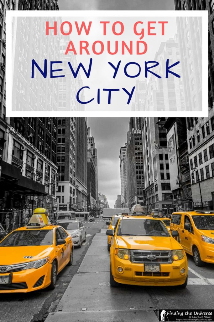
The iconic yellow taxi is certainly a popular way to get around the city with residents and visitors alike. The yellow taxi is easy to recognise, being bright yellow, and having a yellow light on the roof. These yellow taxis are the only vehicles that are allowed to pick passengers up in response to a street hail across the entire city.
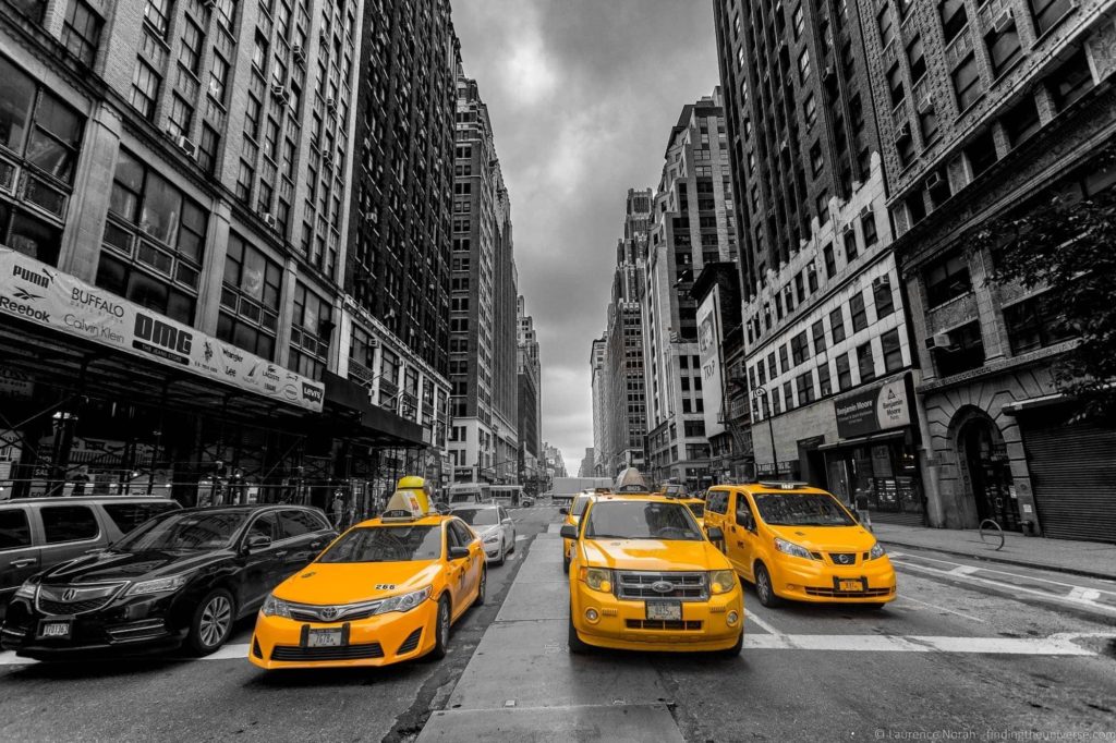
A taxi shows it’s availability by illuminating the yellow light. An illuminated light means the taxi is available for hire. To hail a taxi, you just need to attract the drivers attention, usually by waving from the street corner.
Once the taxi sees you, they will stop somewhere safe to pick you up. Let the driver know your destination address. Taxis are metered, with fares starting at $3, and then increasing as time and distance pass – you can see the fares here . Note that tolls will also be added to your taxi fare. New York taxi Fares can be paid in cash, or with a credit or debit card.
It’s definitely worth taking a taxi in New York just for the experience. It’s not a big expense, particularly for shorter rides.
There are of course alternatives to the yellow taxi, including ride-sharing services such as Uber and Lyft. These need to be booked in advance using their apps, and do generally work out cheaper than a yellow cab.
The New York Metropolitan Transport Authority (MTA) operates a fleet of almost 6,000 buses in New York, which cover over 322 routes. Suffice to say, you should be able to find a bus route to meet your needs!
Buses in New York are generally classified as local or express. Express routes have reduced stops and focus on serving commuter routes from some of the busier areas of Manhattan to the outer boroughs.
Buses only stop at marked stops, which are normally located two to three blocks apart. Bus stops are clearly marked with blue signs and sometimes with shelters. The bus stop will indicate which bus routes service the route.
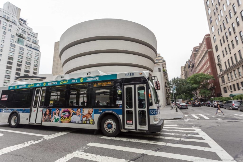
To use the public bus in New York, just stand at the stop, and as your bus approaches, just signal with your hand that you want the bus to stop. Fares are $2.75 for standard buses, and $6.75 for express buses. Fares can be paid in cash, by MetroCard or using contactless via the OMNY system . If paying in cash, you need to give exact change, and be aware that only coins are accepted as fare – no bills.
If you have a contactless payment card or smartphone device, the OMNY system is going to be the easiest way to pay for your fare. Just swipe your card or device on the reader and the fare will be deducted. OMNY also has the advantage that you only pay for the first 12 fares in a week (starting on a Monday). Rides after that are free.
The MetroCard is a alternative if you don’t have contactless. It covers a number of different transport options in the city, and you can recharge it. If paying by MetroCard, just swipe it when you board the bus.
MetroCards can be purchased at MetroCard vending machines, subway station booths, and local stores. They cost $1 to purchase, but can then be refilled.
One main advantage of paying by OMNY or MetroCard is that you can transfer for free to other bus or subway services within two hours of your first fare.
When you want to get off the bus, locate a “stop” button on the bus, which you should press to indicate to the driver that you want to stop at the next stop. You don’t need to swipe your Metrocard or contactless payment card to disembark.
One of the most popular ways to get around New York is the New York Subway. This is a great way to get around the city as you avoid any traffic.
With 472 subway stations, the New York City subway is the largest subway system in the world as measured by total number of stations. It’s also one of the oldest subway systems in the world, as well as one of the busiest. It’s operates twenty four hours a day across 36 lines, and serves four out of five of New York’s boroughs.
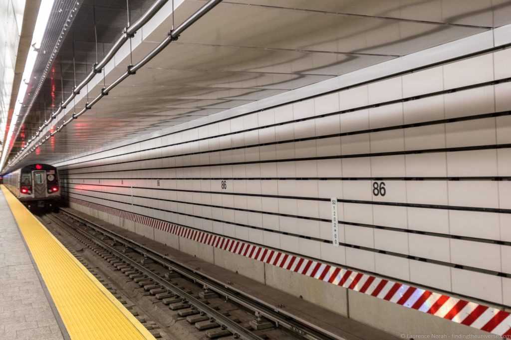
Suffice to say, as a visitor to New York City, the subway is likely to be able to get you pretty much anywhere you want to go!
Riding the subway is easy. First, you need to find a nearby subway station, which will be well signposted with an entry sign. This sign will also indicate which routes are served at the subway stations, with routes denoted either by numbers or letters. The majority of subway stations will have a map of the network to help you plan your route.
As with the bus system, you can pay for your fare either with a contactless payment device using OMNY, a MetroCard, or you can purchase a single ticket.
OMNY and Metrocard fares are $2.75, whilst single tickets are $3. Fares are not distance dependent and unlike many other subway systems, there is no zone system. So you can go as far as you want on your single ticket.
Tickets and MetroCards can be bought at the vending machines at the stations, or if available, at ticket desks. The machines accept coins, bills and credit/debit cards. We definitely recommend buying a MetroCard for your New York City visit.
To access the subway, you need to scan your ticket, contactless payment device/card, or MetroCard at the turnstile, which will activate the barrier with a green “GO” sign. You will exit through similar turnstiles or doors, but the majority of these do not require you to scan a ticket – you just walk through them. Trains stop at every station, you do not need to request the stop.
As well as the subway, there are a number of passenger railway lines operating around New York city. The majority of these are commuter focused lines designed to bring people into the city from the more distant boroughs, and they include the NYC suburban train, Staten Island Railway, New Jersey Transit, Port Authority Trans-Hudson, Long Island Railroad and Metro North Railroad.
Unless you are planning on visiting one of the more distant part of the city, or have booked a hotel a long way from the main sights in New York, it’s unlikely you’re going to need to use one of these rail services.
If you do, you will most likely have to buy a ticket for the individual journey at the train station. There is also an eticketing app called eTix, available for both Android and iPhone devices, which lets you buy tickets on your phone for the Metro-North Railroad or Long Island Rail Road. Fares will vary depending on the route you take.
There’s a lot of water in New York, and as a result, there are a variety of options for using boats to get around the city, including the NYC Ferry service and Staten Island Ferry.
The NYC Ferry is a relatively recent addition to New York’s public transport system. Launched in 2017, at time of writing this offers six lines, with additional lines planned to open in the coming years. There are 21 terminals and 28 boats in operation, connecting Manhattan with Brooklyn and Queens.
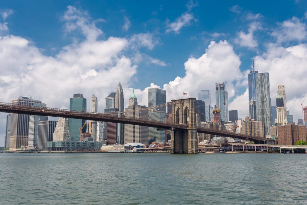
We rode this service a number of times when we visited New York in the summer of 2017. We were staying in Brooklyn, and found the ferry to be one of the best options for getting to parts of Manhattan. Services are regular and good value – it costs $2.75 for a single trip, which is the same as the subway or bus system.
NYC Ferry tickets are not a part of the MetroCard system, and must be purchased separately. All the ferry stations have ticket vending machines, which accept cash or credit cards. Tickets can also be bought on board, using the NYC Ferry app , or on the NYC Ferry website . Just show your ticket when you board.
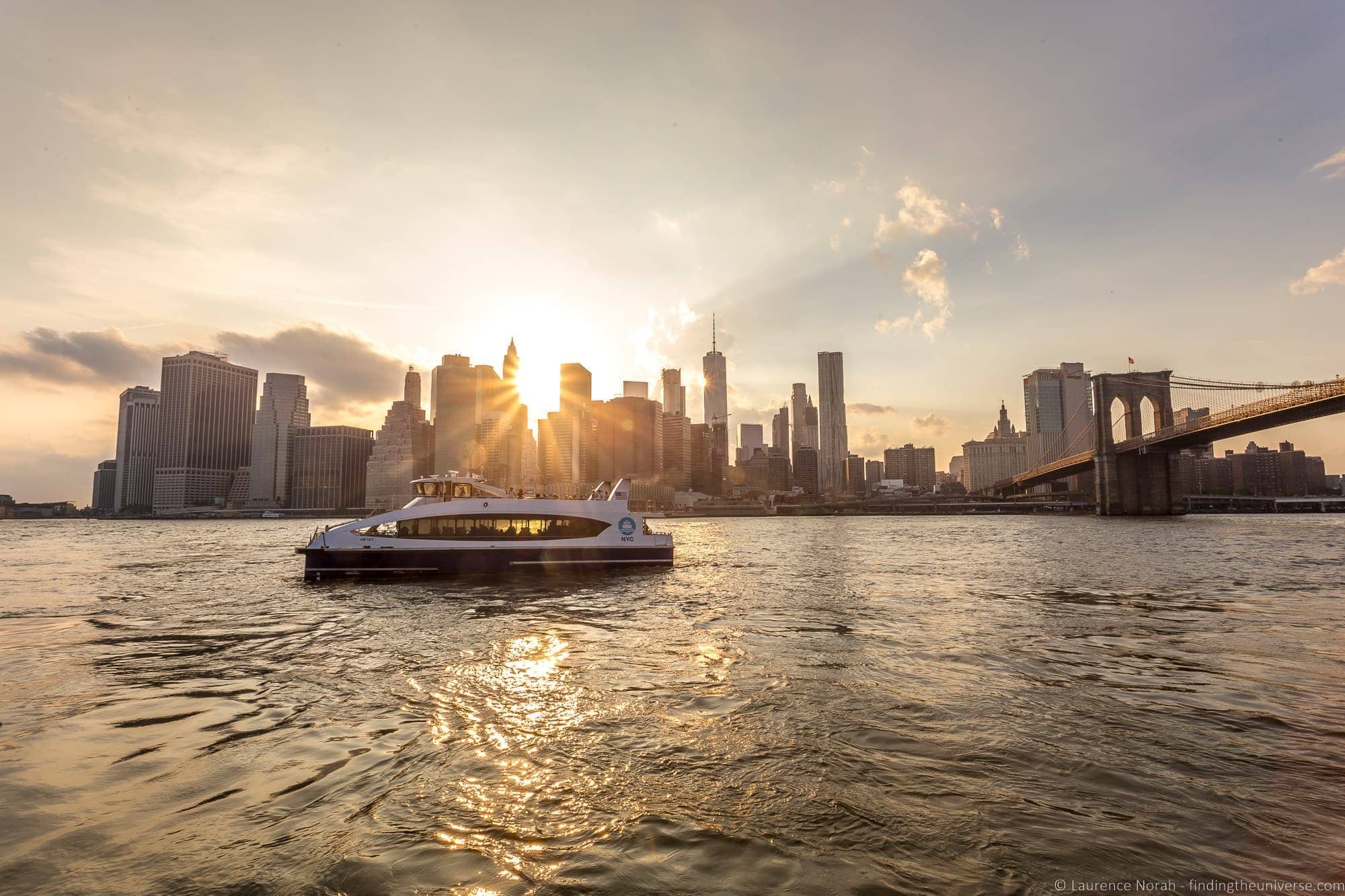
We really liked the NYC Ferry system – it’s a good value way to get around, and the views of the Manhattan skyline and various bridges on the trip to various Brooklyn ports is really nice – it’s worth paying to ride the ferry just for this alone!
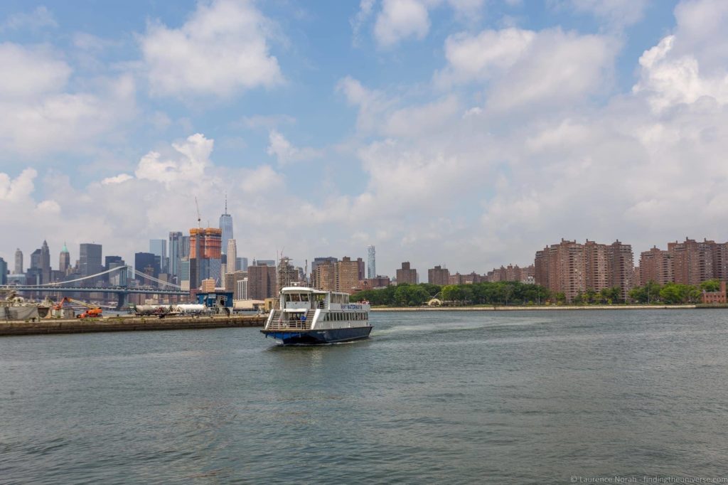
There are a number of other passenger water services in New York City, including the NY Waterway , the well known Staten Island Ferry and the New York Water Taxi .
The Staten Island Ferry, as the name suggests, operates between Manhattan and Staten Island. It’s totally free to use, and is a great way to get a relatively close view of the Statue of Liberty without taking a paid tour.
The NY Waterway and New York Water Taxi services service additional routes, and also need their own tickets, so depending on the routes you are taking you might find them useful as well.
New York is a big place, but don’t discount walking as an option for getting around! Just be aware that distances might be further than you imagine when looking at a map. Still, exploring different parts of the city on foot, which is for the most part fairly flat, is certainly a possibility.

Just be aware that the locals will also be walking around, and they tend to move quickly, and can get irritated by slow moving tourists with limited situational awareness. So just be aware of your surroundings, and don’t just stop in the middle of busy sidewalks to grab a selfie or consult your map!
7. Bicycle / Pedicab
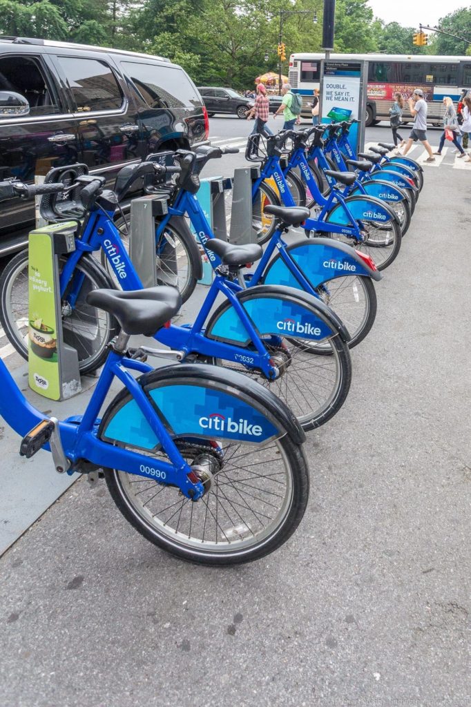
Like many cities around the world, New York has a bike hire program whereby you can get access to a large network of bikes located around the city, which you can drop off and pick off at various points.
The Citi Bike program is open to both locals and visitors. At time of writing, it’s $12 for a day pass, and $24 for a 3 day pass. These passes can be bought through the Citi Bike Mobile App , or in person at a station kiosk (see kiosks here ). Annual memberships are also available, which are more suited to residents or those staying longer term in the city, and you can sign up for those on the official website .
Passes can be bought with either a debit or credit card – cash is not accepted.
Once you have your 1 or 3 day pass you use the bike for up to 30 minutes at a time. After thirty minutes, there’s an extra fee, so if you want to ride longer, it’s best to drop off the bike and pick up another one. Annual memberships let you ride for 45 minutes without incurring additional fees.
Note that the Citi Bikes program does require you to be 16 years or older to rent and use them.
There are also other options for bike rental as well. See this service which offers bike rental for varying durations.
If the idea of cycling yourself seems like a lot of effort, there are also pedicabs for hire in the city. These are three wheeled cycles with a driver that can either take you from one point to another, or can be booked for tours.
Pedicab operators must have a Pedicab Drivers License, and their pedicabs have to pass an inspection. Fares are time based, and must be clearly displayed on the Pedicab in a relatively large font.
Fares range from $3 – $7 per minute, and the Pedicab will be fitted with a compliant timer that all passengers can see. Drivers are not allowed to levy any other fee – you can see all the applicable laws here so you know your rights before taking a Pedicab.
8. Helicopter
Ok, so this is not exactly a budget option. But if you want to quickly get from downtown Manhattan to a wide range of destinations around New York, including the airport, then a quick ride on a helicopter is your best bet. There’s a heliport located in downtown Manhattan , which is the most popular as it is so close to Wall St. There’s also a heliport at East 34th Street.
The majority of heliport activities are around servicing busy executives, but you can also book sight-seeing helicopter tours like this one , which is a unique way to see the city, and perfect for a special occasion.
9. Aerial Tram
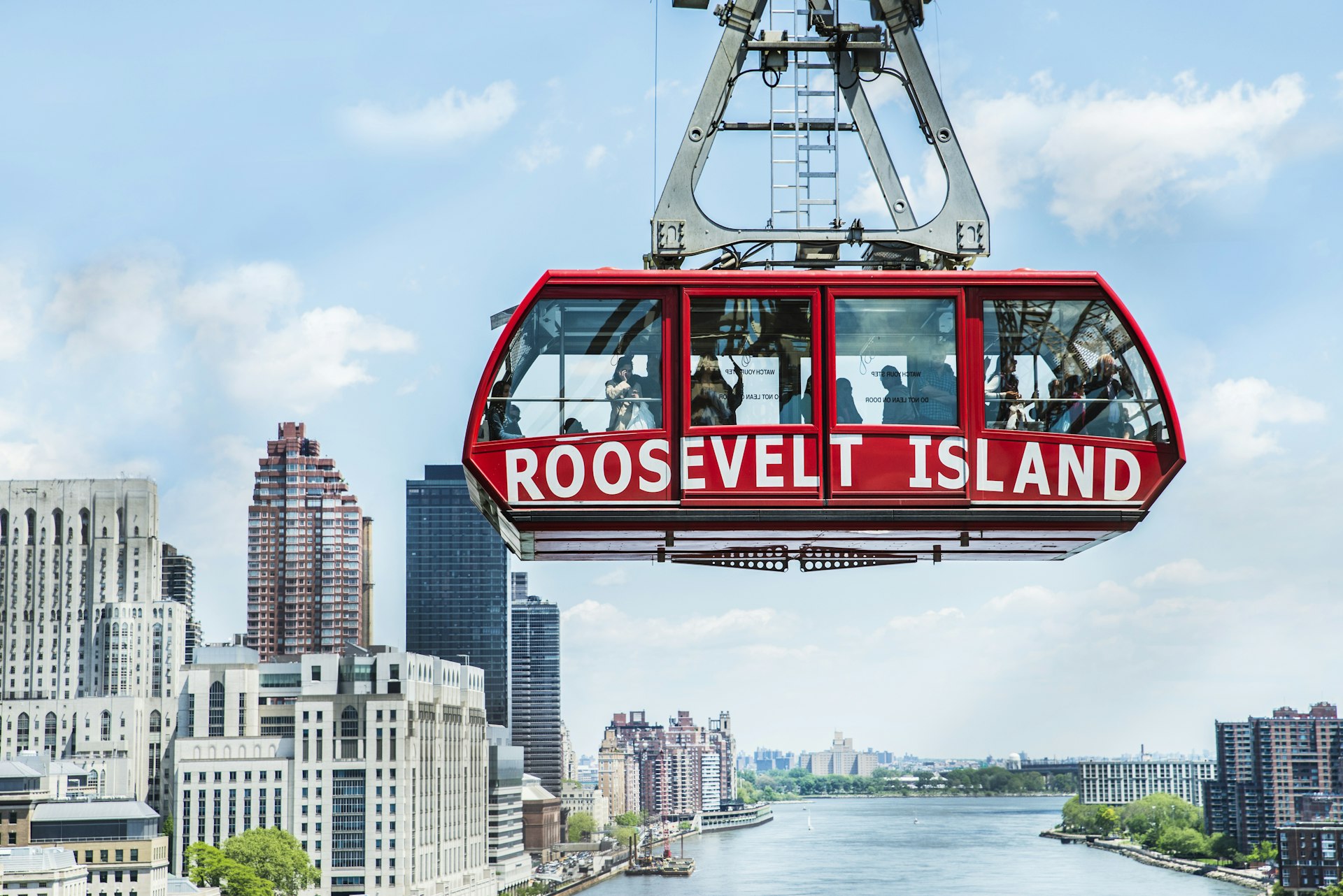
New York definitely has no shortage of transport options. The Roosevelt Island Tramway is an aerial tram which links Roosevelt Island with the Upper East Side of Manhattan. It’s been in operation since 1976, and was the first aerial tram of its kind in the USA.
It was primarily built as a commuter tram to link Roosevelt Island with Manhattan, but is also popular with visitors looking for a unique view of the skyline. Whilst not operated by the MTA, you do need a MetroCard to ride the tram. Prices are the same as a subway or bus ride, at $2.75 for a single.
In addition, because it is linked to the MetroCard system, you can transfer from the tram to a bus or subway service without paying any more.
10. Hop-on Hop-Off Bus
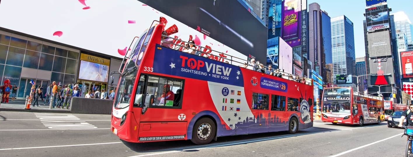
If you’re looking for a way around New York that focuses on the attractions and also provides information, then you’ll likely want to take a Hop-On Hop-Off bus tour of New York. These open-top buses follow routes around the city that stop at all the major attractions you’ll want to visit, and you can get on and off as often as you want for the duration of your ticket.
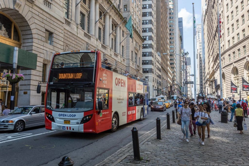
We find that HOHO buses are a great way to see a lot of a city in a short amount of time without trying to figure out the public transport system, plus they come with commentary which will give you lots of information about the city you are visiting, and the New York HOHO buses are no different.
You can buy HOHO bus tickets in advance here , or they are also included on many of the New York city attraction passes, such as the New York Pass , New York Explorer Pass & New York Sightseeing Pass .
You can see our review of the top New York City attraction passes here to see if they are a good option for your visit.
What is the Best Way to Get Around New York?
We think the best way to get around New York is a combination of the subway, bus system and walking. If you’re situated over in Brooklyn, we would add the NYC Ferry to that list.
If you are new to the city and want to get a feel for the layout and the sights, then we can also recommend a Hop on Hop off bus tour. These are especially worth doing if you have invested in a sightseeing pass as they are normally included.
As you can see from our list, there are lots of options to get you around the city. The best option for you is going to depend on where you are staying, where you need to go, and your needs.
Further Reading
Hopefully this post answered all your questions about public transport in New York City! Before you go, we wanted to share with you some more articles and resources to help you plan your trip to New York.
- We have a detailed guide to spending 2 days in New York and 3 days in New York to help you plan your time in the city
- We have a guide to our favourite New York city attraction passes , which can save you money on sightseeing in the city
- We have a complete guide to visiting the Empire State Building
- If you enjoy walking tours, check out our review of some of the Take Walks New York walking tours
- Wondering how much to budget for your trip? We have a guide to how much it costs to travel in the USA to help you plan
- If you’re heading on from New York and thinking of hiring a car, take a look at our tips for driving in the USA
- For more information about public transport in New York, take a look at the NYC MTA website , which has a lot of helpful information covering the major transport networks in the city
- If you’re looking for a guide to New York, we can recommend the Frommer’s EasyGuide to New York City .
And that’s it for our guide to public transport in New York! As always, if you’ve got feedback or questions, let us know in the comments below!
Enjoyed this post? Why not share it!
There are 12 comments on this post
Please scroll to the end to leave a comment
12th February 2020 at 12:47 pm
I was told that the HOHO bus is a very slow method of seeing the major sights. Too much time spent in slow moving traffic. We’ve never been on a subway and the thought of trying to navigate it is a little intimidating! Due to medical conditions, long walks are not an option. Any advise?
Laurence Norah says
12th February 2020 at 1:38 pm
We’ve taken the HOHO bus in New York and it is a good experience, but it is more useful as a sightseeing tour than a means of transport between the sites, as it does take a bit of time due to the traffic, and you do obviously have to wait for the next bus to come. That said, it is one of the more convenient ways to do sightseeing, as most of the stops are at places you will want to visit.
The NYC subway is not too hard to navigate. The system is well laid out and there are lots of lines to choose from. Tickets are easily purchasable at every station, although I’d recommend buying a metrocard rather than individual tickets. Then you just swipe the metrocard to go in. Unlike some cities, the subway isn’t very deep, so you don’t have to worry about hundreds of steps.
Obviously the other option is the normal bus (lots of route, metrocard also accepted), or taxi. The latter will get you where you want to go, but will definitely be the most expensive option.
I’d probably go for the subway or HOHO bus personally 🙂
Have a great trip – let me know if you have any more questions!
Louis Marotta says
29th December 2019 at 4:24 am
Every so often, making my way through the mayhemed tangle of NYC’s cracked and potholed highways and roads , I see in dimmly lighted dots, the feeble and perhaps apologetic advice to “use mass transit” . I assume “car pools” are not solely implied here. It makes me wonder though, if any of the people who were in any way connected to this NYC “public service message ” are actually sacrificing the immediate comforts of thier automobiles despite the gridlock and toll rip offs to rise perhaps one or two hours earlier, walk the filthy sidewalks to the crowded little grime encrusted bus stand or dirty, foul smelling subway and cram thier way into what is undoubtedly the most vile, unsightly, and thankless mass transportation rides in the world.
29th December 2019 at 10:04 am
I take it you are not a fan 😉
Kyle William says
1st May 2019 at 8:18 pm
These above pictures look so fascinating and I really like your post. Thanks for sharing and keep up the amazing work.
2nd May 2019 at 8:26 pm
Thanks Kyle!
Martin says
23rd March 2019 at 6:06 am
Thanks so much for the information! Leaving for NYC in 5 days and this was awesome!
23rd March 2019 at 11:11 am
Our pleasure Martin – have a great time!
18th December 2018 at 9:03 am
That’s the best article I could dream about! So much information. Thank you guys for your work
18th December 2018 at 3:21 pm
Our pleasure Jane 🙂
4th July 2018 at 5:31 am
Great information compiled into a concise article. Thank you!
4th July 2018 at 9:13 am
My pleasure!
Leave a Reply Cancel reply
Your email address will not be published. Required fields are marked *
Let me know when there's a reply to my comment (just replies to your comment, no other e-mails, we promise!)
Subscribe to our monthly Newsletter where we share our latest travel news and tips. This also makes you eligible to enter our monthly giveaways!
We only ask for your e-mail so we can verify you are human and if requested notify you of a reply. To do this, we store your data as outlined in our privacy policy . Your e-mail will not be published or used for any other reason other than those outlined above.
NYC Attractions & Landmarks
Top Things to Do in NYC
Free Things to Do in NYC
Beaches Near NYC
Best Museums in NYC
Theater in NYC
NYC's Best Live Music Venues
One Day in NYC: Itinerary
Day Trips From NYC
The Best Food to Try in NYC
Family-Friendly NYC Restaurants
NYC's Best Bars
Breweries in NYC
Weather & Climate
New York Airports
Neighborhoods to Know
Driving in NYC
NYC Public Transportation
Getting Around New York City: Guide to Public Transportation
Everything you need to know to get around New York City
Wikipedia Commons
The easiest, most affordable way to get around New York City is by public transportation. New York City mass transit generally falls into two categories: buses and subways. The city has 36 subway lines (that go to 472 stations) and 5,725 buses that can take you anywhere you want to go. Once you know how to use them, you'll find them efficient, reliable, and easy. The only problem is you must learn the system.
This guide will tell you everything you need to know about navigating your way around New York City's public transportation. You'll feel like a local in no time, maybe even venturing to far away places you never thought you would.
Watch Now: Riding the Subway in New York City
How to ride the new york city subway.
Most visitors will find themselves wanting to get around the city by subways. Subways serve most of Manhattan and the outer boroughs very well, and they take you directly to many popular tourist destinations.
- Before you ride the New York City subway you need to buy a MetroCard. You will swipe this card every time you enter a subway station at the turnstiles. MetroCards cost $1 to purchase. Once you buy your MetroCard you can add money to it.
- MetroCards may be purchased and refilled at subway station booths, MetroCard vending machines, and at other vendors . You can use cash, credit, or debit cards to make your purchase.
- New York City subway fares are $2.75 per trip. For visitors staying more than a couple of days you can buy a one week unlimited MetroCard for $33 or an unlimited monthly MetroCard for $127.00. People who are 65 or older or who have qualifying disabilities can get a reduced fare, which is half price. You must see an attendant at a station to purchase one.
- Because New York City has so many subway lines, it's impossible to memorize them all. Even locals have to look up directions on occasion. The best way to plan your trip is to consult Google Maps or the MTA website . There are also a variety of apps that you can download before your trip to easily look up subway directions. You simply type in your point of origin and your destination, and the app will tell you the route.
- New York City has some subways that run express. Your trip planning app will tell you exactly which line to take. If it tells you to take the 1, for example, don't get on the 2 or 3 even though it looks like it's going in the same direction. Those trains are express and won't stop at the station you need.
- The New York City subway operates 24 hours a day, but service is more sporadic between midnight and 6 am and on weekends. If you're traveling on the weekends or late at night, you should be aware of service interruptions that might impact your trip. Taking a few minutes to review the planned service changes can save you a ton of hassle. Trip Planning apps like Google Maps are aware of these disruptions and can help you plan your route.
- In every station there is an information booth where you can press the green button and talk to an attendant. If you are confused or need help it's a great tool to use.
- MTA has a list of accessible subway stations on its website.
Other Transit Options
Subways serve most of Manhattan and the outer boroughs very well, but in those areas where the subway service is not ideal there are buses, trains, bikes, and boats that can take you where you need to go.
New York City Buses
The city has around 5,000 buses, and you'll find they are particularly helpful when you need to travel to the far east or west portions of Manhattan.
New York City bus fare is $2.75 per trip. Be aware that buses only accept MetroCards or exact fare in coins—drivers cannot make change. There are also some buses along major routes in Manhattan & the Bronx that have you pay your fare before you board to speed the process of boarding. It's called "Select Bus Service" and the kiosk for pre-paying your fare is usually very obvious and easy to use.
Google Maps and MTA Trip Planner can tell you the best buses to take (and whether you should take one instead of the subway.) You can also look up New York City Bus schedules.
The NYC Ferry Service
In the past few years New York City has launched new ferry services taking commuters and visitors to Manhattan, Brooklyn, Queens, & Bronx. Ferries are particularly advisable if you are traveling to places along the water (perhaps you are going from the South Street Seaport to Brooklyn Bridge park.)
The ferries are fun to ride because they offer incredible views and refreshments on board (even local wine and beer!) During warmer seasons you can sit on the outer decks and enjoy the sunshine. They are also relatively inexpensive at $2.75 a ticket. You can look up routes and ticket information on the website.
Railroad Services
If you need to get to the suburbs or areas around New York City you might need to take railroads. Metro North trains take you to Connecticut and Westchester. They leave from Grand Central Station.
Long Island Railroad takes you into Manhattan, and New Jersey Transit takes you to New Jersey. Both train services leave from Penn Station. Google Maps will tell you which service to take.
All train services are reliable and run frequently, but they can get crowded at rush hour. Sometimes it's standing room only during morning and evening commutes. Avoid those times (8 a.m. to 10 a.m. and 5 p.m. to 7 p.m.) if possible.
Taxis and Ride Shares
Many New Yorkers prefer to take taxis or private cars, especially late in the evening when subway service is more sporadic. Yellow taxis are the iconic New York City cars. You can flag them down when you need them. If you are in Brooklyn or another outer borough, the taxis are green.
New York City has a variety of ride-sharing apps. Uber and Lyft allow you to book a private car or share a car with passengers traveling in a similar direction. Both are reliable services and usually arrive very quickly.
One of the best ways to get around New York City is by Citi Bike, New York's bike share system. There are stations in Manhattan, Brooklyn, Queens & Jersey City where you can unlock a bike with your credit card and return it when you get to your destination. Download the Citi Bike app to find the docking stations closest to your location.
While many parts of the city have bike paths, be careful when riding bikes in the city. Lanes can get congested, and sometimes bike paths are close to speeding cars. Accidents happen regularly so vigilance is key.
Rental Cars
While New York City has ample car rental places, it's not advisable. It's difficult to drive in New York City. There is usually heavy traffic, and taxis are used to swirling in and out of lanes. Parking a car can also be difficult especially in Manhattan.
Tips for Getting Around New York City
- If you are traveling around Manhattan during the day, a subway is your best option.
- Between midnight and 6 am and on weekends check trip planning apps to determine how to travel to your destination. Routes and lines get changed during those times.
- Buses are your best option if you are traveling from East to West across the city.
- If it's a pleasant day try to rent a bike or ride a NYC ferry. You will see more of the city and have fun.
- NYC has many ride sharing options. If you are in a hurry choose a private car. If you have time and want to meet new people order a shared car. You never know who you will meet!
- Driving is tough in the city. It's also hard to park. Avoid a rental car if possible.
How to Travel From Newark Airport to Manhattan by Train, Bus, Car, and Shuttle
Getting Around Pittsburgh: Guide to Public Transportation
How to Travel from JFK Airport to Manhattan by Subway, Train, Taxi, and Shuttle
JFK Kennedy Transportation
Getting To and From LaGuardia Airport in NYC
How to Travel From LaGuardia Airport to Brooklyn by Subway, Bus, and Car
New York City Guide: Planning Your Trip
Getting Around Mexico City: Guide to Public Transportation
A One-Day Itinerary for Visiting New York City
Getting Around Beijing: Guide to Public Transportation
How to Travel From Toronto to New York City by Train, Bus, Car, and Plane
Getting Around Paris: Guide to Public Transportation
18 Best Things to Do as a Solo Traveler in NYC
Strategies for Visiting New York City on a Budget
Getting Around Salt Lake City: Guide to Public Transportation
New Jersey Hotels for a New York City Visit
Everything you need to know about getting around New York City

Update: Some offers mentioned below are no longer available. View the current offers here .
Have you ever heard the phrase, "Getting there is half the battle"? Well, in New York City it's more like getting around is half the battle — if you don't know what you're doing.
From trains to planes to automobiles, the options for traveling around New York City are endless. But not all transportation is created equal, which is why we've put together this handy guide so you spend less time on your next visit to New York City stuck in traffic and more time, well, doing what you came to do.
For more TPG news delivered each morning to your inbox, sign up for our daily newsletter .
The best way to get from the airport to New York City
First things first: Getting from one of New York's three major airports to wherever you're staying. The good news is you have plenty of options. The bad news is, none of the city's airports are particularly close or convenient.
How to get from Newark (EWR) to the city
You're probably going to go from Newark , located in New Jersey, to Manhattan one of three ways: getting a taxi or car; take the AirTrain to NJ Transit; or take a shuttle bus if you're staying in Midtown.
Getting a taxi or Uber is the quickest but most expensive option. You walk out of the airport and boom, you're on your way to your desired destination. If you're staying in Midtown, expect the trip to take anywhere from 30 to 45 minutes, depending on the time of day and traffic, and to cost around $80 if you're taking a taxi or grabbing a car.
Related: From budget to luxe: Use hotel points at these 9 NYC hotels
The Newark Airport Express shuttle bus is a convenient and affordable alternative, especially for travelers staying in Midtown. There's a pickup right outside each terminal at the airport, and you have a choice of drop-off locations: Port Authority, Grand Central and Bryant Park. One-way tickets are $17 and round-trip tickets cost $30. The only downside is if you get on the bus at one of the first airport pick-up locations or are getting off at one of the last drop-offs, as it will take a while. Also, make sure to budget enough time on the way back to the airport to accommodate for late buses or heavy traffic.
Taking a combination of the AirTrain to the NJ Transit, PATH or Amtrak might be the most inexpensive route, but requires multiple transfers. You'll be able to access the AirTrain from each terminal for $7.75. Depending on where you want to end up, each of the three train methods of transportation will get you into Manhattan. This trip will take about an hour and a half. Consider the amount of luggage you'll be dragging around before embarking.
How to get from New York-JFK to the city
JFK has a leg up on the airport competition in that you can take the subway all the way into the city after an easy AirTrain ride. It will cost you $7.75 plus $2.75 ($10.50 total) for the MTA and take about an hour to reach Times Square. You can also catch the Long Island Railroad (LIRR), which is a quicker, nicer ride, but will set you back $7.75. to $10.75, plus $7.75 for the AirTrain ($15.50 to $18.50). This takes 30 minutes.
Grabbing a car from JFK is neither inexpensive nor quick: You're looking at $56 for a taxi, $70 for an Uber and about an hour on the road, depending on traffic.
Related: JFK vs. LaGuardia vs. Newark: Which NYC airport should I fly into?
How to get from LaGuardia (LGA) to the city
LaGuardia is the toughest airport to get to and from, due in large part to the massive construction project going on .
While cost-effective at only $2.75 per ride, catching the MTA bus out of LGA to the subway is a true test of patience and grit, because there's a good chance you can walk faster than a city bus moves. It can be done, but be prepared.
Both a taxi and ride-hailing service such as Uber or Lyft from the airport to the city will cost you $40 plus tip and take about 45 minutes.
Catch a helicopter from the airport
Blade launched helicopter transports from Manhattan to New York-JFK in March of 2019 and expanded its service to all airports in the New York City area, including Newark and LaGuardia, that May. The routes are between LaGuardia and Manhattan's Downtown/Wall Street Heliport, and passengers can reach Newark by helicopter from Blade Lounge East (East 34th Street Heliport). The route to JFK departs from Blade Lounge West (West 30th Street Heliport) across from Hudson Yards. A seat on a Blade helicopter to the airport costs $195, and the transfer (to JFK, at least) takes about five minutes.
Related: We tried Uber's new helicopter service from Manhattan to JFK
The best ways to get around New York City
Once you've made it to the city, you'll have to decide how you'd like to get around. The best, most inexpensive tourist attraction for anyone visiting New York City is simply walking around the city — which is free! — so pack comfortable shoes. But, if inclement weather strikes or it's too cold to be outside, you still have plenty of options. We'll, ahem, walk you through them all.
New York's subway, the MTA, is mostly reliable and very affordable. A single ride will cost you $2.75, and the city offers unlimited seven-day passes for $33 which are great for. travelers spending the week. It costs $1 for a new subway card so, repeat after us: Do not lose it! Download the MTA app for service changes and the fastest routes.
Related: TPG's guide to Penn Station
Taxi or ride-hailing service
One of the hardest lessons to learn in New York City is that it's (usually) faster to take the train than a car. That said, we've all been there after a long day of sightseeing when you just want to get off your feet and into a cab. Plus, you get a better view of the city. Surge pricing (read: Drives on New Year's Eve, during peak rush hour or a good rainstorm) can make an Uber or Lyft for expensive, but normally rates are competitive with a taxi.
For tips on how to maximize your ride and get deals on Uber and Lyft, check our guide to the best credit cards to use here . And if you have an early or late flight to catch lining up a car ahead of time is the way to go.
If you decide to go old school and hail a cab, look for one with its light on and make sure to exit on the curbside.
New York City has a robust bus system that's especially great for getting you across town, from east to west. Be prepared, however, to make frequent stops. You can use the same card on the bus as you'll use on the subway.
Related: How to get to New York City on points and miles
Arguably the best way to get around New York City is to walk. Walking is an excellent way to take in the sights and sounds of the city all while getting to your destination.
Boats, bikes and more
Chances are, someone's told you about the free ferry ride from lower Manhattan to Staten Island, which gives you a fantastic view (twice!) of the Statue of Liberty. This is not a tourist trap — it's actually really fun, especially on a beautiful day. But that's not the only ferry in town. There are numerous other ferries you can catch to, well, ferry you around town. Check out the full list here .
Citi Bike is another great option. If you don't feel comfortable biking the actual streets of the Big Apple (we don't blame you), at least go for a spin down the West Side Highway path along the Hudson River. Chase Sapphire Reserve cardholders can activate one free year of Lyft Pink membership , which includes three free bike or scooter rides per month (as well as 15% off rides and priority airport pickups).
Oh, and whatever you do, don't get in a pedicab (no matter how many times they hassle you). The ride is bumpy and more expensive than a penthouse apartment in Tribeca.
Related: These are the best times to visit New York City
Bottom Line
One of the greatest things about a trip to the Big Apple is that you definitely do not need a car. In fact, we would encourage you not to drive, as parking is exorbitant and traffic can be a nightmare. For short trips, don't be afraid to pound the pavement, and for longer trips, get the full New York City experience by heading underground. When it comes to the airport, it's worth the splurge to get an Uber or Lyft, especially if you can stack offers from a credit card.
Photo by Tim Robberts/Getty Image
How to find your way around New York City

Mar 16, 2024 • 12 min read
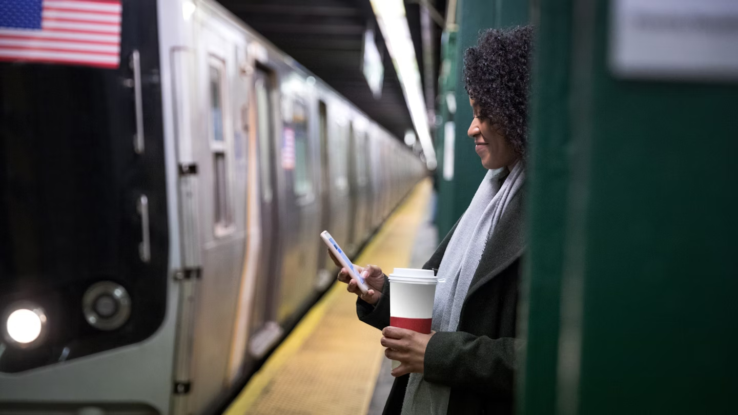
New York is easily explored on foot, but there are plenty of other transportation options if walking doesn't appeal © LeoPatrizi / Shutterstock
If there's one thing that will impact how you choose to get around in New York City , it's the weather. Taking the subway in summer or opting to walk in the depths of winter can challenge even the hardiest of travelers.
This city never sleeps, largely because you can get anywhere, anytime, thanks to night owl cabbies and trains that run around the clock. The party keeps going in NYC for as long as you're willing to join it.
Everyone thinks of yellow cabs and the subway when they think of New York – and the extensive public transit system is indeed a source of both pride and frustration for the city's millions of residents – but there are many more options for getting around.
Buses, ferries and commuter trains complete the public transit system, and getting around on foot can be one of the most rewarding ways to explore. Some adventurous, patient souls even choose to get around by bike or car.
Best of all, public transit is inexpensive – combined with the many free things to do in NYC , this can help offset the cost of accommodation. Here's everything you need to know about getting around New York City.
Get around night or day on the subway
With 25 routes covering more than 665 miles of track, the New York City subway system is a behemoth, welcoming 1.7 billion riders on an annual basis. It’s operated by the MTA and covers Manhattan, Brooklyn , Queens, the Bronx, and Staten Island, though the latter’s trains don’t connect to the other boroughs directly (you'll need to reach Staten Island by bus or ferry).
Unlike other major cities in the US, New York's subway trains run 24 hours a day, seven days a week. However, with the system’s advanced age – 28 stations date back to 1904, and signals from the 1930s are still in use today – it’s susceptible to delays and breakdowns. Construction is often scheduled for nights and weekends, so weekend subway travel can be challenging. You'll find countdown clocks in every station, telling you when the next train is coming.
To keep on top of service changes, anticipated or not, the MYmta app is frequently updated with information on each line, and it’s a handy tool for trip-planning in general, but Google Maps is even better for plotting a course, with integrated service info as well as details on stations, schedules, and the onboard experience. The MTA Twitter feed is also worth bookmarking for up-to-the-minute info on service disruptions and delays.
Tips for taking the subway : Standing on the subway without holding onto something is a rookie mistake. If you’re not familiar with the way the trains stop and start, it’s a good way to wind up in a stranger’s lap. Do everyone a favor and hold on to a pole – or even better, grab a seat if there's one available and enjoy the ride. If you're standing, take your backpack off your back to create more space for those around you.
Before you board, be aware that empty train cars on otherwise busy trains may be empty for a reason. It could be a terrible smell or a mess on the floor, but trust us – you don’t want to know the details. You’re often better off in a crowded car or even waiting for the next train if you have to.

People watch from the window of a bus
The MTA is also responsible for the city’s buses , and its fleet includes nearly 6000 vehicles. For the most part, New York’s buses run on a grid, and routes cover uptown, downtown and crosstown, with stops on every (or every other) corner. There are local buses with frequent stops as well as express lines which eliminate local stops for a quick ride. The select bus service (SBS) is even faster but requires prepayment before boarding – unless you pay with a contactless credit or debit card, which you can tap at the bus's OMNY reader upon boarding.
For a normal bus trip, pay the fare ($2.90) as you board with a MetroCard, contactless credit or debit card, or exact change (coins only). For SBS routes and certain regular routes (like along 14th St), buy your ticket before you board from one of the kiosks near your stop (you can also tap your credit or debit card upon boarding normal buses). You won’t have to show your ticket to the driver, but you do need to keep it for the duration of the trip in case of inspection – don’t lose it, or you could get hit with a hefty fine.
The MYmta app has timetables and service info for buses, and each bus stop has a QR code that’s scannable for arrivals, departures, and status updates.

How do you pay for public transit in NYC?
To travel on any bus or train operated by the Metropolitan Transit Authority costs $2.90 per ride, payable via MetroCard or OMNY , a touchless ticketing system introduced in 2019. Single-use MetroCards cost $3.25 and are not refillable; pay-per-ride cards can be funded by value or time, with seven- and 30-day unlimited-ride options available for $34 and $132 respectively. Kids less than 44 inches tall ride for free when they’re with a paying adult.
If you’re paying per ride, you get one free transfer within two hours of your first swipe (bus to bus or train to bus only). Once you exit through the subway turnstiles, you can’t transfer to another line or reenter the station without paying again.
An unlimited card gives you as many transfers as you’d like, but you can’t use it at the same station within 18 minutes of your first swipe, so individual or pay-as-you-go cards are the best options if you’re sharing with travel companions.
For contactless payment, you can either pick up an OMNY card and top up your account online, or tap your contactless credit or debit card or electronic device on an OMNY reader to pass through the turnstile.
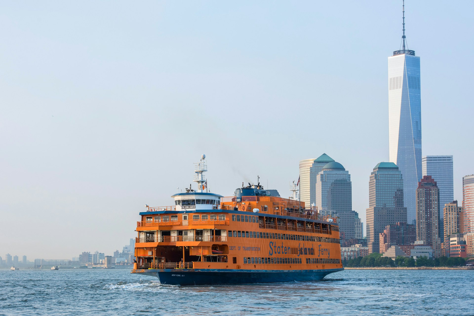
Board a ferry to get panoramic views
The subway gets all the attention, but New York’s ferry system is a rewarding and much-underrated means of transportation. Seeing New York from the water can also be a fun, low-cost feature of a day out with kids .
The Staten Island Ferry runs from the Whitehall Ferry Terminal in lower Manhattan to the St. George Ferry Terminal in Staten Island. It’s also a great way to take in waterside views of the Statue of Liberty – and it’s absolutely free.
NYC Ferry connects communities along the city’s waterways, including the East River, South Brooklyn, the Rockaways, Western Queens, and the Bronx, with seasonal routes between Manhattan and Staten Island, Governors Island , and Coney Island. Tickets can be purchased from vending machines at the landings or via the NYC Ferry app ; single-ride tickets for adults cost $4.
NY Waterway operates between Manhattan and New Jersey, making stops in midtown, Battery Park City, and Wall Street before crossing the Hudson River and docking in Jersey City, Hoboken, Weehawken, and Edgewater. On weekdays, fares range from $7.50 to about $21.50 for adults, depending on your route.
Explore the suburbs on a commuter train
Along with the subway, NYC has a useful network of suburban trains, comprising the Long Island Rail Road (LIRR), Metro-North Railroad , NJ Transit and New Jersey PATH , which bring legions of commuters to Penn Station, Central Station, Secaucus and Hoboken. AMTRAK trains from further afield also run into Penn Station.
Fares depend on the line and length of the trip but the trains are a cost-effective way to reach outlying locations, including Newark Liberty International Airport (in New Jersey) and the beaches of Long Island.
Hail an iconic yellow taxi
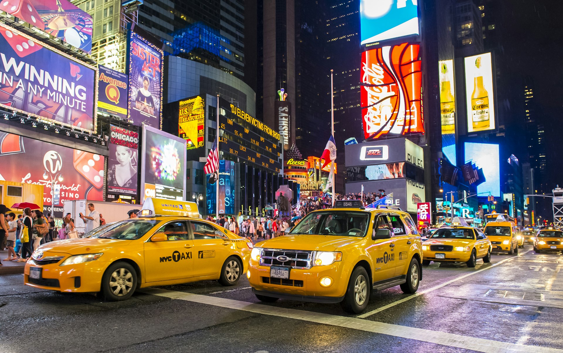
Few things are more iconic than the swarms of yellow cabs flooding New York City’s streets. Cabs licensed by the NYC Taxi & Limousine Commission are metered, with fares starting at $3.00, plus $0.70 per mile if traffic is slow or stopped and $0.70 per 1/5 mile if it’s moving at least 12 miles per hour. There are also various surcharges depending on when and where you’re traveling, not including tolls and tip (customarily 15 to 20 percent).
To hail a cab, look for one with its rooftop lights on and raise your arm to signal for pickup; lights off are a sign that a taxi is occupied or off-duty. An assortment of apps, including Curb , Waave and Myle , let you book rides with TLC-licensed cabs in advance. Be aware that green taxis operate in outer New York boroughs as well as yellow cabs.
It’s technically illegal for drivers to refuse to take you anywhere within the city limits, so push back if they tell you they don’t want to go to the outer boroughs.
Ride-hailing apps in New York
Uber and Lyft are both extremely popular in New York; rates often undercut yellow cabs and your ride will usually arrive after only a short wait. Via is another ride-hailing app that operates here, often with cheaper rates than its bigger-name brethren.
Get a real feel for NYC on foot
If you’re not in a hurry, traversing the city on foot is one of the best ways to see the sights. Pick a neighborhood and get lost in its side streets, or choose an avenue and follow it from one end of Manhattan to the next.
Just be aware of your surroundings – the sidewalks can be crowded enough that if you’re staring up at the skyline or down at your phone, or if you stop suddenly or change directions unexpectedly, you’re bound to collide with someone sooner or later. And New Yorkers are not shy about expressing their dissatisfaction with foolish tourists!
Sidewalk etiquette dictates that you walk no more than two people across when others are around – any more than that, and you’ll be blocking the flow of foot traffic in either direction. Note that winter brings chilly conditions for exploring at street level, made worse by icy winds and periodic dumps of heavy snow. Luckily, there are plenty of warm cafes and coffee shops to duck into when the cold bites.

Explore the city streets on two wheels
With the introduction of dedicated cycling lanes and a popular bike-sharing system, New York has become more two-wheel-friendly over the years. But considering the chaos of drivers and traffic in the city’s streets, city biking isn’t necessarily an activity for beginners – regardless of skill level or experience, a helmet is essential.
The bike-share program CitiBike has more than 1300 stations and 20,000 bikes within the city limits and across the river in Jersey City. A single 30-minute ride costs $4.79, and day passes cost $19 and cover as many 30-minute rides as you can handle in 24 hours; annual memberships are also available. Once you’ve purchased a pass, check the app to find the closest station, then pick a bike, scan the QR code on its handlebars and get peddling. You can also pay by card at any kiosk.
First things first: take safety seriously. Despite the city’s Vision Zero initiative to decrease traffic fatalities, thousands of cyclists are involved in accidents here each year.
Read up on how to cycle like a pro before you go. There are some 1375 miles of bike routes, but you’ll often find cars idling in dedicated bike lanes; keep an eye out for taxis pulling over to discharge their passengers, and anyone opening a car door – never assume they've checked for oncoming bikes.
If you don't fancy dealing with vehicle and pedestrian traffic, saddle up and head for one of the city’s green spaces . Central Park and Prospect Park have paved loops that are popular with cyclists. There are also greenways along the East River, the Hudson River and the Harlem River.
The best driving tip for New York City
Our advice about driving in New York is quite simple: don't do it. Between the traffic snarls and the impossible-to-find parking spots, public transportation, taxis and ride-hailing apps are the way to get around here.
Take the tram to Roosevelt Island
A tiny spit of land measuring just 1.75 miles in length, the East River’s Roosevelt Island has been home to hospitals, an asylum and a prison but these days there are high-rises interspersed with historic architecture, green spaces, and unbeatable skyline views.
You can get there by subway, bus or ferry, but taking the aerial tram is half the fun. It departs every seven to 15 minutes from 59th Street and Second Avenue in Manhattan and costs just the swipe of a MetroCard.
Accessible transport in NYC
New York’s subway system can be difficult to navigate for travelers with disabilities, even given the MTA’s recent push to become more accessible. Out of 472 stations across the five boroughs, only 130 are currently ADA-compliant with street-level ramps or elevators.
Braille and raised-lettering signage do appear at most street-level entrances, while service changes and PSAs are announced visually and over a loudspeaker. There is an accessible boarding area near the middle of the platform – that’s where the conductor’s car usually stops, and where the gap between the platform and the train is the narrowest. The MYmta app keeps track of elevator and escalator outages system-wide.
Bus transit can be a better option. The driver can lower the bus or let down a ramp or lift for wheelchair users, then secure the chair or scooter in place; once on board, priority seating is available for seniors and passengers with disabilities. Service animals are allowed system-wide, as long as they’re kept on a leash.
Wheelchair-accessible taxis are also available, either by dispatch, car service, ride-share app, or flagging them down in person. The Accessible Dispatch Program has an app and a website; you can also book a ride by phone. Ride-sharing apps like Curb and Myle are licensed by the TLC and give passengers the option of requesting wheelchair-accessible vehicles.
Keep planning your trip to NYC:
Start crafting your budget with these tips Check out these restaurants on your food tour of NYC Find the best time of year to visit Save these day trips near NYC for a city break
This article was first published May 20, 2021 and updated Mar 16, 2024.
Explore related stories

Public Transport
May 28, 2024 • 8 min read
Take a break from the big city energy, with a beach, art, historic — or even pizza! — getaway from NYC.

May 21, 2024 • 11 min read

May 13, 2024 • 7 min read

Apr 29, 2024 • 11 min read

Apr 25, 2024 • 9 min read

Apr 14, 2024 • 6 min read

Apr 7, 2024 • 11 min read

Apr 6, 2024 • 7 min read

Apr 3, 2024 • 6 min read

Apr 2, 2024 • 9 min read
NYC Transportation Guide | How to Get Around NYC
Home | Travel | North America | United States | New York | NYC | NYC Transportation Guide | How to Get Around NYC
Manhattan is pretty big, and it’s just one part of New York City, so you’ll have to rely on public transportation in NYC during your trip.
That’s not a problem since New York’s transit network is expansive, efficient, and inexpensive. There are plenty of ways to get to Brooklyn and the other boroughs in NYC , including Staten Island across the harbor.
As much as we don’t mind walking, sometimes public transportation is the best way to get around New York , and we had no trouble navigating the city’s buses and subways. I have no doubt that you’ll get the hang of it in no time!
To put your mind at ease, this guide will help you find the best way to travel through the city. Not only will you learn how to get around in NYC , but you’ll feel better prepared for your trip. That means less time worrying and getting lost, and more time visiting the most popular attractions in New York City !
Best way to get around NYC
Driving in the Big Apple is exhausting and overwhelming, so public transportation will become your best friend during your time here. So, if you’re not sure how to get around NYC without a car , don’t worry because the transit system is great.
In this guide, I’ll tell you what you need to know about each mode of transportation, including schedules, pricing, NYC transit passes , and other helpful tips.
- Airport transportation
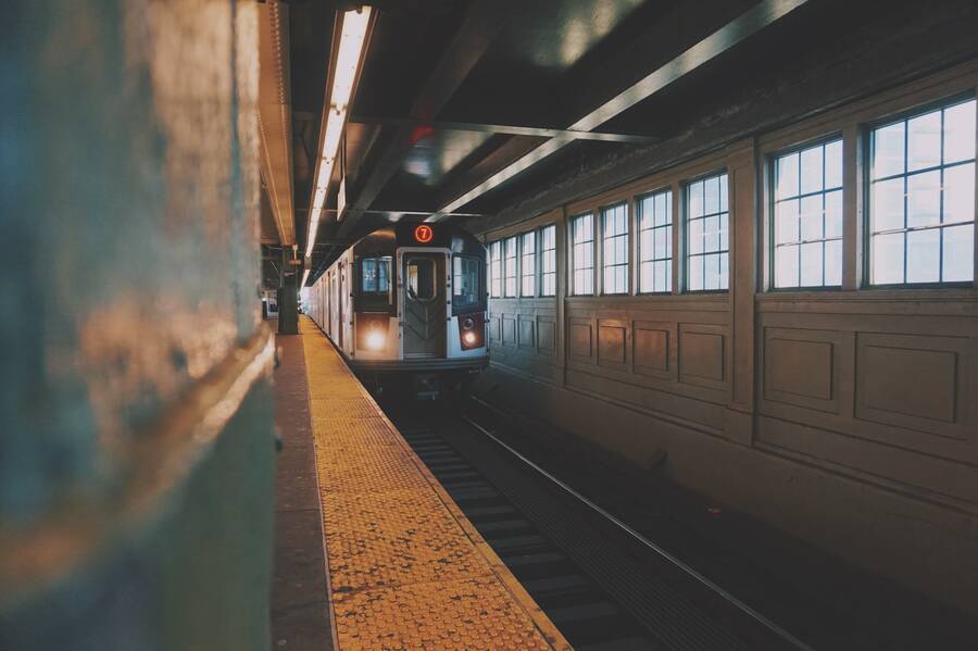
Without a doubt, the NYC subway system is the most popular and fastest way to get around the city. It’s also the most practical since subway lines run 24/7 and you don’t have to worry about traffic unless it’s rush hour, in which case, you should be prepared for crowds.
New York has one of the oldest and largest subway networks in the world, with over 450 subway stations connecting Manhattan, the Bronx, Brooklyn, and Queens. You can get a better idea of the subway routes with this NYC MTA subway map :
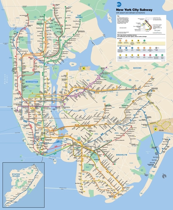
Generally, the subway runs every 2-5 minutes during peak hours (6:30 a.m.-9:30 a.m. and 3:30 p.m.-8:00 p.m.) and every 5-15 minutes outside those hours. Currently, the New York subway fare is $2.75 per ride and $3 if you purchase a single ticket.
If you’re going to be in the city for more than a day, it’s worth getting a Metrocard . A 7-day Metrocard costs $33 and gives you unlimited rides on the subway, New York City buses, the Roosevelt Island Tram, the Long Island and Metro-North Railroads, and the AirTrain airport shuttle. You can check our guide to the New York subway here .
While the subway is the most popular way to get around Manhattan, NYC’s bus service is more common in the other boroughs. If you plan on visiting the Bronx , Brooklyn , or Queens , you’ll probably end up taking a bus at some point.
The bus fare in NYC is $2.75 for a single ride, and you can use your Metrocard. The buses typically run every 5-15 minutes, but you can check the exact routes and schedules here .
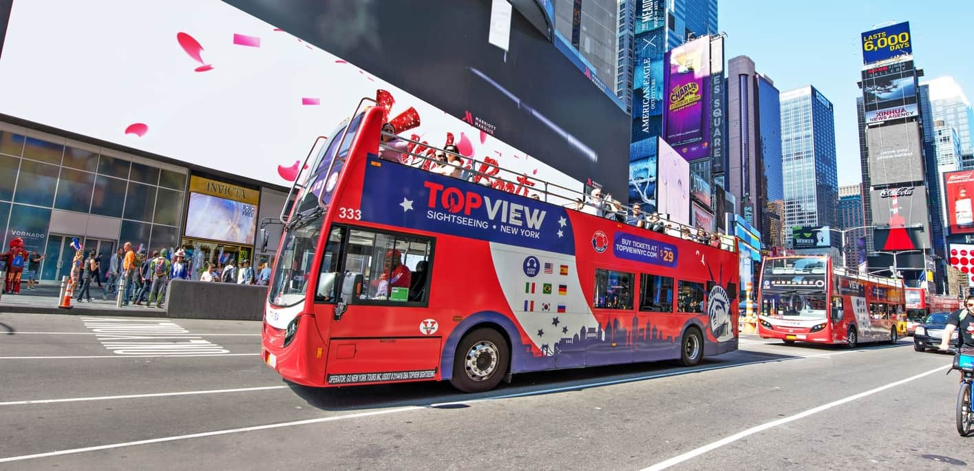
Remember, buses take longer than the subway, and there are often delays, so plan for extra travel time. For an express route, check out the Select Bus Service , which costs $6.50 per ride and makes fewer stops.
Also, if you want to maximize your time and see several landmarks and attractions in one day, consider taking a hop-on hop-off bus tour in NYC . These buses take you to the most popular parts of the city and they’re included in most New York city passes .
Rail service in NYC
Most people who visit New York City do just fine taking the subway or the bus, but if you want to go further out of the city, you can take the Long Island Railroad or Metro-North Railroad . These NYC train services are more popular with locals and commuters coming from or going to New Jersey or Long Island.
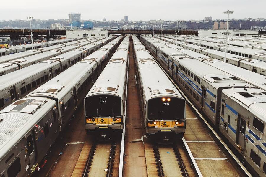
You probably won’t need to use the rail service, but if you do, the price depends on which fare zone you go through. Generally, it costs $10-$15 one-way .
Bike rental in NYC
NYC isn’t very bike-friendly, but there are some great areas to enjoy a bike ride, like the Hudson River Greenway. Central Park is another beautiful place to ride, and a bike can help you see more Central Park attractions in less time.
You can rent a bike in Central Park for a couple of hours and explore the 843-acre park at your own pace. The bike rentals are included in the New York Pass .

Outside of Central Park, you’ll find Citi Bike kiosks across the city. This bike-sharing system is perfect for cruising around the neighborhood, and it’s popular with locals and tourists. A single 45-minute session costs $3.99, although you can get a day pass with unlimited rides for $15. Simply pay with a credit card at one of the Citi Bike kiosks or on the app .
Ferries in NYC
New York is a port city, so there are several waterways, including the Hudson River, East River, and New York Harbor. Fortunately, there is water transit in New York, so you can easily cross over to Staten Island, New Jersey, and more.
The NYC Ferry runs every 30-45 minutes from Manhattan to Brooklyn, Queens, Staten Island, and Roosevelt Island. One-way tickets cost $4, or you can get 10 trips for $27.50. The NYC Ferry doesn’t accept the Metrocard, so get your tickets at one of the landings.
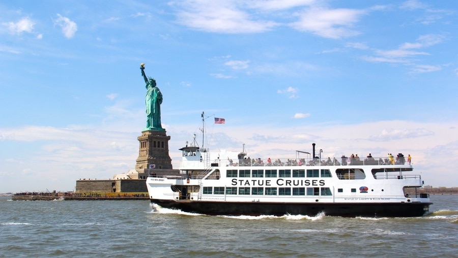
If you want to visit Staten Island or get a better view of the Statue of Liberty , I recommend the Staten Island Ferry . Not only is it one of the best free things to do in NYC , but it also passes several landmarks like Governors Island, Ellis Island, and the Verrazzano-Narrows Bridge. The Staten Island Ferry operates 24/7 and departs every 20 minutes or so from Whitehall Terminal near Battery Park.
There is also the NY Waterway and the New York Water Taxi , but these two options are more expensive, and the latter is a private charter for large groups. In other words, the best way to get around NYC ’s waterways is via the NYC Ferry or the Staten Island Ferry .
Taxi/Uber/Lyft
The yellow taxicabs are an icon of New York City, and while they’re popular in TV and film, they’re not the most convenient way to get around. A taxi can be useful if you’re traveling a short distance in bad weather or late at night, but otherwise, it’s not my first recommendation.
If you do want to take a taxi, you should know that fares start at $2.50 and increase the longer and further you travel. Taxis operate all day and night, and you can pay with cash or card.
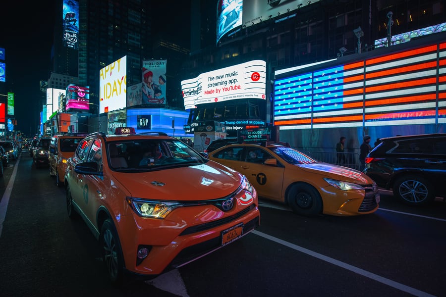
Alternatively, a ride-sharing service like Uber or Lyft is often a cheaper way to get around. You can also find a Lyft or Uber in NYC 24 hours a day, and the rates vary depending on where you’re going and whether you opt for a private or shared trip with other passengers.
Whether you take a taxi, Uber, or Lyft, you should tip your driver about 15% .
Walking is definitely the cheapest way to get around NYC , and while it’s not always practical, it is a great way to explore a neighborhood and experience the local culture. Best of all, it’s free!

Another way to take advantage of walking around New York City is to take a tour. There are all kinds of walking tours in NYC , including tours through the Financial District, Central Park, and Brooklyn’s DUMBO neighborhood .
Roosevelt Island sits in the East River, between Manhattan and Queens. There are some historic landmarks on Roosevelt Island, but the aerial view from the tram is the main reason people make the trip.
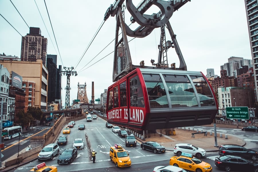
The Roosevelt Island Tram runs every 7-15 minutes from 6 a.m. to 2 a.m. (3:30 a.m. on Fridays and Saturdays). It departs from 59 th Street and 2 nd Avenue on the Upper East Side and drops you off at the Tramway Plaza on Roosevelt Island.
To ride this New York tram , you’ll need a Metrocard. The price for a single ride is the same as the subway, $2.75 .
While driving in the Big Apple is a headache, a car is super useful if you want to take a weekend getaway from NYC . We’ve used DiscoverCars many times and haven’t had any problems. You can rent a car or SUV for a day or two to easily get around NYC and the surrounding areas.
Renting a car is also a great idea if you want to take a road trip from NYC .
Airport transportation in New York City
Finally, if you’re flying into one of the airports near New York City, I recommend planning ahead of time, so you don’t get overwhelmed once you land. There are airport shuttles in NYC that depart from all three major airports: JFK, LaGuardia (LGA), and Newark Airport (EWR), and we tell you everything you need to know in our guide.
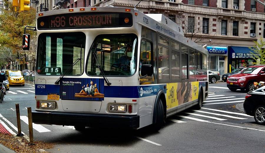
City buses and taxis also depart from the airports, but if you’d rather avoid NYC’s public transport while carrying your luggage, you can opt for a private transfer . I especially recommend this option if you are traveling with small kids or large luggage.
FAQs – Transportation in NYC
Finally, here are some common questions about New York City’s transportation system:
What is the best way to get around NYC?
The best way to get around NYC as a tourist is by taking the subway or the bus since it’s cheap, efficient, and goes to most parts of the city.
How much do taxis cost in New York?
Fares start at $2.50 and increase with time and duration. If you look at NYC taxis vs. Uber or Lyft, it’s generally more expensive to take a cab.
Is the New York subway safe?
Overall, the subway is safe. Just use common sense by staying aware of your surroundings and keeping your belongings out of sight.
How late does the subway run in NYC?
The NYC subway system operates 24/7, so you can take the subway even if you’re out late at night.
What is the cheapest way to get around NYC?
Aside from walking, the bus or the subway is the cheapest way to get around NYC since a single ride costs only $2.75.
That’s it for this guide to getting around NYC ! I hope you feel better prepared to take public transportation in New York City . As you can see, it’s not as overwhelming as you might think, and if you plan ahead, you’ll have no issues exploring all the places and attractions in the Big Apple.
Before I go, I’d like to remind you to check out our tourist maps of NYC , especially if it’s your first time in the city. Of course, if you have any questions about NYC transport , feel free to leave me a comment below. Until then, have an awesome time in New York!
Ascen Aynat

2 replies on “ NYC Transportation Guide | How to Get Around NYC ”
Thank u so much so such precise guide
Hey there, Thanks so much! I hope it helps you get around NYC! 🙂
Leave a Reply Cancel reply
Your email address will not be published. Required fields are marked *
This site is protected by reCAPTCHA and the Google Privacy Policy and Terms of Service apply.

New York City Travel Guide

Getting Around New York City
The best way to get around New York City is on foot as traffic is fairly heavy around-the-clock. That said, the subway system is a convenient option, too, and it extends throughout Manhattan and into the other New York boroughs. Buses are another affordable way to get around, but keep in mind they traverse streets clogged with weaving cars and cabs. Picking up a car isn't the best mode of transportation, as traffic is heavy. To get from the two main airports – LaGuardia (LGA) and John F. Kennedy International (JFK) – into the city, you'll likely want to take a taxi or ride-hailing service like Lyft or Uber. If you'd like to mix in a little sightseeing with your transportation, consider a bus tour or a boat tour .
Many East Coast travelers tend to arrive in New York City on one of the bus services like FlixBus or Megabus . Amtrak is another popular way of getting into the city and trains roll into Penn Station daily.
Explore More of New York City

Things To Do

Best Hotels

You might also like

Philadelphia
# 1 in Best Day Trips from NYC

# 3 in Best Day Trips from NYC

# 1 in Best Places to Visit in New Jersey
If you make a purchase from our site, we may earn a commission. This does not affect the quality or independence of our editorial content.
Recommended
The 28 Best Water Parks in the U.S. for 2024
Holly Johnson|Timothy J. Forster May 8, 2024

The 18 Best Napa Valley Wineries to Visit in 2024
Lyn Mettler|Sharael Kolberg April 23, 2024

The 25 Best Beaches on the East Coast for 2024
Timothy J. Forster|Sharael Kolberg April 19, 2024

The 50 Best Hotels in the USA 2024
Christina Maggitas February 6, 2024

The 32 Most Famous Landmarks in the World
Gwen Pratesi|Timothy J. Forster February 1, 2024

9 Top All-Inclusive Resorts in Florida for 2024
Gwen Pratesi|Amanda Norcross January 5, 2024

24 Top All-Inclusive Resorts in the U.S. for 2024
Erin Evans January 4, 2024

26 Top Adults-Only All-Inclusive Resorts for 2024
Zach Watson December 28, 2023

Solo Vacations: The 36 Best Places to Travel Alone in 2024
Lyn Mettler|Erin Vasta December 22, 2023

26 Cheap Beach Vacations for Travelers on a Budget
Kyle McCarthy|Sharael Kolberg December 4, 2023

- Transportation
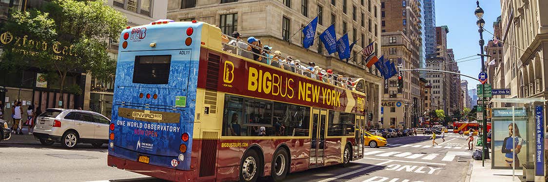
New York Tourist Bus
If you're looking to maximise your time, and want to easily take in New York's main monuments , the best idea is to take the New York Tourist Bus. Panoramic views, commentary, and much more!
The route takes in Downtown, Midtown and Uptown , as well as the mythical Times Square . You can get on and off the bus as many times as you like, exploring the different attractions over the course of more than 25 stops.
Most Important Stops
- Empire State Building
- Wall Street
- Times Square
- Brooklyn Bridge
- Madison Square Garden
- Little Italy
- Statue of Liberty
- Central Park
Timetable and Frequency
The timetable of the bus varies depending on the route and time of year:
- Red line (Downtown Tour) : daily every 15-20 minutes from 8 am to 6 pm (April to October) and from 8 am to 5 pm (November to March). The complete route takes 1 hour and a half.
- Blue line (Uptown Tour) : daily every 15-20 minutes from 9 am to 6 pm (April to October) and from 9am to 5 pm (November to March). The complete route takes 1 hour and a half.
- Green line (Harlem Tour) : daily departures every hour from 10 am to 3 pm. The complete route takes 70 minutes.
- Purple line ( Brooklyn Tour) : daily departures every hour from 10 am to 3 pm. The complete route takes 1 hour and a half.
- Yellow line (Night Tour) : daily every 30 minutes from 7 pm to 9 pm (April to October) and from 6 pm to 8 pm (November to March). The complete route takes 1 hour and a half.
The best option would be to book your ticket for the New York Tourist Bus ahead of time. You can buy your ticket on our website by clicking on the link below:
New York Hop On Hop Off Bus
You may also be interested in

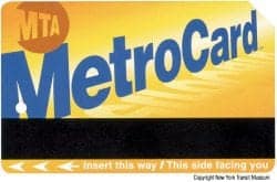
The MetroCard is a thin plastic rechargeable card used to pay the different types of public transportation in New York City: buses and subway.

How to Save
As well as reserving your flight and hotel ahead of time, there are many ways to save money in New York. Figure out how, and make the most of your budget.
Get Daily Travel Tips & Deals!
By proceeding, you agree to our Privacy Policy and Terms of Use .

The 13 Best New York City Apps for Travelers
Jason C. Flynn
Travel Smarter! Sign up for our free newsletter.
The city so nice they named it twice! New York is different things to different people, but two facts are certain. One, there’s always something to do in New York; and two, if you don’t get clued in on the when, where, and how of the city, you’ll find something you didn’t want to do sucking up all your free time (like waiting for a cab). And that’s where the following New York City apps can help.
Here’s a collection of New York apps that can help you stay ahead of the game on your next trip to the Big Apple. This is by no means a comprehensive list because, like New York itself, there is too much to investigate in one pass. But the New York City apps here should cover most of your general needs (and a few specific ones) to help you navigate your Gotham adventure.
The Best New York City Apps for Travelers: Transportation
Citymapper new york.
Unless you’re Spider-Man (and if you are, call me), you’re going be using New York’s impressive and sprawling bus and subway system to get around. Even if you’re from a metro area that has a mass transit network, New York’s can be daunting. The New York City app from Citymapper should be your first tool in using and understanding the public transit system. Not only does it have full maps that can be used offline, but it also shows real-time bus and train departures and lets you combine public transit with other modes such as bike shares and cabs.
Cost: Free Platforms: iOS, Android
Exit Strategy NYC
Sure, Exit Strategy NYC has both a complete subway and bus map for all five boroughs of the city, but as the name implies, its focus is about accessing these options. Exit Strategy also provides the locations to all station entrances and exits, making it easier for you to transition between street and subway. Add to that tips on where to stand on the platforms (a skill some longtime residents of the city still haven’t mastered) and you’ll be in great shape for all your subway hopping needs.
Cost: $3.99 Platforms: iOS, Android
You might be one of the few extremely … let’s say “brave” people who are willing to drive to New York and deal with the cough cough joy of parking there. That means you’re going to pay for parking, be it for a space, for a meter, or to get your car out of impound. ParkMe is one of the best New York City apps for this endeavor. It scans data for lots near your location to show you availability and rates, and lets you prepay and reserve a spot ahead of time. It may sound like I’m overselling how bad the parking is, but trust me: You’ll want to be prepared.
Want to zip around New York City on two wheels? Citi Bike is the city’s official bike-share program. The app will help you find the nearest docking station, save your favorite stations, purchase a day pass, and track your ride stats.
Cost: Free Platforms: iOS , Android
Use the ferry app for route maps, ticketing info, and schedules so you can explore NYC by boat and get around sans traffic. The ferries also offer a free Wi-Fi network.
The Best New York City Apps for Travelers: Attractions
Itourmobile.
This app uses GPS technology to locate your whereabouts and provide information on points of interest nearby, like a Sex and the City filming location or famous pizza shop. Download and use it when you’re walking around NYC, because you never know what’s right around the corner in this fascinating city.
Cost: Free or $1.99 per month to access subscriber-only tours Platforms: iOS, Android
Whether you’re at the museum or in your living room, you can get guided audio descriptions of the museum’s latest collections. There are also detailed visual descriptions for the visually impaired.
Cost: Free Platforms: iOS
Millions of people go to New York every year to see shows on and off Broadway. And while there are numerous ways to purchase tickets, few are as useful as the TKTS stands in Manhattan and Brooklyn. This app lets you avoid the lines, check ticket availability, and read reviews of shows. Known for both last-minute tickets and big discounts on day-of tickets, TKTS is a must-have for anyone who wants to take in a show on the Great White Way.
Statue of Liberty
View the famed NYC landmark through different augmented reality modes and brush up on your history before visiting. You also have access to an on-island audio tour with a map, as well as a podcast miniseries.
WhyzzExplorer
This app gets the entire family involved on a trip to New York City. Let this app guide you through quizzes, conversations, and food challenges as you and your loved ones get to know the Big Apple.
The Best New York City Apps for Travelers: Recommendations
Time out new york.
A staple for locals and tourists alike, Time Out New York can show you all the latest concerts, exhibits, events, and everyday happenings at any and all times. Using this New York app, you can check ticket availability, showtimes, and even reviews for those two shows you’re trying to decide between. (If I were you, I’d go for the one that isn’t likely to be touring next year.) If you’re on a budget or have simply spent too much money on Fifth Avenue, make sure to use the “cheap” and “free” filters on this most useful of New York City apps.
Tripadvisor
Create and share trips with points of interest with your whole group. The new Tripadvisor app is handy for mapping out all of the places that you want to go in one place. P.S. We have our own profile page to follow that has handy, pre-curated trips (and so does the tourism board, NYC Go ). Tripadvisor is SmarterTravel’s parent company.
Odds are if you do any traveling or dining, you’ve got Yelp on your smartphone. While Yelp isn’t always the best app for every location, for major cities like New York it certainly proves its value. Besides reviews, listings, maps, and menus for every type of food you can imagine, it’s a great backup for all the other apps on this list. You don’t always have to be a local to find good stuff in a new town.
Traveling? Consider Some of Our Favorites
Shop the look.
Checked Bag

More From SmarterTravel:
- New York City Travel Guide
- New York on a Budget: 25 Ways to Save on Travel
- Tipping in New York: The New York Tipping Guide
Jason Flynn is a freelance writer, editor, and geek of all trades. Follow him on Twitter @flynntendo .
Editor’s note: This story was originally published in 2016. It has been updated to reflect the most current information. This article has been updated since the date of its publication with the input of NYC Go .
We hand-pick everything we recommend and select items through testing and reviews. Some products are sent to us free of charge with no incentive to offer a favorable review. We offer our unbiased opinions and do not accept compensation to review products. All items are in stock and prices are accurate at the time of publication. If you buy something through our links, we may earn a commission.
Top Fares From

Don't see a fare you like? View all flight deals from your city.
Today's top travel deals.
Brought to you by ShermansTravel
Oslo to Bergen: 6-Night Norway Fjords...

Luxe, 7-Night Caribbean & Mexico Cruise...
Regent Seven Seas Cruises


Shop and Save with Country Inns...
Patricia Magaña

Trending on SmarterTravel
This website uses cookies to improve your browsing experience and analyze the use of the website. Learn More
Reserve Your Spot with Confidence! Full Refunds with 24 Hrs Notice. Reschedule at any point, even after tour, if space allows!

NYC Subway Pass
Which metrocard to buy.

How to pay for your NYC subway ride can be confusing if you are visiting NYC.
Should you get a pay-per-ride or an unlimited MetroCard, or maybe you just pay with OMNY using a contactless credit card?
But, once you understand the basics, the choices aren't so daunting.
As local tour guides who not only use the subway for personal transport but also for our tours, this is definitely one of the topics we get asked about the most.
And, it's our hope, that this post will help you determine which form NYC subway MetroCard is best for you.
And, if you would like to have someone show you how to use the subway in NYC, then consider taking our subway tutorial.
Like most of our tours, it's free to book and runs on the pay-what-you-wish model.

Let's get going!
- Unlimited vs. Pay-Per-Ride Card vs. OMNY
- How to Purchase a MetroCard
- Tips on Using the Subway
- Which Subway App is Best?
- Subway or Hop-On-Hop-Off Bus?
- Things to Do in NYC
Is There a New York Subway Pass for Tourists?
New York City does not currently offer a subway pass intended only for tourists. However, you don't have to worry!
We'll show you where and how to purchase a card, and how much to spend, with special tips for tourists and visitors.
UNLIMITED vs. PAY-PER-RIDE METROCARDS
There are two types of cards to choose from: a Pay-Per-Ride card and an Unlimited Ride card.
With a Pay-Per-Ride card, your card will deduct $2.90 every time you take the subway/bus.
An Unlimited Card costs a flat fee and you can use the subway/bus as many times as you want within a set number of days.
When deciding which card is best , think about how long your trip is and how many times you think you might be taking the subway.
Also, consider the number of people in your party.
*Before buying a MetroCard, read below about NYC's OMNY program which began its rollout in 2019.
Pay-Per-Ride MetroCards
- Add money to your card and each time you 'swipe' your card to enter the subway, $2.90 will be deducted from your card balance.
- There is a one-time $1 fee when you purchase a card. Don't throw your card away when it runs out of money, or you will have to pay $1 again when you buy a new card.
- You can buy a single-ride card for $3, but it is unlikely you will need this type of card.
- See below for what deals are available.
- Up to 4 people can use the same MetroCard. It will still cost $2.90 per person per ride but you do not need to pay the $1 fee for multiple cards.
- Each ride includes a free transfer (within two hours) between subway lines, bus, and subway, or between buses.
- This card can be used on the JFK AirTrain connecting the airport to the subway system (additional cost applies). See our Manhattan to/from JFK Airport .
- See below for other transportation systems that accept the Metrocard.
Before we continue, we are running this poll in our NYC Travel Tips Facebook group.
Would you like the option of a 1-hour subway tutorial tour? Click the link to vote or email us .
Unlimited MetroCards
This card is valid for unlimited subway and bus rides until midnight from the day of first use. You can choose a 7-day unlimited card or a 30-day unlimited.
There is a $1 fee when you purchase a card. *Do not throw away your card when it expires, or you will have to pay $1 again for a new card.
An unlimited 7-Day MetroCard costs $33 and allows unlimited swipes. See below for what deals are available.
While a single ride costs $2.90, the Unlimited card saves you money because the more you use it, the cheaper each ride is.
- for 13 trips = $2.53/ride
- for 15 trips = $2.20/ride
- for 20 trips = $1.65/ride
If your stay is 30 days or longer, consider a 30-day unlimited card for $127 ($63.50 reduced fare).
Important rules that apply to Unlimited MetroCards:
- It can only be used by 1 person.
- Once you have swiped the card to enter the subway, it cannot be used again for 18 minutes.
- Unlimited Ride MetroCards are not accepted by the JFK AirTrain , Express buses or PATH trains.
- See below for other transportation systems that accept this card.
As an alternative to using a MetroCard, riders can now tap to pay at the turnstile!
Metrocard machines were scheduled to be phased out in 2023, but this date is now 2025.
With the new OMNY system, you can tap a credit or debit card onto the OMNY reader, smartphone, or wearable device.
You also have the option of buying an OMNY card, a durable hard card ( see more below ).
The OMNY tap-to-pay method is available at all subway stations in NYC and all MTA-operated buses.
A great feature of the OMNY system is the weekly fare cap .
Starting on a Monday, once you pay for 12 rides, with the same device or card, you can ride for free for the rest of the week through Sunday.
A few important things to know:
- OMNY only offers the “pay-per-ride” option so you will pay full price every time you tap to pay. Unlimited passes and other concessionary prices will be added to the system later.
- You get most of the same features of a MetroCard such as free transfers and the ability to pay for yourself and up to 3 other people on the same card.
- OMNY accepts Visa®, Mastercard®, American Express®, Discover®, and JCB networks. But debit cards requiring a pin cannot be used at this time. Be sure to check the MTA website to see if your card is accepted by OMNY.
If you want to switch to the OMNY tap system but do not have a credit card or contactless form of payment, you can purchase an OMNY card.
OMNY cards are not sold in subway stations yet. You can buy them and reload them at stores like Walgreens, CVS and 7-Eleven.
Since MetroCards are still available until the end of 2024, so until then, it may not be worth buying an OMNY card, which costs $4 more than a MetroCard.
On the other hand, if you use a pay-per-ride MetroCard, you do not get to take advantage of the OMNY fare cap mentioned above .
Find out more about the OMNY card here .
You could also listen to our NYC Travel Tips podcast episode on the NYC subway. You can get our podcast wherever you get your podcasts.
What other transportation systems accept the MetroCard?
In addition to the New York City subway and bus system, both unlimited and pay-per-ride cards can be used on:
- Staten Island Railway (stay and explore Staten Island after taking the free Staten Island Ferry )
- Roosevelt Island Tram (to get one of the best skyline views of NYC . Learn more by reading our post on riding the tram and visiting Roosevelt Island .
- New Jersey PATH trains between Manhattan and certain locations in New Jersey (an extra fee applies for the pay-per-ride MetroCard).
See the official MTA website for:
- subway and bus maps
- service status and delays
- planned service changes
- the MTA TripPlanner to figure out your route.
DECIDING WHICH CARD IS BEST FOR YOU
When deciding what card to get, ask yourself how many times you think you will be taking the subway within the number of days you will be here.
Also, take into account the number of people in your group and their ages as there are offers for seniors and toddlers. (See below ).
If you think you will be taking the subway at least 12 times, the Unlimited Card will likely save you money.
If you think you will take the subway just a few times, go for the Pay-Per-Ride card.
Remember that an Unlimited Card can be used only by one person, and you would each have to buy your own Unlimited card.
But if you are traveling with several people, it makes sense to buy a Pay-Per-Ride card since up to 4 people can enter the subway with the same card.
The card will deduct $2.90 for each person when you enter.
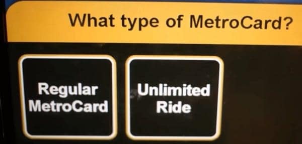
Deals to take into account:
For families, up to 3 children can ride for free with one fare-paying adult, provided all the children are under 44 inches (112 cm) tall.
This policy is good for subways and local buses, no matter which type of MetroCard you choose.
Seniors 65 years+ and also individuals with qualifying disabilities may qualify for reduced fares.
See below to learn how Reduced Fare cards work.
Reduced-Fare Customers - Deals to take into account:
Seniors 65 years and over and those with qualifying disabilities can get a reduced fare.
- Bring your valid ID, such as your passport or driver's license that shows your age
- Go to the station agent in the booth where you will show your ID and pay $2.90 for a non-refillable MetroCard good for TWO rides.
- You do not have to pay the $1.00 new card fee.
- Not all stations have agent booths.
- This 2-trip MetroCard will be accepted at all subway stations, local buses, and Staten Island Railway.
- This card is not accepted for any other bus lines or the Roosevelt Island Tram.
- For more information, click here .
Student MetroCards
Student MetroCards are distributed by NYC schools and allow eligible students 3 free rides per school day to and from school and school-related activities and events.
Note: To receive a refillable reduced-fare MetroCard, you must apply and wait a few weeks to receive it. So unless you plan on staying in NYC for a very long stay, stick with the non-refillable card.
Taxis and Uber
If you like to take taxis, then having a pay-per-ride MetroCard may be your best choice.
You might find that taking a taxi makes more financial sense, especially if you are going short distances.
Not only does a taxi save you time (if there is no traffic), but in some cases, a taxi can be cheaper for most trips under 2 miles (3.2 km), especially if you have 3 or 4 people in your group.
See our posts on how to take a taxi in NYC and use Uber in NYC .
PURCHASING YOUR METROCARD
MetroCards can be purchased from the vending machines at subway stations and some shops and newsstands around the city.
Check here to see what merchants near you sell MetroCards nearest you.
The easiest way is to purchase your card at a station from the vending machines.
There are two types of machines pictured here: the larger machines on the right let you pay with cash, credit cards, or ATM/debit cards.
The smaller machines are for credit or debit cards only.
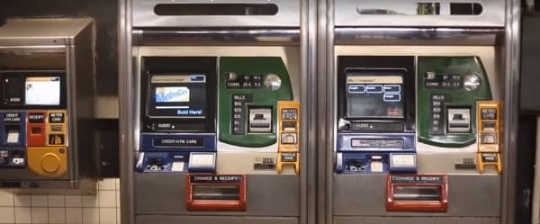
Paying with a credit or debit card:
If you pay with your credit card, you will be asked to enter your zip code after you dip your card.
If you do not have an American zip code, you can use 99999 for a zip code.
Paying with cash:
If you pay with cash and pay with a large bill and not the exact amount, you will receive the difference back but in $1 coins, not bills.
The machine can only return up to $9 in change.
Tip: Always get a receipt in case you lose your card or it does not work.
Here is a step-by-step instructional video.
TIP: A good way to have fun and get an in-person lesson about the subway is to take our Manhattan in One Day Tour .
Once you have purchased your card, here are some tips on how to use it!
Make the most of your metrocard and subway travel.
Foreign Language Speakers
The Metropolitan Transportation Authority (MTA) website offers translations of their site.
Simply look in the lower left-hand corner of the page and you will see an option for Google Translate.
Ride the Subway with a Tour Group
Our New York Subway Art Tour , our All-in-One Tour , and our Manhattan Night Tours use the subway.
This will help you familiarize yourself with the New York Subway System.
You'll get an expert lesson on using your card, including how fast to swipe your card through the turnstile.
Swiping too fast or too slow won't work - you have to find just the right speed!

MetroCard Offers Offers and Deals
For certain attractions, theater tickets, and events. Most New Yorkers do not even know this!
Click here for what concessions are being offered currently.
We can also tell you where to find cheaper tickets for major attractions and Broadway shows .

Enjoy the ride!
Perhaps the best part of riding the subway is the great free musical performances you'll come across.
Our post on where to find NYC street performers and music in the subway will lead you straight to them!
Other means of traveling around NYC
- Travel by various ferries .
- Take a hop-on, hop-off bus tour .
- Take a hop-on, hop-off boat tour, or cruise .
See which bus tours, cruises, and ferries are included in NYC concessionary tourist passes .
Choose a Destination... I want them all PLUS general travel tips. Amsterdam Berlin Boston Charleston Chicago Dubai Lisbon London Los Angeles Miami Nashville New York City New Orleans Paris Philadelphia Prague Rome San Francisco Washington DC
About The Author

Courtney Shapiro
North america, united kingdom & ireland, middle east & india, asia & oceania.

No products in the cart.

Is there a New York Subway Pass for Tourists? 🚇
Share this post.
This post has been updated on January 1, 2024 to reflect the updated MTA fares.
If you’re visiting New York only for a few days, you might be wondering what the most affordable way is to get around the city. Taking the subway is a great option. The different lines connect New York seamlessly – 24/7. However, you don’t want to get a pass that is more expensive than single rides and vice versa.
The question is: Is there a New York Subway Pass for Tourists? And the short answer is: No.
While there used to be a so-called “1 Day Fun Pass” and “14-Day Unlimited Pass” until 2010 available, it is now up to the visitor to decide what other ticket option serves their needs best. Get your calculators out, here are some options that could qualify as a New York subway pass for tourists.
Skip to the option you’re most interested in: Single Rides ( Single Ride Ticket – Single Ride Contactless OMNY – Pay-Per-Ride ) – 7-Day Unlimited Ride – 30-Day Unlimited Ride – Kids Ride Free – Example

Single Ride Ticket – $3.25 per ride
OK, single rides are really only the right option for you if you’re planning on taking the subway as a backup option in case you get tired of walking or you need a last minute ride. The price per ticket is $3.25 (2024). If you already know that you’ll take the subway at least three times, skip this section!
However, if you believe this comes close to the New York subways pass for tourists you were looking for, here’s how it works:
*Available languages: English and Spanish are always available. Italian, German, Chinese, Korean, Russian, Hebrew, and Japanese are only available at selected machines.
**About payment types: If you select a card type, insert your card into the card slot and enter your pin. If you want to pay in cash, please note that machines don’t accept $100 bills.
Once your payment has been accepted you’ll get your single ride ticket. As soon as you’ve swiped the card through the turnstile, the ticket remains valid for 2 hours. During this time you are allowed to change lines but you can’t re-enter the subway system again once you’ve left a station, even if 2 hours are not over. Since you can’t reuse the ticket, feel free to dispose of it after you’ve reached your destination.

Single Ride Contactless (OMNY) – $2.90 per ride
In December 2020 the MTA (Metropolitan Transportation Authority) completed the rollout of the contactless payment option OMNY at subway turnstiles and in busses. NEW since 2022: There’s now a weekly fare cap ($34) when you use OMNY . Once you’ve paid 12 single rides with the same card or device, you’ll ride free for the rest of the week.
If you want to rely on single rides/tickets, this is a slightly cheaper option than the one mentioned above and may be enough to qualify for you as a New York subway pass for tourists.
Here’s how it works (same steps apply when you enter local busses):

Single Ride Pay-Per-Ride (MetroCard required) – $2.90 per ride
If you already know that you’ll take the subway more than three times but still not too frequently and you don’t want to pay contactless, the Pay-Per-Ride option might be the right choice for you. Note that you’ll need a yellow MetroCard first to take advantage of the reduced single ride fare. Here’s how it works:
You don’t have a yellow MetroCard
You already have a MetroCard and want to top it up

⭐ Our Favorite
7-day unlimited ride metrocard – $34 per week.
NEW since 2022: There’s now a weekly fare cap ($34) when you use the contactless payment option OMNY . Once you’ve paid 12 single rides with the same card or device, you’ll ride free for the rest of the week.
The 7-Day Unlimited MetroCard is probably the best alternative to a New York subway pass for tourists, especially if you already know that you will be heavily relying on public transportation. The weekly pass costs $34 per week (2024). With this pass you can also take advantage of the many local busses. Depending on whether you already have a MetroCard or not, here are the purchasing steps:
You already have a MetroCard and want to add a 7-Day Pass

30-Day Unlimited Ride MetroCard – $132 per month
Last but not least, there is the 30-Day Unlimited MetroCard for $132 per month (2024). You probably won’t need this option unless you’re really spending a whole month in New York. However, even then we don’t recommend the 30-Day Unlimited MetroCard as a replacement for a New York subway pass for tourists. Not even many New Yorkers purchase this pass as it’s a huge monetary damage if you lose the card. As a tourist who will rely on public transportation, you’ll always be better off with weekly passes ($34/week). However, if you still want to get a monthly pass, follow the steps described in the “ 7-Day Unlimited Ride MetroCard ” section and select “30-Day Unlimited” instead of “7-Day Unlimited.”
Kids Ride Free
We frequently get asked if parents need to purchase tickets for their children as well. Not necessarily. Up to three children below 44 inches can join you for free if you have a valid ticket or pass.

Wow, that was a lot of information! We understand that taking the subway for the very first time can be overwhelming and confusing. Because there is no New York subway pass for tourists available, many visitors are worried that they won’t pick the right option and end up spending too much on transit.
So here is an interactive example ! The tourist couple Max and Lisa are visiting New York for 4 days and they don’t want to use the subway too often. They believe that single tickets and a couple of contactless rides will work for them. Let’s have a look at their daily itineraries.
Day 1: First they travel from JFK to their hotel in Manhattan ($3.25). Once checked in they decide to explore the neighborhood by foot, then they get tired and take the subway back to the hotel ($3.25).
Day 2: The couple discovers that they can also use the contactless option because their credit cards have the contactless icon on them. They take advantage of OMNY for their sightseeing trip to Brooklyn (probably 2x $2.90) and then back to Manhattan ($2.90).
Day 3: Lisa and Max want to explore Manhattan from Harlem to Battery Park. To make the most of the day they decide to take the subway to move around faster. They use the contactless option at least 3 times (3x $2.90). Once back at the hotel they feel like celebrating their trip at a nice rooftop bar. They dress up and head straight to the bar ($2.90) and then later back again to the hotel ($2.90).
Day 4: The couple still hasn’t seen Central Park ! Before they head to the airport in the evening, they decide that there’s still time for a quick trip to the park (2x $2.90). Afterwards they go back to the hotel, grab their bags from the lobby and take the train back to JFK ($3.25).
Total: $38.75 per person
What ticket option would you have recommended to Max and Lisa instead?
Max and Lisa would've been better off with a 7-Day Unlimited MetroCard for $34 per person (or new since 2022, the contactless payment option OMNY with a weekly fare cap - $34 - after 12 rides) instead of single tickets as both of them would've saved $4.75. Keep in mind, this is really just a rough example, not considering a lot of spontaneous trips.

You see, even if you’re only visiting New York for a few days, single fares can add up and a weekly pass quickly becomes a much better option. While there is no New York subway pass for tourists, you can still be spontaneous with a weekly pass instead of calculating all the time how much money you have left on your card or how many more times you can use single rides so you stay below $34!
We hope you were able to pick an option that qualifies for you as a New York subway pass for tourists. If you’re still having doubts or questions, reach out to us or post a comment below and we’ll help you pick the most suitable option.

Show your love

Stay in Touch
Get the latest new york news directly to your inbox.
Thanks for subscribing 💐
More like this

13 Most Instagrammable Central Park Photo Spots 🌳

Tipping in New York in 2024: How Much Should You Tip in NYC? 💵

Is a Wedding Witness in NYC still required in 2024? 💌
Leave a comment cancel reply.
More From Forbes
5 of new york city’s best-kept travel secrets.
- Share to Facebook
- Share to Twitter
- Share to Linkedin
Governors Island is a world unto itself.
In New York City , summer is the season for festivals and festivities, rooftops and sidewalks, long lunches and longer weekends. The city’s pace may slow down, but the influx of tourists picks up. The New York City Tourism Bureau estimates that the five boroughs will welcome 64.5 million visitors in 2024. So, it’s safe to assume that many of the city’s most famous attractions will be packed.
If you want to see quintessential New York City sights but don’t feel like dealing with the crowds, here’s a local’s list of excellent alternatives to keep in your back pocket.
Instead of Ellis Island , Try Governors Island
A ferry ride to Ellis Island to visit Lady Liberty seems like an obvious must-see. And that is precisely why you’re guaranteed to find lines stretching around Battery Park and back whatever weekend you’re in town.
Instead, why not take the ferry in a different direction and spend the day at Governors Island? You’ll still enjoy Statue of Liberty views as you explore the 172-acre island, but on this stretch, you can rent a beach cruiser from Blazing Saddles and explore the impressive public artworks and myriad food trucks, which includes weekend appearances by Brooklyn’s Threes Brewing and the resident sheep living in Hammock Grove.
NSA Warns iPhone And Android Users To Turn It Off And On Again
Donald trump 300 million poorer after guilty verdict as truth social stock sinks, aurora alert should you prepare to see the northern lights this week.
Prospect Park is Brooklyn’s answer to Central Park.
Instead of Central Park , Try Prospect Park
If you can’t find a spot for a picnic blanket on Central Park’s Great Lawn, pack up your wicker basket and head to Brooklyn’s backyard, Prospect Park. Landscape architects Frederick Law Olmsted and Calvert Vaux designed both parks. But there is a difference: the Brooklyn green space offers more freedom. Long Meadow runs nearly a mile along Prospect Park’s west side, guaranteeing enough space for a picnic blanket and much more.
Should you be staying in Manhattan, it’s understandable that you’ll want to make a day of it at Prospect Park. The rolling 526 acres offer enough activities to fill a weekend. If you visit on Saturday, swing by the 30-plus vendors at the farmers market at the Grand Army Plaza entrance to stock up on picnic supplies. Stop by the park any day but Monday and you’ll also have a chance to catch some late-spring bloom brilliance at the Brooklyn Botanic Garden.
Avoid the mayhem at MoMA here.
Instead of MoMA , Try the Cooper Hewitt
The MoMA boasts one of the world’s best collections of modern art. But on weekends, the cost of admission comes with hour-long lines and crowds elbowing one another for a glimpse of a Van Gogh. The Upper East Side’s Cooper Hewitt Smithsonian Design Museum tends to fly under most tourists’ radar.
The landmark building, an ivy-covered, 64-room Carnegie mansion, is itself a work of art and a piece of Manhattan history. The museum’s historic and contemporary design specialty befits its elegant exterior. Design buffs will pore over the museum’s collection of more than 215,000 design objects and a gift shop that rivals MoMA’s. And if you’re not in the mood to spend a sunny day inside a museum, the Cooper Hewitt boasts a gorgeous outdoor garden across the street from Central Park.
Instead of J.G. Melon , Try EJ’s Luncheonette
J.G. Melon, the longtime Upper East Side pub standard, is notorious for its cash-only policy and a queue stretching down the street of diners in pursuit of one of the city’s best burgers. But there is no need to worry if you’re in the area with a growling stomach or forgot to stop at the ATM because there’s another Manhattan institution just a minute away.
For nearly four decades, EJ’s Luncheonette has proudly continued the quintessential New York City tradition of serving a straightforward menu from the counter. But don’t be fooled by its traditional setup. While Formica tables and turquoise booths create a nostalgic atmosphere, the menu surprises with its modern twists. In addition to traditional burgers and open-faced pastrami sandwiches, you’ll find delicious vegetarian-friendly alternatives. And credit cards are welcomed.
Instead of Bemelmans , Try Monkey Bar
Unless you are a guest of Forbes Travel Guide Four-Star Carlyle Hotel , nabbing a seat at its Bemelmans Bar — famed for its red-suited staffers, art deco ambiance and Madeline author Ludwig Bemelmans’ whimsical murals — is nearly impossible.
Fortunately, Manhattan has no shortage of martinis. If you seek a spot with the same Mad Men -era style, look no further than Midtown’s Monkey Bar. Serving Vesper martinis to well-heeled guests in red leather banquettes since 1936, Monkey Bar features an eye-catching mural depicting some of the bar’s bygone regulars, like F. Scott Fitzgerald, Dorothy Parker and Fred Astaire. And unlike Bemelmans, Monkey Bar accepts reservations.

- Editorial Standards
- Reprints & Permissions
Join The Conversation
One Community. Many Voices. Create a free account to share your thoughts.
Forbes Community Guidelines
Our community is about connecting people through open and thoughtful conversations. We want our readers to share their views and exchange ideas and facts in a safe space.
In order to do so, please follow the posting rules in our site's Terms of Service. We've summarized some of those key rules below. Simply put, keep it civil.
Your post will be rejected if we notice that it seems to contain:
- False or intentionally out-of-context or misleading information
- Insults, profanity, incoherent, obscene or inflammatory language or threats of any kind
- Attacks on the identity of other commenters or the article's author
- Content that otherwise violates our site's terms.
User accounts will be blocked if we notice or believe that users are engaged in:
- Continuous attempts to re-post comments that have been previously moderated/rejected
- Racist, sexist, homophobic or other discriminatory comments
- Attempts or tactics that put the site security at risk
- Actions that otherwise violate our site's terms.
So, how can you be a power user?
- Stay on topic and share your insights
- Feel free to be clear and thoughtful to get your point across
- ‘Like’ or ‘Dislike’ to show your point of view.
- Protect your community.
- Use the report tool to alert us when someone breaks the rules.
Thanks for reading our community guidelines. Please read the full list of posting rules found in our site's Terms of Service.
An official website of the United States government Here's how you know
Official websites use .gov A .gov website belongs to an official government organization in the United States.
Secure .gov websites use HTTPS A lock ( Lock A locked padlock ) or https:// means you’ve safely connected to the .gov website. Share sensitive information only on official, secure websites.
Air Travel Consumer Report: March 2024 Numbers
WASHINGTON – The U.S. Department of Transportation (DOT) today released its Air Travel Consumer Report (ATCR) on airline operational data compiled for the month of March 2024 for on-time performance, mishandled baggage, mishandled wheelchairs and scooters, and 1st quarter oversales. The ATCR is designed to assist consumers with information on the quality of services provided by airlines.
For March 2024, 0.9% of flights were cancelled, lower than the 1.3% cancellation rate for March 2023 and the 2.0% cancellation rate for pre-pandemic March 2019.
DOT expects that airlines will operate flights as scheduled and that when they do not, airlines will provide consumers the services promised when a flight is cancelled or delayed because of an airline issue. After a two-year DOT push to improve the passenger experience, the 10 largest airlines now guarantee meals and free rebooking on the same airline and nine guarantee hotel accommodations. Consumer-friendly information regarding airline commitments to their customers is available on the Department’s Airline Customer Service Dashboard at FlightRights.Gov . DOT also pushed airlines to provide fee-free family seating and rolled out a new family seating dashboard that highlights the airlines that guarantee fee-free family seating, and those of the 10 largest that do not, making it easier for parents to avoid paying junk fees to sit with their children when they fly.
DOT recently announced two final rules that require airlines to provide automatic cash refunds to passengers when owed and protect consumers from costly surprise airline fees . These rules will significantly expand consumer protections in air travel, provide passengers an easier pathway to refunds when owed, and save consumers more than half a billion dollars every year in hidden and surprise junk fees. Provisions of the final rule on airline refunds were fortified through the FAA reauthorization bill that President Biden signed into law on May 16, 2024.
In addition, DOT is improving transportation for individuals with disabilities. In July 2023, DOT finalized a rule which requires airlines to make lavatories on new, single-aisle aircraft more accessible. Then, in February 2024, DOT issued a proposal to address other barriers that Americans who use a wheelchair encounter when it comes to air travel by, among other things, proposing to mandate enhanced training for airline employees and contractors who physically assist passenger with disabilities and handle passengers’ wheelchairs.
Further, when necessary, DOT takes enforcement action against airlines and ticket agents that fail to comply with the Department’s aviation consumer protection requirements. In 2023, DOT issued the largest fines in the history of the consumer protection office. This includes a $140 million penalty against Southwest Airlines for failing passengers during the 2022 holiday meltdown. That penalty, which was in addition to over $600 million DOT already ensured was refunded by Southwest to passengers, requires Southwest to establish a $90 million compensation system for passengers affected by significant delays and cancellations beginning April 30, 2024. Additionally, DOT has helped return nearly $4 billion in refunds to travelers since the pandemic began.
In April, DOT announced the launch of the bipartisan Airline Passenger Protection Partnership with 18 state attorneys general to investigate airlines and ticket agents and hold them accountable when they violate aviation consumer protection laws. The partnership significantly expands the Department’s oversight capacity by establishing a new fast-track system prioritizing misconduct cases from state attorneys general who uncover unfair or deceptive airline practices. Through the partnership, DOT will provide state attorneys general with access to the federal complaint database and help ensure that airlines cooperate with state investigations.
Flight Operations
The 623,409 flights operated in March 2024 were 102.47% of the 608,387 flights operated in March 2023. Operated flights in March 2024 were up 2.47% year-over-year from the 608,387 flights operated in March 2023 and up 13.46% month-over-month from 549,439 flights operated in February 2024.

In March 2024, the 10 marketing network carriers reported 628,786 scheduled domestic flights, 5,377 (0.9%) of which were cancelled. In February 2024, airlines scheduled 552,691 domestic flights, 3,252 (0.6%) of which were cancelled. In March 2023, airlines scheduled 616,234 domestic flights, 7,847 (1.3%) of which were cancelled.
March 2024 On-Time Arrival
In March 2024, reporting marketing carriers posted an on-time arrival rate of 78.7%, down from 83.7% in February 2024 and up from 75.4% in March 2023. The year-to-date on-time arrival rate for 2024 is 78.3%.
Highest Marketing Carrier On-Time Arrival Rates March 2024 (ATCR Table 1)
- Hawaiian Airlines – 87.2%
- Delta Air Lines Network – 84.8%
- United Airlines Network – 81.8%
Lowest Marketing Carrier On-Time Arrival Rates March 2024 (ATCR Table 1)
- Frontier Airlines – 66.4%
- JetBlue Airways – 68.4%
- Spirit Airlines – 69.6%
For the first three months of 2024, the reporting marketing carriers posted an on-time arrival rate of 78.31% up from 76.89% for the same period in 2023.
March 2024 Flight Cancellations
In March 2024, reporting marketing carriers cancelled 0.9% of their scheduled domestic flights, higher than the rate of 0.6% in February 2024 and lower than the rate of 1.3% in March 2023. The year-to-date cancellation rate for 2024 is 1.7%.
Lowest Marketing Carrier Rates of Cancelled Flights March 2024 (ATCR Table 6)
- Delta Air Lines Network – 0.2%
- Hawaiian Airlines – 0.6%
- Allegiant Air – 0.6%
Highest Marketing Carrier Rates of Cancelled Flights March 2024 (ATCR Table 6)
- Frontier Airlines – 2.7%
- Spirit Airlines – 1.7%
- JetBlue Airways – 1.4%
For the first three months of 2024, the reporting marketing carriers posted a cancellation rate of 1.7%, equal to 1.7% for the same period in 2023.
Complaints About Airline Service
The release of air travel service complaint data in the Air Travel Consumer Report (ATCR) has been delayed primarily because of the continued high volume of complaints against airlines and ticket agents received by the Office of Aviation Consumer Protection (OACP) and the time needed to review and process these consumer complaints. The Department is investing in modernizing its system for handling consumer complaints with the support of a Technology Modernization Fund (TMF) investment to improve the customer experience for the tens of thousands of consumers who use the system each year and enable OACP to more effectively engage in oversight of the airline industry.
As DOT modernizes its system, given the continued high volume of air travel service complaints concerning airlines and ticket agents, DOT has revised how it processes consumer complaints received after June 1, 2023. From June 2023 until the date its system is modernized, DOT intends to revise the ATCR to display consumer submissions (complaints, inquiries, and opinions) as opposed to complaints for this period. The Department will continue to display civil rights complaints in the ATCR in a similar manner as before and anticipates publishing submission and civil rights complaint numbers for June 1, 2023 to December 31, 2023 in June 2024.
Tarmac Delays
In March 2024, airlines reported six tarmac delays of more than three hours on domestic flights, compared to 10 tarmac delays of more than three hours on domestic flights reported in February 2024. In March 2024, airlines reported one tarmac delay of more than four hours on an international flight, compared to two tarmac delays of more than four hours on international flights reported in February 2024.
Airlines are required to have and adhere to assurances that they will not allow aircraft to remain on the tarmac for more than three hours for domestic flights and four hours for international flights without providing passengers the option to deplane, subject to exceptions related to safety, security, and Air Traffic Control related reasons. An exception also exists for departure delays if the airline begins to return the aircraft to a suitable disembarkation point to deplane passengers by those times.
The Department investigates extended tarmac delays.
Mishandled Baggage
In March 2024, reporting marketing carriers handled 43.1 million bags and posted a mishandled baggage rate of 0.52%, higher than the rate of 0.48% in February 2024, but lower than the rate of 0.58% in March 2023.
For the first quarter of 2024, the carriers posted a mishandled baggage rate of 0.58%, lower than the first quarter 2023 rate of 0.64%.
The Department began displaying the mishandled baggage data as a percentage (i.e., per 100 bags enplaned) in January 2022. This is consistent with the manner that the mishandled wheelchairs and scooters rate is calculated and displayed. In the prior three calendar year reports (2019 to 2021), the Department calculated the mishandled baggage rate based on the number of mishandled bags per 1,000 checked bags.
Mishandled Wheelchairs and Scooters
In March 2024, reporting marketing carriers reported checking 65,793 wheelchairs and scooters and mishandling 859 for a rate of 1.31% mishandled wheelchairs and scooters, higher than the rate of 1.30% mishandled in February 2024 and lower than the rate of 1.33% mishandled in March 2023.
For the first quarter of 2024, the carriers posted a mishandled wheelchair and scooter rate of 1.36%, lower than the rate of 1.40% in the first quarter of 2023.
To address many of the significant barriers and challenges experienced by passengers who use wheelchairs, the Department has proposed a rulemaking that, if adopted as proposed would make it an automatic violation of the Department’s Air Carrier Access Act regulations for airlines to mishandle a passenger’s wheelchair. This Notice of Proposed Rulemaking would also enhance training requirements for airline personnel who provide hands-on transfer assistance to passengers and handle wheelchairs. The proposal is available at https://www.regulations.gov , docket number DOT-OST-2022-0144.
Bumping/Oversales
Bumping/oversales data, unlike other air carrier data, are reported quarterly rather than monthly. For the first quarter of 2024, the 10 U.S. reporting marketing carriers posted an involuntary denied boarding, or bumping, rate of 0.27 per 10,000 passengers, lower than both the rate of 0.29 in the first quarter of 2023 and higher than the rate of 0.20 in the fourth quarter of 2023.
Incidents Involving Animals
As part of its IT modernization, DOT’s Office of Aviation Consumer Protection (OACP) is improving the options for covered carriers to submit their monthly and annual Reports on Incidents Involving Animals During Air Transport. While the new system is being developed, OACP is permitting covered carriers to delay submission of reports on incidents involving animals during air transport. Annual data on such incidents will be published when DOT receives carriers’ complete submissions of the 2023 data.
In March 2024, carriers reported zero incidents involving the death, injury, or loss of an animal while traveling by air, down from the two reports filed in February 2024, and equal to the zero reports filed in March 2023.
Consumers may file air travel consumer or civil rights complaints online at https://secure.dot.gov/air-travel-complaint , or they may mail a complaint to the Office of Aviation Consumer Protection, U.S. Department of Transportation, C-70, W96-432, 1200 New Jersey Avenue, SE, Washington, DC 20590.
The ATCR and other aviation consumer matters of interest to the public can be found at https://www.transportation.gov/airconsumer .

ON-SITE SCHOOL PROGRAMS
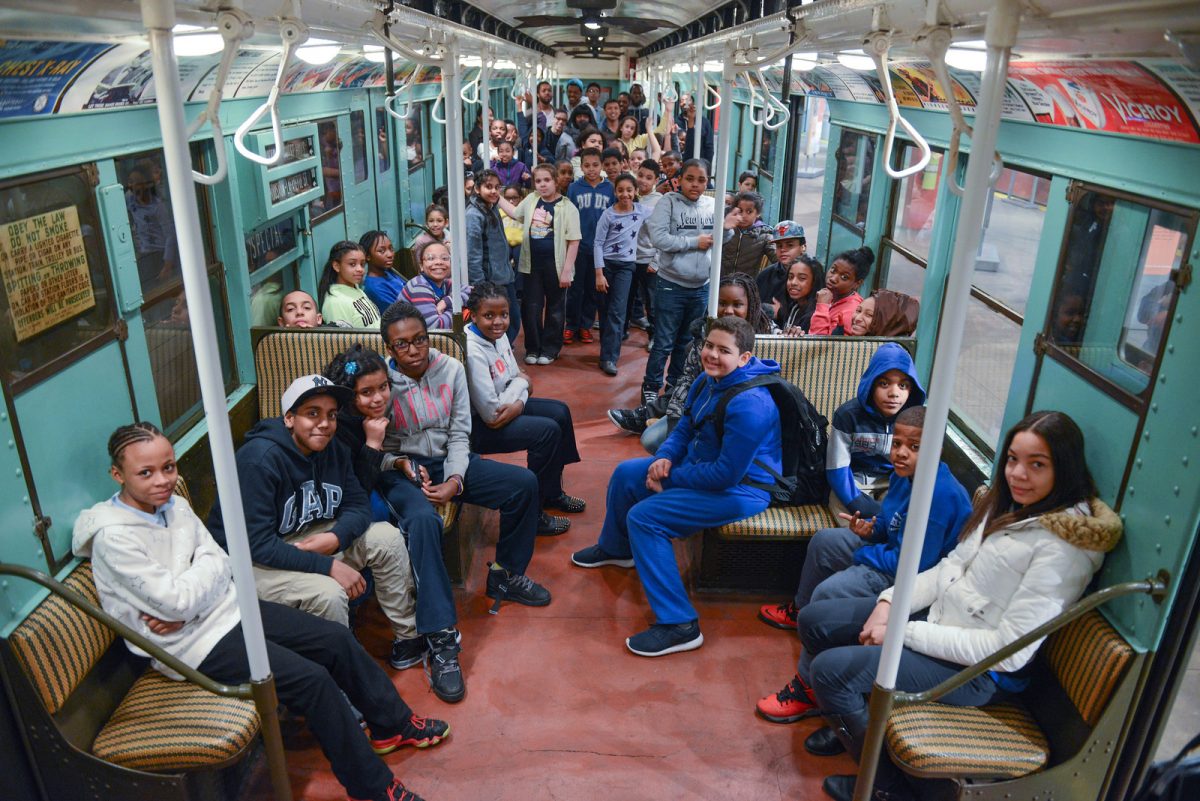
Our school group tours use the museum’s unique space and hands-on collection to explore how transportation helped shape New York City throughout history to present day. Tours include a mix of inquiry, observation, primary and secondary sources, and interactive activities to engage learners of all ages and abilities. Tours are aligned with learning standards and support many curriculum areas and are a great way for school and youth groups to explore the Museum.
TOUR SCHEDULE
In-Person (60 Minutes)
Wednesdays, Thursdays, and Fridays
10:00am, 11:00am, 11:30am, 12:30pm, and 1:00pm
(The Gift Shop is closed on Wednesdays.)
GROUP SIZES & RATES
General Education & ICT Groups
$200.00 per group
Pre-K: up to 18 students (9 chaperones)
Kindergarten: up to 25 students (7 chaperones)
Grades 1-12: 36 participants (including youth and chaperones).
Special Education (Self-Contained) Groups
$100.00 per group, 17 participants (including youth and chaperones).
SCHOOL GROUP TOURS
Moving our communities .
Through imaginative play and our interactive collection of buses and trains, students explore New York City’s different modes of transportation and learn about community workers. (General & Special Education: K-12 Grade)
Art on the Go
Discover the variety of art found throughout New York City and the surrounding region’s transportation system, including visual art, poetry, and music, through an immersive tour of the Museum’s exhibits and vintage train collection that explores the connection between public art and mass transit. (General & Special Education: K-12 Grade)
Journey to the Past
Learn about life, work, science, and transportation throughout New York City’s past and present. Explore the Museum’s vintage train collection to explore life in New York City over time through interactive storytelling. (General & Special Education: K-12 Grade)
Moving the Millions
Discover the magnitude and complexity of New York City and the surrounding region’s public transportation system by exploring elements of construction, engineering, organization and impact over time in this introduction to transit history. ( General & Special Education: K-12 Grade)
Subway Tracks
Explore New York City’s subway system from past to present. Track the history of our complex transit system on a tour of our vintage train collection while also discussing how we safely ride the subway today, from entering the system with a MetroCard or OMNY tap, to recognizing potential concerns and social cues. (Special Education Only; 6th Grade – Adult Learners)
GENERAL INFORMATION
Payment by credit card is preferred but checks are also accepted. If payment is not received three weeks prior to your visit, your program will be canceled. Refunds cannot be given less than three weeks before your visit. If school bus service is suspended due to inclement weather or other factors, we may be able to reschedule groups. Additional payment information will be sent upon booking.
For questions about school group tours and the booking process, please email [email protected] .
For questions about accessibility and Special Education programs, please email [email protected] .
Review and download a social narrative to prepare participants for a group tour at the New York Transit Museum.
PLANNING YOUR VISIT
Reservations are required for all group visits and masks are optional. The Museum does not allow self-guided or unscheduled groups at any time. The Museum does not have lunch facilities. We encourage groups to eat, weather permitting, at some nearby outdoor eating options including Columbus Park, Korean War Veterans Plaza, or Cadman Plaza Park. The Museum does not have a coat or bag check and cannot store backpacks and coats during your program. We recommend leaving backpacks and other personal items on your bus or at school.
ARRIVALS & DEPARTURES
Please arrive no more than 5 minutes before your scheduled tour; the Museum cannot accommodate entry any earlier. Upon arrival, your educator will meet you at the top of the stairs outside the Museum. Do not enter until you are with your educator. Late-arriving groups will receive an abbreviated program. We cannot extend tours due to late arrival for any reason. If you anticipate a late arrival, please email [email protected] .
All groups must depart at their scheduled time. Groups may not stay in the Museum after the program ends.
CANCELATIONS
Tours are non-refundable within three weeks of the scheduled visit, though changes to times and dates may be accommodated on a case-by-case basis and as space allows.
ACCESSIBILITY
Upon booking, you will be asked to share any specific needs for your group so we can best assist you. The Transit Museum is wheelchair accessible via a lift which has a total weight limit of 450 pounds. The lift moves slowly and allows one person at a time, so please plan to arrive 15 minutes before your program’s start time. If you need to use the lift, please inform us in advance. For more information about accessibility options, including ASL Interpreters and listening devices, please visit the Museum’s accessibility page on our website.
TRANSPORTATION
Traveling by subway .
Taking the train is the best way to begin your visit to the Transit Museum. We are conveniently located a short walk from: Borough Hall Station: 2, 3, 4, and 5 lines (0.2 miles) Jay Street MetroTech Station: A, C, F, and R (0.2 miles) Hoyt-Schermerhorn Station: A, C, and G (0.2 miles) Certificates for Free Transportation are provided by NYC Transit to travel to and from school trips.
Traveling by School Bus
Buses may drop off students on either Boerum Place or Schermerhorn Street. Parking is limited and unpredictable in Downtown Brooklyn.

Passing Thru Travel
Conquer Public Transport in Major Cities Like a Pro – Mastering Subways, Buses, and Trains Like a Seasoned Traveler
Posted: March 15, 2024 | Last updated: March 15, 2024
Efficiently navigating public transportation in major cities can transform your travel experience, offering an authentic glimpse into local life while saving time and money. This guide explores the nuances of using public transport systems in twelve major cities around the world. From mastering the subway in New York to hopping on a tram in Amsterdam, these insights will help you travel like a local.
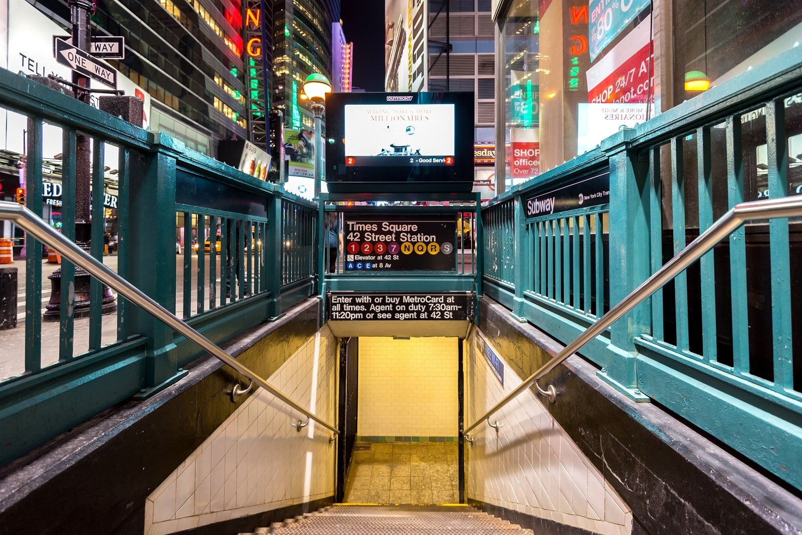
1. New York City, USA – The Subway System
The New York City Subway is an iconic, extensive network requiring navigation savvy. It operates 24/7, connecting Manhattan, Brooklyn, Queens, the Bronx, and Staten Island. Familiarize yourself with express and local trains; express trains skip certain stations, which can be a boon if you’re heading to a popular stop.
Insider’s Tip: Purchase a reloadable MetroCard for convenience.
When to Travel: The subway is usually less crowded outside peak hours (7-9 AM and 4-6 PM on weekdays).
2. London, UK – The Tube
London’s Underground, affectionately called “The Tube,” is a comprehensive network covering central London and beyond. Understanding the color-coded lines and zoning system is key to using the Tube effectively.
Insider’s Tip: Get an Oyster Card or use a contactless payment card for the best fares.
When to Travel: Avoid rush hours, particularly 7:30-9:30 AM and 5-7 PM on weekdays.
3. Tokyo, Japan – Trains and Subways
Tokyo’s train and subway system is renowned for its punctuality and cleanliness. The system can seem complex, but it’s efficiently organized. Stations and trains are well-signed in English, which aids navigation.
Insider’s Tip: Purchase a prepaid Suica or Pasmo card for easy transit across different lines.
When to Travel: Avoid rush hour times, especially early in the morning and late in the afternoon on weekdays.
4. Paris, France – The Metro
Paris Metro is one of the densest subway networks in the world, making it an ideal way to explore the city. Each line is numbered and color-coded. The extensive network can get you within a short walk of most major tourist attractions.
Insider’s Tip: Buy a carnet of 10 tickets for a discount on individual fares.
When to Travel: Avoid the Metro during rush hour, especially in the morning and late afternoon.

5. Moscow, Russia – The Metro
Moscow’s Metro is a transport system and a showcase of Soviet-era art and architecture. It’s one of the deepest metro systems in the world, and its stations are famous for their ornate designs.
Insider’s Tip: Download the Moscow Metro app for real-time navigation.
When to Travel: To avoid crowds, steer clear of rush hour times, particularly in the mornings and evenings.
6. Hong Kong – The MTR
Hong Kong’s MTR is a highly efficient, clean, and safe way to get around the city. It connects major districts, airports, and even mainland China routes. The system is well-signed in English and Chinese.
Insider’s Tip: Use an Octopus card for convenient and discounted travel.
When to Travel: Avoid peak hours, especially early mornings and late afternoons on weekdays. 7.
7. Berlin, Germany – The U-Bahn and S-Bahn
Berlin’s public transport consists of the U-Bahn (subway), S-Bahn (above-ground train), trams, and buses. The U-Bahn is ideal for city center travel, while the S-Bahn covers a wider area, including suburbs.
Insider’s Tip: Consider purchasing a Berlin WelcomeCard for unlimited travel and discounts on tourist attractions.
When to Travel: Midday and late evenings are less crowded times to travel.
8. Amsterdam, Netherlands – Trams and Buses
Amsterdam’s tram system is an enjoyable and convenient way to explore the city. The extensive network covers most tourist attractions and areas of interest. Buses offer a good alternative, especially for areas not serviced by trams.
Insider’s Tip: Buy a GVB ticket for unlimited travel on trams, buses, and the metro.
When to Travel: Early mornings or late evenings are less crowded.
9. Sydney, Australia – The Train and Ferry System
Sydney’s train network connects the city center with the suburbs and beyond. The ferry service is scenic, offering stunning views of the Harbour, especially the Sydney Opera House and Harbour Bridge.
Insider’s Tip: Use an Opal card to conveniently access trains, buses, ferries, and light rail.
When to Travel: Avoid peak commuting times, particularly early morning and late afternoon on weekdays.
10. Seoul, South Korea – The Subway
Seoul’s subway system is known for its cleanliness, efficiency, and extensive network. It’s the most convenient way to get around the city and reach major attractions.
Insider’s Tip: Use a T-Money card for discounted fares and seamless transfers between different lines.
When to Travel: Avoid travel during rush hours in the morning and late afternoon.
11. Madrid, Spain – The Metro
Madrid’s Metro is one of the world’s most extensive and fastest-growing subway systems. It’s an efficient way to navigate the city, connecting major tourist sites, neighborhoods, and the airport.
Insider’s Tip: Purchase a Tourist Travel Pass for unlimited use within a specified period.
When to Travel: Mid-mornings and mid-afternoons are generally less crowded.
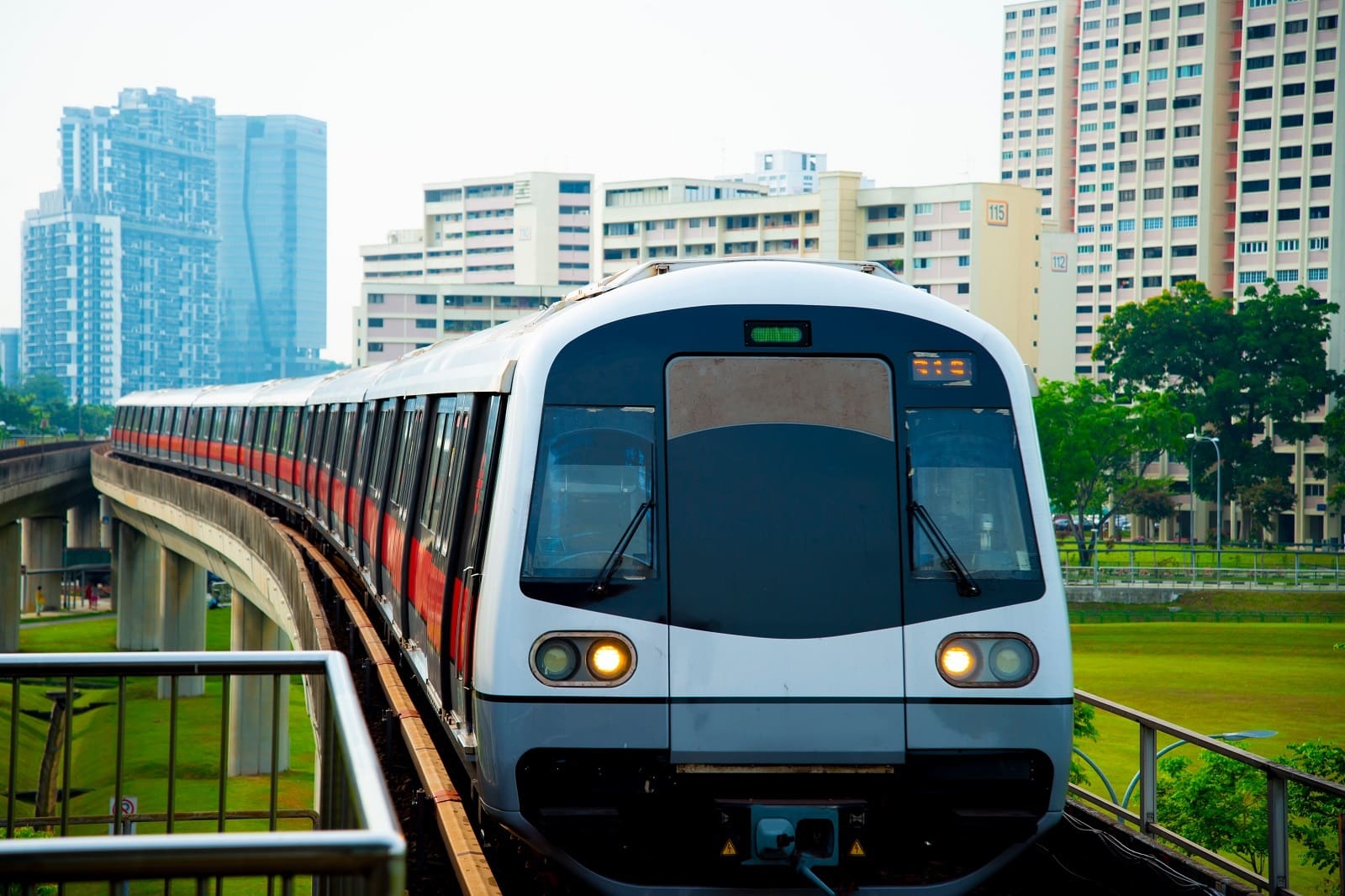
12. Singapore – The MRT
Singapore’s Mass Rapid Transit (MRT) system is a efficient and clean public transportation model. The network covers most of the city-state, including major tourist attractions, shopping districts, and the airport.
Insider’s Tip: Opt for the Singapore Tourist Pass for unlimited travel on the MRT and bus services.
When to Travel: Midday or late evening to avoid rush hour crowds.

The Bottom Line
Mastering public transport in these major cities eases your travels and immerses you in the local way of life. Each city’s transport system has its own quirks and charms, offering a window into the city’s culture and rhythm. With these tips, you’re well-equipped to navigate the subways, buses, and trains like a seasoned traveler, making your city explorations more enriching and efficient.
More Articles Like This…
Barcelona: Discover the Top 10 Beach Clubs
2024 Global City Travel Guide – Your Passport to the World’s Top Destination Cities
Exploring Khao Yai 2024 – A Hidden Gem of Thailand
The post Conquer Public Transport in Major Cities Like a Pro – Mastering Subways, Buses, and Trains Like a Seasoned Traveler republished on Passing Thru with permission from The Green Voyage .
Featured Image Credit: Shutterstock / RossHelen.
For transparency, this content was partly developed with AI assistance and carefully curated by an experienced editor to be informative and ensure accuracy.
More for You
"Mr. Miyagi" From 'Karate Kid': Pat Morita's Tragic Death
"The First Time I Visited The US I Thought This Was A Restaurant Scam": Non-Americans Are Sharing The Things That Are Totally Common In The US But Bizarre In Other Countries
I’m a Bank Teller: 3 Times You Should Never Ask For $100 Bills at the Bank
This TikTok Hack Proves It's Easy To Get Rid Of Wasps With One Ingredient
Loyalty at work no longer pays — and it's employers who are to blame
‘Old People Smell’ Is Real, Here’s What Causes It and How To Avoid It
10% of travelers have had their medicines confiscated. Here's how you can avoid it.
Therapists Say These Are Red Flags That You’re Actually *Too* Independent
Professional housekeeper shares one thing she wishes everyone knew about laundry: 'The best [tip] I've heard in a long time'
The 30 most popular big dog breeds in America, based on data
A Smart Hack To Open A Can If You're Ever Without An Opener
Isiah Thomas explains why Minnesota couldn’t contain Luka Doncic: "One guy is way bigger than the other"
“It will be very funny for those who like to be offended”: Johnny Depp Makes His Hollywood Comeback as Satan in Iconic Director’s Final Film
Fact Check: Trump Once Said a Candidate Under Federal Investigation 'Has No Right to Be Running.' Here's the Context
What not to do on a cruise ship balcony
Max Verstappen’s emphatic response to latest question about his Red Bull future
The Little-Known Wax Paper Trick That Will Keep Your Microwave Sparkling Clean
I moved from the US to Ireland. Here are 11 things that surprised me most.
No, frequent hair trims won't make your hair grow faster. But here's what does.
10 Of The Most Expensive Classic Muscle Cars Of All Time (And What They're Worth Today)
Truckers, facing the highest fees, sue to block NYC congestion pricing
Under the congestion pricing plan, passenger vehicles will be charged $15, trucks will be charged anywhere from $24-$36 depending on size, and motorcycles will be charged $7.50. there are some exemptions -- and some caveats, by philip marcelo • published may 30, 2024 • updated on may 31, 2024 at 7:50 am, what to know.
- Cars will be charged an additional $15 to enter Manhattan at 61st Street and below, while trucks could be charged between $24 and $36, depending on size. All toll readers have been installed
- There are some planned exemptions. Most of those include government vehicles. Yellow school buses with a contract with the DOE are also in the clear, as are city-owned vehicles. Some low-income New Yorkers can also apply for reduced rates.
- T he MTA board overwhelmingly voted to approve congestion pricing in December, saying charging drivers to enter a swath of Manhattan would contribute millions of dollars to the aging transit system
Add truckers to the list of opponents seeking to block New York’s first-in-the-nation congestion fee for driving into Manhattan.
24/7 New York news stream: Watch NBC 4 free wherever you are
The Trucking Association of New York filed a federal lawsuit Thursday against the MTA, which developed the toll plan, arguing the higher fees unfairly and unconstitutionally target the trucking industry. The trucking association’s lawsuit is among at least eight seeking to block the congestion fee plan, which is slated to launch June 30 .
Under the transit authority's plan, trucks will be subject to a charge of $24 or $36 per trip, depending on their size. Most drivers in private passenger cars, in contrast, should expect to pay about $15, with lower rates for motorcycles and late-night entries into the city, according to the proposal finalized in March .
Kendra Hems, the trucking association’s president, said the industry will have no choice but to shoulder the increased costs, as truck operators don’t have flexibility on their driving routes or schedules, which are generally set by the businesses they serve.
That, she said, will only lead to price increases on countless goods, as the trucking industry moves nearly 90% of products in New York City.
Get Tri-state area news and weather forecasts to your inbox. Sign up for NBC New York newsletters.
“As any responsible business does, we deliver when our customers ask us to deliver, which is during prime business hours,” said Joe Fitzpatrick, founder of Lightning Express Delivery Service and a member of the trucking association’s board. “That will not change now, but what will change is higher costs for New Yorkers as a result.”

Israel describes a permanent cease-fire in Gaza as a ‘nonstarter,' undermining Biden's proposal

Tent encampment back on Columbia campus during alumni weekend, weeks after NYPD takedown
The association suggests that the transit authority revise its plan to exempt the industry from the fee, limit trucks to being tolled just once a day or toll them at the same rate as passenger vehicles.
A spokesperson for the MTA declined to comment on the suit Thursday.
A Manhattan federal court judge earlier this month heard arguments in lawsuits brought by unionized public school teachers, politicians and other New Yorkers.
In New Jersey, a federal court judge has also heard arguments in legal challenges brought by New Jersey Gov. Phil Murphy, Fort Lee Mayor Mark Sokolich and others.
Many of those lawsuits argue the tolling scheme was approved by federal transportation officials without proper scrutiny and the court should order transit officials to conduct a more comprehensive environmental study before rolling out the plan.
Both judges have not yet ruled in the cases.
How does congestion pricing work?
Congestion pricing would impact any driver entering what is being called the Central Business District (CBD), which stretches from 60th Street in Manhattan and below, all the way down to the southern tip of the Financial District. In other words, most drivers entering midtown Manhattan or below will have to pay the toll, according to the board's report.
All drivers of cars, trucks, motorcycles and other vehicles would be charged the toll. Different vehicles will be charged different amounts — here's a breakdown of the prices:
- Passenger vehicles: $15
- Small trucks (like box trucks, moving vans, etc.): $24
- Large trucks: $36
- Motorcycles: $7.50
The $15 toll is about a midway point between previously reported possibilities, which have ranged from $9 to $23.
The full, daytime rates will be in effect from 5 a.m. until 9 p.m. each weekday, and 9 a.m. until 9 p.m. on the weekends. The board called for toll rates in the off-hours (from 9 p.m.-5 a.m. on weekdays, and 9 p.m. until 9 a.m. on weekends) to be about 75% less — about $3.50 instead of $15 for a passenger vehicle.
Drivers will only be charged to enter the zone, not to leave it or stay in it. That means residents who enter the CBD and circle their block to look for parking won't be charged.
Only one toll will be levied per day — so anyone who enters the area, then leaves and returns, will still only be charged the toll once for that day.
The review board said that implementing their congestion pricing plan is expected to reduce the number of vehicles entering the area by 17%. That would equate to 153,000 fewer cars in that large portion of Manhattan. They also predicted that the plan would generate $15 billion, a cash influx that could be used to modernize subways and buses.
Here's a full breakdown of the congestion pricing plan from the MTA.
More to know about congestion pricing
For months, the MTA board whittled down proposals and heard tens of thousands of public comments to inform a final decision going for a vote this week.
Despite what officials say were overwhelming public comments "in favor" of congestion pricing by a 2-to-1 margin, a number of vocal groups have stood in opposition, many seeking an exemption from the daily cost to drive in part of Manhattan.
Public hearings paved the way for the final vote on March 27, when the plan was given final approval. For their part, the MTA has insisted that they are merely implementing state law aimed at cleaning the air and modernizing mass transit — conditions a majority of commenters supported at those public hearings.
"We all know that the infrastructure has to be replaced. We need new trains and signals — congestion pricing at this point is the stream that provides the funding for those things," said New York City Transit Senior Vice President Demetrius Crichlow.
Tolling will begin starting at 12:01 a.m. on June 30. Any one of the lawsuits filed against congestion pricing could bring the plan screeching to a halt, but the MTA has said it believes it will win them all.
All of the MTA's 110 toll readers are in place and ready to go.
Cars will be charged an additional $15 to enter Manhattan at 61st Street and below, while trucks could be charged between $24 and $36, depending on size.
T he MTA board overwhelmingly voted to approve the measure in December, saying charging drivers to enter a large swath of Manhattan would contribute millions of dollars to the city's aging transit system.
The approval came after the Traffic Mobility Review Board delivered its report to the MTA on Nov. 30, laying out the general guidelines for the impending tolls, including costs, when certain prices will be in effect, who gets credits and more.
Here's a breakdown of everything that was approved in December, and what comes next in the process.
This article tagged under:
Recommended
First-ever american flamingo to visit new york spotted in east hampton pond.
- View Author Archive
- Get author RSS feed
Thanks for contacting us. We've received your submission.
It’s one of the most celebrated visitors to hit The Hamptons in years.
An American flamingo in all its pink glory was seen this week in the posh waters of East Hampton’s Georgica Pond — the first time the elegant creature has been spotted in New York, one expert told The Post.
Cathy Blinken first laid eyes on the not-so-fowl animal Friday afternoon, while working remotely at her mother-in-law’s home.
“I was just taking a look out onto the pond and the flamingo was directly in front of me,” she said. “And I thought, ‘Wait a second, that looks like a strange-looking swan.’ As soon as it lifted up its neck, I knew instantly it was a lost flamingo.”

Blinken, whose husband happens to be the first cousin of Secretary of State Antony Blinken, proceeded to call the East Hampton Star so they could photograph it because she couldn’t snap a good picture.
The bird, native to the West Indies, northern South America and the Yucatán Peninsula, was still there Saturday afternoon “just hanging out.”
“I have a telescope on him and I’m watching him all day,” she said. “He kind of flies and he does a couple of bank turns and he comes back. He’s so sweet.”

Hundreds of bird lovers have been flocking to get a glimpse.
“He’s very well visited. I woke up at like 6 o’clock this morning and there were people already out there observing the flamingo and just being very respectful,” she said.
Get all the stories that move New York to your inbox
Sign up for our Metro Daily newsletter!
Thanks for signing up!
Please provide a valid email address.
By clicking above you agree to the Terms of Use and Privacy Policy .
Never miss a story.
There’s never been a record of an American flamingo in New York state, said ecologist Jose Ramirez-Garofalo, a PhD candidate at Rutgers University and director of the Freshkills Biological Station on Staten Island.
Hurricane Idalia, which slammed the southeastern US in August, could have helped ferry the feathered beast up north, he said.
“The hurricane essentially brought a whole bunch of flamingos across the United States,” Ramirez-Garofalo told The Post. “It was pretty unprecedented. … There’s not many records of them this far north.”

After the hurricane, the flamingos “overwintered” in the Southeast, so “this bird is probably one of those that overwintered somewhere in the United States,” he predicted.
It makes sense the bird has remained on the pond, he said.
“This bird is probably tired. It’s looking for food. It can definitely stick around,” he said. “There’s plenty of food, the temperature is right. There is some precedence to having flamingos on the East Coast stick around for the entire summer season.”
Blinken hopes the creature will stay.
“Yesterday, there was a crazy sailboat guy trying to get a closeup and he kept shooing off the flamingo, who was trying to escape the boat,” she said.
“And I thought, ‘Oh God, don’t scare the flamingo away!'”
Share this article:

Advertisement
- Share full article

Colorado’s Bold New Approach to Highways — Not Building Them
The state has made it harder to widen highways, and transportation officials are turning their eyes to transit.
Credit... Elliot Ross for The New York Times
Supported by
By Megan Kimble
- May 31, 2024
When Interstate 25 was constructed through Denver, highway engineers moved a river.
It was the 1950s, and nothing was going to get in the way of building a national highway system. Colorado’s governor and other dignitaries, including the chief engineer of the state highway department, acknowledged the moment by posing for a photo standing on bulldozer tracks, next to the trench that would become Interstate 25.
Today, state highway departments have rebranded as transportation agencies, but building, fixing and expanding highways is still mostly what they do.
So it was notable when, in 2022, the head of Colorado’s Department of Transportation called off a long planned widening of Interstate 25. The decision to do nothing was arguably more consequential than the alternative. By not expanding the highway, the agency offered a new vision for the future of transportation planning.
In Colorado, that new vision was catalyzed by climate change. In 2019, Gov. Jared Polis signed a law that required the state to reduce greenhouse gas emissions by 90 percent within 30 years. As the state tried to figure out how it would get there, it zeroed in on drivers. Transportation is the largest single contributor to greenhouse gas emissions in the United States, accounting for about 30 percent of the total; 60 percent of that comes from cars and trucks. To reduce emissions, Coloradans would have to drive less.
An effective bit of bureaucracy drove that message home. After sustained lobbying from climate and environmental justice activists, the Transportation Commission of Colorado adopted a formal rule that makes the state transportation agency, along with Colorado’s five metropolitan planning organizations, demonstrate how new projects, including highways, reduce greenhouse gas emissions. If they don’t, they could lose funding.

Within a year of the rule’s adoption in 2021, Colorado’s Department of Transportation, or CDOT, had canceled two major highway expansions, including Interstate 25, and shifted $100 million to transit projects. In 2022, a regional planning body in Denver reallocated $900 million from highway expansions to so-called multimodal projects, including faster buses and better bike lanes.
Now, other states are following Colorado’s lead. Last year, Minnesota passed a $7.8 billion transportation spending package with provisions modeled on Colorado’s greenhouse gas rule. Any project that added road capacity would have to demonstrate how it contributed to statewide greenhouse gas reduction targets. Maryland is considering similar legislation , as is New York .
“We’re now hoping that there’s some kind of domino effect,” said Ben Holland, a manager at RMI, a national sustainability nonprofit. “We really regard the Colorado rule as the gold standard for how states should address transportation climate strategy.”
That won’t be easy. States have almost unilateral power to determine how billions of dollars in federal transportation funding is spent. A recent analysis showed that more than half of $1.2 trillion enabled by the Infrastructure Investment and Jobs Act of 2021 will be spent on highway expansion and resurfacing.
“In order to fundamentally change how most federal transportation dollars are spent,” said Shoshana Lew, the executive director of Colorado’s transportation agency, “you have to get into the network of state D.O.T.s.”
In other words, the people most likely to reduce cars on the road are the ones who have long prioritized them.
More lanes, more cars, more greenhouse gasses
People have been fighting highway expansions for as long as there have been highways. In recent years, activists in Houston, Los Angeles and Portland, Ore., have fought widenings, arguing that the increased exhaust would worsen air pollution and exacerbate high rates of asthma in Black and Hispanic neighborhoods.
In Denver, a fight started in 2014 when the transportation department announced a plan to triple the width of Interstate 70, which runs through majority Hispanic neighborhoods in North Denver. Growing up, Ean Tafoya would stand in his front yard, in the shade of a century-old maple tree, and look north at the highway’s elevated lanes. Beyond the highway, a smokestack at a nearby oil refinery billowed toxins. His neighborhood was among the most polluted in America, and residents experienced significantly higher rates of respiratory diseases than those elsewhere in Denver.
Mr. Tafoya was working for the City Council when he heard about the plan to expand the highway just blocks from where his mother still lived. “I-70 radicalized me,” he said. He quit his job and helped organize a statewide coalition of activists and community members who tried to stop the Interstate 70 expansion with lawsuits and protests. In the end, Interstate 70 was expanded. But the fight served as a warning to leaders like Ms. Lew that future highway construction would face spirited opposition.
At the same time, a larger reckoning with how transportation decisions affect greenhouse gas emissions was playing out.
The basic principle linking wider highways to more carbon emissions has been well understood since the 1960s. Back then, an economist rebutted the prevailing assumption that adding lanes would fix traffic, showing instead that wider roads only increased the number of cars and made congestion worse. This phenomenon came to be called “ induced demand .”
State transportation departments nonetheless consistently underestimate how highway expansion leads to more driving. In 2019, a team led by Susan Handy, a professor of environmental science at the University of California, Davis, developed an induced demand calculator to help others translate how specific expansions led to more cars on the road.
In Colorado, Mr. Holland and several other climate activists used Dr. Handy’s calculator to do more than measure increased driving. In 2021, they modeled the greenhouse gas effects of all the projects in the state transportation’s agency’s 10-year plan, which included more than 175 miles of lanes added to highways. They found that the projects could increase annual greenhouse gas emissions by the equivalent of 70,000 more cars and trucks on the road.
The transportation agency disputed the figure, but the calculation nonetheless changed the conversation, Mr. Holland said. Until that point, “nobody was actually putting real emissions numbers behind highway expansion,” he said. The analysis galvanized climate activists, who had largely left highway fights to people like Mr. Tafoya, those living in communities directly affected by expansion.
In June 2021, when Governor Polis signed a $5.4 billion transportation funding bill, it included a requirement that the Transportation Commission of Colorado, which oversees CDOT, make a plan to reduce transportation-related greenhouse gas emissions. Other states had tried to reduce emissions from transportation, but with little effect because there were few consequences for failing to do so. Activists in Colorado were determined that this rule would be different.
Mr. Tafoya, who was by then the Colorado director of a national advocacy group called GreenLatinos, showed up to the transportation commission’s monthly meetings and submitted detailed comments on the draft rule. When it passed in December 2021, the rule contained the forceful incentive tying emissions targets to funding.
Six months after the rule passed, on a hazy morning in June 2022, advocates gathered in a bike lane with Interstate 25 thrumming behind them and asked CDOT not to widen the highway. This time, they had leverage.
Why electric cars aren’t enough
If every car on the road were battery-powered and those batteries were charged entirely by renewable energy, transportation emissions would be close to zero. But the average car on the road is 12 years old, meaning that every gas-powered car sold today will emit carbon for at least another decade. And even though President Biden’s administration has invested tens of billions of dollars to stimulate electric vehicle production and infrastructure, electric cars accounted for just under 8 percent of new cars sold in the United States last year.
“The scale of the challenge to getting a net-zero transportation system is, I think, much bigger than folks want to acknowledge,” said Costa Samaras, the director of the Wilton E. Scott Institute for Energy Innovation at Carnegie Mellon University. To meet emissions targets, “ridiculously high levels of electrification” are needed, he said. “We also, at the same time, need to be building the types of communities that enable folks to move around without needing to rely on a car.”
How, exactly, to do that is the challenge now facing Colorado’s transportation department. The emissions rule does not prevent highway expansions, and several are still being planned. But the agency has begun a significant shift. When Ms. Lew was appointed in 2018, she observed that the work force “was very rooted in the old culture of highway building,” she said. “I think that actually goes part and parcel with some of the overemphasis on these big highway widening projects.”
When the proposal to widen Interstate 25 came up, Ms. Lew took several things into consideration. The “tremendous amount of controversy” that surrounded the Interstate 70 expansion — the one Mr. Tafoya had tried to stop — was one issue.
The widening was also unlikely to fix traffic: Years earlier, the agency had spent $800 million to expand another stretch of Interstate 25 in south Denver and ended up with worse congestion than before construction began.
Perhaps most important, the department couldn’t expand Interstate 25 and meet its newly mandated climate targets. “We can’t get there with electrification alone,” said Kay Kelly, CDOT’s chief of innovative mobility. The transportation agency, she said, now has to think harder about ways “that allow people to get places without a car.”
For years, Denver had been trying to build bus rapid transit , which runs more like a light rail than traditional bus service, with faster travel times and more frequent service. Then came the greenhouse gas rule, which quickened that effort by years, Ms. Lew said.
In 2022, the agency allocated $170 million for bus rapid transit in Denver and $120 million for Bustang, a statewide bus service, over the next decade. Late last year, Ms. Lew announced CDOT’s first three rapid routes, including one along 18 miles of Federal Boulevard, which runs north-south across the city, roughly parallel to Interstate 25.
“It’ll come so frequently that you won’t need to read a schedule,” said Ryan Noles, who was hired last year to lead the transportation agency’s new bus rapid transit program. Mr. Noles hopes that CDOT will break ground on the Federal Boulevard rapid bus line in 2027, with riders on board by 2030.
That won’t be soon enough to have an impact on the state’s 2030 carbon emission reduction goals, which it’s not likely to hit . Building new transportation, even without changing the course of a river, takes time. And when the new bus line is up and running, lots of people still have to change their daily habits. Reducing emissions from transportation, Ms. Kelly said, requires changing the behavior of “millions of people and dozens of decisions that they make throughout their daily lives.”
Which comes first, transit or housing?
On a bright, unseasonably warm day in January, I met Danny Katz, the executive director of the nonprofit Colorado Public Interest Research Group, near the Decatur-Federal Station, one of the busiest transit stops in Denver and a future stop on the bus rapid transit line. We walked down Decatur Street toward the South Platte River, the one that was once rerouted to accommodate Interstate 25. The sounds of construction — the slow beeps of a truck in reverse, a pile driver pounding the hard earth — filled the air. But the machines aren’t for highways; they are for housing.
Over the coming decade, tens of thousands of housing units will be built within a two-mile radius of this spot. “This is the perfect place not to widen a highway,” Mr. Katz said. If transit is going to work anywhere, he said, it’s here.
To make it possible for people to drive less, they need to live closer to where they are going. “I think where we stand now is that the real frontier is around land use,” said Will Toor, the executive director of the Colorado Energy Office, a state agency responsible for reducing emissions. Changing zoning laws to allow for more dense development could reduce emissions in Denver by 8 percent, largely by reducing the distance and frequency people have to drive, according to a 2023 study by RMI.
Governor Polis agrees. After a sweeping land use reform bill failed last year, he focused on smaller measures to increase the state’s housing supply. In May, he signed laws to create incentives for denser housing development near transit stops and to allow accessory dwelling units to be built in more neighborhoods. “Big efforts often take several years,” Mr. Polis said in an interview. “Most people don’t want to have 45-minute commutes each way. They do it out of necessity and affordability. So housing opportunities that people can afford close to job centers means less travel in a car, less emissions and less time lost in traffic.”
Housing and transportation, in other words, are intertwined. Unlike most state transportation directors, Ms. Lew did not study engineering. She has a master’s degree in American history and a background in finance. Transportation represents most of the federal investment in cities, she said. But until recently, investing in transportation largely meant following a playbook written in the 1950s, building grand concrete structures that efficiently swept cars from one side of a city to another.
No longer. In 1958, the year that Interstate 25 opened to traffic, the State Highway Department constructed the sweeping interchange connecting Federal Boulevard to Colfax Avenue and demolished more than 240 homes and businesses in the process. That project, which shaped the city for half a century, might now be undone. In March, CDOT was awarded a federal grant to remove the cloverleaf and rebuild the street grid, complete with storefronts and apartment buildings full of people. And, if Ms. Lew is successful, a rapid bus to take them where they need to go.
Should transportation planners stop prioritizing highway construction?
Megan Kimble is an independent journalist based in Austin, Texas, and the author of “City Limits: Infrastructure, Inequality and the Future of America’s Highways” (Crown 2024).
The Headway initiative is funded through grants from the Ford Foundation, the William and Flora Hewlett Foundation and the Stavros Niarchos Foundation (SNF), with Rockefeller Philanthropy Advisors serving as a fiscal sponsor. The Woodcock Foundation is a funder of Headway’s public square. Funders have no control over the selection, focus of stories or the editing process and do not review stories before publication. The Times retains full editorial control of the Headway initiative.
Advertisement

IMAGES
VIDEO
COMMENTS
When riding in a yellow cab below at or below 60th street, a $1.25 surcharge will be added; ride-share apps like Uber or Lyft will incur a $2.50 surcharge. Ferries, bicycles, pedicabs and one cool tram are all great ways to get around New York. For a full list of options, see our Getting Around page. Learn about NYC transportation to access and ...
3. Subway. One of the most popular ways to get around New York is the New York Subway. This is a great way to get around the city as you avoid any traffic. With 472 subway stations, the New York City subway is the largest subway system in the world as measured by total number of stations.
Fact checked by. Jillian Dara. Wikipedia Commons. The easiest, most affordable way to get around New York City is by public transportation. New York City mass transit generally falls into two categories: buses and subways. The city has 36 subway lines (that go to 472 stations) and 5,725 buses that can take you anywhere you want to go.
New York's subway, the MTA, is mostly reliable and very affordable. A single ride will cost you $2.75, and the city offers unlimited seven-day passes for $33 which are great for. travelers spending the week. It costs $1 for a new subway card so, repeat after us: Do not lose it!
New York public transport. The Metropolitan Transportation Authority (MTA) is New York City's public transportation system which consists of subways, buses, and ferries with most lines operating 24 hours a day.. Ⓜ️ The subway system has 24 lines, identified by either letters (A, B, C, etc.) or numbers (1, 2, 3, etc.). These routes serve Manhattan, the Bronx, Brooklyn, and Queens.
Get around night or day on the subway. With 25 routes covering more than 665 miles of track, the New York City subway system is a behemoth, welcoming 1.7 billion riders on an annual basis. It's operated by the MTA and covers Manhattan, Brooklyn, Queens, the Bronx, and Staten Island, though the latter's trains don't connect to the other ...
New York is a port city, so there are several waterways, including the Hudson River, East River, and New York Harbor. Fortunately, there is water transit in New York, so you can easily cross over to Staten Island, New Jersey, and more. The NYC Ferry runs every 30-45 minutes from Manhattan to Brooklyn, Queens, Staten Island, and Roosevelt Island ...
Bus. The bus, a flat $2.75 per ride, appeals to visitors who want an above ground view of New York City. Using a MetroCard (available at subway stations) is the way to go since bus drivers won't ...
Transparency Our leadership, performance, budgets, financial and investor information, and more. Careers at the MTA Job postings, how to apply, employee benefits, and more. Safety and security Our safety procedures, how to report an incident, and tips for having a pleasant trip. Climate Learn how we're making transit even more sustainable and ...
One of the most important tips for first time visitors to New York is to bring comfortable walking shoes. If helpful, I recently wrote a guide on the 10 BEST Shoes for Walking Around New York City. Most of my out-of-town guests average 15,000-20,000 steps per day, simply because there's so many great things to see in New York City.
Plan your New York City trip with NYC.com's comprehensive visitor guide to neighborhoods, hotels, New York on a budget, getting to/from airports, getting around, and cool interactive maps. Browse our walking tours, hotel guides, style pages, all-new Best of New York and Off the Beaten Track guides. Broadway Tickets; Concert Tickets; Sport ...
Here's what you need to know about them: Like the subway, the fare for a bus ride is $2.75. It's also paid via Metrocard or exact change. Because of New York's famed traffic and congestion, buses are almost never on time—and rides usually take much longer than Google Maps estimates (often twice as long or more).
New York City Transit manages and maintains subway and bus service in New York. New York City Transit manages and maintains subway and bus service in New York. ... Schedule a visit at the Customer Service Center. Get help with common MetroCard problems. Other ways to contact the MTA. Latest news May 31, 2024 12:00 pm.
LaGuardia Airport. Newark Airport. US$ 158. Book. Newark Airport. JFK Airport. US$ 164. Book. Get to know the routes and stops on the New York tourist bus, and enjoy stunning views in total comfort.
MetroCards cost $1. All cards except for the Single Ride card are refillable. You pay the fare at turnstiles before you board the train. You don't have to do anything after. Up to three children under 44 inches tall ride for free when they're with a fare-paying adult on the subway and local, limited, and Select Bus Service buses.
WhyzzExplorer. This app gets the entire family involved on a trip to New York City. Let this app guide you through quizzes, conversations, and food challenges as you and your loved ones get to ...
Go to the station agent in the booth where you will show your ID and pay $2.90 for a non-refillable MetroCard good for TWO rides. You do not have to pay the $1.00 new card fee. Not all stations have agent booths. This 2-trip MetroCard will be accepted at all subway stations, local buses, and Staten Island Railway.
However, even then we don't recommend the 30-Day Unlimited MetroCard as a replacement for a New York subway pass for tourists. Not even many New Yorkers purchase this pass as it's a huge monetary damage if you lose the card. As a tourist who will rely on public transportation, you'll always be better off with weekly passes ($34/week).
The city's pace may slow down, but the influx of tourists picks up. The New York City Tourism Bureau estimates that the five boroughs will welcome 64.5 million visitors in 2024. So, it's safe ...
WASHINGTON - The U.S. Department of Transportation (DOT) today released its Air Travel Consumer Report (ATCR) on airline operational data compiled for the month of March 2024 for on-time performance, mishandled baggage, mishandled wheelchairs and scooters, and 1st quarter oversales. The ATCR is designed to assist consumers with information on the quality of services provided by airlines.
Our school group tours use the museum's unique space and hands-on collection to explore how transportation helped shape New York City throughout history to present day. Tours include a mix of inquiry, observation, primary and secondary sources, and interactive activities to engage learners of all ages and abilities.
Singapore's Mass Rapid Transit (MRT) system is a efficient and clean public transportation model. The network covers most of the city-state, including major tourist attractions, shopping ...
Rail Services. Amtrak 800-872-7245, 215-856-7924 Amtrak is the national passenger railroad of the United States. New York City's Penn Station is its busiest station in the nation. The company offers numerous packages and deals, including sightseeing opportunities for both US residents and international visitors to make multiple stops throughout the country.
Mr. Karsh saw this shift happen firsthand on a recent trip to New York City, when his family opted for a ride in a yellow cab. "My 3½-year-old son turns to me and my wife and says, 'Look ...
Truckers, facing the highest fees, sue to block NYC congestion pricing Under the congestion pricing plan, passenger vehicles will be charged $15, trucks will be charged anywhere from $24-$36 ...
An American flamingo in all its pink glory was spotted this week in the posh waters of East Hampton's Georgica Pond — the first time the elegant creature has been spotted in New York, o…
At 10:05 p.m., hundreds of people rushed the entryway of track 11 at Penn Station, where a train to Trenton was boarding nearly four-and-a-half hours behind schedule.
Within a year of the rule's adoption in 2021, Colorado's Department of Transportation, or CDOT, had canceled two major highway expansions, including Interstate 25, and shifted $100 million to ...