Indrahar Pass Trek

Can You Help Us With Photographs Of This Trek?
We are looking to enrich this documentation with more photos. Pictures go a long way in explaining the trail, more than words ever can. If you have done this trek, can you share your photos with us? We will include them on this page, with due credit to you. Click here to contribute .

The Complete Guide to Indrahar Pass Trek
Indrahar Pass Trek is a enchanting experience at the heart of an endlessly fascinating range. It is a notch in the skyline on the high ridge that runs down to the west from Mon peak.
Working Geological Model
Dhauladhar is one of the primary and powerful areas in the Himalaya where the pressure cast by the Indian subcontinent plate on the Eurasian plate is at its strongest. While the Indian mass wedges itself deeper under the Asian Plate, the Dhauladhar range is one where you can see a working geological model of the Great Himalayan Range in general. When you cross the watershed ridge of the Dhauladhar from Kangra to Chamba or vice versa, you pass through every Himalayan Climato-ecological belt possible- from tropical highlands of the great Himalayan rivers to the sub arctic wastes at the top of the ridge.
Kangra & Chamba Valleys
Standing up like a wall between the Beas and Ravi river valleys (the latter a gorge for much of its run from its source through Chamba) that constitute, respectively, the Kangra and Chamba valleys, the range is scored with passes connecting the two. The range has many subsidiary ridges that fall on either side of the divide. These ridges form little secluded valleys cut through with prominent streams that flow to the Beas and the Ravi respectively.
At the Kangra end, the ridges of the Dhauladhar rise pretty swiftly and steeply, so the south-facing valleys comprise steep and wooded glens and chasms and the rise to the crest of the range is pretty rapid. On the Chamba side, these valleys are long, narrow and winding. Indrahar pass is a notch in the skyline on the high ridge that runs down to the west from Mon peak.
The Obstacles
Our trek was in the monsoon, not the most popular time for treks in the Himalaya, and definitely not on the Dhauladhar. It receives the first blast of the rains when it hits the western Himalaya. The range positively swims in thunderstorms and heavy showers, especially in the peak months of July and August. Our’s was a very unusual trek because we did it between July end and early August, at the peak of the monsoons. I have seen the Dhauladhar in many seasons and it is a fact that treks across the range are fairly easy. During the monsoon months however, due to the dramatic intensity and variability of the climate, the trail becomes a fairly tough one. Falling rocks, wet rocks, stinging nettles, all kinds of insects, landslides and rivers in spate are just some of the many formidable obstacles. However, to trek in the monsoon is also to have the entire range to yourself-apart from Gaddi herders in their high camps on the ridge- and revel in the profusion of flowers and the sheer overload of greenery in all its hues.
➤ Short Itinerary
A trek at the heart of an endlessly fascinating range
- The Dhauladhar is an endlessly fascinating range and the Indrahar Pass trek is a strong reiteration of its diverse offerings.
- This high, rocky ridge is extensive enough and important enough both in its profile of ascent and its relative proximity to the plains to be a major Himalayan range.
- It is a geologically active region, set on a major thrust zone of the Indian plate.
➤ Detailed Itinerary
Day 1: bhagsu/dharamkot to triund via galu devta: 6184ft to 9760ft – approx. 10km.
The Indrahar Pass Trek is a 10-day ordeal. Bhagsu and Dharamkot are two villages situated about 2km up the ridge from McLeodganj. Both of them can be considered the roadhead, as alternate trails from both these villages meet at the Galu devta temple at the top of the Dharamkot spur of the Laka ridge and form the main trail that snakes up to Triund. The trail from Dharamkot is arguably the nicer one as it climbs through the thick crown of pine forests above the village. Walk up through the forest for about 15 minutes before you get to the Galu temple clearing. There’s a small tea shop here just below the shrine. From here one trail goes south-west into the forest to the village of Naddi. Another forest trail goes north west to the stream that descends from Laka, while the main trail to Triund continues straight past the small shrine.
The trail here is a gently rising one through oak thickets and traverses the steep side of the Laka ridge, following its contour. Dharamkot and Bhagsu lie directly below his trail. Approximately halfway up the trail is a deep gully that traverses a steep and rocky section of the ridge to emerge on a rocky spur. The main Dhauladhar range which passes out of view as you ascend from Dharamkot, swings into view here, with the pyramidal peak of Mon appearing larger than life. This entire stretch is perfect for birdwatchers as the forests here are literally swarming with various kinds of songbirds.
Past the Magic View Café, the trail gets steeper. At this point the Dharamkot spur of the Laka ridge meets the Triund ridge at right angles, creating a series of steep gullies that end up in thickly wooded chasms. The trail continues up through a series of steep switchbacks as it climbs the Triund ridge through dense and tightly packed thickets of rhododendron and fantastically shaped oak trees. It’s a pleasant, if slightly strenuous climb from here to Triund in good weather. Watch your step when it’s raining, as the path turns to mush. The last couple of switchbacks bring you out of the rhododendrons and out onto the Triund ridge. It’s an open grassy ridge that stretches a good kilometer to the south before plunging into the Kangra valley. There’s plenty of places to camp. You could even get some provisions at the four tea shops here.
Day 2: Triund to Lahesh cave via Laka:
9760ft to 11646 ft , Approx. 9km
The trail goes north up the Triund ridge past the forest guest house and a small devi shrine. The ridge begins to rise here in the very typical Dhauladhar way of cascading boulders. The trail keeps up with the Chauran nala chasm to the right, rising through more rhododendron and oak thickets and the occasional grassy ledge. The Gaddis maintain the stone trail here very well as it goes past a couple of shrines. As the the range looms up, the trail veers to the east and starts a steep traverse to get to the top of the Laka ridge. The views from here are quite magnificent. To the east, the Dhauladhar ridge rises in a series of peaks, the most prominent of which goes by the local name of Narwana. Below lie the green grassy ridge of Triund and just beside the trail are deep wooded chasms through which run the various streams that drain the southern face of the Dhauladhar.
Past the steep incline, the path enters rolling pasturage and reaches the camping ground of Laka. This marks the uppermost portion of the Dhauladhar foothills. The upper main ridge of the Dhauladhar looms above the little bowl of Laka to the North East, with Mon dominating the scene. A number of deep boulder fields descend the face of the ridge to Laka. The true trail to Lahesh cave and Indrahar goes up the northernmost boulder field. It is extremely important that you do not take the wrong path as it’s very easy to get lost in the maze of the upper boulder fields and come to grief. There’s a small tea shop (rather grandiosely called the Snow-line café) where you could take a breather before continuing.
The trail crosses two boulder fields usually with snow in them in May-June and again in October. At other times you’ll have to ford the shallow, but quick-flowing streams that go down them and start climbing up the steep and boulder-filled mountain side. The upper sections of the range rise up in gigantic, tiered bounds of striated rocks that loom over the trail like some gigantic medieval castle. The shepherds have installed an ingenious system of cairns to guide the way through this steep maze. For orientation stick close to the true right of the stream (to your right) and continue up the rib of the rockface. After about an hour’s strenuous climbing, you’ll arrive at Lahesh cave, which is basically a long and deep fissure in a wedge between two huge boulders. It’s a nice and dry camping spot, as long as you quickly get used to the fact that you won’t ever have the space to do anything but squat on your haunches when you’re in the cave.
The natural courtyard in front of the cave commands a great view of the lower ridges of the Dhauladhar and the Kangra valley. The rockface around the cave is pretty steep, although during monsoon you’ll find thousands of alpine flowers blooming on small grassy ridges, that you never suspect these rocky heights could hold.
Day 3: Lahesh Cave(11646ft) to Indrahar Pass(14160 ft ) and down to Chhata(12729 ft): Approx 12km
Today is a long day, so try and start as early as you can. The trail continues over the rocks straight up the North East face of the ridge, keeping the steep wall of Mon to its right. The trail follows the path marked by the cairns as it rises steeply up the 2,500 odd feet from Lahesh cave to the crest of the pass.
Take the trail at your own pace as it gets quite steep in places. Again the ingenuity of the Gaddi shepherds help a lot in making this a straightforward ascent. To facilitate an easy passage for their goats, the shepherds have built a succession of rock-hewn staircases along the steepest sections. It’s pretty much like climbing up a ladder, only much more fun. The normal trajectory of the trail is that of rock stairs alternating with shallow ledge and then up the next set of stairs and then another shallow ledge and so on. Keep your eyes on the rocks above as you wouldn’t want to miss the cairns that mark the way. The ledges are often overhanging with 200-300 ft falls right under them so be careful.
The Dhauladhar has it’s own mini weather system, and rainstorms often break out towards the afternoon. This is frankly one of the most difficult sections of the trek, so take your time and don’t rush. However, you should try and be on the pass by 11 am, as there’s a long descent on the other side as well. Due to foreshortening, intervening cliffs often give the impression that you’re close to the top only for that illusion to be shattered once you reach the cliffs. You know you’re getting close to the pass when the trail becomes even steeper and a keen wind starts blowing. The pass is reached quite suddenly, with the small shrine with cairns and a collection of tridents marking the deep notch on the top of the Dhauladhar that mark the spot. Here, near the crest of the Dhauladhar, the landscape is truly surreal, made up as it is with huge bands of heavily compacted slabs of rocks. The Mon peak, which lies a few hundred feet to the east and is an easy climb from its north face, is merely a continuation of the this broken, rocky ridge. The view from the pass is superb. To the south lies the Kangra valley and the distant plains of Punjab in a blue haze, while up north rises wave upon wavesof ranges like the Pir Panjal (north), Kishtwar (west), Bara Bangahal (east) and Manimahesh (north east).
The northern ridges of the Dhauladhar here drop away steeply to the valley of the Kuarsi nala and finally into the Ravi river system. The trail down from Indrahar is fairly clearly defined but much of the upper course is over extensive boulder fields. During October or June, much of this might be covered by snow and therefore easier to negotiate, but at other times, especially in winter, it is a mess of steep boulders and should be negotiated slowly.
The trail descends from the pass hugging a rocky ridge with overhanging boulders to the left, past small glacial fields. You can see the day’s camp at Chhata in the distance, and though it looks quite close, bear in mind that there’s still quite a long way to go. Once you reach the base of the rock spur, veer to the west and traverse over snow and boulder fields and small flower patches past the upper springs which feed the myriad streams that ultimately form the Kuarsi Nala. This area is something like a hanging valley, and it’s a fairly easy traverse.
From the lip of the hanging valley, the trail then descends through meadows and rock gardens down the true left of the Kuarsi Nala. This mini cirque of high ridges is quite spectacular with their towering, black rock walls ending in fantastically shaped peaks. To the west are a number of eccentrically named peaks like Arthur’s Seat, Rifle-Horn and Arthur’s Footstool. In season you might come across Gaddi camps with their sheep, goat and sheepdogs in these areas.
The trail then descends continuously to the North East for the next three to four km and for about a thousand feet. You will have to ford two big side streams coming down from the left (north). In both cases you can do so by crossing the glacier bridges in May and June. By monsoon, these bridges become rotten, so you’ll have to use a series of boulders across the face of the streams to get to the other side. Once past these you enter a long, green rolling meadow dotted with the most brilliant alpine flowers in the monsoon which trails off into a deep gully. Cross the gully and move steadily closer to the stream until you get to the picturesque camping spot of Chhata Parao.
Day 4 Chhata to Kuarsi via Mandhara Crossing: 12729ft to 7293 ft, Approx. 14km
It’s an easy walk down to Kuarsi village from Chhata. Start early again, because the distance to be covered is sizable.Today you will have to cross the Kuarsi Nala later in the day, and it’s best to do so before it gets too hot and the volume of water in the stream increases.
Chhata is at the northernmost edge of the large bowl-like upper valley of the Kuarsi formed by the cirque of peaks that make up the northern face of the Dhauladhar. After striking camp, you follow the trail through beautiful belts of pine and deodhar for about half an hour before you reach the lip of this upper camp, and to your right, the stream falls off and enters an upper gorge. Another sizable stream rushes down from the ridge wall to the left to join the Kuarsi. Cross this by descending to the level of the side stream and hopping across some conveniently placed boulders across its channel. The path then rises again and maintains its height for the next 45 mins or so, crossing another stream coming down from the left. The main Kuarsi Nala has by now dug out a pretty deep gorge for itself, masked by pine forests, so sometimes even its roar can’t be heard.
The trail rises one last time straight into the middle of a pine forest flecked with flowers and butterflies before you suddenly come across the gorge. It’s a precipitous descent via narrow rock chutes from the pine forest to the bed of the river, which here comes down in a series of cascading waterfalls. This is the point where you cross the Kuarsi Nala at Mandara on its true right. It is always a tricky crossing because of the strength of the current, so try and get here before midday. Early in the day, you can possibly wade across it (except in monsoon) or do the usual boulder hop across the channel. Once on the other side, the trail rises up the ridge to regain the level of the pine forests, before continuing on its winding course following the river on its true left.
The Kuarsi crossing is the toughest bit in today’s walk but the rest of the trail to Kuarsi is a fairly long one, with many ups and downs. Although the trail keeps to the pine level throughout, you lose height in imperceptible degrees, and even that involve innumerable descents into deep gullies followed by lung-bursting ascents with unerring monotony for the next hour. The view though is marvelous. Although the enclosing valley walls of the Kuarsi Nala are pretty steep, the further you go, the views to the north open up further. In clear weather views of the distant Pir Panjals are an ever present, until higher intervening ridges cut out that view.
The forests around the trail are thick and lush and black bears abound, so make sure you make enough noise while going through the forested stretches. Soon the trail hits the pipeline that carries water from the upper valley to Kuarsi village and thereafter the trail pretty much follows the pipeline. The Kuarsi meanwhile descends deeper into its gorge some 1000 ft below the trail.
Finally, after a particularly strenuous ascent, you come to a high cliff and Kuarsi village with its surrounding fields. From here it’s a thousand feet of steady but indirect descent, first across steep slopes and then across fields of paddy and mango orchards until you reach the village. You can camp overnight at the famous temple of the Indru Naga.
Day 5 Kuarsi-Hilling-Lamu (Approx 13km)-Donali by bus-walk to Brehi:
7293 ft to 3937 ft
The trail winds out of the level valley of the Kuarsi village and enters a thick forest through which it continues for about an hour. Soon enough though, the path narrows and becomes extremely precipitous as it skirts beside a steep ravine falling a straight 900 ft into the raging Kuarsi Nala below.
The trail runs thus until a side river cuts through the ridge to the right of the trail and descends to meet the Kuarsi. A steep and damp set of ancient wooden staircases takes the trail down to the stream which it crosses and then climbs back up to the thick pine forest.
In about an hour, the trail crosses the village of Hilling and it widens out to a metalled road. Walk on the road on to Lamu on the Ravi river which is the roadhead. Buses ply fairly regularly, and from here it takes about an hour and a half to reach Donali, which is the roadhead for the Donali Khal valley which you follow to reach Minkiani Pass.
It’s best to walk up the valley for about 3 km and reach the village of Brehi for your night halt. There are meadows and orchards where you can set up camp, or even in the local schoolyard.
Day 6 Brehi to Minikiani camp via Drakund: 3937ft to 11483 ft, Approx. 20km
From Brehi, the trail winds through the village proper on the true right of the Donali Khal, gently gaining altitude. The trail passes through beautiful apple orchards and oak trees, past little cattle enclosures to a suspension bridge.
The trail crosses it and continues along the true left of the river past a naga shrine and some village houses. After the crossing, the trail proceeds to rise above the river in a series of switchbacks. You pass by quite a few temporary Gaddi shelters, farms as well as small villages on the way to Drakund. It’s a beautiful if tiring trail to the forest guest house in the middle of thick oak and pine forest. It’s a nice place to stay with a friendly chowkidar.
After crossing the guesthouse, the trail levels out a little and continues along the rising river valley. It’s a narrow, if well laid out trail which more or less goes straight south.. In season it’s fairly clear, but in the monsoon months the surrounding vegetation almost overwhelms the path, so a stick or an ice-axe should come handy to clear the path.
The valley opens out as the trail rises past the rushing river. After about an hour’s walking, a side stream comes down from the south west, which you will have to cross by the usual means of hopping over conveniently placed boulders. Once across, the trail continues beside the river for about half an hour before it starts rising again in a series of switchbacks. This bit of the trail is very tiring, so take it slowly. Side valleys open up to the south east, and beyond the upper pine forests the crest of the Dhauladhar starts to come into view.
You continue past an abandoned forest dwelling and emerge clear of the lower valley. The view behind (to the north) is pretty spectacular, with the Manimahesh range holding pride of place to the north east. Once clear of the treeline, boulder fields begin. The final hour’s walk to the camping spot is a weary slog over boulders. Take note to pitch camp in such a place which protects your tent from the sudden high winds that descend from the Dhauladhar’s crest to the south.
Day 8: Minkiani camp(11483ft)-Minkiani Pass(13944 ft)-Kareri lake(9515 ft.)
Approx. 10km
Although today isn’t a long day, it does involve the tricky descent from Minkiani pass so start early to avoid the thunder showers that often hit the range late in the afternoon. The trail follows the line of the river which curves to the south east before straightening out again. Soon you come across the springs that feed the upper reaches of the Donali Khal. This forms a large, shallow pool which you cross over the stepping stones that are arranged on its surface.
Once across you continue up the rocky valley. In about 15mins, you come smack up against the crest of the main range. The rocky peaks stand out like mighty sentinels. At their feet, you can see the first of the many lakes that form a chain going from west to east (tending to the left that is) at the northern base of the range. The lake that can be seen from the trail is the Lam Dal. The holy lake of Nag Dal and the others lie further to the east in the direction of the Gag pass.
The trail to Minkiani veers to the right (west) and continues up over boulders and small pastures to a cave that the Gaddis use to camp in with their flocks. You will most likely come across groups of two or three Gaddi shepherds with the their vast flocks from either Kareri or Drakund here. Stop and chat to catch your breath and maybe have a cup of tea before continuing.
The final trail up to the crest of the pass is the most tiring part of the days walk, as you have to cross literally a sea of boulders and climb about 1300 ft. This is beyond simple boulder hopping, as at places you have to tortuously climb around yawning holes between massive boulders. However, the shrine marking the pass can be seen from here, so you have a general idea of which way to go. Once across the boulders, a well laid out trail takes you up to the crest of the pass.
On the southern side, it’s a direct descent of over 3,500ft to the enclosed valley of the Kareri Dal or lake, which appears like a sapphire gem right below. The trail traverses to the west for a little bit across a small grassy patch before rushing headlong down a narrow and steep boulder-filled gully. Things can get very tricky during this descent over rocky boulders so proceed with caution. At places you will have to traverse across the face of the gully to avoid running water coming down from the pass.
This is a hazard during the monsoon and involves a fair bit of clambering over rocks and some nifty footwork. The gully leads inexorably down and you descend down this chute for the good part of an hour before it opens out about a 1000 ft above the lake and you enter the boulder-strewn upper part of Kareri’s enclosed valley.
The going gets progressively less steep as you follow a rough trail over beautiful, emerald green meadows cut through with runnels of water that empty into the lake. You can camp either beside the lake or in the premises of the temple that stands on the southern bank of the lake.
Day 9 Kareri Lake(9515 ft.) -Kareri (7218 ft ): Approx 13km
It’s a pleasant descent though sparse stands of pine and rhododendrons along the true left of the Khauli Khad that drains the Kareri lake.
The trail is clearly marked out and fairly broad. It crosses the river a fair number of times on the way down, and in places it is also quite steep. After about a couple of hours’ descent, the trail enters the thick forests above Kareri village.
The trail here leaves the side of the river and traverses to the east through the forest to gain the upper pastures of Kareri village. After another hour’s walk the forest clears and the first houses of the village come into view. This incredibly pretty village has a large forest guest house where you can stay for the night. Alternately you can set up camp in the guest house grounds. In season, this walk is fairly straightforward, but during monsoon, prepare to be drenched by sudden showers and be confronted by a strong river in spate. Kareri also has a bit of a leech problem during the rainy months so be on your guard.
Day 10 Kareri-McLeodganj:
There’s a nice trail that leads across the Bhated Khad from Kareri to Naddi and onward to McLeodganj. However in the monsoon the forested stretch near the Bhated is infamous for its leech infestation. So it’s better to take the trail down from Kareri to the roadhead and catch a shared jeep or a bus to Dharamshala.
➤ How to Get Fit for the Trek

Minimum Age:
Past experience in trekking:.
Useful but not essential
Fitness required:
You need to be in good physical condition before the start of the trek. You should be able to jog 4 kms in 30 minutes before commencement of the trekking expedition. The air is thin and the conditions difficult. You also need to carry a backpack that is heavy weight. Your physical fitness is important for a successful completion of the trek. Training yourself to get to a jogging distance of 4 km under 30 minutes makes your lungs strong and gives it ability to process less air for more work.
Flexibility Exercises:
Flexibility is the ability of muscles and tendons to relax and stretch easily. It determines the amount of movement your bones can make in any direction around joints such as shoulders, elbows, hips and knees. Stretching improves your posture and helps to prevent low back pain. Stretching your hamstrings, quadriceps, hip flexors and low back muscles regularly, promotes relaxation in the tissues reducing the strain on your back. On your trek, it is important that you arrive on the slopes with your muscles relaxed. Carrying a backpack, however light, can become a strain after a while. These exercises will help you to be in good shape before the trek.
Going to Kashmir? Want to make sure you’re fit enough to thoroughly enjoy the experience?
Here’s a simple,effective fitness plan that will help you be better prepared.

➤ What to Pack for your Trek
Watch this instructional video about what to take and what not to take on a high altitude trek.
- Backpack (40-60 litres): Backpack with sturdy straps and supporting frame. Rain cover for backpack is essential.
- Daypack (20 litres): It is mandatory to carry a daypack if you choose to offload your backpack. If you decide to carry your backpack, day pack is not required.
- Trekking shoes: No sports shoes. The shoes need to have soles with good grip and ankle support. Do not wear a new shoe to a trek. It might cause blisters. Before bringing them to trek, wear it for a week to make it softer. We recommend FORCLAZ 100, 500, and 600.
- Socks (3 pairs): 2 cotton pairs, 2 woolen pairs (mostly to be used on campsites and while sleeping. Keep them dry.)
CLOTHES – REGULAR
- Trek pants (3 pairs including the one you are wearing): We highly endorse synthetic quick-dry pants as they are light. Plus, when it’s cold you can wear one over the other. While trekking a pair is what you would carry apart from the worn. You could keep the third pair for your return journey. Alternative : Cotton pant with many pockets / Track pants are comfortable too. Please do not get Denim jeans, shorts or 3 quarters to trek.
- Collared t-shirts (3 pairs including the one you are wearing): Preferably light, full sleeve t-shirts. The collar and the sleeves prevent sun burns on the neck and arms. Avoid loud colors that would distract birds and animals.
- Full sleeve woolens (2 pairs including the one you are wearing): We endorse fleece over wool as it is light weight, compact and warm.
- Thick jacket: Carry 1 hollow full sleeve windproof jacket/down jacket
- Thermal inners: 1 pair of lightweight, upper and lower (optional)
ACCESSORIES
- Raincoat/poncho: A lightweight poncho is preferred as it covers your rucksack as well from top. Raincoat can also be used as wind proof when required. Enquire Indiahikes for availability of ponchos at the base camp.
- Balaclava: The cap must cover your ears and neck. You may also use scarves.
- Synthetic handgloves: Ensure that the gloves are waterproof.
- Suncap: 1 pair of nice warm gloves required, fleece or woolen. 1 pair of water proof/resistant, wind proof gloves. You get very thin inner gloves nowadays. You may get one of those to use layering.
- Sunglasses: Curved ones will cover your eyes well. No blue coloured sunglass — they don’t block UV. Blacks, greens, browns are fine. Avoid multi tone sunglasses. Sunglasses prevent snow blindness. Sunglasses are mandatory for this trek.People who wear spectacles, choose one of these – contact lenses, photo chromatic glasses, or if either of the above is not possible, wear your spectacles and carry a big sunglass that can be worn over your spectacles.
- Toiletries (Sunscreen – SPF 40+, moisturiser, light towel, lipbalm/chap stick, small soap, toilet paper, wet tissue)
- Repair kit (needle & thread)
- Headlamp/LED torch: Mandatory
- Camera: Carry all accessories – spare batteries, charger, etc.
- Cutlery: Carry a plate, spoon, coffee mug & a lunch box. We insist on trekkers getting their own cutlery for hygiene reasons. To save weight, you may use your lunch box to have food in it and also carry it.
- Water bottles: 2 bottles, 1 Litre each. Packaged drinking water bottles like Aquafina, Bisleri and others are not allowed.
- Trekking pole: Trekking pole is mandatory. Duralumin 4-step telescopic anti-shock trekking poles are available with Indiahikes at the cost of Rs 550. To order mail us at [email protected]
- Plastic covers: While packing, use plastic bags to compartmentalize things and carry few extra plastic bags for wet clothes.
PERSONAL MEDICAL KIT – Mandatory
- Diamox – 10 tablets (to prevent AMS)
- Crocin – 6 tablets (fever)
- Avomine – 4 tablets (motion sickness)
- Avil 25mg – 4 tablets (allergies)
- Combiflam – 4 tablets (Pain killer)
- Disprin – 6 tablets (headache)
- Norflox TZ & Lomofen– 6 tablets each (diarrhea)
- Digene – 10 tablets (acidity)
- Omez/ Rantadine – 10 tablets (antacids)
- Crepe bandage – 3 to 5 meters
- Gauze – 1 small roll
- Band aid – 10 strips
- Cotton – 1 small roll
- ORS – 10 packets
- Betadine or any antiseptic cream
- Moov spray (aches, & sprains)
MANDATORY DOCUMENTS
In addition, please carry the below three documents. Document two and three need to be downloaded (PDF), filled in, signed and handed over to the trek leader at the base camp. Without these documents you will not be allowed on the trek.
1. Original and photocopy of government photo identity card- (driving license, voters ID, etc.) – 2 copies
2. Medical Certificate, and disclaimer (to be filled by the trekker) – Download PDF
3. Medical certificate (to be filled by a doctor) – Download PDF
Tips & Advice
- Avoid sports shoes. They are ill suited for trekking. We recommened FORCLAZ 100, 500, and 600. Wear the shoes for a week prior to the trek to avoid shoe bites/blisters on slope.
- Duralumin 4-step telescopic anti-shock trekking poles are available with Indiahikes for Rs 550. To order mail us at [email protected] .
- We highly endorse synthetic quick-dry pants. They are light and can be worn in layers when it gets cold. Cotton pants/track pants are an alternative.
- Jeans,shorts and 3/4 pants are not suitable for trekking.
- Light full sleeve collared t-shirts are the best option. Avoid round neck t-shirts which exposes the neck during cold weather and may cause sun burns during the day.
- We endorse fleece jackets over wool as it is light weight, compact and warm. It is better to layer your clothing with multiple light sweaters than to carry one thick heavy jacket.
- Thermal inners are optional for those who are more sensitive to the cold.
- You may use scarves as an alternative to balaclavas.
- People who wear spectacles, choose one of these – contact lenses, photo chromatic glasses, or if either of the above is not possible, wear your spectacles and carry a big sunglass that can be worn over your spectacles.
- We insist on trekkers getting their own cutlery for hygiene reasons.
- While packing, use plastic bags to compartmentalize things and carry few extra plastic bags for wet clothes.
➤ Trek Contribution
Author: Bibek Bhattacharya
Upcoming Treks

Nafran Valley

Bodpathri Trek

Hampta Pass

Valley of Flowers

Bijli Mahadev Trek
Sign up for our much loved Weekly Mailer
We have terrific trekking tips, trek updates and trek talks to look forward to
Treks by Categories
Treks by season, treks by month, treks by duration, treks by difficulty.
- Easy - Moderate
- Moderate - Difficult
Treks by Region
- Uttarakhand
- Himachal Pradesh
- Lahaul and Spiti
- Jammu & Kashmir
- West Bengal
- Chhattisgarh
Treks by Experience
- Family Treks
- Stargazing Treks
- Senior Treks
- Adventure Therapy
- Summer Camps
- Youth Camps
- Cancellation policy
- Work with us
- Our sustainability practices
- Privacy Policy
- Terms & Conditions
080 468 01269 Mon to Sat - 9.30 AM to 7.30 PM Sun - 9.30 AM to 6.30 PM
Bengaluru Office
139, Defence Colony Road, Defence Layout, Sahakar Nagar, Bengaluru, Karnataka 560092
Dehradun Office
Mohabbewala, Titan Road, Near Titan Factory, Chandramani Khalsa Dehradun - 248002
© 2024 Indiahikes Private Limited
All images are copyrighted by their respective authors.
- Treks in Himachal Pradesh
- Treks in Uttarakhand
- Treks in Sikkim
- Treks In Jammu & Kashmir
- Uttarakhand
- Himachal Pradesh
Indrahar Pass Trek Guide 2024: Best Time, Temperature, Map, and Itinerary
Table of Contents
Located in serene Himachal Pradesh, Indrahar pass trek is all about stunning landscapes. With deodar forest accompanying the journey, beautiful landscapes, gushing streams, and beauty to behold, Indrahar pass trek is one memorable trek to remember for a lifetime. It shall fascinate all age groups alike.
Any traveller with a passion for the trek will love to experience this trek throughout. The trek stretches from a height of 2,875 meters to 4,425 meters. This is a 9 days trek which shall leave you contempt for the amazing adventures it offers.
It is an easy to moderate level trek so if you want to start your trekking journey, the Indrahar pass trek is an amazing place to start with.

The Indrahar pass trek lies on a stretch of the Dhauladhar range, offering an alluring view of the hamlets below. It also acts as a border between Chamba and Kangra districts.
Experience Indrahar Pass Trek With Us – BOOK NOW
Dhauladhar road tracks give travellers a view of the serene waters of lake Mankiani and Kareri, their adventures on the Dhauladhar road tracks and the fascinating range of avifauna at altitudes on different levels. These factors and the culture of Himachal Pradesh combine to give you that extra color for the journey.

Where is Indrahar Valley Trek?
The Indrahar pass is located at an altitude of 4342 meters (14245 ft) above sea level on the Dhauladhar range of the Himalayas. It is a mountain pass which is famous for its trekking trails. The Indrahar pass works as a dividing wall between the famous districts Kangra and Chamba of Himachal Pradesh. The best visiting period is between May and mid-October.
Indrahar Pass Trek Best Time To Visit
In the starting months of the year that is January to April, there is high snowfall on passes which slowly melts till august. The monsoon brings rain to the Dhauladhar range but as we go up high, the weather becomes quite warm, heart-melting, and sunny (12 to 20 degrees Celsius). At night, the temperature rises to minus ( -2 to 6) degree Celsius.
Hence, the trekkers can experience nice weather with a little bit of snowfall during September and October. As the month of October starts, the temperature varies from 12-18 degrees Celsius, but the night is again comparatively much colder with the temperature falling down to minus 6 to minus 4 ( -4 to -6) degree Celsius.
Indrahar Pass Temperature
In Summer: 20 to 25 degrees C in the day and at night 5 to 10 degrees C In Winter: 10 to 12 degrees C in the day and at night – 1 to -10 degrees C
Read more: Snow Leopard Trek Ladakh
Indrahar Valley Trek Highlights
- The Dhauladhar and the Pir Pranjal range of mountains are visible as a magnificent view.
- Famous peaks like Arthur’s Seat (4525m), Moon ( 4666m), etc can be glimpsed.
- Camp at Lahesh cave which is a natural rock shelter.
- Chance to visit the beautiful Chamba Valley
- Staying in guest house/camp/hotels at night
Indrahar Valley Trek Location
The Indrahar Valley trek is located in Himachal Pradesh in the mountain range of Dhauladhar. You may arrive at McLeodganj, at the seat of the Dalai Lama, to the Triund . From there the trail continues.
Indrahar Pass Trek Map

How To Reach Indrahar Pass Trek?
Kangra Airport, also called Gaggal Airport, is the closest landing near Dharamshala. You can take cars and buses from the airport.
All the major cities of North India, including Delhi, Chandigarh, Manali, Srinagar, Dehradun are very well connected to Dharamshala. You can come by state-owned buses, private cabs and taxis.
The nearest Railway station is Pathankot railway station. It is 84.5km away from Dharamshala.
Places to visit near Indrahar pass
The distance between McLeod Ganj and Indrahar pass trek is about 16km. Before you begin your adventurous trek to Indrahar Pass, you can always indulge in sightseeing near McLeod Ganj town.
Namgyal monastery
This beautiful and calm, scenic Namgyal Monastery was founded by the Third Dalai Lama in 1564. It was initially known as Phende Lekshe Ling in Tibet and was originally from the palace of Lhasa. During the Tibetan Revolt in 1959, this historical monastery found its place in Dharamshala. The monastery still preserves the Buddhist sculptures, scripts, rare rituals, and tantric practices.
Manimahesh Lake
This pristine lake surrounded by the Pir Panjal Range of the Himalayas is one of the must-visit places near McLeod Ganj. It is also one of the major pilgrimage known as Manimahesh yatra. The holy lake is situated at an altitude of 4,080 meters above sea level.
St. John in the wilderness church
The church was dedicated to John the baptist, also the then viceroy of India. It was built in the year 1852 amidst the peaceful valley of McLeod Ganj. The church is about 8 km from Dharamshala. This is a very peaceful place to calm down your soul and be ready for the trek the next day. The church building has a stunning old British church kind of look designed with stained Belgian glass windows.
Kalachakra temple
The Kalachakra temple situated at the heart of McLeodganj is an astonishing example of Tibetan art. The temple represents Tibet’s rich ethnicity and spirituality. The walls and columns of the temple feature Tibetan Thangka paintings. It is one of the most visited sacred places in McLeodganj, Dharamshala.
Chamunda Devi temple
The Chamunda Devi temple is located on the banks of the Baner river and is one of the most visited places in Chambar. The floral and animal carvings on silver sheets crafted back in the 16th century are one of the main attractions of the temple. The temple is dedicated to Goddess Kali, built by Maharaja Umed Singh.
The temple is around 30 mins from McLeod Ganj.
Tibetan museum
The Tibetan museum is a must-visit if you are interested in the works of the Dalai Lama and explore the rich culture of Tibetans. There are various paintings in the museum depicting the Chinese invasion of the Tibetan culture. This is a popular place among historians and photographers.
Kangra Fort
Kangra Fort is about 25 km from McLeodGanj. So if time permits, visit the majestic palace built by the Katoch Dynasty in the 4th century B.C. It features ancient architectures of the Katoch dynasty and has witnessed major wars and invasions. Kangra Fort is a complex of palaces built by the rulers of Kangra.
You can also see a mosque built in the Kangra Fort complex. It was built by Mughal Emperor Jahangir after he captured the fort from Katoch ruler in 1621.
Indrahar Pass Trek Itinerary
Day 01: delhi – mcleodganj (2196 mts/ 7,200ft).
Staying in Delhi in the evening you can take AC Volvo Coach to McLeodganj. It is an overnight night journey.
Day 02: Arriving at McLeodganj
Trekkers will first arrive at Chakki Bank at about 3.30 AM and will further need to take another vehicle to the McLeodganj hotel.
You can explore McLeodganj and its local markets, try out some local cuisine or just have a good sleep in your hotel rooms to get recharged for the trek.
In the evening that follows you will be assigned a guide who shall give you instructions and also a training session. You will also get your instruments for trekking after instructions. Take your dinner and stay in the hotel for the night.
Day 03: McLeodganj – Triund (2994mts/9818ft) , 10kms/3-4 hrs
Wake up and pack your bags for the start of your trekking day with a 10km trek to Tirund via Dharamkot. Then have your dinner at triund camp and stay for the entire night.

Day 04: Triund – Lahesh Cave( 3598mts/11800 ft) 9 kms/ 3-4 hrs
After your breakfast starts for today’s destination, Lahesh Cave. To reach the caves, you will cross the bridges. Walk under the beautiful flowering ground and please your eyes, walk under oak and conifer trees and finally stay at Lahesh Cave camp shire for the night.

Day 05: Lahesh Cave – Indrahar Pass( 4375 mts/ 14,350ft) – Chatru Parao (12kms/6-7 hrs)
Now is the time for your trek on the beautiful pictures que snowfield of the Indrahar Pass trek. After breakfast kick-start your trek up the hill towards Indrahar Pass. it can be a little harsh as it will be a limb of 300 – 400 m steep.
Quite challenging but upon reaching the pass you will be awarded the magnificent view of Pir Panjal Range (4,100 m ) in the north direction and beautiful Mani Mahesh Kailash peak (5656 m ) will be all worth it. After you take in the beauty of the pass, trek back to Chatru Parao, have your dinner, and spend your night at the camp.
Day 06: Chatru Parao – Kuarsi ( 2747 mts / 9010 ft) 15kms/ 6-7 hrs
First, trek to the left side of the valley for a few kilometers, after that you will come across a bridge, cross it and follow the trail to meadow till Kuarsi, and you will end up on the right side of the valley. Dinner and a whole night stay at Kuarsi camp.
Day 07: Kuarsi – Machetar (5886 ft) – Chamba (16kms/6-6 hrs) traveling 80 kms / 3-4 hrs.
Post breakfast, get started for the down the hill trek to Machetar. Drivers will be waiting at Machetar to drop you off at Chamba hotel. You will get your dinner and stay overnight there at Chamba FRH.
Day 08: Chamba – Pathankot – Delhi
Take your breakfast and pack all your luggage. You can head back to Pathankot. From Pathankot, you will board a train back to Delhi at 23:55 hrs. It is an overnight journey.
Day 09: Way Back To Home With Lot’s of Memories
Now finally you are in Delhi and can travel back to your home sweet home. Take a lot of pictures along the way and cherish all the adventures and memories you made.
I hope you had a safe journey. Keep on capturing some photos and videos while traveling and driving through the hills. to capture some photos and videos while driving through the hills.
You will be tired and a bit upset because the trip ended. But I hope you fully enjoyed your trip to Indrahar pass trek.I know you must be feeling quite tired and also sad at the same time because your trip has ended. Till then, keep on trying new trekking activities. We will meet soon with a new trek.
Ask us Anything!
Here is our Upcoming Treks . Pick one of them and experience the best With Us
Frequently asked Question ( FAQ)
How long does it take to acclimatize.
Suddenly climbing up to great heights can cause some difference in your body and hence you have to be careful. It is nothing to be very afraid of just your body needs to acclimatize to the changing temperature. Hence take proper veg diets rich in carbohydrates and less oily . Have plenty of rest even if you are not tired.
What is the Minimum Temperature During the Indrahar Valley Pass Trek?
The temperature can be as low as 8° C in the months June, July, August and September.
How Difficult is Indrahar Pass Trek?
Difficulty levels of Indrahar Pass Trek are easy to moderate
Can You Tell Me Some Indrahar Pass Solo Trek is Safe?
Yes, the Indrahhar Pass trek is safe for solo travel but prepare yourself and take care of yourself.
How is Indrahar Pass Weather ?
Indrahar pass is fully covered with snow on winter days and snow starts melting around the month of August but after monsoon weather is very good.
Can you go to the Indrahar pass trek without a guide?
If you are a beginner at trekking, then you should definitely avoid going to Indrahar Pass trek without a trek. But if you are a professional, or have been trekking for a really long time, and have an idea how things work you can go without a guide. There are small shops where you can sleep if you are going solo, and can also have food there. Also to go without a guide, you must know how to set up a tent.
How to prepare for Indrahar Pass trek?
Fitness and flexibility are the two most important criteria for any trekking whatsoever. You must have the stamina to walk for hours that too with a heavy backpack on your shoulders. Also, the oxygen levels are a bit lower as the altitude increases. Before trekking, make sure are able to jog 4km within 30 minutes. This is an outstanding way to check if your lungs are efficient or not. Stretching is important to improve your posture and flexibility. Train your muscles. And always start the day with relaxed muscles.
Is it necessary to have a trekking experience for the Indrahar pass trek?
It is obviously good if you have trekking experience, but for Indrahar pass trek this is not absolutely necessary. The trek is beginner-friendly, with easy to moderate difficulty.
How much does the Indrahar pass trek cost?
The average cost per person for the Indrahar pass trek is around 4000 to 8000 INR. There are several trekking agencies that offer trekking packages.
What is the best time for the Indrahar pass trek?
The best time for the Indrahar pass trek is around April to May. avoid monsoon at all costs because landslides are very frequent here and are very dangerous. Indrahar pass is a perfect summer trek.
- Share This Post:

Related Articles

10 Best Hill Station In Himachal Pradesh, Highlights, FAQ’s

10 Best Hill Stations In Maharashtra, Highlights & FAQ’s

10 Best Hill Stations In West Bengal – Best Time, How to Reach Highlights & FAQs

10 Best Maharashtra Trekking Places, Highlights, Treks & FAQ’s

10 Best Trekking Places Near Delhi In 2024 & FAQ’s

10 Best Treks in Himachal That You Can Do in Winters
8 thoughts on “indrahar pass trek guide 2024: best time, temperature, map, and itinerary”.
[…] do. Because South Goa is one of the favorite hangout n chill places that belongs to every Indian “must-visit” places checklist. Wait.. what? You don’t know the exact places to explore while staying in […]
[…] is the perfect option for your next big adventure. The trek promises you a lifetime of exhilaration. Though challenging, the final destination of the […]
[…] Read more: Indrahar Pass Trek […]
[…] the Frozen River Trek popularly known as the Chadar Trek is one of the most challenging and strenuous treks in the Ladakh region of Jammu and Kashmir State in […]
Add a Comment Cancel reply
Save my name, email, and website in this browser for the next time I comment.
Things To Carry On Your Trek
Book your experience with us.

- Amenities 5
Kareri Lake Trek

Dayara Bugyal Trek

Pindari Glacier Trek

Snowline Trek
Book your unforgettable experience with us, reset password.
WhatsApp Us
- More Networks
A Complete Guide to Trekking Tours in India
India Tours
International tours, destination wedding, medical tourism, plan your trip.
- Trekking in India
Indrahar Pass Trek
- Accommodation
- Sightseeing
- Trip Highlights
- Best Time to Visit
About Indrahar Pass Trek
With beautiful landscapes, sparkling streams, deep gorges, tranquil lakes and deodar forest all throughout the journey, the Indrahar Pass Trek in Himachal Pradesh is one of the most awe – inspiring treks in the Indian Himalayan region that bursts the mind of several travelers from all age group. The journey is a perfect combination of diverse nature and traditional colors of Himachal, and it stretches from an elevation of 2,875 meters to 4,425 meters. The Indrahar Pass forms the border between Kangra and Chamba districts and lay bare the stretch of Dhauladhar range with the fascinating glimpse of hamlets below. It also uncovers the tranquil waters of Lake Mankiani and Kareri. Nonetheless, the dark boulder road tracks of the Dhauladhar and rhododendrons and a wide range of avifauna at different altitude simply enriches the journey and wins the heart of travelers.
The Indrahar Pass trek, which is one of the easy to moderate treks in Himachal Pradesh, takes off from McLeodganj, which is the seat of Dalai Lama, to Triund at 2,875 meters. The trek to Triund via Dhramkot village and Galu Devi reveals a magnificent view of the Kangra Valley and Dharamshala town below. From Triund, the trail leads off to Lahesh Cave via Laka passing through a meadow scattered with boulders. From Lahesh Cave the journey for the day commences for Indrahar Pass walking over the rocks straight on the North East face of the ridge, keeping the steep wall of Mon to its right. The trail continues over the crest and comes across several ascents. The view from the pass is just mind blowing. To the south lie the Kangra valley and the distant plains of Punjab in a blue haze, while up north rises wave upon waves of ranges like the Pir Panjal to the north, Kishtwar to the west, Bara Bangahal to east and Manimahesh to the northeast. The trail further continues down to Chhata passing through an untamed stream over the dark boulder and expunges into a beautiful valley dotted with several species of wildflowers. From Chhata, the route snakes to Kuarsi via Kuarsi Nala and leads off at Brehi en route to Lamu followed by Donali. Brehi is the gateway to Minikiani Lake, and the track passes through a dense forest via Drakund. After crossing the Minikiani Lake, the route leads to Kareri Lake and then to the camp at Kareri followed by the downhill trek to McLeodganj.
Indrahar Pass Trekking Tour Highlights
- Clear views of the Dhauladhar and Pir Panjal range of mountains
- Catch glimpses of famous peaks like Moon (4666 m), Arthur’s Seat (4525 m), etc.
- Camping in Lahesh Cave, a natural rock shelter
- Night stay in hotel/Guest House/Camp
- Visit beautiful Chamba Valley
Best Time to Visit Indrahar Pass Trek
May to Mid-October
During the early months of the year, there are chances of snow on high passes, which considerably melts by August. During the monsoon season, Kangra and Dhauladhar range remains affected due to rain, but when we talk about the high places, the weather is warm and sunny (12-20 °C) during the day, while the night temperature could be in minus (-2 to 6 °C). During the September and October, trekkers can experience a good weather, with little snowfall. With the onset of October, the day temperature is hovering around 12-18 °C but the evening starts getting comparatively colder with (- 6) to 4 °C.
Where is the Indrahar Pass Trek?
Indrahar is a mountain pass in Dhauladhar range of Himalaya, at an altitude of 4342 meters (14245 ft) above the sea level. Famous for its trekking trails, the pass is mainly a frontier which divides the famous districts of Himachal Pradesh- Kangra and Chamba. Best time to go for trekking to Indrahar Pass is between May and October.
Indrahar Pass Trek (Detailed Itinerary)
Delhi – mcleodganj (2196 mts/7,200 ft), other benfits (on arrival).
- Stay Included
In the evening, you will board AC Volvo Coach to McLeodganj from one of the meeting points in New Delhi. Overnight Journey.
Arrive McLeodganj
At 03:30 AM, trekkers will arrive at Chakki Bank and then they will be transferred to another vehicle, which will drop them at McLeodganj hotel. On this day, you can either choose to relax in the hotel or can explore McLeodganj. In the evening, guide of the trek will hold a training session to instruct and distribute the instruments for trekking. Dinner and overnight stay in a hotel.
McLeodganj - Triund (2994 mts/9818 ft.) 10 kms/3-4 hrs
Rise and shine, kick start your first day of trekking with a 10 km trek to Triund via Dhramkot. Dinner and Overnight stay in Triund camp.
Triund – Lahesh Cave (3598 mts/11800 ft) 9 kms/ 3-4 hrs
Post breakfast; get set ready to reach the destination of today, Lahesh Cave. To approach the cave, you will have to cross the bridges and walk on the flowering ground, under Oak and Conifer trees silhouettes. Overnight stay in Lahesh Cave campsite.
Lahesh Cave – Indrahar Pass (4375 mts/14,350 ft) – Chatru Parao (12 kms/6 -7 hrs)
Finally, the day has come, when you will be trekking on the snowfield of the Indrahar Pass. Post breakfast; start trekking uphill towards Indrahar Pass, which is going to be a little harsh as there will be 300 – 400 m steep climbing. It will be challenging, but when you reach the pass, rewarding view of Pir Panjal Range (4,100 m) in the north and Mani Mahesh Kailash (5656 M) peak in the east will compensate all the effort. After spending some time at the pass, trek back to Chatru Parao. Overnight stay and dinner in the Chatru Parao tent.
Chatru Parao - Kuarsi (2747 mts/9010 ft) 15 kms/ 6 - 7 hrs
For the first few kilometers, trek to the left side of the valley, after few kilometers there will be a bridge, cross it and follow the series of meadows till Kuarsi, which will take you to the right side of the valley. Dinner and overnight stay in Kuarsi camp.
Kuarsi - Machetar (5886 ft) - Chamba (16 kms/5 - 6 hrs) Traveling 80 kms/3 – 4 hrs
Following today’s breakfast, get set ready for a downhill trek till Machetar. At Machetar, our drivers will be waiting to drop off at Chamba hotel. Dinner and overnight stay in Chamba FRH/hotel.
Chamba – Pathankot - Delhi
Post breakfast, we will drive to Pathankot. From Pathankot, we will board a train to Delhi at 23:55 hrs. Overnight journey.
Arrival in Delhi marks the end of Indrahar Pass Trek.
Fill Enquiry Form Below
Why tmi for trekking holidays, experienced.
An experienced trekking tour operator, with a team of an experienced adventure enthusiast ensure to give our clients well-designed trekking tour packages.
We are certified by major tour and travel associations in India and world like IATA, IATO, TAAI, IMF & MOT (Ministry of Tourism, Govt of India).
Happy Customers
TMI has received numerous accolades from its happy customers for its excellent services and best adventure holidays.
Local Offices
We have local office in Ladakh, Uttarakhand, Sikkim, Jammu & Kashmir, & Himachal Pradesh for our customers to find assistance anytime and anywhere.
Related Tour Packages
11 Nights - 12 Days
Bara Bhangal Trek
5 Nights - 6 Days
Beas Kund Trek
10 Nights - 11 Days
Bhaba Pass Trek
7 Nights - 8 Days
Bhrigu Lake Trek
9 Nights - 10 Days
Chandratal Baralacha Trek
12 Nights - 13 Days
Chandratal Trek
Charang valley trek, dalhousie manali trek via murhu pass, dalhousie-kishtwar via sach pass, deo tibba trek, dharamshala nayagaon trek.
6 Nights - 7 Days
Dharamshala to Chamba Trek
Friendship peak trek.
8 Nights - 9 Days
Hampta Pass Trek
Jagatsukh to base of deo tibba trek, jalori pass trek.
16 Nights - 17 Days
Kalihani Pass Trek
Kareri lake trek, kinner kailash parikrama trek, kugti pass trek, manimahesh kailash trek.
15 Nights - 16 Days
Pin Parvati Pass Trek
Sach pass trek, shepherd trail gaddi trek.
13 Nights - 14 Days
Thamsar Pass Trek
More about trekking in himachal, our latest informative travel blogs, explore the hidden natural treasure of himalayas with these unexplored treks in uttarakhand, india trekking guide: best informative blogs on india himalayas trekking tour, where to visit in uttarakhand and himachal for adventure, chilling, and finding peace for a post-lockdown holiday, india trekking information at a glance, trekking destinations.
- Uttarakhand
Special Interests Treks
- Wildlife Treks
- Spiritual Treks
- Weekend Treks
- Cultural Treks
- Family Treks
Best Time for Trekking in India
- Best Time to Do Ladakh Trek
- Best Time to Do Uttarakhand Trek
- Best Time to Do Sikkim Trek
- Best Time to Do Himachal Trek
- Best Time to Do Kashmir Trek
- Best Time to Do Garhwal Trek
Fixed Departure Tours
- Fixed Departure for Ladakh
- Fixed Departure for Uttarakhand
- Fixed Departure for Sikkim
- Fixed Departure for Himachal
- Fixed Departure for Kashmir
Seasonal Treks
- Spring Season Treks
- Summer Season Treks
- Monsoon Season Treks
- Autumn Season Treks
- Winter Season Treks
Essential Links
- Things to Carry
- Terms & Condition
- Trekking Equipment
- Trekking Permit
How It Works
- Tell us details of your holiday plan.
- After you submit the form, one of our travel experts will get back to you with customised holiday package based on your requirement, within 24 hours.
- Grab the deal and start packing your bags for an indelible holiday with Tour My India.
Call Us for details
+91-9212553106
Request a quote.

Indrahar Pass Trek
MAX ALTITUDE
₹ 8800 + 5% GST
Mcloedganj to Mcloedganj
Available Batches
Brief description.
Indrahar Pass is a mountain pass in the Dhauladhar range of the Himalayas. Located at an altitude of 4342 metres/14,245 ft above the mean sea level, near the tourist town of Dharamshala in Himachal Pradesh. Indrahar pass forms the border between Kangra and Chamba districts. The trek starts from the small town, Mcleodganj, situated in the outskirts of Dharamshala and goes up to Indrahar Pass. The trail passes through the famous Triund, Ilaqa Pass and Lahesh Caves. The ridges over the Dhauladhar do not lend themselves to easy trekking. Trek to the Indrahar pass is no exception, even though it follows one of the more established trails used by the Gaddi shepherds en route to their summer grazing pastures in the upper Ravi Valley and Lahaul. The ascent to the Indrahar Pass involves a continual climb often over scree or boulders which needs a good fitness level even though it is an easy trek ideal for both beginners and experienced trekkers alike. In the south are spectacular views of the Indian plains; to the north is the sacred peak of Mani Mahesh Kailash and the snowcapped Pir Panjal Range. Stay on this page for everything you need to know about the Indrahar Pass trek including Indrahar Pass route map, itinerary, temperature chart, photos, videos, and reviews. Scroll to the end to read Indrahar Pass trek blogs.

McLeodganj (5,865 ft) to Triund (9,750 ft) - 9 km
Today we start the trek from McLoedganj to Triund covering a total distance of 9 km. The Indrahar Pass trek goes through a mixed forest of oak, rhododendron and deodar trees. First two Kilometers of the trail is a steep ascent but there is a gradual ascent after Galu Devi Temple. The last 1 kilometer is again a steep ascent through the forest taking you to Triund which is a flat meadow on top of a ridge. From here panoramic view of Dhauladhar range on one side and Kangra valley on other is a memorable sight. We camp here for the night. Have dinner and retire for the night. Overnight in tents.
Triund to Laka Got (11,480 ft) - 7 km
On this day, wake up early in the morning as the view from Triund is magnificent at this time. Take a deep breath and absorb the view of mighty Dhauladhar ranges shining through the mesmerizing sunrise. After breakfast, start your trek to Laka Got which will take around 3 to 4 hours to reach. The first milestone in today’s trek is Snowline Cafe, which is around 2 km from Triund and then comes Laka Got. From here, traverse a ridge to reach Laka Got. Laka Got is situated at the snout of a small glacier, which is full of snow and ice in early summer, and the snow melts away during the monsoon. This is our campsite for the night. Have dinner and retire early since tomorrow you will cross the Indrahar Pass. Overnight stay in tents.
Laka Got to Indrahar Pass (14,271 ft) to Laka Got - 12 km
Today we cross the mighty Indrahar Pass. Make sure you begin your trek early in the morning. The distance is the longest today and it is also the most difficult part of the entire trek. So be mentally prepared. The total distance for this day trek is around 12 km and it takes around 6 hours to reach the top, i.e., Indrahar Pass and another 4 hours to come down to Ilaqa Pass. The route from Ilaqa Pass to Indrahar Pass is steep and is completely uphill. The difficulty level varies from moderate to strenuous. There is no vegetation here and the terrain is mostly rocky. The trail leading towards Indrahar Pass from Lahesh Caves is a bit confusing as well. However, with an experienced guide, there will not be any problem. After reaching Indrahar Pass, spend some time there and experience a majestic view of higher ranges and valleys. Make sure you start descending soon enough in order to reach back by afternoon. Do an overnight stay at Laka Got.
Laka Got to McLeodganj (5,865 ft) - 16 km
Start trek in the morning after breakfast and have your lunch at Triund. From Triund, take caution while coming down as the trail is rocky. You don’t want to slip and get your ankle twisted here. It is advised to trek at a normal pace. After reaching Mcleodganj, you can either explore Mcleodganj and its nearby places such as Bhagsunath waterfalls, Namgyal Monastery, and Dal Lake or you can take an overnight direct bus to Delhi.
Frequently Asked Questions
Pick your question, eligibility: experience required.
This trek is apt for the first-timers. Those coming for the first time should prepare and read extensively about the trek. A basic knowledge about how to use a sleeping bag, toilet tents, sleeping tents, and mountain mannerisms will come in handy.
Eligibility: Fitness benchmark
1. Jog/Run for 3 Kms in 30 mins and 2. Hold your breath for 20 seconds If you are not meeting these benchmarks, please use the preparation schedule to improve your fitness till you achieve the above benchmarks.
Eligibility: Requisite Skills
1. How to choose a right rucksack: It is essential that you choose a right rucksack for the trek since you are going to carry it all the time while trekking. Make sure you don’t make these common mistakes while buying a rucksack. 2. How to pack a rucksack: Trekking in mountains become more fun when your rucksack is well-organized. It also makes it easier for you to carry without being much load on your shoulders. Follow the guidelines on how to pack a rucksack.
About the activity: Why should I go for this trek?
Indrahar Pass is a good first trek in the Dhauladhar with views of Manimahesh Kailash and other peaks.
Best Season: What are the best months to visit this trek?
Pre monsoon - April to June Post monsoon - September to November
Packing List: What to pack
Click here for packing list .
Connectivity: How to Reach the base of the trek & how to go back from the end point?
The base for Indrahar Pass is McLeodganj, which has easy connectivity with Delhi. By Road: The road distance from Delhi to McLeodganj is 475 km. There are multiple overnight buses from Delhi to McLeodganj. You can also hire a private taxi. By Rail: If you are travelling by train, the closest station to McLeodganj is Pathankot, 90 kms away. From Pathankot, you can hire a taxi or take a bus to McLeodganj. By Air: There are multiple daily flights from Delhi to Dharamshala Airport, 17 kms away from McLeodganj. Taxis from the airport to McLeodganj are easily available.
Connectivity: What is the cellular network connectivity for this trek?
There is coverage for all major networks in McLeodganj and Airtel and BSNL up till Triund.
Nearby attraction: What are the nearby attractions that I can explore?
Bhagsu Falls: Set amidst lush greenery and dreamy sceneries, in an pristine atmosphere, are these falls with much grandeur and breathtaking beauty, that one just cannot miss, while in the area. Bhagsunath Temple: Surrounded by beautiful pools and lush greenery, this temple is located at a height of 1770 m above sea level and attracts a huge number of devotees and tourists throughout the year. Namgyal Monastery: Overlooking the mountain ranges of Dhauladhar, the Namgyal Monastery is situated within the Tsuglagkhang complex. This complex also is the proud home to the residence of Dalai Lama, among various other shrines, temples, bookstores, souvenir shops etc. Dal Lake: Named after the Dal lake of Srinagar, this beautiful small lake is just 3 km from the Mcleodganj town. This lake is surrounded by deodar trees and also has a temple here dedicated to Lord Shiva. Tibetan Museum: This museum is located inside the Tsuglagkhang complex and has a collection of brilliant forms of Tibetan Art, which include history documents, pottery, handicrafts, paintings etc. Church of St. John's in the Wilderness: This neo-gothic architecture was built in 1852 and is one of the most important churches in Himachal Pradesh. Located near Dharamshala and on the way to Mcleodganj , this church was built in dedication to John the Baptist. Norbulingka Institute: The Norbulingka Institute is a centre for practicing and fostering Tibetan art and crafts. The structure itself is a fine specimen of Tibetan style of architecture and design.
Eligibility: Is this trek good for me?
The Indrahar Pass Trek is an easy level trek climbing to an altitude ideal for both beginners and experienced trekkers. For beginners, it is an ambitious start to enter the world of trekking. It can get very rigorous for the first-timers. Therefore, it is recommended to the first timers to maintain good physical stamina and read extensively. Any experienced trekker would love to trek to Indrahar Pass for the love of its views and trekking.
The Indrahar Pass trek is an ambitious start for the first-timers. Although the trek is doable by beginners, they should prepare and read extensively about the trek.
Eligibility: Requisite skills
- How to choose a right rucksack : It is essential that you choose a right rucksack for the trek since you are going to carry it all the time while trekking. Make sure you don’t make these common mistakes while buying a rucksack.
- How to pack a rucksack: Trekking in mountains become more fun when your rucksack is well-organized. It also makes it easier for you to carry without being much load on your shoulders. Follow the guidelines on how to pack a rucksack .
- Jog/Run for 4 Kms in 35-40 mins or Walk continuously for 8 Kms (with 3-4 small breaks) on plain terrain (slight incline is better) - You would be required to produce a screenshot from a fitness app testifying the same
- Hold your breath for 25-30 seconds
If you are not meeting these benchmarks, please use the preparation schedule to improve your fitness till you achieve the above benchmarks.
The best months to do this trek are the months of May, June, September and October.
Packing List: How should I pack my rucksack?
Packing List: How should I select my trekking shoe?
One can expect cellular connectivity a little beyond Mcloedganj until Triund. There will be no cellular network beyond Triund.
The Indrahar Pass trek starts from Mcloedganj which is 6 km from Dharamshala. Dharamshala is about 500 km from Delhi and is well connected by rail, road, and air. By Road: Dharamshala is well-connected to Delhi via a network of state-operated buses as well as private tour operators. Most buses stop at the main bus terminal in lower Dharamshala. An overnight journey from Delhi to Dharamshala takes about 13 hours. By Rail: The nearest major railway station is at Pathankot, 85 km away. There are numerous trains that go to Jammu and Kashmir that stop by in Pathankot. You can take a taxi or bus from Pathankot to reach Dharamshala. There is also a smaller railway station, Kangra Mandir, just 22 km from Dharamshala but none of the important trains halt here. By Air: The nearest airport is at Gaggal, about 13 kilometres away from Dharamshala. Gaggal airport connects Dharamshala to Delhi via Air India and Spice Jet flights.
Mcloedganj and Dharamshala are located in the Kangra district of Himachal Pradesh. This hillside city is home to the Dalai Lama and the Central Tibetan Administration (Tibetan government-in-exile). The Dalai Lama Temple Complex is the main attraction of Dharamshala along with the Thekchen Chöling Temple Complex which is a spiritual center for Tibetan Buddhism. Another must visit place would be the Norbulingka Institute which is dedicated to the preservation of Tibetan culture. A walk to the Bhagsu Waterfalls situated near the Bhagsu village makes a great attraction near Dharamshala. Explore the lovely city of Mcloedganj bustling with cafes and shops.
Age limit: What is the minimum & maximum age limit?
The minimum age limit is 9 years. However, minors aged between 9 to 17 should be accompanied by their parents or guardians. If you are above the age of 60, kindly carry a medical certificate from your doctor that deem you fit for adventure activities like trekking
Accommodation:
On trekking days, all the trekkers will be accommodated in twin sharing tents. Along with this, there will also be a toilet tent and a dining tent installed at every campsite as we roll.
Equipment and facilities: What kind of tents and sleeping bags will be provided to us?
We provide 4 seasons tents by Gipfel for higher altitudes which can easily withstand heavy snowfall and storms. They are spacious enough to accomodate 3 people at once with a vestibule to place the backpacks. Our sleeping bags are made up of Heatseeker Pro synthetic insulation that can provide you comfort in -10 degrees celsius. We also use additional fleece liners to have thermal efficiency even in the extreme temperatures of -17 degrees Celsius. If you carry your own sleeping bag, you will get a cashback reward provided that you inform us as soon as you have booked your trek.
Equipment and facilities: Are there any washroom/toilet facilities on the trek?
Toilet tents will be provided to you on the trek.These are portable toilets tents where a deep pit will be dug. A shovel will be provided inside the tent to cover the waste after you have made your business. You can take a toilet roll inside. Make sure you dig used toilet paper along with the waste. Though water is recommended in place of toilet paper. Please refrain from using wet wipes as they are non-biodegradable. There will be no facility for bathing on the trek. Go through our blog section for tips on how to maintain personal hygiene on treks.
Equipment and facilities: If we trek in snow, what equipment will you provide?
You will be provided with good quality gaiters and microspikes from us depending upon the situation of the snow. Our trek leaders will also be carrying ropes and ice axe.
Equipment and facilities: What kind of food will be provided for the trek?
Vegetarian food will be served throughout the trek. The only non-vegetarian item served on our treks are eggs. Our kitchen staff follows a proper menu for breakfast, lunch and dinner which has been designed in order to fulfil the nutritional requirements of the participants. There will be milk, poha, eggs, muesli/corn flakes, bread and butter served for breakfast. Rice or simple roti sabzi will be packed for lunch. In dinner, you will have dal, egg curry or any other vegetarian dish along with rice, roti, and a dessert item. Packed lunch will be provided to you on the days you are trekking. You are requested to carry your own tiffin box and a mug to consume food. The meals consumed on the journey and arrival day are not included in our cost.
Equipment and facilities: What equipment can I rent from you?
You can rent the following items from us- Trekking Pole, Trekking Shoes, Fleece Jacket, Rucksack
Weather conditions: When will there be snow on this trek?
On Indrahar Pass trek you can expect snow in the month of June. It is difficult to expect snow post monsoons. Heavy snowfall in winter makes this region inaccessible.
Weather conditions: What will the temperatures be like during this trek?
The days are pleasant with temperatures of around 25 - 30 degree Celsius. But the temperature may drop as low as 5 degree Celsius at night. The month of October is significantly colder.
Miscellaneous : Is there an option to offload my backpack?
If you want to offload your rucksack, you will have to make a request for offloading a few days prior to the trek through an email so that arrangement can be made in advance. You will be charged per day for offloading your rucksack. In case you decide to offload on the spot, you may have to pay a higher price than usual. However, offloading your rucksack is not recommended since it is not a safe practice.
Miscellaneous : Who will lead us on the trek?
A team of participant will be led by a course certified trek leader and a local guide. All participants are requested to abide by what their leader says. There will also be a team of kitchen staff and porters on the trek. We maintain 1:8 ratio of trek leader and participants. All our trek leaders and staff have a certified training in first-aid and rescue operation.
Miscellaneous : Is the trekking pole necessary?
It is not mandatory but it is more convenient with the pole. If you don’t want to buy one, you can rent it from us on minimal daily basis charges. You can request the renting link from us.
Miscellaneous : Are there any local stores/shops from where I can shop trekking necessities?
Mcloedganj has a reasonable size market but please do not leave anything for last minute buying.
Miscellaneous : Is it safe for solo woman traveller to trek in Fixed departures?
Yes, it is absolutely safe for solo woman to travel in fix departures. Women on the trek will be sharing tent with each other. In case you are the only woman on the trek, you will be given a separate tent.
Miscellaneous : Will you give certificates on completion of trek?
Yes, e-certificates will be given at the end of each trek provided that you completed it. It will bear your name, the trek, and the maximum altitude you achieved on the trek.
Transport: In case we opt for the transport with you, where will you pick us from and where will you drop?
There are no pick-up or drop points as you have to reach Mcloedganj on your own and the trek starts from Mcloedganj itself.
Transport: What time will we reach the end point on last day of the trek?
Expect to reach Mcloedganj by late afternoon. Book your further travels accordingly.
Mandatory documents: What are the mandatory documents required for the expedition?
No mandatory documents are required for the trek.

Learning Experience
- We are an Adventure Learning Organisation first.
- We want you to not just complete a trek safely but also pick up some basic trekking knowledge and skills along the way.
- To achieve this we have integrated learning modules into our itineraries.
- These modules will help you build the necessary skills to progress from trekking to mountaineering over time.
Loyality Programs
Our community is an integral part of us and we take pride in our trekkers and climbers. When you complete at least three days on any trek or expedition with us, you become eligible for our membership and referral programs.
- Currently we have three levels:
- Basic Membership
- Summiteer Membership
- Leader Membership
Personalized Attention
- Our group sizes on treks don’t exceed 15 members in order to maintain a healthy Participants : Leader Ratio of 8:1.
- Over time we have found this number to be optimum when it comes to ensuring personalised attention to every member of our group.
- On mountaineering expeditions this number is even smaller. Our group sizes are capped at 12 members ensuring a Participants : HAP Ratio of 2:1.
Best Expedition Leaders
- Our Expedition leaders are advanced mountaineering course qualified, specially trained in rescue procedures from NIM and certified first-aid responders.
- Even our local guides are certified first-aid responders.
Eco-friendly Practices
- Group sizes are capped at 15 people.
- Batch sizes are capped at 250 people per trail per season.
- We follow a rolling campsite model.
- We are constantly exploring and introducing new trails to reduce the burden on existing ones.
For us, a successful summit is not about reaching the highest point of a mountain but about making it safely back to base.
- To ensure this:
- Every region of ours is mapped with an emergency evacuation plan.
- The equipment we use is UIAA certified.
- Our trek leaders are AMC certified with specialisation in rescue procedures.
- Our support staffs are trained in first aid as well.
What's Included
Whats included.
- Food as per menu on the trek.
- Forest Permits/Camping Charges , if any (Upto the amount charged for Indian nationals)
- Tents, Sleeping bags, mats
- Technical equipment ,Safety Equipment.
- Trek guide, cook, helpers, porters & mules for carrying common luggage.
- Mountaineering course certified Trek Leader with Wilderness Emergency Responder & Rescue. course from NIM Uttarkashi
Whats Not Included?
- Meals during road Journeys.
- Meals during hotel stays.
- Any expense of personal nature.
- Any expense not specified in the inclusion list.
- Any kind of Insurance
- Portage of personal bags during the trek
Cancellation Policy
Cash refund.
Cancellations up to 30 days prior to departure date 5% Deduction
Between 30 days to 15 days prior to departure 50% deduction
Less than 15 days of departure No Cash Refund
Voucher Refund
Cancellations up to 5 days prior to departure date No Deduction
Cancellations less than 5 days prior to departure No Refund
Please note
- Cash refund is applicable only in case of bookings made without using any promotional offer code or vouchers.
- This is only a brief of cancellation terms. For finer details please refer Detailed Cancellation Policy.
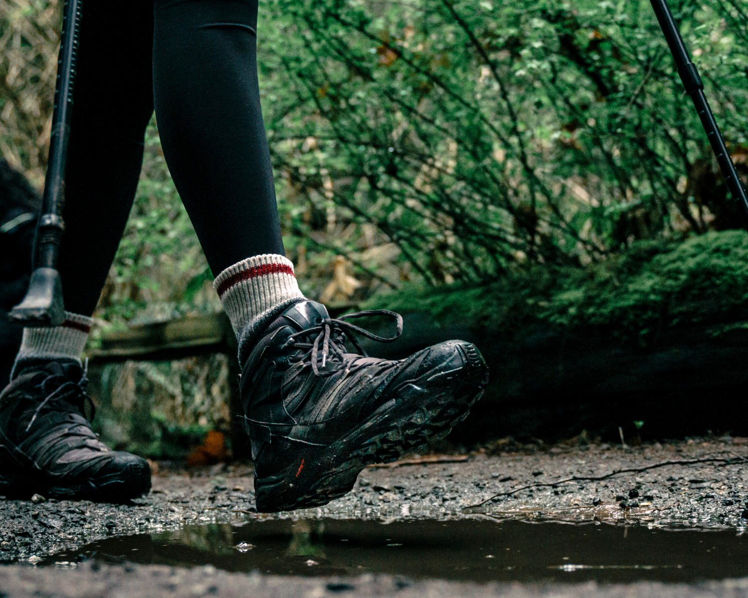
How to Choose the perfect pair of Trekking Shoes?
Sarthak Madan 21 May 2021
<p><span style="color: #000000;">Your choice of trekking shoes can make your trek a blissful or blister-full experience based on how well it fits you. A good pair of trekking shoes is the most essential piece of equipment you will use while hiking.&n
Campcraft Basics : How to Pack your Rucksack

10 Mountain features that must be a part of any trekker’s vocab!
Experiential.

BARAADSAR LAKE: THE RABBIT OUT OF A HAT: A PHOTO STORY
Informative.

HIGHLIGHTS OF BARAADSAR LAKE

Baraadsar lake: Who is this trek meant for?
Enter your email, certifications.

Events by Month
- January July
- February August
- March September
- April October
- May November
- June December
Events by Activity
- Popular Treks
- Aspirational Expeditions
Events by Grade
Events by duration.
- 5 & more Nights
Bikat Adventures
- Environment Policy
- Privacy Policy
- Terms & Conditions
- Work With Us
- Address: 303, 3rd Floor, Tower B4, Spaze Itech Park, Sector 49. Gurgaon
- Pre Sale - 8448680062 , Post Sale - 8588878499, 9667639126
- Cancellation & Refunds
- Content Sharing
We are Social
Payments we process, submit enquiry.
Indrahar Pass Trek
Indrahar pass.

Description
Reviews (0), things to take, available dates, include / exclude, awe- inspiring beauty of indrahar pass.
Indrahar Pass Trek a high Pass in the Himalayas of Himachal , located at a height of 14,245 meters above the sea level. It acts as a border amid Chamba and Kangra districts. The start and end point of this trek is Mcleodganj which lies on outskirts of Dharamshala.
The trail goes through fable destinations i.e. Triund, Ilaga Pass and Lahesh Caves.
Indrahar Pass attracts many travelers of different age groups because of its awe inspiring beauty.
Explore the Diversity with Striking Views
The four day Indrahar Pass trek takes you through sprawling meadows, gushing streams, deep gorges, serene lakes and forests of deodar.
Explore the cultural diversity of Himachal and the perfect nature. Witness the beautiful Lakes – Mankiani and Kareri.
The pass offers mind blowing views of Kangra valley, Pir Panjal, Kishtwar, Bara Banghal and Mani Mahesh.
Key Points of Indrahar Pass Trek
Level: Moderate to Difficult
Proper conditioning & training of body required
Need proper gear & clothing for sub-zero temperature?
Shoes are the single most important equipment.
High Altitude requires proper acclimatization.
Beautiful landscapes so carry good photo gear & Extra battery backup.
Travel light
The backpack should not exceed 10kgs.
Must Read about Indrahar Pass Trek
Duration: 4 Days (Mcleodganj to Mcleodganj)
Best Season: May, June, Sep and Oct
Highest Point: 14,245 feet
Weather: Nights are cold and day temperature is pleasant during the season.
Temperature: (- 5°C to 18°C)
Starting Point: Mcleodganj
Short Itinerary Indrahar Pass Trek
Day 1 – Mcleodganj (5865 feet) to Triund (9750 feet) (9 km)
Day 2 – Triund (9750 feet) to Laka Got (11,480 feet) (7 km)
Day 3 – Laka Got (11,480 feet) to Indrahar Pass (14,245 feet) and return to Laka Got (12 km)
Day 4 – Laka Got (11,480 feet) to Mcleodganj (5865 feet)
Day 1: Mcleodganj (5865 feet) to Triund (9750 feet) (9 km)
Meet the team at Mcleodganj Bus Stand and start the trek to Triund. Today’s trek will be amazing through mixed dense forest of Oaks, Deodar and Rhododendrons.
Triund is on the ridge top and offers exotic views of Dhauladhar ranges on one side and Kangra valley on the other. Setup your camps there in the peaceful environments and spend your night in the tranquil charm of Triund.
Day 2 : Triund (9750 feet) to Laka Got (11,480 feet) (7 km)
Wake up early to watch the sunrise view and changing colors of lofty Himalayan peaks. Have sumptuous breakfast at Triund and head towards Laka Got.
2 km ahead is a snowline cafe, from this point start climbing a ridge. Laka Got is located at snout of the glacier and it is your campsite for today. Setup your camps here and retire for the night.
Day 3 : Laka Got (11,480 feet) to Indrahar Pass (14,245 feet) via Ilaga Pass and return to Laka Got (12 km)
Start the day early, the trekking distance is long and the trail is challenging. The trail is very steep from Ilaga Pass to Indrahar Pass. The treeline recedes and the now the area turns to rocky with no vegetation.
Pass through Lahesh Caves and after a steep and tiring ascent reach Indrahar Pass (14,271 feet). Relish the spell binding views of high Himalayan ranges and mesmerizing wide valleys. Spend some time there and plan your descent to Laka Got.
Day 4 : Laka Got (11,480 feet) to Mcleodganj (5865 feet) (16 km) (5/6 hours)
Post breakfast leave for Mcleodganj via Triund. Halt there for some time, have lunch there and continue the trek. The terrain is rocky so walk carefully.
This distance is long but descending takes less time. Reach Mcleodganj; the start and end point of this trek.
Mandatory Documents
Please carry the documents given below.
Original and photocopy of government photo identity card- (Aadhar Card, Driving License, Voters ID, etc, Passport and Visa important to foreigners Medical Certificate (First part should be filled by the Doctor and Second part by the Trekker) Declaration Certificates
Note: – Many trekkers commit the same mistake of carrying unnecessary items on a trek which only makes the backpack heavy. It is important to know the right items to carry. It differs from season to season if you are trekking in summers then carry less layers of warm clothing and if you are trekking in winters carry enough layers to protect yourself against chilly cold.
Necessary Items for trekkers

Backpack (50 to 60 liters) A strongly built backpack with good support is compulsory for a trek. (Rain cover is important)
Sturdy Trekking Shoes The shoes should be strong enough with good support. The people ask if sports shoes would be comfortable but it is good to bring the right trekking shoes.
The Clothes You Should Bring On a Trek Avoid keeping extra clothes because it only makes you backpack heavy.
Trek Pants – The jeans are never suitable for a trek so you need at least 2-3 trek pants for treks carry more for longer treks.
Jacket – Jackets are very important to carry on a trek it protects you against the chilly weather. So carry 2 jackets on a week long trek.
Layers of warm Clothing Carry warm woolen layers or fleece. Carry more layers during winter season (at least 2 to 3) and less during summer.
Thermals – The Temperature decreases at night so you might be need thermals for Night.
T- Shirts – Bring those t shirts which dry fast.
Poncho –They are needed if you are trekking on a Rainy day to keep you dry.
Hiking Pole
Water Bottle 2
Cap or Balaclava
Woolen and Waterproof Gloves
Socks (Woolen and Regular)
Torch head light
Personal Toiletry Items – (toothpaste, toothbrush, toilet paper, sanitizer etc.)
Carry Personal Medical Kit
Personal Medical Kit (Carry minimum 5 tablets and maximum 10)

Diamox – (Prevents altitude sickness)
Digene – (It cures discomfort in stomach, acidity)
Crocin Advance – (Cures fever and headache)
Aspirin/Combiflam – (Pain reliever)
Disprin – (Cures headache)
Avomine – (Prevents motion sickness)
Avil – (It treat allergies)
Norflox TZ & Lomofen – (Prevents Diarrhoea)
Ranitidine – (Reduces the amount of acid in stomach)
Volini/Moov spray – (For sprains)
Betadine/Savlon – (Antiseptic cream)
Stretchable/Elastic bandage
Note:- Use medicines only when prescribed by the doctor. In case you face any problem during your trek, discuss and take advice from the Professional guide.
Sorry! Here are no Available dates right now. For Any Queries you can Email us with [email protected] and Call Us +91 9756197558
What is Included In This Trek?
Transport Facility Mcleodganj To Mcleodganj
Forest Permit and entrance fee
Accommodation in tents on twin share basis
All meals: breakfast, packed lunch, tea, coffee, snacks, soup and dinner
(All camping gears)
High quality tents
Sleeping bags
Separate Toilet tents – Ladies and Gents
Dining Tent
Dining Table
Kitchen team
Radio Walkie Talkie for Communication
Good Experience Trek Leader guide and Technical guide
Medical Kit
Oxygen Cylinders
Crampons and Gaiters
What is Not Include In This Trek?
Personal Insurance
Medical Certificate
Personal toiletry Items and Personal Medicine kit
On first day En Route to base camp the Breakfast and Lunch are Not Included
Last Day En Route Lunch and Dinner are Not Included
There are no reviews yet.
Your email address will not be published. Required fields are marked *
Name *
Email *
Save my name, email, and website in this browser for the next time I comment.
Related Tours

Fachu Kandi Pass Trek
Fachu Kandi Pass – An Unknown Pass ahead Sarutal

Hemkund Sahib Trek
The Hemkund Sahib Trek is a famous pilgrimage route in the Indian state of Uttarakhand.

Tapovan Trek
Tapovan Trek – Journey to the Base camp of Mt. Shivling
Send a quick enquiry
- Overview Itinerary Dates Include/Exclude

INDRAHAR PASS TREK

- Level : Moderate
- Altitude (Meters) : 4350
- Location : McLeod Ganj
Embark on the captivating Indrahar Pass Trek, a moderate-to-difficult adventure through the majestic Dhauladhar range in Himachal Pradesh. Conquer an altitude of 4,342 meters (14,245 ft) and witness breathtaking landscapes, from the lush Kangra Valley to the snow-capped Pir Panjal Range.
Trek Highlights
- Challenge Yourself: Experience a demanding yet rewarding trek suitable for both beginners and experienced trekkers with good fitness.
- Panoramic Vistas: Witness breathtaking southern views of the Indian plains and the northern spectacle of Mani Mahesh Kailash and the Pir Panjal Range.
- Cultural Experience: Hike along ancient trails used by Gaddi shepherds for centuries, connecting with the region’s rich heritage.
- Unforgettable Sights: Explore the charming town of Mcleodganj, the famous Triund meadow, the mysterious Lahesh Caves, and the scenic Ilaqa Pass.
- Day 1: McLeodganj (5,865 ft) to Triund (9,750 ft) – Ascend through forests to the scenic Triund meadow with Himalayan views.
- Day 2: Triund to Laka Got (11,480 ft) – Hike through alpine landscapes to your high-altitude campsite.
- Day 3: Laka Got to Indrahar Pass (14,271 ft) and back – Conquer Indrahar Pass, enjoy panoramic views of Pir Panjal Range & the plains.
- Day 4: Laka Got to McLeodganj (5,865 ft) – Descend through valleys and forests, concluding your Himalayan trek.
- Begin your Himalayan adventure with a scenic 9-hike from McLeodganj through oak, rhododendron, and deodar forests.
- Ascend a mix of steep and gradual trails, with the final leg being particularly challenging.
- Reach Triund meadow, offering breathtaking views of the Dhauladhar range and Kangra Valley.
- Camp overnight amidst stunning mountain scenery.
- Wake to a magnificent Dhauladhar sunrise at Triund—a photographer’s dream!
- Hike 3-4 hours to Laka Got, passing Snowline Cafe and traversing a scenic ridge.
- Amid early summer snow or verdant monsoon meadows, set up camp at a glacier’s snout.
- Rest and prepare for the challenging climb to Indrahar Pass the next day.
- Start early for a demanding 6-hour ascent to the mighty Indrahar Pass.
- Conquer steep, rocky terrain with the help of your experienced guide.
- Experience the thrill of reaching the pass and savor panoramic views of high ranges and valleys.
- Begin your descent with care, returning to the Laka Got campsite for the night.
- Embark on your descent, stopping at Triund for lunch and to retrace the beautiful scenery.
- Exercise caution on the rocky downhill trail and maintain a steady pace.
- Arrive in McLeodganj and choose between exploring its charms or boarding a direct bus to Delhi.
- Nourishing Meals: Enjoy delicious meals, prepared according to a planned menu to fuel your Himalayan adventure.
- Essential Permits and Fees: We’ll handle all necessary forest permits and camping charges (applicable to Indian nationals), ensuring a smooth trekking experience.
- Comfortable Camping: Rest well with provided tents, sleeping bags, and mats, designed for the demands of a Himalayan trek.
- Safety First: Trek with confidence, knowing you have access to technical and safety equipment for secure navigation.
- Experienced Support Team: Benefit from the expertise of a certified trek leader, skilled cook, helpful porters, and mules for transporting essential gear.
- Travel & Off-Trek Meals: Please budget for meals during road journeys and any hotel stays before or after the trek.
- Personal Expenses: Any miscellaneous expenses of a personal nature (e.g., souvenirs, extra snacks, beverages) are not covered in the trek cost.
- Unexpected Costs: Be prepared for any unforeseen expenses not specifically outlined in the inclusions list.
- Trek Insurance: We strongly recommend obtaining comprehensive travel and trek insurance for your Himalayan adventure.
- Personal Bag Portage: You’ll be responsible for carrying your own backpack during the trek. Porters are provided for common group equipment.
- Waterproof, snow-proof trekking boots: Your primary footwear needs to handle all the terrain and potential snow on this trek.
- Sneakers or Camp Shoes: For comfort at the campsite.
- Warm Socks: Thick woolen socks for hiking, plus regular socks.
- Main Backpack (50 ltr): To carry the majority of your belongings.
- Daypack (20–30 ltr): For water, snacks, extra layers, and essentials during hikes.
- Duffel Bag: Optional, for extra items transported by porters.
Clothing: Layering is Key!
- Waterproof Jacket & Pants: Breathable, essential for rain or snow.
- Insulated Jacket: A down or synthetic jacket for warmth.
- Trekking Pants: Water-resistant, ideally with a warm inner lining.
- Thermal Layers: Base layers (top and bottom) for cold days.
- T-shirts/Fleece: For variable weather.
Head & Hand Protection
- Warm Hat & Gloves: Wool/fleece hat, plus waterproof outer gloves.
- Sunglasses: UV protection and glare reduction for snow.
- Sun Hat & Bandana: For sun protection.
Trekking & Camp Essentials
- Trekking Poles: For stability and support.
- Headlamp: With extra batteries.
- Water Bottle/Hydration Pack
- Sunscreen & Lip Balm
- Basic First-Aid Kit & Personal Medications
Departure Date
Call- +91 8198838368| 7696131323
Cancellation Policy
Cancellation due to Natural Disasters or Unforeseen Circumstances:
Suppose a trek is cancelled at the last minute due to a natural disaster or unforeseeable circumstances (such as floods, earthquakes, landslides, attacks, or bandh). In that case, Trekking Cougars will issue a Trek voucher for the full amount. The voucher can be used for the same or a different trek over the next year.
Client Cancellations:
- Cancellations made within 30 days of the trek’s start date will receive a full refund.
- Cancellations made between 30 and 20 days before the trek will receive a 50% refund.
- There will be no refund for cancellations made less than 20 days before the trek begins.
Please note that all refunds are subject to a 4% cancellation charge to cover processing fees. Additionally, trek insurance is non-refundable.
Trekking Cougars Responsibilities:
Trekking Cougars assumes no responsibility for any damage or injury to your clothing, equipment, or other belongings while on the trek. The trek fee covers all expenses associated with the trek, from start to finish, as outlined in the specific trek itinerary.
Get in Touch
Indrahar Pass Trek
- Duration : 3 Nights 4 Days
- Elevation : 4,342 m
- Group Size : Min 4
- Difficulty : Moderate to Difficult
Indrahar Pass Trek, Mcleodganj
About indrahar pass :.
Indrahar Pass is like a secret doorway in the big, beautiful Dhauladhar mountains of the Himalayas. It sits way up high at 4350 meters above sea level, near the cool town of Dharamshala in Himachal Pradesh. This pass is like a line drawn between Kangra and Chamba districts, stretching from 2874 meters to 4350 meters high.
The adventure begins in the cozy town of Mcleodganj, just outside Dharamshala, and takes you all the way up to Indrahar Pass. Along the way, you’ll pass by famous spots like Triund, Laka Glacier, and Lahesh Caves. But be warned, the path is not easy to walk on those Dhauladhar ridges!
The trek to Indrahar Pass is no walk in the park, even though it follows a trail that the Gaddi shepherds use to get to their summer pastures in the upper Ravi Valley and Lahaul. Climbing up to Indrahar Pass means a lot of uphill walking, sometimes over rocky terrain. From the top, you can see amazing views of the Indian plains to the south, and the sacred Mani Mahesh Kailash peak and snowy Pir Panjal Range to the north. It’s like standing on top of the world!
HIGHLIGHTS:
- Bask at the magnificent sight of the Dhauladhar ranges from a height of 14,245 ft.
- Capture some fascinating pictures of the rustic Lahesh Caves on your way to Indrahar Pass.
- Rest aside the panoramic views of Dhauladhar and other Himalayan peaks on this astounding Indrahar Pass trek.
- Famous peaks Arthur’s seat (4525m) Moon Peak (4666m) etc can be glimpsed.
- Witness the fascinating Himalayan peaks that are the add-ons of this astounding Indrahar Pass trek.
- Undertake the fascinating Indrahar Pass Trek with an experienced and friendly guide.
- Best time to visit April to November. The temperature varies from 12-18 degrees Celsius. At night the temperature rises to minus -2 to -6 degrees Celsius.
Short Itinerary: Day 1: Mcleodganj to Leta Manu Adventures Camp. via Upper Bhagsunag village. 2-3 hours walk. (Mix of easy and uphill walk. Day 2: Leta Village to Laka Glacier via Triund. 4-5 hours walk (Mostly uphill till Snowline and then 1 hour easy walk to Laka Glacier). Day 3: Laka Glacier to Indrahar pass via Lahesh caves. 5-6 hours walk. (Difficult to steep climb). Day 4: Laka Glacier to Mcleodganj via Triund. 4-5 hours walk (Moderate to downhill walk).
Day Basis Itinerary:-
Day 1: mcleodganj to leta manu adventures camp: (2-3 hours trek). after breakfast at our own we meet up at the start point which is manu adventures india bhagsunag. from here we start our trek to leta village. we cross the upper bhagsu village to reach the famous waterfall. it takes roughly 20 to 25 minutes to reach the waterfall where we stop to click some pics and one can also enjoy some hot meals like eggs and bread or hot spicy maggie with cup of tea at the chill out shiva cafe. then we cross the waterfall and start our steep climb for leta campsite. the guide will keep you entertained by telling stories about the place to ensure that you enjoy the walk and not get bored. the beautiful natural trail will keep you on your toes and walking on these trails will hold your interest throughout the tour. on reaching the campsite you can leave your bags off and feel more relaxed and trek further to get panoramic views of shivalik hills and plains of kangra valley. one can also visit the small temple nearby dedicated to mata leta walli, which is one of the most famous temple around. later enjoy dinner near the bonfire with some soothing music. spend time under the star studded night while enjoying the warmth of bonfire. overnight stay at camps. day 2: leta manu adventures camp to triund to laka glacier ( 4-5 hours trek): after early breakfast at campsite we trek from leta to laka glacier (3200 meters) via triund. we stop here to enjoy our packed lunch. we pass through snowline café approx 1.5 hour from triund and laka glacier at another two hour. we reach the campsite and are free to explore around the area. overnight stay in the camps with dinner. day 3: laka glacier to inderhar pass trek via lahesh caves to laka glacier (4350 mts.) we start very early today like 04 or 05 am in the morning. we try to reach the summit before the sun reaches the top .it is steep climb on a rocky route. this will be the hardest and the longest day of the trek depending on the weather. so be mentally prepared for the same. there is no vegetation here and the terrain is mostly rocky. the trail leading towards lahesh caves is bit confusing but with the help of mountain guide you will be able to do it.. we get magnificent views from the indrahar pass top (4350 meters). after brief stay at top we climb down and trek back to laka glacier or leta campsite depending on the time we have on our hands. overnight stay in the camps with dinner. day 4: laka glacier to mcleod ganj (4-5 hours trek) the sunrise is perhaps the main highlight of this trek so we get up early to view the most amazing sunrise withsome golden lights hitting the mountain ranges. enjoy the hot breakfast click some nice pictures and then trek to mcleodganj by early noon and you have rest of the day to explore the city. end of services. included.
- Meals while on trek (Veg.)
- Oxygen cylinder, first aid medical kits and stretcher
- Professional Trek Leader (Mountaineering qualified), Guide, and Support staff.
- Complete Trekking arrangements with English speaking guide.
- Trekking permit, camping & wildlife fees & Current government taxes.
- Any hotel in Dharamsala
- Transportation
- Air Fare, Train ticket & Travel insurance.
- Tips to trekking staff.
- Any personal equipment for trek.
- Expenses due to bad weather, Land Slide, Road block and any other natural reason beyond our control.
₹5200 / person *
Inquire / book.
- We assure the privacy of your contact data.
- This data will only be used by our team to contact you and no other purposes.
Got a Question?
Our destination expert will be happy to help you resolve your queries for this tour..
- +91-9736871426
10:30 AM – 8:00 PM (Mon to Sat)
Email:- [email protected]
Indrahar Pass Trek Quick Facts:
- Height: 4342 m/14,245 ft
- Distance: 35 Km
- Day: 12°C – 18°C
- Night: -6°C to 4 °C
- Electricity: Electricity is not available at the campsite
- Nearest ATM: ATM is available at Mcleodganj
Available Group Departures:
- Weekend Departure
Note: Customization available
How to reach Dharamshala/Mcleodganj?
Gaggal Airport or Kangra Airport at Dharamshala is about 20 km away from McLeod Ganj and is well connected to Delhi, Kullu, and Chandigarh. A number of state-owned and private buses connect McLeod Ganj with other cities like Delhi, Chandigarh, and Dharamshala. Pathankot Railway Station, situated approximately 90 km away, is the closest broad gauge railhead serving those headed to McLeod Ganj.
Things To Carry for Indrahar Pass Trek
- Good Sleeping bag
- Trekking Boots
- Trekking poles (Optional)
- Shirts / T-shirts
- Trousers / Track Pants
- Windproof jacket (preferably Gore-Tex)
- Fleece / Full-sleeve
- Woollen sweater
- Thermal inner wear(upper & lower)
- Mittens (Woollen gloves)
- Woollen socks (extra pairs to be carried)
- Raincoat / Poncho
- Water bottle
- Sunscreen Lotion
- Torch / Flashlight (with extra batteries)
- Medicines, if requiring any specific medication
- Cameras (with extra memory and batteries)
- Personal toiletries Books, if you like reading
Indrahar Pass Trek FAQs
1. what is indrahar pass, 2. how high is indrahar pass, 3. what is the best time to visit indrahar pass, 4. how difficult is the trek to indrahar pass, 5. how long does it take to complete the trek to indrahar pass, 6. are there any permits required to trek to indrahar pass, 7. what are the accommodation options available near indrahar pass, 8. is it safe to trek to indrahar pass, 9. what are some highlights of trekking to indrahar pass, awesome capture, mcleodganj top attractions.

Laka Glacier Trek

Triund Trek

Triund Day Trek

SnowLine Trek Dharamshala

Lovely Kashmir Vacation with Gulmarg

St. John In The Wilderness
Why choose us, experience the excitement of exploring a new world with us.
Since 2005, Manu Adventures India has been dedicated to providing unforgettable outdoor experiences for over 500,000 individuals of all ages. Whether it be a day trip or a two-week vacation in the majestic Himalayas, we strive to create lasting memories for our clients.
As a reputable travel company based in Dharamsala, we take pride in our professional ownership and well-managed team of young experts. Specializing in trekking, adventure activities, holiday tours, jeep safaris, and paragliding in the picturesque hills of North India, we are committed to delivering top-notch services to our valued customers.
The Thrilling Journey: Exploring the Unknown
Manu Adventures India is a renowned provider of a wide range of adventure activities, including trekking, hiking, river rafting, and paragliding. Our services are designed to cater to the thrill-seekers and nature enthusiasts who seek unforgettable experiences in the great outdoors.
The Art of Having Fun Responsibly and Safely
At our company, safety is our top priority on all of our Trekking tours. We are dedicated to ensuring the well-being of our clients at all times. Our team has extensive experience in conducting rescue operations, further demonstrating our commitment to safety.
Going Above and Beyond: The Power of Friendly Customer Service
We provide highly professional and friendly travel and adventure services, boasting a successful track record of over 15 years of operation in North India.
What They Say
Testimonial.
Frequently Ask Questions
The average travel advice for North India is full of clichés such as “expect the unexpected.” So start with some Google research before visiting any place. It will make your travel easy and comfortable. Be more practical and keep your patience. Always travel with a guide for safety purposes. Ask us questions thru email or call us anytime.
Firstly we would suggest to visit “Manu Adventures India” page on our webiste and look for North India tours. Decide the tours or places you would like to visit and call us we will customize it for you. You can also book online or use the online form also and send us the enquiry for the same.
To get the most of your travel book your holidays around festival season in North India. You will love the experience. You can always call us for more details or check information on festivals in India on Google.
Most of the cities in North India have airports and are also well connected thru roads and railways. You can decide what suits you best and we can book it for you. You can also call us for more information.
You will be met by our local representative on arrival. They would be carrying placard with your name written on it. You would also be provided the name and mobile number of the representative.
For International travelers we require the complete passport details, flight details, phone number and hotel details at the time of booking.
North India is quite safe to travel one just needs to be alert when travelling around. However for female traveler we recommend not to travel alone in the evening for safety reasons. Incase in emergency you can always dial 100 for police and 102 for ambulance.
All major currencies are accepted in North India.
We accept bank transfer, online, google pay, scanner or cash for booking.
One can visit North India at any point of the year and explore the unexplored places.
Our Partners

Memberships

Quick Links
Sign up our newsletter to get update information, promotion and insight., campsite location.
- Leta Village, near Bhagsu nag Dharamshala, Himachal Pradesh 176219
- [email protected]
- Bhagsu Nag, Dharamshala, Himachal Pradesh 176219
We are Social
Our websites.
Manu Adventures India is a well known travel company in Dharamsala. Since 2005, we’ve helped more than 900,000 people of all ages enjoy the best outdoor experience of their lives. Whether it’s for one day or a two-week vacation, in the Himalayas.
manuadventures.in
Manuadventuresindia.com.
dharamsalatreks.com
.png?w=auto&h=400 "indrahar pass trek distance")
Indrahar Pass Trek
Indrahar pass trek overview.
Indrahar Pass trek is a captivating experience of climbing to the heart of an endlessly gorgeous range situated between Himachal Pradesh and Uttarakhand. It is an incision in the skyline on the high ridge that strikes to the west from the Moon peak. The different altitudes on the trekking trails of the Indrahar Pass give you an opportunity to witness the sweeping views of different forests.
Situated at a towering height of 14245 feet, Indrahar Pass is a perfect combination of traditional and diverse colors of Himachal Pradesh. Through this trek, you can experience a few of the tribal groups of the region. Although it is a short trek from McLeodGanj, it is considered to be the most difficult trekking trail that includes multiple sharp ascents and steep climbs. On account of the gorgeous views of the terrain, the luscious green valleys and the tropical flora and fauna will leave you astonished with its immaculate beauty. Moving further on your trek, you will come across the tranquil crystal blue waters of Lake Kareri and Lake Mankiani.
On the climax of your Indrahar trek, the trekkers will hike through the lush green landscapes of Dhauladhar Range and other beautiful mountain ranges. This trekking destination will definitely blow your mind while providing an amazing experience of trekking.
Book Indrahar Pass Trek Package
Indrahar pass trek, mcleodganj, highlights of indrahar pass trek.

Maximum altitude: 14245 feet
Grade: Moderate to Difficult
Duration: 4 days
Trekking distance: 35 kilometers
Trail type: A round trail through caves
Rail head: The nearest rail head to the base camp is Dharamshala.
Airport: Kangra Airport, Himachal Pradesh
Snow Season: January to March
Service from: McLeod Ganj to McLeod Ganj (including transportation)
Base camp: McLeod Ganj
Best season: May, June, September, and October
Region: Himachal Pradesh
Who can participate: - The trekker should be at least 15 years of age.- Serious trekkers who are fond of experiencing cold temperatures.- People with enough stamina to cover a distance of at least five kilometers in just 30 minutes.- Should have a backpack holding capacity of 12 to 16 kilograms.- Has an experience in at least one high-altitude trek of 3500 meters.
Short Itinerary for Indrahar Pass Trek
Day 1 - The first day of the Indrahar Pass trek will start from McLeodGanj to Triund and end in the Mana Village.
Day 2 - You will trek from the Mana Village to Ilaqa Got while passing through Lahesh Caves.
Day 3 - This will be your exciting day of the trek as you will climb to Indrahar Pass from the caves. After spending some time in the Indrahar Pass, you will return to the Ilaqa Got.
Day 4 - It is the last day of your trek when you will trek back to McLeodGanj from Ilaqa Got.
Indrahar Pass Trek Detailed Itinerary

Trek from McLeodGanj to Triund
The Indrahar Pass trek will commence through one of the highly renowned trekking routes in Himachal Pradesh.
The first day of your trek will start at 9 am from McLeod Ganj.
You will have to continue walking to Triund for at least five to six hours.
After reaching the top of Triund, you can spend some time with your fellow travelers, click pictures, and then travel to Mana Village.
The first day of the trek will end with an overnight sleep in the Mana Village.

Trek from Mana to Ilaqa Got
The second day of the Indrahar Pass trek is very interesting as you will start your trek from Mana Village to Ilaqa Got.
The initial phase of the trek will allow you to move through the attractive Lahesh Caves which are situated at an altitude of 3500 meters above sea level.
You must move through this cave during the earliest part of your trekking experience as the weather may become a little risky and challenging in the terrains by the afternoon.
Moving further, you will cross the Snowline Cafe. You can spend a few minutes in this cafe and then proceed further.
After walking for another one hour, you will reach your final destination for the day, Ilaqa Got. It is going to be your camping ground for the day.
If you find it difficult to camp around the Ilaqa Got, you will be taken back to the caves.
Enjoy your overnight sleep at the camp in Ilaqa Got.

Trek from Lahesh Caves to Indrahar Pass, Return to Ilaqa Got
The third day of your trek is the most thrilling part as you will be climbing to Indrahar Pass today.
Wake up early in the morning and have a sumptuous breakfast with your fellow trekkers.
Start climbing through the rocky terrains of the Lahesh Caves to the mesmerizing Indrahar Pass at 4300 meters.
After reaching the top of Indrahar Pass, you can sight and relish the sweeping views of the Dhauladhar Range and other gorgeous Himalayan ranges.
Capture the beautiful moments of the Indrahar Pass and start descending to Ilaqa Got for an overnight stay.

Trek from Ilaqa Got to McLeod Ganj
Day 4 is officially your last day of the Indrahar Pass trek.
On this day, you will come back along the trails that you have trekked on the first and second day.
Walk for around four hours to return back to McLeod Ganj.
Your trek to Indrahar Pass will come to an end after your arrival in McLeod Ganj.
What to Pack for Indrahar Pass Trek?

- 40 to 60 liters backpack with sturdy straps and supporting frame and a rain cover
- 20 liters daypack and a rain cover
- 2 thermos flask water bottles of one liter each
- A walking stick
- Medical kit after consultation from the doctor
- Snacks, like energy bars, dry fruits, electoral / ORS, and much more.
- 3 pairs of cotton trek pants (avoid shorts, denim jeans, or 3 quarters)
- 3 pairs of collared T-shirts
- 2 pairs of full-sleeved woolens
- 1 hollow full sleeves waterproof jacket or down jacket
- 1 pair of lightweight thermal inners (both upper and lower)
- A pair of old trekking shoes
- 2 pairs of cotton socks
- 2 pairs of woolen socks
Accessories:
- A lightweight raincoat or poncho
- Balaclava (optional)
- Synthetic waterproof hand gloves
- 1 pair of warm waterproof and windproof gloves
- Dark and UV-protected sunglasses with side cover (People who wear spectacles can use contact lenses)
Personal Utilities:
- Sunscreen cream with SPF 40+
- Moisturizer
- Hand sanitizer
- Quick dry towel
- Chapstick or Lip balm
- Toilet paper
- Toothpaste and toothbrush
- Repair kit with thread and needle
- Headlamp or LED torch
- Camera with all its accessories, like chargers, spare batteries, and much more.
- Cutlery for hygiene purposes
- 2 water bottles of one liter each or 1 water bottle of one liter and a hydration pack
- Plastic covers
- Personal Medical Kit:
- 4 tablets of Avil 25mg for allergies
- 4 tablets of Avomine for motion sickness
- 10 strips of band aid
- Betadine or any antiseptic cream
- 1 small roll of cotton
- 3 to 5 meters of crepe bandage
- 6 tablets of Crocin for fever
- 4 tablets of Combiflam for pain
- 10 tablets of Diamox for acute motion sickness
- 6 tablets of Disprin for headache
- 10 tablets of Digene for undigested food or acidity
- 6 tablets each of Norflox TZ and Lomofen for diarrhea
- 10 tablets of Omez or Rentadine for diarrhea
- 1 small roll of gauze
- 10 packets of ORS
- Moov sprays for aches and sprains
- Original and 2 photocopies of government photo identity card
- Medical certificate and disclaimed to be filled by trekker
- Medical certificate by a professional doctor
Know Before You Go to Indrahar Pass Trek

It is necessary for the trekkers to keep all the dos and don’ts in mind when going on a trekking expedition. These important tips will not only help fellow trekkers to stay connected but also prevent them in case of any emergency situation. Following are some of the essential tips that you should keep in consideration during the Indrahar Pass trek:
Wear comfortable shoes for trekking and avoid sports shoes as they can cause shoe bites and blisters on the trekking slope.
It is mandatory to carry a 4-step telescopic antishock trekking pole or inform the authorities if you forget to carry one.
Carry synthetic quick dry pants as they are lightweight and you can layer on other clothing when it gets too cold.
Keep a waterproof rain cover in your backpack in case of a rainy day.
Carry some snacks and tents with you on your trekking expedition as you will not get any place to eat and stay after the Snowline.
Bring your power banks and other battery backups for convenient traveling.
Do not go on the Indrahar Pass trek if you are a beginner as the weather may become a little risky and challenging on the terrains.
Avoid filling your backpack with unnecessary things and carry only the essentials.
Have proper gear and equipment for sub-zero temperatures.

By Air- The closest airport to your starting point of the Indrahar Pass trek is Kangra Airport, also known as Gaggal Airport. You can take a flight from any part of the country to this airport in McLeod Ganj to go on this amazing experience. If you are traveling from beyond the boundaries of the country, you can take a flight to Delhi or Chandigarh and then to McLeodGanj for the Indrahar Pass trekking experience.
By Rail- Although it is time-consuming, railways are another best option to travel to McLeod Ganj. You can take a train either to Pathankot railway station or AmbAndaura railway station. There are plenty of direct trains that operate between Delhi and Pathankot.
By Road- McLeodGanj is very well connected to all the fundamental parts of the country, such as Delhi, Chandigarh, Dehradun, Srinagar, and Manali. You can board an overnight Volvo AC bus or hire a taxi or cab from Delhi to McLeod Ganj. Though it is a time consuming mode of transportation, you can catch gorgeous panoramic mountain views of the surroundings along your way to McLeod Ganj.

In Autumn - The best time to go on a trek to Indrahar Pass is between the months of September and October, just prior to the onset of the winter season. During this time, the temperature ranges between 12 to 18 degrees Celsius and the weather remains pleasant with relatively less rainfall. Although it will be a little cold during the night, the days feel comparatively comfortable. It is advisable not to go on this trekking experience during the monsoon season as the place gets a huge amount of rainfall that causes landslides. During monsoons, the trekking trail gets slippery and makes the overall trekking experience even more difficult.
In Summers - Summers is another best time to visit Indrahar Pass, i.e., between April and May. In summers, the weather is neither too hot nor too cold and the gorgeous scenery looks fantastic under the shining sun and clear sky.
Why Go for Indrahar Pass Trek?
You should go on the trek to Indrahar Pass to catch some breathtaking views of the Dhauladhar Range and other Himalayan ranges. The sight of famous peaks like Moon Peak will leave you awestruck with their immaculate beauty. On your way to the Indrahar Pass, you will come across Lahesh Cave, which is a natural rock shelter that allows trekkers to enjoy the natural camping experience. Staying at the camping sites on the trek will also let you experience the surreal feeling of living in the mountains. Hence, professional trekkers should go on this trekking experience to gaze at another beautiful creation of nature.
You May Also Book

FAQ's of Indrahar Pass Trek
How difficult is the indrahra pass trek.
Although the trek to Indrahar Pass is short, it is considered to be the most difficult trek as it includes innumerable sharp ascents and steep climbs. During your climb through the Lahesh caves, you should try to start it as early as possible because the trekking trail on this route gets more risky and challenging by the afternoon. Each of these conditions makes the trekking experience difficult. Thus, only serious and professional trekkers are allowed to go on this route.
Moreover, you should have enough stamina to cover at least four kilometers in just 30 minutes. You can also check your body mass index (BMI) to find if your fitness level matches the difficulty of the trek. If your BMI is within the normal range, you can follow a proper physical fitness regime before going on the trek. On the other hand, if your BMI is not within the normal range, you can consult a medical practitioner before adopting any fitness regime.
Is the Indrahar Pass trek suitable for me?
The Indrahar Pass trek is suitable only for experienced trekkers as it can be vigorous for first-time travelers. Professional trekkers should also follow a good physical routine to keep themselves fit and have enough stamina to cover at least four kilometers in just 30 minutes.
How is the weather in Indrahar Pass?
Indrahar Pass is entirely covered in snow during the winter season. The snow starts melting around the month of August, but the weather becomes better after the monsoon season.
How to prepare yourself for the Indrahar Pass trek?
If you are trekking to Indrahar Pass, fitness and flexibility should always be your top priority. You should have enough stamina to walk for long hours with a lofty backpack on your shoulders. The oxygen level also starts decreasing with an increase in altitude. Hence, you must ensure that you can cover at least four kilometers in just 30 minutes. It will help you identify whether your lungs are functioning properly. You can practice stretching to enhance your posture and flexibility and train your muscles well for extreme conditions.
Can I go to the Indrahar Pass trek without a guide?
Yes, you can go on the Indrahar Pass trek without a guide. However, it is advisable to go with them as they will help you with food, shelter, and several other things in your trekking expedition. They are aware of every condition during the trek and can assist you well on your route to Indrahar Pass.
How is the cellular network connectivity on the Indrahar Pass trek?
The cellular network connectivity is not too good on the Indrahar Pass trek. You can expect some connectivity until Triund beyond McLeod Ganj. There is no network after Triund. Hence, it is advisable to complete all your important calls before going on the trek.
Are there any washroom or toilet facilities on the Indrahar Pass trek?
Yes, you will be provided with toilet tents on your trek to Indrahar Pass. So, you can answer nature’s calls on the trek. However, you will not find any bathing facility on your trekking expedition.
Is there any option to offload my backpack?
If you want to offload your backpack during the trek, it is advisable to request the authorities for offloading a few days before the actual date of trekking through an email so we can make the arrangements in advance. On the contrary, if you want to offload your backpack on the spot, you are required to pay a little more than the usual price. However, it is not safe to offload your backpack as it may be damaging to the ecosystem.
What kind of tents and sleeping bags will be provided to us on the trek?
You will be given 4 season tents by Gipfel for higher altitudes as they can easily withstand heavy storms and snowfall. These tents are highly spacious to accommodate three people with their backpacks in the vestibule. The sleeping bags are made up of Heatseeker Pro synthetic insulation that is very comfortable even in -10 degrees Celsius. You can also use fleece liners for enhanced thermal efficiency at temperatures about -17 degrees Celsius.
Treks in Himachal
Treks in uttarakhand, weekend treks in india, treks in ladakh & kashmir, treks in nepal, treks in sikkim.
The content and images used on this site are copyright protected and copyrights vests with the respective owners.
© 2024 www.heyhimalayas.com All rights reserved.

- Indrahar Pass Trek
- Himachal Tourism
About Indrahar Pass Trek
Indrahar Pass Trek is situated at a height of 4425 m above sea level near Dharamshala in the border between Kangra and Chamba districts in Himachal Pradesh. Indrahar Pass trek offers you exquisite landscapes, gorges, streams, lagoons, and dense forest. Indrahar Pass Trek inHimachal Pradesh is one of the most amazing treks in the Indian Himalayan ranges
Indrahar Pass trek started from McLeodganj and the trekking distance is 35 km. It is a popular trekking destination in Himachal because it is located close to Dharamshala. This beautiful trek will blow your mind and offers you an amazing experience of trekking.
- How to Reach
More about Indrahar Pass Trek
Indrahar Pass trek is one of the easy to moderate treks in Himachal Pradesh which is started from McLeodganj, which is the seat of Dalai Lama. Indrahar pass is a perfect blend of diverse and traditional colors of Himachal Pradesh.
Indrahar pass's varying altitudes of these trekking trails allow you to see the panoramic view of several forests. Indrahar Pass trek also lets you experience a few of the tribal groups of Himachal Pradesh. It is also considered to be a most difficult trekking trail consists of numerous sharp ascents and steep climbs. The path passes by the placid crystal blue waters of Lake Mankiani and Kareri.
The nearest airport to reach Indrahar Pass trek is Kangra Airport at Dharamshala and the nearest railway station is Amb Andaura Railway Station. You have to reach Macleodganj first because the Indrahar Pass trek starts from MacLeodganj.
Best time to visit Indrahar Pass Trek
September and October are the best months to do the Indrahar Pass trek in Himachal Pradesh. The weather is so pleasant with less snowfall in these months. We suggest you not do Indrahar Pass trek in the monsoon season because this place gets a high amount of rainfall which occurs landslides and the trekking route get slippery in monsoon which makes trekking more difficult and full of risks.
Short Itinerary for Indrahar Pass Trek
Day 1:- MacLeodganj to Triund
Arrive at McLeodganj, start your trek to Triund. Triund trek is an easy trek. After reaching Triund, check-in at the camps and rest for a while. Enjoy the view and the beauty of the surrounding. Dinner and overnight stay at the camp in Triund.
Day 2:- Triund to Laka Got
After breakfast, start your trek to Laka Glacier. It is a small glacier. After reaching Laka Got, enjoy some of the snow activities around the campsite, enjoy your hot meal. Dinner and overnight stay at Laka Got.
Day 3:- Laka Got to Indrahar Pass Back to Laka Got
Wake up early in the morning and have your breakfast. Start your trek to Indrahar Pass from Laka got early in the morning. After reaching Indrahar Pass, enjoy the majestic beauty of the place and trek back to Laka Got. Dinner and overnight stay at Laka Got.
Day 4:- Laka Got to McLeodganj
After breakfast, trek back to MacLeodganj. This is the last day of the trip. Our services will be finished at McLeodganj.
- Indrahar Pass Trek Travel Guide
- Indrahar Pass Trek Weather
- How to Reach Indrahar Pass Trek
- Indrahar Pass Trek Photos
What is Indrahar Pass Trek famous for?
Indrahar Pass Trek is famous among tourist as Trekking, High Altitude Trek, Camping.
Indrahar Pass Trek is recommended destination for Corporates, Couples, Foreigners, Groups.
Indrahar Pass Trek is popular destination for following activities/ interests - Trekking .
Indrahar Pass Trek Travel Update
Char Dham yatra will start from 10 May 2024, Bookings Now Open! Check Char Dham Tour Packages - Hotels in Badrinath - Char Dham Yatra by Helicopter - Kedarnath Helicopter Booking Guide - Char Dham hotels
Char Dham Closing Dates: Gangotri , Yamunotri and Kedarnath dhams are closed now. Badrinath temple will be closed 19 Nov. Check out Char Dham Yatra tours : Char Dham News . Char Dham Registration is compulsory for visiting Char Dham Temples. Check Kedarnath Helicopter Ticket booking guide .
Traveling to Uttarakhand? Check out Uttarakhand Covid Stats , Uttarakhand Travel Guidelines and Uttarakhand Travel News
Char Dham Update: Gangotri , Yamunotri , Kedarnath and Badrinath are open for pilgrims. Check out Char Dham Yatra tours : Char Dham News . Char Dham Registration is compulsory for visiting Char Dham Temples. Check Kedarnath Helicopter Ticket booking guide .
Last Updated: 07 May 2024
Indrahar Pass Trek overview
- Best time to visit Indrahar Pass Trek Jan, Feb, Mar, Apr, May, Jun, Sep, Oct, Nov, Dec
- Located in Kangra, Himachal
- Recommended stay 4 days
- Railway Station Amb Andaura Railway Station
- Nearest Airport Kangra Airport
- Famous for Trekking, High Altitude Trek, Camping
Plan your Trip
Travelling to indrahar pass trek in 2024.
Contact us for planning your Indrahar Pass Trek tour with best travel packages of as per your requirements!
- Himachal Tours
- Uttarakhand Tours
- Kashmir Tours
- Ladakh Tours
- Char Dham Yatra
- Char Dham Tours
Himachal Pradesh
- Himachal Travel Packages
Customer Service
- Return, Cancellation & Refund
- Privacy Policy
- Terms of Use
Business Connect
- List your Package
- List your Hotel
- Send Feedback
- Send Enquiry
Get Customized Tour Package
- Tour Enquiry
- Sign up | Login
- My Bookings
- New User? Sign-up
- Domestic Tours
- South India
- Maharashtra
- Golden Triangle
- North India
- North East India
- International
- Maldives (Discontinued)
- All Domestic Tours
- All International Tours
- Offbeat Tours
- Domestic Cruise Tours
- Jungle Lodges by JLR
- Kabini River Lodge
- Bandipur Safari Lodge
- JLR Kings Sanctuary
- River Tern Lodge
- Kali Adventure Camp
- Hampi Heritage & Wilderness Resort
- K Gudi Wilderness Camp
- Car Rentals
- Destinations
- Tourist Places on Drive
- Driving Directions
- * Workation
- * Tour Plans
- List Property
Please wait... the destination details are being loaded
- Himachal Tourist Places
- Mcleod Ganj
Places to Visit in Mcleod Ganj
- Indrahar Pass Trek
Indrahar Pass Trek - History, Timings & Entry Fee
India | Himachal | Mcleod Ganj
#14 of 17 places to visit in mcleod ganj, distance (from mcleod ganj): 16 kms, visited from: mcleod ganj, trip duration (including travel): 3-4 days, place location: 4 km from triund & 8 km from lahesh cave, transportation options: walk/trek, website: na, phone no: na, place address: na, travel tips: none.
At a distance of 16 km from McLeod Ganj and 21 km from Dharamshala, Indrahar Pass is a mountain pass in the Dhauladhar range of the Himalayas near the town of Dharamshala in Himachal Pradesh. Located at an altitude of 4,342 m above mean sea level, Indrahar pass forms the border between Kangra and Chamba districts. The trekking trail to Indrahar pass is very popular and the trek starts from Galu Devi temple above Dharamkot village near Dharamsala, which is 2 km from McLeod Ganj Bus Stop. The Indrahara Pass trek is considered a moderate to difficult trek. The trek passes through the camping grounds of Triund, Illaqa, and Lahesh Caves. Guna Devi to Triund is a 6 km steep but marked trail. Triund is the base camp for the trekkers who continue the trek to Lahesh Cave, Indrahara Pass and Bharmour. Along the way there are many small Tea shops where one can refresh during the hike. Trek up to Triund is very popular and busy with many local and foreign visitors. The trek gets slightly difficult from this point and it requires climbing boulders after passing Lahesh Cave. From Triund, the trail leads to Lahesh Cave (4 km from Triund) via Illaka passing through a meadow scattered with boulders. From Lahesh Cave, another 4 km steep climb over the rocks will take to Indrahar Pass. At the higher elevations there is a steep 300 - 400 m ascent towards the crest of the Dhauladhar. The trail continues over the crest and comes across several ascents. From the pass one can view Pir Panjal Range in the north and Mani Mahesh Kailash (5656 m) peak in the east. The total trek needs to 3-4 days and having a guide is recommended. Best time to visit Indrahar Pass is from Mar to May and September to December.
9 Must Visit Places in Mcleod Ganj

View Details

Mcleod Ganj Tourism
Mcleod Ganj Tour Packages
Best Time to Visit Mcleod Ganj
How to Reach Mcleod Ganj

100% SECURE PAYMENTS
Domestic & international cards accepted.

Our WhatsApp Numbers
International tours, +91-8217845740, south india tours, +91-7995649483, goa, maharashtra, gujarat tours, +91-7032828835, north india tours, +91-9535139583, rest of india, +91-7799591230, request quote, travellers #.
Explore Tour Packages
Planning a Trip?
Discover affordable tour packages, need customized tour request quote, login / sign-up, your sign in was successful itinerary will be downloaded shortly., sign up with trawell.in.
Already Created Account? Login Here
Sign in with Trawell.in Account
Forgot Password?
New User? Sign Up Here
Activate Your Trawell.in Account
Your account is activated successfully. Login Here
Reset Your Trawell.in Password
Your password has been reset successfully. Login Here
Booking Policy
🗓 Best Time To Visit: May to October
⏰ Open Hours: Open 24 hours, but best explored during daylight
🎒 Things To Do: Trekking, camping, photography, explore local flora and fauna
💰 Budget: N/A, as it is a natural trekking path, no entry fees required
🧳 Traveller Types: Adventure seekers, nature lovers, photographers
🔍 Known For: Stunning panoramic views, diverse flora and fauna, trekking trails
📍 Distances: Nearest railway station - Pathankot Railway Station (88 km), nearest airport - Kangra Airport (32 km)
⛺ Camping: Allowed, but travellers must bring their own gear
🥾 Trek Difficulty: Moderate to Difficult
🌦 Weather: Summers (10-30°C), Winters (-10 to 10°C)
💡 Tips: Carry adequate water and food supplies, warm clothing, and trekking equipment. Be prepared for altitude sickness.
Indrahar Pass Trek: A Complete Guide to the Ultimate Himalayan Adventure
Are you looking for a thrilling, scenic and rewarding trekking experience in the Himalayas? Do you want to witness the stunning contrast between the lush green Kangra valley and the barren Chamba valley, as well as the majestic views of the snow-capped peaks, glaciers, lakes and meadows of the Dhauladhar range? Do you want to explore the rich and diverse culture and heritage of Himachal Pradesh, as you pass through charming villages, temples, monasteries and markets? If yes, then the indrahar pass trek is the perfect choice for you!
The indrahar pass trek is a popular trekking destination in Himachal Pradesh, India, that takes you to the indrahar pass, the border between Kangra and Chamba districts, at an altitude of 4342 meters. The trek offers a unique opportunity to experience the beauty and diversity of the Himalayan landscape, as well as the culture and history of the region. The trek is suitable for both beginners and experienced trekkers, as it has a moderate difficulty level and a flexible duration of 8 to 10 days, depending on the route and pace.
In this article, we will provide you with a comprehensive guide to the indrahar pass trek, covering all the essential aspects such as itinerary, difficulty, best time, attractions, inclusions, exclusions and booking options. We will also share some tips and advice on how to plan and prepare for the trek, what to expect from the trek, and how to enjoy the trek to the fullest. By the end of this article, you will have all the information and inspiration you need to embark on the ultimate Himalayan adventure!
Why Choose the Indrahar Pass Trek?
The indrahar pass trek is one of the most rewarding and satisfying treks in Himachal Pradesh, as it offers a variety of benefits and advantages over other treks in the region, such as:

The indrahar pass trek offers a unique opportunity to witness the stunning contrast between the lush green Kangra valley and the barren Chamba valley, as well as the majestic views of the snow-capped peaks, glaciers, lakes and meadows of the Dhauladhar range. The trek takes you through diverse and scenic terrain, such as forests, grasslands, rocky slopes, snowfields, streams and waterfalls, where you can admire the beauty and diversity of nature.
The indrahar pass trek is suitable for both beginners and experienced trekkers, as it has a moderate difficulty level and a flexible duration of 8 to 10 days, depending on the route and pace. The trek does not require any technical skills or equipment, and can be done by anyone with a reasonable level of fitness and stamina. The trek also allows you to customize your itinerary and pace, according to your preferences and goals.

The indrahar pass trek is a great way to explore the rich and diverse culture and heritage of Himachal Pradesh, as it passes through several charming villages, temples, monasteries and markets, where you can interact with the locals and learn about their traditions, customs and cuisine. The trek also gives you a glimpse of the history and legends of the region, as you visit ancient monuments and sites, such as the Galu Devi temple , the Lahesh Cave , the Kuarsi temple, the Chamba fort and the Dalhousie church.
Getting There
The travel time from Delhi to McLeodganj depends on the mode of transport and the route you choose. Here are some of the possible options and their approximate durations:

The fastest way to reach McLeodganj from Delhi is by taking a flight from Delhi to Dharamsala , which takes about 1 hour and 15 minutes. From Dharamsala , you can take a taxi or a bus to McLeodganj, which takes another 30 to 45 minutes. The total travel time by plane is about 3 hours and 15 minutes.
The cheapest way to reach McLeodganj from Delhi is by taking a bus from Delhi ISBT Kashmeere Gate or Majnu Ka Tila to McLeodganj, which takes about 10 to 11 hours. The buses are operated by HRTC, Northern Travels, Asians Shina Tours & Travel and other private companies. The total travel time by bus is about 10 hours and 45 minutes.
By train and taxi:
Another way to reach McLeodganj from Delhi is by taking a train from New Delhi to Amb Andaura, which takes about 5 hours and 15 minutes. From Amb Andaura, you can take a taxi to McLeodganj, which takes another 3 hours and 45 minutes. The total travel time by train and taxi is about 9 hours and 15 minutes.
The most convenient way to reach McLeodganj from Delhi is by driving your own car or hiring a cab, which takes about 7 to 8 hours. The shortest and fastest driving route is via NH 44 and NH 503, which covers a distance of 477 km. The total travel time by car is about 7 hours and 50 minutes.
As you can see, the indrahar pass trek is a truly amazing and unique trekking experience, that you should not miss out on. If you are ready to take on the challenge and the adventure, read on to find out how to plan and prepare for the trek, what to expect from the trek, and how to book and enjoy the trek.
Indrahar Pass Reviews

Places To Visit In India

Travel Blogs for Indrahar Pass

Indrahar Pass Trek, Mcleodganj

Trip Highlights
Trek through the rugged terrain of the Dhauladhar Range to reach the majestic Indrahar Pass, offering breathtaking views of snow-capped peaks and lush valleys.
Explore Indrahar Pass, a gateway to stunning views of the Kangra Valley and the Pir Panjal Range, providing a sense of awe as you stand at this high mountain pass.
Encounter various Himalayan birds along the trek, adding an element of wildlife exploration to your journey through the rugged Himalayan landscape.
Camp under the starlit sky at Laka Glacier, where you can witness the beauty of the constellations and the peacefulness of the night in the lap of nature.

Know Before You Go
- Take your time adjusting to high altitudes, as the weather conditions can be different from lower areas.
- Listen to your trek leaders or instructors carefully for a safe and enjoyable experience.
- Carry basic medications and a first-aid kit during the tour.
- Please carry a valid ID proof.
- No bill will be reimbursed for any missed service/facility.
- Keep your luggage minimum; the more you carry, the more you hassle.
- Any personal expenses, items of personal nature, meals not mentioned, etc. will not be in part of the package.
- Mobile & laptop charging points may/may not be available on campsites at a common point.
- Avoid using plastic bags and maintain the ecological balance of the destinations.
- It is recommended to carry enough warm clothes and the right kind of shoes for the trek.
- Please note that in the event of emergencies or natural calamities, the management reserves the right to modify the trek itinerary. However, any changes due to circumstances beyond our control is not covered in the package cost.
Additional Information
About the trek:
Perched at a towering height of 14,245 ft above sea level, the spectacular Indrahar Pass lies at the border between breathtaking Kangra and Chamba districts. Though a short one, this trek is considered to be a bit challenging as the trekking trail consists of numerous sharp ascents and steep climbs. This is one of the most fascinating treks that Himachal has to offer. Owing to the magnificent view of the might Dhauladhar, the lush green valleys, and the exotic flora and fauna will truly leave you awestruck. The path passes by the placid crystal blue waters of Lake Mankiani and Kareri. Hike through the steep passing mostly through the lush green landscapes of the Dhauladhar Range, this challenging yet tempting trek takes about 4 days to complete.
Start Point/End Point: Mcleodganj - Bhagsu Nag Taxi Stand.
Inclusions:
- Stay: Domed tents on sharing basis cleaned & sanitized on daily basis
- Meals: Breakfast and Lunch or Dinner
- Activities: Trekking & Camping
- Highly experienced trek guide
Quick facts:
Temperature: Day: 12°C - 18°C & Night: -6°C to 4 °C
Trekking distance: 35 km
Maximum Altitude : 14,245 ft
Difficulty Level : Moderate to Difficult.
Electricity: Electricity is not available at the campsite
Nearest ATM: ATM is available at Mcleodganj
How to Reach:
The Indrahar Pass trek starts from Mcleodganj, which is one of the famous hill stations of Himachal Pradesh. You can easily reach here by road, rail, or air and start your four-day trek to Indrahar Pass.
- By Air: The nearest airport from Mcleodganj is Chandigarh, which has regular connectivity with most Indian towns and cities. The airport is located around 250 kilometres away from Mcleodganj. You can cover this distance by bus or cab in around six hours.
- By Rail: Pathankot is the closest railway station to Mcleodganj. It is situated around 90 kilometres away and has good connectivity with places across India. You can take a cab or bus to cover the distance in around three hours.
- By Road: You can take a bus or cab from Pathankot to reach Mcleodganj. The distance between the two places is around 90 kilometres, which you can cover in around three hours.
Related Products

Triund Trek, Mcleodganj

Kareri Lake Trek, Mcleodganj
.jpg "indrahar pass trek distance")
Laka Glacier Trek with Triund, Mcleodganj

Indrahar Pass Trek via Kareri Lake in Himachal Pradesh 2024
.jpg "indrahar pass trek distance")
Minkiani Pass Trek

Indrahar Pass Trek From Delhi

Camping in Mcleodganj with Activities

Triund Trek From Delhi
.jpg "indrahar pass trek distance")
Kareri Lake Trek From Delhi

Laka Glacier Trek with Triund From Delhi

Moon Peak Trek, Himachal Pradesh

Thatharana Trek with Camping in Mcleodganj
Mcleodganj tour faqs, what is the best time to go for indrahar pass trek.
The months of September and October mark the autumn season, which is the best time to go for the Indrahar Pass trek. These months have moderate temperatures ranging between 12 degrees and 18 degrees Celsius. The chances of rainfall are low, although you might see the first snowfall in October-end.
What is the difficulty level of Indrahar Pass Trek?
Can i have liquor or smoke while we're on the indrahar pass trek, how is indrahar pass trek weather, is diamox is advisable at indrahar pass trek, what are washroom/toilet facilities like on the indrahar pass trek, what clothing or equipment do we need to carry from our side during trek to indrahar pass, where does indrahar pass trek start, how do i get to indrahar pass trek, how long does it take to trek to indrahar pass, which type of shoes should i carry on indrahar pass trek.
You will need a comfortable yet sturdy pair of trekking shoes for the Indrahar Pass trek. The shoes should have a good grip so you don’t slip on slopes and in rain or snow. They also need to have good ankle support so your legs don’t get strained due to continuous trekking.
Can I have liquor or smoke while we're on the Indrahar Pass trek?
You are advised to avoid consumption of alcohol and cigarettes on any type of altitude treks since both these activities can let your body dehydrate easily. Then you will find it very difficult to complete the stretches.
Alcohol will open the pores in your skin and let the cold get inside and make the body temperature in terms with the temperature outside. But it will finally lead you to feel dehydrated and thirsty.
Can I do Indrahar Pass Trek solo?
How do i get in shape for indrahar pass trek.
Indrahar pass trek is considered to be a moderate to difficult trek but it needs a lot of cardio vascular endurance. For making your lungs work properly during the trek and get oxygen intake smooth, then you need to follow some exercises that will help your cardio vascular systems function properly.
Start with jogging every day and daily increase the distance and speed. Simple exercises like squats, skipping, swimming will also be perfect for your muscles and flexibility. Stretching exercises can also be of use while perfecting your body to do this trek.
What kind physical fitness will be required for Indrahar Pass trek?
What is the height of indrahar pass trek.
The majestic Indrahar Pass Trek, located in the Dhauladhar Range of Himalayan Peak, is at an altitude of 4342 m (14,245 ft.) from the sea level. The enchanting trekking trail acts as a division between the two districts of Himachal Pradesh – Chamba and Kangra.
Is it safe to do Indrahar Pass trek?
What is the cost of the indrahar pass trek.
The Indrahar Pass trek package can cost around INR 6,500 to INR 8,000. These costs can vary depending on the number of days you spend on the trail and the facilities you get on the journey. Thrillophilia’s packages are inclusive of all details like meals, accommodations, tour guides, transfers and activities like trekking and camping.
How many days are enough for the Indrahar Pass trek?
You will need a minimum of three to four days to complete the entire Indrahar Pass trek itinerary. The trek starts at Mcleodganj and crosses the iconic Triund Lake and Laka Got. The final highlight is the beautiful Indrahar Pass, which you can see on the third day of the challenging trek.
Can beginners do the Indrahar Pass trek?
The Indrahar Pass trek is not suitable for beginners as it is a moderate-level trek. The trail has rough and rocky terrain which can make the experience difficult for those with no experience. However, if you are fit and want a challenging trek for the first time, you can choose Indrahar Pass.
Will there be snow on the Indrahar Pass trek in August?
There are very low chances of finding snow on the Indrahar Pass trek in August. The month of August marks the beginning of the monsoon season, which means rainfall is very frequent and heavy in this month. You can find traces of melting snow on the upper reaches of the trail in August.
Which are the other best Himachal treks that we can book from Thrillophilia?
Here is the list of best treks in Himachal that you can book from Thrillophilia:
- Triund Trek
- Kheerganga Trek
- Sar Pass Trek
- Shrikhand Mahadev Trek
- Bijli Mahadev Trek
More on Mcleodganj Tourism

Indrahar Pass
Views of the snow-capped Pir Panjal range and Mt. Kailash, the highest peak in a subsidiary range between the Dhaula Dhar and the Pir Panjal . Sacred to Hindus as Lord Shiva’s resting place, accompanies you as you pass the 4,453 meter-high Indrahar Pass and descend into the Chamba valley.
Indrahar Pass Trek Details
- Area: Himachal Pradesh – Dharamshala and Chamba
- Altitude: Min: Mc Leod Ganj (1890 Mts.) Max: (Appx 4453 Mts.)
- Age: 10 years and above.
- Duration: 05 Days – 04 Nights
- Trek Grade: Easy Moderate Difficult
- Best Time: May-Oct

Indrahar Pass Route Details
- DAY 01: Mc Leod Ganj 1,890m in Dharamshala
- Day 02: Trek from Mc Leod Ganj 1,890m Trek to Triund 2,751m to Ilaqua Got 3,353m
- Day 03: Ilaqua Got to Indrahar Pass 4,453m to Chhata 3,200m
- Day 04: Chhata to Kuarsi 2,133m
- Day 05: Trek to Machetar Road-head to catch a cab
Cost: INR 25,000 / 300$ USD
Including and excluding.
- Includes: Professional guide, permit, shared tent accommodation, all meals from Day 1 lunch to Day 5 lunch, safety- first aid kit .
- Excludes: Drive, meals in Dharamshala and Machetar.
- Optional: Extra cost for a shared cab from Machetar to Chamba, potter/mule for a day pack.
Packing List for Trekking
Indrahar pass trek itinerary, day 01: mc leod ganj 1,890m dharamshala.
McLeod Ganj is home to a strong Tibetan population, which arrived in 1959 with the Dalai Lama. There is a sightseeing trip planned for the afternoon for those who desire to participate; alternatively, you are free to explore the town or visit Church of St. John in the Wilderness at Forsyth Gunj or rest at the hotel.

Day 02: Trek to Ilaqua Got 3,353m 5 hrs
After breakfast, you quickly leave the hustle and activity of McLeod Ganj and begin a gentle rise through pine and rhododendron woodland until you reach Triund and camp on a meadow with views of the Dhaula-Dhar range above and the Kangra valley below. The Dhaula-Dhar rises to around 16,500 feet/5,029 meters, and several of its peaks are yet unclimbed. Follow a woodland route that gradually ascends to Ilaqua Got / Laka, which is located at the base of the Indrahar pass.

Day 03: Ilaqua Got to Indrahar Pass 4,453m to Chhata 3,200m 6 -7 hrs
An early start as you climb to the 14,501ft/4,420m Indrahar pass, a rigorous six-hour hike with a packed lunch along the route. This is a historic trading route for tea, sugar, salt, and fabric that is frequently covered in snow. It offers excellent views of the central Himalaya and Kailash’s pointed summit (18,556ft/5,656m). (Please keep in mind that, while this Kailash is a sacred peak in the area, it is not the same as the famed Mount Kailash in Tibet.) Carved stairs ascend the final 300 feet to the pass’s summit, where there is a temple to the Goddess Durga. After a four-hour slow descent, you arrive at Chhata and set up a tent along a creek.

Day 04: Chhata to Kuarsi 2,133m 6 -7 hrs
You descend through the wild area with the possibility to see wildlife, pass intermediate peaks, continue the trail through heavy woodland, and drop into the Chamba Valley. Camp at Kuarsi, a Gaddi village. Shepherds love Kuarsi for its Shiva shrine. The temple is on a pilgrimage route and has been converted into an ashram where pilgrims may relax and sleep.

Day 05: Trek to Machetar Road head 3 hrs to catch a cab
Following a rhododendron-rich woodland track, you cross a mountain before descending the Ravi River via farmed fields, apple orchards, and tiny hamlets. You arrive at the road head of Machetar to begin your cab journey along the banks of the Ravi River.

Trek in India Q&A
Inquire and contact.
- Fees on Triund Trek & Limit: HP High Court

Recommended For You
Bhrigu lake trek, map & compass, table of content:.
Built by PixelVJ
© Copyright 2010-23. Ascent Descent Adventures. Privacy Policy | Google Privacy Terms
- Mcleodganj Triund Trek
- Dharamshala Holiday Package
- Mcleodganj Bir Billing
- Bir Billing trip
- Kasol Kheerganga Tosh(KKT)
- Manali Holiday package
- Pangi valley Sach pass
- Dharamshala Pragpur Masroor
- Shimla Manali Kasol Tour
- Spiti Valley
- Leh Ladakh Tour
- Explore Zangskar
- Ladakh bike tour
- Golden Temple Tour
- Dharamshala Dalhouise Holiday Tour
- Sikkim Darjeeling Tour
- Kashmir Tour Package
- Sari Pass Trek
- Himachal tour
Adventure sports
- Paragliding
- Trout fishing
- Mountain biking
- Bird watching
- Bungee jumping
Mountain Climbing
- Moon peak Expedition
- Dhauladhar Matterhorn
- Friendship Peak -Burw
- Mount Ladakhi peak
- Stok Kangri Expedition
- Kanamo peak
Dharamshala
- Triund trek
- Snowline Laka Glacier
Indrahar Pass
- Seven Lakes of Dhauladhar
- Minkiani pass trek
- Bhagpura trek
- Bir Billing Rajgundha trek
- Bhim Ghasutri Pass
- Bara Bhangal
- Talang pass
- Dhauladhar Circuit
- Baleni Pass
- Dehnasar lake
- Jalsu Pass trek
- Tatapani Hot Springs trek
- Shinghar pass trek
- Waru pass trek
Manali & Chamba
- Kheerganga Trek
- Hampta pass
- Friendship Peak
- Pin Bhabha Pass
- Pin parvati trek
- Malana Chanderkhani
- Sara Umga pass
- Deo Tibba Trek
- Bhuranghati Chandernahan lake trek
- Kalicho pass trek
- Manimahesh Kailash Peak
- Pangi Valley trek
- Kalindi Khal Trek
- Dyara Bugyal Trek
- Harki Dun Trek
Latest Treks
- Upcoming Treks
- Parang La Trek
- Miyar valley trek
- Trekking in ladakh
- Zanskar trek
- Trekking in Bhutan
- Sikkim Goeche la trek
- Kashmir great lakes
- Chadar Trek
- Kedarkantha trek
- Chobia Pass
- Dev Roopa Trek
- Blog Listing
- Blog Single
Indrahar Pass trek to Chamba Valley 2024-25
Indrahar pass trek is situated in Dharamshala ,Himachal Pradesh.Indrahar pass is one of the most renowned passes of Dhauladhar range in Kangra district. It is challenging trek as it takes 5 Hours from the base to reach the top of the pass.The trail is well marked on rock surfaces.In the winters the pass becomes Indrahar peak and therefore more Challenging to Conquer it. The view form the top is fascinating ,you can see High peaks on Pir Panjal Range Namely :Manimahesh Kailash Peak, Bar Kanda peak Tent peak, Chobia pass etc
Location : Dharamshala Himachal Pradesh
Best Season : Opening From April- June, September-November 2023
Trek Distance : 45 Kms
Max Altitude : 4347 Metres
Weather: In Summer time the temperature is 20 Degrees in Day time at Snowline and Lahesh Cave.In evening temeprature drops to 9-10 degrees. In Indrahar pass Temperature is 5-7 degrees only and if the weather is cloudy it can drop to 0 degrees.
Preparation : You must have done few treks before of Altitude 3000-4000 metres. You should have good physical fitness and carrying weight capacity at least 12 kgs in your backpack .It will keep you in good endurance. Walking long distances walk upto 10-12 kms is also required.
Itinerary:-
Day 1: Mcleodganj – Triund(4-5 Hours)
Arrive at Mcleodganj meet our trek leader and Start Trek to triund(2875 m) ridge,a famous campsite,on the way have lunch at midway(Magic view cafe) .After Lunch continue trek reach triund for night hault.After reaching relax,have snacks and you will have complete briefing of the site.Evening enjoy with bornfires & sleep in tents.
Day 2:Triund – Lahesh Caves(4 Hours)
After breakfast pack and move to Illaqa(3100 m) along the Tiranga Devi Temple to take blessing for sucess,reaching illaqa ,refreshment is ready and we will take an hour break and have lunch.After lunch move to the base of the dhauladhar’s,cross the nalla(a stream of water coming from glacier) and ascent to lahesh caves(3300 m) for Night stay. Evening is little more cold with nice views of mountains and the colourful Kangra valley.
Day 3:Lahesh Caves – Indrahar Pass – Illaqa(8 Hours)
Early morning after breakfast, Climb to Indrahar Pass(4350 m) ,take blessing in Shiva temple at the top and witness awesome views of the mountains like Manimahesh Kailash peak situated in Bharmaur district ,Pir panjal ranges.and descent few steps on another side,Lunch there and Retrace your steps to illaqa for night stay
Day 4: Illaqa – Mcleodganj(5-6 Hours)
Trek to Mcleodganj via galu temple and end of the trek.
Itinerary 2 :
Day 3:Lahesh Caves – Chatta Parav(8-9 Hours)
Wake up early morning get fresh and start trek towards the Pass(4347 m) ,reaching pass visit goddess temple and see the beautiful view of the pir panjal range specially Manimahesh Kailash peak situated in Chamba district , and descent to other side of the pass to Chatta Parav, it is a downhill trek hours to Chatta parav (base camp)3350 metres. 7-8 Hours
Day 4:Chatta – Kuarsi(5-6 Hours)
After breakfast trek to Kuarsi village through the pine meadows finally reach the beautiful remote village Kuarsi. The village is rich in culture you can see traditional wooden houses, apple orchards, kidney beans fields and interact with villagers as well.Stay Overnight In Nag Temple.
Day 5: Kuarsi – Kalah(4 Hours)
In the Morning see the awesome sunrise the landscapes of pir panjal ranges,visit Heritage Nag temple in the village and after breakfast trek to Lamu roadhead side and later reaching there we can take cab to tyara village and start trek after crossing the bridge the path climbs sharply to upper Tiyari and then to Kalah, the last village. It’s a steep climb that takes us to the ridge overlooking Ravi Valley. Kalah is a small village with some provision shop a school and a temple. We can either camp here or towards Jail Khad which is a camping place with rock shelters.
Day 6- Jail Khad to Manimahesh over Kalah Pass(4618metres) (8 hours)
The trail is also known as forgotten route as it is not much used begins from the right bank of a stream and it turns steep after a small temple on the base of a huge rock face. From there its a sharp climb on rock face, loose boulders and moraine. There are some footholds carved out on the rock at critical places. The climb eases nearly halfway near Suk Dali or the Dry Lake. After that again there’s a steep climb on sharp rock face. After a much tiring journey we reach the top of the ridge. Atop from here we can enjoy magnificent views of Manimahesh Kailash and Kuja Peak up close. The views are breath-taking on a clear day. The downward journey from here is easy, in a few hours we will reach Manimahesh Lake from here.
Day 7- Manimahesh – Hadsar- Bharmaur
After enjoying the spectacular views of Manimahesh Lake and Kailash we will proceed our journey back to the new and most oftenly used route of Hadsar. Its a well paved but long descent from Gauri Kund, Dhancho and then finally to Hadsar in 13 kilometers. Our cars will be waiting for you here to transport you back to your hotel in Bharmour.
Day 8 :Bharmaur
After check out travel to onward destination.I
Certified guide services and Porters, Cook.
All meals (veg)
Transport if required
Basic Medical kit
Permits and taxes
Mountain gear: Tents, Sleeping bags, Insulated matts, Ropes, Ice Axe, Walking poles etc.
- Personal Porters for carrying trekker’s backpacks
- Personal trekking equipments – like trekking poles or sleeping bag liners
- Personal insurance or cost of emergency evacuation
- Purchases of personal natures (like mineral water bottles/bottled or canned beverages/chocolates/dry fruits etc)
- Food to/from the trail head.
Things To Pack:-
- Good pair of trekking shoes with ankle support.
- Clothing: You need to have warm clothes with three-layer jackets, fleece or down feather jacket. Carry 1 or 2 full sleeves t-shirt. For lowers carry cotton pants suitable for trek. Do no carry jeans or shorts for trekking.
- Full body Thermals.
- Socks and Gloves Carry 2 – 3 pair of sports socks along with woolen socks .
- Headlamp/Led Torch are mandatory
- Sunglasses: To protect from sunlight in snow you require UV rays protected sunglasses.
- Lunchbox & Water bottle: Every participant should carry lunch box and water bottle of their own.
- Raincoat/Ponchos: At high altitudes, snowfall and rain are quite common and it’s mandatory to carry a poncho so that one doesn’t get wet.
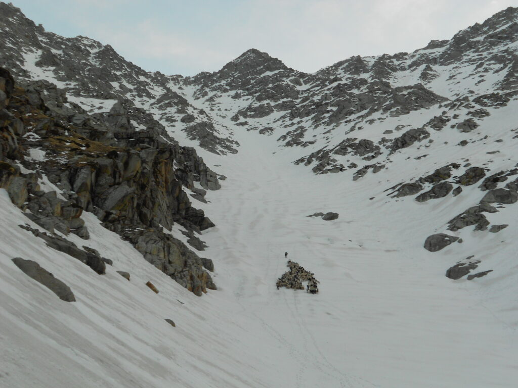
Dharamshala Himachal Pradesh
- + 9858308506
Indrahar Pass Trek
Indrahar pass booking, hostel stay in mcleodganj @500, 100% guaranteed camping experience.
10 Years Experience
Specialized in Camping & Trekking

Dharamkot Road
Near Gandhi's Paradise
700 Meters from Main Square
Mcleodganj, Himachal Pradesh
Download Itinerary

Starting Time: 08 am

Distance: 35 km

Height: 4342 meters

Srarting Point: Dharamkot
The Indrahar Pass Trek is a popular trek in Himachal Pradesh, India that passes through the Dhauladhar mountain range. It is a moderate to challenging trek that takes trekkers through lush green meadows, dense forests, and steep rocky terrain, before reaching the Indrahar Pass, which is situated at an elevation of 4342 meters (14,245 feet) above sea level.
The trek starts from the McLeod Ganj and ends in Chamba and the journey usually takes around 5-6 days to complete. Trekkers pass through several small villages and have the opportunity to interact with the local Gaddi community and learn about their culture and way of life.
The trek offers a spectacular view of the Dhauladhar mountain range, including several peaks such as Hanuman Tibba, Seven Sisters, and the Dhauladhar itself. The trek also offers great views of the Chamba valley and the Ravi river, which is one of the main tributaries of the Indus river.
Indrahar Pass Trek Best Time to Visit
The best time to trek to the Indrahar Pass is from April to June, and from September to November, when the weather is favorable for trekking . However, trekkers should be adequately prepared for unpredictable weather conditions and be properly acclimatized to high altitude.
Trekkers should be in a good physical shape and have a good level of endurance as the trail is strenuous and passes through rocky terrains and steep inclines. It's advisable to take the guidance of a local trek leader or a expert guide to have a safe and successful trek
Indrahar Pass Trek from Delhi
Indrahar pass height.
It is situated at an elevation of 4,342 meters (14,245 feet) above sea level and is a popular trekking destination for adventure enthusiasts . Indrahar Pass is a high altitude pass located in the Dhauladhar mountain range of Himachal Pradesh, India.
The Indrahar Pass Trek is a challenging trek that starts from McLeod Ganj and ends in Chamba and takes around 5-6 days to complete. The trek passes through lush green meadows, dense forests, and steep rocky terrain, offering spectacular views of the Dhauladhar mountain range.
The trek also offers an opportunity to interact with the local Gaddi community and learn about their culture and way of life. Along the way, trekkers will also pass through small villages and traditional settlements and have the chance to witness the traditional lifestyle.
Chamba is a district located in the Indian state of Himachal Pradesh. It is situated in the western part of the state and is known for its picturesque landscapes, beautiful temples, and traditional crafts. Chamba town is the district headquarter.
Chamba is known for its rich cultural heritage, with a history that dates back to the 6th century AD. The district is home to several ancient temples, such as the Chaugan, which is dedicated to Lord Vishnu, and the Laxmi Narayan Temple, which is dedicated to Lord Vishnu and his consort Laxmi. Chamba is also known for its beautiful hilltop temples, such as the Champavati Temple and the Banni Temple, which are dedicated to goddesses and are located on the banks of the Ravi river.
Chamba is also famous for its traditional crafts, such as woodcarving, pashmina shawls, and textiles. The district is also home to the Sui-dha-dhool and Nakkashi, two traditional crafts that involve intricate embroidery and mirror work.
The district is situated in a mountainous region, surrounded by snow-capped peaks, making it an ideal destination for trekking and adventure activities, like river rafting and paragliding. The trek to the nearby peaks like Hanuman Tibba, Indrahara Pass, Manimahesh Kailash, Minkiani Pass, and trek to the several high altitude lakes are the most popular.
The best time to visit Chamba is from April to June, and from September to November, when the weather is pleasant and trekking is possible.
Indrahar Pass Trek Season
The INDRAHAR Pass Trek season is generally considered to be from April to November, which covers the spring, summer, and autumn months. However, the best time to go on this trek is from mid-April to mid-June and from mid-September to early November.
During the spring season (mid-April to mid-June), the weather is mild and pleasant with temperatures ranging from 10 to 20 degrees Celsius. The trail is covered with colorful flowers and the views are breathtaking. This is also the time when the snow starts to melt, and the waterfalls and streams are in full flow.
During the summer season (June to August), the weather is warm and sunny, with temperatures ranging from 15 to 25 degrees Celsius. The trail can be a bit challenging due to the heat and the presence of leeches. However, the clear skies offer panoramic views of the surrounding mountains.
During the autumn season (September to November), the weather is cool and crisp, with temperatures ranging from 5 to 15 degrees Celsius. The skies are clear, and the views are stunning. This is also the time when the autumn colors start to appear, adding a touch of magic to the landscape.
Overall, the Indrahar Pass Trek is a challenging trek that requires good physical fitness and endurance. However, it is also a rewarding experience that offers stunning views of the Himalayas, picturesque villages, and an opportunity to immerse oneself in the local culture.
Indrahar Pass Trek Location
The INDRAHAR Pass Trek is located in the Dhauladhar range of the Himalayas in the Indian state of Himachal Pradesh . The trek starts from the town of McLeod Ganj, which is located near the city of Dharamshala and is a popular tourist destination.
The trek takes you through the dense forests of oak, pine, and rhododendron, and past glistening streams, waterfalls, and scenic meadows. The trail passes through several small villages where you can experience the local culture and way of life.
The highlight of the trek is the INDRAHAR Pass, which is located at an altitude of 4,342 meters (14,245 feet) above sea level. The pass offers stunning views of the surrounding mountains, including the Pir Panjal range and the Manimahesh range.
The trek is considered to be moderately challenging, with steep ascents and descents, and requires a good level of fitness and endurance. The trek can take anywhere from 4 to 6 days, depending on the route taken and the pace of the trekker.
Overall, the INDRAHAR Pass Trek is a beautiful and rewarding trek that offers a glimpse into the natural beauty and local culture of the region.
Indrahar Pass Trek Altitude
The Indrahar Pass Trek is a popular high-altitude trek in the Dhauladhar range of the Indian Himalayas. The altitude of the Indrahar Pass is 4,342 meters or 14,245 feet above sea level.
The trek starts from the small town of McLeod Ganj near Dharamshala, and takes you through the lush green forests, alpine meadows, and snow-covered peaks of the Dhauladhar range. The trek offers stunning views of the surrounding mountains, including the peaks of Manimahesh Kailash, the Pir Panjal range, and the Kangra valley.
The trek is considered moderately challenging, with steep climbs and descents, and requires a good level of fitness and acclimatization to high altitudes. The trek usually takes around 4-5 days to complete, depending on the route chosen and the pace of the trekker.
Overall, the Indrahar Pass Trek is a wonderful adventure for those who enjoy trekking and want to experience the beauty and grandeur of the Himalayas
Indrahar Pass Trek Distance
The distance of the Indrahar Pass trek varies depending on the route taken, but typically it is around 35-40 kilometers (22-25 miles) long.
The trek usually starts from McLeod Ganj, a small town near Dharamshala, and takes you through several beautiful villages and valleys, including Triund, Lahesh Cave, and Indrahar Pass.
The trekking distance from McLeod Ganj to Triund is approximately 9 kilometers (5.5 miles), and from Triund to Lahesh Cave it is about 6 kilometers (3.7 miles). The final ascent to Indrahar Pass is around 8 kilometers (5 miles) from Lahesh Cave.
After crossing the pass, the descent takes you through the beautiful Kuarsi valley, and then to the small village of Chamba. From there, you can take a taxi or a bus back to McLeod Ganj, completing the trek.
Overall, the Indrahar Pass Trek covers a distance of around 35-40 kilometers (22-25 miles), and can take 4-5 days to complete, depending on the pace of the trekker and the route taken.
Fitness required:
Before embarking on the trek, you must be in decent physical level. Before leaving on the hiking excursion, you should be able to jog 4 kilometers in 30 minutes. The air is thin, and the circumstances are challenging. You will also need to carry a large backpack. Physical fitness is essential for completing the walk successfully. Training oneself to run 4 km in under 30 minutes strengthens your lungs and allows them to digest less air for more effort.
Flexibility Exercises:
The capacity of muscles and tendons to relax and stretch readily is referred to as flexibility. It governs how much mobility your bones may make in any direction around joints such as your shoulders, elbows, hips, and knees. Stretching helps to improve your posture and avoid low back discomfort. Stretching your hamstrings, quadriceps, hip flexors, and low back muscles on a daily basis increases tissue relaxation and reduces tension on your back. It is critical that you arrive on the slopes with your muscles relaxed. Carrying a backpack, no matter how light, can get tiresome after a time. These workouts will help you get in shape for the hike.
1 lightweight upper and lower pair (optional) Thermal inners.
Carry one hollow full-sleeve windproof/down jacket Thick jacket.
We recommend synthetic quick-dry pants because they're lightweight. Plus, when it's cold outside, you can layer one over the other. Apart from the worn, you would carry a pair when trekking. You may save the third pair for the return trip. Cotton trousers with lots of pockets or track pants are other good options. Please do not wear denim jeans, shorts, or three-quarters on the journey.
T-shirts with collars ( including the one you're wearing):Light, full-sleeve t-shirts are preferred. The collar and sleeves protect the neck and arms from sunburn. Avoid using bright colors that can disturb birds and animals.
At least two pairs, including the one you're wearing: We choose fleece to wool because it is lightweight, compact, and warm Full-sleeved woolens.
No athletic shoes. The shoes must have solid grip soles and ankle support Trekking shoes. Wearing new shoes on a journey is not advised. It might result in blisters. Wear them for a week before taking them on a hike to soften them. FORCLAZ 100, 500, and 600 are recommended.
2 cotton pairs, 2 woolen pairs (mainly for camping and sleeping Socks (3 pairs):. Maintain their dryness.
A backpack with strong straps and a solid frame Backpack (40-60 litres): . A backpack rain cover is needed.
If you prefer to dump your bag, you must bring a daypack (20 liters). A day pack is not necessary if you wish to carry your bag.
Accessories
A lightweight poncho is preferable because it covers your backpack from top to bottom. When necessary, a raincoat can also be utilized as a windbreaker. Inquire with us about poncho availability at the base camp Raincoat/poncho.
The balaclava must cover your ears and neck. Scarves can also be used.
Make sure they are waterproof Synthetic handgloves.
Curved sunglasses will provide adequate coverage for your eyes. Blue-colored sunglasses are not permitted since they do not filter UV rays. Blacks, greens, and browns are OK. Avoid wearing sunglasses with many colors. Snow blindness may be avoided by wearing sunglasses. Sunglasses are required for this adventure.People who use eyeglasses should pick one of the following options: contact lenses, photochromatic glasses, or, if nothing of the above is practicable, wear your spectacles and carry a large sunglass that may be worn over your spectacles.
Personal Medical Kit Mandatory
10 pills Omez/Rantadine (antacids)
Digene (acidity) - 10 tablets
Crepe bandage - 3 to 5 m
Diamox - 10 pills (for AMS prevention)
Lomofen and Norflox TZ- 6 pills each (diarrhea)
1 little roll of gauze
Crocin (fever) - 6 pills
4 pills Avomine (motion sickness)
(allergies) Avil 25mg - 4 pills
4 pills Combiflam (pain reliever)
6 pills Disprin (headache)
10 band-aid strips
1 tiny roll cotton
10 packets of ORS
Any antiseptic cream or betadine
Moov spray (for pains and sprains)
Toiletries (sunscreen with an SPF of 40 or higher, moisturizer, a light towel, lip balm/chap stick, a tiny soap, toilet paper, and a damp tissue) Needle and thread repair kit
Headlamp/LED torch: Required
Carry all camera equipment, including backup batteries and a charger.
Carry a plate, spoon, coffee mug, and a lunch box. For sanitary concerns, we need hikers to bring their own utensils. You may use your lunch box to store food and carry it to reduce weight.
Water is important part of the trekking so you carry your own bottles at least Two 1 liter bottles. Packaged water bottles.
A trekking pole is required. Duralumin 4-step telescopic anti-shock hiking poles are available for Rs 500 from us.
When packing, use plastic bags to compartmentalize items and keep a few extra plastic bags on hand for damp garments.
Mandatory Documents
Please also bring the three documents listed below. Documents two and three must be downloaded (PDF), completed, signed, and returned to the trip leader at the base camp. You will be denied entry to the journey if you do not have these documentation.
Original and photocopy of a government picture identification card (driver's license, voter ID, etc.) - 2 copies
Avoid sports shoes. They are ill suited for trekking. We recommened FORCLAZ 100, 500, and 600. Wear the shoes for a week prior to the trek to avoid shoe bites/blisters on slope.
Duralumin 4-step telescopic anti-shock trekking poles are available with us for Rs 500
We highly endorse synthetic quick-dry pants. They are light and can be worn in layers when it gets cold. Cotton pants/track pants are an alternative.
Jeans,shorts and 3/4 pants are not suitable for trekking.
Light full sleeve collared t-shirts are the best option. Avoid round neck t-shirts which exposes the neck during cold weather and may cause sun burns during the day.
We choose fleece coats over wool jackets because they are lightweight, compact, and warm. It is preferable to layer your apparel with many light sweaters rather than carrying a single large heavy jacket.
Thermal inners are available as an alternative for people who are more sensitive to cold.
Scarves can be used instead of balaclavas.
People who use eyeglasses should pick one of the following options: contact lenses, photochromatic glasses, or, if nothing of the above is practicable, wear your spectacles and carry a large sunglass that may be worn over your spectacles.
For sanitary concerns, we need hikers to bring their own utensils.
Use plastic bags to compartmentalize items while packing and have a couple extra plastic bags on hand for damp garments.
Indrahar Pass Trek Itinerary
Introduction : This is one of the most pouplar,Difficult and beautiful trek in the area. We walk upto the top of Indrahara pass,one of the most beautiful passes in Dhauladhar range. Dhauladhar range is outer most part of Himalayas. Once we reach the top we can see the Pir Panjal Range of the central Himalayas.
Day 01: On Trek. Bhagsu Nag to Triund (2875m) 10 kms

Day 02: Triund to Laka Got (3200 m) 5 kms
This short stage is included in order to get acclimatized to the steep increase in the altitude. We also do a side walk this day to Kunal Pathri temple situated on top of a hill. Laka got is the base of Indrahara Pass and is situated at the snout of a small glacier which usually melts or recedes during the post monsoon(Sep-November) period.
There is a small cave called Lahes cave little above laka got which can also be used as overnight shelter in case of smaller groups.

Day 03: Laka got – Indrahara pass(4300m) – Laka Got

Day 04: Laka Got- Triund – Mcleod Ganj 14 km
Indrahar pass trek price per person price inclusive of gst.
Indrahar Pass Trek Price is @5500 only Inclusive of GST Indrahar Pass Trek via Triund & Laka Glacier is a popular trek in Mcleodganj. Trek Guide, Stay, Meals, and Permit Included. Best Price Guarantee
Price Does Not Include: • Hotel accommodation and meals in Dharamsala before and after the trek. • Transport to/from Dharamsala before and after the trek. • Bathing facility during the trek. • Ponies to carry all your personal luggage. We will carry sleeping bags,matteresses,tents & food for you. You will have to carry your own personal back pack. • Items and services of personal nature like soft drinks, alcoholic drinks, laundry,etc • Any other services that are not included under the head “Price Includes”
Indrahar Pass Trek Booking
Cancellation Policy: • 08 days before the trek starting date: No Charge. • Less than 08 Days: 50% Charge • Once you start the trek: No Refund.
Things to Bring on your own: • Back Pack to carry your personal luggage, water bottle, camera, packed Lunch, personal clothing,etc. • Good Hiking Shoes. • Sun Protection: Sun Screen lotion, sun glasses, cap, • T-Shirts, loose trouser while walking • Good warm clothes. • Flip Flops. • Small torch. • Personal medicines if any. • Rain Poncho in case of rain.
Sample Menu: Packed Lunch: Veg Biryani+Veg Cutlet+ Cheese Sandwich+Juice+Orange+Banana Light Snacks: Veg Pakora with Tea Dinner: Veg Soup with popcorn/Papad+ Dal+Mix+Veg+Rice+Palak Paneer+Chapaties Breakfast:Bread with Butter/Jam/Honey+Eggs+Porridge+Tea/Coffee+Juice
Indrahar pass trek in march, indrahar pass trek price, indrahar pass trek package, triund indrahar pass trek, indrahar pass trek cost, indrahar pass weather, indrahar pass temperature, indrahar pass trek distance, indrahar pass trek difficulty, indrahar pass trek height, indrahar pass altitude, indrahar pass trek route, indrahar pass trek best time, indrahar pass trek itinerary, indrahar pass is located in, indrahar pass trek map
ADVENTURE TREKKING TOURS
Places near mcleodganj bhagsu, triund trek map, kasol trekking tours, gurgaon stay.

TRAVEL TREK
- When you submit your request,
- a Travel Trek expert gives you
- a call to discuss your plans and
- accordingly suggests you an itinerary.
- deals and discounts
+91 9958308506

Get in touch!
- Triund Trek in May
- Terms Conditions
- Privacy Policy
- Bhagsu Waterfall
- Anthargange Trek
- Mcleodganj to Triund
- Tilak Nagar
- Luxury Camping Kasol
- Himachal Tourist Places
- Prashar Lake Trek
- Kalindikhal Pass Trek
- Dzongri Trek
- Kasol Camp Stay
- Bhagsu Nag Temple
- Nanda Devi Trek
- Nahargarh Fort Trek
- Hotel in Dharamshala
- Chadar Lake Trek
- Sar Pass Trek Kasol
- Bhabha Pass Trek
- Hotels in Dharamkot
- Dharamshala Weather
- Triund Altitude
- Best Time to Visit Triund
- Hotels in Bhagsu
- Kasol Camping Package
- Rome to Paris
- Adi Kailash
- Valley of Flowers
- Harihar Fort
- Angles Landing Trails
- Triund Trek for Beginners
- Hotels in Mcleodganj
- Camping in Gurgaon
- Leopard Trail Gurgaon
To Travel is to Live
Trek To Indrahar Pass

- Trek Reviews 4.4/5.0 (639 Reviews)
- Trek Height 4,341 metres (14,244 ft)
- Trek Distance 35 Km
- Trek Duration 4 Days
Includes/Excludes
Journey started From New Delhi
Reporting Time - 9:00 PM
- Reach our Base Camp at Dharamkot, shower then we'll start our trek at around 10 am.
- Triund is situated on a ridge with a gorgeous view of the entire Kangra valley on one side and Dhauladhar range on the opposite side. First 2km may be a steep ascent but there's a gradual ascent after Galu Devi temple. The last 1 km is again a steep ascent through the forest.
- Triund may be a flat meadow on top of a ridge. From here one can witness a bird's eye view of Dhauladhar range on one side and Kangra valley on the opposite may be a memorable sight.
Overnight stay in tents.
- After a brief ascent from Triund, traverse a ridge to succeed in Laka Got – a short lived shepherd camp.
- Laka Got is situated at the snout of a little glacier, which is filled with snow and ice in early summer and therefore the snow melts away during the monsoon.
- So we'll even have some activities on snow. Night stay within the camp at Laka Got.
- Start early in the morning, the weather gets bad within the afternoon.
- It takes about three to four hours to succeed in the pass and another three hours to return down.
- From the past, the entire Pir Panjal range of central Himalayas may be a sight to behold.
- Back to Laka Got For Panjal range of central Himalayas may be a sight to behold. Back to Laka Got for night stay.
- Follow an equivalent route on the way back via Triund .
- If there's less snow then we'll follow a special route which matches from Triund going over a grassy meadow and descend right down to Bhagsu Nag then to Mcleodganj.
- During the evening, we all will board our respective buses but a pocketful of memories will accompany all folks .
- Leave for Delhi in Evening
Reach Delhi within the Morning
Inclusion/Exclusion
- Accommodation in Tents on Sharing Basis
- Sleeping Bags and Mattress
- All Meals (From Day 1 (Packed Lunch) to Day 4 (Breakfast))
- Kitchen Tents and every one Kitchen Items
- Certified Trek Leader / Guide
- Toilet Tent
- Medicare Kit
- Expenses that are Personnel in Nature.
- Porter, Mules.
- Anything not Mentioned Under Inclusions.
- Extra Food aside from Mentioned Above.
The Indrahar Pass trek is a popular trekking route in the Dhauladhar range of the Himalayas, offering stunning views of the surrounding peaks and valleys.
The trek is considered moderately difficult, with steep ascents and descents, as well as some challenging terrain. It is recommended for experienced trekkers.
The best time to do the trek is from May to October, when the weather is generally favorable and the trails are accessible.
The trek typically takes 4-5 days to complete, depending on the starting point and the pace of the trekking group.
There are various options for accommodation along the trek, including guesthouses, camping sites, and homestays in the local villages.
While it is not mandatory to hire a guide, it is recommended, especially for those unfamiliar with the area. A guide can provide valuable insights and ensure safety.
It is important to pack appropriate clothing, trekking gear, first aid kit, sufficient water, and high-energy snacks. A detailed packing list can be obtained from trekking agencies.
Yes, permits are required for the trek, and they can be obtained from the local authorities or trekking agencies.
The trek involves high altitude, rugged terrain, and unpredictable weather, so trekkers should be prepared for altitude sickness, steep climbs, and sudden changes in weather conditions.
Related trips you might interested in

Kheerganga Trek

Rajgundha Trek With Bir Billing

Hampta Valley Snow Trek
Indrahar Pass Trek
August 2024, september 2024.
If you’re 4 or more people and don’t see a date available, contact us .
Duration: 4 days
Max Altitude: 14245 ft.
Total trek distance: 36 km
Pickup Point: McLeod Ganj
Best Time: April to December
Price: ₹4500 (Book @ ₹1000)
IMAGES
VIDEO
COMMENTS
The Complete Guide to Indrahar Pass Trek. Indrahar Pass Trek is a enchanting experience at the heart of an endlessly fascinating range. It is a notch in the skyline on the high ridge that runs down to the west from Mon peak. ... Start early again, because the distance to be covered is sizable.Today you will have to cross the Kuarsi Nala later ...
Places to visit near Indrahar pass. The distance between McLeod Ganj and Indrahar pass trek is about 16km. Before you begin your adventurous trek to Indrahar Pass, you can always indulge in sightseeing near McLeod Ganj town. Namgyal monastery. This beautiful and calm, scenic Namgyal Monastery was founded by the Third Dalai Lama in 1564.
Indrahar Pass Trek is a 35 km trek in Himachal Pradesh that offers stunning views of the Dhauladhar and Pir Panjal ranges. The trek takes 9 days and covers Triund, Lahesh Cave, Indrahar Pass, Chhata, Kuarsi, Brehi, Minikiani Lake and Kareri Lake.
Today we start the trek from McLoedganj to Triund covering a total distance of 9 km. The Indrahar Pass trek goes through a mixed forest of oak, rhododendron and deodar trees. First two Kilometers of the trail is a steep ascent but there is a gradual ascent after Galu Devi Temple. The last 1 kilometer is again a steep ascent through the forest ...
Day 3 : Laka Got (11,480 feet) to Indrahar Pass (14,245 feet) via Ilaga Pass and return to Laka Got (12 km) Start the day early, the trekking distance is long and the trail is challenging. The trail is very steep from Ilaga Pass to Indrahar Pass. The treeline recedes and the now the area turns to rocky with no vegetation.
Indrahar Pass Trek. Check out this 13.3-mile out-and-back trail near Dharmshala, Himachal Pradesh. Generally considered a challenging route. This is a very popular area for backpacking, birding, and camping, so you'll likely encounter other people while exploring. The best times to visit this trail are May through October.
Embark on the captivating Indrahar Pass Trek, a moderate-to-difficult adventure through the majestic Dhauladhar range in Himachal Pradesh. Conquer an altitude of 4,342 meters (14,245 ft) and witness breathtaking landscapes, from the lush Kangra Valley to the snow-capped Pir Panjal Range.
Nestled in the Dhauladhar Range, the Indrahar Pass Trek stands as a testament to the grandeur of the Himalayas. This section provides an overview of the trek, its challenges, and the breathtaking vistas that await adventurers. b. Highlights of Indrahar Pass Trek. Explore the highlights of the Indrahar Pass Trek, from the mesmerizing landscapes ...
Indrahar Pass Trek Indrahar Pass A mountain pass in the Dhauladhar mountain ranges. 5.0 (602 reviews) 4 ... 11,500 feet. Destination. Himachal. Trek Distance. 125 km. Group Size. 11. Best Time. Sep to June. A mountain pass in the Dhauladhar mountain ranges, Indrahar Pass is on the border between Kangra and Chamba districts. There are excellent ...
Indrahar Pass is like a secret doorway in the big, beautiful Dhauladhar mountains of the Himalayas. It sits way up high at 4350 meters above sea level, near the cool town of Dharamshala in Himachal Pradesh. This pass is like a line drawn between Kangra and Chamba districts, stretching from 2874 meters to 4350 meters high.
Highlights of Indrahar Pass Trek. Maximum altitude: 14245 feet. Grade: Moderate to Difficult. Duration: 4 days. Trekking distance: 35 kilometers. Trail type: A round trail through caves. Rail head: The nearest rail head to the base camp is Dharamshala. Airport: Kangra Airport, Himachal Pradesh. Snow Season: January to March.
Indrahar Pass Trek is situated at a height of 4425 m above sea level near Dharamshala in the border between Kangra and Chamba districts in Himachal Pradesh. Indrahar Pass trek offers you exquisite landscapes, gorges, streams, lagoons, and dense forest. ... Indrahar Pass trek started from McLeodganj and the trekking distance is 35 km. It is a ...
In the Dhauladhar range of the Himalayas rests the Indrahar Pass which is also a mountain pass. It is located at an altitude of 14,245ft above sea level near the famous tourist city of Dharamshala in Himachal Pradesh. Indrahar Pass also outlines the border between Kangra as well as Chamba districts. Though the trek is short but a bit ...
At a distance of 16 km from McLeod Ganj and 21 km from Dharamshala, Indrahar Pass is a mountain pass in the Dhauladhar range of the Himalayas near the town of Dharamshala in Himachal Pradesh. Located at an altitude of 4,342 m above mean sea level, Indrahar pass forms the border between Kangra and Chamba districts.
The Indrahar Pass is located at the altitude of 4,342 meters. Here I describe my trip to the Indrahar Pass. Last summer I went to the most difficult trek ever-The Indrahar Pass. This destination is off-beat because many people only trek to Triund only select few thrill-seeking chaps go to Indrahar ...
Book Indrahar Pass Trek Online @ Best Price Available. Avail Best Offers on Indrahar Pass Trekking Tour & Explore the Himalayas. Book Now!! Indrahar Pass Trek, Mcleodganj Book Indrahar Pass Trek Online @ Best Price Available. ... Trekking distance: 35 km. Maximum Altitude:14,245 ft. Difficulty Level: Moderate to Difficult.
Trek Grade: Easy Moderate Difficult; Best Time: May-Oct; View of Dhauladhar Range from Kangra: Ascent Descent Adventures Indrahar Pass Route Details. DAY 01: Mc Leod Ganj 1,890m in Dharamshala ; Day 02: Trek from Mc Leod Ganj 1,890m Trek to Triund 2,751m to Ilaqua Got 3,353m; Day 03: Ilaqua Got to Indrahar Pass 4,453m to Chhata 3,200m
Best Season: Opening From April- June, September-November 2023. Trek Distance: 45 Kms. Max Altitude: 4347 Metres. Weather: In Summer time the temperature is 20 Degrees in Day time at Snowline and Lahesh Cave.In evening temeprature drops to 9-10 degrees. In Indrahar pass Temperature is 5-7 degrees only and if the weather is cloudy it can drop to ...
The distance of the Indrahar Pass trek varies depending on the route taken, but typically it is around 35-40 kilometers (22-25 miles) long. The trek usually starts from McLeod Ganj, a small town near Dharamshala, and takes you through several beautiful villages and valleys, including Triund, Lahesh Cave, and Indrahar Pass. ...
Trek To Indrahar Pass 4 Days Gallery Trek Reviews. 4.4/5.0 (639 Reviews) Trek Height. 4,341 metres (14,244 ft) Trek Distance. 35 Km. Trek Duration. 4 Days. Itinerary Includes/Excludes FAQs Itinerary. Expand all. Day 1 : TRAVEL FROM DELHI Journey started From New Delhi. Reporting Time - 9:00 PM. Day 2 : ...
Indrahar Pass Trek is a mountain pass in the Dhauladhar range of the Himalayas. Located at an altitude of 4,342 metres (14,245 ft) above sea level, near the tourist town of Dharamshala in Himachal Pradesh, Indrahar pass forms the border between Kangra and Chamba districts. ... The distance between Dharamashala and Mcleod ganj is around 1 hour ...
Indrahar Pass Trek. Check out this 21.4-km out-and-back trail near Dharmshala, Himachal Pradesh. Generally considered a challenging route. This is a very popular area for backpacking, birding, and camping, so you'll likely encounter other people while exploring. The best times to visit this trail are May through October.
Embark on an unforgettable journey with Indrahar Pass Trek by Trekyaari. Witness breathtaking views of the Himalayas. Book your adventure now! Trekyaari. ... Total trek distance: 36 km. Pickup Point: McLeod Ganj. Best Time: April to December. Price: ₹4500 (Book @ ₹1000) Book Now Send Enquiry. Footer. Explore our latest . treks.