Get the best experience and stay connected to your community with our Spectrum News app. Learn More
Continue in Browser
Get hyperlocal forecasts, radar and weather alerts.
Please enter a valid zipcode.


Storm systems don’t just move from west to east
More often than not, we look to the west of our area to see storm systems heading our way. However, there are times when we need to shift our focus to other directions.
What You Need To Know
The jet stream generally moves weather systems from west to east across the u.s. the easterlies, or trade winds, tend to direct tropical systems from east to west backdoor cold fronts bring in showers opposite the direction of typical cold fronts.
Like reading a book, meteorologists tend to track weather systems from left to right (west to east) as they move across the country. Have you ever wondered why that general movement is so common?
Well, nothing moves on its own. There must be a force that moves it. In the case of the atmosphere, the jet stream is the force that pushes storm systems along.

The jet stream, or polar jet stream, is a narrow band of fast-moving air located roughly between 30,000 and 45,000 feet in the air (based on the time of year). It separates the colder air to the north from the warmer air south of it.
The jet stream is nicknamed the "storm track" since systems push from one end of the country to the other, courtesy of the jet stream. However, if a system gets detached from the jet stream, it can meander in place for days without that atmospheric push.

The atmosphere is very dynamic, and you can’t box its behavior into one category. So, there are times when systems move differently from the general west to east direction.
Back door cold front
Cold fronts tend to move in from the north, northwest, or west. However, backdoor cold fronts move in from the northeast.

High pressure (positioned in the Northeast) has a clockwise flow, and that northeast wind brings cooler/damp air to an area, usually impacting the Mid-Atlantic or Northeastern U.S. If showers accompany the front, they’re usually light and move in from the east, northeast direction.
Tropical systems
Tropical cyclones develop over the warm waters of either the Gulf of Mexico, the Caribbean Sea, or the Atlantic Ocean. They are pushed along by winds known as the "easterlies," which moves them generally from east to west across the tropical waters.

So, when a tropical system makes landfall across the U.S., it often moves in with its rain traveling from the east, southeast to the west, northwest.

LATEST NEWS
Breakdown: Why weather systems move from west to east
MEMPHIS, TN (WMC) - In the United States, most of our weather moves from west to east but in actuality systems can move in any direction. You may notice that we are always looking west to see what’s coming next.
The reason that they most often move from west to east is due to the jet stream. The jet stream is a narrow band of fast, flowing air currents located near the altitude of the tropopause that flow from west to east. The jet stream flows around the entire earth. They usually have a meandering, snake-like shape.
Jet streams carry weather systems. Warmer tropical air blows toward the colder northern air. These winds shift west to east due to the rotation of the earth.

Every once in awhile, we get a backdoor cold front in the Mid-south. This is because an area of low pressure can pull down a cold front from the northeast to the southwest.
The structure of low pressure systems, which move cold fronts, favors a front moving either north to south or northwest to southeast. Warm fronts generally move from south to north on the east side of the low pressure system’s counter-clockwise circulation, making an east to west motion more unusual. The systems that move east to west are tropical systems due to the easterly trade winds.
Copyright 2019 WMC. All rights reserved.

3 teens injured in early morning shooting that stemmed from mom finding daughter’s boyfriend in her bed, police say

Off-duty MPD officer arrested for DUI

Family mourns 80-year-old grandmother killed by fallen tree during storm

Lightning strikes cause 2 early morning fires in Shelby County

Severe weather impacts thousands in Mid-South
Latest news.

Your First Alert to increasing clouds and rain chances

Tuesday evening First Alert Forecast from Chief Meteorologist Ron Childers-May 28, 2024

Over 1900 tornado warnings have been issued since January 1st within the entire United States

Tornado warning wrap up of 2024 so far

Your First Alert to a potentially active hurricane season for 2024
Why Does Weather Move West to East? (Science Behind!)

Why does weather move west to east? How many times have you wondered about this question? Did you come up with an explanation?
The truth is that the west-to-east flow of weather has significant effects on Earth’s climate and atmospheric patterns .
But, why does weather system move from west to east? Let’s talk about some of the underlying scientific concepts that govern it.
The Earth’s rotation creates the Coriolis effect , which causes weather systems to travel from west to east.
Why Does Weather Move West to East?

You may have heard a lot about weather systems moving west to east. But, can the weather move east to west? Well, it can, but it is not that common.
It moves from west to east because of the following reasons:
The Earth’s Rotation
Our planet Earth is a fast-spinning globe, rotating around a tilted axis at about 1000 miles per hour .
The direction of the spin, from west to east, pulls the atmosphere and the weather along with it.
And ultimately, this produces an effect that influences the direction taken by major global weather systems.
The Coriolis Effect

The Coriolis Effect is a strange phenomenon, described as an inertial or fictitious force , created because parts of Earth rotate at different speeds.
It makes airborne objects, such as planes and air currents appear to move through the atmosphere. They move following the surface curve rather than in the straight line they are traveling.
How Does It Affect the West-to-East Movement?
The Effect forces weather systems that have developed over warm tropical waters to deflect and turn away from the equator .
Depending on which side of it they formed, either right into the Northern Hemisphere or left into the Southern .
The Coriolis Effect also influences the direction weather systems spin around their low-pressure center .
- It is anticlockwise in the north to form hurricanes
- It is clockwise in the south forming cyclones
Global Wind Patterns

The surface winds that make up the global wind pattern, or ‘general circulation’ form three distinctive wind belts:
- The Polar Easterlies at 60-90 degrees latitude
- The Prevailing Westerlies at 30-60 degrees latitude
- The Tropical Easterlies called the trade winds at 0-30 degrees latitude.
Bands of clouds and thunderstorms form and encircle the globe.
Here, the easterly trade winds of both hemispheres meet in the Intertropical Convergence Zone (ITCZ) near the equator.
How Does It Affect the Weather Systems?

Under the hot sun and over warm shallow seas, the air gathers moisture .
The increased humidity makes the air buoyant and it expands and rises. It cools higher in the atmosphere to eventually release moisture as rain.
The ITCZ shifts according to the seasons.
Its position either just north or just south of the thermal equator changes the direction of the trade winds as they come under the influence of the Coriolis Effect.
When the ITCZ is north of the Equator, the southeast trade wind changes to a southwest wind .
Jet Streams

There are four main jet streams across the globe:
- Two at polar regions
- Two close to the equator
They exist because of the difference in temperatures between the Earth’s hemispheres .
One passes over the UK. It is a rapidly moving ribbon of air that forms at the edge of where the cold air meets warm in the atmosphere.
It is cold along its northern edge but warm along the southern.
Atmospheric Circulation and the Hadley Cells

The global movement of air is driven by temperature and its close relationship with air density and pressure and nature’s attempts to make them all equal.
There are three air systems making up the Hadley Cells , cycling air in each hemisphere, the small Polar Cells and the mid-latitude Hadley and Ferrel Cells.
The Polar Cells
Unlike the mid-latitude cells, the polar cells are relatively dry and cool .
However, there is still sufficient heat and moisture for a simple system of looping thermal currents to rise at the 60 th parallel and move poleward before deflecting east.
They create a region of dry high pressure so that as air descends it pushes the air its replacing towards the 60 th parallel.
The Hadley and Ferrel Cells

In the tropics, the Hadley and Ferrel cells cycle opposite one another. The air currents flow towards their respective poles along the top of the troposphere .
It is some 6 to 9 miles above the Earth’s surface before dropping down.
It drops down at the sub-tropics and returns to the equator by filling the area of low pressure left by the warm air rising in front of it at the ITCZ.
Some air is lost to the polar cells and the currents of the Ferrel which are weaker than the Hadley, can’t support a closed loop.
An Important Consideration
The cells are disrupted as the top layers of the two cells collide.
The Coriolis Effect determines whether the current deflects north or south to become either part of the westerly trade winds or the tropical easterlies.
The Trade Winds

Temperature differences create pressure differences and this triggers the movement of air .
Therefore, wherever there are winds, they always blow from areas of high air pressure too low . Around seven pressure belts are circling the Earth,
- Two Subpolar lows
- Two Subtropical highs
- Two Polar highs
- The Equatorial low
The Role of Trade Winds in Weather Movement
The trade winds (or the easterlies) form in the Equatorial low and are strong permanent west-to-east winds.
They flow from the mid-latitudes of the equator to come in from either:
- The northwest in the northern hemisphere
- The southeast in the southern , strengthening in winter.
- They bring tropical storms with them.

They developed over the warm equatorial waters of:
- Indian Oceans
And they dump water on the landmasses of:
- North America
- Southeast Asia
- East Africa
Historically, the reliable trade winds enabled exploration which eventually led to global trading .
The Prevailing Westerlies

The prevailing westerlies are known as the anti-trades .
Like all weather, because of the spin of the Earth and the Coriolis Effect, the air currents of prevailing westerlies move west to east .
However, they begin in the higher horse latitudes , the result of subtropical high pressure meeting a subpolar low. Also, they tend to stay closer to the poles.
Ocean Currents

On land, winds shape landscapes.
At sea, they drive ocean currents but there are only two types, the warm ocean currents leaving for the poles from the equator and the cold coming back.
Ocean currents transport warm waters from the east to the west near the equator and cold waters from the west to the east in higher latitudes .
And this impacts the movement of weather patterns in a similar direction .
More about the Role of Ocean Currents

There are many local coastal currents where the impact of the wind and waves is determined by land features and the slope of the continental shelf .
Because the Earth spins on its axis west to east, in the open ocean, the wind pushes water around in circles in ocean-wide gyres.
There are five and they are the jet streams of the oceans moving enormous volumes of water in different directions.
For instance:
The direction an ocean current takes is determined by how the Coriolis Effect influences the wind pushing it.
Climate Influences

As the cool air is warmed at the tropics, it expands to support water suspended and carried as vapor.
It is collected from the upper levels of the warm surface water as the cool air current is warmed by passing over it.
In the cold altitudes it condenses into water droplets that form clouds.
The Impact of Climate on Weather Movement
As long as the temperature remains fairly constant, the clouds can travel on the wind over the oceans for thousands of miles.
This mechanism distributes vital fresh water across the planet.
But, it relies on the right atmospheric conditions for accurate delivery, sadly something less guaranteed with climate change .

Why does weather move west to east? Essentially, the west-to-east movement of weather is the result of the earth’s rotation and the Coriolis effect.
It is important to understand the factors contributing to this phenomenon.
It helps us understand the intricate relationship between the planet’s atmosphere and the earth’s rotational forces.


Visual Crossing Weather
Articles, videos, and documentation to help you get the most from Visual Crossing Weather
Why Weather Systems Move from West to East
Like in many parts of the world, weather patterns in the US migrate from west to east. This phenomenon is essential to the nation’s climate and weather patterns and is caused by a variety of natural sources. So why do weather system move only in a certain direction? Let’s learn more about that in this article.
The Coriolis Effect and Atmospheric Movement
The Earth’s rotation is a major factor in the motion of weather system. This rotation causes what is known as the Coriolis effect. This is a pattern of deflection that happens when things, particularly air masses, are placed in motion.

This deflection causes wind moving in the Northern Hemisphere to deviate to the eastward direction. On the other hand, things tend to go westward and deflect to the left in the Southern Hemisphere. In the United States, the eastward migration of weather systems is mostly determined by the Coriolis effect.
Jet Streams and Their Influence
The jet stream is a prevalent cause of westward to eastward movements in prevailing winds. At higher altitudes in the atmosphere, there are small bands of fast-moving winds known as jet streams. The subtropical and polar jet streams are the two main jet streams in the Northern Hemisphere.
Warmer air to the south and colder polar air to the north are separated by the polar jet stream. Such jet streams normally move from west to east. The jet stream propels weather systems, which travel along its course from west to east. Hence this is why the prevailing wind goes out to the east side of the United States.
Cyclonic Movement

Weather patterns depend on high-pressure systems called anticyclones and low-pressure systems called cyclones.
Cyclones and anticyclones revolve around their centers in opposite directions in the Northern Hemisphere.
The Coriolis effect causes cyclones to rotate, which causes them to migrate eastward.
Many weather-related events in the US, such as the formation of storms, precipitation, and temperature fluctuations, are caused by these cyclones. The circulation surrounding these low-pressure systems always travels eastward due to the Coriolis effect.
The Global Wind Patterns in the Mid-Latitudes
The movement of the American weather system fits into a larger pattern of atmospheric circulation throughout the world. Winds know as the westerlies, which blow from west to east, predominate in the mid-latitudes. The overall direction of weather systems in this area is influenced by these westerly winds. Because it is located in these mid-latitudes, the United States is impacted by the dominant westerlies.
The movement of air masses, storm systems, and pressure systems are all shaped by these westerly winds, which have a major influence on weather patterns. This worldwide circulation pattern directly contributes to the west-to-east passage of weather systems across the nation.
Influence of Topography and Local Effects
The eastward travel of weather systems in the United States is mostly caused by the prevailing westerlies, although local geology and geography can bring changes in this trend.
Localized weather patterns can result from the course of weather systems being impacted by mountains, coasts, and other physical characteristics.
Mountain ranges can become barriers, allowing air to climb and cool and resulting in the development of precipitation on windward sides.
Moreover, the existence of significant bodies of water, like the Great Lakes, affect how weather systems travel and behave. Water bodies have the ability to regulate temperature and play a role in the formation of lake-effect snow in certain areas that may not exactly follow the typical west-to-east trend.
Seasonal and Regional Variations
It’s useful to understand that seasonal and regional variations affect the weather system. The position and strength of the jet stream may vary with the seasons, resulting in changes in weather patterns. For instance, in the winter, the polar jet stream may descend further south, bringing with it the possibility of winter storms and lower temperatures to areas that do not usually see them.
In addition, elements including temperature gradients, ocean currents, and proximity to other landmasses affect regional variances. Localized weather patterns and sporadic departures from the west-to-east trend might result from these variables.
The Coriolis effect, the impact of jet streams, global wind patterns, and the terrain of the area, results in the eastward drift of weather systems. Although there is a general eastward trend, seasonal and regional variations should be considered since localized influences can affect weather patterns.
Meteorologists need to understand the mechanics of the movement of the weather system in order to create accurate forecasts. Moreover, it also assists people and communities in being ready for different types of weather. The eastward travel of weather systems is a vital part of the weather and climate of the United States.
How Does Weather Move? Understanding Weather Patterns From West To East

Imagine standing on the edge of a vast ocean, watching as waves crash against the shore. Each wave, like a tiny messenger, carries with it a story of how weather moves across our planet. Weather patterns, like those waves, have a distinct rhythm and direction. They flow from west to east, guided by invisible forces that shape our atmosphere.
In this article, we will explore the intricate mechanisms behind the movement of weather patterns. We will delve into the secrets of the Coriolis Effect, an enigmatic force that influences the direction of winds and currents. We will uncover the global wind patterns that act as powerful engines, propelling weather systems across the globe.
But the story doesn’t end there. We will also discover the high-speed highways of the atmosphere known as jet streams, and how they dictate the speed and path of weather systems. We will unravel the mysteries of fronts, the battle zones where warm and cold air clash, shaping our weather patterns in the process.
And let’s not forget the role of mountains, whose towering presence can alter the course and intensity of weather systems. Finally, we will explore the local factors that contribute to the movement of weather patterns in your own backyard.
So buckle up, dear reader, as we embark on a journey to unravel the fascinating secrets of how weather moves from west to east.
The Coriolis Effect and Its Role in Weather Movement
You may be wondering how the Coriolis Effect influences the movement of weather systems from west to east. Well, let me explain.
The Coriolis Effect is a result of the Earth’s rotation and plays a significant role in shaping the patterns of weather movement. As the Earth spins on its axis, it causes objects, including air masses, to deviate from their straight paths. This deflection is strongest at the poles and weakest at the equator.
When air moves from high pressure to low pressure areas, it is deflected by the Coriolis Effect, causing it to curve instead of flowing in a straight line. This curving motion creates the characteristic eastward movement of weather systems.
Additionally, the Coriolis Effect also influences ocean currents, causing them to move clockwise in the Northern Hemisphere and counterclockwise in the Southern Hemisphere.
So, the Coriolis Effect is a crucial factor in understanding the west to east movement of weather systems and the impact on ocean currents.
Global Wind Patterns and their Influence on Weather Systems
Imagine wind currents encircling the globe, influencing weather systems as they sweep from west to east. Global wind patterns play a significant role in the movement of weather systems.
These patterns are influenced by the Coriolis Effect, which deflects winds to the right in the Northern Hemisphere and to the left in the Southern Hemisphere. This creates a series of atmospheric pressure systems, including high and low-pressure areas, that drive weather movement.
El Niño and La Niña events also impact global wind patterns, altering the normal weather patterns. El Niño, characterized by warm ocean temperatures in the Pacific, weakens the easterly trade winds and disrupts the normal atmospheric circulation. La Niña, on the other hand, intensifies the trade winds and strengthens the normal weather patterns.
Understanding these global wind patterns and their interaction with El Niño and La Niña events is crucial for predicting and understanding weather movement from west to east.
Jet Streams: The High-Speed Highways of the Atmosphere
Jet streams, like high-speed highways, swiftly navigate through the atmosphere, influencing weather systems and their movement around the globe. These narrow bands of strong winds, located at high altitudes, play a crucial role in weather forecasting. By understanding their patterns and behaviors, meteorologists can predict and track the movement of weather systems more accurately.
One way to visualize the complexity of jet streams is through a table that shows their characteristics in different regions. Take a look at the table below:
As climate change continues to impact our planet, the behavior of jet streams is also changing. These shifts can result in more extreme weather events, altered rainfall patterns, and increased storm intensity. Understanding the workings of jet streams is crucial for accurate weather forecasting and assessing the impact of climate change on our world.
Fronts and their Impact on Weather Patterns
Don’t you just love how fronts come in and completely shake up the weather patterns? Frontal boundaries are the key players in these dramatic shifts. They occur when two air masses with different properties meet, leading to atmospheric disturbances.
There are three main types of fronts: cold fronts, warm fronts, and stationary fronts. When a cold front moves into an area, it pushes the warm air mass ahead of it, creating thunderstorms and heavy rainfall. On the other hand, warm fronts bring in warmer air, often resulting in steady rain or drizzle. Stationary fronts occur when neither air mass is pushing the other, leading to prolonged periods of rain or clouds.
Understanding these front dynamics is crucial in predicting weather patterns and their impacts on our daily lives. So next time you experience a sudden change in weather, you can thank the fronts for bringing the excitement!
Orographic Effects: How Mountains Shape Weather Movement
Mountains significantly influence the movement of weather, shaping the patterns in a way that goes beyond our initial perception. The presence of mountainous terrain can greatly impact precipitation patterns and weather movement. Here are some key ways in which mountains shape weather movement:
Orographic Lift: As moist air encounters a mountain barrier, it’s forced to rise, leading to orographic clouds and enhanced precipitation on the windward side of the mountain.
Rain Shadow Effect: On the leeward side of a mountain, the air descends and warms, causing it to become dry. This creates a rain shadow, resulting in reduced precipitation and drier conditions.
Foehn Winds: When air descends down the leeward side of a mountain, it can warm and dry, producing strong, gusty winds known as foehn winds.
Barrier to Air Flow: Mountains act as physical barriers, forcing air masses to either flow around or over them. This can result in the deflection of weather systems and the creation of localized weather patterns.
Understanding how mountains shape weather movement is crucial for predicting precipitation patterns and analyzing the impact of mountainous terrain on our climate.
Local Factors and their Contribution to Weather Patterns
Local factors, such as proximity to bodies of water, can significantly influence weather patterns. Coastal areas experience an average of 30% more rainfall than inland regions due to the interaction between local geography and ocean currents. Coastal areas are often influenced by onshore winds that bring moisture from the ocean, leading to increased precipitation. Additionally, the presence of mountains near the coast can enhance the orographic effect, further enhancing rainfall in these areas.
Ocean currents also play a role in shaping local weather patterns. Warm ocean currents can lead to higher temperatures and increased moisture content in the air, while cold ocean currents can have the opposite effect.
Understanding these local factors is crucial for accurately predicting weather patterns in different regions and can help in planning for potential impacts such as heavy rainfall or drought conditions.
Frequently Asked Questions
What are some of the major factors that influence weather patterns.
The role of topography and the influence of air masses are major factors that shape weather patterns. Topography affects wind flow and precipitation, while air masses bring different temperatures and moisture content.
How do ocean currents affect weather movement?
Ocean currents play a crucial role in shaping climate and influencing weather patterns. For instance, El Niño, a warm ocean current in the Pacific, can disrupt normal weather patterns and cause extreme weather events around the globe.
Can weather patterns change over time, and if so, what causes these changes?
Weather patterns can change over time due to various causes. One significant factor is climate change, which can alter atmospheric conditions and disrupt the normal flow of weather systems, leading to shifts in patterns and more extreme weather events.
Are there any other atmospheric phenomena that impact weather patterns besides those mentioned in the article?
Air pollution and El Niño are two atmospheric phenomena that impact weather patterns. Air pollution can affect temperature and precipitation, while El Niño can cause shifts in ocean temperatures and alter global weather patterns.
How do weather patterns differ between different regions of the world?
Regional variations in weather patterns occur due to factors such as topography and proximity to bodies of water. Additionally, global climate patterns, such as El Niño, can affect weather across different regions of the world.
In conclusion, understanding how weather moves from west to east is crucial for predicting and preparing for various weather patterns. The Coriolis Effect, global wind patterns, jet streams, fronts, orographic effects, and local factors all play significant roles in shaping weather movement.
One fascinating statistic to highlight is that the average speed of the jet streams, which are responsible for steering weather systems, can reach up to 200 miles per hour! This incredible speed greatly influences the movement and intensity of weather systems across the globe.
By comprehending these factors, meteorologists can better forecast and anticipate weather conditions.

Related Post
Bill evans: a meteorologist with a rich history in broadcasting, meet andy hill: the meteorologist shaping the future of weather forecasting, understanding meteorological parameters: the basics of weather forecasting, recent insights into cosmic microwave background discoveries, 5 best insights: dark matter in universe formation, 10 tips: evolution of major cosmological theories, exploring methods to measure cosmic distances accurately.
What Are Trade Winds?
When you’re outside, you might notice that one day the wind blows one direction and the next day, wind is blowing a different direction. That’s a pretty common occurrence.
However, many winds on Earth are quite predictable. For example, high in the atmosphere, the jet streams typically blow across Earth from west to east. The trade winds are air currents closer to Earth’s surface that blow from east to west near the equator.

The trade winds blow from east to west near the equator. Credit: NASA/JPL-Caltech
The trade winds have been used by sailors for centuries. Sailors traveling from Europe or Africa used the trade winds to travel to North or South America. Just like airplanes can use the wind boost from the jet stream to shorten a journey flying east, sailors can use the trade winds to shorten a sea journey when sailing west.
Why do the trade winds blow from east to west?
The trade winds blow toward the west partly because of how Earth rotates on its axis. The trade winds begin as warm, moist air from the equator rises in the atmosphere and cooler air closer to the poles sinks.

The trade winds are created by a cycle of warm, moist air rising near the equator. The air eventually cools and sinks a bit further north in the tropics. This phenomenon is called the Hadley cell. Credit: NASA/JPL-Caltech
So, if air is cycling from the equator to the poles, why don’t all winds blow north and south? That’s where Earth’s rotation changes things. Because Earth rotates as the air is moving, the winds in the Northern Hemisphere curve to the right and air in the Southern Hemisphere curves to the left.
This phenomenon is called the Coriolis Effect and it’s why the trade winds blow toward the west in both the Northern Hemisphere and Southern Hemisphere. The trade winds can be found about 30 degrees north and south of the equator. Right at the equator there is almost no wind at all—an area sometimes called the doldrums .

Earth's rotation causes the trade winds to curve clockwise in the Northern Hemisphere and counterclockwise in the Southern Hemisphere. The area of almost no wind at the equator is called the doldrums. Credit: NASA/JPL-Caltech
How do the doldrums and trade winds affect our weather?
The Sun shines very directly at the equator, creating very intense heat. The heat warms the air and causes some ocean water to evaporate, meaning air in the doldrums becomes warm and moist. This warm, moist air rises in the atmosphere and cools, becoming clouds — and eventually rain and storms — in tropical regions. In the Atlantic Ocean, some of these storms become hurricanes, and the trade winds can steer hurricanes west toward the United States.
NOAA’s GOES-East satellite keeps an eye on how trade winds impact the movement of hurricanes and tropical storms toward the southeastern United States. In this video, GOES-East captured cumulus clouds east of the Caribbean Islands being carried west by the trade winds.
In January 2020, GOES-East captured this series of images showing trade winds moving cumulus clouds in the Caribbean. In this view, the ocean water is black, the low clouds are blue and lavender, and the higher clouds are yellow. Credit: NOAA/CIRA
Advertisement
Do tornadoes always move from west to east?
- Share Content on Facebook
- Share Content on LinkedIn
- Share Content on Flipboard
- Share Content on Reddit
- Share Content via Email

Key Takeaways
- While most tornadoes move from southwest to northeast, there's no absolute rule.
- Tornadoes are influenced by the thunderstorms that form them, following the general path of these storms, but they can suddenly turn or reverse direction due to specific wind conditions.
A good rule of thumb when learning about tornadoes : There's no such thing as always. Sure, some rules aren't easily broken; lying low in an interior room bathroom tub, for instance, is going to be a lot safer than riding out a tornado in a mobile home. But don't fool yourself into thinking that the bathtub is the perfect safe haven, as 200-mile-an-hour (322-kilometer-an-hour) winds can fling them about pretty easily [source: Edwards ]. Likewise, cities aren't often hit by tornadoes, but best you not go spouting off to people in Oklahoma City that they're safe from a twister. Many cities have been hit hard by tornadoes -- including OKC, multiple times-- and there's no reason to believe they are "safer."
All this is to say that if you see a tornado, don't assume that running west is going to save you. While most tornadoes do move from southwest to northeast, that isn't some sort of law of nature [source: MCEG]. In fact, tornadoes must be routinely amused by what lowly humans assume are their "natural laws," because they also don't fear bodies of water or mountains, and nothing "attracts" them to trailer parks.
Just because most tornadoes move in this west-to-east formation doesn't mean that all of them do. Remember that they're formed by thunderstorms , so they often follow the path of their "parent" storms, which also generally move from the southwest [sources: Cappella ; Chicago Tribune ]. But tornadoes can easily turn or even backpedal -- sometimes quite suddenly -- and travel the opposite way if they're hit with the right kind of wind from a system [source: City of Chicago ].
Do remember that different places in the United States (and the world in general) have their own specific, picky weather patterns. Minnesota, for instance, will often have storms that move in a northwestern direction, which checks out, because a lot of their weather systems come down from the north. Texas gets a lot of southeastern fronts, so they're going to see different paths on their storms [source: MCEG]. Each region of the world might have a general weather or storm pattern, but -- maybe you've heard -- weather is unpredictable. It's really dangerous to assume that, just because the storms or wind in your area tend to move in one direction, you can determine where a storm is going.
Bottom line? Tornadoes will often move in a generally west-to-east pattern through a lot of tornado country. But that doesn't mean that they always do, nor does it guarantee that they'll steadfastly stay the course. If you're running from a tornado, best you run straight to a shelter and not try to predict where it will mosey off.
Frequently Asked Questions
What factors influence the direction of a tornado, can tornadoes cross over bodies of water, lots more information, related articles.
- How Fire Tornadoes Work
- 10 Myths About Surviving a Tornado
- How Tornadoes Work
- Can NASA predict natural disasters?
- Name the Price: Natural Disasters
- Shocking: The Thunderstorm Danger Quiz
- Cappella, Chris. "Answers Archive: Tornado Science." USA Today. Sept. 21, 2003. (Dec. 31, 2014) http://usatoday30.usatoday.com/weather/resources/askjack/archives-tornado-science.htm
- Chicago Tribune. "Ask Tom Why." July 30, 2011. (Dec. 31, 2014) http://articles.chicagotribune.com/2011-07-30/news/ct-wea-0731-asktom-20110730_1_tornadoes-thunderstorms-move-parent-thunderstorms
- City of Chicago. "The Basics About Tornadoes." (Dec. 31, 2014) https://webapps.cityofchicago.org/ChicagoAlertWeb/contents/ext/tornado/tornado_basics.jsp
- Edwards, Roger. "The Online Tornado FAQ." Storm Prediction Center at the National Oceanic and Atmospheric Administration. March 5, 2015. (Dec. 31, 2014) http://www.spc.noaa.gov/faq/tornado/
- Milwaukee County Emergency Government, et al. (MCEG). "Tornado Safety." University of Wisconsin Milwaukee. (Dec. 31, 2014) https://www4.uwm.edu/usa/safety/emergency_preparedness/funnel_facts.cfm
Please copy/paste the following text to properly cite this HowStuffWorks.com article:
Success usually comes to those who are too busy to be looking for it. Henry David Thoreau

From Which Direction Does Most Bad Weather Arrive?

Most people know that most weather storms in the United States move from west to east. However, it is not a rule of thumb and many factors may affect the direction where bad weather forms and moves.
A storm is a dynamic process that changes and evolves over time. Size shifts, changes in the storm’s stage, changes in precipitation rate, changes in moving speed, and changes in movement direction may all affect these changes. A storm and rain pass into and out of it. Moisture will condense into rain and hail during this period. Any of the precipitation will reach the atmosphere, while others will persist in the form of cloud particles or dissolve back into gaseous form.

The path of the wind in the middle/upper troposphere is one aspect. Since too much of the storm is subjected to these winds, they have a significant impact on the storm’s passage. The wind also blows from west to east or a combination in this direction in the middle latitudes. This is close to the jet stream’s inclination. Storms can often enter from the northwest, west, or southwest, as a result.
The random variables associated with the forming storm structure are another consideration in storm movement. A storm has the potential to expand in either direction as it grows. This is why storms may appear to be steered by upper-level winds only for a short time. Storms may form in a number of ways. The emergence and passage of a solid convergent boundary, like a cold front, warm front, or dry line, is the third element.
Storms can be steered by the movement of these borders so storms often develop on and around them. These convergence borders, including upper-level wind steering, will appear to shift west to east or in a combination of that path.
More geographic convergence barriers, such as sea breezes and mountain terrain, may also affect storms. Storm motion is often influenced by where you are in a position to a low-pressure area. Winds cyclonically pass through a low-pressure region. Such systems mostly travel west to east, but storms can move in the opposite direction due to the general rotation around a low pressure/mesolow (sub-synoptic low) system. Though middle/upper-level winds are the most important factors in storm steering, other factors are also important.
Table of Contents
What causes wind direction and what is important?
Wind transports moisture, as well as hot and cold air, into the atmosphere, influencing weather trends. As a consequence, a shift in the wind causes a change in weather.
Air friction is a significant determinant of wind speed. The wind blows from high-pressure regions to low-pressure areas. Heat and friction also force the wind to change course. A sea breeze, for example, occurs as the ground heats up more than the ocean, and the warm air increases and travels inland from the higher-pressure water. If the reverse happens, and the water holds more heat than the ground, a land breeze occurs.

The Coriolis Effect as well as topography are two other factors that influence the direction of wind. The Coriolis Impact is induced by the earth’s movement from west to east, which allows winds to blow in either a counterclockwise or clockwise direction. Wind path is influenced by topography, which relates to the earth’s geography, and patterns in the landscape, such as mountains.
Why do most bad storms move from west to east?
The jet stream is the reason they often travel from west to east. Such a stream is a thin band of fast-moving air currents that flow from west to east around the tropopause’s level. The jet stream encircles the entire globe. They normally have a snake-like, meandering form.
Weather services are carried by jet streams. Tropical weather is pushed northward by cooler northern air. Because of the earth’s movement, these winds move from west to east.

In the Mid-South, we occasionally get a backyard cold front. This is because a cold front will be pulled in from the northeast to the southwest by a region of low pressure.
Low-pressure systems, which shift cold fronts, have a structure that favors a front heading north to south or northwest to southeast. Warm fronts normally travel from south to north on the east side of a low-pressure system’s counterclockwise propagation, rendering an east to west flow rare. Because of the easterly trade winds, disturbances that pass east to west are tropical systems.
How to tell if a potentially bad storm is moving?
Watching at the height and color of clouds is one of the simplest ways to tell whether the day would be rainy or only wet. If the clouds are bigger, puffier, and darker in color, rain is almost certainly on the way. It’ll almost certainly be a gloomy day whether the clouds are white/light gray and/or tiny.
The distinction between a storm that will produce rain, hail, and high winds but not tornadoes and one that will produce tornadoes is very subtle. Forecasters have historically used measurements and computer data to detect locations where extreme variability and wind variations coexist. In reality, Doppler weather radar is one of the most effective ways to detect approaching tornadoes.

Here’s how to say whether a storm approaching you is likely to bring just several rain showers or has the ability to create tornadoes:
- Observe the dark clouds. Grey clouds aren’t always the same. A tropical storm with the ability to create lethal weather will also seem dark or even sickly green in nature. The cumulonimbus clouds should be very wide and low-lying. The thunderclouds you see will also continue to form upward at a rapid rate. Keep a close watch on the skies for any signs of movement;
- Temperature matters. A combination of humid, damp air at low levels must collide with fresh, comparatively cold air above for extreme storms and hurricanes to develop. The disparity between wind speeds at the earth and around 20,000 ft above the atmosphere, known as wind shear, would slam the situations together. Keep a careful watch on the weather while you’re waiting outdoors. If the weather drops from mild or hot to a more brisk level, you should be sure that a storm is on its way;
- Sudden wind changes are a bad sign. Be alert if the wind unexpectedly picks up or if there is a sudden quiet before or after a thunderstorm. The strange calm isn’t always the end of a storm, but it may be an indication of impending possibly harmful weather;
- Check the atmospheric precipitation changes. Be on the lookout for hail or heavy rain, which can be followed by either a dead calm or a rapid, violent wind change. Tornadoes may often (though not always) be preceded by large hail;
- A barometer can assist. If you have a barometer, take a hand at it for a couple of hours. If you experience a sharp decrease in pressure, it’s a warning that a storm is coming;
- Listen carefully. When you watch the storm, aim to block away from any unnecessary noises and pay careful attention to what you’re saying. Take cover quickly if you detect a heavy whistle or an intense disturbance that looks like a freight train; a tornado has most definitely spawned;
- Tornado watch and warning are not the same things. Tornado watches and warnings are often misunderstood. Tornadoes are likely in and around the watch region, according to the watch. A tornado warning indicates that a tornado has been observed or detected on radar. If you are in a region where a tornado warning is in place, you must take cover immediately;
- Learn to interpret the radar properly. To interpret radar, you don’t need to be a meteorologist. Look for big red lines on the radar while watching hurricanes. Keep an eye on the front-end of the line for hooks, or locations on the storm cell that seems to be hooking in a specific direction. A tiny green spot in between two bigger spots of red may indicate a threat. However, the only approach to understand the weather is to switch on the weather forecasters and pay attention to what they tell;
What affects the direction of moving thunderstorms?
If you have to focus entirely on perception, assessing how strong a thunderstorm is and in which direction it is traveling can be challenging. With a little context information, though, you may make some fairly decent guesses.
Next, let’s have a peek at how thunderstorms pass. We live in an area of the world where westerly winds predominate, particularly at high altitudes. When it applies to thunderstorms, there is a crucial thing to remember.
As opposed to the areas of low pressure and snowstorms, a thunderstorm typically occupies a comparatively limited region of territory. Thunderstorms, on the other hand, span a wide region as seen from a vertical angle.

Clouds normally range from about 3,000 feet upwards to about 15,000 feet in a normal region of low pressure or snowstorm (much lower than this). Clouds in a thunderstorm arrive at around the same level, but they can climb as much as 50,000 feet in a thunderstorm. Thunderstorms that tower this strong are unusual in Alberta, but thunderstorms reaching between 30,000 and 40,000 ft really aren’t uncommon.
Yes, thunderstorms can cross very high altitudes, but what does this have to do with a thunderstorm’s direction? The path of a storm’s passage may or may not be influenced by surface winds. Thunderstorms are areas of quickly rising weather, so bear that in mind. Consider it like a vacuum: the storm is sucking air upwards, which ensures air from everywhere around the storm is being drawn in.
Each thunderstorm is different, and a number of variables will affect how air behaves during a storm. However, it’s fair to believe that the storm’s path is mostly dictated by the intensity of the surface winds, especially while the storm is nearby. Storm paths are largely determined by wind higher in the atmosphere.
Remember that these storms travel up into the atmosphere, frequently approaching the troposphere or weather-producing areas. This suggests that the high-altitude air pattern, which is normally westerly, helps to control the storm’s passage.
Regrettably, it isn’t often that easy, since we’ve all certainly seen thunderstorms that didn’t originate in the west. Because of the lengthy wave cycles in the upper layers of the atmosphere’s westerly surge, these westerly winds may be bent and move in almost any direction. If you look at the figures of wind direction in the upper atmosphere, you’ll see that much of the time the wind is coming from the southwest to the northwest.
These winds sometimes come from the north or south, and much less frequently from the southeast or northeast. Since easterly winds are so uncommon, the odds of seeing a thunderstorm arriving from the east are exceedingly small.
But wait, haven’t you noticed a thunderstorm approaching from the east? It may have occurred, but it’s more possible that the storm developed from the east rather than coming from the east. Thunderstorm development may be dramatic, to say the least.
A thunderstorm will intensify in ten minutes. If a growing storm is moving steadily from west to east and you’re near to it, say 15.5 miles to the east, the storm could intensify quickly and spread out in all directions. This will give the impression that it was approaching from the east, despite the fact it is slowly heading away from you.
Related Video: How are thunderstorms formed?
How can you determine the direction of a storm.
If the storm is approaching you from the west, you should be worried. Otherwise, keep a storm out for whatever way the higher clouds are heading or have been moving, and keep in mind that a storm’s development will obscure its overall progress. You should even hold a storm on the storm’s peak or surrounding storms to see which way the anvil or straggly clouds are being swept off the top. This will offer some insight into the upper-level wind direction.
What Is an Outflow Boundary?

Least Windy Cities in the US

Weather Station Prices Are Going Up

What Is RealFeel Temperature?
Movement of Weather Systems
Except for hurricanes, why do weather patterns (rain, cold fronts, etc.) seem to move from left to right across the USA?
The atmosphere is always in motion, and the primary direction of motion in the mid to upper latitudes (the range of latitudes from the Gulf of Mexico into central and northern Canada) is generally a west-to-east direction. If you occasionally catch our WAFB AccuCast jet stream depictions, you will see that the jet stream often displays an undulating, "roller-coaster" pattern track (of ridges and troughs), but it is always moving in a general left-to-right (west-to-east) direction, even with these dips and rises. These mid-latitude winds flowing from west-to-east are called the "westerlies." But not ALL of the atmosphere moves in that direction. As you noted, hurricanes often travel from east-to-west. Why? Because in the lower latitudes (from near the equator to the Gulf of Mexico), the atmosphere generally moves from east-to-west. The winds located just north of the equator are called the Northeast Tradewinds ... winds just south of the equator are labeled the Southeast Tradewinds. And close to the Earth's poles, the winds also tend to move east-to-west: these are called the Polar Easterlies. (Note that the flip-flop pattern of changing wind directions is the same for both the Northern and Southern Hemispheres of the Earth). The result for us: west-to-east flow (westerlies) over the U.S. is "sandwiched" by east-to-west flow well to our south and well to our north. Now .. think about how that pattern of flow affects hurricanes. Now you can explain the big "hook" we often see in the tracks of tropical systems. When the storms are south of us, they are being steered mainly east-to-west in the "low latitude" flow of the tradewinds, so many head in our direction from the Atlantic Ocean. But as these storms drift farther and farther northward, they come more and more under the influence of the west-to-east steering of the mid-latitude "westerlies." The shift from the influence of the tradewinds to the influence of the westerlies produces the big hook we so often see in the hurricane tracks. Hope this helps! Jay Grymes Chief Meteorologist WAFB Storm Team

1 taken into custody after standoff on Maplewood Drive

Witnesses speak up following multiple fights during Summer of Hope event at Liberty Lagoon

Woman shot multiple times after confronting suspected car burglar

‘Very concerning... a failure;’ Tangipahoa jail unaware of four inmates escape until phone call tip

Family identifies 13-year-old who drowned in rough Grand Isle waters
Weather | Ask Tom: Why do hurricanes go east to west when…
Share this:.
- Click to share on Facebook (Opens in new window)
- Click to share on X (Opens in new window)
- Click to print (Opens in new window)
- Click to email a link to a friend (Opens in new window)
- Restaurants, Food and Drink
- Entertainment
- Immigration
- Sports Betting
Weather | Ask Tom: Why do hurricanes go east to west when weather systems move west to east?

The weather goes from west to east. Why do hurricanes go from east to west?
— Tony Patzkowsky,
Tinley Park
It’s certainly true that, in general, weather systems move from a westerly to an easterly direction in the mid-latitudes, but almost all hurricanes form and initially travel in the subtropics. The prevailing circulation there is from east to west. That means all weather systems, including tropical cyclones, move approximately westward.
The northern boundary of the Northern Hemisphere subtropical zone is at about latitude 32 degrees north, but it varies considerably depending on the weather situation. Southern Georgia is approximately on that latitude. As tropical cyclones (and hurricanes) move westward, they tend to get caught in mid-latitude westerlies and move north, then northeast or east.
More in Weather

Weather | Tuesday forecast: Highs expected in 90s with a severe weather a possibility in night hours

Chicago White Sox | Monday’s Chicago White Sox game vs. the Washington Nationals is postponed because of rain

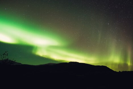
Environment | Northern Lights perk up the sky for a second consecutive night
")
News | Northern lights visible across Illinois amid rare geomagnetic storm
Trending nationally.
- Baltimore D-Day veteran, 104, returns to Normandy, perhaps for the last time
- One nation, under watch: New brand of largely unregulated mass surveillance is expanding in Virginia
- Florida priest bites woman who grabbed Holy Communion wafers
- California city pays nearly $900,000 for ‘psychological torture’ inflicted by police to get false confession
- McDonald’s getting rid of soda machines, free refills

An official website of the United States government
Here’s how you know
Official websites use .gov A .gov website belongs to an official government organization in the United States.
Secure .gov websites use HTTPS A lock ( Lock A locked padlock ) or https:// means you’ve safely connected to the .gov website. Share sensitive information only on official, secure websites.
- JetStream home
- Layers of the Atmosphere
- Air Pressure
- The Transfer of Heat Energy
- Energy Balance
- Hydrologic Cycle
- Precipitation
- Layers of the Ocean
- Ocean Circulations
- The Sea Breeze
- The Marine Layer
- Rip Current Safety
- Global Atmospheric Circulations
- The Jet Stream
- Climate vs. Weather
- Climate Zones
- How clouds form
- The Core Four
- The Basic Ten
- Cloud Chart
- Color of Clouds
- Parcel Theory
- Stability-Instability
- Radiosondes
- Skew-T Log-P Diagrams
- Skew-T Plots
- Skew-T Examples
- Pressure vs. Elevation
- Longwaves and Shortwaves
- Basic Wave Patterns
- Common Features
- Thickness Charts
- Weather Models
- Surface Weather Plots
- Norwegian Cyclone Model
- Types of Weather Phenomena
- Electromagnetic waves
- The Atmospheric Window
- Weather Satellites
- How radar works
- Volume Coverage Patterns (VCP)
- Radar Images: Reflectivity
- Radar Images: Velocity
- Radar Images: Precipitation
- Inter-Tropical Convergence Zone
- Classification
- NHC Forecasts
- Hazards & Safety
- Damage Potential
- ENSO Pacific Impacts
- ENSO Weather Impacts
- Ingredients for a Thunderstorm
- Life Cycle of a Thunderstorm
- Types of Thunderstorms
- Hazard: Hail
- Hazard: Damaging wind
- Hazard: Tornadoes
- Hazard: Flash Floods
- Staying Ahead of the Storms
- How Lightning is Created
- The Positive and Negative Side of Lightning
- The Sound of Thunder
- Lightning Safety
- Frequently Asked Questions
- Types of Derechos
- Where and When
- Notable Derechos
- Keeping Yourself Safe
- Historical Context
- Causes: Earthquakes
- Causes: Landslides
- Causes: Volcanoes
- Causes: Weather
- Propagation
- Detection, Warning, and Forecasting
- Preparedness and Mitigation: Communities
- Preparedness and Mitigation: Individuals (You!)
- Select NOAA Tsunami Resources
- Weather Forecast Offices
- River Forecast Centers
- Center Weather Service Units
- Regional Offices
- National Centers for Environmental Prediction
- NOAA Weather Radio
- NWS Careers: Educational Requirements
- Weather Glossary
- Weather Acronyms
- Learning Lessons
- Subdivisions

Cross section of the jet stream. The strength of the wind increases toward the core of the jet stream. It also does not reside at any one particular height but can extend across hundreds of miles in width and thousands of feet in height.
Download Image
Cross section of the jet stream
The strength of the wind increases toward the core of the jet stream. It also does not reside at any one particular height but can extend across hundreds of mile wide and 1,000s of feet in height.
Jet streams are relatively narrow bands of strong wind in the upper levels of the atmosphere, typically occurring around 30,000 feet (9,100 meters) in elevation.
Within jet streams, the winds blow from west to east, but the band often shifts north and south because jet streams follow the boundaries between hot and cold air.
Since these hot and cold air boundaries are most pronounced in winter, jet streams are the strongest during both the northern and southern hemisphere winters.
Why do the jet stream winds blow from west to east? Recall from the previous section what the global wind patterns would be like if the Earth was not rotating – the warm air rising at the equator would move directly toward both poles.)
We saw that the Earth's rotation divided this circulation into three cells, and it is responsible for the existence of the jet stream as well.
The rotational speed of the Earth’s surface, and thus the air above it, is relative to its latitude. Since the entire Earth makes one rotation in 24 hours, locations along the longer latitudes are rotating at a faster speed than the shorter ones because they are traveling more distance in the same amount of time. Therefore, the Earth’s rotational speed is fastest at its widest point, the equator. As a result, air moving away from the equator does not move directly north and south because it retains this rotational momentum, causing it to rotate faster than the surface below as it moves toward the poles.
Why the jet stream moves from west to east

Based upon the Earth's circumference at different latitudes, the velocity at which we at the surface move east in a 24-hour rotation decreases from over 1,000 mph (1,600 km/h) at the equator to zero at the poles. Someone standing on a pole is not moving east at all, just slowly spinning.
For air moving toward the poles, the Earth's rotational velocity decreases beneath it, but the air itself retains its eastward momentum. This results in wind that moves faster than the Earth rotates. Therefore, as air moves towards the poles, it also moves from west to east relative to the surface. This is the Coriolis effect.

The momentum the air has as it travels around the Earth is conserved, which means that as the air over the equator starts moving toward one of the poles, it keeps its eastward motion constant. The Earth below the air, however, moves slower toward the poles.
The result is that the farther the air moves from the equator, the faster and faster east it moves relative to the Earth's surface below.
In addition, with the three-cell circulations mentioned previously, the regions around 30° N/S and 50°-60° N/S are areas where changes in temperature at any one point are the greatest.
As the difference in temperature increases between the two locations, the strength of the wind increases. Therefore, the regions around 30° N/S and 50°-60° N/S are also regions where the wind in the upper atmosphere is the strongest.
There are several different jet streams, or jets, around the globe. The polar jet is located between the 50°-60° latitude lines in both the northern and southern hemispheres. The subtropical jet is located around the 30° latitude line. Jet streams vary in height of four to eight miles and can reach speeds of more than 275 mph (239 kts / 442 km/h).

The actual appearance of jet streams result from complex interaction between many variables, such as the locations of high and low pressure systems, warm and cold air, and seasonal changes. They meander around the globe, dipping and rising in altitude/latitude, splitting at times and forming eddies, and even disappearing altogether to reappear somewhere else.
Jet streams also "follow the Sun" – as the Sun's elevation increases each day in the spring, the average latitude of the jet stream shifts poleward. By summer in the Northern Hemisphere, the polar jet is typically found near the U.S. Canadian border. As Autumn approaches and the Sun's elevation decreases, the jet stream's average latitude moves toward the equator.

Jet streams are often depicted on weather maps by a line indicating the location of the strongest wind. However, jet streams are wider and not as distinct as a single line; they are regions where the wind speed increases toward a central core of greatest strength.
One way of visualizing this is to consider a river. The river's current is generally the strongest in the center, with strength decreasing toward the river's bank. For this reason, it is said that jet streams are "rivers of air".
- Log in / Sign up
And start your weather experience
- Log in with Facebook
- Log in with Twitter
- Log in with Google+

.cls-3{fill:#007faa;}.cls-4{fill:none;stroke:#046b99;stroke-miterlimit:10;} dot gov icon Official websites use .gov
A .gov website belongs to an official government organization in the United States.
.cls-1{fill:#549500;}.cls-2{fill:none;stroke:#458600;stroke-miterlimit:10;} https icon Secure websites use HTTPS
A small lock or https:// means you’ve safely connected to a .gov website. Share sensitive information only on official, secure websites.
NOAA Planet Stewards is now accepting proposals for 2023/2024 project funding!
What are the trade winds?
Early commerce to the americas relied on the trade winds—the prevailing easterly winds that circle the earth near the equator ..

The Charles W. Morgan is the last of an American whaling fleet that once numbered more than 2,700 vessels. Ships like the Morgan often used routes defined by the trade winds to navigate the ocean.
Known to sailors around the world, the trade winds and associated ocean currents helped early sailing ships from European and African ports make their journeys to the Americas. Likewise, the trade winds also drive sailing vessels from the Americas toward Asia. Even now, commercial ships use "the trades" and the currents the winds produce to hasten their oceanic voyages.
How do these commerce-friendly winds form? Between about 30 degrees north and 30 degrees south of the equator, in a region called the horse latitudes , the Earth's rotation causes air to slant toward the equator in a southwesterly direction in the northern hemisphere and in a northwesterly direction in the southern hemisphere. This is called the Coriolis Effect .
The Coriolis Effect, in combination with an area of high pressure, causes the prevailing winds—the trade winds—to move from east to west on both sides of the equator across this 60-degree "belt."
As the wind blows to about five degrees north and south of the equator, both air and ocean currents come to a halt in a band of hot, dry air. This 10-degree belt around Earth's midsection is called the Inter-Tropical Convergence Zone , more commonly known as the doldrums.
Intense solar heat in the doldrums warms and moistens the trade winds, thrusting air upwards into the atmosphere like a hot air balloon. As the air rises, it cools, causing persistent bands of showers and storms in the tropics and rainforests. The rising air masses move toward the poles, then sink back toward Earth's surface near the horse latitudes. The sinking air triggers the calm trade winds and little precipitation, completing the cycle.
More Information
What are the horse latitudes?
What are the doldrums?
What is a current?
Last updated:
Author: NOAA
How to cite this article
Exploring The Weather Conditions While Traveling East On I-20
- Last updated May 28, 2024
- Difficulty Intemediate
- Category Travel

As you embark on a journey across the vast expanse of I-20, one cannot help but wonder about the ever-changing weather conditions that lie in wait. From the arid plains of West Texas to the humid swamps of Louisiana, this interstate takes travelers on a whirlwind adventure through a variety of climates and landscapes. Join us as we delve into the fascinating world of weather along I-20, exploring the dramatic shifts in temperature, precipitation, and atmospheric conditions that make this route an unpredictable and thrilling experience for any road trip enthusiast. Buckle up and prepare to witness the bewildering beauty of nature at its most capricious while traveling east on I-20.
What You'll Learn
Introduction to traveling on i-20 east and weather conditions, weather patterns and climate along the i-20 east route, tips for preparing for and navigating different weather conditions, safety precautions and resources for staying informed about the weather.
If you are planning a trip on I-20 East, it is essential to understand the weather conditions you may encounter along the way. I-20 East stretches across several states, and the weather can vary significantly depending on your location and the time of year. To ensure a safe and enjoyable journey, it is crucial to be prepared for any potential weather hazards you might encounter. In this blog post, we will provide an overview of the different weather conditions you might experience while traveling on I-20 East and offer tips on how to stay safe on the road.
Spring and Summer Weather
During the spring and summer months, the weather along I-20 East can be quite unpredictable. Thunderstorms, heavy rainfall, and high temperatures are common during this time of year. It is essential to keep an eye on the weather forecast before hitting the road, as severe thunderstorms can bring strong winds, hail, and even tornadoes.
If you are traveling during the spring and summer, make sure to pack the necessary essentials such as rain gear, an emergency kit, and plenty of water. Additionally, it is advisable to have a weather monitoring app on your phone to receive updates on any severe weather alerts in your area.
Fall Weather
Fall is generally considered to be a more pleasant time of year to travel on I-20 East. The temperatures begin to cool down, and the risk of severe storms decreases. However, it is still important to be prepared for sudden weather changes, as temperature fluctuations can occur.
When traveling during the fall, it is a good idea to dress in layers and have a lightweight jacket or sweater with you. Additionally, be aware of foggy conditions that may occur in the mornings and evenings, particularly in areas surrounded by lakes or bodies of water.
Winter Weather
If you are traveling on I-20 East during the winter months, you need to be prepared for potentially hazardous weather conditions. Snow and ice can be significant problems in certain areas, especially in states like Georgia and Alabama, where winter storms are more common.
Before embarking on your journey during the winter months, check the weather forecast and road conditions along your route. If there is a storm warning or icy road conditions, it would be best to delay your trip or choose an alternative route if possible.
It is essential to have winter supplies in your car, including warm clothing, blankets, and an ice scraper. Additionally, make sure to check your tire pressure and ensure that your vehicle is in good condition before traveling on I-20 East during the winter months.
Traveling on I-20 East can be an exciting adventure, but it is crucial to be aware of the weather conditions you might encounter along the way. Whether you are facing thunderstorms in the spring, fog in the fall, or winter storms in the colder months, being prepared is the key to a safe and enjoyable trip.
Always check the weather forecast before you set off, and be ready to adjust your plans if necessary. Pack the essential items you may need, such as rain gear, warm clothing, and an emergency kit. By taking these precautions, you can ensure a smooth journey on I-20 East, regardless of the weather.
The Transformation of Travel: How VR is Revolutionizing the Way We Explore
You may want to see also
The weather patterns and climate along the I-20 East route can vary significantly depending on the time of year and the specific location. It is important to be aware of these variations when planning your travel and to be prepared for any potential weather conditions you may encounter.
Starting in West Texas, the I-20 East route passes through a region known for its dry and arid climate. Summers in this area can be scorching hot, with temperatures often exceeding 100 degrees Fahrenheit. It is important to stay hydrated and to use appropriate sun protection when traveling through this region during the summer months. In the winter, temperatures can drop below freezing, and there may be occasional snowfall. Make sure to check the weather forecast and road conditions before embarking on your journey, and take appropriate precautions if winter weather is expected.
As you continue further east into central Texas, the climate begins to transition to a more humid subtropical climate. Summers in this region can still be hot, but the humidity can make the temperatures feel even more oppressive. Thunderstorms and heavy rainfall are common during the summer months, so be prepared for potential delays or road closures due to inclement weather. Winters in central Texas are generally mild, with temperatures rarely dropping below freezing. However, there can still be occasional cold fronts that bring colder temperatures and the possibility of freezing rain or sleet.
Moving into Louisiana, the climate remains humid and subtropical. Summers in this state can be hot and muggy, with frequent thunderstorms and the potential for tropical storms or hurricanes. It is important to stay updated on any potential severe weather alerts and to have a plan in place in case evacuation becomes necessary. Winters in Louisiana are generally mild, with temperatures rarely dropping below freezing. However, there can still be occasional cold snaps, so it is wise to have warm clothing available.
As you travel further east into Mississippi, the climate remains humid and subtropical. Summers in Mississippi are hot and humid, with frequent thunderstorms. Hurricanes are also a potential threat in this region, so it is important to be aware of any tropical weather systems that may be active during your travel dates. Winters in Mississippi are also generally mild, with temperatures rarely dropping below freezing.
Finally, as you approach the easternmost portion of the I-20 East route and enter Alabama, you will continue to experience a humid subtropical climate. Summers in this state are hot and humid, with frequent thunderstorms. Winters are generally mild, but there can still be occasional cold snaps with freezing temperatures.
In conclusion, the weather patterns and climate along the I-20 East route can vary significantly depending on the specific location and time of year. It is important to be prepared for a wide range of weather conditions, from extreme heat to severe thunderstorms and the potential for tropical weather systems. Stay updated on the weather forecast and road conditions, and be sure to pack appropriate clothing and supplies for any potential weather scenarios.
Navigating the Process: A Step-By-Step Guide to Applying for a Travel Visa to Vietnam
When traveling on Interstate 20 East, depending on the time of year and location, you may encounter a variety of weather conditions. It is essential to be prepared and know how to navigate different weather conditions to ensure a safe and enjoyable trip. Here are some tips to help you prepare for and handle changing weather while traveling on I-20 East.
Check the Weather Forecast:
Before your trip, check the weather forecast along your route and at your destination. This will give you an idea of the conditions you may encounter and help you plan accordingly. Pay attention to any severe weather warnings or advisories issued by the National Weather Service.
Pack Essential Items:
Regardless of the weather conditions, there are a few items you should always have in your vehicle. These include:
- An emergency kit with a flashlight, first aid supplies, extra batteries, and a basic tool kit.
- Warm clothing and blankets, especially if traveling during the winter months.
- A fully charged cell phone and a car charger.
- Extra food and water in case of unexpected delays.
- An ice scraper and snow brush if traveling in snowy conditions.
Understand Road Conditions:
Different weather conditions can affect the road surface differently, making it important to understand road conditions and adjust your driving accordingly. Here are a few examples:
- Rain: Reduce your speed and increase the following distance between you and the vehicle ahead. Avoid sudden movements and be cautious of hydroplaning.
- Snow and Ice: Drive slowly, use your brakes and accelerator gently, and allow extra time for braking. Be cautious of black ice, which can be difficult to see.
- Fog: Reduce your speed and use low beam headlights or fog lights to improve visibility. Use caution when passing other vehicles and keep a safe distance.
Monitor Traffic Updates:
Weather conditions can cause traffic delays and accidents. Stay updated on traffic conditions by tuning into local radio stations or using a GPS with real-time traffic updates. If you encounter heavy traffic or an accident, remain patient, and follow any detour signs or instructions from law enforcement.
Adjust Your Travel Plans:
In severe weather conditions, such as blizzards, hurricanes, or thunderstorms, it may be advisable to adjust your travel plans. Consider delaying your trip or finding alternative routes if possible. Safety should always be a top priority when traveling, and it's better to arrive a little late than risk getting stuck or involved in a dangerous situation.
Stay Informed During Your Trip:
While on the road, continue monitoring weather forecasts and road conditions. This will help you anticipate any changes in weather and adjust your driving accordingly. Additionally, use smartphone apps or websites to receive real-time updates on weather conditions or any emergencies along your route.
Remember, weather conditions can change quickly, especially when traveling long distances. Always be prepared and stay alert to ensure a safe and enjoyable journey on Interstate 20 East.
Does Traveling from the US to Brazil Require a Visa?
When traveling, it is important to stay informed about the current weather conditions to ensure your safety. This is particularly crucial when traveling on a major interstate like I-20 East, as the weather can quickly change and impact road conditions. To help you stay safe, here are some safety precautions and resources to consider:
- Check the Weather Forecast: Before starting your journey on I-20 East, it is essential to know the weather conditions you may encounter along the way. Check the weather forecast for your departure point, destination, and the areas you will be passing through. This will give you an idea of what to expect and help you plan accordingly.
- Pack Emergency Supplies: It is always a wise decision to pack some emergency supplies when traveling. These may include a first aid kit, blankets, non-perishable food, and water. Additionally, keep a flashlight, extra batteries, and a portable phone charger in your vehicle. These supplies will be useful in case you encounter unexpected weather conditions or delays.
- Monitor Road Conditions: Keep an eye on the road conditions along your route. Check for any closures, accidents, or construction zones that may affect your travel on I-20 East. Consider using traffic and navigation apps that provide real-time updates on road conditions, such as Google Maps or Waze.
- Stay Connected: It is crucial to stay connected and informed about any weather updates or alerts. Make sure your mobile phone is fully charged and enable emergency weather alerts. Many weather apps allow you to set notifications for severe weather conditions, such as thunderstorms or high winds. This will help you stay aware of any changes in the weather as you travel.
- Listen to Local Radio Stations: Local radio stations often provide updates on traffic conditions and weather advisories. Tune in to a reliable station along your route to stay informed about any weather-related issues. The radio can be a valuable resource, especially if you encounter areas with limited cellular coverage.
- Take Breaks if Necessary: If you encounter adverse weather conditions while traveling on I-20 East, it is essential to prioritize your safety. If the weather becomes challenging to handle, consider taking breaks at rest stops, gas stations, or other safe locations until conditions improve. Use this time to reassess your travel plans and determine if it is safe to continue.
- Follow Recommended Safety Measures: When traveling on I-20 East, it is crucial to follow recommended safety measures during adverse weather conditions. Reduce your speed, maintain a safe following distance, and use your headlights when visibility is reduced. Be cautious of changing road conditions, such as black ice or flooded areas, which can make driving hazardous.
Remember, your safety is paramount when traveling on I-20 East or any other interstate. By staying informed about the weather, packing emergency supplies, and following safety precautions, you can have a safer and more enjoyable journey. Pay attention to weather updates, use reliable resources, and make smart decisions to ensure a smooth and worry-free trip.
What Qualifies as Eligible Travel Purchases for the Costco Visa?
Frequently asked questions.

- Duke Trotter Author Editor Reviewer Traveller

- Karli Trujillo Author Editor Reviewer
It is awesome. Thank you for your feedback!
We are sorry. Plesae let us know what went wrong?
We will update our content. Thank you for your feedback!
Leave a comment
Travel photos, related posts.

Flexible Travel: How to Change Your Travel Dates without Paying Extra
- May 09, 2024

Is the Antigen Test Accepted for Travel to South Korea?
- May 26, 2024

Is a Visa Required to Travel to the Dominican Republic from Kazakhstan?
- May 06, 2024

Tips for Keeping Typhoid Pills Cold While Traveling
- May 12, 2024

How to Express Your Love for Travel

Exploring Spain: Do You Need a Travel Visa?
- Apr 10, 2024
Advertisement
Supported by
Storms Snarl Memorial Day Travel After at Least 23 Killed
The weather disrupted flights at airports from Atlanta to Boston on Monday after powerful winds and rain battered towns across the South over the weekend.
- Share full article
Severe Storms and Tornadoes Cause Destruction in Several States
Severe weather hit several parts of the united states over the weekend, killing more than 20 people and leaving hundreds of thousands without power..
[NO SPEECH]

By Katie Benner and Ernesto Londoño
Follow our updated coverage of Tuesday’s severe weather here .
Severe weather stretching across the Midwest and East Coast on Monday disrupted plans for millions of Americans trying to make it home after a busy weekend that was expected to break records for Memorial Day travel. The disruptions followed storms and tornadoes that killed at least 23 people in the South and left hundreds of thousands without power.
Flights at airports from Atlanta to Boston experienced ground delays and stops as severe weather, including heavy rain and potentially damaging wind and hail, moved into much of the Eastern United States on Monday afternoon and evening.
Parts of New York, New Jersey and Pennsylvania were under severe storm watches through late Monday, and a tornado watch was issued for an area from northern Maryland through eastern North Carolina, including Washington, D.C. Heat and more thunderstorms were forecast for Texas and the Southern Plains on Tuesday, including possible hail and strong winds.
Officials with the Federal Aviation Administration said that they had worked with the airlines to plan for the expected weather disruptions over the Memorial Day weekend. On Friday, 2.9 million people were screened at U.S. airports , the Transportation Security Administration said — a single-day record.
By midday on Monday, La Guardia Airport in New York City had reported average ground delays of 100 minutes. Flights were also delayed at Hartsfield-Jackson Atlanta International Airport, the busiest in the world. And ground stops and major delays were reported or expected at airports in Chicago, Virginia, Baltimore, Washington, Philadelphia and Cleveland because of the storms, according to the F.A.A.
In Kentucky, Gov. Andy Beshear declared a state of emergency on Monday morning after four people were killed over the weekend. On Monday afternoon, Gov. Beshear announced a fifth storm-related death in the state, a person who died from a heart attack while cutting fallen trees. More than 150,000 customers in the state were without power at midday after damaging winds.
Elsewhere, a tornado left at least seven people dead in North Texas, including two children ages 2 and 5. Eight people were killed in Arkansas, and two died in Oklahoma as severe storms swept through the region, flattening hundreds of buildings and blowing away homes. And severe thunderstorms in Virginia resulted in at least one fatality, officials said.
Share of customers without power
Thousands of others in the South and the Midwest were without power on Monday, according to the tracking site poweroutage.us .
Later on Monday, severe thunderstorms were expected from Texas to New York, the National Weather Service’s Storm Prediction Center said . Flash flooding was possible from Maryland to the Catskill Mountains in New York, the Weather Service said , and tornadoes were possible in the Mid-Atlantic region.
Forecast risk of severe storms for Monday
The system was the latest to pummel the region over the past few days. Five people were killed and part of a city was obliterated in Iowa last week after a powerful tornado hit.
President Biden issued a statement of condolence to those affected by the storms, and he thanked emergency responders for their work.
“Jill and I are praying for those who tragically lost their lives as a result of devastating tornadoes that tore through Texas, Arkansas and Oklahoma, leveling entire communities and leaving a path of destruction in their wake,” Mr. Biden said.
Mr. Biden said that the federal government was “ready to provide support as needed.” He noted that the Memorial Day holiday storms came just weeks after counties in the Midwest and South were recovering from severe weather.
On Sunday, severe thunderstorms in Howell County, Mo., produced hail the size of baseballs and tornadoes that downed trees and damaged homes near the town of Mountain View, said Kelsey Angle, a meteorologist with the National Weather Service in Springfield.

In Kentucky, Governor Beshear deployed the National Guard to help state forestry workers clear downed trees and dangerous debris. He activated the state’s price-gouging statute to prevent price increases on necessary supplies, and said he believed that the state would qualify for public assistance from the Federal Emergency Management Agency.
Emergency workers have reported high water, fallen trees and other dangerous conditions in about a third of Kentucky’s 120 counties, mostly in the western part of the state, Jim Gray, the Kentucky transportation secretary, said at a news conference. The storms also impacted nearly 100 state highways.
In Texas, Governor Greg Abbott s igned a severe weather disaster declaration that covered 106 counties. Officials estimate that nearly 100 people were injured over the weekend, more than 200 homes were destroyed and over 220 buildings were damaged.
Johnny Diaz and Mike Ives contributed reporting.
Katie Benner is a correspondent writing primarily about large institutions that shape American life. More about Katie Benner
Ernesto Londoño is a Times reporter based in Minnesota, covering news in the Midwest and drug use and counternarcotics policy. More about Ernesto Londoño
Simple Flying
Why it's quicker to fly east than west.
Airlines plan their routes to take advantage of geophysical phenomena.
A transatlantic flight from London to Vancouver takes about nine hours and 45 minutes, while the return journey takes just under nine hours. The aircraft follows a similar flight path in both directions, but considerable discrepancies in flight times exist.
Do these phenomena have anything to do with the Earth's rotation? Or is the total distance somehow greater in the direction of the west? What is a jet stream? This article explores the real reason behind the geographical phenomena that impact aircraft flying in certain directions.
It has nothing - directly - to do with the Earth spinning
Many might think the Earth's eastward rotation is the cause for the faster eastbound journeys; this is not so. As NASA's Robert Frost explained in an interview with Forbes , the Earth's rotation has nothing directly to do with the speed of a flight. Just as you do not walk faster when trotting from east to west, the direction does not affect how fast a plane flies.
The spinning of the Earth around its own axis might look like an intuitive answer. While it doesn't directly affect the aircraft, the truth is still to be found in its indirect impact on the weather. More specifically, the real answer concerns a geophysical phenomenon known as jet streams.
What are jet streams?
The reason for quicker flights while flying eastwards is jet streams. Put simply, these are fast-flowing, narrow air currents in the atmosphere found at high altitudes. These currents are formed due to atmospheric heating from the sun's radiation and the Earth's Coriolis force (defined as a rotating object has a force perpendicular to the rotation axis ). Combined, these factors produce streams of fast-flowing air responsible for flight times looking significantly different depending on which way they are traveling.
The most prominent jet streams are the polar stream and the subtropical stream. These can be found at 60° and 30° north and south of the equator, respectively. The polar stream is the stronger of the two, and it causes much faster winds compared to the subtropical. Most airlines on transatlantic and transpacific routes make use of the polar stream while planning flight paths.
Jet streams can be as strong as 80 to 140 miles per hour, sometimes reaching 275 mph. These strong winds have significant upsides and downsides for commercial air travel. What's more, as the temperature of the Earth is affected by climate change, they could be about to shift, impacting far more than just flight times.
Recent research from the University of Southampton has shown that the winter jet stream over the North Atlantic and Eurasia has increased its average speed by 8% to 132 miles per hour. It could also shift northwards and beyond its historical boundaries within the next few decades.
Hitching a ride on the wind
The first time a commercial flight essentially hitched a ride on a jet stream was in 1952 on a flight from Tokyo to Honolulu. It was discovered that flying along jet streams cut the journey from 18 hours to a mere 11.5 hours when flying just under 25,000 feet. Airlines quickly realized the value of jet streams and began to incorporate them into flight planning.
The Various Considerations Of Route Planning & Aircraft Selection
Since the jet streams flow from west to east, they make one leg of the journey much faster (when flying with the stream) and one slower (against the stream). Imagine going downstream or upstream a river, or how it feels when you are cycling against the wind, as opposed to when you have it at your back.
Even on shorter transcontinental flights between cities like New York and Los Angeles, jet streams can impact the flight time by up to an hour. On long-haul transpacific routes, these streams can be beneficial for both passengers and airlines. By following the polar stream, the flight time from Tokyo to Los Angeles is just ten hours and five minutes, versus the 11 hours and forty minutes in reverse.
Subsonic transatlantic record: How a British Airways Boeing 747 hit speeds of 825 mph due to a jet stream
Clear Air Turbulence
While jet streams can speed up flights, they have a significant drawback due to a phenomenon called clear air turbulence (CAT). CAT is sudden severe turbulence that occurs in a cloudless sky, causing violent shaking of the aircraft. It happens when a slow jet stream interacts with a fast jet stream, creating a pocket of extreme disturbance. Unlike other forms of turbulence, CAT is also impossible to detect visually or by aircraft radar.
What Are The Different Kinds Of Turbulence?
Studies have concluded that CAT is set to rise in frequency by as much as 170% in the coming decades as a result of global warming. This means flying through jet streams will only become riskier in the coming years. Some areas could experience several hundred percent more turbulence, and some estimates project that by 2050, the rate of injuries will have almost tripled.
One major accident occurred onboard United Airlines flight 826 from Tokyo Narita (NRT) to Honolulu International (HNL) in 1997 - the exact route on which jet streams were first used on a commercial flight. Sudden CAT caused the aircraft to fall 100 feet, causing severe spine and neck injuries to 18 passengers. One passenger, who wasn't wearing their seat belt, died due to the sudden turbulence.
Not so simple
Jet streams are a natural phenomenon and, just like all natural things, are subject to change. While this only means a few more minutes or maybe an hour of extra flying on most routes, on ultra-long-haul trips, it can become an issue. Recent years have seen an extraordinary rise in demand and supply of 15+ hour flights, connecting North America and Europe with Asia and Oceania. However, they haven't come without their bumps.
For example, Air New Zealand's Auckland-New York service has been heavily affected by headwinds. Clocking in at 17.5 hours, the flight pushes the Boeing 787-9 to its range limit, meaning even the smallest change can result in cancelation or flying with fewer passengers and cargo.
Indeed, Air NZ has been forced to send travelers on their way without their bags or even rebook them on certain days since more weight for fuel is required. Notice again that the jet stream-supported eastbound service is far less affected and is only 15.5 hours.
However, the hope is that newer aircraft like Qantas' specially modified A350-1000 for Project Sunrise will have the extra capacity needed to offset these slight changes. Singapore Airlines' A350-900ULR has avoided these issues, but as airlines try to push their current planes to the limit, expect to read a lot more about variable weather conditions.
Get the best experience and stay connected to your community with our Spectrum News app. Learn More
Continue in Browser
Get hyperlocal forecasts, radar and weather alerts.
Please enter a valid zipcode.

Severe weather could disrupt Memorial Day weekend travel
If you’re traveling for Memorial Day weekend, the weather could affect your plans. Severe weather will develop across the central and southern Plains on Saturday before shifting east toward the mid-Mississippi and Ohio River Valley on Sunday.
Dangerous and record-breaking heat is possible in South Texas, along the Gulf Coast to South Florida through Memorial Day.
What You Need To Know
Severe weather is expected across the central u.s. on saturday and sunday parts of the southern u.s. could experience record-breaking heat wet weather and storms are expected across the eastern u.s. on memorial day.
Here’s what you need to know about the forecast this weekend.
Severe weather is going to be the primary threat for holiday weekend travelers on Saturday. Storms will develop across the central and southern Plains on Saturday afternoon and evening capable of producing all types of severe weather.
Oklahoma, Kansas and western Missouri will see the highest threat for severe weather, including several strong to violent tornadoes, extreme hail, damaging winds and heavy rainfall Saturday afternoon into the overnight hours.
Scattered showers are possible across parts of the interior Northeast and Mid-Atlantic late Saturday.
The Gulf Coast states, from South Texas to South Florida will experience summerlike heat with the potential for record highs. Heat impacts will likely be highest in South Texas, where heat index values will exceed 115 degrees through Memorial Day.
The western U.S. will be cool to kick off the weekend, as highs stay 5 to 15 degrees below normal.
The same complex of storms from the Plains on Saturday will shift east, bringing the highest severe threat across parts of the mid-Mississippi and Ohio River Valley on Sunday into Sunday night.
Once again, it looks likely that storms will be capable of producing strong tornadoes, large hail, damaging winds and flash flooding. The highest threat will be for parts of eastern Missouri, Illinois, Indiana and western Kentucky.
Other areas that will see rain and storms include Wisconsin and Ohio. A weak front could bring some scattered showers to parts of the upper Northeast and New England on Sunday morning, but it will dry out early.
Dangerous heat remains in place across the southern states on Sunday. Heat index values will be highest in South Texas again as actual air temperatures climb into the upper 90s and even the triple digits. Overnight temperatures won’t cool off much with record warm lows, so little to no relief is expected to those without reliable cooling.
Western parts of the country will warm up slightly as temperatures climb back near normal for late May while the East Coast remains around 10 degrees above normal, topping out in the upper 80s to low 90s.
Wet weather will spread east on Memorial Day, bringing widespread shower and storm chances to parts of the eastern U.S., including the Northeast, New England and Mid-Atlantic.
Memorial Day will kick off with showers, likely across the Ohio River Valley and Mid-Atlantic. As the system moves northeastward, rain and storms will fill into the Northeast through the morning and New England through the afternoon.
Temperatures will also be rain-cooled for these areas, so it will feel more seasonable around the Great Lakes. A few scattered showers and storms are possible in the southeast, too.
The western U.S. also warms back up a few degrees above normal, and Texas and Florida continue to feel the summerlike heat with record highs possible and heat index values climbing well into the triple digits.
Our team of meteorologists dives deep into the science of weather and breaks down timely weather data and information. To view more weather and climate stories, check out our weather blogs section .
- Search Please fill out this field.
- Manage Your Subscription
- Give a Gift Subscription
- Newsletters
- Sweepstakes
- Destinations
9 Best Places to Live in the Western U.S., According to Real Estate Experts
In these stunning locations throughout the Western U.S., residents can enjoy endless outdoor recreation, urban amenities, and a high standard of living.
:max_bytes(150000):strip_icc():format(webp)/Dobrina-Zhekova-2885480a814f40a2801fda922af4d135.jpeg "can weather travel east to west")
DenisTangneyJr/Getty Images
14 states and territories comprise the West Census Region — and life in all of them comes with some serious perks. Proximity to many of the country’s most beautiful natural sites is pretty much a given, as the region is home to an overwhelming majority of the U.S. national parks (40 out of 63). The variety of landscapes, geological wonders, and natural sites is awe-inspiring, with snow-capped peaks, deserts, rainforests, and thousands of miles of beaches.
At the same time, the region also offers plenty of economic opportunities that draw professionals from all industries and educational backgrounds. Utah, for example, was just named the best state to start a business with the largest employment growth in the country.
These are the best places to live in the Western U.S., according to real estate experts.
Sacramento, California
JasonDoiy/Getty Images
"Sacramento isn't just a place to live, it's a place where people feel they belong," Pat Shea, a longtime Sacramento resident and president and CEO of Lyon Real Estate/Luxury Portfolio International , said, adding that California's capital offers the perfect blend of city energy and small-town charm. With excellent schools, many parks and green spaces, and a dining scene that's getting national recognition , Sacramento is a family-friendly, culturally rich city that attracts residents with its affordability. According to Zillow, the median home value here is $483,455, compared to $783,666 for California as a whole.
Shea explained that seven counties comprise the greater Sacramento region, and each offers something unique. "East Sacramento's 'Fabulous Forties' beckons with its picturesque tree-lined streets and historic homes. Land Park, with its lush green spaces and close proximity to the Sacramento Zoo, provides a serene retreat within the heart of the city. Midtown Sacramento pulsates with energy, boasting trendy restaurants, vibrant nightlife, and a thriving arts scene," he added.
Portland, Oregon
benedek/Getty Images
Access to abundant outdoor recreation, a thriving beer scene , and a stunning natural setting have made Portland one of the best places to live in Oregon . Real estate prices have cooled off since the pandemic, and the current median home value is $539,524, about $150,000 less than it was in June 2022. And Aimee Virnig, an agent at Windermere Real Estate/Luxury Portfolio International , said this is great news for people looking to relocate here, as the market is less competitive than it was two years ago.
"My advice to prospective homebuyers is to come to Portland and visit. Make sure you are prepared for those four seasons. If you are used to sunshine, our winters might be surprising," Virnig added. "The more you educate yourself, the more likely you will be able to make a competitive offer when the perfect property becomes available."
Salt Lake City, Utah
georgeclerk/Getty Images
Utah is known as one of the most family-friendly states in the nation, and Salt Lake City is an excellent example of that, with endless outdoor recreational activities, low crime rates, and a school system that ranks among the best in the country .
The city is also known for its bustling tech and healthcare industries fueling the area's economic growth, which in turn attracts highly educated professionals.
"Salt Lake City, in general, is a culmination of new and old townships. It's peppered with hidden gems of pocket neighborhoods that have stood for over a century, such as The Avenues, Harvard and Yale, and Sugarhouse," Tim Jones, a broker with Windermere Real Estate/Luxury Portfolio International , explained. "By contrast, heading southwest of downtown Salt Lake City, the areas of Riverton, South Jordan, and Daybreak have all seen an eruption of new construction."
Jones also added that now is a good time to invest here since many potential buyers are waiting for interest rates to drop and competition is low.
Boise, Idaho
Mitch Diamond/Getty Images
Boise's population grew during the pandemic — it was the fifth fastest-growing city in the U.S. in 2022 — driven by lower cost of living and access to the outdoors. The city, which is the largest in Idaho, offers many urban conveniences but has a much slower pace than other metropolitan areas. It is a haven for outdoor enthusiasts with over 90 parks and hundreds of trekking miles, and it's home to a vibrant cultural scene with many annual festivals, museums, and public art.
Nicolette Kimmel, a broker with Windermere Real Estate, explained that Boise's North End neighborhood is an all-time favorite among buyers for its craftsman bungalows, Tudor-style buildings, and Victorian-inspired homes. Currently, the median home value in the city stands at $484,000.
Vancouver, Washington
Rory Fuller/Travel + Leisure
Across the Columbia River from Portland lies the city of Vancouver, home to 195,000 residents who live a classic Northwestern lifestyle — think access to stunning natural scenery, many opportunities for outdoor recreation and water sports, lots of restaurants and coffee shops, and a thriving art and culture scene. As a no-income-tax state, Washington offers a financial incentive for young families and professionals to make it their permanent home.
"Vancouver has a strong, growing economy with a mix of industries, such as technology, healthcare, and education. The cost of living is four percent lower than the rest of Washington State, and [that] combined with low unemployment is appealing to most buyers," Judy Matz, a broker with John L. Scott Real Estate/Luxury Portfolio International , explained. She added that this has led to an explosion of new developments in the area as the county rapidly expands and median home prices hover around the $500,000 mark.
Reno, Nevada
Jamie Ditaranto/Travel + Leisure
What makes Reno one of the fastest-growing places in the nation ? According to agent Nicolle Gust, at Chase International Real Estate , it's affordable and offers a lower cost of living compared to other urban areas on the West Coast.
"This makes it an ideal destination for families, young professionals, and retirees looking to enjoy a high quality of life without breaking the bank," Gust said. But that's not nearly all. As Nevada's fourth-largest city, Reno has a thriving arts scene and is surrounded by beautiful landscapes with easy access to Lake Tahoe, the Sierra Nevada Mountains, and several national parks.
And new buyers have plenty of neighborhoods to choose from. Old Southwest, with its idyllic tree-lined streets and charming homes, has plenty of character, while Somersett, on the western edge of Reno, is a master-planned community with modern, resort-like amenities.
San Jose, California
pbk-pg/Getty Images
"San Jose is a phenomenal location, situated in the heart of the Silicon Valley. You have access to so many amenities, including hiking trails, [and you can take] a short drive to the coast, head up the peninsula to San Francisco, or make your way to Lake Tahoe in a few hours," Jordan Mott, an agent at Intero Real Estate Services/Luxury Portfolio International , said.
The "capital of Silicon Valley" recently ranked fourth nationwide for quality of life and was in the top 15 cities to live in America according to U.S. News, thanks to its strong employment market and high standard of living.
However, newcomers should be ready to pay a hefty price for all of that. Housing prices are well over the one million mark (currently around $1,461,923), and the cost of living is 25 percent higher than the state's average — and a whopping 75 percent higher than the rest of the country.
Boulder, Colorado
"I personally moved here as an age-group triathlete, drawn to Boulder's fantastic outdoor training opportunities, and quickly got hooked! That was almost 30 years ago," Phil Booth, a broker with Slifer Smith & Frampton Real Estate/Luxury Portfolio International , shared with Travel + Leisure.
Set against the Rocky Mountains, the city is a dream for outdoor enthusiasts. But it's also home to a top-notch university, a thriving artist community, and a hub for tech industries. Booth explained that the city's real estate market has evolved over the last decade into one of the hottest in the nation.
"Taste-wise, there is something for everyone. Whether it be accessible mountain living, classic historical neighborhoods, contemporary architectural beauties, or small-acreage equestrian properties, you get to choose the type of 'Boulderite' you want to be," he added.
Phoenix, Arizona
Matt Mawson/Getty Images
Phoenix's population has increased by four percent on average since 2020, adding nearly 200,000 new residents. The city's lower cost of living, warm and sunny year-round weather, robust job market, and proximity to national parks and outdoor recreation are all factors for this impressive growth.
Shane Edic, an agent at Long Realty Elevate/Luxury Portfolio International , said that the West Valley, a region within the Phoenix metro area, is experiencing a significant upsurge "fueled by the burgeoning industrial developments along the 303 corridor."
Related Articles
5 dead in Kentucky after tornadoes, severe weather. Here's what we know

At least five people have died across Kentucky following two tornadoes and other severe weather on Sunday that damaged property and left tens of thousands without power.
At 12:12 a.m. Monday, Gov. Andy Beshear issued a state of emergency for the commonwealth. This declaration allows the state to bring in additional resources such as the National Guard.
Gov. Andy Beshear held an 11 a.m. press conference Monday — Memorial Day, to address the ongoing weather situation and provide an update on storm damage along with the state’s response plan.
"Last night many families and communities were not safe," Beshear said. "We had devastating storms that hit almost the entire state."
At least two confirmed F-1 tornadoes touched down in Kentucky, according to preliminary survey results from the National Weather Service in Louisville. One tornado with 90 mph winds hit eastern Meade and northern Hardin counties. A second tornado touched down in Butler and northern Warren counties with 85 mph winds.
In Louisville and other parts of the state there were tornado watches and severe thunderstorms that brought down trees and caused property damage.
The Memorial Day weekend storms weren't the state's first run in with tornadoes and storms this year. In April storms moved through Louisville and Southern Indiana leaving destruction, and in March three tornadoes that caused structural damage were confirmed in the area .
Now following yet another series of severe weather in Kentucky, here's what we know:
What part of the state was hit hardest?
Beshear said one tornado in Western Kentucky continued for about 40 miles. This tornado barely missed the prison in Eddyville and barely missed Mayfield, the site of the destructive 2021 tornadoes that the area is still recovering from .
"At least one family who lost their home in the 2021 tornado lost their home again last night," Beshear said.
He noted there were several other tornadoes that "spun down then spun back up." The state is still waiting for the National Weather Service to confirm the total number of tornadoes.
Kentucky Secretary of Transportation Jim Gray said it appears that Western Kentucky was hit the hardest by the storms, noting damages across state highways and roads.
Beshear said not only did the storms take out power for thousands of people, but many roads and interstates were temporarily closed due to the storms. Many businesses and residential areas also suffered "massive damage." Beshear urged individuals to report any and all levels of damage to the emergency management agencies in their county to help the state qualify for FEMA assistance and other resources.
"But like we always see after severe weather events, first responders and everyday Kentuckians rally to help each other in those toughest moments," Beshear said.
Were there any fatalities from the storms?
In the press conference, the governor confirmed at least four people have died and one individual is "fighting for their life" as a result of the Sunday storms.
In a statement sent on X just before 5 p.m. Monday, Beshear confirmed that a fifth person has died related to the severe weather.
"I’m sad to share we have another reported death as a result of yesterday’s storms," read the post. "A 54-year-old man died from a heart attack while cutting fallen trees in Caldwell County. His loved ones are in our prayers during this difficult time."
Confirmed fatalities also include a 67-year-old woman from Mercer County, a 62-year-old woman in Hardin County, a 48-year-old woman in Hopkins County and a 34-year-old man in Jefferson County who was hit by a tree.
Beshear said he is not aware of any unaccounted for Kentuckians.
How many people are without power?
Statewide, there were roughly 175,000 customers without power across the state, Beshear said. While large cities should expect to see power restored Monday, the governor said counties like Trigg and Todd may be without power for several days since there was significant destruction to the power infrastructure in the area.
How many states of emergency have been declared?
Across the state, 14 counties and five cities have declared states of emergency alongside the governors declaration.
Is there a storm shelter set up?
The Red Cross has opened a shelter in Clay County.
Beshear also said Pennyrile Forest State Resort Park will be opened up as a shelter for those in need of rooms. This site is where victims of the 2021 tornado were sheltered.
Are there any environmental concerns from the storm?
On Dale Hollow Lake, a dock broke away, which was believed to have caused a significant fuel spill. The Energy and Environment Cabinet are in the area with a hazmat team but currently no further information is available regarding this potential environmental impact resulting from the storms.
"It's one of the most significant impacts of these storms," Beshear said.
Can I travel currently?
Gray said if you see water in the roads, "turn around, don't drown."
He also expressed other safety notes for people who need to travel in the midst of storm damage including:
- Don't drive over downed power lines.
- Don't touch live wires or downed power lines.
- Beware of debris on roadways.
- If traffic lights are out, treat the intersection as a four-way stop.
Contact business reporter Olivia Evans at [email protected] or on X, the platform formerly known as Twitter at @oliviamevans_ .
🥵 Toughest DI baseball regional
DI men's golf finals
Auburn vs. FSU
🔮 DI baseball tournament preview
⛳️ Hiroshi Tai claims individual men's golf title
Stan Becton | NCAA.com | May 27, 2024
2024 ncaa outdoor track and field championships: schedule, location, tv channels, history.

Over 250 NCAA member institutions sponsor Division I track and field teams, and each year, these teams hope to compete in the championship meet. With over 20 events for both men and women, the championship meet will cap off an exciting outdoor season.
Here's all you need to know about the 2024 NCAA outdoor track and field championships.
🔗 Click or tap here for live updates for the championships from first round selections to final site champions 🔗
When are the 2024 NCAA outdoor track and field championships?
The 2024 NCAA outdoor track and field championships are from Wednesday, June 5 through Saturday, June 8. Both the men's and women's championships are held simultaneously.
Where are the 2024 NCAA outdoor track and field championships?
The 2024 NCAA outdoor track and field championships will be held at Hayward Field in Eugene, Oregon. It will be the 15th time the outdoor championships have been held in Oregon and the first time since 2022.
You can purchase tickets to the 2024 championships here.
MORE: Here's how the outdoor track and field championships work
How to watch the 2024 NCAA DI outdoor track and field championships
The 2024 NCAA DI Outdoor Track & Field Championships will air on the ESPN family of networks.
* All broadcast times and networks are subject to change. All times listed are Eastern.
Click or tap here for the latest updates to broadcast information.
What is the schedule of events?
The NCAA announced the 2024 NCAA DI Outdoor Track & Field Championships schedule of events on February 9, 2024. Below are some of the notable dates and times for events:
All times are Pacific and subject to change

Click or tap here for the schedule of events in pdf form | Live Results link
How are championship participants selected?
The NCAA Division I Men’s and Women’s Track and Field and Cross Country Committee will select and announce the participants for the 2024 NCAA Division I Men’s and Women’s Outdoor Track and Field Championships.
The top 48 declared student-athletes will be accepted into the first round competitions for each individual event. The top 24 declared relay teams will be accepted into the first round competitions for each relay event.
Combined events do not attend the first round. For combined events (Heptathlon and Decathlon), the top 24 declared student-athletes in each event based on their position on the national descending-order list will be accepted directly into the Championships.
There are two first rounds, one for the east region and one for the west region. The qualifiers out of these two regions will compete in the 2024 NCAA Division I Men’s and Women’s Outdoor Track and Field Championships.
🏆: Here are the DI track and field teams with most NCAA championships
When is the championship field selected?
The 2024 DI men and women's outdoor track and field final site selections will be announced on Tuesday, May 28.
First round selection
Qualifying performances for the 2024 first rounds can begin March 1. The qualifying window closes for every meet that isn't a conference championship on Sunday, May 12. The qualifying window closes for conference championship meets on Monday, May 13.
Athletes accepted into the first rounds will be announced on Thursday, May 16.
Click or tap here for the first round selections press release
Championship selection
Combined event athletes (heptathlon and decathlon) accepted into the championship meet will be announced on Thursday, May 16.
The top 12 competitors from each individual event and the top 12 teams from each relay event advance from each first round. The list of qualifiers from each event contested in the first rounds will be announced by 5 p.m. ET on Sunday, May 26. The final list of the championships competition participants will be announced by 3 p.m. ET on Tuesday, May 28.
Click or tap here for the championship selections press release
When are the 2024 NCAA first rounds?
The NCAA first rounds run Wednesday, May 22 through Saturday, May 25. Both the DI men's and women's first rounds are held simultaneously.
Where are the 2024 NCAA first rounds?
The meets will be held in two locations for the east and west regions. The NCAA East first round will be located in Lexington, Kentucky, with Kentucky serving as the host school. The NCAA West first round will be located in Fayetteville, Arkansas with Arkansas serving as the host school.
🗓: Here are the future dates and sites for DI outdoor track and field through 2026
What are the schedule of events for the first rounds?
You can find schedule of events for the 2024 NCAA East and West first rounds below:
- Location: Lexington, Kentucky (University of Kentucky)
- Schedule of events
- Live Results
- Wednesday 6 p.m. ET
- Thursday 6 p.m. ET
- Friday 5 p.m. ET
- Saturday 5 p.m. ET

- Location: Fayetteville, Arkansas (University of Arkansas)
- Wednesday 7 p.m. ET
- Thursday 7 p.m. ET
- Friday 6 p.m. ET
- Saturday 6 p.m. ET

What are the current outdoor track and field rankings?
Click or tap here to view the latest men's track and field USTFCCCA rankings . Click or tap here to view the latest women's track and field USTFCCA rankings . Both will be updated throughout the season.
Who are the past outdoor track and field team champions?
Here are the previous winners of the NCAA outdoor track and field championships. The women's championship began in the 1982 season while the men's championship began in the 1921 season.
DI women's track and field championship history
#Participation in the championships vacated by the NCAA Committee on Infractions History of scoring in championships—1982-84 (15-12-10-9-8-7-6-5-4-3-2-1); 1985-present (10-8-6-5-4-3-2-1).
DI men's track and field championship history
* Unofficial championship & Participation in the championships vacated by the NCAA Committee on Infractions.

2024 NCAA Division I Outdoor Track and Field Championships advancements announced

Wisconsin-La Crosse, WashU win 2024 Division III men's and women's outdoor track and field championships

Every collegiate track and field record broken in 2024

- International

Israel-Hamas war

Trump's hush money trial
The latest on the massive solar storm
By Angela Fritz, Elise Hammond and Chris Lau, CNN
Incredible lighthouse picture from Maine
From CNN's Chris Lau

Among a flurry of surreal images capturing the dazzling auroras is one taken by Benjamin Williamson of a lighthouse in Portland, Maine.
"It's one of the most incredible things I've ever seen, the awe and wonder," Williamson told CNN.
He said he used a long-exposure technique to snap the shot, but did not edit it.
Watch the full interview with Williamson here .
Things could be about to ramp up
If you still haven't seen the aurora, hold on for another 30 minutes to an hour, according to CNN meteorologist Chad Myers.
The next wave of coronal mass ejections, or CMEs, which cause the aurora, is about to arrive, he said.
"Just wait a minute because things are going to start to ramp up here," he said, adding that the increase could arrive "anytime now." "When it comes, get outside, get ready, put your coat on."
For those who are too busy to witness the phenomenon tonight, Myers said the aurora is expected to last three nights.
Why does the aurora last for a weekend?
By CNN's Chris Lau

Generally, it takes just eight minutes for light to travel 93 million miles to the Earth from the sun, but astrophysicist Janna Levin said the energized particles causing the current wave of aurora travel a lot slower, causing the phenomenon to last for the weekend.
"Some of these mass ejections are trillions of kilograms," she said. "They're slower. So they're taking longer, but still hours, maybe tens of hours."
Here's how the solar storm looks in the South and on the East Coast
The aurora was visible across the East Coast and in the South Friday.
Here's how it looked in Chester, South Carolina.
Down in Florida, waves of color swam through the sky.
Up north in New Jersey, a purple-ish haze could be seen in the sky.
Will solar storms get more intense and risky in the future?
The answer is probably not in the short term, according to astrophysicist Hakeem Oluseyi.
He said scientists study what is constantly happening on the surface of the sun and have found a pattern.
“Geological data shows us that in the past the sun was way more active than it is today. It has cycles where it goes very quiet ... and you have events that show that the solar activity was much, much greater,” he told CNN. “So there's no evidence that we're going to see those big maxima this cycle."
But the astrophysicist also spoke of a caveat - the limitations of modern science.
“Even though it's predictable in the short term, we still don't quite understand what creates the magnetic fields in the sun,” he said, adding: “That's why NASA has so many satellites looking at the sun.”
In Pictures: Auroras light the sky during rare solar storm
From CNN Digital's Photo Team

A series of solar flares and coronal mass ejections from the sun are creating dazzling auroras across the globe .
The rare solar storm may also disrupt communications. The last time a solar storm of this magnitude reached Earth was in October 2003, according to the National Oceanic and Atmospheric Administration's Space Weather Prediction Center.
See more photos of the aurora from tonight.
Behind dazzling aurora could lie “real danger,” Bill Nye the Science Guy says

The massive solar storm could present “a real danger,” especially with the modern world relying so much on electricity, according to Bill Nye the Science Guy , a science educator and engineer.
Scientists are warning an increase in solar flares and coronal mass ejections from the sun have the potential to disrupt communication on Earth into the weekend. Solar flares can affect communications and GPS almost immediately because they disrupt Earth’s ionosphere, or part of the upper atmosphere. Energetic particles released by the sun can also disrupt electronics on spacecraft and affect astronauts without proper protection within 20 minutes to several hours.
In comparison to tonight's event, Nye drew comparisons with another incident in 1859, known as the Carrington Event, when telegraph communications were severely affected.
“The other thing, everybody, that is a real danger to our technological society, different from 1859, is how much we depend on electricity and our electronics and so on,” Nye said. "None of us really in the developed world could go very long without electricity."
He noted that there are systems in place to minimize the impact, but “stuff might go wrong,” stressing that not all transformers are equipped to withstand such a solar event.
“It depends on the strength of the event and it depends on how much of our infrastructures are prepared for this the sort of thing,” he said.

Bill Nye breaks down significance of the solar storm | CNN
This post has been updated with more details on solar flares' impact on electronics.
Here's where clouds will block the view of the northern lights in the US
From CNN's Angela Fritz

After an incredibly stormy week, most of the Lower 48 has clear skies to see the northern lights. But there are some areas where clouds and rainy weather are spoiling the view.
A deck of clouds is blocking the sky in the Northeast, from parts of Virginia into Maine, as an area of low pressure spins off the East Coast.
In the Midwest, the aurora will be hard to see through thick clouds in parts of Wisconsin, Michigan — including the Upper Peninsula — and Illinois.
A stripe of clouds is tracking across Texas, including Dallas-Forth Worth, and into Louisiana.
And in the Southwest, patchy clouds across the the Four Corners region could make the northern lights difficult to spot.
Aurora seen at least as far south as Georgia
Barely visible to the naked eye, the aurora can be seen in Atlanta in the 10 p.m. ET hour.
It is easier to see through photographs using a long exposure. The photos below, taken by CNN's Eric Zerkel and Emily Smith, used 3- and 10-second exposures.

Please enable JavaScript for a better experience.
IMAGES
VIDEO
COMMENTS
The Coriolis effect deflects the moving air to the right enroute — that is, toward the west — and the net effect is that the prevailing winds, better known as the trade winds, are out of the northeast. Something similar happens in the arctic. Frigid polar air contracts, sinks, and heads south. The Coriolis effect deflects it to the right ...
They are pushed along by winds known as the "easterlies," which moves them generally from east to west across the tropical waters. So, when a tropical system makes landfall across the U.S., it often moves in with its rain traveling from the east, southeast to the west, northwest. Weather can slide into your area from any direction.
Warmer tropical air blows toward the colder northern air. These winds shift west to east due to the rotation of the earth. Every once in awhile, we get a backdoor cold front in the Mid-south. This is because an area of low pressure can pull down a cold front from the northeast to the southwest. The structure of low pressure systems, which move ...
But, can the weather move east to west? Well, it can, but it is not that common. It moves from west to east because of the following reasons: The Earth's Rotation. Our planet Earth is a fast-spinning globe, rotating around a tilted axis at about 1000 miles per hour. The direction of the spin, from west to east, pulls the atmosphere and the ...
This worldwide circulation pattern directly contributes to the west-to-east passage of weather systems across the nation. Influence of Topography and Local Effects. The eastward travel of weather systems in the United States is mostly caused by the prevailing westerlies, although local geology and geography can bring changes in this trend.
Tropical. 50-70 mph. East to West. 0°-20° N/S. Changes in tropical storm intensity. As climate change continues to impact our planet, the behavior of jet streams is also changing. These shifts can result in more extreme weather events, altered rainfall patterns, and increased storm intensity.
The Short Answer: The trade winds are winds that reliably blow east to west just north and south of the equator. The winds help ships travel west, and they can also steer storms such as hurricanes, too. When you're outside, you might notice that one day the wind blows one direction and the next day, wind is blowing a different direction.
As the pattern progresses, the jet stream pushes that feature from the west to the east. Every now and then, we can get storms here to move in from the east, but it takes a big perturbation in the jet stream to do so. In general, you can expect storms to move from west to east. Stay tuned for another segment of weather 101 in two weeks!
These represent the usual wind flow in an area or region. The prevailing wind direction here across the U.S. is from west to east, which explains why most storm systems move in that direction ...
Now, the reason hurricanes travel toward us from east to west is because the prevailing winds blow from east to west in the tropics. Once a hurricane moves above 30 degrees north, or right around ...
Just because most tornadoes move in this west-to-east formation doesn't mean that all of them do. Remember that they're formed by thunderstorms, so they often follow the path of their "parent" storms, which also generally move from the southwest [sources: Cappella; Chicago Tribune].But tornadoes can easily turn or even backpedal -- sometimes quite suddenly -- and travel the opposite way if ...
Whenever meteorologists track storm systems moving in, it's noticeable that the western areas get in on the action first. That's true for half of the norther...
National Weather Maps. Surface Analysis. Highs, lows, fronts, troughs, outflow boundaries, squall lines, drylines for much of North America, the Western Atlantic and Eastern Pacific oceans, and the Gulf of Mexico.
Most people know that most weather storms in the United States move from west to east. However, it is not a rule of thumb and many factors may affect the direction where bad weather forms and moves. A storm is a dynamic process that changes and evolves over time. Size shifts, changes in the storm's stage, changes in precipitation rate ...
Now you can explain the big "hook" we often see in the tracks of tropical systems. When the storms are south of us, they are being steered mainly east-to-west in the "low latitude" flow of the ...
Dear Tom,The weather goes from west to east. Why do hurricanes go from east to west?— Tony Patzkowsky, Tinley ParkDear Tony,It's certainly true that, in general, weather systems move from a ...
As such, there is a prevailing headwind (-mph) going east to west and a prevailing tailwind (+mph) going west to east. The path of the jet stream is highly variable (its usually shown on weather maps, because it is the primary determinant of weather), but can be usually thought of as a U shaped curve that on average goes from say, Oregon, south ...
Let us know. Jet streams are relatively narrow bands of strong wind in the upper levels of the atmosphere, typically occurring around 30,000 feet (9,100 meters) in elevation. Within jet streams, the winds blow from west to east, but the band often shifts north and south because jet streams follow the boundaries between hot and cold air.
Because they are often located within the tropical easterly wind zone, these systems will travel from east to west. Credit: WQAD. As they approach the United States, there are a few more factors ...
Track the weather and extreme weather situations along your route to make every trip a safe journey, whether it's sunny, rainy, or snowing.
The Coriolis Effect, in combination with an area of high pressure, causes the prevailing winds—the trade winds—to move from east to west on both sides of the equator across this 60-degree "belt." As the wind blows to about five degrees north and south of the equator, both air and ocean currents come to a halt in a band of hot, dry air.
It's certainly true that, in general, weather systems move from a westerly to an easterly direction in the mid-latitudes, but almost all hurricanes form and initially travel in the subtropics ...
Weather patterns and climate along the I-20 East route. The weather patterns and climate along the I-20 East route can vary significantly depending on the time of year and the specific location. It is important to be aware of these variations when planning your travel and to be prepared for any potential weather conditions you may encounter.
Severe weather stretching across the Midwest and East Coast on Monday disrupted plans for millions of Americans trying to make it home after a busy weekend that was expected to break records for ...
The polar stream is the stronger of the two, and it causes much faster winds compared to the subtropical. Most airlines on transatlantic and transpacific routes make use of the polar stream while planning flight paths. Jet streams can be as strong as 80 to 140 miles per hour, sometimes reaching 275 mph.
Severe weather could disrupt Memorial Day weekend travel. By Spectrum News Weather Staff Nationwide. PUBLISHED 4:30 PM ET May 24, 2024 PUBLISHED 4:30 PM EDT May ... Wet weather will spread east on Memorial Day, bringing widespread shower and storm chances to parts of the eastern U.S., including the Northeast, New England and Mid-Atlantic. ...
14 states and territories comprise the West Census Region — and life in all of them comes with some serious perks. Proximity to many of the country's most beautiful natural sites is pretty ...
At least five people have died across Kentucky following two tornadoes and other severe weather on Sunday that damaged property and left tens of thousands without power. At 12:12 a.m. Monday, Gov ...
You can find schedule of events for the 2024 NCAA East and West first rounds below: East : May 22-25 Location: Lexington, Kentucky (University of Kentucky)
A stunning aurora, caused by a severe geomagnetic storm, is painting the sky shades of pink, purple and green as it spreads into locations it rarely reaches Friday night.