
Austin, TX Traffic and Road Conditions
Austin traffic map.
How to use the Austin Traffic Map Traffic flow lines : Red/White dashed lines = Closed Road, Red lines = Heavy traffic flow, Yellow/Orange lines = Medium flow and Green = normal traffic. Black lines or No traffic flow lines could indicate a closed road, but in most cases it means that either there is not enough vehicle flow to register or traffic isn't monitored. Also, If you do not see traffic flow, you can zoom in closer to reveal localized data. If you are unable to pan the map, press here (to focus off of the map) and try again. Traffic Incidents (beta) : Each image represents traffic event or incident such as road construction, closure (red circle with a white dash) or accident.
Traffic Alert

- Click or touch the map to move in different directions.
- If you do not see any markers on the map, try zooming in one or two levels using "+" on the top left side. However, they are not always available.
- Click an incident icon on the map to get more information.
Austin Traffic Alerts
More local information, bookmark and share, traffic nearby.

Austin weather and traffic updates by locals
Write your own Austin, Texas report, forecast, or traffic update:
E-mail: will not be posted, shared or used for marketing!
Austin, TX Report, Forecast or Traffic Update:
Traffic Map
Membership test drive, member access.
Sign In
Password Retrieval

Search for an Airport
Aus - austin-bergstrom international airport current conditions, current weather forecast, 09-jun-2024.
Partly cloudy this evening, then becoming mostly cloudy. Lows in the lower 70s. South winds 5 to 10 mph with gusts up to 20 mph.
Partly cloudy in the morning, then clearing. Highs in the mid 90s. South winds 5 to 10 mph.
Mostly clear in the evening, then becoming partly cloudy. Lows in the mid 70s. Southeast winds 5 to 10 mph.
Partly cloudy. Highs in the lower 90s. Southeast winds around 5 mph, becoming east in the afternoon.
Partly cloudy. Lows in the lower 70s. East winds 5 to 10 mph.
Partly cloudy in the morning, then becoming mostly sunny. Highs in the mid 90s.
Mostly clear in the evening, then becoming partly cloudy. Lows in the mid 70s.
Mostly clear. Highs in the mid 90s. Lows in the mid 70s. Highest heat index readings up to 105.
Clear. Lows in the mid 70s.
Around the Globe
Hurricane tracker, severe weather, radar & maps, news & features, winter center, health & activities.
Whether commuting to work or heading out on a road trip, knowing the weather along your route can help make every trip a safe and enjoyable one.
- Stay up to date on your car's maintenance (e.g., windshield wipers, clean headlight covers, tire treads).
- Slow down and leave space between you and other cars.
- Don't brake during turns.
- Never drive into floodwater.
Weather Near Austin:
- Cedar Park , TX
- Killeen , TX
- Round Rock , TX
We have updated our Privacy Policy and Cookie Policy .
Get AccuWeather alerts as they happen with our browser notifications.
Notifications Enabled
Thanks! We’ll keep you informed.
Austin-Travis County Traffic Report Page
This page provides information on active traffic related incidents reported to the Austin Police, Aviation Police, and Travis County Sheriff. Information is updated every 5 minutes.
I. Driver's Crash Report (Blue Form) - This report is completed by a driver involved in a traffic crash when the crash is not investigated by a law enforcement officer and apparent damage is $1,000 or more or when the crash resulted in injury or death. Visit the TXDOT website for more information.
II. Crash HS Hot Shot - Collisions that are blocking traffic on high speed roadways, and/ or require life-saving first-aid. Examples: Crashes with a high probability of serious injuries such as rollover, head-on, or very high rate of speed crashes. Collisions blocking High Speed Roadways. HSR (High Speed Roadways) are Interstates, US and State Highways to include frontage roads. Collisions on HSR that have been pulled to the shoulder and are no longer blocking are not a Hot Shot call.
III. Crash Service - Collisions that are not blocking or impeding traffic. Collisions having occurred on private property. Leaving the scene collisions where there are no injuries, lanes, blocked, or any parties chasing the other as a result of the collision.
IV. Crash Urgent - Collisions involving minor injuries and or where minor injuries are suspected. Collisions that are blocking secondary roadways (non-high speed). Collisions having occurred on a HSR (High Speed Roadway), but are no longer blocking (having pulled to the shoulder / parking lot)*See Crash Service*. Collisions involving city vehicles. Traffic Hazard Any traffic hazard on major thoroughfares that may cause a collision, injuries, or otherwise cause undue traffic congestion. For example: pedestrians, stalled vehicles, debris in the roadway, and / or inoperative traffic signals.
V. Traffic Impediment - Impediments located on minor roadways that do not pose an immediate hazardous situation; but if not addressed could cause future problems. For example: railroad arms stuck in the down position, stalled vehicles, and street parking issues that impede traffic.

- Rivers and Lakes
- Severe Weather
- Fire Weather
- Long Range Forecasts
- Climate Prediction
- Space Weather
- Past Weather
- Heating/Cooling Days
- Monthly Temperatures
- Astronomical Data
- Beach Hazards
- Air Quality
- Rip Currents
- Safe Boating
- Thunderstorms
- Sun (Ultraviolet Radiation)
- Safety Campaigns
- Winter Weather
- Wireless Emergency Alerts
- Weather-Ready Nation
- Cooperative Observers
- Daily Briefing
- Damage/Fatality/Injury Statistics
- Forecast Models
- GIS Data Portal
- NOAA Weather Radio
- Publications
- SKYWARN Storm Spotters
- TsunamiReady
- Service Change Notices
- Be A Force of Nature
- NWS Education Home
- Pubs/Brochures/Booklets
- NWS Media Contacts
NWS All NOAA
- Organization
- Strategic Plan
- Commitment to Diversity
- For NWS Employees
- International
- National Centers
- Social Media
- NOAA Predicts above-normal 2024 Atlantic hurricane season
- Experimental HeatRisk tool is now available ahead of the hot summer months
- NWS Summer Safety Campaign Materials are available
- Skywarn Trainings available...check the calendar for details. Virtual trainings to be added.
Privacy Policy
Austin/San Antonio, TX
Weather Forecast Office
NWS Austin/San Antonio
- Submit a Storm Report
- Hazard Risks
- Recent Storm Reports
- Winter Storm Severity Index
- Observed Precipitation
- Surface Observations
- Local KEWX Standard Radar (low bandwidth)
- Local KEWX Enhanced Radar
- Local KGRK Standard Radar (low bandwidth)
- Local KGRK Enhanced Radar
- Local KDFX Standard Radar (low bandwidth)
- Local KDFX Enhanced Radar
- Regional Standard Radar (low bandwidth)
- Local Radar Details
- Activity Planner
- Hourly View
- Forecaster's Discussion
- Interactive Map
- Custom Area
- Winter Weather (Experimental)
- *New* National Water Prediction Service (NWPS)
- *New* NWPS - Local View
- Current Conditions
- West Gulf River Forecast Center
- Local Drought Information Statements
- Climate Graphs
- Daily Rainfall Map
- Daily Temps Map
- Climate Records
- Weather Events
- NOAA Climate Service
- Tropical Cyclone Reports
- Outreach & Education
- SKYWARN®/Public Training
- #eWXspotter Program
- Social Media Dashboard
- Integrated Warning Team
- Local Newsletter
- Student Opportunities
Last Map Update: Sat, Jun 8, 2024 at 7:20:53 pm CDT

Forecasts Routine Fire Weather Aviation Air Quality Tropical
Observations Surface Satellite Imagery Local Radar Rivers/Lakes CoCoRaHS
Climate and Past Weather Drought Status Daily Rainfall Map Climate Graphs Daily Temperatures Map Past Events Record Tables Tropical Cyclone Reports
Hazards Outlooks Submit Storm Report Recent Storm Reports
National Centers National Weather Severe Weather Tropical Weather Aviation Weather Space Weather Ocean Prediction Climate Prediction Environmental Modeling
Weather Education Turn Around Don't Drown® Lightning Safety Severe Weather Tornado Heat Safety Owlie SKYWARN® JetStream Weather School
Outreach Cooperative Observers NWS StormReady® Public Training SKYWARN® Spotters Guest Speakers NOAA Weather Radio
About Us Contact Visitors Newsletter En Español Social Media Dashboard
US Dept of Commerce National Oceanic and Atmospheric Administration National Weather Service Austin/San Antonio, TX 2090 Airport Road New Braunfels, TX 78130 (830) 629-0130 Comments? Questions? Please Contact Us.
NTSB says an air traffic controller's faulty assumption led to a close call in Austin
Federal investigators say an air traffic controller’s faulty assumption nearly caused a runway collision at a texas airport last year, by david koening | the associated press • published june 6, 2024 • updated on june 6, 2024 at 5:16 pm.
An air traffic controller's faulty assumption that a Southwest Airlines jetliner would take off from a Texas airport before a landing FedEx plane reached the runway caused the planes to come within less than 200 feet of colliding in thick fog last year, federal investigators said Thursday.
The National Transportation Safety Board said the Southwest pilots contributed to the close call in Austin on Feb. 4 1 , 2023, by not telling the controller they needed time on the runway before beginning their takeoff roll.
Streaming 24/7: Watch NBC 5 local news and weather for free wherever you are
The air traffic controller had cleared both planes to use the same runway. A potential disaster was avoided at the last moment when the FedEx pilots glimpsed the silhouette of the Southwest jet —carrying 128 passengers and crew members— and climbed out of harm’s way.
“This incident could have been catastrophic if not for the heroic actions of the FedEx crew,” NTSB Chair Jennifer Homendy said during the hearing.
Get DFW local news, weather forecasts and entertainment stories to your inbox. Sign up for NBC DFW newsletters .
Board member Michael Graham called the incident a failure of aviation safety.
“We had two aircraft within 200 feet of each other, and that should not happen,” Graham said. He noted the lack of airport ground radar or technology to warn pilots of the potential for collision and said the air traffic controller and Southwest crew showed poor judgment and decision-making.
“If it was not for the FedEx crew’s last-minute go-around, we might be having a different discussion today,” Graham said.
News from around the state of Texas.
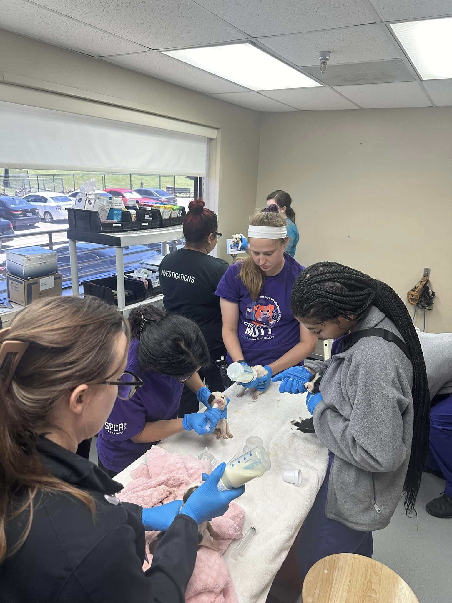
10 newborn puppies abandoned in the summer Texas heat
Unchecked Terlingua growth around Big Bend sparks debate over water — a prelude for Texas
In a statement of probable cause that it adopted unanimously, the five-member board also faulted the Federal Aviation Administration for not requiring the Austin airport to have technology that would have helped air traffic controller Damian Campbell track the planes. He told investigators he could not see the Southwest jet as it taxied to the runway.
The board also said a lack of recent training by Austin controllers on operating in poor visibility contributed to the close call.
The FedEx plane was making its final approach to land at Austin-Bergstrom International Airport when it nearly hit the top of the Southwest Boeing 737, which was roaring down the runway for takeoff in thick fog.
Campbell told investigators that he had expected the Southwest jet to take off more quickly. In hindsight, the controller said, he could have made the Southwest crew wait until the FedEx Boeing 767 landed.
NTSB investigators said controllers in Austin had not recently trained for nor worked in low-visibility conditions. “As a result,” investigator Brian Soper said, Campbell “was not adequately prepared to handle the traffic” that morning.
Investigators pointed out that the Austin airport lacked radar-based ground-tracking technology — in use at 43 other U.S. airports — that would have helped the controller track the planes. The FAA has announced plans to make GPS-based tracking technology available to more airports, including Austin.
Investigators also noted that the Southwest pilots were still 550 feet short of the runway when they said they were ready to take off. When they reached the runway, they held longer to run up the engines. The pilots should have told the controller they needed more time, said investigator Warren Abrams, a former airline captain.
FedEx co-pilot Robert Bradeen Jr. was in the audience Thursday and received an ovation. FedEx captain Hugo Carvajal III, who was not at the hearing, previously told investigators he was irritated and perplexed when he heard the controller clearing the Southwest jet to take off from the same runway that he was approaching.
The incident was among several close calls last year that prompted the FAA to call a “safety summit” of aviation industry participants.
FAA officials have maintained that U.S. aviation has never been safer. However, a panel of independent experts concluded last year that the safety margin is shrinking and the FAA needs better staffing and technology to manage the nation's airspace.
“Alarming as they are, events like (the one in Austin) are rare. Commercial aviation is by far our safest mode of transportation,” Homendy said. “But the somber truth is that it only takes one” mistake that “can lead to tragedy, shatter our stellar safety record, and destroy public confidence in our aviation system.”
According to FAA figures, last year there were 23 of the most serious “runway incursions” — close calls involving one or more planes on the ground — compared to 16 in 2022.
“We are trending in the wrong direction,” said Homendy, a frequent critic of the FAA.
The FAA countered that the rate of serious runway incidents has dropped 59% so far in 2024 compared with 2023. The agency said it has improved tracking technology at several airports, including Austin, where the tower now has a tool called “approach runway verification" and modernized simulators for training.
The FAA said it would review the NTSB's recommendations.
“Our top priority is the safety of the flying public,” the agency said, “and the FAA and the aviation community continue to pursue the goal of zero serious close calls.”
This article tagged under:

- Departments
- Sustainability
City of Austin Releases Critical Climate Information to Prepare for Summer 2024 and Beyond

City of Austin
As Austin braces for another hot season, the City’s Offices of Sustainability and Resilience have published a suite of documents designed to help the community and City departments understand and prepare for the impacts of rising temperatures. These documents include the updated Climate Projections for the Austin area, the 2024 Summer Outlook, and the Heat Resilience Playbook. “As we move into summer, we must acknowledge the increasing temperatures affecting our community," said Zach Baumer, Austin’s Chief Sustainability Officer. “These documents provide essential science-based information to help our City departments and community members understand the climate impacts affecting Austin now and in the future — and how we can address them.” UT-City Climate CoLab The Climate Projections and Summer Outlook were developed through the UT-City Climate CoLab , a collaborative effort between the City’s Offices of Sustainability and Resilience and researchers at the University of Texas at Austin. Established in 2023, the CoLab is the first city-specific climate collaborative globally, linking City officials and climate scientists to develop Austin-specific climate data, tools, and assessments. “Austin has experienced a series of weather extremes in recent years, from droughts and heat waves to heavy rain events and deep freezes,” said Dev Niyogi, Professor of Earth and Planetary Sciences at the Jackson School of Geosciences, and part of UT’s Planet Texas 2050 grand challenge. “The City and community members are deeply invested in understanding and preparing for future changes in our climate. The UT-City Climate CoLab represents a significant step in linking scientific advances with practical city needs and educational opportunities to develop effective climate solutions and resilience.” Climate Projections for Austin The latest Climate Projections for Austin indicate that climate change will lead to hotter summers with more frequent heatwaves and fewer cold spells. Rainfall projections are highly uncertain, but the amount of rainfall in our area is expected to remain relatively unchanged. As the climate shifts, we can anticipate more extreme weather, more climate variability, and a slight increase in windy days. Temperatures above 110°F, once rare, are expected to become more common. 2024 Summer Outlook The seasonal outlook for Summer 2024 tells us that Austin is likely to experience a hotter-than-normal summer this year, with temperatures on some days expected to soar between 105° and 110°F. The first 100-degree day this summer is predicted to happen in early June. On average, the first and last 100-degree days are July 4 and August 30. The precipitation outlook for this summer is evolving due to the likelihood of moving from El Niño to La Niña conditions and a more active than usual forecasted hurricane season. Because of a shift toward La Niña conditions, it is expected to be drier later in the summer. However, during this transition, we could experience heavy rainstorms. Heat Resilience Playbook The Office of Resilience developed the City of Austin’s first-ever Heat Resilience Playbook in collaboration with City departments, regional agencies, and community members. It outlines existing City-led heat resilience efforts and high-impact actions to build heat resilience. It focuses on three pillars: supporting healthy and prepared Austinites, prioritizing cooling investments in high-heat neighborhoods, and enhancing infrastructure and ecological capacity to adapt to extreme heat. What’s next As climate change continues to impact Austin, proactive measures are essential to reduce greenhouse gas emissions and prepare City infrastructure and community members for extreme weather. The recent Climate Projections and 2024 Summer Outlook will enable science-based, informed decisions on community preparedness and City infrastructure. The UT-City Climate CoLab will continue to develop climate-related data and analysis to help the City and community understand and prepare for increasing climate impacts.
La Ciudad de Austin divulga información climática crítica para prepararnos para el verano de 2024 y después
A medida que Austin se prepara para otra época calurosa, las Oficinas de Sostenibilidad y de Resiliencia de la Ciudad publicaron un conjunto de documentos destinados a ayudar a la comunidad y a los departamentos de la Ciudad a comprender y prepararse para los efectos de las altas temperaturas. Estos documentos incluyen las Proyecciones climáticas actualizadas para el área de Austin, las Perspectivas de verano para 2024 y el cuadernillo con tácticas para la resiliencia al calor Heat Resilience Playbook.
“A medida que nos adentramos en el verano, debemos reconocer el aumento de las temperaturas y cómo afectan a nuestra comunidad”, dijo Zach Baumer, Director de Sostenibilidad de Austin. “Estos documentos proporcionan información esencial basada en ciencias para ayudar a los departamentos de nuestra Ciudad y a los miembros de la comunidad a comprender los impactos climáticos que afectan a Austin ahora y en el futuro, y cómo podemos abordarlos”.
UT-City Climate CoLab Las proyecciones climáticas y las perspectivas del verano fueron desarrolladas a través del UT-City Climate CoLab , una colaboración entre las Oficinas de Sostenibilidad y de Resiliencia de la Ciudad e investigadores de la Universidad de Texas en Austin. CoLab, establecido en 2023, es la primera colaboración climática global específica de una ciudad, que relaciona a funcionarios de la Ciudad y a científicos del clima para desarrollar datos climatológicos, herramientas y evaluaciones específicos para Austin.
"Austin sufrió una serie de fenómenos meteorológicos extremos en los últimos años, desde sequías y olas de calor hasta intensas lluvias y heladas”, dijo Dev Niyogi, Profesor de Ciencias de la Tierra y Planetarias de la Facultad de Geociencias de Jackson, y parte del gran desafío Planet Texas 2050 de la UT. “La Ciudad y los miembros de la comunidad tienen muchísimo interés en comprender y prepararse para los cambios climáticos futuros. El UT-City Climate CoLab representa un paso significativo para relacionar los avances científicos con las necesidades y las oportunidades educativas prácticas de la ciudad para desarrollar soluciones climáticas eficaces y resiliencia”.
Proyecciones climáticas para Austin Las últimas Proyecciones climáticas para Austin indican que el cambio climático provocará veranos más calurosos con olas de calor más frecuentes y menos olas de frío. Las proyecciones de precipitaciones son sumamente inciertas, pero se espera que la cantidad de lluvia en nuestra área se mantenga relativamente sin cambios. A medida que cambia el clima, podemos anticipar condiciones climáticas más extremas, más variabilidad climática y un leve aumento de días ventosos. Se espera que las temperaturas superiores a los 43°C, que solían ser raras, se volverán más comunes. Las proyecciones se basan en modelos con altas emisiones de gases de efecto invernadero y con emisiones iguales que ahora.
Perspectivas de verano para 2024 Las perspectivas estacionales para el verano de 2024 nos dicen que es probable que Austin tenga un verano más caluroso que lo habitual este año, con algunos días con temperaturas que se espera suban entre los 40° y los 43°C. Se prevé que el primer día con temperatura superior a 37° de este verano será a principios de junio. En general, el primer y el último día con temperaturas así de altas son el 4 de julio y el 30 de agosto.
El pronóstico de lluvias para este verano se está desarrollando debido a la probabilidad de pasar de condiciones de El Niño a La Niña y una temperada de huracanes pronosticados más activa que la habitual. Debido al cambio hacia las condiciones de La Niña, se espera un verano más seco más adelante. Sin embargo, durante esta transición, podríamos tener tormentas intensas.
Heat Resilience Playbook La Oficina de Resiliencia desarrolló el primer cuadernillo de tácticas para la resiliencia al calor Heat Resilience Playbook de la Ciudad de Austin en colaboración con departamentos de la Ciudad, agencias regionales y miembros de la comunidad. Describe las tareas actuales de resiliencia al calor a cargo de la Ciudad y medidas de alto impacto para desarrollar resiliencia al calor. Se concentra en tres pilares: apoyar a austineses saludables y preparados, priorizar inversiones en enfriamiento en barrios con mucho calor y mejorar la infraestructura y la capacidad ecológica para adaptarse al calor extreme.
Lo que se viene Mientras el cambio climático sigue afectando a Austin, las medidas proactivas son indispensables para reducir las emisiones de gases de efecto invernadero y para preparar a los miembros de la comunidad y a la infraestructura de la Ciudad para el clima extremo. Las recientes Proyecciones climáticas y las Perspectivas de verano para 2024 propiciarán una toma de decisiones informadas y basadas en ciencias para la preparación comunitaria y la infraestructura de la Ciudad. El UT-City Climate CoLab seguirá desarrollando datos climáticos y análisis para ayudar a la Ciudad y a la comunidad a comprender y prepararse para los crecientes impactos climáticos.
Acerca de las Oficinas de Sostenibilidad y de Resiliencia de la Ciudad de Austin La Oficina de Sostenibilidad de Austin trabaja para asegurar una comunidad próspera, equitativa y resiliente en materia ecológica porque proporciona medidas positivas, influyentes y de liderazgo a través de la participación y la creación de beneficios medibles para Austin. La oficina trabaja para lograr emisiones de gases de efecto invernadero cero neto en toda la comunidad para 2040, un sistema alimentario local, saludable y justo, estrategias con eficiencia de recursos para operaciones municipales, proyectos tangibles que demuestren sostenibilidad y una ciudad resiliente y adaptable. Lea más en austintexas.gov/sustainability .
La Oficina de Resiliencia de Austin trabaja con varios departamentos y socios externos para abordar complejidades, reunir un amplio conjunto de partes interesadas, generar apoyo para iniciativas individuales, liderar y apoyar el proceso de desarrollo de estrategias para la resiliencia, implementar medidas y controlar el progreso de las tareas de resiliencia. Lea más en austintexas.gov/resilience .
IMAGES
COMMENTS
TxDOT is committed to your safety and to the reliability of the information contained on this site. While road conditions can change rapidly, DriveTexas.org is an industry leader in providing some of the most accurate and up-to-date travel-related information currently available to drivers in Texas.
Traffic News Real-time Traffic Map Trouble Spots Drive Times Traffic News Click on the map for traffic news in that area or choose a link below. Central Austin Traffic News Downtown Austin Traffic …
Austin, TX traffic updates reporting highway and road conditions with live interactive map including flow, delays, accidents, construction, closures,traffic jams and congestion, driving conditions, text alerts, gridlock, and driving conditions for the Austin area and Williamson county.
Austin traffic reports with real-time conditions, maps, incidents, construction news, jam factors and more. Stay in your lane with "Good Day Austin's" Jane Lonsdale.
World North America United States Texas Austin. Cedar Park , TX. Killeen , TX. Round Rock , TX. Your localized air-travel weather forecast, from AccuWeather, provides you with the tailored weather ...
During severe weather and freezing road conditions, it is important to keep up with driving conditions near you. ... Austin Weather. Current 96° Sunny. Tonight ... Texas DPS radio traffic ...
05-Jun-2024. Sunday Night. Partly cloudy with a slight chance of showers and thunderstorms. Lows in the lower 70s. Monday. Partly cloudy. Highs in the lower 90s. Current weather and airport delay conditions for (AUS) Austin-Bergstrom International Airport located in Austin TX, US.
IH-35 SB before Spur 1825 - Grand Ave Pkwy. FM-734; 4 MILES; 6 MIN ...
Travel and Weather See More. World North America United States Texas Austin. Cedar Park , TX. Killeen , TX. Round Rock , TX. Your localized Driving weather forecast, from AccuWeather, provides you ...
Austin traffic reports. Real-time speeds, accidents, and traffic cameras. Check conditions on key local routes. Email or text traffic alerts on your personalized routes. Austin Traffic Report. Start Route. Clear Route. End Route. You are offline. Data from: 9:13 PM. Sigalert.com.
7-Day Forecast. Austin traffic news, accidents, congestion and road construction from KVUE in Austin, Texas.
Live images from the City of Austin's traffic cameras. Traffic cameras. Filter. Online (625) Offline (81) 100 BLK NECHES ST. offline. 100 BLK TRINITY ST. online. 1137 BLK AIRPORT BLVD. online. 11406 BLK MC ANGUS RD. online. 1150 BLK AIRPORT BLVD. online. 11TH ST / 35 SVRD. online. 12500 BLK N LAMAR BLVD. online. 12500 BLK N LAMAR BLVD. online.
Traffic Details. Select a point on the map to view speeds, incidents, and cameras. Austin traffic reports. Real-time speeds, accidents, and traffic cameras. Check conditions on key local routes. Email or text traffic alerts on your personalized routes.
Traffic Cameras. Avoid congestion with our live camera footage in the following metro areas: TxDOT traffic cameras allow you to view traffic conditions in Amarillo, Austin, Dallas, El Paso, Fort Worth, Houston, San Antonio and Wichita Falls.
Interstate 10 (I-10) Weather Road Conditions - Drive Weather. This map of I-10 shows weather road conditions with current radar. See 12 hour weather, wind, and temperature forecasts along the I10.
125 W Alpine Rd. S CONGRESS AVE/ALPINE CIR. AUSTIN PD. 30.228247. -97.761591. The following definitions are used by the Austin Police Department. I. Driver's Crash Report (Blue Form) - This report is completed by a driver involved in a traffic crash when the crash is not investigated by a law enforcement officer and apparent damage is $1,000 or ...
The Texas Department of Transportation has partnered ... news, project and road condition updates, traffic camera views and community meetings along the I-35 corridor - all 588 miles. Tweets by I35travel. Statewide Planning. Learn more about TxDOT planning efforts. News. Read recent I-35 news and newsletters. Texas Highway Conditions. Get ...
COVID-19: Information for Travelers and Flights. Find out what you need to know to travel safely at the following resources: Austin-Bergstrom International Airport (AUS) Air Travel Updates. CapMetro and CapMetro's Recovering with Care, COVID-19 service updates. City of Austin Micromobility & Shared Vehicle Services.
41.878 | -87.630. Edit your arrival time. Got it. Realtime driving directions based on live traffic updates from Waze - Get the best route to your destination from fellow drivers.
NOAA National Weather Service Austin/San Antonio, TX
Austin-Bergstrom International Airport Activity Reports 2024 2023 2022 2021 2020 2019 Skip to main content. austintexas.gov. Action Navigation. 3-1-1; Filter ... Cargo Traffic at Austin-Bergstrom. May 30, 2024. Austin-Bergstrom International Airport Welcomes SkyWest Airlines Flight Crew Base. May 23, 2024.
Austin & Central Texas Local Radar Allergy Report KXAN's Severe Weather Guide : Open for information on what to do during thunderstorms, tornadoes, flooding, hurricanes, winter storms, heat waves ...
Discover Texas . Texas eclipse 2024. See live traffic cameras. ... Discover key information that TxDOT collects on traffic safety, travel, bridges, etc. Study our various maps, dashboards, portals, and statistics. ... Prepare for severe weather; Traffic signs and signals; Driving safety and laws; Bicycle and pedestrian safety;
900 Central Freeway. Wichita Falls, TX 76306. (940) 723-7931. Email. Texas travel information centers are staffed by professional travel counselors who welcome visitors to Texas, help with routings and provide information of interest for visitors to the Lone Star State.
KVUE.com is the news leader for Austin, Texas. Get the latest news and breaking news from the KVUE Team. ... Austin's Leading Local News: Weather, Traffic, Sports and more | Austin, Texas.
AUSTIN, Texas - A near-miss at the Austin-Bergstrom International Airport in 2023 was caused by a lack of critical safety technology, and incorrect assumptions by an air traffic controller, the ...
An air traffic controller's faulty assumption that a Southwest Airlines jetliner would take off from a Texas airport before a landing FedEx plane reached the runway caused the planes to come ...
Investigators: Weather, lack of air traffic control technology led to February 2023 close call at Austin's airport A FedEx plane and Southwest plane almost collided at the Austin-Bergstrom ...
Prepare for severe weather; Traffic signs and signals; Driving safety and laws; Bicycle and pedestrian safety; ... 6230 E Stassney Lane Austin, TX 78744. Additional contacts . Search Contacts: Telephone: Director: 512-486-5900: ... Texas Travel Information- literature requests: 800-452-9292: Fax: 512-486-5909: TxDOT Divisions.
As climate change continues to impact Austin, proactive measures are essential to reduce greenhouse gas emissions and prepare City infrastructure and community members for extreme weather. The recent Climate Projections and 2024 Summer Outlook will enable science-based, informed decisions on community preparedness and City infrastructure.