
Volcano Tajumulco
Central America’s highest peak
Map & expenses
Brief facts
Things to bring
Are you up for a challenge that will leave you in awe of the stunning sunrise views? Look no further than the Volcano Tajumulco hike, where you can conquer the highest peak in Central America at almost 14,000 feet.
Not only will you feel accomplished, but you’ll also witness one of the most beautiful sunrises you’ve ever seen. While it’s a demanding hike, it’s still doable for many travelers, including those with little hiking experience.
Central America’s highest point
Unparalleled views
Central America’s sunrise
Cuchumatanes mountain range
Enroll yourself in a two-day trek expedition up the highest peak of Central America, Volcano Tajumulco, standing at 13,845 feet tall (4,220 meters). The exploration will take you on a wandering single-track trail through fog immersed pine forests and meadows.
The trek to the ‘Tajumulco’ Volcano is a must-do for volcano-lovers. The highest in all of Central America with a height of 4,220 meters above sea level. When you reach the top, you will have a spectacular view of the Volcanic chain of Guatemala. Although it is located in the tropical part of the planet, the temperature at its peak can reach between 0 and 10 degrees below zero at night.
From the highest summit, you can see various volcanoes, the border with Mexico, the Pacific ocean, and the longest mountain chain in Central America. The difficulty of its ascent is medium since it has a path for hikers, and the guide gives the necessary instructions for your safety. The volcano is currently inactive, but it has reports of eruptions in history.
Your driver will pick you up from your hotel in Quetzaltenango, also known as Xela. The trek starts in the place known as Tuichan where the path leading to the volcano is located. Before starting the adventure, a certified guide will give you a brief talk with the necessary recommendations for your safety. As you advance on the trail, you will enjoy Guatemala and its wonderful landmarks.
You will notice more vegetation and mountainous forest with the feel of the air growing purer and purer. There will be breaks so you can hydrate and taste some snacks. At about three o’clock in the afternoon, the tour will reach the place of the camp. The group will set up the tents, and you will have lunch and time to enjoy the spectacular view. Later, you will hike 200 more meters to the very top to see an amazing sunset. Relax and prepare for the best that comes tomorrow.
As the route pushes higher, you will find yourself hiking on clouds. The final steep push in the trail embraces those worthy of the challenge with a dramatic view. Stars, clouds, a stretch full of other volcanoes going off, and the ascending sun make for an exceptionally sweet compensation.
Itinerary 5:00 a.m. Pickup from your hotel 5:15 a.m. Drive approx. 2 hours to San Marcos 7:30 a.m. Arrive at San Marcos and have breakfast at a small local restaurant 8:30 a.m. Continue to Tuichan, where the pathway is located 10:00 a.m. The hike begins 2:30 p.m. Arrive at base camp, about 200 meters below the summit 3:00 p.m. Set up a camping site, eat lunch, and relax 6:00 p.m. Contemplate sunset from the second summit of Volcano Tajumulco, Cerro Concepción at 4100 meters above sea level (weather allowance) 7:00 p.m. Delicious dinner and hot drinks, and call it a night early
Hike to the very summit of the volcano. Upon arrival, you will have the opportunity to enjoy a spectacular sunrise more than four thousand meters above sea level. This is an impressive sunrise that will make it worth the effort of the climbing. You will enjoy a fabulous view of the volcanic cones that can be seen throughout the horizon of the country, and you can take your best photographs for your memory album.
This is an unforgettable adventure by having climbed the highest volcano in all of Central America. After the descent of the volcano, a private transport awaits you at the entrance of the sidewalk to take you back to your hotel where this amazing adventure trekking Tajumulco volcano ends.
Itinerary 3:30 a.m. Early wake up 4:00 a.m. Hike to the summit 5:30 a.m. Reach the summit, contemplate the sunrise (weather allowance) 8:00 a.m. Go back to base camp, eat breakfast, and pack 10:00 a.m. Hike down the volcano 12:30 p.m. Eat a delicious lunch at a small local restaurant in Tuichan 1:30 p.m. Take your private transportation back to Xela 4:30 p.m. Arrive at Xela
map, expenses & price

Volcano Acatenango
Expenses included: -All private transportation. -Camping and cooking equipment. -Local certified guides. -Freshly prepared picnic lunch, dinner & breakfast. -Juice, coffee, tea, and snacks -Park entrance fee. *This tour is exclusively available to guests who plan their trip with us.
Brief facts Volcano Tajumulco
Regular backpack weight: 15 – 20 kilograms* Maximum altitude: 4220 meters above sea level Total hike distance: 15 kilometers A fun fact: in 2009, due to a cold front, a snowfall of twenty centimeters fell at its peak, which was a historical snowfall in Guatemala. At the end of the ascent, you will spend the night in the volcano to admire a spectacular sunset and sunrise the next morning at its peak. *For any travelers who would like to do this hike however are concerned about the weight of their backpack, mules are accessible to rent for $75.
-Hiking boots or good trekking shoes – (no sandals) -Large-capacity backpack (50L+) with rain cover -One warm layer and/or windbreaker -Rain jacket -Cold-weather clothing for near-freezing night-time temperatures at camp -Personal toiletries and/or medications -Camera, hat, sunglasses & sunscreen -4 liters of water (minimum) -Flashlight

5 days & 4 nights

2 days & 1 night

4 days & 4 nights
Travel Advisory
El Salvador
© MAYAN GATEWAY | TERMS OF SERVICE | PRIVACY
Speed optimized by Speedable
Volcán Tajumulco
Watch the sun come and go from the highest point in Central America.
Start Booking
Get 20% off your second multi-day hike!
Join us on our two day trek to the highest point in Central America: Volcán Tajumulco! At 4,220 meters tall, Tajumulco means “above the clouds” in the local Mayan language.
**There is a mandatory pre-trip meeting at 6:00pm the evening prior to the trek’s departure. Here, you will meet your guides and fellow trekkers, borrow any gear you may need, receive communal gear, finalize payment, and more.**
Quick Facts
5:00 AM, Xela
5:00 PM, Xela
Total distance
15 km (9 mi)
Maximum elevation
4,222 m (13,850 ft)
Average backpack weight
15 kg (35 lbs)
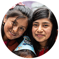
The profits from one person hiking Tajumulco provides all the school supplies in the primary school for a week!
Want to get back on trek and make an even bigger impact? We’d love to go on another overnight adventure with you. If you book another multi-day trek with us, we will give you 20% off! In the confirmation email of your first trek, we will attach a promo code for you to use in your second booking.
Travel Details
Start time & location.
Quetzaltrekkers Office (inside of the Casa Argentina hostel, Xela)
- 6:00 PM Mandatory pre-trek meeting the evening prior to trek departure
- 5:00 AM Meeting time the morning of the trek
End Time & Location
- 5:00 PM Expected return to Xela
What to bring
Hiking Backpack (>60L); Sleeping Bag; Sleeping Mat; Hiking Shoes; Hiking Clothes; Warm Clothes; Rain Jacket/Poncho; Headlamp; 3-4 Liters Water; Communal Food Items, Communal Tents
- Any hiking gear you do not have is available to borrow at no additional charge. This will be provided at the pre-trek meeting.
What is included
- 1 night of accommodation (in tents)
- 2 breakfasts
- Trail snacks
- Transportation
What’s not included
- Additional snacks or drinks
Frequently asked questions
Where do we sleep.
We sleep in tents at the base camp (4,000m). Tents are carried by the group.
Will I need to bring food and water?
No, we provide plenty of food throughout your whole trek, and purified drinking water.
What if I have dietary needs?
We accommodate dietary restrictions. All our trek food is vegetarian, and we can arrange for any other considerations as needed. Please let us know of any dietary needs that we should be aware of when you book the trek.
Can I bathe on the trek?
Not on this one!
Can I store personal luggage not needed for the trek in Xela?
Yes, we have a secure, locked room in which you may store your luggage.
How can I pay for the trek?
You can pay any remaining balance at our office during the pre-trek meeting on the night before the hike. We accept cash quetzales, or cards with a 3% fee.
Help Without Hiking
Your support is providing housing, care, and education for the children of EDELAC in Xela, Guatemala
100% of your monthly gift goes directly to providing opportunities for children living in poverty
Special Festival Trek! Oct 29 - Nov 2
Join us for our special edition hike from Nebaj to Todos Santos! This trek offers not only breathtaking views but also a chance to partake in the vibrant Day of the Dead and All Saints festivals. It’s an extraordinary blend of natural beauty and cultural celebration, and an unmissable event in the Guatemalan calendar.
Climb Volcano Volcán Tajumulco
San Marcos, Guatemala
Elevation Gain
Out-and-Back
Description
Added by Garrett Gossett
You can say you conquered the highest peak in Central America and climb to almost 14,000 feet! In addition you'll likely witness one of the most amazing sunrises you've ever seen in your life. It's challenging enough to kick your butt, but also doable for a wide range of people, even those with little or no previous hiking experience.
Looking for a challenging climb leading to the best sunrise you’ve ever seen in your life, well here it is. Enlist yourself in a two-day trek up Guatemala’s highest peak, Volcano Tajumulco, standing at 13,845 feet tall. The journey will take you on a meandering single-track trail through fog immersed pine forests and meadows. As the trail pushes higher, you’ll find yourself walking on clouds. The final steep push in the trail greets those worthy of the challenge with a spectacular view. Stars, clouds, a horizon full of other volcanoes going off, and the rising sun make for a remarkably sweet reward. While the trail is arduous, those with little or no previous mountain climbing experience can conquer the journey to the summit. You only need a strong mind or a stronger climbing partner to keep you focused on making it to the top. If a little poodle can do it, you can do it too!
Tajumulco can be conquered with or without a guide, but from my experience, I’d wager to say that the average person would find it easier to go with a guide. The trail is not always easy to follow so if the weather isn’t perfectly clear, it could become quite difficult to remain on the right path. I’d recommend Quetzaltrekkers, a local non-profit, volunteer run organization, who invest all profits into the local orphanages in Quetzaltenango. At the time of writing, a two day trek cost $66 USD, and any or all gear needed for the trek, along with meals, were provided by the company.
Quetzaltenango, better known as Xela (Shayla), is the main launch off spot for all trekking adventures to the volcano. In Xela, go to the main bus terminal and find a bus headed towards San Pedro, which will take approximately one and a half hours. This bus will take you to the terminal in San Pedro, where you will then ask around for the bus heading to Tajumulco. The next bus up the mountain will take approximately 45 minutes, but the road is extremely curvy, so bring some medicine if you tend to get carsick.
The start of the road (trail) is clearly marked by signs on the side of the road. If you are on one of the local chicken buses, just mention to the driver where you are headed and he’ll be sure to let you out at the right place. From there the hike takes you up a road through a couple small villages, until the road ends and turns into a single-track trail. Be sure to bring along a little money, as the locals might ask for a small entrance fee to the volcano.
The trail is relatively straightforward, although there will likely be some fog, in which case it can be a bit difficult to maintain your exact bearings. This is where having a guide, or someone who’s hiked it before is beneficial. The trail will take you first through a forest, then through a meadow, and again through another segment of steep forest. Once you’ve made it through the second forest section, you will likely be above the clouds. At this point you should have a view of the summit of the volcano, which won’t be too far away. When looking up at the volcano, to the left side there is another small summit, which is the sister of Tajumulco. The best area to set up camp is in the flat ground between these two peaks. You’ll know you’ve made it there when you see several rock circled fire pits set up by previous climbers.
It should take a medium paced climber roughly four hours to reach the base camp, which is 200 meters below the summit. From there, there are trails on each side of the peak, which will take you to the top. On the right side of the summit, the trail is steeper and more arduous, while the left side offers an easier incline and nice views. I’d recommend taking the steeper trail on the way up, opting for the easier trail with nicer views on the way down. From base camp to the peak, at a medium pace it should take you about an hour and fifteen minutes.
The trekking groups typically wake you up at 3 in the morning to start the ascent to the peak. By around 4:45 you’ll be at the peak and wait around for hour for the sun to rise. It’s really cold on top of the volcano, often reaching near 20 degrees Fahrenheit at night, so be sure to pack the appropriate layers to keep warm. Gloves, a beanie and a headlight are mandatory.
The hike back down takes roughly 2 hours, and the buses run every hour.
This hike could certainly be done in one day, although you’d miss the sunrise, which is the most epic part. If you were interested in doing it in one day, you’d want to catch a 5am bus out of Xela to have the appropriate amount of time to get up the volcano and make it back before nightfall. In addition, it’s common that people suffer from altitude sickness once near the summit, so plan accordingly.
Download the Outbound mobile app
Find adventures and camping on the go, share photos, use GPX tracks, and download maps for offline use.
Climb Volcano Volcán Tajumulco Reviews
Leave no trace.
Always practice Leave No Trace ethics on your adventures and follow local regulations. Please explore responsibly!

Hike to the Indian Nose, Lake Atitlan

Hike Volcan San Pedro in Lake Atitlan

Hike Volcan Acatenango
- Local Adventures
- Tours and trips
- Camping Nearby
- Outbound PRO Membership
- Add your property
Mobile Apps

© 2024 The Outbound Collective - Terms of Use - Privacy Policy
A Couple of Drifters
Where Do We Go From Here?
Hiking Volcan Tajumulco Without a Guide
Last Updated on May 13, 2020
Climbing Central America’s highest peak meant doing it on our time and according to our budget – that meant hiking Volcan Tajumulco without a guide and finding our own way to the trail. Independent budget travelers considering this must know how easily it can be done. Sure, pay for an “expedition” if you want, or do this hike as a day trip from Xela and save your Quetzales.
For info on unguided hikes in Xela check out my article Hiking and Hot Springs Near Xela , with maps of trails through beautiful countryside featuring stunning views of Santa Maria volcano – just minutes from the city! That article also features hot springs closer to Xela than Fuentes Georginas. Self-guided directions for the natural steam baths of Los Vahos are featured in my article, too. Check it out!
Is Hiking Volcan Tajumulco With a Guide Necessary?
Popular overnight guided hikes of Volcan Tajumulco are marketed by offering a chance to witness sunrise from the peak. Similarly, groups market the idea that hikers should camp overnight on the mountain to acclimatize to elevation, which I’ll mention later. Indeed, camping out with fellow hikers and watching sunrise from the peak of Tajumulco may be for you.
If hiking Volcan Tajumulco without that extra fuss sounds appealing, please continue reading. I’ll share everything you must know for a solo hike. Choose this as either a day trip from Xela or using San Marcos as a base. I recommend the latter, simply because the pace of a day trip from Xela gives you less time at Tajumuco’s peak.
Before attempting this or any hike, know the weather, know where you are going, bring plenty of water, snacks and sufficient protection from the sun! Also, carry a stick or a few stones in your pockets – dogs in the countryside tend to be very protective of their turf!
Getting to Volcan Tajumulco From Xela
- From Xela’s Minerva Terminal take an early chicken bus to San Marcos – the first early bird departs at 4:00 am.
- Transfer at San Marcos terminal to any minibus going to Sabinal or Tacaná. Ask to be dropped off at El sendero para Tajumulco .
- Volcan Tajumulco trailhead begins on the left side of the road, opposite Hotel Villa Real.
From Xela as a Day Trip
I suggest the earliest chicken bus to San Marcos from Minerva Terminal. This journey takes about an hour; in our *example a 4:00 am bus gets you to San Marcos no later than 5:15 am . The ride from San Marcos terminal to Volcan Tajumulco trailhead is about 1.5 hours. This has you on the the trail at about 6:45 am . Hiking Volcan Tajumulco takes about 3 to 3.5 hours. It’s now about 10:15 am as you reach the summit.

In our scenario, 1.5 hours at the top means you descend at 11:45 am . Expect slightly less than 3 hours for the descent, putting you roadside at the trailhead and on a bus to San Marcos by 2:45 pm . Arrive in San Marcos by 4:15 pm and transfer at the terminal to a chicken bus back to Xela. Expect to arrive at Minerva Terminal by about 5:30 pm .
* All times are, of course, merely estimations and you may or may not find these similar in your experience.
Why Hiking Volcan Tajumulco From San Marcos Is Best
Our above scenario is possible if you get that first bus from Xela and the rest of the journey goes smoothly . Things happen – you sleep in, the bus breaks down along the way or perhaps your miss the next transfer. This is why I suggest you base yourself in San Marcos for hiking Volcan Tajumulco. This allows for a much easier pace and gives you more time at the summit.
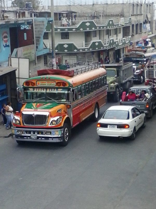
It clearly makes sense basing yourself in San Marcos rather than making this a day trip from Xela. We spent 2 nights here and found it a friendly place with cheap food and accommodation options. Step off the trail, so to speak, and spend time somewhere few travelers experience while visiting Guatemala . Above all, basing yourself here means you don’t need to catch a bus at 4:00 am !
The Tale of the Trail
The Volcan Tajumulco trail begins at an elevation of roughly 10,000 feet. Xela tops out at 7,640 feet, meaning any needed altitude acclimatization has likely happened while there. In fact, this entire region of Guatemala is at a considerable altitude and you likely don’t need to spend a night on the mountain to prepare. Of course, pace yourself on the climb and know your limits .

To further my point regarding altitude acclimatization and camping, consider exactly where Tajumulco tours set up camp. Groups hiking Volcan Tajumulco camp on a flat area of the mountain about 300 feet below the peak. At this point the toughest part of the climb is already well behind you. Again, pace yourself while hiking Volcan Tajumulco and know your own limits .

In Conclusion…
Hiking Volcan Tajumulco as a day trip from Xela is possible. Doing this requires two early morning buses and good fortune. Travelers with extra time to spare and a sense of adventure are better off arranging their Tajumulco hike from San Marcos.
Consider a tour if the enhanced experience of sunrise from the top of Volcan Tajumulco is what you want. Tours are often a good way to get perspective from local guides and for meeting plenty of other travelers. Whatever you choose, stay safe and have a great time!
Pin Me Now!

First bus from Xela is 5am not 4am as I just found out
Thank you very much for sharing the latest updates regarding early morning bus departures from Xela – this could be helpful to others reading your comment. We’re surprised to hear buses are no longer running earlier than 5 am, but schedules can and do change.
Were you able to hike Tajumulco as a day trip from Xela, or did you base yourself in San Marcos?
Thank you again, Chris!
Your Drifters, Jerry and Fiona
I just read the comment of David G . He claims to know you two drifters and so do I…. continue posting the lovely phots and very interesting and informative article. How to Climb Central American’s Highest Peak Without a guide.
Thanks so much! We were having some issues with this post and your support has let us know everything is OK!
Jerry, you need some 80:1 to keep you awake on those long drives! Enjoying your blog.
Safe travels, Patrick.
Patrick. It is really good to hear from you! I certainly have been drinking lots of coffee. The van has racked up nearly 5000 miles since leaving Portland. I want to thank you for being a follower from early on and I hope you continue to read our posts. We are currently in Albuquerque, where we used to live nearly 20 years ago. It is great to be back, and to be on the road again. Keep in touch, Patrick. Your Drifters, Jerry and Fiona
Having read a handful of your posts makes me feel like I know you two.
We certainly thank you for you support, which we feel has always been there.
We’d say you know us pretty well, but please keep reading! Your Drifters, Jerry and Fiona.
Leave a Comment Cancel
Your email address will not be published. Required fields are marked *
Email Address
Save my name, email, and website in this browser for the next time I comment.


Follow us on Facebook and Instagram for regular doses of beauty and delight

- Western Volcanic Highlands Guatemala
- Find a random walk
- Volcan Tajumulco


Key information: Volcan Tajumulco
- Central America’s highest mountain, a huge and thrilling ex volcano.
- Inspirational dawn and sunset views to Guatemala's other great volcanic peaks.
- Climb a beautiful ridge clad in open pine forest.
Walkopedia rating
- Walkopedia rating 89
- Natural interest 17
- Human interest 6
- Charisma 33
- Negative points 2
- Total rating 89
- Note: Negs: altitude
Vital Statistics
- Length: 14km
- Maximum Altitude: 4,219m
- Level of Difficulty: Difficult

WALK SUMMARY
Close to the border with Mexico, Volcan Tajumulco is the highest point in Central America at 4,219m, with inspirational dawn views across a sea of clouds to Guatemala’s other great volcanic peaks. It is a long return walk, so best broken up with a night up there (at just under 4,000m, so quite high).
You approach Tajumulco by a long ridge from the north-east, alternating steepish sections with some gentler ones. It is delightful walking, through open pine woodland with attractive grasses and shrubs, with huge views back down to the (relative) lowlands, or a sea of clouds with a few high points emerging from it, depending on the weather.
The main approach route starts at around 3,100m, and climbs to follow the ridge. With the campsite on a beautiful wooded platform at 3,980m between the main (4,219m) and lesser (4,100m) summits, it is a demanding 14km/9-10hrs return climb at altitude, but less brutal that Acatenango or Santa Maria. You can, though, start quite a bit higher (3,590m) at a corner of a spectacular cobbled mountain road, and climb to join the ridge to reach the campsite a mere 400m higher in 1.5 hrs or so. When Walko was here, we had no choice as (so we were told) villager disputes made the longer route inadvisable – but we got stopped at road 'repairs' by some quite thuggish looking locals, which required payment to be cleared, and 3 times at that, so it had its moments. So it would be good to check practicalities before planning to climb here.
The campsite is a really lovely place to loiter on a sunny day; it quckly gets bitterly cold at sunset. Our team used their ponies to forage for logs, and we had a wonderful fireside evening.
The steep climb (30 mins up) to the lesser (southern) peak to enjoy the sunset gilding the rocks, trees and clouds is not to be missed.
The summit needs to be enjoyed at dawn, so, early the next morning, you need to make the steep, 200m+, climb in the dark and freezing breeze. It will take 1 hr-ish, depending on how the altitude has taken you – Walkopedia really struggled, it has to be said. You won't be disappointed, enjoying vast views across many of Guatemala's magnificent volcanoes emerging fom the sea of clouds above the slumbering lowlands, including Santa Maria and, further off, Agua and Acatenango with busy Fuego belching little puffs of poison next to it. Really amazing.
Then it is back to camp for breakfast and a return down the ridge to the roadhead, still benefitting from the sharp morning light.
Although not as tough as Acatenango or Santa Maria, this is demanding walking on a high mountain with variable weather, with (usually) a huge altitude gain from your previous night which can cause real problems. Take it slowly and come prepared.
Walkopedia came here on Much Better Adventures' Guatemala 5 Volcano challenge ( https://www.muchbetteradventures.com/products/10037-adventures-guatemala-5-volcano-challenge/ ), and we loved it.
We’d love to share more! Please help us by making suggestions and sending photos! Thank you!
For more information and photos, including detailed practical information and some warnings, see our Guatemala’s Volcanoes page.
Other accounts: share your experiences
Your comments on this walk, your experiences and suggestions, and your photos are very welcome. Where appropriate, you will be credited for your contribution.
Responsible travel matters, a lot. How you travel will make a real difference - for better or worse. PLEASE consider this when making plans. Read more

Safety and problems: All walks have inherent risks and potential problems, and many of the walks featured on this website involve significant risks, dangers and problems. Problems of any sort can arise on any walk. This website does not purport to identify any (or all) actual or potential risks, dangers and problems that may relate to any particular walk. Any person who is considering undertaking this walk should do careful research and make their own assessment of the risks, dangers and possible problems involved. They should also go to “ Important information ” for further important information.

Anyone planning an expedition to this place should see further important information about this walk.

- Key information
- Walk summary
- Research essentials
Other great walks in Guatemala
- Guatemalas Amazing Volcanoes
- Chicabal Crater Lake
- Volcan Acatenango and Volcan Fuego
- Volcan Pacaya
- Volcan Santa Maria
- Volcan Zunil
- Mayan Guatemala
- Volcan San Pedro
RESEARCH ESSENTIALS
Information and review.
- UK Foreign Office
- US State Department
Finding flights, organising travel
- Rentalcars.com - millions of cars in over 10,000 locations.
Accommodation
- Booking.com

Equipment & Clothing
Books and maps.
- Maps and guides from Maps Worldwide
- Cicerone � explore the world�s best collection of walking books
Holidays and Activities

Walking with Trees: the Kumano Kōdō Kōhechi - Stephen Barber's account and photos of one of Japan's great pilgrimage trails. March 2021
RESPONSIBLE TRAVEL
- Add your ideas and photos
- All Our Walks
- Walk of the Month
- Random Walk
- William's Favourite Walks
- Planning & Links
- Useful Links
- Responsible Travel
- History of Walkopedia ®

All material on this website is © Walkopedia Ltd 2008 - 2024, unless specified otherwise. ALL RIGHTS RESERVED
Your browser is a-n-c-i-e-n-t! Upgrade to a different browser or install Google Chrome Frame to experience this site.

There are currently no items in your cart.
- Share Facebook Pinterest Twitter Linked In
- Currency GTQ AUD USD GBP EUR CAD NZD SGD HKD SEK NOK DKK JPY XPF
Volcán Tajumulco (2 Days)

- Duration: 2 Days
- Location : Xela
Join us on our 2 day trek to the highest point in Central America: Volcan Tajumulco ! Standing at 4,220 meters tall, Tajumulco means, "above the clouds" in Mam, the local Mayan language.
After a strenuous trek through montane pine forests to our base camp, this giant of the Guatemalan Highlands offers views galore. We'll enjoy lunch and dinner at camp before going to bed early in preparation for the highlight of our trip.
We will awake in the earliest hours of Day 2 to begin the final ascent to the summit under the cover of dark. There, we will watch the night sky turn to dawn as the sun rises over the volcanic line of Guatemala. To see all that the summit has to offer, we will circumnavigate the volcano's dormant crater during our descent to capture views of surrounding mountain ranges, nearby Mexico, and the Pacific Coast.
At the basecamp, we will have breakfast and prepare for our final climb down the mountain. We will begin the journey back to Xela after eating a small comedor at the bottom of the mountain. Although this is a moderately difficult trek, we think its potential rewards make it worthwhile.
**There is a mandatory pre-trip meeting at 6:00pm the evening prior to the trek’s departure. Here, you will meet your guides and fellow trekkers, borrow any gear you may need, receive communal gear, finalize payment, and more.**
Start Booking Now
Please enable cookies in your browser to place a booking how do I enable cookies?
Enter Number of Trekkers *
Choose a date *, choose a time *.

You may also like

Nebaj - Todos Santos (5 Days)
- Duration: 5 Days

Xela - Lago Atitlán (3 Days)
- Duration: 3 Days

Zunil - Fuentes Georginas (2 days)
Trekking Volcan Tajumulco in guatemala
Hike Volcan Tajumulco will give you the satisfaction of conquering the tallest volcano in Central America. Reaching Tajumulco’s summit to watch the sunrise and enjoy the view of more than 6 volcanoes in the cordillera.
It will be an experience you will never forget. You will be in awe of the celestial dome full of dramatic colors and light. This view leaves you feeling as if you’ve had a spiritual encounter with nature.
Volcan Tajumulco is the tallest volcano in Central America at 4,202 meters (13,786 ft). With 2 summits. It offers a spectacular sunrise full of colors and views of several volcanoes including 7 Orejas, Santa Maria, Santiaguito, Santo Tomas, Laguna Chicabal, and others.
Hike Volcan Tajumulco summits is a two-day hike. We will be leaving our building in Quetzaltenango at 4:30 AM. We will walk to La Terminal bus station where we will take a “chicken bus” to San Marcos.
The bus ride takes 2 hours. We also offer private transportation from Quetzaltenango to Chuan. It is more comfortable than sharing the chicken bus with 80 people.
In San Marcos, we will stop for breakfast. There we’ll take another bus to the town of Christian, a small town 6 km away from the summit.
Hiking the first km will be not very steep. However, the second km becomes very steep and rocky. Carrying a backpack will make the hiking a bit slower. If you do not want to carry your pack, it is possible to rent mules in the town which helps ease the trek difficulty.
We will not reach the summit the first day and will stay overnight in the base camp which is located 250 meters below the summits.
The next morning, the final trek will begin at 4:00 AM. Upon reaching the summits you will notice it becoming very windy and cold.
But you will be distracted by the incredible view of the sunrise and the mountains and volcanoes in Guatemala. It will all be worth it!
Donation: $200.00 for one person, $220.00 for two people, $300.00 for three people, 400.00 for four people. It does not include tips. Departures everyday.
All the profits will be donated to La Pedrera Community Project, a non-profit organization supporting more than 60 children with after-school academic support * computer classes, more info, www.lapedreraschoolproject.com Your donation is tax-deductible in the US.
We also offer private transportation from Quetzaltenango to Chuan. Please contact us for the price.
We offer this hiking with private transportation from our building o your hotel to Tajumulco, a town near the summit. This trip from Xela to Tajumulco and here to the Tajumulco summit will be much shorter. Please contact us for more details.
The donation includes One night stay in our building with your sleeping bag in a communal big room, 4 meals, ground transportation, guide.
What to bring. A very good flashlight, hiking shoes, winter coat, a backpack, sleeping bag, plenty of water, snacks, toilet paper. This volcano has microclimates. The peak will be very cold and windy.
We also offer other hiking trips.
Cerro Quemado Laguna Chicabal Volcan Santiaguito Hike to Lake Atitlan from Xela
Casa Xelaju has been offering Spanish immersion, renting apartments, and hiking trips for 31 years. We are the only socially responsible travel organization in Guatemala rated A+ by the BBB.
Follow us on Facebook
Hike Cerro Quemado
Spanish tutoring online for middle and high school students, you may also like, study spanish in guatemala, rent a beautiful apartment #17 in quetzaltenango, xela, gace spanish tutorial test preparation, btlpt spanish 190 test preparation, regular spanish immersion, hike volcan santiaguiato’s cone in guatemala, spanish tutoring online for middle and high school..., hike volcan santiaguito.
Roaming Around the World
Travel Guides, Tips, and Tales
Hiking Volcan Tajumulco: Summiting the Highest Mountain in Central America
March 10, 2014 By John Widmer 13 Comments
Under the cloak of the night sky we were completely lost, clinging to the side of a mountain cliff with no ropes or harnesses, shivering cold in below freezing temperatures, and unable to breath the thin air. Surely we had to be close to the mountain’s summit but the moonlight wasn’t bright enough to tell. Maybe we should play it safe and just head back down the way we came, but climbing down at this point seemed even more challenging than continuing upward. This is what our Sunday morning has become. It was 5:30 AM and we were gasping for air, hanging on the edge of the highest mountain in Central America: Volcan Tajumulco. The following recants our harrowing tale during our Volcan Tajumulco hike in Guatemala.
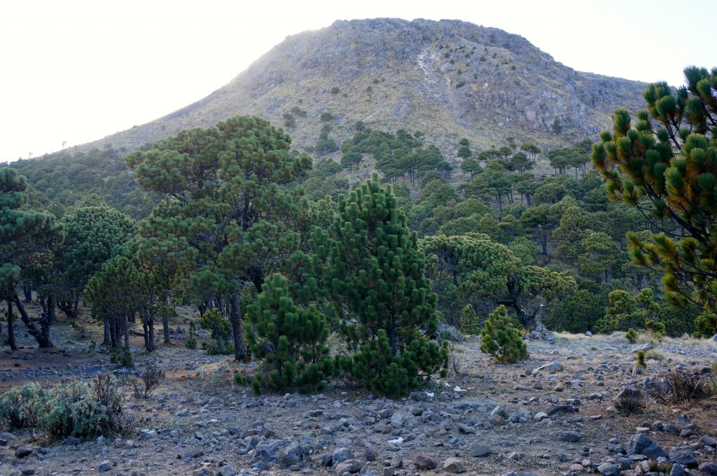
Tajumulco peak taken from camp just under the summit.
So how did we get here? We were staying in the nearby city of Xela, Guatemala, so when we discovered that the highest mountain in Central America was a dormant volcano only a few hours drive away, it was a challenge staring us right in the face that we must attempt to conquer. We signed up with an outfitter who was providing a guide and the camping gear for the overnight trek to the summit.
Exactly How Tall is the Highest Mountain in Central America?
Tajumulco is the tallest mountain for “Central America.” But how high could it really be? We’ve hiked the Rockies before and surely Tajumulco has nothing on those huge peaks, right? Wrong. It’s actually taller than most all of the Rocky Mountains. At 4,220 meters in elevation, Tajumulco’s summit is more than 2.6 miles high. That’s taller than every US state’s highest point, except narrowly missing four (AK, WA, CO, & CA). Have you ever done the hike to Mount Mitchell (NC), the highest point in the entire Appalachian range? For perspective, Tajumulco is more than double its height. We had no idea.
Arriving to Volcan Tajumulco Guatemala
After packing our gear, we left around 6:00 AM, early on a Saturday morning to take a series of chicken buses a few hours to the trailhead.
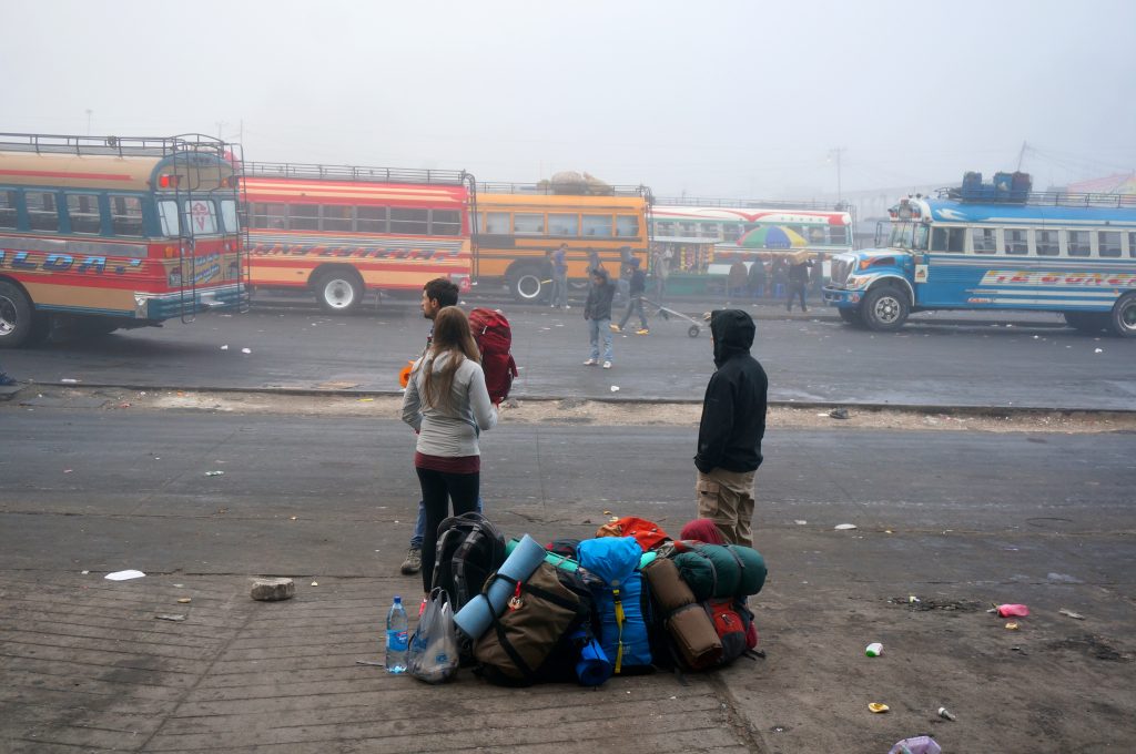
Joining us on the trek was our guide, his nine-year-old nephew (to help), and five other people who had signed up for the tour. The trailhead was a dusty dirt road. No single track or steep inclines. We could see Tajumulco from the trailhead and it looked so close that we were disappointed it wouldn’t be a longer and more challenging hike. The bus already took us up a decent length of the way. This would be smooth sailing from here.
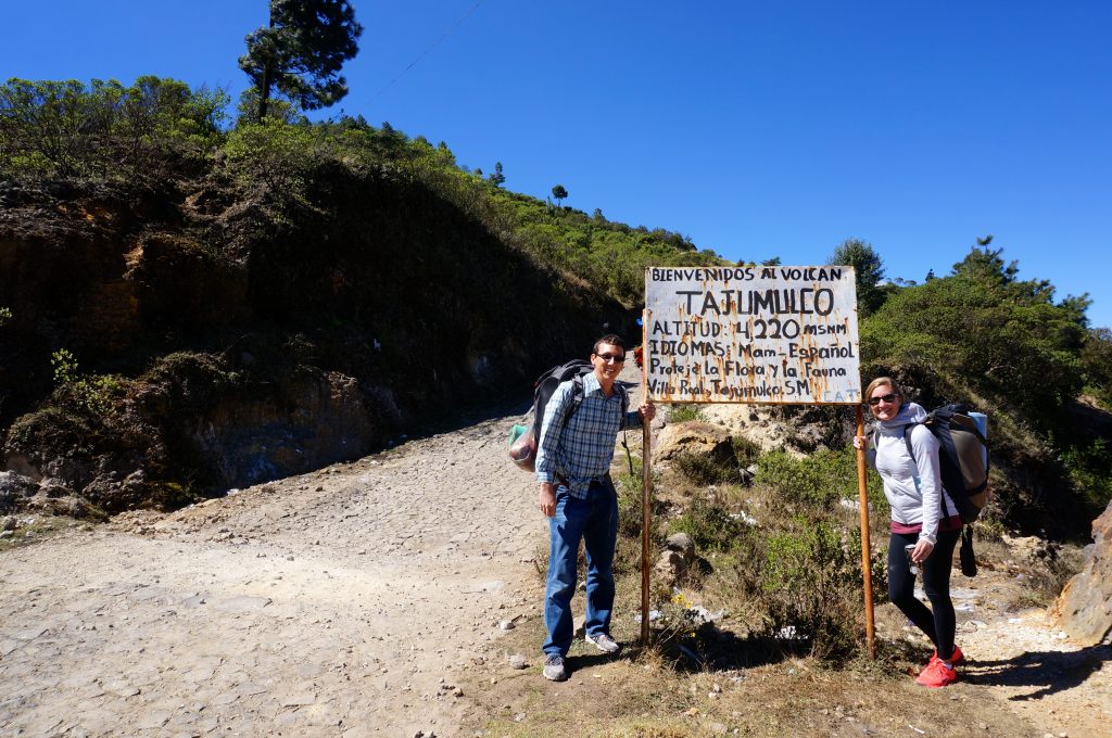
Beginning our Volcan Tajumulco Hike
The beginning of the trail was tame. Near the base there were a few Mayan people, their basic homes, and some boys herding sheep.
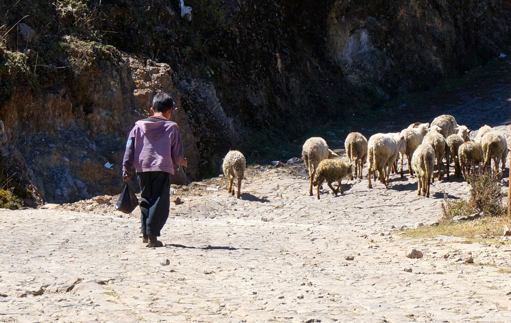
After about a half mile, any signs of civilization were gone. Then after about a mile, the trail began to narrow and the gradient became steeper and steeper. We began cutting through forests, across valleys, and along magnificent viewpoints. Clouds began to press up against the sides of the mountain and soon enough we were above the cloud line.
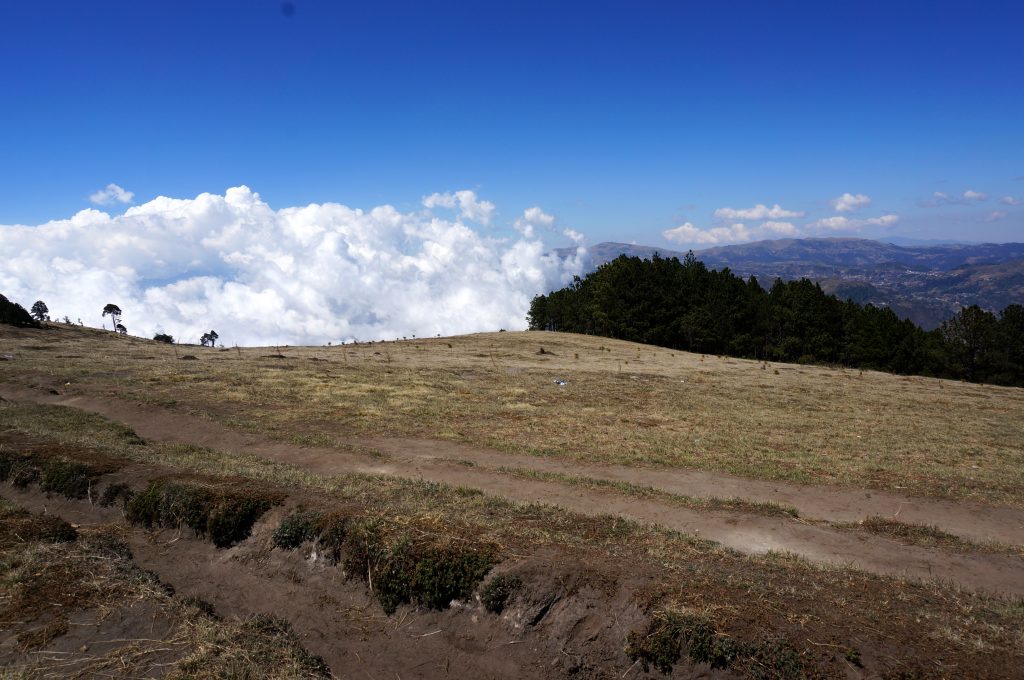
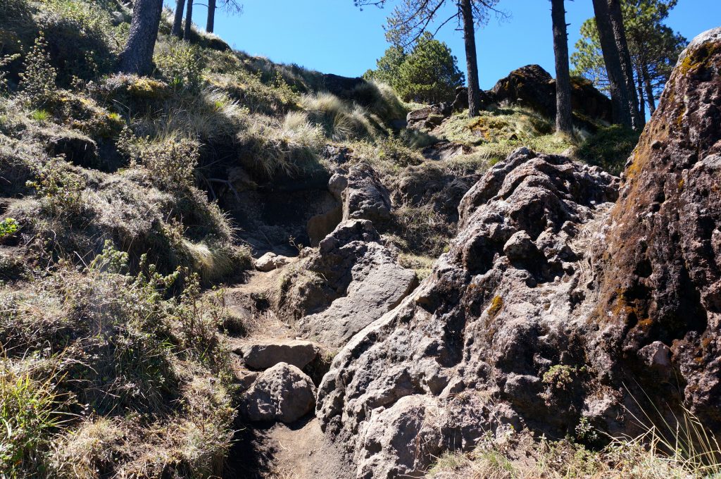
The trail was becoming more technical at times, with areas where we would have to hoist ourselves up over boulders and rock outcroppings.
Hiking Volcan Tajumulco: Slowing Down
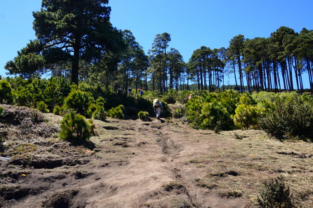
Pretty soon we were lagging behind the rest of the group a bit. We’ve never had a difficult time hiking or keeping up with the pack. Usually we were the ones out ahead waiting for everyone else. What was going on here? It was total role reversal. Maybe we’ve gotten a little bit out of shape. Or perhaps the heavy packs we were carrying were weighing us down. As we chugged along, Maroon 5 was in my head because it was getting harder and harder to breathe .
Volcan Tajumulco Hike: Altitude Sickness
We had been at or near sea level for most of our trip so far. Just days earlier we were at the ocean and here we were now over 2 miles up in the air attempting to summit this peak. The others in our group had been in the highlands for weeks, some for months, and had acclimated to the altitude. We had not. No one had warned us about this, but we were really feeling the symptoms of altitude sickness. As we continued onward hiking Volcan Tajumulco more and more space grew between us and the rest of the group. Eventually the guide took the other five people onward and the nine-year-old nephew hung back with us. It wasn’t long when we reached a point in which we could only walk about five steps before needing to stop for a minute or two. We simply could not catch our breath in this extremely thin air. It is how I imagine asthma feels like. It was horrible.
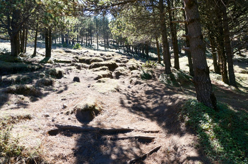
But it wasn’t just the inability to breath. There was also the splitting migraine headache, the stomach sickness, the ringing in our ears, and the tingling throughout our bodies. It was awful. We were suffering from very bad altitude sickness. The nine-year-old boy was throwing up too. Well, I guess we weren’t the only ones feeling it. Walk five steps. Rest for a few minutes. Repeat. This is the game we played for the next several hours as we tried to get to where we were breaking camp. Everything was in slow motion as if we were walking through mud.
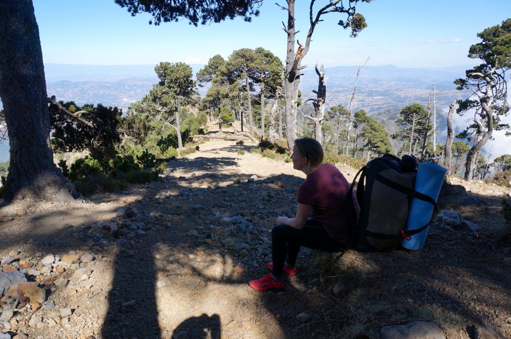
Volcan Tajumulco Camping
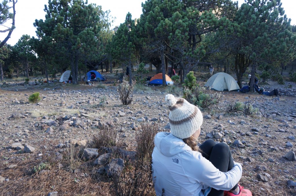
Finally we reached camp, at about 4,000 meters in height. Day 1 of our Volcan Tajumulco hike was over. After resting for a few minutes I decided to help gather some firewood since I wasn’t around to chip in with setting up camp. Even simply walking around on flat ground with no pack was proving extremely challenging up here. This was not normal. The Tylenol nor Advil could do a thing for our pounding skulls.
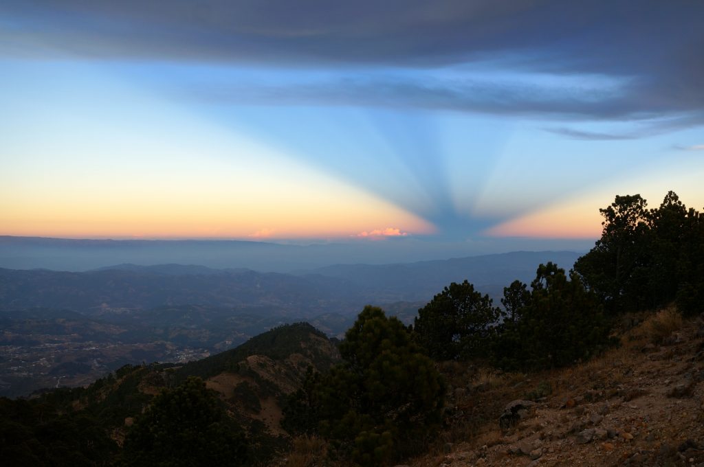
Rather unceremoniously, the sun set behind a mountain and some clouds. But it was minutes later in the East sky where strange inverted pyramid-shaped rays of slight glistened through.
It was already very cold up here, but now that the sun was down, it was downright freezing. We had figured Central America was all sunshine and coconuts. We thought we parted with our cold weather clothing when we left Michigan’s polar vortex. But we weren’t getting off that easy. We didn’t know this at the time, but temperatures would be plunging below freezing within the next few hours high atop this mountain.
Before we sought out on the trek, the outfitter noticed I had no jacket and he let me borrow one of his. It was pretty thin but I was so thankful to have it. I had a few shirts with me and I layered on every single one. I wrapped those few layers up with a rain poncho, not because it was raining, but because it was just one more thin layer to add. The multiple layers didn’t seem to do much though, since none were thick or warm. The shivering continued.
Our guide used his propane stove to cook us a delicious spaghetti dinner. Maybe I was just cold and hungry, but the homemade sauce using fresh tomatoes tasted as if it came from an Italian chef. The warm meal disappeared quickly into our bellies. A friendly dog had followed us all the way up from the trailhead, so it only felt right to share a little with him too.
The guide and fellow trekkers attempted to light a fire but it was just not catching. We both huddled around it, poking it, adding more wood, and fanning it with air in hopes of it catching to provide us some warmth. Occasionally we’d have a few minutes of fire but it just wouldn’t stay on strong. It was only about 8:00 at night but we decided to call it a night and perhaps try to warm up in our sleeping bags.
Among the nine of us, there were only three small two-person tents. The guide and his nephew (2 people) took one tent, a couple and a solo trekker (3) squeezed into another, and another couple (2) had the last tent. Um, so where is our tent? We could either split up for the night (one of us sleeps in the guide tent and while the other share a tent with the couple) or we could stay together and attempt to really squeeze in with the other couple, lying four-deep. We cliqued well with the couple so decided to pack into their tent. Cramming in the tiny tent together with this couple we had just met was only slightly awkward but was extremely tight-squeezed.
There would be no sleeping. First it was just shivering. Although we were sleeping with all our layers on, the subfreezing temps were still unbearable. But after a few hours our combined body heat and sleeping bags did their jobs and the shivering subsided. But the migraine headaches and other altitude symptoms were going full force. The cold hard ground and the sardine-packed conditions were not making matters better. Our heads resting on water bottles and whatever supplies remained in our backpack did not make for comfortable pillows. To describe it as uncomfortable is an extreme understatement. Finally around 1:00 am or so, we somehow nodded off for a few hours of broken sleep.
When we awoke around 4:00 in the morning, our tent mates were missing. Even their sleeping bags were gone. We eventually spotted them several feet away sleeping under the stars. They left the tent because they said (and I quote) “it was like sleeping next to a bunch of drunken walruses.” Apparently we were both snoring so loudly that they preferred to be out in the freezing elements. We felt really bad. We had a miserable night sleep ourselves and it seems their night was even worse, due to us.
Summiting Volcan Tajumulco
But we tried to get ourselves together to make the final hike to the summit in the pitch black dark, sick as hell, and on very little sleep. The frost on the ground and in the air had confirmed the freezing temperatures. The other five went at a normal steady pace, as we once again lagged behind trying to catch our breath. The hike-rest-hike routine was back in full force. Soon the glow of their flashlights disappeared up and around the side of the peak and we were again left with the nine-year-old to watch over us.
We were out from the forest and the rocky trail was like a moonscape. It became very steep, at times forcing us to climb in the dark, as loose rocks and gravel broke way and bounced down the cliffs below us until we could no longer hear it. The drop was straight down. This left us questioning if we somehow took a wrong turn in the dark. This couldn’t possibly be the trail. But we put our trust with the nine-year-old and proceeded onward and upward until we found ourselves hanging off the side of the mountain face, shining our lights at the darkness below, breathless and struck with fear.
False Summit
We’d been hiking for about two hours now, so surely we had to be close. Thankfully the faint dawn light began to creep in and slowly illuminate the sky. We could now see the way to go and it appeared that we were very close to the top. The only problem was that there didn’t seem to be anyone else up there. We were puzzled but continued. That’s when we heard a faint shout to our left. It was our guide on a neighboring peak. We were apparently summiting the wrong peak! Ahhh! So we spent the next 15 minutes climbing down a different face of the mountain, which connected the two peaks, before continuing with the ascent of the true summit. It wasn’t too much further and we now were reunited with our guide.
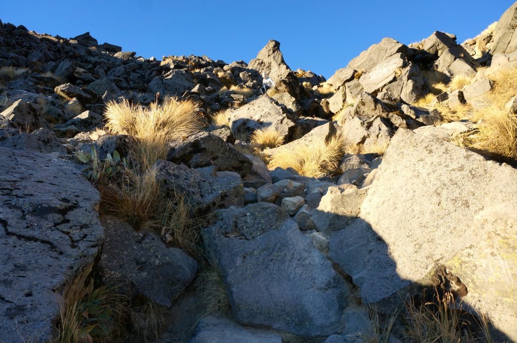
Not just a bunch of rocks. This is the correct trail to the summit.
The True Summit of Tajumulco
The final summit was challenging (mostly just due to the altitude) but it was nothing compared to the impromptu mountain climbing we did on the neighboring peak in the dark. But, with everything against us, we finally reached the actual summit of Tajumulco! Hooray!
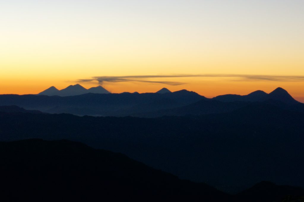
We got there just before the sun was going to reveal itself over the volcanoes and mountains to our East. The summit was very cold and windy, yet for a brief moment the joy of accomplishment had subdued the fatigue, misery, and altitude sickness.
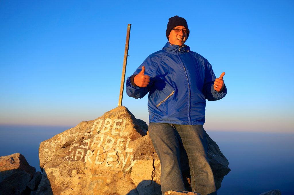
Well, perhaps Heather was still not feeling very well.
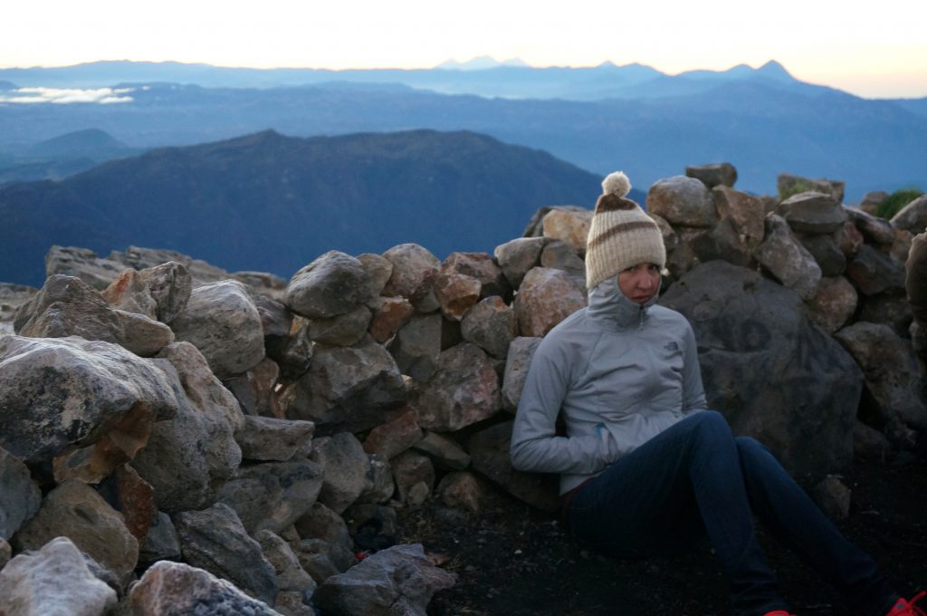
Ok, now lets put aside the pain and agony and look happy for a victory photo!
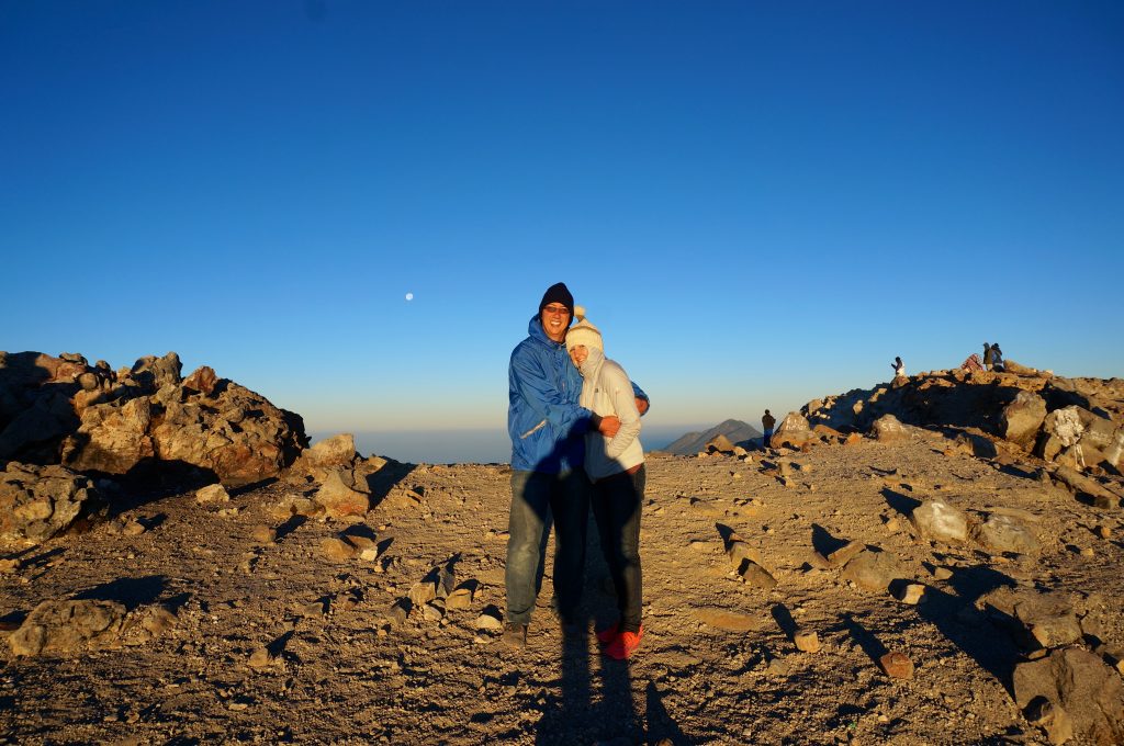
We were on top of the world! Or at least on top of Central America! You could see all the way into Mexico and the fog rising over the Pacific Ocean. The views were incredible and pictures can’t even begin to do it justice. After the sunrise, an enormous shadow was cast out from the volcano we were on top of, which was a very interesting site.
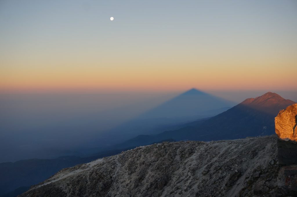
Struggling Down Volcan Tajumulco
We enjoyed the sunrise and spectacular views for about an hour before reversing our Volcan Tajumulco hike to make our way back down to lower altitudes. It was thankfully only downhill from here (or so we thought) and going down the correct trail was much easier than the way we ascended. Since we were still moving at a slower pace, we again hiked under the guidance of the not-so-trusty nine-year-old. The trail back down to camp should only take about an hour. Sure, we were slow, but at two hours something just didn’t seem right. Then we began to notice areas we had passed well before reaching camp the day prior. We somehow had hiked down about an hour further passed camp, which now required us to hike all the way back up to camp.
The boy had got us lost …again! For those of you keeping track, this is now twice in the same morning! He was only nine, so it was hard to be mad at him, but our patience was running very thin at this point. With the altitude sickness still greatly hindering us, it took everything we had to hike up all the extra distance back to camp. This entire bonus hike, added a few more hours to our already very strenuous morning. Once finally reaching camp, everyone was worried and thought we had gotten hurt. The guide had even gone back up towards the summit looking for us.
A Trustworthy Dog on Tajumulco
After regrouping, finally eating breakfast, and getting packed, it was time to descend back down. We didn’t want to slow the group one final time, so the two of us decided to leave shortly before the rest, as they would certainly catch up. We knew the way because we had just hiked down there when the boy overshot camp. No guide needed. But the friendly dog we had shared our dinner with decided to tag along. There were some forks in the trail but we just followed the dog. It turns out the dog was a better guide than the boy. We should have just enlisted his services.
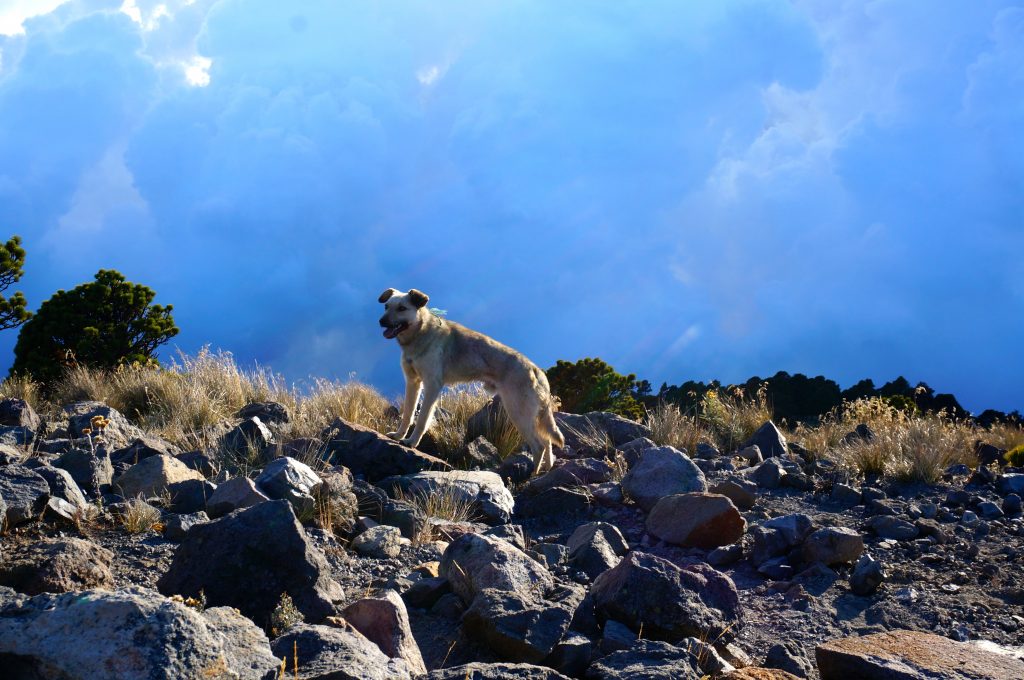
As we got lower and lower we could feel ourselves returning to normal. The migraine turned into a mild headache. Stomach sickness subsided. The tingling stopped altogether. This really motivated me to go faster down the mountain as I could feel myself getting better with each step.
The rest of the group did catch up with us but the dog got us the entire way back down to the trailhead. That’s a good boy!
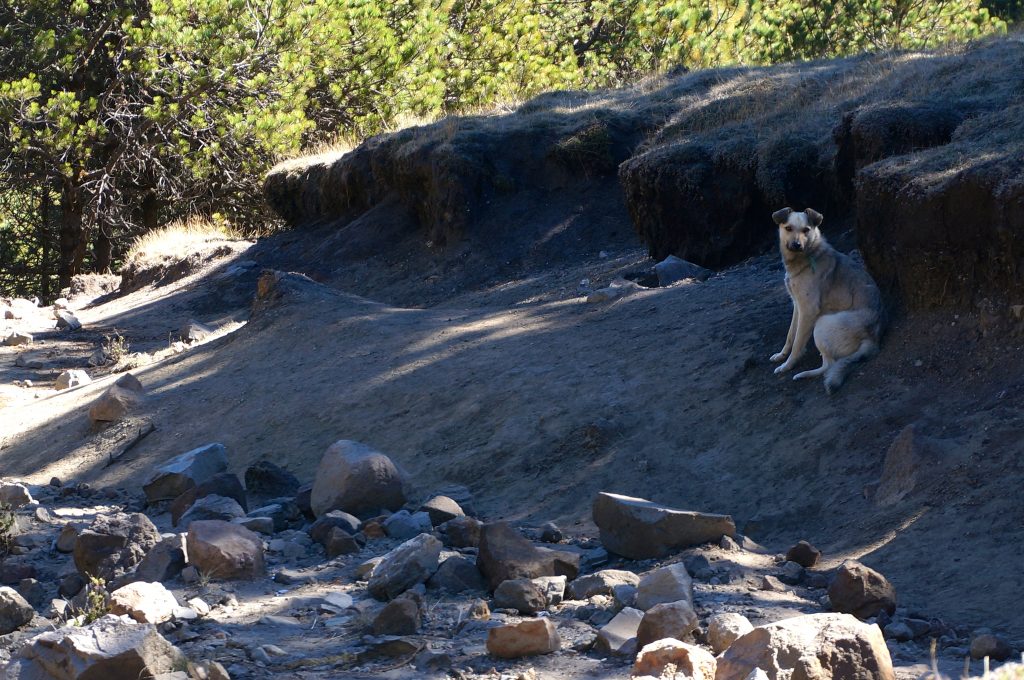
Despite the altitude sickness, extreme freezing temps, less-than-ideal sleeping conditions, and getting lost (twice!), we’re glad to have conquered this once-in-a-lifetime summit. It was certainly an experience and much more difficult than we ever imagined. But it was a remarkable achievement to have summited the tallest mountain in all of Central America. The challenge of Tajumulco was deceptive but we overcame the trials it lobbed at us and truly enjoyed the rewards the summit offered.
Lessons Learned Hiking Tajumulco Guatemala
Lessons learned:
- (1) wait to acclimate to the altitude ,
- (2) bring very warm clothes , and
- (3) always trust a friendly dog .
Related Posts
April 14, 2018 at 5:36 PM
THAT LOOKS THAT YOU GUYS HAD A VERY NICE ADVENTURE THERE, I CLIMED UP THE TAJUMULCO VOLCANO ALSO AND I KNOW IS TIRING BUT AT THE SAME TIME ENJOYABLE, I SUGGEST TAKING WARM CLOTHS GOING TRAILHEAD, I LIKE THE STORY YOU WROTE ABOUT THE DOG SALUDOS YO SOY DE GUATEMALA, GOD BLESS YOU GUYS KEEP KEEP UP WITH YOUR GOOD ATTITUDE IN VISITTING AMAZING NATURE PLACES …… 🙂
May 9, 2018 at 11:43 AM
Thanks and so glad to hear you also had a positive experience on Tajumulco!
July 5, 2016 at 11:13 AM
I just did this hike alone, yesterday, and without a guide. (Not highly recommended as a single female, but I live dangerously). It is definitely a hard hike, despite what the distances say. I set my GPS on the way down (well, when I got back to base camp) and it was almost 5.25 miles back down to the chicken bus stop. Add the extra 100m to the summit and that’s a more accurate distance. So about 11 miles round trip.
Beautiful hike!!! The views are stunning! Be careful if a storm rolls in. Start EARLY if you are going alone and without a guide. I did it as a day hike.
July 6, 2016 at 5:46 AM
Wow, you’re a rockstar! That is awesome you managed to do the hike by yourself! Agree with you not recommending it for solo hikers to attempt, but still pretty awesome that you managed the feat. The hike definitely seemed more difficult than the distances suggest. Seemed way longer than 5.5 miles each way but I know that is about the accurate length and glad to hear your GPS confirming it. Thanks for leaving this advice for anyone else attempting the summit!
June 3, 2016 at 6:11 PM
Hey there- sounded really interesting, I’m going this August and was wondering what guide service you used? It seems like you had a good experience and I’m trying to find something similar. Thanks!
June 8, 2016 at 12:37 PM
We used Quetzaltrekkers. Overall they were pretty good and we’d recommend. But do check on the tent configuration before leaving for the trek. There were 4 of us that were put into a 2-3 person tent which was extremely tight quarters to sleep in.
February 11, 2016 at 8:18 PM
Wow. It must have been an awesome adventure but a very difficult achievement indeed.
My girlfriend and I were invited to climb the volcano next week on Friday… We live in Guatemala City, I’m 29 and I just quit smoking two weeks ago.
I wanted to conquer something great on my first 21 days of not smoking but after reading this… It sounds impossible and scary…
Maybe in a not so distant future we’ll climb it.
February 12, 2016 at 8:05 AM
Hi Andy, We had a tough time trekking Tajumulco mainly do to the altitude. If you’re living in Guatemala City, you’re already acclimatized to about 5,000 feet high, so you likely wouldn’t feel the harsh affects like we did. Everyone else in our group had been acclimatized and didn’t seem to have any trouble at all when sticking with the guide. If you are in reasonably good shape and are able to hike 10 miles or so, I would say give this summit a try! 🙂 Don’t let our harrowing tale stop you from going. PS. Congrats on the accomplishment of quitting smoking!
September 5, 2015 at 12:37 PM
I love this honest report 😀 I’m kinda glad I+m not the only one struggling. I did a trail in Turkey totally fell in love with hiking, even though I have a few health problems that are not the best for hiking 😀 This winter I hope to get to central america and hike in every country if possible…so tell me…is the guide necesery, are there any markers on the trail cause I wish to do it alone l
love peace and pancakes from croatia pam
September 5, 2015 at 6:09 PM
There are no markers on the trail but the first part of the trail to the camp is pretty straight forward. There really isn’t any major forks in the trail. But I would not recommend hiking from camp to the top in the dark on your own. We did that with a guide (sort of) and still wound up on the wrong peak. If you were to do it all in the daylight, I think it may be possible to do on your own. But I’d probably recommend guide service. It was cheap, nice to not have to worry about whether we were going the right way, made some friends, and had our meals covered.
October 7, 2014 at 7:46 AM
Cool hike. Nice photos I’m climbing Tajumulco a month from now, to bag another country’s high point. I’m a little disappointed to learn on another site that the main trail is only 6km long. True? Also – I was wondering about doing it without a guide. Did you encounter anyone doing that? The internet is pretty sparse on details.
Thanks … and have fun in Turkyie. I went to Cappadocia myself and found it to be a little too expensive. I set out on a trek alone in the hills north of Urgup and had a great time.
If you’re going to western China eventually, send me an email. I lived there and it is truly one of the world’s finest destinations. (Also I’d love to hear your advice on Tajumulco)
October 8, 2014 at 3:15 AM
I don’t recall the distance. It certainly seemed like more than 6km though. It took us about 4-5 hours to the camp just below the summit and another 45 minutes or so from there. Granted we were really suffering from the altitude and perhaps a little out of shape at the time, but it really seemed longer than 6km. I’d think at least 10, but thats just going off memory, so take that for what it is.
If you have all of your gear, I think it can be done without a guide. While its not marked very well, it is a pretty easy-to-follow trail. I wouldn’t recommend doing the summit in the dark though without a guide because that portion of the trail was a little difficult to follow in the dark. But I’d imagine its easier in the daylight hours. Some people do the entire trek up and down in the same day. So if you’re an avid hiker, you might want to consider that too. It’ll be a long day, but very possible, plus you won’t have to haul up all your gear. We did see a couple people doing that without a guide. Didn’t see any overnight trekkers without a guide.
Thanks for the recommendations of Turkey and China. We’re going to try to head out to China eventually but not anytime soon. Safe travels and have fun ticking Tajumulco off your highest-point list!
March 13, 2014 at 4:03 PM
I truly enjoyed reading about your adventure. The dog added a cute touch to the story. I can relate this to when we went hiking in California. Of course, got lost, and froze overnight, but probably not as cold as you all got. Keep the stories coming, well written. Love, mom.
Leave a Reply Cancel reply
Your email address will not be published. Required fields are marked *
Don't subscribe All new comments Replies to my comments Notify me of followup comments via e-mail.

Tajumulco Volcano Hike
The Tajumulco Volcano Hike is a 2 day, 1 night tour.
Duration: 2 days Starts: 6:00 am the first day Back the next day at: 13:00 hrs Minimum: 4 people Elevation: 4,220 m (13,845 ft) Cone: Composite Status: inactive
Location: The municipality of Tajumulco, Depto. San Marcos, 17 km from the border with Mexico.
Description:
We pick you up at your Hotel or House stay around 6 in the morning, and take a public bus to San Marcos, were we switch to a different public bus.
At the junction road we start 2 ½ hours hike to ascend at 4,000m to a flat part where we set our camping site. For one more hour of hiking we reach the summit where you can see all the volcanoes in Guatemala lining up, the Pacific ocean and Mexico, have no doubts it will be “THE BEST VIEW”.
We get up around 5am to hike to the top again to see the sunrise, and then we will come back to Xela the same way we arrived.
Tajumulco is the tallest volcano in all of Central America.
Tajumulco has two peaks. The higher peak at 4,220 m (13,845 ft) has a crater 50m (160 ft) in diameter. The lower peak has an elevation of 4,100 (13,451 ft). The type of rock found on both peaks is hornblende andesite and pyroxene.
Includes. Transportation, Food, Equipment, and guide.
- Destinations
- Quetzaltenango
- Things to Do
Hiking Tajumulco Volcano
Let Bitty know what you think!
Days available
Languages offered, transportation, mobile ticket.
At an elevation of 13,845 feet (4,220 meters), the Tajumulco Volcano is the highest point in Central America. This tour takes you to its summit.
The Tajumulco Volcano is located 42 miles (68 km) northwest of Quetzaltenango. The hike to the summit takes around 5 to 6 hours and isn't extremely challenging as long as you're acclimatized. On a clear day you can see into Western Guatemala and sometimes even Mexico.
This hike begins very early in the morning. You'll take a private shuttle to the base of the volcano and begin hiking. The hike up is moderately difficult, but slightly easier because you won't bring heavy bags.
This tour offers travelers a unique high-alpine experience in Guatemala. Be sure to bring appropriate clothing and a jacket, as it can be quite chilly at the summit.
After a rest at the top of the volcano, you'll descend and arrive back in Quetzaltenango around 2:00 PM the same day.
What to Bring
What's included, similar things to do, hiking santa maría volcano, sneak peek of santiaguito volcano, hiking the chicabal volcano, quetzaltenango cultural walk, market tour to chichicastenango, takalik abaj olmec archeological site, colonial churches tour, know quetzaltenango by the tram, market tour to chichicastenango, culinary & cultural encounters, adventure sports, hidden local gems, photo opportunities, mind & body rejuvenation, easy sightseeing, city-life energy, rugged exploration, rest & relaxation, romantic moments, mind-blowing vistas, off-the-beaten-path exploration.
Sign up to receive the latest news and offers from Anywhere

COMMENTS
The trek to the 'Tajumulco' Volcano is a must-do for volcano-lovers. The highest in all of Central America with a height of 4,220 meters above sea level. When you reach the top, you will have a spectacular view of the Volcanic chain of Guatemala. Although it is located in the tropical part of the planet, the temperature at its peak can ...
Join us on our two day trek to the highest point in Central America: Volcán Tajumulco! At 4,220 meters tall, Tajumulco means "above the clouds" in the local Mayan language. After a strenuous trek through montane pine forests to our base camp, this giant of the Guatemalan Highlands offers views galore. We'll enjoy lunch and dinner at camp ...
Enlist yourself in a two-day trek up Guatemala's highest peak, Volcano Tajumulco, standing at 13,845 feet tall. The journey will take you on a meandering single-track trail through fog immersed pine forests and meadows. As the trail pushes higher, you'll find yourself walking on clouds. The final steep push in the trail greets those worthy ...
The ride from San Marcos terminal to Volcan Tajumulco trailhead is about 1.5 hours. This has you on the the trail at about 6:45 am. Hiking Volcan Tajumulco takes about 3 to 3.5 hours. It's now about 10:15 am as you reach the summit. Tajumulco trailhead, just off the main road. In our scenario, 1.5 hours at the top means you descend at 11:45 am.
More. Length 7.7 miElevation gain 3,940 ftRoute type Out & back. Discover this 7.7-mile out-and-back trail near Tajumulco, San Marcos. Generally considered a challenging route, it takes an average of 6 h 23 min to complete. This is a popular trail for hiking, but you can still enjoy some solitude during quieter times of day.
At the start of the trek, there are two paths, one towards the Volcan and one towards Tajumulco (the city). Bare left and you will walk up a cobblestone path and past some houses (with more dogs). Once you get off the road into the hiking-only path, there are orange markers tied to trees and bushes to let you know you're going the right direction.
Close to the border with Mexico, Volcan Tajumulco is the highest point in Central America at 4,219m, with inspirational dawn views across a sea of clouds to Guatemala's other great volcanic peaks. It is a long return walk, so best broken up with a night up there (at just under 4,000m, so quite high).
Join us on our 2 day trek to the highest point in Central America: Volcan Tajumulco! Standing at 4,220 meters tall, Tajumulco means, "above the clouds" in Mam, the local Mayan language. After a strenuous trek through montane pine forests to our base camp, this giant of the Guatemalan Highlands offers views galore.
Watch on. Volcan Tajumulco is the tallest volcano in Central America at 4,202 meters (13,786 ft). With 2 summits. It offers a spectacular sunrise full of colors and views of several volcanoes including 7 Orejas, Santa Maria, Santiaguito, Santo Tomas, Laguna Chicabal, and others. Hike Volcan Tajumulco summits is a two-day hike.
This is what our Sunday morning has become. It was 5:30 AM and we were gasping for air, hanging on the edge of the highest mountain in Central America: Volcan Tajumulco. The following recants our harrowing tale during our Volcan Tajumulco hike in Guatemala. Tajumulco peak taken from camp just under the summit.
Tajumulco is a large stratovolcano in Guatemala's San Marco department. At 4220m it is the highest of Guatemala's countless volcanoes. Since we are far from being experienced hikers, we were doubting if we would be able to conquer it. But the fact that Tajumulco is Central America's highest peak really motivated us.
The air was getting thinner and we had to stop several times to catch the breath and have a sip of water. I was excited to see the sunrise from the highest place possible in all of Central America. Tajumulco volcano rises to 4220 meters. birthday kiss on a special place - top of Tajumulco volcano at sunrise.
Tajumulco is the highest peak in both Guatemala and Central America. Like most of the rest of the high mountains in Guatemala, it too is a volcano. The volcano had its last small eruptions in 1821 and 1863 and has been quiet since. This is a spectacular climb, and has views of both Mexico and Guatemala. The mountain is also surrounded by ...
Tajumulco is the tallest volcano in all of Central America. Tajumulco has two peaks. The higher peak at 4,220 m (13,845 ft) has a crater 50m (160 ft) in diameter. The lower peak has an elevation of 4,100 (13,451 ft). The type of rock found on both peaks is hornblende andesite and pyroxene.
Guatemalan Volcano Trek: Pacaya, Fuego, Zunil, Tajumulco, & More - 16 Days View Map. On this 16-day active adventure trough Guatemala, you'll conquer seven volcano summits located in the country's highlands. The beginning of the trip is anchored in Antigua, where you'll hike and camp near volcanos including Pacaya, Acatenango, and Fuego.
Trek to Chicabal Volcano and Lagoon near Quetzaltenango , Guatemala. 7. Wildlife Watching. from. $50.00. per adult. Sunrise Hike Tour on Indian's Nose Mountain. 55. Recommended.
Join us on an adventure to the highest point of Central America....Volcán Tajumulco!More infohttp://www.quetzaltrekkers.com/xela/treks/tajumulco/About Quetza...
Included. At an elevation of 13,845 feet (4,220 meters), the Tajumulco Volcano is the highest point in Central America. This tour takes you to its summit. The Tajumulco Volcano is located 42 miles (68 km) northwest of Quetzaltenango. The hike to the summit takes around 5 to 6 hours and isn't extremely challenging as long as you're acclimatized.
The trek up to Tajumulco volcano in Guatemala was one of the best experiences and views we have ever had. Tajumulco is the highest peak in central America. W...
More. Length 7.7 miElevation gain 3,940 ftRoute type Out-and-back. Discover this 12.4-km out-and-back trail near Tajumulco, San Marcos. Generally considered a challenging route, it takes an average of 6 h 23 min to complete. This is a popular trail for hiking, but you can still enjoy some solitude during quieter times of day.
Trek to the top of the volcan Tajumulco, Guatemala, the highest point of central america (4220m).Trek with Quetzaltrekkers, from Quetzaltenango.Thank you to ...
At the start of the trek, there are two paths, one towards the Volcan and one towards Tajumulco (the city). Bare left and you will walk up a cobblestone path and past some houses (with more dogs). Once you get off the road into the hiking-only path, there are orange markers tied to trees and bushes to let you know you're going the right direction.
Volcán Tajumulco is a large stratovolcano in the department of San Marcos in western Guatemala. It is the highest mountain in Central America at 4,203 metres (13,789 ft). It is part of the mountain range of the Sierra Madre de Chiapas, which begins in Mexico's southernmost state of Chiapas. [1]