
Home » North America » USA » Driving the Santa Fe Trail Auto Route

Driving the Santa Fe Trail Auto Route
By Author Lance Longwell
Posted on Last updated: July 17, 2023
Across the Midwest, the land is still scarred by one of the most remarkable events of the 19 th Century. For 50 years throughout the 1800s, the westward expansion of the United States occurred along the Santa Fe Trail. Today, travelers can relive that spirit of adventure by driving the Santa Fe Trail Auto Tour route.
As I was growing up in the American West, the Old Santa Fe Trail had a near ubiquitous quality to it. Local schools, restaurants and stores all the bore the name of this iconic trail from Missouri to Santa Fe, New Mexico. There was literally no escaping the route’s impact, and all of the businesses and roads served as daily reminder for me.
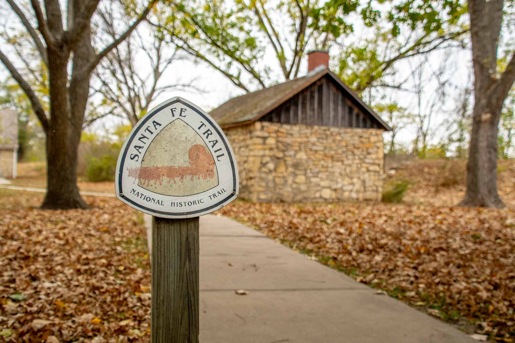
And yet, over 200 years later, the route still captures people’s interest. So one summer, we loaded up the car to drive the Santa Fe Trail and experience this national treasure first hand. This itinerary takes in the best sites along the Santa Fe Trail National Scenic Byway, a National Park Service designated byway.
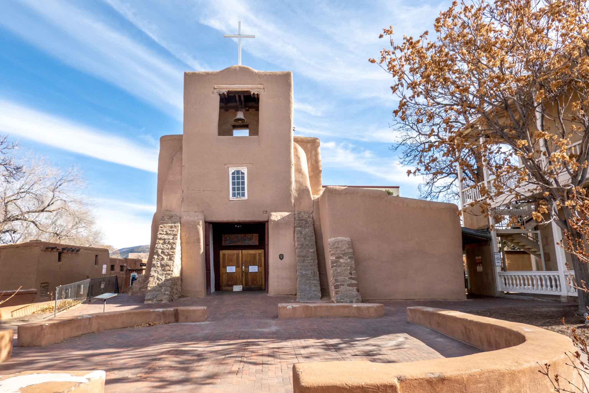
The Old Santa Fe Trail was the main overland transport route for goods and people to the west. For 60 years, the trail was known for wealth and opportunity, but also for heartache.
For much of early period of American history, Santa Fe resided in the Spanish territories and was considered quite wealthy. As pioneers pushed west, developing trade with the Santa Fe was desirable. Unfortunately, the Spanish were quite hostile to the outsiders. All of that changed when the independent government of Mexico was established in 1821.
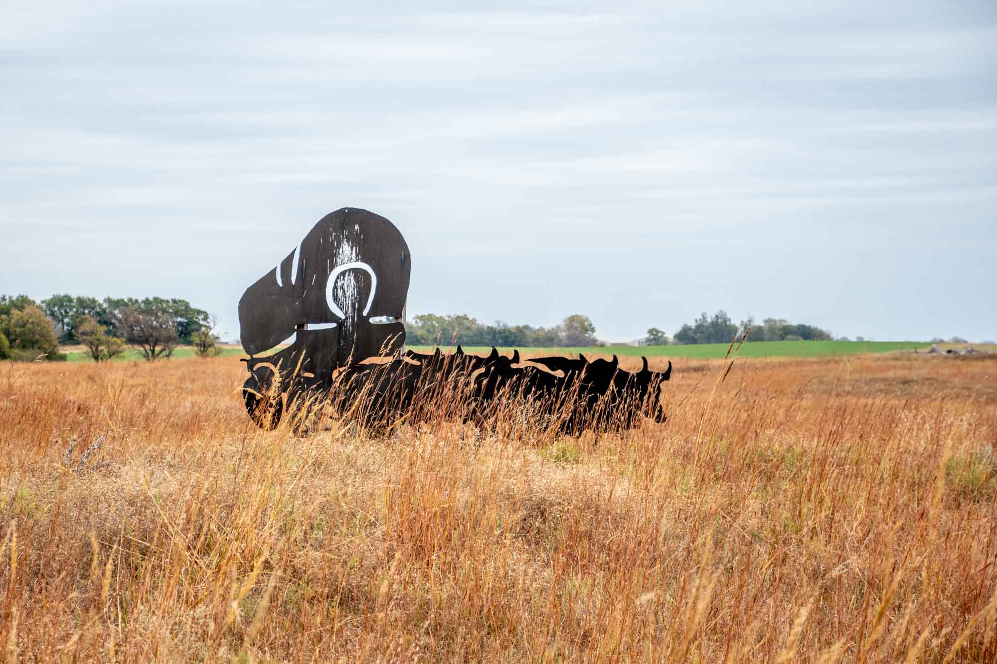
In the fall of 1821, a trader named William Becknell set out from Franklin, Missouri to establish a land trade route from the Midwest and points east to Santa Fe. Becknell’s trade goods proved popular in the new Mexican colony.
As word of his exploits spread, others got into the act. Within a few short years, numerous traders were making the overload route. For the first 25 years, until 1846, the road was used by Americans heading southwest, and by Mexicans heading northeast.
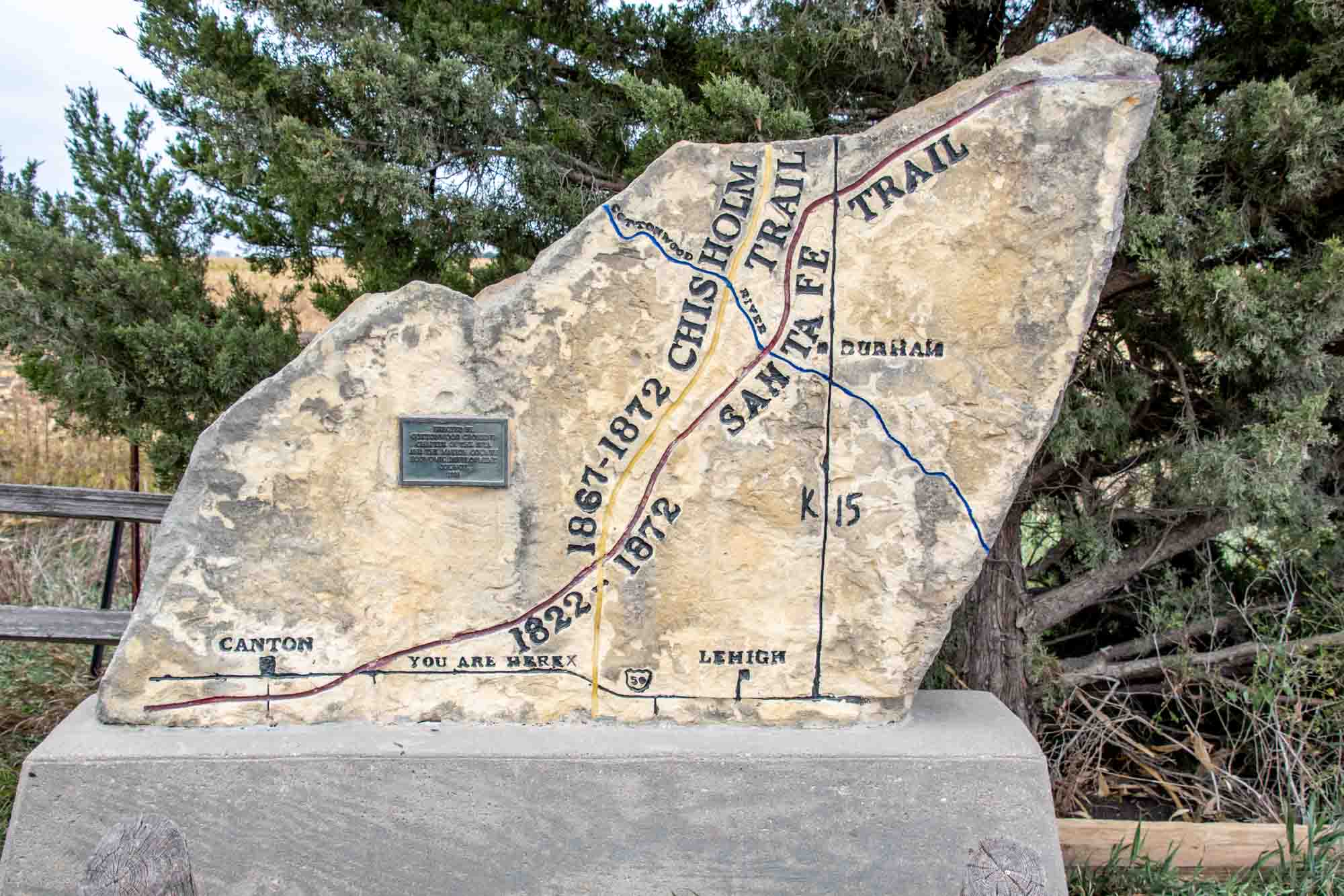
That changed in 1846 with the Mexcian-American War. Soon, the American military took control the trail and used it to push troops and weapons into Mexico. The Santa Fe Trail was extremely busy with military trade from 1846-1848. The strife ended with the Treaty of Guadalupe Hidalgo in 1848, but trade was just getting started.
From 1848-1866, the road boomed with westward expansion, settlers, gold prospectors and people looking to start a new life, which included a healthy number of immigrants from around Europe, but also the rest of the world. The Civil War years of 1861-1865 didn’t deter the westward expansion of the country.
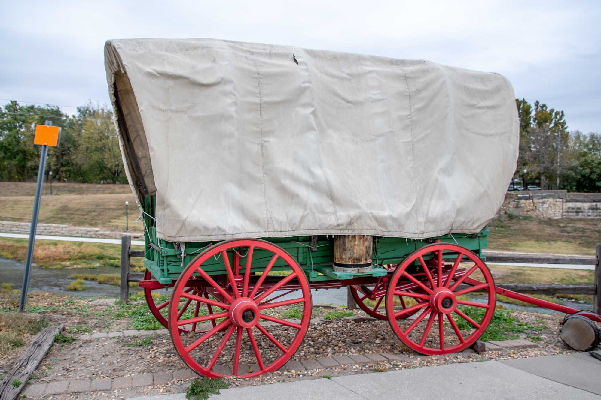
Between 1866-1873, railroad lines were built all the way across Kansas, facilitating the movement of goods and people. And by February 1880, the railroad would cross Raton Pass and make it all the way to Santa Fe. With a rail option, the Santa Fe Trail ceased to be.
And yet, by the 1950s, there was a resurgence of interest in the trail from history buffs, school children and others. Soon, people began trying to recreate the journey – usually in cars, but sometimes on foot or on bicycles. The Santa Fe Trail would not die because the interest of America will always keep it alive.
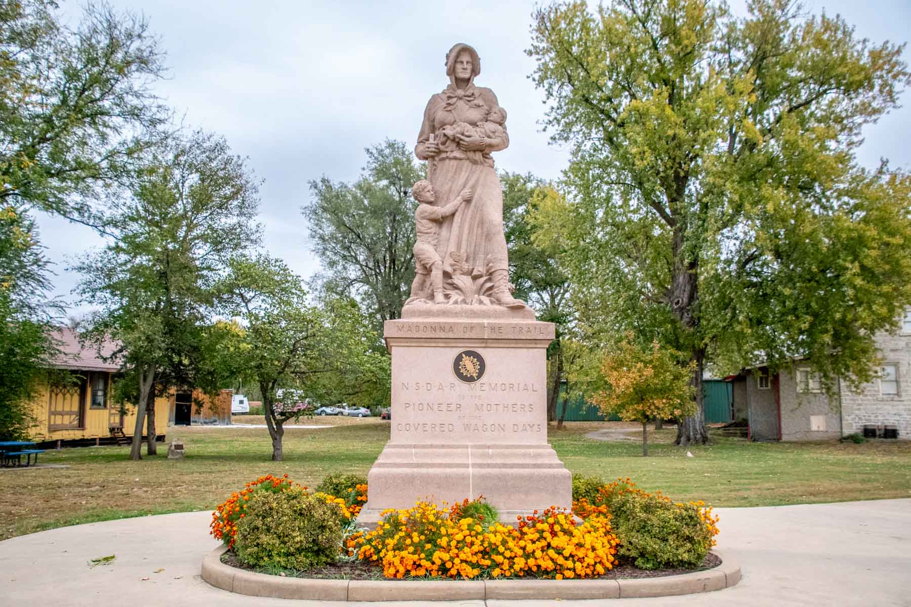
There are a number of interesting sites along the Santa Fe Trail auto tour route that you can still visit today:
Old Franklin Town Site
The Old Franklin Town Site in Missouri holds great historical significance as it marks the beginning of the renowned Santa Fe Trail. Established in 1816, Franklin served as a vital trading and transportation hub in the early 19th century. The town was strategically located on the banks of the Missouri River, allowing for easy access to water transportation.
The Old Franklin Town Site now serves as a reminder of this historical era, although there’s not much to see. A flagpole in a field marks the site of the center of town. Near the road, there’s a couple of Santa Fe Trail markers to interpret the site.
A few miles south, in the town of Boonville, there are some interesting murals on the buildings that are worth noting. Old Franklin Town site is located about a mile and half northwest of Boonville on Missouri Route 87. (GPS coordinates: 38.987209, -92.755281)
Mahaffie Stagecoach Stop & Farm Historic Site
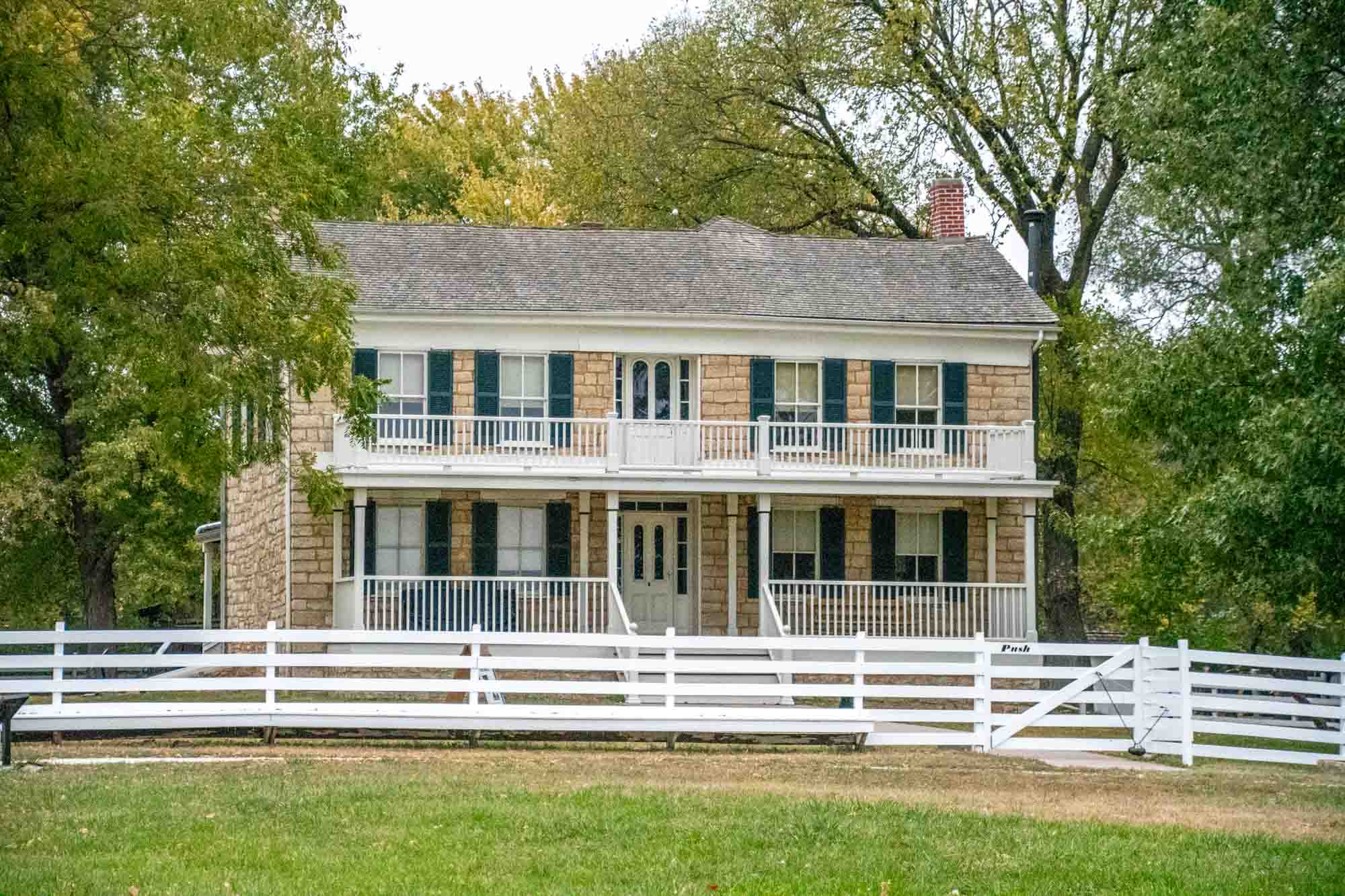
In the city of Olathe, Kansas, the Mahaffie Stagecoach Stop & Farm Historic Site has a unique distinction – it is the only surviving stagescoach stop still open to the public. Every summer, the Mahaffie Farmstead operates as a kind of living history farm that interprets the 1850s-1870s time period when James Beatty Mahaffie and his wife Lucinda operated the farm, stagecoach stop and inn.
The farm was uniquely positioned as the last major spot along all three of the major westward trails: The Santa Fe Trail, the Oregon Trail and the California Trial. At this point, mail and goods where shuffled depending on their ultimate destination. Located at 1200 E. Kansas City Road in Olathe.
Black Jack Ruts
On June 2, 1856, the Civil War effectively begin in Kansas with abolitionist John Brown leading an armed revolt. Despite occurring years before the start of the actual Civil War, this event was an important turning point in history.
The Black Jack Battlefield site is now a well preserved park with an log cabin that is open to school groups and during select periods. The battle took place during the period when the trail was operating and items inside the cabin structure are original to the period.
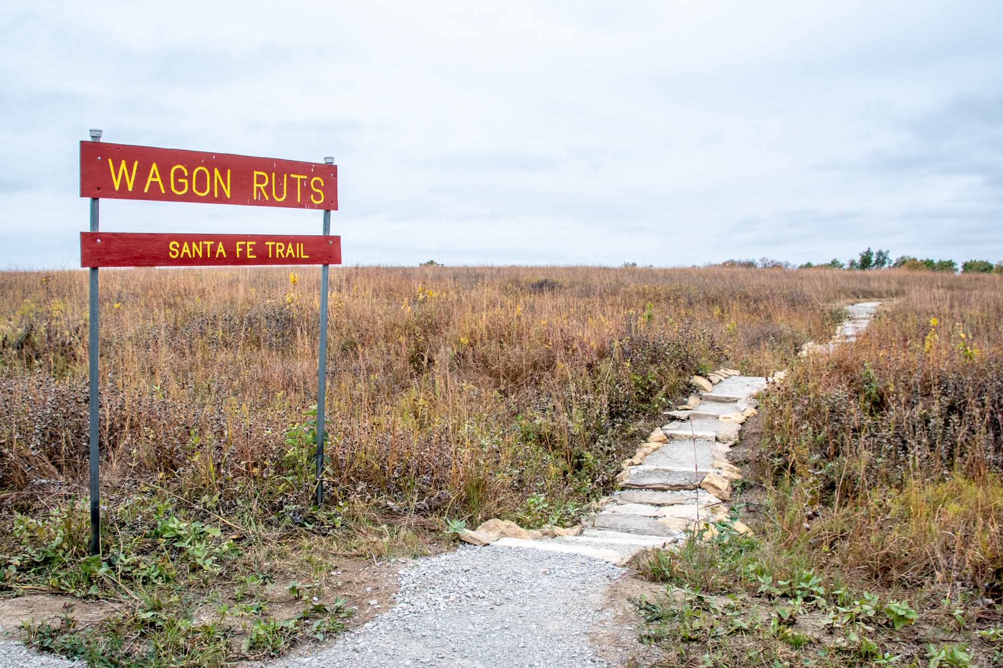
But Santa Fe Trail lovers focus their attention on the hillside about 400 yards before the battlefield. Here the Santa Fe Trail forged a small creek. Several dramatic, parallel trail ruts can still be seen on the hillside. During our drive across the Santa Fe Trail, the Black Jack Ruts were the best preserved and most impressive ruts we came across. There is a small footpath through the ruts which leaves from Black Jack Highway Park on U.S. 56. Located at 2011 N. 200 Rd. (GPS Coordinates: 38.766288, -95.129591 )
Council Grove
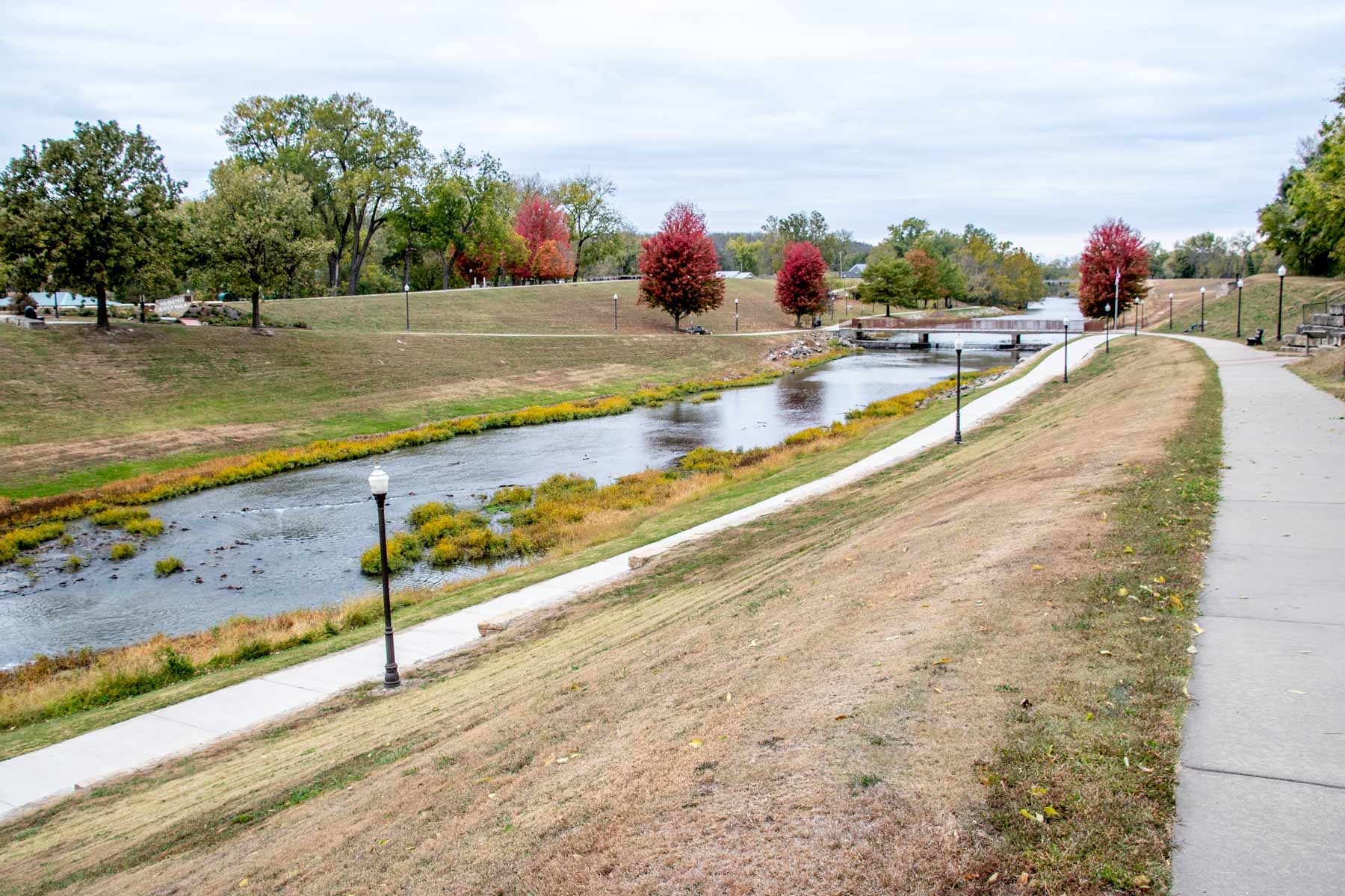
Council Grove, Kansas holds significant importance on the Santa Fe Trail due to its role as a vital stopping point and supply center for travelers along the trail. Established in 1825, Council Grove served as a crucial rendezvous site for traders, pioneers, and Native American tribes.
The town’s location on the Neosho River provided a reliable water source for travelers and their livestock. Additionally, the area offered abundant timber for construction and fuel.
Council Grove gained its name from the council meetings held there between Native American tribes and government representatives. These councils played a crucial role in maintaining peace and fostering trade relationships between the settlers and Native Americans.
To resupply convoys, the town boasted several trading posts, blacksmith shops, and other essential services that catered to the needs of those traveling the Santa Fe Trail. It was the last supply point for over 600 miles.

Today, Council Grove’s historical significance is preserved through numerous landmarks. Visitors can see the Council Oak, where meetings with the Native American tribes took place (located at the corner of E Main Street and N. 4 th Street), as well as the Neosho River Crossing (where U.S. Highway 56/Main Street crosses the Neosho River).
Finally, visitors can see the Seth Hays Home. Hays was the founder of the town (and grandson of Daniel Boone and cousin to Kit Carson). He arrived on the banks of the river in 1847 and stayed until his death in 1874. But his brick home is one of the few structures along the trail that has been preserved in its original condition. It’s now home to the local historical society. Located at 215 Wood St in Council Grove .
Tallgrass Prairie National Reserve
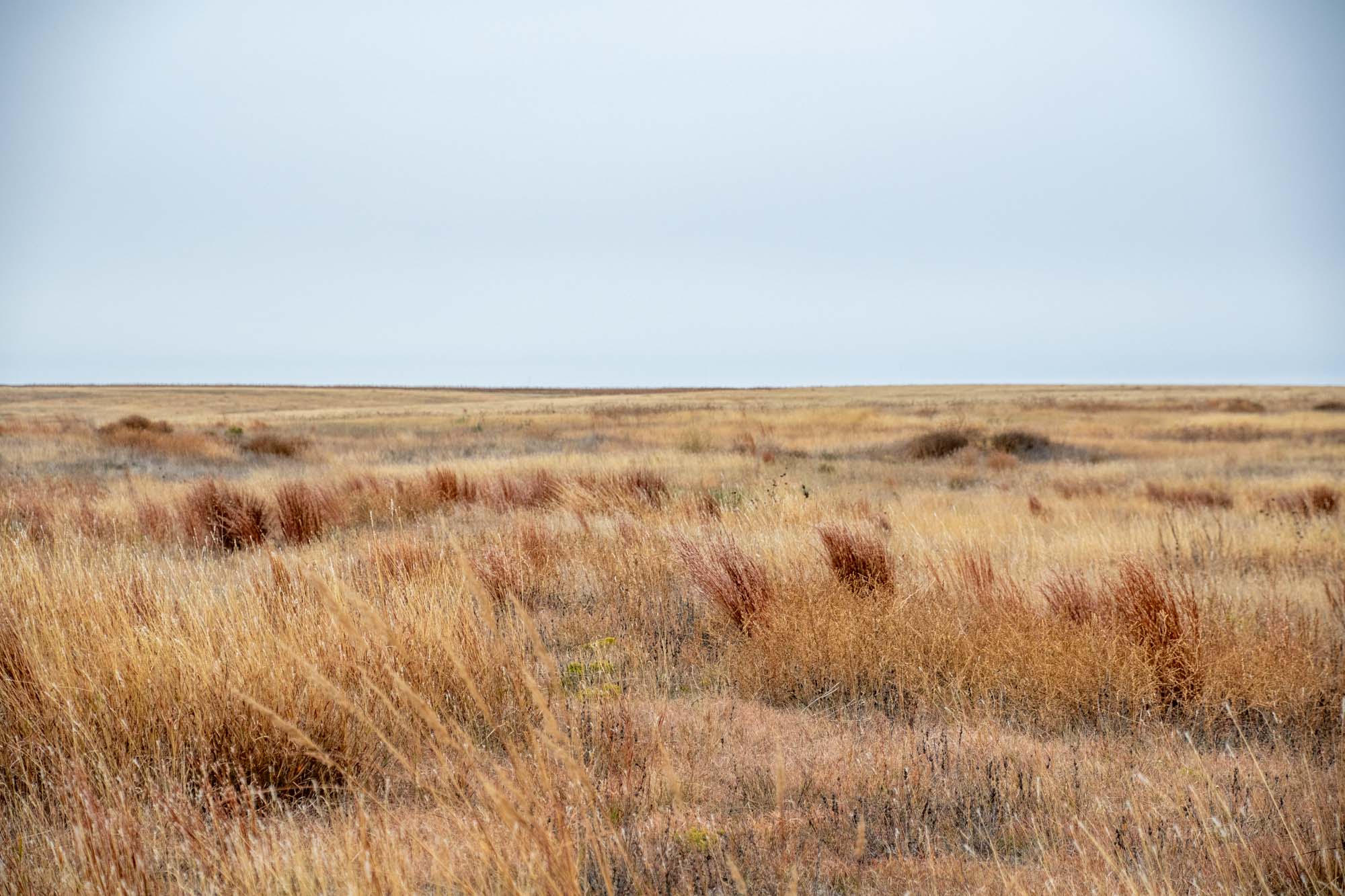
The Tallgrass Prairie National Reserve in Kansas is a breathtaking and ecologically significant destination that immerses visitors in the beauty and grandeur of the tallgrass prairie ecosystem. Stretching across thousands of acres, this protected area showcases the stunning natural landscapes that once dominated the heartland of America.
Most importantly, it is a chance to see what land around the Santa Fe Trail looked like before farming and cultivation. Put simply, visiting the Tallgrass Prairie National Reserve is the closest we can get to going back in time and seeing what the Santa Fe Trail was really like at the time.
If you are driving the Santa Fe Trail, consider making a stop here and talking a hike to experience the vastness and beauty of the American prairies. Located at 2480B KS-177 in Strong City, Kansas .
Ed Miller Grave
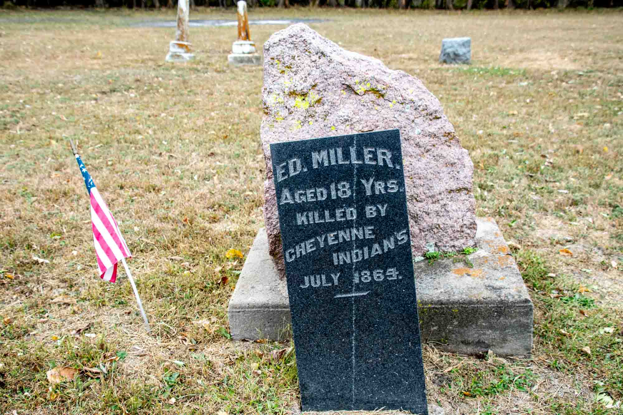
It is perhaps inevitable that the westward expansion of the country and the movement of goods and people along the trail would bring conflict. Armed conflicts between jittery white settlers and agitated American Indians were not unheard of.
According to legend, in 1864, a young 18-year old named Ed Miller was working for the U.S. government as a dispatcher when he was attacked and killed by Cheyenne Indians. It is believed that Miller was the last white man killed by the Native Americans in western Kansas.
Visitors can read more about his story . Located on 29 th Avenue, north of Route 56 in Canton, KS. (Approx. GPS coordinates: 38.383454, -97.386283).
Ralph’s Ruts
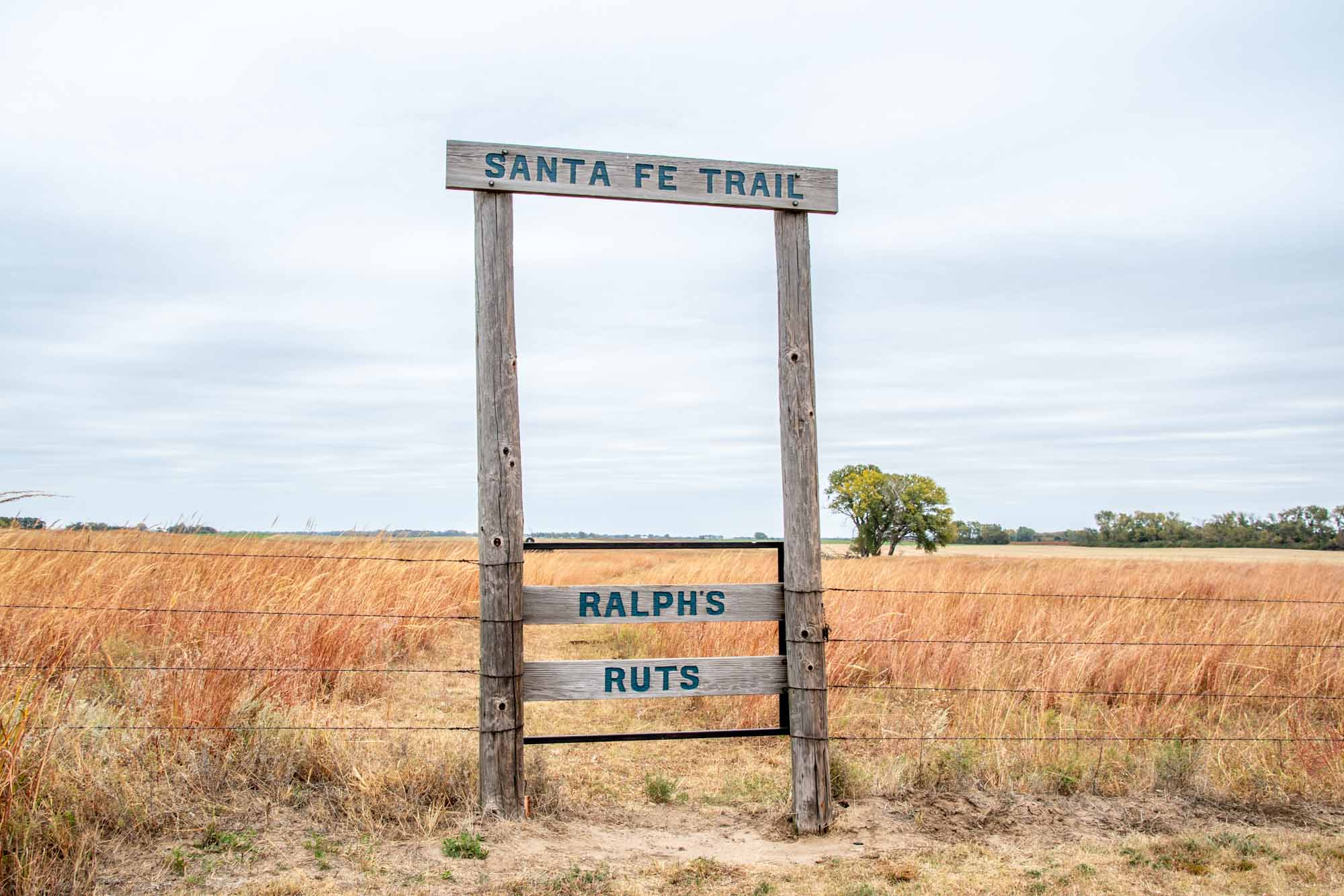
While there are many places in Kansas to see Santa Fe Trail Ruts, one of the most prominent and famous are the Ralph’s Ruts near the town of Chase, Kansas.
These ruts cross the land of Ralph Hathaway on land that was originally settled by his grandparents John and Mary Hathaway in 1878. Early on, it was recognized that the soil was too sandy to support crop cultivation, so it was left for grazing, which protected the trail ruts. Located on 4 th Road about 4 miles west of Chase, Kansas and north of Highway 56.
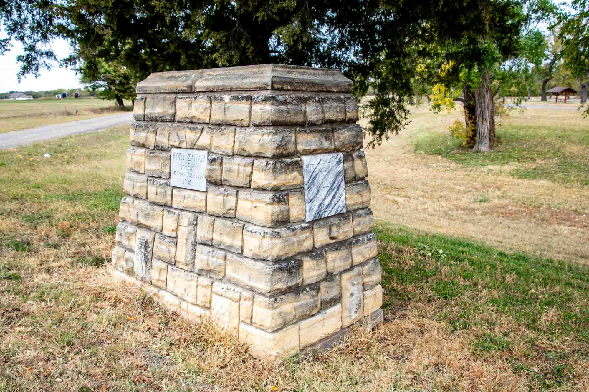
Situated along the route, the Santa Fe Trail brought travelers to the site of Fort Zarah, an impressive stronghold comprised of a substantial stone structure housing officers’ quarters, troop accommodations, mess halls, kitchens, and storage facilities. Functioning as a pivotal post during its active years, Fort Zarah served as a vital support system for those traversing the trail.
However, in 1869, a decision was made to abandon Fort Zarah due to a perceived decrease in the Indian threat. The government concluded that maintaining a second post in such close proximity to Fort Larned was unnecessary.
Today, remnants of this historic site can be found on the north side of US Highway 56, conveniently located just east of Great Bend. Fort Zarah State Park now occupies the area, offering a glimpse into the past and an opportunity to reflect upon the significance of this once-thriving military outpost. A historical marker of stones is the only thing to see. Located east of the town of Great Bend on the north side of Highway 56 just east of 30th Road along the banks of Walnut Creek. (GPS Coordinates: 38.365270, -98.713842)
Pawnee Rock
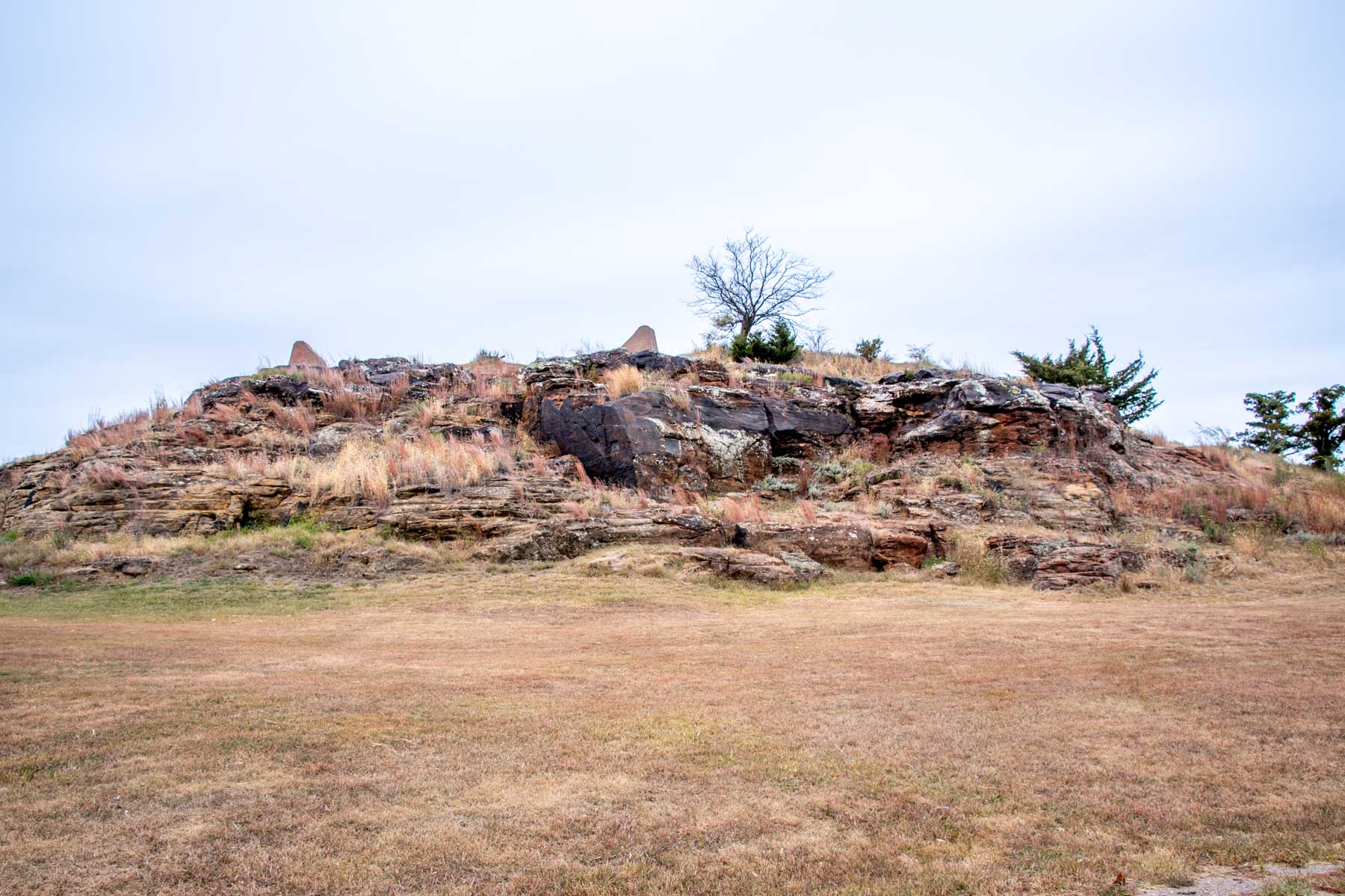
Continuing on its path, the Santa Fe Trail meandered alongside the majestic Arkansas River, eventually heading southwest near the present-day town of Great Bend, Kansas. From Great Bend, the next significant landmark travelers would encounter was referred to as “Pawnee Rock,” a notable natural formation on the trail.
Pawnee Rock gained prominence due to its distinctive presence—an imposing outcrop composed of Dakota sandstone. Legend has it that the rock derived its name from a battle between early settlers and the Pawnee Indians.
Pawnee Rock is a Kansas State Historic Site, preserving its historical and cultural significance. It’s well worth a visit to stand atop the rock and take in the sweeping panoramic views of the surrounding prairie from this elevated landmark. Located due north of the town of Pawnee Rock at 631 N. Center Street. It’s the tallest thing around, so you can’t miss it. (GPS Coordinates: 38.272051, -98.982022)
Fort Dodge, Kansas
Fort Dodge played an important part in the growth of the Santa Fe Trail. One of the most important military outposts along the trail, Fort Atkinson, was located a few miles outside the town. Later, Fort Dodge took over the role of protecting travelers.
From 1865-1882, the military outpost of Fort Dodge protected by travelers along the Santa Fe Trail as well as traders, trappers and hunters. It was the first and largest community in Western Kansas. When the military fort was decommissioned, it was turned over to the state to become the Kansas Soldiers’ Home. Located at 714 Sheridan in Fort Dodge, KS .
Caches Monument
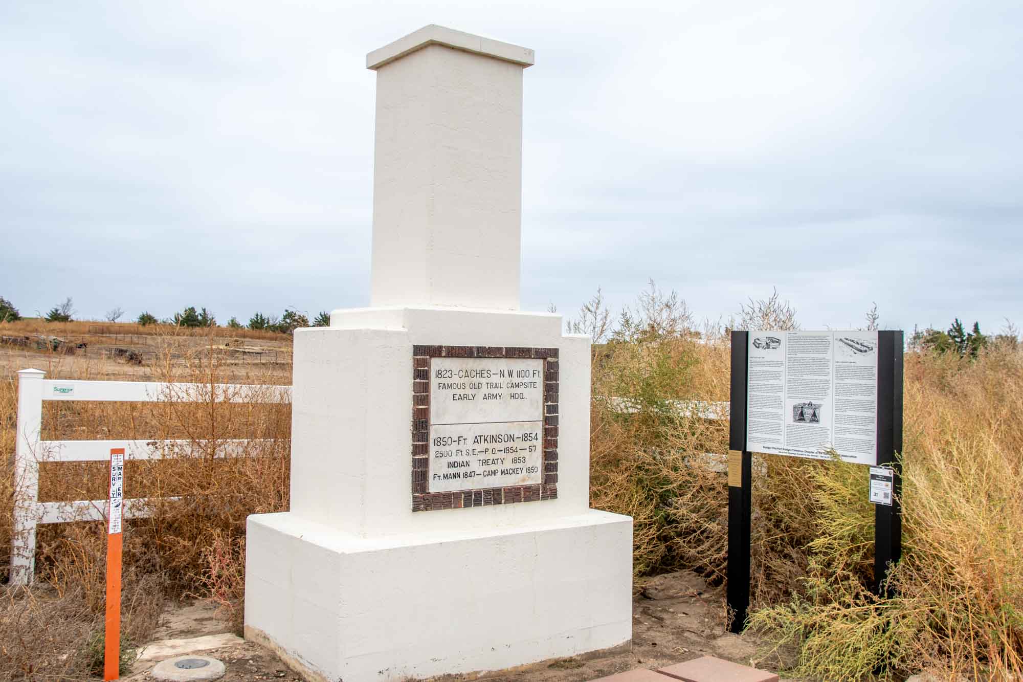
Gracing the landscape along US-50 west of Dodge City, a striking marble column stands as a testament to the historical significance of the Mountain Route of the Santa Fe Trail. Nestled north of the highway, this monument serves as a commemoration of several key milestones in the trail’s rich history.
First and foremost, the column honors the notable Caches campsite of 1823, a crucial waypoint along the Santa Fe Trail that facilitated trade and exploration. Additionally, it pays homage to Fort Atkinson and Fort Mann, two formidable military outposts that safeguarded the trail from 1850 to 1857, ensuring safe passage for travelers and protecting vital supply lines. Located at US-50 and 107 th Road. (GPS Coordinates: 37.758643, -100.087858 )
Santa Fe Trail Tracks

For over 60 years, horses and wagons wore deep groves in this land just north of the Arkansas River. These Santa Fe Trail tracks are all that remain.
From the parking lot, walk uphill about 100 yards for a good view of the overlook. Then proceed walking north across a series of small bridges. As you look to your left and right, you will see the trail ruts in the land. While the area is heavily overgrown with vegetation in the summers, these tracks tell the story of time. Located along US-50 about 11 miles west of Dodge City, Kansas. (GPS Coordinates: 37.789486, -100.197578)
Bent’s Old Fort
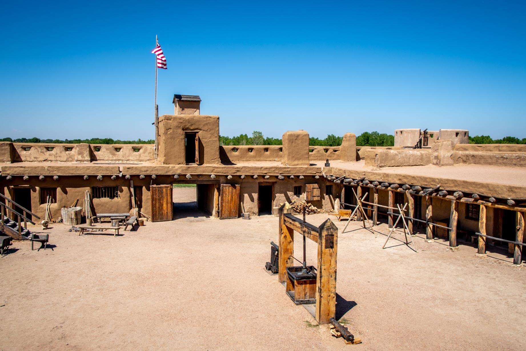
The Mountain Route of the Santa Fe Trail headed northwest into Colorado following the banks of the Arkansas River. It was here that the Bent brothers, William and Charles, hailing from a prominent St. Louis family, stumbled upon an opportunity in the West. They brothers led a caravan train to Santa Fe in 1829, marking a successful endeavor. Along the way, the noticed that was nowhere to re-provision between Council Grove, Kansas and Santa Fe, New Mexico – a distance of hundreds of miles.
Sensing opportunity, they sought to build a settlement. In 1833, they established Fort William (now known as Bent’s Fort) on the northern bank of the Arkansas River. The fort, situated on the boundary between the United States and Mexico, served as a crucial resupply point while also facilitating trade with the local Native American tribes, including the Kiowa, Arapaho, Cheyenne, and Comanche.
In 1846, Bent’s Fort took on military significance when it became a key organizational and deployment site for the “Army of the West” led by Colonel Stephen Watts Kearny during the Mexican-American War.
After the death of his broth Charles in 1847 and the description of the old fort, William constructed a new fortification known as Bent’s New Fort, located 40 miles downstream at a place called Big Timbers, where Native American tribes traditionally wintered. By 1853, the new fort was fully operational. Subsequently, in 1859, William sold the new fort to the U.S. government, which renamed it Fort Wise.
Bent’s Old Fort (which has been entirely reconstructed) is a highlight for visitors driving the Santa Fe Trail byway. Read our detailed article about visiting Bent’s Old Fort . Located at 35110 CO-194, La Junta, Colorado. (GPS Coordinates: 38.043824, -103.431786)
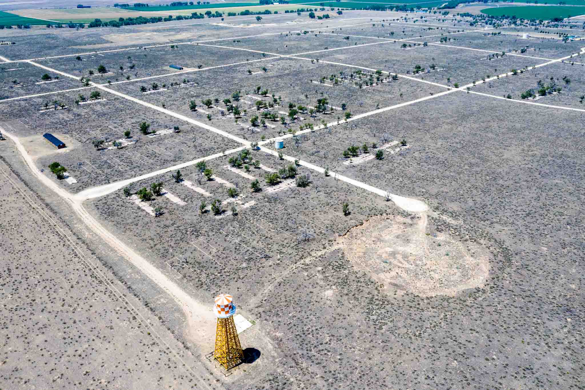
Note: Bent’s Old Fort is very close to the Camp Amache Relocation and Detention Center , one of the centers for Japanese-Americans during World War II. We highly recommend visiting this important site, which is located along the Santa Fe Trail (although it is obviously much more recent).
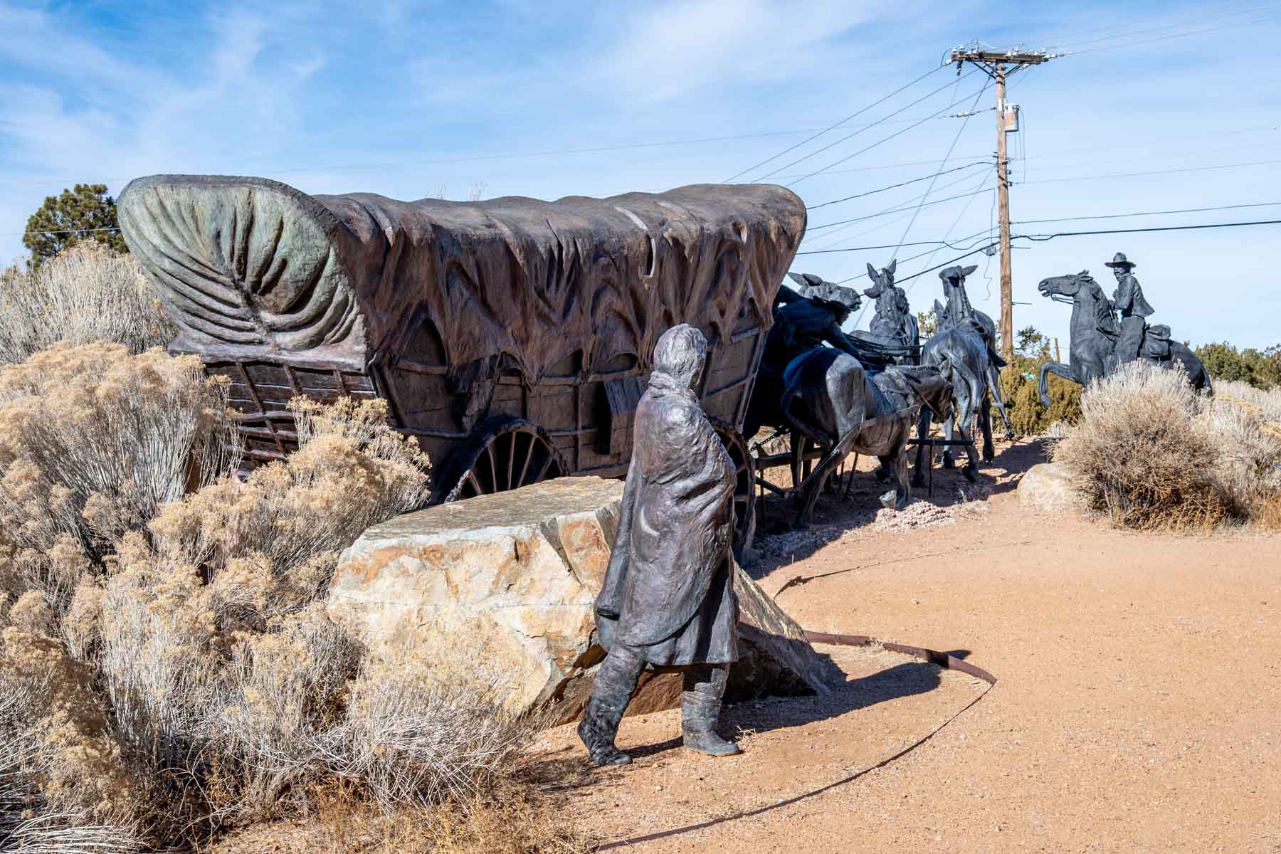
The goal of travelers was Santa Fe, New Mexico. Originally established in 1610 and is one of the oldest cities in United States, this town had over 15,000 inhabitants in 1820 and was a major center of commerce.
When Mexico secured its Independence from Spain in 1821 (and voided Spain’s policy of economic isolationism), the westward rush began. Over the next 60 years, thousands made the trek along the 800+ mile Santa Fe Trail to reach this city.
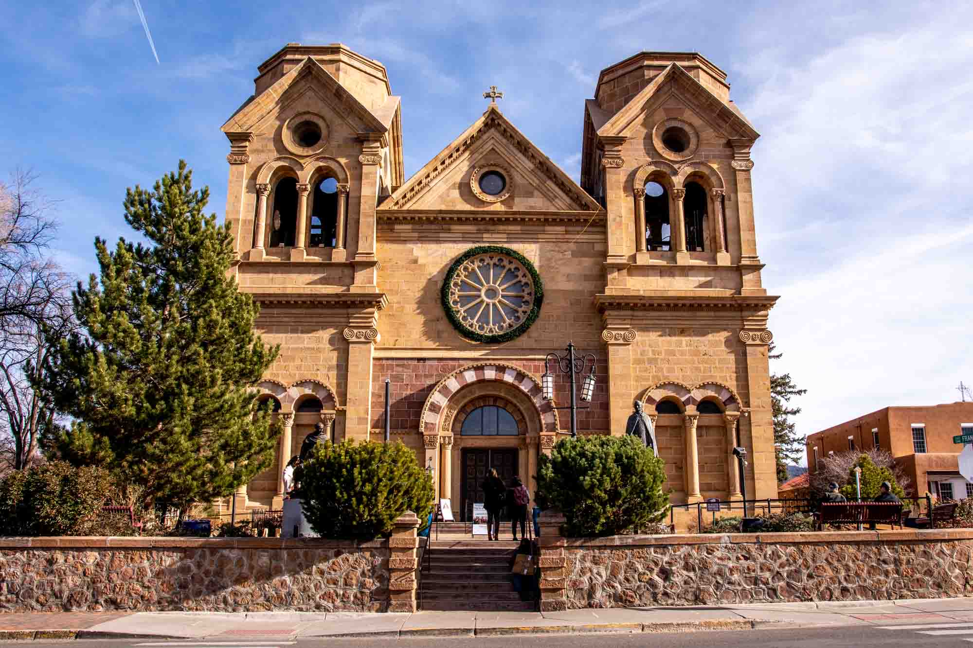
People visiting Santa Fe can still see many trail-era sites. The Santa Fe Plaza still exists, as does the Mission, the Palace of the Governors, and the historic San Miguel Mission Church (the oldest church in the continental United States dating back to 1610).
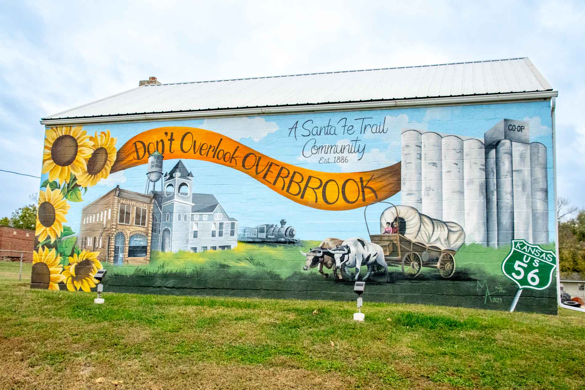
If you are considering driving the Santa Fe Trail Auto Route, we recommend breaking up the trip into four days. While it is technically possible to drive the trail straight through in about 17 hours (no stops), you’ll want to get out of the car and visit some of these sites. Consider breakup up the route as follows:
- Boonville, Missouri to Kansas City/Olathe, Kansas
- Kansas City/Olathe, KS to Dodge City, KS
- Dodge City, KS to Las Vegas, NM
- Las Vegas, NM to Santa Fe, NM
This will give you time to explore and see some of the sights.
A final thought on driving the auto trail. Actual driving times are far longer than the distances and speed limits would indicate. You’ll hit railroad crossings and farm vehicles out on the roadways, which will slow you down. Enjoy life in the slow lane and savor the journey for what it is.
Have you done the Santa Fe Trail driving route? What did you find were the highlights?
Lance Longwell is a travel writer and photographer who has published Travel Addicts since 2008, making it one of the oldest travel blogs. He is a life-long traveler, having visited all 50 of the United States by the time he graduated high school. Lance has continued his adventures by visiting 70 countries on 5 continents – all in search of the world’s perfect sausage. He’s a passionate foodie and enjoys hot springs and cultural oddities. When he’s not traveling (or writing about travel), you’ll find him photographing his hometown of Philadelphia.
Share this post:
This site uses Akismet to reduce spam. Learn how your comment data is processed .
Bob Trailman
Monday 20th of November 2023
No, but it going on the bucket list. Was going to do a route 50 trip but just might divert off and do some route 56 and see what happens.
- Skip to right header navigation
- Skip to main content
- Skip to primary sidebar
- Skip to footer

- Trip Planner
Santa Fe Trail Byway – Lamar-Trinidad
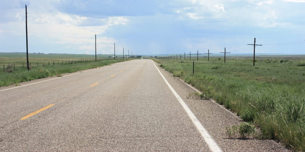
The Santa Fe Trail is a tranquil drive through Southeast Colorado, connecting Lamar with Trinidad. It roughly follows the national historic trail by the same name.
The Colorado portion begins east of Lamar on the Kansas border. It follows Highway US-50 until it reaches La Junta. It then travels southwest past La Junta and Trinidad via US-350, and into New Mexico. This historic trade route was heavily used between the 1820s and 1870s.
While you can venture in either direction, it’s probably best driven east to west so you can be in awe of the Rocky Mountains. You’ll have spectacular views of the Sangre de Cristo Mountains .
Activities near Santa Fe Trail Byway
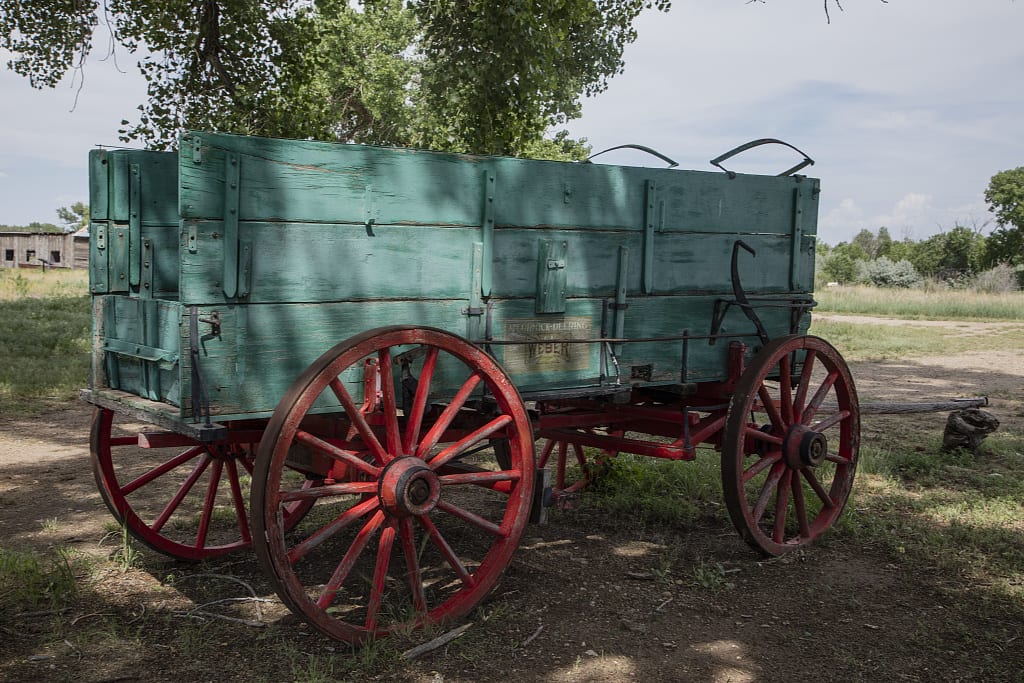
Biking – Follow the quiet paved Auto Route through Southeast Colorado.
Camping –
- You can find dispersed camping in the Comanche National Grassland.
- There are also modern campgrounds at John Martin Reservoir and Trinidad Lake .
- Read about the camping near La Junta and Lamar .
- Read about the camping near Trinidad, Walsenburg and La Veta .
Ghost Towns – There are a handful of ghost towns near Trinidad and La Junta, CO on the stretch of US-350. Visit Timpas, Delhi, Thatcher, Tyrone, and Model to see abandoned homes and businesses of what were once hopeful up-and-coming towns.
Hiking – Trek the whole national historic trail or just sections around Trinidad or La Junta.
Horseback Riding – Permitted on parts of the Santa Fe Trail.
Landmarks – Both amazing manmade and natural landmarks are found along the Santa Fe Trail Byway.
- Bent’s Old Fort – Located just northeast of La Junta on the way to Lamar, this national historic site features a reconstructed 1840s adobe trading post. It was very popular in its heyday for travelers along the Santa Fe Trail.
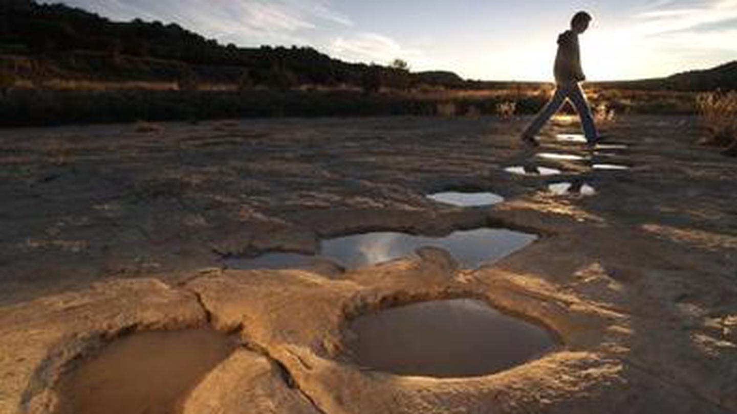
- Picketwire Canyonlands – From dinosaur tracks to petroglyphs, this is a stunning place to visit. It’s located
Scenic Drive – The Auto Tour Route traces the original Santa Fe Trail the best it can. The 188-mile Colorado section takes about four hours (one way), and has been designated a national scenic byway.
Nearby Towns:
Season: Year Round
Length: 188 miles / 4 hours
Map: Santa Fe Trail Byway (.png)
Website: codot.gov/…
Latest in Santa Fe Trail
Ghost Towns on Old Santa Fe Trail in SE Colorado
One of Colorado’s more ghostly scenes can be found along U.S. 350, between La Junta and…
Ghost Towns on Old Santa Fe Trail in SE Colorado Read More
View more Santa Fe Trail articles
Get In Touch
- Privacy Policy
- Disclaimer—Terms of Service
Things To Do
- Travel Blog
- Colorado Activities
- Colorado Events
- Colorado Towns
- Colorado Hotels
- Colorado Restaurants
- Colorado Transportation
- Made in Colorado
Fall Activities
- Federal Lands
- Ghost Towns
- Hot Springs
- Ski Resorts
- State Parks
- Train Rides
Discover Your Perfect Stay
Santa Fe National Historic Trail Auto Tour Route on the Mountain Branch of the Santa Fe Trail
Heading north on 350: the complete santa fe trail byway.

Traversing the historic landscapes of the American West, the Santa Fe Trail offers a journey through time. As you venture north on Highway 350, the Trail Byway beckons with tales of a bygone era, where commerce and culture mingled to define an epoch. Today, the journey is complemented by museums and information-filled broadcasts available on AM radio, providing an immersive exploration of the storied past.
Museums: Trail Information on AM Radio at 15.90 and 16.10
The Santa Fe National Historic Trail is not only marked by its scenic vistas but also by its dedication to educating travelers. As you drive, tune your AM radio to 15.90 or 16.10 wherever the Santa Fe Trail triangle sign is visible. These continuous broadcasts relay the rich history of the Mountain Branch, turning your auto tour into a narrated adventure through time.
Auto Tour: The Mountain Route Byway
Emblazoned with the distinctive Santa Fe National Historic Trail logo, the Auto Tour Route provides a tangible connection to history. Administered by the National Park Service and a network of partners, the route is meticulously marked along major highways that mirror the historic trail. Driving the Mountain Route offers a panoramic view of the past, with interpretive signs leading the way.
Events: Arm yourself with some good guide books!

To enhance your journey along the Trail, two essential guidebooks are recommended for the modern explorer: "The Santa Fe Trail Revisited" by Gregory M. Franzwa and "Following the Santa Fe Trail: A Guide for Modern Travelers" by Marc Simmons. These companions offer engaging narratives, detailed directions to historic sites, and maps to ensure a thorough and informed adventure.
The Complete Santa Fe Trail
Stretching 900 miles from Missouri to Santa Fe, the Santa Fe Trail witnessed the exchange of diverse cultures and goods. As a vibrant trade route, it bridged traditional divides and left a lasting impact that ripples through the American spirit. The trail, now meant for leisure and learning, offers visitors a window into the blend of activities and cultural experiences that shaped the great prairie highway of international commerce.
The Mountain Route
Unlike the one-way journeys of other trails, the Mountain Route stood out as a two-way street of commerce. Revel in the 188-mile stretch, a living museum sprinkled with landmarks, evidence of historical buildings, and natural wonders—traces of a route that once guided ambitious travelers toward the promise of profit and prosperity.
Trail Information on AM Radio at 15.90 and 16.10, Auto Tour

Focusing on the segment known as the Mountain Branch, information is readily available on AM Radio at 15.90 and 16.10. This audial guide serves as a companion to the visual markers, enriching the Route Byway experience with historical contexts and anecdotes.
Heading North on Hwy. 350
Whether you start from the south, east, or north, your entry into the Mountain Branch brings you through welcome centers like beacons of hospitality. They offer a launching pad into an odyssey marked by historical intrigue and the serene beauty of the trail. Here, volunteer staff are ever-ready with brochures, maps, and a warm welcome that will usher you into the heart of the Mountain Branch.
Immersing yourself into the historic Santa Fe Trail, you embark on more than just a road trip. It is an experiential tapestry woven through vibrant stories, epic landscapes, and the lingering spirit of adventure. As you tread this well-preserved path, you find yourself a part of the living narrative that is the Mountain Branch of the Santa Fe Trail, a journey that reconnects you with the pioneering spirit of travel that shaped the American West.
- Coosawattee River Resort
- Coyote Mountain Lodge
- Four Seasons On The Gulf
Lake Louise
- Deer Lodge Lake Louise
- Las Vegas Cabins
Mammoth Lakes
- Alpenhof Mammoth
- Sierra Lodge
- Sundestin Beach Resort Destin Fl
- Cabins Destin Fl
- Ocala Cabins Rental
- Cabin Monterey
Palm Springs
- Ocotillo Lodge Palm Springs
- San Diego Cabin Rental
Wisconsin Dells
- Great Wolf Wi Dells
- Cabins In Wisconsin Dells
- Cabins In Manistee Michigan
French Lick
- French Lick Cabins Indiana
Traverse City
- Great Wolf Lodge Traverse City Michigan
- Cabins In Traverse City
- Santa Fe Cabin Rentals
- Cabins Mobile
- Cabins In Houston Texas
- Econo Lodge Hollywood Florida
- Biloxi Cabins
- Waco Cabins For Rent
- Cabins San Marcos
- London Cabins
- Cabin In Orlando Florida
- Cabins In Truckee
- Cabin Rentals Boulder Co
- Charleston Sc Cabin Rentals
- Cabins In Ruidoso New Mexico
- Oakhurst Lodge Oakhurst California
- Cabins For Rent In Ocean City Maryland
Manitou Springs
- Cabins Manitou Springs
Leavenworth
- Leavenworth Cabin Rental
- Silverton Cabin
- Cabin In Aspen
- Cherokee Nc Cabin Rentals
- Cabins In Sylva Nc
Beech Mountain
- Beech Mountain Cabin Rentals
- Seward Ak Cabins
- Cabin Rentals In Asheville Nc
- Cabin Rentals In Put In Bay
- Ouray Cabins Rentals
- Anchorage Cabin Rentals
- Austin Cabins
- Cabins Portland
Coeur d'Alene
- Cabins Coeur D'Alene Id
- Cabins Memphis
- Cabins In Taos

Lake Arrowhead
- Cabins Lake Arrowhead
- Amsterdam Cabins
Miami Beach
- Cabins Miami Beach
- Cabins For Rent Seattle
- Cabins San Jose Ca
- Cabins Athens
San Antonio
- Cabins In San Antonio
Virginia Beach
- Cabin Rentals Virginia Beach
- Venice Cabins
- Cabin In Copenhagen
- Siesta Beach Resort Siesta Key Florida
- Skip to global NPS navigation
- Skip to this park navigation
- Skip to the main content
- Skip to this park information section
- Skip to the footer section

Exiting nps.gov
Alerts in effect.
Last updated: January 28, 2020
Park footer
Contact info, mailing address:.
National Trails Office Regions 6|7|8 Santa Fe National Historic Trail 1100 Old Santa Fe Trail Santa Fe, NM 87505
Stay Connected
The Santa Fe Trail got its start in 1821, with an advertisement in the Missouri Intelligencer by William Becknell, seeking men willing to join and invest in a trading expedition to the west. Becknell started on this expedition September 1, 1821 from the Franklin. & Arrow Rock area of Missouri , ending at the Plaza in Santa Fe, New Mexico in November of the same year. His first trip was made with pack animals, the next trip to trade in 1822, Becknell used wagons. The Trail soon became a highway of trade & supply, connecting the southwest area of Santa Fe, New Mexico with eastern trade centers. Larry & Carolyn Mix Santa Fe Trail Research Dot Com "Faye Anderson Award" January 14, 2001 Larry E. Mix With Award Well here we go from just a little bit south the Santa Fe Trail, but you can almost see it from here. I've lived in Kansas all my life on or very near the Santa Fe Trail. I was born in Great Bend, Kansas in 1939. Lived in Hoisington for a short time before my parents decided to move to Great Bend. They bought a home in the southeast part of town in 1945. My Dad always said that the Santa Fe Trail ran across our property. We did fiind an ox shoe one time. We lived about three block north of the Arkansas River. It is possible that the older trail, when the Walnut Creek Crossing was south of US 56, could have ran across the property. I went to St. Rose grade school, then on to Great Bend High School. During all these years I can say I never had any interest in the Trail. After High School I went to the Service. After I got out, one day I decided to go dove hunting along the Arkansas river. While hunting, I shot myself in the foot. This ended the Service part of my life. Moved to Dodge City, Kansas & found a job at a typewriter repair shop. I had been doing a little of this kind of work during school. After this I got a job at McCoy Scaggs, the Ford Dealer in town. While in Dodge I chased a lovely lady until she caught me . We got married in December of 1960 & have been together ever since. We moved to Great Bend, Kansas for several years then to Kinsley, Kansas. While at Kinsley, Kansas we lived about two mile north of Ardell, Kansas. The Big Coon Creek Crossing & Fort Coon were just a mile east of us. The Trail ran across the south east corner of the section we lived on. A Short History of Our Website This Santa Fe Trail Adventure & research of the Santa Fe Trail began when we lived in Edwards County, Kansas in 1965 two miles north of the ghost town of Ardell. History & books became a passion after Larry bought his first book about the Santa Fe Trail for his wife Carolyn. The book was a first edition of "Dodge City The Cowboy Capital" by Robert M. Wright. Larry bought the book because it told first hand, the history that happened where Carolyn was born & lived until we married in 1960 at Dodge City. After getting the book home, between the pages of this book we found a collection of hand drawn maps & hand written notes about the Santa Fe Trail on a microfiche. The company Larry worked for at the time, Fravel Motor Company, Kinsley, Kansas had an old reader that we used to copy these maps to modern day maps. After this was done Larry began searching for the sites that were talked about in the text. The maps proved to be quite accurate, being in the general area anyway. A good friend of Larry's worked for a company that could take this microfiche & make them into hard copy maps, so we let him do just that. He brought them back to us one day & about a month later he passed away. He wouldn't take any pay for doing this for us, he said just take me out to some of the sites. We never did get to go out together & explore the Trail, but we think about him every time we use them. From these maps & notes it was discovered that the Santa Fe Trail crossed the southeast quarter of the property we were renting at the time, less than a half mile from where we were living. This location was just one mile west of Big Coon Creek Crossing & Fort Coon, five miles west of Kinsley, Kansas. These maps became the backbone for the research to find & record the historic sites of the Santa Fe Trail as we found them. Since this first book the collection of maps, local, Kansas history & Santa Fe Trail books has grown & keeps growing in 2020. For many years along with Carolyn we made trips up & down the Trail exploring the many places we read & researched. Any place we went, some time during the trip we would end up at a trail site. This left the two of us to explore on our own. We have made two complete trips from Franklin, Missouri to Santa Fe, New Mexico & have been to most of the major sites along the way. We have logged thousands of miles just along the Santa Fe Trail in the State of Kansas. We are planning another complete trip of the Trail in the very near future. Every time we go out along the Trail we find something new. Along about 1992 , we heard about the push to get the Santa Fe Trail off the ground & into the history of the nation where it should be. There were Chapters being formed all along the Trail. We found out from some old friends in Pawnee County, that there was going to be a Chapter of the Santa Fe Trail in Edwards & Pawnee County area of Kansas. We went to the next meeting & joined the Wet/Dry Routes Chapter . in 1992.. Later we were awarded the Faye Anderson Award & became a life member. We helped with many projects the chapter thought up. They all were hard work but very interesting in nature. One of the largest & rewarding projects was the Directory of Santa Fe Trail Sites book that Daved Clapsadle produced. During this time we did just about everything, setting markers, cleaning weeds, taking photos, helping a young man get his Eagle Badge & making sure the GPS reading & mileage in the Directory were on target. We have had several people tell us that they put in the reading in their GPS unit & followed the trail any where it went in our area. In 1992 , a medical condition forced Larry to quit work. Rather than go crazy sitting around doing nothing, Larry thought he would try to keep busy rather than worry about his condition. Larry started to gather & sort the information, putting it on the first used computer he bought in Great Bend, Kansas. This first computer was doing the job, but it wasn't how Larry had envisioned it. This is when Larry decided to get some professional help & took it to our local computer shop & traded this "dinosaur" as Mac Zimmerman called it, for a later model & started the job over with the latest programs. Entering information into the computer was very slow because up until this time Larry hadn't even turned one on. Typing, for me was last done in high school in 1957. There was another little deal to over come, nine fingers! This later computer did the job the way it had been pictured in Larry's mind. The information could be accessed quick & easy, a lot easier than the stacks of papers & books that were in a dozen different places around the house. There were many mistakes & changes. Some day I expected my old computer to put up a screen that said; "Make up your dam mind" but it never has, so far anyway. I guess it just puts up with the many changes this old guy can come up with. Then came a set back after upgrading to a second computer. It was found that transfering information from one computer to the other wouldn't work. If we entered data on our new computer with all the newer programs, the information couldn't be read on an older one with older or different programs. Research into this for someone that knew nothing about this type of stuff was difficult to say the least. After looking & just plain common sense told me that it needed to be put into something that could be read by any computer. HTML is an international language to all browsers that are on all computers. Make it simple & any browser will be able to read it. This was the solution to the problem & this is how it's been done. All the research information has been entered as web-pages on my computer. In 1993 , I decided to put up a website. It started out as a personal site, with information about our grandson that was setting track & field records across the state. He still holds some state records. On the site we put some Santa Fe Trail information about the Wet/Dry Routes Chapter, the first Chapter along the trail to have a website by the way. This first website was on Geocities . The website was left up until January 1, 2001, it hadn't been updated for some time & at that time it was deleted & is no more. Over the years we've been associated with the Wet/Dry Routes, we've spent countless hours up & down this part of the Santa Fe Trail researching , installing markers , taking pictures , cleaning weeds from Lyons to Garden City to Hays, Kansas. We were also major contributing member of the team that researched & compiled the data for the Chapter publication A Directory of Santa Fe Trail Sites in 1999. We bought a GPS unit & mapping software for our computer & did all of the GPS mapping for this publication , this page is an off shoot of that project & we got recognition for using the Microsoft Research Maps website in our search for Santa Fe Trail sites. In 1994 , Larry & Carolyn volunteered to transport the displays the Chapter made, to several locations around the central part of Kansas. In the time we were doing this, we traveled over 2,000 miles setting up the displays & answering questions at several locations. At the time there were two displays . One of the displays traces the evolution of transportation on the Santa Fe Trail. It featured commentary & artifacts related to the various beasts of burden used to transport trade goods to & from New Mexico. Included in the display are a pack saddle, harness hames, a stay chain, ox shoes, & American ox yoke, a Mexican ox yoke, & an ox chain. The original traveling display portrayed the fifty-nine markers set along the five separate routes of the Trail between Larned & Dodge City, Kansas. These displays are now housed at the Edwards County Museum in Kinsley, Kansas. Also in 1994 Larry assisted in helping a young man by the name of Matt Waldren of Troop 238 in Lewis, Kansas to complete an " Eagle Service Award " project. The project was the compilation of a directory of sites marked by the Wet/Dry Routes Chapter in Pawnee, Edwards, & Ford Counties in Kansas. In addition to the name & addresses of the property owners on whose land each marker is placed, the legal description of each site is noted. The directory was placed in the Santa Fe Trail Center , Fort Larned National Historic Site , And the Kansas State Historical Society for future references. For several years we collected & archived information on the Santa Fe Trail, along with other history about the area we lived in at the time. Over the years there were people that kept telling me to put it into some form, some kind of a filing system so it could be found in a timely manner. From 1964 to about 1994 Larry had collected mountains of information. It was found on everything from a napkin to just a simple piece of paper & photos of all kinds relating to the Trail. Most of the text was photocopied from articles that were found at research centers across the length of the Santa Fe Trail. There is even information on VCR tapes. The video camera was a research tool that we used on trips to where ever we went. In 1998 , St. John, Kansas got its own Internet service provider . At that time the Wet/Dry Routes website was moved to stjohnks.net , only it still was a secondary page on our website. It stayed this way for about a year. When our internet bill came due, we went down & talked to Mac Zimmerman about a name change & new address to put the Santa Fe Trail website on as the number one page. Mac & I put our heads together & decided that the new address would be; " www.stjohnks.net/santafetrail/ ." The Santa Fe Trail part of the website became the main page. It had been clear from the start that there are a lot of people out there from around the world interested in the Old Santa Fe Road & we are only interested in getting information to them. This website was averaging about 100 hits per day. In 1998 we brought the Santa Fe Trail Center in Larned, Kansas, to the internet. They are the National Headquarters for the Santa Fe Trail & the Official Santa Fe Trail History Museum in the State of Kansas. We created a complete new site with pictures for the museum, but after they changed ISP we were no longer able to update the site, the new company wouldn't let us in. In 1999 Larry & Carolyn's web site was selected as one of the Net's finest & informative. It is included in StudyWebTM's listing of educational links. "StudyWeb is one of the Internet's premier sites for educational resources for students & teachers. Since 1996, our expert reviewers have scoured the Internet to select only the finest sites to be included in StudyWebTM's listing of educational links. Inclusion in StudyWebTM will increase your exposure & attract new visitors to your site: our reviews have been featured on Webcrawler Select, The Lycos Top 5%, Education World & many others, & StudyWebTM updates are provided to media & educational resources around the world." Of course, we already knew this because at the time it was being used by several schools around the world as a study site for History of Westward Expansion. The most visitors to the site are in this order; #1 is .com, #2 is .net, #3 is .us & #4 is .edu, which is US Educational. This is a fact that we are the most proud of. The fact that we just might be a small part of shaping a young person into being the next true Santa Fe Trail Historian like Mac Simmons or Leo & Bonita Oliva Wagon Tracks Editor & book author. How about an in-depth researcher for a project like the Directory of Santa Fe Trail Sites ! These young people are the future of the Santa Fe Trail! Along about this time Leo & Bonita Oliva gave us permission to put on our web site the Index to Wagon Tracks Volume 1 to 10, 1986/1996. This is one of the best research tools for the Santa Fe Trail there is & a lot of people do use it. We've tried for years to get the Historic content of the Wagon Tracks Quarterly on our site so the Index can really be used to its fullest, it hasn't happened as of yet anyway & doubt it ever will. Most of the questions we receive from the Wagon Tracks Index are given information on ordering & directed to the Last Chance Store for back issues of Wagon Tracks . September of 1999 the Santa Fe Trail Symposium was held at Council Grove, Kansas, Larry E. Mix was given the " Award of Merit " for our significant contribution to the Preservation, Protection & Promotion of the Santa Fe Trail & developing & maintaining the Santa Fe Trail Research website. This Oval Santa Fe Trail Sign is in a Private Collection in Central Kansas!! Yee Haaaaw!!!! Something we had been looking for came true for Larry & Carolyn. We've always wanted one of the Oval Santa Fe Trail signs & now we have one. With only about 100 of these signs put on Kansas schools along the Santa Fe Trail in 1948, never in our life time did we think we would even find one, let alone to buy it & have this sign in our collection of Santa Fe Trail items. Now we have six! No they are not for sale. They are being preserved in our collection for the future to enjoy. Some day they will be given to a museum or historic site along the trail that don't have one. May-June of 2000 , the sign above was dropped into our lives with an email requesting information on oval signs. Which we answered with all the information we had on the signs. Then along came this email several months later. Subject: In a rut. Date: Tue, 16 May 2000 (EDT) Would you be interested in purchasing my oval marker? E-mail me with a bid. E-mails will be answered. For a photo, send a self addressed stamped envelope to. Sue, New Jersey. I will try to post a picture on the Internet. Thanks, Sue We were the high bidder & our sign was delivered on June 10, 2000 . Some people along the trail don't understand the scope of what to preserve. Any historic item no matter what it is, be it a trail rut or a sign, should be in the hands of someone that enjoys it, & will keep it safe & protect that piece of history. Most of the Oval Signs we have on our site have stories about being found in the trash, or buried somewhere. We have a story of one being cut to cover the hole for a transfer case on a pickup with a picrure to prove it. Plowing a trail rut, trail crossing under for a few acres of ground, that is total destruction of that historic item. The Wet/Dry Routes Chapter marked a half dozen or so that this happened to. A prime example of preservation is the story of the Frizzle Family & their ownership of the Fort Larned National Historic Site . The page we have on Santa Fe Trail Oval Signs, we believe to be the most up to date information there is out their on location & history of them. August of 2000 our website took on another new look & name, same address. It became the "Santa Fe Trail Research Site" The Great Highway of Commerce. This was in preparation for the addition of seven new web-sites, Wet/Dry Routes Chapter , the first Chapter of the Santa Fe Trail to have a website on the Internet on January 28, 1998. The Quivira Chapter came on line February 15, 2001, Fort Dodge/Dodge City Chapter on March 1, 2001, Wagon Bed Spring Chapter on May 1, 2001, Missouri River Outfitters Chapter on September 1, 2002, Flint Hills Chapter on March 25, 2003. On April 14, 2004 the Cottonwood Crossing Chapter joined our plan to have all chapters along the Santa Fe Trail have a web sites for information on their area. At one time we had seven of the twelve Chapters of the Santa Fe Trail on the St. John Kansas Server. Our only goal was to further promote these sections of the Santa Fe Trail with new research material from the people who know the area, the people who live within these sections of the Trail. November of 2000 , we put up a site for Keith Chadd, well known history buff & teacher of Dodge City, Kansas. This site was all about Historic Maps of Ford, Edwards & Kiowa Counties in Kansas. Keith had researched the historic information about these counties & marked them on maps. Keith passed away in 2008, but his memory lives on. Joyce, his wife passed away in 2011. Guess Keith took his map site with him as it is not on the internet anymore. January 14, 2001 , Larry E. Mix of St. John, Kansas, was awarded the Faye Anderson Award by the Wet/Dry Routes Chapter of the Santa Fe Trail at the winter meeting, in Kinsley, Kansas. Although the only name that appears on the plaque is Larry E. Mix, I share this with my most prized possession, this being my best friend & wife of Dodge City, Kansas, Carolyn L. (Thomas) Mix. We do this site as a team. Kansas Historical Quarterly 1931 to 1977 September of 2001 Larry & Carolyn took on another project. This one was to help the Kansas State Historical Society transcribe the Kansas Historical Quarterlies & put them on the net for all to enjoy. We did 18 articles that were about the Santa Fe Trail. They would be happy to have you join this remarkable group of volunteers putting the Quarterlies on their website so all can read about the Rich History of the State of Kansas You can help! Like all our projects, this is purely a volunteer effort. They need many people to help scan or type these articles into electronic files for presentation on the Internet. Participating is easy, all you need to do is check it out with the link to their site! I got the scare of my life in 2003 when I got an email from Microsoft asking for a time they could call me. The only thing I could think of was a law suit over the way I was using their Microsoft TerraServer maps . I finally broke down & gave them a time. All they wanted to do was praise me on the work we were doing with their maps. Also they wanted to write a couple articles about how & why we were using the maps & put the articles in their company newsletter. What a relief, no jail time or law suit! January 2003, Microsoft took notice of how our site was using their photos & links to their Microsoft Research Maps site. "This is a really fascinating story about how a retired mechanic figured out how he could find missing sections of the historic Santa Fe Trail using the Microsoft Research Maps , a satellite imaging system developed by Microsoft Research . Some of the wagon trail ruts are still visible from space but hard to find at ground level." John Spilker of Microsoft Research Dot Com stated: "I had the pleasure of taking with Larry Mix last year several times. He has devoted an incredible amount of his life to researching the trail & loves to share his research with Trail Buffs, grade schools, high schools & college students. After he discovered the Web would enable him to publish to a very broad audience, he learned HTML on his own & built a Santa Fe Trail Web site. On top of this, he doesn't even like computers. There's a lot of really bright people at Microsoft Research , but I doubt anyone there could have made the discovery that Larry did." & here's a great piece of advice from Larry: "My wife & I are planning another trip along the complete length of the trail in the very near future. I hope that we'll see you in a rut along the way. Don't forget to bring your laptop, & now Smart Phone" Larry said. Some Santa Fe Trail sites & Ruts can be only seen with the USGS aerial photos as there are no roads to get to the sites or they are on private property. The later part of February of 2004 , Research at Microsoft Dot Com did a feature article on how the Santa Fe Trail Research Site used the tool " Microsoft Research Maps " to explain & see the Santa Fe Trail. We also got a link for another article Microsoft did on how Microsoft Research Maps was put together & how it works. It's just nice to be noticed by the most successful business in the world. "Microsoft"! Larry & Carolyn of the Santa Fe Trail Research Site, "Thank you!" for this honor." "John Spilker - Family Technology" Cool things that you & your family can do on the Internet Wednesday, June 30, 2004 Exploring History From Space This is a really fascinating story about how a retired mechanic figured out how he could find missing sections of the historic Santa Fe Trail using the Microsoft TerraServer, a satellite imaging system developed by Microsoft Research. Some of the wagon trail ruts are still visible from space but hard to find at ground level. John had the pleasure of taking with Larry Mix last year. He has devoted an incredible amount of his life to researching the trail & loves to share his research with high school & college students. After he discovered the Web would enable him to publish to a very broad audience, he learned HTML on his own & built a Santa Fe Trail Web site. On top of this, he doesn't even like computers, they are always right. Wanting to get more information I went to the people working on TerraServer . John was told to get in touch with Larry Mix in Kansas, he useing the technology, developed by Tom Barclay & Jim Gray from the San Francisco lab, to follow the path of the Santa Fe Trail. Larry Mix, a history buff in Kansas, has used Microsoft TerraServer Map images to follow the Santa Fe Trail from Franklin, Missouri to Santa Fe, New Mexico. With these maps & with his research he discovered the Original Dry Route of the Santa Fe Trail, which runs from southwest of Garfield, Kansas to the Campsite west of Dodge City, Kansas called "The Caches." There's a lot of really bright people at Microsoft Research , but I doubt anyone there could have made the discovery that Larry did. And here's a great piece of advice from Larry: "My wife & I are planning another trip along the complete length of the trail in the very near future. I hope that we'll see you in a rut along the way. Don't forget to bring your laptop, Larry said. John Spilker Editor April 1, 2003, the Santa Fe Trail Research Site became the Official Santa Fe Trail website at their board meeting at Trinidad, Colorado. On September 1, 2003 we gave that job up going back to just providing Santa Fe Trail information to the world. May 3, 2003 at the annual meeting of the Fort Larned Old Guard we became the Official Fort Larned Old Guard website. We have posted on our site all the Old Guards Newsletters, "Outpost" that we have in our files. There are some missing & would like to fill those blank spots. If you should happen to have any of the missing newsletters please let us know or mail copies of them to us. Outpost has some of the best historic information to be found on the net today about Fort Larned, Kansas. We are very honored to have this bestowed upon us & our site! January 10, 2004 , another dream came through. The Directory of Santa Fe Trail Sites , researched, published & written by a charter member of the Wet/Dry Routes Chapter, David Clapsaddle, his & the chapters work was added to our site. This doubled the size of our site on the Internet. A Directory of Santa Fe Trail Sites & Auto Tour are included in this major research & marking project. The Wet/Dry Routes Chapter has always been the leading force along the Santa Fe Trail with all their on going projects of interpretation & marking of the Old Santa Fe Road. This project is the most researched & complete survey of any section of the Santa Fe Trail today. It covers from Lyons, Kansas to Cimarron, Kansas, & from Fort Hays to Fort Dodge, on the Fort Hays-Fort Dodge Road. Directory of Santa Fe Trail Sites has been updated & added to over time with maps, site photos, aerial photo's, GPS readings, driving instructions & other historic data researched & collected by the history buffs who make up the Wet/Dry Routes Chapter of the Santa Fe Trail in Central Kansas. This research project started in 1989 when the Chapter began to mark the Fort Hays/Fort Dodge Road at ten locations along it's route. 205+ sites have been marked all together over this area. The Chapter is adding an Auto Tour Guide to be used if you wish to visit the 205+ sites the Chapter marked. The Directory of Santa Fe Trail Sites {out of print} project is the most ambitious & complete marking of any section of the Santa Fe Trail undertaken in this century by any organization. January 28, 2004 the Great Bend Tribune did an article about the placing of the Directory of Santa Fe Trail Sites Book on the Santa Fe Trail Research Site of St. John, Kansas. The Larned Tiller & Toiler did a front page article on our site & the Directory of Santa Fe Trail Sites book. The Dodge City Daily Globe put a link to the Santa Fe Trail Research Site in their Adventures Magazine 2004 edition, to help tourists who come to the area tour southwest Kansas & the Santa Fe Trail. The day we got this project on the World Wide Web, I sat there & was wondering just "why" this would be good to put on the Internet other then some real good Santa Fe Trail information. Then I got to thinking about the day you could take a laptop , or one of those smart phones or any other device to use our site while you were walking in a trail rut. That day is here & now! As of Friday, February 26, 2004 we have been working real hard to convert our site so it can be viewed on the internet & also your Smart Phone ! We hope to have it finished in two weeks. You will have no trouble with most of the pages. Over the past six months there have been quite a few coming to our site with their new phones. We hope you enjoy this improvement to our site as we are the only & first Santa Fe Trail site that can be viewed on a Smart Phone. Then I thought, here we are again, the Wet/Dry Routes Chapter waiting for the rest of the Santa Fe Trail to catch up! May 6, 2006, the Commanding Officer of the Fort Larned Old Guard , bestowed on us the rank of Lieutenant for our service to the Fort Larned Old Guard. We wish to thank the Old Guard for this honor! In the year of 2009 we became what the Fort Larned Old Guard calls a "Career Officer" with our Life Membership in the Old Guard . This is a great way to help preserve one of our National Treasures we have right here in our backyard & the State of Kansas. January 10, 2008 a major change took place on the Santa Fe Trail Research Site . We got our own domain name, Santa Fe Trail Research Dot Com . We also changed the name of our site to Santa Fe Trail Research. The main reason for this is because of the number of schools that come to our site just for research & teaching of the history of the Santa Fe Trail. The school year of 2008-2009 our site had more then 3,500+ different schools used our site for the study of history. So "Thanks" to all the teachers who direct the young folks to our site. We do hope you find what you are looking for, if not please ask & we will be more than happy to help you find an answer to your question. Our new "dot com" site came with a new counter, it gives us a lot more information then we've had in the past. Coming in at number 4 is still ".edu" which shows us that a school came to our site. In March of 2012 the stats for our site reads like this: hits per hour average of 177 to a high 3,059, hits per day average, 4,266 to a high of 7,142, the total that month was, 132,260. The total hits for the year of 2012 was 1,254,759. That's an increase over 2011 of 107,471. Our total hits for 2013 were 1,607,225, giving an increase of 352,466. In the year of 2011 we had 3,158 school computers hit our site, Total hits for that same year 1,964,742. Well, thats just about all we can tell you about our Santa Fe Trail Adventure . We get a lot of feedback about spelling. There may be spelling mistakes, but a lot of the information is written just as it appears in the resource we are using so it is historically correct. We enjoy hearing from everyone!! The website is yours, we are just the "Keepers & Webmasters" of it. There are to many people to thank for allowing us to put their material on our site. To all of them from all "Trail Buffs" a great big "Thank You!" If there is something you like, let us know, & that goes for something you don't like also. October 1, 2010 was a sad day, the day we lost our son to liver cancer. A portion of our hearts died with him. . . . .our only son! But he's in a good place, pain free & sitting with God. At the same time he was fighting liver cancer, Larry was having some rectal bleeding & had a colonoscopy. . . .we heard the words no one ever wants to hear. . . . "you've got cancer!" Larry was diagnosed with Stage 3 colo-rectal cancer & went through 28 days of chemo & radiation. One month to the day after Tim passed away Larry had surgery at Via Christi St. Francis in Wichita. Dr. Porter & his team removed the cancer. Larry was in 8 days & after being home about a week went back with an infection & in the hospital 4 more days. Larry was in again the end of December to remove the ostomy bag & was in another 4 days. Our girls were all there during the surgery plus Kayla & at least one stayed in Wichita with their mom all the time Larry was in the hospital! We never told Tim dad had cancer as he was dealing with enough already. Larry is now fighting neuropathy as a result of the chemo & that has taken his mobility & balance away. The good news is that he is going on "13 Years Cancer Free" . February 5 & 6, 2022 Larry was having trouble with his balance & kept falling. We called an ambulance & went to the Pratt Hospital where it was determined Larry had COVID. They admitted him & he spent 4 days in Pratt where they found out his Dilantin was very high! Larry was then transfered to the Stafford Hospital where he spent 14 more days. Larry did physical therapy for three weeks at home & then released. It's going to take quite a while for Larry to get back to where he was before all this. Still use crutches to help with my balance, I don't want to fall anymore. January 2013, our "Santa Fe Trail Research Site" had over 4448+ files of information & hundreds of pictures. There were USGS photos for over 850+ Santa Fe Trail sites along it's length. There were several hundred articles that are trail related. We have been involved with many projects along the trail, but the most rewarding thing schools & the people we meet & the people we don't meet through our site. We can tell someone is there but who? Last year on our counter there were over 3,500 different schools from all over the world come to our site. We have been getting over a million hits a year & growing. We always hoped we are doing something right that will go down in the history of the Santa Fe Trail as an educational site for everyone, young & old. But like everything in this world today you get Old & Gray, something comes along that will do it all bigger & better, with all the new bells & whistles. Ours just doesn't work right with the new electronic, so I've been told. So it was decided that it's time to put it to bed after 31 years on the WWW we think It is time. We would like to thank so many people who have had anything to do with the success of our site. As always there are to many, & we don't want to miss any, you know who you are.
- Picket Wire Canyonlands Guided Auto Tour
Overview: For a unique and unforgettable family experience, tour the Picket Wire Canyonlands. Located on the Comanche National Grassland south of La Junta, Colorado, these rugged and remote canyons are home to the largest dinosaur tracksite in North America! Guided auto tours are the easiest way to experience the Picket Wire Canyonlands and learn about its amazing, colorful past. During the tour, a knowledgeable U.S. Forest Service tour guide will show you hidden dinosaur tracks, share the history of the early pioneers and their historic ranches and homestead, some of the rich Native American history and beautiful natural features of the canyons. This auto tour truly has something for everyone and is the only motorized access into the canyons.
Dinosaur Tracks: Located on the banks of the Purgatoire River in southeast Colorado, this dinosaur tracksite is the largest documented assemblage of trackways in North America. Over 1,900 prints in 130 separate trackways extend across a quarter mile expanse of bedrock. Apatosaurus and Allosaurus are two types of dinosaurs that left prints in the mud over 150 million years ago. This tracksite has given scientists interesting insights into the social behavior of dinosaurs. Tour guides will tell you what scientists have learned and show you difficult to find small tracks made by a carnivorous dinosaur or theropod. Without a guide you will miss the whole story of the tracksite! Rock Art: Long ago, pictures of life, important events, and markers of time were carved and painted on the canyon walls by the numerous Native American tribes that travelled through the Picket Wire Canyonlands, prior to the arrival of Europeans in North America. You will get a rare glimpse at some of the most treasured and generally inaccessible Rock Art panels in the canyons.
Spanish Expedition: According to legend, a group of Spanish treasure seeking soldiers died in the canyons without benefit of clergy. Thus, in the sixteenth century the river was named El Rio de Las Animas Perdidas en Purgatorio (the River of Souls Lost in Purgatory). Later, French trappers shortened the name to the Purgatoire. Early Anglo travelers on the Santa Fe Trail could not pronounce Purgatoire and hence further corrupted the name into Picket Wire.
Early Settlers: In the 19th century, Hispanic and European settlers homesteaded in Picket Wire Canyonlands. Guides will take you to an early Catholic Church and cemetery, which was built on land donated by Damacio Lopez. You will also visit Rourke Ranch, which is on the National Register of Historic Places, and learn how pioneer Eugene Rourke's ranch grew from a 160-acre homestead in the late 1800s to an over 50,000-acre cattle empire still owned by the Rourke family into the 1970s. Join us! Don't miss this opportunity to spend a day exploring Picket Wire Canyonlands with a knowledgeable tour guide! All day tours (8 a.m. to 4 p.m.) are offered on Saturdays during Spring and Fall. Tours start at the USDA Forest Service office at 1420 East 3rd St., La Junta, CO. Sign up early because the tours fill up fast! Tours are offered through the USDA Forest Service. Due to rough roads, visitors will need their own four-wheel drive high clearance vehicle. Call the USDA Forest Service at 719-384-2181 for more information.
Need to Know
All tour participants 18+ years old must read through the safety checklist. Visitors on the tour are responsible for providing their own 4-wheel drive, high clearance vehicle. All-wheel drive, minivans, RVs, slide-in or cab-over campers for trucks, sedan type, ATV and UTV vehicles are not allowed. Tours are limited to a maximum of 40 people and are conducted by a tour guide. Tours start at USDA Forest Service in La Junta at 8 a.m. the day of the tour. Plan for a full day; from 8 a.m. to about 4 p.m. You must stay with the tour group for the full duration of the tour. It is not possible to take a partial tour or depart early due to access restrictions. Tours may be subject to cancellation due to adverse weather or road conditions. If the USDA Forest Service cancels a tour for this reason, tour fees will be refunded.
Be aware of the potential risks and to take safety precautions at all times while on the tour. Children under the age of 18 are the complete responsibility of their accompanying adults/guardians. There must be one adult for every five children. Please do not let your children wander away from the tour.
NO PETS ARE ALLOWED.
Drinking water is not available on the tour. Bring a minimum of 2 quarts of water per person. Carry extra water in your vehicle.
Restrooms are available at the office (morning), at the dinosaur tracksite (noon), and at Rourke Ranch (last stop of the day at about 3:00 p.m.).
High-top hiking boots are recommended. Bring water shoes or old sneakers for crossing the river at the dinosaur tracks. Be prepared for extreme weather! Wear a hat, sunglasses, sunscreen and insect repellant and loose breathable clothes for hot weather and layer clothing for cold or changing weather conditions. It is often at least 10 degrees warmer in the canyon than the temperature in the plains above. Bring rain gear.
Reptiles and insects live in the canyon. Avoid tall grass and watch where you sit and place your hands and feet. Bring insect repellant and an EpiPen if you are allergic to insect stings. Trails in the canyon have loose rocks, wire, cactus, and animal burrows. Watch your step. Be prepared for changing weather conditions and high winds. If the weather looks like rain, the tour may leave the canyon early. Bring all medications needed for a 24-hour period. Bring a first aid kit.
Cell phone service is typically unavailable in the canyon.
Be aware - the river may look shallow but may have sudden deep drop-offs and the water current can be swift. Tour guides will determine whether or not the river is safe to cross based on its depth and current. You assume your own risk if you choose to cross the river. Children must be supervised at all times, especially near the water.
Four wheel drive, high clearance vehicles and an experienced driver are required for the tour. Please use 4-wheel drive if the tour guides request it. Your vehicle may scrape vegetation, have a flat tire, or have damage to your axle or frame if not careful. Sharp and blind curves exist. Please drive slowly at all times. Be aware that hikers, horseback and bicycle riders, and wildlife all share the road; please keep your eyes on the road. Stop your vehicle only at safe level locations. Flat tires may occur while on the tour. Bring at least one functional, properly inflated, spare tire. Bring a lug wrench and a jack that work for your vehicle. During hot weather, engines have the potential to overheat. Check all fluid levels in your vehicle before the tour.
Booking Windows
Please check the individual ticket offering page for availability.
Changes and Cancellations
Contact information, mailing address.
1420 EAST THIRD ST La Junta CO 81050
Phone Number
719-384-2181
Available Tours and Tickets
Photo gallery.
Camp, RV, and Explore Outdoors
Recreation.gov is your gateway to explore America's outdoor and cultural destinations in your zip code and across the country. We provide tools and tips to discover new adventures through a one-stop shop for inspiration and ideation, trip planning, information sharing, and reservations. Find incredible places and experiences that help you bring home a story through Recreation.gov!
Get to Know Us
- Rules & Reservation Policies
- Accessibility
- Media Center
Plan with Us
- Find Trip Inspiration
- Build a Trip
- Enter a Lottery
- Checkout our Mobile App
- Get Involved
- Use Our Data
- Add Your Facility
Let Us Help You
- Help Center
- Submit Feedback
- Responsible Disclosure

Santa Fe Trail National Scenic Byway
About the Byway
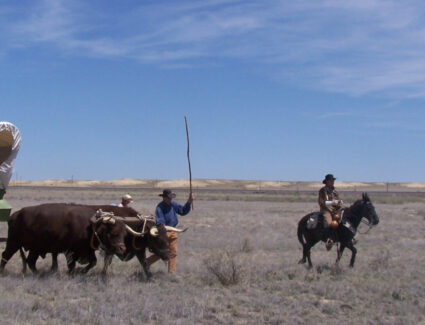
The Santa Fe Trail Scenic & Historic Byway traverses one of the last strongholds of the nomadic Plains Indians and one of the first toeholds of Anglo-American pioneers, who began homesteading along the Arkansas River in the 1860s. This Colorado Byway follows an 188-mile portion of the original Santa Fe Trail.
The Mountain Branch of the Santa Fe Trail entered what is now Colorado just east of present-day Holly and followed the Arkansas River to Bent’s Old Fort, once a trading post and cultural melting pot, now a National Historic Site. From Bent’s Fort the route traveled along the current US Highways 50 and 350 to Trinidad and crossed Raton Pass, a mountain gap used by Native Americans for centuries.
On a clear spring day, a sharp observer can still discern the wagon-wheel ruts of the Santa Fe Trail wending their way across the prairie. The cultural legacies of this historic trade route, which saw its heaviest use between the 1820s and 1870s, remain just as distinct.
The Santa Fe Trail was designated by the U.S. Secretary of Transportation as a National Scenic Byway in 1998. It is one of 13 America’s Byways® designated in Colorado.
Byway Length
188 miles (565 miles total CO/NM)
Driving Time
Features and attractions on a byway tour.
As you enter Colorado, the first town you come to, Holly, offers the first chance to see ruts of the Santa Fe Trail . They are at the entrance to the Holly Cemetery, located just north of US Highway 50 off of County Road 35. The ruts are marked just as you enter the cemetery gates. The cemetery also has a monument to and the graves of the victims of the Towner Bus Tragedy when several children perished after their school bus got stranded in a terrible blizzard in 1931.
Next, learn about controversial American history with a detour to two National Park Service sites: Amache National Historic Site just west of Granada and Sand Creek Massacre National Historic Site to the north. Amache is the former site of a World War II incarceration camp known as Camp Amache or the Granada Relocation Center, which housed more than 7,000 Japanese-Americans, most of whom were U.S. citizens at the time. The Sand Creek Massacre site memorializes another atrocity, where U.S. volunteer soldiers viciously attacked a village of Cheyenne and Arapaho Indians in 1864, resulting in 230 American Indian deaths — mostly women, children, and the elderly.
When you arrive in Lamar be sure to visit the Colorado Welcome Center . Here you can see the Madonna of the Trail statue – one of 12 statues erected across the country in the 1920s by the Daughters of the American Revolution dedicated to pioneer women. Then explore town history with visits to Lamar Theatre , a beautiful 1946 art-deco building, and the Big Timbers Museum , which houses a World War I poster collection. Shore Arts Center warrants a stop for its performing arts programming and gallery.
Back on the byway (now U.S. 50 heading west), just past the Prowers County/Bent County line, a turn onto County Road 35 will take you to the site of Bent’s New Fort. This post, built by William Bent after abandoning his original post 40 miles upriver, eventually became the site of the original Fort Lyon, from which troops marched north to attack the village at Sand Creek. Though on private property, the site is open to visitors and includes a short trail with interpretive panels telling the story of the forts.
Continuing west back of U.S. 50, you pass by John Martin Reservoir State Park , the second largest body of water in Colorado. Two rare birds — the piping plover and the interior least tern — can be spotted along the lakeshore in summer. It’s also an official stop on the Plover Trail, part of the network of Colorado Birding Trails . Camping and picnic grounds are available in the state park. The state park also contains a protected area of swales or ruts of the Santa Fe Trail.
Back on U.S. 50, just east of Las Animas , historic Fort Lyon lies a few miles south of the highway on Colorado Highway 183. Established here in 1867, the post protected travelers on the Santa Fe Trail as well as early settlers in the region. Later it became a naval hospital and a correctional facility. Today it serves as a rehabilitation center. Many historic buildings remain. Just inside the entrance gate is the Kit Carson Chapel, a relocated building, once the post surgeon’s office, where Kit took his last breaths.
When you arrive in Las Animas, plan for a stop at Boggsville Historic Site , a restored mid-19th-century settlement remembered as an early Colorado agriculture and trade center. This Santa Fe Trail historic site preserves two historic 1860s buildings, the Boggs and Prowers houses, and was the last home of the famous Kit Carson. The J.W. Rawlings Heritage Center in downtown Las Animas is also worth a visit for insight into the history of this Santa Fe Trail town.
For another extremely worthy detour not to be missed, hop off the byway and follow signs to Bent’s Old Fort National Historic Site . Founded in 1833 by brothers William and Charles Bent and their partner, Ceran St. Vrain, this reconstructed fort was a trading post strategically located between fur trappers in the Rockies, traders on their way to Santa Fe, and Cheyenne, Arapaho, Comanche and Kiowa Indians who hunted in the area. Today, National Park Service rangers in period attire staff the fort and bring the 1840s to life for visitors.
The next major town on the byway, La Junta , is an Official Colorado Main Street Community, is home to the Koshare Museum , opened in 1949 by a group of Boy Scouts inspired by American Indian culture. Amazingly, this small museum houses one of the country’s greatest collections of Native American art by some of the most famous Taos artists. Also in La Junta , the Otero Museum is filled with artifacts related to area history including a stagecoach that traveled the trail. Several relocated buildings here take you back to the region’s early days.
As you head southwest on U.S. 350 through Comanche National Grassland , look closely and you’ll see this area is full of life. Falcons and hawks search for prey, songbirds flit from the grasses and antelope graze in the meadows. In late summer, the roadside is inundated with sunflowers. And the U.S. Forest Service, which manages the grassland, has developed three interpretive sites that focus on the history of the Santa Fe Trail, which parallels U.S. 350 between La Junta and Trinidad. First, Sierra Vista Overlook (about 1/2 mile south of U.S. 350 on Colorado 71) offers a view of the Rockies to the west as well as the start of a 3-mile hiking route where visitors can walk the historic path of the trail to Timpas Picnic Area. Back on U.S. 350, Timpas Picnic Area is located just west of the highway at the tiny town of Timpas. Besides picnic pavilions and a toilet, Timpas offers a short 1/2 mile nature trail that takes you out to a Santa Fe Trail marker near the banks of Timpas Creek. Continuing down U.S. 350, the Iron Springs Historic Site, just east of the highway, offers more hiking opportunities along the historic trail including some of the best swales or ruts to be found in Colorado.
End your tour in Trinidad , a small city with a quaint Victorian downtown. It’s recognized as another Official Colorado Main Street Community and for its historic El Corazón de Trinidad Creative District replete with local artists, artisans and galleries. Stop by the historic Baca House , a grand adobe house that Felipe and Dolores Baca acquired for 22,000 pounds of wool in 1873. On the same site, you can visit Bloom Mansion , another historic home that’s part of the Trinidad History Museum , and the Santa Fe Trail Museum , which displays family heirlooms and commercial goods of the time.
Events on the calendar: Santa Fe Trail Days in Las Animas, Tarantula Fest in La Junta, High Plains Snow Goose Festival in Lamar, Bent’s Old Fort Living History Encampment near La Junta.
Interactive Trail Map
Use the interactive map below to learn more about each point on the Santa Fe Trail. From the menu in the top left-hand corner of the interactive map, choose Layer List. Then, select Fe Santa NHT from the Layer list.
Next, click on the 3 dots to the right and select “Zoom To” from the menu that appears. Then, use the + and – signs in the upper right corner of the map to zoom into or out of the particular area of the Santa Fe Trail you would like to see. This will allow you to Zoom into very detailed topographic maps showing the route of the Trail.

Lorem ipsum dolor sit amet, consectetur adipisicing elit sed.
Follow us on
Auto Tour Route

- Skip to global NPS navigation
- Skip to this park navigation
- Skip to the main content
- Skip to this park information section
- Skip to the footer section

Exiting nps.gov
Alerts in effect, tour route - oregon.
Last updated: April 30, 2018
Park footer
Contact info, mailing address:.
National Trails Office Regions 6|7|8 California National Historic Trail 1100 Old Santa Fe Trail Santa Fe, NM 87505
Stay Connected
Your browser is not supported for this experience. We recommend using Chrome, Firefox, Edge, or Safari.
To the... well..
You tell us.

Join our e-newsletter
Travel Guide
To the storytellers.

One Epic Trail. Two Hundred Years.
In 1821, Captain William Becknell and a party of five headed west from the Missouri River to trade mules and horses and to hunt on the plains. They wound up in welcoming Santa Fe, eventually carving a 900-mile trade route that thousands of freighters, military troops, Native Americans and others followed for the next 60 years.
Celebrating its 200th anniversary this year, the pathway—now identified as the Santa Fe National Historic Trail—passes through five states. Kansas claims a significant share of the expanded 1,200-mile route meandering through towns such as Gardner, Council Grove, Great Bend and Cimarron that sprung up along the way. Fort Leavenworth, Fort Larned, Fort Dodge and other Kansas military posts protected the trail.
Retrace the route and join this year’s party at local historical sites and events, saluting the commercial highway that bustled until the railroad reached Santa Fe in 1880.
SANTA FE TRAIL TOWNS
Old West spirit still kicks up its heels in Dodge City, where trail ruts indent the prairie and frontier fun carries on at Boot Hill Museum.
Long before Gunsmoke fame, Dodge City defined the Old West, triggered by a stream of Santa Fe Trail voyagers. As H.L. Sitler, the first settler of what became Dodge City, described: “If you stood on the hill above Dodge City, there was traffic as far as you could see, 24 hours a day, seven days a week, on the Santa Fe Trail.” Proof remains in trail ruts carved across grasslands west of town. Visitors can follow a walkway and interpretive signs to view some of the most clearly defined wagon ruts along the trail. Relive Dodge City’s notorious heyday at the saloon, jail and general store, as well as through gunfights on Front Street at Boot Hill Museum . At the brand-new interactive exhibit hall, feel the floor shake during a simulated buffalo stampede. Time your visit right, and you can enjoy five days of pro rodeoing, a longhorn cattle drive and a Western parade during Dodge City Days (July 29–August 8).
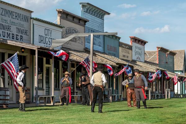
Once a guardian of the trail, Larned preserves its story at an original frontier fort and Santa Fe Trail museum complex.
Brave the untamed territory with a visit to the best-preserved military fort on the Santa Fe Trail. The Fort Larned National Historic Site and its nine original buildings take visitors back to the 1860s when the post’s soldiers patrolled the trail. The Santa Fe Trail Center’s extensive collection of photos, artifacts and displays guide visitors through trail days and westward expansion at this complex of 10 buildings. A welcome landmark northeast of town, Pawnee Rock marked the trail’s halfway point. Walk the grounds of the sandstone vantage point, now a state historic site with interpretive signs, for a 360-degree view as seen by American Indians and trail travelers. Circle back to Larned to celebrate Santa Fe Trail Days (May 28–30), with live music and an evening glow parade.
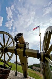
Council Grove
Like early-day travelers headed west, rendezvous in quaint Council Grove and discover the town’s rich history at more than 25 historic sites.
Well-preserved Council Grove makes it easy to imagine wagon trains rolling past the 19th- century buildings that still line Main Street. In an 1861 stone home, from-scratch meals of bison pot roast and German schnitzel speak to early culinary influences at the Trail Days Cafe and Museum. A few blocks down the street, the Kaw Mission and Last Chance Store Museums on the Santa Fe Trail State Historic Site combine for a dual history lesson. At Kaw Mission—built to educate Kaw boys—learn about the crossroads of cultures formed by the trail. Both attractions are slated to reopen in early 2021 after extensive reinterpretation work to put personal stories in the spotlight. Council Grove salutes its heritage with a Kaw Nation powwow, concerts and a parade during the annual Washunga Days (June 18–20).
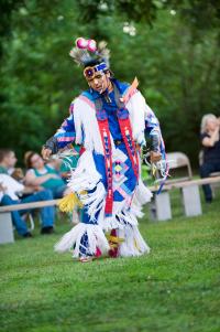
Leavenworth
Troop to the oldest active Army post west of the Mississippi to experience its proud military heritage and peacekeeping role.
Make the Frontier Army Museum at Fort Leavenworth your vantage point for exploring the “post that opened the West.” Its exceptional collection of military artifacts traces the 1827 fort’s mission to keep peace among Native American tribes and to protect the western frontier and the newly opened Santa Fe Trail. From the museum, a self-guided tour leads to 22 points of interest, including the oldest house in Kansas, one of the first national cemeteries and the Buffalo Soldier Monument .
MORE SANTA FE TRAIL TO EXPLORE
CIMARRON NATIONAL GRASSLAND , ELKHART
Follow a 30-mile auto tour through the native grasses, wildflowers, rock cliffs and sagebrush of these 108,000 acres, Kansas’ largest parcel of public land. Score a panorama shot at the Point of Rocks overlook.
HISTORIC ADOBE MUSEUM , ULYSSES
A 1930s adobe-block building sets the stage for this story of life on the High Plains, told through a Native American encampment and artifacts, plus a loaded-up Santa Fe-bound wagon and a sod house.
BARTON COUNTY HISTORICAL SOCIETY MUSEUM AND VILLAGE , GREAT BEND
In addition to the indoor exhibits, a dozen outdoor buildings include a 1950s steel Lustron home, a stone settler’s house, a blacksmith shop and others original to Barton County.
MORTON COUNTY HISTORICAL SOCIETY MUSEUM , ELKHART The county that contains the most miles (33) of the Santa Fe Trail preserves its history with displays of trail, pioneer and local lore, along with a covered wagon. Outdoors, visit a one-room school and old-time church.
GARDNER HISTORICAL MUSEUM , GARDNER
Situated near the junction of the Santa Fe, Oregon and California trails, this 1893 Victorian home-turned-museum recalls trail days with exhibits in its bedrooms, a period kitchen and a timeline mural in the parlor.
SHAWNEE INDIAN MISSION STATE HISTORIC SITE , FAIRWAY
A National Historic Landmark, this site with three original 19th-century buildings recounts early days as a school for Native American children, and later, as a territorial capital and supply point on the Santa Fe Trail.
In the 19th century, a vehicle’s horsepower meant just that. At the Mahaffie Stagecoach Stop and Farm Historic Site in Olathe, ride in a reproduction stagecoach and get a taste of 1860s farm life. It’s the Santa Fe Trail’s last stagecoach stop open to the public. Help with chores, see what’s cooking in the kitchen’s wood-burning stove and watch a blacksmith at work.
Hit the trail to more outstanding Kansas destinations featured in the 2021 Kansas Official Travel Guide.

Debbie Leckron Miller
- Police Report
- Lamar Schools Calendar
- Yard Sales – General Merchandise Listings
- Prowers Community Calendar
- Classifieds/Public Notices/Property Sales
- Yard Sales – General Merchandise Listings
26th Annual Santa Fe Trail Auto Tour, May 19-21, 2023
Barbara Crimond | May 05, 2023 | Comments 0

LAS ANIMAS, Colo. – The natural and cultural history of southeastern Colorado will be on display during the annual Bent on Birding Festival and 26th annual Santa Fe Trail Auto Tours, Friday, May 19 through Sunday, May 21 in Bent County.
The three-day event centers on birding, wildlife-watching and the cultural heritage of the area around Bent County. Birders can also get an insider’s view of some of the most spectacular private ranch land and petroglyphs in Colorado. More than 400 species of birds have been documented in this area.
“Bent on Birding provides an extraordinary opportunity to observe birds and wildlife in the amazing environment of the areas canyonlands,” said John Koshak, former Colorado Parks and Wildlife Watchable Wildlife Coordinator. “Participants have a rare invitation to tour some amazing ranches and meet the landowners whose management has protected our wildlife and wildlife habitat for generations.”
Event guides will host organized trips that will give birders a chance to seek sought-after birds such as the least tern, piping plover and black rail, along with eagles, ferruginous hawks and other native songbirds, shorebirds, raptors and waterfowl. The tours wind along the Colorado Birding Trails, along the shores of John Martin Reservoir and on some of the most spectacular private-land wildlife habitats in SE Colorado’s cattle ranching and canyon country.
In addition to organized birding and wildlife outings, organizers have also lined up tours that feature historic, archaeological and cultural sites, such as prehistoric petroglyphs and historic sites along the Purgatoire and Arkansas Rivers, Colorado’s ‘most beautiful courthouse’, as well as the homes of frontiersman Kit Carson and ‘Gunsmoke’ actor, Ken Curtis.
There will be history, food and fieldtrips events in Las Animas all weekend. A full schedule of ‘Bent on Birding & Heritage’ events is available online or email: [email protected]; or call: 719-456-0485, 719-456-1320.
The events are co-sponsored by Colorado Parks and Wildlife, the Colorado Historical Society, Supporters of Colorado Preservation and Bent on Birding.
Bent on Birding is one of several cultural celebrations during the SE Colorado Heritage event. At Bent’s Old Fort National Historic Site, the National Park Service hosts daily guided tours or an option to visit the ‘Sand Creek Site’.
Share this:
Filed Under : Chamber of Commerce • Consumer Issues • Entertainment • Featured • History • Media Release • Recreation • Tourism
Tags : Bent County • Bent on Birding Festival • Santa Fe Trail Auto Tours
About the Author :
RSS Feed | Comments Feed
Get the latest updates via email.
Privacy guaranteed. We will not share your information.
- Police Report 264 views
- Alex Dieterle, Jr. – August 28, 1939 – February 22, 2024 190 views
- Helen L. Dorris – March 8, 1930 – January 23, 2024 168 views
- Police investigate apparent murder-suicide in La Junta 142 views
- Public and school board members tour site of new Thunder Stadium to view progress 71 views
- Gideon Semmens – June 20, 1927 – June 12, 2024 60 views
- Lola Loretta Barnard – April 6, 1939 – June 2, 2024 38 views
- Classifieds/Public Notices/Property Sales 35 views
- Yard Sales – General Merchandise Listings 34 views
- Meeting between coroner and Prowers County Board of Commissioners June 4, 2024 gets heated 31 views

- Alex Dieterle, Jr. – August 28, 1939 – February 22, 2024
- Helen L. Dorris – March 8, 1930 – January 23, 2024
- Police investigate apparent murder-suicide in La Junta
- Public and school board members tour site of new Thunder Stadium to view progress
- Gideon Semmens – June 20, 1927 – June 12, 2024
- Lola Loretta Barnard – April 6, 1939 – June 2, 2024
- Meeting between coroner and Prowers County Board of Commissioners June 4, 2024 gets heated
- Agriculture
- Chamber of Commerce
- City of Granada
- City of Holly
- City of Lamar
- City of Wiley
- Consumer Issues
- Entertainment
- Environment
- Lamar Chamber of Commerce
- Law Enforcement
- Letters to the Editor
- Media Release
- Public Safety
- The Journal Alert
- Transportation
- Veterans Issues

Welcome to the Official Santa Fe Trail Association

Santa Fe Trail National Historic Trail Sign

National Trail System
Quivira Chapter

"The storm burst, and the o’er charged sky poured fourth its torrent over the grassy plains. The wind increased to a hurricane and drove the falling rain almost horizontally before it." — Matt Field, near Cheyenne Bottoms, 1839
Join the Quivira Chapter is just $10 per year for individuals or families! To download the membership form, click here.
History of the Quivira Chapter

Quivira Chapter Website
Quivira Chapter Facebook Page
Location and Directions
The Santa Fe Trail enters the Quivira Chapter at the McPherson/Marion County line. The major cities within the Quivira Chapter are McPherson, Lyons, and Great Bend. U.S. Highway 56 closely follows the Trail east to west through the chapter area. You can reach U.S. Highway 56 from Interstate 70 by traveling south from Salina on I-35 to exit 60 at McPherson. From Wichita, go north on I-35 to the same exit.
Points of Interest

A few of the many sites of interest along the Santa Fe Trail within the chapter area. View Now
An Auto Tour of the Trail
Download a brochure with maps to follow the Santa Fe Trail through the Quivira Chapter.
The Quivira Chapter is working on the completion of the Quivira Auto Tour project to mark the Trail through the chapter.
Goals of the Quivira Chapter
The goals of the Quivira Chapter are to preserve and protect the Santa Fe Trail and to educate people about the Trail and its history. The Chapter hopes to increase landowner involvement in chapter activities, and to increase overall membership. We encourage all people, especially landowners, to become involved in chapter activities.

IMAGES
VIDEO
COMMENTS
There are a number of interesting sites along the Santa Fe Trail auto tour route that you can still visit today: Old Franklin Town Site. The Old Franklin Town Site in Missouri holds great historical significance as it marks the beginning of the renowned Santa Fe Trail. Established in 1816, Franklin served as a vital trading and transportation ...
Interested in a certain area? Find trail sites to visit by state. Click further to learn more about a site's significance to the trail, how to visit, amenities available and more! Tours. Discover the Santa Fe Trail one state at a time by following these self-guided tours. Explore each state's app sites and their rich natural and cultural features.
Pawnee Rock was the Trail's halfway mark between Independence and Santa Fe. At Larned tour The Santa Fe Trail Center's one-room school, church, sod house, vintage depot—authentic restored buildings from the area. ... After the 1870s, the Santa Fe Trail ceased to be the leading westward travel route; yet it continues to be a romantic place ...
The Santa Fe Trail is a tranquil drive through Southeast Colorado, connecting Lamar with Trinidad. It roughly follows the national historic trail by the same name. ... Scenic Drive - The Auto Tour Route traces the original Santa Fe Trail the best it can. The 188-mile Colorado section takes about four hours (one way), and has been designated a ...
Auto Tour: The Mountain Route Byway. Emblazoned with the distinctive Santa Fe National Historic Trail logo, the Auto Tour Route provides a tangible connection to history. Administered by the National Park Service and a network of partners, the route is meticulously marked along major highways that mirror the historic trail.
Daughters of the american revolution (D.a.r.) marker on hwy 77, one mile east and 1.1 miles north of the town of Lost springs. this marker was originally placed in a
Travel the Trail: Map Timeline 1821 - 1880. William Becknell opened up the Santa Fe Trail, between the Missouri River and the Mexican provincial capital of Santa Fe, in the fall of 1821. The route played a major role in bringing people, goods, and ideas to and from Santa Fe for the next 59 years. However, the Santa Fe Trail was rarely a static ...
NPS photo. Car. You can reach most trail sites by auto or bicycle, or on foot. Some sites are along unpaved roads. A family of road signs has been initiated across the Santa Fe Trail to help you find original routes, trail crossings, and local sites. Follow the signs exhibiting the distinctive Santa Fe Trail National Historic Trail logo.
A Directory of Santa Fe Trail Sites & Auto Tour are included in this major research & marking project. The Wet/Dry Routes Chapter has always been the leading force along the Santa Fe Trail with all their on going projects of interpretation & marking of the Old Santa Fe Road. This project is the most researched & complete survey of any section ...
This year marks the 200th anniversary of this epic journey. From 1821-1880, teams pulling heavily loaded wagons made this overland crossing in about eight weeks. With my 21st century horsepower, I will travel its entirety in eight days. But there's a complication: the Santa Fe Trail is divided. It splits.
Early Anglo travelers on the Santa Fe Trail could not pronounce Purgatoire and hence further corrupted the name into Picket Wire. Early Settlers: In the 19th century, Hispanic and European settlers homesteaded in Picket Wire Canyonlands. Guides will take you to an early Catholic Church and cemetery, which was built on land donated by Damacio ...
The historic Santa Fe Trail weaves through southeastern Colorado via Lamar, La Junta and Las Animas, where historic sites recall the area's pioneer past. ... and you can also arrange for a guided auto tour. Other interesting stops in the grassland include Vogel, Picture and Carrizo canyons. All three canyons feature ancient rock art preserved ...
Extend your trip by driving south 20 minutes along I-25 to Raton Pass, located at the Colorado-New Mexico border. Cutting through the Sangre de Cristo mountains, this Santa Fe Trail segment is both scenic and challenging to travelers of yore. The Santa Fe Trail byway loosely follows the Arkansas River to the New Mexico-Colorado border.
Mindful of this, the Santa Fe Trail Association (SFTA), a non-profit association with a 501 (c)(3) status, was created in 1986 to help protect and preserve it. The U.S. Congress likewise recognized the significance of the Trail to American history by proclaiming it a National Historic Trail in 1987. Junior Wagon Master.
The Santa Fe Trail Scenic & Historic Byway traverses one of the last strongholds of the nomadic Plains Indians and one of the first toeholds of Anglo-American pioneers, who began homesteading along the Arkansas River in the 1860s. This Colorado Byway follows an 188-mile portion of the original Santa Fe Trail. ... End your tour in Trinidad, ...
Camp Amache. Koshare Indian Museum. Lamar Welcome Center. Prowers House, Boggsville. Santa Fe Trail Museum. Vogel Canyon. Antelope at Sunset. Photos are to be used only to promote Colorado as a leisure destination or in a news story. They cannot be used to promote individual, for-profit businesses or sold or used in a photo project that is for ...
Colorado Scenic Byways. Southeast. Santa Fe Trail. Photo Tour. Auto Tour Route. Auto Tour Route. Photo by Sally Pearce, CDOT. Click to view full-size image…. Size: 1.5 MB.
Heart of the Flint Hills Chapter Auto Tour. Our Santa Fe Trail tour starts at Lone Elm Campground, which is located just south of Olathe, Kansas. In our area, a great deal of the main Santa Fe Trail parallels US 56 Highway. West of Lone Elm, you will arrive at Gardner, Kansas. Roughly two miles west of Gardner is the junction of the Santa Fe ...
Auto Tour Route driving directions for Oregon. 1. Take State Route 39 north to State Route 66. 2. Turn west onto State Route 66 at Klamath Falls. 3. Take State Route 66 west to Interstate 5. 4. Turn onto I-5 north at Ashland.
One Epic Trail. Two Hundred Years. By Debbie Leckron Miller on Jan. 22, 2021. In 1821, Captain William Becknell and a party of five headed west from the Missouri River to trade mules and horses and to hunt on the plains. They wound up in welcoming Santa Fe, eventually carving a 900-mile trade route that thousands of freighters, military troops ...
LAS ANIMAS, Colo. - The natural and cultural history of southeastern Colorado will be on display during the annual Bent on Birding Festival and 26th annual Santa Fe Trail Auto Tours, Friday, May 19 through Sunday, May 21 in Bent County. The three-day event centers on birding, wildlife-watching and the cultural heritage of the area around Bent ...
The Santa Fe Trail is considered to have been active in Marion County from 1821 (Becknell's pack mule caravan) through approximately 1866, when the railroad reached Junction City, Kansas. ... Marion County Auto Tour. The Cottonwood Crossing Chapter has erected a series of signs which direct motorists on an auto tour across Marion County. The ...
The Quivira Chapter is working on the completion of the Quivira Auto Tour project to mark the Trail through the chapter. The goals of the Quivira Chapter are to preserve and protect the Santa Fe Trail and to educate people about the Trail and its history. The Chapter hopes to increase landowner involvement in chapter activities, and to increase ...