Arrive Safely to your destination every time with the best road trip weather planner app

"A very effective travel tool. Very helpful in navigating our film crews around the United States and making route changes based on weather conditions nationwide!"
- Ignite Movie Studios

The Best Road Trip Weather Planner App The Best Road Trip Weather Planner App
Get the weather forecast for your entire road trip.
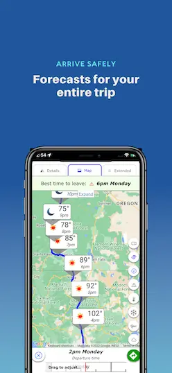
View forecasts on the map to see if there's snow in that high mountain pass, or flash flooding across that lonely desert, all at the same time.
Weather Along Your Driving Route Weather Along Your Driving Route
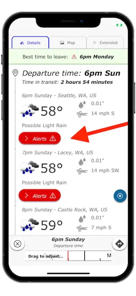
Every forecast is adjusted to show the road weather precisely when you'll be driving through each location.
Live Doppler Radar and Traffic Cameras Live Doppler Radar and Traffic Cameras
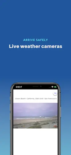
View livehighway camera images for locations along your trip to see live weather conditions for yourself.
Travel Forecast Travel Forecast
Drag along the time slider to change your departure time and instantly see how the weather forecasts change at different times of day. Perfect for road trips with flexible schedules.
Have You Wondered About Finding the Best Time to Leave? Have You Wondered About Finding the Best Time to Leave?
Not sure what time to leave? The departure assistant will suggest an ideal time to start your trip. We'll find the ideal weather forecast to ensure a safe trip.
22% of all driving accidents are related to weather
What's New?
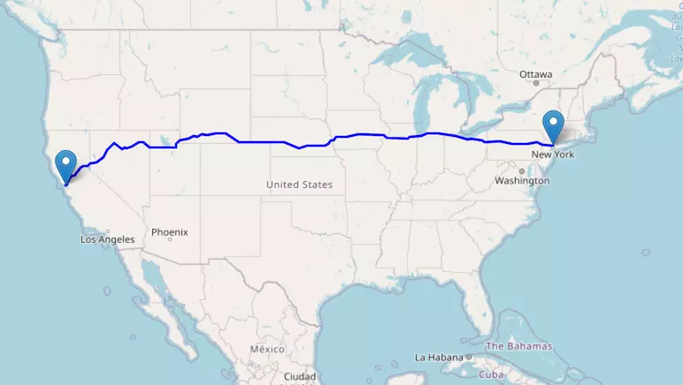
We now provide interactive highway maps for all major interstates in the US and Canada!
Trusted by All Kinds of Travelers for Their Road Trip Travel Needs Trusted by All Kinds of Travelers for Their Road Trip Travel Needs

Powered by Weather Route technology
Trusted & approved by the Innovative GEOINT Application Provider Program (IGAPP) for secure government devices.
We take privacy seriously. Your data is safe and will never be shared.
"The first app I open after I order a load. Easy steps, I can put in all my delivery addresses. I love it."
"I drive to Tennessee almost monthly. Outstanding reports. With GPS this is unbeatable."
- Dennis Ditinno
Check Weather Along Route Check Weather Along Route
- Parents taking families on trips between cities.
- Truckers and commercial crews driving for work.
- RVers and road trippers visiting a nation’s cities and parks.
- Motorcyclists looking for fun day rides.
- Professionals wishing to get the most from their business trips.
... and anyone with a passion for travel and a preference for careful and intelligent planning.
Our reports for traveling weather driving conditions will always keep you on course.
Download From Your App Store Download From Your App Store
"This works great for me as a truck driver to let me know what kind of weather I am heading in to and if I need to re-route. It's also very accurate."
- Preston Tanner
"Always accurate! Helps to determine what route I'll take on a road trip!"
- Dawn King
76% of weather-related fatalities involve wet pavement
What do we provide that sets our highway weather reports apart from our competitors what do we provide that sets our highway weather reports apart from our competitors, stay safe, informed, and on schedule stay safe, informed, and on schedule.
Highway Weather keeps you abreast of ...
- Moment-to-moment weather changes.
- The best time to hit the road.
- Every piece of relevant weather info at every stage of your trip!
Our technology streamlines your travel logistics by displaying real-time weather updates right alongside your trip route. It’s never been easier to plan your routes, maximize efficiency, and dodge the highway delays that come from sudden inclement weather.
We even customize the weather forecast for your needs. For example, if you're looking for trucking weather forecasts, we'll tailor the results to specially suit your vehicle, such as highlighting wind speed in our results.
Compare Routes and Find the Best Time to Drive Compare Routes and Find the Best Time to Drive
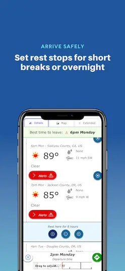
A good travel weather app recognizes that you’re looking to avoid hailstorms and flood warnings. A great app knows you’re also considering where you’ll spend the night, stop for lunch, drop off a shipment, or encounter the least amount of traffic. Highway Weather gives you the ability to add stops along the way and receive departure time recommendations that take into account the forecasts for the days ahead.
Our app allows users to observe and compare multiple route options, compare forecasts, and ensure that your trip itinerary meets all the needs for your road trips.
If you're planning your trip in advance or have a flexible departure time, use our interactive slider to adjust your departure time. Weather forecasts will update in real-time as you adjust the slider, giving you immediate feedback about weather conditions at different times in order to find the best conditions for travel.
Leverage a top-caliber weather app for travel planning that optimizes your trip and gives you as many clear sky days as possible!
Make Real-Time Adjustments Using Live Forecasts Make Real-Time Adjustments Using Live Forecasts
Highway Weather is the best weather app for traveling. Our interactive features provide ongoing updates for road weather information based on your specified arrival and departure times. You'll know when to stay on the road, when to get off the road, which road to take — and where to steer clear of debilitatingly bad weather. As you proceed, our app uses traffic cameras, forecast data, and weather radar to alert you to temperature, visibility, precipitation, wind speed, and many other relevant details.
Get to Your Destination — and Arrive Safely! Get to Your Destination — and Arrive Safely!
Highway Weather streamlines your travel plans by showing you all options for the best and most efficient routes. You will know exactly when and where you can expect to encounter weather that might pose a danger or inconvenience to your trip. We want to see you make it to your destination and return home with swiftness, comfort, and ease.
Since 2013, Highway Weather has continually developed and improved our features and design. With more than 100k global users, we’ve made a name for ourselves as one of the best travel weather apps available — complete with reliable, friendly customer support to answer and address any questions or concerns.
We provide free forecasts in addition to subscription features that proactively notify you of bad weather while you’re on the road driving. The app is even a preferred weather app for secured government devices who choose Highway Weather for its advanced privacy and security features.
Install Highway Weather now — and prepare to get back on the road!
What Do We Provide That Sets Our Highway Weather Reports Apart From Our From Competitors? What Do We Provide That Sets Our Highway Weather Reports Apart From Our From Competitors?
Arrive safely with our travel weather forecast arrive safely with our travel weather forecast.
Our technology streamlines your travel logistics by displaying real-time weather updates right inside your drive. It’s never been easier to plan your routes, maximize efficiency, and dodge the highway delays that come from sudden inclement weather.
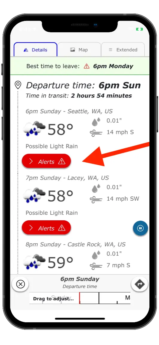
Leverage the best weather app for travel planning that optimizes your trip and gives you as many clear-sky days as possible! And be on the lookout for severe weather alerts that are especially dangerous.
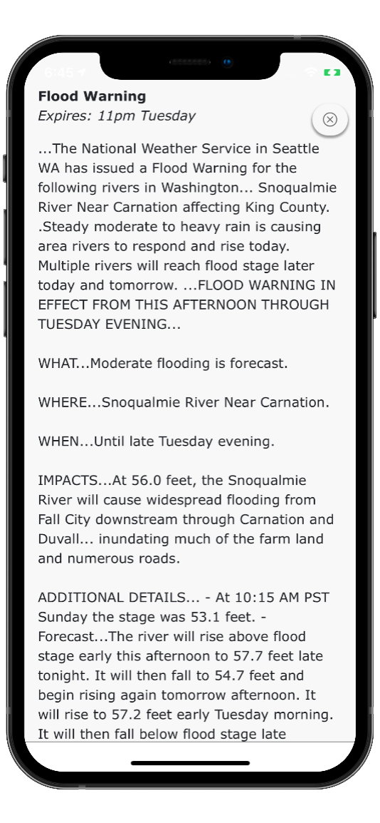
Highway Weather is the best weather app for traveling. Our interactive features provide ongoing updates for road weather information based on your specified arrival and departure times. You'll know when to stay on the road, when to get off the road, which road to take — and where to steer clear of debilitatingly bad weather. As you proceed, our app uses traffic cameras, forecast data, and weather radar to alert you to temperature, visibility, precipitation, wind speed, and other relevant details.
Highway Weather has existed since 2013, continually developing and iterating our features and design. With more than 100k global users, we’ve made a name for ourselves as one of the top apps of our kind — complete with reliable customer support to answer and address any questions or concerns.
Ready to Arrive Safely on Your Drive? Ready to Arrive Safely on Your Drive?
Download Highway Weather for free on Google Play or the App Store.
We Began Just Like You We Began Just Like You
Highway Weather was born of necessity.
It began in late 2012 with a simple problem: The app founder, Devan Stormont, was trying to visit family for the winter holidays. The drive was about 7 hours through "middle-of-nowhere" rural country with limited road and cell services. A series of rolling snowstorms were moving in a way that it wasn't clear whether the trip could be made without getting trapped in a storm. Existing apps and websites were not helpful in resolving the problem.
For the sake of safety, the trip was cancelled. Out of frustration, the first version of Highway Weather was created over the following weeks (and originally called Weather Route ).
At first, it was a hobby/personal app used to solve a personal problem and updates were made to fix personal annoyances. Over time, it became popularly adopted by many travelers and commercial users.
Since 2013, it's been our mission to ensure everyone can arrive at their destination safely.
Today, we do that by providing you the best road trip weather planner app on the market.
Welcome to 511 PA
Get started to discover new and exciting features!
Signing up with 511PA
- Creating an account is NOT mandatory on this website; however if you do, you’ll be able to personalize your experience and receive traffic alerts.
- Select ‘Sign Up’ from the menu options in the top right corner
- Enter your name, email, and create a password. Click ‘Sign Up' when done.
- You will get an email to verify your account, click the link that was sent to your email.
- Including a phone number will allow you to receive text alerts, you will receive an SMS (text) with your confirmation code. Note this is in addition to the email verification.
Creating & Saving a Customized Route
- Review the routes generated and select the one that suits you best.
- When done, enter a name for your route and click ‘Save’.
Creating an Alert for your Route
- Once your route is saved, you will be asked if you want to be notified of events on this route. Click ‘Create Route Notification’
- You will be redirected to the alert creation page. Enter the required information for your route, select a delivery option (email or SMS), and click ‘Save’.
- You will now be notified of any future events that affect your route.
Welcome to 511PA
- Verify your account by following the link that was sent to your email.
- If you registered with a phone number, you will also receive an SMS (text) with your confirmation code
- In the Manage My Routes table, find the route that you previously saved that you would like to create an alert for and click ‘Create Alert’.
Content for Heading
There's no additional information right now.
My Cameras Toggle
To add to My Cameras View:
- Map page - Click on a camera icon on the map, then click the "My Cameras" button at the top of the camera popup. Select from the Camera View list to add or de-select to remove.
- Camera page - Click on the three dots icon below the camera image to access the "My Cameras" option. Select from the Camera View list to add or de-select to remove.
- Closed/Stopped
- Speed Restrictions
- Vehicle Restrictions
- Limited Services
- Out Of Service
Would you like to be notified of events on this route?
Default options for receiving Event Notifications:
- 6 AM - 6 PM
- Log in / Sign up
And start your weather experience
- Log in with Facebook
- Log in with Twitter
- Log in with Google+
WHAT'S NEW
There's no alert at this time.
My Cameras Toggle
To add to My Cameras View:
- Map page - Click on a camera icon on the map, then click the "My Cameras" button at the top of the camera popup. Select from the Camera View list to add or de-select to remove.
- Camera page - Click on the three dots icon below the camera image to access the "My Cameras" option. Select from the Camera View list to add or de-select to remove.
- Closed/Stopped
- Generally Clear & Dry
- Severe Snow / Ice
- Portions Closed
- Update Pending
- No Active Reporting
Would you like to be notified of events on this route?
Default options for receiving Event Notifications:
- 6 AM - 6 PM
Weather On The Way
The most advanced road conditions app.
- Weather along your route
- Exactly at the time you will be driving through
- Pick the best time to leave
- Say NO to weather delays
- Know EVERYTHING about weather conditions at any point of your trip

A Road Trip Weather App
Weather on the Way is a new travel weather app that provides a detailed weather forecast for your driving route. Thanks to combining forecasting and navigation, you get weather conditions precisely at a time you will be driving through .

Perfect for road trips
Check the radar ahead.
For longer trips add waypoints and stops along the route. Set the stop duration and get the perfect forecast for the next day!
Pick a route, avoid a storm
No more unexpected delays.
Check alternative routes to make sure you have picked one with the best weather

CarPlay Support
Weather radar on your dashboard.
Track the weather forecast and precipitation while driving your car.

Full of details
Every step of the way.
Temperature, conditions, visibility, precipitation, wind speed, UV Index and more
Plan in advance
Up to 7 days before departure.
Swipe left and right to find the best time to leave.

Be aware of severe conditions
Stay safe on the road.
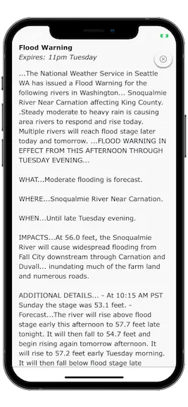
Weather alerts and radar along your driving route.
Check wind conditions
Speed, direction and gusts.
Driving a large vechicle like an RV or towing a trailer? Check for dangerous wind to avoid a risk of rollover.

"Literally saving my trip! [...] The app showed warnings where smoke and air quality were dangerous and I was able to pick a new route. So grateful!!"
"Why can’t google maps be like this. Finally, someone does it and they do it RIGHT. [...] Genius.
"Awesome! This app is ESSENTIAL for any road trips lasting more than an hour."
"It’s always frustrating that my other major map programs don’t show time zone changes or weather. Score on both counts! Nice."
FEATURED ON

See where it's raining - Live precipitation radar
Find the best time to leave - Interactive departure slider
NOAA alerts and advisories
Plan a road trip and set stop points
Ask Siri for Weather Ahead
Avoid blinding sun – Sunset and sunrise times
Know the weather at the destination – Should you take a raincoat or a swimsuit?
Easy to read forecast – Put your phone in a car mount
Dark Mode – Comfortable during long nightly drives
Privacy focused – No creepy tracking, no ads, no analytics. Does not store your location
Free PRO on first 5 trips
$4.99 monthly / $24.99 yearly after that.
Compare PRO features
Global – Works in 70+ countries.
Built by an independent developer
More to come!
Android version is coming soon
Sign up to get notified.

Coeur D Alene Traffic and Road Conditions
Coeur d alene traffic map.
How to use the Coeur D Alene Traffic Map Traffic flow lines : Red lines = Heavy traffic flow, Yellow/Orange lines = Medium flow and Green = normal traffic or no traffic*. Black lines or No traffic flow lines could indicate a closed road, but in most cases it means that either there is not enough vehicle flow to register or traffic isn't monitored. Also, If you do not see traffic flow, you can zoom in closer to reveal localized data. If you are unable to pan the map, press here (to focus off of the map) and try again.
* In known extreme weather events or accidents, the map provider may still show green lines, even if lanes or the entire road is closed.
Traffic Alert

- Click or touch the map to move in different directions.
- If you do not see any markers on the map, try zooming in one or two levels using "+" on the top left side. However, they are not always available.
- Click an incident icon on the map to get more information.
Coeur D Alene Traffic Alerts
More local information, bookmark and share, traffic nearby, coeur d alene weather and traffic updates by locals.
Write your own Coeur D Alene, Idaho report, forecast, or traffic update:
E-mail: will not be posted, shared or used for marketing!
Coeur D Alene, ID Report, Forecast or Traffic Update:
Traffic Map
Member access.
Sign In
Password Retrieval

Driving Time Calculator
Driving time between two cities.
Travelmath helps you find the driving time based on actual directions for your road trip. You can find out how long it will take to drive between any two cities, airports, states, countries, or zip codes. This can also help you plan the best route to travel to your destination. Compare the results with the flight time calculator to see how much longer it might take to drive the distance instead of flying. You can also print out pages with a travel map.
You may want to search for the driving distance instead. Or if you're thinking about flying, make sure you compare flight times between airports. For a long road trip, check the cost calculator to see if it's within your budget.
Home · About · Terms · Privacy


Traffic + Weather
- • I-10 Broadway Curve
- • SF Bay Area 511
- • Inland Empire
- Connecticut
- Massachusetts
- Mississippi
- New Hampshire
- North Carolina
- North Dakota
- Pennsylvania
- Rhode Island
- South Carolina
- South Dakota
- West Virginia
- Plan a Road Trip
- Plan a Flight
- Find an Airport
- Where to Stay
- All Questions
Road trip planner
Starting City
Destination City
Or switch to flying
Planning a road trip?
Get advice from people who have done the same trip.
The Trippy road trip planner automatically calculates the optimal itinerary including stops recommended by Trippy members, favorite restaurants and hotels, local attractions and things to do based on what people who live in the area have suggested, and more.
Once you have a quick trip planned, you can customize every detail, adding or removing stops, or changing what time you leave in the morning or how long you stay at each stop. Then you can save your custom trip and share it with friends and family.
Let us know if you have requests for more features you'd like to see in the trip planner!
Driving this Christmas? Here's how to avoid the worst traffic.

It's going to be a busy holiday travel season, especially for those who are planning to hit the road to reach their final destination.
AAA projects 115.2 million travelers between Dec. 23 and New Year's Day – and 90% of those people will be going by car. It'll be the second-highest on record of drivers following 2019.
"This year-end holiday forecast, with an additional 2.5 million travelers compared to last year, mirrors what AAA Travel has been observing throughout 2023," Paula Twidale, senior vice president of AAA Travel, said in a statement.
With packed roads, driving times can take up to 20% longer, according to Bob Pishue, transportation analyst at INRIX. Travelers in major metro areas such as Denver, Minneapolis and Washington, D.C., may encounter almost double the typical delays, he added.
Despite the serious congestion, there is some good news: Gas prices this holiday season will be the same or lower than last year.
Learn more: Best travel insurance
Here's everything you need to know about driving to your holiday destination.
Travel safe Holiday scams aren't so easy to spot anymore. How online shoppers can avoid swindlers.
What are the best times to travel by car?
Drivers with flexibility in their travel plans should hit the road on Christmas Eve, Christmas, New Year's Eve and New Year's to avoid the worst traffic.
On Saturday, Dec. 23, early birds who leave before 10 a.m. will get the worm (hit less traffic).
The days between Christmas and New Year's (Tuesday, Dec. 26; Wednesday, Dec. 27; Thursday, Dec. 28; Friday; Dec. 29; and Saturday, Dec. 30) will be the most hectic on the roads. The least traffic will be before noon.
What are the worst times to travel by car?
Drivers can anticipate the worst traffic before Christmas on Dec. 23 between 11 a.m. and 7 p.m.
After Christmas, on Wednesday, Dec. 27, the roads are forecasted to be packed between 1 p.m. and 7 p.m., and between 2 p.m. and 8 p.m. on Dec. 28 and 29, according to INRIX.
As people head to their New Year's destinations, the worst traffic will be between 5 p.m. and 7 p.m. on Dec. 30.
Peak congestion times in major US cities
To steer clear of bumper-to-bumper traffic, be smart about the routes and timing of your drive. "Avoid peak commuting hours and use traffic apps, local DOT notifications, and 511 services to minimize holiday travel traffic frustrations," Pishue said.
◾ Worst route: Augusta to Atlanta via I-20 West.
◾ Worst day: Dec. 30.
◾ Worst time: 7:15 p.m.
◾ Estimated travel time: 1 hour, 56 minutes.
◾ Worst route: Boston to Portsmouth via I-95 North.
◾ Worst day: Dec. 23.
◾ Worst time: 4:15 p.m.
◾ Estimated travel time: 1 hour, 41 minutes.
◾ Worst route: Fort Collins to Denver via I-25 South.
◾ Worst day: Dec. 29.
◾ Worst time: 2 p.m.
◾ Estimated travel time: 1 hour, 40 minutes.
Los Angeles
◾ Worst route: Bakersfield to Los Angeles via I-5 South.
◾ Worst day: Dec. 27.
◾ Worst time: 6:15 p.m.
◾ Estimated travel time: 2 hours, 41 minutes.
Minneapolis
◾ Worst route: Eau Claire to Minneapolis via I-94 West.
◾ Worst day: Dec. 28.
◾ Worst time: 10:15 a.m.
◾ Estimated travel time: 2 hours, 7 minutes.
◾ Worst route: New York to Hamptons via Long Island Expy East.
◾ Worst time: 2:30 p.m.
◾ Estimated travel time: 2 hours, 8 minutes.
San Francisco
◾ Worst route: San Francisco to Sacramento via I-80 East.
◾ Worst time: 5:15 p.m.
◾ Estimated travel time: 1 hour, 49 minutes.
◾ Worst route: Baltimore to Washington, D.C., via Balt/Wash Pkwy South.
◾ Worst time: 3:45 p.m.
◾ Estimated travel time: 1 hour, 1 minute.
Kathleen Wong is a travel reporter for USA TODAY based in Hawaii. You can reach her at [email protected] .
- Island of Hawaii Tourism
- Island of Hawaii Hotels
- Island of Hawaii Bed and Breakfast
- Island of Hawaii Vacation Rentals
- Flights to Island of Hawaii
- Island of Hawaii Restaurants
- Things to Do in Island of Hawaii
- Island of Hawaii Travel Forum
- Island of Hawaii Photos
- Island of Hawaii Map
- All Island of Hawaii Hotels
- Island of Hawaii Hotel Deals
- Last Minute Hotels in Island of Hawaii
- Island of Hawaii
- Things to Do
- Restaurants
- Vacation Rentals
- Travel Stories
- Rental Cars
- Add a Place
- Travel Forum
- Travelers' Choice
- Help Center
Saddle road tomorrow? - Island of Hawaii Forum
- United States
- Hawaii (HI)
- Island of Hawaii
Saddle road tomorrow?
- United States Forums
- Europe Forums
- Canada Forums
- Asia Forums
- Central America Forums
- Africa Forums
- Caribbean Forums
- Mexico Forums
- South Pacific Forums
- South America Forums
- Middle East Forums
- Honeymoons and Romance
- Business Travel
- Train Travel
- Traveling With Disabilities
- Tripadvisor Support
- Solo Travel
- Bargain Travel
- Timeshares / Vacation Rentals
- Hawaii forums
- Island of Hawaii forum

6 replies to this topic

Being from Oregon rain and fog aren't intimidating if you drive carefully. Sacramento gets it's share of fog? Any highway is fine for a rental. No off roading unpaved roads. The Laupahoehoe Train Museum is open Friday 10-2. I found the history of sugar cane on the east side fascinating supported by over the top investment in train infrastructure. In case you go the north route tomorrow.

hey hey Lorenky
can never guess what saddle road will bring you. could be a sunny day but the hilo side maybe misty/wet.
akaka falls will be closed during weekdays for rockfall mitigation work. they will be open on weekends.
http://hawaiipublicradio.org/akaka falls state park closed temporarily week days.
you can stop at laupahoehoe lookout point (hawaiibeaches.com/laupahoehoe state beach park)
coming from honokaa there will be a sign to the point. turn left crossing over highway and drive down the jungle like small narrow road down to bottom. this is where the april 1st 1946 tsunami hit and killed 24 teachers and students. you will see a memorial. my brother was also born at the old hospital here on new year's eve 1950, a special place for our family and also having our picnic celebrations here.
the train museum is more history about the sugar cane plantations along the coast, not many people stop and learn about it like mouseGradMom mentions
i sent you a reply to your post about visiting annecy, some of the things we did while we stayed for 6 days. loved it, a small cute village on the lake
aloha & hang loose

- Hilton or Marriott Waikoloa 6:48 pm
- Dukes Restaurant to open in late 2025 in Kona. 1:26 pm
- Pololu Trail and parking closed June 7 until after 2 pm 9:52 am
- Saddle road tomorrow? 9:04 am
- Swimmable beaches near Kona yesterday
- Need help with 9 night itinerary in June yesterday
- Stay in Hilo or Kona yesterday
- Manago Hotel will close this year yesterday
- Snorkel op bans snorkelers floatation aids/vests? yesterday
- Cost of 100% Kona coffee at Hawaii Costco? Jun 05, 2024
- Wait time at KOA for Thrifty/Dollar car rentals? Jun 05, 2024
- Kamehameha Day Parade & Ho'olaule'a, 06-08-24 Jun 05, 2024
- Lava viewing this week Jun 05, 2024
- Big Island - 8 Nights Mona Lani Aubergine w/9yo must dos! Jun 05, 2024
- Kona vs Hilo 8 replies
- Best place to stay? 18 replies
- Big Island vs Maui 9 replies
- Best places to stay in Hilo? 5 replies
- Best beaches in Kona, Hawaii 16 replies
- Kona with kids 8 replies
- Cheap places to stay 9 replies
- Best boogie boarding, body surfing beaches 5 replies
- Where to stay on the Big Island 11 replies
- Hawaii with Kids? Which Island do you recommend? 19 replies
Island of Hawaii Hotels and Places to Stay
- Lava Viewing information
- What are the issues about swimming with dolphins?
- How can I visit Mauna Kea summit and/or the Visitor Information Station?
- Snorkeling & diving on the Big Island - Kona Coast & Kohala Coast options
- West Side Beaches: Which ones should I visit ?
- Where to stay on the west side; Kona districts vs. Kohala districts
- Where do I stay to visit the east side of the Big Island and/or to see volcano?
- Photo-centric trip reports of the Big Island? - You want to see some great photos?
- Kohala Coast Lodging Options
- Kona Lodging Options
- All About Mauna Lani Resort
- All about the Waikoloa Beach Resort
- Respecting Hawaiian place names. Why not to use nicknames or English translations
- Trip Reports! - Links to TR's from 2010 to present
- I want to eat "local"! Where do I go?
- What are some good splurge or special occasion restaurants on the Big Island?
- What is good reef etiquette? Great video on reef etiquette.
- Manta Ray Night Snorkel/Dive
- Gluten Free Dining
- Inexpensive/Affordable Eats
- What are some quality cultural and educational activities on the Big Island?
- Where can I find good live Hawaiian or local music and/or hula?
- Altitude sickness, taking kids, risks when visiting Mauna Kea summit
- What can I do--or avoid--to be a responsible visitor?
- Safe Driving/Night Driving
- Why do I need to pack warm clothes for a trip to Hawaii Island?
- Rental Car Questions and Answers
- What to do the day of a red eye flight out
- Where can I can find a good church service with some local flavor?
- Where can I camp (tent or camper) and what are the rules? Should I camp?
- Need info on backpacking and wilderness camping
- Resort Fees on Big Island & Other Islands
- Big Island webcams
- Ocean Safety

Drive Weather: Road Conditions 4+
Road trip & travel weather map, concept elements llc.
- #73 in Weather
- 4.6 • 9.2K Ratings
- Offers In-App Purchases
Screenshots
Description.
Check the Road Weather Conditions on Drive Weather. Drive Weather takes the guesswork out of figuring out when and where the bad weather is! It shows the weather forecast on your route based on departure time. The Drive Weather app presents weather, wind speed and direction, temperatures, and radar along with other tools to help plan your road trip to avoid the bad weather and stay safe. Drive Weather illustrates the National Weather Service's forecast showing drivers the weather along their route when they're expected to be at each point. In under 60 seconds you can know what weather forecast calls for and when to expect it on your route and have a safer journey. The app allows comparison of different routes, creating stops, interactively changing departure time, and other features that help plan road trips around the weather. Drive Weather's unique difference is the vast amount of weather information it efficiently communicates. This provides comprehensive information needed to make informed decisions on what time and what route to take on your road trip ensuring safety and better situational awareness. Great for truckers, RVers, bikers, van life, and road trips, storm chasers or any other reason you're on the road. FREE FEATURES: • Weather - Rain, Snow, Fog, Freezing Rain, Tornados, Thunderstorms, Hail, Smoke, & Haze • Temperatures • Animated Radar • Cloud Cover Forecast • Compare Routes • Time Tweaker for Truckers and RVers • Free Version has ads, provides up to 2 days of weather forecast. • Area Weather for general weather • Exceptionally cool animated waiting screens • All data saves on close and reopening. • Automatic updates while on the road. • Updates Route while on the road - without internet connection. • Clean and consistent interface. • High resolution weather locations - See More Weather and Make Better Decisions. PRO FEATURES - All the above plus: • Icy Pavement Indicator • Wind Speed and Direction, Gusts and sustained. • Night Location Indicator • 7 Days of Weather Forecast • Severe Weather Alerts • Ad Free • Unlimited Route Length • Add Stops on Your Route • Add Waypoints • Weather Filtering • Fully Interactive Interface for Better Road Trip Planning. • Summary View showing times and distances between each stop and waypoint. Comments, Questions, Concerns email us at [email protected]
Version 9.4.3
UI Improvements GPX Import tweak
Ratings and Reviews
9.2K Ratings
BEST MULTI-STATE TRAVEL APP EVER!!!
DriveWeather is a game changer for planning road trips! For 30+ years I spent hours checking multiple sources when planning a interstate trip, and using the DriveWeather app in less than FIVE MINUTES I have all that information (and more)!! If you travel by RV or car (or you’re a truck driver), DriveWeather really will be your new favorite app. If you are planning travel through multiple states, this app is exceptional and the user support is exceptional too. Using DriveWeather I can easily see weather, wind speed, temperatures and precipitation for the entire trip. I can adjust the start day or time and see what the weather forecast will be for the entire trip at the time I’ll be in a specific location!! (I upgraded to the paid version on my first trip for $10/year, and received more than $10 in value the first time I used DriveWeather). *I sent the developer a question, and in less than 30 minutes I received a very polite detailed personal response* I have never had a developer respond to a question, and if I had downloaded the latest update to the app I wouldn’t have needed to ask the question.
Best tool for planning drives!!!
What a fantastic app for looking at weather during a drive and planning! It is simple enough for determining drive time for short drives and robust enough with customizations for planning long drives. I recently completed a cross-country trip. This app allowed me to figure out where to stop and when to depart each day to dodge weather events throughout the trip. Examples: I got through one area just as it started snowing before it got bad enough to hinder driving. It allowed me to bypass a hail storm in an area and miss some major thunderstorms in another area. It also allowed me to get to my destination before a winter storm set in which is expected to dump 6” of snow. Now, I know that weather events can’t always be avoided, but I also see the advantage of this app is that you can at least know what to expect during the drive. If you drive, I highly recommend adding this app!
Major Glitches
I am so anxious to find an app that does what this app claims to do, but this one isn’t there. After several times, deleting and reconfiguring a road trip I have already planned on another app, I am not going to waste any more time on this. Each time I tried, stop number 4 could not get the times right, and therefore threw off the entire trip beyond that. I can’t possibly leave a stop at 6AM, make another stop, 50 miles away, and stay there 4 hrs (leave here at 10:48AM), drive another 50 miles, and get to my next stop at 7:58AM. Especially since the route is going east across time zones, not the opposite. I really tried to get that stop fixed, including changing locations, just adding the time there, to the time at the previous stop, and deleting and re adding it multiple times. Each time, the stop 4 made the same timed error. There are other things that make the app not so user friendly, like not having a location for Death Valley, a National Park, and not allowing you to add a waypoint off the designated route. Sometimes diversions are part of a trip, and I am looking for a travel app with weather, that allows you to set your own trip. This is not that. It is a fun app to play with but, it isn’t as functional as I would like when planning a trip across country.
Developer Response ,
Sorry for the problem, that issue with the times has just been resolved and is fixed in version 7.0.2
App Privacy
The developer, Concept Elements LLC , indicated that the app’s privacy practices may include handling of data as described below. For more information, see the developer’s privacy policy .

Data Used to Track You
The following data may be used to track you across apps and websites owned by other companies:
Data Not Linked to You
The following data may be collected but it is not linked to your identity:
- Search History
- Identifiers
- Diagnostics
Privacy practices may vary, for example, based on the features you use or your age. Learn More
Information
- Drive Weather Pro $17.99
- Pro Version $5.99
- Annual Subscription $9.99
- Developer Website
- App Support
- Privacy Policy

Family Sharing
Some in‑app purchases, including subscriptions, may be shareable with your family group when family sharing is enabled., more by this developer.
Atmosphere Weather
You Might Also Like
Weather on the Way
Highway Weather
Highway Weather, Travel, Road
NOAA Live Weather Radar
Storm Shield
Storm Tracker°
Welcome to Idaho 511
Get started to discover new and exciting features!
Signing up with Idaho 511
- Creating an account is NOT mandatory on this website; however if you do, you’ll be able to personalize your experience and receive traffic notifications.
- Select ‘Sign Up’ from the menu options in the top right corner
- Enter your name, email, and create a password. Click ‘Sign Up' when done.
- You will get an email to verify your account, click the link that was sent to your email.
- Including a phone number will allow you to receive text notifications, you will receive an SMS (text) with your confirmation code. Note this is in addition to the email verification.
Creating & Saving a Customized Route
- Enter your start and end locations by typing the addresses into the address fields. Alternatively, you may also right click on the map. Once you have entered the route locations, click ‘Drive’.
- Review the routes generated and select the one that suits you best.
- When done, enter a name for your route and click ‘Save’.
Creating a Notification for your Route
- Once your route is saved, you will be asked if you want to be notified of events on this route. Click ‘Create Route Notification’
- You will be redirected to the notification creation page. Enter the required information for your route, select a delivery option (email or SMS), and click ‘Save’.
- You will now be notified of any future events that affect your route.
Road Conditions
Turn your road trip into an adventure .
Find amazing stops along your route.

- Auto Travel

You’re always a short detour from an
Extraordinary place.
Our collection of more than 300 Extraordinary Places will take your trip to the next level. Look for the illustrations on our maps and read our takes on what make these places so special. We’ve been there, and we think you should go, too.
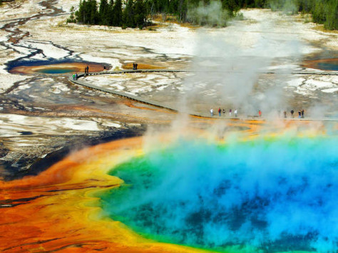
Yellowstone National Park
Mammoth, wy.

Salvation Mountain

Walt Disney World
Lake buena vista, fl.

Blue Whale of Catoosa
Catoosa, ok.
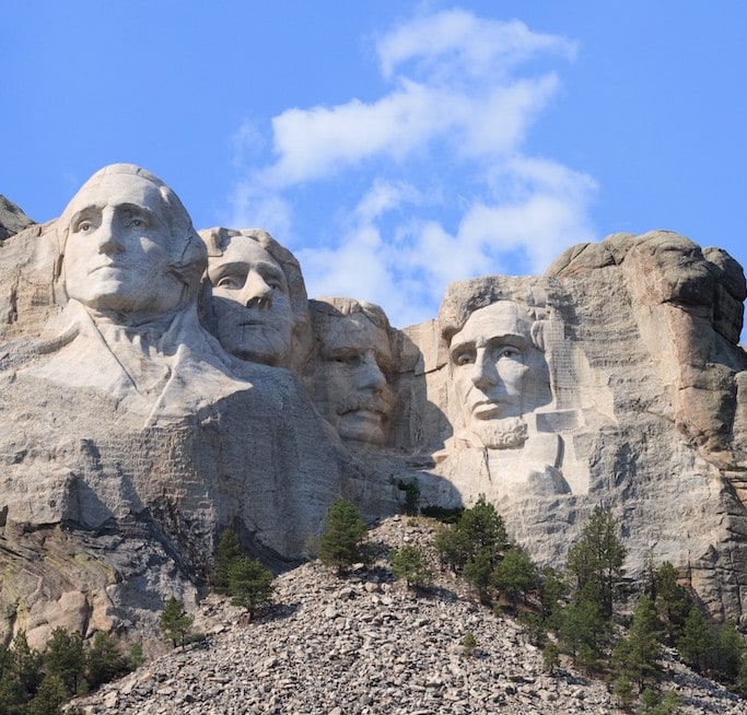
Mount Rushmore National Memorial
Keystone, sd.
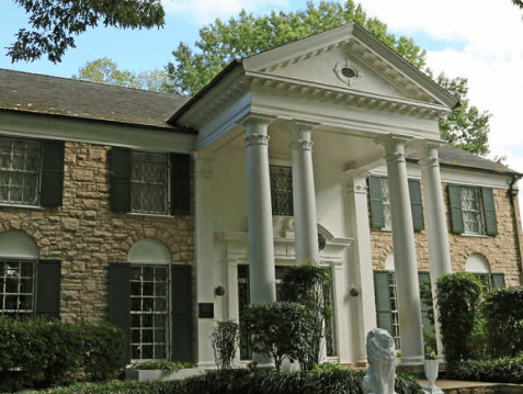
Graceland Mansion
Memphis, tn.

Glacier National Park
West glacier, mt.
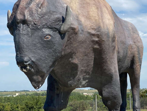
World's Largest Buffalo Monument
Jamestown, nd.

Yosemite National Park
Yosemite valley, ca.

Cadillac Ranch
Amarillo, tx.

Acadia National Park
Bar harbor, me.

Mothman Statue
Point pleasant, wv.
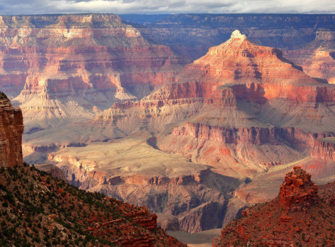
Grand Canyon National Park
Grand canyon village, az.

Statue of Liberty
Liberty island, ny.

Las Vegas Strip
Paradise, nv.

The Fremont Troll
Seattle, wa, build your perfect road trip.
Tell us where you want to go and what you'd like to see and do. Roadtrippers will help you find all the best stops along the way.
- Places to Camp
- Sights & Attractions
- The Great Outdoors
- Bars & Restaurants
- Hotels & Unique Stays
- Activities & Experiences
- Fuel & Rest Stops
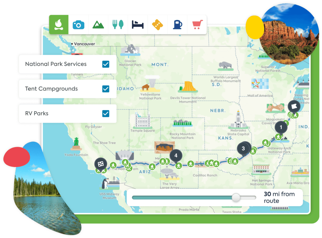
On all your devices
Any trips you've saved or places you love will sync automatically across devices.
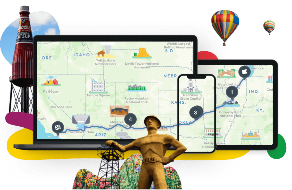
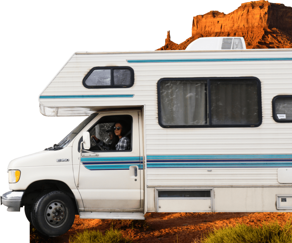
In-app RV navigation
Hit the road with safety and ease by using turn-by-turn directions, designed specifically for your RV. Simply enter your rig’s size and propane restrictions, and we’ll find the best routes to your next destination.
Ready to start your adventure?
- Sign up Log in Sign out
- Log in Sign out
Plan your journey, find amazing places, and take fascinating detours with our app.
If you used to sign in with Roadpass, you should now use the same username and password to log in directly with Roadtrippers above.
We couldn't find an existing Roadtrippers account using that service. Please try signing in with another option.
We need your email address to send you trip itineraries and other updates.
How do you want to plan your trip?
With just a few questions, our newest Premium feature, Autopilot, will plan your next adventure.
- Skip to global NPS navigation
- Skip to this park navigation
- Skip to the main content
- Skip to this park information section
- Skip to the footer section

Exiting nps.gov
Alerts in effect, road status.
Longmire-to-Paradise Winter Road Opening Decision Matrix NOTE: Closed roads may be open to non-motorized vehicles like bicycles . CHECK SIGNS on closed road gates before proceeding. During snow plowing operations or when otherwise posted, park roads are closed to all use, including hiking, skiing, snowmobiles, and bicycling.
All vehicles are required to carry tire chains when traveling in the park during the winter season (Nov 1 - May 1).
This requirement applies to ALL vehicles (including four-wheel drive), regardless of tire type or weather conditions. Review the Tire Chain Frequently Asked Questions for more information or learn more about Winter Recreation at Mount Rainier.
Last updated: June 7, 2024
Park footer
Contact info, mailing address:.
55210 238th Avenue East Ashford, WA 98304
360 569-2211
Stay Connected
- Skip to content
- Accessibility
Travel updates
We want to get you the information you need so you can plan your journey.
Travelling now?
Live traffic and incident information from Traffic England
Travel alerts (breaking news)
Updates on active major incidents that may impact your journey.
Travelling later?
Build your own traffic report about issues on our network that may impact your journey now or in the future.
Daily closure report
Advance notification of full closures on England’s network. Now filterable online (.XLS file still available for those that need it).
Abnormal loads
Application forms and guidance material useful when wishing to make an abnormal loads movement by road in England.
Motorway service access guides
The guides will help you plan where to stop for a break at any one of the 114 motorway service areas across England.
Follow us on social media
Our social media channels give you important information about using our roads safely and help you see what is happening on our road network.
Mobile services
We provide a range of mobile services designed to allow you to stay in touch with our latest information and traffic updates on the move.
Keep up-to-date
Sign up to email updates to keep you informed about roadworks and incidents on our network.
Useful Links
- Traffic information RSS feeds
- Commercial vehicles
- The Orwell Bridge
- Advice for recovery operators on our motorway network
- Network claims
For traffic flow information please visit Traffic England

Southington police announce detours, road closures during wake for TFC Aaron Pelletier
Published june 3, 2024 • updated on june 3, 2024 at 12:25 pm.
Southington police have announced a series of detours and road closures that will be in place for the calling hours for Trooper First Class Aaron Pelletier.
The calling hours will be held at Della Vecchia Funeral Home at 211 N. Main Street in Southington on Tuesday. They are open for family and friends from 12 p.m. to 3 p.m. and for members of the law enforcement community from 5 p.m. to 8 p.m. The calling hours are not open to the general public.
Free 24/7 Connecticut news stream: Watch NBC CT wherever you are
TFC Pelletier was killed in the line of duty when he was hit by a pickup truck while conducting a traffic stop on I-84 in Southington on Thursday.
The following detours and road closures will be in place Tuesday from 10 a.m. until 9 p.m., according to police.
Get Connecticut local news, weather forecasts and entertainment stories to your inbox. Sign up for NBC Connecticut newsletters.
All traffic traveling southbound on Route 10 will be detoured at the following intersections:
- Eastbound traffic at Flanders Road
- Westbound traffic at Curtis Street
All traffic traveling northbound on Route 10 will be detoured at the following intersections:
- Eastbound traffic at Berlin Street
- Westbound traffic at Columbus Avenue
Road closures
No traffic will be permitted on Route 10 beginning at the following intersections:
- Southbound at Chapman Street
- Northbound at Mill Street
Parking/shuttle for the services will be at:
- Calendar House Senior Center, 388 Pleasant St, Southington
- Joseph A DePaolo Middle School, 385 Pleasant St, Southington
The roads along these routes will be designated at "No Parking" and violators will be subject to towing and/or a fine, police said.
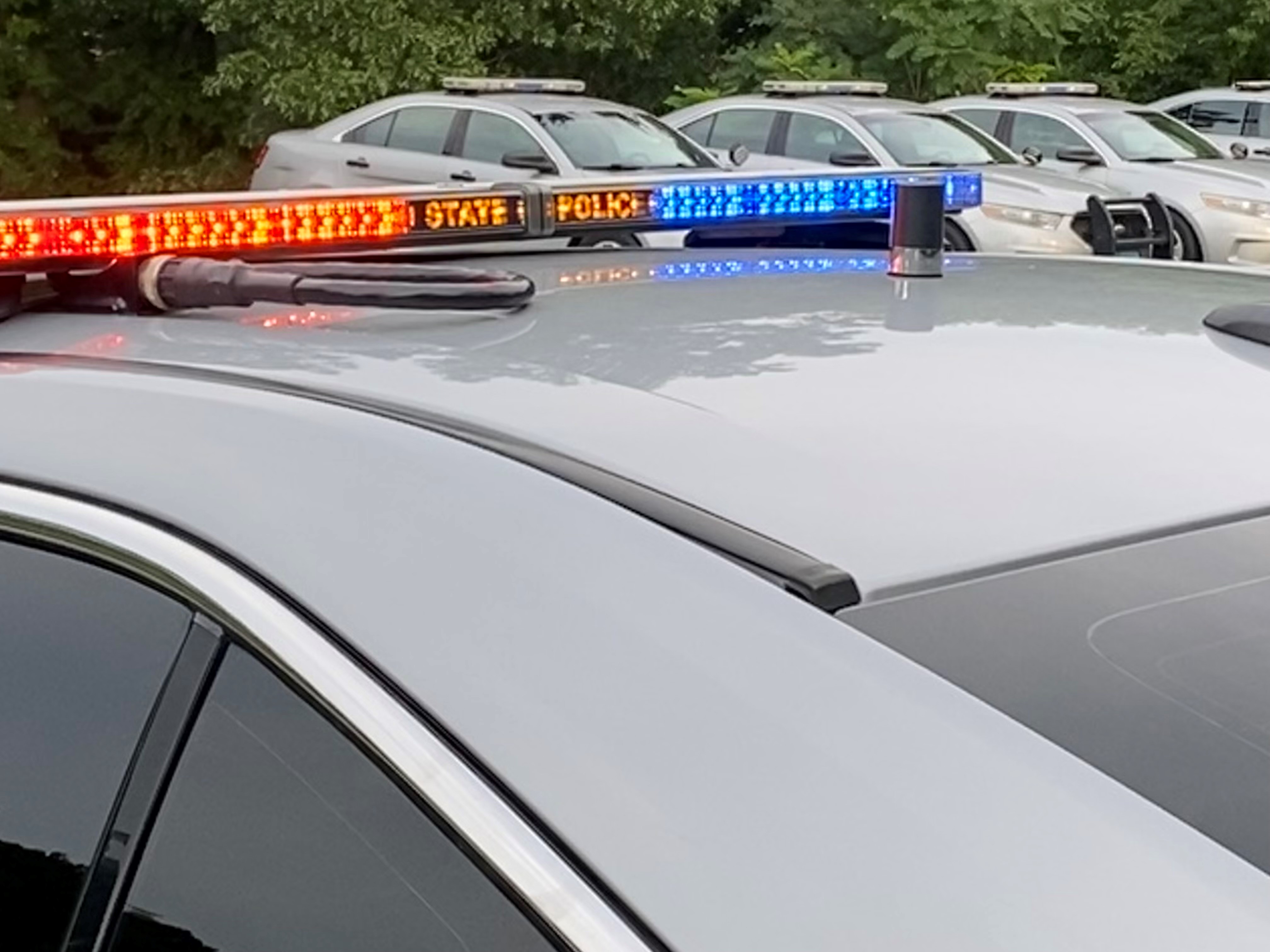
Police search for driver after 2 were struck and killed on Route 5/15 in East Hartford

Sunny with temperatures in the 80s on Friday
A funeral service will be held for TFC Pelletier at the Xfinity Theatre in Hartford Wednesday at 11 a.m.
This article tagged under:

More weekend Interstate 17 closures happening this weekend. Here's what to know
A portion of northbound Interstate 17 is scheduled to be closed for the weekend due to pavement improvement work, the Arizona Department of Transportation announced.
As a continuation of recent weekend closures on I-17, which have caused significant traffic delays over the past weeks , ADOT announced another planned weekend obstruction on the interstate, this time northbound between Happy Valley Road and Loop 303 in north Phoenix from 10 p.m. Friday to 5 a.m. Monday.
Northbound I-17 on-ramps at Deer Valley and Pinnacle Peak roads will also be closed, ADOT stated.
Start the day smarter. Get all the news you need in your inbox each morning.
The posted detour follows westbound Happy Valley Road to northbound Lake Pleasant Parkway and eastbound Loop 303 back to I-17, ADOT said. The detour route from last weekend's southbound I-17 closure , which will operate in the opposite direction during this upcoming closure, helped "move traffic efficiently" during the obstruction, ADOT added.
Crews are continuing a "much-needed project to improve the ride on I-17," ADOT said, adding that this weekend's improvements are the last of an initial four-weekend closure. However, additional I-17 closures or lane restrictions will occur in the future as the work proceeds, ADOT added.
Crews are removing a top layer of older, worn asphalt pavement and will create a smoother surface between Happy Valley Road and State Route 74 in a process known as diamond grinding, according to ADOT. The roadwork ensures crews can "safely and effectively" remove the surface asphalt and clear as much dust and debris as possible before the freeway reopens, ADOT said.
As always, ADOT encourages Valley motorists to expect delays and to schedule their commute accordingly, such as allowing extra time for travel and opting for alternate times for departure.
Additionally, ADOT advises drivers to remain on the designated detour route, as using local streets as alternate routes can cause longer delays. Law enforcement officers will be stationed at intersections throughout the area to assist with traffic flow, ADOT added.
Despite lengthy traffic backups being "unavoidable," ADOT also suggested motorists consider using Interstate 10 in the West Valley to northbound Loop 303 as an alternate detour route.
For free updates and information regarding Phoenix-area freeway projects, drivers are encouraged to subscribe on ADOT's website at https://azdot.gov/home .
Those interested in upcoming I-17 projects can visit http://www.improvingi17.com/ for more information. Traffic alerts to various freeway projects can be found at azdot.gov/projects .
This article originally appeared on Arizona Republic: More weekend Interstate 17 closures happening this weekend. Here's what to know


Major routes in Franklin will shut down to traffic Wednesday and Thursday as CSX works on train tracks

NASHVILLE, Tenn. (WTVF) — I have a heads up for Franklin drivers! Major routes will shut down to traffic today and tomorrow as CSX works on train tracks in the area.
This will affect important downtown traffic flows.
Today the city tells us CSX will work on the tracks on Highway 96 also known as 3rd Avenue near the Harpeth River. Use Liberty Pike as your detour to east and west between downtown and Mack Hatcher.
Tomorrow, crews will be on Lewisburg Pike near Carnton Lane. Use Columbia Avenue and Highway 96 instead.
The city estimates the work could span from 6 a.m. to 9 p.m.
Carrie: https://ewscripps.brightspotcdn.com/2e/72/be0f23854c54a228c9d6138c9847/carrie-recommends-header.png
Ben: https://ewscripps.brightspotcdn.com/df/c4/19fa7c504480938f39a431e3b276/ben-recommends-header.png
Amy: https://ewscripps.brightspotcdn.com/b9/b6/1408516a4a91b97639b178fc1ba9/amy-recommends-header.png
Rhori: https://ewscripps.brightspotcdn.com/5b/25/a224d13d47739165c92b94e643db/rhori-recommends-header.png

I think we can all remember our favorite teachers. In so many ways they leave an imprint on our lives. Get your tissue ready for Forrest Sanders' story on Ms. McMurray. She has poured so much into her students, and they are returning the love when it's needed most.
-Carrie Sharp

Our gift to the Nashville community
Politics | Former President Trump’s Newport Beach visit…
Share this:.
- Click to share on Facebook (Opens in new window)
- Click to share on Twitter (Opens in new window)
- Click to share on Reddit (Opens in new window)
- Click to print (Opens in new window)
- Investigative Reporting
- Environment
Politics | Former President Trump’s Newport Beach visit means road closures, traffic impacts

Bayside Drive, from Jamboree Road to Pacific Coast Highway, will be closed to motorists from 7 a.m. to around 3 p.m. on Saturday, according to the city’s plans. Local residents will be able to access the road, but only with proof of an address, like a photo ID or passport.
There will be no parking along the entirety of Harbor Island Road; residents will need to find other parking until about 3 p.m., the city said.
Beacon Bay, Habor Island, Promontory Bay and Promontory Point residents will be able to access their houses during Trump’s event through Pacific Coast Highway and Bayside Drive. Access to Linda Isle’s gated community will also be limited to those two roads.
Residents who are expecting guests on Saturday should accompany them into the community, the city said, because those without proof of residency will be turned away.
These traffic plans are subject to change, noted Sgt. Steven Oberon, a spokesperson for the Newport Beach Police Department.
The Bayside Shopping Center is scheduled to remain open for now — but could still be impacted by the event, according to the city.
“Please be flexible as this will be a dynamic situation,” said the city’s notice to residents.
Trump is in town as part of a fundraising swing following his felony conviction last week. Tickets for the Newport Beach event, hosted by entrepreneur Palmer Luckey and John and Kimberly Word, range from $3,300 to attend the luncheon to $100,000.
It is not known exactly how Trump plans to traverse from Los Angeles County down to Orange County and arrive in Newport Beach.
Trump’s visit to Newport Beach’s Lido Isle in 2020 for a fundraiser — also hosted by Luckey — caused traffic headaches, especially for those who were coming in from out of town. Newport Beach residents and employees of nearby docks and restaurants were alerted to Trump’s visit and traffic impacts the day prior to the visit, but non-residents did not get such a heads up, the Southern California News Group reported at the time .
Since the conviction, Trump’s campaign and the Republican National Committee have said they’ve seen an influx of donations. Earlier this week, the campaign and RNC said they hauled in $141 million in May, attributing the support as a response to the verdict in Trump’s hush money trial. Other pro-Trump organizations brought in an additional $150 million in May, they said.
Supporters who aren’t attending the high-dollar fundraisers plan to line the streets in both Newport Beach and Beverly Hills to welcome the former president.
No major road closures are expected in Beverly Hills on Friday. Rolling closures are expected to shut down intersections briefly while Trump’s motorcade passes through, according to the Beverly Hills Police Department.
Staff writer Clara Harter contributed to this report.
- Newsroom Guidelines
- Report an Error
More in Politics

Retail | How a Depression-era law could be used to make booze cheaper

Ex-LAPD officer Mark Fuhrman barred from policing 29 years after lying at OJ Simpson trial

National Politics | Biden reelection campaign launches push for Republican votes

National Politics | Mark Meadows arraigned in Arizona fake Trump electors scheme

Official websites use .boston.gov
A .boston.gov website belongs to an official government organization in the City of Boston.
Secure .gov websites use HTTPS
) or https:// means you've safely connected to the .gov website. Share sensitive information only on official, secure websites.
Traffic Advisory for June 1-8, 2024
Events in the City of Boston will bring parking restrictions and street closures.
People attending events are encouraged to walk, bike, or take public transit.
Information on Bluebikes, the regional bike share service, may be found on the website and information on the MBTA may be found online .
BACK BAY/ SOUTH END
Boston Pride for the People Parade – Saturday, June 8, 2024
The Boston Pride for the People Parade will take place along the historical route of the Boston Pride Parade, stopping at Boston Common. The route: Boylston Street at Clarendon Street, right onto Clarendon, left onto Tremont Street, left onto Berkeley Street, right onto Boylston Street, left onto Charles Street ending at Boston Common. The parade starts at 11 a.m. The route will be closed to traffic during the parade.
Parking will be restricted on the following streets:
- Boylston Street, Both sides, from Dalton Street to Tremont Street
- Beacon Street, Southside (Boston Common side), from Charles Street to Park Street
- Berkeley Street, Both sides, from Tremont Street to Newbury Street
- Clarendon Street, Both sides, from Newbury Street to Tremont Street
- Dartmouth Street, Both sides, from Newbury Street to St. James Avenue
- Exeter Street, Both sides, from Newbury Street to St. James Avenue
- Fairfield Street, Both sides, from Boylston Street to Newbury Street
- Gloucester Street, Both sides, from Newbury Street to Boylston Street
- Hereford Street, Both sides, from Boylston Street to Newbury Street
- Tremont Street, Both sides, from Union Park Street to East Berkeley Street
- Charles Street South, Both sides, from Park Plaza to Boylston Street
- Charles Street, Both sides, from Boylston Street to Beacon Street
BACK BAY/ BEACON HILL/ GOVERNMENT CENTER
The Ancient Honorable Artillery Company Of Massachusetts, Monday, June 3, 2024
The parade will take place in three phases over the following streets:
- Phase one – 12:30 p.m.: North Street, left onto Congress Street, right onto State Street, straight onto Court Street, left onto Tremont Street, to Boylston Street, to Charles Street entering Boston Common for the Drum Head Election and the Change of Command Ceremony at the Parade Grounds at 1:3o p.m.
- Phase two – 2:00 p.m.: Drum Head Election and the Change of Command Ceremony at the Parade Grounds
- Phase three – 2:45 p.m.: From Boston Common to Charles Street to Park Plaza to Columbus Avenue to Saint James Avenue, to Dartmouth Street to Old South Church, arriving no later than 3:15 pm for a retreat ceremony followed by a church service at Old South Church.
Boston Dyke March, Friday, June 7, 2024
The March begins at 7 p.m. and takes place over the following streets: Parkman Bandstand - Boston Common, right onto Charles Street, left onto Beacon Street, left onto Arlington Street, right onto Commonwealth Avenue, left onto Clarendon Street, left onto Boylston Street, returning to Boston Common at the corner of Boylston Street and Charles Street.
BEACON HILL
Beacon Hill Arts Walk – Sunday, June 2, 2024
The annual Beacon Hill Arts Walk will take place from noon to 6:00 pm with physical set up beginning at 9:00 am. This event will close West Cedar Street
to through traffic and eliminate parking on the street.
Parking restrictions will be in place on the following street:
- West Cedar Street, Both sides, from Phillips Street to Cambridge Street
Blarney Stone 5k Road Race, Sunday, June 2, 2024
The race will take place over the following streets: Dorchester Avenue at the Blarney Stone, outbound to Lower Mills, turn around just before Mother Julia Road in Lower Mills and return to the Blarney Stone. The race starts at noon.
Dorchester Day Parade – Sunday, June 2, 2024
The annual Dorchester Day Parade will take place on the same route as in previous years: Dorchester Avenue from Richmond Street to Columbia Road. The parade starts at 1 p.m. and should be completed by 4 p.m. The route will be closed to traffic during the parade.
- Dorchester Avenue, Both sides, from Pierce Square (Adams Street, Washington Street, Dorchester Avenue) to Columbia Road
- Adams Street, Staging Both sides, Pierce Square (Adams Street, Washington Street, Dorchester Avenue) heading southerly to the Milton Line
- Richmond Street, Staging, Both sides, from Washington Street to Adams Street
- Butler Street, Staging, Both sides, from Adams Street to Richmond Street
- Washington Street, Staging, Both sides, from Gallivan Boulevard to Morton Street / Richmond Street
Zuave, Saturday, June 1, 2024
The annual Zuave event will be taking place in part on Talbot Avenue and parking restrictions will be in place from 8 a.m. to 8 p.m. on the following street:
- Talbot Avenue, Both sides, from Nightingale Street to Wales Street
WEST ROXBURY
Annual Corrib Classic 5k Road Race, Sunday, June 2, 2024
The race will take place over the following streets: Lagrange Street, right onto VFW Parkway, right onto Corey Street, left onto Weld Street, right onto Maple Street, right onto Centre Street, left onto Bellevue Street, right onto Howitt Street, right onto Lagrange Street to Billings Field
The race will start at noon with street closures from 11:30 a.m. to 12:30 p.m. to accommodate the 2,500 runners.
- Last updated: May 29, 2024


IMAGES
VIDEO
COMMENTS
Driving directions. Leave now. 41.878 | -87.630. Edit your arrival time. Got it. Realtime driving directions based on live traffic updates from Waze - Get the best route to your destination from fellow drivers.
The Arizona Travel Information system provides users the most curent road conditions, access to ADOT's statewide network of highway cameras and more information, including: Crashes/incidents (Heavy, Medium, Minimal, Future) Delays/roadwork (Full, Partial, Future) Closures (Medium, Low, Future) Highway info/activities. Weather advisories/forecasts.
Road Trip Weather: Check for snow, rain, storms, tornados, high winds and radar on your route with the Drive Weather App.
Highway Weather is the best weather app for traveling. Our interactive features provide ongoing updates for road weather information based on your specified arrival and departure times. You'll know when to stay on the road, when to get off the road, which road to take — and where to steer clear of debilitatingly bad weather.
There's no additional information right now. Provides up to the minute traffic and transit information for Pennsylvania. View the real time traffic map with travel times, traffic accident details, traffic cameras and other road conditions. Plan your trip and get the fastest route taking into account current traffic conditions.
Plan Your Route. +. Track the weather and extreme weather situations along your route to make every trip a safe journey, whether it's sunny, rainy, or snowing.
Route Legend Camera Guide. Provides up to the minute traffic and transit information for New York. View the real time traffic map with travel times, traffic accident details, traffic cameras and other road conditions. Plan your trip and get the fastest route taking into account current traffic conditions.
A Road Trip Weather App. Weather on the Way is a new travel weather app that provides a detailed weather forecast for your driving route. Thanks to combining forecasting and navigation, you get weather conditions precisely at a time you will be driving through. Perfect for road trips
Keep exploring with the Roadtrippers mobile apps. Anything you plan or save automagically syncs with the apps, ready for you when you hit the road! Plan your next trip, find amazing places, and take fascinating detours with the #1 trip planner. Every trip is a road trip.
How to use the Coeur D Alene Traffic Map. Traffic flow lines: Red lines = Heavy traffic flow, Yellow/Orange lines = Medium flow and Green = normal traffic or no traffic*. Black lines or No traffic flow lines could indicate a closed road, but in most cases it means that either there is not enough vehicle flow to register or traffic isn't monitored.
Travelmath helps you find the driving time based on actual directions for your road trip. You can find out how long it will take to drive between any two cities, airports, states, countries, or zip codes. This can also help you plan the best route to travel to your destination. Compare the results with the flight time calculator to see how much ...
Know B4 U Go: Real-time traffic info & details on closures, incidents, traffic cameras, and more. IBM WebSphere Portal. An official State of Ohio site. ... OHGO: Real-Time Traffic and Road Status Information. Know B4 U Go: Real-time traffic info & details on closures, incidents, traffic cameras, and more. Web Content Viewer. Actions.
Plan your trip with SafeTravelUSA, the one-stop site for traffic and weather conditions across the US.
The Trippy road trip planner automatically calculates the optimal itinerary including stops recommended by Trippy members, favorite restaurants and hotels, local attractions and things to do based on what people who live in the area have suggested, and more. Once you have a quick trip planned, you can customize every detail, adding or removing ...
Here are some of the worst congestion times within U.S. traffic corridors on Wednesday, the day before Thanksgiving: Atlanta: Interstate 85 South from Clairmont Road to Martin Luther King Jr ...
Download Idaho 511 App. Provides up to the minute traffic and transit information for Idaho. View the real time traffic map with travel times, traffic accident details, traffic cameras and other road conditions. Plan your trip and get the fastest route taking into account current traffic conditions.
Peak congestion times in major US cities. To steer clear of bumper-to-bumper traffic, be smart about the routes and timing of your drive. "Avoid peak commuting hours and use traffic apps, local ...
2,427 Reviews. View Hotel. Hilo, Island of Hawaii. Answer 1 of 6: Hello. We're leaving Kona tomorrow to head for Hilo for a few days. I was assuming we would take the saddle Road in the morning probably around 11 AM, but I'm reading about it now and it's getting a bit intimidating.
FREE FEATURES: • Weather - Rain, Snow, Fog, Freezing Rain, Tornados, Thunderstorms, Hail, Smoke, & Haze. • Temperatures. • Animated Radar. • Cloud Cover Forecast. • Compare Routes. • Time Tweaker for Truckers and RVers. • Free Version has ads, provides up to 2 days of weather forecast. • Area Weather for general weather.
Road Conditions. Provides up to the minute traffic and transit information for State View region in Idaho. View real time Road Conditions details on a list page.
This is an excellent feature for drivers. Traffic news results show all the issues that might cause problems and delays - roadworks, temporary traffic lights and accidents. You'll also get updates on the busiest sections of road, indicating how traffic is flowing. If all is going smoothly, for example, you'll be informed that traffic is ...
Keep exploring with the Roadtrippers mobile apps. Anything you plan or save automagically syncs with the apps, ready for you when you hit the road! Tall tales, trip guides, and the weird and wonderful. Plan your next trip, find amazing places, and take fascinating detours with the #1 trip planner. Every trip is a road trip.
Road Status - Updated May 31, 2024. This report is updated when road status changes. Check Alerts at the top of this website for road updates and announcements, including daily status of the Longmire gate in winter.. Weather can change quickly and affect road conditions. Webcams can also provide an idea of current weather conditions.; Plan ahead to avoid summer congestion.
Our social media channels give you important information about using our roads safely and help you see what is happening on our road network. Mobile services We provide a range of mobile services designed to allow you to stay in touch with our latest information and traffic updates on the move.
Plus, get real-time traffic information about delays and incidents along the way. If you're running low on fuel, you can find the nearest and cheapest place to top up. And if you need a parking space, we know just the spot. All you have to do is set the filters for the kind of parking you want, and away you go. Once you've found a space, our ...
Southington police have announced a series of detours and road closures that will be in place for the calling hours for Trooper First Class Aaron Pelletier. The calling hours will be held at Della ...
Here's what to know. A portion of northbound Interstate 17 is scheduled to be closed for the weekend due to pavement improvement work, the Arizona Department of Transportation announced. As a ...
Major routes will shut down to traffic today and tomorrow as CSX works on train tracks in the area. This will affect important downtown traffic flows. Today the city tells us CSX will work on the ...
Former President Donald Trump is headed to Newport Beach's Harbor Island on Saturday, June 8 — and that means road closures and expected traffic delays for residents of the Bayside Harbor ...
The annual Dorchester Day Parade will take place on the same route as in previous years: Dorchester Avenue from Richmond Street to Columbia Road. The parade starts at 1 p.m. and should be completed by 4 p.m. The route will be closed to traffic during the parade. Parking will be restricted on the following streets: