

Llucalari, in Menorca
Activities near cala llucalari.

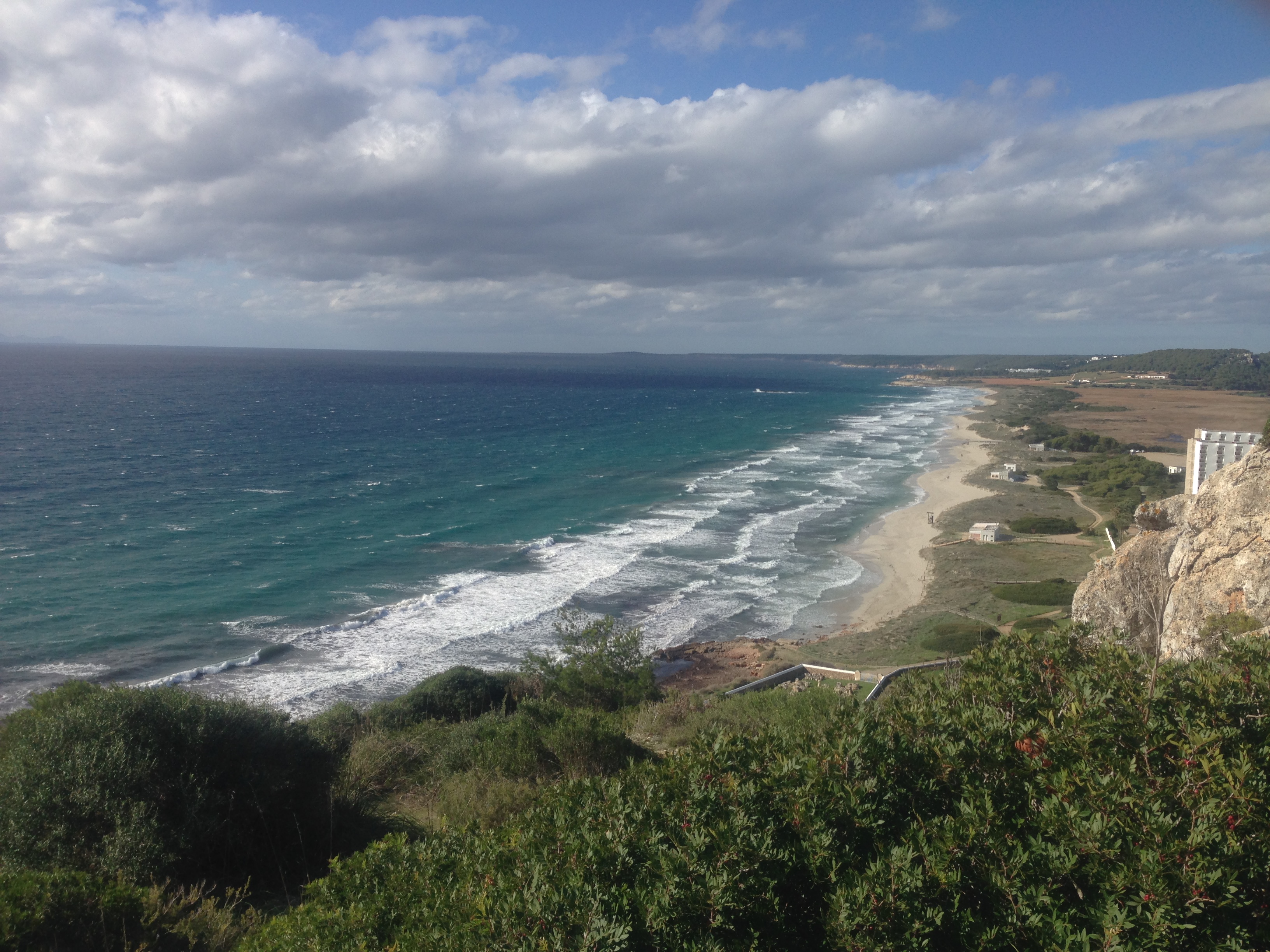
Cala Llucalari, totally lost in Menorca
Cala Llucalari is a secret beach in Menorca. Only a tiny bit of people know about it, making it a lonely place even in summer.
It is very close to Son Bou, towards the east, along the Camí de Cavalls. Specifically between the Ses Penyes cape and the Sa Calç cave. A natural and protected area.
How to get to Llucalari
To get there, you will have to do a bit of trekking along a path from the beginning of the Son Bou beach. First, you will have to follow the way of skirting the majestic cliffs in the area. The track, known as Camí de Cavalls, goes around Menorca, and in this case, you will have to pass through Mahón beaches.
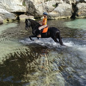
A good option is to get to Llucalari by bike, and much better if it is a mountain bike. The path to the cove is incredible for fans of adrenaline and cycling.
Has no sand
South winds affect Llucalari beach. On the shore, you will appreciate round stones known as macs instead of sand. They are usually white or greyish.
It usually has a lot of algae.
Algae tend to be present most days; perhaps that is why the cove is not popular with visitors. However, being natural does not take away from the fact that you are in one of the island's loneliest and most unspoilt coves.
Tips for visiting Llucalari
Bring enough water and food.
Do not expect a cove with services; you should bring water and food if you go to this beach to spend the day. However, if you have forgotten and you are already there, the Son Bou urbanization has a supermarket and several good restaurants where to eat.
Not much coverage
Bear in mind that once you descend the ravine and have flanked its high cliffs, you may be uncommunicated. Tell a friend or somebody that you have been to this cove in case you have an incident.
Don't forget some diving goggles!
If you go with the idea of diving, this cove is so unspoiled that the fish are not used to human presence. In addition, goggles and fins are essential to enjoy the sea.
As you move away from the shore, you will see marine life appear everywhere. Cala Llucalari is a very rocky area with expansive meadows of Oceanic Posidonia.
Nearby beaches

Map of Beaches
Son Bou and Llucalari
Discover the cliffs of llucalari and son bou beach.

Crowded area
Very clear waters and cliffs.
Once past the cliffs of Canutells and Llucalari, we arrive at the longest beach in Menorca . Son Bou.
With 2.4 kilometers long and 120m wide, it has an urbanization, hotels and restaurants and at the end of it a wild and totally virgin area called Atalis.
Son Bou has European quality certifications and therefore the Blue Flag .
The bottom is white sand making the water turquoise, small rocky areas and meadows of posidonia oceanica.
We normally anchor with our llaut very close to the cliffs of Llucalari, making them protect us from the waves. From there, you can reach the shore of the beach swimming or directly with the south paddle without problem.
For the more adventurous, once you reach the shore and have passed the Roman basilica, you can walk and reach the cliff of Llucalari where from there you can appreciate the immensity of the beach.
Another smaller and much more exclusive beach is Cala de Llucalari. This small cove is anchored between cliffs and offers very interesting areas for diving and exploring underwater caves.
From Llaut Menorca, we offer this boat excursion daily, departing from the port of Mahón and lasting 2 hours without stopping at other places.
Check our prices and the list of excursions.

Do you want more excursions?
Punta prima, es canutells.
Camí de Cavalls: from Son Bou to Cala en Porter
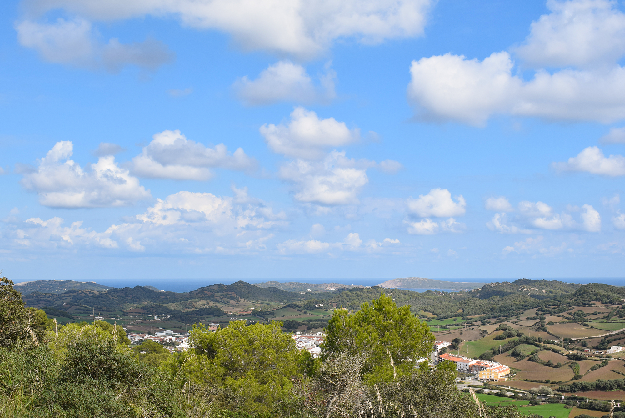
We have a few stages left of the Camí de Cavalls to complete a full circuit of the route that circles the island of Menorca and today we will walk from Son Bou to Cala en Porter, a stretch that is characterized by wetlands and ravines that are found at both ends – west and east.
The route starts where we left it, near the Early Christian Basilica of Son Bou . For those who missed it in the previous stage, you will have the opportunity to visit this before starting the walk. The path starts with a climb but leads to an impressive panoramic viewpoint to contemplate Son Bou from a watchtower. Then, the path follows a pronounced descent to sea-level, specifically to Cala Llucalari , a pebbly cove rarely visited.
The Camí de Cavalls continues with a 2 kilometers climb, which will lead us to an area of typically Menorcan landsacape: a mosaic of farmland alternating with areas of wild olive trees. By the way, for those who enjoy archaeology as well as walking, the excursion passes very close to Torre d’en Galmés , the largest Talayotic settlement on the island. It is located further north of the road that crosses the path and without a doubt, it is worth a visit.
After 4.5 kilometers, we begin to descend towards the Cala en Porter ravine, whose walls protect bird nests and rock-dwelling plants, as well as offering protection to the fruit orchards that predominate in the landscape. For a long time, the Menorcans have taken agricultural produce from these fields and their zero kilometer products can be found in markets and restaurants all over the island.
Almost at the end of the ravine and entering the beach of Cala en Porter, the water of the torrent creates a wetland . The beach of Cala en Porter is another of the wonderful corners of Menorca with white sand, hidden between cliffs and frequently visited during the high season. If the weather suits, it is worth a dip as a final reward for our excursion.
Distance : 8 km
Estimated time with stops at interesting points : 3 hours and a half
Difficulty : Medium

Written by Bonnin Sansó
Posts you may also like.
Route through Sa Penya de s’Indio, an excursion for the wh...
Enjoy Menorca’s cuisine with the Menorca Gastronomic days
LITHICA: an old quarry converted into a magical place

Castel of Santa Agueda
Four beaches to visit in 2020
The Talayotic village of Sant Agustí
Cala Llucalari

Top ways to experience nearby attractions
Most Recent: Reviews ordered by most recent publish date in descending order.
Detailed Reviews: Reviews ordered by recency and descriptiveness of user-identified themes such as wait time, length of visit, general tips, and location information.
Also popular with travelers
CALA LLUCALARI: All You Need to Know BEFORE You Go (with Photos)
Cala Llucalari

they say is cool
Nelle vicinanze
There are 75 beaches near Alaior

Migjorn Gran - Hidden, Sandy

Cala en Porter
Alaior - Fashion, Sandy, Equipped beach

Playa de Sant Tomas
Migjorn Gran - Fashion, Sandy, Equipped beach

Playa de Binicodrell

Playa de Binigaus
Migjorn Gran - Fashion, Sandy

Cales Coves
Alaior - Hidden, Gravel

Cala Escorxada

Cala Fustam

Cala Canutells
Maó - Hidden, Sandy

Cala Trebaluger

Cala Mitjana
Ferreries - Fashion, Sandy, Snorkeling

Cala Binidali
guarda tutte le spiagge nelle vicinanze di Alaior
Embed this beach on your website
Cala Llucalari
Top ways to experience nearby attractions
Most Recent: Reviews ordered by most recent publish date in descending order.
Detailed Reviews: Reviews ordered by recency and descriptiveness of user-identified themes such as waiting time, length of visit, general tips, and location information.
Also popular with travellers
CALA LLUCALARI: All You Need to Know BEFORE You Go (with Photos)
Beaches in Menorca, guide of the best beaches and coves in Menorca.
Cala de Llucalari
- Information on the beach
INFORMATION ON THE BEACH
Cala de Llucalari is a small pristine cove east of Platges de Son Bou. It is situated among cliffs and its access is through Camí de Cavalls, so it looks like a torrent.
Length = 40 m , Width = 30 m .
From second line of Platja de Son Bou, at the most eastern end, there is an information sign from the beginning of Camí de Cavalls, follow this path to the east for approximately 1 km until you reach Cala de Llucalari.
Nearby restaurants
NO RESTAURANTS CLOSE TO THIS AREA
Pictures of Cala de Llucalari
Hotels near the beach, activities to do near cala de llucalari.
( a 231 metros ).
( a 1974 metros ).
( a 3215 metros ).
( a 4650 metros ).
- Cala en Porter
- Sant Adeodat
- Cales coves
- Cala Escorxada
- Cala Fustam
- Cala Canutells
- Macar d´es Canutells
- Disfruta la playa
- Scuba diving
- Beach sports
- Balearic fishing
- Follow us in Facebook
- Follow us in Twitter
- Our videos on beaches in Youtube
Son Bou - A Comprehensive Guide to Menorca's Hidden Gem
The Mediterranean island of Menorca remains an enchanting enigma, captivating visitors with its blend of pristine beaches, historical richness, and serene landscapes. Among its many jewels, Son Bou stands out as a must-visit destination. This guide will walk you through the wonders of Son Bou, from its stunning beach to its historical sites, ensuring your visit is nothing short of magical.
Table of contents
The splendid beach of son bou, the albufera of son bou, urbanizations: san jaime mediterráneo and torre solí nou, dining and leisure activities in son bou, exploring the rich history, the mirador de son bou, adventurous excursions, the prehistoric village of torre d’en gaumés, the military battery of llucalari, accessing son bou, why son bou is a must-visit destination.
Son Bou boasts the longest and most striking beach in Menorca. Stretching seamlessly along the coast, it offers an open-sea beach experience like no other. The extensive sands are backed by dunes, creating a natural barrier that separates the beach from the Albufera, a vital wetland area. Despite its popularity, the beach’s vastness prevents overcrowding, offering a peaceful retreat for sun-seekers.
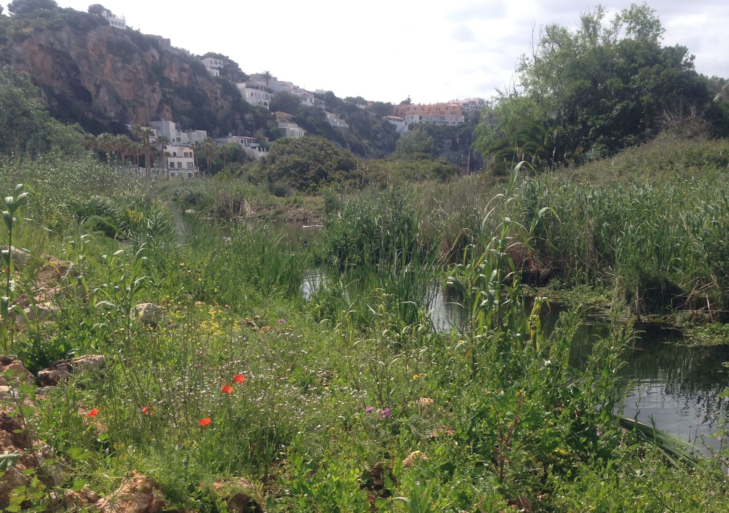
Adjacent to the beach is the Albufera of Son Bou, a protected wetland of significant ecological importance. This natural reserve forms an unbroken barrier between the beach and the nearby urbanizations, playing a crucial role in the local ecosystem.
Nestled in the hills surrounding the beach are the urbanizations of San Jaime Mediterráneo and Torre Solí Nou. These areas offer a range of accommodations, from charming chalets to large hotels, all integrated into the natural landscape to minimize visual impact.
Son Bou caters to all palates with its diverse gastronomic offerings. From local Menorcan cuisine to international dishes, every meal promises to be a delight. Besides dining, the area is rich in leisure activities, including water sports, diving courses, and a water park, ensuring endless fun for all ages.
History buffs will appreciate the Paleochristian Basilica of Son Bou, a remarkable open-air museum showcasing Roman presence on the island. Additionally, the nearby cliffs house modern-day troglodytes in caves, some even equipped with modern amenities like TV.
For breathtaking views, head to the Mirador de Son Bou. Accessible via a scenic trail, this viewpoint offers spectacular sunsets over the Mediterranean, with the bay of Cala Llucalari visible across the water.
Adventure seekers can embark on a hike from Son Bou to Santo Tomas beach. This journey, taking about an hour, lets you experience the diverse coastal landscapes of Menorca. In the evening, the dunes become a serene spot to relax and listen to the symphony of migratory birds in the Albufera.
Close to Son Bou lies Torre d’En Gaumés, one of Menorca’s largest and best-preserved prehistoric villages. The site offers a glimpse into the island’s ancient past and is a testament to its historical significance.
A short distance from the prehistoric village is the Llucalari military battery. Once a key defensive point with large cannons, it now stands as a historical relic offering stunning coastal views.
Reaching Son Bou is straightforward, with clear directions from nearby Alaior and the main road connecting Maó and Ciutadella. The journey itself is a scenic introduction to the area’s beauty.
Son Bou’s unique blend of natural beauty, historical richness, and vibrant community life makes it an irresistible destination for travelers seeking an authentic Menorcan experience.
Son Bou is more than just a destination; it’s an experience that stays with you long after your visit. Its harmonious blend of nature, history, and culture makes it an essential part of any Menorca itinerary.
What is the best time to visit Son Bou?
- The best time to visit Son Bou is during the late spring and summer months, from May to September. This period offers warm and sunny weather, perfect for enjoying the beach and outdoor activities. However, if you prefer a quieter experience with milder temperatures, consider visiting during the shoulder seasons in April or October.
Are there family-friendly activities in Son Bou?
- Yes, Son Bou offers a wide range of family-friendly activities. You can explore the beach with your children, visit the water park for a day of fun, or take part in various water sports suitable for all ages. Additionally, the natural surroundings and historical sites provide opportunities for educational outings.
How do I get to the Mirador de Son Bou?
- Take the road leading into the Son Bou urbanization.
- Pass through the tunnel and stay on the right side of the road.
- Look for a pathway leading to the cliff’s edge. If you’re driving, there’s a left turn about 300 meters after the tunnel. Leave your vehicle here.
- Proceed through a small forested area, and you’ll find a well-marked trail that takes you to the viewpoint. The trail is well-trodden and easy to follow, making it accessible both on foot and by car.
What are the must-visit historical sites near Son Bou?
- Some of the must-visit historical sites near Son Bou include the Paleochristian Basilica of Son Bou, showcasing Roman history, and the nearby troglodyte caves. Additionally, the prehistoric village of Torre d’En Gaumés and the historic military battery of Llucalari offer insights into the island’s past.
Can I find diverse dining options in Son Bou?
- Yes, Son Bou offers a diverse range of dining options to cater to different tastes. You can savor local Menorcan cuisine, seafood, international dishes, and more. There are restaurants, cafes, and eateries that provide a variety of culinary experiences, ensuring you can find something to suit your palate.
- son-bou
- beaches
- history
- nature
- Cala Llucalari
Playas del Sur de Menorca
Cala llucalari es una cala virgen del sur de menorca y vecina de son bou , y muy poco frecuentada aunque de muy bonito paisaje.

Como hemos mencionado anteriormente, esta cala es virgen, y además, es muy poco frecuentada, por ello entonces supone un paraje muy tranquilo y exclusivo, apto para venir con familia, amigos o en pareja. Esta situada al sur-este de Son Bou y es con un talud de grava y arena, pero a medida que nos vamos adentrando en el agua vemos zonas de arena y algas.
Es una cala muy poco frecuentada, debido a la relativa dificultad que supone llegar a ella y el poco interés turístico que tiene, pero sin embargo, tiene un interés paisajístico increible. El barranco que encontramos, que es la causa de la formación de la cala, forma una verdadera entalla contra el peñascal de Llucalari , dando lugar a un paisaje muy bonito entre dos formaciones rocosas.
Se encuentra protegida por los vientos de este y oeste por las formaciones rocosas que se forman a sus costados, pero aun así queda totalmente desprotegida de los vientos del sur ( migjorn ), debido a esto, es normal encontrar algas en la cala.
Al ser una cala virgen, no tiene ningún tipo de servicio concreto para dicha cala, aunque esté cerca del núcleo urbano de Son Bou . Se desaconseja el fondeo de embarcaciones en dicha cala, ya que no es posible atracar en la zona costera de la cala y las condiciones subacuáticas no son favorables para ello. No obstante, podemos llegar a través del mar con pequeñas embarcaciones deportivas como el kayak, las cuales podemos alquilar en la zona de Son Bou si disponen de ese servicio en la playa.
Mapa de situación
Como llegar a cala llucalari.
Para llegar a esta recóndita cala, el mejor camino que podemos tomar es desde la urbanización de Son Bou . Se trata de tomar el legendario “Camí de Cavalls”, que curiosamente pasa por la urbanización y llega hasta cala Llucalari . Cerca de los apartamentos de Royal Son Bou Family Club, nos situamos cerca de la salida de la urbanización y por esta zona verde veremos indicaciones de Camí de Cavalls y señalizaciones de Cala Llucalari a 1,1 Km.
Reconoceremos el camino porque la entrada es una pared seca con una barrera de madera característica de Menorca y una entrada sin barrera. Basta con seguir ese camino y las indicaciones que podríamos encontrar en el para llegar rápidamente a la cala, aproximadamente hay unos 20 minutos de camino.
No hay un transporte habilitado para Cala Llucalari , pero si que podemos llegar en autobús a la urbanización de Son Bou durante los meses de verano.
Galería de Cala Llucalari

- Basílica de Son Bou
- Basílica de Es Fornàs de Torrelló
- Basílica de la Isla del Rey
- Necrópolis de Cales Coves
- Naveta des Tudons
- Necrópolis de Cala Morell
- Poblado de San Agustín
- Poblado de Santa Mónica
- Poblado de Son Catlar
- Es Talatí de Dalt
- Talayot de Binicodrell
- Torralba d'en Salord
- Torre d'en Galmés
- Torretrencada
- Torrellafuda
- Guía de Monumentos
- Situación y datos de la Isla
- Evolución Geológica de la Isla
- Climatología
- Vegetación y medio natural
- Sector Primário
- Industria y comercio
- Prehistoria - Cultura talayotica
- Fenicios, griegos y cartagineses
- Menorca Romana
- Cristianismo
- Los vándalos y el imperio bizantino
- La Menurka Islámica
- La conquista de Alfonso III
- El Reino de Mallorca
- La corona de Aragón
- Los saqueos turcos
- El siglo XVII
- Dominaciones extranjeras siglo XVIII
- Reintegración a España Siglo XIX
- El siglo XX
- Cronografía
- Cala Na Macaret
- Arenal d'es Castell
- Arenal De S'Olla de Son Saura
- Cala Tirant
- Playa de Binimel·là
- Cala Pregonda
- Cala Morell
- Cala en Bosch
- Son Xoriguer
- Cala en Turqueta
- Cala Macarella y Macarelleta
- Cala Galdana
- Cala Mitjana
- Cala Trebalúger
- Cala Fustam
- Cala Escorxada
- Cala Binigaus
- Playa de Binicodrell
- Santo Tomás
- Cala en Porter
- Cales Coves
- Es Canutells
- Cala Binidali
- Cala Binibèquer
- Playa de Punta Prima
- Cala de Alcaufar
- Cala de Sant Esteve
- Cala de sa Mesquida
- Albufera de Es Grau
- Cala Morella Nou
- Cala Tortuga
- Cala Blanca
- Costa Norte
- Faros de Menorca
- Guía Náutica
- Es Migjorn Gran
- Reserva de la biosfera

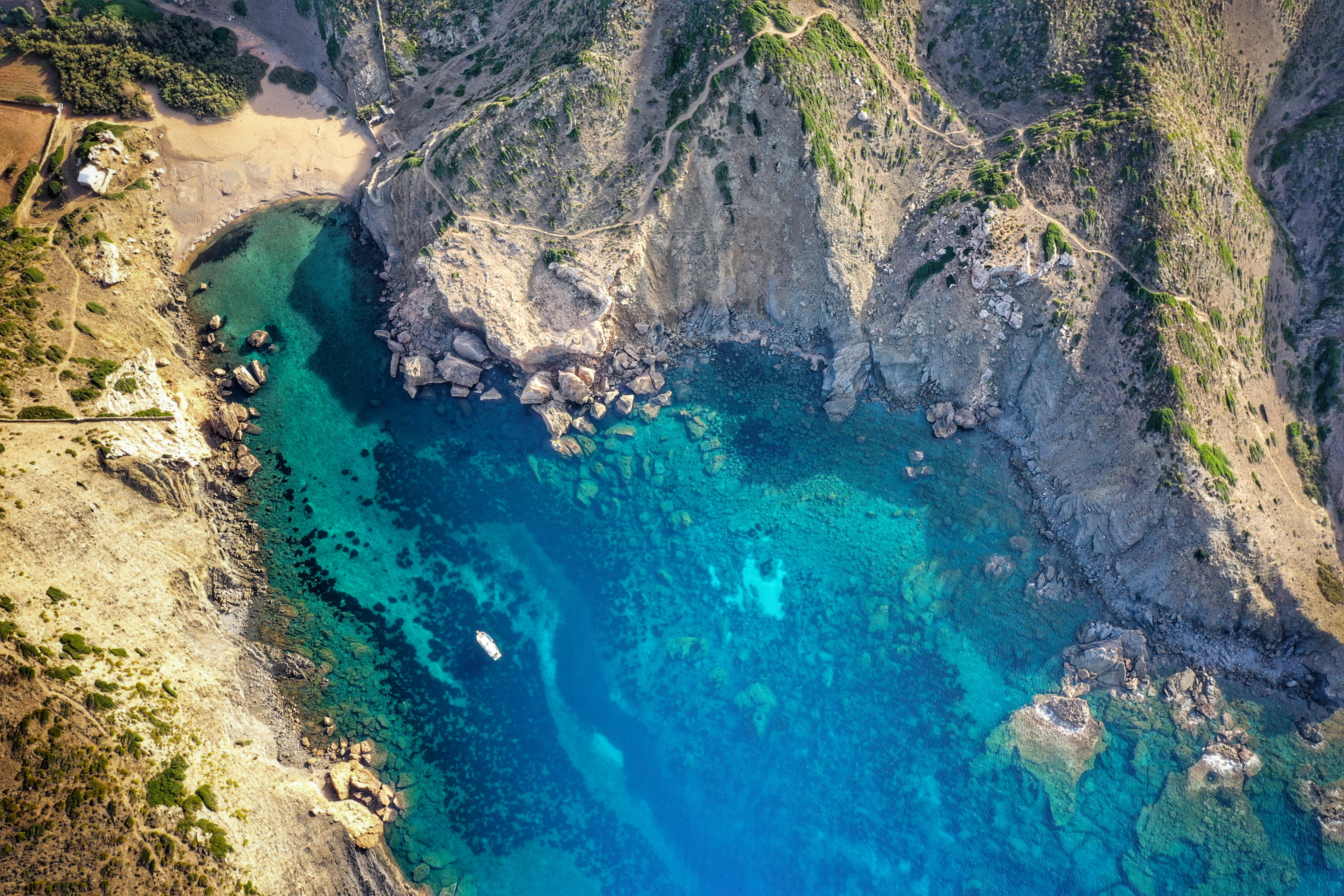
Llucalari Cove
A place that will captivate you.
Llucalari is a small rocky cove nestled between two very high cliffs where high sports are practiced. Close to Son Bou, this cove offers nature in its purest state and all the solitude that is impossible to find in its neighbor.
Little frequented by tourists, the ravines, the sound of birds flying through the region and its colors (the intense green of its vegetation, the deep blue of its waters and the gold of its sand), envelop you and trap you.
Those who visit Llucalari and its privileged environment, never want to leave it again.

Name: Llucalari Cove
Location : South Zone II (39°53’26.5 “N 4°04’54.9 “E)
Distance from Mahón : 17’5 MN ; 20 km
Time from Mahon : 1h 24 min by boat (average speed: 15 knots); 22 min by car
Type of beach: Rocky
Anchoring with boat : Sand and seaweed. It must be anchored outside the cove due to its shallow waters.
Dangerous access by boat: Medium. Rocks on the W face. Shallow depth
Posidonia: Yes
Nearest gas station for boats: 11’8 MN; Cala’n Bosch

NO SERVICES

WALK 1.2 Km

PADDLE SURF RENTAL
Discover the secret corners and beaches of Menorca!

RENT SCUBAJET
Explore the seabed with the Scubajet thruster. Expand your possibilities of use by motorizing your paddle surf .
Cala de Llucalari in Menorca, how to get there?
The easiest way to reach Son Bou is by road . If we start from Mahón, we will have to take the Me-1 towards Ciutadella and follow it until we can join Carrer Carretera Nova.
From there, we will have to follow all the signs to Carretera de Son Bou, which will take us to the beach of the same name and, once there, we will continue on foot along the Camí de Cavalls . From this beach we will have to walk a total of 1200 meters, through a steep terrain before we can enjoy the waters of Llucalari.

Services near Llucalari Cove
NO NEARBY SERVICES*.
*We consider them “close” if they are within a radius of 250-300 m approx.

What can we do in Cala de Llucalari?
Sand is scarce and boulders are abundant on this beach, so it is not the most suitable place to lie in the sun. It is also true that even the access to its waters is somewhat uncomfortable due to all the stones we find along the way. Of course, once we reach the shore, and we have the opportunity to go into the sea, it becomes as blue as it can be and the clarity of its clear waters makes swimming in it becomes a magical experience.
If we are in Llucalari, it is interesting to consider doing some section of the Camí de Cavalls . For example, the route that ascends to Ses Penyes offers spectacular views. In addition, if we want to walk a little further we should consider visiting the military batteries of Llucalari, where two of the five largest cannons of the Minorcan coast are located.
After years of abandonment, these batteries became home to squatters for a time, who took up residence there and turned the area into a village where the bunkers were inhabited, houses were rehabilitated, and even vegetable gardens and chicken coops were created. Several families came to occupy the site until they were evicted in 2011.
A little history never hurts, and the visit will not leave you indifferent.
How to get to Cala de Llucalari by boat?
To access Cala de Llucalari by boat, we must leave the port of Mahón heading SE. We will sail along the coast, leaving Illa del Rei to port.
We will continue out to the open sea, leaving the Punta de Sant Carles lighthouse to starboard.
Following the coastline in a southerly direction we will pass the outcrops of Na Girada and Punta Rafalet. We will continue skirting the island, which will take us in a SW direction and leave Punta Prima and Punta dels Marbres to starboard. At this point we will have the Illa de l’Aire on our port side.
Following the coastline, we will head NW and ascend passing Cabo Binibeca and Cap d’en Font. Past the Cala de Sant Llorenç, we will see the Cap de ses Penyes, and just in front of it (on its E side) a small inlet where the Cala de Llucalari is located.
Do you want to go to Cala de Llucalari by boat?

Cala Llucalari
Cala Llucalcari is situated at eight kilometres from Alaior ('the menorquin Montpellier'), located between Cap de ses Penyes and Cova de sa Calc. This beach is the result of the confluence of a sea inlet and the mouth of a torrent between canyons. This coastal corner is characterized by having a small size (50 metres long and 30 metres large), and a gravel and sand surface, a rare vegetation on the right side (bushes) and a thicker vegetation typical for wetland at the rear, as well as by being located between cliffs, the rocks on the left side are quite high, abrupt and steep. The southern area of Menorca is cut by about forty canyons, some of them irrigated by torrents, with a contrasting landscape, as well as a rich flora and fauna. The summits are dry because of their sunny exposition, whereas the sides are dark and wet because they are more protected. The marine and underwater conditions for anchoring boats are not good because this coastal corner is not very safe. The accessibility by car is easy until the nearby beaches Platges de Son Bou. The private car can be left on a free parking area in the surroundings. You can also reach this beach with the public transport in the summer season. From Son Bou you can reach Cala Llucalcari on foot after a short one kilometre walk. These characteristics explain that the beach is not very crowded by local visitors and tourists. When the beach has a lifeguard service, you must follow the lifeguards' instructions and the warnings on flags. A red flag indicates dangerous swimming conditions and means that swimming is not permitted. A yellow flag indicates that precaution must be taken, but that swimming is permitted. A green flag indicates that swimming is permitted. An orange flag is used to indicate that the lifeguard is absent. Act cautiously when no lifeguard is present or the service is not available and enjoy the beach without taking any unnecessary risks. For health and safety reasons, the municipal ordinances ban pets on beaches. Information about this beach may change. To confirm the data or consult changes or new features, please contact the tourism office below: Tourist Information - Menorca Main technical data Type of access: Type of access: For pedestrians - For vehicles - For boats Average width: Access for disabled people: No Anchoring zone: si (vigilado, 200 plazas, pago) Aparcamiento: si (vigilado, 200 plazas, pago)
Travelers reviews
A 1,5 kms de la playa de Son Bou, se llega a traves de Cami de Cavalls. Mejor ir con zapatillas (no chanclas) y necesarios los escarpines. Pequeñita pero bonita. Para ver peces. No tiene arena solo piedras (cantos).
Nearby Places Cala Llucalari
Display distance in Feet | Meters
Download your Menorca guide!

- You have currently no favorites. Click on to start planning your trip.
- View all favorites
- Send to mobile Download offline app
Beach information
Cala llucalari, tecnical file, security and vigilance, other beaches in alaior, real-time information on the beaches, ibiza - formentera, find your location, balearic islands, find all the beaches of each of our islands.
Discovering Menorca
The guide to an island of nature and culture

Son Bou – Cala en Porter walking by the Camí de Cavalls

This stage of the Camí de Cavalls begins at the far eastern end of the beach of Son Bou . Following the signs, you quickly leave the road and pick up a small path that climbs steeply and takes you to Cala Llucalari . Picking up the path on the other side of this cove, you climb up and out of the gully to where the dry landscape is characterized by fields and pastures dotted with lentisc and wild olive bushes. You reach a small road, where you should turn left for 10 minutes before finding the path again heading off to the right. After crossing a small wooden footbridge, you take the a track to the right leaving behind in the distance the views of the pre-historic settlement of Torre d’en Galmés . In ten minutes, you have to enter on your left the Torrenova estate . From here and for almost 15 minutes, you drop gradually down into the gully of Cala en Porter . Then, the path continues between fruit trees and dry-stone walls as far as the small wetland behind the beach that has formed where the gully reaches the sea. Distance : 8 km • Difficulty : Average • Estimated walking time : 3 h
The surroundings
This stretch of the Camí de Cavalls connects two of the most important gullies on the southern coast of Menorca, the Barranc de Llucalari to the west and Barranc de Cala en Porter to the east. In between, you walk through a typical Menorcan agricultural landscape, with fields and pastures alternating with large areas of wild olive bushes. The contrast between the gullies of Llucalari and Cala en Porter is very obvious: the former is rugged and wild, whilst in the latter you will see how humans have taken advantage of the hillsides that provide shelter from the north Tramuntana wind to plant fruit trees. On this stage you will also have the chance to get to know two wetlands, Son Bou and the small marsh formed at the mouth of the stream that flows down the gully of Cala en Porter .

• Son Bou paleo-christian church : Remains of a rectangular church with three naves separated by pillars that is thought to have been built in the 5 th century. It stands at the far eastern end of the beach of Son Bou , just a few metres from the sea. • Pacaners de s’Hort Squella : When you reach the gully of Barranc de Cala en Porter , and just before you cross the bridge over the stream, you will find the Pacaners de s’Hort Squella , a stand of pecan trees that has been catalogued as monumental by the Government of the Balearic Islands. • Cala en Porter wetland : Small marsh formed at the mouth of the gully’s stream where various species of interest inhabit the stands of bulrushes and reeds.
NEARBY SITES OF INTEREST • Torre d’en Galmés: One of the largest prehistoric settlements in the Balearic Islands. To get there, turn off the road to Torrenova 1 km before you get to the entrance to this estate. • Son Bou wetland : Also known as L’Albufera de ses Canessies, this is one of Menorca’s main wetlands and a must for birdwatchers and nature-lovers in general. • Torralba d’en Salort: This pre-historic village houses one of the largest and best-preserved taules in Menorca. It lies 4.5 km south of Alaior on the road to Cala en Porter .

How to get there
• Son Bou and Cala en Porter: At both ends of the stage you will find residential and tourist areas with all types of facilities, above all during the tourist season.
Accommodation and logistics on Camí de Cavalls
If you want to go through the Camí de Cavalls in stages, either a part or all of it, you have to plan your trek well. There are no accommodation for trekkers on the path, so you will have to make use of the touristic accommodations you will find on the route. That is the reason why making the route outside the tourist season could be somewhat complicated.
It is important to adapt the route plan to your physical condition and your experience as a trekker. In many cases, the ideal choice is to hire a logistic service for you to resolve those shortcomings. This way, you will be able to get the most out of the experience.
Camí de Cavalls 360º is a specialised travel agency that helps you to make the route in stages, in a self-guided manner and with a series of related services (among others, accommodation and logistics). Camí de Cavalls 360º offers you different choices to traverse the Camí de Cavalls with autonomy, always adapting to your needs.
See all stages of the Camí de Cavalls
All stages of the Camí de Cavalls

Leave a Reply
Your email address will not be published. Required fields are marked *
Save my name, email, and website in this browser for the next time I comment.
I have read and accepted the Privacy Policy *
Privacy Overview
Cala Llucalari
Top ways to experience nearby attractions
Most Recent: Reviews ordered by most recent publish date in descending order.
Detailed Reviews: Reviews ordered by recency and descriptiveness of user-identified themes such as waiting time, length of visit, general tips, and location information.
Also popular with travellers
Cala Llucalari - All You Need to Know BEFORE You Go (2024)
Cala Llucalari
Top ways to experience nearby attractions
Most Recent: Reviews ordered by most recent publish date in descending order.
Detailed Reviews: Reviews ordered by recency and descriptiveness of user-identified themes such as waiting time, length of visit, general tips, and location information.
Also popular with travellers
CALA LLUCALARI: All You Need to Know BEFORE You Go (with Photos)
Cala Llucalari
Top ways to experience nearby attractions
Most Recent: Reviews ordered by most recent publish date in descending order.
Detailed Reviews: Reviews ordered by recency and descriptiveness of user-identified themes such as waiting time, length of visit, general tips, and location information.
Also popular with travellers
Cala Llucalari - All You MUST Know Before You Go (2024)

Current time by city
For example, New York
Current time by country
For example, Japan
Time difference
For example, London
For example, Dubai
Coordinates
For example, Hong Kong
For example, Delhi
For example, Sydney
Geographic coordinates of Elektrostal, Moscow Oblast, Russia
City coordinates
Coordinates of Elektrostal in decimal degrees
Coordinates of elektrostal in degrees and decimal minutes, utm coordinates of elektrostal, geographic coordinate systems.
WGS 84 coordinate reference system is the latest revision of the World Geodetic System, which is used in mapping and navigation, including GPS satellite navigation system (the Global Positioning System).
Geographic coordinates (latitude and longitude) define a position on the Earth’s surface. Coordinates are angular units. The canonical form of latitude and longitude representation uses degrees (°), minutes (′), and seconds (″). GPS systems widely use coordinates in degrees and decimal minutes, or in decimal degrees.
Latitude varies from −90° to 90°. The latitude of the Equator is 0°; the latitude of the South Pole is −90°; the latitude of the North Pole is 90°. Positive latitude values correspond to the geographic locations north of the Equator (abbrev. N). Negative latitude values correspond to the geographic locations south of the Equator (abbrev. S).
Longitude is counted from the prime meridian ( IERS Reference Meridian for WGS 84) and varies from −180° to 180°. Positive longitude values correspond to the geographic locations east of the prime meridian (abbrev. E). Negative longitude values correspond to the geographic locations west of the prime meridian (abbrev. W).
UTM or Universal Transverse Mercator coordinate system divides the Earth’s surface into 60 longitudinal zones. The coordinates of a location within each zone are defined as a planar coordinate pair related to the intersection of the equator and the zone’s central meridian, and measured in meters.
Elevation above sea level is a measure of a geographic location’s height. We are using the global digital elevation model GTOPO30 .
Elektrostal , Moscow Oblast, Russia
IMAGES
VIDEO
COMMENTS
Cala Llucalari. See all things to do. Cala Llucalari. See all things to do. See all things to do. Cala Llucalari. 4. 4 reviews #175 of 210 things to do in Menorca. Beaches. ... Excursion to the southern beaches of Menorca with paella included HolaCruise. 28. Full-day Tours. from . $60.25. per adult. Small Group Diving Adventure in Menorca. 60.
Cala Llucalari, totally lost in Menorca. Cala Llucalari is a secret beach in Menorca. Only a tiny bit of people know about it, making it a lonely place even in summer. It is very close to Son Bou, towards the east, along the Camí de Cavalls. Specifically between the Ses Penyes cape and the Sa Calç cave. A natural and protected area.
Another smaller and much more exclusive beach is Cala de Llucalari. This small cove is anchored between cliffs and offers very interesting areas for diving and exploring underwater caves. From Llaut Menorca, we offer this boat excursion daily, departing from the port of Mahón and lasting 2 hours without stopping at other places.
The beach of Cala en Porter is another of the wonderful corners of Menorca with white sand, hidden between cliffs and frequently visited during the high season. If the weather suits, it is worth a dip as a final reward for our excursion. Distance: 8 km. Estimated time with stops at interesting points: 3 hours and a half.
Skip to main content. Discover. Trips
Cala Llucalari Cala Llucalari is a stunning beach located in Alaior, Spain. It features white sand and crystal clear water surrounded by lush greenery and tall cliffs. The secluded beach offers an idyllic setting for swimming, snorkeling, kayaking, or simply relaxing on the shoreline. Visitors can also explore the nearby caves and coves that ...
Cala Llucalari. 4. 4 reviews #175 of 210 things to do in Menorca. Beaches. Write a review. Full view. All photos (14) Suggest edits to improve what we show. Improve this listing. Revenue impacts the experiences featured on this page, learn more. Top ways to experience nearby attractions.
Cala de Llucalari is a small pristine cove east of Platges de Son Bou. It is situated among cliffs and its access is through Camí de Cavalls, so it looks like a torrent. Beaches in Menorca, guide of the best beaches and coves in Menorca.
For breathtaking views, head to the Mirador de Son Bou. Accessible via a scenic trail, this viewpoint offers spectacular sunsets over the Mediterranean, with the bay of Cala Llucalari visible across the water. Adventurous Excursions. Adventure seekers can embark on a hike from Son Bou to Santo Tomas beach.
Como llegar a Cala Llucalari. Para llegar a esta recóndita cala, el mejor camino que podemos tomar es desde la urbanización de Son Bou.Se trata de tomar el legendario "Camí de Cavalls", que curiosamente pasa por la urbanización y llega hasta cala Llucalari.Cerca de los apartamentos de Royal Son Bou Family Club, nos situamos cerca de la salida de la urbanización y por esta zona verde ...
Name: Llucalari Cove. Location: South Zone II (39°53'26.5 "N 4°04'54.9 "E) Distance from Mahón: 17'5 MN ; 20 km. Time from Mahon: 1h 24 min by boat (average speed: 15 knots); 22 min by car. Type of beach: Rocky. Anchoring with boat: Sand and seaweed. It must be anchored outside the cove due to its shallow waters.
Get tips & travel information about Cala Llucalari in Menorca, Spain. Get ratings, reviews, and photos for Cala Llucalari and other Menorca attractions, hotels, restaurants, museums, monuments & shopping.
Etapa 16 del Camí de Cavalls - Cala Llucalari - Sala hipostila - Poblat talaiòtic de Torre d'en Galmés - Cala'n Porter Nordic Walking trail in Son Bou, Baleares (España). Download its GPS track and follow the itinerary on a map. Ruta de Son Bou a Cala'n Porter pasando por: - Cala Llucalari (1.0 km) - Sala hipostila (4.6 km) - Poblat talaiòtic de Torre d'en Galmés (4.9 km) - Mata de ...
Beach Cala Llucalari - Menorca - Balearic beaches ... Entre Sen Bou i Cala en Porter. Geographical coordinates: 39º 53' 29" N 4º 04' 55" E. Degree of occupation: High. Medium. Low. User type: Local. Tourist. Proximity to the urban center: Urban. Semi-urban. Far away.
The contrast between the gullies of Llucalari and Cala en Porter is very obvious: the former is rugged and wild, ... The best walks and excursions around the coast of Menorca along the Camí de Cavalls (GR-223), an ideal way of exploring the island's coastline at your leisure. Unspoilt beaches, rocky outcrops, pinewoods and sea-cliffs step-by ...
Cala Llucalari. Coordinates: 39.891229°N 4.08193°E. Cala Llucalari from the West. Cala Llucalari is a small bay and beach at Menorca 's southern coast located in a natural preserve. The beach is sparsely visited, despite the highly developed Son Bou resort beach town nearby. The Camí de Cavalls passes just behind the bay. [1]
Cala Llucalari, Menorca: See 4 reviews, articles, and 14 photos of Cala Llucalari, ranked No.175 on Tripadvisor among 210 attractions in Menorca. ... Excursion to the southern beaches of Menorca with paella included HolaCruise. 28. Full-day Tours. from . C$82.67. per adult. Small Group Diving Adventure in Menorca. 60.
Elektrostal is a city in Moscow Oblast, Russia, located 58 kilometers east of Moscow. Elektrostal has about 158,000 residents. Mapcarta, the open map.
Skip to main content. Review. Trips Alerts
Moscow Oblast (Russian: Московская область, romanized: Moskovskaya oblast, IPA: [mɐˈskofskəjə ˈobləsʲtʲ], informally known as Подмосковье, Podmoskovye, IPA: [pədmɐˈskovʲjə]) is a federal subject of Russia (an oblast).With a population of 8,524,665 (2021 Census) living in an area of 44,300 square kilometers (17,100 sq mi), it is one of the most densely ...
In 1938, it was granted town status. [citation needed]Administrative and municipal status. Within the framework of administrative divisions, it is incorporated as Elektrostal City Under Oblast Jurisdiction—an administrative unit with the status equal to that of the districts. As a municipal division, Elektrostal City Under Oblast Jurisdiction is incorporated as Elektrostal Urban Okrug.
Cala Llucalari. 4. 4 reviews #175 of 210 things to do in Menorca. Beaches. Write a review. Full view. All photos (14) Suggest edits to improve what we show. Improve this listing. Revenue impacts the experiences featured on this page, learn more. Top ways to experience nearby attractions.
Geographic coordinates of Elektrostal, Moscow Oblast, Russia in WGS 84 coordinate system which is a standard in cartography, geodesy, and navigation, including Global Positioning System (GPS). Latitude of Elektrostal, longitude of Elektrostal, elevation above sea level of Elektrostal.