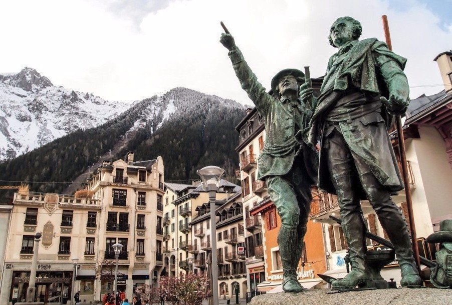
- Tour de France
- Frauen-Radsport
- Sport & Gesellschaft

- Preis-Leistung-Spezial
- Test Spezial
- Wintertraining Spezial
- Gravelbikes
- Hometrainer
- Schaltgruppen
- Wissenschaft
- Gewinnspiel
- Einzelausgaben
- Sonderausgaben

8450 Höhenmeter
Tour du mont blanc: radmarathon über 8450 höhenmeter.
„Bin ich wahnsinnig? Diese eine Frage stellte ich mir immer wieder. vor, während und nach der Tour du Mont Blanc.“
Als der Startschuss die Stille durchbricht, ist es noch finster. Es ist fünf Uhr morgens – in Les Saisies, einem kleinen Dorf in den französischen Alpen. Um mich herum setzen sich 800 Radfahrer in Bewegung. Sie stürzen sich in ein Abenteuer, von dem sie nicht wissen, ob und wie sie es überstehen werden. Wie mechanisch steige ich auf mein Rennrad und tue es ihnen gleich. Vor dem schlechten Fahrbahnbelag und den nassen Straßen hatte ich im Vorfeld großen Respekt. Jetzt stelle ich bereits nach wenigen Metern im Fahrerfeld fest: Das angeschlagene Tempo ist ruhig. Keiner drängelt, keiner ist hektisch, keiner stürzt. Niemand riskiert etwas. Jeder fährt bei der Tour du Mont Blanc auf sich und seine Sicherheit bedacht.
Es ist eine fast gespenstische Ruhe, die sich während der ersten Meter im Feld breitmacht. Die ersten Kilometer bergab in den Ort Megève ähneln einem kollektiven Luftholen. Ein letzter klarer Atemzug. Ein letztes tiefes Einatmen, an einem Tag, der mir den Atem rauben wird: 338 Kilometer und 8450 Höhenmeter auf dem Rennrad – durch Frankreich, die Schweiz und Italien. Die ersten 1000 Höhenmeter habe ich nach etwa 40 Kilometern zurückgelegt – allerdings bergab.

„100 Kilometer habe ich an der Passhöhe des Col de la Forclaz bereits in den Beinen. Es ist weniger als ein Drittel der Distanz.“
Tour du Mont Blanc: Extrem
Extrem harte und lange Radmarathons sind meine Leidenschaft. Bereits ein Jahr vor meinem Mont-Blanc-Abenteuer war ich beim „Schwarzwald Super!“ am Start. Die Strecke dort: 265 Kilometer und 6800 Höhenmeter durch den Schwarzwald . Die Tour du Mont Blanc ist um mehr als ein Viertel länger.
Zur Vorbereitung fuhr ich im Juni den Dreiländergiro und Anfang Juli den Rad-Marathon Tannheimer Tal. Die Form am Berg war zu diesem Zeitpunkt vielversprechend. Jedoch fuhr ich bis zur Tour du Mont Blanc überhaupt erst zweimal im Leben länger als 300 Kilometer – beide Male aber in flachem Terrain und im Grundlagentempo. Heute soll ich die mehr als 300 Kilometer mit 8500 Höhenmetern kombinieren? Bin ich wahnsinnig? Diese Frage stellte ich mir immer wieder. Auch noch am Abend vor dem Startschuss. Oft.
Bereits die Anreise nach Les Saisies, dem Start- und Zielort der Tour du Mont Blanc, war beeindruckend. Sie führte durchs Schweizer Jura und am Genfer See vorbei. Je näher ich dem Mont Blanc kam, desto kleiner fühlte ich mich, angesichts der hohen, schneebedeckten Riesen, auf die ich zufuhr. Les Saisies, der Start- und Zielort der Tour du Mont Blanc, gilt als einer dieser typischen französischen, sehr touristisch geprägten Alpen-Retortenorte. Das Dorf besteht zum größten Teil aus Hotels. Nicht schick, nicht hässlich – einfach pragmatisch gebaut, um den Skifahrern im Winter einen Platz zum Übernachten zu bieten. In den Sommermonaten, der „Nebensaison“, hat nur ein Bruchteil der Hotels geöffnet.
Die schönsten RennRad-Bilder des Jahres: Unser Kalender 2020 – jetzt bestellen!
Hohe Berge, lange Anstiege bei der Tour du Mont Blanc
Eine Stunde ist seit dem Startschuss vergangen. Es geht bergauf. 220 Watt zeigt mein Radcomputer. Es ist exakt der Wert, den ich mir vorgenommen habe. Bergauf will ich maximal 220 Watt treten und bergab sowie im Flachen möglichst viel Kraft sparen. Bei meinem Fahrergewicht von rund 67 Kilogramm ist dieser Wert eher niedrig.
Mein Ziel bei der Tour du Mont Blanc: durchkommen. Zu meinem Plan zählt auch, an jeder Verpflegungsstation anzuhalten und zu essen. Anders als viele der Fahrer in meiner Gruppe tue ich das bereits an der ersten Verpflegungsstation. Der Respekt vor diesem Radmarathon ist riesig. Nie zuvor habe ich eine solche Distanz mit dem Rennrad absolviert. Nie zuvor ging es über so viele Pässe.
Ich passiere die erste Verpflegungsstation. Die Straße führt bergab nach Chamonix. Als ich den Ort durchfahre, spüre ich wenig von der Faszination, die er auf Sportler ausüben soll. Nebelwolken hängen an den Bergketten. Die Sonne versteckt sich irgendwo dahinter. Der Riese, der diesem Radmarathon seinen Namen gibt, ist nicht zu sehen. Der Mont Blanc ist unsichtbar. Noch.

Der Weg zum Col des Montets ist 11,5 Kilometer lang und führt moderate 426 Höhenmeter bergauf.
Vom zweiten Anstieg des Tages werde ich aus meinen Gedanken gerissen. Sechs weitere Anstiege sollen folgen. Der Weg zum Col des Montets ist 11,5 Kilometer lang und führt moderate 426 Höhenmeter bergauf. Die Passhöhe liegt auf 1419 Metern. Der Col des Montets verbindet die Schweizer Alpenpässe mit der Achse der Route des Grandes Alpes. Auf der nächsten Abfahrt – meine dritte bereits an diesem Tag – überquere ich die Grenze zur Schweiz, in den Kanton Wallis.
Unmittelbar danach geht es über Trient bereits wieder nach oben auf den 1526 Meter hoch gelegenen Col de la Forclaz. Auf und ab. Den ganzen Tag. Das macht die Tour du Mont Blanc so besonders. 100 Kilometer habe ich an der Passhöhe bereits in den Beinen. Eigentlich geht es jetzt erst richtig los. Die langen und vor allem hohen Berge stehen mir noch bevor. Wieder bleibt mein Blick am Mont Blanc hängen, der von dichten Wolken umhüllt, aber sichtbar ist. Dann geht mein Blick wieder auf den Asphalt. Die nächste Abfahrt. Die nächste Möglichkeit, um sich etwas zu erholen.

„Nach über 300 Kilometern und mehr als 15 Stunden im Sattel gebe ich kein Bild des Leidens ab. Im Gegenteil. Ich habe Gänsehaut. Nicht vor kälte: Vor Glück.“
Tour du Mont Blanc: Bergauf, bergab
Dann der nächste Anstieg: Es geht knapp 1000 Höhenmeter hinauf nach Champex-Lac. Der Schweizer Ferienort liegt auf 1498 Metern. Die ersten Fahrer verabschieden sich aus meiner Gruppe und zollen dem Tempo Tribut. Andere wiegen mit dem Oberkörper hin und her. Sie sind am Limit. Alle eint das Ziel: gemeinsam oben an der Passhöhe ankommen. Dort fülle ich an der Verpflegungsstation nur kurz meine beiden großen Trinkflaschen auf und fahre gleich weiter. Bergab. Bis ins Tal nach Orsières.
Dort beginnt das Spiel von vorne – nur noch härter. Vor dem 2469 Meter hohen Großen Sankt Bernhard hat man mich gewarnt. Die ersten Kilometer beginnen recht harmlos. Nur selten zeigt mein Radcomputer mehr als sieben Prozent Steigung. Meist liegt die Zahl deutlich darunter. Ich bleibe bei meiner 220-Watt-Pacing-Strategie, obwohl mich einige Fahrer überholen. Der dichte Verkehr von Auto- und Motorradfahrern stört mich eher. Immer wieder werde ich mit nicht ausreichendem Sicherheitsabstand von motorisierten Fahrzeugen überholt und aus dem Rhythmus gebracht.
Erst nachdem die Route kurz nach Bourg-Saint-Pierre auf die alte Passstraße abzweigt, wird es deutlich ruhiger. Wir Radfahrer haben die Straße dann größtenteils für uns allein. Dafür wird es nun, nach mehr als 15 Kilometern moderater Steigung, deutlich anspruchsvoller. Die folgenden rund acht Kilometer haben es in sich. Es wird schön – und steil. Die Steigung pendelt sich im zweistelligen Bereich ein. Die engen Kurven und schmalen Straßen ermöglichen einen grandiosen Ausblick – in alle Richtungen. Nach unten blickt man auf ein schmales Band an Radfahrern, die sich den Anstieg emporquälen. Nach oben und zur Seite erblickt man die Schönheit der Natur.
Der RennRad Cycling Club – Deine Leidenschaft. Dein Club. Jetzt alle Informationen einsehen!
Nudeln, Suppe, Tee
Die Berge, das Grün, den weiß-blauen Himmel. In einem besonders steilen Abschnitt schließe ich zu Grigor auf, einem etwa 40 Jahre alten Schotten. Wir beide staunen laut über die Schönheit der Aussicht und kommen kurz miteinander ins Gespräch. Doch unsere Allianz gegen die Höhenmeter ist nur von kurzer Dauer. Dann kann er meinem Tempo nicht mehr folgen und muss abreißen lassen. Meine Pacing-Strategie funktioniert. Ich sammle nun Fahrer um Fahrer ein. Viele davon sind noch im unteren Teil viel schneller an mir vorbeigefahren.
Die letzte Kurve, die letzten Höhenmeter des Großen Sankt Bernhard. Mein Blick wandert auf das Pass-Schild und die Verpflegungsstation. Hier auf knapp 2500 Metern Höhe werden auch Nudeln, Suppe und heißer Tee angeboten. Angesichts der Kälte ist dies definitiv eine gute Idee. Ich stelle mein Rad ab und greife nach einem Teller Nudeln.
Während ich still genießend mit einem Teller voller dampfender Nudeln auf den See blicke, der knapp unterhalb des Passes liegt, reißt mich eine bekannte Stimme aus meinen Gedanken. Es ist Grigor, der Schotte. Er strahlt über das ganze Gesicht und sagt: „Frederik, warum tun wir uns das an?“ Ich starre ihn an, zucke mit den Schultern – und wir müssen beide lachen. Ich stelle den leeren Teller beiseite, verabschiede mich von Grigor und stürze mich in die lange, kalte, nasse Abfahrt.
Dieser Artikel erschien in RennRad 6/2019. Hier können Sie die Ausgabe als Printmagazin oder E-Paper bestellen!
Die Hälfte der Strecke
Eigentlich hätte der angekündigte, aber bislang ausgebliebene Regen laut Wettervorhersage zu diesem Zeitpunkt bereits wieder nachlassen sollen, stattdessen fängt er jetzt erst an. In der langen Abfahrt Richtung Aostatal lasse ich es ruhig angehen. Überholt werde ich trotzdem nicht. Offenbar gehen auch alle anderen Fahrer auf Nummer sicher. Ich blicke auf meinen Radcomputer. Die Kilometerangabe verrät mir: Mittlerweile habe ich knapp die Hälfte der Strecke zurückgelegt. So gut es bisher auch lief, so groß sind meine Sorgen vor dem zweiten Teil. Dieser wurde mir als deutlich anspruchsvoller im Vergleich zum ersten beschrieben.
In der sehr langen und trotz des Regens durchaus schönen Abfahrt schließe ich zu einem jungen Franzosen auf, mit dem ich von da an zusammenfahre. Gemeinsam geht es ins Aostatal – und vom Regen in die Sonne. Als ich meine Regenjacke in der Trikottasche verstaue, zeigt mir mein Radcomputer 28 Grad Celsius an. Wir schließen auf eine weitere Gruppe von Fahrern auf. Zu sechst geht es in relativ zügigem Tempo weiter in Richtung des nächsten Berges, des Kleinen Sankt Bernhard. Der ist zwar kleiner als der Große Sankt Bernhard, aber immer noch 2188 Meter hoch. Wer sich hier noch gut fühlt, der wird die Tour du Mont Blanc schaffen, bekam ich im Vorfeld von vielen Seiten zu hören.
Meine Atmung ist flüssig, die Beine bewegen sich im Takt. Ich habe keine Schmerzen und keine Krämpfe. Trotzdem wage ich es noch nicht, daran zu glauben, es ins Ziel zu schaffen. Zu groß ist der Respekt vor dem, was da noch kommt.

Jetzt die RennRad ohne Risiko testen! Zum Shop!
Erneuter Temperaturabsturz
Wieder schlage ich 200 bis 220 Watt im Anstieg an. Meine Begleiter aus dem Aostatal hänge ich bald ab. Ich trinke regelmäßig und nehme immer zur Hälfte jedes Berges ein Gel zu mir. Da es an jeder Verpflegungsstation Gels zum Mitnehmen gibt, besteht keine Gefahr, dass sie mir ausgehen. Je höher ich am Kleinen Sankt Bernhard komme, desto kälter wird es wieder. Kurz vor der 2000-Meter-Grenze ziehen dichte Wolken auf und umhüllen den Berg. Ein erneuter Temperatursturz ist die Folge. Auf der 2193 Meter hohen Passhöhe halte ich mich nicht lange auf. Ich ziehe meine Arm- und Beinlinge wieder hoch, fülle schnell meine Trinkflaschen nach und verpflege mich kurz.
Danach geht es in die Abfahrt, vor der ich aufgrund der schlechten Straßenverhältnisse großen Respekt hatte. Doch ich bin alleine und kann alles aussteuern. Zum Glück. Denn hier reiht sich Schlagloch an Schlagloch. Und: Es beginnt schon wieder zu regnen. Da die Temperatur aber mit jedem Meter bergab steigt, kühle ich nicht mehr zu sehr aus. Unten im Tal erlebe ich ein Déjà-vu: Wieder kommt die Sonne raus. Wieder wird es angenehm warm.
Startplätze zu Events, Rabatte bei Reisen und ein direkter Kontakt zu Radprofis: Informiere Dich jetzt über den RennRad Cycling Club!
Letzte Verpflegungsstation bei der Tour du Mont Blanc
In Bourg-Saint-Maurice auf 810 Metern Höhe gibt es die letzte große Verpflegungsstation. Von dort aus wartet der vorletzte Anstieg des Tages, der 1967 Meter hohe Cormet de Roselend. Meine Beine fühlen sich immer noch richtig gut an. Ich kann kaum glauben, dass ich bereits seit 280 Kilometern im Sattel sitze. Manchmal ziehe ich für ein paar Meter das Tempo an, nur um zu sehen, was noch geht.
Langsam, aber sicher beginne ich daran zu glauben, das Ziel in Les Saisies zu erreichen. Den Werten meines Wattmessgeräts kann ich zu diesem Zeitpunkt längst nicht mehr glauben. Seit Bourg-Saint-Maurice liegen diese im exorbitanten Bereich. Wie sich später herausstellen wird, ist die Batterie nass geworden. Also fahre ich wieder wie früher: nach Gefühl und Herzfrequenz.
Selbst das Steilstück kurz vor dem Scheitelpunkt macht mir keine Probleme mehr. Ich erreiche die Passhöhe, trinke eine Cola, verpflege mich kurz mit einem Gel und stürze mich in die Abfahrt. Zum letzten Mal an diesem Tag. Nach fast 15 Stunden im Sattel. Mit jedem Tiefenmeter wächst die Freude aufs Ziel. Noch zehn Kilometer.

Jetzt die neue RennRad-App kostenlos downloaden!
Der längste Tag
Leider bergauf. 700 Höhenmeter trennen mich vom Finish des härtesten Radmarathons Europas. Mein ganzer Körper bebt – vor Freude, vor Glücksgefühlen, vor Stolz. Völlig euphorisiert spüre ich nun keine Müdigkeit mehr – im Gegenteil: Ich werde immer schneller. Einige der Fahrer, die ich überhole, schauen mich ungläubig an – und auch ich selbst kann es nicht glauben: Nach über 300 Kilometern im Sattel gebe ich kein Bild des Leidens ab, sondern fühle mich richtig gut.
Die letzten Kilometer hinauf nach Les Saisies kann ich genießen. Ein paar Kinder am Straßenrand klatschen mit mir ab und feuern mich an. „Allez, allez, allez!“ Als ich das Ortsschild von Les Saisies erblicke, bekomme ich Gänsehaut. Die letzten Pedalumdrehungen, ein letztes Mal im Wiegetritt.
Ich fahre nach 15:59:49 Stunden über die Ziel-Linie am Col des Saisies, reiße die Arme nach oben und juble. Es ist vollbracht. Überstanden. Erlebt. Erlitten. Genossen. 338 Kilometer und 8450 Höhenmeter. Der längste Tag meines Lebens auf dem Rad geht zu Ende. Was für ein Tag, was für eine Fahrt – was für ein Erlebnis.
- Erfahrungsbericht
- Radmarathon
- Tour du Mont Blanc
- Datenschutz
- © BVA BikeMedia 2022

- Départ: Les Saisies
- Arrivée: Les Saisies
- 330 km - 8300 m/d+
- Départ 1 : Les Saisies Départ 2 : Gd-St-Bernard
- Arrivée 1 : Gd-St-Bernard Arrivée 2 : Les Saisies
- Cycliste 1 : 155 km - 4300 m/d+ Cycliste 2 : 175 - 4000 m/d+
LE TOUR DU MONT BLANC
Frontale allumée, il est 4h55 du matin. Vous écoutez les dernières consignes de sécurité du speaker et du Directeur de Course. 4h58 , la musique de départ se met en route, tout un tas de pensées se bousculent dans votre tête : « Mais qu’est-ce que je fais ici ? » « Pourquoi me faire du mal comme ça ? » « Est-ce que je suis vraiment prêt pour me mesurer à cet énorme défi ? » « Pourquoi est-ce que je m’inflige tout ça ? ».
Nous avons la réponse à toutes ces questions : Pour devenir un Héros ! « Héros : personne qui fait preuve d’un grand courage ».
Référence parmi les épreuves ultra, le Tour du Mont-Blanc Cyclo vous demandera une préparation sans faille, un courage hors norme et vous poussera à dépasser vos limites afin de devenir un héros. Parce que oui, devenir un héros, tel est l’objectif de chacun des participants du Tour du Mont-Blanc. “The world’s toughest one day bike race” . C’est ainsi que la presse spécialisée qualifie le Tour du Mont-Blanc Cyclo. En effet, parcourir les 330km et affronter les 8300m de dénivelé positif que l’on vous propose, en une journée, n’est pas une mince affaire !
Au programme pour la douzième édition, la traversée de 3 pays, la France , la Suisse et l’Italie . Vous serez une nouvelle fois confrontés à un tracé exigeant et impitoyable qui attendra de vous une force de tous les instants. Une expérience unique à n’en pas douter.
Images épiques

Sending email...
Email sent!
You are using an out of date browser and this website will not function properly.
Please upgrade to Edge or Chrome browsers.

+33 (0)781586903
montblanctreks
- Dates & Prices
To win an 8-day guided trek in the Atlas Mountains, ENTER HERE!
The Tour du Mont Blanc
Trek overview.

History of the Tour du Mont Blanc
Since the 18th century, explorers, scientists and geologists have been drawn to this area of stunning beauty. The draw of Mont Blanc and all its neighbouring peaks, aiguilles, glaciers and valleys was too hard to resist. Many of the routes through the Alps and over the cols date back to the old trading routes of centuries past.
The first circumnavigation of the Mont Blanc range was back in 1767 by Horace Benedict de Saussure, who set out with a group of friends and porters from Chamonix, on a scientific Mont Blanc expedition to gain further knowledge of its geographical structure. During the Victorian age, the Tour du Mont Blanc became a must-do for the rich and famous, albeit on the back of a mule. Since then, trekking the Tour du Mont Blanc has become one of the most popular long-distance trails in the European Alps.
The Tour du Mont Blanc in Europe
The Tour du Mont Blanc is the most popular long-distance trek in Europe that covers a total distance of approximately 170km depending on which route is taken (some variants can be sorter or longer than the original section). The daily height gain on the Mont Blanc circuit is substantial, and overall the accumulation over the 10 days is in the region of 9,000m.
The Tour du Mont Blanc route takes you over 8 mountain cols and through 3 Alpine regions within France, Italy and Switzerland, circumnavigating the Mont Blanc. The scenery is second to none, from the broken rocky lunar landscape of the Aiguille Rouges to the pasturelands of the Contamines valley; every day has something different to offer, yet there is one common factor - the constant backdrop of the Mont Blanc range.
Villages and Hamlets on the Tour du Mont Blanc
Chamonix, france.
Steeped in history, Chamonix is the mountaineering and off-piste skiing capital of the world. It is truly a stunning place tucked in under Western Europe’s highest peak. For centuries explorers, scientists and mountaineers have travelled here to get up close to this impressive environment.
Les Houches, France
A much smaller and quieter village in the Chamonix Valley, and yet Les Houches shares the same stunning views of the Mont Blanc massif. It has good facilities, restaurants, bars, supermarkets and shops.
Les Contamines, France
Les Contamines is a charming little village on the westerly end of Mont Blanc. It has good facilities, restaurants, bars, supermarkets and shops, and offers great views of the Aiguille du Bionnassay and Domes du Miage.
Chapieux & Ville des Glaciers, France
Chapieux & Ville des Glaciers are tiny hamlets on the southwesterly tip of the circuit and probably one of the most remote places on the tour. The valley and its hamlets are totally cut off in winter. Chapieux offers 1 auberge, 1 little shop and a campsite and Ville des Glaciers a refuge and cheese farm which sell fabulous Beaufort cheeses.
Courmayeur, Italy
Charming, Italian-style Alpine town, Courmayeur is definitely on a par with Chamonix with great food, wine and coffee. All facilities are available here.
La Fouly, Switzerland
Small village in the Swiss Val Ferret, La Fouly has great views of Tour Noir and Mont Dolent. The village offers basic facilities, a shop and a few hotels with bars.
Champex-Lac, Switzerland
Champex-Lac is situated at the easterly end of the TMB. This is a typical picture postcard Swiss village with a beautiful lake. A lovely, relaxing enclave with a range of bars, restaurants and shops.
Trient, Switzerland
Trient is a small Swiss village with limited facilities. The village enjoys fabulous views of the Trient Glacier.
Argentiere, France
Situated at the easterly end of the Chamonix Valley, Argentiere is nested under the famous Grand Montets off-piste and extreme ski area. Argentiere shares the same history as the rest of the Chamonix Valley. It is a lively place in peak season and has a good range of restaurants, bars and shops.
Sign up to Our Newsletter
Marketing permissions.
Mont Blanc Treks will use the information you provide on this form to be in touch with you and to provide updates and marketing. Please let us know if you are happy to receive emails from us by checking the box below.
You can change your mind at any time by clicking the unsubscribe link in the footer of any email you receive from us, or by contacting us at [email protected]. We will treat your information with respect. For more information about our privacy practices please visit our website. By clicking below, you agree that we may process your information in accordance with these terms.
We use Mailchimp as our marketing platform. By clicking below to subscribe, you acknowledge that your information will be transferred to Mailchimp for processing. Learn more about Mailchimp's privacy practices here.
- Chamonix Run Festival June 7th to 9th, 2024
- Weekend of 25 & 26 May 2024 was busy for the Chamonix PGHM
- The Panoramic Mont-Blanc Lift opens 25 May 2024 for the summer season!
- Gondolas, cable cars & trains open May 2024 in Chamonix
- End winter season at Grands Montets Freeride day Sunday 5 May 2024
At the foot of Mont Blanc (4808m or 15,770ft), the highest mountain in western Europe, Chamonix's alpine town atmosphere

The resort of Chamonix has three 5 star hotels, eleven 4 star hotels, twenty two 3 star hotels, thirteen 2 star hotels

Since 1934, Snell Sports has been the largest mountain shop in the Chamonix Valley.

Compare & Book Online with Chamonix.net
Tour du mont blanc hiking - routes, maps and itineraries.

The Tour du Mont Blanc (TMB) is a 170 km trek that encompasses the whole of the Mont Blanc Massif; with nearly 10 000m of cumulative descent and ascent it is usually completed in a number of days.
The TMB has a variety of accommodation facilities along the route (hotels and mountain huts with possibility for vehicle support) that allow you to really enjoy the scenery, take lots of photos and walk each day with just a light pack.
Alternatively, the TMB can be done completely self-sufficiently: you carry all your own food and camping gear. This gives you a better sense of freedom and the ability to go where you please whenever you want.
Tour of Mont Blanc General Information
Mont Blanc Tour mountain huts are open, in general, from mid-June until the first or second week in September. It is advisable to reserve a bed, particularly in the high season of mid July to mid August.
Early in the season is the quietest and most beautiful, but beware of old snow on the higher paths which could be icy and dangerous and would make an ice axe essential.
For additional safety or to just show you the way you could hire an Independent Trek Leader .
Wildlife on the Tour du Mont Blanc
Have a look at the Chamonix.net nature, fauna and flora page for more information on wildlife you might encounter on the Tour of Mont Blanc. Chamois, deer, eagles and a range of beautiful alpine flowers can all be seen and photographed.
Tour du Mont Blanc Maps, Kit List and Equipment
Lightweight boots and shorts are sufficient as long as there are warm clothes in your backpack. Waterproofs are essential and trekking poles useful. Here are some of the best mountain equipment shops in Chamonix .
Do not forget sunglasses, skin and lip protection. Always carry drinking water and check the Chamonix weather forecast before starting your journey.
Maps for the Tour of Mont Blanc:
Tour of Mont Blanc - Route Descriptions
You have plenty of options: from 4 day sportive hikes to leisurely 12 day cultural experiences; there is not only one way to do the Tour of Mont Blanc. Here are a couple of different suggestions which may help you make up your mind on your particular style.
- You can go on your own with your own GPS track, or benefit from a mountain leader's experience
- You can carry your own gear or hike with a light pack with vehicle support
- You can sleep and eat in the refuges or carry a tent
Here is a list of contact information for the various mountain huts .
4 day trip: Not quite racing - but fast enough: For the hardcore hiker
This itinerary follows pretty much in the footsteps of the Ultra Trail race (which varies slightly from year to year). This is for very fit hikers and is done with only a light day pack, eating and sleeping in huts and is basically the run/walking version of the Tour du Mont Blanc. The times noted are for fit spandex-wearing (not obligatory!) hikers.
7 day trip: Hiking the Tour of Mont Blanc - hiker
Start with the previously mentioned itinerary and break up the days a bit depending on where you would like to spend the night.
For people who carry their own gear, plan on a 7 day trip.
9 to 11 day trip: Taking the time to look at the scenery
Of course if you really do have time, you can expand the experience. Here's an example of a slower pace, with time to veer a little off the path. This is described as an 11 day trip, but it would be really easy to knock off the first and last days as those days are dedicated to trekking in the Chamonix Valley.
Each year, in the last days of August, the trails around the Mont Blanc get really busy. This is because of one of the most amazing human competitions ever organized on this planet - The Ultra Trail du Mont Blanc - so keep this in mind when planning your hike of the Tour du Mont Blanc.

Social Networks

Latest News

- Where to stay – Chamonix
- Geneva Airport to Chamonix
- Itineraries
- Tour du Mont Blanc Refuges
- Refuges ebook
COMPLETE TMB IN A WEEK - 7 DAYS
This Tour du Mont Blanc 7 day itinerary follows the complete TMB trail but ideally uses occasional public transport so is best taken during the peak trekking months of July and August. Completing the entire TMB trek in just 7 days is a definitely a challenge and only for the very fit!
Please note this itinerary is for a fast packer not the average hiker or walker.

warning – variant routes
This itinerary ideally takes several variants routes. We’ve included these because the scenery is spectacular however variants Col du Tricot (day 1), Col des Fours (day 2), Col du Fenêtre (day 6) should NEVER be crossed in bad weather. You will need to hike the traditional route if you are trekking early season or if the weather forecast predicts a thunderstorm. Only variant 1 via the Col du Tricot can be safely taken early season during June and even into the first week of July. Read my article here on trekking the TMB early season .
Complete TMB in a week 7 days
Start point: Chamonix, France End point: Chamonix, France Length: 7 days Difficulty: Very fit trekkers
- Day 1 Les Houches – Val Montjoie
Day 2 Val Montjoie – Val Veny
- Day 3 Val Veny – Refuge Bertone
- Day 4 Refuge Bertone – Gite Alpage de la Peule
- Day 5 Gite Alpage de la Peule – Relais d’Arpette
- Day 6 Relais d’Arpette – Refuge La Boerne
- Day 7 Refuge La Boerne – Les Houches
Good to know: this itinerary takes various transport short cuts to enable this complete TMB trek to be done in only 7 days. These include the Bellevue cable car, free shuttle bus from Les Contamines – Notre Dame de la Gorge, Le Tour chairlift & gondola and Le Brèvent gondola. All of these transport options run into early September apart from the Les Contamines shuttle bus which will stop operating at the end of August.
Start point: Les Houches, a village at the beginning of the Chamonix Valley, France (1 hr from Geneva Airport)
If you’re arriving from Geneva Airport you can get a direct mini bus transfer to Les Houches which takes around an hour and fifteen minutes.
timings, distances, elevation
Timings for this itinerary are approximate and non-stop , meaning you should add extra time for stopping to take photos, rest stops and your lunch break. Expect this to always be more than you imagine. Consider adding 2 hours onto your timings per day (for a full day). Remember it’s best to set off early and arrive early – thunderstorms commonly occur around 4pm each afternoon in the peak summer months on the TMB trail.

Day 1 Les Houches – Val Montjoie (via Col du Tricot)
2004m up / 1311m down / 24.1km / 6-7hrs (les houches – refuge de la balme), 1222m up / 1320m down / 18.9km / 5-6hrs (bellevue plateau – refuge de la balme), this itinerary takes the variant stage 1 via the col du tricot. in bad weather you should take the traditional trail via bionnassay, route overview:.
This itinerary ideally takes the Bellevue cable car from Les Houches to the Bellevue Plateau & picks up the path for the Col du Tricot. The timings given however include the extra 2 hours of trekking up from the valley floor, in case you do not wish to take the Bellevue cable car.
Bellevue cable car
Did you know that you can bypass the first 7km of the TMB by taking the Bellevue cable car from Les Houches. It’s a godsend to those who want to omit the first 2 hours of up (680m/7km) on the Tour du Mont Blanc. This section doesn’t have fabulous views so for me it’s a no brainer to take the cable car – its perfect for the variant Col du Tricot trail as it drops you off just five minutes away from the trail. I always take this cable car when it’s operating (early June to approx 10 Sept). Of course many others would prefer to trek this section and I begrudgingly do so if I’m trekking later in September (which is a glorious time to trek!)
After the Himalayan suspension bridge the route begins to gently climb until the spectacular Bionnassay glacier comes into full view. From here you can see the top of the Col du Tricot and it’s a steady climb up to the grassy saddle. Spend some time here to admire the views over the Miage Valley and far off the Col du Bonhomme. Spot Refuge Miage in the distant cluster of farm buildings way down in the valley below (a great stop refreshment stop if you have time). If you look carefully to your left, you’ll see a stone archway on the ‘smugglers route’ to Refuge Plan Glacier (see our adventure itinerary). The descent down is STEEP! Take it easy and use your poles. Reaching the valley floor follow the signs to reach Refuge Miage in just 5 minutes. This cluster of farm buildings in set in an idyllic rural setting and is charmingly French. The view of the Dômes de Miage (3600m) from the refuge is outstanding.
After an initial short climb from the Miage Valley up and over to Auberge du Truc. From here it’s a long steady descent through the forest into Les Contamines. Have a leisurely lunch in this small French town before either choosing to walk along the river to Notre Dame de la Gorge or pick up the free shuttle bus ( navette ) outside the Tourist Office to Notre Dame de la Gorge where the trail heads out into the wild once more. Taking the free shuttle bus means the difference between the stated length & hike time above. Take a moment to visit the beautiful Notre Dame de la Gorge chapel next to the gushing water before setting out on the well marked path. Warning – the trail is VERY steep here along an ancient slabbed Roman road to Refuge Nant Borrant but pleasantly flanks the bubbling racing gorge for much of the ascent. Be sure to look out for the pont naturel sign leading to a natural arch on the river, just a minute from the trail. Cross the roman bridge to take in the rushing gorge below. After reaching Refuge Nant Borrant press for almost a further 3kms before reaching Refuge Le Balme.
It’s always lovely to have lunch at one of the refuges on today’s section. Refuge Miage is popular with fantastic views (popular in peak season so consider sending an email to book a table) or 45 mins further up the trail is the humble, very authentic Auberge du Truc which has simpler fare, no less delicious!
accommodation on your first night
Accommodation on your first night will ideally be in Refuge de la Balme, or just before in Refuge Nant Borrant or Refuge des Prés. All of these refuges have small dorms and shared bathroom facilities. Refuge Le Balme does offer a private room (double + bunks) which can be booked just for two or up to four people, however it does not have a bathroom ensuite. If you’re booking online and would like to book the Le Balme private room please add a note in the special requirements box.

1820m up / 1335m down / 24.4km / 7-8hrs (Refuge Le Balme via Les Chapieux to Elisabetta)
1764m up / 1279m down / 21.9km / 7-8hrs (refuge le balme via col des fours to elisabetta), this itinerary takes the variant col des fours however this must not be taken in bad weather or early season. when trekking in june or the first week of july or during bad weather in peak season you must take the traditional route via les chapieux.
Today you’ll make the climb over a whopping 3 mountain passes! Col du Bonhomme (2329m) and Col de la Croix du Bonhomme (2483m) where early in the season (late June – end of July) you can expect to cross snow patches and finally Col de la Seigne the border between France and Italy.
If the weather is fine take the alternative route just before Refuge de la Croix du Bonhomme via the Col des Fours. This spectacular variant leads you over a lunar like landscape before dropping into the Vallée des Glaciers picking up the trail at Ville des Glacier.
Note this route cuts out the hamlet of Les Chapieux. Never attempt this variant route if the weather is nothing short of perfect.
do not take the variant Col des Fours early season
The Col des Fours variant should never be taken early season in June or even sometimes into the first week of July. There are numerous glacial torrents which are covered in snow. As the snow melts, snow bridges form and these can be very dangerous. There have been fatalities here in early season so please adhere to this advice.
Tête des Fours view point
In good weather take the 10 minute detour at the top of Col des Fours to the view point Tête des Fours – it is nothing short of spectacular and is the only point on the trek where you can see where you’ve come from and where you’re going to from a birds eye view – oh and the view of the Mont Blanc Massif is nothing short of spectacular as well! I advise stashing your rucksack behind one of the many boulders to simply float up to the view point!
Note: if you don’t want to take the variant but still want to go to the viewpoint, it’s around an hour return from the cairn marking the top of the Col de la Croix du Bonhomme.
If you’re continuing along the normal TMB route the well marked trail will descend all the way to the valley of to Les Chapieux, where you can stop for a welcome refreshment at the friendly Auberge de la Nova and carry on a further hour up the trail to Refuge Les Mottets. Or as we would suggest catch the navette (shuttle bus) which ferries you in 30 minutes to the parking area of Refuge Les Mottets (you’ll then have to walk down the hillside to the refuge in the valley bottom). Our 4hr timing includes taking the navette to Refuge Les Mottets.
You’ll stay in the cavernous Refugio Elisabetta in Italy, a high mountain refuge with epic views from it’s incredible location perched at the base of two glaciers.
If you’re taking the Col des Fours variant then the only real option for lunch at refuge would be Refuge Mottets. If its early season or bad weather and you are trekking the traditional route then Auberge de la Nova would be a good option.
accommodation on your 2nd night
Accommodation on your second night is in the Val Veny. Accommodation is limited here to just two refuges, Refugio Elisabetta or Cabane Combal.

Day 3 Val Veny – Rifugio Bertone
1350m up / 1552m down / 20.6km / 6-7hrs (from elisabetta).
Today’s hike takes you up out of the Val Veny floor climbing steadily up to the highest point, a spur from Mont Favre. Looking back you can see the monstrous moraine of Glacier Miage dwarfing Cabane Combal and on a clear day all the way back to Col de la Seigne. From here you’ll trace the contours of the south flank of the Val Veny, following the rise and fall of the mountain side with jaw dropping views of sawtooth peaks and Monte Bianco opposite.
From Rifugio Maison Vielle during peak season (Aug & Sept) you can opt to take the chair lift and connecting cable car down to Dolonne which is a 10 minute saunter into Courmayeur. The descent from Maison Vielle is brutal so if you’re weary or just want a longer lunch in the lovely Italian town of Courmayeur this is definitely a good option. We highly recommend Pizzeria Ristorante du Tunnel who serve the largest pizza we’ve ever seen!
After a leisurely lunch it’s 4km uphill to your bed for the night at Rifugio Bertone.
A good location for lunch would be Rifugio Maison Vielle.
accommodation on your 3rd night
Accommodation on your third night will be at Rifugio Bertone, a fantastic refuge just 2-2.5 hours up from the Italian town of Courmayeur.
If you want to cut this day down due to sheer exhaustion, injury or to perhaps include a rest day in Courmayeur there is an option to take the bus from Visaille to Courmayeur. Visaille can reached in just under 2 hours from Rifugio Elisabetta or just under an hour from Cabane Combal. Turn right after the bridge just before Cabane Combal – it’s a 30-40 minute walk to the village of Visaille where the bus departs on the hour.

Day 4 Rifugio Bertone – Gîte Alpage de la Peule
1193m up / 1095m down / 20.9km / 6-7hrs.
You’ll be hiking the gentle southern ridge of the Val Ferret valley today before the climb over the Grand Col Ferret (2537m), the border between Italy and Switzerland. Home will be at a working dairy farm, the Gîte Alpage de la Peule nestled into the mountain side on the other side of the Col.
This itinerary follows the easier route along the contour balcony trail from Rifugio Bertone as you’ll be tackling the Grand Col Ferret today as well. For those really wanting to push themselves there is an option to take the Mont de la Saxe high ridge route to Tête de la Tronche which offers insane views of the southern buttress of the Mont Blanc Massif. However, again this route should not be taken in bad weather.
A good place to have lunch would be at Hotel Chalet Val Ferret before you start the Grand Col Ferret climb.
accommodation on night 4
Accommodation tonight will be in the working dairy farm Gîte Alpage de la Peule, just over the border in Switzerland. If you prefer a private room you will need to descend a little further to hotel options at Ferret or La Fouly.

Day 5 Gîte Alpage de la Peule – Relais d’Arpette
743m up / 1187m down / 22.7km / 5-6hrs.
You may be up early this morning – the Alpage de la Peule is an authentic working dairy farm and the cow bells clang at dawn. It’s mostly downhill today. The Swiss section of the TMB is altogether a more mellow landscape with rolling green pastures, pretty meadows and lush forest. You’ll descend into Ferret and then La Fouly.
La Fouly sits at the foot of two mighty mountains, Tour Noir (3, 836m) and Mont Dolent (3,823m) which incredibly is the tri-point where all three of the Tour du Mont Blanc countries, France, Switzerland and Italy’s borders meet!
The main villages and hamlets of this valley are Ferret, La Fouly, Prayon, Praz de Fort, Les Arlaches, Issert and Som la Proz. All of which you will pass through apart from the last when you will turn uphill for the last 90 minutes to Champex-Lac (pronounced Champay-Lac).
The route hugs the left side of the valley, following the west bank of the river La Drance de Ferret and parallel to the main valley road which can easily be heard as your hiking. In wilderness you are not!
The best part of today is that you’ll wander through a couple of charming Swiss hamlets. The tiny Les Arlaches with it’s interlaced wooden roofs are a real gem. Before long you’ll start the climb up to Champex-Lac – the only climb of the day. At the top you’ll be rewarded with the beauty of Champex-Lac. Nicknamed ‘Little Canada’ it’s not hard to imagine why – this beautiful lakeside town is surrounded by hills of pine and is genuinely a beautiful spot. You’ll press on though out of town for a further 5km up taking the beginning of the variant route up to the Relais d’Arpette where you can relax and bed down ready to tackle, weather permitting one of the most exciting sections of the TMB trail – the Col du Fenêtre.
I would order a packed lunch (pique-nique) from your refuge for today’s lunch or buy something from the well stocked supermarket in La Fouly as you pass through. There is one place to eat in Praz-de-Fort however it may be closed early or late season and it’s hard to depend on.
accommodation on night 5
Accommodation on night 5 is in the Relais d’Arpette, a popular refuge on the variant stage 8 of the TMB which crosses the Fenêtre d’Arpette. This refuge is around 30-45 minutes up from Champex-Lac. Rooms are private or dorms.

Day 6 Relais d’Arpette – Refuge Col du Balme/Gîte d’Alpage Les Ecuries de Charamillon/Tré-le-Champ
1981m up / 2228m down / 22km / 7-8hrs (to tré-le-champ), 1904m up / 1612m down / 18k / 6-7hrs (to gîte d’alpage les ecuries de charamillon), 1904m up / 1316m down / 16km / 6-7 (to refuge col du balme), this itinerary takes the variant via the fênetre d’arpette. this is a technical, challenging variant which should never be done early season or in bad weather.
Today is a long day combining two variant stages into one. We must again make you aware that you cannot hike the Col du Fenêtre if the weather is less than perfect. It’s the most technical terrain on the entire TMB and unlike the rest of the trek, the trail is not marked well and can be lost. The boulder field just before the Col requires a lot of attention and trekkers need to be mindful of loose screw and rocks that dislodge easily and can be fatal to trekkers below. Set off super early though and you’ll be in for a treat. When you finally summit the Col you will feel a real sense of achievement – it’s the only place on the trek I’ve experienced other trekkers congratulating each other a real sense of camaraderie.

The descent from the Col du Fenêtre is nothing short of astounding. Hairpin bends wind down the rocky descent with the incredible Trient Glacier trailing down beside the trail. This huge hunk of ice will mesmorise you during your descent and will surely be one of your unforgettable memories of this incredible trek.
Once you reach the buvette you’ll cross the wooden bridge and start the uphill slog to Refuge Les Grands. The Tibetan style path carved out of the rock will leave you in awe. Stop at the refuge for a cold drink and press on high along hugging the mountain flank until eventually you’ll spot Trient far below and the Trient glacier disappears behind you. You’ll soon see Refuge Col du Balme with it’s iconic red shutters – a tiny dot on the Col du Balme saddle – another frontiere marking the boundary between Switzerland and France. The gentle balcony walk contours around until you pass the refuge. Re-bonjour! You’ve come in a complete circle and once again the Chamonix Valley is in sight. Look to the far end of the valley to spot Les Houches where you set off. Our itinerary descends now to the valley floor just past the refuge via the chairlift and gondola to Le Tour. It’s then a 30 minute saunter to Tré-Le-Champ where you’ll rest your weary limbs in the historic and charming Auberge la Bœrne.
If you choose to take the variant across the Fênetre d’Arpette you will need to organise a packed lunch as there is no-where to eat on the trail until Buvette du Glacier which is too late in the day. This section is particularly dry so you will need to carry extra water with you.
If you are trekking the traditional route (Bovine) you can stop to have lunch at the wonderful L’Alpage du Bovine, one of the most authentic experiences on the trail. If it is raining it may not be possible to eat here without a prior reservation as their interior is tiny (only 20 seats). In good weather there is plenty of exterior seating.
accommodation on night 6
Accommodation tonight is ideally in Refuge Col de Balme, but could be slightly off the trail in Gîte d’Alpage Les Ecuries de Charamillon, or further down in Tré-le-Champ in cosy Auberge de la Bœrne, one of the oldest and most historical refuges on the trail. Those who would prefer private rooms can go on to a hotel in nearby Argèntiere.

Day 7 Refuge Col de Balme/ Auberge la Bœrne – Les Houches
1801m up / 2187m down / 25.5km / 8-9hrs (full route down to les houches), 2138m up / 1065m down / 15.5km / 5-6hrs taking plan praz cable car down.
Trekking the north flank of the Chamonix Valley, this itinerary divides stages 10 and 11 of the Tour du Mont Blanc with a detour up to the infamous Lac Blanc. Hiking through the Aiguille Rouge National Park, you’ll have a good chance of seeing marmots, chamois or bouquetin. If you want to complete the entire Les Houches to Les Houches circuit though you’ll need to set off uber early today – it’s a challenging day ending with a knee crunching descent into Les Houches. It may be too much for some and if this is the case there’s the option to take the Plan Praz cable car down to Chamonix centre rather than pressing onto Les Houches.
It’s a 2 hours climb up to Lac Blanc for trekkers of your speed. The route climbs steadily until you reach the infamous TMB ladders – a series of 13 ladders and metal ware built into the rock. It’s the most exciting physical aspect of the entire Tour du Mont Blanc. See notes at the top of this page for how to avoid these ladders if you suffer from vertigo. At the Tête aux Vents, a large cairn (2132m) which borders the national park you can choose to detour up to Lac Blanc or traverse along the trail to La Flégère. Lac Blanc (2,352m) has an almost mythical stature – however if you’re not staying overnight at the refuge you’ll most probably experience the hoard of day trippers who access the lake via the cable car and chair lift. It’s still worth a look but downgrade your expectations. The magic here happens when the day trippers leave late afternoon. If you have an extra day in your schedule it’s worth booking Refuge Lac Blanc and experiencing the incredible serene peace that descends each evening.

Follow the balcony trail past La Flégère and continue to Plan Praz. The entire route along this balcon walk has incredible views of Mont Blanc weather permitting. It truly is astounding. Often it seems like a painted landscape it truly is surreal. Descend via the Plan Praz cable car to Chamonix centre or if you’ve still got energy – you’ve set off early and want to complete the entire circuit from start to finish you’ll need to continue onwards. The best way to do this is to take the cable car UP from Plan Praz to Le Brévent which gives again, insane views of Mont Blanc. The long descent from Le Brévent is hard on the knees but is beautiful with wild red and pink azaleas popping with colour. This area again is known for common sightings of chamois. Expect to fall into Les Houches – this is a huge day but also completing the whole TMB in just 7 days is no easy feat. Well done!
A good location for today’s lunch stop would be at the restaurant at the top of the Brèvent summit.

Tour du Mont Blanc Hike
Privacy overview.
- Frauenradsport-News
- Sonderseiten der Rennen
- Rennkalender Männer 2024
- Die World-Teams 2024
- Rennkalender Frauen 2024
- Die Women´s WorldTeams 2024
- Fahrer-Datenbank Männer
- Team-Datenbank Männer
- Sonderseite
- Die Startliste
- Strecke & Favoriten
- Live-Ticker, 1. Etappe
- Ergebnis + Rennbericht, 1. Etappe
- Die deutschen KT-Teams 2024
- Die österreichischen KT-Teams 2024
- Bundesliga Deutschland
- Bundesliga-Kalender 2024
- Radliga Österreich
- Women´s WorldTour
- UCI-Rennen der Männer
- UCI-Rennnen der Frauen
- Verein suchen
- Verein eintragen
- Verein bearbeiten
Oder: Paket bei Steady buchen
16. Juli 2022 - Savoien (F) - 338 km, 7 Pässe
Le tour du mont-blanc: das härteste eintagesrennen der welt.

06.10.2021 | (rsn) - Die "Tour du Mont Blanc Cyclo" gilt mit 338 Kilo- und 8500 Höhenmetern als der härteste Rad-Marathon weltweit: Über sieben Pässe und durch drei Länder - Frankreich, Schweiz, Italien - müssen sich die Teilnehmer/innen quälen. Die zwölfte Ausgabe der Mont-Blanc-Runde wird - nach der erneuten Absage diesen Sommer - im kommenden Jahr am 16. Juli stattfinden, wie der Veranstalter "Cycling Classics" kürzlich bekanntgab; die Anmeldung geht voraussichtlich Ende Oktober online (siehe Link hier unten)
Zuletzt haben sich im Sommer 2019 am dritten Juli-Sonntag im französischen Bergdorf Les Saisies unterhalb des Mont-Blanc um fünf Uhr früh über 1700 leidensfähige Radsportler als Solo-Fahrer oder als 2er-Gruppe auf die 330-km-Runde gemacht.
Die Gewalt-Tour führt über Megève, Saint Gervais, Chamonix, den Col des Montets (1419 m), den Col de la Forclaz (1525 m), Martigny, den Col du Grand St Bernard (2469 m), das Aosta-Tal, den Col du Petit St Bernard (2189 m), Bourg-St-Maurice, den Cornet de Roselend (1967 m) und Beaufort zurück zum Col des Saisies (1657 m). Unterwegs gibt es sieben Verpflegungskontrollen.
Die Zweier-Mannschaften wechseln sich am Großen St Bernhard ab, so dass der erste Fahrer 157 km und 4100 hm zurückzulegen hat, und der zweite dann 173 km und 3900 hm. Reicht auch - oder?

Weitere Jedermann-Nachrichten

Ein Tag zum Vergessen: Nur ein Team-Fahrer der Strassacker-Equipe kam beim anspruchsvollen Vogesen-Granfondo "Les Trois Ballons“ am vergangenen Samstag ins Ziel. Nach 180 Kilometern und über 4000

(rsn) - Die 19. Auflage der Erzgebirgs-Tour, geplant vom 14. bis 16. Juni, steht auf der Kippe. Das hat Organisator Markus Illmann gestern vermeldet: "Bei der aktuellen niedrigen Teilnehmerzahl ist di

Nachdem das Team Strassacker in Aachen und den Vogesen den Sieg jeweils knapp verpasste, konnte die Equipe in Celeste beim Klassiker in Köln mit einem Doppelsieg zurückschlagen. Nach perfekter Vorar

Nach dem erfolgreichen Saison-Start mit dem dritten Platz der Team-Wertung in Göttingen und dem Sieg auf der "Express-Strecke" bei Eschborn - Frankfurt setzt sich die Podiums-Serie des Team Velolease

Mit dem Granfondo Vosges stand am Sonntag vor einer Woche für drei Fahrer des Team Strassacker - Moritz Beinlich, Jannis Wittrock und Benjamin Witt - das nächste harte Rennen auf dem Programm, diesm

(rsn) – Vier Wochen sind es noch, bis im kalifornischen Oceanside wieder einmal das berühmteste Ultracycling-Event der Welt beginnt: das Race Across America, kurz: RAAM. Das 1982 erstmals ausgetrag

(rsn) – Am Mittwoch beginnt in Ludwigshafen die Internationale Bahnen-Tournee 2024. Das mehrtägige Traditionsevent, das alljährlich am Pfingst-Wochenende ausgetragen wird, dauert im Olympia-Frühj

Der erste UCI Gran Fondo auf deutschem Boden war natürlich auch für das Team Strassacker ein Pflicht-Termin und Highlight im Rennkalender 2024. Auch wenn die Strecke komplett in der Bundesrepublik l

(rsn) - Im Herbst 2022 hat Marcus Burghardt, Ex-Edel-Helfer von Cadel Evans, Mark Cavendish und Peter Sagan, das Freizeitrennen "Shades of Speed" aus der Taufe gehoben, eine Eintages-Radrundfahrt durc

(rsn) - Vier Strecken durch drei Bundesländer: Bei der zweiten Ausgabe des "ACL Gravelday" am 19. Mai, veranstaltet vom Radsport-Club AC Leipzig, startet man in Haselbach in Thüringen, fährt durch

Die vergangenen Amateur-Rennen des Rad-Klassikers Eschborn - Frankfurt wurden seit 2019 von den Fahrern in Celeste dominiert - doch diesmal ging die Equipe aus Süßen in der Einzelwertung leer aus.

(rsn) - Jubiläum in der Mecklenburgischen Seenplatte: Die Mecklenburger Seen-Runde führt seit nunmehr zehn Jahren immer Ende Mai auf zwei Strecken durch schöne Seen-Landschaften - "die beste Rad
Helfen Sie uns!
Das Angebot von radsport-news.com wird mit Werbung finanziert. Wenn Sie einen Adblocker verwenden, entgehen uns die Einnahmen, die wir benötigen, um das Angebot in diesem Umfang anzubieten.
Bitte deaktivieren Sie Ihren Adblocker!
Hallo max mustermann.
Sie unterützen uns mit einer kostenpflichtigen Mitgliedschaft. radsport-news.com wird Ihnen bis zum 1.1.2018 werbefrei angezeigt.
- Keine Termine
Alle Termine
- Trägerhose für den Fitness-Tracker | 29.05.2024
- Brillen vom Laufrad-Spezialisten | 28.05.2024
- Neue Laufradsätze für jeden Einsatzzweck | 22.05.2024
- BENOTTI FUOCO CARBON ULTRA SE No. 1: 20 Jahre BENObikes – limitierte BENOTTI Special Edition | 17.05.2024
- Superleichte Gruppe mit neuer Hebelform | 17.05.2024
Weitere Markt-News
Newsletter:
PROFI-NEWS JEDERMANN-NEWS LIVE MARKT KALENDER VEREINE
SONDERSEITEN
GIRO D´ITALIA 2024 TOUR DE FRANCE 2024 VUELTA A ESPAÑA 2024 RENNERGEBNISSE PROFI-TEAMS PROFI-FAHRER
AMATEURE & JEDERMANN TECHNIK TRAINING & GESUNDHEIT PROFI-RADSPORT BAHNRADSPORT TRIATHLON
UNSERE ANGEBOTE
RSS-FEED RADSPORT-NEWS.COM MTB-AKTIV.DE -->
ÜBER UNS
KONTAKT ZUR REDAKTION WERBUNG & MEDIADATEN PRODUKTINFORMATIONEN ETHIKRICHTLINIE RADSPORT-NEWSLETTER -->
- Routenplaner
Tour du Mont Blanc by Mountain Bike
Auf der karte, tour du mont blanc by mountain bike - full route.
Die Tour du Mont Blanc ist eine der bekanntesten Wanderrouten der Welt. Ein Rundweg voller spektakulärer Gletscher, atemberaubender Almwiesen, grandioser Bergpässe und reizvoller Täler. Überqueren der Grenzen von drei Ländern; Frankreich, Schweiz und Italien.
Tour du Mont Blanc by Mountain Bike - Stage 1
Als wir uns auf den Weg machten, waren die ersten 4 Stunden des Tages die härtesten der gesamten Reise! Der Aufstieg vom Parkplatz in Les Chapieux bis zum Refuge du Col de la Croix du Bonhomme ist die ganze Strecke mit dem Fahrrad unterwegs. In der Nähe der Schutzhütte verlangsamte sich der Fortschritt … weiterlesen
von Katie-Jane L'Herpiniere
Entdecke Orte, die du lieben wirst!
Hol dir jetzt komoot und erhalte Empfehlungen für die besten Singletrails, Gipfel & viele andere spannende Orte.
Tour du Mont Blanc by Mountain Bike - Stage 2
Beim ersten Tageslicht waren wir wach und bereit, einen weiteren Monstertag in Angriff zu nehmen. Direkt aus dem Camp führte eine lange, aber fahrbare 4x4-Strecke hinauf zum Col de Balme (2195m), an der Grenze zwischen Frankreich und der Schweiz. (Je nach Jahreszeit besteht die Möglichkeit, von Le Tour … weiterlesen
Tour du Mont Blanc by Mountain Bike - Stage 3
Der letzte Tag und zwei große Cols zu erobern! Der erste war der Col du Grand Ferret (2.537 m) an der schweizerisch-italienischen Grenze. Es gab eine 4x4 Servicestrecke bis zur Schutzhütte Alpage de La Peule, wo wir ein zweites Frühstück auf der Terrasse einnahmen, in der warmen Morgensonne genossen … weiterlesen
Tour du Mont Blanc by Mountain Bike - Stage 3 alternative balcony route
Dir gefällt diese collection.
Meld dich kostenlos bei komoot an, um mitzureden.
Collection-Statistik
- Distanz 382 km
- Zeit 28:04 Std
- Höhenmeter 17 020 m
Dir gefällt vielleicht auch
Well and Good Travel

The Foolproof Tour du Mont Blanc Itinerary: 10-Days
10 days of hiking in the Alps – the ULTIMATE wellness trip if you ask me. This Tour du Mont Blanc self-guided itinerary follows the traditional TMB route, includes tips, daily trail specs, and accommodation suggestions, and addresses some of the most common questions you might be asking yourself as you begin planning your tour.
The Tour du Mont Blanc, or the TMB, is a 105-mile (170 km) trail that circumnavigates Mont Blanc, the highest peak in Europe. The TMB is often considered one of the most beautiful through-hikes in the world, introducing hikers from around the globe to the exquisite and dramatic scenery of the Alps.
👉 Don’t forget travel insurance for this trip! I always use SafetyWing !
Want to save yourself a lot of planning time? Check out Skyhook Adventures’ 10-day guided trek if you want all of your accommodations, food, and transportation taken care of!
Tour du Mont Blanc Itinerary 10 Days

This itinerary does not include, but I recommend, staying in Chamonix for a couple of days before and after your tour, first to acclimate and then to relax.
The TMB is broken up into “stages”. Traditionally, there are 11 stages but depending on how many days you want to trek you can find different versions of the stages.
During your planning, and your trekking, take all distance, time, and elevation markers or estimations with a grain of salt. Mileage on GPS and in guidebooks and blogs rarely match up, and there are a lot of variables that affect the accuracy of the time estimations. The trail markers seem to allot 30 minutes for every mile, but depending on your age, the weather, and what shape you’re in, that will be different for every person. For your own sake, just always assume you’ll have an additional mile or 30 minutes 🙂
Tour du Mont Blanc Trek Specs:
- Distance: 105 miles / 170 kilometers
- Route Type: Loop
- Starting Point: Les Houches (traditionally)
- Direction: Counter-clockwise (although it can also be hiked clockwise)
- Total Elevation Gain/Loss: 33,632ft / 10,251 m
- Maximum Altitude: 8,500 ft / 2600 m
- Days To Hike: 7-12 days
- Countries: France, Italy, Switzerland
- Difficulty: Difficult (never flat, always up or down)
Tour du Mont Blanc Itinerary Disclaimers:
- Most stages have alternative route options, or “variants”, as they are called. This itinerary follows the traditional TMB route, except for day 10. Refer to the recommended guidebooks for variant options.
- Some stages have options to use public transport and lifts/gondolas to accelerate and shorten the path. This itinerary discloses any shortcuts by calling out *SHORTCUT*.
- There are many mountain huts/refuges along the TMB to choose from. This allows for total personalization of your trek. The huts recommended in this 10-day tour du mont blanc itinerary are huts that I stayed in and will provide my honest opinion about.
Day 1: Les Houches to Les Contamines

Do not get off at the first stop in Les Houches – stay on until you see the Office de Tourismo (on your left). Here you will see the TMB starting point arch. Take a photo and walk onward for about 10 minutes until you see the “Telecabine Bellevue”. *SHORTCUT* This will cut off a 2600 ft / 800 m climb through the forest. Begin your trek at the top of this cable car.
You’ll pass through many towns and villages today, and you won’t feel very “out there”. The signage is decent, just make sure you pay attention and don’t pass any turnoffs. Use the guidebooks and GPS for support.
✔ Mileage: 9 miles / 14.5 km (if you take the cable car, 11 if you don’t)
✔ Elevation Gain: ~ 1000 ft / 300 m (if you take the cable car, 3550 ft if you don’t)
✔ Estimated hiking time: 5 hours (with cable car)
💤 Where to stay: Gai Soleil

Gai Soleil is a quaint and quiet hotel just off the main road in Les Contamines. There is a lovely yard to relax in after hiking all day. The rooms are basic but very comfortable with amazing views. Breakfast was great and there is wifi. I would recommend staying here.
Day 2: Les Contamines to Les Chapieux
💪 This is one of the most challenging days of this 10-day tour du mont blanc itinerary.

Today you will climb over two Cols (mountain passes). You will see fewer towns and be pleasantly surprised by the beauty that is everywhere. Be prepared for lots of elevation gain and possible weather. It can get very cold (and wet!) at the top of the cols.
When you begin to descend from the second col, you’ll pass Croix du Bonhomme – a refuge. Stop here for hot chocolate or coffee but DO NOT stay here (outhouses, flies, no showers, etc).
BONUS: Look out and listen for lots of Marmots as you descend from Croix du Bonhomme!
✔ Mileage: 14 miles / 22.5 km
✔ Elevation Gain: 4500 ft /3000 ft down
✔ Estimated hiking time: 7 hours
💤 Where to stay: Auberge de la Nova
You will see the Auberge immediately as you descend into Les Chapieux (there isn’t much else here!). Try to get a private room if you can – unless you are fully comfortable sleeping in dorms. The dinner was one of the best dinners of the trek! Hot showers but no wifi or service.
Day 3: Les Chapieux to Rifugio Cabane du Combal
🌀 One of the most beautiful days of the trek!

Today you will get your first view of Mont Blanc from the trail and cross over into Italy via Col de la Seigne. To begin, take a bus from Les Chapieux to Les Mottets (NOT Ville des Glaciers). *SHORTCUT* This will cut about an hour and a half of walking on a skinny paved road which made sense to us (and most others).
There is a small wooden information center in Les Chapieux, just outside Auberge de la Nova. You can buy bus tickets here – try and buy them the night before in order to get the first bus, otherwise, you may have to wait until the 9 am bus (or just walk).
BONUS: When you get to Cabane du Combal, continue on another 10 minutes to see Lac Miage and the adjacent moraine – you’ll see the signs outside the rifugio. If you sit and listen at the top, you’ll hear small rockslides happen every few minutes as a result of the melting glacier.
The All Trails map linked below maps you to Rifugio Elisabetta. A lot of people like to stay here but I saw the sleeping area and would highly recommend continuing on to Cabane du Combal. It’s another 30 minutes and 1.5 miles on FLAT gravel road. Definitely stop at Elisabetta for a cappuccino though. You’ll have to climb up their long and steep driveway but it is worth it!

✔ Mileage: 10 miles / 16 km
✔ Elevation Gain: 3400 ft / 1036 m
✔ Estimated hiking time: 5.5 hours
💤 Where to stay: Cabane du Combal

Cabane du Combal is a very sweet rifugio with large, clean rooms and the dinner was really very good. They tend to get herds of ibex hanging around (hence their logo), so be on the lookout! We saw several here 🙂 Lastly, there is no wifi or service here.
Also read: Tour du Mont Blanc Refuges: Everything You Need to Know
Day 4: Cabane du Combal to Rifugio Maison Vieille
🌀 One of the most beautiful days of this tour du mont blanc itinerary!

This was one of my absolute favorite days. It was a short day but SO beautiful. On several days you trek through villages and towns, but this day you are just in the mountains the entire time. You’ll be walking at eye level with glaciers and alongside grazing sheep and cows. Take your time and admire the beauty in every direction.
ALTERNATIVE ITINERARY: As much as we loved Maison Vielle, I recommend continuing past Rifugio Maison Vielle and booking a hotel in Courmayeur. Courmayeur is the largest town you will go through and a great opportunity to stay somewhere nicer, and it will balance out the distances on days 4 and 5. The Alltrails map below goes to Courmayeur.
✔ Mileage: 6 miles / 9.6 km (to Maison Vieille)
✔ Elevation Gain: 1900 ft / 600 m
✔ Estimated hiking time: 3 – 4 hours
💤 Where to stay: Rifugio Maison Vieille

As I mentioned, I would continue on to Courmayeur. However, if you choose to stay at Maison Vieille you can spend the afternoon lounging in lawn chairs and sipping on cold beers. This is a popular lunch stop for day hikers so it’s very busy and fun. They only have dorms – no private rooms, FYI. But, they do have wifi.
Day 5: Rifugio Maison Vieille to Rifugio Walter Bonatti

Maison Vieille is situated at the top of a ski lift. When you depart on day 5 you can either sleep in and wait for the ski lift to open at 9 am to take you down to Dolonne or you can walk down the very steep descent which will take you about 2 hours. * This is another reason to stay in Courmayeur because you can take the ski lift down in the afternoon the day before.
*SHORTCUT* We chose to save our knees and took the ski lift as soon as it opened. You have to take a Gondola following the lift which drops you in Dolonne. You’ll walk about 10 minutes to Courmayeur. Build in some time to walk around and get some coffee if you can because it’s very cute here.
Next, begin your ascent through a paved neighborhood and then into a popular wooded hiking area. Stop at the top at Rifugio Bertone for a snack and beverage and then continue on. Today is another day of hiking eye to eye with massive glaciers… in fact, you’ll be sleeping directly across from one at Rifugio Bonatti!
✔ Mileage: 9 miles / 14.5 km (from Maison Vieille)
✔ Elevation Gain: 3600 ft / 1100 m
✔ Estimated hiking time: 6 hours
💤 Where to stay: Rifugio Walter Bonatti

Rifugio Bonatti is situated directly across from a massive glacier – it is an unbelievable location. The rifugio is a little newer and offers dorms and private rooms that are quite comfortable and clean. The dinner was pretty good. You have to get a coin for the shower and only get 4 minutes. There is no wifi, but some service. Although, if you ask nicely the staff might share the wifi password.
Day 6: Rifugio Walter Bonatti to La Fouly

On day 6 of this Tour du Mont Blanc itinerary, you’ll cross over into Switzerland. This is an absolutely stunning day of hiking, especially the climb to Grand Col Ferret (tough!). Prepare to see lots of rolling green hills, glaciers, cows, and sheep.
✔ Elevation Gain: 3200 ft. / 975 m
💤 Where to stay: Auberge des Glaciers

This Auberge is right in the center of town – as soon as you enter La Fouly you will see it. The rooms were cute (private) and the showers were hot! Dinner was delicious but it was an expensive auberge/refuge. Conveniently, there is a market right next door if you need to stock up on snacks.
Day 7: La Fouly to Champex

Day 7 is one of the easier days of this Tour du Mont Blanc itinerary. You will be in the forest most of the time. Look for wooden animal carvings along the whole trail. This day was very rainy for us – several people ended up taking the bus from La Fouly to Champex to avoid hiking in the rain. We were soaked by the time we got to La Fouly but ultimately we were glad we didn’t take the bus. You’ll pass through some really interesting and tiny Swiss towns today – not the most exciting day though.
✔ Mileage: 9 miles / 14.5 km
✔ Elevation Gain: 2000 ft. / 609 m
✔ Estimated hiking time: 4.5 hours
💤 Where to stay: Hotel Splendide

I had originally booked Hotel Belvedere, but when we arrived I was informed I accidentally booked it for the night before. They didn’t have room for us the night we needed it but it ended up being a BLESSING IN DISGUISE. Belvedere was very dark and dingy and the husband of the husband-wife combo was RUDE. We went next door to Hotel Splendide which happened to have a cancellation. It was such a treat to stay there. The rooms are sweet and gorgeous – amazing views and breakfast!!
Day 8: Champex to Trient

This day was challenging for us, mentally. Not incredibly tough but it felt very long. This was the easiest stage to get lost, in my opinion. When you leave Champex Lac, stay on the main road through town, following the TMB signs. If you turn off the road too soon you’ll find yourself in a maze of trails and the GPS is unreliable here. You’ll see a large boulder with “bovine TMB” painted on it. This is where you turn off.
When you reach Trient, continue on another km (15 minutes) to reach Le Peuty – it’s on the map.
BONUS: If you do the main route and not a variant, you’ll pass by Alp Bovine, a small unassuming rustic restaurant in the hills. The homemade tarts are AMAZING. The views and atmosphere are warm and authentic. A must-stop.
✔ Mileage: 12.5 miles / 20 km
✔ Elevation Gain: 2800 ft. / 853 m
💤 Where to stay: Le Peuty

I booked Le Peuty on a whim because it looked unique and fun and wow am I so glad I did. This was one of, if not the top place of all the places we stayed in this tour du mont blanc itinerary. The atmosphere and vibes here are unbeatable. There is a dorm above the kitchen, a huge field for camping, and one private yurt. I booked early enough that I was able to get the yurt and it was awesome. The BEST part of our stay though was hands down the food. Dinner was cooked fresh from scratch and could have come from a multi-star restaurant. Breakfast was equally as delicious. Best food and best vibes of the trip.
Day 9: Trient to Tre le Champ

This was one of our favorite days of the TMB. Our bodies felt conditioned to the daily grind and the weather and views were gorgeous. You’ll return to France today, via Col du Balme. It’s a steep ascent to the top so stop at the top for a coffee or beer (and photos!). As you reach the top you regain an unobstructed view of Mont Blanc and it remains in site the rest of the trek.
✔ Mileage: 10.5 miles / 17 km
✔ Elevation Gain: 3400 ft. / 1036 m
💤 Where to stay: Auberge la Boerne

The location of this Auberge is great, it’s very cute and rustic, unique, and has a very cool history. However, the dorm we stayed in was literally the size of a closet (not joking see pictures). It was fine – just funny. The dinner was also not very good – maybe the worst of the whole trip. All part of the experience though! I’d probably choose to stay here again versus hiking down into Argentiere if that’s any consolation.
Day 10: Tre le Champ to Chamonix

The final stretch! Today you will go through the “ladder section” which you will hear about during your TMB planning. It is a little nerve-wracking, but totally doable so don’t be deterred. If you have an intense fear of heights, you can avoid the ladders by doing the Col Des Montets variant.
We decided to take our first variant today and go to Lac Blanc. It adds on another hour or so and a bit of elevation gain but the views are worth it in my opinion. And the hike out of Lac Blanc is very cool and different from much of the rest of the path.
When you reach the ski lift, take it down to La Flegere, then continue on the TMB path to the Plan Praz gondola. This will drop you in Chamonix! Below is the trail map to La Flegere. If you want to do the Lac Blanc variant, just follow the signs once you get to the top of the ladder section.
There are a number of options to descend into the Chamonix valley (i.e. at La Flegere, Plan Praz, or further along) so decide what is best for you. We felt strong when we reached La Felgere so we decided to continue to Plan Praz. You do NOT need to buy lift cable car tickets ahead of time. However, make sure you get there before they close (5 pm).

✔ Mileage: 11.5 miles / 18.5 km
✔ Elevation Gain: 3200 ft. / 990 m
💤 Where to stay: Grand Hotel des Alpes

Treat yourself! Stay at the Grand Hotel des Alpes , in the center of Chamonix. They have an amazing spa with a gorgeous sauna and hot tub area (this was the major selling point for me). The rooms are stunning and the beds are amazing just stay here!!
Tour du Mont Blanc Itinerary Planning Resources
Blog posts, facebook groups, the official TMB website, GPS and weather apps, and guidebooks are all of the resources you will need to plan and hike your tour du mont blanc itinerary.
This Facebook group is very active and super helpful. People share their experiences, share all sorts of tips, and provide a decently accurate picture of what the current conditions and situation is on the trail.
I carried Jim Manthorpe’s Tour du Mont Blanc guidebook (2nd edition) with me and while it is not always 100% accurate, the detailed maps and elevation and distance charts were really helpful. He also covers all of the different variants available to you.

The official TMB website is a somewhat helpful planning resource. It is also the only way to book some of the refuges so if you plan on staying in mountain huts you will need to utilize this site.
Meteoblue is a helpful weather app to have – again, not always accurate of course but it’s more detailed than weather.com.
Tour du Mont Blanc Alltrails
While not always accurate, alltrails was the best GPS app for us. There are a number of route options that are downloadable. This way, if you don’t have service (which you won’t) you can still use the map. Alltrails has all of the traditional stages mapped out, as well as variants, alternative stages, and the entire loop even.
You will need to create an AllTrails account. Search for your desired stage, crosscheck it with guidebooks to make sure it’s accurate, and then download it. While you are hiking you will be able to go into the app and click on the respective stage and the app’s GPS will follow along the route.
FAQs About the Tour du Mont Blanc Hike
If you are just getting started with your TMB planning, I’m sure you have a LOT of questions. Don’t worry, everything will start to make sense and come together. It seems more daunting than it actually is. Hopefully, this FAQ gets you off to a good start!
What is the best time to hike the Tour du Mont Blanc?
August. I hiked this tour du mont blanc itinerary August 13th-22th and it rained two of those days. Earlier August you may see less rain, but I think generally anytime in August is a great time to hike the TMB. It was in the 80s in Chamonix, but higher up on the trail it was perfect hiking weather (60s and 70s).
If you go in June, you may encounter remnants of winter, in July it may be scorching hot, and in September it could snow. That being said, the trail will be busy June through September.

How much water should I carry on the TMB?
At least two liters. Although, you may need three liters during the hottest months or if you are planning on hiking longer distances than most people each day.
I carried two 1 liter Nalgene’s (I am not a fan of camelbacks) and never ran out of water. There are several water troughs along the route to refill if you are running low, although I recommend that you never begin the day with less than two liters just in case.
There are some occasions, particularly towards the end of summer, when the water is not flowing in all of the troughs along the trail. That being said, we found at least one water refill trough at every stage – and usually several.
How far in advance should I plan my Tour du Mont Blanc Itinerary?
Approximately, 6 to 10 months. If you plan on staying in refuges/mountain huts along the trail, you’ll need to book them well in advance. I booked all of our accommodations about 7 months ahead of our trip. If you plan on camping you have some more freedom to start your planning later.

Do I have to start the TMB in Les Houches, Chamonix?
No, absolutely not! Les Houches is the “official” starting point, and made the most sense for us because we wanted to spend time in Chamonix before and after our trek. However, there are several other starting points – pretty much any main town along the path can be a starting point. The only other starting point I would consider, personally, is Courmayeur.
How do I book the refuges?
The refuges, also called mountain huts, rifugios, and auberges, depending on what country you’re in, can be somewhat challenging to reserve. They need to be booked early if you want a guaranteed spot, and they all have different booking processes. For more information on how to book the refuges, refer to my post Refuges: Everything You Need to Know .
What gear do I need for the TMB?
See Tour du Mont Blanc Packing List [COMING SOON].
What To Expect on The Trail
- A variety of weather! Make sure you pack for every condition.
- Wildlife! Specifically, marmots, ibex, chamois, vultures, deer, sheep, cows, and goats.
- Crowds. The TMB is one of the most famous treks in the world, you are going to be hiking with a lot of people. There are days when you may not see many people, but most days you will see a lot. One positive is that it makes the trek feel very safe and is a great option for solo female hikers.
- Wild berries! You will find wild blueberries along much of the route, and occasionally some wild raspberries.
- Water refill stations. As I mentioned earlier, there are several water refill troughs along each leg of the hike. Make sure to always pack enough water for the day in case they are dry. Check Facebook groups to know the status of the water before you go.

Wrap-Up: Tour du Mont Blanc Itinerary 10 Days
So, if you are on the fence about hiking the TMB, let me just give you a little push. Allow yourself to breathe in the freshest of air, to gravel at the massive glaciers all around you, to sleep in places so remote that the stars seem brighter and more abundant than any place you’ve ever been. Give yourself a screen break, clear your head, and meet amazing people from around the world. Eat fresh homemade food every day, and drink untouched mountain spring water.
Use this Tour du Mont Blanc itinerary as a starting point – take what works for you and customize the rest to your needs.

Jade Gershen is the founder of Well and Good Travel. She has lived on three continents and explored more than 20 countries in the past 10 years. U.S. based, she also shares her favorite places to go and things to do in the States. Having experienced the impacts of chronic stress Jade has a particular interest in using travel and outdoor adventure to improve well-being and shares that with her readers.

Tour du Mont-Blanc
The Tour du Mont-Blanc is the most famous trail running route in the world, and for good reason. Wandering over mountain trails from France, to Italy, to Switzerland and back into France, the “TMB” footpath includes some of the most iconic mountain terrain anywhere.
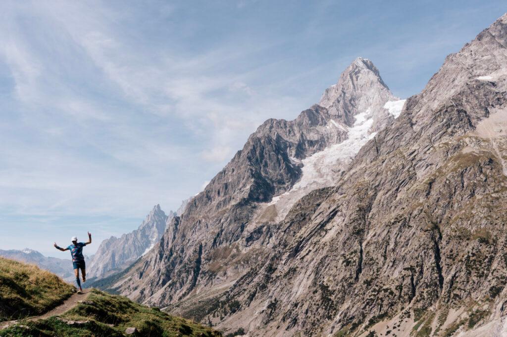
We’ll kick off the trip with a day of running one of Chamonix’s famed, high “balconies,” in one of the world’s great trail running locations. Then, we’ll take our time and run highlights of the TMB in seven running days, covering 10 – 20 miles and one mountain pass each day. Our overnights will include a mix of remote mountain inns and comfortable hotels in and around the Mont Blanc Massif, including Chamonix, France; Courmayeur, Italy; and La Fouly, Switzerland.
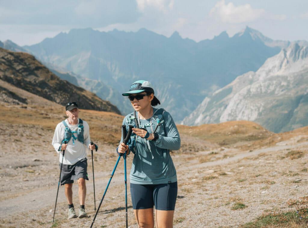
Our route differs slightly from the standard Tour du Mont-Blanc and the famous ultra trail race of the same name. Where the race course takes less scenic routes, we diverge for better views and more enjoyable running. An option exists to follow the race route, for those who want it.
Two opportunities of note: the longer July trip allows participants to run one of the several trail races that are part of the Gran Trail Courmayeur race series. (If you want to race, note so on your registration form and we will follow up with you. Here’s additional information .) Second, the tour at the end of August will overnight in Courmayeur on the evening that runners pass through the village on their way around Mont Blanc, so there will be a unique opportunity to cheer on the world’s best mountain runners.
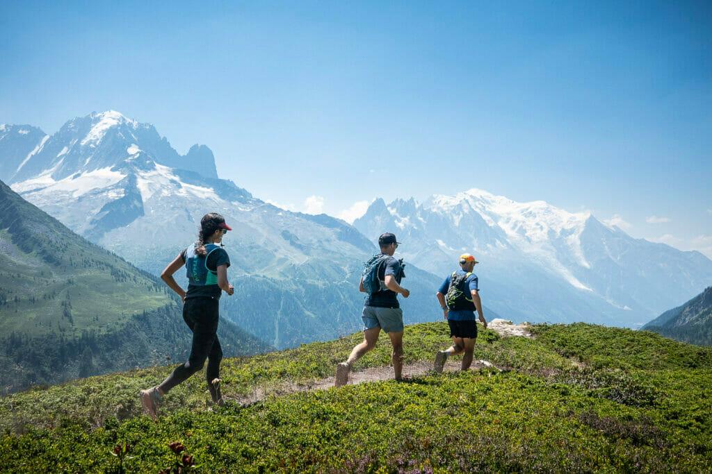
Our typical day on the Tour du Mont Blanc Run starts with a continental buffet breakfast at our inn, and soon we’ll be out on the trail. With many passes to cross, the hiking and running is challenging, but there will also be opportunities for easier days. Our tour will go counter-clockwise around Mont Blanc, starting in Chamonix, then through Italy and into Switzerland, before coming back to Chamonix. Several optional transfers allow for shorter days days that get us right to the best trail running.
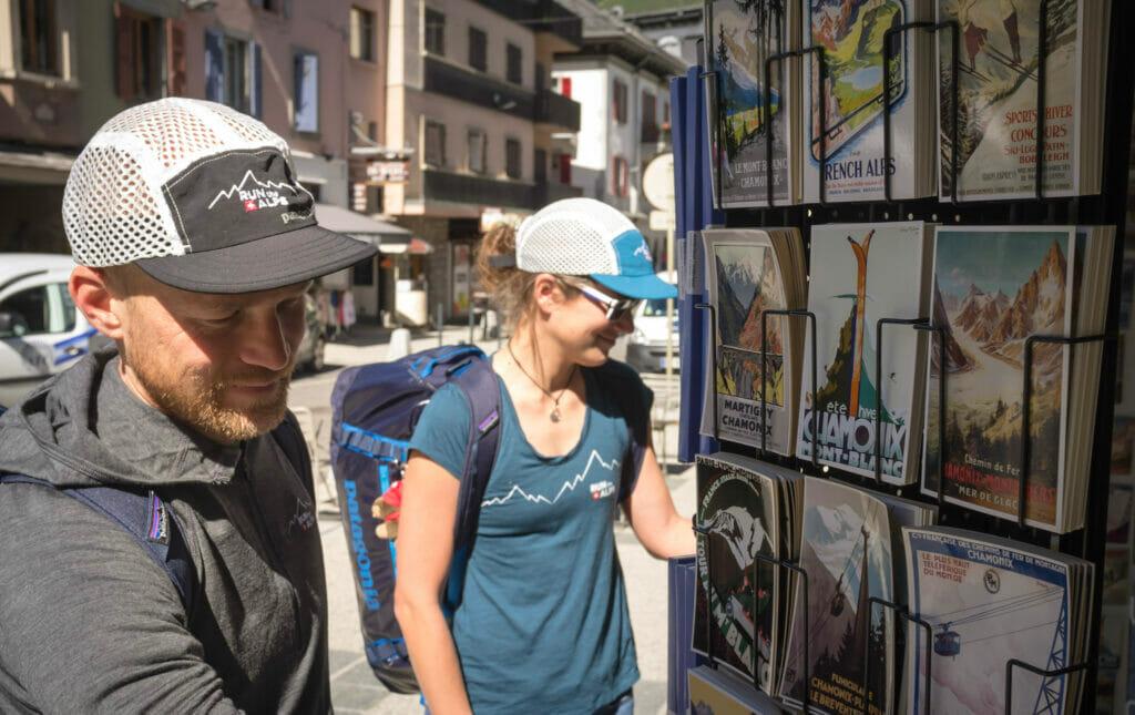
Most of these stages can be hiked in a full day or run in a bit more than half a day, and we should finish each day with some time to relax. Your bags will be transferred separately, each night. In the evening we’ll enjoy dinner together at our inn or a nearby restaurant. These are multi-course feasts featuring local French, Italian and Swiss specialties, and will be hearty, filling, well-earned, and very delicious. We will leave one dinner in Courmayeur free, where you will have a chance to explore on your own.
Book this tour

Chamonix train station. (Photo: Kim Strom)
Arrive in Geneva, and transfer to Chamonix, the world-famous resort and mountaineering center in France. Enjoy your first impressive views of Mont Blanc, with time to relax at the pool and outdoor patio of our Chamonix hotel before joining the group for our trip meeting, followed by dinner.
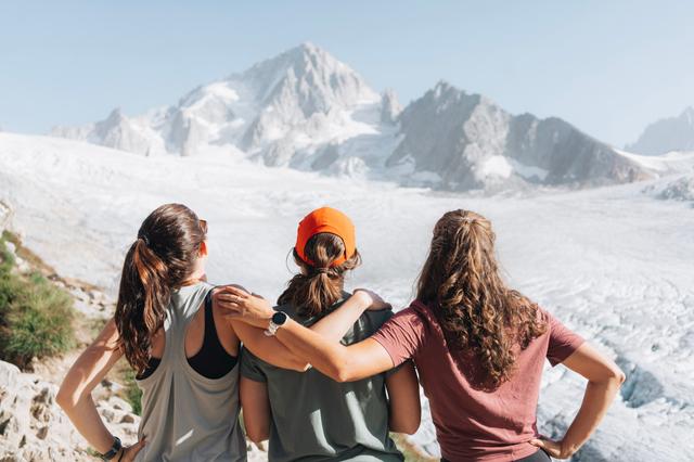
Enjoying the view. (Photo: Sam Hill)
We’ll enjoy some of the many excellent trails in the Chamonix valley, as we get oriented and take in the views. We’ll run one of Chamonix’s dramatic “balconies,” with big views of the glaciers of Mont Blanc.
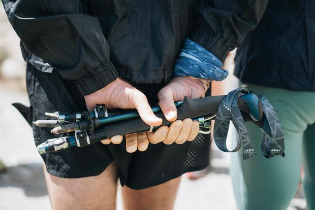
Poles are handy for the Tricot pass. (Photo: Sam Hill)
An undulating trail leads through alpine pastures and pine forests, over the Tricot pass and through the quiet and quaint Miage valley.
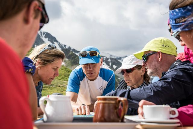
Mapping out the day’s route. (Photo: Mark Brightwell)
Following an old Roman trail, we continue the tour with a long, steady ascent across two lofty passes, Col de la Croix du Bonhomme and Col du Bonhomme.
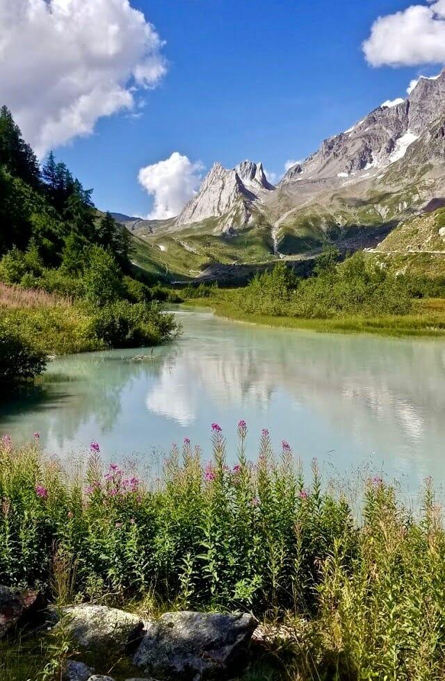
Looking back up to Col de la Seigne. (Photo: Tonya Gray)
Leaving France, a gradual ascent through quiet alp pastures leads to the Col de la Seigne and into Italy. Here we’re greeted by an amazing view into the Veny valley and the Mont Blanc range.
Ready to eat in Italy! (Courtesy photo)
After one of our favorite breakfasts on the tour, a second day in Courmayeur gives you a chance to rest and soak in the hot spring spa at nearby Pré Saint Didier. For those who want to run, the area around Courmayeur is filled with beautiful, quiet single track and huts serving delicious treats, cappuccino, and wine!

The view from Bonatti hut, on the route of the Tour du Mont-Blanc. (Courtesy photo)
We’ll head up to Rifugio Bertone and run some of the best single track on the tour, stopping at the stunning Rifugio Bonatti for lunch. Then it’s time to tackle the ascent of Grand Col Ferret, and cross the border to descend to the quiet Swiss village of La Fouly.

Running above Champex Lac, Switzerland. (Photo: Sam Hill)
Today’s run leads us along the Ferret river then climbs to the pretty lakeside village of Champex-Lac. Next, it’s through woods and meadows to Trient, with views of Switzerland’s Rhône valley and the historic city of Martigny along the way.

Crossing back into France to finish the loop. (Photo: Kim Strom)
We climb to the Col de Balme on the border with France to enjoy gorgeous views of Mont Blanc and the entire Chamonix valley as we cross the pass and descend to la Tour. Finish with a run through the Chamonix valley, or hop on a train for the ride back to Chamonix, where we enjoy a delicious celebratory dinner.
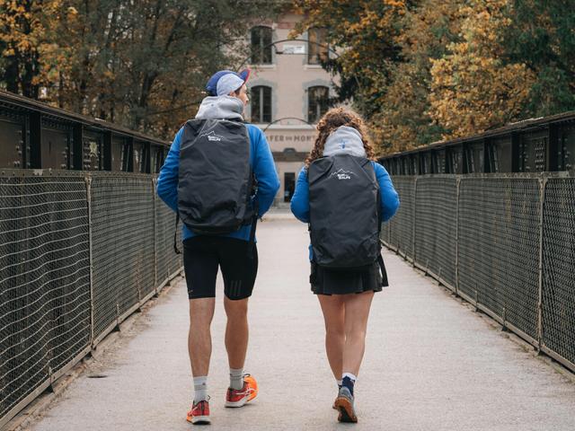
(Photo: Sam Hill)
Today we say “ au revoir” to the Tour du Mont-Blanc and the Vallée du Trail, and depart for our post-Mont Blanc destinations.
Regional map
What's included.
Plan to arrive the day your tour starts, at the latest. Note that flights from the US usually arrive on the following day, so schedule accordingly. The closest airport is Geneva, Switzerland. This tour includes a shared shuttle pickup at the Geneva Airport. If you’d like to arrive a day or more before the tour starts, the shuttle is still included.
For those wanting to spend a few extra days in Chamonix, the “Vallée du Trail” with over 500 kilometers of trail running, we can assist in extending your time and providing self-guided trail running materials, either before or after the tour. The option to run a trail race exists, too– please check our race schedule for more information.
Plan your departure for the day the tour ends at the earliest. Since the Geneva airport is only ninety minutes away by shuttle, it is possible to leave the day the tour ends. If your flight departure time is before 10am, a private shuttle is required at an added cost of $240.
More options for this tour:
Self-guided: Everything but the guide… custom tour design, trail runs, and all the details.
Private: Make it private! Your companions, your dates, your tour– we do the rest.
Contact us for details.
All Run the Alps guests receive a copy of our Guide to Trail Running in the Alps to assist in preparing for their trip.
Terms and Conditions : Read up on Run the Alps’ Terms and Conditions and travel insurance.
Concerned about being ready? We can help! We’ve teamed up with the wonderfully supportive team at Vert.run to offer customized training plans tailored to each Run the Alps trip. Once you’ve signed up for a trip, we’ll email you all the details and your unique code for your FREE first month of training! In the meantime, you can start exploring the plans here .
Tour Balance: Your tour balance is due 90 days before your tour starts. We will send you an invoice about a month before that due date. However, you can pay your balance at any time. If you’d like the simplicity of paying in full sooner, or would like to pay in installments, please contact us .
Tour stories
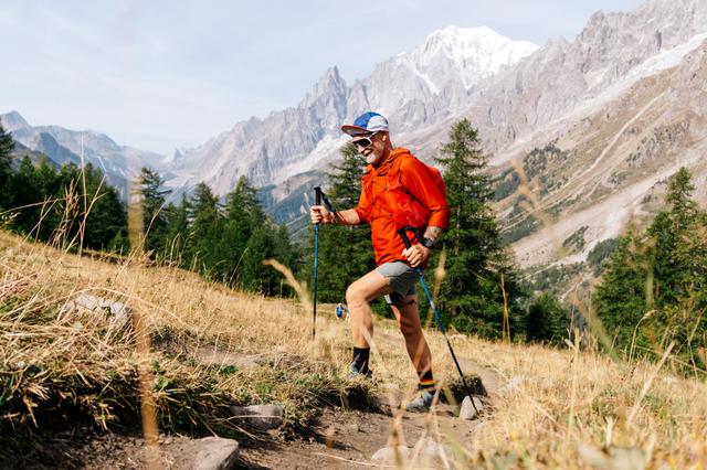
Guides for this Tour

Need a hand preparing?

- Rennrad-Markt 0
- Winterpokal 0
- Posteingang 0
- Kontrollzentrum
- Trainingsverwaltung
- Mitgliederkarte
- Backstage-Blog
- eMTB-News.de
- MTB-News.de
- Nimms-Rad.de
- Neue Beiträge
- Foren durchsuchen
Folge dem Video um zu sehen, wie unsere Website als Web-App auf dem Startbildschirm installiert werden kann.
Anmerkung: This feature may not be available in some browsers.
- Hallo Gast, wir suchen den Renner der Woche 🚴 - vielleicht hast du ein passendes Rennrad in deiner Garage? Alle Infos
- Rennrad Board
- Rennen-, RTF-, Marathon- und Event-Forum
Le Tour du Mont-Blanc 2024 / Vorbereitung und Erfahrungsaustausch
- Ersteller diesel_power
- Erstellt am 24 Februar 2024

diesel_power
Neuer benutzer.
- 24 Februar 2024
Hallo zusammen, im Juli werde ich die nicht kleine Herausforderung angehen und bei der Tour du Mont-Blanc an den Start gehen. Anmeldung ist raus. Apartment ca. 25 min Autofahrt vom Start/Ziel entfernt ist gebucht. Ein ärztliches Attest wird nicht mehr benötigt. Nur noch empfohlen. 330 km und 8300 hm stehen an. Mein längster Marathon war letztes Jahr die Alb Extrem 260km mit 4800 hm (laut Wahoo ) in knapp 11h Gesamtzeit (205 W gewichtet). Da war mein Pacing aber inkonsequent und das hat sich am Ende gerächt. Für die TdMB strebe ich gemütliche 15h an (Ankunft im letzten Tageslicht). Davor wird dann Ende Juni die Alb Extrem 300km/6000hm als Generalprobe auf dem Plan stehen. Ich möchte mich gerne mit gleichgesinnten austauschen, die auch vor der Tour stehen, oder bereits Erfahrung gesammelt haben. Pacing, Verpflegung, Ausrüstung, Logistik Drumherum, etc. Viele Grüße, Jochen
Schau mal hier: tour du mont blanc rennrad .
- 26 Februar 2024
Rennrad-News.de
Stiers schrieb: Lese dann mal mit Dieses Rennen wollte ich dieses Jahr eigentlich auch angehen, überschneidet sich aber leider terminlich, ist für 2025 geplant. Bei mir war der längste Marathon im MTB Bereich 2023 die Salzkammergut Trophy A Distanz mit 209 KM / 7000HM mit 14h Gesamtzeit. Grüße Jochen Zum Vergrößern anklicken....

far from the audax spirit
- 1 März 2024
Ich bin das im Jahre 2016 mal gefahren, weiß nicht, inwieweit das noch von Relevanz ist.
Angstbrmsr schrieb: Ich bin das im Jahre 2016 mal gefahren, weiß nicht, inwieweit das noch von Relevanz ist. Zum Vergrößern anklicken....
- 9 März 2024
diesel_power schrieb: Was würdest Du aus der Erinnerung heraus anders machen? Oder anders angehen? Meine größte Sorge ist, am Anfang mich nicht zur Übertreibung hinreisen zu lassen und eine passende Verpflegungroutine zu finden. Und auf gutes Wetter hoffen. Zum Vergrößern anklicken....
- 10 März 2024

- Trip Finder
- Newsletter Signup
- Request a call

Tour du Mont Blanc - Deluxe, Guided Edition
Europe's most popular trek. Without huts, with luggage transfers and expert guides
Down from Mont Chetif along the Tour du Mont Blanc trail.

Self-Guided Tour du Mont Blanc
Self-Guided Trekking for the Independent Traveler
Photo by Annie Spratt

Maps, Books, and Gear
Go prepared with everything you need for a perfect trek
Some of the available maps and books on the Tour du Mont Blanc. Photo by Alpenwild

Tour du Mont Blanc Trekking
Guided and self-guided alpenwild tour options.
Hike and Trek around Mont Blanc, which rises over 15,770 feet (4,808 meters) above sea level, and is the snow-capped queen of the Alps. Its flanks, glaciers, and deep valleys straddle three countries—France, Italy, and Switzerland. Hiking the Tour du Mont Blanc is the trip of a lifetime. As you circle the base of Mont Blanc you’ll experience the immense snowfields, hanging glaciers, wild-flowered meadows, and dense forests that decorate its walls. More than just a single peak, the Mont Blanc Range, which we compass, contains ten other major summits—each over 4,000 meters high. And with all that elevation you’ll find abundant glaciers, including the Mer de Glace and the Miage Glacier—the longest glaciers in France and Italy, respectively.
A classic Alps adventure awaits as you join one our guided or self-guided Deluxe Tour du Mont Blanc treks.

Starting in Chamonix, France, the 12 days and 11 night Deluxe Tour du Mont Blanc Alpenwild trek includes:
- Handpicked inns and hotels (no huts)
- Luggage transfers
- Experienced and qualified guide
- Incredible meals
- Transportation to and from the airport and during the tour
- Les Hauches cable car
- Bioonassay suspension bridge
- Visit the 15th century baroque chapel of Notre Dame de la Gorge
- Courmayer rest day
- Skyway Monte Bianco – cable car
- Courmayer nature gardens
What are you waiting for? Come join us on the Tour du Mont Blanc this summer!
Do you have any questions or concerns? Talk with an expert (who has actually done the tour) email [email protected] or call 801-226-9026.
Tour du Mont Blanc: A Trek of a Lifetime
With nothing to do but book flights and get in shape for this classic trek, prepare to have the adventure of a lifetime. At Alpenwild, we are Tour du Mont Blanc tour experts. You will thoroughly enjoy the trails, accommodations, meals and comradery along the trail.

Tour du Mont Blanc Overview
Let’s start planning your Tour du Mont Blanc hike with the basics. Where. When. How.

A Mont Blanc Trek Above the Rest
Discover what features make Alpenwild's Tour du Mont Blanc stand out from the rest.

Trek Packing List
We've been there, done that and share our packing list so you can go there, without forgetting that.
The Perfect Way to See the Alps

Tour du Mont Blanc
Be a part of the Tour du Mont Blanc for just 4 minutes in this new Alpenwild video

Guides and Trip Leaders
Alpenwild guides are the best in the Alps. Meet them. Read their stories. See what our guests say about them.

Luggage Transfers and Shuttles
Hike light and enjoy the trek. Luggage transfers make all the difference
The Tour du Mont Blanc is a classic inn-to-inn alpine trek—one which Alpenwild has refined with many creature comforts, exquisite cuisine, and superb accommodations. As you trek the Tour du Mont Blanc, you’ll experience the culture, the rich history of the Alps along with the stories of how this massive mountain has beckoned hikers and mountaineers for over 250 years. Our 12-day guided trip sets a new standard, and on our self-guided treks you can adjust the itinerary to perfectly suit your skills and interests.
See our Privacy Policy.

Routes and one-day walks around Mont Blanc

Tour du Mont Blanc
3 countries, one identity, 10,000 m in altitude and about 60 hours of walking, 170 km of discovery for a total of 10 days of satisfaction!
Our suggestions: historic routes, mountains for all the senses and walks "for everyone" around Mont Blanc

Themed itineraries

Excursions for everyone

Historic routes
- Tourensuche
- Tourenplaner
- Reiseführer
- Ausflugsziele
- Essen & Trinken
- Unterkünfte
- Klettergebiete
- Aktuelle Bedingungen
- Lawinenlage
- Veranstaltungen
- Geschichten
- Bücher & Karten
- Einstellungen
Rennradtouren in der Montblanc-Gruppe

- Bilder einblenden Bilder ausblenden
Die 10 schönsten Rennradtouren in der Montblanc-Gruppe

Entdecke viele weitere Touren in der Tourensuche
Plane ganz einfach eigene Touren
- Alles in Radfahren
- Mountainbike
Wetter für Montblanc-Gruppe
Empfehlungen aus der community, ähnliche aktivitäten in der montblanc-gruppe.

Everything You Need To Know About Hiking The Tour du Mont Blanc
A s an avid hiker, you’ve probably heard of the Tour du Mont Blanc or TMB hiking trail. You might even have plans to conquer this popular hiking destination one day. If so, here’s everything you need to know before you go.
In 1760, a Swiss Geologist and physicist, Horace-Bénédict de Saussure, then living in Geneva, discovered the TMB hiking trail. Saussure wanted to explore the Mont du Blanc Mountains to examine and document plant specimens. Also called the Mont Blanc massif, the mountain range is 60 miles by 20 miles long, with 11 summits over 4,000 meters high. Though he discovered it in 1760, Saussure first walked around the entire TMB hiking path in 1767.
Unfortunately, the Swiss scientist failed to climb one of its peaks on that initial journey around the path. The first to achieve this feat were Michel Paccard and Jacques Balmat. The two found a path to the apex in 1786 through the Grands Mulets route. Sausurre became the third person to reach the summit shortly thereafter.
Trail Overview
Though Pacard and Balmat first reached the peak of the Mont Blanc massif via the Grands Mulets route, the Gouter route is today’s standard path. This trail is 105 miles long and passes through 3 countries: France, Italy, and Switzerland . The Gouter Route (also known as the Voie Des Cristalliers and Voie Royale) is one of the two most commonly utilized routes to reach the summit of Mont Blanc in the Alps. Though the Gouter route reaches an elevation of 15,774 ft, it is considered the most straightforward ascent. The route lies on the north side of the mountain, in France, seeing thousands of mountaineers annually.
The Tour du Mont Blanc difficulty level is somewhat subjective to the hiker. The Gouter route is relatively easy because it takes about two days to reach the ascent and does not require extensive technical skills. Nonetheless, it is physically demanding and mentally challenging if you lack athletic ability. The most difficult aspect of this route includes a narrow passageway of unstable rocks on the mountain’s edge. Seventy-four have died, and 180 were injured in accidents along this dangerous segment between 1990 and 2011.
Once passing this tricky part, the Gouter route is smooth sailing. It steadily increases in steepness while crossing exposed terrain. Hazardous weather conditions are the most dangerous aspects that remain. Cold and wet conditions can cause hypothermia and frostbite. Therefore, visiting the Tour du Mont Blanc for Summer hiking, Mid-June to mid-September, is safest. During the summer, temperatures will range from 40 degrees at night to 80 degrees during the day. Some days require shorts beneath a warm, sunny sky ; others might entail brisk, wet conditions.
Permits And Regulations
No permits are required for the TMB and there are no regulatory restrictions. However, some believe a technical skills test could reduce deaths and injuries along the path. Additionally, residents are disturbed by the amount of trash that hikers inevitably abandon to lighten their loads on the ascent. What’s interesting about the Tour du Mont Blanc is that there are many comforts along the path in the form of hotels and huts. Several companies offer self-guided packages that include accommodations, detailed hiking guides, and set itineraries.
Trail Highlights And Points Of Interest
The Tour du Mont Blanc hike is considered one of the world’s top ten “bucket list” hiking trails. In addition to the soothing sounds of waterfalls , there are glaciers, streams, high alpine meadows, and the natural beauty of the Mont Blanc landscape. Among the most beautiful and visible flora are the rare Slipper Orchid, the Martagon Lily, Aquilegia Alpha, the famous Edelweiss, and rare Campanula thyrsoides. Though heavily impacted by human presence, the animals that remain in the wilderness of the Mont Blanc massif include Marmots, Ravens, Goats, Mountain Hares, Vultures, and Eagles, among others.
Safety Considerations
On the Tour du Mont Blanc hiking trail, the most important considerations will be comfortable shoes and a good quality backpack with appropriate dimensions and weight. What qualifies as an appropriately sized bag will depend on whether you stick to hiking the trail or detour slightly to local huts and hotels. The former will require a 60L bag, and the latter will require a 30L bag. Remember to break in your footwear a few months in advance and buy shoes larger than usual to accommodate swollen, achy feet. Trekking poles will help lessen aches and pains experienced in the knee and leg muscles. Hiking crampons are a “better safe than sorry” item to add to your Tour du Mont Blanc packing list. They will help maintain balance and avoid slipping across waterways and snow patches, which might even save a life!
In case of an emergency, administer first aid, note location and grid reference on a map, call for help (cell phone service is generally available along the TMB). If no phone is available, blow a whistle or flash a flashlight six times. If there is an injured person, carefully consider whether to go for help or stay with the injured. If the injured party stays behind, leave them with food, water, and warm clothes.
Planning and Preparation
Being physically prepared for the TMB hike is a necessary safety precaution. Training should start at least three months in advance and should be in layered clothing, hiking boots, and a fully packed backpack to best simulate trail conditions. Other things that require planning include booking accommodations along the trail and deciding how many days to stay. An itinerary will vary depending on whether two days, two weeks, or even two months are set aside to experience the beauty of TMB.
Most hikers can ascend the Tour du Mont Blanc self-guided if interested. The trail is easy to follow, with well-maintained paths, directional markings, and clearly understood signs. However, map reading skills are essential, and hikers should also carry a guidebook.
People Ask: Hiking the Tour du Mont Blanc
Q: What is the Tour du Mont Blanc hiking trail?
A: The Tour du Mont Blanc is a 170-kilometer hiking trail that circles the Mont Blanc massif in the Alps, passing through France, Italy, and Switzerland.
Q: How long does it take to complete the Tour du Mont Blanc?
A: The entire trail takes about 10 to 12 days to complete.
Q: What is the best time of year to hike the Tour du Mont Blanc?
A: The best time to hike the Tour du Mont Blanc is from mid June to mid September, when the weather is typically mild and the trails are clear of snow.
Q: Are there any accommodations along the trail?
A: Yes, there are many accommodations available along the Tour du Mont Blanc, including hotels, hostels, and mountain huts.
Q: Is it necessary to hire a guide for the hike?
A: No, it is not necessary to hire a guide for the hike. The trail is well-marked and there are many resources available for hikers.
Q: How difficult is the hike?
A: The hike is considered to be moderately difficult, with some steep ascents and descents.
Q: What should I pack for the hike?
A:You should pack appropriate hiking gear, including sturdy boots, warm clothing, and rain gear. You should also bring a map, a compass, and plenty of water and snacks.
Q: Are there any safety concerns I should be aware of?
A: Yes, there are some safety concerns to be aware of, including potential hazards such as steep drops, loose rocks, and unpredictable weather. It is important to stay on the marked trail and to be prepared for changing conditions.
Q: Can I hike the trail in sections?
A: Yes, it is possible to hike the Tour du Mont Blanc in sections, with many hikers choosing to focus on one or two sections at a time.
Q: What are some of the highlights of the hike?
A: Some highlights of the Tour du Mont Blanc include stunning views of the Alps, charming mountain villages, and the opportunity to experience the unique cultures of France, Italy, and Switzerland.
The Tour du Mont Blanc is a renowned hiking trail accommodating hikers from across the globe. It is mentally and physically challenging, but efforts will be rewarded with breathtaking views along the route. The TMB is accessible with or without a guided tour, as there is food, water, emergency services, accommodations, and other modern amenities along the path. With a reasonable amount of advanced preparation, physical training, thoughtful packing, and a conscientious “Leave no trace” mindset, this unforgettable journey is worth experiencing for yourself.

IMAGES
VIDEO
COMMENTS
Reference among the ultra events, the Tour du Mont-Blanc Cyclo will require you a flawless preparation, extraordinary courage and push you to exceed your limits to become a hero. Because yes, becoming a hero is the goal of every participant of the Tour du Mont-Blanc. "The world's toughest one day bike race".
Die Tour du Mont Blanc gilt als der härteste Radmarathon Europas: 338 Kilometer und 8450 Höhenmeter - an einem einzigen Tag. Ein Selbstversuch.
Welcome to the Tour du Mont Blanc (TMB) 3 countries, one identity, 10,000 m in altitude and about 60 hours of walking, 170 km of discovery for a total of 10 days of satisfaction!
C'est ainsi que la presse spécialisée qualifie le Tour du Mont-Blanc Cyclo. En effet, parcourir les 330km et affronter les 8300m de dénivelé positif que l'on vous propose, en une journée, n'est pas une mince affaire ! Au programme pour la douzième édition, la traversée de 3 pays, la France, la Suisse et l'Italie.
The Tour du Mont Blanc is an epic hiking experience that takes you through three countries - France, Italy, and Switzerland - in an intense week. This adventure invites you to measure yourself against the majesty of the Alps, crossing mountain passes such as the Col du Brévent, the Col de la Seigne, and the Col des Fours, while admiring the grand landscapes of Mont Blanc.
Mit dem Fahrrad auf der legendären Tour du Mont Blanc. Rennrad-Collection von Steph Lightfoot. 3 Touren. 20:02 Std. 323 km. 8 810 m. 766. 22. Drei Tage, drei Länder, 320 Kilometer und fast 9.000 Höhenmeter: Die Tour du Mont Blanc ist eine wahrhaft grandiose Fahrradstrecke.
The Tour du Mont Blanc is a magnificent loop. I have chosen to start from Chamonix in France and ride clockwise, always under the watchful eye of the Mont Blanc massif. This three-stage Collection allows you to enjoy the adventure and have a great time. Bike lovers rejoice!
Tour du Mont Blanc ist eine schwere Rennrad-Tour: 439 km in 19:25 Std. Schau diese Route an oder plan deine eigene!
The Tour du Mont Blanc or TMB is one of the most popular long-distance walks in Europe. It circles the Mont Blanc massif, covering a distance of roughly 165 kilometres (103 mi) with 10 kilometres (6.2 mi) of ascent/descent and passing through parts of Switzerland, Italy and France. It is considered one of the classic long-distance hiking trails.
The Tour du Mont Blanc is the most popular long-distance trek in Europe that covers a total distance of approximately 170km depending on which route is taken (some variants can be sorter or longer than the original section). The daily height gain on the Mont Blanc circuit is substantial, and overall the accumulation over the 10 days is in the region of 9,000m.
Tour du Mont Blanc Hiking - Routes, Maps and Itineraries. The Tour du Mont Blanc (TMB) is a 170 km trek that encompasses the whole of the Mont Blanc Massif; with nearly 10 000m of cumulative descent and ascent it is usually completed in a number of days. The TMB has a variety of accommodation facilities along the route (hotels and mountain huts ...
This classic Tour du Mont Blanc 11 day itinerary follows the traditional route of the TMB. Trek every step of this glorious 170km trail through France, Italy and Switzerland basking in the magnificent scenery of this once in a life time long distance trek.
A comprehensive trip report and planning guide for Tour du Mont Blanc hike, one of the most incredible and demanding alpine treks in Europe.
This Tour du Mont Blanc 7 day itinerary follows the complete TMB trail but ideally uses occasional public transport so is best taken during the peak trekking months of July and August. Completing the entire TMB trek in just 7 days is a definitely a challenge and only for the very fit!
16. Juli 2022 - Savoien Die Tour du Mont Blanc Cyclo gilt mit 338 Kilo- und 8500 Höhenmetern als der härteste Rad-Marathon weltweit: Über sieben Pässe und durch drei Länder - Frankreich, Schweiz, Italien -
The Tour du Mont Blanc is one of the most famous hiking routes in the world. A circular route filled with spectacular glaciers, breathtaking alpine meadows, grand mountain passes and charming valleys. Crossing the borders of three countries; France, Switzerland and Italy. With Covid preventing all long haul travel, but European countries just opening up just enough for EU residents to cross ...
A 10-day itinerary of the Tour du Mont Blanc trek including trail specs, GPS maps, accommodations, tips, and frequently asked questions.
The Tour du Mont-Blanc is the most famous trail running route in the world. The "TMB" trail includes some of the most iconic mountain terrain anywhere.
Hallo zusammen, im Juli werde ich die nicht kleine Herausforderung angehen und bei der Tour du Mont-Blanc an den Start gehen. Anmeldung ist raus. Apartment ca. 25 min Autofahrt vom Start/Ziel entfernt ist gebucht. Ein ärztliches Attest wird nicht mehr benötigt. Nur noch empfohlen. 330 km und...
The Tour du Mont Blanc: A trek of a lifetime around Mont Blanc, which rises over 15,770 feet (4,808 meters) above sea level, is the queen of the Alps.
Tour du Mont Blanc. 3 countries, one identity, 10,000 m in altitude and about 60 hours of walking, 170 km of discovery for a total of 10 days of satisfaction! More details.
Die 10 schönsten Rennradtouren in der Montblanc-Gruppe. Rennrad · Rhône-Alpes. Route des Grandes Alpes. Top schwer Etappentour. 679,1 km. 45:42 h. 17.064 hm. 17.480 hm. Nul besoin d'aller à l'autre bout du monde pour vous offrir le plus beau des voyages ! 700 kilomètres, 18 cols mythiques et 14 étapes, la Route des Grandes Alpes est ...
A: Some highlights of the Tour du Mont Blanc include stunning views of the Alps, charming mountain villages, and the opportunity to experience the unique cultures of France, Italy, and Switzerland ...