Mount Baker Highway Day Trip From Bellingham
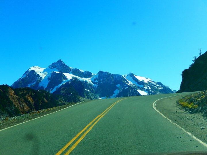
Touring the Mount Baker Highway is an extraordinary day trip packed with breathtaking scenery. Officially, it is both a Washington State Scenic Highway and a National Forest Scenic Byway. The route follows Highway 542 from Bellingham , passing through farmland and forest before winding its way up to Artist Point at 5100 feet.
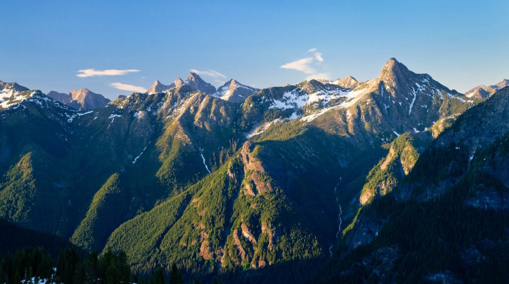
Most of the route (116 miles round trip) is open year-round, taking you as far up as the Mount Baker Ski Area. Views of the Nooksack River Valley, Mount Baker-Snoqualmie National Forest, and the peaks of the North Cascade Mountain Range can be enjoyed during winter and summer.
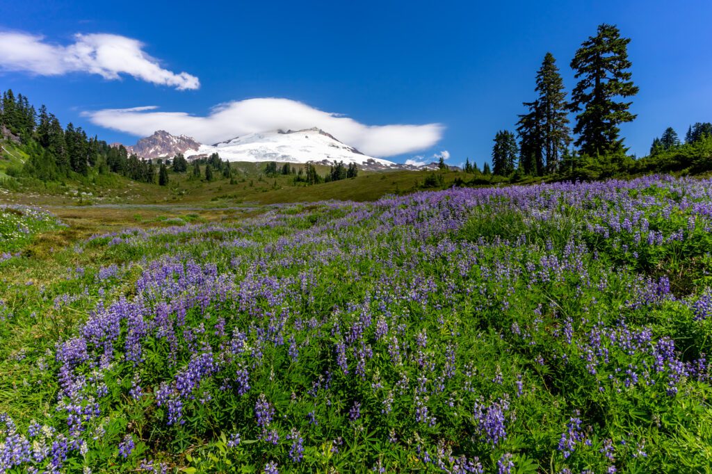
Some of the most gorgeous and memorable scenery is located past the ski area where the road is only open during the warm months. The very best vistas and hikes along the Mount Baker Highway are at Heather Meadows and Artist Point. Planning your trip in August or September allows you to take full advantage of the stunning and colorful scenery. Late September and early October bring a bit of fall color .

What to Know Before You Go
Be prepared with a full tank of gas. There are no services such as food, gas, or flushing toilets beyond the town of Glacier at Mile 33, so be sure to bring snacks and plenty of water.
Choose your trails carefully if you have a dog. Dogs on leashes are permitted on most, but not all, trails.
A recreation pass is required. If you don't have the appropriate annual pass , you can purchase a day-use pass at the Glacier Public Service Center, located at Mile 34.
Where to Stop Along the Way
A great road trip combines ever-changing scenery with lots of fun stops where you can get out and explore. You'll find dozens of stopping places along the Mount Baker Highway, both inside and outside the National Forest. Among the many options, these are highly recommended:
Glacier Public Service Center (mile 34)
Open seasonally, this official Mount Baker-Snoqualmie National Forest station is the place to talk to expert rangers about current trail and road conditions, to get maps and guidebooks, and to purchase recreation passes. And there are bathrooms! This is the last public restroom along the highway with flush toilets, so take advantage of this opportunity. It is also the last place to fill your water bottles.
Nooksack Falls (mile 40)
A short drive off the main highway along Wells Creek Road (a well-maintained dirt road) takes you to the viewing area for this charming misty waterfall.
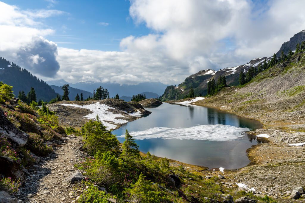
Picture Lake (mile 55)
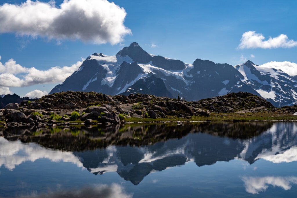
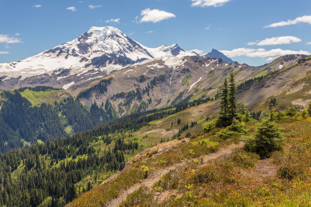
For much of the year, this extremely photogenic little lake is as far as you can travel along the Mount Baker Highway. The road circles the lake, as does a flat and accessible half-mile trail. From the trail (or your parking spot) you can enjoy an amazing view of Mt. Shuksan, made all the more lovely reflected in the still lake.
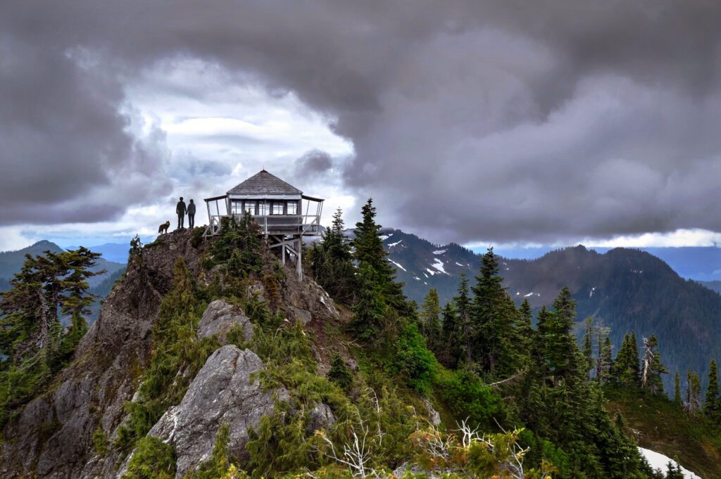
Heather Meadows Visitor Center Area (mile 56)
While the visitor center is charming and historic, it's the surrounding scenery, including Table Mountain and Bagley Lakes, that make this stop a must-see. You can explore the area on the easy Fire & Ice Trail, the moderate Bagley Lakes Trail, or the more ambitious Chain Lakes loop.
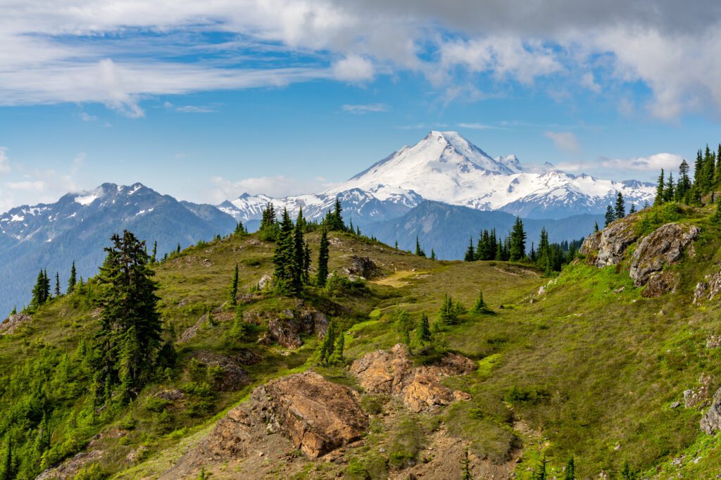
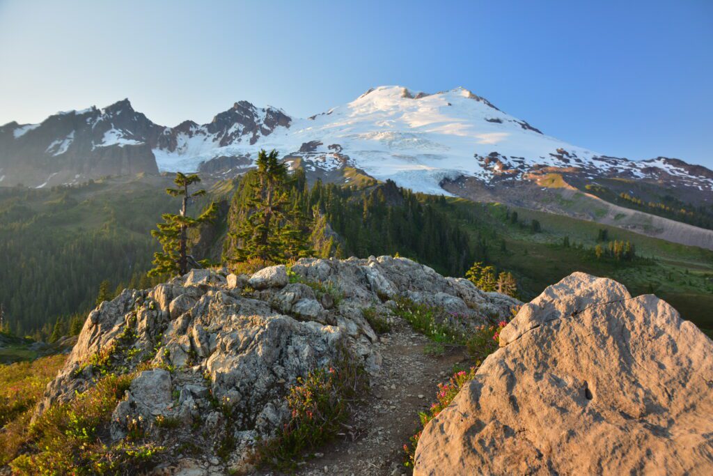
Artist Point (mile 58)
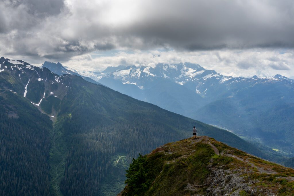
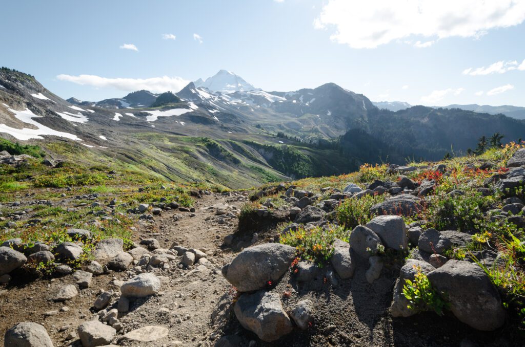
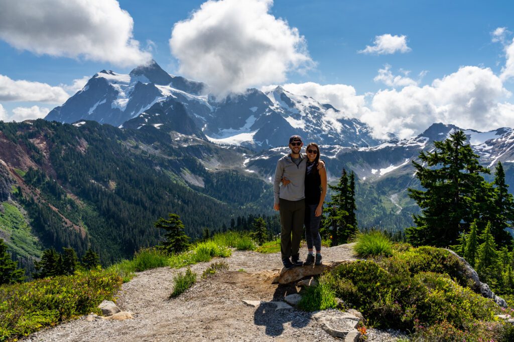
After you've wound your way up Mount Baker Highway, all the gorgeous mountain scenery comes to an extraordinary climax at Artist Point. A short hike takes you to grand views of Mount Baker itself, the volcanic peak to the southwest of Artist Point. You don't even have to leave the parking lot to take in the breathtaking sight of Mt. Shuksan and the North Cascade Range. Hiking trails, including the short Artist Ridge trail, allow you to savor the views in all directions.
Recommended Day Hikes Along the Mount Baker Highway
One of the things that makes a Mount Baker Highway day trip so enjoyable is that's it's easy to break up the "road" part with time on nature trails or short day hikes. Maps and details for these hikes and more can be found at Mount Baker-Snoqualmie National Forest website . Don't forget to ask about current trail conditions at the Glacier Public Service Center.
Short and Easy Day Hikes Even if you are more of a walker than a hiker, there are some picturesque places to get out and stretch your legs. Be sure and take your camera
- Picture Lake (1/2 mile loop)
- Fire & Ice (1/2 mile loop)
- Artist Ridge (1 mile)
- Boyd Creek (1/4 mile)
More Challenging Day Hikes Be sure and plan extra time for these challenging hikes. While the distances don't seem long, for the average hiker, the terrain may slow you down. And then, of course, there are the stop-worthy views.
- Chain Lakes (6.5-mile loop)
- Heliotrope Ridge (5.5 miles round trip)
- Skyline Divide (9 miles round trip)
Food and Drink Along the Mount Baker Highway
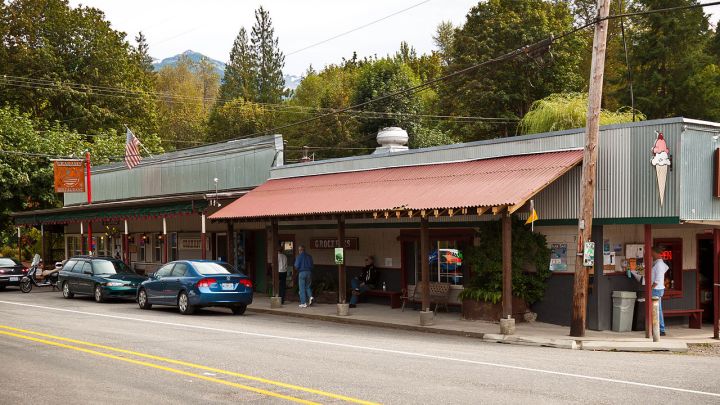
There's some great food and drink to be had along State Highway 542. The bad news is that it's concentrated along the first half of the route. The good news: You'll get to take advantage of it each way, fueling yourself early in the journey and satisfying the appetite you worked up during the day on the way down. Here are some recommendations:
- The North Fork Brewery (mile 20) This "beer shrine," pizzeria, and wedding chapel offers microbrews crafted on-site as well as tasty pizza, calzones, grinders, and salads.
- Grahams Restaurant (mile 33) Under new ownership since 2011, Grahams Restaurant in Glacier continues to offer burgers, beer, and other house specialties.
- Milano's Pasta Fresca (mile 33) This family-run restaurant features fresh and authentic Italian cuisine as well as deli-style sandwiches and desserts. Their Foriana pasta dish, with anchovies and raisins, is a unique and tasty dish.
Top 12 Washington State Attractions
Best Places to See Fall Color in the Pacific Northwest
Bellingham and Whatcom County Travel Guide
Mount Hood Attractions and Activities
Great Washington State Road Trips
Washington's Cascade Loop Scenic Driving Tour
The 28 Best Day Trips From Seattle
Amazing National Parks Near Seattle
Plan Your Trip to Washington State
Hanging Rock State Park: The Complete Guide
11 Things to Do in Fidalgo Island, Washington
7 Best Hikes in Oregon
Glacier National Park: The Complete Guide
What to See and Do in Glacier National Park
The 10 Best Hiking Trails Found Inside America's National Parks
The Most Dog-Friendly National Parks in the U.S.
Tell us what you're looking for
Mount Baker Scenic Byway
Winding along the banks of the Nooksack River, through small logging communities, past waterfalls and alongside old-growth forest groves, this 58-mile trek ends at the base of the 10,781-foot volcano Mount Baker and one of the most photographed scenes in the country at Picture Lake with its mirror reflection of Mount Shuksan.
The end of the road at Artist Point is only open for 3-4 months in late summer and early fall so you may want to plan around that to get some of the best hikes and photo ops of Mount Baker.
CLICK TO EXPLORE ON MAP to find more things to do, places to stay and eat along this route.

1. Bellingham
90-minutes north of Seattle, you will find yourself in the northwest corner of Washington State. Known for its unique and local museums, shops, galleries, breweries and restaurants, Bellingham is a must-see town when visiting the West Coast.

2. Eagle Watching on the Nooksack River
Along the shores of North Fork of the Nooksack River, hundreds of bald eagles feast upon the schools of returning chum salmon. As the chum slowly start to decompose after arriving in freshwater and spawning, eagles from around the Pacific Northwest flock to the region in hopes for serious sustenance. Visible from the road, this amazing display of nature is the perfect weekend trip for residents of the Pacific Northwest. December through January are typically the best viewing times.

3. Silver Lake Park
If you are looking for an outdoor recreation experience that gives you the best Whatcom County has to offer, then visit Silver Lake Park. Just 40 minutes east of Bellingham on the scenic Mt Baker Highway, Silver Lake Park is the perfect place for families to gather. Come enjoy: Camping, Cabin Rentals, Day & Overnight Lodge Rentals, Horse Camping, Fishing, Boating, Picnicking, and Trails.

4. Glacier Ranger Station
A highly recommened stop on your way up the mountian—especially for backcountry and hiking information—the Glacier Public Service Center on the Mt. Baker Scenic Byway, State Route 542, serves visitors headed into the northern reaches of the Mt. Baker-Snoqualmie National Forest and North Cascades National Park.

5. Nooksack Falls
A few miles past Glacier, watch for FS-33 which leads to where the Nooksack River flows through a narrow gorge and drops 88 feet into a deep rocky river canyon.

6. Picture Lake - Mount Shuksan
Picture Lake is the centerpiece of a strikingly beautiful landscape in the Heather Meadows area. The classic alpine vista of Mt. Shuksan mirrored in Picture Lake is one of the most photographed mountain scenes in North America. A backdrop of mountains, wildflowers and colorful plant foliage make this a beautiful, universally accessible family hike.

7. Mount Baker Ski & Recreation Area
Mt. Baker Ski Area is a ski resort located in the northwest corner of Washington State, at the end of the Mt. Baker Scenic Highway, SR-542. The base elevation is at 3,500 feet, while the ski area is at 5,089 feet. It is about 10 miles south of the 49th parallel, the international border with Canada.

8. Artist Point
Located at the very end of Mount Baker Highway, State Route 542, Artist Point boasts 360-degree views of Mount Shuksan and Mount Baker, as well as access to a variety of trails. Due to excessive annual snowfall, this coveted destination is typically only open from late July to early October.
Emerald Downs

Mount Baker Scenic Highway


- Scenic Drives
- Road Trip Planner

- Suggestion Box
- Water Access
- Vista Points
- Information
- Campgrounds
- Charging Stations
Home ▼ » Pacific Northwest » Washington Scenic Drives and Road Trips
Share Link Open in new window
Mount Baker Highway
A scenic drive to Mount Baker
- Download Map/GPS
- Send to Phone
- Print Directions
Related Drives
- Share Pictures
Our free Road Trip Planner will reverse the route and include the places of interests. Click the “Add to Road Trip” above to start planning your next road trip.
Send this link to your phone. Standard text messaging rates apply.
Get directions from your start address to the beginning of and including this scenic drive. Choose either an alternate ending or same as start.
- Starting: * Use GPS
- To: Mount Baker Highway
- Ending: Same?
Have more destinations? Use our free Road Trip Planner to completely plan your adventure. Click the “Add to Road Trip” above to start planning your next road trip.

Get a Park Pass
Natural areas along this route require an entrance fee used to protect and maintain our most scenic treasures. Save time by purchasing your forest passes before you go.
- Pacific Northwest Forest Passes (Washington, Oregon)
The Mount Baker Highway drive starts in Bellingham and it follows the Nooksack River to Mount Baker’s Artist Point. At 10,781 feet tall, Mount Baker is the fourth highest mountain in Washington and the sixth highest of the Cascade Mountain Range. It is the second most glaciated mountain ( Mount Rainier being the first), having more snow than all other mountains combined in the range with the exception of Mount Rainier, and averages 615 inches of new snow per year. Mount Baker is also second most active volcano in the range ( Mount St. Helens being the most active).

To reach the starting point, take Exit 255 from I-5 to WA-542 and follow it eastward. Our map above begins just after you cross the North Fork Nooksack River and arrive at Nugent’s Corner. In case you’re ready for a picnic already or spotting places to stop by on your way home, there is a small dirt road just after you cross the North Fork Nooksack River where you can enjoy your picnic on a rocky beach at Nooksack Corner (A1) . This drive follows the North Fork Nooksack River nearly to its source, Mount Shuksan.
Washington is fortunate to have many great wineries, and the Nooksack River and Mount Baker create an excellent climate for growing wine grapes. The Mount Baker Vineyards (A2) , located just a few miles before Deming, presents you the opportunity to taste some of these fine wines.
Mosquito Lake Road is a quaint side trip. At the WA-9 intersection, head south for a few miles, and it will be on your left.
The thick forest starts right around Maple Falls and this is your last chance for gas before heading up Mount Baker. For a beautiful lake, head north on Silver Lake Road for Silver Lake Recreation Area (W1) . The lake is surrounded by the foothills of Mount Baker. You can walk through its forests, enjoy a picnic on the beach, or rent a boat and row around the lake.
Continuing east on WA-524, the Glacier Public Service Center (I1) will be on your right and is a great place to get updated information on road closures that may affect your plans.
Just east of the center, you can take Glacier Creek Road (Forest Road 39) for a half mile to a bridge where salmon can be spotted traveling upstream Thompson Creek (A3) to spawn. If you continue on Glacier Creek Road about 9-miles, there are great viewpoints of Mount Baker’s Coleman Glacier (V1) . A 2.5-mile hike leaves from here through the forest and heads to the glacier.
The Nooksack River generally meanders through the Mount Baker Snoqualmie National Forest and it forms several waterfalls, including the Nooksack Falls (H2) which plunges down 175 feet. You can see it by following the unpaved Wells Creek Road until the bridge.
Continuing on Mount Baker Highway, you will now start climbing up Mount Baker, enjoying views of the mountain at many of the roads turnouts. There are many hikes for all skills and lengths, most starting at the Heather Meadows (H3) Visitor Center. Further up from the Visitor Center, Artist Point, marks the end of our drive. On clear days from Mount Baker, you can see the San Juan Islands, the Canadian Rockies, the Cascade Mountains, and more. Enjoy a portion of the Artist Ridge Trail (H4) to enjoy the spectacular views.
To head back home, just turn around and enjoy the road on the way back. Consider taking WA-9 just before Deming southward to the North Cascades Highway or the Mountain Loop Highway .

- Mosquito Lake Road
- Chuckanut Drive
- North Cascades Highway
- More Washington scenic drives
- Find more scenic drives
- Plan a Road Trip
- Recommend a Stop
- Gas Calculator
- Jump to the map
myscenicdrives.com
How it works.

Drive and Hike Mt. Baker Scenic Byway
From Bellingham to the majestic peak of Mt. Baker , Mt. Baker Scenic Byway (SR 542) offers visitors a step back in time. The highway winds through farmlands, rolling wooded hills, and small communities including Nugents Corner, Deming, Kendall, Maple Falls and Glacier. This byway provides access to stunning hiking, photo opportunities, and snow sports in the winter.


FROM SEATTLE TO MOUNT BAKER ON A 10-DAY ROAD TRIP

13 November 2018

Seattle’s location in Washington State’s northwest corner means that it’s a perfect base for exploring the area’s natural wonders. Both on land and off-shore.
In fact, there’s so much to explore that you could conceivably spend several weeks travelling around by road, train and boat.
For instance, to the west is the majestic Olympic National Park featuring the rugged Olympic Mountains. To the northwest Vancouver Island entices with its combination of wilderness and small towns.
Meanwhile, Mount Rainier National Park , home to the iconic mountain bearing the same name, is less than a two-hour drive south.
But, arguably the drive north provides the best and largest variety of attractions. And they can all conceivably be visited on day trips. Taken together, though, they make for an exhilarating ten-day road trip beginning and ending in the Emerald City.
In our opinion, it’s a trip that’s best appreciated if you pack a tent or hire a campervan . And there are plenty of campgrounds to choose from. Not to mention a whole host of places to finish the day with a glass or two of some of the state’s finest craft beers .
So, here’s how to do it…

Whidbey Island
Deception pass national park, san juan islands, chuckanut drive, mount baker highway, north cascades highway, snoqualmie falls, road trip from seattle – final thoughts.
- Subscribe to our newsletter
- Submit a comment
This page contains affiliate links. To help us maintain our site we work with a number of partners who we’ve personally used and can recommend to our readers. If you decide to purchase any products through the links on this page, we’ll receive a small commission at no extra cost to you.
Of course, before you start your road trip you’ll want to explore Seattle itself.
It’s a city that’s compact enough to walk around. Especially if the weather is good. And that’s a big “if” outside of summer.
But with spectacular views across the bay to the Olympic Mountains and also Mount Rainier to the south, it begs to be viewed from a decent height. Which the observation deck in the iconic Space Needle certainly provides. As does the Smith Tower , Seattle’s first skyscraper.
Or you can get a free panoramic view of the city at Kerry Park.
Another view of the Seattle Skyline from Beacon Hill

The Space Needle
Elsewhere, there’s the famous and historic Pike Place Market with its fish-tossing market stall sellers. There’s also Pioneer Square , Seattle’s original downtown and home to unique tours of the underground passageways .
Of course, after all that walking you’ll need to sample a selection of Seattle’s renowned craft beers, preferably at one of their brewpubs . We can especially recommend Cloudburst Brewing near to Pike Place Market and Fremont Brewing over in Fremont.
And, while you’re in the vicinity, make sure you seek out the bizarre concrete sculpture of a Fremont Troll clutching a Volkswagen Beetle.
Yes, you heard me right.

The Fremont Troll
If you’ve got any cash left you might also want to try at least one of the city’s museums, of which there are many.
We’d heard good things about the Chihuly Garden And Glass museum but opted instead for the Museum Of Pop And Culture . After all, hailing from Merseyside (home to Liverpool and The Beatles) as I do, I’ve always felt a certain affinity with other cities with a musical heritage. And Seattle, the birthplace of Jimi Hendrix and the city that introduced Nirvana et al to a worldwide audience, certainly fits the bill.
Indeed, in the museum, there’s an exhibition dedicated to both Hendrix and Nirvana. There’s also a monumental structure consisting of nearly 700 guitars and other musical instruments to admire.
But, on the top floor, there’s a music area where you get the opportunity to play a range of musical instruments in small sound-proofed rooms. Suffice to say, my ten minutes on an electric guitar with the amplifier knob “turned up to eleven” was undoubtedly one of Seattle’s musical highlights of the year.
Pity no-one else heard it, really.
Back to Contents →

Ok, so you’ve seen Seattle and it’s time to head out on your road trip.
Your first point of call will be Mukilteo, via Interstate 5, to catch the car ferry (leaves every 30 minutes) for the 20-minute journey over to Whidbey Island.
The small town’s other notable claim to fame is that it’s home to the largest building in the world by volume – the Boeing Everett Factory. There’s a museum – The Future Of Flight Aviation Center – and a tour of the factory if that’s your kind of thing.
Once you’ve arrived at Whidbey Island you’ll travel northwards on what is part of Washington State’s Cascade Loop – an epic 440-mile road trip that crosses the North Cascade Mountains, much of which can only be completed during summer months.
Along the way, stop off and wander around a couple of lovely historic coastal towns, Langley and Coupeville .
In addition to Langley’s restaurants, breweries and early-20th Century shop fronts there’s the chance to visit the Whale Center to learn about the orcas and grey whales that forage around the island. And you’re encouraged to ring a bell at a nearby observation point should you happen to spot one offshore.
Meanwhile, Coupeville’s gorgeous old buildings, shops, eateries and wharf are worth an afternoon of anyone’s time. As are the town’s famous Penn Cove mussels.

The Whale Bell in Langley, Whidbey Island
But the island’s real gem lies at its far north tip.
Deception Pass is the state’s most-visited National Park and spans the tips of both Whidbey and Fidalgo Islands. Connected by the iconic Deception Pass Bridge , the park contains trails, campgrounds, beaches, tidepools and stellar views.
Many visitors just park up beside the bridge and take in the view but you could easily spend multiple days here exploring the many trails, both in the park and surrounding area.
Don’t miss the walk along the rugged coastline from Lighthouse Point to Rosario Beach, watching out for seals, porpoises and American Bald Eagles.

Deception Pass Bridge
At the northern tip of Fidalgo Island sits lovely Anacortes.
With a bustling marina and ferry connections to both the San Juan Islands and Vancouver Island, it’s the major activity hub for the area. So, whether you fancy a few hours’ whale-watching or simply kayaking around its stunning coastline, there’s an opportunity to park the vehicle for a while and get out on to the water. Although that doesn’t come cheaply!
Otherwise, there are some good walks around the likes of Cap Sante Marina and up to the viewpoint at Cap Sante Point. Just out of town, you can drive to the trail around Washington Park and to the Mount Erie car park for a more taxing hike up to its summit.
As you’d expect, there are plenty of places to eat and drink. But for a “rustic” option try the Shrimp Shack on State Route 20. It’s something of an institution in these parts. Although, despite its name, it’s not exactly a budget option. But when the choices on offer not only include regular items such as Clam Chowder and Fish Tacos but also Blue Crab Burger and Fried Colossal Prawns then I’m sold.
In town, the Anacortes Brewery and Brown Lantern are worth a visit for a beer or two. But if you only have the chance to visit one bar we’d recommend The Union Tavern , with its changing range of craft beers and quite possibly the best gourmet hot dogs we’ve ever tasted!

Cap Sante Marina, Anacortes

Sunset at Mount Erie
From Anacortes, head to the ferry terminal to catch an early (like 6:20 am early) car ferry over to the San Juan Islands . You can actually just rock up at the terminal and join the queue without booking. But, between May and September, you might want to make an online reservation at least a day or so beforehand. Prices are for the round trip to Friday Harbor, San Juan Island and back again via Orcas and Lopez Islands.
The journey over by boat is one to savour as Fidalgo Island fades behind under the watchful eye of the snowbound Mount Baker. And, as the pine-clad hills of the San Juan archipelago draw nearer, the route passes through a number of channels between both inhabited and uninhabited islands.
Once back on land at Friday Harbour on San Juan Island, take a leisurely drive along the San Juan Islands Scenic Byway . The road circumnavigates the island and passes through most of the main sights. Of particular interest are American Camp and English Camp – two relics from the 19th Century when the British and Americans agreed to a joint occupation of the island. Oh, those heady days of cross-Atlantic cooperation!
And Lime Kiln State Park is considered to be one of the best places in the world to watch orca whales from the shore.
Of course, you can spend a full day on the island and enjoy a night at one of its campsites before catching a morning ferry to Orcas Island. Or you can catch an afternoon ferry instead and continue your journey along the Scenic Byway.
To be honest, we found Orcas Island to be more scenic than San Juan. Especially the drive up to the summit of Mount Constitution and its panoramic views across the islands to the mountains of British Colombia.
Craft beer tip: visit the tiny Island Hoppin’ Brewery in Eastsound.
While we’d suggest you spend a night on either San Juan or Orcas Island, by catching an early-morning ferry, you could conceivably tour both islands and return to Anacortes in the evening.

Moran State Park, Orcas Island
Back on the mainland, head east along State Route 20 to Burlington, then turn north on to Interstate 5 before getting off at the next junction for Chuckanut Drive (State Route 11).
The road then continues through farmland before it snakes its way between the coast and Chuckanut Mountain, with lovely views across Samish Bay to the San Juan Islands. We reckon it’s best appreciated with your speed dial well below the legal limit. And there are some worthwhile gastronomic stops to be had along the way.
For instance, stock up on some dough-based goodies by taking a slight detour to the Bread Farm in Edison. And I defy you to try one of their Ginger/Honey/Cardamon Shortbreads without scoffing the whole packet.
Further along the coast, The Oyster Bar offers (not surprisingly) oysters and other seafood with complimentary views over Samish Bay. It’s a fine dining experience with a reputation to match.
But for more of a DIY experience try the Samish Oyster Bar & Shellfish Market where you can choose from a dizzying selection of seafood and grill your choice on one of the barbecues in the picnic area.
The road eventually leads to the coastal university town of Bellingham with its vibrant craft beer scene driven by no less than 15 breweries. If you’ve only got time to visit one (and you really should) I can heartily recommend Aslan Brewing Company . Trust me on this, just order a starter portion of Black Bean Dip with Homemade Tortilla Chips alongside a pint of Batch 15 IPA and the world will suddenly feel like a much better place.

Almost a permanent sight from anywhere in this part of Washington State, Mount Baker’s brilliant white peak looms over the area like a beacon of snowbound light. And the good news is that State Route 542 from Bellingham takes you up into the Mount Baker-Snoqualmie National Forest for a much closer look.
It’s a 60-mile journey from Bellingham but the road is good and surprisingly light on traffic. Although, depending on what time of the year you tackle it, you might find that its upper reaches are closed because of snow. Indeed, when we visited in May we couldn’t get any further than Picture Lake – which was also covered in snow.
But in the height of summer, the end of the road – or Artist’s Point as it’s called – can be reached for truly phenomenal views of Mount Baker and Mount Shuksan.
Nevertheless, no matter how much of it you can access, just enjoy the drive through sublime mountain scenery. Especially when the road climbs above the tree line of the forest.

Having retraced your route back along SR 542, take a left on SR 9 until it connects with SR 20 at Sedro-Woolley. A left turn will then put you on the North Cascades Scenic Highway.
This is another road that will potentially be closed at some point along the way, depending on the time of the year. But as it passes through the aptly named town of Concrete, the road transforms into another gateway to a gallery of jaw-dropping mountain views.
Following its route along the banks of the Skagit River, be sure to stop off at the Howard Miller Steelhead Park near Rockport, which is one of the best places in the state to see American Bald Eagles in large numbers. And it’s a good place to spend the night in your camper, too.
Continuing along the highway, the road climbs until it reaches the ridiculously beautiful Diablo Lake . From the off-road viewpoint, the turquoise-indigo colours of the lake contrast with the dark green pine forests surrounding it and the white snow-clad peaks of the Cascade Mountains behind. It’s the best view panoramic view of the whole road trip. And it shouldn’t be rushed.
To cap it all, the Diablo Lake Trai l features a precipitous gorge with 700-foot waterfalls. And if you manage to complete the full 7 km hike, you can even catch a ferry back along the lake.

Just beyond the lake, the road was again closed when we visited in May. But beyond that is The Cascade Loop which you can opt to take during the summer months if and when this section of the road is open.
Otherwise, you can turn around and make some stops on the way back to Sedro-Woolley.
Like this turn-off on the shores of Diablo Lake, for instance…

Reflections on Diablo Lake
And don’t miss the amazing Diablo Dam , which stretches across the lake towards its western tip. You can drive across but I’d suggest to park up just before it and wander across by foot.
It’s no longer one of the world’s largest dams but I defy you to witness one that’s in a better location. And, when it opens up to let a thunderous cascade of white water drop hundreds of feet into the gorge below, it’s a truly breathtaking sight.
Indeed, you’ll still be thinking about it when you stop for a well-earned beer at Birdsview Brewing Company , our final recommended watering hole, just the other side of Concrete.

And so, for our final destination, continue back on SR 20 until it meets Interstate 5 and then head south towards Seattle before turning off for Snoqualmie at Everett.
Snoqualmie Falls is one of Washington’s most-visited attractions. And with good reason as the 270-foot waterfall once again benefits from a spectacular setting.
And fans of David Lynch’s mother-of-all-TV-series, Twin Peaks, will recognise it as the waterfall that features in slow-mo during the opening credits of the original series. Not to mention the hotel at the top of the falls which doubled as the Great Northern Hotel in the same series.
There’s a trail down to the base of the falls for a closer look, where there’ll also be fewer people for company.
It’s a touristy place for sure. But, as the final stopping point on the round trip to and from Seattle, it’s a fittingly dramatic one, too.

As I mentioned earlier, each of the destinations featured in this article can be done separately as day trips from Seattle. Indeed, the San Juan Islands can be reached by ferry directly from Seattle rather than Anacortes.
But, for us, there’s nothing quite like the feeling of leaving your home base behind for a few days and having the freedom to explore at will or change plans on the hoof.
And in this beautifully wild, mountainous corner of the United States, you really are spoiled for choice.
What did you think? Have you been to Washington State? Or perhaps you’re thinking of visiting there in the near future? Either way, we’d love to hear from you so please add your comments below.
- Header image of Mount Baker courtesy of tajenli via Pixabay on a Creative Commons licence
MORE ON WASHINGTON STATE

BOOK YOUR TRIP
To help us maintain our site we work with a number of partners who we’ve personally used and can recommend to our readers. If you decide to purchase any products through the following links, we’ll receive a small commission at no extra cost to you. Thank you for your support!
with Skyscanner
Travel insurance
with World Nomads
with Booking.com
PIN IT FOR LATER

Subscribe To Our Newsletter
GDPR consent: By subscribing, I agree to have my email address transferred and stored securely with MailChimp
You have successfully subscribed
THANKS FOR READING!
Hi, we’re Ian and Nicky, an English couple on a voyage of discovery around the world, and this blog is designed to reflect what we see, think and do. Actually, we’d like to think it also provides information, entertainment and inspiration for other “mature” travellers, too. So please feel free to pour yourself a glass of something suitably chilled and take a look around.
23 Comments

Sounds like a fun road trip! Taking some notes. We’ll be taking our dogs, so we’re definitely looking for dog-friendly spots. We recently got a Pup Passport in Seattle which has been super helpful.

Washington State is one of our favorites, but there is so much we haven’t even seen yet. This looks like a great road trip for our next visit there!

I know what you mean, Bonnie – it’s incredible to think we’ve only seen a tiny corner of the state. An excuse for us to return one day, too!

Oh my gosh you covered a lot of territory. this is my home state and your amazing photos made me homesick. I’m glad you were able to admire it’s beauty!

Love, love, love! We lived in Washington state for one year, and just loved it so much. The people are so friendly and the scenery is amazing. Did you get as far as Roslyn? It is a tiny town where Northern Exposure was filmed.

Really gorgeous shots here and I think this road trip looks amazing. I would love to do it someday!

Thank you, we were blessed with good weather and great scenery! Do let us know if you get there, we love getting updates ????

Very detailed post. This sounds like a road trip I definitely need to do. Was lucky enough to visit Seattle a few years ago but regret not being able to see the troll, so a good excuse to go back and get road tripping!!!
Our excuse to go back is to see Mount Baker during the summer months and maybe do the full Cascade Loop. Oh, and try out one or two more of those brewpubs! Hope you get to do the road trip at some point, Lizzie.

This is the only road trip I have ever wanted to do. Hubs wants to do it on a motorcycle but I’m too old for that lark but I would be as happy as larry to do it in a comfy car oh my word those views sigh…
Hope you get to do it one day Faith! We saw a few Hogs doing the road trip they look pretty comfy! Plus, it means you get to sample all the craft beers as hubs would be driving! Thanks for stopping by!

Amazing trip. Spent a good bit of time in Seattle and Oregon but missed most of these places–San Juan Islands. Snoqualmie Falls looks great.
Thank you! We loved the atmosphere on the San Juan Islands Sue, it was really chilled, which coupled with some stunning scenery made for a great trip! You now have an excuse for a return trip!

10-day road trip planning and this is so great! saw at the beautiful picture is so worth it. I in love with this one! thank you for sharing this amazing post with us.
You’re welcome Jess! Glad you enjoyed it. ????

This road trip looks awesome! We are planning to visit that part of the US next year so this will be super helpful – an area I’ve never heard of (other than Seattle, of course). Where did you stay along the way?
Hi Rebecca, there are so many accommodation options. We had our own vehicle so we’re able to make use of campsites along the way, although we did stay with friends too and a couple of Air BnB’s. There’s definitely something for every budget. Have a great trip!

I love a good road trip, and your Seattle to Mount Baker road trip looks particularly scenic. I’d definitely love to visit Orcas Island, especially since you can combine beautiful scenery with craft beer!
For me, there’s only one thing better than combining beautiful scenery with a craft beer. And that’s ordering a second one!

This looks awesome – I will definitely bookmark this for whenever I am in the area. We havn’t traveled much in the USA yet.
Thanks Jade. You’re in for a treat when you do get to The States! There are so many amazing National Parks to explore!

Great itinerary, we are retiring in 5 weeks and relocating from Wisconsin to Arizona. Extensive roadtripping is in our future!! I especially appreciate your appreciation of craft beer.
Thanks, Janet. And we’ve definitely got another US road trip or two in us yet. Including taking in plenty more of those breweries, of course. Not been to Arizona yet but that’ll be high on our list when we do return. Enjoy your retirement and especially the road tripping!
Submit a Comment Cancel reply
Your email address will not be published. Required fields are marked *
Save my name, email, and website in this browser for the next time I comment.
This site uses Akismet to reduce spam. Learn how your comment data is processed .
Pin It on Pinterest

November 21, 2023
Looking for the best hiking trails on the Mount Baker Highway? For the best hiking trails accessible from Washington’s Mt Baker Highway for families, hard hikes, and mountain views, read on!
why me? Hi there! My name is Maddy, and I work as an outdoor guide and writer, but mostly importantly I’m a real person writing this blog. I spent all of Fall 2023 from September to November based at the beginning of the Mt Baker Highway. Every chance I got I was exploring the area, and I’m so excited to show you around.

10 Epic Hiking Trails off The Mt Baker Highway
Washington’s Mount Baker Highway (542) is one of the most scenic drives in Washington State and a great hiking destination!
Note! This post contains affiliate links; that means if you choose to make a purchase based on my recommendation I make a small kickback at no additional cost to you.
What to pack for hiking and backpacking around Mount Baker:
Hiking and backpacking around Mt. Baker is an awesome experience and snow-free roughly July-mid October. The best months to visit are September and October. Here’s some of the best gear to pack for hiking on the Mt Baker Highway:
- 2 lightweight, long hiking pants. I wear a size 8 and am short, and find the REI trailmade to be super flattering as well as the Kuhl freeflex .
- A pair of shorts , and yoga pants with pockets
- A fleece. Any fleece will do, but I really love my Patagonia Synchilla
- Wool baselayers. Five years of heavy paddling and my Smartwool baselayers are the only wool baselayers I’ve had that have really stood the test of time. For seven days, pack four baselayer tops.
- Study hiking boots. I like my Briger Mids. Working in outdoor retail I literally never had anyone try on these shoes and not buy them. Pair with Darn Tough hiking socks and pack at least five pairs. In the alpine areas, trekking poles are also a great choice!
- hiking sandals
- Quick dry shots: I like Patagonia Baggies
- A puffy jacket. It can be cool even in the summer near the lakeshore, especially evenings. My partner Andy (also a wilderness guide) swears by the Patagonia Nano Puff . I like my Helly Hansen Liftloft .
- If camping, a tent, packable sleeping bag ( Nemo Disco ) and pad ( comfortable sleeping pad ): Read my budget tent recommendations here!
- A day hiking pack: I love my Perimeter 35L . I was gifted this pack a few years back and it’s still my go-to day pack; a savvy packer can easily pack for a seven day hiking trip in this bag.
- A raincoat. I love the Moss Raincoat from Helly Hansen ; It’s affordable, cute, and super durable.
- A Northwest Forest Pass is required to hike in the National Forest (National Parks Pass also valid)
- Mt. Baker Trails Map by Greenmaps

Leave No Trace in the Mt. Baker-Snoqualmie National Forest:
The Mt. Baker-Snoqualmie National Forest is on the land of the Nooksack Indigenous People. When recreating here, you are recreating on potential cultural and archeological sites. Remember to tread with care, pack out all waste, and take nothing with you.
Food must be stored in a bear-resistant manner (I recommend the Urssack ). In addition, all human waste must be packed out and not buried. In this area, it is especially important to say on trail as alpine meadows can be easily damaged by foot traffic.
One of the most common Leave No Trace mistakes even seasoned backpackers make is camping too close to apline lakes! Camp at least 200 feet from all lakes and streams. View more LNT in the Mt. Baker-Snoqualmie National Forest here .
1) Horseshoe Bend
If you’re looking for one of the best easy hikes on the Mt. Baker Highway, look no further than Horseshoe Bend Trail. While many of the trails on the Mount Baker Highway are inaccessible in the winter, Horseshoe Bend is at a lower elevation.

Check out that moss! Here, I’m wearing the Helly Hansen Moss Raincoat , Handknit mittens , a Fjallraven Hip Pack, and Oboz Insulated Sapphires.
Here, the trail follows the North Fork of the Nooksack River past beautiful bends and over high banks of the river. Personally, my favorite part of this trail is the beautiful mossy trees. This hike is an out and back hike with up to three miles of hiking.
2) Yellow Aster Butte
For hikers looking for one of the prettiest hikes in Washington, head up to Yellow Aster Butte. This trail is almost eight miles with just under 3,000 feet of elevation. Personally, I’ve only hiked the beginning portion of the hike.

View from the road to Yellow Aster Butte!
Nonetheless, this hike is beautiful every step of the way with fall colors. The road up to the trail can be a little rough. Alternately for higher clearance vehicles, you can continue up the very sketchy road to Twin Lakes and Winchester Mountain. Overnight camping is allowed at campsites; all human waste must be packed out and not buried.
3) Huntoon Point / Artist’s Ridge: Best easy hiking trail on the Mt Baker Highway
This short, one mile trail is one of the best easy hikes off the Mount Baker Highway. Here, you’ll be treated to views of Mount Shuksan, Mount Baker, and a few small ponds with mountain reflections all while on a fairly easy hike.

Beautiful views from Huntoon Point/ Artist Ridge off the Mt. Baker Highway!
4) The Lake Ann Trail
For a beautiful, moderate hike to an incredible Alpine Lake, check out the Lake Ann Trail. While officially this hike clocks in at just over eight miles round trip, with a quick detour toward the Lower Curtis Glacier it can easily become closer to ten. Hiking to the Lower Curtis Glacier as well as the lake takes you on a trail that is technically a climbers trail. Despite this, a good portion of the beginning of the trail is suitable for hikers.

Glacier views on the Lake Ann Trail! Here, I’m wearing my favorite Granite Gear Perimeter Pack!
This beautiful trail covers just over 2,000 feet in elevation, less than most of the longer trails in the area. Still, the Lake Ann Trail finishes on a pretty brutal uphill to the parking lot.
The Lake Ann Trail is easily one of my favorite hiking trails on the Mt Baker Highway. Along the way, we saw a number of people unprepared for the hike! Remember to pack adequate water, snacks, maps, and wear appropriate footwear for the hike. This trailhead becomes crowded by about 10am every day, and thins out again at around 4pm.

Overnight camping at designated campsites is allowed but note that all human waste must be packed out and not buried.
Read my full Lake Ann Trip Report
5) ptarmigan ridge.
For a difficult hike with incredible views, head out on the Ptarmigan Ridge Trail. This trail leaves from the Artists Point Parking lot and is an out-and-back. Because of this, it’s easy to turn around at any point!

Views from the Ptarmigan Ridge trail in late september. On the right, you can see the trail winding toward Mt. Baker.
At some point, the trail turns to a climbers trail. Use your own good judgement on how far you would like to hike.
6) Chain Lakes Loop: Best Hiking trail on the Mt Baker Highway
If you’re looking for a moderate hike featuring alpine lakes and beautiful views of Mt. Baker, check out the Chain Lakes Loop. This beautiful hiking trail is one of the most popular and beautiful hiking trails on the Mt. Baker Highway.

Some of the incredible views along the Chain Lakes Loop! Here, Andy is wearing his favorite Gregory Day Pack and Fjallraven Trousers.
Here, you’ll be hiking almost seven miles and 2,000 feet of elevation. There are a few different starting and ending options along this hike. Personally, I like to park down by heather meadows and begin with the climb rather than park up at Artist’s Point and climb at the end.
7) Hannegan Pass
For a beautiful out and back through a valley up to beautiful Hannegan Pass (and peak if you’re willing), check out the Hannegan Pass Trail. This trail features beautiful views and on rainy days, incredible waterfalls. At 10 miles round trip and 3,000 miles of elevation gain, this trial makes for a great overnight backpacking route.

Incredible & moody fall views along the Hannegan Pass Trail.
The Hannegan Pass trail is also often used as an entry point into North Cascades National Park. While you do not need any particular camping permit to backpack in the National Forest, you will need a permit once you cross into the National Park.
8) Excelsior Peak: Most difficult Mt Baker Highway Hike
For a difficult nine mile hike with 4,000 feet of elevation gain, check out the Excelsior Peak trail via the Mt. Baker Highway. This hike begins at the Mt. Baker Highway and then travels straight up for three miles a series of switchbacks in the woods before finally breaking clear of the treeline.

Beautiful views from the Excelsior Pass & Peak trail. Here, I’m wearing a handknit sweater.
Once out of the woods, the views are truly unbeatable. From Excelsior Peak, you’ll be treated to beautiful 360 views of the North Cascades and Mt. Baker. Note that this route can be easier accessed from the Damfaino Lakes area.
9) Picture Lake: Most beautiful stop on the Mt. Baker Highway
While there are plenty of difficult hikes on the Mount Baker Highway, you can’t miss this popular roadside attraction. Picture Lake is likely one of the most photographed alpine lakes in Washington, and for good reason. Here, you can see Mount Shuksan reflected in the beautiful lake.
This is a short walk from the car and a beautiful place, especially at sunrise and sunset. I didn’t take any photos here when I visited in August! We just stopped quickly to check it out, but the area was SWARMING with photographers even though it was only 7am!
Looking to see the best of Washington State in just a few days? I planned the perfect one-week road trip to see the best that Washington has to offer!
10) bagley lakes.
For a quick loop featuring alpine lakes on the Mt. Baker Highway, head to the Bagley Lakes loop accessible from the Heather Meadows visitors center. This is a quick, 2 mile kid-friendly hike!

Some of the beautiful views along the Bagley Lakes area.
11) Bonus: Heliotrope Ridge
As of November 2023, the road to Heliptrope Ridge has been repaired! This is a 5-mile trip with beautiful Mt. Baker views and glacier views. In addition, except to cross several small streams. For more, important information on safey when hiking to Heliotrope Ridge, check out the WTA’s write up here .
What’s the weather like for hiking in the Mt. Baker-Snoqualmie National Forest?
The weather in the Mt. Baker-Snoqualmie National forest is usually beautiful from July-October! This is the best season for hiking off the Mt. Baker Highway. Snow is likely to linger at higher elevations well into June. In general, most of the hiking trails are accessible until mid-November.
Come November, the last few miles of the Mt. Baker Highway above Heather Meadows close for the season. The rest of the highway is still accessible, though vehicles are required to carry chains.
How do I go backpacking in the Mt. Baker-Snoqualmie National Forest?
To go backpacking on most of the National Forest Land or in the Mt. Baker-Snoqualmie Wilderness area you do not need a permit. However, I still suggest checking in at the ranger station before hitting the trail. Chat with the rangers in Glacier, the last town off the Mt. Baker highway, for relevant information for backpacking.
If you plan on crossing into North Cascades National Park, you will need a permit to camp. All human waste must be packed out and not buried. Camping is allowed only in pre-determined campsites. I recommend picking up a physical map of the area with campsites marked before heading out. There is little to no cell service in most of the region. Several, but not all of the campsites have rustic pit toilets.

Where can I car camp off the Mt Baker Highway?
There are two excellent and reservable campgrounds off the Mt. Baker Highway! The Silver Fir Campground is located near the road to Hannegan Pass. This campground is a great place to basecamp to access some of the higher elevation hikes. There is a pump for water and pit toilets available.
Alternately, the Douglas Fir Campground is located near the Horseshoe Bend Trailhead with excellent access to many of the hikes at lower elevations and the town of Glacier.
Love reading about the best hiking trails on the Mt Baker Highway? Check out these related articles…
- Check out a budget-friendly guide to Olympic National Park
- Visit Washington’s incredible San Juan Islands
- Plan an Oregon Coastal Road Trip
free resources like this one are made possible by paying subscribers of the Hello Stranger Newsletter . Join the newsletter today to connect with thousands of like-minded adventurers and get gritty and honest adventure stories delivered right to your inbox (aka read my diary).
Share the best hiking trails on the mt baker highway:.

Mount Baker Highway is an extraordinary day trip in Washington
How long is mount baker highway in washington, when was mount baker highway in washington built, how’s driving on the mount baker highway.
How long does it take to drive Mount Baker Highway?
Is the Mount Baker Highway open?
- Adventure Log
Mount Baker Day Tour
Experience the vastness and magnificence of Mount Baker’s wilderness atop the North Cascades!
The Mount Baker Day Tour takes you on an Adventure thru old-growth forest, pristine rivers, alpine meadows and lakes. And finally, up to 5,000 ft where Mount Shuksan and Mount Baker stand grand showcasing their glaciers!
Stephanie, Skagit’s expert Mount Baker Guide-Naturalist, loves to share her knowledge about the natural history, geology, glaciology, temperate rainforest ecology, flora and fauna of the North Cascades.
Enjoy breathtaking views and great photo opportunities in all her favorite locations:
- Nooksack Falls
- Picture Lake – one the most photographed lakes in the world!
- Hike around alpine lakes (2 mi, optional ) – where streams, summer wildflowers and fall blueberries abound!
- Visitor Center and gift shop
- Artist Point – undisputedly the top scenic view of the North Cascades in Washington State!
Look • Listen • Smell • Feel • Admire
Let your soul fly away into the vastness of the North Cascades. Even on cloudy or foggy days, the Mount Baker Wilderness is mystical and magical…
September and October showcase the amazing sub-alpine fall colors! However, rainy weather begins. Availability for 2-3 days is recommended when considering booking this Adventure during these two months.
Notes: Lingering snow from winters with heavy snowfall may prevent accessing certain areas, the visitor center and trails during June and July. Summer temperatures can soar into the 90s, increasing the possibility of heat stroke and forest fires. Fire smoke and haze (of varying amounts) can occur July-September.
Skagit Guided Adventures is fully insured and permitted to operate in the Mount Baker National Forest.

JULY – OCTOBER
9:30 am – 5:30 pm.
Activity level: easy – moderate
Catered to your level
SENIOR FRIENDLY
more details below

Backed by over 30 years of safely guiding Adventures in Nature!
Life is unpredictable. Look for the option to purchase booking protection with Peek Protect offered during checkout.
“What awesome memories my grandson and I have from our tour of Mount Baker! Stephanie was an attentive and knowledgable tour guide. It was fun, beautiful, educational and a once in a lifetime experience. I highly recommend this tour to folks of all ages!”
Teresa & Connor, Louisiana
“Stephanie was a wonderful guide, pointing out at every turn the smaller wonders that were a part of the much larger, beautiful landscape. The trip exceeded my expectations!”
Amanda, New York
“Stephanie was kind, informative and really knowledgeable. She let me set the pace and was very patient about me stopping frequently for photos.”
Sadaf, Seattle

Included: Skagit’s top guide, transportation and fuel surcharge (WA – 3rd highest gas prices in the US)
Not included: lunch, taxes & fees, gratuity
Very small group size: 1-5 Adventurers.
What to bring: weather appropriate clothing, comfortable walking or hiking shoes, lunch/snacks & beverage.
Meeting locations: Anacortes, La Conner, Burlington and Mount Vernon. I do NOT pickup in Seattle.
Please be advised that there are inherent risks (such as accidents, forest fires, rock/snow slides, wildlife collisions, etc) when travelling on the only road leading into the Park through the North Cascade Mountains. Road blockages can take several hours to clear thus affecting access into/out of the Park. I advise bringing extra food and beverages and having flexibility in your travel schedule to allow for such unforeseen circumstances which could potentially entail an overnight stay.
FAQs: How do I get to your area? | Where can I stay? | Booking & Cancellation policy | Safety & Forms
Looking for a Multiday Adventure in Skagit?

North Cascades National Park Day Tour

North Cascades Guided Hikes

Anacortes “Wild Side” Eco Tour
The 3-Hour Road Trip Around The Mount Baker Scenic Byway Is A Glorious Spring Adventure In Washington

Jessica Wick
Jessica Wick is a writer and travel enthusiast who loves exploring new places, meeting new people and, of course, beautiful Big Sky Country and every part of Washington State.
More by this Author
March lasted for approximately six months this year, while we seem to have lost the entire month of April. The good news is, there’s still plenty of spring left here in Washington… and the better news is, our beautiful state parks and attractions are slowly starting to reopen. Taking a nice day trip is a great way to enjoy a change of scenery without worrying about crowds. And if you live near the Mount Baker Highway, you should take advantage of that underrated stretch of terrain.
Related Stories

Try The Sweet Bliss At Sweet Life Cakery In Washington (Trust Us)

Spokane Cheesecakes In Washington Is About To Become Your New Addiction

Barb's Pies And Pastries In Washington Has The Best Donuts And Danishes On The Planet
OnlyInYourState may earn compensation through affiliate links in this article. As an Amazon Associate, we earn from qualifying purchases.
Want more Washington in your inbox?
Get the latest on things to see, do, and eat around Washington!
An error occured.
Related Articles
- Treat Yourself To Ice Cream And Shop For Unique Gifts At Amethyst Creamery, A True Gem In Washington
- The Absolutely Massive And Creative Frozen Concoctions From The Ice Cream Renaissance Are The Perfect Cool Treat On A Hot Washington Day
- Hop In Your Car And Take Mount Baker Scenic Byway For An Incredible 58-Mile Scenic Drive In Washington
- Pickle Ice Cream And Other Creative Concoctions Await You At Scoops & Bites In Washington
- This Mouthwatering Ice Cream Trail In Washington Is The Sweetest Adventure In The State
- The Lighthouse Road Trip On The Washington Coast That's Dreamily Beautiful
- Whidbey Pies & Cafe In Washington Has A Loganberry Pie Known Around The World
- An All-You-Can-Eat Ice Cream Festival Is Coming To Washington This Year
Explore Washington
- Bakeries & Dessert
- Bars & Nightlife
- Breakfast & Brunch
- Breweries & Wineries
- Hidden Gems
- Iconic Foods
- International Food
- Pizza & Italian
- Quick Bites
- Seafood & Steak
- Unique Dining
Featured Addresses
Join the Newsletter: Get brand new travel guides sent directly to your inbox!

9 Incredible Hikes near Mt. Baker: A Complete Guide
From the alpine forests to the glacial peaks, the Cascade and Olympic Mountain Ranges in Washington state have some of the best hiking in the continental United States. Mt. Baker National Forest, encompassing a vast section of northwestern Washington, is no exception.
This underrated forest offers some of the most spectacular hiking in Washington , with fewer crowds than other parks. The best hikes near Mt. Baker boast wildflower-dotted valleys, snowy peaks, and alpine lakes; the quintessential Pacific Northwest wilderness that I daydream about whenever I am anywhere else in the world.
The Pacific Northwest is the closest place I have to call home, having grown up as a third culture kid and then transitioning into my nearly full-time nomadic life. Even though much of my year is spent elsewhere around the world, Seattle has been my home base off and on for over a decade.
Whenever I’m gone, I dream of summers gone by and summers to come spent exploring valleys and slopes among the Cascade Mountains in western Washington, where I came to fall in love with hiking and the mountains.
Over the years, Mt. Baker has increasingly become one of my favorite hiking spots. In many ways, I feel as though I’m just getting started.
Disclaimer: Some of the links in this post, like hotel and vacation rental links, are affiliate links, meaning at no additional cost to you we make a little bit of money if you click through and book. That being said, we would absolutely never recommend something to you that we don’t stand behind 100%.
Mt. Baker Geography: A Quick Overview
Sitting about thirty miles east of Bellingham and sixteen miles south of the Canadian border in northwestern Washington, Mt. Baker is a heavily glaciated volcano in the Cascade Mountain Range and the third highest mountain in Washington state.
Mt. Baker has held a deep significance for the indigenous peoples of the Pacific Northwest for centuries, known as “Kulshan” in Lummi, “Kobah” in Skagit, and “Quck Sam-ik” in Nooksack.
In Mt. Baker-Snoqualmie National Forest, you will find an abundance of history and wilderness, from glaciated peaks and snow fields, to lush meadows and old growth forests.
Mt. Baker hiking trails span a vast area stretching from the Central to the North Cascades.
While the Mt. Baker region is quite expansive, Mt. Baker can generally be categorized into two primary hiking areas: Mt. Baker highway , which is north of the mountain, and the Baker Lake area, which is in the southern sector.
The Mt. Baker Highway (Hwy 542)
The northern sector of Mt. Baker is home to splendid hikes where views of snow capped Mt. Baker, Mt. Shuksan, and other rugged peaks are the backdrop to wildflower-speckled meadows, rushing creeks, and glacial lakes; a few of the key components to almost all of my favorite hikes in Washington .
To reach this sector, start driving on Mt. Baker Scenic Byway in Bellingham, follow along the North Fork Nooksack River, and eventually reach Artist Point, where the majority of hiking near Mt. Baker is clustered.
Here, you can take a short stroll to the highly photogenic Picture Lake before heading further into the forest for more strenuous hikes.
Southeast of the mountain lies the Baker Lake area, which is reachable from the Baker River Highway.
This section of the forest offers a range of moderate lower elevation and early season hikes. Around Baker Lake, you’ll find an easy trail to walk along and a number of campsites.
This is the same highway that runs through the North Cascades, which makes it easy to add one of these hikes onto your North Cascades itinerary if you find yourself with some extra time.
The Best Time to Go Hiking at Mt. Baker
The hiking season in Mt. Baker National Forest is all-too brief, albeit glorious while it lasts.
I find it challenging to pack in as many hikes in the region as possible and attempt to fill every summer and early fall weekend, and even weekdays (a bonus of working remote and freelance!) with hikes that I can.
Mt. Baker hikes open early summer after the snow has melted from the trails and close after the first snowfall. Although this depends on the year, the hiking season generally lasts from late June to mid-October .
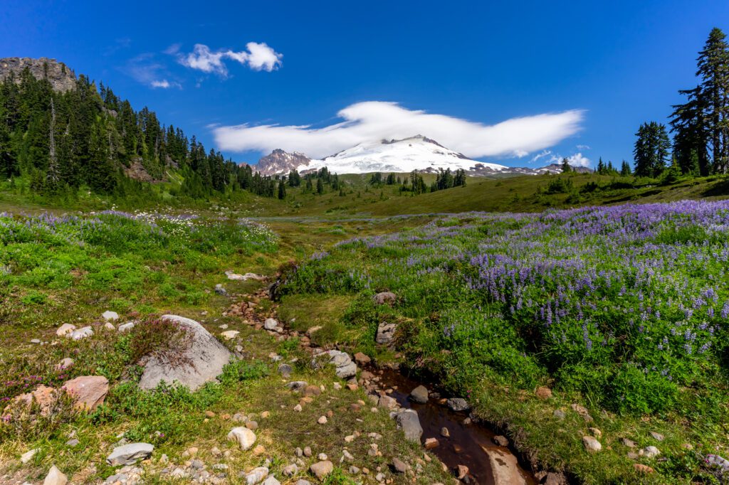
July and August are the peak summer months when wildflowers are blooming. While the sun-soaked blue skies and long days are my favorite time to enjoy Mt. Baker, this also means trails will be more crowded and campgrounds fill up quickly.
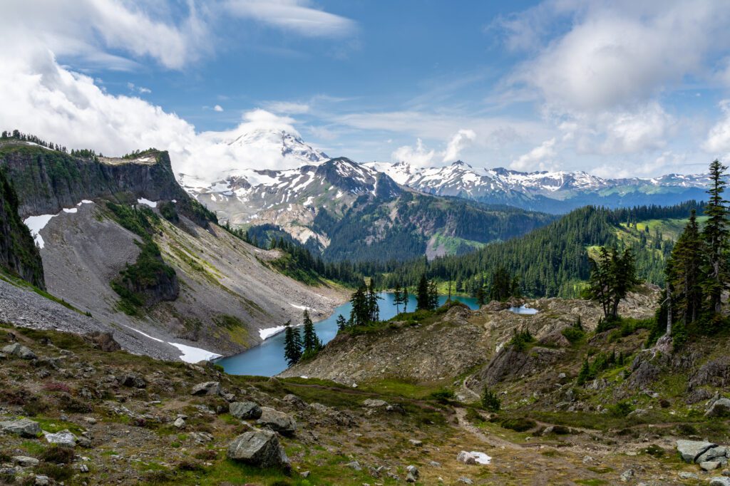
Late September through early October offer spectacular displays of fall foliage, Mt. Baker boasts some of the best fall colors in Washington state. Blueberry bushes turn shades of red, purple, and orange, while fireweed turns a rich red and mountain ash become golden yellow. Lake Ann and Yellow Aster Butte are two of my favorite hikes for fall colors in Mt. Baker.
November through June, trails are shut for the season. However, come winter, you can hit the slopes in some of Washington’s best ski and snowboarding areas at Mt. Baker or try your hand at snowshoeing or cross-country skiing around Baker Lake area or Artist Peak, which offers a 4-mile round trip snowshoe trail over relatively flat terrain with views of Baker Lake and the Cascades.
Although I’ve always been a fair-weathered hiker, I spent this past season in Washington during winter for the first time in years. I found a new appreciation for winter hiking, enchanted by the frozen lakes and evergreens draped in layers of white snow.
Tips for Hiking Around Mt. Baker
Research the hike and the current trail conditions beforehand to know if there is anything to be cautious of, such as road closures, bugs, or potentially dangerous trail conditions.
Come prepared and pack sufficient water, protein and energy-rich snacks, layers appropriate for the season, sun protection, and a flashlight. In the fall, always pack a raincoat because weather is unpredictable and appropriate hiking gear to navigate muddy, slippery trails.
Look out for wildlife that might be living among the forests you’re walking through in Mt. Baker. Creatures such as deer, mountain goats, marmots, pika, and black bears can be sighted within the forest. Remember to be respectful of their habitat!
Arrive early at the trailhead to ensure that you find parking and beat the crowds as much as possible. This will also help you to beat the heat. I love nothing more than hiking in the crisp, fresh mountain air in the morning and arriving at the summit as the sun is coming out, just in time for a lunch break and a swim in a lake if that’s an option on the hike. By autumn, the days are much shorter, so it is advisable to start the hikes on the early side to ensure you’ll be back to your car before dark.
The Best Hikes Near Mt. Baker
With over 1,500 miles of hiking trails, there is no shortage of hiking options in the vicinity of Mt. Baker and within the Mt. Baker National Forest.
From shorter hikes with modest elevation gain, to lengthier hikes with lofty ascents, from treks through old growth forests to those traversing grassy meadows and boulder fields, there is an incredible range of options appropriate for every type of hiker.
Here are some of my recommendations for the best hikes near Mt. Baker.
The Lake Ann Trail
- Length : 8.2 miles
- Elevation Gain: 1,900 ft.
- Trail Type : Out & Back
- Difficulty : Moderate
- Trailhead Location
Lake Ann is one of the first hikes I did in Mt. Baker and still holds a certain nostalgia for me. The hike starts out from a paved lot with sufficient parking before descending through subalpine forest.
The trail weaves in and out of forest and open meadows, giving a mix of views and shade.
As you walk through the Mt. Baker Wilderness, the trail will level off and cross over boulder fields, meadows dotted with wildflowers, and trickling streams.
The rocky path eventually levels off into a well-maintained trail through covered forest that eventually opens up into a basin with spectacular views of Mt. Baker, Mt. Shuksan, and Artist Point.
Ascend over rocky basins that come to life with colorful wildflowers during late summer months. Descending down to the shores of Lake Ann, you’ll find yourself amidst a very green grassy forest, which is the perfect spot for lunch with up-close views of Mt. Shuksan.
The Chain Lakes Loop Trail
- Length : 6.5 miles
- Elevation Gain : 1,820 ft.
- Trail Type : Loop
- Difficulty : Moderate
Chain Lakes offers what hiking in the Pacific Northwest is all about in my opinion: trails winding through grassy meadows, vivid views of the snow-covered North Cascades, and alpine lakes for swimming.
This hike can be started from three different parking lots, meaning you can hike this trail from a number of different directions.
Whether you choose to hike Chain Lakes clockwise or counterclockwise depends on if you prefer to climb first and then descend the steep Wild Goose Section (clockwise) or prefer to hike down the steep section first before ascending up to Herman Saddle (counterclockwise).
Either way, you’ll end up with a significant ascent and descent ahead of you with views over Mt. Baker, Table Mountain, Mt. Shuksan, and a spread of green valleys and lakes below. I’ve done the hike both directions and honestly find that each has their own merits.
The ultimate reward of Chain Lakes is Bagley Lakes, where you can cool off in the blissful water as a reprieve before continuing on your way. If you’re shy of cold water, just make the plunge without thinking too much.
Jumping right into the water helps me get over my reservations and once I’m soaking in the refreshing lake, I have no regrets.
The Yellow Aster Butte Trail
- Length : 7.5 miles
- Elevation Gain : 2,550 ft.
- Trail Type: Out & Back
- Difficulty : Difficult
The fiery shades of orange, red, and yellow make Yellow Aster Butte a popular choice come fall, and one of my personal favorites for fall foliage in Washington.
There really is no bad time to endeavor on this hike though, as the expansive meadows are brushed with brilliant wildflowers during spring and summer, making this hike an exceptional one throughout the seasons.
Yellow Aster Butte is one of the more challenging hikes in Mt. Baker, with an elevation gain of almost 1500 feet in the first mile and a half. I personally don’t mind the elevation gain, enjoying the challenge and relishing in the rewards that much more at the end.
The trail crosses an avalanche pass, so it is best hiked when it is snow-free. You’ll walk through woods full of varied trees and meadows blooming with lupine and heather.
After the initial ascent, the trail flattens out to give you a rest before switchbacks lead up to the summit of Yellow Aster Butte. You’ll soon forget about the climb once you reach the top, which looks straight into the face of the pointed, snow-capped peaks of the North Cascades.
Note from Matt & Alysha : The road to this trailhead is long and bumpy, but we made it up with our Honda Odyssey with only one problem area. Passenger vehicles should be find – take it slow!
The Ptarmigan Ridge Trail
- Length : 9 miles
- Elevation Gain : 1,350 ft.
- Trail Type : Out & Back
To reach this rocky hike, park in the lot for Artist Point and start off on the Chain Lakes Trail. After 1.1 miles, you’ll reach a junction from which you will go straight to start on the Ptarmigan Ridge trail. Follow the trail down, across, and up crests and open terrain, passing lupine and blueberry patches.
Note that there is very little shade on the trail, which can be challenging on a sunny day. Washington mountains can get unexpectedly hot during the summer, so I always pack extra water and hydration tablets to be prepared.

After crossing beneath Coleman Pinnacle across patches of snow, you will be privy to views of Mt. Baker and Coleman Pinnacle, which is a great place to take off your backpack and rest for a bit. To the south, you’ll spot views of the stunningly green Goat Lake.
From here, you hike up to a plateau, which is more or less the pinnacle of the hike. The path leads down to Goat Lake but you may want to use this as your turnaround point, as the trail down is quite precarious with loose gravel.
The Hannegan Peak Trail

- Length : 10.4 miles
- Elevation Gain : 3,100 ft.
- Difficulty : Difficult – Very Difficult
- Trailhead Location
At the end of Hannegan Pass Road, you’ll find a parking lot, which is also where the hike begins. Enjoy a relatively moderate first couple of miles that takes you in and out of shady forest glades and across small waterfalls.
I appreciate the gentle grade at the start of the hike, which was a necessary warmup to ease into the more challenging latter half of the hike.
The grade eventually increases, turning into steep switchbacks that will bring you to Hannegan Pass, which makes for a perfect spot to take a snack break with views into North Cascades National Park.
Ahead lies an even more challenging section of the trail, where you will climb 1,000 ft. of elevation gain in just over a mile. Once you catch your breath at the top, the summit of Hannegan Peak will stun you with 360 views of the Cascades, including Goat Mountain, Ruth Mountain, and Mt. Baker.
Come prepared with snacks, water, and energy, and the payoff at the top will be well worth the effort.
Park Butte Lookout
- Length : 7.5 miles
- Elevation Gain : 2,200 ft.
NOTE : This hike is the only one on this list that is on the southeast side of Baker, near Baker Lake.
This popular hike brings you to an historic fire lookout with panoramic views of the North Cascades. From the parking lot, which fits around 40 cars, you will head to the trail and cross over Sulphur Creek.
Before long, there will be an intersection with Scott Paul Trail and you will continue left, walking through a meadow of wildflowers during the summer and salmonberries, blueberries, and huckleberries come autumn.
Eventually you’ll cross over boulder fields before entering old-growth forest, where you will climb up through yellow cedar and hemlock.
Enjoy the backdrop of Koma Kulshan as you pass through meadows, which are ablaze with flaming red bushes in the autumn.
To reach the pinnacle of the hike—the lookout tower—you’ll have to climb a ladder.
Fire lookouts are a staple feature of many Washington hikes and were formerly used to look for fires in the mountains. At this point, stand amidst fir trees, where you can relax and take in the surrounding views of Black Buttes, the Twin Sisters, and the Nooksack River Valley.
Note from Matt & Alysha : Another somewhat bumpy road, particularly at the beginning when you turn off of the paved road. Definitely passable as long as it’s not wet and muddy – Homer, our Honda Odyssey – made it up just fine.
Artist Ridge
- Length : 1.2 miles
- Elevation Gain : 200 ft.
- Difficulty : Easy
This short but sweet hike starts out from the parking lot of Artist Point. Due to snow conditions, the Artist Ridge trail is accessible for less than three months a year, making the time that it is open quite crowded.
The entirety of this mostly flat hike offers stunning views of Mt. Baker and Mt. Shuksan, as well as views of smaller mountains in the distance. You will pass by gnarled trees, stumps, glacial lakes, and wildflowers that emerge in late summer along the way.
Unfortunately, the hike’s accessibility and undeniable views have attracted many crowds over the years, which have had an apparent impact on the wilderness and might be a deterrent to more adventurous hikers.
While it wouldn’t be my personal choice for a Mt. Baker hike, if you’re looking for a quick and easy jaunt through some spectacular Mt. Baker terrain accessible for all ages and physical levels, Artist Ridge may be worth the visit.
Winchester Mountain
- Length : 3.4 miles
- Elevation Gain : 1,300 ft.
- Difficulty : Easy – Moderate
The rocky and potholed road that leads to the parking lot for Twin Lakes trailhead, where the route for Winchester Mountain also starts, requires a high clearance vehicle.
It’s just past the trailhead for Yellow Aster Butte, and it’s at that point where the road gets really rough, narrow, and sometimes steep.
More days than not, I’m not thrilled with the idea of navigating a difficult road to a hike. However, if you have the right vehicle, don’t let a bad road deter you because some of the best hikes in Washington lie at the end of a tiring drive.
If you can manage the bumpy road there, this moderate hike to Winchester Mountain will bring high rewards.
The trailhead starts between the Twin Lakes, climbing gradually up a trail dotted with blueberries. The route eventually opens up, offering views that only get better with each step.
Continue straight (to the left is a rough, vertical, snow-covered scramble that should be avoided), until you make the final climb to the lookout point.
At the summit, relax with panoramic views of Mt. Baker, Mt. Larrabee, the Twin Lakes, and Tomyhoi Lake and Tomyhoi Peak. With a sprawling area up top amidst evergreens and grassy valleys, I have enjoyed passing the afternoon reading a book and enjoying the views.
The Skyline Divide Trail
- Length : 9.0 miles
- Elevation Gain : 2,500 ft.
- Difficulty : Moderate – Difficult
- Trailhead Locati o n
The trail for Skyline Divide starts at the end of Forest Road 37, where there is a parking lot with room for about 30 cars and additional parking along the side of the road.
Beware of the switchbacks and potholes along the way, which make for a bumpy ride best fit for a high clearance vehicle.
Much of the path is exposed so bring sunscreen and sufficient water. For the first couple of miles, you will walk on a moderately steep incline through a forest of fir and hemlocks until you reach the ridgeline.
As you emerge, you’ll come face-to-face with Kulshan and Shuksan and continue walking through the Mt. Baker Wilderness.
Marvel at the fireweed, lupine, and glacier lilies blooming along the way, which eventually turn into paintbrush, heather, and other flower varieties as the terrain becomes rockier.
At the summit of the sixth knoll, you will reach the peak of the hike with incredible views of Kulshan and the North Cascades in the distance. Sit down, catch your breath, and soak up the incredible setting for as long as you please.
Note from Matt & Alysha : We actually avoided this one, since the road is long and bumpy, and we figured it would be an hour-long, white-knuckle journey in our low-clearance minivan. High-clearance, 4WD vehicles are strongly recommended.
Places to stay near Mt. Baker
There are dozens of campgrounds within the vicinity of Mt. Baker. There are spots to camp near most of the major hikes and trails, although these are typically hike-in only. If you prefer campsites that are accessible by vehicle instead of backpacking, there are a number of options as well.
North – Along the Mt. Baker Highway
Silver Fir Campground : Located north of Mt. Baker, Silver Fir Campground is situated in the forest along the North Fork Nooksack River. Camp beneath the shade of silver fir and western cedar trees just a short walk away from the river and a sunny gravel bar. Picnic tables, fire pits, drinking water, and garbage services are all available at Silver Fir.
Douglas Fir Campground : Douglas Fir is also located in the northern sector of Mt. Baker, situated on the banks of the North Fork Nooksack River in the North Cascades. Set up camp among the stunning forested scenery equipped with picnic tables and fire rings. The campground has access to hiking trails and opportunities to kayak and whitewater raft on the river.
South – Around Baker Lake
Panorama Point Campground : Halfway up the basin and on the western shore of Baker Lake, Panorama Point Campground is a popular choice for camping south of the mountain. Pitch your tent among the forest with views of the lake. While the setting is lovely and offers access to drinking water and a boat launch, do note that it is a popular site for fishing and gets particularly busy during Sockeye fishing season.
Swift Creek Campground : This lakeside campground located about halfway up Baker Lake offers spectacular views over the water with about 50 private campsites. Here you’ll also find picnic tables, grills, and a boat launch.
Cabins Near Mt. Baker
If your idea of a good time is hiking by day, and staying in a cozy cabin, soaking in a hot tub under the stars by night, here are some options for you.
Cedar Point Cabin (sleeps 2-4) : This chic cedar cabin nestled into the forests of Glacier is the perfect stay for a couple. Cozy up in front of the fireplace or relax in the hot tub after a day of hiking along the nearby Nooksack River or skiing the slopes of Mt. Baker.
Shuksan Cabin (sleeps 6) : Retreat to this woodsy hideaway with your family or friend group, complete with tall ceilings and gorgeous woodwork. Relax on the deck amidst the mossy trees with the sound of Glacier Creek in the background.
Mountainview Lodge (sleeps 8) : Bring your family or go with a group of friends to this charming 1970’s renovated cabin showing off views of the mountains from the vaulted ceiling windows. Take a soak in the hot tub after a day of hiking or gather around the firepit come nighttime.
MORE TO EXPLORE IN THE PACIFIC NORTHWEST
If you’re planning a trip to the Pacific Northwest, we’ve got you covered with all sorts of super detailed travel guides to our favorite places in Washington and Oregon.
- Seattle : Find the perfect place to stay in Seattle , use our itinerary and complete Seattle city guide to plan your weekend in Seattle (we also have a guide to one day in Seattle for shorter trips), find a new hike near Seattle to tackle, and plan your next day trip or weekend getaway .
- Portland : Get a local’s take on what to do in Portland and where to stay in Portland , plan your weekend itinerary (we also have a guide to one day in Portland for shorter trips), find the best hikes in and around Portland , and discover the best day trip and weekend getaway destinations.
- Road Trips : Explore the best of the Pacific Northwest on a 14 day Pacific Northwest road trip . Plan an amazing Washington road trip or Oregon road trip with our detailed guides, including a couple of itineraries that you can copy/paste.
- The Oregon Coast : Explore the best of the Oregon Coast on a 7 day Oregon Coast road trip . Discover the best hikes on the Oregon Coast , and figure out what to do in Cannon Beach and Astoria .
- Hiking in Oregon : Get a local’s take on the best hikes in Oregon , the most spectacular Oregon waterfalls , and dive deeper into each region with our guides to the best hikes at Mt. Hood , in the Columbia River Gorge , and more.
- Hiking in Washington : Add to your Washington hiking bucket list with our guide to the best hikes in Washington . Then dive into our regional hiking guides to discover the best hikes near Seattle , hiking at Mount Rainier , in Olympic National Park , in the North Cascades , and at Mount Baker .
- Mount Rainier National Park : Plan the perfect trip to Mount Rainier with our guides to the best things to do , the best hikes , and how to plan a perfect day trip to Rainier .
- Olympic National Park : Explore the best that Olympic National Park has to offer – the best hikes , a complete itinerary , and exactly where to stay in Olympic National Park .
- North Cascades National Park : The least visited of the National Parks in Washington , learn how to plan a perfect itinerary , and figure out the best hikes to add to your list.
- Crater Lake National Park : Discover the best that Oregon’s only national park (isn’t that crazy?) has to offer with our guide to planning your Crater Lake itinerary , and our guide to the best hikes in Crater Lake . Plus, a guide to planning an amazing Seattle to Crater Lake road trip .

Alicia was born in Seattle and has called Washington state her home on and off for the past three decades. Even though she spends much of her time abroad these days, Alicia craves a dose of the Pacific Northwest when she’s away too long and comes back as often as time allows it to explore the nature of the region. The alpine lakes, evergreen forests, snowcapped mountains, and salty sea air keep her dreaming about Washington state almost as much as the local wineries and microbreweries when she’s gone. You can follow along on her adventures on https://www.journeywithalicia.com/.
Similar Posts

The 7 Best Hikes in Snoqualmie Pass: Complete Hiking Guide

The 17 Best Hikes on the Oregon Coast: A Complete Guide

28 Amazing Cabins in Washington State to Book Now

The 14 Best Things to Do in Port Townsend: A Complete Guide

15 Incredible Waterfalls in Washington For Your Bucket List

7 Incredible Hikes in Crater Lake National Park
Leave a reply cancel reply.
Your email address will not be published. Required fields are marked *
Save my name, email, and website in this browser for the next time I comment.
This site uses Akismet to reduce spam. Learn how your comment data is processed .
Your summertime Escape is just a click away!
4.8 / 5 average star rating
Over 90,000 happy travelers
600+ bookings in the last week
- Itineraries
- Deutsch ( German )
- Français ( French )
- Italiano ( Italian )
- Español ( Spanish )
- Campervan Artwork
- Campervan Cooking
- Class B RV Rental
- How-To's & Resources
- Jeep Campervan
- National Parks
- News & Events
- Renter Guest Posts
- Traveling With Kids
- Trip Ideas & Guides
- Winter Road Trips
- Women on the Road
- Los Angeles
- San Francisco
- Portland, OR
- Vancouver, BC
- Salt Lake City
- Calgary, AB
Get our top tips for saving money on a campervan trip:
5 can’t-miss stops along washington’s mt. baker scenic byway.
National Parks , Trip Ideas & Guides
By Emily Butterfield
The Mt. Baker Scenic Byway (State Route 542) is a beautiful year-round playground for outdoor adventurers. The 58-mile route near the Canadian border runs northeast from Bellingham to Artist Point and is the only road to reach Mt. Baker Ski Area. It’s under 3 hours from our Seattle camper van rental site .
From fall through early summer, the last 2.7 miles of the road is closed between the upper ski resort and the Artist Point parking lot due to snow. This snowy section is a popular route for snowshoers, backcountry skiers, and snowboarders. During the summer months, the highway leads to many stunning hiking trails in the Mt. Baker Wilderness and North Cascades National Park .

1. Watch the Sunset or Sunrise at Artist Point
Artist Point is one of the most beautiful vistas you can reach by car in the entire state. After a few hairpin turns, Mt. Baker highway ends in the Artist Point parking lot where you’ll find several trailheads for day or overnight hikes. You can easily enjoy the scenery right from the parking lot or along a short footpath. You’ll get up-close views of Mt. Shuksan, Mt.Baker and the rugged North Cascade range. Be sure to catch Mt. Shuksan’s reflection in one of the tarns or Picture Lake.

2. Stop and Smell the Wildflowers on Yellow Aster Butte
OK, it’s more like a bumpy drive up a forest service road and a 7.5-mile round-trip hike, but the wildflowers on this trail are stunning – there’s a reason it has ‘yellow aster’ in its name. Referred to by locals as YAB, you’ll gain 2,550 feet of elevation along the hike, reaching a high point of 6,150 feet in the North Cascades. You’ll be rewarded with views of Mt. Baker, Mt. Larrabee, the High Divide, and the Canadian Border Peaks. It’s also a popular hike to see the colorful fall foliage. The glacier-fed tarns are a great place to refill your water bottle or pitch a tent for the night.

3. Enjoy a Breakfast Burrito and Espresso at the Wake ‘N Bakery
Located in the town of Glacier, the Wake ‘n Bakery is a popular stop for breakfast or a cup of joe. The baristas serve up organic espresso, home-baked goods, and savory breakfast burritos. They also sell locally made gifts like jewelry and pottery. It’s a perfect stop for a pre- or post-adventure recharge!

4. Watch Bald Eagles Feast on Salmon in the Nooksack River
From late November through January, thousands of bald eagles descend on the Nooksack River to feast on chum salmon. It’s a thrilling event for photographers or anyone wanting to get an up-close view of these majestic creatures. One of the best places for viewing is just off Mt. Baker Highway on Mosquito Lake Road at Deming Homestead Eagle Park. The birds sit on the river boulders and up in the trees, hunting their favorite cuisine. Don’t forget your binoculars!

5. Grab a Beer – or Get Married – at the North Fork Brewery
Small-batch beer brewed on site, yummy pizza, a beer shrine, and even a wedding chapel makes The North Fork Brewery a unique stop along the highway. Located in the town of Deming, it’s been a local favorite since opening in 1997. They brew British-style ales and barrel-aged sours and lagers, but of course, you can find a Pacific Northwest staple – India Pale Ale – on tap as well.
Where to Camp:
There are two designated Forest Service campgrounds on Mt. Baker highway: Douglas Fir Campground and Silver Fir Campground . There are also dispersed camping opportunities along the highway. For more information, call the Mt Baker Ranger District office in Glacier at (360) 599-2714.

Ready for Your Trip Through Mt Baker Scenic Highway?
If you want to take a road trip through Mt Baker, go ahead and book your campervan from our Seattle depot. Happy travels!
5 thoughts on “5 Can’t-Miss Stops Along Washington’s Mt. Baker Scenic Byway”
Hownare the road conditions to the ski area at Mt Baker. I took my kids sleddijg there awhike back. I’m from texas and dont know how to find road conditions. They want to go sledding again. We drive a sedan don’t want to be driving on ice/snow to get to that ski area. Thank you!
The Department of Transportation websites for each state are usually a good place to start when searching for road conditions. Here is Washington’s DOT website: https://www.wsdot.com/traffic/passes/passinformation.aspx#mt.bakerhwysr542link It looks like the road is all clear at the moment (5/12/20 10am).
You missed the obvious! Nooksack Falls.
I’m trying to figure out our trip (end of April) and a little confused of where the bypass is/closed roads. Is Heybrook Lookout all the way to Artist point still the same bypass area? It seems really confusing online so just trying to put it all together
Hi Macy! I would recommend checking the WDOT website for real-time road updates. Here: https://wsdot.com/travel/real-time/
Leave a Reply Cancel reply
Your email address will not be published. Required fields are marked *
In high demand - book now!
This website stores cookies on your computer to improve the website experience and improve our personalized services to you. To find out more about these cookies and our privacy processes please see our privacy policy. By clicking Accept you are granting permission for us to store this cookie. If you do not want us to install this cookie please close your browser window now.
- Snow Sports
Northwest ski mountaineers tackle new Mount Baker glacier race
MT. BAKER NATIONAL RECREATION AREA, Whatcom County — The lead skiers zipped down the Easton Glacier to a checkpoint with only handkerchief-sized red flags flapping in the stiff alpine breeze to guide them. Attached to fiberglass wands and stationed at 30-foot intervals, the course markers were among the only artificial elements at the first-ever Kulshan Randonnée, a ski mountaineering (or “skimo”) race on the flanks of Mount Baker — the latest in a legacy of adventure races on Washington’s northernmost volcano.
This unique-in-North America competition, only the third of its kind in the world, drew 21 teams of three to a remote trailhead May 18 for a chance to race far outside the controlled confines of a ski resort. While professional mountain guides and seasoned backcountry skiers and climbers made diligent safety preparations, there were no chairlifts or gondolas, no patrol huts, no snowmobiles and no marked obstacles. From crevasses to cliffs to creeks, competitors had to be self-sufficient as they crisscrossed 15 miles and 6,800 vertical feet, up and down, as fast as they could.
MORE OUTDOORS
- A perfect Seattle summer: Day trips, events, races, outdoor movies and more
- Should this historical Olympic National Park chalet be saved?
- At age 20, Camas man became youngest to climb WA’s 100 tallest peaks
- 5 WA beginner backpacking trips for this summer
- 10 WA races, walks and outdoor events for summer 2024
- City-run Trailhead Direct hiking shuttle returns for 2024, serving Issaquah Alps this summer
The racers included many passionate recreationists who relished the chance to push themselves in a competitive setting, but also a handful of amateur athletes hoping to represent the U.S. or Canada at the 2026 Winter Games in Cortina d’Ampezzo, Italy, where ski mountaineering will make its Olympic debut.
The path to the Olympics, it turns out, runs through a muddy, potholed forest road 19 miles outside of Concrete, Skagit County.
A century of Baker races
For the uninitiated, ski mountaineering consists of climbing mountains and skiing down them.
Ski mountaineers do most of their climbing on alpine touring skis, which have an adjustable binding that allows for a free heel on the way up, like a cross-country ski, and a locked heel on the way down, like an alpine ski.
For the uphill, they affix climbing skins with glue on one side and mohair or nylon on the other, providing traction to ascend moderately pitched slopes. When the mountain gets too steep for skinning, ski mountaineers attach skis to their packs and climb on foot like a mountaineer, often with crampons and ice axes.
The mountain discipline itself is nothing new in Washington — Cascades climbers have incorporated skis into their repertoire for a century. As a modern competitive sport, though, skimo racing is still nascent in the Northwest . Large races draw hundreds of competitors during winter in Colorado and Utah — and Europe boasts a World Cup circuit where thousands of fans turn out — but the PNW’s penchant for deep powder has historically been less enthusiastic about spandex and skinny skis.
That’s slowly been changing, especially since 2018, when ultrarunner Richard Kresser started SnowGoat Skimo as an umbrella for skimo races in Washington and Oregon. All along, he has dreamed of organizing a race on a glaciated Cascades volcano, the region’s defining mountain feature — something you won’t find in the Alps or the Rockies. (There are two other official glaciated team skimo races, one each in Italy and Switzerland.)
“This race has been a work in progress for the past six years,” Kresser said. “It’s the reason I started SnowGoat Skimo in the first place — to create an endurance backcountry ski mountaineering competition more akin to a 50K trail race, a true adventure.”
Racing on Koma Kulshan, as the mountain is known to the Coast Salish, has a considerable pedigree. From 1911 to 1913, the Mt. Baker Marathon pitted racers on an open course — get from Bellingham to the summit and back by whatever means necessary (essentially, either by car or train to the mountain, then on foot up and back down). The third and final iteration nearly ended in disaster when a competitor spent five hours trapped in a 40-foot crevasse due to bad weather and poor course management.
The race was deemed too dangerous to repeat, though its spirit inspired the more genteel Ski to Sea Race (launched in 1973), which starts at the Mt. Baker Ski Area rather than venturing high onto the untamed mountain. But more than a century after the demise of the marathon, a hearty group of Bellingham ultraunners sought to resurrect the fabled race .
In 2017, the Mount Baker Ultramarathon was born — 50 miles out and back from Concrete to the summit of Sherman Peak, a subpeak of Mount Baker at 10,160 feet. Kresser served as the race’s mountain director during its four successful iterations — no racers fell into crevasses — and oversaw the installation, operation and deconstruction of some 2 miles of fixed lines to the Sherman summit. Competitors clipped their harnesses to these ropes anchored in the snow to allow safe passage up and down the race’s highest reaches. The experience gave Kresser the confidence to continue the lineage of wild races on Mount Baker.
“So Cascadian”
The first Kulshan Randonnée should have been last year. A string of bad weather scuttled that plan, which meant some racers had been waiting a year for their chance.
Even then, an incoming May storm compelled Kresser and his team, which included course designer and certified guide Phil Straub, to adjust on the fly and set a foul weather course lower on the mountain that topped out at 6,900 feet in elevation. Competitors glided through snow flurries in the alpine, and at times the course experienced near-whiteout conditions. Mount Baker’s summit never came into view, but Kresser’s ambition is for the race to eventually scale as high as Sherman Peak, weather permitting.
Clouds and drizzle didn’t dampen spirits in Concrete , an 800-person hamlet along the North Cascades Highway , as a parade of campervans rolled into town the day before the race. They were carrying teams from British Columbia, Colorado, Montana, Oregon, Utah and Washington. Modern safety protocols mean that a race of this adventure quotient requires participants to pass a skills assessment: Competitors donned harnesses in a gravel parking lot to demonstrate their competence at roping up for glacier travel and rigging a haul system with ropes and anchors to pull a victim out of a crevasse.
On race day, dozens of vehicles caravanned up a winding forest road until mud gave way to snow. Shortly after 8 a.m., a range of spry 20-something athletes and seasoned, over-the-hill backcountry enthusiasts assembled in harnesses and helmets. Wearing packs laden with ice axes, climbing ropes, carabiners, ice screws and ascender devices, they clipped into their skis and waited for the starting gun — a Frankenstein half-ski, half-chainsaw wielded by Kresser.
By the time the 63 racers set off, 20 volunteers had already climbed high on the mountain — most had gone up the night before and camped — to erect tents and staff checkpoints. A mix of guides from Cascade Mountain Ascents, local mountaineers and trail runners familiar with the crewing culture of ultraraces, they melted snow to wash down the 10 pounds of food they had carried up for the racers. They hauled some 1,400 wands and flags to mark the course.
But climbing glaciers to reach ridgetop checkpoints required another Northwest rite of passage for the racers: the approach. Nearly every spring journey into the alpine requires thrashing through slide alder and pushing back evergreen boughs. The Kulshan Randonnée was no different, with slushy trails, muddy patches and creek crossings that required taking off skis and fording a raging torrent where a misstep could mean sopping-wet feet.
“The whole thing is so Cascadian,” said Wallingford resident Brad Lipovsky (team name: Last Minute Locomotives), a University of Washington glaciologist who credited the challenging course for keeping his mind entirely off glacier science for the first time while on a glacier.
Most Read Life Stories
- Why North Cascades National Park is WA’s wildest
- Meet Seattle artist Casey Curran, whose Met Gala design went viral
- 8 North Cascades National Park adventures for this summer
- Jollibee fried chicken chain to open in Seattle next week
- Seattle’s Wing Luke Museum to reopen exhibit that sparked staff walkout
For the out-of-towners, it was an introduction to the pleasures and perils of ski mountaineering in the Cascades. For the local competitors, the drizzly bushwhacking followed by superb glacier skiing was just another spring day in the mountains.
Olympic dreams
A swift trio from lower mainland B.C. (team name: The Bad Dogs) made quick work of the course in a blistering 2 hours, 59 minutes and 20 seconds . Peter Nowicki, Akio Kato and Jessie McAuley averaged 5 mph on skis while carrying packs, most of it uphill. All three are members of the Canadian national ski mountaineering team with Olympic aspirations.
The course’s fastest women — Alyssa Wendt, Christina Volken and Emmiliese von Avis (team name: Chix on Skinny Stix) — finished in 3 hours, 59 minutes and 17 seconds. Bozeman, Montana-based von Avis is likewise an Olympic hopeful currently on the U.S. national team .
At the finish line — a collection of pop-up tents and fire pits in the middle of a forest — the 100-odd racers, volunteers, family and friends sipped Kulshan Brewing beers and noshed on canned chili cooked over a camping stove.
The scene was a marked contrast for the elite racers who spend much of the winter competing on the World Cup circuit.
Races there are marquee events for mountain towns in the Alps and Pyrenees, bringing cheering crowds, camera crews and athlete entourages. With the sport’s history in military mountain maneuvers, the most prestigious ski mountaineering race is organized by the Swiss army, not a motley crew of volunteers and a race director who arrives in the back seat of a Subaru Forrester.
What’s more, skimo’s Olympic debut will be highly contrived — a series of sprints and relays on a short course of just 262 vertical feet. Races will be over in three to eight minutes. TV-friendly, but a far cry from a grueling competition across a wild, untamed volcano where hazards lurk.
“This type of event is the heart of skimo,” von Avis said of the inaugural Kulshan Randonnée. “The origins of the sport are very much about being in the big mountains as a team.”
An earlier version misstated the home neighborhood of Wallingford resident Brad Lipovsky.
The opinions expressed in reader comments are those of the author only and do not reflect the opinions of The Seattle Times.
- Things to Do
- Restaurants
- Vacation Rentals
- Travel Stories
- Rental Cars
- Add a Place
- Travel Forum
- Travelers' Choice
- Help Center
Fantastic views and old Russian... - Savvino-Storozhevsky Monastery
- Europe
- Russia
- Central Russia
- Moscow Oblast
- Zvenigorod
- Zvenigorod - Things to Do
- Savvino-Storozhevsky Monastery
Savvino-Storozhevsky Monastery located on the Storozhi Mountain at the confluence of the Storozhka... read more
First time me and my wife visited this place was some thirty years ago. What a sad view... It... read more
Fantastic views and old Russian architecture, and the church with St.Savva.
This is a very old monastery established by St.Savva in 15th centure, and it was also a fortress and a seasonal residence of Russian tzar and his wife. You will see fantastic views of meadows, hills and forests of the central Russia.
It's one of the places that are part of the "Golden Ring" , it's the closest to Moscow . If you are interested in Russian culture/ history , it's the must! There are many small nice restaurants around, as well as hotels. Magnificent place , very powerful and truly Russian . Unspoiled beauty!
Thrilled to see that the Savvino-Storozhevsky Monastery already has a such a wealth of positive reviews; I totally concur and will consequently attempt to keep my own comments relatively brief. A peaceful place offering some lovely views out across the surrounding countryside. Especially recommended for long-term Moscow dwellers needing a break from the teeming metropolis. Though other reviewers have already mentioned this, I would be remiss if I omitted to say that as this is a working Russian Orthodox place of worship, some sort of head-scarf is recommended for women. As a man, I feel a somewhat awkward saying that, but it's definitely worth knowing. My only regret about my own visit is that we didn't buy more pastries from the on-site bakery, the ones we did have were truly delicious. I would say take large bags with you and stock up, but I am not sure how the full-time residents of the monastery would feel about me advocating baked-goods-based gluttony!
It's an ancient Church opened not so long ago after closing by Soviets. Must visit to feel Russian people and Russian soul. Do not forget that it's a male monastery so consider to wear long dresses with sleeves.
Quiet, with a wonderful architecture. But, ladies, do not forget that it is not for tourists, so cover heads and legs !
Well restored with well-maintained grounds (lots of flowers in July) with a separate spring easily reachable by drive or walk from the main compound. The buildings are colorful and the churches beautiful. A simple cafe near the spring offers a chance to rest and eat excellent baked goods. Worth the visit.
THE 10 BEST Things to Do in Elektrostal
Things to do in elektrostal.
- 5.0 of 5 bubbles
- 4.0 of 5 bubbles & up
- Good for a Rainy Day
- Good for Kids
- Good for Big Groups
- Adventurous
- Budget-friendly
- Hidden Gems
- Good for Couples
- Honeymoon spot
- Good for Adrenaline Seekers
- Things to do ranked using Tripadvisor data including reviews, ratings, photos, and popularity.
1. Electrostal History and Art Museum
2. Statue of Lenin
3. Park of Culture and Leisure
4. museum and exhibition center.
5. Museum of Labor Glory
7. Galereya Kino
8. viki cinema, 9. smokygrove.
10. Gandikap
11. papa lounge bar, 12. karaoke bar.
- Yekaterinburg
- Novosibirsk
- Vladivostok

- Tours to Russia
- Practicalities
- Russia in Lists
Rusmania • Deep into Russia
Out of the Centre
Savvino-storozhevsky monastery and museum.

Zvenigorod's most famous sight is the Savvino-Storozhevsky Monastery, which was founded in 1398 by the monk Savva from the Troitse-Sergieva Lavra, at the invitation and with the support of Prince Yury Dmitrievich of Zvenigorod. Savva was later canonised as St Sabbas (Savva) of Storozhev. The monastery late flourished under the reign of Tsar Alexis, who chose the monastery as his family church and often went on pilgrimage there and made lots of donations to it. Most of the monastery’s buildings date from this time. The monastery is heavily fortified with thick walls and six towers, the most impressive of which is the Krasny Tower which also serves as the eastern entrance. The monastery was closed in 1918 and only reopened in 1995. In 1998 Patriarch Alexius II took part in a service to return the relics of St Sabbas to the monastery. Today the monastery has the status of a stauropegic monastery, which is second in status to a lavra. In addition to being a working monastery, it also holds the Zvenigorod Historical, Architectural and Art Museum.
Belfry and Neighbouring Churches
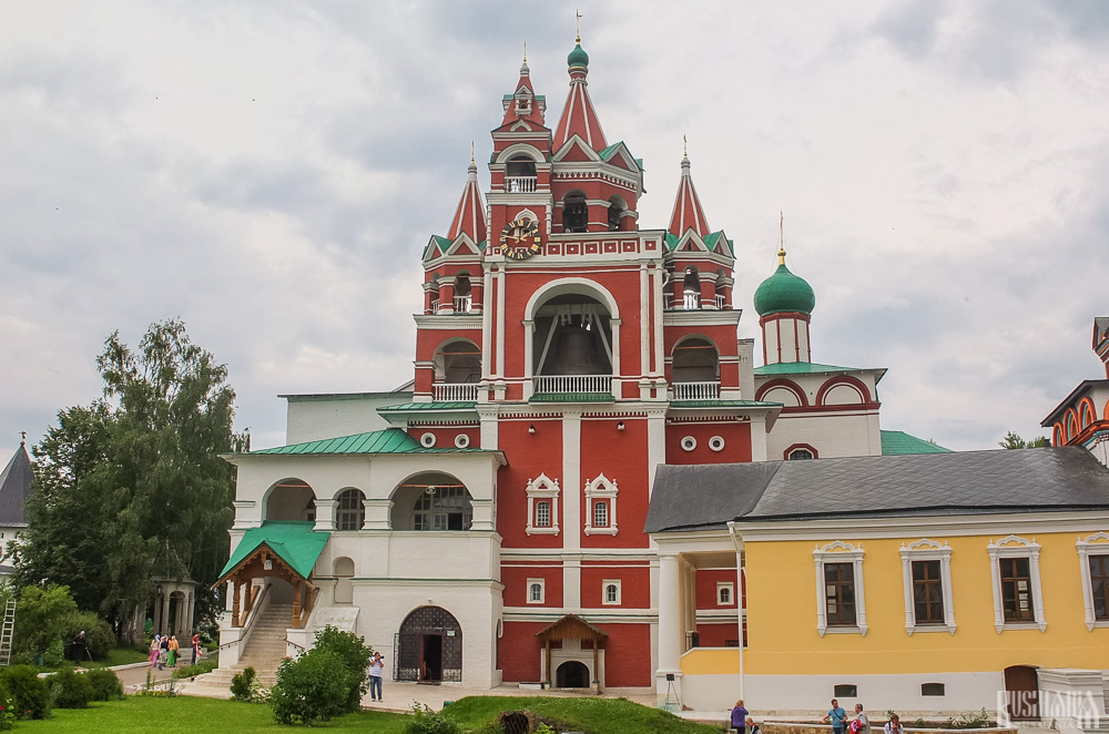
Located near the main entrance is the monastery's belfry which is perhaps the calling card of the monastery due to its uniqueness. It was built in the 1650s and the St Sergius of Radonezh’s Church was opened on the middle tier in the mid-17th century, although it was originally dedicated to the Trinity. The belfry's 35-tonne Great Bladgovestny Bell fell in 1941 and was only restored and returned in 2003. Attached to the belfry is a large refectory and the Transfiguration Church, both of which were built on the orders of Tsar Alexis in the 1650s.
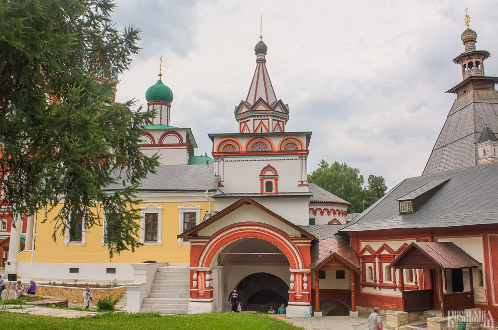
To the left of the belfry is another, smaller, refectory which is attached to the Trinity Gate-Church, which was also constructed in the 1650s on the orders of Tsar Alexis who made it his own family church. The church is elaborately decorated with colourful trims and underneath the archway is a beautiful 19th century fresco.
Nativity of Virgin Mary Cathedral
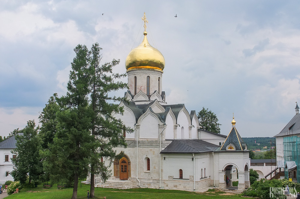
The Nativity of Virgin Mary Cathedral is the oldest building in the monastery and among the oldest buildings in the Moscow Region. It was built between 1404 and 1405 during the lifetime of St Sabbas and using the funds of Prince Yury of Zvenigorod. The white-stone cathedral is a standard four-pillar design with a single golden dome. After the death of St Sabbas he was interred in the cathedral and a new altar dedicated to him was added.
Under the reign of Tsar Alexis the cathedral was decorated with frescoes by Stepan Ryazanets, some of which remain today. Tsar Alexis also presented the cathedral with a five-tier iconostasis, the top row of icons have been preserved.
Tsaritsa's Chambers
The Nativity of Virgin Mary Cathedral is located between the Tsaritsa's Chambers of the left and the Palace of Tsar Alexis on the right. The Tsaritsa's Chambers were built in the mid-17th century for the wife of Tsar Alexey - Tsaritsa Maria Ilinichna Miloskavskaya. The design of the building is influenced by the ancient Russian architectural style. Is prettier than the Tsar's chambers opposite, being red in colour with elaborately decorated window frames and entrance.
At present the Tsaritsa's Chambers houses the Zvenigorod Historical, Architectural and Art Museum. Among its displays is an accurate recreation of the interior of a noble lady's chambers including furniture, decorations and a decorated tiled oven, and an exhibition on the history of Zvenigorod and the monastery.
Palace of Tsar Alexis
The Palace of Tsar Alexis was built in the 1650s and is now one of the best surviving examples of non-religious architecture of that era. It was built especially for Tsar Alexis who often visited the monastery on religious pilgrimages. Its most striking feature is its pretty row of nine chimney spouts which resemble towers.
Plan your next trip to Russia
Ready-to-book tours.
Your holiday in Russia starts here. Choose and book your tour to Russia.
REQUEST A CUSTOMISED TRIP
Looking for something unique? Create the trip of your dreams with the help of our experts.
IMAGES
VIDEO
COMMENTS
Touring the Mount Baker Highway is an extraordinary day trip packed with breathtaking scenery. Officially, it is both a Washington State Scenic Highway and a National Forest Scenic Byway. The route follows Highway 542 from Bellingham, passing through farmland and forest before winding its way up to Artist Point at 5100 feet.
Mount Baker Ski & Recreation Area. Mt. Baker Ski Area is a ski resort located in the northwest corner of Washington State, at the end of the Mt. Baker Scenic Highway, SR-542. The base elevation is at 3,500 feet, while the ski area is at 5,089 feet. It is about 10 miles south of the 49th parallel, the international border with Canada.
Aug 2015 • Family. While the Mount Baker Scenic Byway (WA-542) technically starts at its interchange with I-5 in Bellingham, the most scenic section starts at Glacier and continues for about 24 miles (39k) first following the North Fork Nooksack River then eventually climbing to its end at Artist Point with an elevation of 5,140 feet (1,567m).
Road Trip. Seasonal route: The road is subject to closure in winter. Soak up views of rugged mountain peaks and the Nooksack River along Mount Baker Highway (SR 542), which takes you into the northern reaches of Mount Baker-Snoqualmie National Forest. Expect sharp curves and steep grades as you climb more than 3,000 feet to the road's ...
The Mount Baker Scenic Byway stretches from the Bellingham area to Artist Point along State Route 542. Google Maps. At just 58 miles in length, this drive can easily be done in a day, even if you have to travel a bit to reach it. Believe it or not, this is one of the most scenic drives in the entire country, especially around Picture Lake at ...
The Mount Baker Highway drive starts in Bellingham and it follows the Nooksack River to Mount Baker's Artist Point. At 10,781 feet tall, Mount Baker is the fourth highest mountain in Washington and the sixth highest of the Cascade Mountain Range. It is the second most glaciated mountain ( Mount Rainier being the first), having more snow than ...
Bellingham Whatcom County Tourism. Visitor Center Located at I-5 Exit 253 - Check Hours 904 Potter Street, Bellingham, WA 98229 Phone: 360-671-3990. From Bellingham to the majestic peak of Mt. Baker, the Mt. Baker Scenic Byway (SR 542) offers access to stunning hiking, amazing photo opportunities, and snow sports in the winter.
FROM SEATTLE TO MOUNT BAKER ON A 10-DAY ROAD TRIP. Seattle's location in Washington State's northwest corner means that it's a perfect base for exploring the area's natural wonders. Both on land and off-shore. In fact, there's so much to explore that you could conceivably spend several weeks travelling around by road, train and boat.
Mount Baker Summit via Coleman-Deming Route, May 10/11 Elevation Gain - 7,300 feet/2,225 m Mileage - 12 miles/19 km 14 Hours Car 2 Car FSR - Great with some potholes Gear - Ice Axe, helmet, crampons, poles, snowshoes, sunglasses Trailhead - Heliotrope As fate would have it, my 1st time summiting the icon itself happened to be truly once in a lifetime experience because of being coupled with ...
Cross at Sumas-Abbotsford (Huntingdon)—this is one of the quietest crossings near Vancouver, and the most direct route to Mt Baker. 8:00 a.m. Turn left at the sign for Route 547 to Mount Baker. This winding country road snakes past picturesque farms and tiny churches before connecting to Highway 542, a scenic byway that terminates at the ...
3) Huntoon Point / Artist's Ridge: Best easy hiking trail on the Mt Baker Highway. This short, one mile trail is one of the best easy hikes off the Mount Baker Highway. Here, you'll be treated to views of Mount Shuksan, Mount Baker, and a few small ponds with mountain reflections all while on a fairly easy hike.
How long is Mount Baker Highway in Washington? The road (also known as Washington State Route 542) is fully paved. It's 92km (57 miles) long and runs from the Interstate 5 interchange in Bellingham (a coastal city in Washington State, near the Canadian border, 90 minutes north of Seattle), along the scenic North Fork Nooksack River, to Mount Baker's Artist Point (at 1,566m-5,140 feet above ...
The Mount Baker Day Tour takes you on an Adventure thru old-growth forest, pristine rivers, alpine meadows and lakes. And finally, up to 5,000 ft where Mount Shuksan and Mount Baker stand grand showcasing their glaciers! ... The trip exceeded my expectations!" ... Road blockages can take several hours to clear thus affecting access into/out ...
2. 1. 303 reviews. Write review. Recent reviews of the Mount Baker via Easton Glacier trail in Deming, Washington, indicate challenging conditions on the Roman Wall, with sketchy and dicey sections. The lower glacier has lots of crevasses, some of which require walking above snow bridges and anchoring. It is recommended to stay on tracks to ...
The Mount Baker Highway is also known as State Route 542. Skwiki / TripAdvisor. This 58-mile long highway is located in Whatcom County, which is full of stunning scenery. Start in the Bellingham area, cruising onto WA-542 E toward Glacier. DaPheonix / TripAdvisor.
The dominant feature in the North Cascades is Mount Baker, a glaciated volcano that can be seen on clear days from as far as Seattle and makes a great backdrop for photos of Vancouver, BC. Many hiking trails follow the ridges around Mount Baker and offer stunning views of the summit. Climbing to the summit is done mainly via the Coleman and Easton glaciers and requires technical expertise with ...
The Mt. Baker Highway (Hwy 542) The northern sector of Mt. Baker is home to splendid hikes where views of snow capped Mt. Baker, Mt. Shuksan, and other rugged peaks are the backdrop to wildflower-speckled meadows, rushing creeks, and glacial lakes; a few of the key components to almost all of my favorite hikes in Washington.
The Mt. Baker Scenic Byway (State Route 542) is a beautiful year-round playground for outdoor adventurers. The 58-mile route near the Canadian border runs northeast from Bellingham to Artist Point and is the only road to reach Mt. Baker Ski Area. It's under 3 hours from our Seattle camper van rental site. From fall through early summer, the ...
Baker Lake - Maple Grove. — Friday, May. 10, 2024. Bridge out. This was my partner's first overnight backpacking trip, and my first after a long hiatus. It's a great choice for this purpose--fairly flat with campground options at several points along the trail. The main obstacle is the Anderson Creek crossing described later.
From 1911 to 1913, the Mt. Baker Marathon pitted racers on an open course — get from Bellingham to the summit and back by whatever means necessary (essentially, either by car or train to the ...
Savvino-Storozhevsky Monastery: Fantastic views and old Russian architecture, and the church with St.Savva. - See 592 traveler reviews, 1,385 candid photos, and great deals for Zvenigorod, Russia, at Tripadvisor.
The duration of the trip is about 1h20. Elektrichkas leave from Moscow's Belorussku Railway Station (Белорусский вокзал). There are three direct bus routes from Moscow to Zvenigorod: 452 - departing from Kuntsevskaya Metro Station (exit closer to the last carrige of metro if you come from the city centre). Duration about 50 ...
9. SmokyGrove. 10. Gandikap. 11. Papa Lounge Bar. 12. Karaoke Bar. Top Things to Do in Elektrostal, Russia: See Tripadvisor's 801 traveller reviews and photos of Elektrostal tourist attractions.
Zvenigorod's most famous sight is the Savvino-Storozhevsky Monastery, which was founded in 1398 by the monk Savva from the Troitse-Sergieva Lavra, at the invitation and with the support of Prince Yury Dmitrievich of Zvenigorod. Savva was later canonised as St Sabbas (Savva) of Storozhev. The monastery late flourished under the reign of Tsar ...