- Things To Do
- Backpacking
- Backpacking Red Rock Country: Southern Utah

BACKPACKING UTAH'S RED ROCK COUNTRY
Backpacking opportunities are virtually unlimited in the Canyon Country of Southern Utah. Most of this land is seldom visited, and its backcountry affords excellent opportunities for solitude and unconfined wilderness recreation. Wherever you travel here, whether down remote desert washes or up narrow, lonely canyons, you will be rewarded at the end of your trip with vivid memories and a yearning to return.
But with so many backpacking possibilities to choose from, where do you begin? To help, we’ve compiled a selection of some stellar backpack trips throughout Canyon Country’s finest destinations. From the awesomeness of Canyonlands and Zion National Parks to the seldom-visited reaches of Cedar Mesa, the Dark Canyon Wilderness, and Grand Staircase-Escalante National Monument, you are sure to find one of the following trips to your liking.
1. The Big Needles Loop (Canyonlands National Park, Needles District): 23.2 miles. A major backpacking trip covering most of the outstanding features of the Needles District of Canyonlands National Park.
2. Harvest Scene (Canyonlands National Park, Maze District): 8.7 miles. This trail is not only a rare loop (most Maze trails are out and back), but it’s also the longest designated trail in the Maze and takes hikers to Harvest Scene, one of the most famous rock art sites in the world. There are several great campsites along the route.
3. West Rim Trail (Zion National Park): 14.2 miles. A great backpack along the top of the Horse Pasture Plateau from Lava Point to the floor of Zion Canyon.
4. Owl Creek–Fish Creek Loop (Cedar Mesa): 17 miles. A multi-day loop backpack in two spectacular desert canyons. Both Owl Canyon and Fish Canyon are quite deep and narrow, with an abundance of stark, scenic beauty. During the hike you’ll pass Nevill’s Arch, two unnamed arches, and a few Ancestral Puebloan cliff dwellings and rock-art sites.
5. Dark Canyon (Dark Canyon Wilderness): 40 miles. The Dark Canyon Wilderness, south of Canyonlands National Park, offers beautiful forest and desert scenery, Indian ruins, and peace and solitude. This five- to seven-day trip is for experienced backpackers.
6. Egypt-Twentyfive Mile Wash (Grand Staircase-Escalante National Monument and Glen Canyon National Recreation Area): 20 miles. This loop hike offers a diverse desert canyon hiking experience. The hike can vary in duration, depending on the number and length of side trips taken, but requires a minimum of two long days. The recommended and more leisurely trip, with time for exploring, takes four to five days.
Well-prepared travel is responsible travel.
Do your part by planning ahead

- Sleep Systems
- Trekking Poles
- Camp Kitchen
- Accessories
- e-Gift Cards
- Backpacking 101
- Expert Articles
- Returns & Exchanges
- Search by Map
- Browse List

Top 8 Backpacking Trails in Southern Utah
Southern Utah is arguably the most scenic area of the state. It is home to 7 state parks, 5 national parks, and many national monuments, forests, and rec areas. This area boasts the largest concentration of slot canyons and natural arches in the world. Arches National Park alone has over 2,000 documented ones. With all these unique geological features, it's no wonder that so many people flock to this region for hiking, backpacking, and general sightseeing.
Today, we're looking at some of the best southern Utah backpacking trails to get up close and personal with these natural wonders.
Featured Photo: Reflection Canyon Sunrise by Ken Xu
Canyonlands-Needles District
Looking to make the most of your time at Canyonlands National Park? This 32-mile, 3-day loop is your best bet. Plus, you won't have to worry about spotting a car or setting up a shuttle! This trip is leisurely, allowing for extra time to explore. The path takes you past several geological highlights, including Devils Kitchen and Druid Arch. You can also add a spur to Peekaboo Arch. (Just a few miles extra.) On top of that, you'll hike through a different canyon each day. So, the scenery is always changing!
Camping is allowed in designated areas only. Make sure to get your reservations early. A good map is also highly recommended. For more details, head over to our detailed Hike of the Week: Canyonlands article .

Coyote Gulch Loop
Located in the Glen Canyon Rec Area, this short 13.5-mile trip is great for a quick overnight. This trail features towering rock faces and even a small waterfall, an unusual find in the desert. Other features include Coyote Natural Bridge, Crack in the Wall, and Jacob Hamblin Arch. (The best camping spots are near the latter.) Be sure to bring some rope to lower your pack down through Crack in the Wall. That should give you an idea of how tight it is. It's also worth noting that there are several areas where walking through water is unavoidable. Looking for a longer trip? There are several trails in this area to extend your stay.
Trans-Zion Trek
Ready to immerse yourself in everything Zion NP has to offer? The 47-mile Trans-Zion Trek takes most people 3-5 days to complete. It offers a mix of all the park has to share, including “creeks, desert, meadows, pine forests, and sprawling views from rim tops”. Make time for side trips to Kolob Arch and the duly popular Angels Landing. Expect several hard days, especially the steep incline in and out of Zion Canyon.
A shuttle is needed for this trail. It's located in a remote area of the park. You will have plenty of privacy, but you should also be prepared with plenty of water and a good map.

Owl Creek-Fish Creek Loop
Need a quick getaway, but still want something challenging? This 17-mile overnight is perfect for that. Or, set a leisurely pace and stay two nights to enjoy the stark beauty longer. This route is also great if you're looking to avoid the crowds at nearby Grand Gulch. The downfall is that the trail is not maintained. Again, be familiar with reading maps. (There are rock cairns too, but those can be unreliable.)
The Owl Creek-Fish Creek Loop follows a streambed. The valley is full of juniper, prickly pear, and yucca. Major highlights include excellent views of Cedar Mesa, Neville's Arch (and several other unnamed ones), and ancient Puebloan cliff dwellings and rock paintings. Small springs are found along the way, so fill up when you can. There are some long stretches without any water.
Buckskin Gulch/Paria Canyon
Want to explore the longest slot canyon in the U.S.? Prepare for a 44-mile, 4-day trip in the remote Vermillion Cliffs Wilderness. There are all kinds of neat geological features along the way. These include petroglyphs and fossils, beautiful orange, yellow, and purple canyon walls, and plenty of nooks and crannies to explore. (Be prepared for some boulder scrambling in a couple of spots too!) You could also add a side trip to Wrather Arch.
It's very important to check flash flood warnings ahead of time. You will be traveling along a river bed. Several freshwater springs are available to fill up at. There are a limited amount of permits, so plan accordingly. Check out our full article on Buckskin Gulch / Paria Canyon for more details.

Bullet Canyon to Grand Gulch
Sure, we mentioned above that Grand Gulch can become crowded, but it's still a great hike. Like most areas, you can get to these highlights several different ways. Most range between 14 and 20 miles round-trip. You could get this done as an overnight, but you'll likely want to spend more time exploring all the area has to offer.
Grand Gulch is one of the most popular hiking destinations in southern Utah. Looking for more than the stunning scenery of the sandstone cliffs rising above you and the pinon-juniper covered valleys? Grand Gulch is an archaeology lover's dream too. Many Anasazi cliff dwellings and art are found here. Bullet Canyon, which is an off-shoot of Grand Gulch, houses Perfect Kiva and Jailhouse Ruin. Several other ruins, including some granaries, are found along the way too.
Reflection Canyon
This iconic spot in the Glen Canyon Rec Area has gained popularity over the past decade or two. You've likely seen pictures of this secluded section of Lake Powell, winding through the multi-colored canyon walls. The journey is about 20 miles, but difficult. Lengths vary as there is no set trail. This is also a good reason to make sure your wayfinding skills are on par! The route offers great views of Navajo Mountain. Reflection Canyon itself is a magnificent backdrop for sunsets and sunrises. Be sure to take a camera!
Permits are free, but you'll still need to get one at the Escalante Visitor Center. It's also one of the few trails you can bring your K-9 friend along. There is no water at all, though, so make sure you bring plenty, even if it's just you.
Under the Rim Trail
Bryce Canyon is another popular national park in the region. This 23-mile trail gives you a different view of the park than most see. The park is famous for its tall rock spires, known as hoodoos. You'll get an up-close and personal look at these unique geologic anomalies. Other highlights include Hat Shop (white-capped hoodoos), Natural Bridge, and the popular Bryce Point. The campgrounds near Yellow Creek are shaded, forested spots. Nice for a break and water, at the least. The trail also offers unique views of the “amphitheater”. You'll also find that the scenery is very different and lusher than other areas of southern Utah.
There are many access points if you need to bail along the way. You will also need to spot a vehicle for the end of your journey.
If you're looking for more hike ideas, read our " Best Backpacking Trips in the Desert Southwest " roundup post. Also, the following “Hike of the Week” articles cover other great hikes in the region.
Hike of the Week: Halls Creek Narrows Hike of the Week: Grand Canyon Rim-to-Rim Hike of the Week: White Rock Springs
For even more amazing backpacking trips, visit The Trailhead, our interactive hike map . It contains a curated list of dozens of hikes, each with a detailed write-up.

Finally, check out our comprehensive list of backpacking articles that cover just about everything there is to know about backpacking. If you're just starting out, our Backpacking 101 section covers all the basics. If you already have a few trips under your belt, you can find more advanced topics covered in our Expert Articles .
Leave a comment
Please note, comments must be approved before they are published.
Who is Paria Outdoor Products?
Looking for backpacking trip ideas?
Browse Articles by Topic

We stand behind our gear and offer a lifetime warranty on all of our products.

Free standard shipping on all US orders. Shipping fees apply on international orders.

Browse our interactive map with dozens of amazing hikes through the U.S. and beyond.
- National Parks
- Tiny Houses
20 Best Backpacking Trips In Utah
Posted by Mac Misseldine July 31, 2019 Updated November 05, 2023
We research, evaluate and select travel destinations based on a number of factors, including our writers’ experience, user reviews and more. We may earn a commission when you book or purchase through our links. See our editorial policy to learn more.
Whether you’re planning an overnight adventure or a weeklong backpacking trip, you’ll find plenty of worthy trails with stellar sights in the Beehive State.
Locals and visitors will find an unbelievably diverse range of backpacking trails at their disposal in Utah. Up north, the Wasatch-Uinta-Cache National Forest serves up an alpine paradise replete with rocky peaks, lush pine and aspen forest, pristine mountain lakes, and more waterfalls than you can count.
Down south, the scenery shifts to a red rock desert landscape with fascinating rock formations, epic canyons, and the largest collection of natural arches on the planet.
Thanks to the climate diversity, backpacking is a year-round activity in Utah. When it’s hot out, head to the mountains in northern Utah to cool off. When the weather turns cold and the Wasatch Range is covered in snow, head south to Grand Staircase-Escalante , Zion , and Arches National Parks to thaw your frozen limbs.
In short, no matter the season or how much time you can spare, there’s always a backcountry trail calling your name in Utah.
The Wasatch Range
Red pine lakes.

Why you should go : Visit two of the most popular alpine lakes in Utah.
- Distance : 6.8 miles
- Elevation Gain : 1,940 feet
- Difficulty : Hard
The trail to Red Pine Lakes delivers one of the best hikes in Little Cottonwood Canyon. The popular day-hike is even better when you make it an overnighter, providing more time to explore the picturesque Upper and Lower Red Pine Lakes and the surrounding Lone Peak Wilderness .
After you’ve had a chance to visit Red Pine Lake, plan another backpacking trip to its sister lake in Little Cottonwood Canyon — White Pine Lake . It’s a longer hike (10 miles round trip), but the intense blue water is out of this world.
More Information: Visit Utah
Lone Peak Area To Bells Canyon

Why you should go : Utah’s first congressionally designated wilderness features fascinating rock formations, alpine ridges, lush valleys, and panoramic views.
- Distance : 12 miles
- Elevation Gain : 5,000 feet
- Difficulty : Very Hard
The trek from the Schoolhouse Springs Trailhead to Bells Canyon highlights the best features of the Lone Peak Wilderness Area and Little Cottonwood Canyon.
You’ll ascend a drainage area with several mountain meadows to Lake Hardy, an alpine lake that sits directly between Big Horn and Chipman Peak near Thunder Mountain. We recommend stopping here to camp for the night — mostly for the spectacular views, but also because it’s the only reliable water source near the crest.
From here, you can either head back the way you came or continue over the ridge into Little Cottonwood Canyon. We prefer the latter as the hike to Bells Canyon explores Thunder Mountain and features more mountain lakes, streams, and waterfalls.
More Information : Visit Utah
Lake Blanche

Why you should go : Camp between three alpine lakes at the foot of Sundial Peak.
- Distance : 7 miles
- Elevation Gain : 2,720 feet
Lake Blanche has been a popular destination for backpackers in Utah since the 19th century. It’s hard to say what’s more beautiful — the trio of Lake Blanche, Lake Florence, and Lake Lillian, or the imposing Sundial Peak that dominates the skyline.
The trail is also a favorite of geologists, featuring fascinating quartzite formations carved by glaciers when the canyon formed thousands of years ago.
Related Read: Everything You Need to Know About Backpacking with Kids
Mount Timpanogos
View this post on Instagram A post shared by Holly Geilman (@4seasons2run) on Jul 29, 2019 at 5:31pm PDT
Why you should go : A simple overnighter with the best views in Utah Valley.
- Distance : 14.3 miles
- Elevation Gain : 4,566 feet
Perhaps the most iconic mountain along the Wasatch Front, Mount Timpanogos beckons to every backpacker within sight of its photogenic peaks. It’s possible to reach the summit on a long day-hike, but you’ll enjoy the journey more on an overnight backpacking trip.
There are two paths to the top of Mount Timpanogos. The Timpooneke Trail is the shorter, more popular route. The Mount Timpanogos Trail from Aspen Grove is arguably more scenic, but it’s also a mile longer, steeper, and a little more challenging.
Whichever route you choose, the result is the same: stunning panoramic views in every direction as far as the eye can see, and a lifetime of bragging rights.
More Information : Hiking Project
The Uinta Mountains
Ibantik lake.
View this post on Instagram A post shared by Brant Beckstrand (@beckstrandenterprises) on Jul 15, 2018 at 3:46pm PDT
Why you should go : An overnighter with four alpine lakes and a mountain pass that delivers gorgeous views.
- Distance : 8.5 miles
- Elevation Gain : 1,123 feet
- Difficulty : Moderate
The hike to Ibantik Lake packs a lot of scenery for such a relatively short trip. You’ll pass three mountain lakes — Wall Lake, Hope Lake, and Lake Lovenia — and have the chance to spend the night near the shore of Ibantik Lake, an alpine lake that lies in a cirque. You’ll enjoy some great views along the way, especially from the Notch Mountain Pass after Hope Lake.
Amethyst Basin
View this post on Instagram A post shared by Louis Kamler (@uintatrekker) on Jul 18, 2019 at 5:04pm PDT
Why you should go : The best backpacking adventure in the High Uintas Wilderness.
- Elevation Gain : 1,900 feet
See the best features of the High Uintas Wilderness with a tour of Amethyst Basin. The picturesque basin boasts multiple alpine lakes and waterfalls surrounded by a grand mountainous landscape.
This isn’t exactly a beginner trail, but the moderately challenging hike is great for new backpackers with a healthy set of legs — especially if you break it up into three or four days.
Trail Information : The Outbound
Red Castle Lakes
View this post on Instagram A post shared by Kelsey Kagan (@kelseykagan) on Sep 5, 2017 at 8:40am PDT
Why you should go : A red rock paradise in the High Uintas replete with a towering rock formation and several alpine lakes.
- Distance : 25 miles
- Elevation Gain : 3,010 feet
It’s a long road to Red Castle Lakes, but the slow-and-steady pace makes the elevation gain pretty doable.
You’ll wind through a lodgepole pine forest with tranquil mountain meadows, then ascend a series of switchbacks before the Red Castle comes into view. Lower Red Castle Lake is just ahead, and yes, you’re free to take a dip in the water to cool off after a long day of hiking.
Lower Red Castle Lake is magnificent, but it’s a popular camping area that can get a little crowded. For those seeking seclusion, press on another three miles to Red Castle Lake. You can also make the quick hike up to Upper Red Castle Lake and Red Castle itself to enjoy more of the local sights.
King’s Peak
View this post on Instagram A post shared by Jacob Huff (@jacobhuff6) on Jul 30, 2019 at 5:14pm PDT
Why you should go : Summit Utah’s highest peak and enjoy astounding views of the Uinta Range.
- Distance : 26.8 miles
- Elevation Gain : 5,118 feet
At 13,528 feet, King’s Peak takes the cake for the tallest mountain in Utah. It may not be a Colorado 14er, but King’s Peak is known for having one of the most dramatic prominences in the lower 48 states. You’ll enjoy incredible top-of-the-world views that are well worth the ascent.
There are at least four well-known trails to King’s Peak, so you can pick your starting point on any side of the mountain. Henry’s Fork Campground is the most popular place to begin, especially if you bring a fishing pole or kayak and have an extra day to spend on the water.
On your journey to the top of King’s Peak you’ll pass a number of picturesque mountain lakes, including Alligator Lake, Sawmill Lake, Bear Lake, Grass Lake, Henry’s Fork Lake, and Dollar Lake.
Trail Information : Utah Travel
Grand Staircase-Escalante National Monument
Golden cathedral.

Why you should go : Picture beams of golden sunlight cutting through the sandstone ceiling to illuminate the tranquil pool below.
- Distance : 9.5 miles
- Elevation Gain : 1,260 feet
This is one of those rare backpacking adventures where the journey is nearly as magnificent as the destination. Starting at the Egypt Trailhead, you’ll immediately enjoy views of the Egypt Cliffs before descending into Neon Canyon. As the name suggests, Neon Canyon features a brilliant display of natural color as the sunlight and shadows dance across the sandstone walls.
Your ultimate destination is Golden Cathedral, a unique natural wonder where thousands of years of water erosion has carved three holes into the sandstone ceiling. At midday, the sunlight streams through the openings and lands on the pool below like a trio of natural spotlights.
Don’t let the Golden Cathedral Trail’s moderate difficulty fool you — this is a technical trail that requires canyon navigation skills and climbing gear to rappel down. The hydro-hike involves wading through multiple pools and possibly swimming through some sections if the water levels are high, so be sure to pack appropriately with waterproof gear.
More Information : Your Hike Guide
Death Hollow
View this post on Instagram A post shared by Catherine Gregory (@catgphoto) on Oct 31, 2018 at 3:19pm PDT
Why you should go : A hydro-hike through a deep gorge with slot canyons, waterslides, petroglyphs, and beautiful views.
- Distance : 14 miles
- Elevation Gain : 2,312 feet
The Death Hollow hike takes backpackers across McGrath Point Bench and Slickrock Saddle Bench down to the narrow depths of Death Hollow. Ignore the morbid name — this surprisingly deep gorge is one of the most dramatic canyons in the area, showcasing the raw, natural beauty of the wilderness that draws adventurers to Grand Staircase-Escalante National Monument.
You’ll spend a fair amount of time wading through pools as you navigate Death Hollow, and you may find yourself swimming when the water levels are high enough. Flash floods are deadly down here, so keep a sharp eye on the weather.
More Information : Utah Travel
Glen Canyon National Recreation Area
Coyote gulch.

Why you should go : a gorgeous red rock canyon featuring two arches, a natural bridge, and multiple waterfalls
- Distance : 11.5 miles
- Elevation Gain : 1,840 feet
Coyote Gulch is a popular destination in the heart of southern Utah’s canyon country, accessible by quick day hikes, overnighters, and weeklong backpacking adventures.
Whichever path you choose, you’ll enjoy spectacular scenery from start to finish. Along the lazy river you’ll find a couple of arches, a natural bridge, ancient pictographs, and a number of small waterfalls.
Reflection Canyon

Why you should go : visit the most photogenic canyon in Glen Canyon National Recreation Area
- Distance : 20 miles
- Elevation Gain : 1,234 feet
If you’re an Apple fan, you may recognize Reflection Canyon as the default screensaver back in 2012. As great as it looked in full Retina color, trust us — the view is even better in person.
Reflection Canyon flew under the radar until National Geographic photographer Michael Melford published some epic photos of the canyon in 2006. It’s steadily grown in popularity since then, though the distance and challenge do a good job of keeping the crowds down.
More Information : Outdoor Project
Bryce Canyon National Park
Bryce canyon under the rim trail.
View this post on Instagram A post shared by Doug (@dhadzhouser) on Jul 2, 2018 at 12:26pm PDT
Why you should go : Tackle the longest trail in Bryce Canyon National Park with epic views from start to finish.
- Distance : 23 miles (one-way)
- Elevation Gain : 2,700 feet
Bryce Canyon’s Under the Rim Trail delivers a legendary backpacking adventure through the country’s smallest national park. Whether you tackle the monstrous trail point-to-point or combine it with other trails to make a loop (the park has a great shuttle system to support both), you’ll enjoy distant views of Bryce Canyon’s famous slot canyons and hoodoos in relative seclusion.
Wildfires and trail damage have forced the park to close several portions of the Under the Rim Trail, so be sure to check the National Park Service website for closures when you’re planning your route.
Zion National Park
Trans-zion trek (zion traverse).
View this post on Instagram A post shared by Matt Morawetz (@mattynochains) on Jul 16, 2019 at 2:43pm PDT
Why you should go : An epic odyssey through Zion National Park that’s been crowned one of the most scenic trails in America.
- Distance : 48.3 miles
- Elevation Gain : 6,334 feet
Men’s Journal proclaimed the Trans-Zion Trek the most scenic running trail in America back in 2003. While we agree with the scenic part, we’re pretty confident that you’ll enjoy the journey’s stellar sights more at a leisurely pace.
You can easily break the Trans-Zion Trek into smaller day-hikes and overnighters, but the truly adventurous will begin their 50-mile odyssey at Lees Pass in Kolob Canyon. The 4-6 day journey takes you all the way from the northwest tip to the southwest corner of the park, concluding at the Echo Canyon Trailhead.
West Rim Trail
View this post on Instagram A post shared by A Stokes (@iamstokes317) on Jul 4, 2019 at 6:54am PDT
Why you should go : Descend from the highest point in Zion National Park through the White Cliffs to the photogenic Grotto in Zion Canyon.
- Distance : 16.2 miles
- Elevation Gain : 3,600 feet
If you don’t have a week to tackle the Trans-Zion Trail, check out the West Rim Trail. You can complete the top-to-bottom hike in 2-3 days, and you’ll still get to see some of the best sights in Zion National Park.
The West Rim Trail starts at Lava Point, where you’ll find a stellar viewpoint that serves as a preview for your backpacking adventure. Your journey will take you down past the White Cliffs into picturesque Zion Canyon, where you’ll find a magical desert grotto awaiting at the end of the trail.
Canyonlands National Park
Big needles loop.

Why you should go : A long but mostly level loop hike through the colorful spires of Cedar Mesa Sandstone that comprise The Needles.
- Distance : 23.2 miles
- Elevation Gain : 600 feet
With much of the area only accessible by backcountry trails, you’ll find that The Needles offers the best of Canyonlands National Park without the crowds that swarm to the Island in the Sky. Thanks to a great network of interconnected trails, you can easily put together a multi-day itinerary that fits your schedule and doesn’t rely on complicated shuttle transfers.
The four-day Big Needles Loop features enough impressive sights and viewpoints to stand on its own, but the best part about this hike is the number of side trips at your disposal. If you have time to spare, consider making detours to visit Elephant Canyon, Upper Lost Canyon, Peekaboo Spring, and Chesler Park Overlook.
Harvest Scene
View this post on Instagram A post shared by Steven Foldi (@deathwithwalls) on Apr 21, 2019 at 5:51pm PDT
Why you should go : Navigate the narrow canyons of The Maze to reach one of the most famous rock art sites in the world.
- Distance : 8.7 miles
- Elevation Gain : 1,600 feet
Known for its labyrinth of narrow canyons, The Maze is the least accessible district in Canyonlands National Park. It’s been named one of the 10 most dangerous hikes in the US by Backpacker Magazine — a siren song for experienced backpackers looking for a unique and challenging desert adventure.
The Harvest Scene Hike is the only loop trail in The Maze, and it’s just the right length for an overnight backpacking trip. If you can successfully tackle the rocky labyrinth without getting lost, Harvest Scene features a miraculously well-preserved set of petroglyphs that dates back 3,000 years. ;
Bears Ears National Monument
Grand gulch.
View this post on Instagram A post shared by Nick C McMahan (@nickcmcmahan) on May 30, 2019 at 6:20pm PDT
Why you should go : An exciting hike for history buffs and archaeologists, featuring well-preserved cliff dwellings, artifacts, and pictographs of the Ancestral Puebloans.
- Elevation Gain : 1,719 feet
A hidden gem, Grand Gulch was once the best-kept secret in southern Utah. The rugged, remote stretch of backcountry is only accessible by foot, providing backpackers a level of silence and solitude that’s becoming increasingly rare on the trails.
Grand Gulch features gorgeous red rock canyons, stellar stargazing, fascinating Native American ruins, and ancient pictographs. The ruins and pictographs date back 700-2000 years and are miraculously well-preserved.
More Information : Roots Rated
Dark Canyon Wilderness
View this post on Instagram A post shared by Utahgram (@utahgram) on Jun 26, 2019 at 6:05am PDT
Why you should go : Enjoy peace and quiet on the trail as you traverse the forest and desert landscape of the Dark Canyon Wilderness.
- Distance : 40 miles
- Elevation Gain : 2,300 feet
The Dark Canyon Wilderness in Manti-La Sal National Forest offers a diverse range of scenery, featuring a mix of forest and desert landscape that’s dotted with ancient Native American ruins and petroglyphs. Backpacking the full 40-mile loop through Dark, Woodenshoe, and Peavine Canyons usually takes 5-7 days, though you can almost double that with all of the side trails at your disposal.
Owl Creek—Fish Creek Loop
Why you should go : As you explore two incredible desert canyons you’ll pass three natural arches, ancient cliff dwellings, and rock art sites.
- Distance : 17 miles
- Elevation Gain : 1,300 feet
As Grand Gulch grows in popularity, more backpackers are looking elsewhere to experience Cedar Mesa without the crowds. The Owl Creek—Fish Creek Loop is a popular alternative, taking backpackers through two deep, narrow canyons with gorgeous desert scenery, including Nevill’s Arch and two unnamed arches.
As you’re appreciating the desert scenery, keep an eye out for the Ancestral Puebloan cliff dwellings and rock art on the canyon walls.
Keep Exploring Utah
When you’re ready to swap your backpack for a daypack, check out our favorite hikes near Provo and Moab . We’ve also got the 411 on the best waterfall hikes in Utah , featuring falls from the Salt Lake area down to red rock country and everything in between. For a cushier stay in Utah, check out our favorite Airbnb rentals near Zion National Park .
More Utah Camping
14 Best Hikes Near Provo, Utah
17 Best Hikes Near Salt Lake City, Utah
15 Epic Day Hikes Near Moab, Utah
The Best Hikes at Bryce Canyon National Park
12 Best Hikes in Arches National Park
5 Incredible Backpacking Excursions in Zion National Park, Utah
Sign up for our free email to join thousands of readers getting epic travel, hiking, camping and gear ideas every week.
Seen in: Arches National Park , Backpacking , Canyonlands , Utah , Zion National Park

Posted by Mac Misseldine
Mac is a digital marketer and freelance writer based in Pleasant Grove, Utah. He enjoys exploring the countless trails that the Beehive State has to offer, though his favorite outdoor adventures involve a snowboard and fresh powder.

15 Refreshing Waterfall Hikes in Utah
Find your next adventure.
Sign up for Weekend Wanderer and join thousands of readers getting epic travel ideas weekly.
Related Posts

Trail Guide: Timberline Trail at Mount Hood, Oregon
If Oregon's biggest treasure is Mount Hood’s snow-capped peak, then the Timberline Trail is its shining tiara.

Hike Through History on These Stretches of The Oregon Trail
The Oregon Trail is more than a simple hike — it's a journey through time.

The 11 Best Things To Do in Kanab, Utah
Kanab is the perfect basecamp tor adventures through these vast areas, and considering how much there is to do in Kanab, you could spend a whole week here, easily.

How To Go Backpacking Solo & Start Enjoying Solitude Like No Other
There’s something about feeling completely alone — vulnerable, yet confident — that is empowering. Here's how to take the plunge into solo backpacking.

The Best Trekking Poles of 2024
If you could have four legs when you're on the trail, wouldn't you? That's why trekking poles are essential tools for hikers and backpackers.

Nude Hiking: How to (Legally) Celebrate Naked Hiking Day
Hiking is fun. Being naked is sometimes fun. Here's how to make 'em work together.

9 Best Hikes in Canyonlands National Park for Every Adventurer
Desert vistas, buttes, arches, and wildlife all make a hike through Utah's Canyonlands National Park an epic and rewarding experience.

Itinerary Ideas for One Breathtaking Day in Zion National Park
Use this a "pick-your-own-adventure" rubric to plan ONE beautifully epic day in the nation's 15th National Park.
Coyote Gulch Backpacking Guide
Plan your Coyote Gulch backpacking trip through slot canyons in Utah’s Escalante National Monument with our guide to gear, permits, & more.

I’ve done a number of backpacking trips in Southern Utah and Coyote Gulch stands out as one of my favorites. It is a stunning slot canyon that sits on the edge of Utah’s Grand Escalante National Monument and Glen Canyon National Recreation Site about 6 hours from Salt Lake City.
It’s a great backpacking trip for beginners due to the fairly level terrain, water availability, and the fact that you can hike it in 1-2 nights. The trail showcases towering canyon walls, a large mystic arch, a natural bridge, and numerous waterfalls along the route – a collection of geologic features that you’d be hard-pressed to find together on another trail.
There are many ways to hike Coyote Gulch. I started at Hurricane Wash and exited via Crack in the Wall. In this guide, I share the details of my trip and all of the info you need to plan your own Coyote Gulch backpacking trip.
Coyote Gulch Trail Basics
Coyote Gulch is an awesome backpacking trip or day hike destination. Here’s what you need to know:
- Trail Type: Point-to-Point, or Out-and-Back
- Distance: 13-22 miles, depending on your route (our route was 15 miles)
- Suggested Time: 2D/1N (for the route we did)
- Difficulty: Moderate
- Permits: Yes, for backpacking
- Dogs allowed: No
- Campfires allowed: No
- Group Size Limit: 12 people
Short on time? There are a ton of options when it comes to your route, and you can even conquer the best parts of Coyote Gulch in a long day hike if desired.
Save this post!
Enter your email & I'll send this post to your inbox! You'll also receive my weekly newsletter full of helpful advice for planning your adventures.
Coyote Gulch YouTube Video
Watch my YouTube video from our overnight backpacking trip in Coyote Gulch!
Getting to Coyote Gulch, Utah
Coyote Gulch sits on the edge of Escalante National Monument and Glen Canyon National Recreation Area . All of the trailheads are located just east of the small town of Escalante, UT off of Hole in the Rock Road, which starts at mile 64.8 on HWY 12.
From Escalante, UT you’ll take HWY 12 east for five miles, and as the highway makes a left curve, the unpaved Hole in the Rock Road will be on the right side of the road. There should be a sign near the curve that says “Hole in the Rock Road.” Turn right off of Hwy 12 here.
From the turnoff onto Hole in the Rock Road, you’ll want to reset your trip odometer, so you can determine your distance, as there are very few marked trailheads and parking lots off of Hole in the Rock Road. Be warned, Hole in the Rock Road is about as washboard as it gets, and the further you drive, the rougher it gets.
You don’t necessarily need 4wd, but you should check the status of the road at the Rangers Station in Escalante (where you’ll also get your permit) before you set out. After a rainstorm, the road can get muddy and rutted. Depending on your vehicle and how crowded the road is it can take anywhere from 45-90 minutes to reach the trailheads once you’ve turned onto Hole in the Rock Road.
Best Time to Backpack Coyote Gulch
Spring ( March to June ) or Fall ( September to October ) are perfect for Coyote Gulch backpacking trips. Generally, in the late summer, it can get incredibly hot in Utah’s desert, and in the winter it gets very cold so it is important to check the weather before heading out.
Another consideration is water levels. Because Coyote Gulch is a slot canyon, it does experience flash floods. Avoid hiking Coyote Gulch if a rainstorm is imminent.
Coyote Gulch is also a very popular trail, so you should avoid the peak of Spring Break and right after school gets out if you are hoping for any solitude.

Coyote Gulch Backpacking Permits
Backcountry permits are required if you plan to camp. You can obtain a permit at the Escalante Interagency Visitor Center in the town of Escalante or at either Crack in the Wall or Hurricane Wash trailheads. Permits are not required for day-hiking Coyote Gulch but for your own safety, you are encouraged to sign the trail register before beginning from any of the trailheads. Permit information can be found here .

My Coyote Gulch Route
There are numerous ways to hike Coyote Gulch as either a round-trip route or a one-way route. We chose to hike one way from Hurricane Wash (where I parked my car) to Crack in the Wall (where a friend parked their car).
If you have two cars and can do a shuttle, then I’d highly suggest doing a one-way route. I personally liked the direction we walked from Hurricane Wash to Crack in the Wall, even though exiting Crack in the Wall meant we left the steepest uphill to the end. The pros of hiking this direction were that you get the “boring” scenery out of the way first and leave some of the best scenery and waterfalls for last.

Hurricane Wash is where we started our Coyote Gulch hike. This is the easiest trailhead for accessing Coyote Gulch which means it is also very popular. The trailhead is 33.8 miles down Hole-in-the-Rock Road at a large pull-off on the right. You’ll cross the road and walk along the wash to a trail register. From this trailhead, you’ll be hiking in dry sandy wash (with no water availability) for about 5.5 miles before you reach the river and enter Coyote Gulch.

Shortly after reaching the river, the canyon quickly narrows and you’ll start to notice campsites on benches on both sides of the river. You can camp wherever you want in the canyon, and I’d suggest you keep going until you reach Jacob Hamblin Arch at 7 miles. There are some nice (but non-private, and non-shady campsites across from the arch), and one of the better campsites, if it’s available, is just around the corner.
We decided to continue on in search of more privacy, but once you get past here, there aren’t too many great campsites until you get to Coyote Natural Bridge at mile 8.5, where we chose to stay.
The second day, I thought the scenery in Coyote Gulch got even better. From mile 11 to mile 13, where we turned right to go up towards Crack in the Wall (see the next section), there were a number of gorgeous waterfalls to play around in and the canyon walls were absolutely massive.

Just make sure to pay attention to your surroundings at mile 13. The sandy trail up to Crack in the Wall is on your right and wouldn’t be hard to miss. If you continue 0.4 miles past that junction, you’ll reach the Escalante River which I explored on a packrafting trip .
If you choose to exit this route as we did, one of the last sections of the trail is a sandy 700ft climb. It wasn’t too bad, but it can be strenuous to climb for beginners or those not used to climbing on sand, and you’ll want to make sure you have plenty of water.

The stream bed is 2.5 miles (one way) from the Crack in the Wall Trailhead. And just in case you were curious, yes, there is a “Crack in the Wall” that will require you to slither through an 18-inch wide crack! You will need a rope (which you need to pack with you) to pull your bags up once you are above the Crack, as it’s way too narrow to shimmy through with your big backpack.

One thing to note about the Crack in the Wall trailhead is the last bit before the parking lot is not that easy to follow. You’ll see a bunch of big rock cairns that mark the trail. These are for navigation, so please don’t make new cairns for fun , as it can confuse hikers. As always, I’d also suggest having a trail map, and I generally like to save a trail guide to my phone for reference using one of my favorite hiking apps .

Crack in the Wall was our exit trailhead, and where we finished our hike. From there, it’s a 7 mile drive to Hole-in-the-Rock Road and another 36 miles back to the highway. Just be prepared, the first two miles from Crack in the Wall travel through deep sand are not suitable for low-clearance vehicles.
Sidenote: If you want to hike as much of Coyote Gulch as you can as a day hike, Crack in the Wall is a good trailhead choice that allows you to see all of the waterfalls. The Natural Bridge would be a good turn-around point for a day-hike starting and ending here, which would be 13-miles round trip. If you do this, I’d camp near the trailhead and get a very early start.
Alternative Trailheads
Red well trailhead.
We didn’t do this trailhead, so I don’t know too much about it. According to the map, Red Well Trailhead is 30.7 miles down the Hole-in-the-Rock Road, and you’ll see a BLM sign that says, “Red Well 1.5 mi.” You can follow this track towards the trailhead and trail register.
Forty-Mile Ridge Water Tanks Trailhead
Only have a day to explore and feel a little more adventurous? The quickest way down into Coyote Gulch is the Water Tanks Trailhead which drops you into the Gulch right at Jacob Hamblin Arch. The route requires a short scramble, and you’ll want a rope. My friend Kristin (the awesome solo female traveler behind Be My Travel Muse) did this hike by herself and wrote up a detailed Coyote Gulch day hiking guide on her blog. Make sure to check it out if you are looking to day hike.
Water Availability in Coyote Gulch
Before you start your hike, I’d recommend packing in at least 3 liters of water , especially in the warmer summer months. Then once you are down in the Gulch, water is available year-round in the canyon. The safest place to fill up your water bottles or hydration reservoirs is at one of the numerous natural rock springs where water seeps right out of the canyon walls. The most reliable spring is located just around the corner from Jacob Hamblin Arch at mile 7 on the left if you are hiking from Hurricane Wash. Make sure to have a full 3 liters when you leave this spring.
We also found another spring on the left side of the river just before starting our hike up to Crack in the Wall. Our guidebook also said there was a spring near the Natural Bridge, but we couldn’t find one there.
Don’t forget to pack a lightweight water filter or water purification tablets just in case you need to drink water from the river.

Coyote Gulch Backpacking Gear
Like any backpacking trip, you should always check the weather before you start your Coyote Gulch hike so you can pack accordingly. In addition to your typical backpacking gear list , there are a few special gear considerations for a Coyote Gulch backpacking trip:
- Shoes: Depending on the time of year, much of your hike will likely be through ankle-deep water. I’d recommend an old pair of tennis shoes or a pair of non-waterproof hiking shoes (waterproof boots will hold in water making it harder to hike) and some neoprene socks for hiking and then a comfy pair of sandals for camp so your feet can dry out at night.
- Rope: Bring a 10 foot rope if you plan to enter or exit via Crack in the Wall. You can use it to hoist your bags up and over the crack.
- Wag Bags: You are required to pack out your poop in Coyote Gulch . This rule was instituted due to the number of people hiking and camping here. Imagine if everyone was pooping in the watershed, it would be really gross. If you’ve never used a wag bag….the bag you poo in contains a special blend of polymers that breaks down the waste and turns it into a deoderized gel. You seal that bag up and then this goes inside a second securely sealed ziplock bag that keeps it all contained. Once you are back in civilization, the entire wag bag goes into the garbage. Please follow the rules and buy wag bags as its essential for keeping the area clean for everyone else.
- Clothes: You’ll want to wear clothes that protect your skin. Check out my post What to Wear Hiking in the Desert for specific recommendations. Also make sure to wear a sun hat!

Nearby Resources (aka the Nearest Town)
Escalante, UT is the closest town to the trailhead. Escalante is also only 50 miles east of Bryce Canyon National Park which makes Bryce Canyon & Coyote Gulch a great combo for a Spring getaway. The town of Escalante is rather small but does have all the basic services for visitors. Escalante Outfitters is an outfitter with some backpacking basics. If you are in need of a shower and hot meal, they also offer cabins, tent sites, and delicious homemade pizza.

Have you been to Coyote Gulch or are you planning a trip there? Leave us a comment below!

With two decades of hiking and seven years of van life under her belt, Kristen has dedicated her life to helping people experience the positive effects of nature. As a pioneer in the outdoor blogging space, she founded Bearfoot Theory in 2014 and has since authored more than 350 blog posts about outdoor travel, hiking, camping, and van life. Her work has been featured in National Geographic, Outside Magazine, and Backpacker, and when she’s not on the road, she lives in Park City, Utah with her partner Ryan, their son, and two adventure pups.
Leave a Reply Cancel reply
Your email address will not be published. Required fields are marked *
Save my name, email, and website in this browser for the next time I comment.
20 Comments
- Pingback: How to Hike Coyote Gulch in Grand Staircase Escalante in One Day
Last year I went in and out using the Redwell TH. The main reason I used this TH was to explore a side canyon called Sleepy Hollow. It has undercuts in the canyon walls at least as big as the ones in Coyote Gulch near Jacob Hamblin Arch. I spent 2 nights near Hamblin Arch. I went in on a Sunday. The place was pretty much deserted and only saw about 8 people. I did a day hike from my campsite to the Escalante River and back on my second day. Got to experience my first flash flood. Water went from ankle-deep to 4 feet deep in some places. After a few hours the water level was back to normal. Got a lot of nice pictures. My favorite place was the Black Lagoon. I have also been in this canyon as a day hike a few years before. I went in through crack-in-the-wall, and came out at Jacob Hamblin Arch.
Hey Mike! Sounds like you had a great trip (minus the flash flood). I’ll have to find that Black Lagoon next time. 🙂
Hi Kristen, great write up on this trail! I might have to plan a trip soon. Can I ask what brand your button up shirt is? As you probably know it’s hard to find “cute” camp clothes and that shirt looks really comfy! Thanks!
Just discovered this hike. What do you suggest if we are coming from LA and only driving one car. Is there an actual shuttle so we can do the one way or would we have to do a round trip kind of hike? Just reading your blog post and trying to figure out the best plan for us. Love the idea of seeing the entire thing sine we are coming from so far. thank you!
Hi Kimberly, glad you enjoyed the post. There is a company that does offer shuttle service for Coyote Gulch, you can find their information via a simple google search. Let us know how your trek goes! Have fun.
Do you need to apply online for a backpacking permit in advance for this trip? Or do you get the permit at the visitors center before you take off?
Hi Rowan, no you don’t need to apply online. Backcountry permits are required if you plan to camp. You can obtain a permit at the Escalante Interagency Visitor Center in the town of Escalante or at either Crack in the Wall or Hurricane Wash trailheads. Permits are not required for day-hiking Coyote Gulch but for your own safety, you are encouraged to sign the trail register before beginning from any of the trailheads.
Hey Kristen, I can’t seem to find information anywhere on parking by Crack in the Wall. Am I allowed to park near it or do I have to park at the tanks? Also, there does seem to be parking near Hurricane Wash. Can you confirm that? Thank you!
Hey Kristen, Thanks for the write up. Thinking of doing this as a loop starting at the crack and heading back up to Hamblin to exit. Watched a few vids of the crack descent and noticed you have 10 feet of rope in your gear list. Looks like a much longer drop than that, are you able to do it with several small hoists? Would rather not carry 100 feet of rope if not necessary.
Couple things. The visitors center in Escalante no longer gives out wag bags. Did the hike in March 2017 and they gave us bags. Did it in April 2018 and they charged us $4 ber person. I think you can purchase them elsewhere cheaper, but please use them. This canyon is getting over used and the biggest issue is human waste. Second thing is that in the near future, this will be a lottery hike (i.e., you will have to get a permit and they will be limited in number).
I’ve hiked it 8 times in the last decade and it is my favorite. I always go in at the Crack and out at Jacob Hamblin. I think that lets you see the best part of the canyon (with a side trip down to the Escalante River and sometimes up the Escalante and up Stevens Canyon), plus you get to go down the sand hill and not up.
Thanks so much, Alan, for letting us know! Glad to hear you’ve experienced the canyon more than once!
How long of a hike is it that way? And is there camping in between?
How long of a hike is it that way? And is there camping in between the crack trail and Jacob Hamblin arch?
Would you recommend this hike in August? Or is the heat too much?
Hi Jill, it can be really hot in August. If you do choose to hike in August make sure you hydrate and bring plenty of water. Also, start early so you’re not hiking in the heat of the day as much. We have an entire post on desert hiking tips that you might find helpful.
Very informative. Thanks for the info!
Hello! I’ve done this hike starting at Hurricane Wash and am considering going with friends from Crack in the Wall. Watched a few videos, is crack #3 really 18″ wide? It seemed thinner! Trying to decide if I can tolerate the short amount of narrowness for the rest of the hike. Thanks!
Great blog, thank you. Is there a specific map you’d recommend? Tom Harrison? Thank you.
You can download the map on alltrails. The Escalante National Monument Visitors Center in the town of Escalante will also have maps available.
The Ultimate Coyote Gulch Backpacking Guide
Coyote Gulch is one of the best backpacking trips in Southern Utah! If you’re looking for some classic Utah red rocks and arches, this trip has them both. This guide will give you all the info you need to plan your own trip!
This post may contain affiliate links. Read my full disclaimer here.

If you’re new to desert backpacking, Coyote Gulch is a great backpacking trip for beginners because the terrain is mostly level, it’s easy to navigate, and there’s a water source year-round.
Since I live in Utah, I’ve been lucky enough to do this backpacking trip a couple of times over the years – it’s one of my favorites!
In this Coyote Gulch backpacking guide we’ll cover:
- the best time of year to hike Coyote Gulch
- trailhead options + what I recommend
- permit information
- Coyote Gulch campsites
- water availability
- things to see and do in Coyote Gulch
- recommended gear
- possible 3-day trip itinerary
- additional things to know before you go
1) Best time of year to hike Coyote Gulch

Coyote Gulch is on the edge of Escalante National Monument and Glen Canyon National Recreation Area. The Summer months are very hot, and even though it’s technically a desert, the winters are very cold. (See average temperature chart above.)
Like most backpacking trips in Southern Utah, the best time to backpack Coyote Gulch is:
- Late Spring – April, May, and Early June (although spring runoff can add challenge)
- Early Fall – September and October
Warning: Coyote Gulch is a slot canyon. There is flash flood potential. You must check the weather and local alerts before you go and change plans if needed. Spring runoff can increase water levels and intensity depending on the year.
2) Coyote Gulch Trailheads
All of the trailheads are located East of Escalante, UT off of Hole in the Rock Road, which starts at mile 64.8 on scenic HWY 12.
Hole in the Rock Road is an unpaved dirt road, so be prepared to drive slower. There are very few trail markers, so reset your odometer at the start of the road.
You don’t need a 4wd vehicle, but the road can be muddy and rutted. You can get an update on the road conditions at the Rangers Station in Escalante.
There are several trailheads used to access Coyote Gulch. Let’s talk about the options:
Warning: There are no maintained trails in this area. You’ll need at least a map and compass or a GPS to navigate.
Hurricane Wash Trailhead
The Hurricane Wash Trailhead is the easiest and most popular starting point.
This trailhead is about 33 miles down Hole-in-the-Rock Road. Coming from the town of Escalante, the parking will be on the right side of the road and the trail begins directly across from the parking lot on the left.
For about the first 5.5 miles, there will be no water, and very little shade on this trail.

Fortymile Ridge: Water Tank
This is the shortest, most direct way to enter Coyote Gulch.
This route requires a short but steep scramble of class 5 friction climbing. You can see it in the picture above or the video below. You might want a rope.
My group hiked up the steep section on one of our days in the canyon, just to check it out. Even without a heavy backpack on, I found this to be a little unnerving. If you don’t like heights and don’t feel comfortable scrambling, I don’t recommend using this trailhead.
In addition, during the busy season, there could be a wait to get up or down this section of the trail.
This trail is only about 2 miles, and it drops you right into the gulch at the very popular Jacob Hamblin Arch.
Fortymile Ridge: Crack-in-the-Wall
I didn’t do this trail, so I don’t know a ton about it other than: it will require you to slither through an 18-inch wide crack (hence the name!). You’ll need a rope to pull your bags up or lower them down once you’re above or below the crack. It’s too narrow to climb through with your backpack on.
Red Well Trailhead
I’ve never hiked this trail, so I don’t know much about it. About 30 miles down Hole-in-the Rock Road you should see a signed junction. From there, it’s 1.5 miles to the trailhead.
What I recommend
I recommend starting at the Hurricane Wash Trailhead. It’s easy to find on Hole-in-the-Rock Road, and you don’t have to deal with any rope or climbing if that’s not your thing. It’s a beautiful hike that’s mostly level. I recommend starting and ending your hike there.
Below is a video from my last backpacking trip in Coyote Gulch!

3) Coyote Gulch Permits
Backcountry permits are required for backpacking in Coyote Gulch. You can get a permit at the Escalante Interagency Visitor Center in the town of Escalante, UT or at one of the entry trailheads.
As of now, there’s no online reservations system.
The group size limit for Coyote Gulch is 12 people.
4) Coyote Gulch Campsites
Once you enter Coyote Gulch, you’ll begin to see campsites on both sides of the Gulch. Around Jacob Hamblin Arch, there are several campsites. The ones directly under the arch are very popular and there’s no privacy.
If you’re coming from Hurricane Wash, continue under Jacob Hamblin Arch and around the corner, to find a couple more campsites that are little more private.
If you continue through the Gulch, there are a few more campsites around Coyote Natural Bridge too.
Coyote Gulch is a very popular backpacking trip, so don’t expect a ton of solitude.

5) Water Availability in Coyote Gulch
Water is available year-round in Coyote Gulch, and there are even 2 natural springs!
The first spring is just east of Jacob Hamblin Arch. Look for hanging plants and lots of greenery on the north wall of the canyon. The first time I was there, I walked right past it because I was expecting more water at the spring. It’s just a trickle, but still a great water source.
The second natural spring in Coyote Gulch is about 1 mile from the Escalante River. If you’re hiking downstream, look up to your left to find it.
Note: Although these are natural springs, I still recommend that you filter that water from it.
I’ve been using the Sawyer Squeeze Water Filter and absolutely love it for backpacking. It’s reliable, easy to back-flush, small, and lightweight.

6) Things to See and Do in Coyote Gulch
Once you’re in Coyote Gulch, there’s a lot to explore!
I recommend doing this backpacking trip as a 3-day/2-night trip, that way you’ll have an entire day “off” in the Gulch to explore.
Here are a few things to lookout for in the Gulch:
- Jacob Hamblin Arch
- Coyote Natural Bridge
- The Black Lagoon
The Black Lagoon is a side trail in the Gulch leading to… a black lagoon! Can you find it? 😉

7) Recommended Gear
When backpacking in Coyote Gulch, you’ll need all your typical backpacking gear.
Expect to get your feet wet when hiking in Coyote Gulch so bring shoes that you don’t mind getting wet.
I went in the Fall and didn’t think the water was too cold. However, if you’re worried about your feet being cold in the water, bring some neoprene socks to hike in.
They seriously make such a big difference in keeping your feet warm during water hikes!

8) Possible Trip Itinerary
This is a possible trip itinerary for a 2-night/3-day backpacking trip in Coyote Gulch:
Start at the Hurricane Wash Trailhead and hike in to the Jacob Hamblin Arch area. Continue downstream around the corner to find camping nearby. You can re-fill water from the natural spring at Jacob Hamblin Arch. Even though it’s spring water, I still recommend that you filter it. Set up camp and relax for the night!
Spend the day hiking through the Gulch and checking out all the arches and waterfalls. Hike as far as you would like, then turn around and head back to camp for the night.
Have a slow relaxing morning in the backcountry and then hike out to the Hurricane Wash trailhead where you began.
9) Additional Things to Know
- Fires are not permitted in Coyote Gulch.
- Pets are not permitted in Coyote Gulch.
- Do not build rock cairns. They can mislead other hikers.
- Flash floods can result from heavy rain and thunderstorms. The flash flood potential is highest in July, August, and September. During this time, powerful thunderstorms can come through and dump several inches of rain in just a few hours. The rocky landscape doesn’t absorb the water very well and all that water runs off into narrow side canyons forming flash floods. Always check the weather before your trip.
- Be prepared to get wet. Your feet will get wet on this hike, so bring appropriate shoes for the hike.
- Human waste must be removed from Coyote Gulch. You can use a portable toilet or a specifically engineered waste containment bag. I like these bags the best.
Now you’re ready to go backpacking in Coyote Gulch!
I hope this guide was helpful. If you have any questions as you’re planning your trip, just ask me in the comments below.
More Utah Backpacking Trip Guides:
- Chesler Park Backpacking Trip Guide [Canyonlands National Park]
- Backpacking to Red Castle in Utah [High Unitas Wilderness]
- Kolob Canyon Backpacking Guide [Zion National Park]

Amanda is a Utah-based adventurer with a major love for fresh sage, slot canyons, and dutch oven brownies! If you’ve come to learn about camp cooking, hiking, and USA travel, you’re in the right place.
Leave a Reply Cancel reply
Your email address will not be published. Required fields are marked *
Save my name, email, and website in this browser for the next time I comment.
I am planning on doing this trip, Hurricane Wash trailhead to Jacob Hamlin Arch and back this coming weekend. Do you know the conditions? Is there too much water? Will the campsites be washed out? Anything you can tell me, if you know, would be helpful. By the way, I love your website! Thanks.
Hi Adam, unfortunately, I don’t know the current conditions. I would give the ranger station a call, they should have accurate information.
Thanks for tips! Such an amazing post.
What kind of footwear did you wear? I have GTX mid boots, but have never fully submerged them before.
Also, did you leave all your gear at the campsite on day 2 during your day hike? If so, did you leave everything set up and spread out? Any concerns about theft or animals getting into gear/tent during the day?
So I think the first time I went, I wore lightweight trail running shoes that dried pretty quick, and I brought sandals for hanging around camp. The second time I went, I wore my Bedrock Sandals pretty much the whole time. I love those sandals and they’re the only ones I wear now. I also brought another pair of lightweight shoes to wear in case my feet got cold in the sandals in the evening. I did leave my gear at the campsite on day 2, but it was cleaned up and in the tent. However, the food does need to be stored properly. This is a popular camp area, so any food and trash need to be out of reach from rodents. They will eat through your tent and food bag if there’s food left out on the ground. Lastly, I just packed my backpack with my day hiking essentials when I went out exploring on day 2. If you can’t find a good place to hang your food from rodents, then you can always just bring it with you for the day. That’s probably your safest bet. I will add some of this info to the blog post. Good questions!

- Awesome Places To Go Backpacking
- Gear Reviews
Discover the Thrills of Southern Utah Backpacking: A Journey Through Canyons, Mesas, and Beyond

Are you looking for a thrilling adventure that will take you through breathtaking landscapes and stunning natural wonders? Look no further than Southern Utah backpacking! This region is a backpacker’s paradise, with countless canyons, mesas, and trails to explore. From the iconic red rock formations of Zion National Park to the remote wilderness of the Grand Staircase-Escalante National Monument, Southern Utah has something for everyone. Whether you’re an experienced hiker or a novice adventurer, the diverse terrain and stunning vistas of Southern Utah will leave you in awe. So pack your bags, grab your hiking boots, and get ready to embark on a journey through some of the most beautiful and thrilling landscapes that America has to offer. Join us as we explore the thrills of Southern Utah backpacking, and discover the natural wonders that await you in this stunning region.
The History and Geology of Southern Utah
Southern Utah is a place of great geological wonder. The region is home to some of the world’s most spectacular rock formations, including the towering sandstone cliffs of Zion National Park, the hoodoos of Bryce Canyon National Park, and the twisting canyons of the Grand Staircase-Escalante National Monument.
But Southern Utah’s geological story is much deeper than just its stunning rock formations. The region’s geology dates back millions of years, and is the result of a complex interplay between tectonic forces, erosion, and climate change.
The rocks of Southern Utah are primarily sedimentary in nature, and were formed by the accumulation of sediment in ancient seas and lakes. Over time, these sediments were buried and compressed, eventually forming the sandstone, limestone, and shale formations that we see today.
Southern Utah’s geological history is also marked by periods of uplift and erosion. The region was pushed up by tectonic forces, creating the high plateaus and mountains that we see today. But these same forces also exposed the rock formations to the elements, leading to the erosion and carving of the canyons and mesas that make Southern Utah such a unique and beautiful place to explore.
Popular Trails and Routes for Backpacking in Southern Utah
Southern Utah is a paradise for backpackers, with endless trails and routes to explore. Whether you’re looking for a day hike or a multi-day backpacking adventure, the region has something for everyone.
One of the most popular backpacking routes in Southern Utah is the Zion Narrows. This stunning canyon is carved by the Virgin River, and is famous for its towering sandstone cliffs and narrow passages. The hike through the Narrows is a challenging but rewarding experience, and takes you through some of the most beautiful landscapes in the region.
Another popular backpacking route is the Escalante River Trail. This remote wilderness area is located in the Grand Staircase-Escalante National Monument, and offers backpackers a chance to explore some of the most beautiful and rugged terrain in the region. The trail follows the Escalante River through a series of narrow canyons and beautiful desert landscapes, and is a true wilderness experience.
For those looking for a shorter backpacking trip, the Fairyland Loop in Bryce Canyon National Park is a great option. This 8-mile loop trail takes you through some of the most stunning hoodoo formations in the park, and offers breathtaking views of the surrounding landscape.
Essential Gear and Supplies for Southern Utah Backpacking
If you’re planning a backpacking trip in Southern Utah, it’s important to have the right gear and supplies. The region can be unpredictable, with hot temperatures during the day and cold temperatures at night. Here are some essential items to bring on your backpacking trip:
- A high-quality backpack: Look for a backpack that is comfortable and durable, with plenty of room for your gear and supplies.
- A good pair of hiking boots: Make sure your boots are comfortable and provide plenty of support and traction.
- A warm sleeping bag: Nights in Southern Utah can be cold, so make sure you have a sleeping bag that is warm enough for the conditions.
- A lightweight tent: Look for a tent that is lightweight and easy to set up, but also sturdy enough to withstand the elements.
- A water filter or purification system: Water sources in Southern Utah can be scarce, so make sure you have a way to purify water in the backcountry.
- Plenty of food and snacks: Make sure you bring enough food to sustain you during your backpacking trip, and don’t forget to pack some snacks for energy on the trail.
- Sunscreen and a hat: Southern Utah is known for its hot and sunny weather, so make sure you protect your skin and eyes from the sun.
- A first aid kit: Accidents can happen on the trail, so make sure you have a first aid kit with you in case of emergencies.
Safety Tips for Backpacking in Southern Utah
Backpacking in Southern Utah can be a thrilling and rewarding experience, but it’s important to take safety precautions to ensure that your trip is enjoyable and safe. Here are some safety tips to keep in mind:
- Always let someone know where you’re going and when you plan to return.
- Check weather conditions before your trip, and be prepared for changes in weather.
- Bring a map and compass, and make sure you know how to use them.
- Stay on designated trails to avoid getting lost or damaging fragile ecosystems.
- Be aware of wildlife in the area, and take precautions to avoid encounters.
- Do not drink untreated water from streams or springs.
- Leave no trace by packing out all trash and waste.
Planning Your Southern Utah Backpacking Trip
Planning a backpacking trip in Southern Utah can seem overwhelming, but with a little preparation, it can be a fun and rewarding experience. Here are some tips for planning your trip:
- Decide on your route and itinerary: Research trails and routes in the area, and decide on the length and difficulty of your trip.
- Obtain necessary permits: Some areas in Southern Utah require permits for backcountry camping and hiking, so make sure you obtain any necessary permits before your trip.
- Gather gear and supplies: Make a list of necessary gear and supplies, and start gathering them well in advance of your trip.
- Research weather conditions: Southern Utah can be unpredictable, so make sure you research weather conditions for your specific trip dates.
- Make travel arrangements: If you’re traveling from out of town, make sure you make travel arrangements well in advance of your trip.
- Plan for emergencies: Make sure you have a plan in place for emergencies, including first aid and communication with the outside world.
Best Times of Year to Backpack in Southern Utah
Southern Utah can be backpacked year-round, but certain times of year are better than others depending on your preferences and the trails you want to hike. Here are some things to keep in mind when planning your trip:
- Spring (March-May): This is a popular time to visit Southern Utah because of its mild temperatures and beautiful wildflowers. However, some trails may still have snow and ice, so make sure you check trail conditions before your trip.
- Summer (June-August): Summers in Southern Utah can be hot and dry, but if you’re prepared with plenty of water and sunscreen, it can still be a great time to backpack. Just be aware that some trails may be crowded during peak season.
- Fall (September-November): This is a great time to visit Southern Utah because of its mild temperatures and beautiful fall foliage. However, some areas may close due to hunting season, so make sure you research trail closures before your trip.
- Winter (December-February): Winter in Southern Utah can be cold and snowy, but it’s also a great time to avoid crowds and experience the region’s stunning landscapes in a unique way. Just be aware that some trails may be closed due to snow and ice.
Top Natural Wonders to See while Backpacking in Southern Utah
Southern Utah is home to some of the most stunning natural wonders in the world. Here are some must-see destinations for your Southern Utah backpacking trip:
- Zion National Park: This iconic park is known for its towering sandstone cliffs and narrow canyons. Don’t miss the Zion Narrows hike, which takes you through the heart of the park’s most stunning landscape.
- Bryce Canyon National Park: This park is famous for its unique hoodoo formations, which create a surreal and otherworldly landscape. The Fairyland Loop is a great backpacking trail that takes you through some of the park’s most beautiful landscapes.
- Grand Staircase-Escalante National Monument: This vast wilderness area is home to a variety of stunning landscapes, including slot canyons, mesas, and arches. The Escalante River Trail is a great backpacking route that takes you through some of the most beautiful and remote landscapes in the region.
- Arches National Park: This park is known for its stunning rock formations, including more than 2,000 natural arches. The park has a variety of hiking trails, including the Devils Garden Trail, which takes you past some of the park’s most iconic landmarks.
Leave No Trace Principles for Backpacking in Southern Utah
When backpacking in Southern Utah, it’s important to follow Leave No Trace principles to minimize your impact on the environment. Here are the seven Leave No Trace principles:
- Plan ahead and prepare
- Travel and camp on durable surfaces
- Dispose of waste properly
- Leave what you find
- Minimize campfire impact
- Respect wildlife
- Be considerate of other visitors
By following these principles, you can help protect the fragile ecosystems of Southern Utah and ensure that future generations can continue to enjoy this stunning region.
Some Frequently Asked Questions for Backpacking in Southern Utah
- What are the best months to go backpacking in Southern Utah? Answer: The best months for backpacking in Southern Utah are from late spring to early fall when the temperatures are not too high.
- Do I need a permit to go backpacking in Southern Utah? Answer: Yes, a permit is required for most backpacking trips in Southern Utah, especially in national parks and monuments. Check with the park or monument beforehand.
- What equipment do I need for backpacking in Southern Utah? Answer: You will need a good quality backpack, hiking boots, tent, sleeping bag, water filter, cooking stove, and other essential gear. It is best to consult a gear list before going on a trip.
- Can I camp anywhere in Southern Utah? Answer: No, camping is not allowed everywhere in Southern Utah. You will need to camp in designated campsites or wilderness areas.
- Are there any dangerous animals in Southern Utah? Answer: Yes, there are some dangerous animals in Southern Utah, including rattlesnakes, black bears, and mountain lions. It is important to be aware of your surroundings and take necessary precautions.
- What are the best hiking trails in Southern Utah? Answer: Southern Utah has a lot of great hiking trails, but some of the best include Angels Landing in Zion National Park, the Narrows in Zion National Park, Peek-a-Boo and Spooky Gulch in Grand Staircase-Escalante National Monument, and the Fiery Furnace in Arches National Park.
- Can I hike alone in Southern Utah? Answer: It is not recommended to hike alone in Southern Utah, especially in remote or rugged areas. It is best to hike with a partner or group.
- Are there any water sources in Southern Utah for backpackers? Answer: Yes, there are some water sources available for backpackers in Southern Utah, including streams, rivers, and natural springs. However, it is important to filter or purify the water before drinking.
- What are the Leave No Trace principles? Answer: The Leave No Trace principles are guidelines that promote responsible outdoor practices, including packing out all trash, staying on designated trails, and respecting wildlife and other visitors.
- How do I deal with extreme weather conditions in Southern Utah? Answer: It is important to be prepared for extreme weather conditions in Southern Utah, including high temperatures and flash floods. Be sure to check the weather forecast beforehand and bring appropriate gear and supplies.
Backpacking in Southern Utah Research Resources:
- The National Park Service website for Southern Utah Parks: https://www.nps.gov/state/ut/index.htm
- The Bureau of Land Management Utah website: https://www.blm.gov/utah
- The Utah State Parks website: https://stateparks.utah.gov/
- Visit Utah website for Southern Utah: https://www.visitutah.com/places-to-go/southern-utah/
- Utah Office of Tourism: https://www.utah.com/
- Southern Utah Wilderness Alliance: https://suwa.org/
- All Trails Southern Utah Hiking and Backpacking Guide: https://www.alltrails.com/us/utah/southern/backpacking
These websites provide information on the best backpacking trails, weather conditions, camping options, permit requirements, safety tips, and other important information to make the backpacking trip to Southern Utah a successful and enjoyable experience.
Conclusion: Why Southern Utah Backpacking Should Be on Your Bucket List
Southern Utah backpacking offers a unique and thrilling adventure through some of the most beautiful and stunning landscapes in the world. From the towering sandstone cliffs of Zion National Park to the remote wilderness of the Grand Staircase-Escalante National Monument, Southern Utah has something for everyone. Whether you’re an experienced hiker or a novice adventurer, the diverse terrain and stunning vistas of Southern Utah will leave you in awe. So pack your bags, grab your hiking boots, and get ready to embark on a journey through some of the most beautiful and thrilling landscapes that America has to offer. Southern Utah backpacking should be on every adventurer’s bucket list!
Thank you for taking the time to read our article on Southern Utah Backpacking. We hope that you found the information helpful and informative as you plan your own backpacking adventure. Be sure to bookmark this post for future reference, and don’t hesitate to share it with your friends and family who may also be interested in exploring the wonders of Southern Utah. Happy trails!
Welcome folks, my name is Martin and I’m just your average backpacker, wanderer, and general travel enthusiast. I’ve recently returned from completing the North 500 route in Scotland and also backpacked solo around Western Australia, and boy are my arms tired! But in all seriousness, I’ve had the time of my life and I want to share my experiences, tips, and tales with all of you. My blog is a window into my wanderlust world, where I’ll be spilling all the beans on how to survive long bus rides, where to find the best street food, and how to avoid getting lost (most of the time). So, grab a cuppa and join me on my journey, it’s going to be one hell of a ride!
Leave a Comment Cancel reply
Save my name, email, and website in this browser for the next time I comment.

As an affiliate of the Amazon Associates Program, Instant Backpackers may earn a commission from qualifying purchases made through links to Amazon.com. This means that if you click on an Amazon link on our website and make a purchase, we may earn a commission at no additional cost to you. We only recommend products that we have used and believe in, and any commissions earned help support the maintenance and growth of our website. Thank you for your support!
- Terms and Conditions
- Privacy Policy
© Copyright 2023 InstantBackpackers

40 Amazing Hikes Near Kanab That Prove Utah Is a Hiker’s Paradise
J ust like how the desert goes on forever in Southern Utah and Northern Arizona horizons, the number of canyons, nature, and hiking trails in and near Kanab, Utah are limitless. Below are 40 of some of the best hikes in and near Kanab, along this beautiful stretch of the American expanse.
I have divided this best hikes in and near Kanab, Utah post into three sections . They will be listed from closest to furthest out from Kanab :
- 2WD hikes in Kanab, Utah (within 10 miles)
- 2WD hikes near Kanab, Utah (Up to 90 miles)
- 4WD hikes in and around Kanab, Utah
Town of Kanab Utah
A trip past Kanab, Utah is likely if you plan on visiting iconic rock formations, slot canyons, or the Grand Canyon on your Southwest USA road trip. A surprisingly touristy town sitting along Highway 89, Kanab, Utah, offers visitors hip restaurants, trading post souvenir shops, and usual small-town America stuff to do.
But what is even more incredible is that Kanab is a hub for all the crazy amount of hikes surrounding it on all sides. The sandstone-rich landscape is filled with adventurous things to do, from short to all-day hikes, scenic drives to ATV accessible only viewpoints.
Basic Information of Hikes in and Near Kanab, Utah
Here are all the best hikes in and near Kanab, Utah, organized by distance from the Kanab Visitor center in the middle of town. Every hike will indicate basic statistics, like length in miles, difficulty, and elevation change. If elevation change is not stated, assume it will be minimal.
Most trails are dog-friendly and do not need a permit or additional fee, so assume you’re good unless I have specifically called out otherwise. Many of the hikes are also in remote areas of the desert, so don’t forget to pack your hiking essentials . Get ready to be psyched for 40 hikes in and near Kanab, Utah!
Bad Weather Warning: Look at the forecast for any bad weather. Any amount of rain can cause a flash flood in slot canyons.
Best Hikes in Kanab Utah (up to 10 miles)
1. k hill trail .
1.7 miles from Kanab, Utah
- Off the Beaten Path: No
- Type of Trail: Out-And-Back
- Total Miles: 1.87 Miles
- Elevation Change: 200 Feet
- Difficulty: Easy
- Trailhead GPS: (37.046494, -112.514732)
From anywhere in downtown Kanab, spot a giant letter “K” on top of the nearby cliffs towering over the town’s everyday goings. If you haven’t guessed it yet, K Hill Trail directs you along a nice, easy stroll to the foothills of the iconic symbol of Kanab.
Expect beautiful views of the Vermilion Cliffs, Kanab, and the Kaibab Plateau at the top. You can continue onto Tom’s Canyon Trail, turning left from a T junction near the trailhead.
2. Tom’s Canyon loop
1.8 miles from Kanab, Utah
- Total Miles: 3 Miles
- Trailhead GPS: (37.05139,-112.51985)
Tom’s Canyon Trail is a pleasant, well-marked hike along the dry ravine floor that leads to a box canyon at the end. The first section of the hike meanders uninterestingly through new development before entering the more scenic canyon.
3. Squaw Trail
1.9 miles from Kanab, Utah
- Total Miles: 3.2 Miles
- Elevation Change: 760 Feet
- Difficulty: Easy/Moderate
- Trailhead GPS: (37.058334, -112.526377)
In northern Kanab, Squaw Trail traverses up the red rock rim to gorgeous panoramic views of the town and its red cliff surroundings. You can even see across the border of Arizona from the top platform. Several switchbacks wind up the cliff, with some narrow areas of rock scramble.
Squaw is universally considered offensive, so some now call this trail “the trail with no name.”
Tip: If you only do one hike in Kanab, it should be Squaw Trail. This trail can also be combined with other popular Kanab hikes such as Tom’s Canyon and Cliffs Trail to turn it into a 7.7 mile loop.
4. Raven and Roadrunner Bike and Hike Loops (part of Squaw Hike)
- Type of Trail: Loop
- Total Miles: 2.1 miles Singletrack (1.2 miles Raven/0.9 miles Roadrunner)
- Difficulty: Moderate/Difficult for Biking
- Trailhead GPS: (37.059076, -112.527872)
For the bikers out there looking for some adventure in the heart of Kanab, check out Raven/Roadrunner, a trailhead just west of Squaw Trail. Raven, a short but challenging singletrack bike trail, signifies the first completed section of a planned mountain bike trail system. The loop is generally completed clockwise but can be ridden in either direction.
Raven terminates at the junction with Squaw Trail, where you can then continue onto the multi-use Roadrunner Trail.
Note: Although primarily used as a bike loop, you are free to hike Raven and Roadrunner as well.
5. Greenhalgh Hike (Green Kanab Trail)
3.8 miles from Kanab, Utah
- Off the Beaten Path: Yes
- Type of Trail: Out-and-Back
- Total Miles: 4 miles
- Difficulty: Moderate
- Trailhead GPS: (37.0776,-112.54015)
Hike along the tops of the Vermilion Cliffs across Trail Canyon, a path once used to carry mail on horseback between Kanab across the Coral Pink Sad Dunes to neighboring small towns.
Fun fact: Outgoing mail would be lowered using a pulley system down the cliffs to an awaiting mailman to continue the historic paper route.
Half a mile in, the trail splits into Greenhalgh trailhead, climbing up the cliffs to get sandstone mountaintop views.
Directions: Park at ATV Bridge to walk the sandy 0.4 miles to the trailhead starting point. The trail is open to foot and horse only.
6. Bunting Trail
3.9 miles from Kanab, Utah
- Total Miles: 4.2 miles
- Elevation Change: 1404 Feet
- Difficulty: Hard
- Trailhead GPS: (37.021420, -112.559630)
Just west of Kanab, Bunting Hike strenuously burns the thighs up a steep rocky trail to fantastic vantage points of Kanab, Vermillion Cliffs, and even the first step of Grand Staircase and Bryce Canyon National Park. Try spotting well-preserved Native American petroglyphs and dinosaur tracks on your way up.
7. Dinosaur Tracks
4.1 miles from Kanab, Utah
- Total Miles: 0.7 miles
- Elevation Gain: 300 Feet
- Trailhead GPS: (37.084210, -112.539260)
Step back in time to the Jurassic period, when at least 20 species of dinosaurs roamed this area of the American Southwest. View the remnants of 185 million-year-old dinosaur tracks embedded into the rock, relics of a time long lost.
Although short, the Dinosaur Tracks hike in Kanab Utah is steep and requires a strenuous scramble to the top of an unmarked path. Kind souls before you have marked the dinosaur tracks with rock cairns to more easily find the prints.
Directions: Park at the Port of Entry, where all the trucks are. The trailhead starts at the port-o-potties.
8. Jackson Flat Reservoir
4.2 miles from Kanab, Utah
- Total Miles: 3.5 miles
- Trailhead GPS: (37.00721,-112.51635)
Change up the desert scenery by visiting the local watering hole, Jackson Flat Reservoir. An easy 3.5 mile paved path loops around the entirety of the reservoir, with opportunities for fishing, (non-motorized) boating, and watching wildlife.
Note: If you need a fishing license, you may purchase them from Glaziers Market. Check the visitor center if you are looking for paddleboard, canoe, or kayak rentals.
9. Mansard Trail
6.4 miles from Kanab, Utah
- Total Miles: 5.3 miles
- Elevation Change: 1223 Feet
- Trailhead GPS: (37.03459,-112.42374)
Hike in Kanab amongst history, passing ancient Anasazi petroglyphs along this strenuous 5.4 mile hike ascending uneven terrain switchbacks and rock scramble before flattening at the top.
The summit features another overlook with views of Kanab, Vermilion Cliffs, and the Kaibab Plateau from the southwest side. A rock shelter preserves the rare occurrence of petroglyphs on the floor, so watch where you step.
10. Moqui Sand Caves
- Total Miles: 1 mile
- Elevation Change: 124 Feet
- Trailhead GPS: (37.113752, -112.554459)
Look out from beneath the domed arches of Moqui Sand Caves. These manmade caves are actually the remains of the glass mining industry extracting minerals from the sand. This impressive hillside cave system is one of the best hikes in Utah .
Find the easiest entry point up a sandy scramble starting from the Kanab Sand Caves vehicle turn-out. Although steep, people of all ages are welcome on this short hike. Empty your shoes and shake the sand out of your hair after!
Just 1 mile north of the parking lot, Moqui Museum depicts the history and life of Southern Utah, displaying Native American Artifacts, dinosaur tracks, and various minerals.
11. Best Friends Animal Sanctuary
7.8 miles from Kanab, Utah
Welcome Center Address: 5001 Angel Canyon Rd, Kanab, UT 84741
The beloved Best Friends Animal Sanctuary welcomes 1,700 cats, dogs, horses, birds, pigs, and rabbits to provide them a second chance at life. With public tours running all day, warm your heart by bringing the whole family to engage and learn about different species of animals living under their care.
Explore the nearby areas of the sanctuary at your own pace, discovering a rock amphitheater at Angel’s Landing, movie set remains of Disney Barn, and Native Anasazi ruins at Indian Ruins. Nearby Angels Overlook is the final resting place for many pets, but at least they have breathtaking views.
12. Kanab Creek
9.3 miles from Kanab, Utah
- Type of Trail: Creek Access
- Total Miles: Short Distance
- Trailhead GPS: (37.145014, -112.540335)
Just before Turtle Rock, a little further north of Best Friends Animal Sanctuary, follow the dirt road to a nifty little slot canyon with a small stream. The ever-flowing Kanab Creek rushes along the canyon wall, eventually feeding into the Grand Canyon. The water level flows between ankle deep to waist high on this hike down to see the dam.
13. Hidden Lake Recreation Area from Kanab Creek
10.2 miles from Kanab, Utah
- Total Miles: 1.5 miles from Kanab Creek
- Difficulty: Easy, but extremely sandy
- Ending GPS Location: (37.138930, -112.533500)
Explore Hidden Lake 1.5 miles away from Kanab Creek to discover an underground lake inside a sandstone cliff opening to form a cave. This cave used to act as a refrigerator of sorts for settlers to keep food and dairy fresh.
Best Hikes Near Kanab, Utah (up to 90 Miles)
14. belly of the dragon .
18 miles from Kanab, Utah
- Total Miles: 0.5 mile roundtrip tunnel, can continue 4 miles up the wash
- Difficulty: Very Easy
- Trailhead GPS: (37.21169,-112.68505)
The Belly of the Dragon hike is a short 0.5 miles round trip through a manmade highlight, a carved sandstone tunnel. Originally built as a drainage tunnel to direct water into the North Fork River, over time, the water flow carved ripples in the inner walls that mimic the insides of a mystical beast.
Park at the mouth of the tunnel. While exploring the pipe, note that there are a few rock scrambles to get through. If you want to prolong the hike, you can continue up the wash for 4 miles, ending in another small slot canyon.
15. Coral Pink Sand Dunes State Park
21.6 miles from Kanab, Utah
- Permit Required: $8/vehicle
- Address: 2500 S Sand Dunes Rd, Kanab, UT 84741
Coral Pink Sand Dunes State Park is one of the most popular things to do near Kanab, Utah. To see why the park got its name, head there before sunrise or sunset just as the light hits the sand at just the right angle to see the soft shades of pink. At the height of the day, the sand turns a more familiar orangey hue.
Coral Pink Sand Dunes offers sandboarding, 1200 acres of ATV’ing, and hiking. Sandboard rentals and ATV tours are available from the visitor staging area. There are two off-the-beaten-path 4WD hikes nearby: South Fork Indian Canyon Pictographs and Hell Dive Pictographs.
16. Paria Townsite and River Valley Trail
37.2 miles from Kanab, Utah
- Total Miles: 22 miles one-way, turn back when ready
- Difficulty: Easy to Paria Ghost Town, Moderate Up River
- Parking GPS: (37.236807, -111.957554)
The downfall of the town of Paria began in the 1860s during the Blackhawk War. Since that first misfortune, flooding, overgrazing, and poor dam construction slowly forced people to abandon their homes for greener pastures.
In an area of extreme beauty, a few western films have been shot here. But, in 2006, the film set had also been burned down. Today, a few foundations and remnants of a past time are left behind among the rainbow cliffs.
Before hitting Cottonwood Canyon Road, turn in at mile marker 31 and drive 5.6 miles to the parking area near Paria Townsite and cemetery. Follow north along the river to continue an adventurous hike through the valley. Roads can get extremely muddy.
Catsair Canyon Trail
39 miles from Kanab, Utah
Halfway between Kanab and Page sits one of southern Utah’s most accessible slot canyons, Catsair Canyon.
Catsair Canyon Trail entails two separate hikes – Riprap and Writings. On the map, these two hikes seem to align perfectly, but they are indeed two separate canyons with their own respective parking lots. A large dropoff/cliff between the two trails can leave you stranded if attempted. Don’t go down places you can’t get back up.
17. Catsair Canyon RipRap
- Total Miles: 1 mile roundtrip
- Trailhead GPS: (37.12647,-111.95482)
Head down the wash of Catsair Canyon RipRap about a quarter-mile to view the Detroit Riprap, a pile of junk cars piled together in the middle of nowhere. Why are they there? They do serve a purpose! The pile of crushed vehicles keeps the sandy hillside from eroding during storms.
18. Catsair Canyon Writing
- Total Miles: 1.5 mile roundtrip
Continue east on Highway 89 between mile markers 24-25; you will reach the separate parking lot for Catsair Canyon Writing. To reach the trailhead, drive a short distance after entering through the closed gate (close it behind you)
Hike through the narrow canyon to see ancient and “modern” petroglyphs on the inner walls. Continue to the end of the box canyon for some spectacular views of the area.
- Zion National Park
42.8 miles from Kanab, Utah
No list of hikes near Kanab Utah would be complete without mentioning Zion National Park. Although Zion is home to plenty of hikes and treks, the two most popular hikes are some of the most unique in the United States: Angel’s Landing and the Narrows.
Recommendation for both hikes:
- Get an early start, and don’t start later than late morning unless you are a fast hiker. Both hikes are within the Zion shuttle area, which terminates at 7:15pm.
- During shuttle season, visitors can’t drive their personal car into Zion Canyon Scenic Drive. Park at Zion Lodge to get onto the park shuttle.
- Hiking the Narrows and Angel’s Landing are both strenuous hikes but not technically challenging nor dangerous hikes. (Angel’s Landing hike does get narrow at the end, just don’t look down)
- Leave time to drive the rest of the scenic route!
- If you plan on visiting more than two national parks this year, save money by buying a National Park Pass.
19. The Narrows Hike
- Total Miles: One Way 2.5 miles to Orderville Canyo & Wall Street, 2 more miles to Big Springs
- Elevation Gain: Basically Flat
- GPS Trailhead: (37.285336, -112.947176)
Wade through the shin to waist-level icy waters of the Virgin River while winding through Zion’s The Narrows hike. Towering cliffs envelop you on both sides as you wade upstream through this beautiful slot canyon.
With no set ending point, feel free to turn back whenever you are ready. Take the shuttle to the final stop, Temple of Sinawava, to start the hike at Riverside Walk, the gateway to The Narrows. In the winter, icy waters require you to rent dry suit clothing to prevent hypothermia.
Note: Due to high water levels from snowmelt, The Narrows is typically closed between mid-march to late May.
20. Angel’s Landing Hike
- Total Miles: 4.4 miles
- Elevation Gain: 1,600 Feet
- Permit: Yes, $6/application up to 6 people for the day-before
- GPS Trailhead: (37.25909,-112.95122)
Summit Angel’s Landing, the 5,790 feet giant rock tower to be awarded the best views in all of Zion. The last section of the hike may not be best for those scared of heights, with little railing protection and narrow footpaths.
Honest Opinion: Angel’s Landing may be one of the best hikes in America.
Take the shuttle to the Grottos, and begin your adventure at Grotto trailhead, crossing a bridge across the Virgin River.
Tip: Starting 2022, Day-before lottery permits are required for the trail from Scout Lookout to Angel’s Landing.
21. Toadstool Hoodoos
44 miles from Kanab, Utah
- Total Miles: 2 miles roundtrip
- Trailhead GPS: (37.101310, -111.873310)
Enter the Toadstool Hoodoos to a world of strange balancing rock formations in the Grand Staircase-Escalante National Monument. The mushroom head of hoodoos forms when the softer sediment erodes beneath the firmer rock, leaving odd balancing shapes and different colors throughout this straightforward, mostly flat hike.
22. Buckskin Gulch Slot Canyon
46 miles from Kanab, Utah
- Total Miles: 21 miles one way
- Elevation Change: 500-1500 Feet
- Permit: Yes, $6/person Dayuse , $5/person Overnight – booked in advance)
- Difficulty: Moderate – Hard due to Length
East of Kanab in the depths of the Vermilion Cliffs Wilderness, explore Buckskin Gulch, the longest and deepest slot canyon in the southwest United States (and possibly the world). Neighbors with the famous Wave hike, Buckskin Gulch runs 16 miles through valleys and peaks of sandstone walls.
Drive down the dirt House Rock Valley Road to reach Buckskin Gulch. Despite being in BLM (Bureau of Land Management) area, permits are required. Due to its remote location, there is no cell service in this entire area.
There are a few methods of exploring Buckskin Gulch: Buckskin Trailhead, Middle Trailhead, or cutting in through Wire Pass.
Note: If you plan on hiking the entire length of the canyon, most people plan an overnight backpacking trip. Water from recent rains can linger for months or carry obstacles that may obstruct your path to continue.
23. Buckskin Gulch via Wire Pass
- Total Miles: 5.6 Miles
- Elevation Change: 600 Feet
- Permit: Yes, $6/person Dayuse
- Wire Pass Trailhead GPS: (37.01916,-112.02529)
Wire Pass allows you to cut right into the best part of Buckskin Gulch. After 1.5 miles of the boring Wash Trail, a towering narrows sucks you into the depths of the canyon, which open up into a beautiful confluence. You can turn either right or left from the intersection as both have equally impressive bits. This is a bucket list hike near Kanab Utah for those road tripping through this area.
24. The Wave Trail
- Off the Beaten Path: Yes, due to Permit Restrictions
- Total Miles: 6.7 Miles
- Elevation Change: 1,230 Feet
- Difficulty: Moderate (No shade & can have high winds)
- Permit: Yes, $9 difficult to obtain ($100,000 max fine/jail time if caught without)
- Trailhead GPS: (37.01916,-112.02529) – Same trailhead as Wire Pass
A smooth patterned ripple lays before you, stuck in time. What you’re looking at is not water, but the famous Southwest rock formation, The Wave. So popular and fragile is the landscape, The Wave limits daily visitors to 64 individual people or 16 groups per day max!
Tip: Don’t just stop at The Wave. Make sure you continue to see the arch and the mini cave dune.
How To Enter The Wave Lottery
“the wave” advanced permit lottery.
Coyote Buttes North Advanced Permits are notoriously difficult to obtain as demand far outnumbers supply. Lottery drawings open up four months in advance of your trip date. The online lottery fee is $9 per group held on recreation.gov.
“The Wave” Daily Permit Lottery
Starting from 2022, lotteries are no longer organized for free at the Kanab Center Gymnasium. All lottery permits have moved online, including the daily permits.
Send in a $9 application two mornings before your desired hiking day. You must be within the geofenced area of Southern Utah/Northern Arizona to apply. Check here for the latest permit instructions .
25. Aspen Mirror
52.1 miles from Kanab, Utah
- Total Miles: Easy Stroll
- Elevation: 8500 feet
- Turn-In GPS Location: (37.517, -112.682)
Get away from the heat in the summer months at Aspen Mirror Lake, a beautiful crystal-clear lake surrounded by green pines and filled with rainbow trout. There is plenty of wildlife to be on the lookout for, fish to reel in, and trails for hiking, biking & OHVs.
Nearby Navajo Lake is another beauty to explore, offering a campground on site.
26. Cascade Falls
57 miles from Kanab, Utah
- Total Miles: 1.2 miles
- Elevation Gain: 137 Feet
- Trailhead GPS: (37.49728,-112.75162)
If you’re planning a visit to nearby Cedar Mountain or Aspen Mirror Lake, detour to the short 1 mile waterfall hike to Cascade Falls. This out-and-back route hugs the mountainside along steep dropoffs to a waterfall flowing out of the cliff rocks at the end of the trail.
Tip: The best time to visit Cascade Falls is between June to October. Water levels can be low enough that the waterfall dissipates. Winter brings road closures and inaccessible icy conditions on the trail.
27. Wahweap Hoodoos
58.5 miles from Kanab, Utah
- Total Miles: 10 miles roundtrip
- Elevation Change: 435 Feet
- Trailhead GPS: (37.102160, -111.676590)
Another excellent option to see the unique balancing rock formations is navigating through Wahweap Hoodoos and exploring its hidden little slot canyons. Local legends believe that the hoodoos were remnants of people turned to stone.
Directions: 2WDs can drive past the softball field and two fish hatcheries before parking just before the corral and creek. 4WDs have the option to continue past the stream another 0.3 miles, where the Wahweap Hoodoos trailhead begins.
28. (Lower) Hackberry Canyon
60 miles from Kanab, Utah
- Type of Trail: Out-and-Back Maintained Dirt Road
- Total Miles: 4.5 – 12 miles roundtrip
- Elevation Change: Minimal – 1,932 Feet
- Difficulty: Easy – Hard, depending on how far you go
- Trailhead GPS: (37.25698,-111.90873)
You already know this part of the American Southwest is filled with slot canyons. Off Cottonwood Canyon Road, add the little-known narrow slot canyon Hackberry Canyon to your list too.
Begin in the easy wash of Lower Hackberry Canyon. Keep cool along the trail as an ankle-deep shallow stream flows beside you, leading to dinosaur tracks (2.1 miles in), then Watson’s cabin (5.2 miles in.) Lower Hackberry Canyon leads into Hackberry Canyon to another scenic sight, Sam Pollock Arch.
29. North Rim of The Grand Canyon
81.1 miles from Kanab, Utah
Only making up 10% of annual Grand Canyon visits, the North Rim of the Grand Canyon is worthwhile for those wishing to explore this Northern Arizona crown jewel without the crowds.
For those coming in from Kanab, Utah, the north rim is only an 81 mile drive versus 200+ miles to the South Rim visitor center. Plan your visit to the North Rim on recreation.gov.
30. Snow Canyon State Park
90.4 miles from Kanab, Utah
- Address: 1002 Snow Canyon Dr, Ivins, UT 84738
Cheating since I am mentioning an entire park rather than a trail, but if Zion wasn’t right next to Snow Canyon State Park, it might have been a national park.
Just outside St. George, Snow Canyon rivals the beauty of its neighbor Zion National Park, but without its crowds. Explore the lava tubes, petrified sandstones, and panoramic desert views. All the must-do hikes are moderately short, so you can see much of the park in one long day.
31. Kanarra Creek Canyon Waterfall Hike
90.5 miles from Kanab, Utah
- Total Miles: 3.7 miles
- Elevation Gain: 650 Feet
- Dog-Friendly: No
- Permit: Yes, $12/person, limited to 150 permits/day ( online /in-person)
- Trailhead GPS: (37.53715,-113.17535)
Kanarra Creek Canyon Waterfall hike is like a smaller version of The Narrows in Zion National Park. Trudge through the unavoidable ankle to shin-deep icy water before reaching the best part of the hike, the waterfall. Climb the ladder to continue up the slot canyon, but the further you go, the deeper the water.
4×4 in and Near Kanab
Unfortunately, many hikes near Kanab, Utah, and this part of the American Southwest is on pure sand. 4WDs would be best to safely arrive at many trailheads, especially after precipitation. Due to this barrier of entry, assume that nearly every trail is Off the Beaten Path.
Tip: You can opt to hike many of the 4WD required roads adding to the total trail length. At times, it may even be advised to forgo a 4×4 and go all out for an ATV. A few ATV tour companies and outfitters are available for rent for the more popular hikes.
32. White Wave (White Tower)
12.8 miles from Kanab, Utah | White Tower GPS Location: (37.216172, -112.551449)
Who said that “The Wave” was the only one in the area? If you weren’t lucky enough to get a permit to the famous Wave, bypass the permit requirement to see the White Wave. Make a day of it by combining 4WD Peek a Boo Slot Canyon and the 2WD Sand Caves.
ATV Tours are available for White Wave, Great Chamber, and Peek-A-Boo Slot Canyon.
Directions:
- Turn right at the Peek a Boo parking area, heading northeast on Road 102.
- Cross the wash onto Road 107H, then turn left to 102H for 2.6 miles.
- Park here for a wash hike to the White Wave.
33. Peek-A-Boo Slot Canyon (Red Canyon)
12.8 miles from Kanab, Utah | Slot Canyon GPS Location: (37.178930, -112.557781)
Peekaboo Canyon Kanab is one of the most legendary slot canyon hikes in the Kanab area. Wind your way through a breathtaking hike through fierce colored sandstone walls over 100 feet high. Some people even refer to Peek-A-Boo as Antelope Canyon without the crowds. This canyon has two sections, so make sure you reach the end.
Directions: Deep sand terrain makes arriving at the trailhead tricky. Stay on Road 102; do not turn left into very deep sand on Road 102L.
34. Huntress Slot Canyon
15 miles from Kanab, Utah | Trailhead GPS: (37.19051,-112.64567)
A charming canyon through colorful cliffs, Huntress Slot Canyon features pockets of water pools and toadstool rocks. Hike to the top of the hike’s famous landmark, Diana’s throne, to see views of Zion.
35. Sand Dune Arch
9.7 miles from Kanab, Utah | Arch GPS Location: (37.145669, -112.584522)
On your way to the Hell Dive Pictographs, detour at Sand Dune Arch, a unique arch jutting out of the otherwise flat ground. Just off Highway 89, the Sand Dune Arch is easily hikeable without a 4WD.
36. Hell Dive Pictographs
23 miles from Kanab, Utah | Hell Dive Approx Trailhead GPS Location: (37.044303, -112.640092)
Get ready for a sandy adventure into the depths of Pink Coral Sand Dunes to find Hell Dive Canyon. The pictographs are drawn in a cave, which locals believe Natives used to use for medicinal ceremonies or childbirth.
Directions: Turn west onto Hancock Road down Road 50. Continue on Road 51 (not Road 52 – extreme rock climbing).
37. Mail Drop
40 miles from Kanab, Utah | MailDrop Area GPS Location: (37.134935, -112.920825)
Near Coral Pink Sand Dunes State Park, enter at the confluence of Shunes Hollow Road and Whitney Road, running past Elephant Butte and Sand Butte. Wind through 25 miles of brush and juniper trees for sights of Zion National Park before hiking 1 mile up a sandy wash to the Maildrop lookout.
Mailmen historically made the dangerous hike to deliver mail before creating a pulley system to lower their packages down 300 feet cliffs instead.
38. Warriors Walk
41 miles from Kanab, Utah | Warrior’s Walk GPS Location: (37.094806, -112.896458)
Follow the same path as Maildrop Trail until you pass Elephant Butte. Turn left on Road 17 for 2 miles, then stay right for road 19 to 19A. This rough 5 mile section is only accessible by small 4x4s and ATVs to be awarded views of sandstone Slickrock with Zion peering behind.
39. Eagle Sink
42 miles from Kanab, Uta h | Parking GPS Location: (37.05228, -112.154649)
A sinkhole that can even be viewed from the highway, Eagle Sink depresses 160 feet into the Earth. Admire how strange this planet is as you step up to the railings or hike along the edges, watching as birds soar in and out of the hole.
40. White Pocket
75.7 miles from Kanab, Utah | Parking GPS Location: (36.954861, -111.895415)
Another fantastic alternative to The Wave in the same area, White Pocket showcases a natural masterpiece of swirling grey, white, and orange sandstone formations. 10 miles of rugged off-road is rewarded with a much larger area to explore, no crowds, and no dealing with permit lotteries.
FAQ For Hikes In and Near Kanab Utah
Is kanab utah worth visiting.
100% yes. Nearby Moab certainly gets a lot more attention for its nearby outdoor activities, but Kanab has its own set of endless hiking trails and nearby iconic parks like Zion and The Grand Canyon.
What is the best time of year to visit Kanab Utah?
Not just for Kanab Utah, the best time to visit Southwest USA is shoulder seasons, spring and fall, to avoid the blazing heat of the summer and unexpected weather of the winter.
Related Post: Find the best way to plan your trip through the southwest USA.
What do I need to hike in Kanab?
Kanab Utah can be hot, hot, hot for most of the year. Bring plenty of water and basics like sunscreen and a hat, for most hikes are under the open sun with no shade. Even slot canyon hikes typically require hikes through an open wash before arriving into a shaded canyon.
Do you need a permit to hike in Kanab Utah?
Most hikes in Kanab Utah do not require a permit. A few notable hikes that require a fee are: The Wave, Buckskin Gulch, Coral Pink Sand Dunes State Park, Angel’s Landing, and Kanarra Creek Canyon. All National Parks in the area require an entry fee, so I recommend buying a National Park Pass.
What is there to see between Kanab and Page?
Check out my other post for everything to see between Las Vegas and Page, Arizona, on a road trip or pick from one of the many tour options between Las Vegas and Antelope Canyon . Many of the adventures are similar to this guide but organized in a road trip itinerary.
If you’re heading into Page , look for more outdoor adventures like Lake Powell, Horseshoe Bend, and more slot canyons in this city guide.
Bucket List Worthy? Hikes in and Near Kanab Utah
Kanab is filled with unlimited outdoor recreational opportunities. This list of 40 hikes in and near Kanab, Utah, only calls attention to most of the best hikes in the area but is far from conclusive. An infinite amount of exploration is around every sandstone cliff in this area of Southwest USA.
If you can’t decide which hikes in and near Kanab, Utah to pick, here are some of the best to add to your Kanab bucket list:
- Moqui Sand Caves
- Peek-A-Boo Slot Canyon
- Buckskin Gulch
The post 40 Amazing Hikes Near Kanab That Prove Utah Is a Hiker’s Paradise appeared first on Nomadicated .

Explore The Backcountry: Utah's Top 10 Backpacking Trips
Leave the city behind for a couple days.
By: The Outbound Collective + Save to a List

Utah is known for having incredible access to the outdoors. In most cities throughout the state, you can go from eating lunch downtown to setting up camp in the backcountry within an hour. Not bad, eh? A little further afield, Utah is also home to some incredible, incredibly remote areas that are well worth the effort. Scan the list below for something that fits your schedule and ambition and start making your weekend plans. Better to print out your maps than rely on your phone, though, because you can’t count on a signal.
1. Backpack Mount Timpanogos

2. Backpack to Red Pine Lake

3. Backpack and Camp at Ibantik Lake

4. Backpack Amethyst Basin

5. Backpack to Red Castle and Red Castle Lakes

6. Backpack Coyote Gulch

7. Backpack Reflection Canyon

8. Backpack Bryce Canyon’s Under the Rim Trail

9. Backpack to Joint Trail in the Needles District, Canyonlands National Park

Explore some of the most unique rock formations in the world in the Needles District of Canyonlands National Park. Learn more .
10. Backpack Kings Peak

Get more information on these trails and others around Utah at Utah.com .
Cover photo: Emily Goodman
We want to acknowledge and thank the past, present, and future generations of all Native Nations and Indigenous Peoples whose ancestral lands we travel, explore, and play on. Always practice Leave No Trace ethics on your adventures and follow local regulations. Please explore responsibly!
Do you love the outdoors?
Yep, us too. That's why we send you the best local adventures, stories, and expert advice, right to your inbox.
")
10 Days Across the Plains of Arizona and Utah (in a van!)
Jordan Tarver

A Road Trip Guide to Southern Utah and Northern Arizona
Brayden Weeks
A road trip that will leave you with wanting more.

5 Badass Backpacking Trips in Southern Utah
The Outbound Collective
Southern Utah is one of the most enchanting places on the planet, sitting directly at the crossroads of desolation and flourishing life.

Northern Utah's Top 7 Backpacking Trips
Backpacking in Ogden, Logan & Beyond

How to Successfully Execute The Utah Road Trip
Brad Willetts
Stories, Guides and Tips for your Utah Adventure!
- Local Adventures
- Tours and trips
- Camping Nearby
- Outbound PRO Membership
- Add your property
Mobile Apps

© 2024 The Outbound Collective - Terms of Use - Privacy Policy

435-893-3039
[email protected], southern utah backpacking trips.
Journey to some of the most incredible destinations in Southern Utah! Sleep under the stars, explore oasis’ and slot canyons, and cool off in swimming holes and waterfalls. There’s so much fun and adventure to find, and so many memories to create!
Public trips – Dates to be determined by availability of interested parties.
3 days, 2 nights – Halls Creek Narrows – April 2024
Journey to a slot canyon oasis at the southern tip of Capitol Reef National Park. We’ll hike 8.5 miles to the mouth of the Halls Creek Narrows, set up camp, day hike this excellent slot canyon, and hike out the next day. An excellent introduction to multi-day backpacking if you’re a beginner!
Sign up for our waitlist for a 3 day, 2 night April 2024 public trip to the Halls Creek Narrows – $1000 per person. No deposit or payment needed until we reach a 4 person “Go ahead” threshold.
4 days, 5 nights – Paria Canyon or Grand Gulch – Bears Ears
4 night, 5 day October 2024 trip to either Paria Canyon – Vermillion Cliffs National Monument, or Grand Gulch – Bears Ears National Monument. Approximately 40 miles of backpacking.
Paria Canyon is one of THE premier backpacking routes in Southern Utah, with huge walls and water almost the entire way. A truly stunning place that requires some real work and limited permits to reach.
Grand Gulch in Bears Ears National Monument has a number of different routes – another stunning canyon setting for the fall, with awe-inspiring ancient rock art and ruins throughout the entire canyon.
Sign up for our waitlist for a 4 day, 5 night late October 2024 public trip – $1850 per person. No deposit or payment needed until we reach a 4 person “Go ahead” threshold.
Custom dates are available through the spring and fall – pricing varies on location and number of days.
We provide on all trips: We provide backpacks, tents, sleeping pads, sleeping bags, trekking poles, and eating dishes and utensils, and cooking gear. Pack weights may vary between 25 and 50 pounds, depending on the area, the duration of the trip, the time of year, and your height and weight. Food and group gear will need to be evenly and fairly distributed amongst the group.
All meals are included from when we meet on the first day through lunch the last day. Your guide will prepare all meals on the trip.

EXAMPLE TRIP OPTIONS
- Spring Canyon overnight (2-3 days)
- Upper and Lower Muley Twist (2-4 days)
- Halls Creek -) 2-4 days)
- Escalante River – can include day hike to swimming holes of Mamie Creek
- Boulder Mail Trail – Death Hollow – Escalante River multiday
- Little Death Hollow
- Davis Gulch – find your solitude on this remote slot canyon backpack
- Reflection Canyon
- Coyote Gulch (permit application still pending)
- Porter service (up to 30 lbs of gear) – $350 per day
Check out our excellent reviews!
©2022 by sleeping rainbow adventures llc, call us at 435-893-3039.
- Grand Canyon Hiking Tours
- Utah Hiking Tours
- Yosemite Backpacking Trips
- Sedona Hiking Tours
- Havasupai Falls
- Custom Tours
- Backpacking Vacations
- Basecamp Adventures
- Lodge Based Adventures
- Frequently Asked Questions
- Trip Difficulties
- Training For Your Trip
- Why Choose FSG
- Testimonials
- Reservation Request
- Terms and Conditions
- Trip Insurance
Southern Utah’s Most Popular Hikes
Utah’s majestic waterfalls, beautiful arches, canyons, and mind-blowing views are some of the planet’s most magical works of art. Hiking throughout Utah’s backcountry allows nature-lovers to experience so many fantastic landscapes. Knowing where to start will be the most difficult part. Here are Southern Utah’s top three most popular hikes:
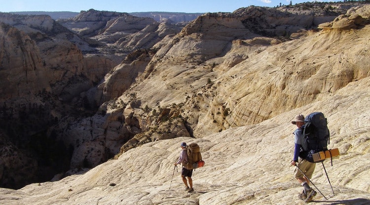
Angels Landing
Angels Landing allows hikers to relish in unbelievable views of Zion National Park. A trail of approximately 2.4 miles in length ascends about 1500 feet up the side of the canyon. The route leads up to a series of twenty-one switchbacks, known as Walter’s Wiggles, past a short respite at Scouts Lookout, and finishes via a very narrow and exposed trail with steep drop-offs on either side. The trail is narrow, but after that final push, a fantastic view of Zion Canyon awaits.
The Narrows
The Narrows is another Zion National Park classic. Most often, folks will embark on a day hike through the Narrows, starting at the Temple of Sinawava and forging upstream for as long as desired before turning around and heading back. You literally hike through the Virgin River as you go, staring up at the incredibly tall cliffs bounding you on either side.

For intrepid backpackers, a 2-day/1-night trip will lead you from the top down, a 16-mile trek through the length of the Narrows. Regardless of how you attempt the hike, be sure to check weather conditions and flow rates at the Zion Visitor Center. Flash floods or high flows due to spring runoff can make the hike impossible.
The Fairyland Loop
The Bryce Canyon trail known as The Fairyland Loop is considered to be a gem of the Southwest. This eight-mile hike offers an array of views with multiple changes in elevation. Fairyland Point and Sunrise Point are two of the most well-known viewpoints.
The Chinese Wall is another breathtaking sight along The Fairyland Loop, showcasing a series of hoodoos and eroded walls that are an unbelievable sight to see.
When hiking or backpacking throughout Southern Utah, preparedness is key. It will be important to acquire any necessary permits and to research the routes, so as to choose the most appropriate time of year, understand weather concerns, and be knowledgeable of any rules and restrictions. It is often best to enlist the expertise of a seasoned trail guide through a backpacking or hiking outfitter. This allows you to enjoy the views and experience without having to worry about all of the finer details. And you might even be treated to some of the lesser-known gems of southern Utah hiking!
Related posts

- United States /
- Backpacking
Best Backpacking Trails in Utah

Top trails (380)
- Lake Blanche Trail Hard • 4.8 ( 12652 ) #1 - Lake Blanche Trail Twin Peaks Wilderness Length: 7.0 mi • Est. 4h 59m This incredible hike is often called one of the best hikes in the Twin Peaks Wilderness Area. It features a beautiful mountaintop lake, awesome views, and abundant wildlife. Heads up! Because this trail lies within a protected watershed, dogs and swimming are not permitted at the lakes. The trail starts at the Mill B South Fork Trailhead off Big Cottonwood Canyon Road. You’ll begin by walking alongside the creek on Mill B South Trail for a short distance before turning onto Lake Blanche...
- Wall Street, Queens Garden, and Peekaboo Loop (Figure Eight Trail) Moderate • 4.9 ( 6309 ) #2 - Wall Street, Queens Garden, and Peekaboo Loop (Figure Eight Trail) Bryce Canyon National Park Length: 6.3 mi • Est. 3h 23m The peekaboo hike has amazing views and little traffic in the morning. There is no water so be sure to bring your own.
- Red Pine Lake and Gloria Falls via White Pine and Red Pine Trail Hard • 4.8 ( 5156 ) #3 - Red Pine Lake and Gloria Falls via White Pine and Red Pine Trail Lone Peak Wilderness Length: 7.7 mi • Est. 4h 31m This route takes you to Red Pine Lake. The lake itself boasts gorgeous views and several great camp spots for backpackers. and a lot of nice camping spots also. There are multiple creek crossings along this route. Many of them can be crossed on bridges along the trail. You'll also get a chance to check out Gloria Falls on a side trip. If you continue around the lake, you can reach Upper Red Pine Lake, Pfeifferhorn Peak, or White Baldy by going further south. The Red Pine Canyon area is...
- Mount Timpanogos via Timpooneke Trail Hard • 4.8 ( 4645 ) #4 - Mount Timpanogos via Timpooneke Trail Uinta-Wasatch-Cache National Forest Length: 14.2 mi • Est. 8h 47m Know Before You Go: This trail accesses or travels through potential avalanche terrain. For more information and to read the daily avalanche forecast please visit: https://utahavalanchecenter.org. A few other good sources for trail conditions are the Pleasant Grove Ranger District, and TERT (Timpanogos Emergency Response Team) Facebook page. There are two main trails to the top of Timpanogos, one of the most popular hiking destinations in Utah. This is the Mount Timpanogos via Timpooneke...
- Pfeifferhorn via White Pine and Red Pine Lakes Trail Hard • 4.8 ( 2337 ) #5 - Pfeifferhorn via White Pine and Red Pine Lakes Trail Lone Peak Wilderness Length: 9.9 mi This trail leads to one of the most scenic and most frequently visited peaks on the south side of Little Cottonwood Canyon. Plus, you'll get to visit the Red Pine Lakes. Gloria Falls is also not far from the main trail, and is a quick optional side trip. The majority of the hike is on a well-maintained and easy to follow trail. The portion of trail between Lower Red Pine Lake and the Alpine Ridge is only slightly difficult to follow, but the direction of travel is obvious and should keep...
- Battle Creek Falls Trail Hard • 4.5 ( 3567 ) #6 - Battle Creek Falls Trail Uinta-Wasatch-Cache National Forest Length: 4.1 mi • Est. 3h 8m Know Before You Go. This trail accesses or travels through potential avalanche terrain. For more information and to read the daily avalanche forecast please visit: https://utahavalanchecenter.org Pretty trail along the river - crowded up until the falls but if you go past the falls it clears up a lot.
- The Grotto Trailhead to The West Rim Hard • 4.9 ( 1620 ) #7 - The Grotto Trailhead to The West Rim Zion National Park Length: 9.0 mi • Est. 5h 53m Zion National Park charges a fee to enter. Fees are $35 per vehicle or $30 per motorcycle. If you are entering on foot, horse, or bike the fee is $20 per person. You can also purchase a park specific annual pass for $70. Start by parking at The Grotto trailhead, or taking the West Rim Shuttle to The #6 Grotto shuttle stop. Begin by crossing a bridge over the Virgin River, the first 2-miles of the West Rim Trail are a well-maintained, paved trail. Most of the path is sunny, but Refrigerator...
- Malan's Peak Trail Hard • 4.7 ( 3041 ) #8 - Malan's Peak Trail Uinta-Wasatch-Cache National Forest Length: 4.5 mi Located on the east side of Ogden, the summit of Malans Peak offers dramatic views out over the community, the Great Salt Lake and the surrounding mountains. The trail is signed and easy to follow. The route is somewhat steep, but not too bad. Take it slow and anyone can make this hike. There are excellent views at several points along the trail, and so you don't have to make it to the summit to enjoy a hike here. Strong hikers can continue past the summit into Malans Basin, which is a...
- Mount Timpanogos Trail Hard • 4.7 ( 1803 ) #9 - Mount Timpanogos Trail Mount Timpanogos Wilderness Length: 13.9 mi • Est. 9h 10m The Mount Timpanogos Trail from Aspen Grove is one of two routes the summit of Mount Timpanogos. For the Timpooneke Trail, check out: https://www.alltrails.com/trail/us/utah/mt-timpanogos-timpooneke-trail This route to the summit features many switchbacks, waterfalls, and small stream crossings. The trail also takes you to the Hidden Lakes basin followed by the well-known Emerald Lake. The trail then stretches towards the saddle across a boulder field where it joins with the Timpooneke trail...
- White Pine Lake Trail Hard • 4.7 ( 2131 ) #10 - White Pine Lake Trail Length: 10.2 mi • Est. 5h 48m White Pine Lake is a gorgeous area in the Lone Peak Wilderness. This area is most popular during the summer months. While some hikers opt to snowshoe on this route in the winter time, winter hiking to White Pine Lake requires more preparation. Winter adventures to the lake require winter backcountry experience and technical gear.
Helpful reviews of trails in Utah
Top parks in utah.
Top cities in Utah
Frequently asked questions about backpacking trails in Utah
What national parks in utah have backpacking trails, what is the longest backpacking trail in utah, which backpacking trail has the most elevation gain in utah, what is the most popular and difficult backpacking trail in utah, adventure anywhere.
- Aspen Grove
- Salt Lake City
- Mutual Dell
- Cottonwood Heights
- Bryce Canyon National Park
- Zion National Park
- Arches National Park
- Capitol Reef National Park
- Canyonlands National Park
- Dead Horse Point State Park
- Antelope Island State Park
- Snow Canyon State Park
- Goblin Valley State Park
- Escalante Petrified Forest State Park
- Kodachrome Basin State Park
- Gunlock State Park
- Coral Pink Sand Dunes State Park
- Red Fleet State Park
- Wasatch Mountain State Park
- Navajo Loop and Queens Garden Trail
- Angels Landing Trail
- Scout Lookout via West Rim Trail
- Delicate Arch Trail
- Devil's Garden Trail
- The Watchman Trail
- Lake Blanche Trail
- Wall Street and Queens Garden Loop Trail
- Lower Falls via Bells Canyon Trail
- Gloria Falls
- Emerald Pools Trail
- Fairyland Loop Trail
- Wall Street, Queens Garden, and Peekaboo Loop (Figure Eight Trail)
- Zion Canyon Overlook Trail
- The Zion Narrows Riverside Walk
Little Blue Backpack
chase what's fun.
Destinations , Vacations , West Coast · June 18, 2021
The Ultimate 7-Day Southern Utah Road Trip Itinerary: Zion, Bryce, Escalante
Southern Utah is full of stunning scenery. It makes for memorable hikes, lookouts that make your jaw drop, and long, beautiful drives that seem much quicker than they really are. One of the top destinations in the United States, a southern Utah road trip will not disappoint.

Disclosure: This post contains affiliate links that earn a small commission at no extra cost to you.
Who Should Go on a Southern Utah Road Trip?
Everyone! Take a solo trip. Make it a girl’s trip. Head out for a getaway with your significant other. Take the whole family! There is something for everyone that will make it impossible to regret.
If you’re a hiker, you definitely don’t want to miss out. If exploration for you means scenic drives, you will love it just as much!
As long as you love beautiful places and getting outside, you’re all set.

Note: the itinerary provided below will resonate most with those who want to do a lot of hiking mixed with grabbing drinks and eating good food. While hikes range from moderate to difficult, there are no 16-mile days or backpacking excursions! But you will get out and move every day!
When is the Best Time to Take a Southern Utah Road Trip?
The sweet spot for visiting Utah is in the spring and the fall when crowds dwindle (somewhat) and the weather is a comfortable temperature. Summer months definitely get crazy with both people and hot weather. And the winter months, though unique and beautiful in their own right, obviously come with snow and cold temperatures!
Keep in mind, besides the dead of winter, these places are busy all of the time. Go when it works for you, and be prepared for crowds.

Where Does This Southern Utah Road Trip Itinerary Take Me?
Many Utah itineraries you find are going to be based around the “Mighty 5,” which includes Zion National Park, Bryce Canyon National Park, Arches National Park, Canyonlands National Park, and Capitol Reef National Park.
In my opinion, to do “The Mighty 5” right, your trip should be two weeks total—10 days at the very least. Anything under that and you will be doing a lot more driving than exploring.
Since this trip is only one week (including travel days), it’s two national parks and a national monument.

There are notes and tips about substituting different places on certain days so, obviously, you are not locked in. That said, it is a place to start and I highly recommend this itinerary for a week that includes a range of experiences!
How Can I Spend 7 Days in Utah?
- Travel Day : Arrive in Southern Utah with options to stop along the way
- Start with 1 Day in Zion National Park (East Side—aka the “secret side”)
- 1 Day in Bryce Canyon National Park
- 1 Day at Grand Staircase-Escalante National Monument
- 2 Days back at Zion National Park (South End)
- Travel Day : Back home on Day 7
The trip includes three different places to stay, so while you do hotel-hop (Airbnb), it’s not a daily switch. All of the details on that are below.
The Best Southern Utah Road Trip Itinerary: One Week
A southern Utah road trip takes a little more pre-planning than a lot of vacations, but the adventures are totally worth it. Let’s get started!
Before Your Southern Utah Road Trip
Do your research.
Google. Read blogs. Browse Instagram. Ask your friends. Whatever you need to do, soak up as much information as possible! Everyone’s experience is different but I guarantee a better time if you have a plan together and a good idea about what you’re getting into!
Additional, HIGHLY-DETAILED blog posts of mine are linked throughout the post so make sure to visit those for even more tips.

I highly recommend a quality SUV for this trip. You spend a lot of time in the car, one day involves dirt roads, there are switchbacks through Zion, and you will need enough space for all of your passengers and luggage. My group went with a Chevy Equinox and it was perfect.
Annual Park Pass
If you are planning to visit more than three national parks in the next 12 months, grab an America the Beautiful Pass for $79.99 . It’s $35 at each park (for 7 consecutive days) so you make up your money in just three NP visits.
This pass twice is used twice on this trip so if you have another national park planned (or find it likely—you’ll only be out $10 if you don’t) then definitely grab one of these! If you don’t want to go that route, you can grab week-long passes at the entrances.
What to Pack for a Southern Utah Road Trip
Water Bottle: You need a big one that keeps liquids cold. This 32 oz. water bottle is my absolute favorite (still had ice in it after a day at Zion in 80+ degrees!) It has an easy-to-carry handle and I love the mouthpiece.
Hiking Shoes: Don’t forget your hiking shoes! If you don’t have a pair, invest in some. A few of these hikes will be difficult without them. The REI Outlet is a great place if you want to keep things affordable.
Layers: A few mornings you will get started early and temperatures are much, much cooler than they will be in the day. Make sure to have a jacket, long sleeves, leggings, and shorts, as well as a warm hat if you are going between late September-May.
Snacks: Between long hikes and busy areas with restaurant wait times, you will want snacks! My favorite are these Chomps Beef Sticks (all clean ingredients and lots of protein), and Trader Joe’s Simply the Best Nuts (individually packaged which makes everything easy). They easily fit in a suitcase and can be in your carry-on.
Sunscreen: No matter what time of year! If you are on the hunt for a clean product, the best out there is Cocokind . It’s not a weird texture or sticky on your face. I love it, plus it’s a great size for travel.
And with that, let’s get into the official southern Utah road trip itinerary!

Day 1: Travel Day
Where do i fly into for a southern utah road trip.
McCarran International Airport in Las Vegas, Nevada , is the closest airport to southern Utah. It’s 170 miles away from Springdale, Utah (Zion National Park), and is a major hub where you can typically find cheap flights. This itinerary will start in Sin City!
Note: Salt Lake City International Airport is the next closest and is 311 miles from the park. This is a good option if you prefer to road trip through Utah from north to south.

Pick Up Your Rental Car
Grab your rental and be on your way! Your first day of travel will have you on a scenic drive as you make your way from Vegas, through Arizona, and finally, into Utah. It’s a fairly easy drive that will find you on curvy stretches every now and then and takes a total of 160 miles (2 hours, 35 minutes.)
KEEP IN MIND: there is a time change between Las Vegas (PDT) and Utah (MT)! Your clocks will move ahead one hour.
Places to Stop between Las Vegas and Springdale
- Valley of the Fire State Park : this can be your first stop if you’d like to do a short hike and check it off your list! Located under an hour from Vegas and still in Nevada, is beautiful desert land and red sandstone formations.
- St. George : is a city a couple of miles north of the Arizona and Nevada border in the very southwestern corner of Utah. It’s one of the bigger towns on your drive and perfect for a gas and food stop.
- Other than that, it’s mountains, small towns, and jackalopes! Lol
Depending on what time you arrive, check in to your place, explore Springdale, Utah, or better yet, just relax! You have a big week ahead. (Note: there are a few Springdale restaurant recommendations later in the post.)
Where to Stay in Springdale, Utah
Best western plus (night 1/1).
Springdale, Utah accommodations are not cheap given the high demand! One of the more affordable places is the Best Western PLUS , located right downtown and near a shuttle stop—more on that below.
The rooms are very spacious, clean, and complete with a view. Plus, they offer an (actually delicious) continental breakfast that is the perfect pre-hike meal. And lessens the blow of the bill.

Options: There are plenty more places to choose from in Springdale, Utah including the Zion Lodge inside the park (need to book early), camping, and additional hotels and Airbnb’s. Check out How to Spend Two Days at Zion National Park: What You Need to Know for more options.
Day 2: Zion National Park (East)
Hike: observation point via east mesa trail.
Observation Point is one of the most beautiful spots in Zion and you will want this hike on your list. More specifically, the version of this hike that is done via the East Mesa Trail. The more popular version of the hike to Observation Point is from the south end of the park—bottom-up. This requires a shuttle bus and there are an endless amount of people.
Luckily, there is an alternative route if you drive to the east side of Zion—top-out. Bonus: the scenic drive there (via UT-9) is one to remember!
Note: the popular, south-end version of the hike to Observation Point is currently closed due to rockfall. (That said, I’d still choose East Mesa Trail, even when it’s reopened.)

The East Mesa Trail hike is not one you need an early start for which makes it a good option after a travel day. Wake up, grab breakfast, and be on your way at a leisurely pace. Plan to leave Springdale between 11:00-12:00 PM.
Plug “East Mesa Trailhead/Observation Point Trailhead” into your Google Maps and you will be all set for a 52-minute journey. It’s only 23 miles, but given the switchbacks and drive through the mountains and tunnels (awesome!), it takes longer. There is a bathroom as you approach the east-side entrance. And a few miles from the trailhead, you hit a dirt road which is where your SUV comes in handy.
Note: you will not return to Springdale tonight and this is bringing you in the right direction once your hike is over.
Park at the trailhead (we arrived at 1:00 PM and found parking, no problem) and you will find where the 6.8 miles, out-and-back trail begins.

* This Hike Takes 3-4 Hours *
You are led through a woodsy setting with mountains in the distance and amazing views once you make it to your destination. The best in the park, in fact! Though the hike is a bit longer, it’s not strenuous in terms of incline. A less than a mile or so stretch on your way back will be the toughest part on your booty!
Your destination (Observation Point) gives you not only a great hike but one of Utah’s best views . It includes a birds-eye view of both Angels Landing and The Narrows. Tip: it’s very windy at the top!
After your hike, you will make your way to Hatch, Utah (54 miles—1 hour, 10 minutes) which is very well-positioned between both Zion National Park and Bryce Canyon National Park. Tomorrow, you’ll tackle Bryce. But don’t worry, you will return to Zion in a couple of days!
Survive on snacks until you arrive. There is an awesome (and a bit unassuming) place to eat called Outlaw Saloon – Western Bar and Steakhouse . PRO TIP: Get the ribs. The meat falls off at the touch of a knife.
Where to Stay in Hatch, Utah
Mountain ridge cabins and lodging (night 1/3).
Mountains Ridge Cabins and Lodging is the perfect place to stay in Hatch, Utah. They are adorable and affordable with a restaurant/bar, convenience store, and coffee shop right nearby. The cabins are very clean (with daily housekeeping available) and include a shower, TV, and free drip coffees at the coffee shop.
Day 3: Bryce Canyon National Park
Hike: the figure 8.
All right, people. Get ready. Because this is going to be a day to remember. Everybody raves about Zion National Park (which, of course, is beautiful) but the real winner in my book is Bryce Canyon National Park. The rock formations, known as hoodoos, will take your breath away!
Day 3 is going to require an earlier start. Leave Hatch, Utah absolutely no later than 8:30 AM ; I would recommend between 7:30-8:15 AM and potentially earlier in peak season.
Sip your coffee on the 30-minute drive over and park in the Sunset Point parking lot after showing (or purchasing) your pass at the park entrance. Note: we got one of the very last spots in the lot at 9:02 AM. And if it’s summer, it will fill up earlier than that.
Sunset Point parking lot will connect you to Rim Trail and one of the most beautiful overlooks at the top of the canyon. You will be hiking down into it—and back up! And trust me, the views will be worth it.

Hike the Figure 8 Hike
The best and most rewarding 6-7 mile hike (depending which route you choose) in Bryce Canyon National Park consists of three hikes looped together into a Figure 8. Always remember, STAY RIGHT.
*This Hike Takes 3-4 Hours*
- Wall Street : a series of switchbacks that lead you down onto the canyon floor. (Left side image once I reached the bottom.)
- Peekaboo Loop Trail : an up and down 3-mile loop inside the canyon that offers the most INCREDIBLE non-stop views of the rock formations.
- Navajo Loop Trail OR Queens Garden : The way back up to the parking lot which is a tough, but worth it, journey! Navajo is shorter yet steeper and brings you to Sunset Point. (Right side image. Phew!) And Queens Garden takes some extra time but is less of an incline and brings you to Sunrise Point parking lot.
You can find EVERY SINGLE DETAIL on this hike here: The Best Day in Bryce Canyon National Park . You will have the BEST time!
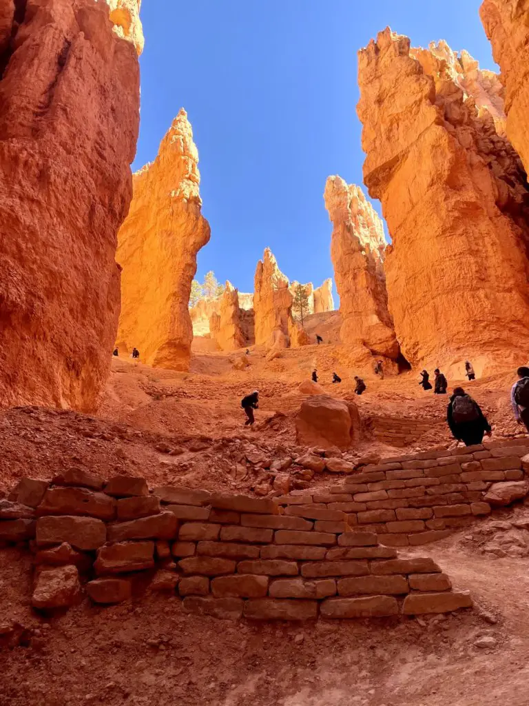
After the Figure 8 hike, which I cannot recommend enough, you still have an entire afternoon ahead of you. Choose one of these great options:
- Walk Rim Trail and check out all of the viewpoints. This brings you along the edge and does not get down into the canyon. You can park at Sunset Point OR Sunrise Point. There are no inclines so it can be a very casual walk while getting some great pictures.
- Drive the Scenic Byway known as Route 63 . If you’d rather drive, this will bring you to a TON of great views. (You can easily make this a full day as well.)
It has been a DAY! Find a restaurant in Bryce or make your way back to Hatch and hit Outlaw Saloon – Western Bar and Steakhouse again. This time, get the steak. It melts in your mouth!
Where to Stay: Hatch, Utah (Night 2/3)
Return to your little cabin for another night’s stay! Option: if you’d like to stay inside the park, Bryce Canyon Lodge is the only option and must be booked far in advance!
Day 4: Grand Staircase-Escalante National Monument
Hike: peekaboo gulch & spooky gulch slot canyons.
Ready for a mini road trip from Hatch to Escalante, Utah? If slot canyons are on your list, then your going to love this day! It’s such a fun experience.
67 miles (1 hour, 15 minutes) east of Hatch, and through Bryce, is Escalante, Utah. It is in the heart of Grand Staircase-Escalante National Monument on Scenic Byway 12 and home to a few different slot canyon hikes that will blow your mind!
Use this as a day to sleep in a bit (this is by far the least populated area of your trip so you won’t need to worry so much about crowds) and leave Hatch, Utah by about 10:30 AM. This will put you in the town of Escalante by around NOON assuming you stop once. Once you get there, check out the little town, grab some coffee if need be, and be on your way.
Hike Peekaboo Gulch + Spooky Gulch
The plan is to hike Peekaboo Gulch and Spooky Gulch which are located about 40 minutes down a dirt road from Escalante. I know, more driving. But it’s all an adventure and the beautiful drives make them seem quick! Make sure you have an SUV for this trip.
*This Hike Takes 2-3 Hours*
This 3.5-mile lollipop loop hike will have you start at the trailhead, walk around the rim and down into the lower desert, and arrive at Peekaboo Gulch, the first of two slot canyons. From here you have a couple of options:
- Climb into Peekaboo Gulch (that’s the toughest part), and hike through the narrow canyon walls about .25 miles. This one is really fun and a pretty easy hike to maneuver. And the afternoon sun hits the walls perfectly for pictures.
- When you come out the other side, you can hike over to Spooky Gulch, which is only about half a mile or so. Or go back through Peekaboo the way you came. Spooky Gulch is much more narrow (like 10 inches in some spots.) If you had a tough time with Peekaboo or are just nervous to give it a go, turn around. If you’re ready and excited (and just a little nervous), do Spooky! It’s really a unique experience.
- If you end up doing Spooky Gulch, you’ll loop right back around to Peekaboo once you come out of the slot canyon (this one is also about .25 miles) and stay right.
- Of course, you can always reverse it and start with Spooky Gulch and make your way over to Peekaboo second. This is said to be tougher.
This hike is outlined in FULL details (including the drive) over on The Best Grand Staircase-Escalante, Utah Slot Canyons to Hike . Definitely read the details if you are headed that way!
Once you finish your hike and make your way back to the small town of Escalante via the dirt roads, it will be about 5:00-6:00 PM which makes it the perfect time for a beer! Stop for just that and a bite to eat at one of the restaurants/bars. I recommend:
Circle D Eatery
Right off the main road is a great hiking reward! Circle D Eatery is a part of an independently-run motel and serves some delicious food and drinks in a casual environment. There is plenty of space inside, as well as an outdoor seating area. I recommend the Jalapeno Cream Ale beer that I am still thinking about. And the BBQ Brisket Nachos.
After you eat, it’s time get some rest! Or just keep drinking 🙂 You’ve earned it!
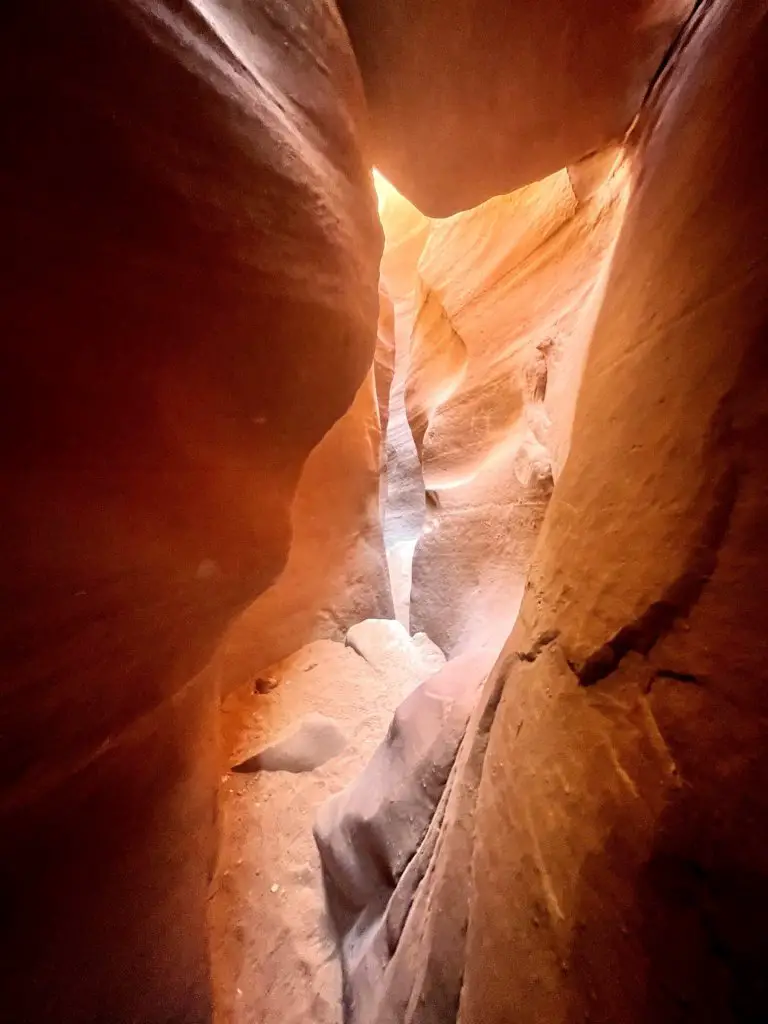
Where to Stay: Hatch, Utah (Night 3/3)
It’s your last night in the tiny cabin! I recommend making your way back just because it gets you much closer to Zion National Park, where you will make your way back to tomorrow. But…
Options: There are actually quite a few places to stay in Escalante, Utah. Click for all of the lodging choices , including motels and camping if you’d rather not drive more. There are also plenty of places to stay in Bryce, Utah which you drive through and puts you closer to Zion for the morning.
Day 5: Zion National Park (South)
Hike: rest day or your choice.
Sidenote: Zion National Park requires a LOT of details. Please don’t miss How to Spend Two Days at Zion National Park: What You Need to Know where nearly every single detail is outlined. This post will give you a lot of great high-level information, but we really go in-depth over there.
Back to Zion, it is! I like the idea of starting with Zion and looping back around to end with it to give you a shorter distance to and from the airport.

At this point, you will want to check off one (or two!) more hikes in the next two days. Depending on how you feel, you might need a rest day, which Day 5 is perfect for. Zion National Park is crazy busy and in order to have the best experience, you need to wake up EARLY. Being that you’ll wake up in Hatch, Utah, that will be difficult. A few options:
- Rest Day: Go at a leisurely pace today, explore Springdale, Utah and get ready for a big day tomorrow. This is the choice this itinerary covers!
- Hike Watchman Trail or Canyon Overlook Trail: these hikes don’t require the shuttle which makes it way easier to work into the day. Watchman is 3 miles from inside the south entrance and Canyon Overlook is 1 mile and off of UT-9.
- Hike Angel’s Landing: this is the most popular hike at Zion National Park and a later-in-the-day start might not be the best experience. That said, it’s your vacation!

Grab a delicious breakfast at Hatch Station. They have omelets that will hit the spot! Plan to take off and make your way back to Springdale (60 miles—1 hour, 20 minutes, and a beautiful drive) by about 11:00 AM.
Make a road trip stop at Belly of the Dragon. It’s right off UT-89 and is a quick, fun, and unique stop through a cave. There aren’t a lot of people and it’s perfect for kids—or just a couple of cool pictures! Plus, a chance to get out and walk around.
This is your chance to explore the town of Springdale, Utah! You might not be able to check into your hotel or Airbnb (my recommendation below!) until late afternoon so just find a parking spot and meander around the town. Recommendations:
- Go Shopping: This tourist town is, of course, full of shops that line the block towards Zion National Park. Souvenirs, crystals, sweet treats, boutique-style clothes, and gifts.
- Coffee/Drinks: FeelLove Coffee Zion is the cutest place and it is not just coffee, there are dinner and cocktail menus as well.
- Beer: Definitely plan to have a beer or five at Zion Brew Pub where there is both indoor seating as well as an awesome outdoor beer garden. It’s right near the entrance to Zion National Park.
- Eat: Whiptail Grill , a converted gas station, is a great place for lunch! Grab anything from steak tacos to chicken sandwiches on their Mexican fusion cuisine menu. They do have beer and wine.
- Visitor Center: go talk to park rangers and grab maps for tomorrow.

After your day of exploring, it’s time to grab dinner and then call it a night. (Note: if you are doing The Narrows hike tomorrow, grab your gear from Zion Outfitters . More information below.)
Zion Pizza & Noodle Co
Dine-in (there’s a beer garden) at Zion Pizza & Noodle Co . or order your food from the counter and bring it to your hotel or Airbnb. The European Trail was a delicious pizza option.

Townhouse Airbnb (Night 1/2)
I stayed in the most perfect townhouse in the heart of Springdale and it was perfect! Very clean, modern, and has two bedrooms plus comfy living space, laundry machines, and a TV. And the outdoor patio space (pictured below) makes it worth every penny.
You are only a short walk from the Springdale Shuttle that will bring you to the park (more on that below.) And there is a marketplace across the street that’s perfect for grabbing meals to prep at the place and snacks for your hikes. We stayed two nights and weren’t quite ready to leave! Highly recommend.

Options: Visit How to Spend 2 Days at Zion National Park for more places to stay.
Day 6: Zion National Park (South)
Hike: the narrows.
Today is a big day and a check-off of the Bucket List! If you didn’t get a major hike done yesterday, you’ll need to pick between The Narrows and Angels Landing—two of the most popular hikes.
This itinerary will walk you through The Narrows , a fun and unique experience that isn’t quite as close to death as Angels Landing. (LOL I’m kidding. Sort of…)
Note: if neither of these sounds appealing, check out the list of other popular Zion National Park hikes .

Early. Start early. It cannot be stressed enough. As I mentioned, Zion is a very popular place. And between the number of people and the shuttle bus(es) requirement, it’s best to get going. We’re talking like, be in line for the Zion Canyon Shuttle at 6:00 AM. EEK! Don’t worry, it’s worth it. First things first:
Zion Shuttle Buses
The most popular hikes in Zion National Park REQUIRE taking the Zion Canyon Shuttle Bus. There are TWO separate shuttles in the area.
- The Springdale Shuttle : connects the town of Springdale (stops near your hotel or Airbnb) to the South Entrance of the park where you catch the Zion Canyon Shuttle. Note: this runs April-October. This is not required, you can also walk.
- Zion Canyon Shuttle : This gives you access from inside the park to the upper canyon (most popular hikes) since private vehicles are prohibited along Zion Canyon Scenic Drive between March and November. It is first-come, first-serve. Don’t forget your park pass or purchase at the entrance.
Hike The Narrows
Shuttle bus stop 9: temple of sinawava.
One of the most unique hiking experiences in the United States is through the Virgin River inside one of Zion’s canyons. After taking the Zion Canyon Shuttle to the last stop (#9) and making a mile or so hike on the Riverside Walk paved trail, you’ll enter the river with high canyon walls on either side.
*This Hike Takes as Long as You’d Like! Likely at least 4 hours*
Once you enter the water, you can go as far as 8 miles, but you can turn around and come back whenever you choose. The scenery doesn’t change a ton, so we went about 1.5 hours or so before we made the trek back.
As far as gear, I recommend the boots, neoprene socks, and a walking stick from Zion Outfitters . You can find WAY more details in this post . Note: this is not required!

- Pick another shorter hike inside Zion National Park such as Emerald Pools or Weeping Rock.
- Head back out to Springdale to drink beer and eat; you’ve done enough hiking for one day!
Townhouse Airbnb (Night 2/2)
Back to the perfect townhouse in Springdale where you can enjoy your outdoor patio, maybe do some laundry before you head out, and relax!

Day 7: Travel Day
That’s it! You have reached Day 7 of your southern Utah road trip experience and it’s time to make you way back to the airport. You are 2 hours and 40 minutes from Las Vegas so depending on when you flight is, make sure you are packed and ready to roll!
Mix-and-Match + Additions
When you only have one week, including travel days, there is simply too many places to squeeze in on a southern Utah road trip. Here are other destinations in the area that you can replace in your itinerary, or add extra days for:
- Capitol Reef National Park: if you’re focused solely on national parks, you could potentially swap “Day 4: Escalante Slot Canyons” with this park which is also east of Bryce. It is more driving and you’ll likely need to stay the night.
- Canyonlands National Park: even farther east than Capitol Reef, you will probably need more days to work this in.
- Arches National Park: a tad more east from Canyonlands, these three national parks are pretty close in proximity. As I said, 10-14 days for “The Mighty Five” is what you’ll need. I plan to do these 3 as a separate trip.
- Dead Horse Point State Park: one of Utah’s state parks with views of the Colorado River. It’s near the three national parks above and the city of Moab, Utah.
- Cedar City + Cedar Breaks National Monument: a town north of Zion. You could choose to loop from Zion to Cedar City to Bryce and back around.
- Northern Arizona: PACKED with places to check out, this can easily be a vacation on its own! The Grand Canyon, Antelope Canyon (popular slot canyons that are currently closed), and Horseshoe Bend are all highlights.
One Last Thought…
It’s tough to come by in Utah! Lol. Here’s the skinny: You can get 5% or less at gas stations, marketplaces, etc. Anything percentage above that, and you have to go to a liquor store. The kicker? There aren’t many liquor stores! Ha. Definitely scope it out during your travels and figure out your option to stop and grab some booze.
As far as restaurants, many (not all) only have beer and wine. And many (not all) places don’t have an actual bar to sit at.
This was my least favorite part of Utah and thought you should know! Lol.
You will LOVE this trip! And you will come out of it with so many amazing pictures and incredible memories. Comment your favorite spot on this trip! Or one I may have missed.
Happy travel! 🙂
Did this post help you out? Support the work and pass along $5 for a Coors Light 😉 VENMO: @Amber-LBB or PAYPAL: [email protected]. THANK YOU.
You’ll Also Love
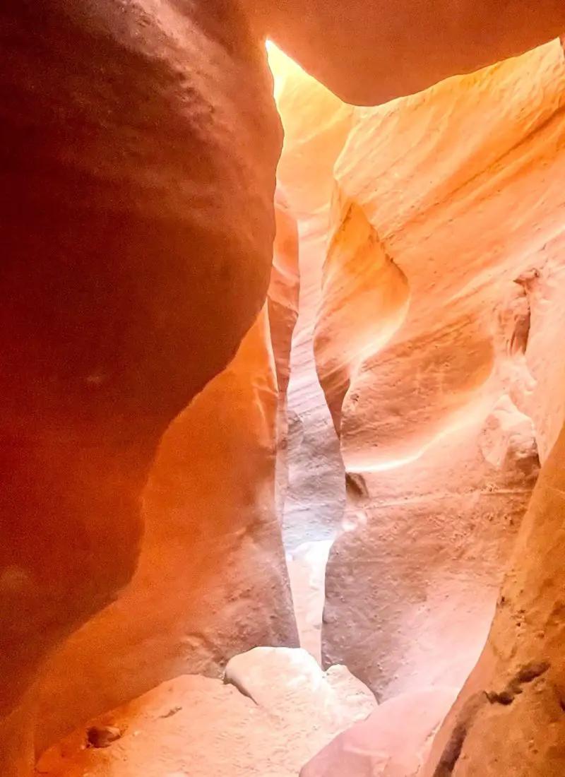
The Best Grand Staircase-Escalante, Utah Slot Canyons to Hike
What the people love.
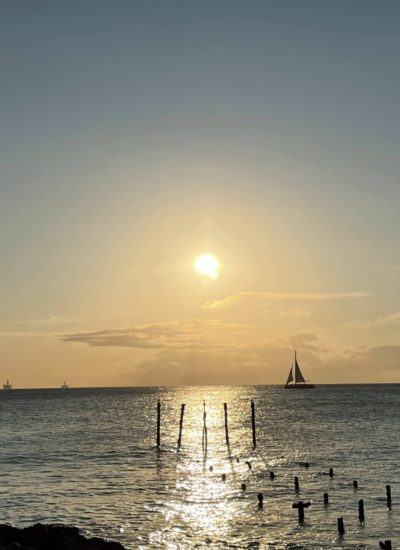
- Destinations
- Save Money to Travel
- Tips & Tricks
- Let’s Connect
Copyright © 2024 Little Blue Backpack · Theme by 17th Avenue


Backpacking in Utah: Hiking Through Time and Terrain

Affiliate Disclaimer
We may earn commission as an affiliate from qualifying purchase made through any of the link in this post thank you so much.
Utah is a backpacker’s paradise. With its stunning natural scenery, diverse terrain, and countless hiking trails , it offers an incredible outdoor experience for backpackers of all levels. Whether you’re looking for a short day hike or an overnight adventure, Utah has it all.
Backpacking in Utah provides an opportunity to explore the state’s rugged wilderness, from the towering peaks of the Wasatch Mountains to the iconic red rocks of Moab.
It’s a chance to disconnect from the world and immerse oneself in nature , all while enjoying the physical and mental benefits of hiking .
For those seeking an adventure of a lifetime, Utah’s diverse landscape and abundance of backpacking trails are beckoning.
Here’s a closer look at what makes backpacking in Utah an unforgettable experience.
Key Takeaways:
- Utah is a backpacker’s paradise with stunning natural scenery and diverse terrain.
- There are countless hiking trails for backpackers of all levels.
- Backpacking in Utah provides an opportunity to disconnect and immerse oneself in nature .
- Utah’s diverse landscape and abundance of backpacking trails make it an unforgettable experience.
- Backpacking in Utah offers physical and mental health benefits.
Exploring Utah’s Backcountry Trails

Utah boasts an extensive network of backpacking trails that provide opportunities for adventurers of all skill levels.
From day hikes to multi-day treks, backpackers can explore the diverse landscapes of the state, including canyons, mountains, and deserts.
There are numerous backpacking trails in Utah that offer stunning vistas and unique experiences. Some notable trails include:
- The Zion Narrows: This 16-mile trail follows the Virgin River through a narrow slot canyon, offering breathtaking views and challenging terrain.
- The High Uintas Wilderness: This expansive wilderness area in northeastern Utah boasts over 500 miles of trails, including the popular Kings Peak Trail.
- The Grand Staircase-Escalante National Monument: This vast wilderness area in southern Utah features a variety of backpacking trails, including the popular Coyote Gulch Trail.
Backpacking Trips
Backpacking trips in Utah offer a chance to explore the state’s natural beauty and rugged terrain.
Multi-day trips can provide a deeper immersion in the wilderness and allow for more extensive exploration of the terrain.
Some popular backpacking trips in Utah include:
- The Hayduke Trail: This 800-mile trail runs through some of the most remote and rugged landscapes in Utah, including Canyonlands National Park and the Grand Canyon.
- The Uinta Highline Trail: This stunning 104-mile trail runs through the High Uintas Wilderness and offers breathtaking views of the surrounding mountains and alpine lakes.
- The Trans-Zion Trek: This 50-mile trek traverses Zion National Park and offers stunning views of the park’s iconic sandstone formations and canyons.
Backpacking Trails Utah
Utah’s diverse landscapes offer a wide range of backpacking trails for outdoor enthusiasts.
The state’s mountain ranges, canyons, and deserts all provide unique opportunities for exploration and adventure.
Some popular backpacking trails in Utah include:
Whether backpackers are seeking a challenging trek through the mountains or a leisurely hike through a scenic canyon, Utah’s backcountry trails offer a wealth of opportunities for adventure and exploration.
Backpacking Utah’s National Parks

Backpacking in Utah’s national parks is a unique and unforgettable experience that allows hikers to immerse themselves in the stunning natural beauty of the region.
One of the most popular destinations for backpackers is Canyonlands National Park , which features over 500 miles of trails that wind through towering cliffs, meandering canyons, and jagged rock formations.
The national park offers backpackers numerous opportunities to explore its diverse landscapes, from the Island in the Sky mesa to the remote and rugged backcountry regions.
The park features four distinct districts: Island in the Sky, the Needles, the Maze, and the rivers, each with their unique trails and backpacking opportunities.
Backpacking in national parks requires careful planning and preparation, as permits are required for overnight stays, and certain areas may be closed due to weather conditions or conservation efforts.
Additionally, hikers are expected to follow Leave No Trace principles to minimize their impact on the environment and preserve the natural beauty of the parks for future generations.
“Canyonlands National Park is incredibly diverse. The different districts all offer unique backcountry experiences and trails, from easy day hikes to challenging multi-day backpacking trips .” – Ranger John Smith
Other National Parks in Utah
Aside from Canyonlands National Park , Utah is home to several other national parks that offer backpacking opportunities.
Arches National Park features over 2,000 natural arches, and backpackers can explore the park’s backcountry areas on several multi-day trips.
Zion National Park, located in southern Utah , is known for its towering sandstone cliffs and narrow slot canyons, which make for challenging backpacking adventures.
Overnight Backpacking Adventures in Southern Utah

When it comes to hiking and backpacking in Utah , Southern Utah offers some of the most captivating natural beauty and diverse trail options in the state.
From the towering red rock formations of Bryce Canyon National Park to the otherworldly landscapes of Zion National Park, backpackers will encounter a range of unique experiences and environments.
Hiking through Southern Utah also provides the opportunity to explore some of the state’s less-traversed areas, allowing backpackers to discover hidden gems and secluded trails .
With its stunning scenery and relatively moderate climate, Southern Utah is an ideal destination for backpacking trips throughout the year, but especially during the spring and autumn months.
The Top Overnight Backpacking Spots in Southern Utah
From the sweeping landscapes of the Grand Staircase-Escalante National Monument to the slot canyons of the Paria Canyon-Vermilion Cliffs Wilderness, Southern Utah boasts a diverse range of backpacking trails and experiences.
Here are some of the top overnight backpacking spots in the region:
Each of these trails offers breathtaking scenery and unique experiences, but they also require careful planning and preparation.
Backpackers should be aware of the terrain, climate, and potential hazards of each trail before embarking on their journey.
Backpacking Tips for Southern Utah
Before setting out on a backpacking trip in Southern Utah, it’s important to be prepared for the challenges that this diverse terrain can present.
Here are some backpacking tips to keep in mind:
- Check weather conditions and pack accordingly, as temperatures can vary significantly throughout the day and night.
- Carry plenty of water and plan water sources carefully, as water availability can be limited in some areas.
- Be aware of potential hazards, such as flash floods and rockfall, and plan accordingly.
- Leave no trace and respect the natural environment by properly disposing of waste and avoiding damaging flora and fauna.
By following these tips and being prepared for the unique challenges of backpacking in Southern Utah, outdoor enthusiasts can embark on an unforgettable adventure through one of the most stunning and diverse regions in the state .
Trekking Through Northern Utah’s Natural Beauty

Northern Utah offers backpackers some of the most spectacular and diverse landscapes in the state.
From rugged mountain ranges to tranquil lakes and rivers, there’s something for every outdoor enthusiast in this region.
One of the top backpacking destinations in Northern Utah is the Uinta Mountains.
This stunning range features beautiful alpine lakes, rolling meadows, and rugged peaks, making it a favorite among hikers and backpackers alike.
With over 400 miles of trails to explore, there’s no shortage of adventure to be had in the Uintas.
For those seeking a more challenging backpacking experience, the Highline Trail in the Wasatch Range is a must.
This 104-mile trail winds through some of Utah’s most dramatic mountain landscapes, with steep ascents and descents that reward hikers with breathtaking views at every turn.
Northern Utah is also home to several national forests, including the Ashley National Forest and the Cache National Forest.
These forests offer a wide variety of backpacking trails and camping opportunities, as well as spectacular scenery and wildlife viewing.
Additional Backpacking Destinations in Northern Utah
– Logan Canyon
– Ogden Valley
– Antelope Island State Park
– Bear River Range
No matter where you choose to backpack in Northern Utah , you’re sure to be surrounded by natural beauty and adventure at every turn.
Unforgettable Backpacking Trips Near Salt Lake City

Salt Lake City is a gateway to some of the most unforgettable backpacking trips in the state of Utah.
Whether one is a seasoned backpacker or a beginner , there are plenty of overnight backpacking trips and backpacking trails within Utah County that await exploration.
One of the most popular overnight backpacking trips near Salt Lake City is the Lone Peak Wilderness Area.
This area offers a variety of trails that vary in length and difficulty, providing options for backpackers of all skill levels.
The Lone Peak Trail is a 6.2-mile trail that takes backpackers through rugged mountain terrain and past stunning alpine lakes.
For those seeking a longer and more challenging trek, the Jacob’s Ladder Trail is a 14.6-mile point-to-point trail that provides stunning views of the Wasatch Range.
Another option for backpackers near Salt Lake City is the Timpanogos Wilderness Area.
This area is home to Mount Timpanogos , a peak that rises over 11,000 feet and provides backpackers with breathtaking views of the surrounding mountains.
The Timpanogos Trail is a 14.4-mile trail that takes backpackers through wildflower-filled meadows, past rushing mountain streams, and up to the summit of Mount Timpanogos .
For backpackers seeking a more unique experience, the Squaw Peak Trail in Provo Canyon offers stunning views of the Utah Valley and the nearby Wasatch Range.
This trail is 6.4 miles long and is known for its wildflowers and beautiful scenery.
Backpackers can also explore the Dry Creek Trail, a 6.4-mile trail that winds through dense forest and provides access to stunning mountain vistas.
Before embarking on any overnight backpacking trips near Salt Lake City, it is important to ensure that one has the necessary gear and knowledge to stay safe and comfortable during the journey.
Backpackers should bring a map, compass, plenty of water, and appropriate clothing for the weather conditions.
It is also important to follow Leave No Trace principles and to practice responsible camping and hiking habits.
The Majestic Beauty of Utah’s Mountain Ranges

Utah’s mountain ranges offer breathtaking vistas and pristine wilderness that attract outdoor enthusiasts from around the world.
Visitors can explore a variety of trails and peaks, each offering unique experiences and challenges.
One of the most popular destinations is Mount Timpanogos , which towers over Utah County and the Salt Lake Valley.
With an elevation of 11,752 feet, Mount Timpanogos is the second-highest peak in the Wasatch Range and provides stunning views of the surrounding landscape.
Hikers and backpackers can choose from several trails, including the Timpooneke Trail, Aspen Grove Trail, and the more challenging Mount Timpanogos Summit Trail.
Each trail offers its own unique features, including wildflowers, waterfalls, and wildlife sightings.
Other popular mountain ranges in Utah include the Uinta Mountains, the highest range in Utah, and the La Sal Mountains, which offer stunning views of Moab and Arches National Park.
Nature at its Finest
Utah’s mountain ranges offer a chance to connect with nature and experience its beauty firsthand.
Visitors can explore forests, meadows, and alpine tundra, as well as observe a variety of wildlife, including moose, elk, and mountain goats.
In addition to hiking and backpacking, visitors can also enjoy skiing and snowboarding in the winter months.
Utah is home to world-class ski resorts, including Park City Mountain Resort, Deer Valley Resort, and Snowbird Ski Resort.
The Salt Lake Connection
Utah’s mountain ranges are easily accessible from Salt Lake City, making them a popular destination for both locals and visitors to the area.
The Salt Lake Valley lies at the foot of the Wasatch Range, providing stunning views of the mountains from the city.
Visitors to Salt Lake City can take advantage of the city’s many outdoor amenities, including hiking and biking trails, parks, and recreational areas.
They can also take a day trip to nearby mountain ranges for a quick getaway into nature.
Year-Round Backpacking in Utah

Utah offers a diverse range of backpacking experiences year-round, allowing hikers to witness the beauty of its natural splendor in different seasons.
Whether it’s hiking amid picturesque hills in the spring, or the captivating change of colors in autumn, Utah’s wilderness remains a must-see destination for any backpacking enthusiast.
If you plan to backpack in Utah during March, October, or winter, you’ll want to ensure that you select the right gear and routes for the season, as weather conditions can vary dramatically.
To help you prepare for your trip, we’ve put together some essential tips on backpacking gear and other considerations for each season:
Backpacking Utah in March
March marks the beginning of spring, and it’s an excellent time to explore Utah’s majestic landscapes.
The snow begins to melt, and the hillsides are covered with colorful wildflowers, providing a picturesque backdrop for your backpacking adventure .
To make the most of your March backpacking trip, be sure to pack the following essentials:
- Layered Clothing: Dress in layers to keep warm as the temperatures can still be cool during the mornings and evenings.
- Trekking Poles: They help to maintain balance on muddy and wet trails.
- Waterproof Gear: Pack waterproof boots, jackets, and a tent to stay dry in case of rain showers, snow, or hail.
Backpacking Utah in October
October is a beautiful time to backpack in Utah, particularly due to the fall colors that emerge across the state.
However, the weather can be unpredictable, and hikers need to be prepared. Here are some essentials to pack:
- Warm Clothing: The temperature drops significantly in October, so be sure to pack a warm jacket, sleeping bag, and socks.
- Navigation Tools: With the leaves falling off the trees, trails can be challenging to follow. Navigation tools such as a compass and GPS are critical for hikers to stay on track.
- Headlamp: Since the days are shorter in October, hikers need a reliable headlamp to navigate in the dark.
Backpacking Utah in Winter
Winter may not be the most popular season for backpacking in Utah, but it can be a rewarding experience for hikers looking for a unique adventure.
The scenery can be stunning, with snow-covered peaks and frozen lakes . However, backpackers should take the necessary precautions and pack suitable gear:
- Winter Gear: Be sure to pack winter-specific clothing and gear, including waterproof and breathable outer layers, insulated mid-layers, winter boots, and gloves.
- Tent: Consider a four-season tent that can withstand extreme weather, including winter winds and heavy snow.
- Food and Water: Ensure you carry enough food and water, as backpackers burn a lot of calories to stay warm in the cold.
“Backpacking during the winter in Utah can offer a unique and unforgettable experience, with stunning scenery and peaceful solitude.”
Utah’s natural beauty shines in every season, and with the right gear and preparation, backpackers can experience the state’s stunning scenery all year long.
Unique Backpacking Experiences in Utah’s Deserts

Utah’s deserts offer a truly unique backpacking experience, with breathtaking scenery and rugged terrain that will challenge even the most experienced hikers.
Backpackers can explore the vast red rock landscapes of Southern Utah or the remote wilderness of Southeast Utah, both of which boast incredible natural wonders and hidden gems.
Backpacking in Southern Utah offers a chance to explore the stunning Zion National Park, known for its towering sandstone cliffs and narrow slot canyons.
The popular Narrows hike takes visitors through a dramatic slot canyon, wading through the Virgin River and marveling at the sheer rock walls towering above.
For a more secluded adventure, backpackers can explore the Coyote Gulch , a picturesque canyon with natural arches, waterfalls, and multi-colored rock formations.
Southeast Utah is home to the iconic Arches National Park , with its vast collection of natural sandstone arches and unique rock formations.
The Devils Garden trail in the park offers a challenging hike through a landscape of towering fins and arches, while the Canyonlands National Park provides backpackers with a chance to explore the rugged canyons and mesas of the Utah desert.
Backpacking Utah’s Desert Essentials
When backpacking in Utah’s deserts, it is essential to be prepared for the unique challenges of this environment. Here are some tips to make the most of your desert backpacking adventure:
- Bring plenty of water – the desert can be hot and dry, so pack more water than you think you’ll need.
- Protect yourself from the sun – wear a hat, use sunscreen, and consider lightweight long-sleeve clothing.
- Be aware of wildlife – there are many unique desert animals, including snakes and scorpions, so it’s important to know what to do if you encounter them.
- Stay on the trail – the desert environment is fragile, so it’s important to minimize your impact by staying on designated trails.
“The desert is not a wasteland, but a treasure trove of natural wonders waiting to be explored.”
Essential Gear and Tips for Backpacking in Utah

Backpacking in Utah can be an unforgettable and exhilarating experience, but it requires good planning and preparation.
Whether you are an experienced backpacker or exploring this kind of adventure for the first time , it’s important to have the right gear and knowledge to ensure a safe and enjoyable trip.
Here are some essential tips and gear recommendations for backpacking in Utah.
Planning a Backpacking Trip in Utah
Before embarking on a backpacking trip in Utah, it’s essential to plan all aspects of the trip carefully. Start by selecting a trail that matches your skill level and experience.
Look for information on permits, weather conditions, and camping regulations relevant to the trail you plan to explore.
To help you plan your backpacking trip in Utah, consider using online resources such as the official website of Utah State Parks or the Bureau of Land Management.
These websites provide valuable information on trails, permits, and regulations.
Backpacking Essentials for Utah
Here are some essential items that are necessary to bring for a safe and successful backpacking trip in Utah:
Backpacking Gear for Utah
In addition to the essentials listed above, there are additional items that can enhance your backpacking experience in Utah. Consider investing in the following gear:
- Trekking Poles: useful for steep ascents and descents, and can reduce the impact on your knees and joints.
- Camp Stove: allows you to cook warm meals and boil water while on the trail.
- Headlamp: essential for navigating camp at night or for early morning hikes.
- Bear Canister: required for some trails in Utah to protect against wildlife.
With proper planning and the right gear, backpacking in Utah can be a remarkable experience that offers adventure, natural splendor, and a sense of personal accomplishment.

Utah offers a wide variety of natural beauty and adventure for backpackers of all levels.
From exploring the backcountry trails to trekking through majestic mountain ranges, backpackers can experience unforgettable journeys in this unique region.
Backpacking in Utah’s National Parks, including the stunning Canyonlands National Park, is a must-do experience for any outdoor enthusiast.
Southern Utah’s breathtaking landscapes and Northern Utah’s hidden gems offer even more opportunities to explore and discover.
Year-round backpacking in Utah is possible, with specific tips and recommendations for each season.
In addition, backpackers can embark on a unique experience in the state’s deserts, such as backpacking in Southern or Southeast Utah.
Proper planning and essential gear are important for a successful backpacking trip in Utah.
By following safety tips and packing the necessary items, backpackers can ensure a comfortable and enjoyable journey.
Overall, Utah’s unparalleled natural beauty and adventure make it an ideal destination for backpackers seeking unforgettable experiences in the great outdoors.

What is backpacking?
Backpacking refers to a form of outdoor recreation where individuals carry all their necessary gear and supplies in a backpack while exploring and hiking through remote and natural areas.
Why choose Utah for backpacking?
What is backpacking? Backpacking refers to a form of outdoor recreation where individuals carry all their necessary gear and supplies in a backpack while exploring and hiking through remote and natural areas.
What are the best backpacking trails in Utah?
Utah is home to numerous outstanding backpacking trails. Some popular options include The Narrows in Zion National Park, The Highline Trail in the Uinta Mountains, and the Coyote Gulch in Escalante.
When is the best time to go backpacking in Utah?
The best time for backpacking in Utah depends on the specific region and trail. Generally, spring and fall offer pleasant temperatures, while summer can be hot. Winter backpacking is possible but may require additional planning and specialized gear.
What essential gear do I need for backpacking in Utah?
Essential gear for backpacking in Utah includes a sturdy backpack, hiking boots, appropriate clothing for the weather, a tent, sleeping bag, cooking equipment, maps, a compass, a first aid kit, and ample food and water.
Are permits required for backpacking in Utah’s national parks?
Yes, permits are required for overnight backpacking in Utah’s national parks, such as Canyonlands and Zion. It is essential to obtain permits in advance to ensure availability and comply with park regulations.
Can I backpack in Utah on a budget?
Yes, backpacking in Utah can be done on a budget. By bringing your own gear, preparing your meals, and opting for free or low-cost camping options, you can minimize expenses while still enjoying the stunning natural beauty of the state.
What safety precautions should I take while backpacking in Utah?
Some important safety precautions include informing someone of your itinerary, carrying a map and compass, staying hydrated, being aware of weather conditions, packing proper emergency supplies, and following Leave No Trace principles to preserve the natural environment.
Are there guided backpacking trips available in Utah?
Yes, there are guided backpacking trips available in Utah. Various companies offer guided tours and expeditions led by experienced guides who can provide a safe and informative backpacking experience.
Can I bring my dog backpacking in Utah?
Some backpacking trails in Utah allow dogs, while others have restrictions. It is essential to research and check with the specific trail or park regulations to determine if dogs are permitted and if any additional requirements need to be met.
What are some beginner-friendly backpacking trails in Utah?
Beginner-friendly backpacking trails in Utah include the Lower Calf Creek Falls in Grand Staircase-Escalante National Monument, the Silver Lake Trail in Big Cottonwood Canyon, and the Mirror Lake Trail in the Uinta Mountains.

About the author
travelexplain
Hi, I am Joseph Benson. I love exploring new places and cultures, meeting people from all over the world, and learning about their history and customs. And because I am a traveler who is always on the go, never miss an adventure.
Leave a Reply Cancel reply
Your email address will not be published. Required fields are marked *
Save my name, email, and website in this browser for the next time I comment.

Latest posts

Backpacking in Arizona: Unveiling Hidden Desert Treasures
Backpacking in Arizona is indeed a mind-blowing experience. Arizona is a backpacker’s paradise, with some of the most breathtaking scenery…

Should I Carry A Gun while Backpacking? | Well Explained
As an outdoor backpacker, safety is always a top concern. When venturing into the wilderness, there are many potential dangers, from…

Is It Legal to Hike with A Firearm? | Hiking Explained
Many outdoor enthusiasts enjoy hiking as a way to experience nature and get some exercise. But is it legal to hike…
You are using an outdated browser. Please upgrade your browser or activate Google Chrome Frame to improve your experience.

- Trip Styles
- Destinations
3 Best Utah Spring Break Backpacking Trips
- All Inspiration and Destinations
- Canadian Rockies
- New Hampshire
- New Zealand
- North Carolina
- Vancouver Island
- Washington State

Southern Utah has the most stunning canyons in the world. For spring break trips , Capitol Reef , Coyote Gulch , and the longest slot canyon in the world become prime destinations for backpacking trips to beat the winter blues!
1. Capitol Reef, Water Pocket Fold

Sixty-five million years ago, the same compacting forces that created the Rocky Mountains formed a fold in the earth under southern Utah. Less than a century ago, that tangle of crevices, canyons and chasms became the last-mapped landscape in the lower 48. Rich in wilderness and history , this is country that hid Mormon moonshiners, polygamist safe houses and Butch Cassidy. And even today it feels a step from the edge of the earth. Capitol Reef is a Gold-Tier International Dark Skies Park , making it one of the best places in the world to view the stars and Milky Way.
Trip Overview
Visit one of the only double arches in the world before taking a unique hike through a slot canyon with virtually no visitors other than yourselves. Skirt the Waterpocket Fold and visit the iconographic but hidden Hamburger Rocks, then visit Lower Muley Twist through its namesake canyon.
Getting There
Check conditions of Notom-Bullfrog and Burr Trail roads before going.
Road Conditions Resources – Anasazi State Park in Boulder, UT: 435-335-7308 – Capitol Reef Visitors Center in Fruita, UT: 435-425-3791
Access Lower Muley Twist TH via the Burr Trail Road east of Boulder, UT. Halls Creek Overlook trailhead is off the Notom-Bullfrog Rd, which runs north/south between the Waterpocket Fold and the Henry Mountains.
From Salt Lake City, UT: 5.5 hours Take I-15 South to US Hwy 50. Continue on UT 24 to access UT 12 and the Burr Trail via Torrey and Boulder, where you’ll connect with the Burr Trail Road.
From St. George, UT: 5.5 hours Take I-15 North to UT 20. Head east on UT 20 to HWY 89. Take HWY 89 south to UT 12, then follow UT 12 to Boulder, where you’ll connect with the Burr Trail Road.
From Las Vegas, NV: 7.5 hours Take I-15 North for two hours and join directions from St. George above.
Recommended Day by Day Itinerary
Lower Muley Twist TH to Halls Creek Overlook TH, via Halls Creek Narrows
Day 1 : Enter Lower Muley Twist TH. Short hike with impressive canyon walls through most of the day. Plan to Dry Camp as there are no reliable water sources in Lower Muley. Potential water options within the Lower Muley Canyon are at the following coordinates: 37.760455, -110.983039, and 37.790714, -110.994216. Total hike is 3.3 miles, ~700 feet gradual elevation loss.
Day 2 : Sandstone walls top out at 1000′. Explore multiple Alcoves, including “Cowboy Cave,” which has lots of pioneer graffiti. Terrain is gradual decline for most of the day. Exit the bottom of Lower Muley Twist Canyon towards the end of the day. Option to camp near Hamburger Rocks or near Brimhall Arch; both have water sources. Total hike is 4-7 miles, ~800 feet elevation loss.
Day 3 : Lots of miles today but easy, fast-moving terrain. Essentially, continue down the Halls Creek Drainage to in the vicinity of Fountain Tanks . You’ll be walking along the Waterpocket Fold the entire day. Total hike is ~7-10 miles, 600 feet elevation loss.
Day 4 : Day hike loop of Halls Creek Narrows > return to camp with options to layover or to pack-up and continue up-canyon towards Fountain Tanks. Comparable in size and scope to the Virgin River Narrows in Zion National Park , Halls Creek Narrows is one of the most stunning canyon narrows sections on the Colorado Plateau. Total hike is 5.5-9 miles, nominal feet elevation change.
Day 5 : Today’s hike is straight up the Halls Creek Drainage. You’ll be following the 1881 wagon route designed by Charles Hall as be an alternative to Hole In The Rock Road, and pass by Red Slide (500′ slide coming off the Fold) and explore a side canyon in-route. Total hike is 4-8 miles, 400-600 feet elevation gain.
Day 6 : Start your day with a short hike up the Halls Creek watershed from camp. Then day hike out-and-back to Brimhall Arch, and end with an 800′, 1.2-mi (at times steep) ascent from the Halls Creek drainage. Total hike is 3-5 miles, 900 feet elevation gain.
Permits, Fees, Reservations…etc.
Backcountry permits are required. These are free, and can be picked up at the National Park Visitors Center in Fruita, UT or Anasazi State Park in Boulder, UT.
- Capitol Reef National Park Visitors Center is open daily with exceptions for some holidays. 435-425-3791
- Anasazi State Park (convenient if arriving from St. George and points west) is generally open year round, seven days a week (some holiday closures). 435-335-7308
You can find all backcountry regulations on the Capitol Reef park website. See also, Capitol Reef backcountry route information and resources .
When to do this Trip
Ideal times of year to complete this backpacking trip in Capitol Reef National Park are both as a spring break trip , and in the fall. Best date windows, based on historical data, are March 15 – May 1 and September 15 – November 1.
For current conditions, see weather at Lower Muley Twist. We also strongly recommend you call the visitor center (information above).
One of the great things about backpacking in Capitol Reef is that you are not limited or restricted to designated backcountry campsites; camping in the backcountry is at-large. Your major considerations when selecting a backcountry campsite are proximity to water, impact on the environment (LNT) and your own safety.
Here are some backcountry campsites that we recommend on this route.
Night 1: Lower Muley Twist Canyon near jct w/ Cutoff Tr. (ca. 4964′) Night 2: near Muley Tanks / Hamburger Rocks (ca. 4613′) Nights 3 & 4: before Halls Divide (ca. 4160′) Night 5: Grand Gulch (Halls Creek) south of jct w Halls Creek Overlook Tr (ca. 4416′)
Hike Capitol Reef with a Guide
Guided Capitol Reef backpacking trips are available, and are a stress-free, exciting way to do this trip. The tour company handles permits, gear, transportation, meals, and provides a professional guide so you can focus 100% on enjoying your adventure. Read more…
All-inclusive Utah Backpacking Adventures
2. Paria Canyon Through-hike

Paria (pronounced Purr-eee-ah) is a Paiute word describing the river as muddy or silty. This 40-mile wilderness canyon connects the southern end of Grand Staircase-Escalante National Monument to the northern end of the Grand Canyon (it ends where the Grand Canyon Rafting Trips begin).
Imagine hiking Zion Canyon from the Narrows to the Visitors Center and beyond. Now imagine that canyon looked like it did in 1849 when the first white settlers came to the region. That’s as close-a-description as you can get to hiking from Paria Canyon to Lees Ferry . This 5-day through-hike treks beneath Zion-scale sheer canyon walls (the tallest in the world) without the cars or crowds contained in a National Park.
You’ll start your hike at White House Trailhead, east of Kanab, UT; and conclude at Lees Ferry, west of Paige, AZ.
From St. George, UT: 2.25 hrs Head towards Kanab, UT via Colorado City, AZ on UT-9, AZ-389 and (north on) HWY 89A. Head East in Kanab on HWY 89. The turnoff for the trailhead is 43 miles east of Kanab on HWY 89. The dirt road to the trailhead is on the south (right) side of the highway.
From Flagstaff, AZ: 2.5 hrs Take HWY 89 north via Paige, AZ and Big Water, UT. The turnoff for the trailhead (on your left) is 15.5 miles west of Big Water. (Note: last substantial services are in Paige.)
From Salt Lake City, UT: 6 hrs Take I-15 south (ca. 215 miles) to UT-20. Go east on UT-20 to HWY 89, and take HWY 89 south to Kanab. Follow directions from Kanab (from St. George) above.
Day 1 : The first day’s hike takes you down the Paria River drainage towards your campsite at the intersection of Paria and Buckskin gulch. The trail begins in a wide wash. Expect the wash to either be dried up mud or wet. If wet, the mud can be very slick. As you hike further downstream the trail narrows as you enter the narrow parts of Paria Canyon. Depending on previous weeks’ rainfall there can be water while hiking that varies widely. Terrain is totally flat. Total hike is 7.5 miles, minimal feet elevation loss.
Day 2 : Take a day hike up Buckskin Gulch (the longest slot canyon in the world!) before packing up camp and continuing down the Paria. Big Spring is your next available campsite (river mile 12). Others exist further along as well; the campsite at river mile 14.7 is really wonderful. Do get water at Big Spring as your next available spring is at mile 18.4. Total hike is 5-8 miles, minimal feet elevation loss.
Day 3 : You’ll get late sun in the morning thanks to incredibly tall canyon walls. Continue down river and plan to camp at one of the three springs between river miles 20 and 23. Enjoy numerous opportunities for side hikes up various feeder canyons. We strongly recommend taking the short walk up Wrather canyon for views of one of the most impressive natural arches in Arizona. Another recommended side hike is the impressive KeyHole slot. Total hike is 7-10 miles, minimal feet elevation change in the river and uphill in the side canyons.
Day 4 : The Paria River is an impressive canyon carving machine. By river mile 22, it has dug through nearly 1000 feet of the Navajo sandstone (the premiere layer in Zion National Park). At Shower Spring, the even more erosion resistant Kayenta Formation begins to be exposed. Your hike will continue through several more rock layers giving a “canyon within a canyon” feel. Then the river reaches the Chinle formation, a soft shale eroding out from under the sandstones above it. The river bed becomes choked with huge boulders and you’ll eventually leave it for terrace on its west side. The terrace gives you a sweeping view of the canyon through to echo peak, 11 miles away. Camp tonight, under some cottonwood trees by the side of the river, and watch sunset on the high cliffs.. Total hike is 8-10 miles, ~200 feet elevation gain and loss over the terrace.
Day 5 : There is no escaping the heat of the Arizona desert today. The canyon has widened to the point that shade from the cliff walls is few and far between. So an early start is a necessity. As the trail continues its gradual decent, the river crossing get farther apart. Keep your eyes open for California Condors and desert big horn sheep, both species which were successfully reintroduced here. Eventually, you’ll arrive at the Lonely Dell Ranch , Lee’s ferry, and the mighty Colorado River. Total hike is 5-7 miles, minimal elevation loss.
Backcountry permits are required for Paria Canyon, which is protected in Vermillion Cliffs National Monument and administered by the Bureau of Land Management. Limit 20 hikers entering the canyon per day (from any trailhead).
You can reserve a backcountry permit up to four months from the month that your trip starts. So, for example, for a trip starting anytime in the month of May, you’d be able to reserve that permit on February 1 at 12:00pm Mountain Time.
Permits are non-refundable.
Warning: May and June permits can sell out in a matter of minutes.
The Paria river draws a massive watershed to the north, including Bryce Canyon. So precipitation up in Bryce can send a flash flood tumbling down through the Paria Canyon Narrows.
The combination of dry conditions (i.e. low flash flood potential) and mild temps make May the most popular month to hike in Paria Canyon . The first half on June is also great. And while monsoons are uncommon the entire month, late June can leave you with sweltering temps on the final day’s hike into Lonely Dell Ranch.
In the fall, September though mid-October are also pretty ideal = low flash flood potential + mild temperatures.
The most important thing to consider when selecting a campsite in Paria Canyon is safety from the threat of advancing waters. The excellent publication “ Hiker’s Guide to Paria Canyon ,” put out by the BLM, provides detailed, mile-by-mile suggestions for safe (elevated) places to camp, as well as locations of springs and other features such as petroglyphs .
Here are our suggested campsites, based on the itinerary above.
Night 1: Paria/Buckskin Confluence Night 2: Big Spring (river mile 12) or excellent camping at river mile 14.7 (fill up with water at Big Spring) Night 3: River mile 22 near Shower Spring Night 4: Several good campsites between river miles 30 and 33.5. (note, last reliable spring, named “Last Reliable Spring” is just past river mile 25)
Hike Paria Canyon with a Guide
Guided Paria Canyon backpacking trips are available, and are a stress-free, exciting way to do this trip. The tour company handles permits, gear, transportation, meals, and provides a professional guide so you can focus 100% on enjoying your adventure. Read more…
Award Winning USA Hiking Vacations
3. Coyote Gulch Backpacking Trip

In the southern Escalante Canyon system in Glen Canyon National Recreation Area , Coyote Gulch give you a glimpse of what Glen Canyon was like before being flooded by Lake Powell. Highlights include beautifully sculpted streambeds, intimate cascades and waterfalls, deep overhangs and alcoves, and numerous natural bridges and arches.
You can access Coyote Gulch from four different trailheads. Lots of folks choose to access Jacob Hamblin Arch and Coyote Natural Bridge (two of the Gulch’s more iconographic sights) from Hurricane Wash or Jacob Hamblin Arch TH.
By far, our favorite route in Coyote Gulch is to take a through-hike from Redwell TH to Fortymile Ridge TH.
All trailheads to Coyote Gulch are accessed via the historic Hole In The Rock Road , which runs 62 miles from UT-12 down to the Colorado River. The turnoff for Redwell TH is at mile 31, and the turnoff for 40 Mile Ridge TH is at mile 35.8.
Before traveling down Hole In The Rock Road, we highly recommend checking in with the Interagency Visitors Center in Escalante, UT. They’ll be able to supply you with the most up-to-date conditions. 435-826-5499.
From St George, UT: 4.5 hrs Take I-15 north to UT-20 east to HWY 89. Take HWY 89 south to UT-12, which you’ll take east through the town of Escalante before turning off (south/right) on Hole In The Rock Road. Continue down Hole In The Rock until your intended TH (see above).
From Salt Lake City, UT: 6 hrs Take I-15 South to US Hwy 50. Continue on UT 24 to access UT 12 and the Burr Trail via Torrey and Boulder. From Boulder, Continue on UT-12 for 23.8 miles (5.4 miles before you get to Escalante). Follow Hole In The Rock south/left to your TH (see above).
From Las Vegas, NV: 6 hours Take I-15 North for two hours and join directions from St. George above.
Day 1 : Start at Redwell Trailhead. Hike in big hollow wash to Dry Fork Coyote Gulch and on to camp. Be ready to encounter quick sand a tamarisk in upper Coyote Gulch. Total hike is 4 miles, 400 feet elevation loss.
Day 2 : We recommend exploring up on the slickrock before packing up camp and continuing on down Coyote Gulch. Also plan to allocate some time in/under the Jacob Hamblin Arch area. Total hike is 5 miles, no significant elevation change.
Day 3 : You’ll descend through lower Coyote Gulch. Enjoy a couple of different water falls and take a side hike into black lagoon (great in hot weather). Camp near the confluence; camp spots are available in the gulch before the exit, or slightly up the trail towards Crack In The Wall. Total hike is 5 miles, 300 feet elevation gain (assuming you camp up the exit trail; see below).
Day 4 : Hike up the big sand dune to exit Crack In The Wall. Enjoy sweeping views of the confluence with the Escalante River and Lake Powell. Bring rope or p-cord to haul your pack over Crack In The Wall. After you get through Crack In The Wall, it’s an easy 2 miles overland to 40 Mile Ridge Trailhead. Total hike is 5 miles, 500 feet elevation gain.
At the time of writing, there are no restrictions on the number of hikers allowed in Coyote Gulch. You can write yourself a permit (required) at the trailhead, or pick one up at the Interagency Visitors Center (see above) in Escalante, UT.
Wag bags are required for hiking in Coyote Gulch . You are required to pack out all human waste. This is absolutely vital for the protection of this fragile ecosystem. We recommend purchasing the Rest Stop 2, which you can order online or purchase locally.
Due to the preponderance of water and shade, this is a great warm weather (or even summer) desert hike. To be safe, you’ll want to stay out of Coyote Gulch during Monsoon season, which runs mid-July through mid-August (earlier and later some years).
May, June and September are ideal months to hike Coyote Gulch. You can also have an enjoyable time in April and October (just plan for colder temps).
You can check out the latest Coyote Gulch weather here .
Night 1: Near Confluence Sleepy Hollow and Coyote Gulch. 37.425111, -111.078667 Night 2: Near Coyote Natural Bridge. 37.414389, -111.020611 Night 3: Above the confluence of Coyote Gulch and the Escalante River. 37.428344, -110.983518
Hike Coyote Gulch with a Guide
Guided Coyote Gulch backpacking trips are available, and are a stress-free, exciting way to do this trip. The tour company handles permits, gear, transportation, meals, and provides a professional guide so you can focus 100% on enjoying your adventure. Read more…
Wildland Trekking Hiking Adventures
As the world’s premier hiking and trekking company , Wildland believes in connecting people to fantastic environments in amazing ways. Grand Canyon National Park offers an array of incredible hiking and trekking experiences. Wildland Trekking provides 21 different multi-day hiking and backpacking adventures in the Canyon. Read more about our Utah hiking tours .
To learn more about our guided backpacking trips and all of our award-winning hiking vacations , please visit our website or connect with one of our Adventure Consultants: 800-715-HIKE
About WildlandTrekking

Wildland Trekking, a home-grown USA adventure travel company started in 2005, has become one of the world’s leading trekking companies. Learn about the origins, mission and people of Wildland, America’s #1 source for Unforgettable Hiking Vacations!

wildland Wires
Sign up to receive our exclusive Wildland Wire emails and stay up to date with Wildland Trekking's promotions, discounts, contests, outdoor tips and tricks, trip reports and more!
6 of the best hikes in Utah
Apr 23, 2024 • 9 min read

Bryce Canyon offers some of the most epic landscapes in Utah © Shutterstock / Diegomezr
If you're looking for a new outdoor adventure and you want to go big, go to Utah . This state is made for hikers and epic adventures.
It's an easy landscape to love : red-rock mesas thrusting above mighty rivers, vertiginous treks teetering along knife-edge ridges, and tracks leading ever deeper into skinny slot canyons that elemental forces have carved out since dinosaurs roamed the earth.
Check out our list of the best places to explore Utah's wild and ragged backcountry.
1. Peekaboo Loop Trail
Best hike for a day trip 5.5 miles roundtrip, 3-5 hours, difficult
An ideal day hike, Peekaboo Loop Trail sees the most variety of terrain and scenery in Bryce Canyon National Park, with 1500 to 1800ft of cumulative elevation changes.
Access to this circular trail is via either the Navajo Loop or the Queen’s Garden Connecting Trail, which runs off the Queen's Garden Trail. The following description starts from Bryce Point – if starting from Sunrise Point it’s a 6.6-mile hike; from Sunset Point it’s 5 miles.
The Peekaboo Loop Trail is also a horse trail, so expect to see occasional riders. They move slowly, so you’ll have plenty of advance warning. Stock animals have right of way – step off the trail and let them pass undisturbed. If you don’t want to navigate around horse droppings, consider another route. But views here are among the park's best, particularly of the Wall of Windows, the Silent City and the Fairy Castle. You’ll also find shady spots to rest, a picnic area and pit toilets (the latter are on the loop, just west of its intersection with the connecting trail to Bryce Point, and only open during summer).
This trail rises and falls many times; be prepared for a workout. If you’re afraid of heights, be forewarned that in places you’ll pass sheer drops, though the trail is comfortably wide enough for a horse.

2. Grand Wash Trail
Best hike for beginners 4.4 miles roundtrip, 45 min-1.5 hours, easy
Capitol Reef National Park’s most dramatic canyon is worth visiting just to walk between the sheer walls of the Narrows. Avoid this hike if rain threatens, as the wash is prone to flash floods.
Start from the parking lot at the end of the Grand Wash spur road. It’s a leisurely stroll up the packed-sand wash from the parking area. Look for seasonal wildflowers such as reddish Indian paintbrush, shrubby white-flowering Apache’s plume and stalky, yellow-flowering prince’s plume. The canyon’s walls inch closer and closer together until, about 1.25 miles from the trailhead, you reach the Narrows, where the 80-story canyon is just 15ft wide – a thrilling sight. The canyon walls shrink and spread out again as the flat trail approaches Hwy 24. Return the way you came, or arrange for someone to pick you up on Hwy 24, around 4.5 miles east of the visitor center (look for a trailhead marker on the south side of the highway, where there’s a small gravel pull-off).
3. Chesler Park/Joint Trail Loop
Best overnight hike 11 miles roundtrip, 1-2 days, moderate overnight hike, moderate-difficult day hike
This trail, located in Canyonlands National Park , loops across desert grasslands, past towering red-and-white-striped pinnacles and between deep, narrow slot canyons, some only 2ft across. It also gives a great perspective on the Needles . Elevation changes are mild, but the distance makes it an advanced day hike.
Keep in mind that you won’t find any water. The Trails Illustrated Needles District map should suffice for most hikers, but if you’re inclined to wander, carry a 7.5-minute USGS map.
Park at the Elephant Hill trailhead, three miles from Squaw Flat Campground. The trail climbs to a bench from the parking area, then undulates over slickrock toward rock spires. The next section is typically where people make a wrong turn. Cross the wash at the T-junction and follow signs to Chesler Park (not Druid Arch), descending 300ft along switchbacks into Elephant Canyon. Continue to follow signs along the canyon floor.
The final 0.2 miles to the Chesler Park Viewpoint climbs 100ft, topping out on the rocky pass amid spires 2.9 miles from the trailhead. This marks the beginning of the 5-mile Chesler Park Loop. Five campsites lie southeast of the junction.
The next morning, leave your backpack at the campsite and explore the claustrophobia-inducing Joint Trail, where the fractured rock narrows to 2ft across in places; the trail junction lies to the south, about midway around the Chesler Park Loop. Pause just east of the Joint Trail for stellar views of the towering pinnacles that ring Chesler Park. On the southwest section of the loop, you’ll follow a half-mile stretch of a 4WD road. If staying two nights, take the side trip to Druid Arch.

4. Landscape Arch
Best hike for families 1.6 miles roundtrip, 30 min to 1 hour, easy to moderate
Among the world’s longest natural stone spans in Arches National Park, Landscape Arch is a spectacular ribbon of rock reached via a moderate gravel trail with spurs of interest.
Landscape Arch lies 0.8 miles along the Devils Garden trail at the northern end of the main park road. Along the route, don’t miss the short spurs (0.5 miles) to Tunnel and Pine Tree Arches. From the trailhead, you’ll thread through sandstone fins that stand on end like giant wedges. A third of a mile in, bear right at the fork and head downhill to Tunnel Arch (on your right) and the 45ft Pine Tree Arch (on your left). High on a cliff, aptly named Tunnel Arch looks like a subway tube through the Entrada sandstone. In contrast, Pine Tree Arch is meaty, with a bulbous frame around its gaping middle. Look for the gnarled namesake juniper, which juts from the base of the window.
As you approach Landscape Arch along the main trail, the terrain opens up, revealing long views to distant ridges and a vast expanse of sky. In the past, visitors could hike right beneath the elegant 306ft sweep of desert-varnished sandstone, longer than a football field. But in 1991, a 60ft slab of rock fell from the arch, nearly killing several hikers. When you notice the cracks on the left side of the arch, it’s easy to understand why the National Parks Service (NPS) closed the trail.
Facilities include restrooms, picnic sites and drinking water.

5. Lower Calf Creek Falls
Best hike to see a waterfall 6 miles roundtrip, 4 hours, moderate
The sandy track at the Grand Staircase-Escalante National Monument eventually follows a year-round running creek through a spectacular canyon before arriving at a 126ft waterfall, a joy on a hot day.
Lower Calf Creek Falls’ beauty is no secret; this is easily the most heavily traveled trail in the entire monument. Its accessibility – right off Hwy 12 between Escalante and Boulder – makes it a perfect stopover. Though it doesn’t climb much, the trail has long sandy stretches that can take a lot out of you. Carry plenty of water (available at the trailhead); the creek is not safe for drinking.
Park at the Calf Creek Recreation Area (day use $5) and campground, between mile markers 75 and 76 on Hwy 12. As you work your way toward the creek, you’ll pass honeycombed rocks and Navajo sandstone domes, an 800-year-old Native American granary, a box canyon where calves were once herded (hence the name Calf Creek), prehistoric pictographs and lush green wetlands.
Past the last bend, the trail ends in an amphitheater of rock with a 126-foot-tall waterfall with a thin stream cascading into a large pool. The sandy shore and extended knee-deep wading area, before the deeper drop-off, make this a favorite with families. Remember, the sandy walk out is as strenuous as the walk in, so pace yourself.

6. The Narrows: From the bottom
Best hike for adventure Up to 10 miles roundtrip, up to 8 hours, difficult
Hiking through a fast-flowing river in knee- to chest-deep water, the canyon walls seem to grow and press in on you: this is arguably the quintessential Zion National Park experience. Although some hikers will want to do the full overnight trip beginning at the top , if you hike up from the bottom, you don't need a permit and you can still reach the narrowest and most spectacular section. If you trek the entire 5 miles to Big Springs (as far as day hikers are allowed), you'll outpace most of the day-trippers – but don’t underestimate the distance: this is a long way to hike upstream.
The "trail" begins at the end of the Riverside Walk, where you enter and start following the river. Around the first bend you'll find Mystery Falls, the exit point for Mystery Canyon. You may catch canyoneers on their last rappel here. As you hike, each alcove, bowl, hollow, crack and arch seems its own secret place. Ravens glide low over the water, and you can sometimes hear waterfalls spilling down from inside the rock.
It’s about 2.5 miles to the junction with Orderville Canyon, which is another popular canyoneering route. If you have time and energy, don't miss the side trip up the smaller and narrower Orderville. It’s possible to follow the canyon half a mile upstream to a waterfall, beyond which you’ll need a permit. (There are several small falls before this; you'll know you've reached the main one when you see a park service sign or by the simple fact that it is impassible to most.) However, there is an admission price of sorts to the canyon: about a quarter-mile upstream is a small pool that you’ll need to swim across to continue.
Past Orderville Canyon is the famous Wall Street, where the sheerness, nearness and height of the cliffs shatter whatever remains of your perspective. After this section, the canyon opens slightly again, the water gets periodically deeper (usually requiring swimming in places), and your fellow hikers thin out.
After the 4-mile point, you’ll negotiate a series of huge boulders, and the canyon, though gorgeous, becomes somewhat less otherworldly. At 5 miles you come to Big Springs, a fern-fringed rush of water much larger than anything so far. Here day hikers are required to turn around.
While it can take up to eight hours to do the full round-trip to Big Springs, set aside a minimum of five hours so you’ll at least have time to reach Wall Street. Don’t forget you also have to hike the Riverside Trail back to the Temple of Sinawava.
Tips for hiking in Utah
Since 2022, there's been a timed entry system at Arches. Officials haven't confirmed if it's permanent yet despite it's return every season since, but if you're visiting anytime between now and October 21, 2024 - we recommend reserving a spot online .
Check the websites for Visit Utah and the National Park Service for maps and details on trails, permits, getting around and weather conditions. Park visitor centers can advise on trails and help arrange permits for backcountry hikes. The majority of trails are marked with cairns and signed at intersections. Advance reservation is essential for campgrounds in season (generally March to October). Hiking is possible in summer when temperatures can reach 100°F (38°C), but try to avoid the midday heat and carry sufficient water and sunscreen.
This article was first published Jun 10, 2016 and updated Apr 23, 2024.
Explore related stories

Oct 18, 2023 • 9 min read
Fall might be the best time to enjoy the USA’s fabulous national parks. Here are 10 of the best to take in 2023.

Sep 5, 2023 • 6 min read

Aug 15, 2023 • 6 min read

Jan 10, 2023 • 8 min read

Sep 28, 2022 • 8 min read

Mar 14, 2022 • 7 min read

Mar 1, 2022 • 6 min read

Oct 8, 2021 • 6 min read

Sep 8, 2021 • 7 min read

Jul 14, 2021 • 5 min read
- Skip to global NPS navigation
- Skip to this park navigation
- Skip to the main content
- Skip to this park information section
- Skip to the footer section
Exiting nps.gov
Alerts in effect, utah's first national park.
Follow the paths where people have walked for thousands of years. Gaze up at massive sandstone cliffs of cream, pink, and red that soar into a brilliant blue sky. Experience wilderness in a narrow slot canyon. Zion’s unique array of plants and animals will enchant you as you absorb the rich history of the past and enjoy the excitement of present-day adventures.
Learn about the Free Zion Canyon Shuttle Service.
Apply for permits to visit Angels Landing, to canyoneer, and to camp in Zion Wilderness
Campgrounds in Zion
Planning and permits for backpacking, canyoneering, and other Wilderness trips.
Maps, shuttle schedules, hiking, and camping information. Check here for materials translated into languages other than English.
The National Park Service works to ensure everyone has an equal opportunity to enjoy Zion National Park
Enjoy this park movie which gives good insight into a Zion National Park visit.
Find out about weather, road conditions, and facilities.
Last updated: May 25, 2024
Park footer
Contact info, mailing address:.
Zion National Park 1 Zion Park Blvd. Springdale, UT 84767
435-772-3256 If you have questions, please email [email protected]. Listen to recorded information by calling anytime 24 hours a day. Rangers answer phone calls from 9 a.m. to 12 p.m. and 1 p.m. to 3 p.m. MT, but a ranger may not answer if they are already speaking with someone else.
Stay Connected
Here's Where To Find The Best Hiking In Utah
Utah has thousands of hiking trails, but which ones are the best? Here's where to find Utah's best hikes, in both northern and southern Utah.
- Utah offers over 3,200 trails, with Zion National Park boasting some of the highest-rated hikes in the US.
- Angel's Landing is a top-rated hike, known for its dangerous incline and breathtaking views, a must-do in Utah.
- Northern Utah's Lake Blanche Trail and Gloria Falls provide unique landscapes and challenges for hikers seeking local experiences.
Utah and hiking are a match made in heaven. This outdoor haven is full of hikes of every length and difficulty, with AllTrails logging over 3,200 hiking trails across Utah .
Even for locals, visiting every trail across the state is an impossible task. There are five national parks, dozens of national park sites, urban parks, and hundreds of hidden gems sprinkled around every corner. So where should you start?
Thankfully, AllTrails has some guidance for those wondering which trails to try first. Hikers are never afraid to share their thoughts about their trail experiences, and their reviews have revealed certain trends in Utah's great outdoors.
From the easiest Utah hikes with scenic views to some of the most extreme hikes in the US , here's where to find the best hikes in Utah.
Ratings have been pulled from AllTrails , which uses a five-star rating system based on hiker reviews.
How I'd Spend $1,000 On A 3-Day Trip To Utah
Where to find the best hiking in southern utah, zion national park has some of the top-rated hikes not just in utah, but in the entire us.
Hikers love Utah, but hikers really love Zion National Park . The trails in Zion National Park are consistently some of the most universally loved in the state. Zion offers a variety of landscapes, including sheer canyon rims and lush riverside foliage. This variety, paired with the vibrant red backdrop of southern Utah, makes Zion one of the most iconic hiking areas in the country.
Angel's Landing
Angel's Landing, dubbed America's most dangerous hike , has a near-perfect 4.9-star rating with nearly 28,000 reviews, making it one of the top-rated hikes in the US . The challenging incline, death-defying drop-offs, and exclusive permit system make Angel's Landing one of the most desirable trails in Utah.
Angel's Landing starts at the Grotto, at stop six of the Zion Shuttle, and quickly leads hikers nearly 1,000 feet up the canyon rim along Walter's Wiggles, a series of 21 stone switchbacks. For many, this is the most tiring part of the trek, with the final chain portion acting as more of a mental challenge than a physical one.
With both physical and mental trials, Angel's Landing seems to be a challenge worth taking, and hikers all echo the same sentiment — the views are worth every minute.
Angel's Landing uses a lottery system to distribute hiking permits. One of the most coveted hiking permits in US national parks , Angel's Landing permits are highly competitive, particularly on weekends and during peak season.
The Narrows
Zion is a land of contrast, which explains why the second highest-rated hike in Zion National Park (and in Utah overall) is about as different from Angel's Landing as they come. Instead of towering over the canyon on a desert rim, hikers along the Narrows trail will wade through the Virgin River, the same river that carved the canyon itself over thousands of years.
Depending on the season and stretch of trail, the river may simply wash over boots. In the narrower portion of the canyon, however, hikers may find themselves wading in water up to their chests.
Considering temperatures in Zion can exceed 110 degrees in the summer months, this water excursion is the perfect way to cool off and enjoy one of the most unique geological regions in Zion National Park.
There are two ways to hike the Narrows, from the bottom up or the top down. The top-down hike is permit only, as it often requires hikers to spend the night in the canyon.
Easier Zion National Park trails, like the Canyon Overlook Trail , Pa'rus Trail , and Emerald Pools Trail , have impressively high ratings thanks to their dramatic views and unique pathways. With such consistently high ratings all around the park, it is clear that Zion National Park has some of the best hiking in Utah.
7 Amazing Things We Did With Only 48 Hours In Zion National Park
Where to find the best hiking in northern utah, the wasatch and uinta mountains in northern utah offer very different, but equally stunning, views.
Zion National Park receives over 4.5 million visitors every year, so it's no surprise that its trails are the highest-rated in the state. However, Utah has more than just a red rock desert to explore, and several of the best hikes in Utah are in the northern half of the state.
Like Southern Utah, Northern Utah features dramatic canyon trails, often with steep inclines and sheer drop-offs. Northern Utah also features plenty of scenery that is all its own, including cascading waterfalls, forests of birch trees, and crystal-clear alpine lakes. Among the many landscapes, the mountains and canyons near Salt Lake City are some of the best hiking trails in Utah.
Lake Blanche Trail
Steady inclines are a staple of the best Utah hikes, and the Lake Blanche Trail in the mountains east of Salt Lake County promises to deliver. A challenging mountain hike that is frequently covered in snow leads to a beautiful oasis. Evergreen trees surrounding Lake Blanche feel worlds away from the famous red Utah views.
This trail is also a popular area for moose, deer, and other mountain wildlife, boosting its already high ratings.
Gloria Falls
Waterfall hikes are some of the most popular trails in the Wasatch and Uinta Mountains that lie east of Salt Lake and Utah counties. With river crossings that occasionally flood and avalanche warnings in place throughout the cooler months, Gloria Falls doesn't necessarily seem like the ideal hiking area.
The reviews, however, tell another story, with hikers loving the varied terrain and the challenge of the trail, without having to commit to a full day hike. Gloria Falls itself is also impressive, showing off a different side of Utah and highlighting the beauty of the mountain area.
Other dramatic hikes, like Donut Falls and Lake Mary , offer similar views of Utah's sprawling mountains. Considering Northern Utah is far less visited than Southern Utah, the Wasatch Mountain, and the adjacent Uinta Mountains are some of the best places to go hiking in Utah to feel like a local.
Honorable Mentions - Where To Find More Of Utah's Best Hikes
Other highly rated hiking areas offer easier trails and quieter experiences for utah hikers.
Utah has so many highly rated hikes that even narrowing it down by region means that some popular hiking areas get missed along the way. Here are a few more places worth hiking around, depending on what kinds of views travelers are hoping to find.
Best Easy Hikes to Dramatic Formations - Arches National Park
Zion National Park may be the most visited of Utah's "Mighty 5," but Arches National Park has the most recognizable formations in all of Utah.
The Delicate Arch Hike , a 3.2-mile out-and-back trail up slickrock and along a sandstone ledge, ranks as high as Angel's Landing according to AllTrails users. There is just no beating the view at the end. The Delicate Arch is so iconic, that it is plastered all across the state, but realizing how massive this natural formation is in person is a bucket list experience.
Most of the hikes in Arches National Park are ranked easy or moderate, with many less than a mile round trip. The arches along the way keep ratings high, with the Double O Arch Trail, Sand Dune Arch Trail, and Devil's Garden area all providing plenty of wow factor for hikers of every ability level.
Best Hikes to Avoid Crowds - Dixie National Forest
Not far from Bryce Canyon National Park lies the mostly undiscovered Dixie National Forest , with a particularly scenic Red Canyon Wilderness Area . The trails in Dixie, including the Pink Ledges Trail and Golden Wall Trail, are almost as highly rated as those in Zion, with similar red rock terrain and rim overlooks.
The real reason Dixie National Forest has some of the best hiking in Utah, however, is that it is one of the few places in Southern Utah where hikers can actually be alone. The national forest sees just a fraction of the guests of the neighboring national parks, which means less sliding past other hikers, less waiting in line for pictures, and less listening to music that that one hiker insists on blaring on a portable speaker.
Right Now Is The Best Time For Utah Hikes
Determining the best hiking in Utah is a challenging task. There are over 3,200 trails in the state, many of them ranked 4.5 or higher on AllTrails. In Southern Utah, Zion National Park has the best-rated trails, with several hikes ranking as some of the best in the US. In the northern half of the state, the Wasatch Mountains have a variety of waterfall and mountain canyon views that locals flock to all year long.
Other popular hiking areas, like Arches National Park and Dixie National Forest, offer experiences for those looking for a specific Utah hiking experience. With so many hiking trails, and so many different views, finding the best hiking in Utah is just a matter of deciding where to look.
Where is your favorite place to hike in Utah? Let us know in the comments!

1 Week, 5 Utah National Parks: A Curated Road Trip Itinerary
In just one eye-popping, mind-blowing, camera-clicking week, experience all of utah’s mighty 5..
- Visit our facebook
- Visit our pinterest
You may have heard, Utah is home to some pretty amazing national parks. And by amazing we mean jaw-dropping, breathtaking, heart-racing stuff. Cliffs, hoodoos and pillars made of candy colored rock; slot canyons, natural arches and verdant valleys. The scenery goes on and on and on.
So obviously you’d like to see for yourself, did nature really design a valley of castle turrets? Can a bridge of rock be held up by sheer willpower? Yes and yes, and we have a customizable Utah national parks itinerary to prove it. Use our free PDF map download to navigate your road trip through Utah’s Mighty 5 in one fell swoop. Well, a 1,000-mile scenic drive, gallons of drinking water and miles of hiking swoop. Tuh-MAY-toe, tuh-MAH-toe.
What's so great about that arch on Utah license plates? See for yourself in Arches National Park.
Travel tips
Before throwing your hiking shoes and sunhat into your carry-on, take care of a few details.
- Buy an America the Beautiful park pass; the $80 fee covers entrance to all the national parks, saving you some cash for souvenir T-shirts. Get your pass through the National Park Service .
- Make park reservations. Arches requires a timed-entry ticket from April through October; visit Recreation.gov to make your vehicle reservation. Some hikes in Zion have a permit lottery; sign up at Recreation.gov .
- April to October is peak season: Make camping or hotel reservations well in advance.
- Check the weather . It gets HOT during the summer months; pack appropriate clothing, sturdy footwear, reusable water bottles and plenty of sunscreen.
- Plan to start your days early. Most people visit the park between 10 a.m. and 4 p.m.; go during the off hours for cooler temps and fewer crowds. Plus, the lighting is better for your Insta pics.
- Remember, you can come back! It’s impossible to hike every trail in one park in just a day or two, let alone all five. So plan what you can reasonably do this time around. And don’t worry, the scenery has been around for thousands of years, it’ll be here for you next time.
Accommodations
You can experience the outdoor wonders in three ways: fully immersive, semi-immersive and I-need-a-good-night’s-sleep immersive. If you want the deep dive experience — dirt in your shoes, campfire smell in your clothes — you can set up a tent in or near the national parks.
If you want to dip your toes in the wilderness but still want a mattress, consider renting an RV, campervan or camper trailer . But, if you’re more of a hot shower, hot tub kind of traveler, there are hotels and cabins , either inside the parks or in nearby towns. Can’t decide? Try glamping , camping-like lodging with some luxury hotel amenities.
Arrivals and Departures
The national parks are located in the southern half of Utah, so the two closest international airports are in Salt Lake City and Las Vegas. Plan your travel as a round trip, or fly into one city and leave from the other. Pick up your rental vehicle and let your Utah national parks road trip begin.
Introduce yourself to Zion along the Riverside Walk.
Day One: Airport to Zion National Park
- Salt Lake City to Zion: 313 miles, 4.5 hours
- Las Vegas to Zion: 168 miles, 3 hours
- Lodging: Camping (spots inside the park fill quickly), hotels, bed-and-breakfasts, glamping
We suggest starting your Utah national parks road trip at Zion , when your legs are the freshest; there are some serious hikes here. In fact, there are so many swoon-worthy hikes at this park, it’s hard to choose just one. Or two. Or three. There’s a reason Zion sees some 5 million visitors every year. Plan on spending at least two days, if you can, to soak up all the scenery. And hey, if you decide to stay even longer, we totally get it.
Temple of Sinawava
After checking into your accommodations, head over to the park to stretch your legs on a warmup hike. Catch a free shuttle at the Visitor Center; it travels the length of Canyon Scenic Drive, with stops at the Zion Lodge and the trailheads.
Stay on until the last stop, Temple of Sinawava, and take the Riverside Walk for the perfect introduction to the park. The paved, 2-mile (round trip) walk takes you along the Virgin River and into a canyon. You’ll see hanging gardens, weeping walls and maybe some wildlife.
This trail ends where the Narrows hike begins. If it’s open and you have sturdy shoes, step into the river and walk the first portion of the hike. Be sure to give yourself plenty of time to catch the shuttle back or you’ll be walking an extra nine miles. Fuel up for tomorrow at one of Springdale’s many eateries.
- Grilled grub: Camp Outpost, Whiptail Grill
- Fancy fixin’s: Spotted Dog, King’s Landing Bistro
- Family fare: Zion Pizza & Noodle, Porter’s
Get the best view in Zion National Park from Angels Landing.
Day Two: Zion
If you can get a permit, hike Angels Landing . It has a lot of uphill, steep switchbacks and some sheer drop-offs, but the view of the canyon from way up there? Matchless. Plan on taking several hours for the 5-mile hike. Pack a lunch to enjoy at the top; it’s definitely a better view than any rooftop restaurant can offer. Be sure to pack out all your trash. Register for permits with the National P ark Service .
If you didn’t get a permit, there are plenty of other (and easier) hikes . We recommend Emerald Pools . You’ll see three natural ponds and some waterfalls, separated by a short climb through desert vegetation. The lower pool is a fairly easy hike; it’s a bit more work to get to the other two, but the trail is easy to follow. At the upper pool, cool off in the grotto surrounded by enormous, weeping rock walls.
If you still have some energy, you may want to try another short but noteworthy hike . When you're properly worn out for the day, head back to Springdale for dinner, then maybe catch a show at the Bumbleberry Inn .
Day Three: Zion to Bryce Canyon
- Zion to Bryce: 2 hours, 84 miles
- Lodging : Campgrounds, cabins, B&Bs, glamping
Next stop, Bryce Canyon . Drive back into Zion, heading east on scenic Highway 9 toward Mt. Carmel. You’ll drive through the mile-long Zion-Mt. Carmel tunnel. In addition to gaining a mad respect for 1920s sandstone blasters, you may catch a glimpse of some bighorn sheep through the built-in windows.
Make one last stop before you leave the area: Checkerboard Mesa . Imagine a giant sat down to do his math homework and got a bit carried away drawing lines. Then, on to Bryce.
Note: Oversize vehicles, such as RVs, are only allowed through the tunnel during limited hours and must pay an additional fee. Read more about restrictions at the National Park Service .
Walk among sandstone towers in Bryce Canyon.
Bryce is Nice
Remember when you tried to make an epic sandcastle? Well, Bryce Canyon did it first. See an entire valley of the tallest, coolest, colorfulest hoodoos on a walk from Sunset Point to Sunrise Point.
If your legs are still a bit wobbly from Zion, take the Mossy Cave Trail , an easy 1-mile round trip among the spires. Another option is the Bristlecone Loop Trail , which will give you a bird’s-eye view. A little more challenging, the Navajo Loop is the most popular trail in the park; you’ll descend 800 feet into the heart of the hoodoos.
Got more stamina than that bighorn sheep you saw on the drive over? Try the 8.3-mile Fairyland Loop . You’ll hike down into the pink and white canyons, see natural amphitheaters and be surrounded by hoodoos. No need for wings, but you may wish you had some.
Park your tired puppies back in the car and head over to the tiny town of Tropic for some tasty respite. Steaks, house specials, lavender sponge cake and a wine menu await you at Stone Hearth Grille . For more casual fare, stay in Bryce Canyon City for Ruby’s Inn Cowboy’s Buffet and Steak Room .
The vistas are wide and grand in Canyonlands. Photo by Chad Hurst
Day Four: Canyonlands
- Bryce to Canyonlands: 4 hours 20 minutes, 256 miles
- Lodging : camping, hotels, cabins, glamping
Are you ready to mumble? Under your breath in awe, that is. Definitely not because your quads and hammies are jiggly; they can rest on the drive. Pull out our map of Utah national parks and head toward Moab. It’s the home base for Canyonlands and Arches.
Where Bryce seems like fine handiwork, Canyonlands was made with broader strokes. Get an overview of Utah’s largest national park from the Grand View Overlook . The easy hike takes you up a 1-mile sandstone stairway — to heaven? Just about. It ends at a mesa with an unobstructed view of Monument Basin. Be aware, while the path is wide, there are sheer cliffs.
Catch a perfectly framed sunrise at Mesa Arch.
Mesa Arch is another sweet spot for sweeping vistas, evident by the dozens of photographers shooting here at sunrise. The 27-foot long arch is so obliging, it perfectly frames your photos of the La Sal mountains. It’s worth squeezing into your day no matter the hour, since the trail is only 0.6 miles round trip. Hint: Walk to the arch clockwise, then retrace your steps back to avoid some of the stone steps.
If you’re visiting Canyonlands in the spring or winter, consider hiking the Confluence Overlook Trail , a moderate, 11-mile round trip. You’ll do some scrabbling up and down rocky slopes but it’s mostly flat. The payoff is the vista, 1,000 feet above the spot where the Green River and Colorado River come together. We don’t recommend it for a summer’s day; the trail is fully exposed — no shade — and the heat can be brutal.
The Confluence Overlook Trail is long, but the views are unparalleled. Photo by Chad Hurst
Even if you’re camping, head to Moab for some dinner and a casual walk down its charming Main Street. For a small town, there’s a surprisingly large assortment of dining options, from traditional kebabs at Sultan Mediterranean Grill to curry from Thai Bella Moab.
Day Five: Arches
- Canyonlands to Arches: 29 minutes, 26 miles
Just half an hour away from Canyonlands, Arches has mesas, buttes and some wiiiide, gravity defying arches. The most popular — so popular it can be seen on one-third of Utah’s license plates — is Delicate Arch. It’s not an easy hike to see it; there are some steep stretches on the 3-mile trip. But you’ll be rewarded by a magnificent, solitary arch standing in a bowl of sandstone. Wax as poetic as you like, it’ll be fitting.
Visit one of the world's longest natural bridge in Arches.
Actually, rare beauties are a thing for Arches. You’ll understand what we mean when you head over to Landscape Arch ; it’s the fifth longest natural bridge in the world. The slab of rock spans 290 feet, but it is only 18 feet wide. How does it stay up? No idea.
Day Six: Canyonlands or Arches
Have time to stick around for another day? You could take another hike in Arches, or head back to Canyonlands. Or consider some activities nearby such as white-water rafting , kayaking and off-roading .
Drive on to the town of Torrey, just outside Capitol Reef, for the night so you can get an early start in the morning.
Day Seven: Capitol Reef and Home
Park logistics.
Arches to Capitol Reef: 2 hours, 133 miles
Lodging : camping, glamping, hotels
The final stop on our Utah national park itinerary is Capitol Reef National Park . This compact park is no slouch in rock sculptures, either.
Reach for the stars at Cassidy Arch, named for a local outlaw.
First hike: A moderate 3.5 mile climb to Cassidy Arch . It’s a big one — standing 400 feet tall. It’s pretty photogenic, too, much like the movie star who played the arch’s namesake, Butch Cassidy.
Next up, a moderately easy jaunt up to the Hickman Bridge . The 2-mile round trip trek includes fantastic scenery along the way, culminating in not just one, but TWO arches.
Grab a late lunch outside the park at Capitol Burger, a food truck serving gourmet burgers (find its exact location for the day on its Facebook page). Then settle your trail-worn body into your vehicle, crank up the air, choose your playlist and head back to the airport.
Home Logistics
Capitol Reef to Salt Lake City: 3 hours 23 minutes, 218 miles
Capitol Reef to Las Vegas: 5 hours, 327 miles
On the long drive back, make your case for which national park deserves a second, longer look. Utah.com will be here to help you plan your next trip and all your other excursions around our state.
Free Travel Guides
Views like this delivered to your inbox, categories:, you may also like, just add water for insta-adventure: rafting moab, utah.
Go on the adventure of a lifetime with Western River Expeditions. One of the best Moab rafting compa...
Step Right Into Your Vacation From Utah Airports
Utah has seven major airports to get you to our natural wonders as quickly as possible. Pack your ba...
Grand Circle Tour: Shaping Lives One National Park at a Time
There’s a lot of symbolism surrounding the cornerless shape known as the circle. It represents timel...
Can You Drive Through Zion National Park?
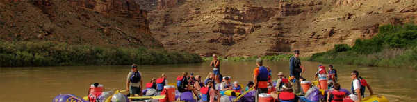
BACK TO TOP
IMAGES
VIDEO
COMMENTS
1. The Big Needles Loop (Canyonlands National Park, Needles District): 23.2 miles. A major backpacking trip covering most of the outstanding features of the Needles District of Canyonlands National Park. 2. Harvest Scene (Canyonlands National Park, Maze District): 8.7 miles. This trail is not only a rare loop (most Maze trails are out and back ...
Coyote Gulch Loop. Located in the Glen Canyon Rec Area, this short 13.5-mile trip is great for a quick overnight. This trail features towering rock faces and even a small waterfall, an unusual find in the desert. Other features include Coyote Natural Bridge, Crack in the Wall, and Jacob Hamblin Arch.
Distance: 7 miles. Elevation Gain: 2,720 feet. Difficulty: Hard. Lake Blanche has been a popular destination for backpackers in Utah since the 19th century. It's hard to say what's more beautiful — the trio of Lake Blanche, Lake Florence, and Lake Lillian, or the imposing Sundial Peak that dominates the skyline.
Southern Utah is one of the most enchanting places on the planet, sitting directly at the crossroads of desolation and flourishing life. ... Most of these backpacking trips cover 20+ miles of this stunning terrain, so if you're up for a challenge, read on and start making your plans. 1. Backpack the Trans-Zion Trek. Photo: Mike Quine. 2 ...
What to Wear Hiking in the Desert. Sun Protection for Hikers. A Desert Hikers Guide to Cryptobiotic Soil. 3. Lower Hackberry Canyon. Location: Grand Staircase-Escalante National Monument. Trail Type: Out and Back. Distance: 12.4 miles. Suggested Time: 2 days, 1 night.
The desert of Southern Utah offers some of America's most iconic scenery for adventurers in the west. The five national parks, or the Mighty Five [1], provide many choices and locations for people to enjoy this fascinating landscape. ... Reflection Canyon: This difficult 20-mile round-trip backpacking trip takes you to a remote corner of Lake ...
I've done a number of backpacking trips in Southern Utah and Coyote Gulch stands out as one of my favorites. It is a stunning slot canyon that sits on the edge of Utah's Grand Escalante National Monument and Glen Canyon National Recreation Site about 6 hours from Salt Lake City.. It's a great backpacking trip for beginners due to the fairly level terrain, water availability, and the fact ...
Like most backpacking trips in Southern Utah, the best time to backpack Coyote Gulch is: Late Spring - April, May, and Early June (although spring runoff can add challenge) Early Fall - September and October. Warning: Coyote Gulch is a slot canyon. There is flash flood potential.
4.6. (4681) 20 items. Filter. Copy to my lists. Share. Explore Backpacking 2-day Southern Utah - view hand-curated trail maps and driving directions as well as detailed reviews and photos from hikers, campers and nature lovers like you. View full map. Report an issue.
Totaling over 47 miles long, this is the ultimate, long distance adventure offered within the borders of Zion National Park. From the Southeast corner to the Northwest corner (or Vice versa) and everything in between. The following adventure guide for the Trans-Zion Trek will actually consist of six separate trails.
Experience the beauty of Southern Utah on a backpacking adventure! Discover the stunning national parks, red rocks, canyons, and mesas as you hike and camp in some of the most breathtaking scenery in the world. Get tips on preparing for your trip and explore top destinations in Southern Utah. Read our guide now!
Some of Southern Utah's Best Hikes are not known to many. Backcountry adventures with an experienced guide can take the pressure off and increase adventure! (928) 585-5382 ... Four Season Guides offers guided hiking tours and backpacking adventures across the incredible landscapes of the American Southwest. Choose from a wide selection of ...
Your guide to the top backpacking trips in Utah. Explore the wonders of one of the most remote and beautiful regions in the United States. Just launched! Hike in Ireland this September and beyond. 800-715-HIKE (4453) (9-4:30 Every Day) ... Like most Southern Utah backpacking trips, it is best to plan this journey for the spring or fall after ...
4WD hikes in and around Kanab, Utah; Town of Kanab Utah. A trip past Kanab, Utah is likely if you plan on visiting iconic rock formations, slot canyons, or the Grand Canyon on your Southwest USA ...
More About Utah Backpacking Trips THE MAGIC OF BACKPACKING IN SOUTHERN UTAH. Southern Utah is a backpacking paradise. It's a dramatic landscape rich with natural phenomena, wide open spaces, vast wilderness, hidden canyons, desert oases, wildlife, and fascinating history.
3. Backpack and Camp at Ibantik Lake. Photo: Colton Marsala. At just five miles round trip and 1000 ft. elevation gain, this is a great trip for those without a ton of hiking or backpacking experience. It's a beginner hike with advanced scenery: watch for mountain goats, alpine lakes, meadows and other beautiful views.
4 night, 5 day October 2024 trip to either Paria Canyon - Vermillion Cliffs National Monument, or Grand Gulch - Bears Ears National Monument. Approximately 40 miles of backpacking. Paria Canyon is one of THE premier backpacking routes in Southern Utah, with huge walls and water almost the entire way.
Hiking throughout Utah's backcountry allows nature-lovers to experience so many fantastic landscapes. ... Utah Hiking Tours; Yosemite Backpacking Trips; Sedona Hiking Tours; Havasupai Falls; Custom Tours; Trip Type. Backpacking Vacations; Basecamp Adventures; Lodge Based Adventures;
This trail is estimated to be 796.0 mi long. Which backpacking trail has the most elevation gain in Utah? Utah: With an ascent of 111,961 ft, Hayduke Trail has the most elevation gain of all of the backpacking trails in the area. The next highest ascent for backpacking trails is The Bear 100 Ultra with 20,341 ft of elevation gain.
The Bitterroots, the Beaverheads, the Lost Rivers, the Lemhis, and plenty of other mountain ranges shot skyward as we headed southward. The snowpack kept us from exploring those mountains anywhere other than in our minds and we kept our sights on southern Utah, home to some of the best spring and fall backpacking on the planet.
Travel Day: Arrive in Southern Utah with options to stop along the way. Start with 1 Day in Zion National Park (East Side—aka the "secret side") 1 Day in Bryce Canyon National Park. 1 Day at Grand Staircase-Escalante National Monument. 2 Days back at Zion National Park (South End) Travel Day: Back home on Day 7.
Backpacking Tips for Southern Utah. Before setting out on a backpacking trip in Southern Utah, it's important to be prepared for the challenges that this diverse terrain can present. Here are some backpacking tips to keep in mind: Check weather conditions and pack accordingly, as temperatures can vary significantly throughout the day and night.
3 Best Utah Spring Break Backpacking Trips. Southern Utah has the most stunning canyons in the world. For spring break trips , Capitol Reef , Coyote Gulch, and the longest slot canyon in the world become prime destinations for backpacking trips to beat the winter blues! 1. Capitol Reef, Water Pocket Fold.
Check out our list of the best places to explore Utah's wild and ragged backcountry. 1. Peekaboo Loop Trail. Best hike for a day trip 5.5 miles roundtrip, 3-5 hours, difficult. An ideal day hike, Peekaboo Loop Trail sees the most variety of terrain and scenery in Bryce Canyon National Park, with 1500 to 1800ft of cumulative elevation changes.
Follow the paths where people have walked for thousands of years. Gaze up at massive sandstone cliffs of cream, pink, and red that soar into a brilliant blue sky. Experience wilderness in a narrow slot canyon. Zion's unique array of plants and animals will enchant you as you absorb the rich history of the past and enjoy the excitement of present-day adventures.
Hikers love Utah, but hikers really love Zion National Park.The trails in Zion National Park are consistently some of the most universally loved in the state. Zion offers a variety of landscapes, including sheer canyon rims and lush riverside foliage. This variety, paired with the vibrant red backdrop of southern Utah, makes Zion one of the most iconic hiking areas in the country.
Yes and yes, and we have a customizable Utah national parks itinerary to prove it. Use our free PDF map download to navigate your road trip through Utah's Mighty 5 in one fell swoop. Well, a 1,000-mile scenic drive, gallons of drinking water and miles of hiking swoop. Tuh-MAY-toe, tuh-MAH-toe. What's so great about that arch on Utah license ...